web based geoprocessing tool for coverage data … · web based geoprocessing tool for coverage...
TRANSCRIPT

WEB BASED GEOPROCESSING TOOL FOR COVERAGE DATA HANDLING
Kavisha Kumar a, Sameer Saran b
a Geoinformatics Department, Indian Institute of Remote Sensing, Dehradun, India – [email protected]
b Geoinformatics Department, Indian Institute of Remote Sensing, Dehradun, India – [email protected]
Commission VIII, WG VIII/13
KEY WORDS: Web Services, open source, WCS, WFS, WPS, Python, GDAL, PyWPS, and NDVI.
ABSTRACT:
With the advancements in GIS technologies and extensive use of OGC Web Services, geospatial resources and services are becoming
progressively copious and convenient over the network. The application of OGC WCS (Web Coverage Service) and WFS (Web Feature
Service) standards for geospatial raster and vector data has resulted in an opulent pool of interoperable geodata resources waiting to
be used for analytical or modelling purposes. The issue of availing geospatial data processing with the aid of standardised web services
was attended to by the OGC WPS (Web Processing Service) 1.0.0 specifications (Schut, 2007) which elucidate WPS as a standard
interface which serves for the promulgation of geo-processes and consumption of those processes by the clients. This paper outlines
the design and implementation of a geo-processing tool utilizing coverage data. The geo-process selected for application is the
calculation of Normalized Difference Vegetative Index (NDVI), one of the globally used indices for vegetation cover monitoring. The
system is realised using the Geospatial Data Abstraction Library (GDAL) and Python. The tool accesses the WCS server using the
parameters defined in the XML request. The geo-process upon execution, performs the computations over the coverage data and
generates the NDVI output. Since open source technology and standards are being used more often, especially in the field of scientific
research, so our implementation is also built by using open source tools only.
1. INTRODUCTION
The web service standards have become an inherent part of
geospatial services. OGC (Open Geospatial Consortium) is the
foremost organization guiding the development of standards and
specifications for geospatial services and is committed towards
the interoperability of geodata and services over a distributed GIS
network. OGC has a number of contributors globally involved in
the development of open source and extensible API’s
(Application Programming Interfaces) for distributed GIS. OGC
white paper for OWS (OGC Web Services) (Doyle and Reed,
2001) describes OWS as a standards based framework which
provides for seamless integration of variety of geo-processing
systems and services; interoperable framework for exploitation
and visualization of multiple sources of geodata and geo-
processing capabilities. With the advancements in GIS
technologies, geospatial resources and services are becoming
progressively copious and convenient over the network. The
proclamation of Web 2.0 has played a major role in the increase
in distribution of geospatial information over the web (Gong et
al., 2009). The standard OGC Web Services for the dissemination
of geodata over the network includes OGC WMS (Web Map
Service) which delivers the geodata as maps i.e. an image of the
data; OGC WFS (Web Feature Service) managing geospatial
vector data; OGC WCS (Web Coverage Service) handles raster
coverages including satellite images, digital aerial photographs,
etc. The preliminaries for OGC Web Services are mentioned in
OGIS (Open Geodata Interoperability Specification) for
distributed access to geospatial data and geo-processing services.
Open GIS refers to open and interoperable geo-processing, or the
capability to share heterogeneous geodata and geo-processing
services openly in a network. Web has become a distributed
computing platform with geodata and geo-processes distributed
over the network and accessible by clients when requested. The
geospatial group discerns the significance of providing web
access to the geo-processing systems for the blooming of
geospatial infrastructure (Kiehle et al., 2007). The application of
OGC WCS and WFS standards for geospatial raster and vector
data has resulted in an opulent pool of interoperable geodata
resources waiting to be used for analytical of modelling purpose.
The issue of availing geospatial data processing with the aid of
standardised web services was attended to by the OGC WPS
(Web Processing Service) 1.0.0 specifications (Schut, 2007)
which elucidate WPS as a standard interface which serves for the
promulgation of geo-processes and consumption of those
processes by the clients. Here, the ‘geo-processes’ comprises of
algorithms, computations or models which work in relation with
spatially referenced data. The geo-processing utility can be
configured to provide various GIS functionalities to the users
across the network, covering access to pre-defined models and
algorithms. The swift growth of geo-processing services
vanquished various geospatial challenges concerning the know-
how of integration of GIS analytical or modelling functions with
inputs from geodata over the network (Wang and Armstrong,
2006). The second challenge dealing with management of large
volumes of distributed geodata and alleviating gridlocks of user
interactions over the Internet (Yang et al., 2005). The third being
connected to the adoption of open source technology and
standards (Caldeweyher et al., 2006).
As the geospatial technology has fledged in the previous years, a
vast number of resources and processing operations are
accessible in the form of web services (Zhao et al., 2012).
Different implementations of the geo-processing functionality
has been carried out in research studies. One such study focuses
on the availability and utilization of geo-processing services in
the geoscience domain (Lopez-Pellicer et al., 2012), while the
other focuses on the integration of WPS standards with 3D
processing and analysis (Lanig and Zipf, 2010). Recent research
on web services has been rigorous with aim to provide for
ecological modelling using web services (Dubois et al., 2013;
Skøien et al., 2013). The eStation (Clerici et al., 2013) system is
a versatile and promising Earth Observation (EO) web processing
service supporting ecological monitoring.
The International Archives of the Photogrammetry, Remote Sensing and Spatial Information Sciences, Volume XL-8, 2014ISPRS Technical Commission VIII Symposium, 09 – 12 December 2014, Hyderabad, India
This contribution has been peer-reviewed. doi:10.5194/isprsarchives-XL-8-1139-2014
1139

Figure 1. System Architecture
This paper outlines the design and implementation of a geo-
processing tool utilizing coverage data distributed over the
network, performing distributed geospatial analysis with
emphasis on open source technology and standards.
2. SYSTEM ARCHITECTURE
The architecture (Figure.1) of geo-processing utility pursues a
SOA (Service Oriented Architecture) approach i.e. the intrinsic
algorithm used is accessible as a processing utility over the
network as per OGC WPS standards.
The key element of WPS specification is the conception of a
process which is a geospatial computation with precise inputs and
outputs (Garnell et al., 2009). This involves: realization of
datasets fit to run the algorithm, instigate the process and
availability of results to the clients. The three main operations as
defined by the specifications are: GetCapabilities,
DescribeProcess and Execute (Schut, 2007) (Figure 2).
Figure 2. WPS client server interaction
The operation GetCapabilities return the metadata XML
document describing the abilities of the specific server
implementation. DescribeProcess return a detailed description of
the process along with the inputs required, formats allowed and
outputs that can be produced. Execute instigate the selected
geoprocess with the necessary input data. The WPS instance runs
the computations and returns the results back to the client.
There are several open source implementations of the WPS
specification including Deegree (Kiehle et al., 2007), PyWPS
(Cepicky and Becchi, 2007), 52° North (Schaeffer and Foerster,
2007), ZOO Project (Fenoy et al., 2013). The system expects
some mandatory and optional parameters (for accessing the WCS
server) in the form of XML requests (Figure 3).
Figure 3. Snippet of XML Request
The system is implemented using the python modules and
supporting libraries like GDAL (Geospatial Data Abstraction
Library) and PyWPS (Cepicky and Becchi, 2007). Using the
python bindings for GDAL, the geo-process ingests and outputs
the GeoTIFF layers to the web clients.
3. SYSTEM IMPLEMENTATION
The fundamental purpose of geo-processing is the manipulation
of geospatial data using GIS functions and self-regulation of GIS
tasks in progress. Geo-processing takes an input dataset,
implements a geo-processing function (raster or vector) and
returns the out-turn of processing. The system is realised using
the Geospatial Data Abstraction Library (GDAL) and Python.
The tool accesses the WCS server using the parameters defined
in the form of XML requests. The geo-process upon execution,
performs the computations over the coverage data and generates
the required output. Since open source technology and standards
are being used more often, especially in the field of scientific
research, so our implementation is also built by using open source
tools only.
The International Archives of the Photogrammetry, Remote Sensing and Spatial Information Sciences, Volume XL-8, 2014ISPRS Technical Commission VIII Symposium, 09 – 12 December 2014, Hyderabad, India
This contribution has been peer-reviewed. doi:10.5194/isprsarchives-XL-8-1139-2014
1140

Figure 4. NIR and RED bands extracted from IRS LISS III imagery of Paonta region, Himachal Pradesh, India.
3.1 Algorithm for Implementation
The geo-process selected for application is the calculation of
Normalized Difference Vegetative Index (NDVI) (Rouse et al.,
1974), one of the globally used indices for vegetation cover
monitoring. The NDVI algorithm is implemented based on the
generic equation (1) given by Rouse et al. (1974):
NDVI = NIR − RED
NIR + RED (1)
Where, NIR and RED denotes the spectral reflectance measured
in Near Infrared and Red regions of spectrum respectively.
3.2 Datasets Used
The datasets used for input to the process are NIR and Red bands
extracted from IRS LISS III GeoTIFF imagery (Figure. 4) of
Paonta, Himachal Pradesh, India acquired at 23.5m spatial
resolution, with 4 spectral bands, namely Green, Red, NIR, and
SWIR. The datasets are kept on a server configured to provide
WCS services. Access to the datasets is achieved in the form of
XML requests by the web clients.
Figure 5. User Interface Figure 6 NDVI Output
The International Archives of the Photogrammetry, Remote Sensing and Spatial Information Sciences, Volume XL-8, 2014ISPRS Technical Commission VIII Symposium, 09 – 12 December 2014, Hyderabad, India
This contribution has been peer-reviewed. doi:10.5194/isprsarchives-XL-8-1139-2014
1141
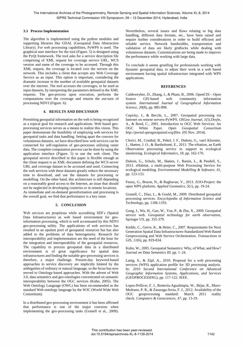
3.3 Process Implementation
The algorithm is implemented using the python modules and
supporting libraries like GDAL (Geospatial Data Abstraction
Library). For web processing capabilities, PyWPS is used. The
graphical user interface for the tool (Figure. 5) is designed using
the PyQt framework. The tool asks for a service description file
comprising of XML request for coverage service URL, WCS
version and name of the coverage to be accessed. Through this
XML request, the coverage is located over the servers on the
network. This includes a client that accepts any Web Coverage
Service as an input. This option is important, considering the
dramatic increase in the number of available geospatial datasets
over the internet. The tool accesses the coverages, to be used as
input datasets, by interpreting the parameters defined in the XML
requests. The geo-process upon execution, performs the
computations over the coverage and returns the out-turn of
processing NDVI (Figure. 6).
4. RESULTS AND DISCUSSION
Permitting geospatial information on the web is being recognized
as a topical goal for research and applications. Web based geo-
processing services serves as a means to realize this vision. This
paper demonstrate the feasibility of employing web services for
geospatial tasks and data handling. Setting apart the concern for
voluminous datasets, we have described how web services can be
connected for self-regulation of geo-processes utilizing raster
data. The complete computation process can be done by using the
application interface (Figure. 5) to use the web client. The
geospatial service described in this paper is flexible enough as
the client request is an XML document defining the WCS server
URL and coverage dataset to be accessed and used. Connecting
the web services with these datasets greatly reduce the necessary
time to download, and use the datasets for processing or
modelling. On the other hand, this architecture is still depending
on a reasonably good access to the Internet, an issue that should
not be neglected in developing countries or in remote locations.
As immediate and on-demand geoinformation and processing is
the overall goal, we find that performance is a key issue.
5. CONCLUSION
Web services are propitious while accrediting SDI’s (Spatial
Data Infrastructures) as web based environment for geo-
information processing, which is well accentuated by this NDVI
geo-processing utility. The applications of web services has
resulted in an opulent pool of geospatial resources but has also
added to the problems of data heterogeneity. Research for
interoperability and implementation are the need of the hour for
the integration and interoperability of the geospatial resources.
The capability to process geospatial data in a distributed
environment is of great significance for spatial data
infrastructures and finding the suitable geo-processing services is
therefore, a major challenge. Present-day keyword-based
approaches to service discovery are implicitly limited by the
ambiguities of ordinary or natural language, so the focus has now
moved to Ontology-based approaches. With the advent of Web
3.0, data semantics and geo-ontologies concentrated on semantic
interoperability between the OGC services (Kuhn, 2005). The
Web Ontology Language (OWL) has been recommended as the
standard Web ontology language by the W3C (World Wide Web
Consortium).
In a distributed geo-processing environment it has been affirmed
that performance is one of the major concerns when
implementing the geo-processing tasks (Granell et al., 2009).
Nevertheless, several issues and flaws relating to big data
handling, different data formats, etc., have been raised and
require further considerations in order to build efficient and
reliable service. Network bandwidths, transportation and
validation of data are likely gridlocks while dealing with
voluminous datasets. Customizations are being made to improve
the performance while working with large data.
To conclude it seems gruelling for professionals working with
dynamic geospatial data, to adjust their work in a web based
environment having spatial infrastructure integrated with WPS
applications.
REFERENCES
Caldeweyher, D., Zhang, J., & Pham, B., 2006. OpenCIS—Open
Source GIS‐based web community information
system. International Journal of Geographical Information
Science, 20(8), pp. 885-898.
Cepicky, J., & Becchi, L., 2007. Geospatial processing via
Internet on remote servers-PyWPS. OSGeo Journal, 1(5).Doyle,
A., & Reed, C., 2001. Introduction to OGC Web Services: An
OGC White Paper. Open Geospatial Consortium
http://portal.opengeospatial.org/files. (05 Nov. 2014).
Clerici, M., Combal, B., Pekel, J. F., Dubois, G., van't Klooster,
J., Skøien, J. O., & Bartholomé, E., 2013. The eStation, an Earth
Observation processing service in support to ecological
monitoring. Ecological Informatics, 18, pp. 162-170.
Dubois, G., Schulz, M., Skøien, J., Bastin, L., & Peedell, S.,
2013. eHabitat, a multi-purpose Web Processing Service for
ecological modeling. Environmental Modelling & Software, 41,
pp. 123-133.
Fenoy, G., Bozon, N., & Raghavan, V., 2013. ZOO-Project: the
open WPS platform. Applied Geomatics, 5(1), pp. 19-24.
Granell, C., Díaz, L., & Gould, M., 2009. Distributed geospatial
processing services. Encyclopedia of Information Science and
Technology, pp. 1186-1193.
Gong, J., Wu, H., Gao, W., Yue, P., & Zhu, X., 2009. Geospatial
service web. Geospatial technology for earth observation,
Springer US, pp. 355-379.
Kiehle, C., Greve, K., & Heier, C., 2007. Requirements for Next
Generation Spatial Data Infrastructures‐Standardized Web Based
Geoprocessing and Web Service Orchestration. Transactions in
GIS, 11(6), pp. 819-834.
Kuhn, W., 2005. Geospatial Semantics: Why, of What, and How?
Journal on Data Semantics III, pp. 1–24.
Lanig, S., & Zipf, A., 2010. Proposal for a web processing
services (WPS) application profile for 3D processing analysis.
In: 2010 Second International Conference on Advanced
Geographic Information Systems, Applications, and Services
(GEOPROCESSING), pp. 117-122. IEEE.
Lopez-Pellicer, F. J., Rentería-Agualimpia, W., Béjar, R., Muro-
Medrano, P. R., & Zarazaga-Soria, F. J., 2012. Availability of the
OGC geoprocessing standard: March 2011 reality
check. Computers & Geosciences, 47, pp. 13-19.
The International Archives of the Photogrammetry, Remote Sensing and Spatial Information Sciences, Volume XL-8, 2014ISPRS Technical Commission VIII Symposium, 09 – 12 December 2014, Hyderabad, India
This contribution has been peer-reviewed. doi:10.5194/isprsarchives-XL-8-1139-2014
1142

Rouse Jr, J. W., Haas, R. H., Schell, J. A., & Deering, D. W.,
1974. In: Proceedings of the Third Earth Resources Technology
Satellite-1 Symposium, Greenbelt. NASA SP-351, pp. 301–317.
Schaeffer, B., & Foerster, T., 2007. Bringing the web processing
service to a new stage: new 52 North WPS features. Free and
Open Source Software for Geoinformatics, Victoria, Canada.
Schut, P., 2007. OGC Web Processing Service (WPS) version
1.0. 0. OGC Standard Document, Open Geospatial Consortium.
Skøien, J. O., Schulz, M., Dubois, G., Fisher, I., Balman, M.,
May, I., & Tuama, É. Ó., 2013. A Model Web approach to
modelling climate change in biomes of Important Bird
Areas. Ecological Informatics, 14, pp. 38-43.
Wang, S., & Armstrong, M. P., 2009. A theoretical approach to
the use of cyberinfrastructure in geographical analysis.
International Journal of Geographical Information
Science, 23(2), pp. 169-193.
Yang, C., Wong, D. W., Yang, R., Kafatos, M., & Li, Q., 2005.
Performance‐improving techniques in web‐based
GIS. International Journal of Geographical Information
Science, 19(3), pp. 319-342.
Zhao, P., Foerster, T., & Yue, P., 2012. The geoprocessing
web. Computers & Geosciences, 47, pp. 3-12.
The International Archives of the Photogrammetry, Remote Sensing and Spatial Information Sciences, Volume XL-8, 2014ISPRS Technical Commission VIII Symposium, 09 – 12 December 2014, Hyderabad, India
This contribution has been peer-reviewed. doi:10.5194/isprsarchives-XL-8-1139-2014
1143