wayne county trail feasibility study
TRANSCRIPT
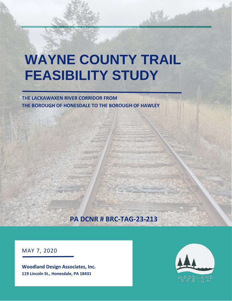
THE LACKAWAXEN RIVER CORRIDOR FROM THE BOROUGH OF HONESDALE TO THE BOROUGH OF HAWLEY
PA DCNR # BRC-TAG-23-213
MAY 7, 2020
Woodland Design Associates, Inc. 119 Lincoln St., Honesdale, PA 18431
WAYNE COUNTY TRAIL FEASIBILITY STUDY
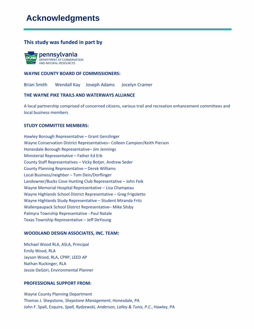
Acknowledgments
This study was funded in part by
WAYNE COUNTY BOARD OF COMMISSIONERS:
Brian Smith Wendall Kay Joseph Adams Jocelyn Cramer
THE WAYNE PIKE TRAILS AND WATERWAYS ALLIANCE
A local partnership comprised of concerned citizens, various trail and recreation enhancement committees and local business members STUDY COMMITTEE MEMBERS:
Hawley Borough Representative – Grant Genzlinger Wayne Conservation District Representatives– Colleen Campion/Keith Pierson Honesdale Borough Representative– Jim Jennings Ministerial Representative – Father Ed Erb County Staff Representatives – Vicky Botjer, Andrew Seder County Planning Representative – Derek Williams Local Business/neighbor – Tom Dein/Dorflinger Landowner/Bucks Cove Hunting Club Representative – John Feik Wayne Memorial Hospital Representative – Lisa Champeau Wayne Highlands School District Representative – Greg Frigoletto Wayne Highlands Study Representative – Student Miranda Fritz Wallenpaupack School District Representative– Mike Silsby Palmyra Township Representative - Paul Natale Texas Township Representative – Jeff DeYoung
WOODLAND DESIGN ASSOCIATES, INC. TEAM:
Michael Wood RLA, ASLA, Principal Emily Wood, RLA Jayson Wood, RLA, CPRP, LEED AP Nathan Ruckinger, RLA Jessie DeGori, Environmental Planner PROFESSIONAL SUPPORT FROM:
Wayne County Planning Department Thomas J. Shepstone, Shepstone Management, Honesdale, PA John F. Spall, Esquire, Spall, Rydzewski, Anderson, Lalley & Tunis, P.C., Hawley, PA

Table of Contents
Table of Contents Executive Summary ....................................................................................................8
Introduction & Context ............................................................................................. 10
Study Purpose ....................................................................................................... 11
Goals for the Feasibility Study ............................................................................... 11
Base Map & Description ........................................................................................ 11
Study Area Description & Context ......................................................................... 12
Physical Inventory & Assessment .............................................................................. 13
a. Aerial Photography (Appendix A-1) ............................................................... 13
b. Roads (Appendix A-2) ................................................................................... 13
c. Topography (Appendix A-3) .......................................................................... 13
d. Hydrology (Appendix A-4) ............................................................................. 14
e. Existing Land Use (Appendix A-5) .................................................................. 15
f. Zoning (Appendix A-6) .................................................................................. 15
g. Points of Interest (Appendix A-7) .................................................................. 16
h. Landowner Map (Appendix A-8) ................................................................... 16
i. Valuation Engineering Mapping (Val Maps) (Appendix A-9) ............................. 16
Pennsylvania National Diversity Inventory (PNDI) (Appendix B-1) ......................... 17
Pennsylvania Historical & Museum Commission (PHMC) (Appendix B-2) .............. 17
Public Participation ................................................................................................... 18
Study Committee (Appendix C) ............................................................................. 18
Conceptual Design Charette (Appendix D) ............................................................ 19
Landowner Letters (Contact) (Appendix E) ............................................................ 19
Public Hearings (Appendix F) ................................................................................. 20
Key Person Interviews (Stakeholders & Jurisdictional) (Appendix G) ..................... 22
Stake Holders ........................................................................................................ 22
Table of Contents
Jurisdictional ......................................................................................................... 24
Public Survey (Appendix H) ................................................................................... 27
Summary .............................................................................................................. 30
Legal Assessment ...................................................................................................... 31
Biking/Hiking trail along U.S. Route 6.................................................................... 31
Water trail on the Lackawaxen River ..................................................................... 31
Multi-use trail within the Railroad Right of Way ................................................... 32
Summary of Railroad Right-Of-Way Legal Findings (Appendix I) ............................ 32
Landowners .......................................................................................................... 33
Feasibility Study Mapping ......................................................................................... 35
Conceptual Design Plans (Appendix J-1 - J6) .......................................................... 35
Renderings (Appendix J-7 – J-10) ........................................................................... 35
Cost Estimate ........................................................................................................ 35
Trail Management, Operation, Maintenance, & Fiscal Feasibility .............................. 39
Maintenance tasks, costs, and responsibility ........................................................ 39
Maintenance schedule .......................................................................................... 40
Trail Operational Revenue .................................................................................... 40
Trail / Risk Management ....................................................................................... 41
Fiscal Feasibility .................................................................................................... 41
Recommendations & Approach ................................................................................ 42
Where to Start ...................................................................................................... 42
Grants ................................................................................................................... 43
Signage (Wayfinding and Rules) ............................................................................ 46
Recommendations ................................................................................................ 47
Table of Contents
Appendices - Table of Contents
Appendix A – Base Mapping
A-0 Base Maps A-1 Aerial Photography A-2 Roads Maps A-3 Topographic Maps A-4 Hydrology Maps A-5 Existing Use Maps A-6 Zoning Maps A-7 Points of Interest Maps A-8 Landowner Maps A-9 Val Maps Appendix B – Environmental and Historical Review
B-1 PNDI B-2 PHMC Appendix C – Study Committee Meetings and Notes
C-1 Meeting #1 C-2 Meeting #2 C-3 Meeting #3 C-4 Meeting #4 C-5 Meeting #5 C-6 Meeting #6 Appendix D – Design Charette Notes
D-1 Charette Notes D-2 Charette Photos and Maps

Table of Contents
Appendix E – Landowner Letters
E-1 Landowner Letter Example E-2 Pennsylvania’s Recreational Use of Land and Water Act Insert
E-3 Landowner Response Chart E-4 Trail Easement Agreement Example
Appendix F – Public Presentations
F-1 Public Meeting #1 - Local Advertisement F-2 Public Meeting #1 - Presentation Agenda F-3 Public Meeting #1 - Presentation Power Point F-4 Public Meeting #1 - Public Comment Notes F-5 Public Meeting #1 - Public Email Comments Received
F-6 Public Meeting #2 - Local Advertisement F-7 Public Meeting #2 - Presentation Agenda F-8 Public Meeting #2 - Presentation Power Point F-9 Public Meeting #2 - Public Comment Notes F-10 Public Meeting #2 - Public Email Comments Received F-11 Public Meeting #2 - Additional Correspondence
Appendix G – Key Person (Stakeholder) Interviews
G-1 Tom Myles, Train Operator/Business Owner G-2 Dan Corrigan, Local Business Owner G-3 Rudy Schemitz, Local Business Owner G-4 Trout Unlimited Board, Local Conservation Group G-5 PennDOT, Jurisdictional Stakeholder G-6 Public Utility Commission, Jurisdictional Stakeholder G-7 Wayne Conservation District, Jurisdictional Stakeholder G-8 Honesdale Borough Council, Jurisdictional Stakeholder G-9 Hawley Borough, Jurisdictional Stakeholder G-10 Texas Township, Jurisdictional Stakeholder G-11 Palmyra Township, Jurisdictional Stakeholder

Table of Contents
Appendix H – Survey Results
H-1 Survey Questions and Results from Survey Monkey, unedited Appendix I – Legal Assessment
I-1 Right-Of-Way Restriction Letter I-2 Quit Claim Deed I-3 Legal Opinion Letter Appendix J – Conceptual Design Plans and Renderings
J-1 Conceptual Design Plan 1 J-2 Conceptual Design Plan 2 J-3 Conceptual Design Plan 3 J-4 Conceptual Design Plan 4 J-5 Conceptual Design Plan 5 J-6 Conceptual Design Plan 6
J-7 River Access and Trailhead Enlargement Plan J-8 River Access and Trailhead Rendering J-9 Conceptual Raised Trail Rendering J-10 Conceptual State Route Crossing Rendering J-11 Cost Estimate Figure
Executive Summary
8
Executive Summary Wayne County, Pennsylvania is known for its scenic beauty, natural areas, rolling farmlands, outdoor recreation, and close-knit family ties. With outstanding agriculture, tourism, and rich industrial history, current residents have placed a high value on accessing their natural and historic surroundings, whether at museums or along pedestrian and water trails. In recent years, citizens have asked repeatedly for a direct link to the natural environment via a trail system between the Boroughs of Honesdale and Hawley within the Lackawaxen River corridor. Many trail users have come forward with input regarding a desire to hike, bike, paddle, commute, bird watch, and socially connect along the Lackawaxen River. Many have demonstrated a willingness to spend both money and time toward these interests. Even more have expressed the ability of this trail to fill not only a physical trail-way gap between the towns, but also a greater social, economic, and environmental gap. The Wayne County Trail Feasibility Study, specifically between the Boroughs of Honesdale and Hawley and within the Lackawaxen River corridor, began with exploring the need for, and potential of, a trail network combining hiking, biking, and boating within the area. A community-based process examined the opportunities to create connections between key community recreational resources and the local economy. After completing an inventory and analysis of existing conditions and regulations, extensive interaction with the public was pursued. A study committee was created, including community members involved with business, recreational, tourism, and municipal backgrounds. A successful on-line survey assisted in interpreting the public’s need, desires, and concerns. Public hearings were held to identify the pros and cons of such a proposed trail system. Once gathered, solutions could be developed. As the planning process continued and the trail ideas were developed, public support and interest in the project increased. Based upon the data acquired, a Trail Concept Plan was created, illustrating the potential of a future multi-use trail system within the Lackawaxen River corridor. The Trail Concept Plan depicted the large scale and long-range vision for what the trail system could become - using the river, railroad, and U.S. Route 6 corridors to interconnect key community resources, existing trails, recreational facilities, economic hubs, and cultural opportunities. The successful implementation of this large-scale vision for the trail system within the Lackawaxen River corridor must begin with a strong and obvious starting point. Gathered public opinion suggests the trail should prioritize the design and development of the ‘core’ of the trail: the railroad line route between Hawley and Honesdale. The study also identified other trail connections along the easterly side of the Lackawaxen River, within Honesdale Borough and Texas Township, including Indian Orchard and White Mills. These can be connected to the trail ‘core’ via new multi-use trail spurs. Tying into existing trails in northern Honesdale Borough was included as part of the hiking portion of the study as well. Public opinion also encouraged the development and inclusion of the PA Route Bike Route Y (US Bike Route 36) between the two Boroughs along Route 6.

Executive Summary
9
Ultimately, the Wayne County Trail Feasibility Study has determined that public support for the project is strong and that it is physically feasible to construct the segments of the Trail Concept Plan. It is hoped that the Feasibility Study and appendices materials continue to reach additional residents in the community and continue to mobilize public and private support for the project. Beyond assessing the opportunities and challenges associated with each trail segment, this study also includes proposed funding and phasing strategies to implement the Trail Concept Plan. The realization of the Wayne County Lackawaxen River Trail System begins with the completion of this successful feasibility study. Now is a critical time to build upon public support and interest with the intent to move beyond planning into design and construction of the trail system. Developed and refined in response to the needs and concerns expressed by residents, landowners, recreational users, business owners, and municipal officials, the construction of the first segment is essential to maintaining community interest and building community partnerships.
Introduction & Context
10
Introduction & Context Wayne County, Pennsylvania is a largely rural county in north-eastern Pennsylvania with a population of just over 50,000 residents (2010 Census); priding itself in its scenic beauty, healthy flora and fauna, outdoor recreational opportunities, agriculture, tourism, and storied industrial history. Though Wayne County's past focused strongly on the transportation of coal on the Delaware and Hudson Canal and the development of America's first steam locomotive, a large portion of the population continues to practice agriculture, tourism, and/or small business services. More recently, recreation areas, such as Lake Wallenpaupack, various resorts, the Delaware and Lackawaxen Rivers, and the towns of Hawley and Honesdale, have become tourist destinations, bringing employment and economic opportunities. Most tourists and residents regularly partake in year-round outdoor recreation in the area; including, but not limited to: snowshoeing, hiking, fishing, hunting, cross country skiing, kayaking, canoeing, bicycling, team sports, bird watching, photography, geocaching, and plant identification. Honesdale, Pennsylvania, which is the county-seat, currently features a population of just under 4,500 (2010 Census) people. Incorporated in 1831, its historic significance is easily seen at its working railroad museum, which provides interpretive rides through White Mills, along the Lackawaxen River to Hawley. Numerous public outdoor spaces and trails exist in Honesdale, including Apple Grove Picnic Area, Irving Cliff, Triangle Park, the Park Street Complex Trail, and Central Park. The village of White Mills, formed in 1803 at the site of a large sawmill, provided continued transportation support for coal from the Lackawanna Valley to New York City. Today, this area is home to nearly 500 residents and features a museum. A portion of the original canal lock and walkable towpath, a glass factory museum with a trail, and a large sports and recreation facility are present focal points. Hawley, Pennsylvania located near the shores of Lake Wallenpaupack, a local, major tourist destination, features existing trails across the lake's dam and along the Lackawaxen River. Hawley's historic character echoes the transportation of coal down the Delaware and Hudson Canal and features the beautifully restored Bellemonte Silk Mill and O'Connor Cut Glassware Factory. With a population of 1,200 people (2010 Census) the town balloons in the summer months as tourists flock to the lake, Bingham Park, and numerous outdoor opportunities; bringing a large, relied upon, economic influx. Many of Wayne County's citizens reside and work within the Hawley/Honesdale region and recognize that an automobile is required to safely access nearby services. Residents have recently brought this issue to light and suggested a solution: a connection to the natural environment, in the form of a multi-use, bike and canoe/kayak trail system. The Lackawaxen River with the Stourbridge Line (an active tourist/commercial railroad) on its western side, uniquely connects these Boroughs. This corridor is home to an abundance of plant and animal species and provides a striking opportunity for the area. By developing this corridor, the historically
Introduction & Context
11
significant regional locations identified by the Local History Round Table in their “Local History Past-Port—for the Northern Pocono Mountains Region” are strengthened to make a one-of-a-kind cultural experience; along with a strong social connection between the Boroughs, the river, and the local environment.
Study Purpose The purpose of the Wayne County Trail Feasibility Study is to research and develop a viable, conceptual multi-use trail system between the Boroughs of Honesdale and Hawley, Pennsylvania. The study will identify legal, environmental, and physical opportunities and constraints, inventory public support, and provide recommendations for phased construction. A basic cost estimate will also be included.
Goals for the Feasibility Study
1. Determine a viable multi-use/bike/water trail route/corridor connecting the Boroughs of Honesdale and Hawley
2. Connect the proposed trail system to recreation areas (both existing and future), municipal grounds, trails, and determined access points
3. Identify the opportunities and constraints of providing the trail system; legally, economically, and physically
4. Provide a trail system which strengthens quality of life and community character through connections between the river, businesses, and cultural and recreational destinations
Base Map & Description Over the course of the Feasibility Study, the Design Team presented findings to the Study Committee and County Commissioners in a series of meetings. A list of the Study Committee members is found on page 2 of this document. A record of meeting minutes and guidance is included in this report (Appendix C). At the direction of the Study Committee and the County Commissioners, a study area base map focusing on the Lackawaxen River between the Boroughs of Honesdale and Hawley, Pennsylvania was created. The study corridor was developed by identifying State Route 6 as the eastern boundary and offsetting the Lackawaxen River one-thousand feet to the west, to include the railroad right-of-way. Adjacent uses to this corridor were immediately inventoried through a conceptual regional study, advised by the Study Committee. All adjacent trails, access points, and areas of recreational and cultural interest were included. Throughout the study, the base map was adjusted to include additional points of significance brought to the Committee’s attention. A map showing the initial corridor, in a scaled plan view drawing, is provided as Appendix A-0.

Introduction & Context
12
Study Area Description & Context The Study Area begins at Apple Grove Picnic Area in the Northern reaches of the Borough of Honesdale and connects to North Main Street, Honesdale via State Route 191 where it joins a small spur to the existing Park Street Complex within the downtown area. Park Street, to the east, was included to link existing trails at Irving Cliff and Riverside Drive as well as honor Borough and privately-owned tracts of land which potentially provide strong commercial or public connections to the Lackawaxen River. Through Honesdale, existing walkways, sidewalks, and crosswalks allow access to the post office, public library, and downtown commodities like restaurants, shops, and Central Park. The study corridor continues along the Lackawaxen River; between U.S. Route 6 (eastern edge) and adjacent railroad line (western edge), from Fourth Street, Honesdale, to White Mills, where it connects to a large property offering public outdoor recreation (the Sports Factory of NEPA). The existing culturally and historically significant trail systems at the Dorflinger-Suydam Estate is a highlighted connection point in White Mills. Along the west side of the River, the corridor features beautiful scenic river views, large swaths of woodland, and connections to Bucks Cove Road, a gravel road owned by Texas Township. From White Mills, the trail corridor continues to follow the railroad to the west and U.S. Route 6 to the east. Focal points along this portion include the Wayne County Historical Society’s Lock 31 and the newly opened portions of the Lackawaxen River eastside Towpath down to the Settlers Inn. This section of the proposed trail is highlighted by Pennsylvania hardwood ridges, riverine ecosystems, and broad corridor views up and down the river. A few connections to rural residences and municipal roads occur as the corridor approaches the Borough of Hawley. Hawley, much like Honesdale, features a train station where the tracks cross Main Avenue (U.S. Route 6). At Hawley, the corridor connects to the large, and well known, Bingham Park and the River Walk trail system. At this location existing walkways, sidewalks, and crosswalks allow access to the post office, public library, downtown Hawley, and ultimately, Wallenpaupack Area High School and Lake Wallenpaupack. Although the Lackawaxen River and railroad right-of-way continue to Lackawaxen, Pennsylvania, and local interest has been expressed, the Committee agreed that Main Avenue, Hawley would be a logical endpoint for this Feasibility Study.

Physical Inventory & Assessment
13
Physical Inventory & Assessment a. Aerial Photography (Appendix A-1)
Current aerial imagery provides a wide range of information pivotal to the planning process. Aerial imagery was gathered early in the study process and provided to the Study Committee. Landmarks, roadways, and adjacent streams were immediately highlighted. Aerial imagery allowed the Committee to easily establish the projects context and location by identifying familiar items at a comfortable scale. During discussions and presentations, the aerial imagery became an underlying datum from which information was gathered, displayed, conveyed, and sketched upon. All aerial imagery was provided by the Wayne County Planning & GIS Department in 2019.
b. Roads (Appendix A-2) Early in the planning process, roads within the Study Area were identified and mapped. State Routes were noted to show separate jurisdictional management. Where the conceptual trail crosses, or is within the right-of-way of a state route, it is subject to specific requirements outlined by the Pennsylvania Department of Transportation. This is further elaborated upon in the PennDOT Jurisdictional Key Interview on pages 23-24 of this report. Other roads and accesses were identified as either under township jurisdiction or private driveways. These locations were later reviewed with the landowner and the appropriate municipality to determine the allowance of a recreational trail as described. The Wayne County Planning & GIS Department also gathered and provided the roadway information used in this analysis.
c. Topography (Appendix A-3) As the trail study corridor parallels the Lackawaxen River valley, the adjacent lands from Honesdale to Hawley have historically provided a physical route, for both the railroad and the D & H Canal, that was advantageous due to the gentle slope change for that distance. At the northerly end of the study corridor along State Route 191 next to the entrance to Apple Grove Park, the elevation is 986 feet above sea level. At the southerly end of the study corridor where the railroad meets Main Avenue in Hawley, the elevation is 900 feet above sea level. The distance between the two points is approximately 10.5 miles following the centerline of the railroad track from Fourth Street, Honesdale to Main Avenue, Hawley. An elevation change of only 86 feet. This equates to a grade slope change of less than 1% overall. Realizing this is only approximate, even with a conservative buffer, the topography can be deemed gentle enough to be advantageous to ADA requirements for trail access.
Physical Inventory & Assessment
14
The topography along the railroad and river corridor varies greatly between the Boroughs of Honesdale and Hawley once out of the river valley. The railroad has an adjacent access route paralleling the tracks for much of the route, but river and stream erosion have caused narrowing and slumping points of concern; necessitating grading and stabilization for a trail to be placed. Picturesque rock outcroppings and the meandering river offer numerous scenic views along the passageway. While limitations exist from a topographic standpoint, creating an ADA accessible trail along this route is feasible; barring acquisition of any necessary permits from the Pennsylvania Department of Environmental Protection (PA DEP) and Wayne Conservation District. Within both Boroughs and behind some of the commercial properties along the river, urban conditions exist; this is a stark contrast to the corridor’s largely meandering, natural, and scenic composition but lends itself to opportunities for connection to areas with economic interest.
d. Hydrology (Appendix A-4) The hydrology within the Study Area is one of the main focal points of the project as the railroad and proposed trail system follow along the Lackawaxen River. Streams and wetlands have been inventoried and are traversed along the way. As the study of the hydrology along the corridor was carried out, multiple sources of information were combined to create a succinct map. This allowed for an inventory of areas and crossings where regulatory and permitting requirements may have to be met. The “Regulated Floodway” and “Regulated Floodplain” information was acquired from the Federal Emergency Management Agency (FEMA) dataset that has been created and distributed through the Pennsylvania Spatial Data Access (PASDA). Additionally, information from a dataset created by the National Wetlands Inventory (NWI) demonstrates the abundance, characteristics, and distribution of wetlands within the study corridor. The hydrology map presented (Appendix A-4) illustrates the study corridor and existing railroad alignment’s relation to these hydrologic features. The inventory of these areas gave the Design Team an opportunity to plan for alternative routes or alternative trail types in areas where the trail is expected to encounter hydrologic features. Points of concern were pointed out and an in-field investigation was conducted to assess existing features. Part of the trail system under consideration is the use of the Lackawaxen River as a water trail to be utilized for boating via canoe and kayak, as well as other recreational opportunities such as fishing. It was found that the Lackawaxen River is a “navigable stream” according to the Pennsylvania Department of Environmental Protection’s List of Streams Subject to the Submerged Lands License Program (09/03). In that list, the Lackawaxen River is specifically listed under the category of “Public

Physical Inventory & Assessment
15
Highway”. The allowable uses in public waters are quite broad and extend to fishing, boating, wading, floating, swimming and otherwise recreating. The public does not have a right to cross through private property to gain access to public waters. However, when entering a public waterway lawfully (e.g., through a public access point), the public can wade, boat, fish, float or otherwise be in the waterway from bank to bank where it passes through private property. As future portions of this project are planned, wetland delineations will need to be conducted in order to assess possible impact of the trail to existing wetlands or waters and the specific, required permits attained. Potential requirements set forth by the Wayne Conservation District and Pennsylvania Department of Environmental Protection were further reviewed with the Conservation District in the Key Person Interviews section of this report.
e. Existing Land Use (Appendix A-5) The existing land use of a community dictates key areas that pose opportunities for recreational infrastructure and those areas that will pose complications from a design, planning, or easement/ acquisition standpoint. Along the railroad, within the railroad right-of-way, the land-use is consistently characterized as “Transportation”. Other existing land-uses inventoried include “Industrial”, “Utilities”, “Forest”, “Commercial”, and “Residential”. The Lackawaxen River is labeled as “Waters”. As a result, portions of the trail may qualify for conditional use hearings in portions of municipalities where a trail is considered a “conditional use”. This is further elaborated on in the zoning portion of the report below. The dataset of information for existing land use was developed by the Wayne County Planning & GIS Department and provided to Woodland Design Associates, Inc. (Woodland Design) for inclusion in the planning process.
f. Zoning (Appendix A-6) Studying the zoning along the corridor and potential trail routes, the Design Team examined uses of adjacent properties and connections. Creating connections to areas of similar or complementary zoning allows for future development and use along the corridor. Zoning designations within the Study Corridor include: Industrial, Rural, Highway Commercial, Central Commercial, Residential/Professional, Single-Family Residential. Through meetings with the municipalities and the review of applicable ordinances, it was determined that all, or portions of, proposed recreational (and multi-use trail) uses may be subject to municipal review(s) as they meet the definition of a “Conditional Use” in certain zoned areas. As a result, the applicable municipality

Physical Inventory & Assessment
16
may require public hearings and/or impose design and construction conditions to protect the health, safety, and welfare of its citizens. The Study Committee was fortunate, during the Feasibility Study, to include members who served within the Boroughs of Honesdale and Hawley, as well as, the Townships of Texas and Palmyra as their respective Zoning Officers.
g. Points of Interest (Appendix A-7) Outlining the points of interest along the Study Corridor created nodes for the Study Committee to focus on connecting. These nodes included village and borough centers, historical, recreational, commercial, and informational areas. Highlighting these areas and identifying needed connections allowed for conceptual path identification. Typically, the simplest, shortest path is ideal and was recorded. Group activities and activities of similar types were noted, to place them in proximity or develop their connections appropriately.
h. Landowner Map (Appendix A-8) With the potential trail corridor identified, Woodland Design reached out to the Wayne County Planning Department to receive property line boundaries and landowner information for all the tax assessed properties within the Study Corridor. A Landowner Map was created, inventorying the landowners, property locations, and proximity to the trail corridor. Tax addresses were also listed for contact later in the process, should the Committee suggest trail connections or pathways through private landowner property. It was noted that the biggest single private landowner impacted by the trail route was the railroad line owner and its operator, who was instrumental in the movement to conduct a study, having interest in the trail as a tourist facility to compliment the current railroad operation. Further explanation regarding this process is included in the “Landowner Letter (Contact) (Appendix E)” section of this report.
i. Valuation Engineering Mapping (Val Maps) (Appendix A-9) In discussions with railroad personnel “Valuation Engineering Mapping” was brought to the attention of the Design Team. These engineering maps, termed “Val Maps”, were made to clearly delineate the location, width, right-of-way location, and scope of the railway line during its creation. The Val Maps for the rail line segments within the study area were provided by Myles Group, the operator of the train system between Honesdale and Hawley. The maps clearly show the rail right-of-way and its position adjacent to or within properties, as it was outlined when it was founded in 1864. The maps also clearly document the deeds which the railroad affects. A copy of these maps is included in the noted appendix.

Physical Inventory & Assessment
17
Pennsylvania National Diversity Inventory (PNDI) (Appendix B-1)
All projects which propose disturbance or a change to the natural environment via earth moving or similar disruption require computer notification and filing through the Commonwealth’s “Pennsylvania National Diversity Inventory” (PNDI) system maintained by the Pennsylvania Department of Conservation and Natural Resources (PA DCNR). On November 5, 2018, this screening was performed using the Pennsylvania Conservation Explorer’s Conservation Planning and PNDI Environmental Review tool. The review included the entire Study Corridor identified by the Committee. By using the broad Study Corridor, all proposed trails within it were included and adjustments could be made throughout the process without a need to conduct additional PNDIs. The PNDI screening tool compares the Study Corridor to areas where species (flora and fauna) of special concern listed under the Endangered Species Act of 1973, the Wild Resource Conservation Act, The Pennsylvania Fish and Boat Code, and the PA Game and Wildlife Code, are known to be or may be present. The screening identified that the Study Corridor was in proximity of a bald eagle nest which falls under the jurisdiction of the U.S. Fish and Wildlife Service. Per the request of the PNDI review, supplemental information was provided to the U.S. Fish and Wildlife Service for their consideration regarding work in the area where Bald Eagle Nests are present. In their reply they have requested that different buffers be followed based on construction activities, date and time of construction, and ongoing activities (walking and recreation). It must be noted that this screening is good for two (2) years from the date the search was conducted. It is highly recommended that any proposed activity includes an updated search at that time. Within Appendix B-1 is a copy of Supplement #1, Pennsylvania Natural Diversity Inventory Search Form (November 5, 2018) with its results.
Pennsylvania Historical & Museum Commission (PHMC) (Appendix B-2)
For all projects which propose disturbance or a change to the natural environment via earth moving or similar disruption, the Commonwealth of Pennsylvania requires notification and review by the State Historical and Preservation Office through The Pennsylvania Historical and Museum Commission (PHMC). On August 13, 2019 photos, drawings, a letter of intent, and applicable forms were received by the PHMC for review. On August 15, 2019, a signed letter was received from PHMC stating, “the project will have no effect on historic properties”. It is highly recommended that any proposed activity includes an updated search at that time in that specific area. Within Appendix B-2 is a copy of Supplement #2, Pennsylvania Historical and Museum Commission (PHMC) (August 13, 2019) with all photos, forms, and results.

Public Participation
18
Public Participation Study Committee (Appendix C) The Wayne County Trail Feasibility Study Committee was assembled in August of 2018. The committee members, listed on the acknowledgement page of this report, include officials from Wayne County, Texas & Palmyra Townships, Hawley & Honesdale Borough, the Wayne Conservation District, local school districts, as well as community leaders and local business owners. Over the course of six (6) meetings, the Study Committee reviewed and provided feedback for each of the attached appendices (requesting data gathering, information, map, and report assembly, etc.). Their insight provided critical information regarding landowners, local nodes and connections, and the public’s interpretation of the presentation and intent of the trail system. Meeting notes were taken and issued for all six (6) meetings; with specific requests and changes noted. These are provided, with the PowerPoint presentations, in Appendix C. General items reviewed and requested during these meeting include the identification of physical constraints, the results of the public survey (covered in later sections), preferred multi-use trail locations, and trail head locations, among much more. The following is a chart of the dates, times, and locations of the Study Committee meetings conducted:
Study Committee: Meeting #1 September 6th, 2018 – 12:00pm Wayne County Communications Building
Study Committee: Meeting #2 November 7th, 2018 – 12:00pm Wayne County Communications Building
Study Committee: Meeting #3 January 9th, 2019 – 12:00pm Wayne County Communications Building
Conceptual Design Charette March 6 & 11th, 2019, 11:30am – 2:00pm Wayne County Communications Building
Study Committee: Meeting #4 April 3rd, 2019 – 12:00pm Wayne County Communications Building
Study Committee: Meeting #5 August 13th, 2019 – 12:00pm Wayne County Communications Building
Study Committee: Meeting #6 January 15, 2020 – 12:00pm Wayne County Communications Building

Public Participation
19
Conceptual Design Charette (Appendix D) On March 6th and 11th, 2019 the Study Committee met with the Design Team to participate in a “Conceptual Design Charette”. A charette is a brainstorming session where large groups are asked to markup and “design” a site based on specified parameters in a set amount of time. As the project lead, Woodland Design provided six (6), 1”:300’ scale laminated aerial base maps with significant items labeled. Study Committee members were divided into six (6), four (4) to six (6) person groups, with each group member from a unique area of the community. This was done to generate diverse conversation and perspective(s). Each group was given one (1) laminated map portion for approximately twenty (20) minutes. During that time, they were asked to mark the plan with information using a dry-erase marker. Specifically, the teams were asked to develop desired trail path(s), connections and nodes, trailheads, parking, bridges, and river access points. Each group was encouraged to write out additional information or reasons for connecting or not connecting items. A team member from Woodland Design worked with each group to answer questions and for general guidance. At the conclusion of each twenty (20) minute session, a team member from Woodland Design photographed the marked-up map and any additional notes before erasing the information to provide a clean map for the next group. The photographs of the marked-up maps are included in Appendix D. The data provided by the Study Committee during this Charette was used to guide the creation of the Conceptual Design Plans, supplied as Appendix J1-J6. Many of the notes received during the Charrette expressed a need to connect the proposed trail system to other areas across private properties. This ultimately led to inventorying and contacting the landowners who may be impacted to see if they were open to the possibility of a public multi-use trail crossing their property.
Landowner Letters (Contact) (Appendix E) Over the course of the project multiple areas were identified where the proposed multi-use trail crossed private property or would benefit from having an access crossing private property; either to access the river or an existing trail, building, or public area. Once these connecting spurs across private properties were inventoried, the contact information for the individual landowners was generated by the Wayne County Planning & GIS Department. A chart of these landowners, with a corresponding location map, is included in Appendix E. In the Landowner Chart, the tax map identification and whether the landowner is open to discussing the use of their property through a recreational easement with the Wayne County Commissioners is

Public Participation
20
noted. Additional information, including contact name, email addresses and phone numbers are not included in this report, but will be provided to the Commissioners, as requested, to reach individual property holders; as this is deemed sensitive, private information. The form letter sent to landowners is included in Appendix E as well. These letters included the insert provided in Appendix E, titled “Pennsylvania’s Recreational Use of Land and Water Act” which explains the immunity defense, “…limit[ing] liability, resulting from personal injury or property damage, of landowners who make their land available to the public for recreation free of charge.” As this is the preferred approach by the Study Committee. Appendix E-4 includes a “Model Trail Agreement” as an example easement agreement for those moving forward with acquisition and design on behalf of the County.
Public Hearings (Appendix F) Throughout the Feasibility Study, along with presenting to the Study Committee, the Design Team presented the project at two hearings, which were made open to the public, once during the process and again to present the Final Draft Report and Conceptual Design Plans. Both public meetings took place at White Mills Fire Hall in the evening. Notes from the meeting, including public comments, an article published in the local newspaper, the Wayne Independent, advertising the public survey and summarizing the hearing are included in Appendix F. Citizens were encouraged to provide additional opinions, if they felt more comfortable, via the public survey or by reaching out to the Commissioners via email. One (1) email was received for Public Meeting #1 and 110 were received for Public Meeting #2. These are included in Appendix F. The following is a chart of the dates, times, and locations of the Public Hearings were conducted:
Emphasized comments which were included, considered, and reflected in the plans and report include:
1. The presence of trash along roadways and the potential for trash and dumping to occur on or near the trail.
2. The presence of transients, campers, and non-residents staying overnight on the trail and posing a danger.
Public Meeting #1 February 6th, 2019 - 7:00pm White Mills Fire Company Public Meeting #2 February 27, 2020 – 7:00pm White Mills Fire Company

Public Participation
21
3. The use of drugs and alcohol on or near the trail. 4. Residents who opposed the trail identified their property or provided their address so
their property could be avoided. 5. Safety with hunting areas on adjacent lands. 6. Trespassing on adjoining private lands. 7. Vandalism on adjoining private lands. 8. Acknowledgement of existing recreational opportunities in the County. 9. Taxes – who is paying taxes for the properties under the rail line? 10. How are other local trails addressing the issues that are brought up repeatedly (see
above)? Recommendations addressing these concerns are included in the final Conceptual Design Plans, Renderings, and Recommendations section of this report. These include having rules and regulations on signage regarding fines for trash dumping, littering, damage to property, staying overnight, camping, and use of drugs and alcohol on the trail. Posted open and close times should be included on the trail signage and applicable laws cited. Residents’ properties who oppose the multi-use trail were noted and avoided in the Conceptual Design Plans. These should remain unaffected by the physical trail placement. As these concerns were brought forth by the public, it was also noted by those present that the concerns listed above would be understood within the basic mindset of the experienced trail user, likely reducing those concerns, and even the seasoned trail user would actually police those concerns along the proposed route. Per a request during the public meeting, a brief discussion was held with a local trail group, specifically Lynn Conrad of the D&H Rail Trail, which shed additional light on how these basic concerns can be addressed (Appendix F-11). Comments at the public meeting also resulted in additional research into land ownership and taxes which are noted in Appendix F-11. In summary, all land not owned outright by the railroad are taxed to the landowner. It was noted that two of the landowners where this occurred are enrolled in the Clean & Green program, indicating they are fully aware of their ownership. There are five (5) additional parcels were this occurs, however at this location the trail jumps off the rail line and is shown running down an adjacent township road, eliminating this issue. During the public comment period, the Pennsylvania Fish & Boat Commission (PAF&BC) reviewed the study and is excited to participate in water trail development (Appendix F-11). Supplemental information provided by PAF&BC and DCNR has been added to the grants section of this report.

Public Participation
22
Other additional existing, similar opportunities for recreation are set to be inventoried and evaluated by the County shortly, as it was awarded a grant in 2018 through the PA DCNR 2018 Community Conservation Partnership Program to prepare a Comprehensive Recreation, Park and Greenway Plan which is slated to begin mid-2020.
Key Person Interviews (Stakeholders & Jurisdictional) (Appendix G) During the Feasibility Study the Design Team kept a list of key individuals outside of the Study Committee, who the Study Committee members asked to be interviewed. Each of these individuals provided a unique perspective due to their role in or adjacent to trail systems in general or this specific trail study. The list of key persons was divided into two categories: “Stake Holders” and “Jurisdictional”. “Stake Holder” key persons have a vested interest in this specific trail, as either owners of properties, a community leader, or a local business owner who will frequently use the trail. “Jurisdictional” key persons are individuals who will provide public agency review or third-party mediation due to their positions in a public agency. Although a synopsis of everyone’s interview is provided in this report, Appendix H features notes taken during each interview, with quotes and the questions posed.
Stake Holders
Tom Myles (Appendix G-1) Tom Myles is the operator of the railroad within the study corridor. This interview was conducted over two separate field days while walking the length of the railroad between Honesdale and Hawley. During the interview, Mr. Myles expressed his interest in the project, and an eagerness to see the trail project come to fruition seeing it as a logical tourist use. He also detailed some of his design criteria for creating the 10-foot-wide multi-use trail along the railroad. During the interview it was learned that the Myles Group is not the owner of the railroad property, but rather Paul Brancato, President of the Stourbridge Railroad. Subsequently the Design Team reached out to Mr. Brancato to both inform him of the Feasibility Study and seek support for the Study and permission to enter the property to conduct the due diligence necessary to complete the study. On January 7, 2019, an email was received providing written cooperation for the Study and the ability to access (Appendix G-1). Some of Mr. Myles preferred design guidelines for the trail are as follows: The trail shall be placed a minimum of (8) eight ft. from closest rail (PUC’s guideline is 12’ minimum from center of rail, see PUC section below); the trail should be designed to be on river side of tracks as much as possible; trail

Public Participation
23
crossings over the tracks should be minimized and directional fencing utilized; existing drainage facilities should be maintained; and the trail elevation should not be graded higher than the railroad bed; trail use should be limited to hiking, biking, cross-country skiing, and snow shoeing, no motorized vehicles, or horses should be allowed. Mr. Myles also mentioned that he had been given a verbal commitment to a donation of stone from a local commercial development site that could be used for a trail subbase. It was a substantial quantity of stone, which should be considered a donation for future grant application money matching. Mr. Myles also noted that several of the adjoining property owners along the route from Honesdale to Hawley had shown an independent interest in obtaining private railroad crossing to access their lands transected by the railroad. He asked that coordination also occur to try to utilize some of these crossings, if installed, as a trail crossing. Dan Corrigan (Appendix G-2) Dan Corrigan is a local entrepreneur and business owner in Honesdale, Pennsylvania. His businesses, Sawmill Cycles and Northeast Wilderness Experience (NEWE), “Offer [multiple]…rail and river program[s], which start in Honesdale and end [down river] in Hawley”. These programs include hiking, kayaking, canoeing, paddle boarding, snowshoeing, biking, and otherwise getting out in the natural environment year-round. Dan and his team are constantly inventorying local natural destinations, including trails, parks, restaurants, hikes, and other public assets. Using this information, they adjust schedules and outdoor programming to bring local and visiting people to them. They currently already have arrangements to kayak and canoe along the Lackawaxen River, loading and unloading at private accesses at the Sports Factory and Settlers Inn Properties, among many others. Dan strongly supports the development of a local cooperative trail which NEWE can use; ultimately to the benefit of all citizens, local or visiting. Rudy Schemitz (Appendix G-3) Mr. Schemitz is a local businessman and landowner with a key parcel of land along the study corridor in White Mills (the Sports Factory). During an on-site meeting in May 2019 with the County Commissioners and Woodland Design, Rudy expressed his willingness to provide a public trail loop, river access, parking, and a trail access (trail head) on his lot along the Lackawaxen River. The Sports Factory parcel at this location currently provides ball fields and recreational space for the local public. The addition of State Route crossings will strengthen the connection with the outdoor recreational property, the Sports Factory building and the trail. Additional renderings are provided showing how the elements reviewed would be applied at this location Appendix G-3. Mr. Schemitz is open to the County pursuing grants and moving forward to provide the elements discussed on his property. Most importantly, an easement agreement will need to be drafted and signed in order to meet the requirements and terms outlined by DCNR; in order to qualify for most grants and limit liability. The

Public Participation
24
financier and attorney(s) have also expressed a strong desire to review these intentions prior to moving forward with these plans at the Sports Factory location.
Trout Unlimited (Appendix G-4) Woodland Design met with the local Wayne-Pike Chapter of Trout Unlimited on April 9th, 2019, by request, to explain the Feasibility Study and why it may be of interest to Trout Unlimited (TU). In attendance were the members of the Trout Unlimited Board as well as general members of the group. Trout Unlimited’ s primary interest was directed at creating an access to the Lackawaxen River for disabled veterans for recreational opportunities. TU urged Woodland Design to explore the idea of collaborating with the Veterans Support Program (VSP) to create such an access. Overall, there was a great deal of support from the group, with interest in the timeframe of the Study, and what the next steps would be once the Study is complete.
Jurisdictional
Pennsylvania Department of Transportation (PennDOT) (Appendix G-5) Woodland Design met with April Hannon and Kristi Cucura of PennDOT on July 31, 2019 to gather information regarding PennDOT requirements for the proposed, conceptual trail route when crossing or paralleling State Road Right-of-Ways. A review of the entire project was conducted, followed by field visits to specific areas of interest. At the culmination of the meeting, the group agreed that there were viable solutions to each posed state route crossing along the route. More investigation may be necessary for each location when the design phase is started, so permits to construct the trail road crossings can be applied for correctly. For a full review including locations of possible State Route crossings and connections to existing sidewalks and roadside access points please see Appendix G-4. Ultimately, when the trail crosses or goes within Pennsylvania State Route rights-of-way, PennDOT assumes jurisdiction, issuing permits for access and crossing. PennDOT provides sample plans, forms, and publications online, which outline crosswalk, paint, and sign requirements, (including Publications 72M and 408). During the design and construction phases of this project a professional should be engaged to develop these encroachments and crossings permits and apply for their use.
Public Participation
25
Public Utility Commission (PUC) (Appendix G-6) Woodland Design contacted the Pennsylvania Public Utility Commission (PUC) via phone and spoke with Rodney Bender, PUC Rail-Safety Engineering Manager, regarding the Feasibility Study and the PUCs applicable, jurisdictional requirements. The PUC’s role in a project like this one, is to review trail portions which fall within their jurisdiction and provide mediator support between outside entities and the owner and operator of the railroad. The trail would come under jurisdictional review wherever it crosses the tracks or crosses a roadway parallel to the tracks. As the owner operator of the railroad has agreed to allow the Study the PUC would simply assist in conversations moving forward and review and drawings proposed. The PUC does not have standards for construction but requires a minimum horizontal clearance of 12’ from the center of the tracks and a 22’ vertical clearance when on the railroad right-of-way. During the interview it was expressed that the PUC is specifically interested in making sure specific maintenance agreements are arranged between the PUC, the train owner, and the entity providing the crossings. The County prefers to take the lead regarding continued maintenance and installation. This can be further discussed during specific project phases, should portions of the project move to design and construction. Conservation District & PA Department of Environmental Protection (Appendix G-7) Woodland Design also spoke with the Wayne Conservation District (Jamie Knecht, Keith Pierson, and Colleen Campion) on August 8, 2019 to gather information regarding permitting requirements along the proposed trail route, as they pertain to both the County Conservation District and the Pennsylvania Department of Environmental Protection (PA DEP). The Conservation District echoed strong support for the trail project and suggested permitting solutions for protecting and crossing wetlands and streams. Due to the linear nature of the project, and public funding, it is expected that the permitting for the project will be completed in phases, over a few years’ timeframe. The Conservation District recommends attaining National Pollutant Discharge Elimination System (NPDES) permits for projects which have earth disturbance areas larger than one acre. Great care should be taken when crossing streams and wetlands and while working in drainage areas of streams which are designated as high-quality (HQ) or exceptional value (EV). In order to cross or place landings in streams and wetlands, various applicable SPGPs (State Programmatic General Permits) should attained in order to conduct work. Additional notes from this meeting are available in Appendix G-7.
Public Participation
26
Honesdale Borough (Appendix G-8) On August 9th, 2019 Woodland Design met with Honesdale Borough officials to deliver a letter explaining the project and to briefly discuss the project’s intent. It was explained that the Study Committee would like to connect the trail system through downtown Honesdale via existing sidewalks, crosswalks, and signage. This would likely benefit local businesses and the downtown area. Possible additions along the downtown sidewalks might include wayfinding signage, accesses to the Lackawaxen River, and additional updates to the existing PA Bike Route and North Main Street bike lanes. Small portions of new trail are proposed as well. A copy of the letter explaining the project and a copy of the letter of support received from the Borough of Honesdale is included in Appendix G-8. It is important to note that the Borough is very interested in having the trail maintained by others to keep their maintenance costs low. They also hope to have stormwater flows considered where the trail would be proposed as the Borough currently has projects planned and is having issues with compounding water and misdirected flows.
Hawley Borough (Appendix G-9) On August 12th, 2019 Woodland Design extended a letter to Hawley Borough through Borough Committee Chairman, Grant Genzlinger, explaining the Feasibility Study and the intent of the trail to connect with Hawley ‘s existing sidewalks, parks, trails, and local businesses. The letter was reviewed by municipal officials and Woodland Design received a letter of support from the Borough (Appendix G-9). Texas Township (Appendix G-10) On August 7th, 2019 Texas Township Supervisors were delivered a letter, attached as Appendix G-10, outlining the intentions of the potential trail within their jurisdiction. Texas Township voiced their support of the project and is open to discussing and negotiating how the trail may connect their property to the network in the future. Palmyra Township (Appendix G-11) On August 7th, 2019 Palmyra Township Officials were delivered a letter, attached as Appendix G-11, outlining the intentions of the potential trail within their jurisdiction. On November 7, 2019, Mr. Joseph Kmetz, Township Supervisor stated that the letter had been received and the topic discussed at their regular November 4, 2019 monthly meeting and documented in the meeting minutes. An email letter of support was received on December 11, 2019 and is included in Appendix H-10 as well.

Public Participation
27
Public Survey (Appendix H) From November 13, 2018 to February 26, 2019 a Public Survey was posted online via the hosting site “Surveymonkey.com”. This Public Survey was composed of ten (10) questions. The questions were developed, arranged, and worded by Woodland Design and the Study Committee in order to logically generate the most information possible. The questions ultimately focused on the opinions, needs, and desires an individual would have, if a trail were placed as described. Two of the questions intentionally provided space for written opinions, so those surveyed had very few limitations. This was done intentionally so that all thoughts and uses might be considered. By posting the Survey online via “Surveymonkey.com”, on the Wayne County website, Woodland Design’s Facebook page, and various other willing group’s websites provided ease of access. A link to the Survey was also able to be copied and shared online, providing even greater distribution. The survey was made available in hard copy and at the conclusion of the survey approximately 35 of these handwritten surveys were submitted. Woodland Design manually entered these written surveys digitally, so they were included in all final survey report graphs and data. There were 1,198 total responses collected through the survey process, including both digital and handwritten. All questions were optional and could be skipped. The total number of responders to each question is included in full summary found in Appendix H. A list of the questions and a brief summary of results is provided below, the full data response can be found in Appendix H: 1. Where do you live? State: County: Municipality: This information was gathered for the Study Committee to confirm that information collected represented input from not only the four (4) municipalities included in the study area, but from the greater region. Most responders stated they lived within Pennsylvania, and more specifically in Wayne & Pike Counties, representing a large range of municipalities within and adjacent to the study area. Q2. What is your age? Under 18 18-24 25-34 35-44 45-54 55-64 65+ The Study Committee selected this question to have a better understanding of the ages and activities of those responding to the survey. This question was compared against known Census data to assure the survey represented a wide range of users with like area demographics. Results showed a range of age from responders, but most responses came in from those over the age of 45.

Public Participation
28
Q3. Please indicate your general interest for the development of a multi-use trail along the Lackawaxen River corridor connecting Honesdale & Hawley. Yes, I think a multi-use trail would be a great addition. No, I do not think a multi-use trail would be appropriate. Maybe; I would like to know more.
Comments: The study committee wanted to include this question early in the survey process to get a feel for the general support of the idea of a multi-use trail in the community. 93% of those who responded to this question answered ‘Yes, I think a multi-use trail would be a great addition’. As noted, there was a comment section to this question which collected 303 responses. These responses covered everything from complete support to specific concerns with the development of a multi-use trail. Refer to Appendix H, pages 30-37, for the complete list of comments. Q4. Of the following, what outdoor activities do you regularly participate in? Walking/Hiking Running Bicycling XC Skiing/Snowshoeing Kayaking/Canoeing Wildlife Observation Horseback riding Photography Fishing The Study Committee selected question 4 to start to address user’s needs, wants, and desires for a multi-use trail in their community, specifically related to outdoor activities. Of those who responded to this question Walking/Hiking and Wildlife Observation were most selected. Horseback riding fell at the bottom of the list as it was only popular with 7% of responders. This question was used to guide physical design of the trail system to accommodate multiple uses desired by responders. 5. Please rank the following uses of multi-use trail to your preference 1 (most preferred) – 4 (least preferred).
Recreation Health & Exercise Commuting Time with family & friends
Question 5 addressed the needs, wants and desires of the community by having responder’s prioritize general use and expectation of the trail. It was identified, through this question, that many responders viewed a multi-use trail as primarily an opportunity for recreation and health and exercise. Commuting was the least preferred option.
6. If a multi-use trail were present along the Lackawaxen River corridor connecting Honesdale & Hawley, how often and when would you use it? (Choose all that apply) How often: Less than 10 times a year 10-25 times a year (Monthly) 25+ times a year (Weekly) When: Throughout the year Seasonally (more often in the summer

Public Participation
29
The Study Committee used question 6 to focus in on the need of a trail system. By asking ‘how often & when’ the Study Committee was able to gather that most of the responders to this question could see themselves using the trail frequently and throughout the entire year. This response combined with the responses found in question 3, emphasized a great support and desire for the multi-use trail. 7. Who do you believe would benefit from a multi-use trail along the Lackawaxen River Corridor connecting Honesdale & Hawley? (Choose all that apply) Families Children Young People Visitors Local Community Elderly Special Needs Groups Commuters Businesses Educational Groups Pet Owners Question 7 was included in the survey to provide feedback on who the community felt would benefit from a proposed trail the most. This information provides a two-fold opportunity, first to identify who the public sees as the main benefit, and secondly to compare this information to the research conducted on trail benefits-- to the County can then work to educate the public on all the benefits a multi-use trail can provide across all user groups. The results show that families, visitors, the local community, young people, and pet owners, in the eyes of those surveyed, would have the most from a multi-use trail. Business and commuters were selected the least. 8. What general features / amenities do you believe a multi-use trail along the Lackawaxen River corridor connecting Honesdale & Hawley should include? (Choose all that apply) Directional and way-finding marker Interpretive signage at point of interest River Access Rest areas & seating Picnic Areas Access to drinking water Toilet facilities Parking Exercise stations Pet Areas ADA accessibility Question 8 what developed as the most specific question regarding amenities that could be incorporated into the trail system. In general, all the options except for one (1) were found to be an amenity more than 50% of survey responders wished to be a part of the multi-use trail: Exercise stations was selected by less than 25% of responders. Woodland Design notes that this is in line with recent trends in trail use. This question also provided an “other” option where responders could manually input additional features. Noted features included in Appendix H, pages 43-46, are a nature preserve, trash & recycling receptacles, and shelters.
9. Please provide any additional comments, questions, or concerns.
While working through the selection of for this survey, the Study Committee decided that question 9 would be left with the ability for respondents to openly comment. All the comments are included in

Public Participation
30
Appendix H, pages 47-61. 354 comments were collected: each reflecting a wide range of support, questions, and concerns. 10. If you would like to be kept informed about the multi-use trail or would like to volunteer in the future, please provide your contact information. (Name, Address, Email, Phone) Appendix H, pages 62-71, features a list of 754 citizens who contributed basic contact information and expressed their desire to be kept informed about the multi-use trail or to volunteer in the future. This list was used twice during the feasibility study to inform the interested citizens of public meetings.
Summary In summary, the information gathered from the Public Survey, Public Hearings, and the Study Committee meetings showcased a strong desire for the regional trail system, as illustrated, in the coming section(s). Through phone calls and responses to the landowner letters, many community members voiced their opinion. Local Municipalities also quickly met with the Feasibility Design Team with a willingness to move forward. Those landowners and individuals who asked not to be included, were noted, and this was portrayed in the plans. The most striking information given during this process was the need for a trail system which included three elements—a multi-use trail, a bike trail, and a paddle (water) trail. Each element connecting Honesdale and Hawley with as many other public path networks as possible. Further investigation would conclude that the Lackawaxen River is considered a “public highway”, meaning that the area within its banks is public land. The railroad ROW which extends from Honesdale to Hawley was noted by the owner and the operator as willing to accommodate a multi-use trail along it. Lastly, a PA Bike Route currently exists, constructed to different degrees of safety, along State Route 191/U.S.6. The Design Team moved forward, under the guidance of the Design Charette, to mark how these two trail types could be strengthened within the corridor. As the plans were further developed to avoid conflicts and honor the opinions received, the limits of the railroad right-of-way use was legally questioned by Bucks Cove Hunting Club.

Legal Assessment
31
Legal Assessment As described in the previous section of the report, two trail types are desired for this Trail Feasibility Report: water (paddle, wade, access), and multi-use (hiking, biking, cross-country skiing, snowshoeing, etc.).
Biking/Hiking trail along U.S. Route 6 Pennsylvania State bike route Y (US Bike Route 36 (USBR36)) exists along U.S. Route 6 within the eastern edge of the delineated corridor, connecting both Boroughs. It extends 398 miles across the center of Pennsylvania, from Ohio to New York. It follows much of U.S. Route 6, which was one of the first highways used to move natural resources, people, and products across the country. As such, the route showcases U.S. industrial history, including the first underground mine, the first steam locomotive, and the first lighthouse on the Great Lakes. Cyclists along PA Bike Route Y/USBR 36 will also experience the Allegheny National Forest, Lake Erie, and the Pennsylvania Grand Canyon. Portions of bike lanes and travel ways in some areas accommodate bike traffic, and in others, do not. Legally, PennDOT, based on the Commonwealth’s designation of Route 6 as a PA Bike Route, allow the use of bikes in the travel lanes of Route 6. PA Department of Transportation (PennDOT) has begun development of a Master Plan for Bike Route Y/ USBR 36 including suggested improvements and wayfinding. In 2017, a design guide for the first 160 miles was released. This action and data provided to date, provide the opportunity for a potential acceleration of the bike trail project within the corridor when combined with action taken on this Feasibility Study, with the opportunity pursue grants and achieve requirements set by PennDOT. In addition to biking, the Route 6 corridor within the study area can be used for hiking purposes within the road right of way as well. This provides for opportunities to avoid the multi-use trail area along the railroad right-of way during times such as rifle hunting seasons. For that same reason, Bucks Cove Road, a public road, owned and maintained by Texas Township, also becomes an alternate route.
Water trail on the Lackawaxen River The Pennsylvania Department of Environment Protection (PADEP) has designated the Lackawaxen River, in the Study Area (Apple Grove Picnic Area to Hawley Borough), as a public highway (per the Public Highway Declaration Act and the List of Navigable Streams). This allows the public to use, travel, and move within its banks legally. This is further elaborated on under the PA Fish and Boat

Legal Assessment
32
Commission’s definition of navigable waterways/public waters, proposing recreation, fishing, floating, wading all as legal uses. Additionally, DCNR has developed a program called the Water Trail Designation Program. This program works to designate water trails by first suggesting a feasibility study be completed then working through an application process to become formally designated. More information regarding the benefits and process of the Water Trail Designation Program can be found on DCNR’s website at: https://www.dcnr.pa.gov/Communities/TrailDevelopment/WaterTrailDesignation/Pages/default.aspx
Multi-use trail within the Railroad Right of Way A multi-use trail for hiking, biking, cross-country skiing, and snowshoeing has been identified through the feasibility design process. This portion of the trail heavily relies upon using the existing railroad right-of-way as a core pathway with spurs onto private land noted. The multi-use trail also will require the most construction to fully accomplish its goals.
Summary of Railroad Right-Of-Way Legal Findings (Appendix I) The legality of using the railroad right-of-way as a trail, rather than strictly a railway was questioned by the Bucks Cove Hunting Club in a letter provided to the railway operator. On June 12, 2019, John Feik, President of the Bucks Cove Hunting Club and a member of the Study Committee, provided to the Design Team a copy of a letter dated June 6, 2019 to the Myles Group (railroad owner/operator) from Attorney Lee C. Krause, representing Bucks Cove Hunting Club. In summary the legal opinion, based upon a deed from 1837, prohibits any use other than railroad. The letter is attached as Appendix I-1. The referenced deed was not attached. The legal opinion presented was contradicted with the Design Team’s cursory review of the January 28, 2003 Quitclaim deed from PennDOT (Appendix I -2) to a previous owner, the Lackawaxen-Honesdale Shipper Association, which includes a statement that it was “determined by the GRANTOR, in accordance with Section 7(a)(3) of the Rail Freight Preservation and Improvement Act, to be appropriate for sale for non-continued rail use. Although it was specifically questioned within the Bucks Cove Hunting Club lands, the question applies to all private landowners who have a recorded easement for the railway to cross their property. Because this legal opinion was posed and the multi-use path along the railroad right-of-way is such a fundamental centerpiece of the trail network, the law firm of SPALL, RYDZEWSKI, ANDERSON, LALLEY & TUNIS, P.C, of Hawley PA was retained as part of the Design Team on August

Legal Assessment
33
26, 2019, to investigate the legal use of the railroad right-of-way for a trail system and to provide a document outlining their findings. On November 6, 2019, Michael Wood of the Design Team spoke by phone with Attorney Lee Krause regarding the referenced 1837 deed which was not attached to his letter of June 6, 2019. Mr. Krause stated that the letter referenced a deed for the Delaware and Hudson Canal rather than the railroad, so the Bucks Cove Hunting Club had moved forward to retain Attorney Alfred J. Howell, of Howell and Howell, Attorneys at Law, located in Honesdale, PA. Attorney Krause stated that Attorney Howell’s legal opinion to the Bucks Cove Hunting Club was that they had no reversionary rights to the railroad property. A request was made to Mr. Feik, Club President by email dated November 25, 2019, with a phone call follow up on November 27, 2019, for a written copy of Attorney Howell’s legal opinion to be included within the appendix of this study to document reasonable vetting of the issue. Mr. Feik stated that he would take that request before the Hunting Club Board of Directors at a meeting to be held on December 1, 2019. He indicated that he would respond to that request after a Board decision the week of December 1st. On, January 15, 2020, at the sixth meeting of the Study Committee, Mr. Feik, indicated that he spoke on behalf of Bucks Cove Hunting Club when stating that it was determined not to provide the legal opinion that they received from Attorney Howell, but he did publicly confirm that the Bucks Cove Hunting Club did not have reversionary rights to the railroad property. On November 6, 2019, a legal opinion was provided to the Design Team by Attorney John Spall regarding the use of the railroad property for a multi-use trail (Appendix I-3). In summary, the opinion supports trail use by citing the language within the Quitclaim deed from 2003, as well as examination of property owner and railroad deeds indicating no reversionary rights to the railroad property.
Landowners As part of the process of properly vetting the legal assessment of the proposed trail route, a total of forty-two (42) property parcels with a total of thirty-three (33) owners, were identified as potential lands for trail placement, as routed by the Study Committee (Appendix J-1 through J-6). The parcels were inventoried in Appendix E-3 entitled the Landowner Chart. All landowners were sent via first class mail correspondence provided by the Design Team on behalf of Wayne County explaining this feasibility study and seeking a response of either yes or no as to whether the property owner to consider future cooperation with the County towards negotiating an easement for a multi-use trail (See Appendix E-1). Attached to each letter was an informational summary document entitled, “Pennsylvania’ Recreational Use of Land and Water Act”, 2011, updated 2014 by the Pennsylvania Land Trust Association (See Appendix E-2).
Legal Assessment
34
Appendix E-3 further documents the confirmation that the landowner was sent a letter and date, as well as confirming follow up phone conversations and verbal commitments, or the declining to participate. Of the thirty-three (33) landowners contacted, only four (4) outright declined either being adamantly opposed to the idea, or simply in the process of marketing the property for sale and indicating that the County should take up the conversation with the new owner later. Six (6) landowners were unable to be reached or simply have not responded to receipt of the letter or phone calls. These are indicated in yellow upon the chart and it is recommended that further investigation to the ability to contact the owners through more detailed research should be considered. The ten (10) parcels cited above have been illustrated upon the Conceptual Trail Route Plan (Appendix J-1 through J-6) as currently a trail gap or have been eliminated due to their wish to be involved. It is recommended that the next action to be taken by the County is to secure trail easement agreements with the various landowners through further negotiations. It is imperative that the first landowner be the Stourbridge Railroad Company, owner of the railroad property. Second, it is recommended that TDRS Properties, LLC, owner of the lands in White Mills, PA, at the intersection of the rail line and for trail head and river access, be. The document, “Model Trail Easement Agreement with Commentary”, 4th Edition, produced by the Pennsylvania Land Trust Association, updated January 19, 2018. (Appendix E-4) has been included for the County’s consideration and potential use. This model was provided to the County for legal review by their Solicitor. On May 21, 2019, the Solicitor provided a response indicating no issues with the model for potential utilization.
Feasibility Study Mapping
35
Feasibility Study Mapping Conceptual Design Plans (Appendix J-1 - J6) Six (6) maps, included as Appendix J-1 – J-6, illustrate the Wayne County Trail Feasibility Study Area, from Apple Grove Picnic Area in Honesdale to Bingham Park in Hawley. These maps include all pertinent information gathered during multiple Study Committee and Public Hearings. Base information including property lines, aerial imagery, hydrology, roads, and topography were compiled from GIS information received from the Wayne County Tax Assessment Office, the Wayne County Planning & GIS Department, and Pennsylvania Spatial Data Access (PASDA) during this project. Over multiple site visits, specific limiting factors were documented using a hand-held Trimble GPS unit for location, field notes, and photos. All specific opportunities for the trail(s) are shown and all constraints numbered at their specific location, with notes in the summary chart. From this map, an inventory of parcels that would be affected by the desired trail placement, was gathered. Those landowners were contacted (see Appendix E). Landowners who wished not to allow the trail within their property were recorded and the maps updated to reflect these findings. As the legend includes, desired parking areas, trail heads, and river accesses are proposed at various locations dictated by the Committee based on the opportunities provided over the course of the Study.
Renderings (Appendix J-7 – J-10) Four (4) renderings are included. An enlargement plan (Appendix J-7) shows a conceptual parking area, river access, and trailhead plan (at the Sports Factory of NEPA River Access) and provides a schematic of what typical items should be provided (as determined by the Committee and outlined in the Public Survey) A rendering of this location is also included (Appendix J-8). A rendering of the typical trail along the rail tracks and a raised walk are also provided. This includes clearance distances and information provided by the train operator, the Public Utility Commission, the Wayne Conservation District, and requests from the Committee (Appendix J-9). Lastly, a rendering depicting the trail crossing a State Route while adjacent to the train tracks is provided; with key clearances and information to consider through construction documentation (Appendix J-10).
Cost Estimate The cost estimate information provided is based on 2019 estimated industry standard pricing; Pennsylvania prevailing wage rates for Municipal and State funded projects; and applicable fees. These costs are approximate and only for a 10-foot-wide, compacted gravel, multi-use trail, with signage and adequate stormwater drainage. These numbers can serve as a guide for grant funding

Feasibility Study Mapping
36
applications, however, specific adjustments and inclusions through design development can greatly affect pricing. The following is a list of the various sections of the overall trail system, where the section is defined by a designated stop or start physical feature. There is no priority given to any of these sections, and the sections are compiled in a north to south location listing (Appendix J-11) • Proposed trail section at Apple Grove (3,000 LF) $294,000.00 • Proposed trail section from Main Street to Future Trail to Seeleyville (1,700 LF) $166,600.00 • Proposed trail sections from Hospital to YMCA on both sides of River (2,500 LF) $245,000.00 • Proposed trail section along Riverside Drive up to Irving Cliff (5,700 LF) $558,600.00 • Proposed trail section along rail right-of-way (ROW) from 4th Street to Brown St. (3,200 LF) $313,600.00 • Proposed trail section from 4th St. to Brown St. on the east side of River (1,700 LF) $166,600.00 • Proposed trail section from Texas Township Building to Route 6 Plaza (3,000 LF) $294,000.00 • Proposed trail section at the Route 6 Plaza (3,000 LF) $294,000.00 • Proposed trail section along rail ROW from Brown St. to W. Mills (& spurs) (30,000 LF) $2,940,000.00 • Proposed trail section along rail ROW from W. Mills to Hawley (& spurs) (20,000 LF) $1,960,000.00
Approximate subtotal: $7,232,400.00
The following is a list of the proposed pedestrian bridges, from north to south along the main trail corridor, with no priority given, as keyed by number in Appendix J1 - J6: 5 Park Street Complex Connection 180-foot span $306,000.00 25 Texas Township Building Connection 150-foot span $255,000.00 35 Route 6 Plaza Connection 200-foot span $340,000.00 64 Lock 31 Museum Connection 125-foot span $213,000.00 Approximate subtotal: $1,114,000.00 The following is a list of the proposed trailheads (vehicular parking and toilet facilities (composting) to be provided along the trail core route where none currently exist as either part of an already established recreational site: Lock 31 River/Trail Head $134,000.00 White Mills River/Trail Head $134,000.00 Route 6 River/Trail Head (parking already exists) $100,000.00 Bucks Cove/Erie St River/Trail Head $134,000.00 Approximate subtotal: $502,000.00

Feasibility Study Mapping
37
*Please note numbers do not include maintenance costs. All linear feet (LF) are approximate and should be verified. Cost is based upon a typical construction cost of $98 per linear foot for new trail construction complete obtained from detailed analysis by this Consultant, of a Historic Unit Cost Report for “trail” search of bid activities within the state of Pennsylvania on January 29, 2020, by PennBid Program website (pennbidprocureware.com). The evaluation was for those projects within 2019. Bridge cost per linear foot is $1,700 determined by a combination of the source above from PennBid along with information provided by Wayne Memorial Health System, John Conte, Facility Services Director, for total costs of installation of a 150 feet span pedestrian bridge within the trail corridor in 2003, adjusted to anticipated 2020 costs. 149 sources were provided by PennBid, but only those costs provided for 2019 were evaluated. Trail heads are for a minimum of 12 parking spaces, crushed stone base at a lump sum cost of $15,000: with 2 paved ADA accessible parking spaces and 25-foot paved access route at a lump sum cost of $19,000. Toilet facilities are a dry composting double unit as manufactured by Clivus Multrum, Inc., or equal at the site delivered and installed price (prevailing wage rates) of $95,000/unit. A $5,000 allotment provided for incidental signage, and site accessories. Prices were determined by a combination Penn Bid Historic Unit Cost Report and documentation on file by the design Consultant for similar scope of work within 25-mile radius of the proposed site for projects utilizing PA DCNR funding in 2019. All cost data resources are on file at the office of the Consultant and are subject to change over time. A project total construction cost of $8,848,400.00, with an additional design and administrative cost of $752,000.00 (8.5% of total construction costs) brings the grand total to approximately $9,600,000.00

Feasibility Study Mapping
38
Trail Management, Operation, Maintenance, & Fiscal Feasibility
39
Trail Management, Operation, Maintenance, & Fiscal Feasibility Trail management, operation, and maintenance involves both the day-to-day and seasonal operations of the entire trail system, including maintenance tasks, safety, and risk management.
Maintenance tasks, costs, and responsibility The responsibility of trail maintenance will fall primarily on the County and/or volunteer organizations which take on an active role. A written maintenance plan should be created and followed throughout the course of the year. Having a written plan will save the County and/or volunteer organizations time and money as well as track hours devoted to each task. A recent study conducted in June 2015 by the Rails to Trails Conservancy & PA DCNR found that “60 percent of rail-trails do not have organized maintenance plans”. Having a trail maintenance plan creates an organized list of tasks to be completed throughout a year as well as demonstrates exercised responsibility to keep the trail safe for users while assuring safe and functional facilities. Tasks specified within the maintenance plan will include restroom and fence maintenance, trash cleanup/receptacle emptying, removing downed trees, stormwater maintenance, vegetation pruning, invasive species management, and mowing. Seasonally, clearing the trailheads of snow will allow visitors access to the trail while eliminating the need to groom the entire trail as at grade trails experience many cross-country skiers. Also included will be maintenance of any damage to the wayfinding or trailhead signage, such as vandalism. During the study, several organizations and groups offered their continued support for trail maintenance and trash cleanup: including local chapters of the Boy Scouts, the National Audubon Society, the local chapter of Trout Unlimited and other local trail groups. Another group recommended to contact for possible involvement by the Study Committee is the newly formed “Keep Hawley-Honesdale Beautiful”, which frequently conducts roadside litter pick-up along U.S. Route 6 primarily in the study corridor. The volunteer work that these groups can provide can lower the incurred costs of trail cleanup throughout the year and increase public support for the trail system through community involvement. Many documents are available providing maintenance and operation costs for Pennsylvania Trails; as there are many ways to build, operate, and maintain one; for a multitude of uses. The documents “PA Trail Design and Development Principles [2013]”, “Maintenance Practices and Costs of Rail-Trails [2015]” and “Rail-Trail Maintenance and Operation [2005]” by the Rails to Trails Conservancy, as well as “Construction and Maintenance for Trails [2007]” by AmericanTrails.org were used to generate approximate costs. Improvements like paving

Trail Management, Operation, Maintenance, & Fiscal Feasibility
40
and the frequency of mowing can greatly affect these costs. During final design County maintenance personnel should provide input regarding preferred maintenance and equipment availability to achieve desired operation while remaining within the available budget. Approximate maintenance cost per mile annually [2019]: $1,500.00-$2,600.00 Total yearly maintenance cost [2019] for total trail length: $21,000.00 - $36,400.00 It should not be over-looked that along with Wayne County, four municipalities (Honesdale and Hawley Boroughs, as well as Texas and Palmyra Townships) have proposed trail sections within their jurisdiction. It is recommended that Wayne County make efforts to engage these host municipalities in taking an active role in contributing toward the construction and maintenance of the trails proposed. These communities will gain both financially to their tax base and recreationally for their citizens. These municipalities can qualify on their own for grant opportunities through many of the same opportunities found later in the study.
Maintenance schedule Maintenance of the trail, as detailed above, will be a joint effort by the County and each respective volunteer group and municipality. It is generally assumed that a crushed stone trail will need to be resurfaced about every ten years. This task will not be considered as part of the regular seasonal maintenance of the trail and should be planned for at the onset of trail implementation. Regular, weekly maintenance is recommended with an in-depth maintenance review twice a year, to ensure winterization and spring opening.
Trail Operational Revenue Revenue via trail fees is not an anticipated income stream as part of this project and continued trail operation. However, it is expected that businesses along the trail corridor between Hawley and Honesdale will benefit from trail implementation due to store and restaurant patronage by trail users. This economic impact will not be immediately evident until the full length of the trail has been implemented and in place long enough for residents and visitors to utilize it on a regular basis. If desired, a parks or trails membership card and fee can be established to assure revenue and ongoing support. Donations for maintenance from the private sector as well as yearly financial support from the County and host municipalities are other sources to be explored.
Trail Management, Operation, Maintenance, & Fiscal Feasibility
41
Trail / Risk Management Public recreational opportunities and liability come hand in hand. Liability associated with proximity to a public trail was one concern raised by landowners adjacent to the trail during the first public meeting. Having an organized maintenance plan will lessen the likelihood of accidents or injuries occurring on the trail as a result of poor trail conditions. Public recreation locations are covered from a liability standpoint under the PA Recreational Use of Land and Water Act. Damage accrued from frequent use of the trail (degrading) and vandalism can be limited through the inclusion of vandalism deterrent paint and selecting materials that withstand frequent use; however, these items will have to be reviewed on a case by case basis. Opportunities for citizens to notify the County or municipality of an issue currently exist and the trail should be inventoried and assessed annually by maintenance personnel to assure upkeep.
Fiscal Feasibility Multiple grant opportunities exist to fund the three portions of the public trail. Over the course of the Feasibility Study, many groups came forward, including the Local History Round Table, Keep Hawley-Honesdale Beautiful, and the Wayne and Pike Trails Alliance; all offering grant pursuit abilities and volunteer maintenance. By gaining grants, donations, and sweat equity from volunteer groups and host municipalities for construction and maintenance, trail construction and upkeep costs are kept fiscally responsible.
Recommendations & Approach
42
Recommendations & Approach Where to Start This Feasibility Study does not recommend any specific geographic phasing of the project although the project will be required to be executed over several years. The main reason for this recommended approach is the result of having identified several leads in moving forward by groups identified in the process. It is clear that the host municipalities: Texas and Palmyra Townships, as well as the Boroughs of Honesdale and Hawley, all have the independent means of executing portions of this project within their jurisdiction via a combination of grant funding and other municipal and private sources and should be encouraged to do so. Groups such as the Wayne Pike Trails and Waterways Alliance, having been successful both financially and volunteer wise and helping to identify specific projects such as river access development can subsequently engage the municipalities as vehicles for matching funds to successfully obtain available grants. The request for proposal made by the County, and subsequently included within the study tasks, asked for a recommended section of the trail which could be constructed first, jumpstarting the realized portion of the project. This would be a project with Wayne County as the lead. The Committee and County are especially interested in a recommended approach to fund, design, and construct the trail system. The County hopes to approach the trail systems construction logically; through phasing and hope to minimize any unnecessary trail gaps. It is recommended that the multi-use trail section from 4th Street (at the end of Main St. Honesdale) to Brown Street be funded and constructed first. This will immediately connect the Park Street Complex and North Main Street, through downtown Honesdale along the rail right-of-way to Brown Street. From the “Cost Estimate” section above: Proposed trail section along rail ROW from 4th Street to Brown Street (3,200 LF) $313,600.00 In doing this selected section first, many choices and issues will be worked out in this “pilot” approach. For example: signage selection, the creation of a maintenance plan, experience through the funding and construction process, and the experience of running a joint municipality trail will all be gained by the team members creating this trail portion. All these selections and choices can be applied to the subsequent sections being designed and built, saving time and money. After the trail section from 4th Street to Brown Street is completed, the next section(s) of the trail recommended would be to fund, design and construct the trail from Brown Street, along the rail

Recommendations & Approach
43
right-of-way all the way down to Hawley. By having this major corridor constructed, spurs, bridges, and connections out to other public trails and land, that were noted in the study, can be pursued methodically. These secondary spurs, accesses, bridges, and crossings can be funded separately under many different programs while the overall core of the trail system remains open to the public. A list of grants for which this project may apply, with tentative application dates are provided below in the “Grants” section of this report.
Grants
Pennsylvania Department of Community and Economic Development (DCED) The Pennsylvania Department of Community and Economic Development offers the Greenways, Trails, and Recreation Program (GTRP), among others. Act 13 of 2012 establishes the Marcellus Legacy Fund and allocates funds to the Commonwealth Financing Authority to provide matching funds for the “planning, acquisition, development, rehabilitation and repair of recreation trails, open space and parks.” Projects which provide river conservation are also desired. Municipalities, businesses, institutions, and authorized organizations can apply. Grants of up to $250,000 are awarded and a 15 percent match of the project cost is required. Grant Round: February 1st – May 31st; annually. DCED also offers the Multimodal Transportation Fund which focuses on alternative forms of transportation and is specifically for projects over $100,000. Funds may be used for the development, rehabilitation, and enhancement of transportation assets to existing communities, streetscape, lighting, sidewalk enhancement, pedestrian safety, connectivity of transportation assets and transit-oriented development. Municipalities, Councils of Governments, businesses, economic development organizations, ports and rail/freight are eligible. Grants of this type do not exceed $3,000,000. 30 percent matching is typically required. The Fund is separate from PennDOT’s Multimodal Program. Grant Round: March 1st – July 31st; annually. DCED is also the administrative authority for the Monroe County Local Share Account (LSA). This grant is provided under Act 71 (the Gaming Act). These funds may be used for economic development, community development, and public interests’ projects in Monroe, Carbon, Lackawanna, Northampton, Pike and Wayne Counties. This grant has no maximum and no match required. Grant Round: July 1st – September 30th; annually.

Recommendations & Approach
44
DCED is also the administer of the Community Development Block Grant (CDBG). This is provided as identified under the Pennsylvania Act of 179 of 1984 as amended, for any eligible community development activities. Funding uses include housing rehabilitation, public services, community facilities infrastructure improvement, development, and planning. Wayne County is currently eligible through the entitlement program which provides annual funding to designated municipalities. 75% of each entitlement grant must be used for activities that benefit low- and moderate-income persons. For projects of this nature, funding would be specific to American Disabilities Act requirements. Grant Round: Annually, each year has a specific application period designed by the Wayne County. Recreational Trails Program (RTP) via the United States Department of Transportation This program provides funds to states to develop and maintain recreation trails and trail related facilities for both nonmotorized and motorized recreational trails. The Department may fund up to 80 percent of the total eligible project cost. Minimum match requirement is set at 20 percent of the total eligible project cost. Maximum grant amounts of $200,000 for working capital projects are awarded. Grant Round: Jan. 15th– Apr. 22nd; annually.
Pennsylvania Department of Natural Resources (DCNR) Pennsylvania Department of Natural Resources provides a variety of funds towards motorized and non-motorized trails under their Recreational Trails Program (RTP). Their Non-motorized Trail Grant Program opens in January each year. These grants typically require a 50 percent match; however, non-cash matching options are available. To gain more information regarding non-cash matching options and grant funding limits, applicants are encouraged to reach out to their PA DCNR Regional Advisor. Grant Round: Jan. 22nd – Apr. 22nd; annually. Pennsylvania Department of Natural Resources provides a variety of funds towards motorized and non-motorized trails under their Community Conservation Partnership Program (C2P2) Grant Program for park rehabilitation and development, trail development, and land acquisition. opens in January each year. These grants typically require a 50 percent match; however, non-cash matching options are available. There is no maximum dollar amount. There is however a $500,000 cap on pre-construction funds. To gain more information regarding non-cash matching options and grant funding requirements, applicants are encouraged to reach out to their PA DCNR Regional Advisor. Grant Round: Jan. 15th – Apr. 22nd; annually.

Recommendations & Approach
45
Pennsylvania Department of Transportation (PennDOT) The PennDOT Transportation Alternatives Set-Aside Program (TAP) provides funds to develop and construct non-driver access to public transportation, trails, bicycle facilities, etc. This program is funded through the Transportation Alternative Set-Aside of the Surface Transportation Block Grant Program. Project construction costs for this grant are for at least $50,000 and do not exceed $1,000,000. *Rails with trails projects, adjacent to active (not abandoned) lines” directly qualify for Eligibility under Appendix A of PennDOT’s Transportation Alternatives Set-Aside Program Guidance Procedures. This should be confirmed with the PennDOT TA-Set Aside Grant Coordinator. Grant Round: All submitted information is due between July through September, on a two-year cycle. This should be confirmed with the PennDOT TA-Set Aside Grant Coordinator. The PennDOT Multimodal Transportation Fund (MTF) provides funds to develop and construct projects which provide access to or additional types of transportation. This includes, but is not limited to greenways, bicycle facilities, crosswalks, traffic lights, transit stops, upgrades, signage, and improving transportation connectivity. Grants are available for projects with a total cost of $100,000 or more. Grant amounts normally do not exceed $3,000,000 for any project. Local match is not less than 30% of the amount awarded. Grant Round: All submitted information is typically due to PennDOT by November 1st, annually. This should be confirmed with the PennDOT TA-Set Aside Grant Coordinator. Penn State Extension’s Dirt and Gravel Roads Program The purpose of this program is to create a better public road system with a reduced environmental impact. Focuses of the program are to reduce the impact of road runoff and sediment into local streams and to reduce long term maintenance costs of the gravel roadways. Any state or local public entity that owns and maintains public roads is eligible to apply. The portion of this trail that proposes navigating along Bucks Cove Road would be an excellent candidate for this grant program to create a walkable/bikeable lane on the road while better managing the stormwater runoff into the Lackawaxen River. Monies are made available through an on-going application process at the local Conservation District. Application, contract, and other funding forms are available at the dirtandgravel.psu.edu website. This grant is a 50 percent matching grant.

Recommendations & Approach
46
Pennsylvania Fish & Boat Commission (PAF&BC) The PAF&BC commission provides funds to develop and construct boating facilities to public entities, including townships, boroughs, municipal and county governments as well as non-profit groups that have or will have the capability to provide boat access facilities that are open and available for general public use. This grant can cover up to 50% of costs for land acquisition, project design and engineering, development, expansion, and construction of public recreational boat access facilities. The PAF&BC periodically issues calls for projects, it is important to check their website for updates.
Signage (Wayfinding and Rules) Over the course of the Feasibility Study a variety or requests and comments were made pertaining to the two variety of signs which exist on multi-use trail systems throughout the state. It is recommended that wayfinding signage in the forms of mile markers, trail head name and mapping, and arrow signage, all match and are coordinated. This will assure ease of reproduction and replacement; as well as provide a uniform design as the trail system grows and expands. Secondly, through Committee and public comment, a variety of concerns were voiced; including but not limited to: trash accumulation, times of operation, staying within the boundaries of the trail, conflict with hunting seasons and adjoining properties, trail uses, vehicles remaining in parking lots overnight, and Americans with Disabilities Act Access. At a minimum, signage at trail heads should be provided which state the name of the trail, provide a map of the trail route with distances and surrounding public focal points, and outline the following rules and regulations: Trail Rules and Regulations
1. Trail use is from dawn until dusk. 2. Trail use is for pedestrians, bicyclists, pets on leashes, cross country skiing, and snow
shoeing. No motorized vehicles are permitted. 3. All trail users are to remain on the trail pathway, river accesses, or designated
recreational areas. Please enjoy the surroundings without damaging them or trespassing.
4. No littering or dumping. Those found in violation will be subject to Pennsylvania Littering and Illegal Dumping Laws (PA Vehicle Code, Title 75 Chapter 49).
5. Please follow all signage rules and regulations. Portions of this trail are closed during different dates and times throughout the year.
6. No hunting is permitted. 7. Alcohol is prohibited on this trail system and in parks statewide.

Recommendations & Approach
47
8. Fires are prohibited. Might eliminate this and ask the committee its thoughts 9. All weapons are prohibited. 10. No camping or overnight activities are permitted.
“Engaging in activity prohibited…constitutes a summary offense under section 7506 of the Crimes Code (regarding conduct on Commonwealth property.”
-PA DCNR. Title 17 Rules and Regulations. Subpart B: State Parks. Chapter 11. General Provisions. Page 24-25.
PA DCNR State Parks offer a variety of signage with rules and regulations. These signs include laws conveying the ticketing, towing, and prosecution which may result if regulations are not followed. It is recommended that signage be like those PA DCNR provides.
Recommendations As part of the study process, the Wayne County Commissioners ask the Study Committee to formalize a list of recommendations addressing implementation of the trail project. At the January 15, 2020 meeting of the Committee the following was presented:
• Enter into an easement agreement with the owner of the Railroad for trail use within the rail
right-of-way, the core of the trail can be created and opened to the public. • Enter into an easement agreement with landowners for trail use on their property, large
portions of the trail can be finalized and opened to the public. • Develop working relationships with property owners adjoining the railroad right of way to
address concerns regarding trespassing, littering, conflict with neighboring land use such as hunting and privacy, by utilizing solutions already in existence at other well-established trail routes, such as volunteer policing, and alternative routing or closure during rifle big game hunting seasons.
• Develop grants may be applied for – acquisition grants for properties to be used along the trail corridor are particularly beneficial to the creation of the trail network.
• Coordinate support with each Municipality to attain fiscal, operational, and legal support. • Having the County enter into a contract agreement with the Wayne & Pike Trails & Waterways
Alliance would be very helpful. The Alliance can then provide day to day operations, maintenance, matching funds, enforcement of trail rules, and public outreach for the trail.
• The Wayne & Pike Trails & Waterways Alliance can be designated to work with landowners to address their continued concerns; such as: trespassing, littering, safety during rifle hunting seasons, designations of river accesses, and displaying of signage (rules and regulations).
Recommendations & Approach
48
• The review of State Route 6 Bike Designation and possible upgrades, including signage can be pursued.
• The County or the Wayne & Pike Trails & Waterways Alliance should consider the development of a feasibility study to have the Lackawaxen River formally designated as a State Water Trail as indicated in the DCNR program.
After input from the second public hearing, this consultant, in coordination with the commissioners added to this list:
• A priority should be placed on moving forward with the water trail portion of the project as a result of the current interest of the PAF&BC. A grant application should be filed with them for development of the various water access points. See appendix F11.
• Move forward with the Comprehensive Recreation, Park & Greenway Plan to identify all current recreational opportunities county-wide.