water availability assessment in data scarce catchments: case study of northern thailand supattra...
TRANSCRIPT

Water availability assessment in data scarce catchments:Case Study of Northern ThailandSupattra Visessri
1st Year PhD Student, Environmental and Water Resource Engineering (EWRE) Section
1

Introduction
• Water is the most precious natural resource to the world.
• Imbalance between water supply and demand has caused problems to the management and users.
• Frequent historical records of floods and droughts especially in the north of Thailand.
• The four basins in the north of Thailand form the Chao Phraya River Basin in which the capital and business centers are located.
• There are few gauges in some subbasins especially along the border of the basin thus introducing the problem of data scarcity.
• Regionalisation is needed to predict water availability and leading to improved water management.

25 Basins of Thailand
1
3
4
5
10
2
9
8
7
6
11
12
13
14
15
16
17
18
19
20
21
22
23
24
25

25 Basins of Thailand: elevations above sea level

Current Methodology of Risk Assessment in Thailand
• Using aggregated measures of water abundance or scarcity.
• Primarily based on a monthly basis and lumped analysis.
• Low resolution of temporal and spatial analysis.
• The assessment is possible only where data are available.

Goal and Objectives
Goal
• To improve methodology for flood and drought risk analysis of large river basins under data scarcity.
Detailed objectives
• To develop insight into various types of rainfall-runoff models i.e data needs, uncertainties.
• To assess the applicability of models used to perform analyses of water-related risks under different environments and data scarcity condition.
• To select models and regionalisation methods which make use of the data sets which are available.
• To test these models (quantify the uncertainty) and methods using a well gauged pilot catchment, plus other less well gauged catchments.
• To evaluate impacts of climate change on water abundance and shortage under data scarce conditions.
• To develop recommendations for future strategy at local level.
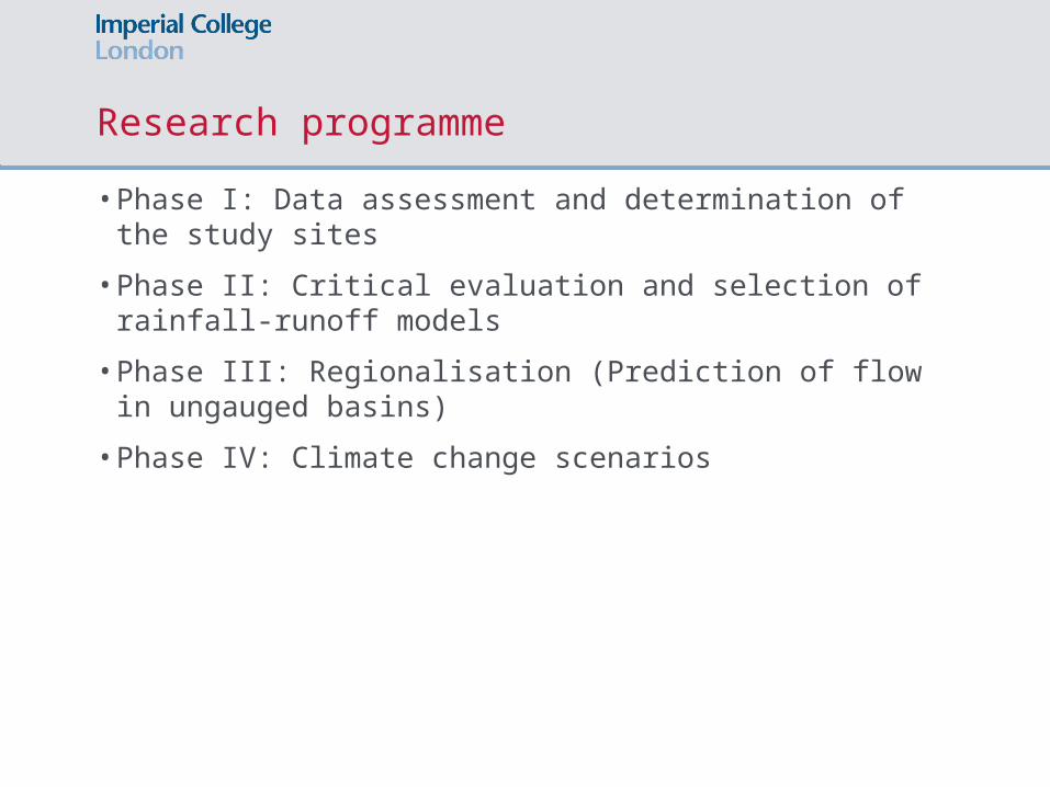
Research programme
• Phase I: Data assessment and determination of the study sites
• Phase II: Critical evaluation and selection of rainfall-runoff models
• Phase III: Regionalisation (Prediction of flow in ungauged basins)
• Phase IV: Climate change scenarios

Phase I: Data assessment and determination of the study sites

• The most complete period of flow and rainfall data is 01/01/1995-31/12/2006 (12 years).
• The number of viable flow gauges with less than 35% of missing record is as below:
Phase I: Data assessment and determination of the study sites
Basin Area (km2)
Flow gauges
Rain gauges
Tele gauges
Ping 33,898 47 63 (16) 12
Wang 10,791 5 18 0
Yom 23,616 14 32 (1) 0
Nan 34,330 23 51 (5) 0
* Numbers in brackets refer to the station with hourly rainfall.

Next step: Assessment of regionalisation method
• Regression method
Use regression analysis to find the relationship of parameters and catchment descriptors (i.e. area, average precipitation, BFI) of well-gauged catchments. By applying the regression equations to ungauged catchments, parameters of ungauged catchments can be obtained.
• Similarity method
Take parameter values of a well-gauged catchment without adjusting.
•Response Indices method
Find the relationship between response indices (i.e. mean daily flow) and catchment descriptors.

Thank you