victoria's earth resources under cover...victoria’s earth resources under cover searching the...
TRANSCRIPT

Victoria’s earth resources
under cover Searching the Deep Earth Summit
31 March – 2 April 2014

UNCOVER the prizes
70 million oz Au Yet-to-find

Characterising the cover
Regolith/Geochemistry

Lithospheric architecture
3D geological model

Lithospheric architecture
AusLAMP
• Programme commenced (red dots)
• Half degree grid spacing (~55 km)
• Deployment ~1 month
• Maximum sensitivity to base of lithosphere

Lithospheric architecture
Heat flow
One of many uses…. We can attribute our State wide 3D model with this data and then calculate the temperature at any depth

Depth to basement
45% of area is less than 200 m

GA & GSV Stavely Project
Increase exploration attractiveness through improved understanding of the subsurface geology and its implications for mineral systems in the Stavely region
Achieved through:
1. Characterising the subsurface geology and recognition of environments where mineral systems may have been active
2. Identifying key elements that demonstrate mineral system potential
3. Understanding the depth and nature of cover

Stavely Project – buried Andean Arc
Interpreted
seismic data
related to a
theoretical
plate tectonic
scenario:
An accreted
Cambrian
back arc –
arc – fore arc
succession.

Characterising the subsurface geology
• Targeted drilling to delineate the
distribution of rocks prospective
for porphyry-epithermal mineral
systems (‘Miga Arc’)
• Test the core with everything
• Test structural models and
geophysical interpretations
• Understand the geological
evolution of the area to target
where mineral systems may have
operated

Identifying elements which demonstrate
mineral system potential
• Mineral system characterisation of
known prospects in the Stavely
area
• Identification of key rock packages
corresponding to metallogenic
events
• Toolkits to recognise distal
footprints of buried mineral
systems:
– DET CRC lab-at-rig technology
– Detailed cover geochemical profiles
– Hydrogeochemistry
– HyLogger
Quartz-K-feldspar-biotite veins (Thursdays
Gossan porphyry prospect)

Understanding the depth and nature of
cover
• Characterisation of cover types in the Stavely area and their
geological, geochemical and geophysical expression
• Constrain the depth to potentially prospective basement rocks
• Determine the best techniques to determine depth to cover in the
Stavely area by comparing pre-drilling geophysical estimates with
drilling results

Pre-drilling geophysical acquisition
• High-resolution ground geophysical acquisition for geophysical
depth to basement modelling
– Refraction seismic collected on 11 sites
– Reflection seismic collected on 5 sites
– >450 new gravity
– >100 km of ground magnetics
– Electrical resistivity survey at 4 sites
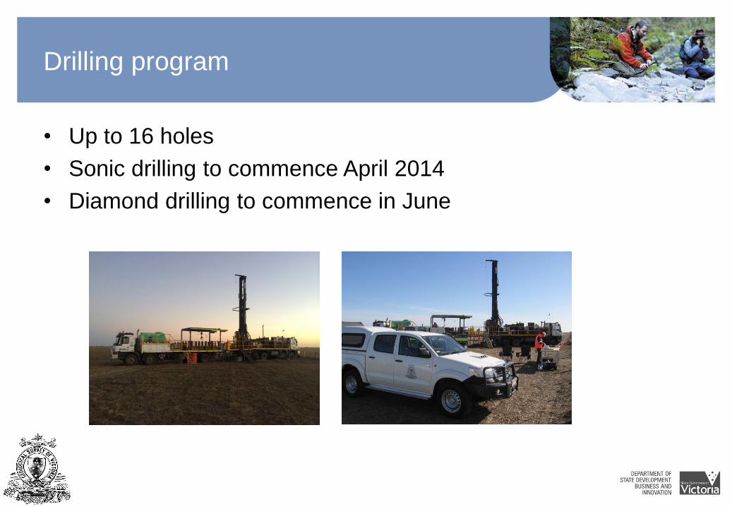
Drilling program
• Up to 16 holes
• Sonic drilling to commence April 2014
• Diamond drilling to commence in June