via regia
TRANSCRIPT
www.edc-viaregia.eu
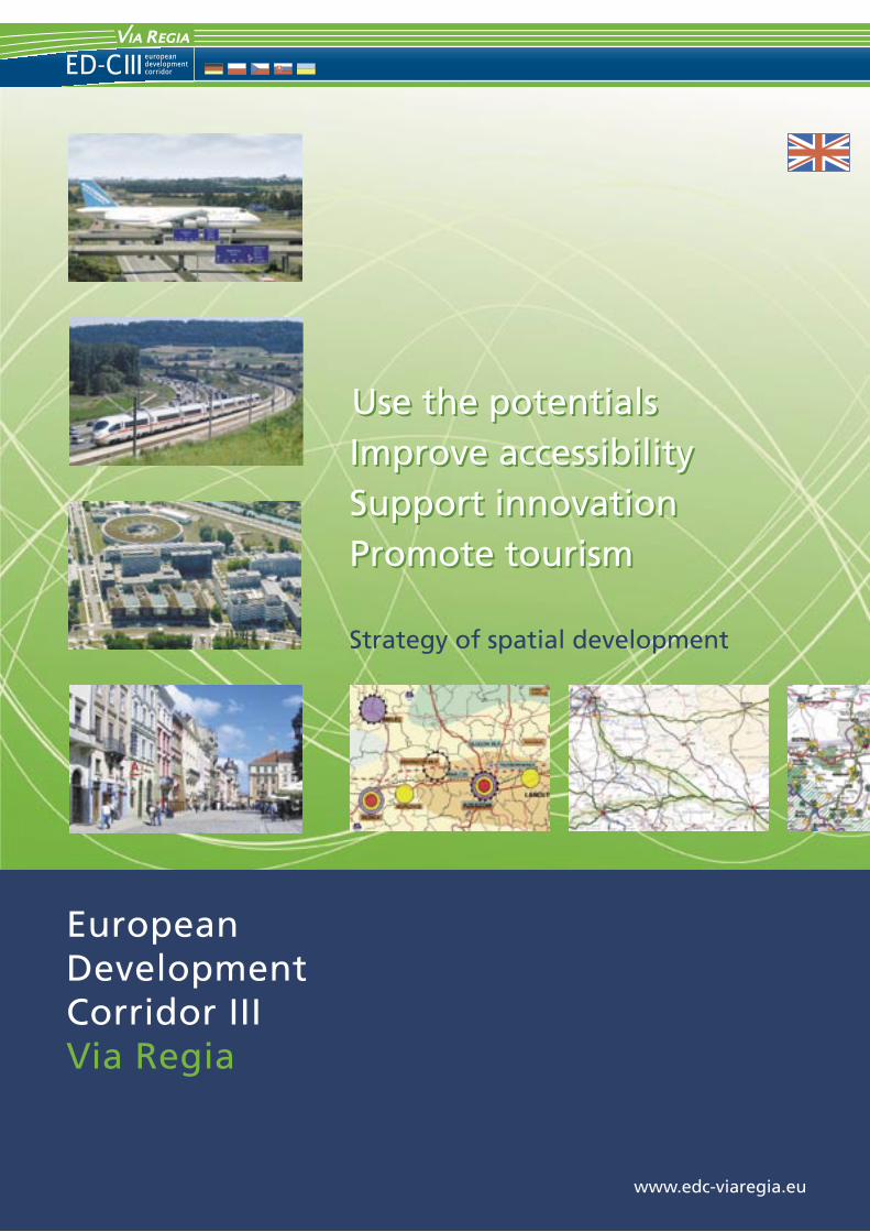
Improve accessibilitySupport innovationPromote tourism
Strategy of spatial development
Use the potentialsUse the potentialsImprove accessibilitySupport innovationPromote tourism
Project partners� Saxon State Ministry of the Interior (D, Lead Partner)
� Joint Spatial Planning Department of Berlin and Brandenburg (D)
� Ministry of Building, Construction and Transport of Thuringia (D)
� City of Cottbus (D)
� Senate Department for Urban Development Berlin (D)
� City of Dresden (D)
� Lower Silesian Voivodship � Regional Bureau for Spatial Planning in Wroc³aw (PL)
� Subcarpathian Voivodship � Subcarpathian Office for Spatial Planning in Rzeszów (PL)
� City of Wroc³aw (PL)
� City of Opole (PL)
� City of Rzeszów (PL)
� K³odzko County Office (PL)
� Ústí region (CZ)
� Pardubice region (CZ)
� Agency for the Support of Regional Development Ko�ice (SK)
� Lviv Polytechnic National University (UA)
Editor
Saxon State Ministry of the InteriorDivision 45 European spatial planning, Sectoral planning
Wilhelm-Buck-Straße 4, D-01097 Dresden
as Lead Partner of the INTERREG III B CADSES project
ED-C III Via RegiaEuropean Development Corridor III Via Regia
responsible: Dr. Edgar Trawnicek
External project managementINFRASTRUKTUR & UMWELT
Professor Böhm und PartnerGregor-Mendel-Straße 9, D-14469 Potsdam
Project duration: 10/2005 � 03/2008
The realisation of the project was supported from the federal programme �Transnational Cooperation� of the Federal Ministry for Transport, Construction and Urban Development.
Project part-financedby the European Union
1
The strategy of spatial development for the “Euro-pean Development Corridor III Via Regia”, descri-bed in this brochure, is borne by the vision of a dynamic region of growth from eastern Germany via southern Poland into the Ukraine, also incor-porating the neighbouring regions in Slovakia and the Czech Republic. The Pan-European Transport Corridor III connects dynamically developing cities and metropolitan areas with each other and forms the backbone of this economic region. It is the inter-face for the exchange of people, goods, knowledge and capital. Building on an infrastructure which is becoming increasingly efficient, the development corridor connects the regions between east and west as well as providing vital intersections with important north-south development corridors. The Corridor therefore, with its metropolitan areas, cities and regions, contributes enormously to the territorial cohesion and to the further integration of the European Union with its neighbours.
Due to their cooperation within the scope of the INTERREG III B Project ED-C III Via Regia, a total of 16 cities and regions from Germany, Poland, the Czech Republic, Slovakia and the Ukraine have laid down one of the foundation stones for the rea-lisation of this important target. I am particularly pleased that the Free State of Saxony, as the Lead Partner, was entrusted with such an important role and that together, we have been successful in pro-viding such important impulses for ourselves and our neighbours for European spatial development.
The Free State of Saxony lies at the intersection of two dynamic European development corridors which, as guarantees for the good accessibility of Saxony and the “Saxon Triangle” metropolitan region in the heart of Europe, are indispensable
components for our future prosperity. At the same time, the historical and cultural heritage of the Via Regia, as the ancient predecessor of the current con-nections between Erfurt, Dresden, Berlin, Wrocław, Kraków, Lviv and Kiev, is both an obligation and an incentive for us — then the Via Regia was also always an axis of European cultural exchange. The Third Saxon State Exhibition, which will take place in Görlitz in 2011, will echo this tradition as it has the Via Regia in its focus.
The strategy of spatial development also shows us, however, which tasks still lie before us. In this sense, it acts as an initiator for the continuation of the cooperation in the new 2007-2013 programming period within the scope of the European Territo-rial Cooperation Programme. State planning and spatial planning in Saxony will continue to parti-cipate actively in the cooperation process. In this connection, together with our neighbours, we wish to ensure that the common themes and interests are given due attention at the national and European decision-making levels and that concrete actions for their realisation are generated.
With these objectives in mind, I am looking for-ward to the future cooperation along the Via Regia.
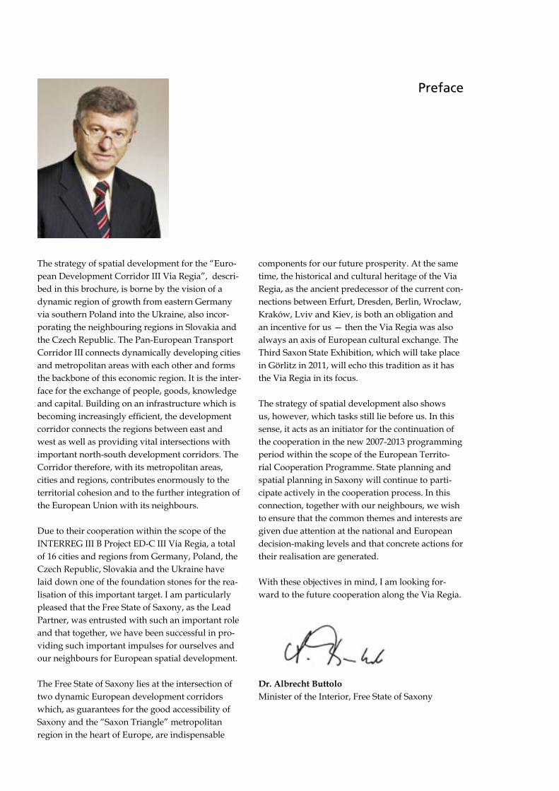
Dr. Albrecht ButtoloMinister of the Interior, Free State of Saxony
Preface
3
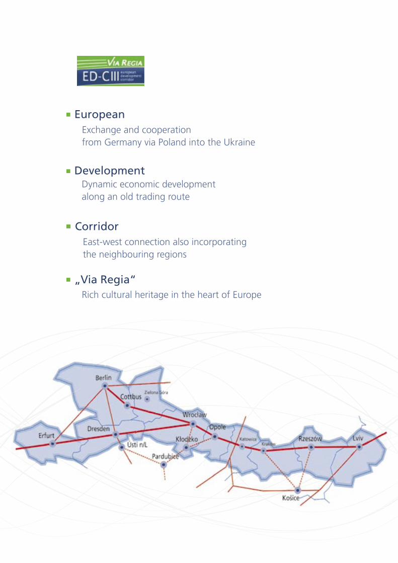
Exchange and cooperationfrom Germany via Poland into the Ukraine
European
Dynamic economic developmentalong an old trading route
Development
East-west connection also incorporating the neighbouring regions
Corridor
Rich cultural heritage in the heart of Europe
�Via Regia�
3
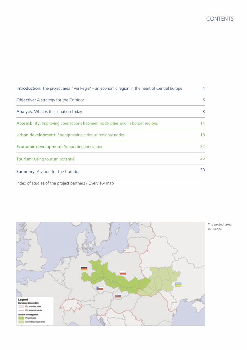
CONTENTS
The project area
in Europe
Introduction: The project area �Via Regia�� an economic region in the heart of Central Europe
Objective: A strategy for the Corridor
Analysis: What is the situation today
Accessibility: Improving connections between node cities and in border regions
Urban development: Strengthening cities as regional nodes
Economic development: Supporting innovation
Tourism: Using tourism potential
Summary: A vision for the Corridor
Index of studies of the project partners / Overview map
4
6
8
14
18
22
26
30
4 5
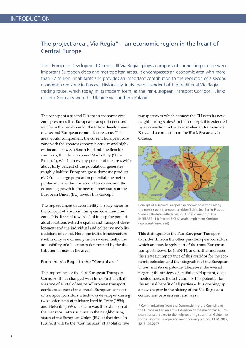
The concept of a second European economic core zone presumes that European transport corridors will form the backbone for the future development of a second European economic core zone. This area would complement the current European core zone with the greatest economic activity and high-est income between South England, the Benelux countries, the Rhine axis and North Italy (“Blue Banana”), which on twenty percent of the area, with about forty percent of the population, generates roughly half the European gross domestic product (GDP). The large population potential, the metro-politan areas within the second core zone and the economic growth in the new member states of the European Union (EU) favour this concept.
The improvement of accessibility is a key factor in the concept of a second European economic core zone. It is directed towards linking up the potenti-als of locations with the spatial and transport deve-lopment and the individual and collective mobility decisions of actors. Here, the traffic infrastructure itself is only one of many factors – essentially, the accessibility of a location is determined by the dis-tribution of uses in the area.
From the Via Regia to the �Central axis�
The importance of the Pan-European Transport Corridor III has changed with time. First of all, it was one of a total of ten pan-European transport corridors as part of the overall European concept of transport corridors which was developed during two conferences at minister level in Crete (1994) and Helsinki (1997). The aim was the extension of the transport infrastructure in the neighbouring states of the European Union (EU) at that time. In future, it will be the “Central axis” of a total of five
transport axes which connect the EU with its new neighbouring states.1 In this concept, it is extended by a connection to the Trans-Siberian Railway via Kiev and a connection to the Black Sea area via Odessa.
This distinguishes the Pan-European Transport Corridor III from the other pan-European corridors, which are now largely part of the trans-European transport networks (TEN-T), and further increases the strategic importance of this corridor for the eco-nomic cohesion and the integration of the European Union and its neighbours. Therefore, the overall target of the strategy of spatial development, docu-mented here, is the activation of this potential for the mutual benefit of all parties – thus opening up a new chapter in the history of the Via Regia as a connection between east and west.
1 Communication from the Commission to the Council and
the European Parliament � Extension of the major trans-Euro-
pean transport axes to the neighbouring countries. Guidelines
for transport in Europe and neighbouring regions, COM(2007)
32, 31.01.2007
INTRODUCTION
The project area �Via Regia� � an economic region in the heart of Central Europe
The �European Development Corridor III Via Regia� plays an important connecting role between important European cities and metropolitan areas. It encompasses an economic area with more than 37 million inhabitants and provides an important contribution to the evolution of a second economic core zone in Europe. Historically, in its the descendent of the traditional Via Regia trading route, which today, in its modern form, as the Pan-European Transport Corridor III, links eastern Germany with the Ukraine via southern Poland.
Concept of a second European economic core zone along
the north-south transport corridor: Baltic Sea-Berlin-Prague-
Vienna / Bratislava-Budapest or Adriatic Sea, from the
INTERREG III B-Project SIC! Sustrain Implement Corridor
(www.sustrain-ic.net)
4 5
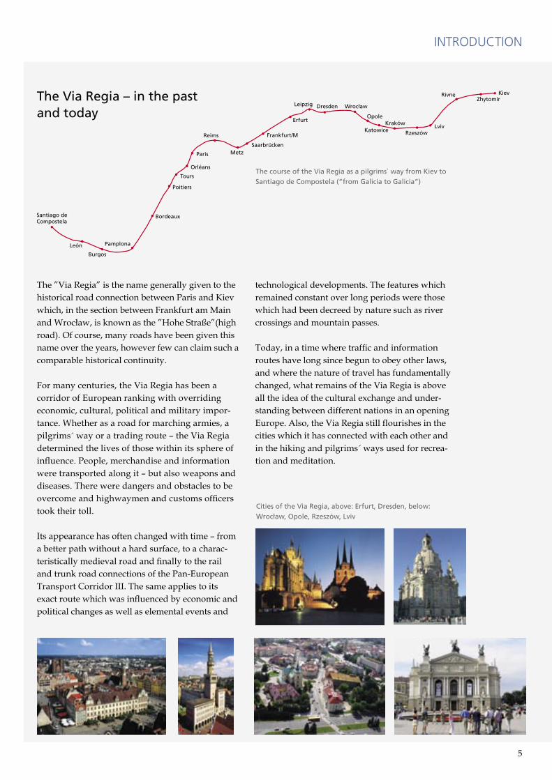
The ”Via Regia” is the name generally given to the historical road connection between Paris and Kiev which, in the section between Frankfurt am Main and Wrocław, is known as the ”Hohe Straße”(high road). Of course, many roads have been given this name over the years, however few can claim such a comparable historical continuity.
For many centuries, the Via Regia has been a corridor of European ranking with overriding economic, cultural, political and military impor-tance. Whether as a road for marching armies, a pilgrims´ way or a trading route – the Via Regia determined the lives of those within its sphere of influence. People, merchandise and information were transported along it – but also weapons and diseases. There were dangers and obstacles to be overcome and highwaymen and customs officers took their toll.
Its appearance has often changed with time – from a better path without a hard surface, to a charac-teristically medieval road and finally to the rail and trunk road connections of the Pan-European Transport Corridor III. The same applies to its exact route which was influenced by economic and political changes as well as elemental events and
technological developments. The features which remained constant over long periods were those which had been decreed by nature such as river crossings and mountain passes.
Today, in a time where traffic and information routes have long since begun to obey other laws, and where the nature of travel has fundamentally changed, what remains of the Via Regia is above all the idea of the cultural exchange and under-standing between different nations in an opening Europe. Also, the Via Regia still flourishes in the cities which it has connected with each other and in the hiking and pilgrims´ ways used for recrea-tion and meditation.
INTRODUCTION
The course of the Via Regia as a pilgrims` way from Kiev to
Santiago de Compostela (�from Galicia to Galicia�)
The Via Regia � in the pastand today
Cities of the Via Regia, above: Erfurt, Dresden, below:
Wroc³aw, Opole, Rzeszów, Lviv

6 7
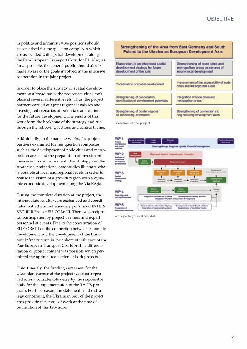
Which potentials for continued cooperation can be exploited along the Pan-European Transport Corridor III, and where the emphasis should be placed here in future, are the subject of the spatial development strategy. As an informal document, this should contribute to overcoming possible development barriers and thus provide active sup-port in the coordination of spatial development.
Therefore the vision is a growth region with a dynamic economic development and an increa-sing interchange of people, goods, knowledge and capital from eastern Germany via South Poland into the Ukraine, taking the neighbouring regions in the Czech Republic and Slovakia into account. In order to turn this vision into reality, the cities and metropolitan regions must be strengthened in
their function as “motors” of economic develop-ment. As communication hubs to other corridors and neighbouring regions they need an approp-riate transport infrastructure which permits and promotes the desired interchange. Spatially, the strategy is concentrated in the border regions, as strengthening their function as interfaces is in the vital interests of everybody situated along the Pan-European Transport Corridor III.
The overriding fields of action are filled with con-tent in the thematic sections of the spatial deve-lopment strategy. In addition, the strategy should also contribute towards strengthening the aware-ness for the ”European Development Corridor III Via Regia” through a better understanding of the common problems and interests. Decision-makers
OBJECTIVE
A strategy for the corridor
Anybody who has travelled along the Via Regia will know which potential and possibilities this area has to offer. One notices also, however, that there is a great deal of work still to be done � and this begins with the transport connections. Whether by road or by rail, the journey takes longer and is less comfortable than in other parts of Europe. One of the objectives of this strat-egy of spatial development is to change these conditions.
Transnational trans-
port networks in the
region of the Euro-
pean Development
Corridor III Via Regia
6 7
in politics and administrative positions should be sensitised for the question complexes which are associated with spatial development along the Pan-European Transport Corridor III. Also, as far as possible, the general public should also be made aware of the goals involved in the intensive cooperation in the joint project.
In order to place the strategy of spatial develop-ment on a broad basis, the project activities took place at several different levels. Thus, the project partners carried out joint regional analyses and investigated scenarios of potentials and options for the future development. The results of this work form the backbone of the strategy and run through the following sections as a central theme.
Additionally, in thematic networks, the project partners examined further question complexes such as the development of node cities and metro-politan areas and the preparation of investment measures. In connection with the strategy and the strategic examinations, case studies illustrate what is possible at local and regional levels in order to realise the vision of a growth region with a dyna-mic economic development along the Via Regia.
During the complete duration of the project, the intermediate results were exchanged and coordi-nated with the simultaneously performed INTER-REG III B Project EU-CORe III. There was recipro-cal participation by project partners and expert personnel at events. Due to the concentration of EU-CORe III on the connection between economic development and the development of the trans-port infrastructure in the sphere of influence of the Pan-European Transport Corridor III, a differen-tiation of project content was possible which per-mitted the optimal realisation of both projects.
Unfortunately, the funding agreement for the Ukrainian partner of the project was first appro-ved after a considerable delay by the responsible body for the implementation of the TACIS pro-gram. For this reason, the statements in the stra-tegy concerning the Ukrainian part of the project area provide the status of work at the time of publication of this brochure.
OBJECTIVE
Objectives of the project
Work packages and schedule

8 9
The analysis of the conditions for the regional development was carried out in three steps: The initial analysis of the development conditions along the corridor, regional analyses and cross-border studies in selected border regions.
Within the scope of the initial analysis, a GIS database was compiled which provided a cross-border mapping basis with data on settlement structure and transport infrastructure. Also, publicly accessible statistical data were evaluated which describe the spatial and social background conditions in the project area.
A special focus was the evaluation of the data on accessibility from the INTERREG III B Project SIC! which has already been completed and cov-ers parts of the project area of ED-C III Via Regia. This data were used to carry out examinations of the quality of interconnections along the Pan-
European Transport Corridor III and in selected bordering regions.
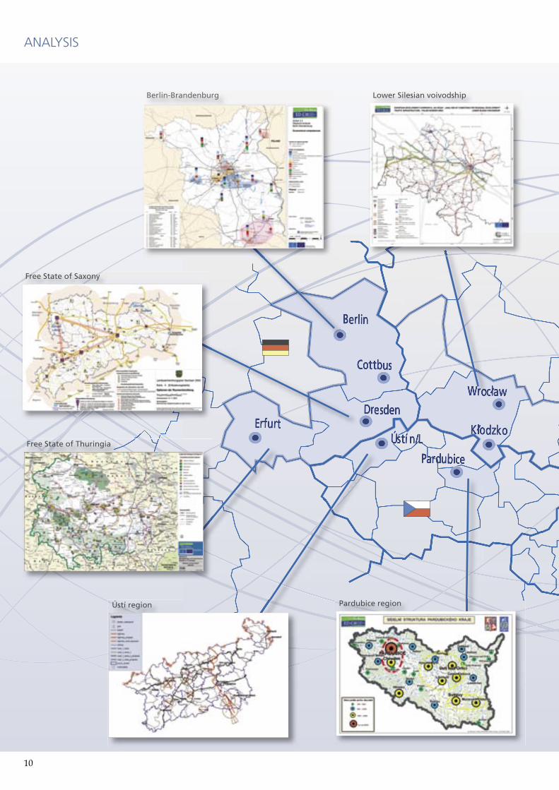
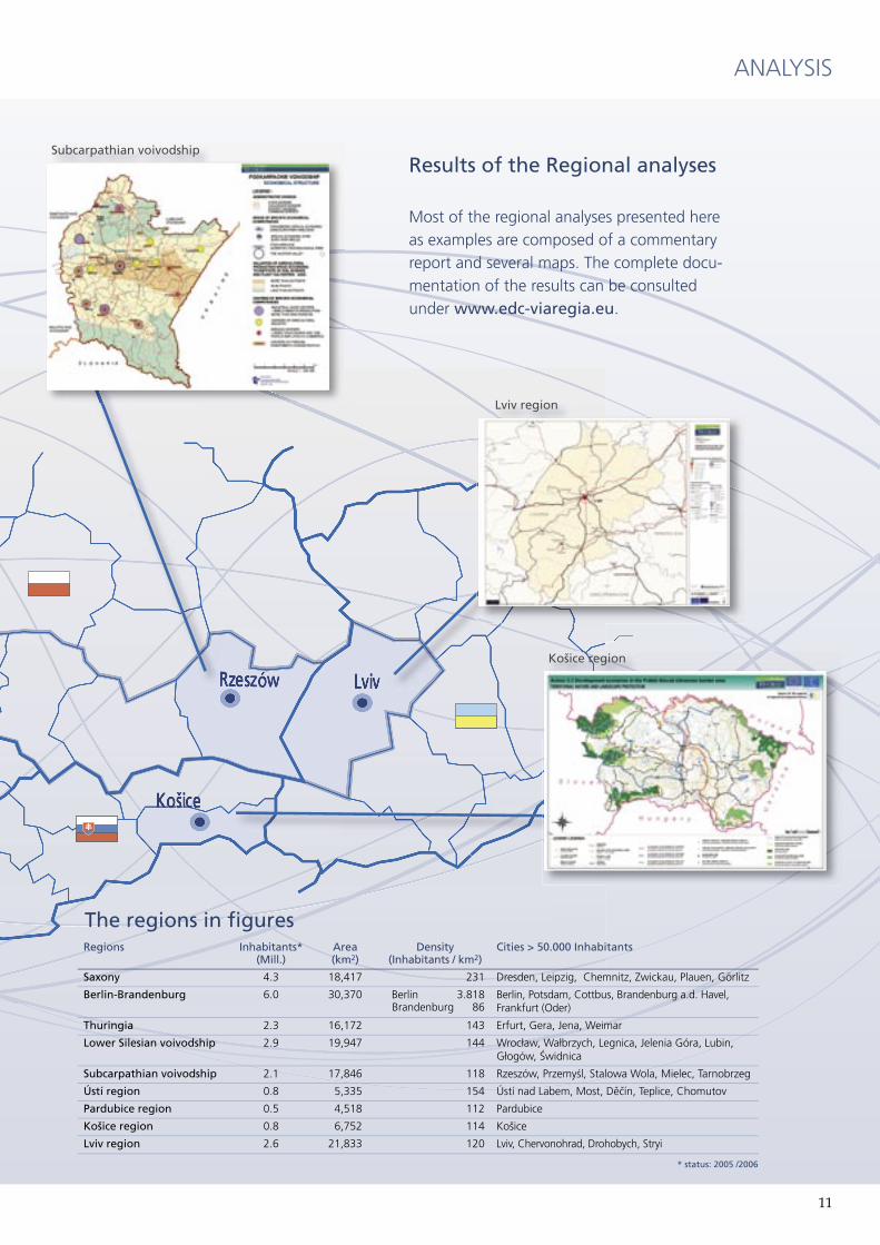
A total of nine regions were examined in the Regional analyses, which were carried out according to an agreed method by the project part-ners for their respective areas of responsibility. The aim was to obtain the most comprehensive acquisition of qualitative and quantitative infor-mation on the subjects of settlement structure, transport infrastructure, research and develop-ment, the economy and the tourism infrastructure.
A selection of the regional analyses results is shown on the following pages. Also shown are the cross-border studies, to which the regional analyses were added. These, along with the other analyses, can be consulted on the Internet site www.edc-viaregia.eu where they are documented.
The initial position: What is the situation today
The analysis of the conditions of regional development, which was carried out within the scope of the project, is the first comprehensive analysis of this kind for the area of the Pan-European Transport Corridor III. The results of the analysis were the basis for the discussion of scenarios and options for the future development and thus contributed directly to the spatial development strategy. This applies both to the acquisition of data as well as its evaluation in maps and statistical analyses.
ANALYSIS
Administrative
structure of the
project area and
investigation area
of the analyses
8 9
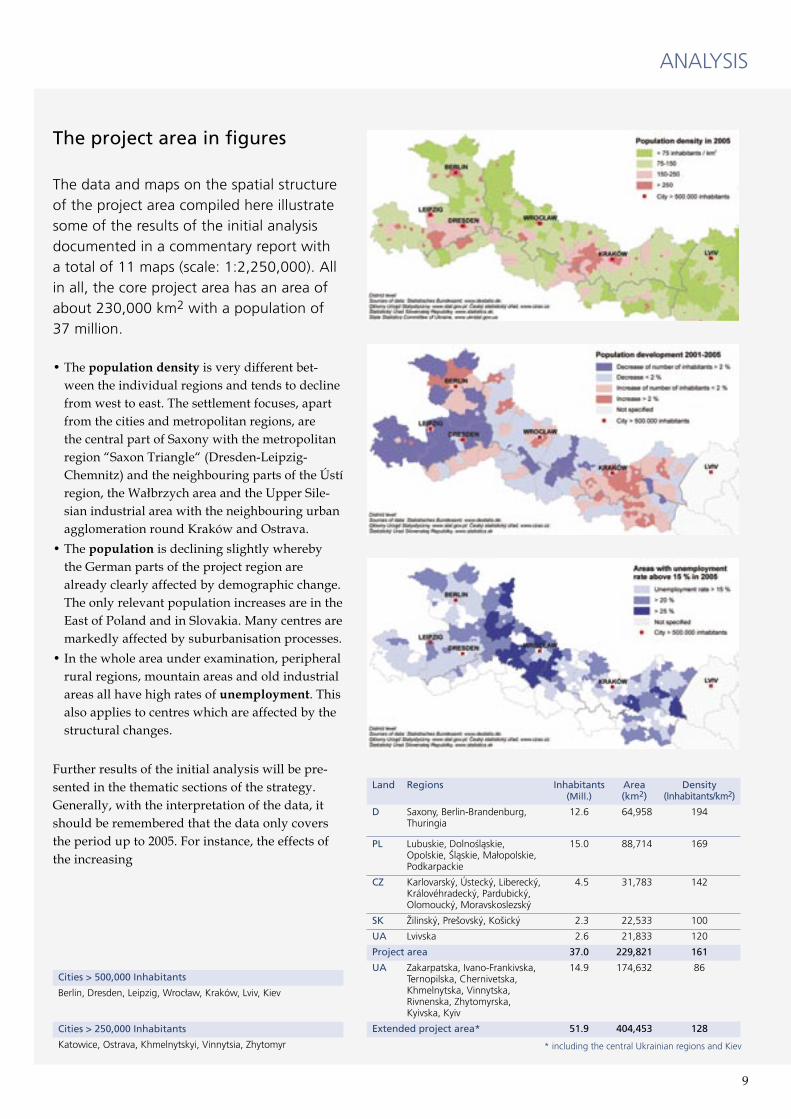
The project area in figures
The data and maps on the spatial structure of the project area compiled here illustrate some of the results of the initial analysis documented in a commentary report with a total of 11 maps (scale: 1:2,250,000). All in all, the core project area has an area of about 230,000 km2 with a population of 37 million.
• The population density is very different bet-ween the individual regions and tends to decline from west to east. The settlement focuses, apart from the cities and metropolitan regions, are the central part of Saxony with the metropolitan region “Saxon Triangle“ (Dresden-Leipzig-Chemnitz) and the neighbouring parts of the Ústí region, the Wałbrzych area and the Upper Sile-sian industrial area with the neighbouring urban agglomeration round Kraków and Ostrava.
• The population is declining slightly whereby the German parts of the project region are already clearly affected by demographic change. The only relevant population increases are in the East of Poland and in Slovakia. Many centres are markedly affected by suburbanisation processes.
• In the whole area under examination, peripheral rural regions, mountain areas and old industrial areas all have high rates of unemployment. This also applies to centres which are affected by the structural changes.
Further results of the initial analysis will be pre-sented in the thematic sections of the strategy. Generally, with the interpretation of the data, it should be remembered that the data only covers the period up to 2005. For instance, the effects of the increasing
ANALYSIS
Land Regions Inhabitants(Mill.)
Area(km2)
Density(Inhabitants/km2)
D Saxony, Berlin-Brandenburg, Thuringia
12.6 64,958 194
PL Lubuskie, Dolno�ląskie, Opolskie, �ląskie, Ma³opolskie, Podkarpackie
15.0 88,714 169
CZ Karlovarský, Ústecký, Liberecký, Královéhradecký, Pardubický, Olomoucký, Moravskoslezský
4.5 31,783 142
SK �ilinský, Pre�ovský, Ko�ický 2.3 22,533 100
UA Lvivska 2.6 21,833 120
Project area 37.0 229,821 161
UA Zakarpatska, Ivano-Frankivska, Ternopilska, Chernivetska, Khmelnytska, Vinnytska, Rivnenska, Zhytomyrska, Kyivska, Kyiv
14.9 174,632 86
Extended project area* 51.9 404,453 128
* including the central Ukrainian regions and Kiev
Cities > 500,000 Inhabitants
Berlin, Dresden, Leipzig, Wroc³aw, Kraków, Lviv, Kiev
Cities > 250,000 Inhabitants
Katowice, Ostrava, Khmelnytskyi, Vinnytsia, Zhytomyr
10 11
ANALYSIS
Free State of Saxony
Berlin-Brandenburg
Ústí region Pardubice region
Lower Silesian voivodship
Free State of Thuringia
10 11
ANALYSIS
Ko�ice region
Subcarpathian voivodship
Lviv region
The regions in fi gures
Results of the Regional analyses
Most of the regional analyses presented here as examples are composed of a commentary report and several maps. The complete docu-mentation of the results can be consulted under www.edc-viaregia.eu.
Regions Inhabitants*(Mill.)
Area(km2)
Density(Inhabitants / km2)
Cities > 50.000 Inhabitants
Saxony 4.3 18,417 231 Dresden, Leipzig, Chemnitz, Zwickau, Plauen, Görlitz
Berlin-Brandenburg 6.0 30,370 Berlin 3.818Brandenburg 86
Berlin, Potsdam, Cottbus, Brandenburg a.d. Havel, Frankfurt (Oder)
Thuringia 2.3 16,172 143 Erfurt, Gera, Jena, Weimar
Lower Silesian voivodship 2.9 19,947 144 Wroc³aw, Wa³brzych, Legnica, Jelenia Góra, Lubin, G³ogów, �widnica
Subcarpathian voivodship 2.1 17,846 118 Rzeszów, Przemy�l, Stalowa Wola, Mielec, Tarnobrzeg
Ústí region 0.8 5,335 154 Ústí nad Labem, Most, Děčín, Teplice, Chomutov
Pardubice region 0.5 4,518 112 Pardubice
Ko�ice region 0.8 6,752 114 Ko�ice
Lviv region 2.6 21,833 120 Lviv, Chervonohrad, Drohobych, Stryi
* status: 2005 /2006
12 13
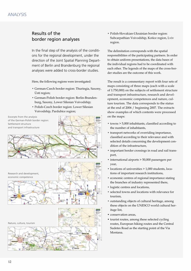
Results of theborder region analyses
In the final step of the analysis of the conditi-ons for the regional development, under the direction of the Joint Spatial Planning Depart-ment of Berlin and Brandenburg the regional analyses were added to cross-border studies.
Here, the following regions were investigated:
• German-Czech border region: Thuringia, Saxony, Ústí region;
• German-Polish border region: Berlin-Branden-burg, Saxony, Lower Silesian Voivodship;
• Polish-Czech border region: Lower Silesian Voivodship, Pardubice region;
• Polish-Slovakian-Ukrainian border region: Subcarpathian Voivodship, Košice region, Lviv region.
The delimitation corresponds with the spatial responsibilities of the participating partners. In order to obtain uniform presentations, the data bases of the individual regions had to be coordinated with each other. The legends of the maps of the cross-bor-der studies are the outcome of this work.
The result is a commentary report with four sets of maps consisting of three maps (each with a scale of 1:750,000) on the subjects of settlement structure and transport infrastructure, research and devel-opment, economic competences and nature, cul-ture tourism. The data corresponds to the status at the end of 2006 / beginning 2007. The extracts show examples of which contents were processed on the maps:
• towns > 5,000 inhabitants, classified according to the number of inhabitants,
• transport networks of overriding importance, classified according to their relevance and with selected details concerning the development con-dition of the infrastructure,
• important border crossings in road and rail trans-port,
• international airports > 50,000 passengers per year,
• locations of universities > 1,000 students, loca-tions of important research institutions,
• economic centres of regional importance stating the branches of industry represented there,
• logistic centres and locations,• selected towns and locations with relevance for
tourism,• outstanding objects of cultural heritage, among
these objects on the UNESCO world cultural her-itage list,
• conservation areas,• tourist routes, among these selected cycling
routes, European hiking routes and the Central Sudetes Road as the starting point of the Via Montana.
ANALYSIS
Excerpts from the analysis
of the German-Polish border region:
Settlement structure
and transport infrastructure
Research and development,
economic competence
Nature, culture, tourism
12 13
Conclusions for thestrategy of spatial development
The fundamentals for the strategy of spatial deve-lopment were generated in a discussion process which took place immediately after the analysis phase. Building on the results of the analysis of the conditions for regional development, the scenarios and options for spatial development in the indivi-dual border regions were discussed and evaluated. Also, key projects and measures were derived, sui-table for supporting the realisation of the strategy.
In order to prepare the examination of the sce-narios and options of spatial development, the regional analyses in some border regions were augmented by neighbouring regions in order to close geographical gaps. In the German-Polish border region, this involves the Lubuskie voivod-ship, and in the Polish-Slovakian-Ukrainian border region the area of Prešov region is incorporated.
The result is that various elaborations have been generated which show which cooperation poten-tials exist in the examined border regions. Not all the projects and measures proposed here were relevant for the strategy of spatial development. Many could also be realised, e.g. within the scope of Euroregions and the accompanying fund-ing programs of the EU for European Territorial Cooperation as cross-border cooperation.
The projects and measures which are to be incorpo-rated in the strategy of spatial development due to their superregional importance will be presented
in the following, together with the associated case studies and strategical examinations of the project partners. Following up on the formulated objec-tives, the analyses performed and the results of the scenarios, the strategy of spatial development is composed of four thematic sections:
• Accessibility,• Urban development,• Economic development,• Tourism.
The structure of the strategy reflects the compre-hensive approach of the project partners to the problem complex of spatial development along the Pan-European Transport Corridor III. It is obvious that the involvement of further actors is necessary to implement the strategy. As far as possible, dur-ing the presentation of the thematic sections, first indications of these further cooperation partners will be provided.
A summary report concludes the strategy of spa-tial development in which a first appraisal of the works to-date is presented and a possible way towards the continued realisation of the strategy is outlined. Furthermore, the case studies and stra-tegic examinations of the project partners are con-tained in a directory which also lists the complete title and the appropriate contact persons.
ANALYSIS
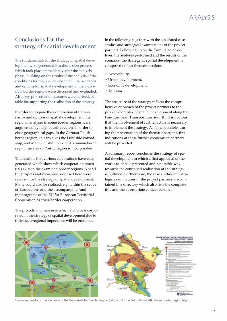
Exemplary results of the scenarios in the German-Polish border region (left) and in the Polish-Slovak-Ukrainian border region (right)
14 15
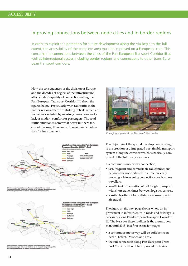
How the consequences of the division of Europe and the decades of neglect of the infrastructure affects today´s quality of connections along the Pan-European Transport Corridor III, show the figures below. Particularly with rail traffic in the border regions, there are striking deficits which are further exacerbated by missing connections and a lack of modern comfort for passengers. The road traffic situation is somewhat better but here too, east of Kraków, there are still considerable poten-tials for improvement.
The objective of the spatial development strategy is the creation of a integrated sustainable transport system along the corridor which is basically com-posed of the following elements:
• a continuous motorway connection,• fast, frequent and comfortable rail connections
between the node cities with attractive early morning – late evening connections for business travellers,
• an efficient organisation of rail freight transport with short travel times between logistics centres,
• a suitable offer of long distance connection in air travel.
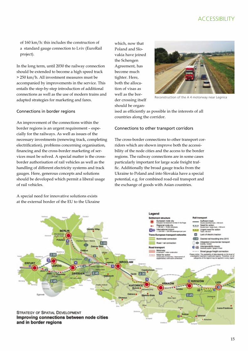
The figure on the next page shows where an im-provement in infrastructure in roads and railways is necessary along Pan-European Transport Corridor III. The basis for these findings is the assumption that, until 2015, in a first extension stage:
• a continuous motorway will be built between Berlin, Erfurt, Dresden and Lviv,
• the rail connection along Pan-European Trans-port Corridor III will be improved for trains
Improving connections between node cities and in border regions
In order to exploit the potentials for future development along the Via Regia to the full extent, the accessibility of the complete area must be improved on a European scale. This concerns the connections between the cities of the Pan-European Transport Corridor III as well as interregional access including border regions and connections to other trans-Euro-pean transport corridors.
ACCESSIBILITY
Changing engines at the German-Polish border
14 15
of 160 km/h: this includes the construction of a standard gauge connection to Lviv (EuroRail project).
In the long term, until 2030 the railway connection should be extended to become a high speed track > 250 km/h. All investment measures must be accompanied by improvements in the service. This entails the step-by-step introduction of additional connections as well as the use of modern trains and adapted strategies for marketing and fares.
Connections in border regions
An improvement of the connections within the border regions is an urgent requirement – espe-cially for the railways. As well as issues of the necessary investments (renewing track, completing electrification), problems concerning organisation, financing and the cross-border marketing of ser-vices must be solved. A special matter is the cross-border authorisation of rail vehicles as well as the handling of different electricity systems and track gauges. Here, generous concepts and solutions should be developed which permit a liberal usage of rail vehicles.
A special need for innovative solutions exists at the external border of the EU to the Ukraine
which, now that Poland and Slo-vakia have joined the Schengen Agreement, has become much tighter. Here, both the alloca-tion of visas as well as the bor-der crossing itself should be organ-ised as efficiently as possible in the interests of all countries along the corridor.
Connections to other transport corridors
The cross-border connections to other transport cor-ridors which are shown improve both the accessi-bility of the node cities and the access to the border regions. The railway connections are in some cases particularly important for large scale freight traf-fic. Additionally the broad gauge tracks from the Ukraine to Poland and into Slovakia have a special potential, e.g. for combined road-rail transport and the exchange of goods with Asian countries.
ACCESSIBILITY
Reconstruction of the A 4 motorway near Legnica

16 17
Short term and low cost improve-ments in passenger rail traffic
An examination was carried out by the Senate Department for Urban Development in Berlin to determine how passenger rail travel between Ber-lin and Wrocław could be improved using simple measures. Result:
• Already today, high-value early morning and late evening connections are possible with a travel-ling time of about 5 hours if the timetables of the express trains travelling between Berlin, Warsaw and Wrocław via Poznań are better coordinated.
• If the Eurocity train ”Wawel” to Kraków does not run via Forst but via Görlitz instead, the travel-ling time can be shortened and the quality of the connections will be improved between Dresden and Wrocław, too.
The study shows that the travelling time of direct trains can be reduced to under four hours if planned investments come quickly. This would be accompanied by an improved service – an impor-tant prerequisite for fully exploiting the passenger
potential, which will increase even more due to the new Berlin Brandenburg International (BBI) airport.
Implementation of attractive offers in local cross-border travel
An impulse for the development of local cross-bor-der traffic for regional tourism was provided by the Joint Spatial Planning Department of Berlin and Brandenburg with their study “Mobile in the Ger-man-Polish border region“. Building on the sub-stantial participation by local actors, in particular in Poland, the cooperation which had already started on the preparation of development scenarios for 2020 in this region was continued. The results of this work identified existing cross-border initiatives and cooperations as well as particularly attractive tourist destinations on both sides of the Oder and Neisse which could be explored using a cross-bor-der travel map.
The long-term target is the implementation of Ger-man-Polish networks and marketing partnerships for products, especially in the tourist sector, as well as integrated cross-border local transport system offers such as those which have already been estab-lished very successfully elsewhere, e.g. with the Euro-Neisse-Ticket in the three countries triangle between Saxony, Lower Silesia and the Liberec region or with Egronet, the linked transport system between Thuringia, Saxony, Bavaria and the Czech Karlovy Vary region.
ACCESSIBILITY
Timetable study 2011:
Possible travelling times and speeds between Berlin and Wroc³aw
Local train to
Wroc³aw at Görlitz
Excursion destinations and cross-border cooperations for
tourism in the border region
16 17
Networking of transport corridors in road traffic
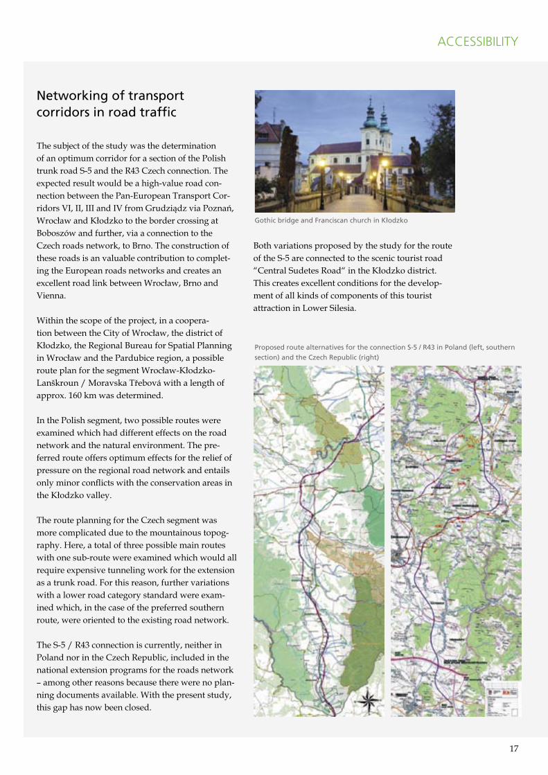
The subject of the study was the determination of an optimum corridor for a section of the Polish trunk road S-5 and the R43 Czech connection. The expected result would be a high-value road con-nection between the Pan-European Transport Cor-ridors VI, II, III and IV from Grudziądz via Poznań, Wrocław and Kłodzko to the border crossing at Boboszów and further, via a connection to the Czech roads network, to Brno. The construction of these roads is an valuable contribution to complet-ing the European roads networks and creates an excellent road link between Wrocław, Brno and Vienna.
Within the scope of the project, in a coopera-tion between the City of Wrocław, the district of Kłodzko, the Regional Bureau for Spatial Planning in Wrocław and the Pardubice region, a possible route plan for the segment Wrocław-Kłodzko-Lanškroun / Moravska Třebová with a length of approx. 160 km was determined.
In the Polish segment, two possible routes were examined which had different effects on the road network and the natural environment. The pre-ferred route offers optimum effects for the relief of pressure on the regional road network and entails only minor conflicts with the conservation areas in the Kłodzko valley.
The route planning for the Czech segment was more complicated due to the mountainous topog-raphy. Here, a total of three possible main routes with one sub-route were examined which would all require expensive tunneling work for the extension as a trunk road. For this reason, further variations with a lower road category standard were exam-ined which, in the case of the preferred southern route, were oriented to the existing road network.
The S-5 / R43 connection is currently, neither in Poland nor in the Czech Republic, included in the national extension programs for the roads network – among other reasons because there were no plan-ning documents available. With the present study, this gap has now been closed.
Both variations proposed by the study for the route of the S-5 are connected to the scenic tourist road “Central Sudetes Road“ in the Kłodzko district. This creates excellent conditions for the develop-ment of all kinds of components of this tourist attraction in Lower Silesia.
ACCESSIBILITY
Gothic bridge and Franciscan church in K³odzko
Proposed route alternatives for the connection S-5 / R43 in Poland (left, southern
section) and the Czech Republic (right)
18 19
Along the Pan-European Transport Corridor III, there are ten primary node cities at the junc-tion with European north-south axes: Kiev, Lviv, Rzeszów, Kraków, Katowice, Wrocław, Dresden, Leipzig, Berlin and Erfurt. As intermodal hubs of European relevance, these cities have special tasks regarding accessibility on the scale of the corridor.
Furthermore, there are many towns which have the function of regional nodes and which, together with the node cities of European relevance, serve as growth centres for their surrounding areas. Towns such as Opole, Cottbus, Ústí nad Labem and Par-dubice are examples and their task is to define their role between the metropolitan areas.
There is a multifarious range of tasks which con-front the node cities in this respect and which con-cern all the fields dealt with in the spatial develop-ment strategy:
• Accessibility: Development of the cities as ”gates” to the corridor, improvement of the inter-faces between the different means of transport,
development of integrated urban traffic systems, city and surrounding area cooperation regarding integrated settlement and traffic development;
• Economic development and innovation: Provi-sion and revitalisation of areas for investment projects, support for initiatives to promote research and innovation, city and surrounding area cooperation in the development of com-merce and industry, concepts for urban and regional logistics, concepts for the management of demographic change, strengthening the educa-tional and qualifications function;
• Tourism and leisure: Development of culture and city sightseeing, development of specific tourist packages, establishing cooperations in tourist packages and their joint marketing.
In this connection, the city of Dresden commis-sioned a study on the cooperation and partnership potentials examining which fields offered future cooperation possibilities for selected cities and regions. Furthermore, the project partners have already carried out a number of exemplary tasks which are described subsequently.
Strengthening cities as regional nodes
Both in the past and today, the cities and metropolitan areas along the Via Regia are the �motors� of development. They have made their mark on this region over centuries and given it its unmistakable character in Europe. In order to fulfil their functions as regional and European centres they must be able to use and develop their potential and qualities within the concept of the vision of a growth region. Each of these cities has its special attractions and specific strengths which they can bring to bear in the context of the corridor.
URBAN DEVELOPMENT
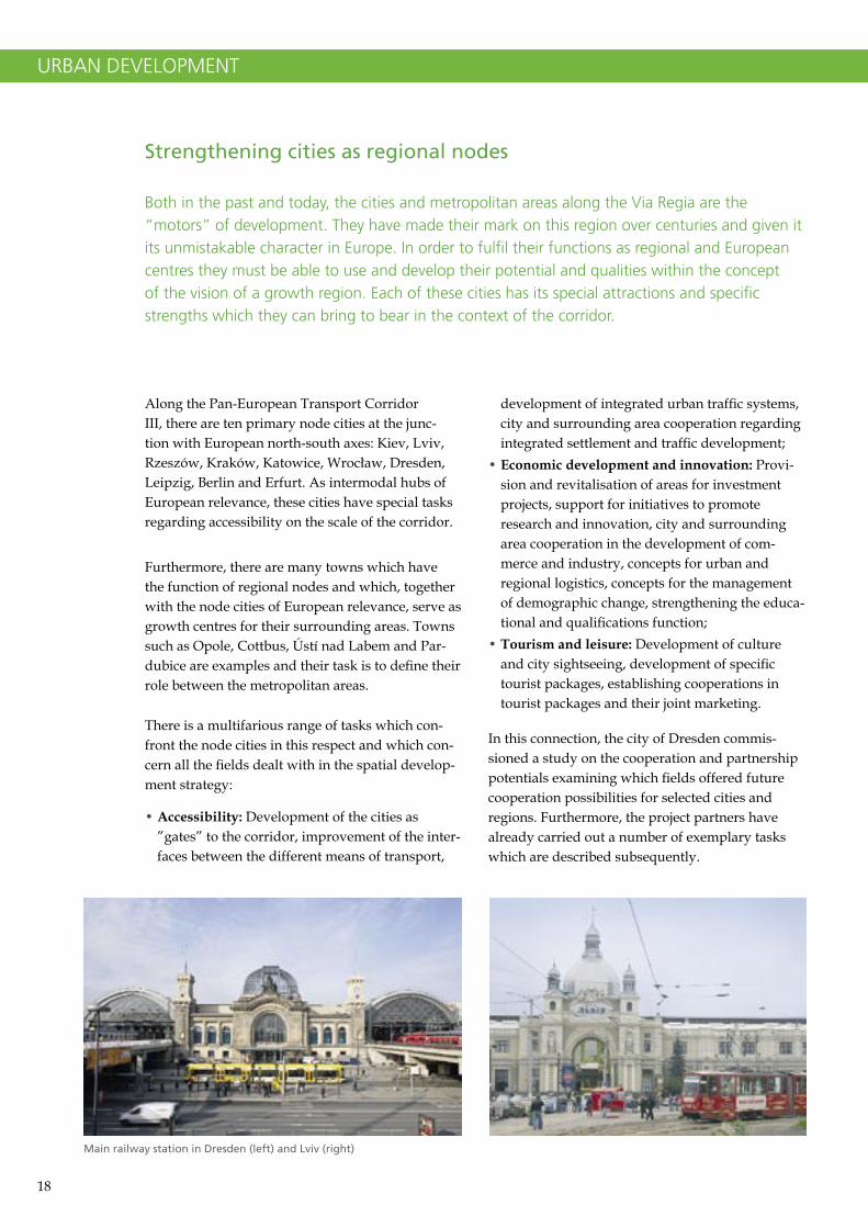
Main railway station in Dresden (left) and Lviv (right)
18 19
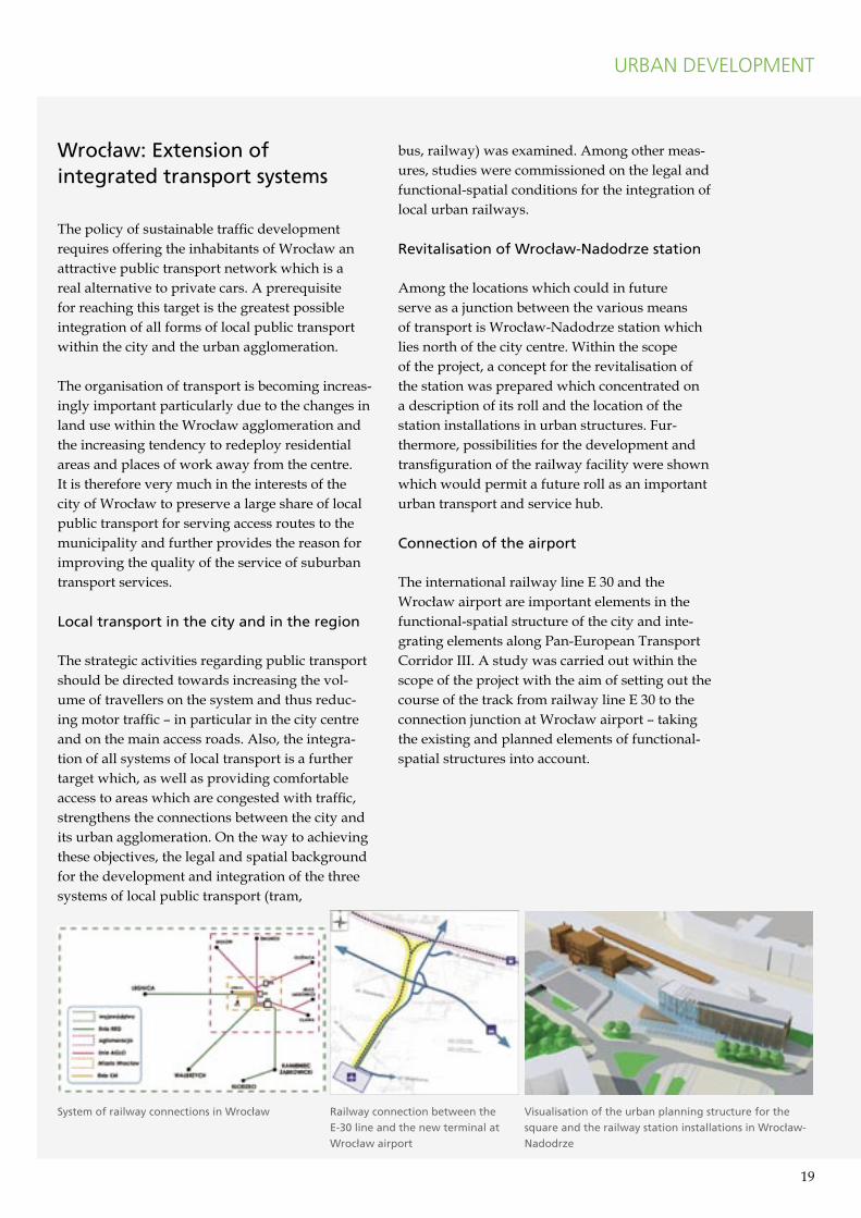
Wroc³aw: Extension of integrated transport systems
The policy of sustainable traffic development requires offering the inhabitants of Wrocław an attractive public transport network which is a real alternative to private cars. A prerequisite for reaching this target is the greatest possible integration of all forms of local public transport within the city and the urban agglomeration.
The organisation of transport is becoming increas-ingly important particularly due to the changes in land use within the Wrocław agglomeration and the increasing tendency to redeploy residential areas and places of work away from the centre. It is therefore very much in the interests of the city of Wrocław to preserve a large share of local public transport for serving access routes to the municipality and further provides the reason for improving the quality of the service of suburban transport services.
Local transport in the city and in the region
The strategic activities regarding public transport should be directed towards increasing the vol-ume of travellers on the system and thus reduc-ing motor traffic – in particular in the city centre and on the main access roads. Also, the integra-tion of all systems of local transport is a further target which, as well as providing comfortable access to areas which are congested with traffic, strengthens the connections between the city and its urban agglomeration. On the way to achieving these objectives, the legal and spatial background for the development and integration of the three systems of local public transport (tram,
bus, railway) was examined. Among other meas-ures, studies were commissioned on the legal and functional-spatial conditions for the integration of local urban railways.
Revitalisation of Wroc³aw-Nadodrze station
Among the locations which could in future serve as a junction between the various means of transport is Wrocław-Nadodrze station which lies north of the city centre. Within the scope of the project, a concept for the revitalisation of the station was prepared which concentrated on a description of its roll and the location of the station installations in urban structures. Fur-thermore, possibilities for the development and transfiguration of the railway facility were shown which would permit a future roll as an important urban transport and service hub.
Connection of the airport
The international railway line E 30 and the Wrocław airport are important elements in the functional-spatial structure of the city and inte-grating elements along Pan-European Transport Corridor III. A study was carried out within the scope of the project with the aim of setting out the course of the track from railway line E 30 to the connection junction at Wrocław airport – taking the existing and planned elements of functional-spatial structures into account.
URBAN DEVELOPMENT
System of railway connections in Wroc³aw Railway connection between the
E-30 line and the new terminal at
Wroc³aw airport
Visualisation of the urban planning structure for the
square and the railway station installations in Wroc³aw-
Nadodrze
20 21
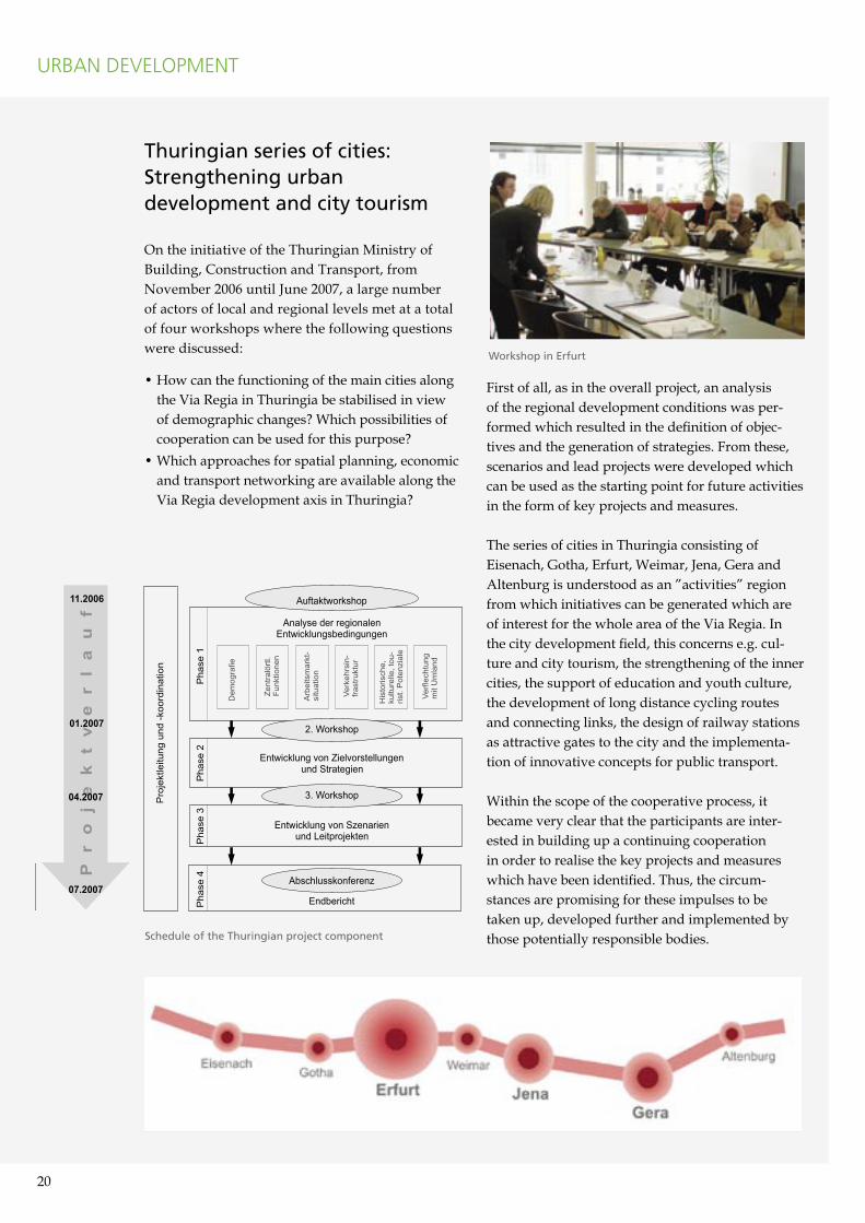
Thuringian series of cities: Strengthening urban development and city tourism
On the initiative of the Thuringian Ministry of Building, Construction and Transport, from November 2006 until June 2007, a large number of actors of local and regional levels met at a total of four workshops where the following questions were discussed:
• How can the functioning of the main cities along the Via Regia in Thuringia be stabilised in view of demographic changes? Which possibilities of cooperation can be used for this purpose?
• Which approaches for spatial planning, economic and transport networking are available along the Via Regia development axis in Thuringia?
First of all, as in the overall project, an analysis of the regional development conditions was per-formed which resulted in the definition of objec-tives and the generation of strategies. From these, scenarios and lead projects were developed which can be used as the starting point for future activities in the form of key projects and measures.
The series of cities in Thuringia consisting of Eisenach, Gotha, Erfurt, Weimar, Jena, Gera and Altenburg is understood as an ”activities” region from which initiatives can be generated which are of interest for the whole area of the Via Regia. In the city development field, this concerns e.g. cul-ture and city tourism, the strengthening of the inner cities, the support of education and youth culture, the development of long distance cycling routes and connecting links, the design of railway stations as attractive gates to the city and the implementa-tion of innovative concepts for public transport.
Within the scope of the cooperative process, it became very clear that the participants are inter-ested in building up a continuing cooperation in order to realise the key projects and measures which have been identified. Thus, the circum-stances are promising for these impulses to be taken up, developed further and implemented by those potentially responsible bodies.
URBAN DEVELOPMENT
Workshop in Erfurt
Schedule of the Thuringian project component
20 21
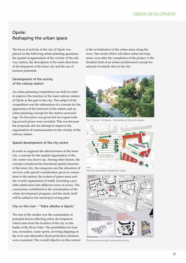
Opole:Reshaping the urban space
The focus of activity of the city of Opole was placed on the following urban planning questions: the spatial reorganisation of the vicinity of the rail-way station, the description of the main directions of development of the inner city and the use of tourism potentials.
Development of the vicinityof the railway station
An urban planning competition was held in order to improve the function of the main railway station of Opole as the gate to the city. The subject of the competition was the elaboration of a concept for the appearance of the forecourt of the station and an urban planning concept for the station surround-ings. No first prize was given but two equal-rank-ing second prizes were awarded. This was because the proposals did not attempt to improve the organisation of communication in the vicinity of the railway station.
Spatial development of the city centre
In order to augment the attractiveness of the inner city, a concept for the spatial organisation of the city centre was drawn up. Among other factors, the concept considered the functional spatial structure of the inner city, the categories and the allocation of services with special consideration given to connec-tions to the station, the system of green areas and the overall organisation of traffic including a pos-sible subdivision into different zones of access. The conclusions contributed to the actualisation of the urban development program, and the study itself will be added to the municipal zoning plan.
City on the river � �Odra uRzeka w Opolu�
The aim of the studies was the examination of potential factors affecting urban development which arise from the location of the city on the banks of the River Oder. The possibilities for tour-ism, recreation, water sports, reviving shipping on the river and alternative flood protection solutions were examined. The overall objective in this context
is the revitalisation of the urban areas along the river. One result which will effect urban develop-ment, even after the completion of the project, is the detailed draft of an urban-architectural concept for selected riverbank sites in the city.
URBAN DEVELOPMENT
The �Venice� of Opole � the banks of the mill stream
The first awarded competition entry
The second awarded competition entry
22 23
Already before the extension of the European Union, a sustainable economic upturn had com-menced along the Pan-European Transport Cor-ridor III which has further gained in momentum over the last years. The basic economic data, shown in the figures below, convey an impression of this process. They also show, however, that the initial conditions in the individual countries are very different (measured against the level of gross domestic product per capita).
The cities and regions along the Via Regia have a variety of institutions at their disposal for the active generation of a knowledge-based society. The traditional universities in Berlin, Kraków, Wrocław, Dresden, Leipzig, Jena and Lviv are augmented by a number of regional further educa-tion centres such as Gliwice, Katowice, Rzeszów, Potsdam, Košice and Opole – to name only the largest. Furthermore, additionally, in Berlin, Pots-dam, Jena and Dresden innovative research cen-tres have been established where, in the fields of biotechnology, optics and microelectronics, Euro-pean top level research is carried out. Wrocław is endeavouring to build up a European Institute of Technology (EIT+), and a number of technology and ”start-up” centres are supporting the develop-ment and strengthening of economic competence in smaller and medium sized towns as well.
For the spatial development strategy, in this con-nection, there are two levels of action which are visualised on the next page:
• On the one hand, the potentials, location quali-ties and economic competences which are avail-
Supporting economic development and innovation
Universities with a rich tradition, leading centres of research and development and commer-cial locations of European ranking are among the valuable assets of the region along the Via Regia. They can be used to build up a large scale network structure and greater cooperation, generating economical growth and innovations. Important objectives are the international marketing of the common economic area and and the improvement of the location qualities in a globalising economy.
ECONOMIC DEVELOPMENT
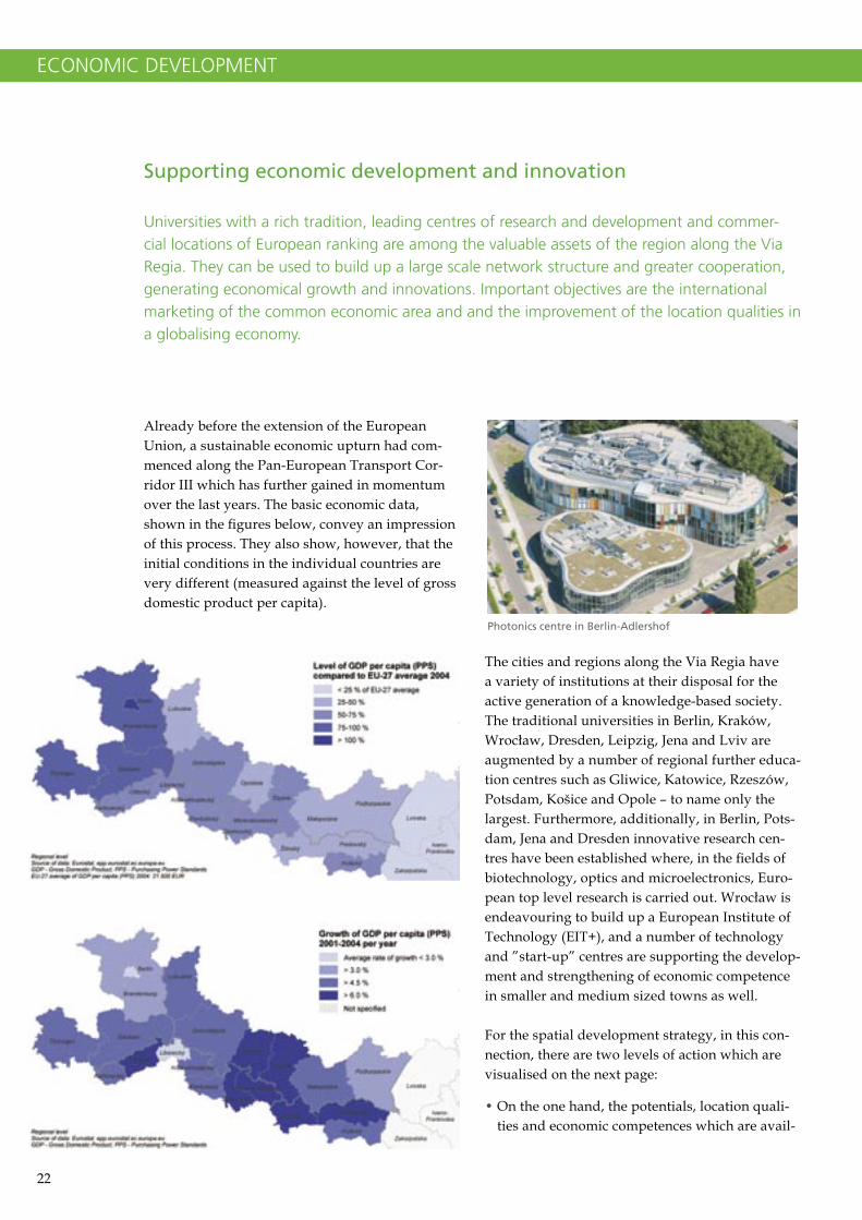
Photonics centre in Berlin-Adlershof
22 23
ECONOMIC DEVELOPMENT
able today are to be further promoted and improved. This is particularly the task of the local actors in the cities and regions.
• On the other hand, regional competences and location qualities should be increasingly linked up to create a cross-border network in order to intensify the exchange of knowledge and infor-mation and to market the economic region to the outside world through common promotion.
Starting from the existing regional networks and cluster initiatives, the cooperation in the economic region along the Via Regia should be used to build up leading European networks. This applies just as much to selected branches as well as to the cooperation of research institutes and universi-ties and it applies to both large as well as small scale cooperations in border regions. The branches which are important here can be seen from the results of the regional analyses and cross-border studies which have been carried out.
Further tasks which trigger new impulses for the cross-border exchange are, e.g. the handling of the structural changes in industrialised areas
and strategies for the formation and preservation of human capital resources. Fields of action are education and qualification of working staff as well as the creation and maintenance of attractive living conditions. This is particularly important in cities and regions which are affected by demo-graphic change and the migration of labour or where a high level of structural unemployment has become established.
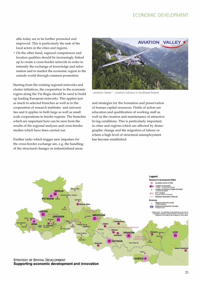
�Aviation Valley� � aviation industry in Southeast Poland
24 25
ECONOMIC DEVELOPMENT
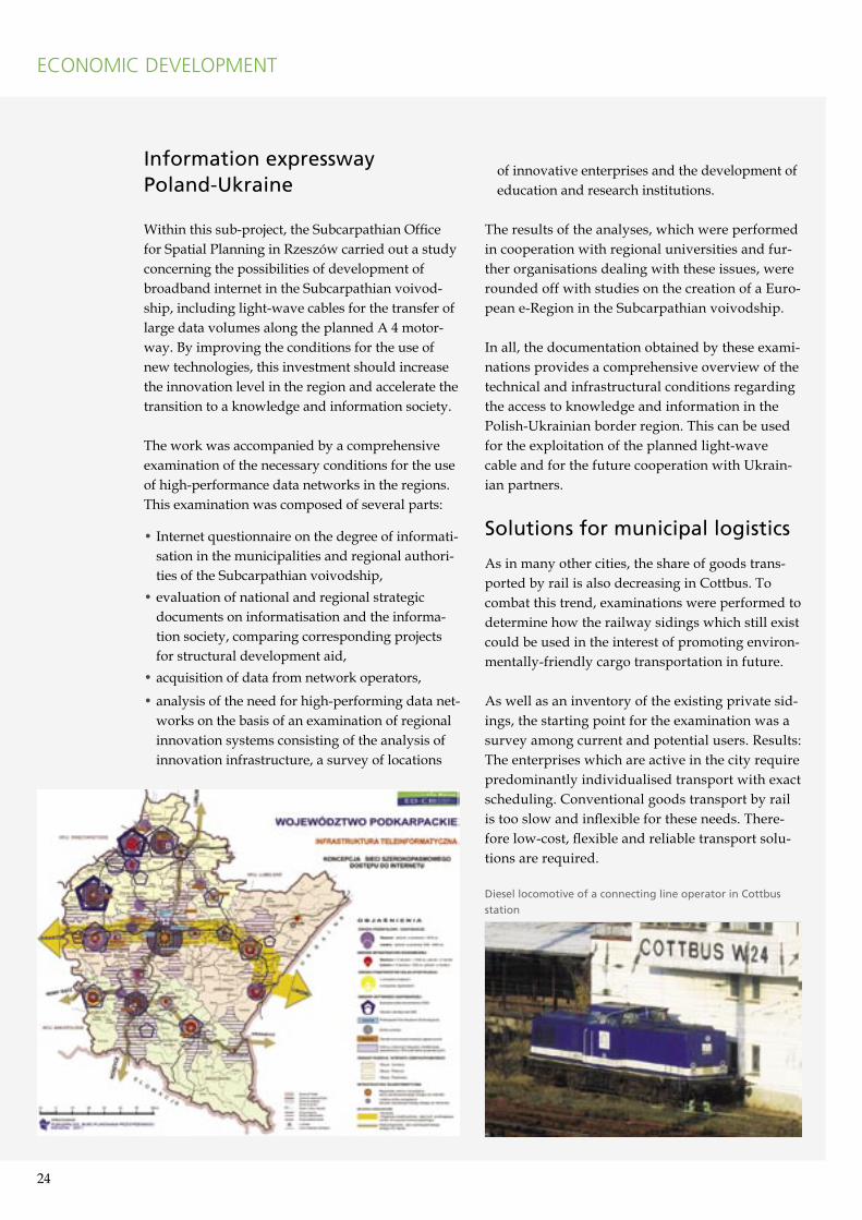
Information expresswayPoland-Ukraine
Within this sub-project, the Subcarpathian Office for Spatial Planning in Rzeszów carried out a study concerning the possibilities of development of broadband internet in the Subcarpathian voivod-ship, including light-wave cables for the transfer of large data volumes along the planned A 4 motor-way. By improving the conditions for the use of new technologies, this investment should increase the innovation level in the region and accelerate the transition to a knowledge and information society.
The work was accompanied by a comprehensive examination of the necessary conditions for the use of high-performance data networks in the regions. This examination was composed of several parts:
• Internet questionnaire on the degree of informati-sation in the municipalities and regional authori-ties of the Subcarpathian voivodship,
• evaluation of national and regional strategic documents on informatisation and the informa-tion society, comparing corresponding projects for structural development aid,
• acquisition of data from network operators,
• analysis of the need for high-performing data net-works on the basis of an examination of regional innovation systems consisting of the analysis of innovation infrastructure, a survey of locations
of innovative enterprises and the development of education and research institutions.
The results of the analyses, which were performed in cooperation with regional universities and fur-ther organisations dealing with these issues, were rounded off with studies on the creation of a Euro-pean e-Region in the Subcarpathian voivodship.
In all, the documentation obtained by these exami-nations provides a comprehensive overview of the technical and infrastructural conditions regarding the access to knowledge and information in the Polish-Ukrainian border region. This can be used for the exploitation of the planned light-wave cable and for the future cooperation with Ukrain-ian partners.
Solutions for municipal logistics
As in many other cities, the share of goods trans-ported by rail is also decreasing in Cottbus. To combat this trend, examinations were performed to determine how the railway sidings which still exist could be used in the interest of promoting environ-mentally-friendly cargo transportation in future.
As well as an inventory of the existing private sid-ings, the starting point for the examination was a survey among current and potential users. Results: The enterprises which are active in the city require predominantly individualised transport with exact scheduling. Conventional goods transport by rail is too slow and inflexible for these needs. There-fore low-cost, flexible and reliable transport solu-tions are required.
Diesel locomotive of a connecting line operator in Cottbus
station
24 25
Action recommendations were derived from the results of the survey. According to these, private sidings should be retained at sites particularly when a long-term interest by the user exists or could become possible, and where the develop-ment of nearby industrial sites could lead to new demands for goods transport by rail. In these cases, the operation of the sidings can be rational-ised if sidings connections are concentrated.
There is a special potential for the opening up of new demand groups due to the use of innovative and low-cost transhipping technology e.g. roll-on roll-off containers or the use of combined road-rail trailers carried piggyback. To the extent that the requirements develop in future, more complex forms of transport organisation could be inves-tigated such as the implementation of an urban logistics platform or e.g. the use of cargo trams.
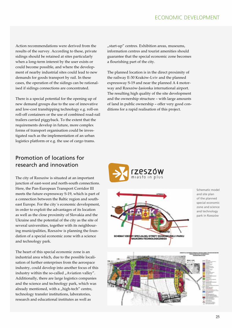
Promotion of locations for research and innovation
The city of Rzeszów is situated at an important junction of east-west and north-south connections. Here, the Pan-European Transport Corridor III meets the future expressway S-19, which is part of a connection between the Baltic region and south-east Europe. For the city´s economic development, in order to exploit the advantages of its location as well as the close proximity of Slovakia and the Ukraine and the potential of the city as the site of several universities, together with its neighbour-ing municipalities, Rzeszów is planning the foun-dation of a special economic zone with a science and technology park.
The heart of this special economic zone is an industrial area which, due to the possible locali-sation of further enterprises from the aerospace industry, could develop into another focus of this industry within the so-called „Aviation valley”. Additionally, there are large logistics companies and the science and technology park, which was already mentioned, with a „high-tech” centre, technology transfer institutions, laboratories, research and educational institutes as well as
„start-up” centres. Exhibition areas, museums, information centres and tourist amenities should guarantee that the special economic zone becomes a flourishing part of the city.
The planned location is in the direct proximity of the railway E-30 Kraków-Lviv and the planned expressway S-19 and near the planned A 4 motor-way and Rzeszów-Jasionka international airport. The resulting high quality of the site development and the ownership structure – with large amounts of land in public ownership – offer very good con-ditions for a rapid realisation of this project.
ECONOMIC DEVELOPMENT
Schematic model
and site plan
of the planned
special economic
zone and science
and technology
park in Rzeszów

26 27
The target is to establish the Via Regia as a con-nection between cities and regions with attractive tourism prospects and thus help to create a net-work – and promote the intensive use – of tourism potentials in the area of the Pan-European Trans-port Corridor III. Of course, the objectives of tour-ism development can vary between the different regions. Whereas, e.g. in the German regions, the focus is mainly on improving the utilization rate of the existing tourism infrastructure, in the new EU member states, it is often a case of building such infrastructure in the first place.
The following action focuses were identified within the strategy of spatial development:
• European city and culture tourism,• setting up of networked tourism packages and• international marketing of regional tourism
packages.
European city and culture tourism
The cities of Erfurt, Weimar, Potsdam, Berlin, Leipzig, Dresden, Wrocław and Kraków are situ-ated within the Via Regia growth region. They are all European centres of city tourism with already
today more than 500,000 overnight stays per year. In future, Lviv, with its historical old city as a UNESCO world heritage site, has the potential to develop to become such a centre. The creation of fast and attrac-tive connections along the corridor is of great impor-tance for these cities in particular, because only then, can the available market for round trips, long week-ends etc. be fully exploited.
This also applies to the remaining towns along the corridor which, as regional centres of city tourism, have the function of staging posts from which the sur-rounding vicinity can be explored. These towns have the task of creating a clear image of their tourism pro-file in connection with regional and local attractions.
Setting up of networked tourism packages
In the central European uplands region from the Thuringian Forest, the Ore Mountains, the Sudetes and the Carpathian Mountains to the Black Sea, there are intensively frequented tourist centres with important functions for the cities and metropolitan regions along the Via Regia. There are also, however, away from these centres, particularly in the Czech Republic, Poland, Slovakia and the Ukraine, attrac-tive areas of outstanding natural beauty which, due
Using tourism potential
Whether city sightseeing or culture tourism, hiking, climbing or water-related tourism � along the Via Regia there are possibilities waiting for all target groups to discover. However, many of the destinations, particularly those away from the main centres, are hardly known on the tourist markets and accessibility deficits impede their development. At the same time though, the joint exploitation of tourism potential is in the interest of all participants because, as the multiplicity of choice increases, so does the appeal of the overall area as a tourist destination.
TOURISM
From left to right: �Saxon Switzerland� near Dresden, hiking in the �Slovak Paradise�, wooden church in Lesser Poland
26 27
TOURISM
to their position on the periphery, up to now have hardly been developed for tourism at all. The con-nection of these areas with each other – thus contrib-uting to their activation for touristical development – is the aim of the tourist route ”Via Montana”.
Perspectives for tourism in small and medium-sized towns is offered by the initiative for the development of the Via Regia as a European cul-tural road and axis of European cultural exchange. Closely connected with this are projects such as e.g. the designation of pilgrims` ways or the idea to develop a European long distance cycling route along the Via Regia.
There are many possibilities for the generation of regionally networked offers in water-related tour-ism. Natural and man-made water sport centres as well as touring on large rivers offer unique potential – particularly in the German-Polish border region.
International marketingof regional tourism packages
Whether water tourism in the Spreewald and in the Lusatian lake district, culture tourism in Saxony and Thuringia, winter sports in the Thuringian For-est and the Carpathian Mountains, health and spa tourism in Lower Silesia, horse riding in Pardubice,
hiking in the Eastern Beskid Mountains or wine tasting in Košice – these are just some examples from the almost inexhaustible spectrum of qualified tourist attractions along the Via Regia.
In order to increase the visibility of these offers in the competition of tourism destinations, the brand name ”Via Regia”, associated with corresponding quality standards and information offers, could be introduced and accompanied by public relations measures such as promotion events, signs along the main roads or the naming of international trains. The independence of the individual tourism products would remain, but they would be supple-mented by a reference to the overall region where they are situated.
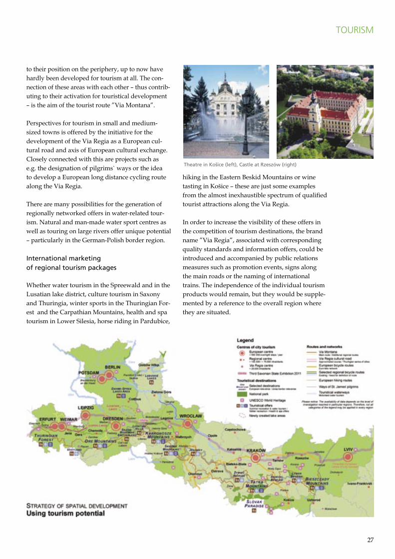
Theatre in Ko�ice (left), Castle at Rzeszów (right)
28 29
TOURISM
The Via Regia is the oldest and long-est land connection between eastern and western Europe and a unique symbol for the relations between the peoples of Europe. In recent years, in many locations along the Via Regia, initiatives have been founded with the explicit purpose of exploiting this potential for European integration. Step-by-step, a network is developing which consciously deals with both the symbolic and real economic, cultural and touristic values which the Via Regia represents.
The activities of the network encom-pass, among others, the organisation of exhibitions and conferences, issu-ing publications, the documentation of the course of the Via Regia and the support of local and regional tour-ist initiatives. In 2006, an important milestone was the award of the title ”Major Cultural Road of the Council of Europe”, whereby the Via Regia was officially included in the list of major European cultural roads.
As with the project ED-C III Via Regia, the focus of activities of the Via Regia network is situated in
Germany, Poland and the Ukraine. Because, from a tourism point of view, the network is mainly founded on small and medium-sized towns there are large synergy effects for the realisation of the spatial development strategy. Within the project, the development of a component for a geographi-cal information system which is in the preparation stage at present was supported. This system will contain information regarding tourism, culture and history as well as contents which are relevant for economic and spatial planning.
Discover the Via Regiaby train and bus
Although originally the Via Regia is a road, together with the neighbouring mountainous regions to the south it can be ”explored” with pub-lic transport. The possibilities which are available already today were the subject of an examination by the Senate Department for Urban Development in Berlin. The result is a travel guide for tourists who are travelling in South Poland without a car.
As well as references for tourists, the travel guide contains all information about travelling with bus or train (timetables and prices). It shows that there are already good offers in some cases for tourists travelling without a car. On the other hand though, it also shows that, in many areas, there is still a lot of work to be done. Rural districts are difficult to reach and on many cross-border railway lines there is often only one train per day. There are also prob-lems concerning the quality of information given to tourists about travel services as well as problems concerning connections to long-distance rail traffic.
The information regarding the deficits which were determined during the production of the travel guide were documented in a separate analysis which can be obtained on request.
Via Regia � Major Cultural Road of the Council of Europe
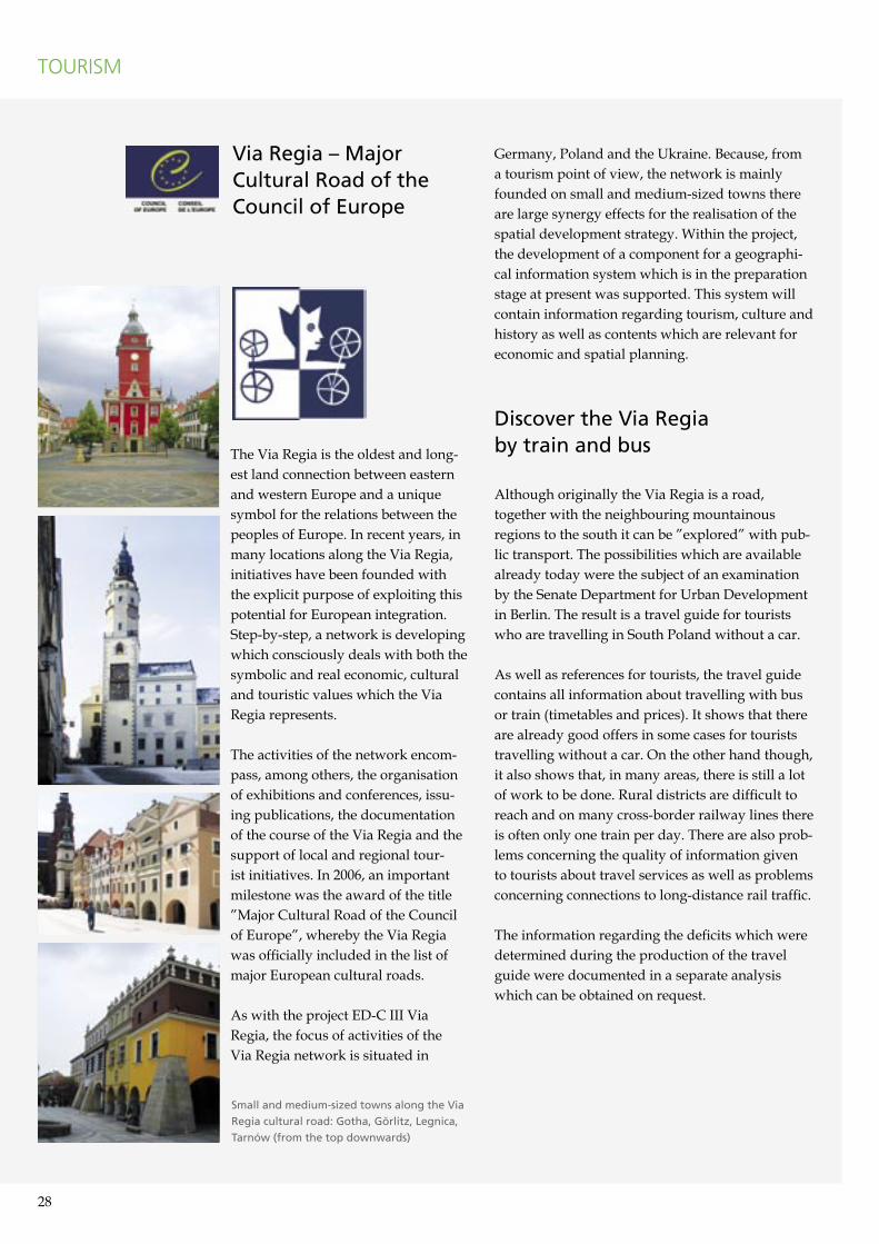
Small and medium-sized towns along the Via
Regia cultural road: Gotha, Görlitz, Legnica,
Tarnów (from the top downwards)
28 29
Via Montana � Concept for an integrated tourism region of the Sudetes and Carpathian Mountains
”Via Montana” expresses the idea of an inte-grated trans-European tourist route with the tar-get of activating marginalised areas which, due to their natural and agricultural values and also because of the exceptional multinational cultural heritage of the population, require social and eco-nomic support.
The route of the ”Via Montana”, with a length of over 2,500 km, was founded in the Sudetes and Carpathians on existing local roads and on higher class roads in the territories of the Czech Republic, the eastern part of Germany, Poland and Slovakia. The road should:
• open up and promote peripheral areas,• support previously undiscovered sites as alterna-
tives to tourism centres which are already known and much visited,
• create an alternative to the main routes and limit traffic in the vicinity of the most valuable nature conservation areas.
The proliferation of the Via Montana idea and its implementation as a tourist route opens up new possibilities of countering negative developments such as an aging population, migration processes and higher unemployment. The exceptional values which these areas have to offer create wide-rang-ing possibilities for the development of different kinds of tourism. The perspective offered here is the development of beneficial socio-economic changes and the generation of an integrated tour-ism product which does not exist on such a scale in this part of Europe.
Within the scope of the project, a detailed study was performed by the Regional Bureau for Spatial Planning in Wrocław on the potential course of the route as well as for an action strategy for the realisation of the project. At the same time, an ”Atlas of the Via Montana touristic route” was published to visualise the course of the Via Montana.
TOURISM
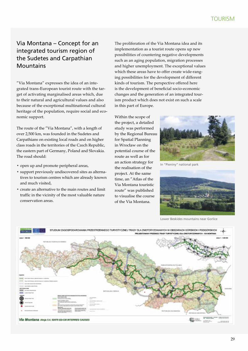
In �Pieniny� national park
Lower Beskides mountains near Gorlice
30 31
The process of formulating the strategy of spa-tial development generated in-depth knowledge concerning cross-border framework conditions of regional development. Also, fields of cooperation have been identified from which joint projects and initiatives can be developed. Thus, the work which has been submitted provides a contribu-tion to the regional implementation of the Terri-torial Agenda.
The strategy of spatial development should help to relay this knowledge to further actors, who have not participated in the cooperation up to now, and thus provide an impulse for the further realisation of the propositions it outlines. The instruments of European Territorial Cooperation again offer excellent conditions for this – also in the new 2007-2013 programming period.
Extension and intensificationof European Territorial Cooperation
As a result of the ED-C III Via Regia project, a com-mitted transnational network of actors in spatial development has evolved which should be further extended and intensified in future. Therefore, an explicitly desired effect of the strategy of spatial development is the emergence from it of further co-operation projects in the different fields of activity.
In this connection, the interlinking of the various cooperation levels plays an especially important part. For example, the cooperation at the transna-tional level opens the perspective for good solutions involving cross-border collaboration and stimulates the exploitation of the considerable development potentials through organisational, infrastructural and informational measures. At the same time, these cooperations help to demonstrate the coherences over a wide area and clearly show once again the key role of the border regions for the complete area.
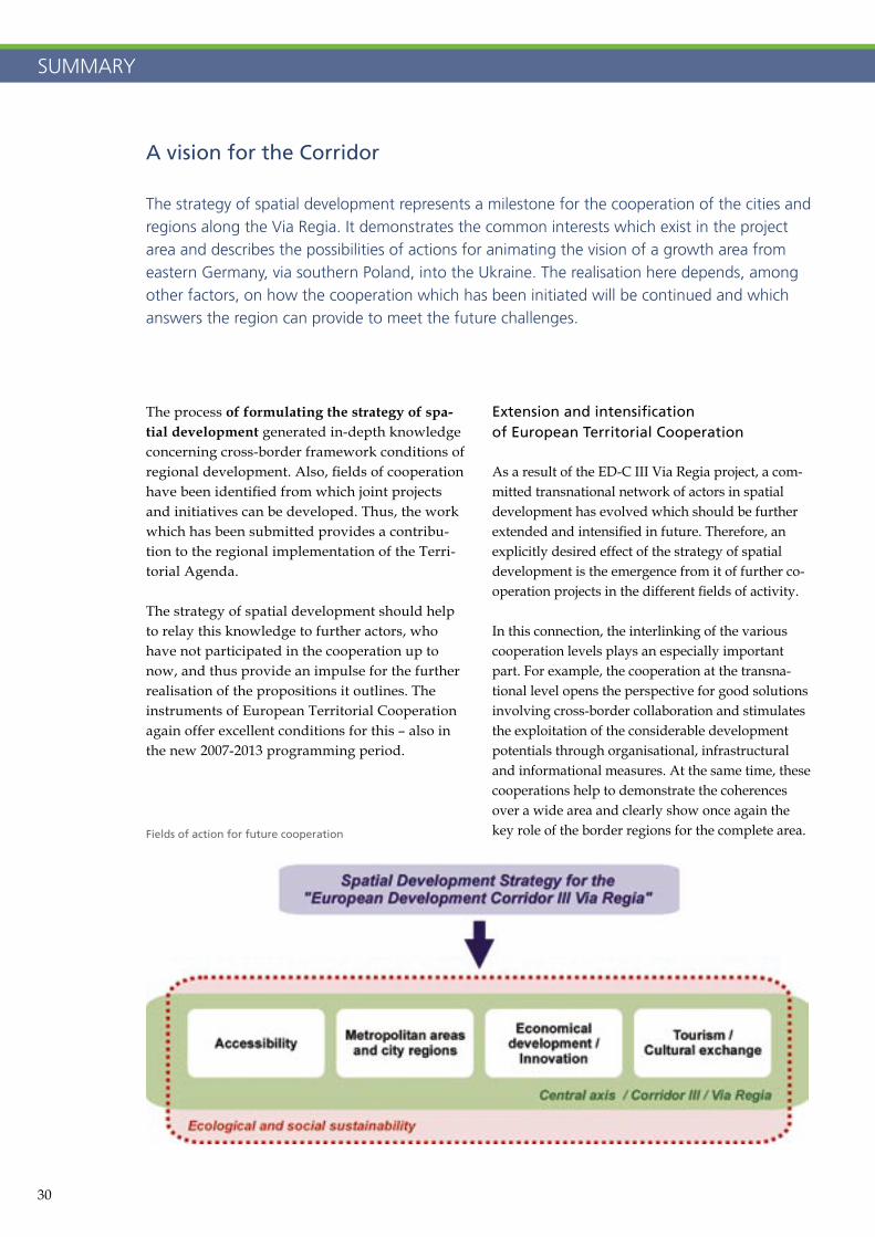
A vision for the Corridor
The strategy of spatial development represents a milestone for the cooperation of the cities and regions along the Via Regia. It demonstrates the common interests which exist in the project area and describes the possibilities of actions for animating the vision of a growth area from eastern Germany, via southern Poland, into the Ukraine. The realisation here depends, among other factors, on how the cooperation which has been initiated will be continued and which answers the region can provide to meet the future challenges.
SUMMARY
Fields of action for future cooperation
30 31
The following future fields of action for further transnational projects have been identified:
• the strengthening of metropolitan areas and their networking over a large area in particular with high-performing rail connections,
• the promotion of economic growth by using each of the specific innovation potentials,
• intelligent intermodal logistics solutions, • the development of further tourism potentials
through the tourism brand ”Via Regia” whether in city tourism, as a European cultural road or as a tourist route.
Each of these approaches addresses its own circle of interested actors and is related to different spa-tial relationships and contexts.
Challenges of the further deepeningof European integration
The expected increase in the exchange of persons, knowledge and capital, which will come with the introduction of the complete free movement of labour in 2011, supports the vision of a growth region along the Via Regia. Even if the region-spe-cific economic effects cannot be forecast individu-ally yet, it is obvious that the infrastructures and transport services must be rapidly prepared for this intensive exchange. This applies in particular to rail traffic which, especially on a transnational scale, must assert itself in hard competition with the road.
Mobilisation due to major events
Major events, which in future will take place more often in central and eastern Europe, will increas-ingly provide incentives for the intensification of the cooperation. The prime example here is the European Football Championship 2012 in Poland and the Ukraine. Already today, this event is drawing a great deal of attention to the venues Wrocław, Krakow and Lviv which are situated on the ”European Development Corridor III Via Regia”.
This geographical and temporal focussing creates good conditions for the activation of additional local and regional forces which should be used e.g. for the sustainable promotion of European city tourism along the Via Regia. In a comparable
manner, although on a smaller scale, national and regional events also have effects, e.g. the already completed National Horticultural Show 2007 in Gera and Ronneburg or the Third Saxon State Exhibition 2011 in Görlitz, which is devoted to the subject ”Via Regia”.
The opening of the Ukraineto the European Union
A very broad field of action, which can only be touched on in connection with ED-C III Via Regia, is the future shaping of the relationships between the European Union and the Ukraine. The geo-graphical extension of the Schengen Agreement has led to a situation between Poland and the Ukraine which requires the development of a long-term perspective for cooperation.
Pan-European Transport Corridor III plays a key role here because, as the „Central axis”, it is one the most important routes between the economic centres of the European Union and the Ukraine. Therefore, the imperative objective is the classifi-cation of Pan-European Transport Corridor III in the group of the 30 priority axes and projects of the trans-European transport network.
The realisation of the diversified approach of the strategy of spatial development will finally result in increased economic exchange and growth.
The decisive prerequisite for the activation of these economic development chances is that peo-ple come into contact with each other. Facilitating and promoting this is the common motive of all elements of the strategy of spatial development and the main objective of the cooperation along the Via Regia.
SUMMARY
APPENDIX
Index of studies by the project partners
PP 2Gemeinsame Landesplanungsabteilung der Länder Berlin und BrandenburgErnst-Wilhelm Zühlke, Renate [email protected]
Regionalanalyse Berlin-BrandenburgINFRASTRUKTUR & UMWELTPotsdam 2006
Zusammenführung der Regionalanalysen zu grenzüberschreitenden StudienINFRASTRUKTUR & UMWELTPotsdam 2007
Entwicklungsszenarien im deutsch-polni-schen Grenzraum 2020INFRASTRUKTUR & UMWELTPotsdam 2007
Mobil im deutsch-polnischen GrenzraumBietergemeinschaft IPG GmbH / NPKG Heike Uhe, Wrocław / Potsdam 2007
PP 3Thüringer Ministerium für Bau und VerkehrDr. Burkhard Gallander, Susan [email protected]
Möglichkeiten zur Funktionsstabilisierung und Kooperation Zentraler Orte entlang der Via Regia vor dem Hintergrund der demogra-fi schen VeränderungenFachhochschule Erfurt, Fachgebiet Planung und Kommunikation in Kooperation mit dem Institut für Verkehr und Raum an der Fach-hochschule ErfurtErfurt 2007
Raumordnerische, wirtschaftliche und ver-kehrliche Vernetzung Thüringens entlang der Entwicklungsachse Via RegiaLandesentwicklungsgesellschaft Thüringen in Kooperation mit Institut für Verkehr und Raum an der Fachhochschule ErfurtErfurt 2007
PP 4Stadtverwaltung Cottbus,Fachbereich StadtentwicklungThomas Kramer, Norbert Hö[email protected]
Fortschreibung Verkehrsentwicklungsplan Cottbus 2020, Teilprojekt: Entwicklung / Ein-bindung GüterverkehrPTV Planung Transport Verkehr AGKarlsruhe / Cottbus 2006
PP 5Senatsverwaltung für Stadtentwicklung BerlinDr. Jürgen Murach, Gerd Mü[email protected]
Via Regia – Kurzfristige und kostengünstige Verbesserungsmöglichkeiten im Schienenper-sonenfernverkehr Berlin-BreslauIPG GmbHPotsdam / Berlin 2006
Via Regia – Den Süden Polens mit Bus und Bahn entdeckenVerkehrsclub Deutschland (VCD), Landesver-band Nordost e.V.Berlin 2008
PP 6Stadtverwaltung Dresden,StadtplanungsamtRolf Hermann, Dr. Ursula [email protected]
Kooperations- und Partnerschaftspotenziale der Stadt-Umland-Region Dresden mit ausgewählten Städten und Regionen im Korridor III unter dem Aspekt der Entwicklung konkreter ProjekteTechnische Universität Dresden, Lehrstuhl für Verkehrs- und InfrastrukturplanungDresden 2007
PP 7Województwo Dolno�ląskie, Wojewódzkie Biuro Urbanistyczne we Wroc³awiuIlona Szarapo, dr Magdalena [email protected]
Analizy uwarunkowań rozwoju regional-nego województwa dolnośląskiegoWrocław 2006
Komunikacyjne studium poszukiwawcze dla drogi ekspresowej (S-5) na odcinku Wrocław (AOW) – Boboszów (granica państwa) – Część analityczna dotycząca zapisów w dokumentach planistycznych na poziomie lokalnym i regionalnymWrocław 2007
Studium zagospodarowania przestrzennego turystycznej trasy dla zmotoryzowanych Via MontanaWrocław 2007
PP 8Województwo Podkarpackie,Podkarpackie Biuro Planowania Przestrzennego w RzeszowieEwa Młodochowska, Marcin [email protected]
Analizy regionalne – województwo podkarpackieRzeszów 2006
Scenariusze rozwoju w polsko-słowacko-ukraińskim obszarze przygranicznym – województwo podkarpackieRzeszów 2007
Studium możliwości rozwoju Internetu szerokopasmowego w województwie podkarpackimRzeszów 2007
PP 9Urząd Miasta Wroc³awia,Biuro Rozwoju Wroc³awiadr Maciej Zathey, Grzegorz [email protected]
Analiza porównawcza (benchmarking) projektów inwestycyjnych w zakresie rozwoju miejskiej komunikacji szynowej na przykładzie miast niemieckichINERCON Sp. z.o.o.Wrocław 2006
Opracowanie programu działań wdrażających przedsięwzięcia składowe niezbędne dla rozbudowy systemu szynowego transportu we WrocławiuIMS Sp. z.o.o.Wrocław / Kraków 2006
Analiza uwarunkowań prawnych możliwości wdrożenia od 1 stycznia 2008 roku systemu przewozów kolejowych pod nazwą Wrocławska Kolej AglomeracyjnaZespół Doradców Gospodarczych „TOR“ Warszawa 2006
Analiza możliwości przeprowadzenia LCR przez śródmieście Wrocławia„Transport Consult” Biuro Projektowo-Konsultingowe Maciej KruszynaWrocław 2006
Opracowanie rozkładów jazdy dla pociągów planowanych do uruchomienia w ramach Wrocławskiej Kolei Aglomeracyjnej (WKA)TC Teresa WysockaWrocław 2006
Koncepcja rewitalizacji stacji kolejowej Wrocław Nadodrze wraz z jej otoczeniemInplus – Doradztwo InwestycyjneWrocław 2007
Studium lokalizacyjne dla połączenia kolejowego linii E-30 z nowym terminalem portu lotniczego we WrocławiuElekol WrocławWrocław 2007
Studium poszukiwawcze dla korytarza drogi S-5 łączącej III paneuropejski korytarz trans-portowy w rejonie Wrocławia z przejściem granicznym w BoboszowieBiuro Ekspertyz i Projektów Budownictwa Komunikacyjnego „EKKOM” Sp. z o.o.Kraków 2007
PP 10Urząd Miasta Opola, Biuro UrbanistyczneMałgorzata Maśko-Horyza, Krzysztof Ś[email protected]
Konkurs na opracowanie koncepcji urbanistyczno – architektonicznej placu dworcowego w Opolu – I wyróżnienieArch. Eduard LangnerOpole 2006
Konkurs na opracowanie koncepcji urbanistyczno – architektonicznej placu dworcowego w Opolu – II wyróżnienieArch. Michał StangelOpole 2006
Aktualizacja i uzupełnienie Programu Rozwoju Miasta o aspekty urbanistyczneOpole 2007
Koncepcja rozwoju przestrzennego ŚródmieściaOpole 2007
“Odra uRzeka w Opolu” – założenia funkcjonalno-przestrzenneInstytut Geotechniki i Hydrotechniki Politechniki WrocławskiejWrocław / Opole 2007
PP 11Urząd Miasta Rzeszówa,Biuro Rozwoju Miasta RzeszowaAnna Giermańska, Sławomir [email protected]
Problemy rozwoju miasta Rzeszowa w kontekście rozwoju III KorytarzaAleksander Noworol KonsultingKraków 2006
Koncepcja zagospodarowania i uzbrojenia terenów pod proponowany Park Technologiczny i proponowaną SSE „Rzeszów – Dworzysko”Pracownia Projektowa ARTPLANRzeszów 2007
P 12Starostwo Powiatowe w K³odzkuMałgorzata Krajnik, Katarzyna Mał[email protected]
Studium poszukiwawcze dla korytarza drogi S-5 łączącej III paneuropejski korytarz transportowy w rejonie Wrocławia z przejściem granicznym w BoboszowieBiuro Ekspertyz i Projektów Budownictwa Komunikacyjnego „EKKOM” Sp. z o.o. Kraków 2007
PP 13Regional Authority of Ústí Region,Regional Development DepartmentIng. Josef Svoboda, Ing. Lucie Kuželová[email protected]
Regional analysis of Ústí regionPhDr. Jan Jílek – SociofondPraha 2006
Examination of Sluknovsko quality traffi c connection in the relaying of I/13 contextValbek spol. s r. o.Ústi nad Labem 2006
Route no I/7 capacities increasing to 4 car-riage highway – segment Chomutov CZ/D borderMetroprojekt Praha a.s.Praha 2006
Relocation of the route no I/27 to the trace Litvinov-Duchcov-TepliceValbek spol. s r. o.Ústi nad Labem 2006
PP 14Regional Authority of Pardubice Region, Department of Strategical DevelopmentMgr. Miroslav [email protected]
Regional analysis of Pardubice regionPardubice 2006
Localistation study of corridor for capacity traffi c route Dolní Lipka (border with Poland) – Dětřichov (MUK R35/R43)Ing. Jindřich Kmoníček – Highway design Hradec Králové 2007
PP 15Agency for Support of Regional Development Ko�iceMgr. Henrieta Kiraľvargová[email protected]
Regional analysis of Košice regionKošice 2007
Complex Analysis of Košice and Prešov Region, Strategic Documents in the Polish – Slovak – Ukraine Border Area and Development of North – South RelationsPavel Smejkal, Košice 2007
Renewal of Historical Roads in the Region of East Slovakia Ján Krcho, Košice 2007
Index of fi gures
Title page, from top downwards: Flughafen Leipzig / Halle GmbH / Uwe Schoßig; DB AG / Claus Weber; Berlin Partner / FTB-Werbefotografi e; Martin Reents; 3: INFRASTRUKTUR & UMWELT (IU); 4: SIC! Sustrain Implement Corridor; 5: Thüringer Tourismus GmbH / Barbara Neumann (Erfurt), Region Dresden (Dresden), Urząd Miasta Wrocławia (Wrocław), Urząd Miasta Opola (Opole), Ryszard Świątonowski (Rzeszów), Ex Oriente Lux Reisen GmbH / Thomas Reck (Lviv); 6-9: IU; 12: IU; 13, from left to right: IU, Podkarpackie Biuro Planowania Przestrzennego (PBPP); 14 at the top: DB AG / Weisfl og; 14 at the bottom: FH Erfurt, Institut Verkehr und Raum / IU; 15 at the top: Europäisches Kultur- und Informationszentrum in Thüringen; 15 at the bottom: IU; 16 left, from top downwards: Martin Reents, IPG GmbH; 16 right: Bietergemeinschaft IPG GmbH / NPKG Heike Uhe; 17 at the top: Tomasz Gmerek; 17 at the bottom, from left to right: EKKOM Sp. z o.o., Ing. Jindřich Kmoníček – Highway Design; 18, from left to right: DB AG / Hans-Joachim Krumnow; Mychajlo; 19, from left to right: Urząd Miasta Wrocławia, ELEKOL Wrocław, INPLUS Doradztwo Inwestycyjne; 20: FH Erfurt, Fachgebiet Planung und Kommunikation; 21, from top downwards: Jarosław Małkowski, Arch. Eduard Langner, Arch. Michał Stangel et al.; 22 at the top: Berlin Partner / FTB-Werbefotografi e; 22 at the bottom: IU; 23 at the top: Stowarzyszenie Dolina Lotnicza; 23 at the bottom: IU; 24 left: PBPP; 24 right: ptv AG / Huschebeck; 25: Urząd Miasta Rzeszowa / Artplan; 26, from left to right: Region Dresden, Košický kraj, Wojewódzkie Biuro Urbanistyczne (WBU); 27 at the top, from left to right: Košický kraj, Ryszard Świątonowski, 27 at the bottom: IU; 28: Europäisches Kultur- und Informationszentrum in Thüringen; 29: WBU; 30: IU
For the cartographic fi gures on pages 3, 6-9, 12, 14-15, 22-23 and 27, data were used which were licensed from © Eurogeographics.
Project part-financedby the European Union
ContactSaxon State Ministry of the Interior
Division 45 European spatial planning, Sectoral planning
Wilhelm-Buck-Straße 4, D-01097 Dresden
Dr. Edgar Trawnicek, Andreas Kühl, Jörg Kellermann
Phone: +49 351 564-3456Fax: +49 351 564-3459
E-mail: fachplanung-eu@smi.sachsen.dewww.smi.sachsen.dewww.landesentwicklung.sachsen.de
www.edc-viaregia.eu
Transport � scientific consulting: Fachhochschule Erfurt, Institut Verkehr und Raum Prof. Dr. Matthias Gather, Mathias Wilde www.verkehr-und-raum.de
Translations: Regina Solová, Aldona Kozar, Wroc³aw (PL) PRO LINGUA Grzegorz Za³oga, Gorzów Wielkopolski (PL) John Steele, Darmstadt (EN)
Design and layout: MEDIENGESTALTUNG Dittmar Apel, Darmstadt
Printing: Brandenburgische Universitätsdruckerei, Potsdam
Editorial deadline: January 2008
Edition size: 3.000
Languages: German, Polish, English
Project part-financedby the European Union
Copyright: This brochure is protected by copyright. All rights to the use of the text, pictures – including excerpts and the pro-cessing with electronic systems – are reserved by the publisher. A reproduction, even in part, is only allowed after previous permission from the publisher. This brochure was produced with the greatest possible care. No liability is assumed for its con-tents and their accuracy!
Distribution notification: This brochure is distributed free-of-charge and is not for sale. It may not be used for purposes of elec-tion advertising. Even without a temporal connection to an imminent election, it may not be used in such a way which could be interpreted as partisanship of the publishers in favour of any individual political group.
INFRASTRUKTUR & UMWELTProfessor Böhm und Partner
Dr. Jürgen Neumüller, Martin ReentsGregor-Mendel-Straße 9, D-14469 Potsdam
Phone: +49 331 50581-0Fax: +49 331 50581-20
E-mail: [email protected]
www.iu-info.de
www.edc-viaregia.eu
External project management:Supported by:
Project part-financedby the European Union