using this guide - freac.fsu.edu · ten thousand to fourteen thousand years ago. as the aucilla...
TRANSCRIPT
12
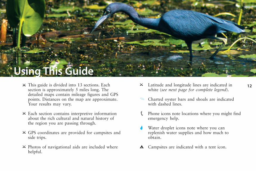
Using This GuideThis guide is divided into 13 sections. Eachsection is approximately 5 miles long. Thedetailed maps contain mileage figures and GPSpoints. Distances on the map are approximate.Your results may vary.
Each section contains interpretive informationabout the rich cultural and natural history ofthe region you are passing through.
GPS coordinates are provided for campsites andside trips.
Photos of navigational aids are included wherehelpful.
Latitude and longitude lines are indicated inwhite (see next page for complete legend).
Charted oyster bars and shoals are indicatedwith dashed lines.
Phone icons note locations where you might findemergency help.
Water droplet icons note where you canreplenish water supplies and how much toobtain.
Campsites are indicated with a tent icon.
13
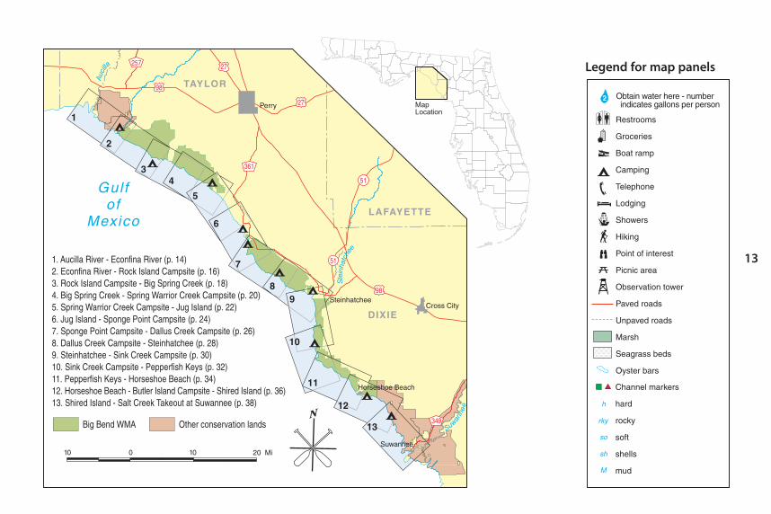
Legend for map panels
14
Aucilla River - Econfina River
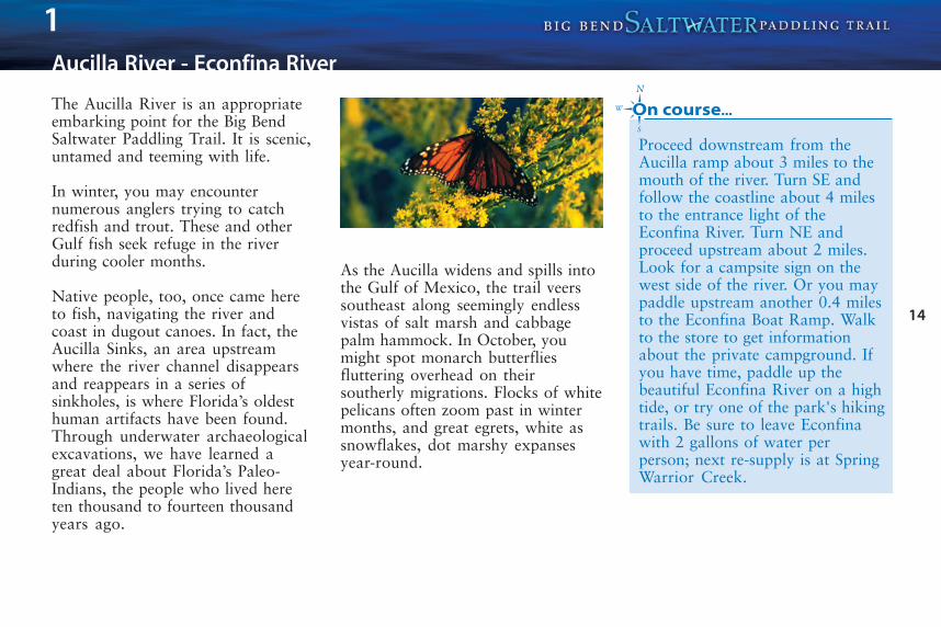
The Aucilla River is an appropriateembarking point for the Big BendSaltwater Paddling Trail. It is scenic,untamed and teeming with life.
In winter, you may encounternumerous anglers trying to catchredfish and trout. These and otherGulf fish seek refuge in the riverduring cooler months.
Native people, too, once came hereto fish, navigating the river andcoast in dugout canoes. In fact, theAucilla Sinks, an area upstreamwhere the river channel disappearsand reappears in a series ofsinkholes, is where Florida’s oldesthuman artifacts have been found.Through underwater archaeologicalexcavations, we have learned agreat deal about Florida’s Paleo-Indians, the people who lived hereten thousand to fourteen thousandyears ago.
As the Aucilla widens and spills intothe Gulf of Mexico, the trail veerssoutheast along seemingly endlessvistas of salt marsh and cabbagepalm hammock. In October, youmight spot monarch butterfliesfluttering overhead on theirsoutherly migrations. Flocks of whitepelicans often zoom past in wintermonths, and great egrets, white assnowflakes, dot marshy expansesyear-round.
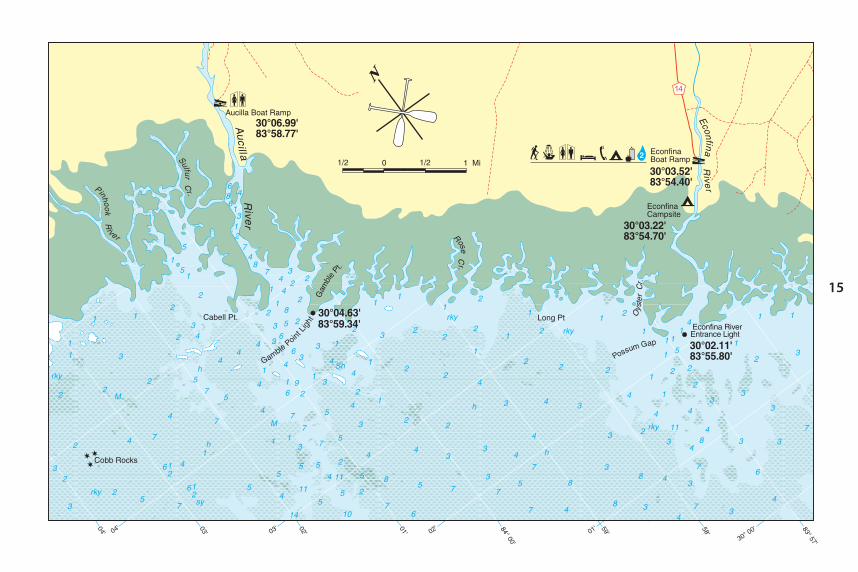
Proceed downstream from theAucilla ramp about 3 miles to themouth of the river. Turn SE andfollow the coastline about 4 milesto the entrance light of theEconfina River. Turn NE andproceed upstream about 2 miles.Look for a campsite sign on thewest side of the river. Or you maypaddle upstream another 0.4 milesto the Econfina Boat Ramp. Walkto the store to get informationabout the private campground. Ifyou have time, paddle up thebeautiful Econfina River on a hightide, or try one of the park's hikingtrails. Be sure to leave Econfinawith 2 gallons of water perperson; next re-supply is at SpringWarrior Creek.
1
15
16
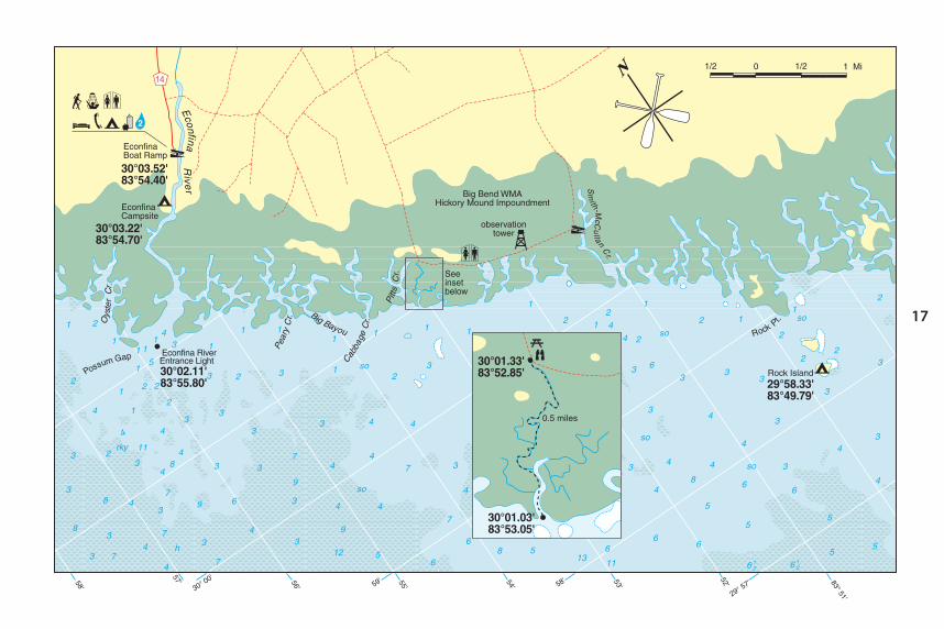
Econfina River - Rock Island Campsite
Like the Aucilla, the Econfina is anunspoiled blackwater river.Decomposing leaves and swampvegetation release tannins, whichgive the water its coffee-colored tint.
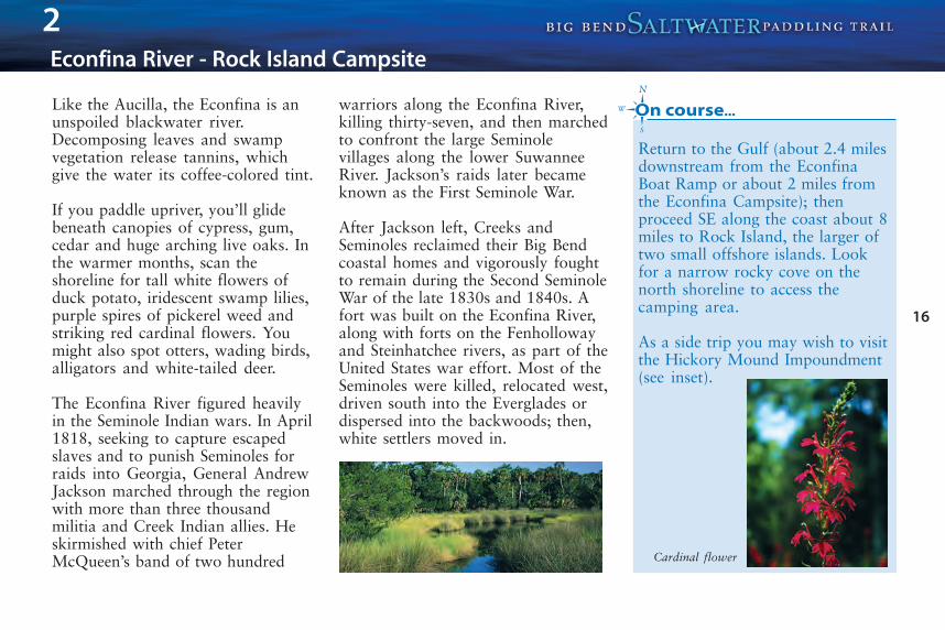
If you paddle upriver, you’ll glidebeneath canopies of cypress, gum,cedar and huge arching live oaks. Inthe warmer months, scan theshoreline for tall white flowers ofduck potato, iridescent swamp lilies,purple spires of pickerel weed andstriking red cardinal flowers. Youmight also spot otters, wading birds,alligators and white-tailed deer.
The Econfina River figured heavilyin the Seminole Indian wars. In April1818, seeking to capture escapedslaves and to punish Seminoles forraids into Georgia, General AndrewJackson marched through the regionwith more than three thousandmilitia and Creek Indian allies. Heskirmished with chief PeterMcQueen’s band of two hundred
warriors along the Econfina River,killing thirty-seven, and then marchedto confront the large Seminolevillages along the lower SuwanneeRiver. Jackson’s raids later becameknown as the First Seminole War.
After Jackson left, Creeks andSeminoles reclaimed their Big Bendcoastal homes and vigorously foughtto remain during the Second SeminoleWar of the late 1830s and 1840s. Afort was built on the Econfina River,along with forts on the Fenhollowayand Steinhatchee rivers, as part of theUnited States war effort. Most of theSeminoles were killed, relocated west,driven south into the Everglades ordispersed into the backwoods; then,white settlers moved in.
Return to the Gulf (about 2.4 milesdownstream from the EconfinaBoat Ramp or about 2 miles fromthe Econfina Campsite); thenproceed SE along the coast about 8miles to Rock Island, the larger oftwo small offshore islands. Lookfor a narrow rocky cove on thenorth shoreline to access thecamping area.
As a side trip you may wish to visitthe Hickory Mound Impoundment(see inset).
2
Cardinal flower
17