using gis for confined space safety -...
TRANSCRIPT
Using GIS for Confined
Space Safety
ESRI Water Conference 2018
Kaitlin Szedlar – GIS Technician
Agenda
▪ Background
▪ Creation, Implementation, Management, & Continuous
Improvement
▪ Confined Space Data : Current State vs Confined Space Safety
Application
▪ Questions
Background
▪ Southern Division Health & Safety Committee
▪ Issue introduced by field crew members, district supervisors, &
safety professionals:
▪ At Illinois American Water large customer vaults
are not company owned. However, we are required
to enter the vaults & perform meter testing on an
annual basis. Because we do not own and therefore
are not responsible for the maintenance of these
vaults, the condition of many of them has
deteriorated in ways that present safety concerns
to our employees.
3
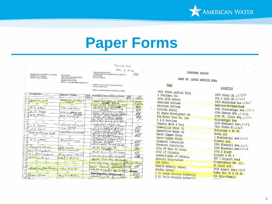
Paper Forms
4
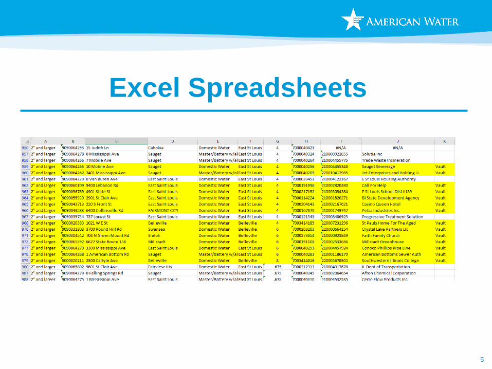
Excel Spreadsheets
5
Employee
Experience/Knowledge
6
Creation
▪ Acquire current state data and standardize
as much as possible
▪ Geocode addresses of confined spaces
(when possible)
▪ Geocoding : Input addresses, GIS generates a point
for each address
▪ This provided a starting point
▪ The rest of the data will be created by end users
7
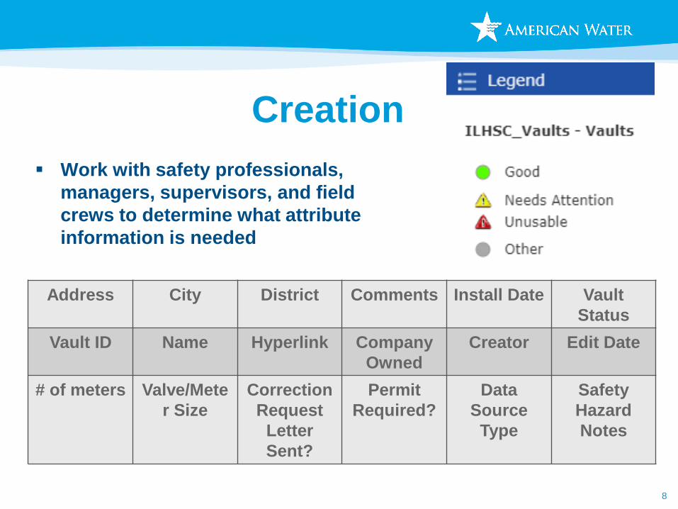
Creation
▪ Work with safety professionals,
managers, supervisors, and field
crews to determine what attribute
information is needed
8
Address City District Comments Install Date Vault
Status
Vault ID Name Hyperlink Company
Owned
Creator Edit Date
# of meters Valve/Mete
r Size
Correction
Request
Letter
Sent?
Permit
Required?
Data
Source
Type
Safety
Hazard
Notes
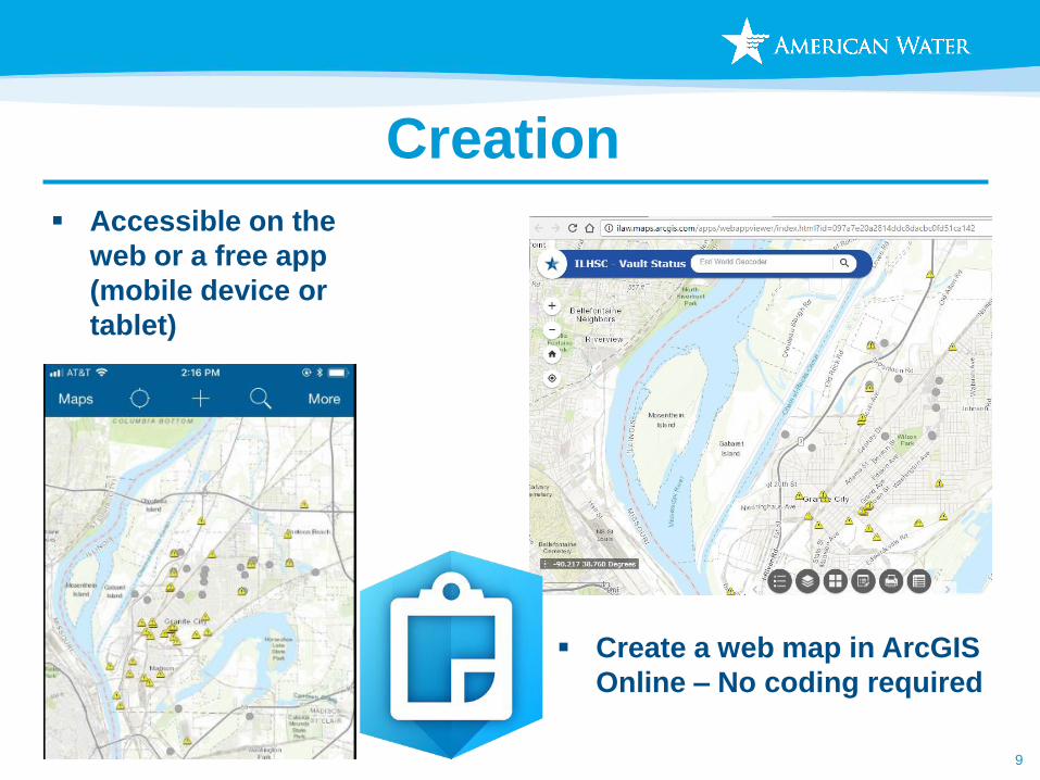
Creation
▪ Accessible on the
web or a free app
(mobile device or
tablet)
9
▪ Create a web map in ArcGIS
Online – No coding required
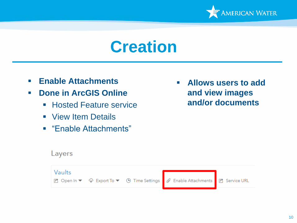
Creation
▪ Enable Attachments
▪ Done in ArcGIS Online
▪ Hosted Feature service
▪ View Item Details
▪ “Enable Attachments”
10
▪ Allows users to add
and view images
and/or documents
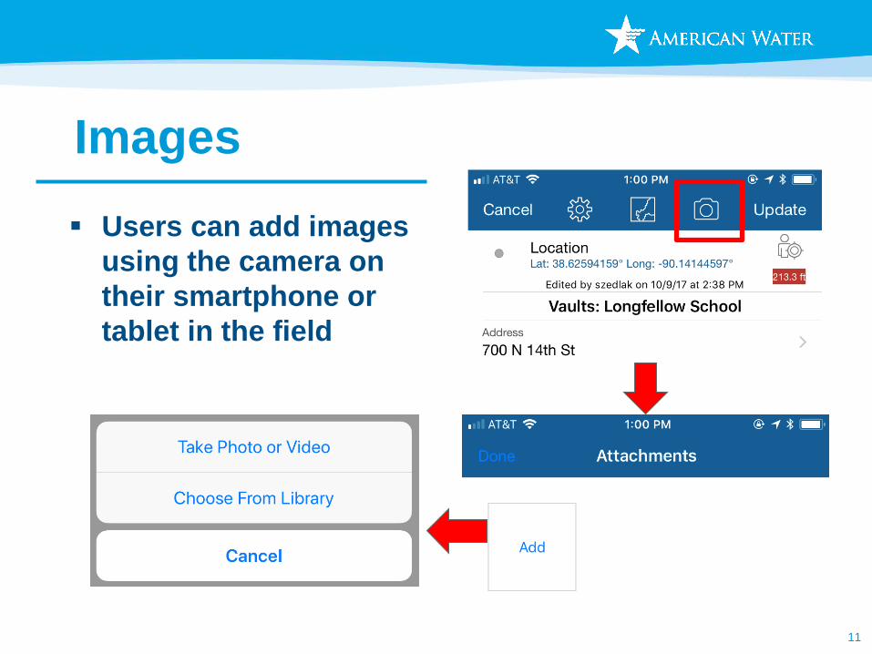
Images
11
▪ Users can add images
using the camera on
their smartphone or
tablet in the field
Images
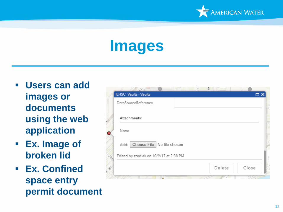
12
▪ Users can add
images or
documents
using the web
application
▪ Ex. Image of
broken lid
▪ Ex. Confined
space entry
permit document
Management
▪ Creation, Management, and Training were all done
by a single user
▪ Once created, data is owned by the end user and
requires very little maintenance
▪ A backup of the data is created monthly
13
Training/Deployment
▪ Scheduled at the beginning of regularly scheduled annual
inspections
▪ ½ day of training
▪ 30 minutes in the office reviewing the basics of the
applications
▪ Hands on training in the field during inspection route for
remainder of the session
14
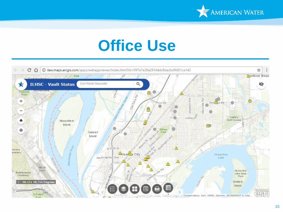
Office Use
15
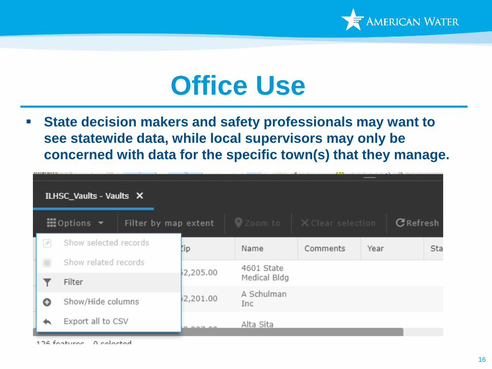
Office Use▪ State decision makers and safety professionals may want to
see statewide data, while local supervisors may only be
concerned with data for the specific town(s) that they manage.
16
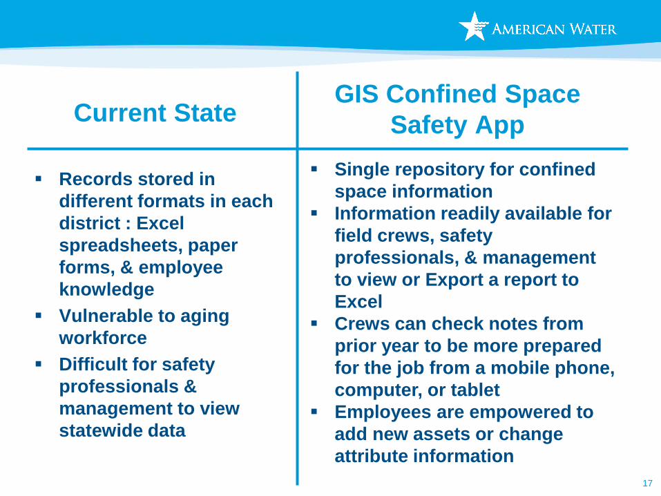
Current State
▪ Records stored in
different formats in each
district : Excel
spreadsheets, paper
forms, & employee
knowledge
▪ Vulnerable to aging
workforce
▪ Difficult for safety
professionals &
management to view
statewide data
17
GIS Confined Space
Safety App
▪ Single repository for confined
space information
▪ Information readily available for
field crews, safety
professionals, & management
to view or Export a report to
Excel
▪ Crews can check notes from
prior year to be more prepared
for the job from a mobile phone,
computer, or tablet
▪ Employees are empowered to
add new assets or change
attribute information
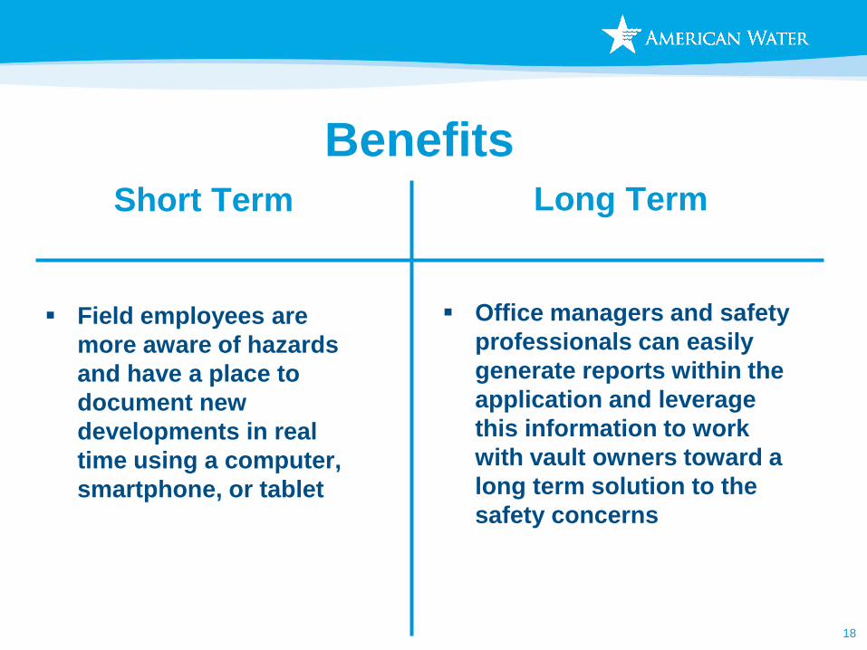
Benefits
▪ Field employees are
more aware of hazards
and have a place to
document new
developments in real
time using a computer,
smartphone, or tablet
18
Short Term Long Term
▪ Office managers and safety
professionals can easily
generate reports within the
application and leverage
this information to work
with vault owners toward a
long term solution to the
safety concerns
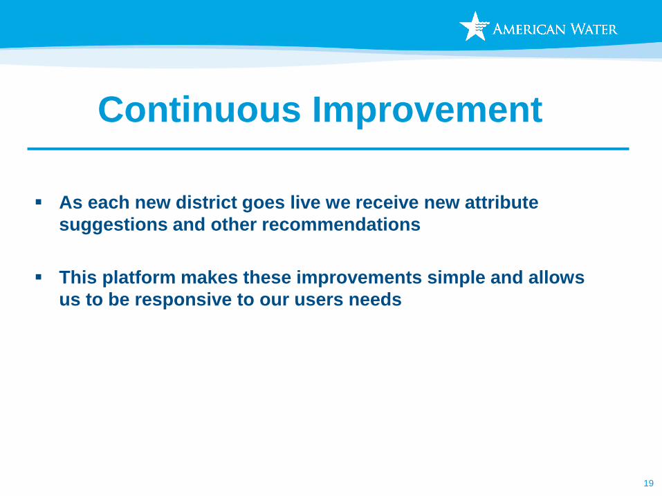
Continuous Improvement
▪ As each new district goes live we receive new attribute
suggestions and other recommendations
▪ This platform makes these improvements simple and allows
us to be responsive to our users needs
19

20