usgs capabilities for studying sediment transport in the ocean · pdf fileusgs capabilities...
TRANSCRIPT
1
USGS Capabilities for Studying Sediment Transport in the Ocean
Marinna MartiniU.S. Geological Survey, Coastal and Marine Geology Program,
Woods Hole Field Center, MA
Sediment Monitoring and Analysis Research WorkshopFlagstaff, AZ Sept. 9-11, 2003
Introduction
The transport and fate of sediment particles is important to the basic understanding of issuesinvolving the coastal ocean, such as habitats, erosion and the movement of contaminants. Fundamental science issues concerning the physics of the bottom boundary layer and particlebehavior remain to be resolved in order to develop a predictive capability for particle transport inthe coastal ocean. This paper is an introduction to USGS Coastal and Marine Geology Program(CMGP) and provides a summary of the Program’s overall mission, how sediment monitoring isimportant to the mission, an overview of the state of the technology in the CMGP, an example ofsome of the technological issues we are working on, and finally some examples of recent fieldprograms which use this technology. The people and web pages mentioned here will point toinformation for follow up during and after this workshop.
The Coastal and Marine Geology Program (CMGP) is “designed to describe marine and coastalgeologic systems, to understand the fundamental processes that create, modify and maintainthem, and to develop predictive models that provide understanding of natural systems, the effectsof man's activities on them, and to provide a capability to predict future change. The programaddresses issues of national importance in the areas of environmental quality and preservation,natural hazards and public safety, and natural resources, providing information andcomprehensive understanding of marine and coastal geology for public benefit. The program willprovide information and products to guide the preservation and sustainable development of theNation's marine and coastal environment of both the oceanic and Great Lakes coastal domains”(CMGP National Plan, 1997).1 While written in 1997, these basic principles continue to drivefuture research and technology. Our information allows the public and resource managers toevaluate the consequences of management actions in the coastal environment. Examples ofsome everyday issues for which the public demands USGS quality data are: whether or not tonourish a beach, the impact of coastal development, where to dredge, where to locate a sewageoutfall pipe, or where the best sand and gravel may be found. The recent National Academy ofSciences’ National Research Council review recommended an increased USGS involvement inpredictive capabilities. Developing a Community Sediment Transport Model is now a majorfocus of the CMGP.

2
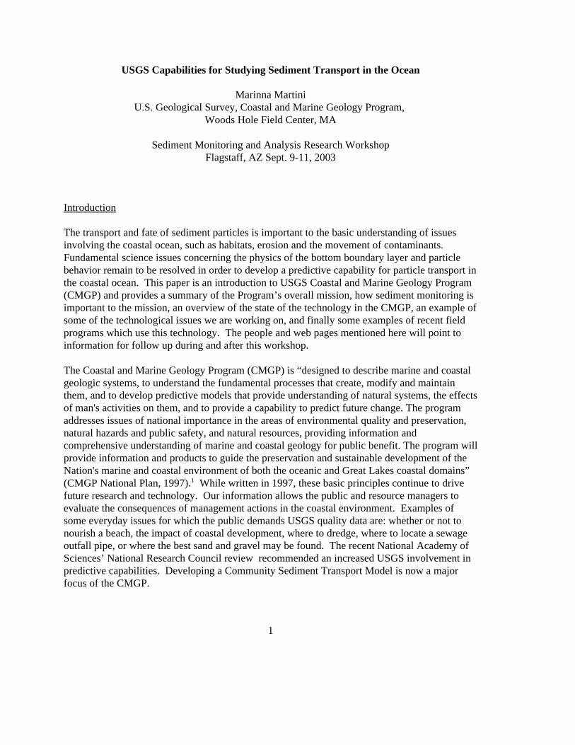
Figure 1: A short subsurfacemooring consisting of a float, Honjotrap and anchor being deployed offScituate, MA from the USCGMarcus Hanna.
The CMGP’s strength is its ability to map, measure and model ocean processes on a regionalbasis using state of the art technology. Our field studies address the following basic questions:where is the sediment now, what kind is it, under what circumstances will it move, and once re-suspended, where will it go. The problems are four dimensional and sometimes unbounded onmany sides, offering a special challenge to modeling.
Field Capabilities
It is a priority in the CMGP to maintain cutting edge technology in sea-floor mapping andsediment transport. We prefer to buy commercially available instruments, but often thetechnology we need does not exist on the commercial market. We work closely with otherinstitutions to help fund new technological advances and to identify the best new technologies. This has resulted in a suite of reliable, productive, and efficient instrumentation that produceshigh-quality data specific to CMGP’s scientific objectives. Our technology includes in situ instrumentation for longterm deployment, side scan sonars and sub-bottomprofilers for mapping, real time video of the sea bed, andsediment samplers. Instruments are either towed behind ormounted on vessels for real time surveys, or deployed insitu for periods of one month to a year on moorings andbottom platforms. The ships we use range from our ownvehicle towed survey boats to 200 foot research vesselsthat are contracted or part of the University NationalOceanographic Laboratory System (UNOLS) or the U.S.Coast Guard. Personnel and equipment are distributedamong three Field Centers located in Menlo Park, CA,Woods Hole, MA and St. Petersburg, FL, each with itsown scientific, technical and regional specialization. TheCenters cooperate to share resources and knowledge.
Moorings for Time Series Observations
Oceanographic moorings and bottom platforms are used bythe CMGP to deploy instrumentation in situ for periods ofone month to a year. An oceanographic mooring consistsof floatation (steel, glass or foam) which suspendsinstruments on chain and wire and is anchored to thebottom by a large weight (Fig 1). Moorings can be as longas 2000 m. The floatation may or may not be a buoy onthe surface. Data can be telemetered to shore by acousticand radio modem links, or via satellite, but most often it isrecovered when the instruments are recovered at the end ofthe deployment. Bottom platforms are almost always a

3
Figure 2: Large tripod aboard the USCGMarcus Hanna awaiting deployment inMassachusetts Bay.
Figure 3: The new seismic reflectionsystem with the “cataraft” sled designedat the Menlo Park Center so data can becollected in water <10 m deep.
tripod design for stability, and can range from 1-5 mhigh depending on the instrumentation beingdeployed (Fig 2). The moorings and tripods arebuilt to withstand the rigors of coastal storms suchas hurricanes and nor’easters as well asentanglement with fishing gear. In many locationslarge surface “guard” buoys are deployed to markthe site to prevent entanglement by fishing activity.
Sea Floor Mapping and Imaging
High resolution acoustic mapping and imagingsystems are employed to map and characterize thesea floor. Sea floor mapping presents regionaloverviews of what sediments are in place, both atthe seabed and below.
• Figure 3 is one of the seismic reflection “fish”towed behind a ship to map below the sea floor. A typical product is a mosaic map compiled ofthe individual lines run by the ship, or a sub-bottom profile of the sediment below. The mapsare ground-truthed using samples, bottomphotographs and video to gain detailedinformation about what kind of sediment hadbeen mapped by the acoustics or seen moving byin situ sensors.
• The Coastal Profiling System uses personal watercraft (jet skis) fitted with and acoustic echosounder and a Differential Global PositioningSystem (DGPS) to perform sub-aqueousbathymetric surveys in shallow water (0-10 m).
• The SWASH (Surveying Wide-Area Shorelines) isa vehicle-based system for measuring shorelineposition which utilizes an array of DGPS sensorsto measure elevation and tilt which areextrapolated to a shoreline datum (Fig 4). SWASHhas mapped pre and post storm changes in beachprofiles on Cape Cod, MA and the banks of NorthCarolina.
• Sector scanning sonar is used to image sand rippleson the sea bed. Using images taken over severalmonths, movies are created from these images,

4
Figure 4: SWASH. Note the multiple GPSreceivers on the top of the buggy.
showing the creation, progression anddestruction of sand ripples in response tobottom processes.
Sediment Sampling and Imaging
Mechanical samplers such as settling traps,gravity cores and van-veen grabs are used tocollect sediment samples from the sea floor orwithin the water column. These have beenparticularly valuable techniques forassociating transport of heavy metals withspecific storm events. Sediment analysis isperformed by a network of laboratorieslocated at all three Centers, and work continues on databases such as the contaminated sedimentsdatabase and aggregates database. A few of the more advanced mechanical sampling systems inuse by CMGP are the slow corer, the SEABOSS, and time-series settling traps:
• The slow corer is an hydraulically damped corer can take up to 50-60 cm sediment coreswithout disturbing the sediment-water interface at the sea bed. Video cameras allowscientists to examine the sea floor in real time and choose where to take a sample.
• The SEABOSS is able to obtain real time video of the bottom, take 35 mm still images, andacquire a grab sample. SEABOSS is typically suspended above the bottom as the ship is allowed to drift over sites of interest. Both the winch operator and scientist cansimultaneously monitor the video.
• The Honjo trap is a long-term, in situ time series settling trap consisting of a large diametercollecting cone attached to a rotating carousel of collection bottles (Fig. 1). Bottle rotation iscontrolled by a computer programmed with a pre-selected schedule.
• The super-sucker is a water transfer system2 which collects sediment by pumping a fixedvolume of in situ water past a pre-weighed filter, which traps the sediment. Also computercontrolled, this instrument selects sampling time based on real time analysis of in situconditions. Bottle and filter contents from these samplers are analyzed for chemical andgeological properties depending on the particular study.
Near Bed Currents and Suspended Sediment Concentration
One of the most difficult problems has been to model, in three dimensions, the types of sedimentthat are resuspended and transported under various conditions. This is key to achieving apredictive capability. Attenuation sensors, backscatter sensors, profiling and single pointcurrent velocity sensors are deployed in situ for one month to a year to acquire time seriessediment resuspension caused by different processes (storms, internal waves, tidal flow, etc.). These data are used to develop and test three dimensional hydrodynamic and sediment transportmodels. The challenges in making these measurements can be divided into two areas: obtaining

5
high resolution data near the sea bed in the presence of resuspension events (such as storms), and calibrating instrumentation to determine sediment concentration.
Acoustic profiling instruments are routine working instruments for water column profiling overranges of 5 to 500 m. This technique is presently limited when brought close to a boundary suchas the sea bed. The challenge is to obtain water column profiles of flow and sedimentconcentration at high resolution without disturbing the flow, for example, to profile 1 m abovethe sea bed at 1 Hz, with 10 cm resolution and better than 5 cm/s accuracy, over a period of fourmonths. There are rapid sampling, highly accurate single-point acoustic sensors, but thechallenge remains to profile accurately at such rates. New “pulse-to-pulse coherent” Dopplerprofiling techniques are beginning to attack this problem. Over the past year, the CMGP hasbeen using state of the art instruments available commercially in routine experiments and intesting during special deployments. These instruments perform very well when presented withslower, steady state, two dimensional flows, but this is not the reality of the coastal ocean,especially during storms. We are presently evaluating the errors induced in these instruments bywaves and highly turbulent flows so that future data analyses will be more accurate, and so thatwe can establish, program-wide, a single, accepted technique for these kinds of measurements.
Acoustic and optical sensing techniques exist to detect resuspension of sediment. It is difficultto gain information about the size, concentration and settling velocity of the particles that are inmotion, especially over long periods of time. Estimates of mass sediment transport are needed totest and refine models. Sediment samplers which trap particles provide information about theparticles they capture, but they are limited by the volume of sediment they can store and themechanical problem of dividing the samples in time so that one knows when the particles arrivedon site. They are often biased collectors of particles. Remote sensing techniques which do notdisturb the environment they sample are preferred for long term, in situ measurements. Sensorswhich detect backscatter, either of light or sound, have been very productive, however they aresensitive to different sizes and mixes of particles. The transmissometer is a favorite sensingtechnique for lower concentrations of sediment.
Backscatter sensors must be calibrated to convert the signal to useful measures of sedimentconcentration. These calibrations, be they acoustic or optical (including the transmissometer),are particle size and concentration dependent. Flocculation of particles under different stressconditions further complicates the calibration problem. CMGP and Woods Hole OceanographicInstitution scientists are working together to calibrate optical and acoustic backscatter sensors inthe laboratory using in situ sediment samples taken from experiment sites. The challengeremains to build a calibration facility that uses volumes of sediment samples that are practical totransport from the experiment site, and that can maintain the volume of sediment in suspensionlong enough for a stable calibration. Each new experiment at a new location with differentsedimentary features requires a new calibration. Even then, the assumption is that the degree offlocculation is dependent on the way the sediment is handled and may or may not representflocculation at the actual experiment site. Finally, the calibration is dependent on the mixture ofparticle sizes and types, which may not represent the concentrations found at the bed.

6
Figure 5: Magnification of the sea floor, in situ,captured by the Poking Eyeball. Visible are shellsand sediment grains.
Backscatter intensity recorded over a range of acoustic frequencies may be able to separatesediment into ranges of size or concentration. Single frequency information is widely availableas a level of acoustic backscatter; it is a standard diagnostic parameter that is stored by allacoustic current velocity sensors that utilize Doppler shift to make measurements. Transmissometers and optical backscatter instruments are also de-facto single channel sensors,as they simply respond to the gross change in sediment resuspended in the water. One advancehas been the commercial availability of multi-frequency acoustic backscatter systems that canremotely sense and record profiles of backscatter intensity above the bed. These allowclassification of resuspended matter into bands of concentration, and once calibration techniquesare improved, may possibly give information about concentrations of particles of various sizes. Another technique which shows great promise can classify particles by size based on laserscattering, however the instrument must be present in the flow field (and therefore cause adisturbance) to do so, and it cannot profile at present.
Photographic imaging shows promise fordetermining grain size. The CMGP hasdeveloped its own photographic systemto obtain images of the surface sediment. Named the “Poking-Eyeball”, it recentlyunderwent its first full field trial. ThePoking Eyeball is brought against the seabed to image sediment in situ at sufficientmagnification to determine grain size. Such images (Fig. 5) provide a timehistory of the type of particles on the seabed. This technique offers an advantageover settling traps in that many moreimages can be taken over the course of adeployment.
Processing and Archival of Data
Data archive and the recording of appropriate metadata in the face of ever growing amounts ofdata is an ongoing challenge for the CMGP. Twenty years ago, a single instrument wouldproduce 2 MB of data in an experiment, and seismic mosaics were pieced together from paperprintouts. Today we deploy arrays of instruments which each generate 40 MB to 2 GB of data,and we map and generate digital mosaics in real time with resolution of a few meters or less. We are striving to standardize techniques used by our Centers to handle data from ourinstrumentation so that these data are more accessible to researchers both immediately after theexperiment and into the future. A single point of contact and a standardized data processingsystem provide a useable archive of data back to 1975. Standardization provides a “best basicversion” of data to scientists for analysis. Sometimes we can rely on manufacturers software,but such software is often designed for a very generic user, and is dependent on the

7
Figure 6: Collection bottles from a time series settling trapshow how amounts of sediment can vary with resuspensionevents.
manufacturer’s long term support. We often find ourselves looking to more open sourcemethods for long term archival and data manipulation.3 GIS and database techniques, MATLABand open format standards such as netCDF are some of the tools we use. Standardization thisway has made collaboration with other institutions, and among our own sister offices, muchmore productive.
Examples of Current Projects
There are several CMGP field projects that are collecting data relevant to sediment resuspensionstudies:
• Long Term Oceanographic Observations in Massachusetts Bay is an ongoing long term fieldprogram to understand the long-term fate of sediments and associated contaminants.4,5 It hasprovided one of the longest continuous time series of currents and sediment observations(1989 to present). Figure 6 shows how sediment samples are used with oceanographicobservations for analysis. The long-term observations document seasonal and inter-annualchanges in currents,hydrography, andsuspended-matter concentrationin western Massachusetts Bay,and the importance of infrequentcatastrophic events such asmajor storms or hurricanes insediment resuspension andtransport.
• Off Washington State, the U.S.Geological Survey and theWashington State Department ofEcology initiated a multi-disciplinary cooperative study togather information on the entirecoastal system to address thecauses of the recent change toincreased erosion of the coast.6
• During the winter of 2002-2003,CMGP participated in theEurostrataform program7 whichbrought together scientists fromthe U.S., Italy, Spain andelsewhere to use selected areasof the European continentalmargin to explore the fate ofsediment particles from their

8
source in rivers to their deposition on shallow deltas, on the continental shelf, and indeep-sea basins.
• Another unique field program is designed to investigate sediment turbidity current events inMonterey Canyon.8 Three long moorings with numerous settling traps, transmissometers andcurrent meters have been deployed in the canyon axis at depths of 1800-800 meters sinceDecember, 2002 to document an event. We hope to see how much sediment is transported,how far, and how high from the sea floor.
• This summer we performed a short instrumentation test off Martha’s Vinyard, MA, incooperation with the Woods Hole Oceanographic Institution, to test two commercialinstruments which can perform high resolution profiling of currents and sedimentresuspended above the sea bed.
All of these projects provide observations for testing numerical models of circulation for theCommunity Coastal Sediment Transport Model.9 This project works to improve prediction ofthe transport, transformation, and fate of sediment and particle-bound nutrients andcontaminants. Goals are to produce advanced numerical models and model infrastructure forcoastal sediment transport that are scientifically sound, expertly coded, well tested, and suitablefor use in both research and practical applications.
Summary
Two technological challenges that are a top priority for study in the CMGP are: high resolutionprofiling within 1-2 m above the sea bed, and calibration of sensors that can detect and measuresediment resuspension events. We want to be able to measure the properties of sediment whilenot disturbing the flow environment and without disturbing too much sediment at the experimentsite. This will require a suite of sensors to be deployed together. Some will be on platformsdesigned not to interfere with flow, and some will be bulkier systems to provide informationneeded for calibrations.
The long term objective of the CMGP is to improve our ability to predict the transport,transformation and fate of sediment in the ocean. The wide array of instruments provides thefield data to develop, test and improve coupled hydrodynamic and sediment transport models.
Bibliography
1. USGS Coastal and Marine Geology Program National Plan (1997),http://marine.usgs.gov/natplan97/natplan97.html
2. Butman, B., Alexander, P.S., Harris, C.K., Traykovski, P.A., and others, Oceanographicobservations in the Hudson Shelf Valley, December 1999 – April 2000: data report: U.S.Geological Survey Open-File Report 02-217, DVD-ROM.
3. Côté, Jessica M., Hotchkiss, Frances S., Martini, Marinna, Denham, Charles R., Version2:May 2003, "Acoustic Doppler Current Profiler Data Processing System Manual", USGeological Survey Open File Report. OFR 00-458, version 2, May 2003.

9
4. Bradford Butman, M.H. Bothner, F.L. Lightsom, B.T. Gutierrez, P.S. Alexander, M.A.Martini, and W.S. Strahle, Long-term Oceanographic Observations in WesternMassachusetts Bay Offshore of Boston, Massachusetts: Data Report for 1989-2000, U.S.Geological Survey Digital Data Series 74, 1989-2000.
5. Boston Sewage Outfall: The Fate of Sediments and Contaminants in Massachusetts Bay, http://woodshole.er.usgs.gov/project-pages/bostonharbor/index.html
6. Gelfenbaum, G., Sherwood, C.R., Peterson, C.D., Kaminsky, G.M., Buijsman, M, Twichell,D.C., Ruggiero, P. , Gibbs, A.E., and Reed, C., 1999, The Columbia River littoral cell: Asediment budget overview: Coastal Sediments '99 - Proceedings of the 4th InternationalSymposium on Coastal Engineering and Science of Coastal Sediment processes, N.C. Krausand W.G. McDougal, editors, American Society of Civil Engineers, Reston, VA, v. 2, p.1660-1675.
7. Eurostrataform work in process, contact Chris Sherwood, Principal Investigator8. Monterey Cayon work in process, contact Marlene Noble, Principal Investigator.9. Community Model for Coastal Sediment Transport,
http://woodshole.er.usgs.gov/project-pages/sediment-transport/
Coastal & Marine Program Technologist Contacts and Web sites
acoustic Doppler profilers Marinna Martini, Jessie Lacyanalytical labs Ellen Mecray
http://woodshole.er.usgs.gov/operations/sedimentlab/index.htmlcoastal profiling system (near shore mapping) Guy Gelfenbaum, Peter Ruggierocurrent measurement Marinna Martini, Brad Butmanhigh resolution profiling (water column) Joanne Ferreira, Jessie Lacy, Chris Sherwoodmoorings & tripods Jonathan Bordenpoking eyeball Dave Rubin, Hank Chezarscanning sonar Marinna Martini, Chris Sherwood, Phil ThompsonSEABOSS Dann Blackwood, Page Valentine
http://woodshole.er.usgs.gov/operations/seaboss/seaboss.htmlseafloor mapping Bill Danforth, Jane Denny, Larry Kooker
http://woodshole.er.usgs.gov/operations/sfmapping/default.htm,http://walrus.wr.usgs.gov/pacmaps/
sediment databases Larry Poppe, Jeff Williamshttp://instaar.colorado.edu/~jenkinsc/dbseabed/dbseabed.html
settling traps, slow corer Rick Rendigs, Mike BothnerSWASH Amy Farris, Jeff List
http://woodshole.er.usgs.gov/operations/swash/index.html
Disclaimer
The mention of trade names or manufacturers in this publication does not constitute anendorsement by the U.S. Government.