usepa brownfields assessment grant€¦ · area of study city of el cajon specific plan 182 (sp...
TRANSCRIPT


USEPA Brownfields Assessment Grant
What is a Brownfield?– Real Property– Recognized Environmental
Conditions– Complicates Reuse

Scope of Work
Conduct Phase I ESAs
Identify RECs
Prepare Comprehensive Report
Prepare Site Conceptual Model
Develop GIS Database
Develop Community Brownfields Action Plan (CBAP)
Conduct Public Meetings
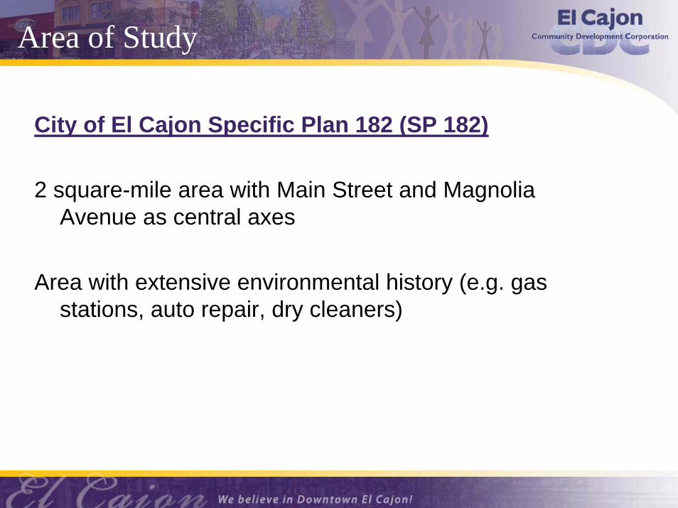
Area of Study
City of El Cajon Specific Plan 182 (SP 182)
2 square-mile area with Main Street and MagnoliaAvenue as central axes
Area with extensive environmental history (e.g. gasstations, auto repair, dry cleaners)
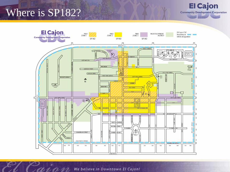
Where is SP182?

Phase I ESA Process
Goals - Identify potential Recognized Environmental Conditions (RECs) and prepare report
Review Data - regulatory information, aerial photos, city directories, permits, and historic maps
Conduct limited site reconnaissance
Identify potential human receptors (schools, daycares, nursing facilities)
Rank environmental priority of each site (i.e. 1, 2, or 3)
Prepare comprehensive report

Phase I ESA Findings
Priority 1 (21 sites) - Unauthorized release of hazardous materials (REC); 7 cases were closed
Priority 2 (85 sites) - Past or present occupants of potentially significant environmental concern (e.g. gas station, dry cleaners, auto-related business)
Priority 3 (>150 sites) - No obvious RECs, no records of releases or past site uses of potential concern.

Phase I ESA Priority Map

GIS Database - Websitewww.downtownelcajon.com

GIS Database - Data on Website
El Cajon Art - Public Art and Art Establishments
Base Data - Roads, Freeways, SP 182 Boundary, Transportation Routes and Stops
Hazard - FEMA Flood, Soils
Developer Data - Parcel Boundaries, Historic Properties, Vacant Land, IRS Economic Based Qualified Census Tracts, and Environmental Concern Ranking
Parcel Data (Tabular) - Parcel Owner & Address, Site Address, APN, Land Use, Planned Land Use, Earthquake & Wildfire Risk
Phase I Info - LUST, UST, REC, Case Number, Case Closed/Open and Contamination Type and a link to the Phase I Report if applicable

GIS Database Layer – Public Art Walk Sites
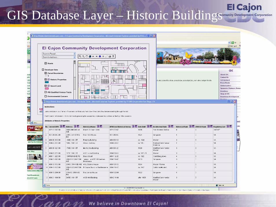
GIS Database Layer – Historic Buildings
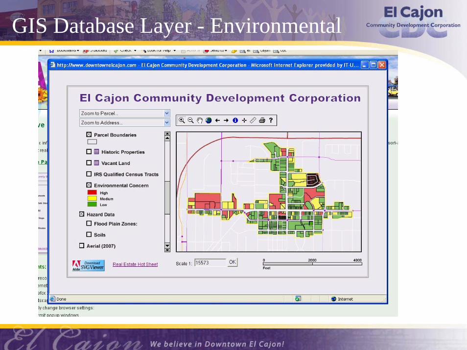
GIS Database Layer - Environmental

Project Benefits for Users
Immediate on-line information
One-stop environmental/demographic information
Identifies priority of potential environmental concern
Allows redevelopment planning for cleanup schedule and costs
Due diligence responsibility of property buyers

Brownfield Funding SourcesMany funding sources available:Federal, State and Private
Depends on: Property ownership and proposed property use
GRANTS = municipalities, redevelopment agencies, community non-profits
LOANS = property owners/developers/others
Funding not specific to a site being a Brownfield
Carefully review applicability requirements
Review websites for requirements/application deadlines
Some information on Internet links provided

Internet Links
USEPA Brownfieldshttp://epa.gov/brownfields/pilot.htm
CalReUSEhttp://www.treasurer.ca.gov/cpcfa/calreuse.asp
SWRCB UST Cleanup Fund & OSCAhttp://www.waterboards.ca.gov/water_issue/programs/ustcf
DTSC Brownfield Targeted Site Investigation Grantshttp://www.dtsc.ca.gov/SiteCleanup/Brownfields/Loans_Grants.cfm
Center for Creative Land Recyclinghttp://www.cclr.org
Continental Environmental Redevelopment Financing, LLC
More Information: Contacts
Edith Saldivar,Economic Development [email protected]
Bob Scott, PG, CHgDivision Manager, Site Assessment and [email protected]

Questions & Answers