use of uav assessment in navajo nation abandoned uranium mine cleanup
TRANSCRIPT

Use of UAV Assessment in Navajo Nation Abandoned Uranium Mine Cleanup – Cameron Chapter
Jim Oliver, RGCrestone Environmental, LLCTechnology [email protected]

Navajo Abandoned Uranium Mine (NAUM) Sites
• Estimated 3,700 Sites in Four Corners Area
• 523 AUM Sites on Navajo Nation
• $1 Billion allocated to cleanup 46 sites
• EPA currently has assessment scope for $85 Million
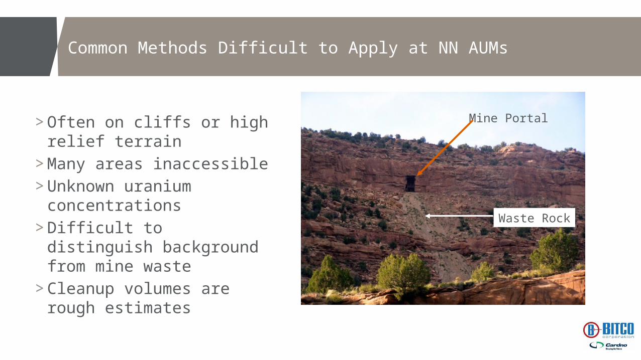
Common Methods Difficult to Apply at NN AUMs
> Often on cliffs or high relief terrain
> Many areas inaccessible> Unknown uranium
concentrations> Difficult to distinguish
background from mine waste> Cleanup volumes are rough
estimates
Mine Portal
Waste Rock

Common Methods to Assess AUM Contamination
GPS Unit
Gamma Sensor
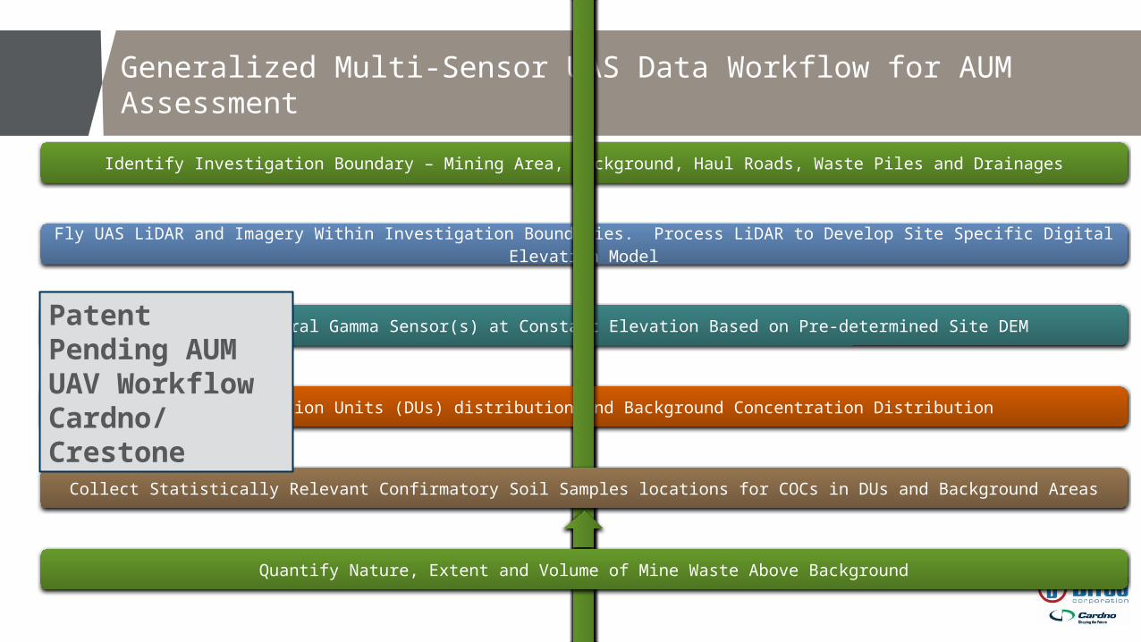
Generalized Multi-Sensor UAS Data Workflow for AUM Assessment
Identify Investigation Boundary – Mining Area, Background, Haul Roads, Waste Piles and Drainages
Fly UAS LiDAR and Imagery Within Investigation Boundaries. Process LiDAR to Develop Site Specific Digital Elevation Model
Fly Multi-Spectral Gamma Sensor(s) at Constant Elevation Based on Pre-determined Site DEM
Assess Decision Units (DUs) distribution and Background Concentration Distribution
Collect Statistically Relevant Confirmatory Soil Samples locations for COCs in DUs and Background Areas
Quantify Nature, Extent and Volume of Mine Waste Above Background
Patent Pending AUM UAV WorkflowCardno/Crestone

Flight Platform: Pulse Vapor 55 VTOL UAV

Sensor Package
LiDAR• Terrain mapping• Volume
quantification• Vegetation layer• Change detection• Feature detection
Gamma• Uranium
contamination• Migration
Pathways• Background
Imagery• Vegetation
assessment• Cultural
resources• Photogrammetry • Geological
correlation

Flight Operations – CAM 27 AUM Near Cameron
• 15 acre coverage• Pre-set Flight Plan• 11 minute data collection time• 75 foot spacing on flight lines• Photogrammetry• Full survey grade ground
control• 150 and 100 ft gamma flights• 5 points per sec• 4,200 total gamma
measurements

Safety Systems in Flight Operations

Imagery Flight Plan
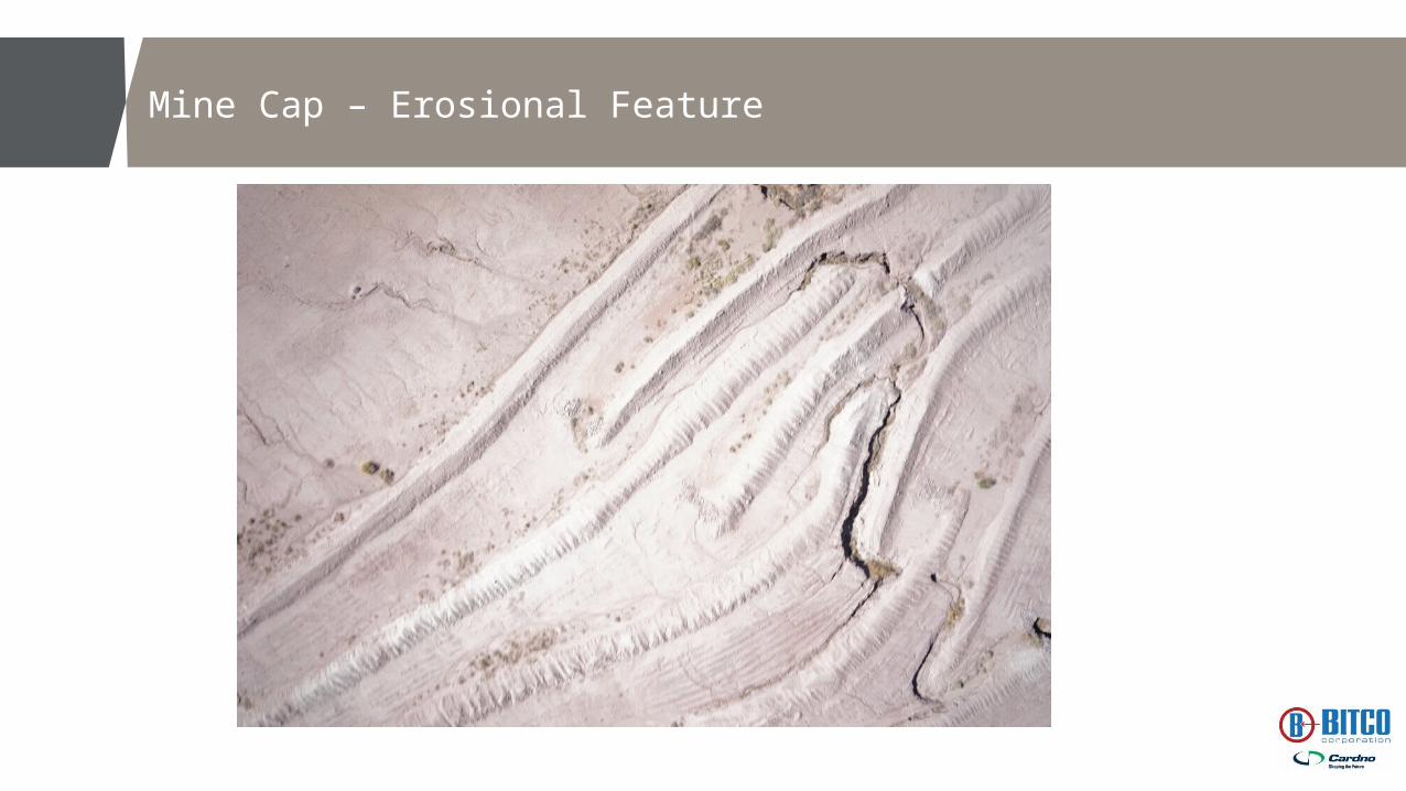
Mine Cap – Erosional Feature

Gamma Data – Level of Radiation from Uranium
> Data provided in Counts Per Second (CPS) along flight path
> As part of the future work, will convert the CPS data into units that will be used to assess cleanup levels

CAM 27 AUM
• Background concentrations outside of mine site (blue)
• Higher concentrations near former mine operations (red)
• Gamma emissions from cap erosional features (Red)
• Elevated gamma readings associated with haul roads (light red)

Tso Property
• Background concentrations over most of property (blue)
• Small area south of home site across road (yellow)
• Much lower overall as compared to mine site

Unique RPAS Multi-Sensor Workflow
> Full understanding of contamination distribution and volume
> Improved repository design
> Less cost and more data than conventional walk around survey
> Post cleanup confirmation> ALARA says so!> EPA behind the curve