urthecast - geospatial world forum · urthecast’s vision ... ultra hd video open sources...
TRANSCRIPT

George Tyc
Co-founder & CTO
UrtheCast
‘Democratizing the View from Space’
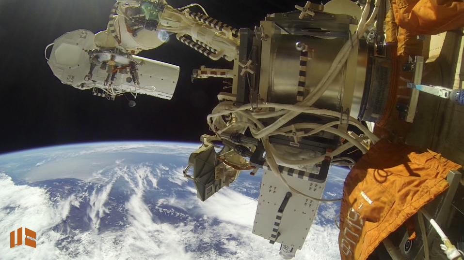
PHOTO: NASA

PHOTO: NASA
UrtheCast’s Vision Create an open web platform providing near real-time video and imagery from the ISS and data from many other sources … allowing everyone to see the Earth and how it’s changing from a whole new perspective
… allowing everyone to experience and participate in events unfolding around the planet in a whole new way and share with friends
… allowing everyone to participate in the stewardship of our planet

Let all see the world from this perspective
PHOTO: NASA

A new kind of EO Social
Ultra HD video Open sources
Competitively priced Widespread awareness
PHOTO: NASA
Near realtime Democratized Crowd sourced Heightened accessibility Fosters planet stewardship
PHOTO: NASA

Platform Apps
Inspires innovation and unique content.
Media
An exclusive source for media outlets.
Web Ads
Ballooning web traffic.
Earth Observation
The only color, Ultra HD video from space.
A new EO revenue model
PHOTO: NASA


MRC: “Theia” HRC: “Iris”

Camera: “THEIA” Fixed nadir viewing !!
Aperture: ! !62 mm!!
Focal Length: !455 mm!!
Sensor: ! !CCD, pushbroom !! ! ! !8800 pixels !
!
4 Bands: Red Green Blue NIR !!
Built-in J2K Compression

Camera: “IRIS” 2-axis pointing, tracks a ground target!!
Aperture: ! !317.5 mm!!
Focal Length: !2.54 m!!
Sensor: ! !CMOS, 14 Mpixel!! ! ! !full colour (RGB)!
!
Images captured at 3 fps!!
Built-in J2K Compression

Cameras installed: Jan. 27


Video & Image Products IRIS: Video Product!GSD: ! ! ! sub m!Image Area: ! 5.5 x 3.6 km!Resolution: ! full res (cropped) or !! ! ! ! full size (down-sampled)!
Video Formats: HD & 4k UHD (H.264)!Frame Rate: ! 30 fps!Perspectives: ! CameraView &!! ! ! ! OrthoView!
Spectral bands: RGB!Video length: ! up to 90 sec!
THEIA: Image Product!GSD: ! ! ! 6.2 m!Swath Width: ! 49.4 to 54.5 km !Perspectives: ! CameraView &!! ! ! ! OrthoView!
Spectral bands: R G B & NIR!!IRIS: Image Stack Product!GSD: ! ! ! sub m!Image Area: ! 5.5 x 3.6 km!No. of images:! 30 images per sec ! ! ! ! of video!
!
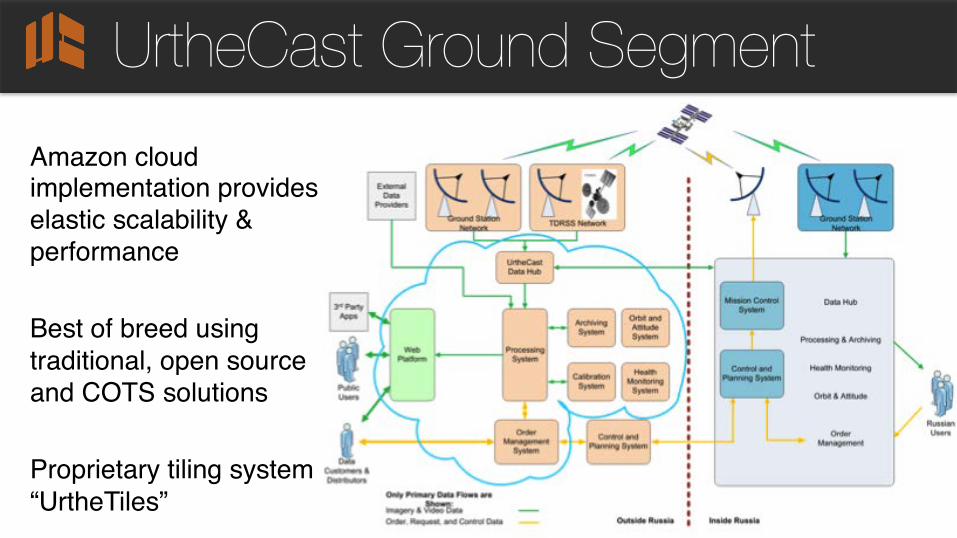
UrtheCast Ground Segment !Amazon cloud implementation provides elastic scalability & performance!!Best of breed using traditional, open source and COTS solutions!!Proprietary tiling system “UrtheTiles” !!! !!

ISS Orbit & Ground Stations

IRIS Camera Coverage

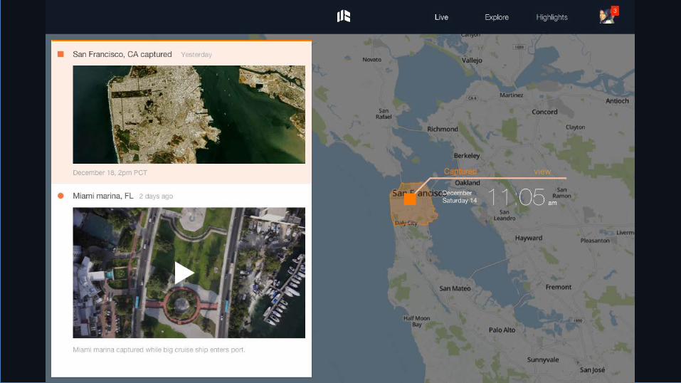
The Platform

Near realtime • Near realtime feed of Earth • Orbit and Map sync • Change Detection • Area-of-interest notifications • Cloud technology
Modern user experience • Full screen, near realtime feed • Responsive design, device agnostic • Intuitive search >> click >> buy • Mobile-first Enhanced availability • Reduced costs • Open source client libraries • Long tail monetization
Next-gen user experience

Web play
• A dynamic, continually updated world map. Data from many sources (space & ground)
• Videos streamed in near realtime from the ISS; feature rich discovery capability
• Users contribute to events and places by uploading videos/images and create “stories”
• A realtime social layer integrated with social media platforms like Facebook and Twitter.


User accounts
view!

Geo-referenced, in near realtime


Social EO


App development Environmental
Weather tracking Gaming Science
Travel Eye candy Educational Conservation
Mining Forestry Activism Urban development
PHOTO: NASA

Harnessing Ultra HD Video
PHOTO: NASA
3D models & mapping Forestry
Humanitarian relief Business intelligence
Media Citizen science

First light: Jamaica

First light: Venezuela

urthecast.com/firstlight