urban heat island
DESCRIPTION
URBAN HEAT ISLANDTRANSCRIPT

221
IDŐJÁRÁS Quarterly Journal of the Hungarian Meteorological Service
Vol. 113, No. 3, July–September 2009, pp. 221–231
Seasonal and spatial distribution of physiologically equivalent temperature (PET) index in Hungary
Ágnes Gulyás1∗ and Andreas Matzarakis2 1Department of Climatology and Landscape Ecology, University of Szeged, P.O. Box 653, H-6701 Szeged, Hungary; E-mail: [email protected]
2Meteorological Institute, Albert-Ludwigs-University of Freiburg, Werthmannstr 10, D-79085 Freiburg im Breisgau, Germany
E-mail: [email protected]
(Manuscript received in final form January 23, 2009)
Abstract—The aim of this study is to present a thermal human bioclimate analysis of Hungary by means of mapping, useing multiple linear regressions. The present study links geographical information with climatological data in order to generate a spatial distribution of PET values of a region. The distribution of average PET values of seasons are drawn at 1 km resolution. Meteorological data used to draw the maps was made with the help of data collation program at the Climatic Research Unit (University of East Anglia, Norwich, UK). The calculation of PET is performed with the aid of the RayMan model, which calculates the measures of the thermal human bioclimate. The calculated PET values show that the difference between the highest and lowest temperature areas is between 7–11 ºC. This means two comfort level differences generally. The winter is an exception, when the whole country can be rated to the same physiological stress level.
Key-words: physiologically equivalent temperature, thermal comfort, mapping, Hungary
1. Introduction
Assessing the climatic capabilities of a certain area, bioclimatic aspects have higher and higher significance. In case of densely populated (urban) areas or extensively visited places (popular tourist destination, health resort), the effect of the climate on the inhabitants is an important question. A bioclimatic assessment is a complex task. The effect of the climate on the human body cannot be described by a single meteorological parameter. The air temperature, air humidity, wind, and radiation fluxes never act solely, but form a complex, so-called thermal factor. This complex factor induces certain physiological ∗ Corresponding author

222
responses on the human body. Several models and indices were created in the last decades to describe this mechanism and quantify thermo-physiological phenomenon occurring in the human body (VDI, 1998).
The recent models, based on the human energy balance, opened new dimensions. These models take into account the heat fluxes (sensible- and latent heat loss, thermal radiation) between the body and the environment as a basis, with several additional empirical factors. Thus the coupling of meteorological parameters and the characteristics of the body give more detailed picture. The output data of the models are different bioclimatological indices, which quantify the extent of the heat stress (Fanger, 1972; Jendritzky et al., 1990; Höppe, 1993, 1999; VDI, 1998; Matzarakis et al., 1999; Spagnolo and de Dear, 2003).
Assessments can be performed at different spatial and temporal levels, according to the purpose of the study (Jendritzky et al., 1990; Matzarakis et al., 1999; Koch et al., 2005; Zaninovic et al., 2006). Microscale (~1 cm −1 km) studies can be used to examine very small microclimatic phenomena, like, for example, bioclimatic properties of a building, street, or park (Matzarakis, 2001; Mayer and Matzarakis, 1998a,b; Picot, 2004; Gulyás et al., 2006; Knez and Thorsson, 2006). The data produced by such researches, which provides, for instance, quantitative information about optimal street forms in order to regulate the climate comfort, can be applied by architects and urban designers (Ali-Toudert and Mayer, 2006; Lin et al., 2006). Applied studies at local- and meso-climatic scales (~100 m –200 km) can provide data for urban planning or regional planning (e.g., tourism) (Matzarakis et al., 2004; Brandenburg and Matzarakis, 2007). Mainly topographical methods are used in case of bioclimatic analysis of larger areas on the macroscale (>200 km). The fast development of geoinformatical methods opens new possibilities also in these studies. Nowadays, analysis of bioclimatic maps is an integral part of regional planning processes in countries with developed tourism infrastructure and industry (Matzarakis et al., 2004; Lin and Matzarakis, 2008).
The aim of this study is to present a bioclimatic analysis of Hungary by means of bioclimatical mapping with the aid of geo-statistical methods. The present study links geographical information (Hastings et al., 1999) with climatological data (New et al., 1999, 2000, 2002) in order to generate a spatial distribution of the bioclimatological index PET in a region. The determination of PET is performed with the aid of the RayMan Model, which calculates the thermal indices mentioned above (Matzarakis et al., 2000, 2007).
2. Study area
Although the original study was done for a larger area, this paper focuses on the description of bioclimatic properties in Hungary (Fig. 1).

223
Fig. 1. Geographical location and topography of Hungary (the numbers are northern latitudes and eastern longitudes in degrees).
Hungary is situated in the Carpathian Basin almost in the central part of
Europe, between the latitudes 45°48’N and 48°35’N and longitudes 16°05’E and 22°58’E, with an area of 93,030 km2. As Fig. 1 shows, it has three basic relief types: the low-lying regions (under 200 m above sea level) of the Great Hungarian Plain in the east, center, and southeast, and of the Little Hungarian Plain in the northwest, which together cover for two-thirds of Hungary’s territory. There are the North Hungarian Mountains, the Transdanubian Mountains, and the hilly regions of Transdanubian Hills in the west and southwest.
The main characteristics of Hungary’s climate and the frequent fluctuations in climatic factors are greatly due to the central position in Europe. Namely, Hungary is situated at the ‘crossroads’ of the East-European continental, the West-European oceanic, and subtropical Mediterranean climatic zones (Pécsi and Sárfalvi, 1964).
Using Köppen’s classification, Hungary belongs to the climatic region Cf, which is characterized by a temperate warm climate with a rather uniform annual distribution of precipitation. Due to the relatively small spatial extension of the country and small vertical differences, the climate is quite uniform (Justyák, 2002).
Its annual mean temperature is 10.4 °C (in Budapest/Lőrinc). The spatial distribution of the temperature is mainly affected by the relief because of the small country size. The annual mean temperature decreases below 8 °C only in the North Hungarian Mountains, the highest peaks of the Transdanubian Mountains and close to the western border of the country. It has highest value on the southern side of the Great Hungarian Plain (just above 11 °C) (Fig. 2). The

224
coldest month is January (–1.6 °C), the warmest is July (20.8 °C). Because of the small country area the radiation conditions are affected mainly by the clouds. The sunny hours are between 1700 –2100 per year; this value is highest in the Great Hungarian Plain and lowest in the mountains. The yearly global radiation sum is the highest in southeast Hungary (above 5000 MJ m–2), and lowest in the North Hungarian Mountains and near the western borders (below 4300 MJ m–2) (OMSZ, 2003).
Fig. 2. The spatial pattern of the annual mean temperature in Hungary for the period 1961–1990.
Fig. 3. Annual mean precipitation for the period 1965–1994 (Szalai et al., 2005).
The annual mean precipitation is 612 mm, with high fluctuations between years. The temporal and spatial distribution of the precipitation is variable

225
(Fig. 3). Southwestern Transdanubia (with Mediterranean effect) and the higher mountain regions get considerably higher precipitation than the middle of the Great Hungarian Plain (800 –1000 mm and 500 –550 mm, respectively). Most of the precipitation falls in spring and summer (WMO, 1996). Homogenized datasets show that the climate of Hungary is getting warmer and drier in the last 100 years. This warming is similar to the global tendencies but with a higher extent (especially the summer temperatures and spring precipitation decline) (Szalai et al., 2005).
3. Methods
Lots of thermal indices are used in bioclimatic studies to characterize the bioclimatic conditions of the surroundings on the human body. In this study one of the most widely used bioclimatic thermal indices, the PET is applied. PET evaluates the thermal conditions in a physiologically significant manner (Höppe, 1999; Matzarakis et al., 1999). Meteorological parameters influencing the human energy balance, such as air temperature, air humidity, wind speed, and short- and long wave radiation (mostly the mean radiant temperature – Tmrt – is used to describe the radiation conditions, like the most important meteorological input parameter for the human energy balance during sunny weather in the hinterland), are represented in the PET values. PET also considers the heat transfer resistance of clothing and the internal heat production. The primary idea in the development of PET was the transfer of the actual thermal bioclimate to an equivalent fictitious indoor environment in which the same thermal sensation can be expected (Mayer, 1993). It is defined as the air temperature at which the human energy budget for the assumed indoor conditions is balanced by the same skin temperature and sweat rate as under the actual complex outdoor conditions to be assessed. The assumed indoor conditions are: Tmrt = Ta, v = 0.1 m–1, VP =12.0 hPa, where the Tmrt is the mean radiant temperature, Ta is the air temperature, v is the wind speed and VP is the vapor pressure.
PET has a widely known unit (°C) as an indicator of thermal stress and thermal comfort (Table 1). This makes the results easily understandable and comprehensible for potential users (according to its definition, PET values around 20 °C can be characterized as comfortable). This is especially the case for planners, decision-makers, and even the public who might be not familiar with modern human-biometeorological terminology (e.g., Mayer and Höppe, 1987; Höppe, 1999).
PET enables various users to compare the integral effects of complex thermal conditions outside with their own experience indoors. Table 2 shows differences between PET values, calculated in typical summer and winter surroundings.

226
Table 1. PET for different levels of thermal sensation and physiological stress on human beings (during standard conditions where the heat transfer resistance of clothing is 0.9 clo and the internal heat production is 80 W) (Matzarakis and Mayer, 1996)
PET (°C) Thermal sensation Physiological stress level
4 8 13 18 23 29 35 41
Very cold …………… Cold …………… Cool …………… Slightly cool ……………. Comfortable ……………. Slightly warm ……………. Warm ……………. Hot ……………. Very hot
Extreme cold stress ……………… Strong cold stress ……………… Moderate cold stress ………………. Slight cold stress ………………. No thermal stress ……………….. Slight heat stress ……………….. Moderate heat stress ……………….. Strong heat stress ……………….. Extreme heat stress
Table 2. Examples of PET values under different environmental conditions
Character of the environment
Ta (ºC)
Tmrt (ºC)
v (m s-1)
VP (hPa)
PET (ºC)
Typical indoor 21 21 0.1 12 21 Winter, sunny -5 40 0.5 2 10 Winter, shaded -5 -5 5.0 2 -13 Summer, sunny 30 60 1.0 21 43 Summer, shaded 30 30 1.0 21 29
One of the recently developed radiation and bioclimate models, the
RayMan, is well-suited to calculate radiation fluxes (Matzarakis, 2002), and thus, all our calculations for Tmrt and PET were performed using this model. The RayMan model, developed according to the Guideline 3787 of the German Engineering Society (VDI, 1998), calculates the radiation flux in easy and complex environments on the basis of various parameters, such as air temperature, air humidity, degree of cloud cover, time of day and year, albedo of the surrounding surfaces, and their solid-angle proportions. The main advantage of RayMan is that it facilitates the reliable determination of the microclimatological modifications of different urban environments, since the model considers the radiation modification effects of the complex surface structure (buildings, trees) very precisely. Beside the meteorological parameters, the model requires input data on surface morphological conditions of the study area and on personal parameters.
227
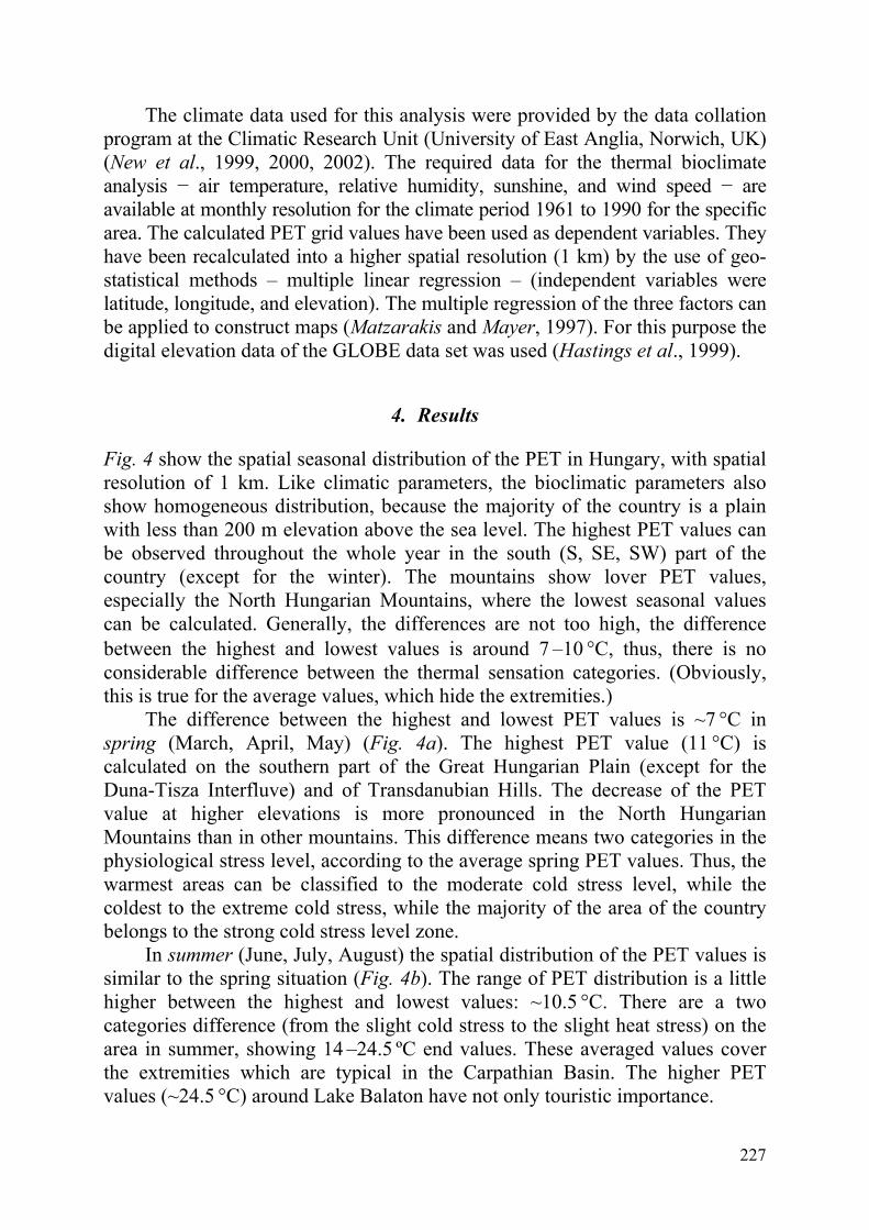
The climate data used for this analysis were provided by the data collation program at the Climatic Research Unit (University of East Anglia, Norwich, UK) (New et al., 1999, 2000, 2002). The required data for the thermal bioclimate analysis − air temperature, relative humidity, sunshine, and wind speed − are available at monthly resolution for the climate period 1961 to 1990 for the specific area. The calculated PET grid values have been used as dependent variables. They have been recalculated into a higher spatial resolution (1 km) by the use of geo-statistical methods – multiple linear regression – (independent variables were latitude, longitude, and elevation). The multiple regression of the three factors can be applied to construct maps (Matzarakis and Mayer, 1997). For this purpose the digital elevation data of the GLOBE data set was used (Hastings et al., 1999).
4. Results
Fig. 4 show the spatial seasonal distribution of the PET in Hungary, with spatial resolution of 1 km. Like climatic parameters, the bioclimatic parameters also show homogeneous distribution, because the majority of the country is a plain with less than 200 m elevation above the sea level. The highest PET values can be observed throughout the whole year in the south (S, SE, SW) part of the country (except for the winter). The mountains show lover PET values, especially the North Hungarian Mountains, where the lowest seasonal values can be calculated. Generally, the differences are not too high, the difference between the highest and lowest values is around 7 –10 °C, thus, there is no considerable difference between the thermal sensation categories. (Obviously, this is true for the average values, which hide the extremities.)
The difference between the highest and lowest PET values is ~7 °C in spring (March, April, May) (Fig. 4a). The highest PET value (11 °C) is calculated on the southern part of the Great Hungarian Plain (except for the Duna-Tisza Interfluve) and of Transdanubian Hills. The decrease of the PET value at higher elevations is more pronounced in the North Hungarian Mountains than in other mountains. This difference means two categories in the physiological stress level, according to the average spring PET values. Thus, the warmest areas can be classified to the moderate cold stress level, while the coldest to the extreme cold stress, while the majority of the area of the country belongs to the strong cold stress level zone.
In summer (June, July, August) the spatial distribution of the PET values is similar to the spring situation (Fig. 4b). The range of PET distribution is a little higher between the highest and lowest values: ~10.5 °C. There are a two categories difference (from the slight cold stress to the slight heat stress) on the area in summer, showing 14 –24.5 ºC end values. These averaged values cover the extremities which are typical in the Carpathian Basin. The higher PET values (~24.5 °C) around Lake Balaton have not only touristic importance.

228
Fig. 4. Spatial distribution of PET in Hungary for (a) spring, (b) summer, (c) autumn, and (d) winter for the period 1961–1990.
The difference between the highest and lowest PET values is smaller again in autumn (September, October, November), it is around 7 °C (Fig. 4c). The values and their spatial distribution is similar to the situation in spring: 4–11 °C PET values, from the extreme cold stress to the moderate cold stress. The highest values restricted to the southern parts of the Great Hungarian Plain, the valley of Danube, and the south part of the Transdanubia. The tendency of the decrease in the southwest – northeast direction is clear on the region east of Tisza River. The pattern is more detailed in Transdanubia, due to the more diverse relief. The positive anomaly at the Lake Balaton can clearly be identified.
The bioclimatic situation of the winter (December, January, February) is the most homogeneous amongst the seasons (Fig. 4d), despite the higher difference between the lowest and highest PET values (9 °C). The lowest values can be observed at the highest peaks of the North Hungarian Mountains, covering small areas. The distribution on the Great Hungarian Plain also changed. The highest values can be observed only on the southern part of Transdanubia, possibly due to the Mediterranean effect (the Mediterranean cyclones have the strongest effect reducing continentality on this area during winter). The PET value on the Great Hungarian Plain decreases gradually from southwest towards northeast. The Transdanubian Mountains cannot be clearly
(a) (b)
(c) (d)

229
separate from their surroundings in bioclimatic aspect. This is especially true in case of the Mecsek Mountains. (It has to be noted, however, that the deficiency of the interpolation and the not calculated exposition data together might cause this phenomenon.) There is no pronounced positive anomaly around the Lake Balaton in winter. These geographical distributions do not mean different categories at the physiological stress level. The whole area of the country can be categorized to the extreme cold stress, with different intensities.
5. Conclusions
• The main novelty of our study is the first publication of maps, based on the output of a modern bioclimatic index, which refers to the human energy balance. Moreover, these calculations were performed for the whole area of Hungary with a resolution of 1 km.
• Seasonal pattern with this resolution shows characteristic spatial structure, with high similarities between the spring-summer and autumn-winter season-pairs.
• Taken the whole area of the country into consideration, there are generally two comfort level differences between the highest and lowest averaged PET values. In summer it means that the thermal sensation on some areas shows cold stress, while on others it shows heat stress. Exception is the winter, when the whole area belongs to the same physiological stress level.
• The bioclimatic situation shows homogeneous distribution due to the relatively small latitudinal and longitudinal extent and low altitudes. The Transdanubian Mountains are not separated distinctly from their surroundings in a bioclimatological sense, especially in winter, when the Mediterranean cyclones reduce continentality on this area.
• The pattern of the Great Hungarian Plain shows a southwest-northeast gradient, that can be ascribed to the increasing continental effect.
• The surroundings of the Lake Balaton, which has touristic importance, show higher PET values than the neighbouring areas, throughout the whole year. This bioclimatological difference does not stand out characteristically, only in winter.
Finally, as we earlier mentioned, the analysis has been performed with no
direct data from observations by climate networks. The application of the CRU database has certain limitations on the area of Hungary. The present method includes geographical latitude, longitude, and elevation, but not the aspect ratio, exposition, and land use, which could produce inappropriate results with the existing dataset. Climate modeling offers, in our opinion, diverse opportunities

230
and possibilities of data in order to perform seasonal or monthly climate analysis. Due to the lack of available data sets, our results have not been compared to measured data, but we hope we will have opportunity to perform this analysis in the near future. Based on the existing data sets, several analyses for sensitive areas and sectors, i.e., agriculture, tourism, health, and regional planning can be performed, especially concerning expected climate change conditions.
Acknowledgements—The work of Ágnes Gulyás was supported by the Baden-Württembergisches Landesstipendium. Thanks to János Unger for proofreading and editing the manuscript.
References
Ali-Toudert, F. and Mayer, H., 2006: Numerical study on the effects of aspect ratio and orientation of
an urban street canyon on outdoor thermal comfort in hot and dry climate. Build. Environ. 41, 94-108.
Brandenburg, C. and Matzarakis, A., 2007: Das thermische Empfinden von Touristen in der Region Neusiedlersee, Ber. Meteor. Inst. Univ. Freiburg Nr. 16, 67-72.
Fanger, P.O., 1972: Thermal Comfort. New York Mc Graw–Hill. Gulyás, Á., Unger, J., Matzarakis, A., 2006: Assessment of the microclimatic and thermal comfort
conditions in a complex urban environment: modelling and measurements. Build. Environ. 41, 1713-1722.
Hastings, D.A., Dunbar, P.K., Elphingstone, G.M., Bootz, M., Murakami, H., Maruyama, H., Masaharu, H., Holland, P., Payne, J., Bryant, N.A., Logan, T., Muller, J.-P., Schreier, G., MacDonald, J.S. (eds.) 1999: The Global Land One-kilometer Base Elevation (GLOBE) Digital Elevation Model, Version 1.0. National Oceanic and Atmospheric Administration, National Geophysical Data Center, 325 Broadway, Boulder, Colorado 80303, U.S.A. Digital data base on the World Wide Web (http://www.ngdc.noaa.gov/mgg/topo/globe.html)
Höppe, P., 1993: Heat balance modelling. Experientia 49, 741-745. Höppe, P., 1999: The physiological equivalent temperature – a universal index for the biomete-
orological assessment of the thermal environment. Int. J. Biometeorol. 43, 71-75. Jendritzky, G., Menz, H., Schirmer, H., Schmidt-Kessen, W., 1990: Methodik zur raumbezogene
Bewertung der thermischen Komponente im Bioklima des Menschen (Fortgeschriebenes Klima-Michel-Modell). Beitr. Akad. Raumforsch. Landesplan. No. 114.
Justyák, J., 2002: Climate of Hungary (in Hungarian). Kossuth Egyetemi Kiadó, Debrecen, Hungary. Knez, I. and Thorsson, S., 2006: Influences of culture and environmental attitude on thermal,
emotional and perceptual evaluations of a public square. Int. J. Biometeorol. 50, 258-268. Koch, E., Marktl, W., Matzarakis, A., Nefzger, H., Rudel, E., Schunder-Tatzber, S., Zygmuntowski, M.,
2005: Klimatherapie in Österreich. Broschüre zu den Potentialen der Klimatherapie in Österreich. Bundesministerium für Wirtschaft und Arbeit.
Lin, T.-P. and Matzarakis, A., 2008: Tourism climate and thermal comfort in Sun Moon Lake, Taiwan. Int. J. Biometeorol. 52, 281-290.
Lin, T.-P., Matzarakis, A., Huang, J.-J., 2006: Thermal comfort and passive design strategy of bus shelters. PLEA2006 - The 23 Conference on Passive and Low Energy Architecture. Geneva, Switzerland.
Matzarakis, A., 2001: Die thermische Komponente des Stadtklimas. Ber. Meteorol. Inst. Univ. Freiburg Nr. 6.
Matzarakis, A., 2002: Validation of modeled mean radiant temperature within urban structures. AMS Symposium on Urban Environment, Norfolk, UK, 7.3.
Matzarakis, A. and Mayer, H., 1996: Another kind of environmental stress: Thermal stress. NEWSLETTERS No. 18, WHO Collaborating Centre for Air Quality Management and Air Pollution Control, 7-10.

231
Matzarakis, A. and Mayer, H., 1997: Heat stress in Greece. Int. J. Biometeorol. 41, 34-39. Matzarakis, A., Mayer, H., Iziomon, M., 1999: Applications of a universal thermal index:
physiological equivalent temperature. Int. J. Biometeorol. 43, 76-84. Matzarakis, A., Rutz, F., Mayer, H., 2000: Estimation and calculation of the mean radiant temperature
within urban structures. In Biometeorology and Urban Climatology at the Turn of the Millenium (eds.: R.J. De Dear, J.D. Kalma, T.R. Oke, A. Auliciems). Selected Papers from the Conference ICB-ICUC’99, WCASP-50, WMO/TD No. 1026. Sydney 2000, 273-278.
Matzarakis, A., de Freitas, C., Scott, D. (eds.), 2004: Advances in tourism climatology. Ber. Meteorol. Inst. Univ. Freiburg Nr. 12, 6-9.
Matzarakis, A., Rutz, F., Mayer, H., 2007: Modeling radiation fluxes in simple and complex environments – Application of the RayMan model. Int. J. Biometeorol. 51, 323–334.
Mayer, H. and Höppe, P., 1987: Thermal comfort of man in different urban environments. Theor. Appl. Climatol. 38, 43-49.
Mayer, H., 1993: Urban bioclimatology. Experientia 49, 957-963. Mayer, H. and Matzarakis, A., 1998a: The urban heat island seen from the angle of human-
biometeorology. Proc. Int. Symposium on Monitoring and Management of Urban Heat Island. Fujisawa, Japan, 84-95.
Mayer, H. and Matzarakis, A., 1998b: Human-biometeorological assessment of urban microclimates’ thermal component. Proc. Int. Symposium on Monitoring and Management of Urban Heat Island. Fujisawa, Japan, 155-168.
New, M., Hulme, M., Jones, P., 1999: Representing twentieth century space-time climate variability. Part I: Development of a 1961–90 mean monthly terrestrial climatology. J. Climate 12, 829-856.
New, M., Hulme, M., Jones, P., 2000: Representing twentiethcentury space-time climate variability. Part II: Development of 1901-1996 monthly grids of terrestrial surface climate. J. Climate 13, 2217-2238.
New, M., Lister, D., Hulme, M., Makin, I., 2002: A high-resolution data set of surface climate over global land areas. Climate Res. 21, 1-25.
OMSZ, 2003: Climate Atlas of Hungary (in Hungarian). Országos Meteorológiai Szolgálat, Budapest, Hungary.
Pécsi, M. and Sárfalvi, B., 1964: The Geography of Hungary. Corvina Press. 8º. XII., Budapest, 299 p. Picot, X., 2004: Thermal comfort in urban spaces: impact of vegetation growth. Case study: Piazza
della Scienza, Milan. Italy Energy and Buildings 36, 329–334. Spagnolo, J. and de Dear, R., 2003: A field study of thermal comfort in outdoor and semi-outdoor
environments in subtropical Sydney Australia. Build. Environ. 38, 721-738. Szalai, S., Bihari, Z., Lakatos, M., Szentimrey, T., 2005: Some Characteristics of the Climate of
Hungary since 1901. Országos Meteorológiai Szolgálat, Budapest, Hungary. http://www.met.hu/pages/climate/Some_characteristics_of_the_climate_of_Hungary_since_1901.pdf.
VDI, 1998: Methods for the human-biometeorological assessment of climate and air hygiene for urban and regional planning. Part I: Climate. VDI Guidline 3787. Beuth, Berlin.
WMO, 1996: Climatological Normals (CLINO) for the Period 1961-1990. WMO/OMM–No. 847, Geneva.
Zaninovic, K., Matzarakis, A., Cegnar, T., 2006: Thermal comfort trends and variability in the Croatian and Slovenian mountains. Meteorol. Z. 15, 243-251.