urban hazards un~8$c>rtableiri$kto fire, and other safety
TRANSCRIPT

Chapters
Safety Element 8.1 introduction The purpose of the Safety Element is to identify and appraise hazards in the community in order to assure community safety. The Safety Element focuses on protection of the community from risks associated with earthquakes, floods, fires, toxic waste, and other hazards. In addition, issues such as disaster preparedness and emergency evacuation routes are addressed in the Safety Element. Some level of risk associated with these factors is unavoidable; the Safety Element is the means by which the City defines what measures will be undertaken to reduce these risks to levels determined by the City to be reasonable.
Information in the Safety Element has been coordinated with the other elements of the City's General Plan, particularly the Land Use and Open Space and Conservation Elements. The extent of a hazard depends on local conditions, since most hazards are confined to a particular area or site. Various health and safety hazards should be considered in planning the location, design, intensity, density and type of land uses in a given area. Long-term costs to the City, such as maintenance, liability exposure and emergency services, are potentially greater where high hazards exist.
The Element includes a Geotechnical and Flood Hazards Map, which identifies areas of known seismic, geologic and flooding hazards. This map is
Adopted November 24, 1998
Safety Element
Table·B-1: Summary of>Key Safet:, .• lement Issues
The Safety Element ofthf;tv!Ulbrae General Plan has four primary concerns:
Protecting the Community ftomtheHarmful Effects of Natura.I Hazards Protectthecommunity from urmaeu;onable risk to life and property caused by seismic,· geologic, and flood .hazards.
l?rotecting the Community from the HarmfulEffects<ofFire andOther Urban Hazards Protect the community.from Un~8$C>rtableiri$kto life and property caused by fire, hazardot:J~ 111<3.tE!riafs, and other urban hazards.
Maintainlng.PubiicSafetyand.Securityin the•Community Protectthe community from· unreasonable risk to public safety and setudty.
l?reparing .. to Respond to Emergencies Minimize potential damage to life, environment, and property through ·timely. well-prepared and well-coordinated emergency preparedness, response.plans, and programs.
based upon mapping at the local, county and regional levels. It is important to recognize that the map designations are very generalized and should be used primarily to indicate areas in which additional study is needed. It is not possible to identify specific hazards or to recommend necessary mitigation measures for new development at this map scale without detailed review of a particular site. Site specific soil and geologic studies are required to be submitted for City review for each development proposal in potentially hazardous areas. In addition, the City has implemented the following measures:
(1) The City has adopted a grading ordinance regulating excavations and grading, and requiring erosion control measures consistent with Association of Bay Area Governments (ABAG) standards.
(2) The Building Code sets standards for structural safety, although some of Millbrae's older buildings may not satisfy current code requirements.
Page 8-1

Safety Element:
(3) Millbrae participates in the Federal Flood Insurance program.
( 4) Fire safety codes are vigorously enforced and on-site early warning mechanism.s are required to improve response times and minimize damage in fires.
(5) The City has implemented an Emergency Plan, which outlines the responsibilities of various city officials in case of an emergency. The City conducts exercises of its Emergency Operations Center personnel on a regular basis.
8.2 Safety Element Requirements Safety issues have been required to be addressed as part of local general plans since 1971. The San Fernando earthquake of February, 1971, which claimed 64 lives and resulted in over $500 million in property damage, and the devastating wildland fires in September and October of 1970, were largely responsible for prompting the Legislature to pass this requirement. The following citation is from Government Code Section 65302(£),
"A safety element for the protection of the community from any unreasonable risks associated with the effects of seismically induced surface rupture, ground shaking, ground failure, tsunami, seiche, and dam failure; slope instability leading to mudslides and landslides, subsidence and other geologic hazards known to the legislative body; flooding; and wildland and urban fires. The safety element shall include mapping of known seismic and other geologi.c hazards. It shall also address evacuation routes, peak load water supply requirements, and minimum road widths and clearances around structures, as those items relate to identified fire and geologi,c hazards."
Geologic and safety hazards are related to landforms and sub-surface features, and thus often cross jurisdictional boundary lines. To eliminate duplicative efforts, State law allows cities to adopt the relevant portions of their county's safety elements, as long as the element is sufficiently detailed and complies with all other General Plan requirements (Government Code, Section 65350).
The County's Seismic and Safety Element (1978) is a comprehensive document, addressing seismic,
Page S-.2
Ch.apter8
geologic, structural and other hazards countywide. The Element was updated in 1984. The element addressed specific issues in Millbrae but contains no policies specific to Millbrae. However, information related to seismic and geologic hazards included in the County element is incorporated by reference.
In addition to the Government Code requirement, the Millbrae Safety Element takes into account the City's location adjacent to San Francisco International Airport. The element should be updated periodically to reflect current data and laws.
8.3 Seismic Conditions and Hazards
Seismic Hazards Millbrae is located in the seismically active San Francisco Bay Region. This area is within the highest seismic risk zone (Zone 4) designated in the Uniform Building Code (UBC 1994). Although the damage by seismic shaking to structures built in compliance with UBC requirements for seismic design would not likely cause collapse of the structures, the damage could require significant repairs. In addition to potential structural damage, nonstructural damage should be expected. Nonstructural damage could include breakage of windows, doors, piping, ducts, and light fixtures; collapse of walls, partitions, ceilings, and stairways; or damage to contents (appliances, computer equipment, and furnishings). Damage to nonstructural elements can account for the majority of a building's replacement costs following a major earthquake.
Adopted November 24, 1998

Chapters
Table 8-2: Definitions of •Com111on Safety Terms
Electro,,.magn~tic field: ·>A fie~~ ~th two components: One electrical~p t~e othermag~!~R~/These .fields arise whenever~l~ctricity is conduc~ed through a medium of transmission~
Fault: A(ta~tureor zone of ciosel)'associated fractures a1ong· .. whf9bEJarth•on ·one side hare been.·di~ptac~.with respect to earth on th~ other side ... Afault z<:>2ft•i~:a ~?nEf of related faultswhich ~rnmortly are braided;ijtJt,"'ITTiCli may be .branching.
Flood, 100-:Vear: The foagnitude .of Sflood'.e~!~,d t~ occur on.the·avera~~ !Y'.'ry••·100 years, bas~d~rrtij~t~.rical data The 100-yearflo~~hasa 1/100, oroneperoer1t~ chance of occurring in atlygivenyear.
Flood Insurance Rate Map: The officialmap on which the Federal .Emergency Managemen~.Agency or Federal Insurance Administration has dt?Hneated areas of flooding.
Geologic Review: The anafysis ~fgeoJogic hazards, including all potential seismic hazards. surface· ruptures, liquefaction, landsliding, mudsJiding;,and the potential for erosion and sedimentation.
Ground Failure:·.· Ground movement or rupture caused by strong shaking during an eartnc;~ake. includes landslide, lateral spreading, lique!action, and subsidence.
Intensity: Measures the perceptibl~ effects. of .energy released by an. earthquake at a particular site.
Millbrae has five seismic faults within its immediate vicinity, two of which actually penetrate the City's boundaries. (See Seismic Fault Location Map.) In addition, two other faults located in the Bay Area have the potential for regional impact and, thus, also are of concern to Millbrae.
The San Andreas Fault, considered active, is just to the west of Millbrae. The San Andreas fault zone runs in a northwest-southeasterly direction along the western edge of Millbrae, roughly along Skyline Boulevard. The Serra Fault also crosses Millbrae. The Serra Fault parallels the San Andreas Fault zone to the east, passing through upper Millbrae residential areas. Until 1981, the Serra Fault was considered active, but no evidence has been put forth to show that movement has occurred during
Adopted November 24, 1998
Safety Element
Hazardous Material: Any substance that, because of its quantity, concentration, orphysical or chemical characteristics, poses a s;g~ifi~ant present or potential hazard tohuman.healthands~fety (')r.to the environment if released int? the workplace .oru,, el1vironment. .. ··•The term includes, but ·is .not limited to, hazardous substances and hazardous wastes;
Liquefaction: The transformation oUoose, wet soil from a , solid .to a liquid state, .often as a result of.ground shaking during an• earthquake.
~icht~f~~~I~: ,:n~e9mrn~n standard of·· measurement·of q,agnl~~d,(?f ap)~~~hqe1ake;a••.•iogarithmic .•• measure. of the ·~f)e;gy;rfJl~~~t.t••··PY••art•.••earthguake*
S~ic~e~: 9)~cmatingwaves inan· enclosed or partly enclosed.body of water, caused by earthquakes· or landslldes which ,displace part oUhewater body.
Seismic load: Forces exerted on a structure by an earthquake~
Shrink-Swell Behavior:.•·• Occurs in soils which•can expand or contract•·depending·•on•moisture content and• soil mineralogy.
Subsidence~ .· T~~sudde~ ~inking .orgraduafdownward settling .andc<>rnpaction• of soil and other surface material with little ornohodzontal motion. Subsidence may be causedt>yavariety of human and natural activityt including earthquakes. ·
Tsuna~i: ~xtremeiylong~period ocean ·waves caused by undersea earthquakes, volcanic eruptionsormassive tandslidestintoadjacent·water bodies.
the last 11,000 years. However, due to its proximity to the San Andreas Fault, the City considers the Serra Fault potentially active and requires AlquistPriolo type studies for developments proposed near the Serra Fault. The faults affecting Millbrae are described below
> San Andreas Fault: The San Andreas Fault is one of the longest, most active, and best studied in the world. The location of the fault is easily identified by surface lineaments which extend along the axis of the San Francisco Peninsula. The main fault line bypasses Millbrae just west of the Junipero Serra Freeway along the eastern bank of Lake San Andreas. These lineaments are defined by scarps, sag ponds, offset streams and other evidence clearly related to recent fault

Safety Element
breaks. (The maximum measured offset of the 1906 movement was 21 feet, horizontally.
The San Mateo County Seismic and Safety Elements describe the San Andreas Fault system, and discuss historic and potential seismic related activities (pages 8 through 36, Volume II, Technical Supplement). Because of its active status, surface rupture potential is considered moderate to high along the San Andreas Fault and in western Millbrae in the vicinity of the Fault. Strong ground motion generated during a major earthquake will cause, according to the "San Francisco Scale" ( devised by Borcherdt and Gibbs, 1975), "very violent" to "very strong" intensities of ground shaking, resulting in severe to moderate damage. The intensity of ground motion corresponds to the distance from the San Andreas fault. Generally, soils and subsurface materials east of Skyline Boulevard (predominantly the Colma and Merced formations) have good earthquake stability. In the higher elevations of Millbrae, areas of colluvium and serpentine or sheared rocks of the Franciscan formation have poor to good earthquake stability.
It is anticipated that further surface displacements along the fault line are likely to accompany moderate to large earthquakes or result from gradual fault creep. The surface movement along the San Andreas Fault is generally horizontal and, potentially, may result in displacements of as much as 20 feet. Vertical displacements of as much as three feet, however, are also possible. Since there is presently creep movement along some of its length, including occasional earthquakes, it is expected that earthquakes of moderate to great magnitude will occur along the San Andreas Fault in the foreseeable future. The reoccurrence interval for a magnitude 8 earthquake along the San Andreas Fault (the 1906 earthquake in San Francisco measured 8.3) is estimated to be between 50 and 200 years.
> Serra Fault: The Serra Fault is a relatively short bedrock fault which parallels the San Andreas Fault nearly bisecting the City of Millbrae. The fault extends along a path through Millbrae
PageS-4
Chapters
An active ta.ulfis defined in the Alquist2PrioicfEarthquake FauifZoning Act as a fault which has ~had<surface d~placement within Holocene time (aboutthe last 11,000 yij~rij);~ the capability for.·mqvement along a fault isa ~r9d~ctof its present tectonic•erMronmentand cannot be 9i~e<::Uydeterrnined. These criteria may be used to assess whethenornotit is an "Active Fault';
■•·· Historiciseismicity;direct··evidencee>f,movement•·withln the la.sf 11 ;000· years· (Holocene.+time);
■ Historic surface displacement or cre~p rµovernent;
■ lnstrumentany .. determined strain accumulation;
Ii Repeated episodes of displacement in the.recent geologic past as deduced fn:>rn:t~e,•stnltigraphic••r~eord;
■ GeologicaUyyoung displacemer1tinferredfrom geomorphic (landform)·features;
along the Spur property into San Bruno where it terminates north of Sneath Lane. The Serra Fault is defined by juxtaposed bedrock units along its length and is assumed to be possibly active, based on geologic evidence.
Future displacement may be caused by this fault, however, fault movement is thought to be less frequent here than on the main active strand of the San Andreas. The nature and amount of movement is generally unknown, but significant horizontal and vertical displacement is considered possible.
West of and extending southeast beyond the Serra Fault and parallel to the Junipero Serra Freeway lies an unnamed series of faults. These faults, however, are not considered active. They extend along the steep slopes of southern Millbrae and well into Burlingame.
► San Bruno Fault: The exact location of the San Bruno Fault can only be inferred due to its generally concealed nature; no recent activity is in evidence. The fault line is thought to approach Millbrae from the north, between the Southern Pacific Railroad tracks and the Bayshore Freeway. Whether this fault continue:, into Millbrae or not is, at this time, unknown.
Adopted November 24, 1998

Chapters
Map8-1
Regional Earthquake Faults
0 20
MILES
Segments of San Andreas and Hayward faults {heavy lines) showing chance of occurrence of an earthquake in the next 30 years (U.S. Geological Survey, 1988). Faults dotted where concealed.
> Hayward Fault: The Hayward Fault is located east of San Francisco Bay and extends southward toward Hollister, where it is thought to merge with the Calaveras Fault (discussed below). In 1836 and again in 1868, significant earthquakes were attributed to this fault. Continued activity is indicated by current measurements showing active creeping along its length and numerous smaller earthquakes recorded in recent years.
> Calaveras Fault: The Calaveras Fault borders the eastern flank of the Berkeley-Hayward Hills, extending southward until it joins the San Andreas Fault Zone south of Hollister. Epicenters of recent earthquakes have been located along or near this fault. Fault creep measured in the City of Hollister has resulted in property damage similar to that caused by creep and faulting along other branches of the San Andreas Fault System.
Adopted November 24, 1998
Safety Element
Seismic Hazards and Development Constraints Due to the differing geology throughout Millbrae and the locations of its active faults, the Cit_y is confronted with several types of seismic hazards. Most of these hazards happen to characterize particular areas of Millbrae. State law governs development within a designated area along active faults. The Alquist-Priolo Special Studies Zone Act (1972) requires cities and counties to regulate certain types of development within the state delineated "special study zones." The Act precludes construction of a structure for human occupancy except certain wood frame single-family dwellings on an active fault trace or within 50 feet of an active fault-"Singlefamily wood frame dwellings to be built on parcels of land for which geologi.c reports have been approved pursuant to ... (the Act, and those) not exceeding two stories when such dwelling is not part of a development of four or more dwellings. H
(California Administrative Code, Title 14, Division 61
Chapter 8, S ubchapter 1, Article III).
The law also recommends that a "geologic report by a geologist registered in California be required for a single-family dwelling otherwise exempt (from the above restrictions) if that structure lies on or within 100 feet of the trace of an historically active or other known active fault as shown on Special Studies Zone Maps or by more precise or detailed information." The Act requires geologic reports to be filed with the State Geologist, and that more comprehensive reports be prepared for II critical or essential" structures such as schools or hospitals.
Although the San Andreas Alquist-Priolo Zone does not extend into Millbrae, the Serra Fault in the western part of the City is considered by the City to be potentially active. The City requires the same type of special study for land in the vicinity of the Serra Fault as is required in the Alquist-Priolo Zone.
Analysis shows the greatest seismic hazard to development in Millbrae is in two geographically distinct areas - on the steeper hillsides and along the original Bay shoreline, much of which is now artificial fill. Potential seismic impacts are summarized below.
Page 8-5

Safety Element
► Fault Creep: This is an ongoing process of relatively slow lateral displacement normally localized along active fault lineaments. Development which straddles the San Andreas or Serra Faults is potentially subject to gradual damage to building foundations, sidewalks, streets, and utility lines even though fault creep has not been identified along either fault in this vicinity.
► Surface Rupture: The main surface lineaments of the San Andreas Fault are a location of extreme hazard to structures from future surface fault displacement, or surface rupture. The trace of the Serra Fault indicates a possible, but largely unevaluated hazard from future surface rupture. This phenomenon normally accompanies only large magnitude earthquakes.
Although ground rupture would probably occur along an existing fault or fault trace, it should be considered possible to occur anywhere within the San Andreas Rift Zone. Rupture or relative ground movement might be in the horizontal direction, verticat or a combination of both. Utility lines constructed within these areas may be severed in the event of surface rupture.
> Ground Shaking: The most widespread effect of an earthquake is ground shaking; this is often the greatest cause of damage. Structures and utilities of all types may suffer severe damage or collapse if not designed to withstand the shaking force. The soil composition beneath a structure substantially affects the vibration forces on that structure. Thus a structure located adjacent to a fault on stable rock might withstand ground shaking better than a structure built on loose soil material one hundred miles away. Although this phenomenon would to some extent affect the entire City, buildings precariously situated on steep unstable slopes and on loose or soft soil are probably subject to the greatest damage.
With so many faults in the Millbrae vicinity, the City is fortunate to have relatively few buildings over two or three stories in height. Taller structures, unless they are specially designed to withstand seismic shock, are normally more prone to serious earthquake damage.
Page 8--6
Chapters
► Landslides: Landslides are often a secondary effect of ground shaking from seismic activity. The steep slopes in Millbrae have already proven to be, in many areas, unstable and susceptible to landslides. This naturally hazardous condition has been seriously compounded by many incidents of insensitive residential subdivision. Steep grading cuts have left many home sites and adjacent properties subject to extreme risk.
► Liquefaction: Soil liquefaction is another secondary effect of ground shaking, a phenomenon in which water-saturated, cohesionless soil temporarily loses its strength when subjected to dynamic forces. The looser the soil, usually the greater the susceptibility to liquefaction. The areas of Millbrae which are considered to be especially susceptible to liquefaction are those comprised of San Francisco Bay mud, with or without artificial fill material. These areas are located generally east of the Southern Pacific Railroad tracks. Whether or not the soil will actually liquefy depends on the soil properties, the intensity and the duration of the shaking. When liquefaction occurs, building foundations may sink or tilt several feet into the underlying soil, with differential ground subsidence possibly a contributing factor.
> Tsunamis: Tsunamis, commonly called "tidal waves", are frequently induced by earthquake activity. Earthquakes responsible for tsunamis may originate on land or at sea long distances from the damage center. Tsunamis that enter San Francisco Bay are quickly dissipated. Damage is normally confined to small craft which are not properly moored.
Millbrae is generally protected from tidal flooding by higher ground along the Old Bayshore Highway, on the east, and high banks of one of the two flood control canals, on the south. Recent studies, however, suggest that a maximum tsunami wave height in the Bay of 20 feet is possible at the Golden Gate Bridge. A tsunami of this magnitude could threaten areas in Millbrae near Bayshore Freeway, although wave heights would be substantially reduced.
Adopted November 24, 1998

Chapters
>- Seiches: Seiches are waves in isolated lakes and reservoirs resulting from the tilting or surface displacement of the bottom or sides. The San Andreas Lake is not considered a threat to Millbrae because of the difference in elevation and the intervening topography.
One effect related to sekhes is the oscillation which can occur during earthquakes in water storage tanks, both elevated and ground supported. Several water tanks in the City were upgraded two years ago to improve the connection between the tank and underground water mains. The bulging of steel tanks has been noted following several recent earthquake disasters around the world. Millbrae has numerous water storage tanks located on its hillsides, in very dose proximity to two active faults. Recent improvements to Millbrae water tanks ensure that construction is adequate to withstand the amaximum probably seismic event".
A second related effect is the spilling or "slopping" from open drainage channels. This may conceivably present a threat to existing and
. potential development immediately adjacent to the Highline and El Portal flood control canals leading to the Bay, especially at high tide when they are more likely to be full.
Loma Prieta Earthquake On October 17, 1989, the magnitude 7.1 Loma Prieta earthquake struck the San Francisco Bay region. This was the largest earthquake in the region since the great 1906 San Francisco earthquake. The epicenter was on the San Andreas fault in the Santa Cruz Mountains, about ten miles east-northeast of Santa Cruz and 60 miles southeast of San Francisco. The quake was felt over an area of about 400,000 square miles.
The earthquake ruptured a 25 mile long segment of the San Andreas fault that had been recognized as having the greatest chance (30% for the next 30 years) for producing a magnitude 6.5 to 7.0. earthquake of any fault segment north of the Mojave Desert.
According to U.S. Geological Survey Circular 1045 Lessons Learned from the Loma Prieta, California
Adopted November 24, 1998
Safety Element
Earthquake of October 17, 1989. an earthquake as large as, or larger than, the Loma Prieta Earthquake is likely to shake the San Francisco Bay region within the lifetime of most of the present residents. Such an earthquake will probably occur in a more urbanized area, most likely on the Hayward Fault or San Francisco Peninsula segment of the San Andreas Fault. Casualties and damage are conservatively projected by USGS to be several times those experienced in the Loma Prieta event
8.4 Local Geologic Hazards Two basic types of geologic hazards exist in Millbrae - that of surface soil instability, and that related to seismic activity. The latter subject is considered separately in the County Seismic Safety Element. Thus, the following discussion is limited to the problems associated with unstable soils in Millbrae, i.e. landslides and erosion.
The information contained in this section is based largely on recent but generalized data provided by the U.S. Geological Survey; as such, it should be regarded as subject to refinement or modification whenever more detailed information becomes available.
Landslide Susceptibility Most of the steeper developed and undeveloped lands west of the Spur property have been identified as having either "moderate" or "highest" susceptibility to landsliding (from field surveys and photo-interpretation}. Landslide susceptibility is basically determined by previous slide activity, slope and soil composition. Those areas identified
Page8-7

Safety Element
as having the highest susceptibility generally coincide with known or assumed landslide deposits. Factors which may speed up erosion or landsliding include ground shaking from seismic activity, rainfall, subsurface water seepage, and improper site drainage; insensitive grading for streets and houses; and vegetation removal.
As yet, no close association has been observed in San Mateo County between active faults and the occurrence of landslide deposits. Nevertheless, Millbrae should definitely consider the increased landslide hazards in its hill areas increased by the presence of the San Andreas and Serra Faults. Higher parts of Millbrae are mainly composed of sandstone, siltstone, and claystone with some deposits of shale and other sheared rock. It is generally where this sheared rock is found in combination with very steep slopes (many in excess of 50%) that landslides have most frequently occurred.
Some of the largest landslide deposits in the City were formed prior to development in Millbrae. Consequently, parts of several subdivisions are now located on old deposits thought to measure 500 to 1,000 feet in breadth.
During the 1996-1998 winter seasons, Millbrae has experienced abnormally heavy rains which have caused the saturation of many hillsides, resulting in breached hillside drainage systems, slides and other earth movement. These events have occurred on both public and private lands.
Hazards to Development Residential development in Millbrae' s hill areas has often failed to recognize or deal with inherent hazards of the site. In many cases, cut and fill grading left bare, loosely compacted slopes exposed to the weathering process. Over the years, this has caused increasing problems of soil erosion and landsliding. Several homes in the extreme southern part of the City have suffered severe damages triggered by intense rainfall. Other home sites have also experienced serious erosion and mudslides. Erosion and/ or slides have usually occurred in backyard areas where steep slopes have not been planted and adequate drainage has not been provided. Soil has slipped down into streets or home sites below, leaving the slope rutted and
Page8-8
Chapters
exposed. Some homes are vulnerable to slides which originate on undeveloped land.
Some homeowners who have experienced such problems in the past have taken precautions to avoid them in the future. Their efforts include planting along slopes, modified drainage systems, retaining walls, and temporary slope coverings. Homeowners who are not taking preventive measures should be strongly encouraged by the City to do so.
8.5 Structural Hazards Structural hazards exist in unreinforced masonry (URM) buildings, structures constructed prior to 1933, and structures on unengineered fill, particularly in areas of former marshland, ancient creekbeds and on bay mud. In 1989, the City Building Division surveyed potential URM buildings and identified three commercial buildings, owners of which are required to correct the potential hazard. All three buildings have now been seismically strengthened.
Freeway structures also are potential hazards in a severe earthquake. Millbrae is bracketed by the U.S. 101 and I-280 freeways. Collapse of any portions of these freeways or their structures could involve serious disruption of traffic and emergency services.
Utility disruption is another safety issue. A severe earthquake with corresponding land movement or heavy winter storms could rupture or weaken major electrical, gas and water transmission lines that cross the City.
8.6 Flood Hazards
Areas Subject to Flooding Millbrae is included in the National Flood Insurance Program. Map 8-2 shows areas that are subject to 100 year floods. Such areas in Millbrae include: The San Anselmo-Landing Lane area in the northeastern part of the City and the marshy portion of Airport property west of Bayshore Freeway. The Aviador/Garden Lane storm drain system is controlled by a 125 .. HP pump. If this pump should fail, portions of this area could flood. A second pump with emergency power is planned to be installed.
Adopted November 24, 1998

Chapters
Millbrae' s major drainage systems include Lomita Creek, Greenhills Creek and Millbrae Creek. These creeks become canals that empty into San Francisco Bay. The canals are named Highline, maintained by the City; Lomita, on Airport land and maintained by the Airport; and El Portal maintained jointly by Burlingame and Millbrae. Upper portions of the creeks that run through private property are not maintained by the City.
As shown on the Geotechnical and Flood Hazards map, low lying areas in Millbrae are subject to potential flood hazards. These areas include the Airport Park and Bayside Manor Subdivisions. Other areas with periodic ponding include Magnolia Avenue near Green Hills Drive, Taylor Boulevard near Magnolia Avenue, East Millbrae at Old Bayshore, El Camino Real at Park Boulevard and at Taylor Boulevard, Millbrae Avenue at Poplar, Mills Creek at South Ashton, and the Clarion Hotel at the El Portal Canal. Because of the low elevation and inadequate storm drainage systems in these areas, flooding periodically occurs during heavy rains and simultaneous high tides.
The greatest chance of flooding in low lying areas occurs when the rain falls at a rate of at least one inch per hour for one hour preceding the high tide (a tide of 4.5 feet or greater). This does not occur except during exceptionally heavy storms. Channels and pipelines are not large enough in these lowlying areas to handle such large amounts of water during high tides. Many building structures are not designed for this degree of flooding. If not elevated adequately, water can flow into the lower levels causing damage and inconvenience, and affecting health and safety.
The City's current flood prevention program consists of extra street sweeping during autumn, clearing the storm drains of silt and organic material and giving early flood warnings to floodprone areas during predictable hazard periods. In addition, City crews patrol flood-prone areas during storms. Dredging of the canals is a priority and is subject to approval by the U.S. Fish and Wildlife Service and California Department of Fish and Game due to endangered species located near the canals.
Adopted November 24, 1998
Safety Element
Efforts to physically remedy the potential flood hazard situations are generally very costly. Improvements to the present stormdrain system such as enlarging pipes should be addressed. Dredging of canals should be accomplished regularly. Larger pumps, deeper channels or holding ponds, would cost upwards of millions of dollars. To elevate all existing threatened structures above anticipated flood levels would be a major hardship on property owners and would disrupt many businesses and homes. Sizable new developments, however, such as development of the Airport lands or eventual replacement of a lar·ge area of existing buildings, should be designed and engineered to avoid potential flood hazards.
The City is presently enrolled in the National Flood Insurance Program administered by the Federal Emergency Management Agency (FEMA). Flood insurance is available to Millbrae residents and merchants under the agency's "'regular,., program, either directly through FEMA or through licensed insurance agents.
High Tides and Rise in Sea Level In California, highest astronomical tides occur in the summer and winter, and therefore extreme high tides can occur during storm periods. The highest tide ever recorded in San Francisco Bay (between 1855 and 1983) occurred on December 3, 1983. Based on the 129-year record of daily high tide, the U.S. Army Corps of Engineers (1989) has developed estimated 100-year high tide elevations for various locations within the bay. The estimated 100-year high tide in Millbrae is expected to reach elevation 7.0 feet NGVD (National Geodedic Vertical Datum). Therefore, areas of the City with elevations below 7.0 feet NGVD and not protected by levees or similar features could be inundated during an extreme high tide event.
Tidal gauge measurements collected over the last 100 years indicate that sea level is rising relative to the land surface in many locations throughout the world (Bay Conservation and Development Commission, 1987). Over the last 100 years, the temperature of the earth's surface has risen approximately 0.6 degree Celsius (U.S. EPA, 1995). It is widely believed that sea level will continue to rise in response to global warming. Global warming
Page 8-9
Safety Element
causes thermal expansion of the upper layers of the ocean (increasing the volume of water) and melting of the earth's glaciers and polar ice fields. Such increases in sea level, if sustained over long periods of time, could create flooding problems ( or exacerbate existing problems) for those areas currently protected from flooding with only minimal freeboard. To plan for, and mitigate, potential flooding problems associated with sea level rise, it is important to be able to quantify the amount of sea level rise expected at a specific location over a given time period.
Long-range projections of the behavior of physical systems are extremely difficult because of the uncertainties involved. Since the EPA released its first major study on sea level rise in 1983 (U.S. EPA, 1983), estimates for the amount of predicted sea level rise have steadily decreased. EPA' s most recent prediction for the expected total sea level rise in Millbrae is 17 cm (0.6 foot) by the year 2050, and 38 cm (1.2 feet) by the year 2100 (U.S. EPA).
Those portions of Millbrae below elevation 8.2 feet NGVD ( elevation of extreme high tide added to predicted sea level rise by 2100) and not protected by levees or other similar features could be subject to increased flooding hazards as time progresses. Some areas of the City east of Highway 101 are below elevation 8.2 feet NGVD.
Storm Drainage System Millbrae' s storm drainage system serves the entire City, collecting and channeling all runoff into the Lomita Creek, Green Hills Creek and Millbrae Creek channels, which carry the storm runoff to the
Chapters
Bay by way of the Highline, El Portal and Lomita Canals. The system originally was constructed to follow natural creek beds. Millbrae and Burlingame share the El Portal canal and pump station on their common border. Millbrae maintains the Highline and the Airport maintains Lomita Canal and its pump stations.
The City has hired a consultant to conduct a current assessment and determination of existing infrastructure capacity to address, among other issues, storm water collection. Portions of the storm drain system need to be studied to identify areas of insufficient capacity, including the area covered by the Millbrae Station Area Specific Plan. Additional information is included in the Land Use Element.
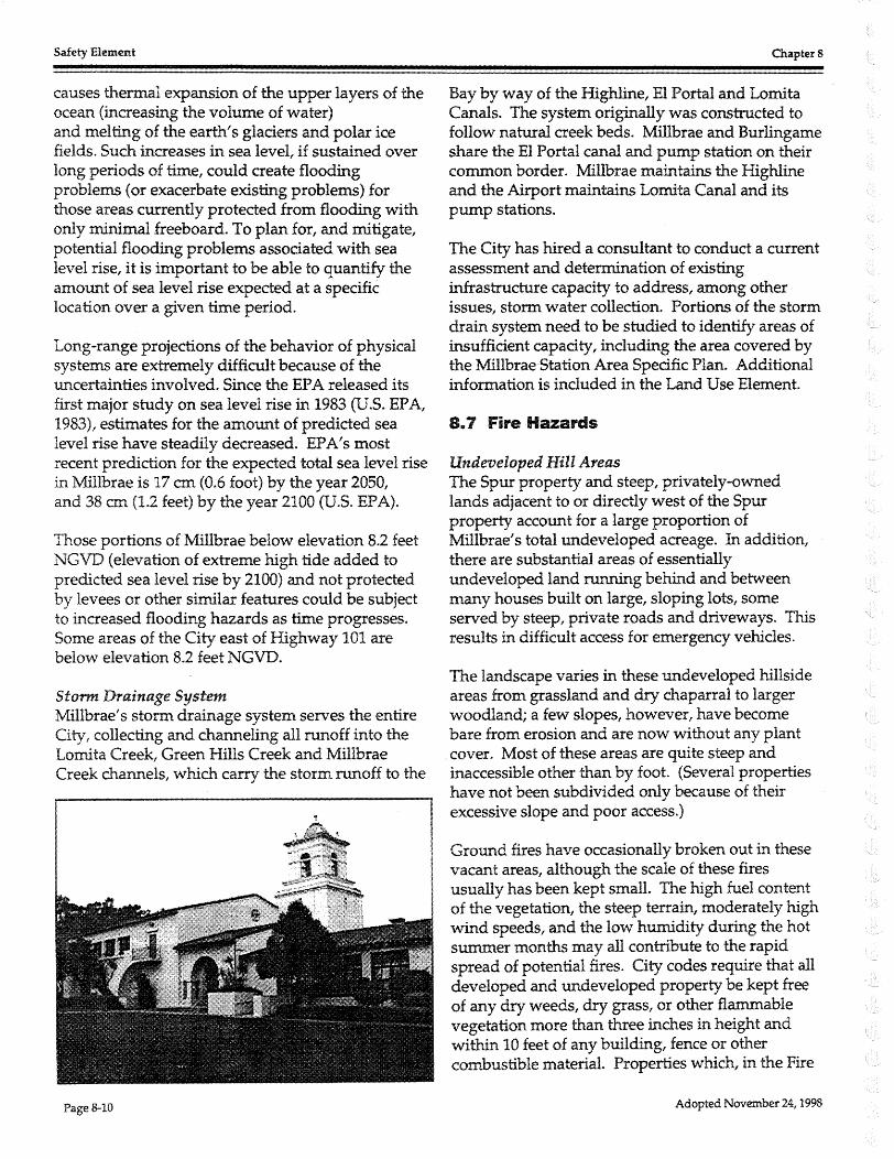
8. 7 Fire Hazards
Undeveloped Hill Areas The Spur property and steep, privately-owned lands adjacent to or directly west of the Spur property account for a large proportion of Millbrae' s total undeveloped acreage. In addition, there are substantial areas of essentially undeveloped land running behind and between many houses built on large, sloping lots, some served by steep, private roads and driveways. This results in difficult access for emergency vehicles.
The landscape varies in these undeveloped hillside areas from grassland and dry chaparral to larger woodland; a few slopes, however, have become bare from erosion and are now without any plant cover. Most of these areas are quite steep and inaccessible other than by foot. (Several properties have not been subdivided only because of their excessive slope and poor access.)
Ground fires have occasionally broken out in these vacant areas, although the scale of these fires usually has been kept small. The high fuel content of the vegetation, the steep terrain, moderately high wind speeds, and the low humidity during the hot summer months may all contribute to the rapid spread of potential fires. City codes require that all developed and undeveloped property be kept free of any dry weeds, dry grass, or other flammable vegetation more than three inches in height and within 10 feet of any building, fence or other combustible material. Properties which, in the Fire
Adopted November 24, 1998

Chapters
Chief's opinion, constitute a fire hazard are notified by the Department to abate such hazard.
The City and County of San Francisco own and manages extensive watershed lands just west of Skyline Boulevard. These too are heavily vegetated and subject to wildfires, especially during the summer. It is considered unlikely, however, that any fire in this area would leap over the ridge (and the 1-280 highway) to threaten development in Millbrae. Protection of these watersheds is the responsibility of San Francisco.
Lowland Areas Other hazards exist in the lowland areas. Jet fuel at San Francisco Airport is a potential hazard requiring contingency plans and cooperation among several fire departments. Residential areas between the railroad tracks and freeway have only one street in and out which could require use of emergency routes if the one ingress were blocked in an emergency. This situation is made worse by railroad grade crossings, always a potential for being blocked, betw'een the fire station and the neighborhoods. This situation has generated discussions betw'een Millbrae and Burlingame about the benefits of automatic response which would mean that in certain cases, the nearest and most available department would provide first response.
Structural Hazards The City of Millbrae has employed stringent modem building and fire codes in the construction of most of its residential and commercial structures. An exception to this might be some of the older stores and apartments in the commercial areas. The Civic Center complex and all elementary and high schools are in conformance with accepted fire protection requirements of high-occupancy public buildings.
Very few dwellings can be considered to be in substandard condition. Generally, they are older woodsided single-family structures located east of El Camino Real. A few are seriously dilapidated with badly overgrown yards. These characteristics are often found in combination with obsolete or defective electrical wiring and/ or faulty gas lines and may represent a potential fire hazard to
Adopted November 24, 1998
Safety Element
neighborhoods in which these structures are located.
Firefighting Resources As further described in the Land Use Chapter, the Millbrae City Fire Department is capable of responding adequately to fire calls throughout the City. Definite handicaps do exist, however, which limit the Department's effectiveness in certain parts of the City and with certain types of emergencies. Agreement with the City of Burlingame helps mitigate the shortage of personnel. As new development occurs with higher height limits new fire fighting capacity will be required.
Water Supply Millbrae has a fairly good water supply. This conclusion is based on: reliability of the water supply with and without electrical power, reliability of the water mains, and the distribution and pumping capacity of hydrants. However, one concern is the need for additional storage capacity. Current capacity of 2.3 million gallons should be increased to 5.5 to provide an amount sufficient for emergencies.
Reliability of the water supply could be improved by interconnecting with Burlingame or San Bruno and developing the ability to pump water from the El Camino Real area to the upper portions of the water system which has a different source of supply. Three of the four zones are dependent on one pipe coming in from the S.F. Water Department filtration plant in San Bruno.
The water, however, could be cut off if water mains are broken by a severe earthquake. In this event, the Fire Department expects to draw upon standing sources of water such as swimming pools and nearby reservoirs which it has inventoried. New developments will be required to store water onsite. If these sources are also seriously damaged, water would then have to be trucked in or airlifted from unaffected areas elsewhere in the region.
8.8 Hazardous Materials The use, storage, and disposal of hazardous materials, including management of contaminated soils and groundwater, are regulated by federal, state, and local laws and regulations. The U.S.

Safety Element
Environmental Protection Agency (EPA) is the federal administering agency for hazardous waste regulations. State agencies include the California Environmental Protection Agency (Cal EPA) State Department of Toxic Substances Control (DTSC), the San Francisco Bay Regional Water Quality Control Board (RWQCB), the Air Resources Board (ARB), and the Bay Area Air Quality Management District (BAAQMD). Local regulatory agencies include the San Mateo County Department of Environmental Health (SMCDEH) and City of Millbrae Fire Department.
Worker health and safety is protected by federal and state regulations. The Occupational Health and Safety Administration (OSHA) is the federal administering agency for worker health and safety regulations. The California Department of Industrial Relations, Division of Occupational Safety and Health (DOSH) enforces State regulations. A description of agency jurisdiction is summarized below:
> EPA: The U.S. Environmental Protection Agency (EPA) is responsible for enforcement and implementation of federal laws and regulations pertaining to hazardous materials. The federal regulations are primarily codified in Title 40 of the Federal Code of Regulations (40 CFR). The legislation is outlined in the Resource Conservation and Recovery Act of 1976 (RCRA); the Comprehensive Environmental Response, Compensation, and Liability Act of 1980 (CERCLA); and the Superfund Amendments and Reauthorization Act (SARA). These laws and associated regulations include specific requirements for facilities that generate, use, store, treat, and/ or dispose of hazardous materials. The EPA provides oversight and supervision for federal Superfund investigation/remediation projects, evaluates remediation technologies, and develops hazardous materials disposal restrictions and treatment standards.
> DTSC.: In California, the California EPA, Department of Toxic Substances Control (DTSC) is authorized by EPA to enforce and implement federal hazardous materials laws and regulations. California regulations pertaining to
Page &-12
Chapters
hazardous materials equal or exceed federal regulations. Most State hazardous materials regulations are contained in Title 22 of the California Code of Regulations (CCR).
DTSC acts as the lead agency for some soil and groundwater cleanup projects. DTSC provides cleanup and action levels for subsurface contamination; these levels are equal to, or more restrictive than, federal levels. DTSC has developed land disposal restrictions and treatment standards for hazardous waste disposal in California.
► RWQCB: The City is located within the jurisdiction of the San Francisco Bay Regional Water Quality Control Board (RWQCB). The RWQCB is authorized to protect the waters of the state. The RWQCB provides oversight for sites where the quality of groundwater or surface waters is threatened. Extraction and disposal of contaminated groundwater due to investigation/remediation activities or due to dewatering during construction would require a permit from the RWQCB if the water were discharged to storm drains, surface waters, or on land. A permit from the local sanitary treatment facility would be required if water were discharged to a sanitary sewer system.
► ARB: The California Toxic "Hot Spots" Information and Assessment Act of 1987 requires that industry provide information to the public on emissions of toxic air contaminants and their impact on public health. The act requires the Air Resources Board (ARB) and local air quality districts to inventory sources of over 200 toxic air contaminants, to identify high-priority emission sources, and to prepare a health risk assessment for each of these priority sources.
> BAAQMD. The City is under the jurisdiction of the Bay Area Air Quality Management District (BAAQMD). The BAAQMD is the local enforcement agency for ARB regulations. The BAAQMD also administers air quality regulations for asbestos abatement activities (BAAQMD Regulation 11, Rule 2).
Adopted November 24, 1998
Chapters
> SMCDEH: The Hazardous Materials Section of the San Mateo County Department of Environmental Health (SMCDEH) enforces state and local regulations pertaining to hazardous waste generators and risk management prevention programs. In addition, the SMCDEH acts as lead agency to ensure proper remediation of leaking underground tank sites and other contaminated sites.
> Millbrae Fire Department: The Millbrae Fire Department enforces hazardous materials management and underground storage tank operation regulations within the city of Millbrae. The Fire Department performs annual inspections at established facilities to verify that hazardous materials are properly stored and handled, and that the types and quantities of materials reported in the Hazardous Materials Management Plan (Business Plan) are accurate, and provides guidance on hazardous materials regulations to city businesses. The Fire Department also issues permits for the operation and removal of underground and above-ground storage tanks within the city of Millbrae.
> OSHA: The Occupational Safety and Health Administration (OSHA) is responsible for enforcement and implementation of federal laws and regulations pertaining to worker health and safety. Under its jurisdiction, the Hazardous Waste Operations and Emergency Response (HAZWOPER) regulations, in 29 CFR 1210.120, require training and medical supervision for workers at hazardous waste sites. Additional regulations have been developed for construction workers regarding exposure to lead (29 CFR 1926.62) and asbestos (29 CFR 1926.1101) during construction activities.
> DOSH: At the state level, the California Department of Industrial Relations, Division of Occupational Safety and Health, formerly known as Cal/OSHA, is charged with enforcement of state regulations and supervision of workplaces in California that are not under direct federal jurisdiction. State worker health and safety regulations applicable to construction workers include training requirements for hazardous waste operations
Adopted November 24, 1998
Safety Element
and emergency response (8 CCR 5192) and lead (8 CCR 1532.1) and asbestos (8 CCR 1529) regulations, which equal or exceed their federal counterparts.
Conditions in Millbrae Industrial land uses, which would be most likely to use significant quantities of hazardous materials, have been restricted by zoning to the area east of the Peninsula Corridor Joint Powers Board (PCJPB) tracks and south of Millbrae Avenue. The City Municipal Code has incorporated the 1994 Uniform Fire Code, which regulates the storage of combustible and flammable liquids, restricts the bulk storage of liquefied petroleum gases, and restricts the manufacturing or storage of explosives and blasting agents.
Manufacturing Facilities Millbrae has very few manufacturing facilities. All have been confined (by way of City zoning and access requirements) to the area located south of Millbrae A venue and east of the Peninsula Corridor Joint Powers Board (PCJPB) tracks. This area is contiguous on the south with Burlingame industrial area and fairly well buffered on all other sides from non-industrial development in Millbrae.
No local industry constitutes a fire or explosion hazard. The City's Municipal Code strictly regulates the storage of flammable and combustible liquids. Similarly, the Code restricts bulk storage of liquefied petroleum gases and absolutely prohibits the manufacturing or storage of explosives and blasting agents. However, various service industries use chemicals and comprised gases which may pose a hazard.
Public Utilities The PG&E substation, located south of Bayside Manor, receives high voltage electricity from outside sources and transmits it incrementally to users in Millbrae. Easements have been reserved beneath each of the main transmission lines to preclude physical development. In other cases, public streets have been selected as easements. This has eliminated two hazards; the possibility of live transmission lines falling onto buildings, and fires from such buildings possibly damaging the transmission lines.
Page 8-13
Safety Element
Telephone and power lines have been undergrounded in the newer subdivisions and portions of the central business district. Those which remain overhead are not considered to be unduly hazardous. The delivery of natural gas to users throughout Millbrae has never caused any difficulty and is presumed to be safe under normal conditions. No regional pipelines pass through the City.
Electromagnetic Field Issues Four sets of 115-kilovolt (kV) electrical transmission lines run north to south through the City. They are the Ravenswood-San Mateo line, the San MateoBelmont line, and tw'o separate circuits of the San Mateo-Bay Meadows line. When completed, the proposed BART alignment would include two sets of parallel 34.5 kV transmission lines. There has been public concern about the potential health effects, particularly leukemia in children, associated with electromagnetic fields (EMF) from such
Table 8-3:·· Hazardous Waste and Substance Sites
The State GovemmentCode,.Section 65962.5 requires the State Department of Health Services to compile and update at least annually a list of hazardous waste and substance sites. Appearing on the listin Millbrae are the foUowing sites, an ofwhich have fuel tank leaks:
Site: San Francisco Public Works/AER()BuiJt:iir,g Location: Riverton Drive
Site: Chevron Location: 400 Skyline Blvd.
Site: Chevron Location: 320 East Millbrae Avenue
Site: Caro! J. Flynn Location: 180 El Camino Real
Site: Thrifty Rent .. a~Car location 355 Adrian Road
Site: Hertz Location 300 E. Mmbrae Avenue
Site: Green Hills Country Club Location: 500 ludemanl .. ane
The problem tanks have been removed or are in the process of being removed ¢r replaced.
Page 8-14
Chapters
sources as transmission lines, electrical facilities, and appliances.
Beginning in 1980, more than 90 epidemiological studies have been performed to determine the link, if any, between EMF and potential health effects. In recent years, several commissions and expert panels have concluded that there is no convincing evidence that high-voltage power lines are a health hazard or a cause of cancer (Campion, 1997). The largest and most comprehensive U.S. study to date, recently conducted by the National Cancer Institute, did not identify any link between EMF levels and acute lymphoblastic leukemia in children (Linet et. al, 1997).
As no health effects of EMF have been conclusively demonstrated, there are no health-based standards for EMF exposure. There are also no federal, state, or local standards or regulations limiting exposure to EMF. The City of Millbrae does not permit buildings to be constructed beneath electrical transmission lines, although this is to prevent electrical shock and fire hazards.
Wireless Communications Facilities The City adopted a Wireless Communications Facilities Ordinance in 1997 to regulate the placement of cell phone and other wireless antenna equipment sites. The ordinance allows for the proper placement of facilities under FCC regulations and discourages the placement of facilities in or near residential areas.
8.9 Emergency Circulation and Access The street system in Millbrae is not laid out to facilitate convenient Fire Department response to all parts of the City. Whereas the downtown area has an apparent overabundance of north/ south oriented through streets, the upper elevations of the City have none. Unfortunately, this requires the Fire Department to take indirect routes when responding to emergencies in these higher areas. This inevitably adds to the time it takes the Department to arrive at a fire site.
Several cul-de-sac streets in the City exceed the commonly accepted fire safety length of 500 feet. No neighborhood, however, is without an alternative means of access.
Adopted November 24, 1998

Chapters
Subdivisions located east of the Peninsula Corridor Joint Powers Board (PCJPB) tracks (Bayside Manor, North Millbrae, and Marino Vista) have access deficiencies. Normal means of ingress and egress are the grade crossings at Center Street and Aviador Avenue. Should these streets be blocked, emergency access to each subdivision is available across the railroad right-of-way. However, a stalled train might still effectively cut off these areas from emergency resources of the City. BART proposes to construct a grade separated entry to Bayside Manor at Hillcrest.
Emergency Evacuation Routes Should a fire or other emergency extend beyond control to the point where lives may seriously be threatened, the entire City or parts of the City may be directed to leave their homes and take refuge elsewhere. At such time, citizens should know which streets would provide them with the most expedient route out of the City. (In many cases, evacuation routes would remain two-way thoroughfares to accommodate relief efforts rushing to the disaster scene.)
> Downtown Vicinity: People living or working in the downtown area between the Spur property and the railroad tracks have the most direct access to routes leading away from the City. Circulation in this area is simplified by a general grid street pattern which funnels traffic down to El Camino Real and U.S.-101 via Millbrae A venue. Both of these routes have very high traffic capacities and continue north and south out of town. If the Millbrae A venue
Adopted November 24, 1998
Safety Element
freeway on-ramp were damaged, on-ramps in San Bruno and Burlingame should be used as alternatives.
► Hillside Areas: For many people living west of the Spur property, Highway 280 will be their most accessible major evacuation route. Onramps are at Hillcrest Boulevard (southbound) and Larkspur Avenue (northbound). Principal east-west collector streets leading to El Camino Real and the two freeways include (from north to south) Lomita A venue, Larkspur Drive, Helen Drive, Richmond Drive, Hillcrest Boulevard, Millbrae Avenue and Murchison Drive.
► Area East of Peninsula Corridor Joint Powers Board (PCJPB) Tracks: The subdivisions located east of the PCJPB tracks suffer from poor access. Conversely, this will also handicap evacuation, from an area susceptible to flood and geologic hazards.
8.10 Emergency Preparedness Plan FacHity and Implementation
A fundamental responsibility of civil government is the protection of life and property and the alleviation of suffering and hardship when disaster strikes. The City of Millbrae needs to continuously review and update its plan of action to ensure effective and efficient response in emergency situations.
The function of the Emergency Preparedness Plan is to anticipate the different emergencies which may conceivably befall the community; to organize the City's staff by assigning each public office and department specific emergency responsibilities; to train the Emergency Operations Team on a regular basis with table-top and full field exercises; to establish coordination for recovery efforts with other City and County jurisdictions. The Plan also describes linkages among governmental and private agencies.
8.11 Aircraft Hazards Being adjacent to San Francisco International Airport presents a concern for safety. The Airport has expanded over the years and projects annual passengers to increase to between 40 and 50 million by 2006. Aircargo projections do not anticipate
Page 8-15
Safety Element
reaching the 150,000 ton levels of 1980, projecting 136,400 in 2006.
Most departures and arrivals are over the Bay. About 10% of the takeoffs and departures are over the residential communities along the peninsula. Of greatest concern to Millbrae would be the few occasions when planes land on the runways perpendicular to U .S.-101.
11 Approach Surfaces" protect aircraft from tall structures near the Airport. These surfaces slope outward and upward from the runways. Federal Aviation Regulations Part 77 prohibit structures that penetrate the Approach Surface. Actually, Millbrae zoning regulations are much more restrictive than the Approach Surface. However,
Chapters
height limits in the Specific Plan are being proposed dose to the glide slope limits.
For example in the East Millbrae A venue-Rollins Road area, the Approach Surface would allow a structure about 60' high, while the current Zoning Ordinance restricts height to 40'. In the Millbrae Avenue-El Camino Real area, the Approach Surface would allow 12ff while the Zoning Ordinances limit is 40'. These limits may change with the Specific Plan adoption.
Millbrae' s Emergency Plan takes into account aircraft hazards and staff conducts drills on simulated aircraft accidents. The City of Millbrae and the Airport are participants in the MultiCounty Mutual Aid Agreement.
Adopted November 24, 1998

Chapters Safety Element
8.12 Safety Goals The City of Millbrae fully recognizes its responsibility to protect its citizenry and visitor population from undue hazards of fire, flood and geology; and is cognizant of the potential dangers said hazards pose to life and property. Millbrae realizes the importance of establishing precautionary measures and specific policies to mitigate these hazards. The goals set forth below provide a framework for the subsequent articulation of the City's policies and implementing programs that will guide future city actions regarding the management and mitigation of safety concerns in Millbrae.
Safety Goals
El
El
Protect Community Health and Safety from Natural and Man-Made Hazards. Minimize the potential for loss of life, injury, damage to property, econo:r.nic and social dislocation and unusual public expense due to natural and man-made hazards, including protection from the risk of flood damage and minimizing hazards of soil erosion, weak and expansive soils, potentially hazardous soils materials, other hazardous materials, geologic instability and seismic activity.
Prepare for Emergency Situations. Ensure government agencies, citizens and businesses are prepared for an effective response and recovery in the event of emergencies or disasters.
8.13 Safety Policies
Goal S1-Protect Community Health and Safety from Natural and Man-Made Hazards
S1.1 Location of Future Development. Permit development only in those areas where potential danger to the health, safety, and welfare of the residents of the community can be adequately :r.nitigated, including development which would be subject to severe flood damage or geological hazard due to its location and/ or design. Development also should be prohibited where emergency services, including fire protection, cannot be provided.
S1.2
S1.3
S1.4
Development Review. Require appropriate studies to assess identified hazards and assure that impacts are adequately mitigated.
Minimize Geological Hazards. Require all geologic hazards be adequately addressed and mitigated through project development. Development proposed within areas of potential geological hazards shall not be endangered by, nor contribute to, the hazardous conditions on the site or on adjoining properties.
Seismic Safety. Assure existing and new structures are designed to protect people and property from seismic hazards.
Adopted November 24, 1998 Page 8-17

Safety Element Chapter 8
S1.5 Geologic/Geotechnical Studies. Require geotechnical studies for development proposals; such studies should determine the actual extent of geologic/ geotechnical hazards, optimum location for structures, the advisability of special structural requirements, and the feasibility and desirability of a proposed facility in a specified location. In particular, the land generally west of the Spur property as potentially hazardous to development. Require detailed geologic/ geotechnkal site studies for all new development and site alterations in this part of the City. Studies should evaluate development risk and determine the engineering precautions necessary to satisfactorily mitigate any risk.
S1.6 Geotechnkal and Geologic Review. Require geotechnical and geologic review of development proposals in accordance with City procedures to assess potential seismic hazards, liquefaction, landsliding, mudsliding, erosion, sedimentation and settlement in order to determine if these hazards can be adequately mitigated. Once identified, all areas having unstable soil conditions and/ or potential seismic hazards should be inventoried and monitored.
S1.7 Bay Fill. Ensure the safety of new development on Bay fill against the effects of liquefaction and/ or subsidence through proper construction techniques.
S1.8 Reforestation. Require property owners to reforest or otherwise landscape steep sites left bare and fragile by excavation. The City should provide information regarding appropriate plant species and planting plans.
S1. 9 Serra Fault. Buildings for human occupancy should not be constructed on or across the main surface lineaments of the Serra Fault, unless such buildings can safely accommodate anticipated fault displacements.
S1.10 Active Faults. The City will minimize, to the extent possible, major streets or public utility lines for gas, water, electricity, flood control, and sanitary sewers being constructed across any active faults.
S1.11 Capital Improvements to Improve Safety. The City shall continue to give priority to capital improvements required to maintain an acceptable level of safety throughout the community, and will take measures to prevent damage to the City's infrastructure and emergency facilities resulting from seismic, geologic and geotechnical hazards.
S1 .12 Ordinances and Codes. The City shall maintain ordinances as necessary to insure safe development in areas of known flood or geological hazard and will use the most current Building and Fire Safety Codes to review permits for new and modified structures.
S1.13 Electromagnetic Fields. The City will monitor available information regarding possible health hazards of electromagnetic fields and will continue to prohibit the construction of permanent buildings directly beneath electrical transmission lines.
S1.14 Spur Property Fire Hazard Potential. Maintain Spur property landscaping so as to minimize the seasonal fire hazard and provide emergency access to the Spur at critical points along the Spur.
Page 8~18 Adopted November 24, 1998

Chapters
S1.15
S1.16
S1.17
S1.18
S1.19
S1.20
S1.21
Sl.22
S1.23
Safety Element
Fire Hazard Abatement. Enforce the prompt abatement of identified fire hazards.
Erosion/Sediment Control. Provide appropriate erosion and sediment control measures in conjunction with proposed development in areas susceptible to erosion and regularly maintain all creekbeds and conduits to minimize problems stemming from their erosion.
Drainage Channels, Hydraulic Pumps and Conduits. Program improvements to drainage channels, hydraulic pumps and conduits to mitigate chronic flooding problems.
Flood Hazards. Assure existing and new structures are designed to protect people and property from the threat of potential flooding. New development shall be designed to provide protection from potential impacts of flooding during the "1 % chance'' or "100-year" flood.
Rise in Sea Level. Coordinate with local, regional, state, and federal agencies regarding potential rise in sea level.
Airport Safety. Regulate land uses in the vicinity of San Francisco International Airport to assure safety of aircraft and of persons and property near the Airport. Limit building height easterly of El Camino Real consistent with the Millbrae Station Area Specific Plan.
Potential Hazardous Soils Conditions. Evaluate new development prior to development approvals on sites which may contain hazardous materials.
Hazardous Materials Storage and Disposal. Require proper storage and disposal of hazardous materials to prevent leakage, potential explosions, fires, or the escape of harmful gases, and to prevent individually innocuous materials from combining to form hazardous substances, especially at the time of disposal.
Hazardous Waste Management. Support measures to responsibly manage hazardous waste to protect public health, safety and the environment, and support state and federal safety legislation to strengthen requirements for hazardous materials transport.
Goal S2-Prepare for Emergency Situations
S2.1
S2.2
High Occupancy Structures. High-occupancy structures (such as schools, hospitals, office buildings and apartments) or critical emergency facilities (such as fire and police stations, emergency relief storage facilities, and water storage tanks) should not be located within an active fault's "zone of potential surface deformation". In addition, high-occupancy structures should be designed or redesigned to protect human life to the highest degree possible during the "maximum probable event" of seismic activity. High occupancy structures should also have emergency plans approved by the City.
Emergency Services Facilities. The structures designated to house local command control of emergency/ disaster services should be designed or redesigned to withstand a "maximum probable event" to remain operational. Secondary facilities should be identified and equipped as back-up.
Adopted November 24, 1998 Page 8-19

Safety Element Chapter 8
S2.3 Hazard Awareness. Publicize disaster plans and promote resident awareness and caution regarding hazards, including soil instability, earthquakes, flooding, and fire.
S2.4 Adequate Police and Fire Services. The City shall continue to maintain police and fire departments adequate in manpower, equipment and resources to respond to any fire or other localized emergency within the City. Use of supplemental volunteers should be considered.
S2.5 "Mutual Aid Agreements". The City shall maintain its mutual aid agreements with San Francisco International Airport and neighboring cities to insure adequate response to large scale emergencies and multiple simultaneous incidents which exceed the capabilities of local resources. The Millbrae Police and Fire Departments will continue to maintain and enhance "mutual aid agreements" with other agencies on a local, state and national level according to the scale of the emergency. ·
S2.6 Access for Emergency Vehicles. Provide adequate access for emergency vehicles and equipment, including providing a second means of ingress and egress to all development. Do not permit new cul-de-sacs in excess of 500 feet in length, unless there is secondary emergency access approved by the Fire Chief.
S2.7 Neighborhood Disaster Preparedness. Neighborhoods with potential for being cut-off in an emergency should have a volunteer center for emergency coordination.
S2.8 Emergency Response. Continue to provide essential emergency public services during natural catastrophes.
S2.9 Disaster Preparedness Training and Planning. Undertake disaster preparedness training and planning in cooperation with other public agencies and appropriate public-interest organizations.
S2.10 Public Facilities. Locate and design emergency buildings and vital utilities, communication systems and other public facilities so that they remain operational during and after an emergency or disaster.
S2.11 Maintaining Order During an Emergency. Provide Police training and preparation to maintain peace and security of property following an emergency or disaster.
Page 8-20 Adopted November 24, 1998

Chapters Safety Element
8.14 Safety Implementing Programs
SIP-1 Periodic Emergency Exercises.
SIP-2
SIP-3
SIP-4
SIP-5
SIP-6
SIP-7
SIP-8
SIP-9
SIP-10
SIP-11
SIP-12
Conduct periodic emergency exercises.
Public Information. The City shall keep its citizenry informed as to the current nature and extent of local safety hazards. Utilize the City's Quarterly Activity Guide (Park and Recreation Department publication), public Television Channel 8, Ham radio operators and the City Report to implement this program.
Emergency Plan Update. The City shall regularly update its Emergency Plan.
Regular Fire Hazard Inspections. Continue the regular inspection program to identify and correct potential fire hazards in structures throughout the City.
Hazardous Waste Management Plan. Cooperate with San Mateo County in implementation of the Hazardous Waste Management Plan.
Building Code Update. Regularly update the Building and other essential codes as necessary to address earthquake, fire and other hazards and support programs for the identification, abatement or mitigation of existing hazardous structures.
Geologic, Flooding and Other Hazard Maps. Maintain detailed hazard maps for use in development review.
Geotechnical Review Procedures. Update City guidelines establishing geotechnical review procedures, including but not limited to, the content of geologic feasibility reports and design level geotechnical reports, and the credentials of the authors of such reports.
Geotechnical Reports Library. The City shall establish a geotechnical report library at City Hall.
Non-Structural Hazards Assessment. The City will include an assessment of non-structural seismic hazards as part of annual inspections of businesses as part of a public education program.
Unreinforced Masonry Buildings. Continue to implement actions to address safety issues related to Unreinforced Masonry Buildings (UR1v1) and other buildings as conditions are discovered.
Transportation of Hazardous Materials. Work with San Mateo County, other cities in the county and other jurisdictions in establishing standards for the transportation of hazardous wastes through San Mateo County and the City.
Adopted November 24, 1998 Page 8-21

Safety Element Chapter 8
SIP-13 Hazardous Materials Storage Tanks. A comprehensive investigation of hazardous materials storage tanks should be undertaken when development is proposed. The potential hazard of any tanks or former tank sites found should then be evaluated using California EPA and local regulatory guidelines, and remediated.
SIP-14 Hazardous Soils. Sites within Millbrae which are contaminated with hazardous substances should be deaned through decontamination of soils and filtration of ground water.
SIP-15 Paramedic Services. Continue to improve paramedic services through staff training and ongoing discussions with the County 1 s emergency response provider.
SIP-16 Flood Control Ordinance. In accordance with Section 8-10.10 of the Municipal Code, update and maintain the Flood Control Ordinance to regulate construction within flood zones.
SIP-17
Page 8-22
Airport Flood Pumps. Continue to coordinate with San Francisco International Airport in assuring adequate flood pumps.
Adopted November 24, 1998

Ill -••••
fll\~ ~;. ~~-.~· (: ~~::... ..
San Andre as Fault Zone
Mapped Serra Fault
Inferred Serra Faul t
City of Millbrae General Plan
s O "
ti r o
f! " -~ F I( fl Ir \ t s
' ''-, I rl t
' ',? \ ( . 1. ~ r
/I •
( \'· ' f! I \.. I }
"" .... \, t
\ '. / (' \
) (\ \ \
C 0
400 Feet Fault Evaluation Zone
1,000 Feet Fault Evaluation Zone
Areas of
\ !
100-Year Flood (see latest National Flood Insurance Rate Maps for more detailed information)
f' . \
s ti C
0
fl r
f! p 0
C 0
ti
r
fl
Note: This map has been prepared for General Planning usage. The City oJ Millbrae is not responsible nor liable for use of this map beyond its intended purpose. For any specific parcel information, contact the City OJ M1llbrne Community Development Department.
Map8-2
Geotechnical and Flood Hazards
Adopted November 24, 1998