united nations - unescap.org version.pdf · economic and social commission for asia and the pacific...
TRANSCRIPT

ECONOMIC AND SOCIAL COMMISSION FOR ASIA AND THE PACIFIC
ASIAN HIGHWAY HANDBOOK
UNITED NATIONS New York, 2003

ST/ESCAP/2303
The Asian Highway Handbook was prepared under the direction of the Transport and Tourism Division of the United Nations Economic and Social Commission for Asia and the Pacific. The team of staff members of the Transport and Tourism Division who prepared the Handbook comprised: Fuyo Jenny Yamamoto, Tetsuo Miyairi, Madan B. Regmi, John R. Moon and Barry Cable. Inputs for the tourism-related parts were provided by an external consultant: Imtiaz Muqbil.
The designations employed and the presentation of the material in this publication do not imply the expression of any opinion whatsoever on the part of the Secretariat of the United Nations concerning the legal status of any country, territory, city or area or of its authorities, or concerning the delimitation of its frontiers or boundaries.
This publication has been issued without formal editing.
CONTENTS
I. INTRODUCTION TO THE ASIAN HIGHWAY………………. 1
1. Concept of the Asian Highway Network……………………………… 1 2. Identifying the Network………………………………………………. 2 3. Current status of the Asian Highway………………………………….. 3 4. Formalization of the Asian Highway Network……………………….. 7 5. Promotion of the Asian Highway……………………………………... 9 6. A Vision of the Future………………………………………………… 10
II. ASIAN HIGHWAY ROUTES IN MEMBER COUNTRIES…... 16
1. Afghanistan……………………………………………………………. 16 2. Armenia……………………………………………………………….. 19 3. Azerbaijan……………………………………………………………... 21 4. Bangladesh……………………………………………………………. 23 5. Bhutan…………………………………………………………………. 27 6. Cambodia……………………………………………………………… 29 7. China…………………………………………………………………... 32 8. Democratic People’s Republic of Korea……………………………… 36 9. Georgia………………………………………………………………... 38 10. India…………………………………………………………………… 41 11. Indonesia………………………………………………………………. 45 12. Islamic Republic of Iran………………………………………………. 49 13 Japan…………………………………………………………………... 53
14. Kazakhstan……………………………………………………………. 56
15. Kyrgyzstan…………………………………………………………….. 60 16 Lao People’s Democratic Republic…………………………………… 63 17. Malaysia………………………………………………………………. 66 18. Mongolia………………………………………………………………. 70 19. Myanmar………………………………………………………………. 74 20 Nepal…………………………………………………………………... 78 21. Pakistan………………………………………………………………... 81 22 Philippines…………………………………………………………….. 85 23 Republic of Korea……………………………………………………... 88 24. Russian Federation……………………………………………………. 91 25. Singapore……………………………………………………………… 96 26. Sri Lanka……………………………………………………………… 98 27. Tajikistan……………………………………………………………… 101 28. Thailand……………………………………………………………..… 104 29 Turkey…………………………………………………………………. 108 30. Turkmenistan………………………………………………………….. 112 31. Uzbekistan…………………………………………………………….. 115 32. Viet Nam……………………………………………………………… 118
Annex: Sources of data and photographs……………………………… 122
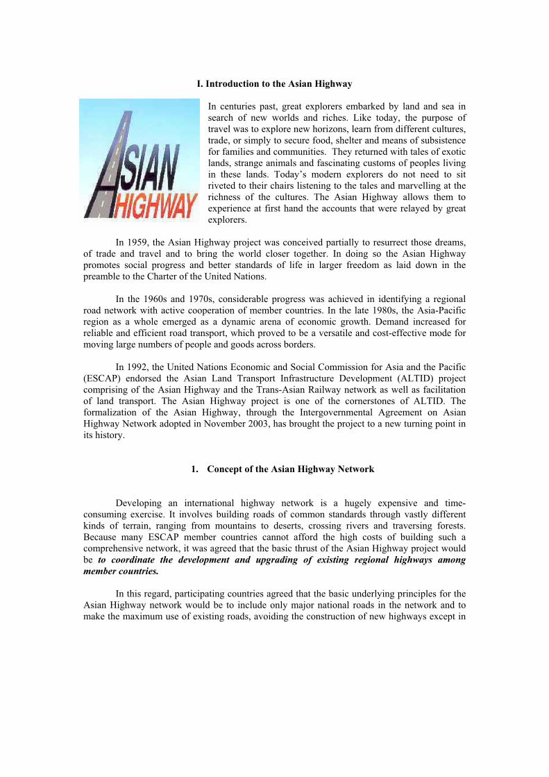
I. Introduction to the Asian Highway
In centuries past, great explorers embarked by land and sea in search of new worlds and riches. Like today, the purpose of travel was to explore new horizons, learn from different cultures, trade, or simply to secure food, shelter and means of subsistence for families and communities. They returned with tales of exotic lands, strange animals and fascinating customs of peoples living in these lands. Today’s modern explorers do not need to sit riveted to their chairs listening to the tales and marvelling at the richness of the cultures. The Asian Highway allows them to experience at first hand the accounts that were relayed by great explorers.
In 1959, the Asian Highway project was conceived partially to resurrect those dreams, of trade and travel and to bring the world closer together. In doing so the Asian Highway promotes social progress and better standards of life in larger freedom as laid down in the preamble to the Charter of the United Nations.
In the 1960s and 1970s, considerable progress was achieved in identifying a regional road network with active cooperation of member countries. In the late 1980s, the Asia-Pacific region as a whole emerged as a dynamic arena of economic growth. Demand increased for reliable and efficient road transport, which proved to be a versatile and cost-effective mode for moving large numbers of people and goods across borders.
In 1992, the United Nations Economic and Social Commission for Asia and the Pacific (ESCAP) endorsed the Asian Land Transport Infrastructure Development (ALTID) project comprising of the Asian Highway and the Trans-Asian Railway network as well as facilitation of land transport. The Asian Highway project is one of the cornerstones of ALTID. The formalization of the Asian Highway, through the Intergovernmental Agreement on Asian Highway Network adopted in November 2003, has brought the project to a new turning point in its history.
1. Concept of the Asian Highway Network
Developing an international highway network is a hugely expensive and time-consuming exercise. It involves building roads of common standards through vastly different kinds of terrain, ranging from mountains to deserts, crossing rivers and traversing forests. Because many ESCAP member countries cannot afford the high costs of building such a comprehensive network, it was agreed that the basic thrust of the Asian Highway project would be to coordinate the development and upgrading of existing regional highways among
member countries.
In this regard, participating countries agreed that the basic underlying principles for the Asian Highway network would be to include only major national roads in the network and to make the maximum use of existing roads, avoiding the construction of new highways except in

2
cases where deemed necessary to complete “missing links”. Furthermore, the criteria used to select the road, rail and road-cum-rail routes should provide for:
Criteria Justification
2. Identifying the Network
The process of identifying the roads to be included in the Asian Highway network began in the late 1950s, but it was mainly after 1992, when the ALTID project was endorsed by ESCAP, that the network formulation process was taken up in earnest. The ESCAP secretariat was tasked with the complex task of coordinating the development of the Asian Highway network by facilitating discussion among member countries. With the financial assistance from the Government of Japan, it conducted a series of studies, the first of which was published in 1995. This study identified 29 Asian Highway routes, totaling 69,000 kilometres.
In 1996, a second study was completed on the Asian Highway network in Central Asia and the South Caucasus, leading to the inclusion of a further 13 routes totalling 21,000 kilometers. In 1999, the Asian Highway routes in Turkey were agreed upon, adding a further 3,200 kilometres to the network.
The ALTID implementation strategy stressed the importance of the formulation of the Asian Highway network to cover all of Asia. Building on this momentum, a third study was completed in 2001 and identified the Asian Highway routes in China, Kazakhstan, Mongolia, the Russian Federation and the Korean peninsula. These routes formed the Northern Corridor of the Asian Highway, effectively linking North-East Asia with Central Asia, the Caucasus and Europe. About 40,000 kilometers of road network were included in the network.
d. Connections to major container
terminals and depots
To promote international transport
and regional integration
b. Connections to main industrial and agricultural centres
To promote links between areas ofeconomic activity
c. Connections to major sea and
river ports
e. Connections to major tourist
attractions
a. Capital-to-capital links
To integrate land and sea transportnetworks
To integrate rail and road networks
To promote use of Asian Highway
by tourists
3
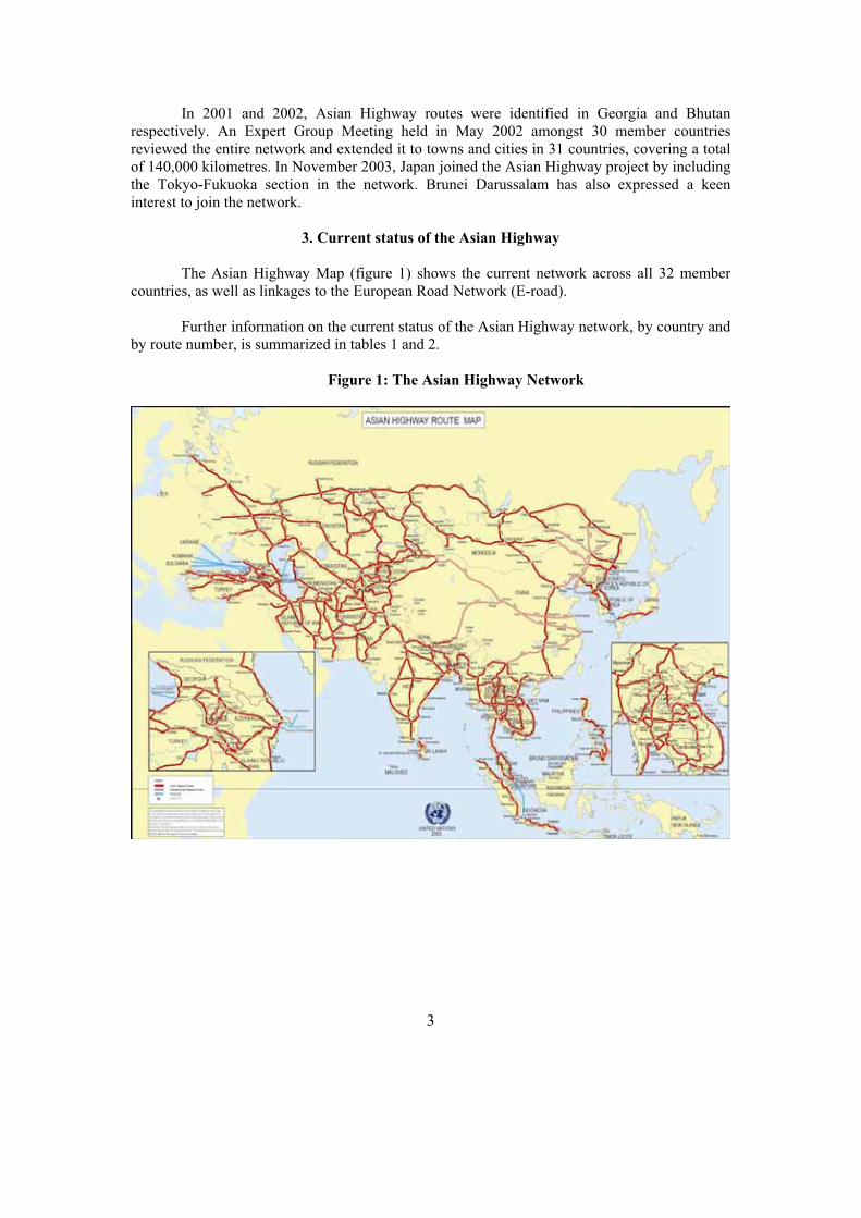
In 2001 and 2002, Asian Highway routes were identified in Georgia and Bhutan respectively. An Expert Group Meeting held in May 2002 amongst 30 member countries reviewed the entire network and extended it to towns and cities in 31 countries, covering a total of 140,000 kilometres. In November 2003, Japan joined the Asian Highway project by including the Tokyo-Fukuoka section in the network. Brunei Darussalam has also expressed a keen interest to join the network.
3. Current status of the Asian Highway
The Asian Highway Map (figure 1) shows the current network across all 32 member countries, as well as linkages to the European Road Network (E-road).
Further information on the current status of the Asian Highway network, by country and by route number, is summarized in tables 1 and 2.
Figure 1: The Asian Highway Network

4
Table 1: Status of Asian Highway by country (as of 2002)
Paved
Country Length 2 Lanes or more
1 Lane Unpaved Ferry Missing link Unknown
CommonSection
Afghanistan 4,247 2,330 10 1,906 1 0 0 472
Armenia 958 958 0 0 0 0 0 10
Azerbaijan 1,442 1,442 0 0 0 0 0 184
Bangladesh 1,804 1,188 584 2 9 21 0 487
Bhutan 1 1 0 0 0 0 0 0
Cambodia 1,339 1,337 0 0 2 0 0 0
China 25,579 25,047 0 532 0 0 0 1,692
DPRK 1,320 0 0 0 0 0 1,320 0
Georgia 1,154 1,154 0 0 0 0 0 206
India 11,432 11,389 43 0 0 0 0 1,174
Indonesia 3,989 3,955 0 0 34 0 0 0
Islamic Republic of Iran 11,152 11,152 0 0 0 0 0 566
Japan 1,200 1,200 0 0 0 0 0 0
Kazakhstan 13,189 12,080 214 895 0 0 0 2,075
Kyrgyzstan 1,695 1,317 0 378 0 0 0 34
Lao PDR 2,297 1,873 0 249 3 45 127 106
Malaysia 1,595 1,595 0 0 0 0 0 0
Mongolia 4,286 800 0 3,486 0 0 0 37
Myanmar 3,003 1,472 1,013 518 0 0 0 771
Nepal 1,321 1,304 0 17 0 0 0 107
Pakistan 5,377 5,377 0 0 0 0 0 1,275
Philippines 3,517 2,979 0 388 150 0 0 0
Republic of Korea 907 907 0 0 0 0 0 68
Russian Federation 16,869 14,945 0 1,924 0 0 0 422
Singapore 19 19 0 0 0 0 0 0
Sri Lanka 650 537 113 0 0 0 0 0
Tajikistan 1,925 1,671 0 220 1 33 0 0
Thailand 5,112 4,553 0 0 2 0 557 363
Turkey 5,254 5,254 0 0 0 0 0 538
Turkmenistan 2,204 2,180 0 24 0 0 0 358
Uzbekistan 2,966 2,722 0 244 0 0 0 379
Viet Nam 2,678 2,343 335 0 0 0 0 0
Total 140,479 125,081 2,312 10,783 200 99 2,004 11,324
Note: The length of route in Japan is estimated by ESCAP.
5
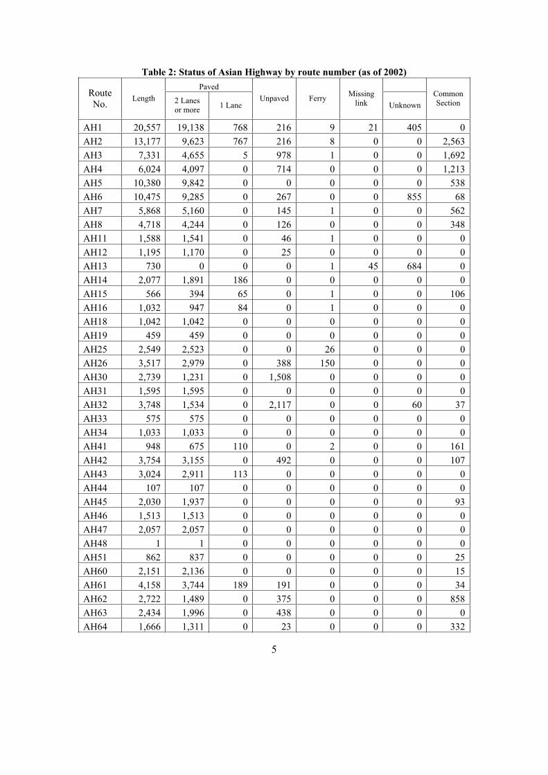
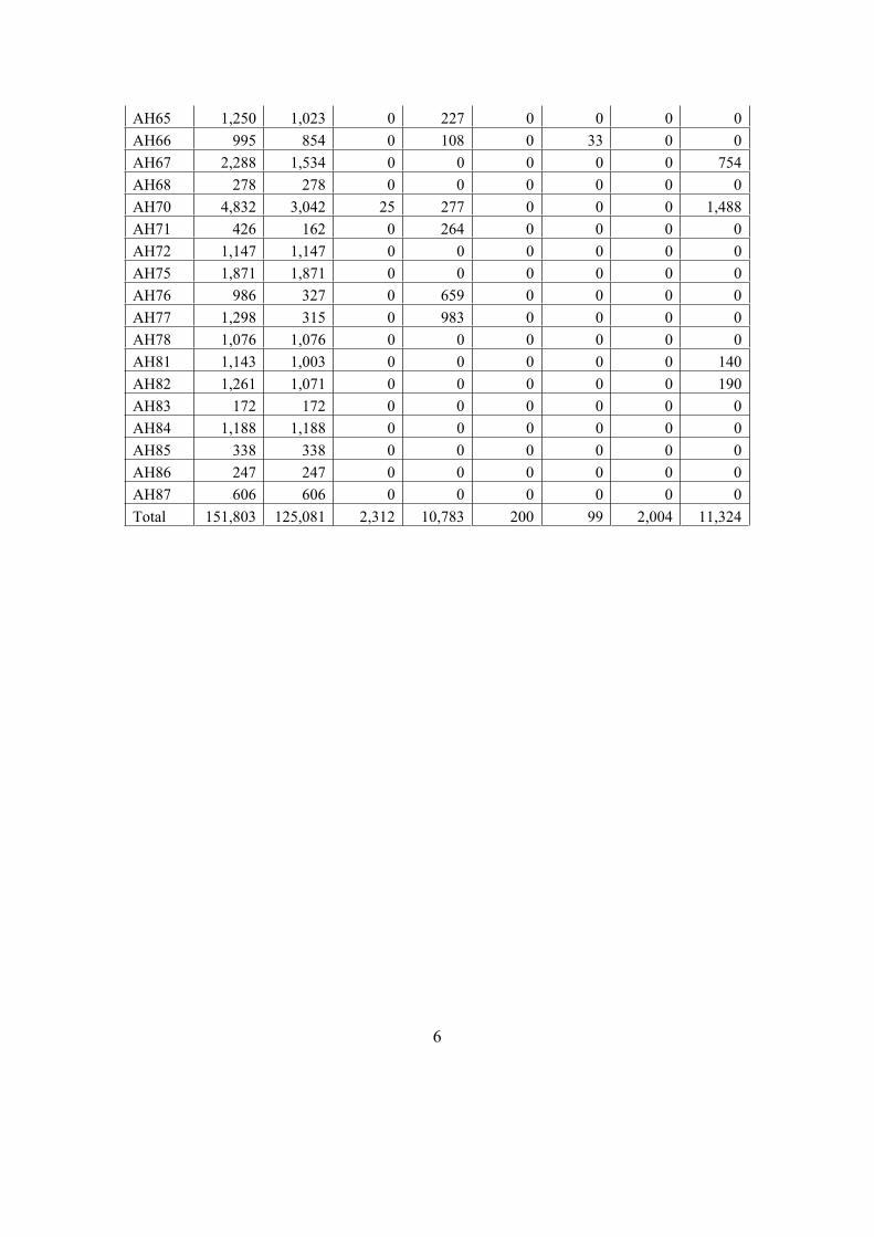
Table 2: Status of Asian Highway by route number (as of 2002)
Paved RouteNo.
Length 2 Lanes or more
1 Lane Unpaved Ferry
Missinglink Unknown
CommonSection
AH1 20,557 19,138 768 216 9 21 405 0
AH2 13,177 9,623 767 216 8 0 0 2,563
AH3 7,331 4,655 5 978 1 0 0 1,692
AH4 6,024 4,097 0 714 0 0 0 1,213
AH5 10,380 9,842 0 0 0 0 0 538
AH6 10,475 9,285 0 267 0 0 855 68
AH7 5,868 5,160 0 145 1 0 0 562
AH8 4,718 4,244 0 126 0 0 0 348
AH11 1,588 1,541 0 46 1 0 0 0
AH12 1,195 1,170 0 25 0 0 0 0
AH13 730 0 0 0 1 45 684 0
AH14 2,077 1,891 186 0 0 0 0 0
AH15 566 394 65 0 1 0 0 106
AH16 1,032 947 84 0 1 0 0 0
AH18 1,042 1,042 0 0 0 0 0 0
AH19 459 459 0 0 0 0 0 0
AH25 2,549 2,523 0 0 26 0 0 0
AH26 3,517 2,979 0 388 150 0 0 0
AH30 2,739 1,231 0 1,508 0 0 0 0
AH31 1,595 1,595 0 0 0 0 0 0
AH32 3,748 1,534 0 2,117 0 0 60 37
AH33 575 575 0 0 0 0 0 0
AH34 1,033 1,033 0 0 0 0 0 0
AH41 948 675 110 0 2 0 0 161
AH42 3,754 3,155 0 492 0 0 0 107
AH43 3,024 2,911 113 0 0 0 0 0
AH44 107 107 0 0 0 0 0 0
AH45 2,030 1,937 0 0 0 0 0 93
AH46 1,513 1,513 0 0 0 0 0 0
AH47 2,057 2,057 0 0 0 0 0 0
AH48 1 1 0 0 0 0 0 0
AH51 862 837 0 0 0 0 0 25
AH60 2,151 2,136 0 0 0 0 0 15
AH61 4,158 3,744 189 191 0 0 0 34
AH62 2,722 1,489 0 375 0 0 0 858
AH63 2,434 1,996 0 438 0 0 0 0
AH64 1,666 1,311 0 23 0 0 0 332
6
AH65 1,250 1,023 0 227 0 0 0 0
AH66 995 854 0 108 0 33 0 0
AH67 2,288 1,534 0 0 0 0 0 754
AH68 278 278 0 0 0 0 0 0
AH70 4,832 3,042 25 277 0 0 0 1,488
AH71 426 162 0 264 0 0 0 0
AH72 1,147 1,147 0 0 0 0 0 0
AH75 1,871 1,871 0 0 0 0 0 0
AH76 986 327 0 659 0 0 0 0
AH77 1,298 315 0 983 0 0 0 0
AH78 1,076 1,076 0 0 0 0 0 0
AH81 1,143 1,003 0 0 0 0 0 140
AH82 1,261 1,071 0 0 0 0 0 190
AH83 172 172 0 0 0 0 0 0
AH84 1,188 1,188 0 0 0 0 0 0
AH85 338 338 0 0 0 0 0 0
AH86 247 247 0 0 0 0 0 0
AH87 606 606 0 0 0 0 0 0
Total 151,803 125,081 2,312 10,783 200 99 2,004 11,324

7
4. Formalization of the Asian Highway Network
As the final step in the formalization of the Asian Highway Network, an Intergovernmental Agreement was adopted in November 2003. The main obligations of the Contracting Parties within the Agreement are to adopt the Asian Highway network as a coordinated plan for the development of highway routes of international importance; bring the network in conformity with the Asian Highway classification and design standards; and facilitate navigation along the routes through the placement of adequate signage along the Asian Highway routes.
The Agreement was prepared by a Working Group on Asian Highway set up by the fifty-eighth session of ESCAP on the recommendation of the Ministerial Conference on Infrastructure held in Seoul in 2001. It is based on the European Agreement of Main International Traffic Arteries.
A formal signing ceremony of the Agreement is scheduled to be held during the sixtieth session of the Commission in Shanghai, China, in April 2004.
(i) The Asian Highway routes
The formal definition of the Asian Highway routes is included as an annex to the Intergovernmental Agreement. These routes are reproduced in table 3. Provisions exist within the Agreement to convene a Working Group, one of the functions of which is to periodically review the routes.
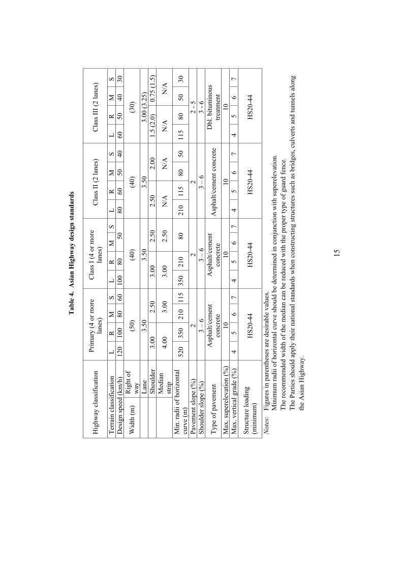
(ii) Asian Highway Classification and Design Standards
Asian Highway routes are required to conform to minimum standards of classification and design in terms of construction, improvement and maintenance. This is intended to uphold quality standards and enhance recognition among users. Member countries have agreed to make
every possible effort to conform to these provisions both in the construction of new routes and
in modernizing existing ones. The provisions of these classification and design standards are summarized in table 4.
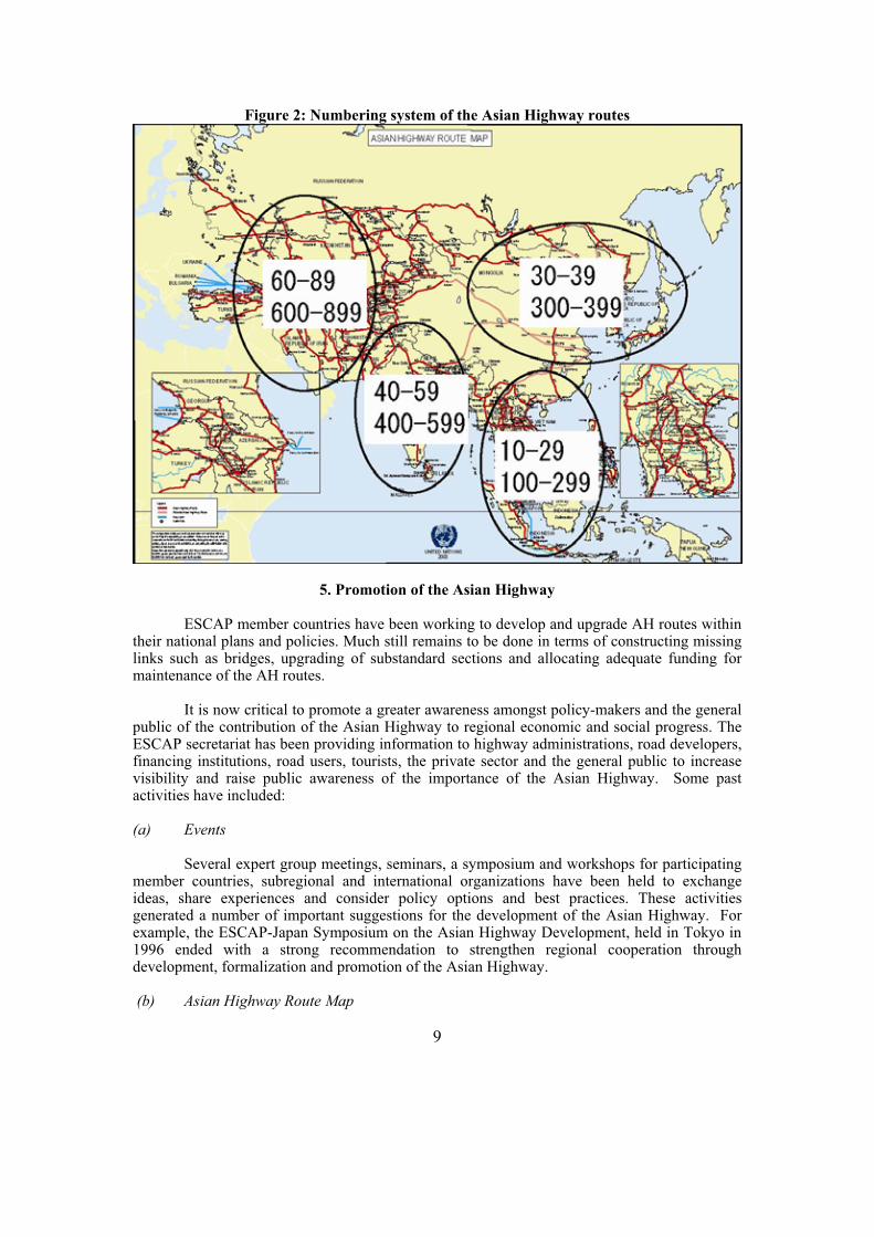
(iii) Numbering and signage
Like airline flights, Asian Highway routes have been assigned numbers to help make them easy to identify on maps as well as via signage along the routes themselves. The principles for assigning route numbers is as follows:
1. Route numbers begin with "AH", which stands for "Asian Highway", followed by one, two or three digits.
2. Single-digit route numbers from 1 to 9 are assigned to Asian Highway routes which substantially cross more than one subregion.
3. Sets of two- and three-digit route numbers are assigned to indicate the routes within subregions, including those connecting to a neighbouring subregion, and highway routes within member States as indicated below:

8
(a) Route numbers 10-29 and 100-299 are allocated to South-East Asia which includes Brunei Darussalam, Cambodia, Indonesia, Lao People's Democratic Republic, Malaysia, Myanmar, the Philippines, Singapore, Thailand and Viet Nam;
(b) Route numbers 30-39 and 300-399 are allocated to East and North-East Asia which includes China, the Democratic People's Republic of Korea, Japan, Mongolia, the Republic of Korea and the Russian Federation (Far East);1
(c) Route numbers 40-59 and 400-599 are allocated to South Asia which includes Bangladesh, Bhutan, India, Nepal, Pakistan and Sri Lanka;
(d) Route numbers 60-89 and 600-899 are allocated to North, Central and South-West Asia which includes Afghanistan, Armenia, Azerbaijan, Georgia, the
Islamic Republic of Iran, Kazakhstan, Kyrgyzstan, the Russian Federation,1
Tajikistan , Turkey, Turkmenistan and Uzbekistan.
This numbering system is illustrated in figure 2.
The Asian Highway signage is rectangular in shape and consists of the letters AH followed by the route number in Arabic numerals with a white or black inscription affixed to or combined with other signs which can be easily identified and understood by drivers.
1 The Russian Federation is included in two subregions for the purpose of assigning route numbers because of its geographic extent.
9
Figure 2: Numbering system of the Asian Highway routes
5. Promotion of the Asian Highway
ESCAP member countries have been working to develop and upgrade AH routes within their national plans and policies. Much still remains to be done in terms of constructing missing links such as bridges, upgrading of substandard sections and allocating adequate funding for maintenance of the AH routes.
It is now critical to promote a greater awareness amongst policy-makers and the general public of the contribution of the Asian Highway to regional economic and social progress. The ESCAP secretariat has been providing information to highway administrations, road developers, financing institutions, road users, tourists, the private sector and the general public to increase visibility and raise public awareness of the importance of the Asian Highway. Some past activities have included:
(a) Events
Several expert group meetings, seminars, a symposium and workshops for participating member countries, subregional and international organizations have been held to exchange ideas, share experiences and consider policy options and best practices. These activities generated a number of important suggestions for the development of the Asian Highway. For example, the ESCAP-Japan Symposium on the Asian Highway Development, held in Tokyo in 1996 ended with a strong recommendation to strengthen regional cooperation through development, formalization and promotion of the Asian Highway.
(b) Asian Highway Route Map

10
A series of maps entitled “A Practical Guide to Motorists - Asian Highway Route Map” were published between 1976 and 1988, sponsored by a tyre manufacturer. These publications were reprinted several times and enjoyed wide recognition amongst travelers.
(c) Asian Highway Database
An Asian Highway database, initiated in 1995, now encompasses details of the network within 31 countries. Some basic information has been posted on the Asian Highway web page. The database is currently being updated, with additional features being added using Geographic Information Systems (GIS) software.
(d) Asian Highway web page
The Asian Highway web page (http://www.unescap.org/tctd/ah/index.htm) contains some key information on the Asian Highway and the database. Internet users have increasingly visited it to access the database and download Asian Highway-related publications. Among the most frequently visited pages are those containing files related to the Highway, country data, tourism prospects and the Asian Highway study on the Northern Corridor.
(e) Asian Highway Brochures
An Asian Highway brochure was published in English and Japanese. Another brochure has been published on the database as a useful handout for distribution to interested users in the Asian Highway member countries.
(f) Asian Highway Auto-Venture
From 1978 to 1998 the “Asian Highway Auto-Venture”, an auto-rally was jointly organized by the Automobile Association of Singapore and the Tourism Authority of Thailand, under ESCAP sponsorship. This event took place annually along the Asian Highway Route Nos. 1 and 2 through Singapore, Malaysia and Thailand. Participants included families and ranged from children to grandparents, all of whom enjoyed the event and opportunity to explore major tourism attractions along the routes.
6. A Vision of the Future
The unanimous of adoption of the Intergovernmental Agreement on the Asian Highway Network by 32 member countries was a landmark event and the Asian Highway project has entered into a new phase. It will enhance the regional network by boosting the priority given by member countries to its development in accordance with the uniform design standards. More Asian Highway route signage will be installed to guide international travellers.
The flow of international traffic is steadily increasing through the Asian Highway network, and will grow further with improved infrastructure, as in Europe. Ways to ensure the sustained growth in cross-border flow of peoples and goods will continue to be discussed in the Working Group on the Asian Highway. At present, the Asian Highway network includes primarily trunk routes of international and domestic importance, but in the future, it is envisaged that secondary roads linking to the Asian Highway will become part of the network, providing important additional links to domestic and international networks.
11
It is envisaged that a day will soon come when products from Singapore, Shanghai or Bandar Abbas will be delivered to buyers in Central Asia or tourists and adventurers may drive to Europe from Tokyo or Bali. The benefits of this for the peoples of the ESCAP region are immense and unparalleled.
12
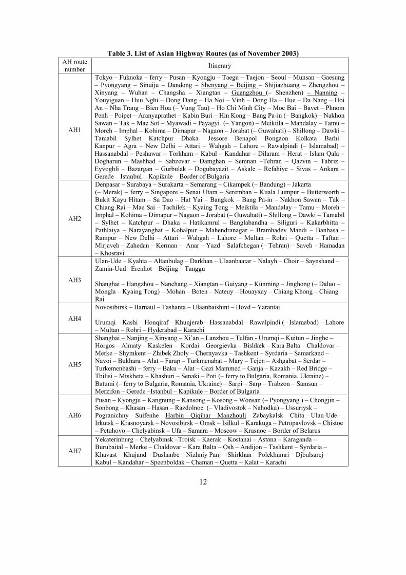
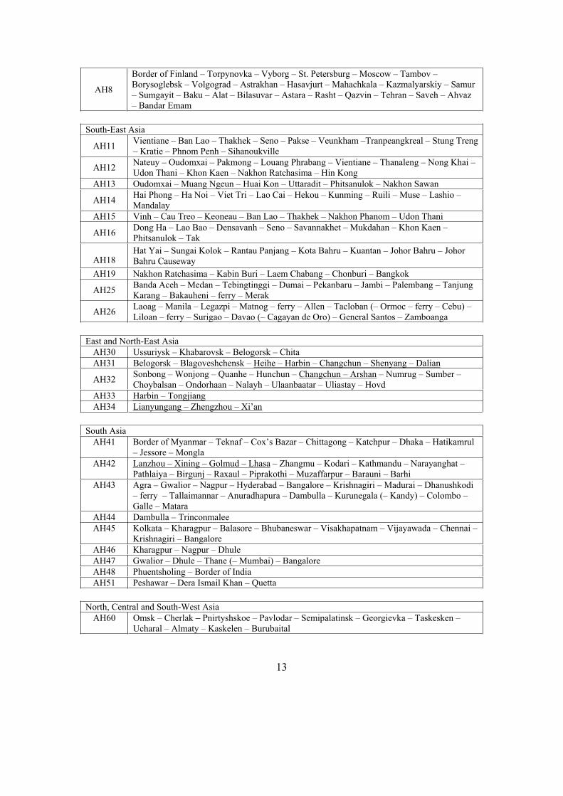
Table 3. List of Asian Highway Routes (as of November 2003) AH route number
Itinerary
AH1
Tokyo – Fukuoka – ferry – Pusan – Kyongju – Taegu – Taejon – Seoul – Munsan – Gaesung – Pyongyang – Sinuiju – Dandong – Shenyang – Beijing – Shijiazhuang – Zhengzhou – Xinyang – Wuhan – Changsha – Xiangtan – Guangzhou (– Shenzhen) – Nanning – Youyiguan – Huu Nghi – Dong Dang – Ha Noi – Vinh – Dong Ha – Hue – Da Nang – Hoi An – Nha Trang – Bien Hoa (– Vung Tau) – Ho Chi Minh City – Moc Bai – Bavet – Phnom Penh – Poipet – Aranyaprathet – Kabin Buri – Hin Kong – Bang Pa-in (– Bangkok) – Nakhon Sawan – Tak – Mae Sot – Myawadi – Payagyi (– Yangon) – Meiktila – Mandalay – Tamu – Moreh – Imphal – Kohima – Dimapur – Nagaon – Jorabat (– Guwahati) – Shillong – Dawki – Tamabil – Sylhet – Katchpur – Dhaka – Jessore – Benapol – Bongaon – Kolkata – Barhi – Kanpur – Agra – New Delhi – Attari – Wahgah – Lahore – Rawalpindi (– Islamabad) – Hassanabdal – Peshawar – Torkham – Kabul – Kandahar – Dilaram – Herat – Islam Qala – Dogharun – Mashhad – Sabzevar – Damghan – Semnan –Tehran – Qazvin – Tabriz – Eyvoghli – Bazargan – Gurbulak – Dogubayazit – Askale – Refahiye – Sivas – Ankara – Gerede – Istanbul – Kapikule – Border of Bulgaria
AH2
Denpasar – Surabaya – Surakarta – Semarang – Cikampek (– Bandung) – Jakarta (– Merak) – ferry – Singapore – Senai Utara – Seremban – Kuala Lumpur – Butterworth – Bukit Kayu Hitam – Sa Dao – Hat Yai – Bangkok – Bang Pa-in – Nakhon Sawan – Tak – Chiang Rai – Mae Sai – Tachilek – Kyaing Tong – Meiktila – Mandalay – Tamu – Moreh – Imphal – Kohima – Dimapur – Nagaon – Jorabat (– Guwahati) – Shillong – Dawki – Tamabil – Sylhet – Katchpur – Dhaka – Hatikamrul – Banglabandha – Siliguri – Kakarbhitta – Pathlaiya – Narayanghat – Kohalpur – Mahendranagar – Bramhadev Mandi – Banbasa – Rampur – New Delhi – Attari – Wahgah – Lahore – Multan – Rohri – Quetta – Taftan – Mirjaveh – Zahedan – Kerman – Anar – Yazd – Salafchegan (– Tehran) – Saveh – Hamadan – Khosravi
AH3
Ulan-Ude – Kyahta – Altanbulag – Darkhan – Ulaanbaatar – Nalayh – Choir – Saynshand –Zamin-Uud –Erenhot – Beijing – Tanggu
Shanghai – Hangzhou – Nanchang – Xiangtan – Guiyang – Kunming – Jinghong (– Daluo – Mongla – Kyaing Tong) – Mohan – Boten – Nateuy – Houayxay – Chiang Khong – Chiang Rai
AH4
Novosibirsk – Barnaul – Tashanta – Ulaanbaishint – Hovd – Yarantai
Urumqi – Kashi – Honqiraf – Khunjerab – Hassanabdal – Rawalpindi (– Islamabad) – Lahore – Multan – Rohri – Hyderabad – Karachi
AH5
Shanghai – Nanjing – Xinyang – Xi’an – Lanzhou – Tulfan - Urumqi – Kuitun – Jinghe – Horgos – Almaty – Kaskelen – Kordai – Georgievka – Bishkek – Kara Balta – Chaldovar – Merke – Shymkent – Zhibek Zholy – Chernyavka – Tashkent – Syrdaria – Samarkand – Navoi – Bukhara – Alat – Farap – Turkmenabat – Mary – Tejen – Ashgabat – Serdar –Turkemenbashi – ferry – Baku – Alat – Gazi Mammed – Ganja – Kazakh – Red Bridge – Tbilisi – Mtskheta – Khashuri – Senaki – Poti (– ferry to Bulgaria, Romania, Ukraine) – Batumi (– ferry to Bulgaria, Romania, Ukraine) – Sarpi – Sarp – Trabzon – Samsun – Merzifon – Gerede –Istanbul – Kapikule – Border of Bulgaria
AH6
Pusan – Kyongju – Kangnung – Kansong – Kosong – Wonsan (– Pyongyang ) – Chongjin – Sonbong – Khasan – Hasan – Razdolnoe (– Vladivostok – Nahodka) – Ussuriysk – Pogranichny – Suifenhe – Harbin – Qiqihar – Manzhouli – Zabaykalsk – Chita – Ulan-Ude – Irkutsk – Krasnoyarsk – Novosibirsk – Omsk – Isilkul – Karakuga – Petropavlovsk – Chistoe – Petuhovo – Chelyabinsk – Ufa – Samara – Moscow – Krasnoe – Border of Belarus
AH7
Yekaterinburg – Chelyabinsk –Troisk – Kaerak – Kostanai – Astana – Karaganda –Burubaital – Merke – Chaldovar – Kara Balta – Osh – Andijon – Tashkent – Syrdaria – Khavast – Khujand – Dushanbe – Nizhniy Panj – Shirkhan – Polekhumri – Djbulsarcj – Kabul – Kandahar – Speenboldak – Chaman – Quetta – Kalat – Karachi
13
AH8
Border of Finland – Torpynovka – Vyborg – St. Petersburg – Moscow – Tambov – Borysoglebsk – Volgograd – Astrakhan – Hasavjurt – Mahachkala – Kazmalyarskiy – Samur – Sumgayit – Baku – Alat – Bilasuvar – Astara – Rasht – Qazvin – Tehran – Saveh – Ahvaz – Bandar Emam
South-East Asia
AH11 Vientiane – Ban Lao – Thakhek – Seno – Pakse – Veunkham –Tranpeangkreal – Stung Treng – Kratie – Phnom Penh – Sihanoukville
AH12 Nateuy – Oudomxai – Pakmong – Louang Phrabang – Vientiane – Thanaleng – Nong Khai – Udon Thani – Khon Kaen – Nakhon Ratchasima – Hin Kong
AH13 Oudomxai – Muang Ngeun – Huai Kon – Uttaradit – Phitsanulok – Nakhon Sawan
AH14 Hai Phong – Ha Noi – Viet Tri – Lao Cai – Hekou – Kunming – Ruili – Muse – Lashio – Mandalay
AH15 Vinh – Cau Treo – Keoneau – Ban Lao – Thakhek – Nakhon Phanom – Udon Thani
AH16 Dong Ha – Lao Bao – Densavanh – Seno – Savannakhet – Mukdahan – Khon Kaen – Phitsanulok – Tak
AH18 Hat Yai – Sungai Kolok – Rantau Panjang – Kota Bahru – Kuantan – Johor Bahru – Johor Bahru Causeway
AH19 Nakhon Ratchasima – Kabin Buri – Laem Chabang – Chonburi – Bangkok
AH25 Banda Aceh – Medan – Tebingtinggi – Dumai – Pekanbaru – Jambi – Palembang – Tanjung Karang – Bakauheni – ferry – Merak
AH26 Laoag – Manila – Legazpi – Matnog – ferry – Allen – Tacloban (– Ormoc – ferry – Cebu) – Liloan – ferry – Surigao – Davao (– Cagayan de Oro) – General Santos – Zamboanga
East and North-East Asia
AH30 Ussuriysk – Khabarovsk – Belogorsk – Chita
AH31 Belogorsk – Blagoveshchensk – Heihe – Harbin – Changchun – Shenyang – Dalian
AH32 Sonbong – Wonjong – Quanhe – Hunchun – Changchun – Arshan – Numrug – Sumber – Choybalsan – Ondorhaan – Nalayh – Ulaanbaatar – Uliastay – Hovd
AH33 Harbin – Tongjiang
AH34 Lianyungang – Zhengzhou – Xi’an
South Asia
AH41 Border of Myanmar – Teknaf – Cox’s Bazar – Chittagong – Katchpur – Dhaka – Hatikamrul – Jessore – Mongla
AH42 Lanzhou – Xining – Golmud – Lhasa – Zhangmu – Kodari – Kathmandu – Narayanghat –Pathlaiya – Birgunj – Raxaul – Piprakothi – Muzaffarpur – Barauni – Barhi
AH43 Agra – Gwalior – Nagpur – Hyderabad – Bangalore – Krishnagiri – Madurai – Dhanushkodi – ferry – Tallaimannar – Anuradhapura – Dambulla – Kurunegala (– Kandy) – Colombo – Galle – Matara
AH44 Dambulla – Trinconmalee
AH45 Kolkata – Kharagpur – Balasore – Bhubaneswar – Visakhapatnam – Vijayawada – Chennai – Krishnagiri – Bangalore
AH46 Kharagpur – Nagpur – Dhule
AH47 Gwalior – Dhule – Thane (– Mumbai) – Bangalore
AH48 Phuentsholing – Border of India
AH51 Peshawar – Dera Ismail Khan – Quetta
North, Central and South-West Asia
AH60 Omsk – Cherlak – Pnirtyshskoe – Pavlodar – Semipalatinsk – Georgievka – Taskesken – Ucharal – Almaty – Kaskelen – Burubaital

14
AH61 Kashi – Turugart – Torougart – Naryn – Bishkek – Georgievka – Kordai – Merke – Shymkent – Kyzylorda – Aralsk – Karabutak – Aktyubinsk – Ural’sk – Kamenka – Ozinki – Saratov – Borysoglebsk – Voronezh – Kursk – Krupets – Border of Ukraine
AH62 Petropavlovsk – Arkalyk – Zhezkazgan – Kyzylorda – Shymkent – Zhibek Zholy – Chernyavka – Tashkent – Syrdaria – Samarkand – Guzar – Termez – Hairatan – Mazar-i-Sharif
AH63 Samara – Kurlin – Pogodaevo – Ural’sk – Atyrau – Beyneu – Oazis – Nukus – Bukhara – Guzar
AH64 Barnaul – Veseloyarskyj – Krasny Aul – Semipalatinsk – Pavlodar – Shiderty – Astana – Kokshetau – Petropavlovsk
AH65 Kashi – Arkaxtam – Irkeshtam – Sary-Tash (– Osh) – Karamyk – Vakhdat – Dushanbe – Tursunzade – Uzun – Termez
AH66 Border of China – Kulma Pass – Khorugh – Kulob – Vakhdat – Dushanbe
AH67 Kuitun – Baketu – Bakhty – Taskesken – Semipalatinsk – Pavlodar – Shiderty – Karaganda – Zhezkazgan
AH68 Jinghe – Alatawshankou – Dostyk – Ucharal
AH70 Border of Ukraine – Donetsk – Volgograd – Astrakhan – Kotyaevka – Atyrau – Beyneu – Zhetybai (– Aktau) – Bekdash – Turkemenbashi – Serdar – Gudurolum – Inche Boroun – Gorgan – Sari – Semnan – Damghan – Yazd – Anar – Bandar Abbas
AH71 Dilaram – Zarang – Milak – Zabol – Dashtak
AH72 Tehran – Qom – Esfahan – Shiraz – Bushehr
AH75 Tejen – Sarahs – Sarakhs – Mashhad – Birjand – Nehbandan – Dashtak – Zahedan – Chabahar
AH76 Polekhumri – Mazar-i-Sharif – Herat
AH77 Djbulsarcj – Bamiyan – Herat – Tourghondi – Serkhetabat – Mary
AH78 Ashgabat – Chovdan Pass – Bajgiran – Qucham – Sabzevar – Kerman
AH81 Larsi – Mtskheta – Tbilisi – Sadakhlo – Bagratashen – Vanadjor – Ashtarak – Yerevan – Eraskh – Sadarak – Nakhchivan – Julfa (– Jolfa) – Ordubad – Agarak – Meghri Aghband – Goradiz – Gazi Mammed – Alat – Baku – ferry – Aktau
AH82 Border of the Russian Federation – Leselidze – Sukhumi – Senaki – Khashuri – Akhaltsikhe (– Vale) – Zdanov – Bavra – Gumri (– Akurik) – Ashtarak – Yerevan – Eraskh – Goris – Kapan – Meghri – Agarak – Nour Douz – Jolfa – Iveoqlu
AH83 Kazakh – Uzungala – Paravakar – Yerevan
AH84 Dogubayazit – Diyarbakir – Gaziantep – Toprakkale (– Iskenderun) – Adana – Icel
AH85 Refahiye – Amasya – Merzifon
AH86 Askale – Bayburt – Trabzon
AH87 Ankara – Afyon – Usak – Izmir
Notes: Routes in parentheses identify branches from the place indicated immediately before the parentheses.
Underlined sections indicate potential Asian Highway routes. The word “ferry” shall not be construed so as to impose any obligation on the Parties.
15
Ta
ble
4. A
sia
n H
igh
wa
y d
esig
n s
tan
da
rds
Hig
hw
ay c
lass
ific
atio
n
Pri
mar
y (
4 o
r m
ore
la
nes
)C
lass
I (
4 o
r m
ore
la
nes
)C
lass
II
(2 l
anes
) C
lass
III
(2
lan
es)
Ter
rain
cla
ssif
icat
ion
L
R
M
S
L
R
M
S
L
R
M
S
L
R
M
S
Des
ign
sp
eed
(k
m/h
) 1
20
1
00
8
0
60
1
00
8
0
50
8
0
60
5
0
40
6
0
50
4
0
30
Wid
th (
m)
Rig
ht
of
way
(50
) (4
0)
(40
) (3
0)
L
ane
3.5
0
3.5
0
3.5
0
3.0
0 (
3.2
5)
S
ho
uld
er
3.0
0
2.5
0
3.0
0
2.5
0
2.5
0
2.0
0
1.5
(2
.0)
0.7
5 (
1.5
)
Med
ian
st
rip
4.0
0
3.0
0
3.0
0
2.5
0
N/A
N
/A
N/A
N
/A
Min
. ra
dii
of
ho
rizo
nta
l cu
rve
(m)
520
3
50
2
10
1
15
3
50
2
10
8
0
210
1
15
8
0
50
1
15
8
0
50
3
0
Pav
emen
t sl
op
e (%
) 2
2
2
2
- 5
Sh
ou
lder
slo
pe
(%)
3 –
6
3 –
6
3 –
6
3 -
6
Ty
pe
of
pav
emen
t A
sph
alt/
cem
ent
con
cret
eA
sph
alt/
cem
ent
con
cret
eA
sph
alt/
cem
ent
con
cret
e D
bl.
bit
um
ino
us
trea
tmen
t
Max
. su
per
elev
atio
n (
%)
10
1
0
10
1
0
Max
. v
erti
cal
gra
de
(%)
4
5
6
7
4
5
6
7
4
5
6
7
4
5
6
7
Str
uct
ure
lo
adin
g
(min
imu
m)
HS
20
-44
H
S2
0-4
4
HS
20
-44
H
S2
0-4
4
No
tes:
F
igu
res
in p
aren
thes
es a
re d
esir
able
val
ues
.
Min
imu
m r
adii
of
ho
rizo
nta
l cu
rve
sho
uld
be
det
erm
ined
in
co
nju
nct
ion
wit
h s
up
erel
evat
ion
.
T
he
reco
mm
end
ed w
idth
of
the
med
ian
can
be
red
uce
d w
ith
th
e p
rop
er t
yp
e o
f g
uar
d f
ence
.
Th
e P
arti
es s
ho
uld
ap
ply
th
eir
nat
ion
al s
tan
dar
ds
wh
en c
on
stru
ctin
g s
tru
ctu
res
such
as
bri
dg
es, cu
lver
ts a
nd
tu
nn
els
alo
ng
the
Asi
an H
igh
way
.

16
1. Afghanistan
A. Introduction
The Asian Highway routes link Afghanistan to the Islamic Republic of Iran, Pakistan, Tajikistan, Turkmenistan, and Uzbekistan. Asian Highway routes in Afghanistan have tremendous potential to play an important part in transit transport from Central Asia to the Persian Gulf and the Indian Ocean.
The Asian Highway routes and national roads have identical route numbers. Due to various periods of conflict, roads and bridges were seriously damaged and neglected. Comprehensive upgrading and rehabilitation is required to meet the Asian Highway classification and design standards. Many funding agencies are supporting the reconstruction of major highways in Afghanistan.
Most of Afghanistan is mountainous. The fertile valleys and plains are home to most of the population. The land is mainly dry. Less than 10 per cent of the land is cultivated and much arable land was damaged by war in the 1980s. The country has considerable potential for natural gas. The population is diverse, including Afghans and Pathans, Tajiks, Hazaras, Uzbeks, and nomadic Turkmen. Pushtu (Afghan), Dari (Persian), Tajik, and Uzbek are the principal languages.
Located on the land route to India through the famed Khyber Pass, Afghanistan has witnessed many conquering armies through the ages.
Country Profile
Capital Kabul
Area 647,500 sq km
Population 23,897,000 (2003)
Urban Population 23 per cent
GDP US$ 21 billion (2000 est.)
GDP per Capita US$ 800 (2000 est.)
Currency Afghani (AFA)
Length of Road 21,400 km (2000)
Asian Highway route length
4,247 km
Number of Motor Vehicles
56,000 (1996)

17
B. Asian Highway in Afghanistan
Status of the Asian Highway in Afghanistan Paved (km)
Route No.
Itinerary Length(km) 2 Lanes
or more1 Lane
Unpaved (km)
Ferry (km)
AH1 Torkham – Kabul – Kandahar – Dilaram – Herat – Islam Qala
1,400 1,390 10
AH7 Shirkhan – Polekhumri – Djbulsarcj – Kabul – Kandahar – Speenboldak
494 493 1
AH62 Hairatan – Mazar-i-Sharif 120 120
AH71 Dilaram – Zarang 264 264
AH76 Polekhumri – Mazar-i-Sharif – Herat 986 327 659
AH77 Djbulsarcj – Bamiyan – Herat – Tourghondi 983 983
Total 4,247 2,330 10 1,906 1
Percentage 100 54.9 0.2 44.9 0.0
Asian Highway in Afganistan
0
200
400
600
800
1,000
1,200
1,400
1,600
AH1 AH7 AH62 AH71 AH76 AH77
Len
gth
(km
)
Ferry
Unpaved
Paved 1 Lane
Paved 2 Lanes or more
1,400km
494km
120km 264km
986km 983km
AH1 in Kabul AH1 from Kabul to Kandahar

18
C. Tourism spots along the Asian Highway
Herat (AH1/AH76/AH77)
The Masjid-e-Jami, in the center of Herat's has been a place of worship since the time of Zoroaster. Rebuilt several times, the mosque stands in perfect splendour since its most recent restoration which is nearing completion.
Kabul Museum, Kabul (AH1/AH7)
The Kabul Museum once had one of the finest collections of antiquities in Asia. Though many items were stolen, damaged or destroyed over the last decade, it is still possible to see some artifacts.
D. Government Department responsible for Asian Highway Network
Ministry of Public Works, Microrayan-e-Awal, Kabul, Afghanistan.
E. Useful Contacts for travel and tourism information
Ministry of Civil Aviation and Tourism, Transitional Islamic Government of Afghanistan, Opposite Italian Embassy, Charahi, Ariana, Kabul. Tel: Satellite (873) 7630 90611; Fax: (873-76) 252 3846.
19
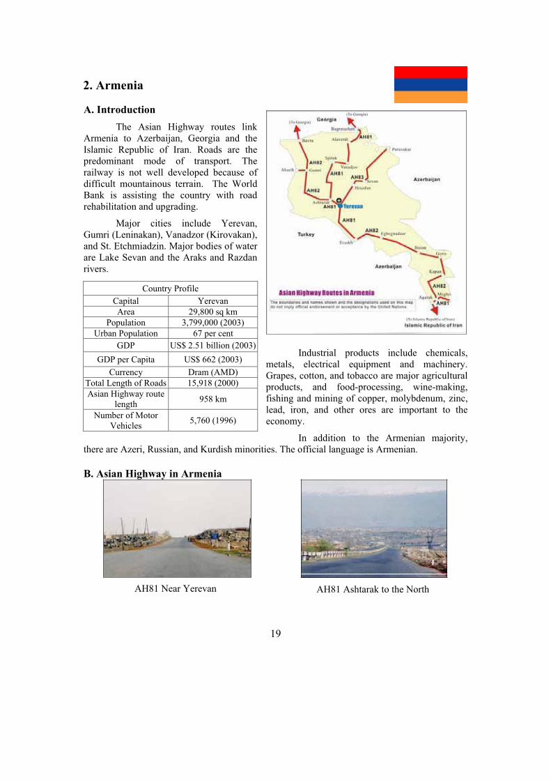
2. Armenia
A. Introduction
The Asian Highway routes link Armenia to Azerbaijan, Georgia and the Islamic Republic of Iran. Roads are the predominant mode of transport. The railway is not well developed because of difficult mountainous terrain. The World Bank is assisting the country with road rehabilitation and upgrading.
Major cities include Yerevan, Gumri (Leninakan), Vanadzor (Kirovakan), and St. Etchmiadzin. Major bodies of water are Lake Sevan and the Araks and Razdan rivers.
Industrial products include chemicals, metals, electrical equipment and machinery. Grapes, cotton, and tobacco are major agricultural products, and food-processing, wine-making, fishing and mining of copper, molybdenum, zinc, lead, iron, and other ores are important to the economy.
In addition to the Armenian majority, there are Azeri, Russian, and Kurdish minorities. The official language is Armenian.
B. Asian Highway in Armenia
Country Profile
Capital Yerevan
Area 29,800 sq km
Population 3,799,000 (2003)
Urban Population 67 per cent
GDP US$ 2.51 billion (2003)
GDP per Capita US$ 662 (2003)
Currency Dram (AMD)
Total Length of Roads 15,918 (2000)
Asian Highway route length
958 km
Number of Motor Vehicles
5,760 (1996)
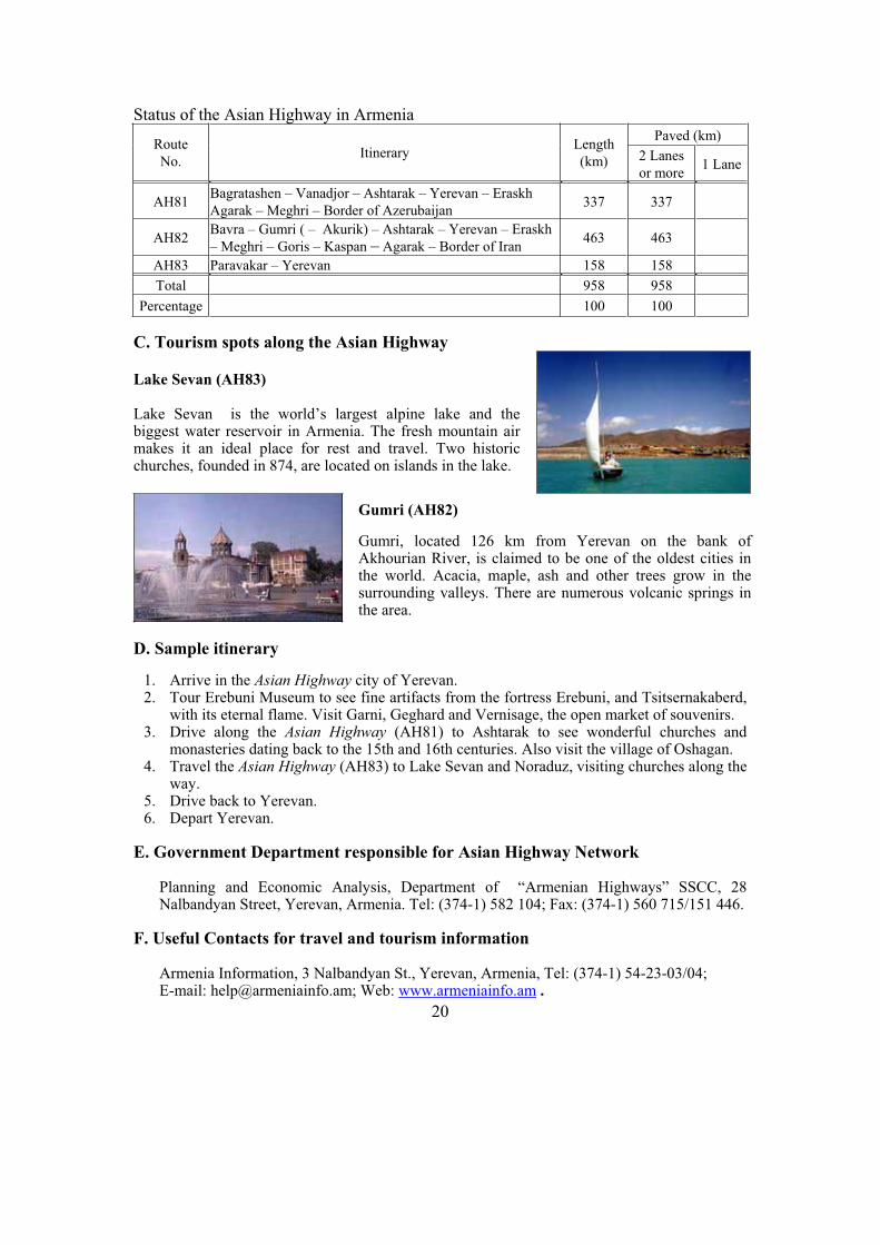
AH81 Near Yerevan AH81 Ashtarak to the North
20
Status of the Asian Highway in Armenia Paved (km)
Route
No. Itinerary
Length
(km) 2 Lanes
or more 1 Lane
AH81 Bagratashen – Vanadjor – Ashtarak – Yerevan – Eraskh
Agarak – Meghri – Border of Azerubaijan 337 337
AH82 Bavra – Gumri ( – Akurik) – Ashtarak – Yerevan – Eraskh
– Meghri – Goris – Kaspan – Agarak – Border of Iran 463 463
AH83 Paravakar – Yerevan 158 158
Total 958 958
Percentage 100 100
C. Tourism spots along the Asian Highway
Lake Sevan (AH83)
Lake Sevan is the world’s largest alpine lake and the biggest water reservoir in Armenia. The fresh mountain air makes it an ideal place for rest and travel. Two historic churches, founded in 874, are located on islands in the lake.
Gumri (AH82)
Gumri, located 126 km from Yerevan on the bank of Akhourian River, is claimed to be one of the oldest cities in the world. Acacia, maple, ash and other trees grow in the surrounding valleys. There are numerous volcanic springs in the area.
D. Sample itinerary
1. Arrive in the Asian Highway city of Yerevan. 2. Tour Erebuni Museum to see fine artifacts from the fortress Erebuni, and Tsitsernakaberd,
with its eternal flame. Visit Garni, Geghard and Vernisage, the open market of souvenirs. 3. Drive along the Asian Highway (AH81) to Ashtarak to see wonderful churches and
monasteries dating back to the 15th and 16th centuries. Also visit the village of Oshagan. 4. Travel the Asian Highway (AH83) to Lake Sevan and Noraduz, visiting churches along the
way. 5. Drive back to Yerevan. 6. Depart Yerevan.
E. Government Department responsible for Asian Highway Network
Planning and Economic Analysis, Department of “Armenian Highways” SSCC, 28 Nalbandyan Street, Yerevan, Armenia. Tel: (374-1) 582 104; Fax: (374-1) 560 715/151 446.
F. Useful Contacts for travel and tourism information
Armenia Information, 3 Nalbandyan St., Yerevan, Armenia, Tel: (374-1) 54-23-03/04; E-mail: [email protected]; Web: www.armeniainfo.am .

21
3. Azerbaijan
A. Introduction
The Asian Highway routes link Azerbaijan to Armenia, Georgia, the Islamic Republic of Iran, Kazakhstan, the Russian Federation and Turkmenistan (by ferry) from Baku. The Asian Highway linkage through Baku port on the Caspian Sea is important for providing transit transport between Central Asia and Europe. Freight transport mostly relies on road transport. Multilateral and bilateral donors are supporting government efforts to improve and reconstruct the road network.
The country is rich in oil, natural gas, iron, copper, lead, zinc, and other ores. Manufactured products include machinery, electrical and oil drilling equipment, cement, and steel. Grains, fruit, grapes, cotton, silk, and tobacco are the major crops.
Overlooking the Caspian Sea, Baku is fast becoming a boomtown. Once a major stopover on the Great Silk Route, there are many captivating sights in this ancient country - Bronze Age petroglyphs, medieval minarets and mosques and Azerbaijan's famous carpets.
In addition to the Turkic-speaking Azeri (Azerbaijani) majority, there are Russian, Armenian and other minorities.
B. Asian Highway in Azerbaijan
Country Profile
Capital Baku
Area 86,600 sq km
Population 8,117,000 (2003)
Urban Population 52 per cent
GDP US$ 7.05 billion (2003)
GDP per Capita US$ 869 (2003)
Currency Azerbaijani Manat (AZM)
Major Port Baku
Total Length of Roads 25,013 km (2002)
Asian Highway route length
1,442 km
Number of Motor Vehicles
451,000 (2001)
AH5 in Baku Baku port in Caspian Sea
22
Status of the Asian Highway in Azerbaijan Paved (km)
Route No. Itinerary
Length
(km) 2 Lanes
or more 1 Lane
AH5 Baku – Alat – Gazi Mammed – Ganja – Kazakh – Red Bridge 515 515
AH8 Samur – Sumgayit – Baku – Alat – Bilasuvar – Astara 451 451
AH81 Sadarak – Nakhchivan – Julfa – Ordubad
Aghband – Goradiz – Gazi Mammed 462 462
AH83 Kazakh – Uzungala 14 14
Total 1,442 1,442
Percentage 100 100
C. Tourism spots along the Asian Highway
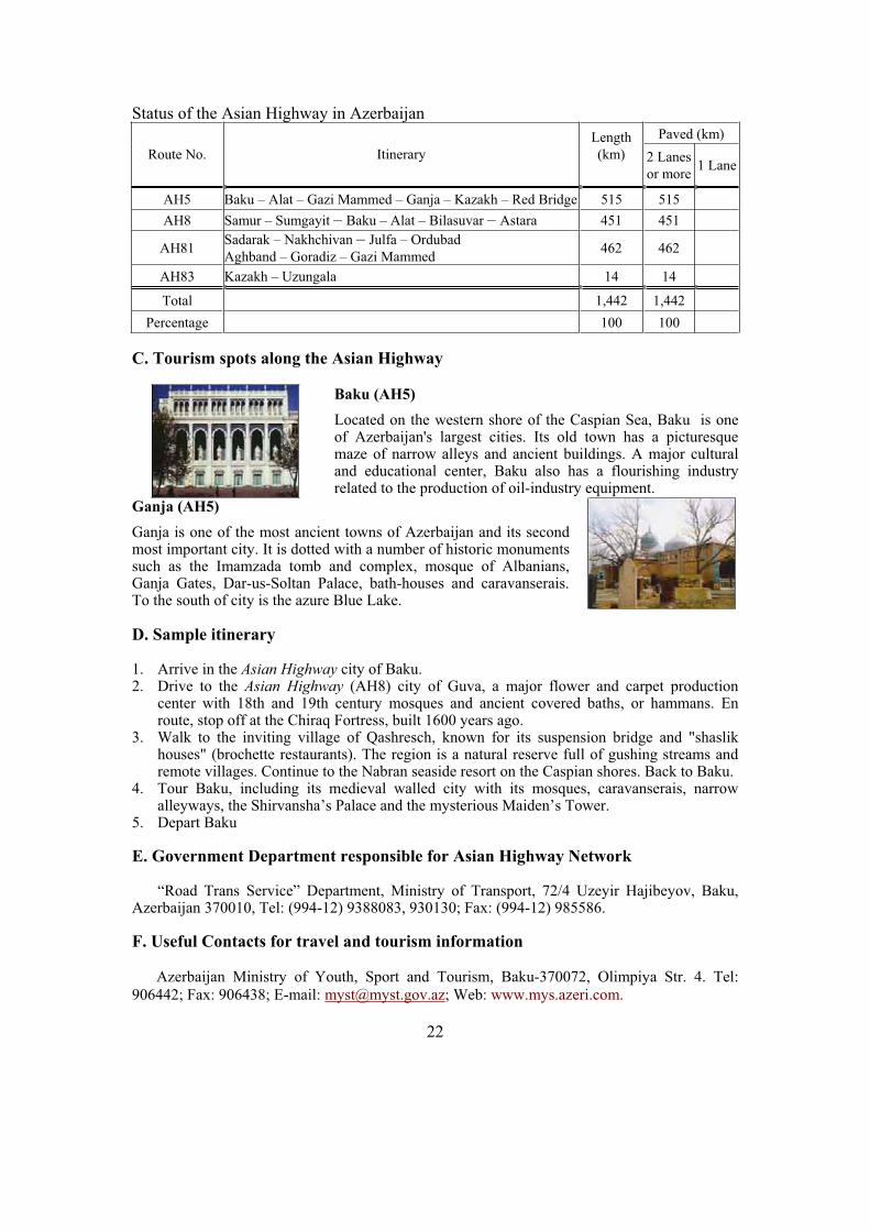
Baku (AH5)
Located on the western shore of the Caspian Sea, Baku is one of Azerbaijan's largest cities. Its old town has a picturesque maze of narrow alleys and ancient buildings. A major cultural and educational center, Baku also has a flourishing industry related to the production of oil-industry equipment.
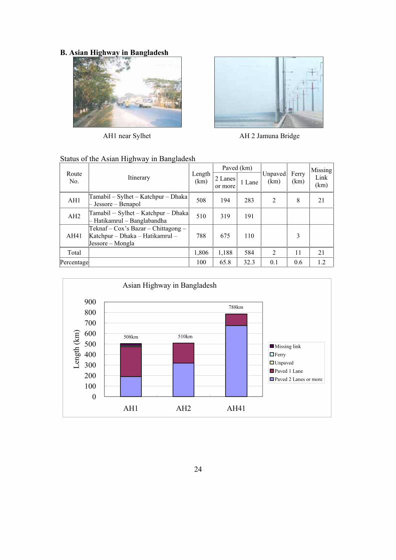
Ganja (AH5)
Ganja is one of the most ancient towns of Azerbaijan and its second most important city. It is dotted with a number of historic monuments such as the Imamzada tomb and complex, mosque of Albanians, Ganja Gates, Dar-us-Soltan Palace, bath-houses and caravanserais. To the south of city is the azure Blue Lake.
D. Sample itinerary
1. Arrive in the Asian Highway city of Baku. 2. Drive to the Asian Highway (AH8) city of Guva, a major flower and carpet production
center with 18th and 19th century mosques and ancient covered baths, or hammans. En route, stop off at the Chiraq Fortress, built 1600 years ago.
3. Walk to the inviting village of Qashresch, known for its suspension bridge and "shaslik houses" (brochette restaurants). The region is a natural reserve full of gushing streams and remote villages. Continue to the Nabran seaside resort on the Caspian shores. Back to Baku.
4. Tour Baku, including its medieval walled city with its mosques, caravanserais, narrow alleyways, the Shirvansha’s Palace and the mysterious Maiden’s Tower.
5. Depart Baku
E. Government Department responsible for Asian Highway Network
“Road Trans Service” Department, Ministry of Transport, 72/4 Uzeyir Hajibeyov, Baku, Azerbaijan 370010, Tel: (994-12) 9388083, 930130; Fax: (994-12) 985586.
F. Useful Contacts for travel and tourism information
Azerbaijan Ministry of Youth, Sport and Tourism, Baku-370072, Olimpiya Str. 4. Tel: 906442; Fax: 906438; E-mail: [email protected]; Web: www.mys.azeri.com.

23
4. Bangladesh
A. Introduction
The Asian Highway routes link Bangladesh to India and Myanmar and link the major seaports of Chittagong and Mongla with the capital, Dhaka. The construction of the Bangabandhu (Jamuna) Bridge, access roads to the bridge, Dhaka eastern bypass and other toll roads are major initiatives to improve road transport. Along AH1, the Government is planning the Padma Bridge, which will remove another missing link in the network.
Although road development is hampered by regular floods and seasonal cyclones, the Government is working to complete the priority highways, develop five arterial corridors linking the ports to the major cities, and formulate the legal and policy framework to attract the private sector.
Bangladesh is composed mainly of the combined delta of the Ganges, Brahmaputra, and Meghna rivers. The economy is largely
agricultural; jute (of which Bangladesh produces over 50 per cent of the world supply), rice, sugarcane, and tea are the principal crops. Principal manufactured products include jute products, textiles, paper, processed food, and fertilizers.
Bangladesh has the world’s highest population density. Most of the people are Bengalis. The official language is Bengali, but English is also spoken.
Country Profile
Capital Dhaka
Area 144,000 sq km
Population 135,678,000 (2003)
Urban Population 23 per cent
GDP US$ 50.54billion (2003)
GDP per Capita US$ 373 (2003)
Currency Taka
Major Ports Chittagong and Mongla
Total Length of Roads 207,486 km (1999)
Asian Highway route length 1,806 km
Number of Motor Vehicles 138,451 (1999)
24
B. Asian Highway in Bangladesh
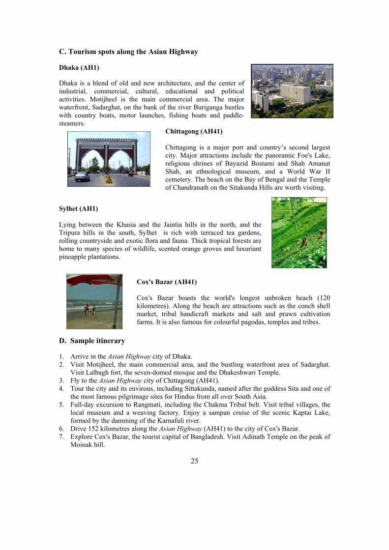
Status of the Asian Highway in Bangladesh Paved (km)
Route No.
Itinerary Length(km) 2 Lanes
or more1 Lane
Unpaved (km)
Ferry (km)
MissingLink(km)
AH1 Tamabil – Sylhet – Katchpur – Dhaka – Jessore – Benapol
508 194 283 2 8 21
AH2 Tamabil – Sylhet – Katchpur – Dhaka
– Hatikamrul – Banglabandha 510 319 191
AH41 Teknaf – Cox’s Bazar – Chittagong – Katchpur – Dhaka – Hatikamrul – Jessore – Mongla
788 675 110 3
Total 1,806 1,188 584 2 11 21
Percentage 100 65.8 32.3 0.1 0.6 1.2
Asian Highway in Bangladesh
0
100
200
300
400
500
600
700
800
900
AH1 AH2 AH41
Len
gth
(k
m)
Missing link
Ferry
Unpaved
Paved 1 Lane
Paved 2 Lanes or more
508km
788km
510km
AH1 near Sylhet AH 2 Jamuna Bridge
25
C. Tourism spots along the Asian Highway
Dhaka (AH1)
Dhaka is a blend of old and new architecture, and the center of industrial, commercial, cultural, educational and political activities. Motijheel is the main commercial area. The major waterfront, Sadarghat, on the bank of the river Buriganga bustles with country boats, motor launches, fishing boats and paddle-steamers.
Chittagong (AH41)
Chittagong is a major port and country’s second largest city. Major attractions include the panoramic Foe's Lake, religious shrines of Bayazid Bostami and Shah Amanat Shah, an ethnological museum, and a World War II cemetery. The beach on the Bay of Bengal and the Temple of Chandranath on the Sitakunda Hills are worth visiting.
Sylhet (AH1)
Lying between the Khasia and the Jaintia hills in the north, and the Tripura hills in the south, Sylhet is rich with terraced tea gardens, rolling countryside and exotic flora and fauna. Thick tropical forests are home to many species of wildlife, scented orange groves and luxuriant pineapple plantations.
Cox's Bazar (AH41)
Cox's Bazar boasts the world's longest unbroken beach (120 kilometres). Along the beach are attractions such as the conch shell market, tribal handicraft markets and salt and prawn cultivation farms. It is also famous for colourful pagodas, temples and tribes.
D. Sample itinerary
1. Arrive in the Asian Highway city of Dhaka. 2. Visit Motijheel, the main commercial area, and the bustling waterfront area of Sadarghat.
Visit Lalbagh fort, the seven-domed mosque and the Dhakeshwari Temple. 3. Fly to the Asian Highway city of Chittagong (AH41). 4. Tour the city and its environs, including Sittakunda, named after the goddess Sita and one of
the most famous pilgrimage sites for Hindus from all over South Asia. 5. Full-day excursion to Rangmati, including the Chakma Tribal belt. Visit tribal villages, the
local museum and a weaving factory. Enjoy a sampan cruise of the scenic Kaptai Lake, formed by the damming of the Karnafuli river.
6. Drive 152 kilometres along the Asian Highway (AH41) to the city of Cox's Bazar. 7. Explore Cox's Bazar, the tourist capital of Bangladesh. Visit Adinath Temple on the peak of
Moinak hill.
26
8. Proceed on an excursion to Moheshkali Island. Visit old temples and the Rakhinee tribal village. Afternoon drive by jeep along the Asian Highway (AH41) to Himchari-Teknaf, the southernmost spot of Bangladesh.
9. Drive back to Chittagong. Fly back to Dhaka. 10. Depart Dhaka
E. Government Department responsible for Asian Highway Network
Department of Roads and Highways, Ministry of Communications, Dhaka, Bangladesh. Tel: (880-2) 9551343; Fax: (880-2) 9562798; E-mail: [email protected].
F. Useful contacts for travel and tourism information
Ministry of Civil Aviation and Tourism, Main Building, Bhaban 6, Civil Secretariat Dhaka 2, Bangladesh. Tel: (880-2) 861 8070; Fax: (880-2) 861 6896; Web1: www.bdtradeinfo.com/travel/index.asp; Web2: www.parjatan.org.
27
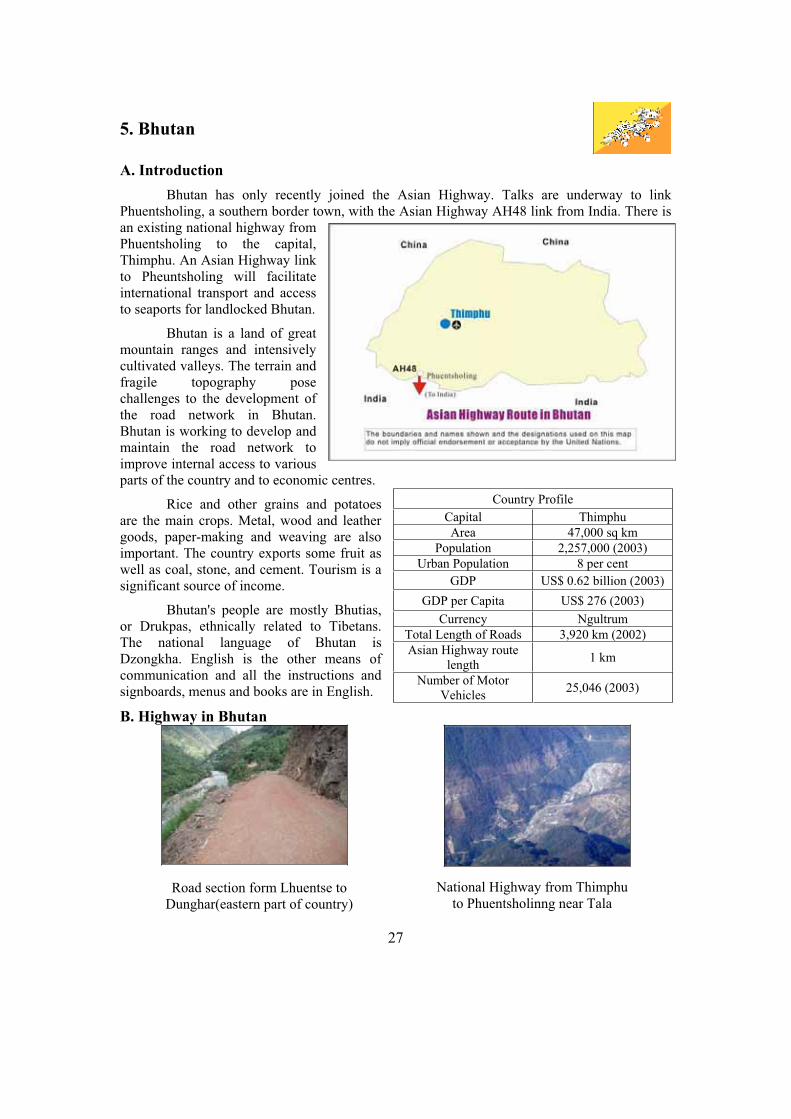
5. Bhutan
A. Introduction
Bhutan has only recently joined the Asian Highway. Talks are underway to link Phuentsholing, a southern border town, with the Asian Highway AH48 link from India. There is an existing national highway from Phuentsholing to the capital, Thimphu. An Asian Highway link to Pheuntsholing will facilitate international transport and access to seaports for landlocked Bhutan.
Bhutan is a land of great mountain ranges and intensively cultivated valleys. The terrain and fragile topography pose challenges to the development of the road network in Bhutan. Bhutan is working to develop and maintain the road network to improve internal access to various parts of the country and to economic centres.
Rice and other grains and potatoes are the main crops. Metal, wood and leather goods, paper-making and weaving are also important. The country exports some fruit as well as coal, stone, and cement. Tourism is a significant source of income.
Bhutan's people are mostly Bhutias, or Drukpas, ethnically related to Tibetans. The national language of Bhutan is Dzongkha. English is the other means of communication and all the instructions and signboards, menus and books are in English.
B. Highway in Bhutan
Country Profile
Capital Thimphu
Area 47,000 sq km
Population 2,257,000 (2003)
Urban Population 8 per cent
GDP US$ 0.62 billion (2003)
GDP per Capita US$ 276 (2003)
Currency Ngultrum
Total Length of Roads 3,920 km (2002)
Asian Highway route length
1 km
Number of Motor Vehicles
25,046 (2003)
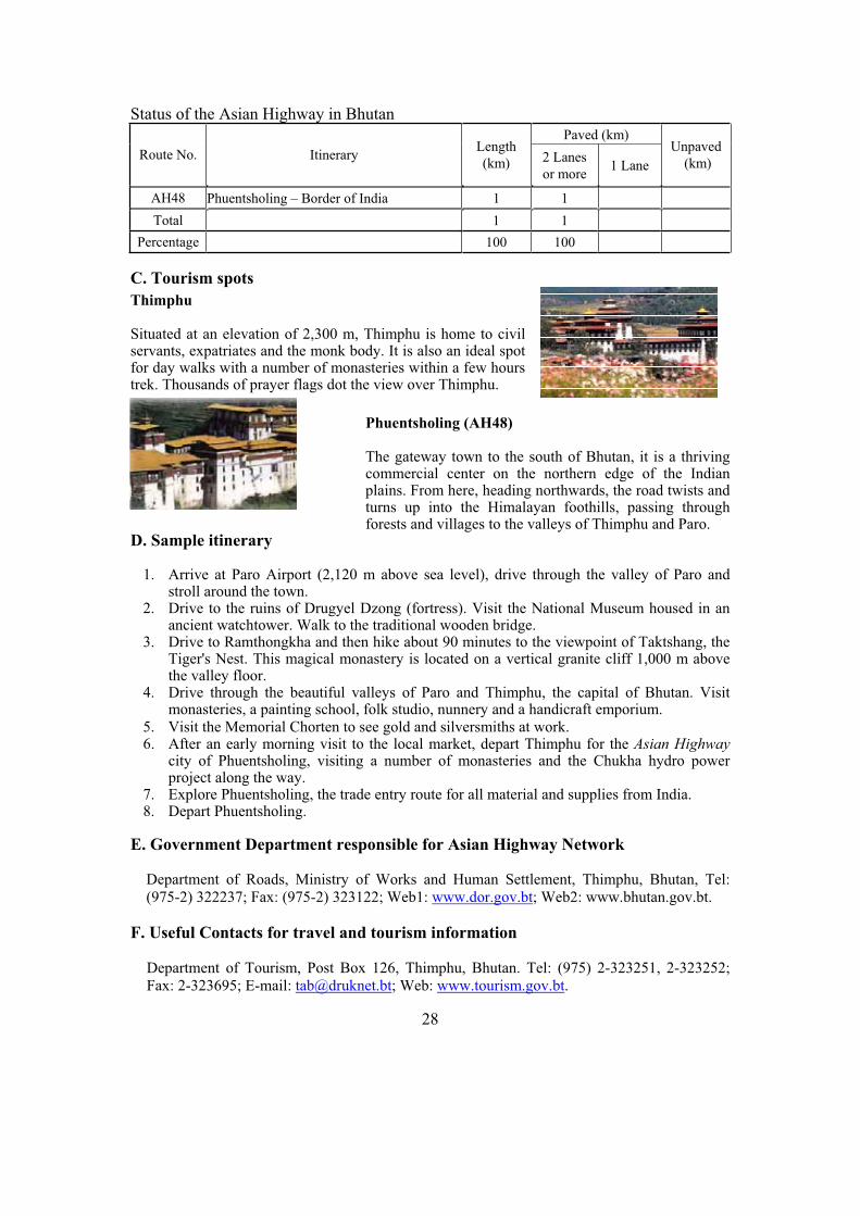
Road section form Lhuentse to Dunghar(eastern part of country)
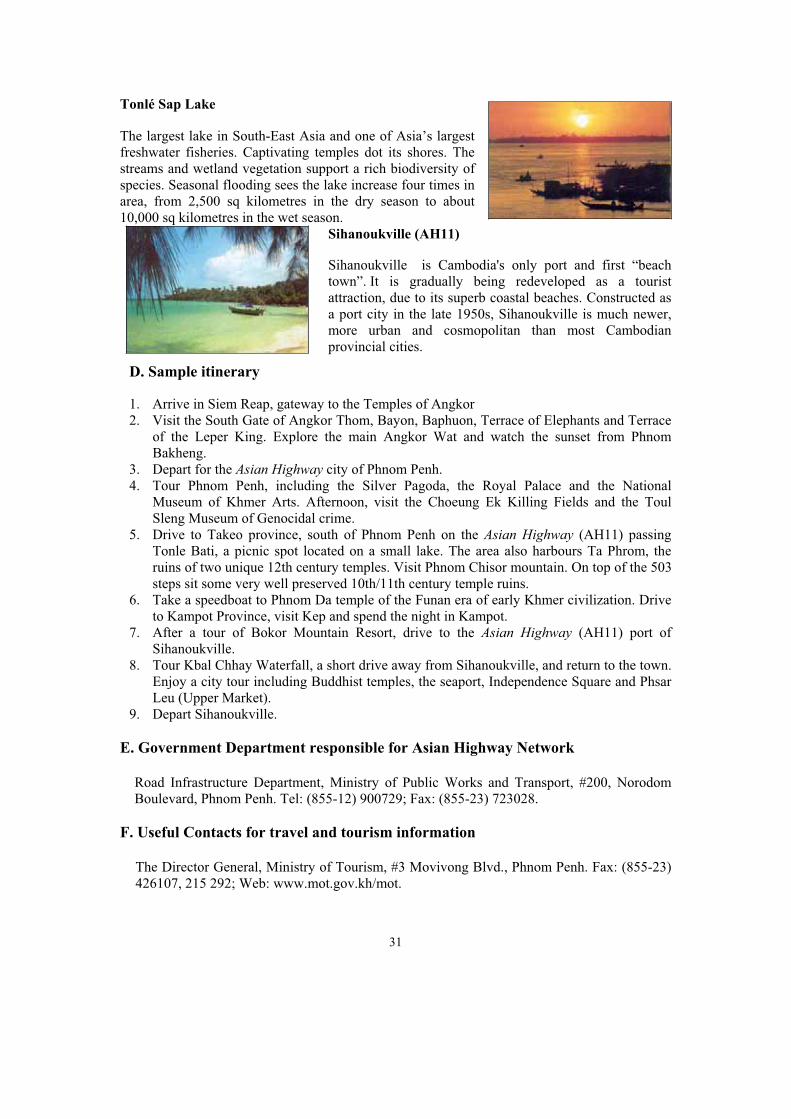
National Highway from Thimphu to Phuentsholinng near Tala
28
Status of the Asian Highway in Bhutan
Paved (km)
Route No. Itinerary Length
(km) 2 Lanes
or more 1 Lane
Unpaved
(km)
AH48 Phuentsholing – Border of India 1 1
Total 1 1
Percentage 100 100
C. Tourism spots
Thimphu
Situated at an elevation of 2,300 m, Thimphu is home to civil servants, expatriates and the monk body. It is also an ideal spot for day walks with a number of monasteries within a few hours trek. Thousands of prayer flags dot the view over Thimphu.
Phuentsholing (AH48)
The gateway town to the south of Bhutan, it is a thriving commercial center on the northern edge of the Indian plains. From here, heading northwards, the road twists and turns up into the Himalayan foothills, passing through forests and villages to the valleys of Thimphu and Paro.
D. Sample itinerary
1. Arrive at Paro Airport (2,120 m above sea level), drive through the valley of Paro and stroll around the town.
2. Drive to the ruins of Drugyel Dzong (fortress). Visit the National Museum housed in an ancient watchtower. Walk to the traditional wooden bridge.
3. Drive to Ramthongkha and then hike about 90 minutes to the viewpoint of Taktshang, the Tiger's Nest. This magical monastery is located on a vertical granite cliff 1,000 m above the valley floor.
4. Drive through the beautiful valleys of Paro and Thimphu, the capital of Bhutan. Visit monasteries, a painting school, folk studio, nunnery and a handicraft emporium.
5. Visit the Memorial Chorten to see gold and silversmiths at work. 6. After an early morning visit to the local market, depart Thimphu for the Asian Highway
city of Phuentsholing, visiting a number of monasteries and the Chukha hydro power project along the way.
7. Explore Phuentsholing, the trade entry route for all material and supplies from India. 8. Depart Phuentsholing.
E. Government Department responsible for Asian Highway Network
Department of Roads, Ministry of Works and Human Settlement, Thimphu, Bhutan, Tel: (975-2) 322237; Fax: (975-2) 323122; Web1: www.dor.gov.bt; Web2: www.bhutan.gov.bt.
F. Useful Contacts for travel and tourism information
Department of Tourism, Post Box 126, Thimphu, Bhutan. Tel: (975) 2-323251, 2-323252; Fax: 2-323695; E-mail: [email protected]; Web: www.tourism.gov.bt.

29
6. Cambodia
A. Introduction
The Asian Highway routes link Cambodia to Lao People’s Democratic Republic, Thailand, and Viet Nam and provide access to the important port of Sihanoukville. Cambodia is improving its road network, the dominant mode of transport, to facilitate links with neighbouring countries, and to open up to trade and tourism.
The heart of the country consists of a large central alluvial plain, drained by the Mekong River and the Tônlé Sap (Great Lake). Mountains flank the plain in the north west and south west.
Cambodia has a tropical climate with monsoons, ideal for growing rice, the chief crop. Corn, vegetables, peanuts, tobacco, and sugar palm are also grown. The industrial sector centres on the processing of agricultural products. Both the industrial and agricultural sectors were devastated during the civil war and strife of the 1970s and 1980s.
About 90 per cent of the population is ethnic Khmer (Cambodian). Minorities include Chinese, Vietnamese, Cham-Malays, and a number of hill tribes. Khmer is the national language, but French is widely spoken.
Country Profile
Capital Phnom Penh
Area 181,040 sq km
Population 14,144,000 (2003)
Urban Population 19 per cent
GDP US$ 18.7 billion (2001
est.)
GDP per Capita US$ 1,500 (2001 est.)
Currency Riel
Major Ports Sihanoukville
Length of Roads 12,323 km (2000)
length of Asian Highway route
1,340 km
Number of Motor Vehicles
350,257 (2000)

30
B. Asian Highway in Cambodia
Status of the Asian Highway in Cambodia Paved (km)
Route No.
Itinerary Length(km) 2 Lanes
or more1 Lane
Unpaved (km)
Ferry (km)
AH1 Bavet – Phnom Penh – Poipet 575 573 2
AH11 Tranpeangkreal – Stung Treng – Kratie – Phnom Penh – Sihanoukville
765 764 1
Total 1,340 1,337 3
Percentage 100 99.8 0.2
C. Tourism spots along the Asian Highway
Phnom Penh (AH1/AH11)
Phnom Penh is located at the confluence of three rivers - the Mekong, the Bassac and Tônlé Sap which feeds into the lake of the same name. Once known as the Pearl of Asia but heavily damaged by war in the 1970s, the city is experiencing a renaissance. It has an exotic blend of Asian and European influence.
The Temples of Angkor
Accessible from Siem Reap (off AH1), Angkor is one of the most important archaeological sites in South-East Asia. Stretching over some 400 sq kilometres, Angkor Archaeological Park contains the magnificent remains of the different capitals of the Khmer Empire, from the 9th to the 15th century. Angkor Wat became a UNESCO World Heritage Site in 1992.
AH11: near Kizuma BridgeAH1: from Pursat to Battambang
31
Tonlé Sap Lake
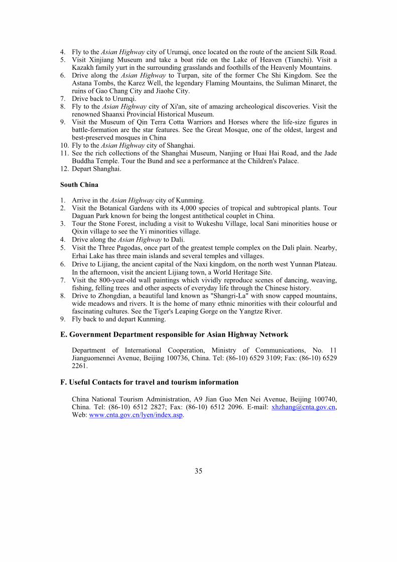
The largest lake in South-East Asia and one of Asia’s largest freshwater fisheries. Captivating temples dot its shores. The streams and wetland vegetation support a rich biodiversity of species. Seasonal flooding sees the lake increase four times in area, from 2,500 sq kilometres in the dry season to about 10,000 sq kilometres in the wet season.
Sihanoukville (AH11)
Sihanoukville is Cambodia's only port and first “beach town”. It is gradually being redeveloped as a tourist attraction, due to its superb coastal beaches. Constructed as a port city in the late 1950s, Sihanoukville is much newer, more urban and cosmopolitan than most Cambodian provincial cities.
D. Sample itinerary
1. Arrive in Siem Reap, gateway to the Temples of Angkor 2. Visit the South Gate of Angkor Thom, Bayon, Baphuon, Terrace of Elephants and Terrace
of the Leper King. Explore the main Angkor Wat and watch the sunset from Phnom Bakheng.
3. Depart for the Asian Highway city of Phnom Penh. 4. Tour Phnom Penh, including the Silver Pagoda, the Royal Palace and the National
Museum of Khmer Arts. Afternoon, visit the Choeung Ek Killing Fields and the Toul Sleng Museum of Genocidal crime.
5. Drive to Takeo province, south of Phnom Penh on the Asian Highway (AH11) passing Tonle Bati, a picnic spot located on a small lake. The area also harbours Ta Phrom, the ruins of two unique 12th century temples. Visit Phnom Chisor mountain. On top of the 503 steps sit some very well preserved 10th/11th century temple ruins.
6. Take a speedboat to Phnom Da temple of the Funan era of early Khmer civilization. Drive to Kampot Province, visit Kep and spend the night in Kampot.
7. After a tour of Bokor Mountain Resort, drive to the Asian Highway (AH11) port of Sihanoukville.
8. Tour Kbal Chhay Waterfall, a short drive away from Sihanoukville, and return to the town. Enjoy a city tour including Buddhist temples, the seaport, Independence Square and Phsar Leu (Upper Market).
9. Depart Sihanoukville.
E. Government Department responsible for Asian Highway Network
Road Infrastructure Department, Ministry of Public Works and Transport, #200, Norodom Boulevard, Phnom Penh. Tel: (855-12) 900729; Fax: (855-23) 723028.
F. Useful Contacts for travel and tourism information
The Director General, Ministry of Tourism, #3 Movivong Blvd., Phnom Penh. Fax: (855-23) 426107, 215 292; Web: www.mot.gov.kh/mot.

32
7. China
A. Introduction
The Asian Highway routes link China to the Democratic People’s Republic of Korea, Kazakhstan, Lao People’s Democratic Republic, Mongolia, Myanmar, Nepal, Pakistan, the Russian Federation, Thailand and Viet Nam. The routes provide important access from landlocked Mongolia and Central Asian countries to seaports like Tianjin, Shanghai, Dalian, and Guangzhou. Road infrastructure has developed rapidly.
In the Tenth Five-Year Economic and Social Development Plan, the goals are primarily to establish a national and international trunk network in order to spread economic benefits to the hinterlands.
China is the world's third largest country (after the Russian Federation and Canada). The economy is the world’s third largest. About 60 per cent of the work force is engaged in agriculture. Principal crops are food grains, including rice, wheat, corn, millet, barley, kaoliang (a form of sorghum), peanuts, sweet potatoes, soybeans, cotton, tobacco and tea. China is one of the world's major mineral-producing
Country Profile
Capital Beijing
Area 9,596,960 sq km
Population 1,319,767,000 (2003)
Urban Population 39 per cent
GDP US$ 1,332 billion (2003)
GDP per Capita US$ 1,009 (2003)
Currency Yuan
Major Ports Shanghai, Dalian,
Lianyungang & Tianjin
Total Length of Roads 1,765,222 km (2002)
Asian Highway route length
27,846 km
Number of Motor Vehicles
20,530,000 (2002)

33
countries. Reserves of coal, its most abundant mineral and principal energy source, rank among the world’s largest. The country's enormous hydroelectric potential is being rapidly developed.
China produces textiles, chemicals, agriculture-related products, such as farm machinery, as well as machine tools, processed foods, iron and steel, building materials, and electronic equipment.
Although the Han (ethnic Chinese) constitute 92 per cent of the total population, 56 recognized minority groups exist mainly in Tibet and Xinjiang. Mandarin dialects, the basis of the national language, are uniformly spoken in the north, but in the south, many dialects, including Cantonese, Wu, and Hakka, are spoken; the written language is common to all dialects. Other minorities include the Zhuangs, Huis, Uigurs, Tibetans, and Mongols.
B. Asian Highway in China
Status of the Asian Highway in China Paved (km)
Route
No. Itinerary
Length
(km) 2 Lanes
or more 1 Lane
Unpaved
2 Lanes
or more
(km)
AH1
Dandong – Shenyang – Beijing – Shijiazhuang –
Zhengzhou – Xinyang – Wuhan – Changsha –
Guangzhou (– Shenzhen) – Nanning – Youyiguan
4,283 4,283
AH3
Erlanhot – Beijing – Tanggu
Shanghai – Hangzhou – Nanchang – Changsha –
Guiyang – Kunming – Jinghong (– Daluo) – Mohan
3,926 3,869 57
AH4 Urumqi – Kashi – Honqiraf 1,863 1,863
AH5 Shanghai – Nanjing – Xinyang – Xi’an – Lanzhou –
Urumqi – Kuitun – Jinghe – Horgos 4,815 4,815
AH6 Suifenhe – Harbin – Qiqihar – Manzhouli 1,523 1,523
AH14 Hekou – Kunming – Ruili 1,178 1,178
AH31 Heihe – Harbin – Changchun – Shenyang – Dalian 1,471 1,471
AH32 Quanhe – Hunchun – Changchun – Arshan 1,131 1,131
AH33 Harbin – Tongjiang 575 575
AH34 Lianyungang – Zhengzhou – Xi’an 1,033 1,033
AH42 Lanzhou – Xining – Golmud – Lhasa– Zhangmu 2,893 2,418 475
AH61 Kashi – Turgat 169 169
AH65 Kashi – Yi'erkeshitan 235 235
AH5: to Kogros (Border of kazakhstan)AH3: Beijin to Tanggu

34
AH67 Kuitun – Baketu 390 390
AH68 Jinghe – Alashan 94 94
Total 25,579 25,047 532
Percentage 100 97.9 2.1
Note: The underlined sections indicate potential Asian Highway routes
C. Tourism spots along the Asian Highway
The Great Wall, Beijing (AH1/AH3)
In about 220 B.C., under Qin Shi Huang, sections of earlier fortifications were merged to form a united defence system against invasions from the north. Construction continued up to the Ming dynasty (1368–1644), when the Great Wall became the world's largest military structure. Its historic and strategic importance is matched only by its architectural significance.
Stone Forest, Kunming (AH14)
Located in Shilin County, 84 kilometres to the south east of Kunming, the stone peaks, stalagmites and stalactites of the “Stone Forest” are estimated to have been formed 200 to 230 million years ago. From a distance, they look like a vast expanse of forests, and are one of the most visited spots in Yunnan Province.
The Yufo (Jade Budha) Temple, Shanghai (AH3)
Located in Shanghai, the Temple was built in 1882 but remains in perfect condition as a sanctuary of Zen Buddhism. The Temple derived its name from a jade statue of Sakyamuni from Myanmar. It contains a graceful image of the Buddha with a serene and calm look.
Xi’an (AH5)
The Mausoleum of the First Qin Emperor, was discovered in 1974. Qin, who died in 210 B. C., was the first unifier of China. He is buried at the site, surrounded by the famous terracotta warriors. The lifesized figures are all different; with their horses, chariots and weapons, they are masterpieces of realism and also of great historical interest.
D. Sample itineraries
North China
1. Arrive in the Asian Highway city of Beijing 2. Visit Tiananmen Square and the Forbidden City's Imperial Palace, featuring the living
quarters, museum and jewelry sections. Visit the Summer Palace and Lake Kunming. 3. Walk the ancient ramparts of the Great Wall. Stroll along the Sacred Way between statues of
warriors and fantastic animals to visit the Ming Tombs and Chang Ling Exhibition Hall.
35
4. Fly to the Asian Highway city of Urumqi, once located on the route of the ancient Silk Road. 5. Visit Xinjiang Museum and take a boat ride on the Lake of Heaven (Tianchi). Visit a
Kazakh family yurt in the surrounding grasslands and foothills of the Heavenly Mountains. 6. Drive along the Asian Highway to Turpan, site of the former Che Shi Kingdom. See the
Astana Tombs, the Karez Well, the legendary Flaming Mountains, the Suliman Minaret, the ruins of Gao Chang City and Jiaohe City.
7. Drive back to Urumqi. 8. Fly to the Asian Highway city of Xi'an, site of amazing archeological discoveries. Visit the
renowned Shaanxi Provincial Historical Museum. 9. Visit the Museum of Qin Terra Cotta Warriors and Horses where the life-size figures in
battle-formation are the star features. See the Great Mosque, one of the oldest, largest and best-preserved mosques in China
10. Fly to the Asian Highway city of Shanghai. 11. See the rich collections of the Shanghai Museum, Nanjing or Huai Hai Road, and the Jade
Buddha Temple. Tour the Bund and see a performance at the Children's Palace. 12. Depart Shanghai.
South China
1. Arrive in the Asian Highway city of Kunming. 2. Visit the Botanical Gardens with its 4,000 species of tropical and subtropical plants. Tour
Daguan Park known for being the longest antithetical couplet in China. 3. Tour the Stone Forest, including a visit to Wukeshu Village, local Sani minorities house or
Qixin village to see the Yi minorities village. 4. Drive along the Asian Highway to Dali. 5. Visit the Three Pagodas, once part of the greatest temple complex on the Dali plain. Nearby,
Erhai Lake has three main islands and several temples and villages. 6. Drive to Lijiang, the ancient capital of the Naxi kingdom, on the north west Yunnan Plateau.
In the afternoon, visit the ancient Lijiang town, a World Heritage Site. 7. Visit the 800-year-old wall paintings which vividly reproduce scenes of dancing, weaving,
fishing, felling trees and other aspects of everyday life through the Chinese history. 8. Drive to Zhongdian, a beautiful land known as "Shangri-La" with snow capped mountains,
wide meadows and rivers. It is the home of many ethnic minorities with their colourful and fascinating cultures. See the Tiger's Leaping Gorge on the Yangtze River.
9. Fly back to and depart Kunming.
E. Government Department responsible for Asian Highway Network
Department of International Cooperation, Ministry of Communications, No. 11 Jianguomennei Avenue, Beijing 100736, China. Tel: (86-10) 6529 3109; Fax: (86-10) 6529 2261.
F. Useful Contacts for travel and tourism information
China National Tourism Administration, A9 Jian Guo Men Nei Avenue, Beijing 100740, China. Tel: (86-10) 6512 2827; Fax: (86-10) 6512 2096. E-mail: [email protected],Web: www.cnta.gov.cn/lyen/index.asp.

36
8. Democratic People’s Republic of Korea
A. Introduction
The Asian Highway routes link the Democratic People’s Republic of Korea to China, the Russian Federation and the Republic of Korea and also to Rajin, Chongjin and Wonjong major seaports. Development of the Asian Highway routes in the Democratic People’s of Korea is essential to connect the Korean Peninsula and mainland Asia.
The Democratic People’s Republic of Korea is focusing on roads as an important mode of transport. Expressway and road construction programmes in the countryside are being implemented.
The mountainous interior is isolated and sparsely populated. The climate is temperate with rainfall concentrated in the summer. Its natural resources are coal, lead, tungsten, zinc, graphite, magnetite, iron ore, copper, gold, pyrites, salt, fluorspar, and hydropower. The official language is Korean.
B. Asian Highway in Democratic People’s Republic of Korea
Country Profile
Capital Pyongyang
Area 120,538 sq km
Population 22,664,000 (2003)
Urban Population 61 per cent
GDPUS$ 22 billion (2002
est.)
GDP per Capita US$ 1,000 (2002 est.)
Currency Won (KPW)
Major Ports Rajin, Chongjin,
Wonjong
Total Length of Roads 31,210 km (2000)
Asian Highway route length
1,320 km
Number of Motor Vehicles
N.A
37
Status of the Asian Highway in Democratic People’s Republic of Korea
Paved (km) Route No.
Itinerary Length(km) 2 Lanes
or more 1 Lane
UnKnown
(km)
AH1 Panmunjom – Pyongyang – Sinuiju 405 405
AH6 Kosong – Wonsan (– Pyongyang ) – Chongjin –Sonbong – Khasan – Border of Russian Federation
855 855
AH32 Sonbong – Wongjong 60 60
Total 1,320 1,320
Percentage 100 100
C. Tourism spots along the Asian Highway
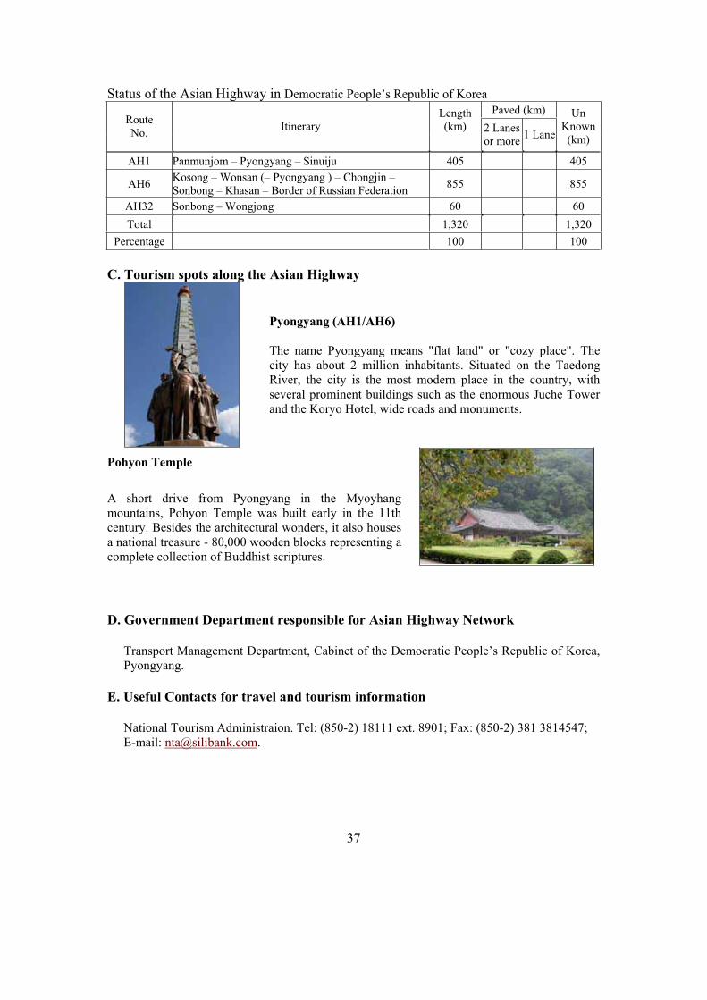
Pyongyang (AH1/AH6)
The name Pyongyang means "flat land" or "cozy place". The city has about 2 million inhabitants. Situated on the Taedong River, the city is the most modern place in the country, with several prominent buildings such as the enormous Juche Tower and the Koryo Hotel, wide roads and monuments.
Pohyon Temple
A short drive from Pyongyang in the Myoyhang mountains, Pohyon Temple was built early in the 11th century. Besides the architectural wonders, it also houses a national treasure - 80,000 wooden blocks representing a complete collection of Buddhist scriptures.
D. Government Department responsible for Asian Highway Network
Transport Management Department, Cabinet of the Democratic People’s Republic of Korea, Pyongyang.
E. Useful Contacts for travel and tourism information
National Tourism Administraion. Tel: (850-2) 18111 ext. 8901; Fax: (850-2) 381 3814547; E-mail: [email protected].

38
9. Georgia
A. Introduction
The Asian Highway routes link Georgia with Armenia, Azerbaijan, the Russian Federation and Turkey and by sea ferry to Bulgaria, Romania and Ukraine from Poti and Sarpi seaports in the Black Sea. Georgia is implementing a Presidential order to upgrade and rehabilitate the entire road network by 2010.
Described variously as part of Europe, Central Asia or the Middle East, Georgia has long been a meeting place of east and west. A mountainous country rich in minerals and coal, Georgia produces iron and steel, machinery, and chemicals. Agricultural products include tea, citrus fruits, and tobacco. The Black Sea coast is a popular resort area.
In addition to the Georgian majority, which comprises about 70 per cent of the population, there are Armenian, Russian, Ossetian and other minorities. Georgian, a Caucasian language, and Russian are spoken.
B. Asian Highway
Country Profile
Capital Tbilisi
Area 69,700 sq km
Population 5,126,000 (2003)
Urban Population 57 per cent
GDP US$ 3.67 billion (2003)
GDP per Capita US$ 716 (2003)
Currency Lari
Major ports Poti and Batumi
Total Length of Roads 20,362 km (2000)
Asian Highway route length
1,154 km
Number of Motor Vehicles
311,577 (2000)
AH5 in Tbilisi AH81 to the Border of Armenia

39
Status of the Asian Highway in Georgia
Paved (km) Route No.
Itinerary Length(km) 2 Lanes
or more 1 Lane
AH5 Red Bridge – Tbilisi – Mtskheta – Khashuri – Senaki –Poti ( – Ferry to Bulgaria, Romania, Ukraine) – Batumi ( – Ferry to Bulgaria, Romania, Ukraine) – Sarpi
489 489
AH81 Larshi – Mtskheta – Tbilisi – Sadakhlo 203 203
AH82 Border of the Russian Federation – Leselidze – Sukhumi – Senaki – Khashuri – Akhaltsikhe (– Vale) – Zhdanov
462 462
Total 1,154 1,154
Percentage 100 100
C. Tourism spots along the Asian Highway
The Sioni Cathedral church, Tbilisi (AH5/AH81)
Located in Tbilisi, the Cathedral is one of the major landmarks, famous for its historical monuments and gorgeous architecture. Tbilisi is a major economic and cultural centre, which also includes the ancient Narikhala fortress and the Paliashvili Opera House, founded in 1851.
Poti (AH5)
Known as the Gateway port to the Caucuses and Central Asia, Poti is supposed to be the legendary city in the story of Jason and his Argonauts, who entered the territory oftoday's Georgia at Phazisi (Poti). Constructed under the Tsar Nikolai II, it is one of the region’s most important ports.
D. Sample itinerary
1. Arrive in the Asian Highway city of Tbilisi. 2. Tour Tbilisi. Explore the basilica style Anchiskhati Church, Metekhi Temple and the
Abanotubani, the area famous for the sulfur baths with Asian style buildings. Tour Georgia's ancient capital, Mtskheta.
3. Drive along the Aragvi River Valley and the Georgian Military Highway to the small town of Kazbegi in the Caucasus Mountains. Walk up to Gergeti Sameba Church to enjoy fascinating mountain views. Drive to Gudauri, ski resort on the south slopes of the Caucasian main range.
4. Visit Gori, a historical town known for its huge fortress and as the birthplace of Joseph Stalin. Continue to the ancient Uplistsikhe cave town and Borjomi, the most famous mountain spa resort in Georgia, known for its mineral water. Visit the Bakuriani ski resort.
5. Drive to Vardzia, site of the most famous cave city in Georgia. 6. Drive along the Asian Highway (AH5) from the mountains to the Black Sea coast. En
route, stop in the Asian Highway city of Kutaisi, the capital of Western Georgia and visit the Bagrati Temple and Gelati Monastery. Arrive in the Asian Highway city of Batumi.
lisi
40
7. Explore Batumi, an exotic subtropical city on the seacoast. Tour the Gonio Fortress and walk through Batumi's Old Town with its historical boulevards and buildings.
8. Depart for Tbilisi, visiting the 11th century Samtavisi Church on the way. Arrive in Tbilisi.
9. Explore Tbilisi, see the Museum of Fine Arts with its priceless masterpieces of Georgian ancient art. Experience the rich traditions of Georgian folk songs and dances.
10. Depart Tbilisi.
E. Government Department responsible for Asian Highway Network
Department of International Relations, Ministry of Transport and Communications, 12, Rustaveli Stveh, Tbilisi, Georgia. Tel: (95-32) 77479717; Fax: (996-32) 999899.
F. Useful Contacts for travel and tourism information
State Department of Tourism and Resorts, 80 Chavchavadze Ave, Tbilisi, 380062, Georgia. Tel: (99532) 294052; Fax: (99532) 294052; E-mail: [email protected]; Web: http://georgia-gateway.org/DTR/index.php3.

41
10. India
A. Introduction
The Asian Highway routes link India to Bangladesh, Nepal, Myanmar, Pakistan, and Sri Lanka (by ferry) and provide access to the ports of Kolkota, Chennai, Visakhapatnam and Mumbai. The routes are important in providing access to seaports for the landlocked countries of Bhutan and Nepal. India is upgrading the Golden Quadrilateral (Delhi-Mumbai-Chennai-Kolkata-Delhi), North-South Corridor (Srinagar - Kanyakumari with Salem-Cochin link) and East-West Corridor (Silchar-Porbandar), using resources from a special levy on fuel, government funding and assistance of multilateral agencies.
India is the world's second most populous country after China.
The Ganges River flows through the heart of the nation. Economically, village India is supported by agriculture, while urban India is one of the most heavily industrialized areas in the world. The traditional textile industry is still important. Heavy industry produces iron and steel, machine tools, transportation equipment, and chemicals. Cut gems, jewelry, and, increasingly, computer software are important exports.
About 70 per cent of the work force is engaged in agriculture, growing rice, wheat, peanuts, corn, and millet; cash crops are sugarcane, tea, oilseeds, cotton, tobacco, and jute. Among rich mineral resources are coal, zinc, iron, manganese, mica, bauxite, and lead.
2 Including data for the Indian-held part of Jammu and Kashmir, the final status of which has not been
determined.
Country profile2
Capital New Delhi
Area 3,287,590 sq km
Population 1,068,512,000 (2003)
Urban Population 28 per cent
GDP US$ 533 billion (2003)
GDP per Capita US$ 499 (2003)
Currency Indian Rupee
Major ports Kolkata, Chennai and
JNPT Mumbai
Total Length of Roads 3,300,000 (2003)
Asian Highway route length
11,432 km
Number of Motor Vehicles
48,390,000 (2000)
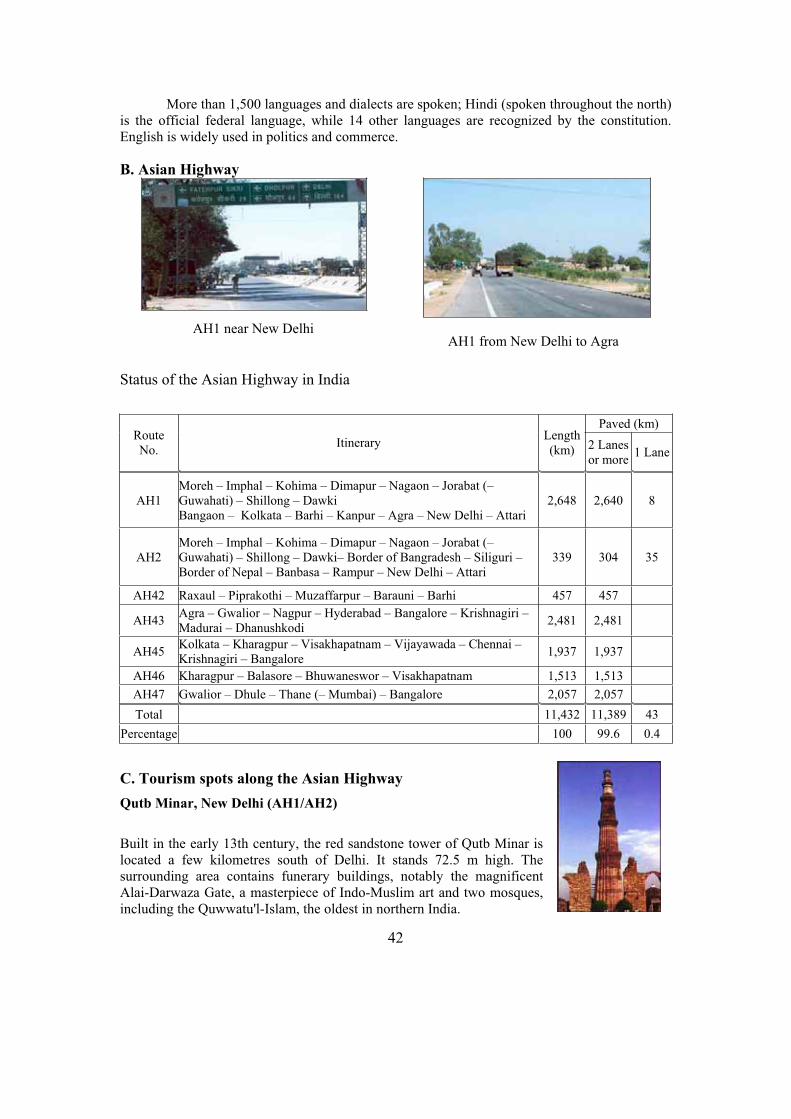
42
More than 1,500 languages and dialects are spoken; Hindi (spoken throughout the north) is the official federal language, while 14 other languages are recognized by the constitution. English is widely used in politics and commerce.
B. Asian Highway
Status of the Asian Highway in India
C. Tourism spots along the Asian Highway
Qutb Minar, New Delhi (AH1/AH2)
Built in the early 13th century, the red sandstone tower of Qutb Minar is located a few kilometres south of Delhi. It stands 72.5 m high. The surrounding area contains funerary buildings, notably the magnificent Alai-Darwaza Gate, a masterpiece of Indo-Muslim art and two mosques, including the Quwwatu'l-Islam, the oldest in northern India.
Paved (km) Route No.
Itinerary Length(km) 2 Lanes
or more 1 Lane
AH1 Moreh – Imphal – Kohima – Dimapur – Nagaon – Jorabat (–Guwahati) – Shillong – Dawki Bangaon – Kolkata – Barhi – Kanpur – Agra – New Delhi – Attari
2,648 2,640 8
AH2 Moreh – Imphal – Kohima – Dimapur – Nagaon – Jorabat (–Guwahati) – Shillong – Dawki– Border of Bangradesh – Siliguri – Border of Nepal – Banbasa – Rampur – New Delhi – Attari
339 304 35
AH42 Raxaul – Piprakothi – Muzaffarpur – Barauni – Barhi 457 457
AH43 Agra – Gwalior – Nagpur – Hyderabad – Bangalore – Krishnagiri – Madurai – Dhanushkodi
2,481 2,481
AH45 Kolkata – Kharagpur – Visakhapatnam – Vijayawada – Chennai – Krishnagiri – Bangalore
1,937 1,937
AH46 Kharagpur – Balasore – Bhuwaneswor – Visakhapatnam 1,513 1,513
AH47 Gwalior – Dhule – Thane (– Mumbai) – Bangalore 2,057 2,057
Total 11,432 11,389 43
Percentage 100 99.6 0.4
AH1 from New Delhi to Agra AH1 near New Delhi

43
The Taj Mahal, Agra (AH1)
An immense mausoleum of white marble built between 1631 and 1648 by order of the Mughal emperor Shah Jahan in memory of his favourite wife, the Taj Mahal is one of the universally admired masterpieces of world heritage.
Ajanta Caves
The first Buddhist cave monuments at Ajanta date from the 1st
and 2nd centuries B.C. During the Gupta period (5th and 6th
centuries A.D.), many more richly decorated caves were added to the original group. The paintings and sculptures of Ajanta are considered stunning works of Buddhist art.
The Meenakshi Temple, Madurai (AH43)
The Meenakshi Temple is located in Madurai, about 480 km from Chennai. It is famous for the gigantic, profusely carved gateways, one of which is 49 metres in height. The temple has exquisite sculptures, ornate pillars and painted ceilings.
D. Sample itineraries
North India
1. Arrive in the Asian Highway city of New Delhi. 2. See the sights of old and New Delhi, visiting the Red Fort, Jama Masjid, cremation grounds
of Mahatama Gandhi, Parliament House, Presidential Buildings, Humayun’s Tomb, Qutub Minar, Birla Temple, Connaught Place, and downtown shopping area.
3. Drive from Delhi along the Asian Highway (AH43) to the historic city of Agra. 4. Visit Taj Mahal, Agra Fort and local markets. In the afternoon, depart Agra for Jaipur, en
route visiting the historic city of Fatehpur Sikri, a World Heritage Site with palaces, courtyards, reflecting pools and a great mosque.
5. Tour Jaipur, India’s Pink City. An excursion to the Amber Fort includes an elephant ride. Visit the Maharajah’s Palace, Hawa Mahal (the Palace of Winds), Royal Observatory, Albert Museum and Johari Bazar.
6. Depart by road from Jaipur for Delhi. 7. Depart Delhi.
South India
1. Arrive in the Asian Highway city of Chennai.

44
2. Tour Mahabalipuram and Kanchipuram, famous as a city of 1,000 Temples. It still has 124 shrines. In turn, Mahabalipuram is famous for the seven pagodas. Evening take the train to Trichy.
3. Arrive Trichy. Tour Lord Robert Clive's house, the Danish Church and the Rock-Fort. Climb 434 steps to the ancient temple of Ganapati and further to a Shiva temple.
4. Drive to the Asian Highway (AH43) city of Madurai. En route, stop at Tanjore to visit the beautiful Chola temple of Brihadeeshwara which is capped by a monolithic cupola made of a single granite block weighing 80 tons.
5. Visit the great Meenakshi Temple dedicated to the consort of Lord Shiva with its towering gates. Tour the Tirumala Nayak Palace - a gracious building famous for the Stucco work on its domes and arches.
6. Drive to Periyar. The earliest wildlife sanctuary to be set up in 1934; it forms part of the high mountain ranges, the Western Ghats. Cruise the Periyar Lake in a motor boat.
7. Drive to Cochin. 8. Tour Cochin, famous for its churches, mosques and temples as well as a natural harbour
created by underwater mud-banks; the rougher the seas are outside, the calmer the waters are within. The Portuguese explorer Vasco de Gama placed the city on the world map.
9. Morning flight to the Asian Highway city of Bangalore. Tour Bangalore, one of India’s rapidly emerging cities thanks to its growing Information Technology sector.
10. Depart Bangalore.
E. Government Department responsible for Asian Highway Network
Ministry of Road Transport and Highways, Parivahan Bhawan, 1 Parliament Street, New Delhi 110001, India. Tel: (91-11) 371 8568; Fax: (91-11) 371 0236.
F. Useful Contacts for travel and tourism information
Ministry for Culture and Tourism, Government of India, Transport Bhavan, 1 Sansad marg, New Delhi 110001, India. Tel: (91-11) 2371 8310; Fax: (91-11) 2373 1506; Web1: www.tourismofindia.com; Web2: www.india-tourism.com.
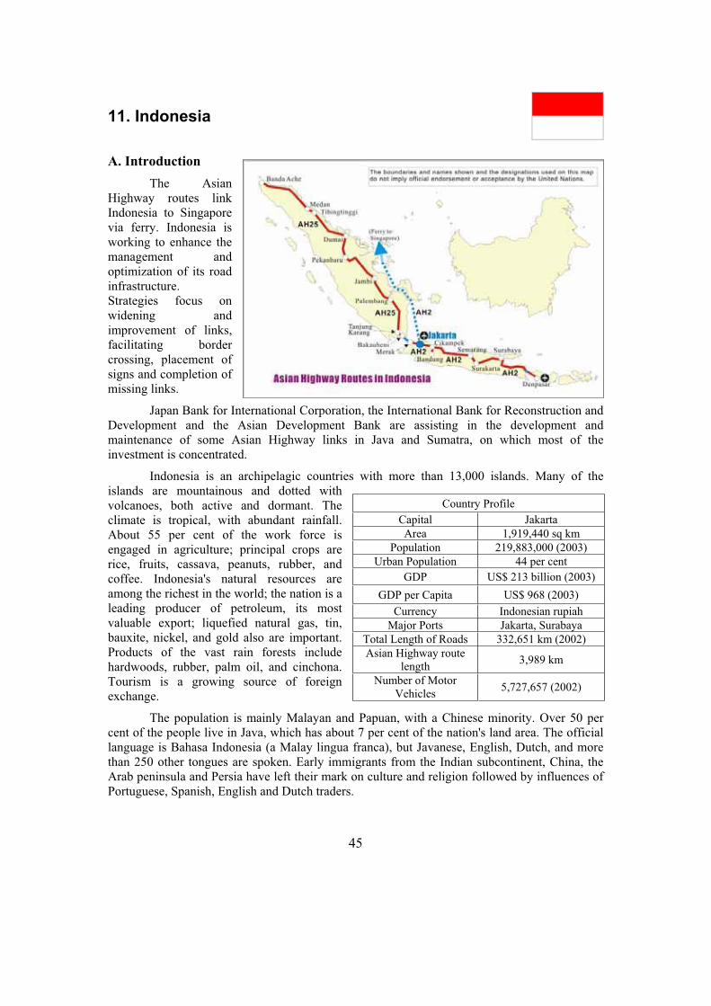
45
11. Indonesia
A. Introduction
The Asian Highway routes link Indonesia to Singapore via ferry. Indonesia is working to enhance the management and optimization of its road infrastructure. Strategies focus on widening and improvement of links, facilitating border crossing, placement of signs and completion of missing links.
Japan Bank for International Corporation, the International Bank for Reconstruction and Development and the Asian Development Bank are assisting in the development and maintenance of some Asian Highway links in Java and Sumatra, on which most of the investment is concentrated.
Indonesia is an archipelagic countries with more than 13,000 islands. Many of the islands are mountainous and dotted with volcanoes, both active and dormant. The climate is tropical, with abundant rainfall. About 55 per cent of the work force is engaged in agriculture; principal crops are rice, fruits, cassava, peanuts, rubber, and coffee. Indonesia's natural resources are among the richest in the world; the nation is a leading producer of petroleum, its most valuable export; liquefied natural gas, tin, bauxite, nickel, and gold also are important. Products of the vast rain forests include hardwoods, rubber, palm oil, and cinchona. Tourism is a growing source of foreign exchange.
The population is mainly Malayan and Papuan, with a Chinese minority. Over 50 per cent of the people live in Java, which has about 7 per cent of the nation's land area. The official language is Bahasa Indonesia (a Malay lingua franca), but Javanese, English, Dutch, and more than 250 other tongues are spoken. Early immigrants from the Indian subcontinent, China, the Arab peninsula and Persia have left their mark on culture and religion followed by influences of Portuguese, Spanish, English and Dutch traders.
Country Profile
Capital Jakarta
Area 1,919,440 sq km
Population 219,883,000 (2003)
Urban Population 44 per cent
GDP US$ 213 billion (2003)
GDP per Capita US$ 968 (2003)
Currency Indonesian rupiah
Major Ports Jakarta, Surabaya
Total Length of Roads 332,651 km (2002)
Asian Highway route length
3,989 km
Number of Motor Vehicles
5,727,657 (2002)

46
B. Asian Highway in Indonesia
Status of the Asian Highway in Indonesia
C. Tourism spots along the Asian Highway Jakarta (AH2)
Officially opened in 1868, the Jakarta National Museum is a centre for research and study into the national and cultural heritage. It also functions as an educative, cultural and recreational information centre. With a collection of more than 100,000 objects of historic and cultural significance, the museum is one of Jakarta's many prominent sights worth visiting.
Borobudur Temple, near Jogjakarta (AH2)
This famous Buddhist temple was restored with the help of UNESCO. The walls and balustrades are decorated with bas-reliefs, covering a total surface area of 2,500 sq metres. Around the circular platform are seventy-two openwork stupas, each containing a statue of the Buddha.
Paved (km) Route No.
Itinerary Length(km) 2 Lanes
or more 1 Lane
Unpaved (km)
Ferry (km)
AH2 Denpasar – Surabaya – Surakarta – Semarang – Cikampek (– Bandung) – Jakarta (– Merak)
1,440 1,432 8
AH25
Banda Aceh – Medan – Tibingtinggi – Dumai – Pekambaru – Jambi – Palembang – Tanjung Karang– Bakauheni – (Ferry) – Merak
2,549 2,523 26
Total 3,989 3955 34
Percentage 100 99.1 0.9
AH25: Province of Lampung (Sumatra)
AH2: Province of Central Java
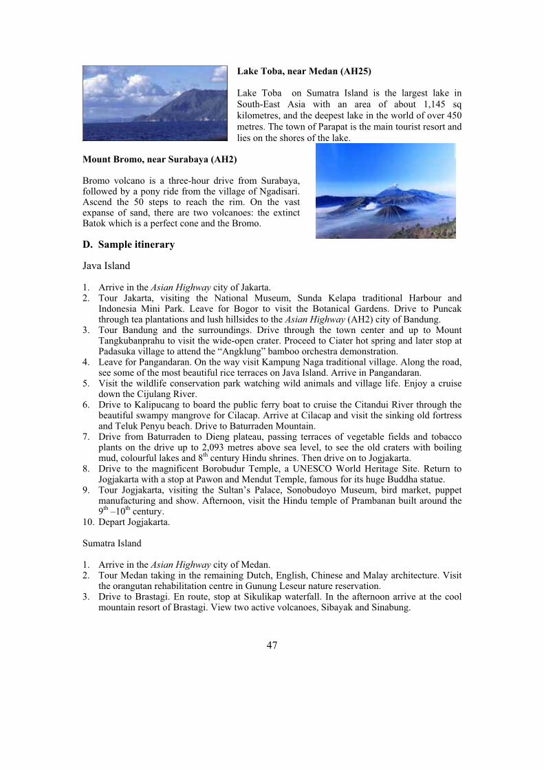
47
Lake Toba, near Medan (AH25)
Lake Toba on Sumatra Island is the largest lake in South-East Asia with an area of about 1,145 sq kilometres, and the deepest lake in the world of over 450 metres. The town of Parapat is the main tourist resort and lies on the shores of the lake.
Mount Bromo, near Surabaya (AH2)
Bromo volcano is a three-hour drive from Surabaya, followed by a pony ride from the village of Ngadisari. Ascend the 50 steps to reach the rim. On the vast expanse of sand, there are two volcanoes: the extinct Batok which is a perfect cone and the Bromo.
D. Sample itinerary
Java Island
1. Arrive in the Asian Highway city of Jakarta. 2. Tour Jakarta, visiting the National Museum, Sunda Kelapa traditional Harbour and
Indonesia Mini Park. Leave for Bogor to visit the Botanical Gardens. Drive to Puncak through tea plantations and lush hillsides to the Asian Highway (AH2) city of Bandung.
3. Tour Bandung and the surroundings. Drive through the town center and up to Mount Tangkubanprahu to visit the wide-open crater. Proceed to Ciater hot spring and later stop at Padasuka village to attend the “Angklung” bamboo orchestra demonstration.
4. Leave for Pangandaran. On the way visit Kampung Naga traditional village. Along the road, see some of the most beautiful rice terraces on Java Island. Arrive in Pangandaran.
5. Visit the wildlife conservation park watching wild animals and village life. Enjoy a cruise down the Cijulang River.
6. Drive to Kalipucang to board the public ferry boat to cruise the Citandui River through the beautiful swampy mangrove for Cilacap. Arrive at Cilacap and visit the sinking old fortress and Teluk Penyu beach. Drive to Baturraden Mountain.
7. Drive from Baturraden to Dieng plateau, passing terraces of vegetable fields and tobacco plants on the drive up to 2,093 metres above sea level, to see the old craters with boiling mud, colourful lakes and 8th century Hindu shrines. Then drive on to Jogjakarta.
8. Drive to the magnificent Borobudur Temple, a UNESCO World Heritage Site. Return to Jogjakarta with a stop at Pawon and Mendut Temple, famous for its huge Buddha statue.
9. Tour Jogjakarta, visiting the Sultan’s Palace, Sonobudoyo Museum, bird market, puppet manufacturing and show. Afternoon, visit the Hindu temple of Prambanan built around the 9th –10th century.
10. Depart Jogjakarta.
Sumatra Island
1. Arrive in the Asian Highway city of Medan. 2. Tour Medan taking in the remaining Dutch, English, Chinese and Malay architecture. Visit
the orangutan rehabilitation centre in Gunung Leseur nature reservation. 3. Drive to Brastagi. En route, stop at Sikulikap waterfall. In the afternoon arrive at the cool
mountain resort of Brastagi. View two active volcanoes, Sibayak and Sinabung.

48
4. Leave for Prapat at the famous Lake Toba, one of the main points of the Asian Highway.Stop at the Sipiso Piso waterfall, at the longhouse of King Purba and at pineapples, coffee and ginger plantations. Cross the scenic Lake Toba by ferry to Samosir Island.
5. Tour the typical Toba Batak villages: Tomok with its kings' tombs, Ambarita with its execution tables and in Simanindo see traditional Batak dances.
6. Early morning, cross the lake for Sibolga, an old harbour town on the Indian Ocean. Travel through the Toba highlands, passing the hot sulphur springs at Sipoholon. By an amazing road with a thousand curves, arrive in Sibolga.
7. Depart for Bukittinggi, in the Minangkabau highlands. The route goes right through the Bukit Barisan mountain ridge of Sumatra, with a wall of tropical rain forest. Pass the equator at Bonjol. Arrive in the cool and pleasant town of Bukittingi.
8. Tour the former Fort De Kock, visit the market and the impressive canyon near to the city. Drive to the Harau nature reserve, famous for its huge rock formations and butterflies. Return to Bukittinggi via Lake Singkarak.
9. Proceed to Maninjau. Hikers can try a one-hour walk through the deep Karbouwengat to the silver town of Kota Gadang. From there, descend to Lake Maninjau which is clean and excellent for swimming.
10. Leave for Padang via the beautiful Anai valley. The harbour city of Padang on the Indian Ocean is the economic centre of West Sumatra. Tour the city.
11. Depart Padang.
E. Government Department responsible for Asian Highway Network
Ministry of Settlement and Regional Infrastructures, Jl. Pattimura 20, Jakarta Selatan, 12110 Indonesia. Tel: (62-21) 7221039/7210393; Fax: (62-21) 7246973.
F. Useful Contacts for travel and tourism information
Ministry of Culture and Tourism, Jl. Medan Merdeka Barat 17, 10110 Jakarta, Indonesia. Tel: (62-21) 383 8231; Fax: (62-21) 3483 3601/2; E-mail: [email protected]; Web1: www.indonesia-tourism.com.
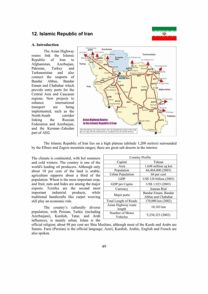
49
12. Islamic Republic of Iran
A. Introduction
The Asian Highway routes link the Islamic Republic of Iran to Afghanistan, Azerbaijan, Pakistan, Turkey and Turkmenistan and also connect the seaports of Bandar Abbas, Bandar Emam and Chabahar which provide entry ports for the Central Asia and Caucasus regions. New projects to enhance international transport are being implemented, such as the North-South corridor linking the Russian Federation and Azerbaijan, and the Kerman–Zahedan part of AH2.
The Islamic Republic of Iran lies on a high plateau (altitude 1,200 metres) surrounded by the Elburz and Zagros mountain ranges; there are great salt deserts in the interior.
The climate is continental, with hot summers and cold winters. The country is one of the world's leading oil producers. Although only about 10 per cent of the land is arable, agriculture supports about a third of the population. Wheat is the most important crop, and fruit, nuts and hides are among the major exports. Textiles are the second most important industrial products, while traditional handicrafts like carpet weaving still play an economic role.
The country’s culturally diverse population, with Persian, Turkic (including Azerbaijani), Kurdish, Tatar, and Arab influences, is mainly urban. Islam is the official religion; about 98 per cent are Shia Muslims, although most of the Kurds and Arabs are Sunnis. Farsi (Persian) is the official language; Azeri, Kurdish, Arabic, English and French are also spoken.
Country Profile
Capital Tehran
Area 1.648 million sq km
Population 66,464,000 (2003)
Urban Population 66 per cent
GDP US$ 128 billion (2003)
GDP per Capita US$ 1,923 (2003)
Currency Iranian Rial
Major ports Bandar Emam, Bandar Abbas and Chabahar
Total Length of Roads 170,000 km (2002)
Asian Highway route length
10,103 km
Number of Motor Vehicles
5,238,323 (2002)
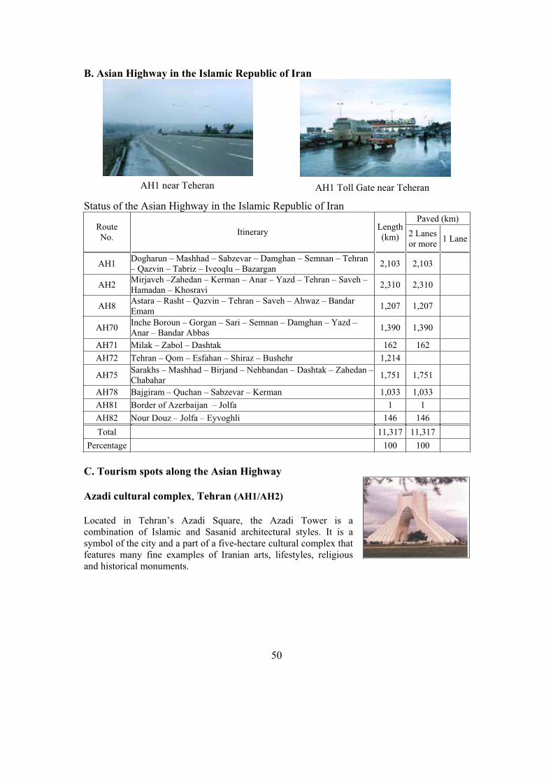
50
B. Asian Highway in the Islamic Republic of Iran
Status of the Asian Highway in the Islamic Republic of Iran Paved (km)
Route No.
Itinerary Length(km) 2 Lanes
or more 1 Lane
AH1 Dogharun – Mashhad – Sabzevar – Damghan – Semnan – Tehran – Qazvin – Tabriz – Iveoqlu – Bazargan
2,103 2,103
AH2 Mirjaveh –Zahedan – Kerman – Anar – Yazd – Tehran – Saveh – Hamadan – Khosravi
2,310 2,310
AH8 Astara – Rasht – Qazvin – Tehran – Saveh – Ahwaz – Bandar Emam
1,207 1,207
AH70 Inche Boroun – Gorgan – Sari – Semnan – Damghan – Yazd – Anar – Bandar Abbas
1,390 1,390
AH71 Milak – Zabol – Dashtak 162 162
AH72 Tehran – Qom – Esfahan – Shiraz – Bushehr 1,214
AH75 Sarakhs – Mashhad – Birjand – Nehbandan – Dashtak – Zahedan –Chabahar
1,751 1,751
AH78 Bajgiram – Quchan – Sabzevar – Kerman 1,033 1,033
AH81 Border of Azerbaijan – Jolfa 1 1
AH82 Nour Douz – Jolfa – Eyvoghli 146 146
Total 11,317 11,317
Percentage 100 100
C. Tourism spots along the Asian Highway
Azadi cultural complex, Tehran (AH1/AH2)
Located in Tehran’s Azadi Square, the Azadi Tower is a combination of Islamic and Sasanid architectural styles. It is a symbol of the city and a part of a five-hectare cultural complex that features many fine examples of Iranian arts, lifestyles, religious and historical monuments.
AH1 near Teheran AH1 Toll Gate near Teheran

51
Persepolis, south of Tehran (AH1/AH2)
Founded by King Darius I in 518 B.C., Persepolis was the capital of the Achaemenid Empire, about 640 kilometres south of Teheran. A UNESCO World Heritage Site, it was built on an immense half-artificial, half-natural terrace, where the king of kings created an impressive palace complex inspired by Mesopotamian models.
Esfahan (off AH2)
Esfahan was the capital of the Safavid era (1501-1732). During the reign of the first Shah Abbas, the most magnificent buildings of Esfahan were built, including Abbasi Jame mosque (Imam mosque), one of the best examples of Persian architecture. In the 17th century, the main square in Esfahan was one of the biggest in the world.
Mashhad (AH1/AH75)
When the Safavid dynasty adopted Islam as the state religion, Mashhad flourished as an important pilgrimage center. The Imam Reza, the only one of the twelve Imams to be buried in the Islamic Republic of Iran, died in 817. The place of his burial was named Mashhad (the place of martyrdom). Attracting over one million pilgrims per year, the shrine is one of the most elegant architectural complexes in the Islamic world.
D. Sample itineraries
Central and Eastern Iran
1. Arrive in the Asian Highway city of Tehran. 2. Visit the Carpet Museum to see elegant Persian carpets dating back to the 17th century. Visit
the Ancient Museum and the National Jewels Museum to see breathtaking jewelry pieces used by former kings.
3. Drive to Esfahan to visit the Naghsh-e-Jahan square, the Imam mosque, and the magnificent Chehel-Sotoun and Aali-Qapu palaces.
4. Visit spectacular mosques, palaces and old bridges like the See-o-Seh Pol and Sheikh Lotfollah as well as the unique Shaking Minarets - if one is shaken, the other shakes too.
5. Visit Vank Cathedral and the Museum, a Christian center in the Armenian Quarters. 6. Visit Persepolis, one of the country’s most historic cities once occupied by Alexander the
Great. See the magnificent palace complex founded by King Darius. Visit Pasargad as well as the tomb of Cyrus the Great.
7. Drive to the Asian Highway (AH2) city of Yazd and visit the Fire Temple ofZoroastrianism, once the state religion.
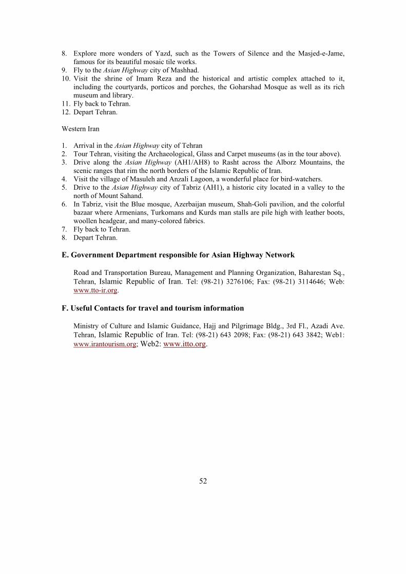
52
8. Explore more wonders of Yazd, such as the Towers of Silence and the Masjed-e-Jame, famous for its beautiful mosaic tile works.
9. Fly to the Asian Highway city of Mashhad. 10. Visit the shrine of Imam Reza and the historical and artistic complex attached to it,
including the courtyards, porticos and porches, the Goharshad Mosque as well as its rich museum and library.
11. Fly back to Tehran. 12. Depart Tehran.
Western Iran
1. Arrival in the Asian Highway city of Tehran 2. Tour Tehran, visiting the Archaeological, Glass and Carpet museums (as in the tour above). 3. Drive along the Asian Highway (AH1/AH8) to Rasht across the Alborz Mountains, the
scenic ranges that rim the north borders of the Islamic Republic of Iran. 4. Visit the village of Masuleh and Anzali Lagoon, a wonderful place for bird-watchers.5. Drive to the Asian Highway city of Tabriz (AH1), a historic city located in a valley to the
north of Mount Sahand. 6. In Tabriz, visit the Blue mosque, Azerbaijan museum, Shah-Goli pavilion, and the colorful
bazaar where Armenians, Turkomans and Kurds man stalls are pile high with leather boots, woollen headgear, and many-colored fabrics.
7. Fly back to Tehran. 8. Depart Tehran.
E. Government Department responsible for Asian Highway Network
Road and Transportation Bureau, Management and Planning Organization, Baharestan Sq.,
Tehran, Islamic Republic of Iran. Tel: (98-21) 3276106; Fax: (98-21) 3114646; Web:
www.tto-ir.org.
F. Useful Contacts for travel and tourism information
Ministry of Culture and Islamic Guidance, Hajj and Pilgrimage Bldg., 3rd Fl., Azadi Ave.
Tehran, Islamic Republic of Iran. Tel: (98-21) 643 2098; Fax: (98-21) 643 3842; Web1:
www.irantourism.org; Web2: www.itto.org.

53
13. Japan
A. Introduction
The Asian Highway route links Japan to the Republic of Korea. Japan’s National Road Development Plan stipulates that a total of 14,000 km of Arterial Highway-Standard Highway network should be ready by the beginning of the 21st century. So far, about 8,000 km is under operation. Designed to reduce congestion around the capital, Tokyo, the national plan provides for equitable development nationwide. Most of the highway network has been constructed and is being operated under a toll road system managed by Japan Highway Public Corporation.
Japan has developed into one of the world's great economic powers. A major world producer of ships and automobiles, it also ranks high in the production of steel, electronic equipment, and textiles. Japan's industry depends heavily on imported raw materials, especially petroleum and iron and aluminum ore, as mineral resources are meager. Many rapid streams provide hydroelectric power, however, and nuclear energy is produced. High-speed train service now extends to many parts of the country.
Japan's successful exports of high quality products, mainly in the fields of consumer electronics and Information Technology, have produced huge foreign trade surpluses. Its farming population has been declining steadily and now comprises about 8 per cent of the total labor force. Arable land (less than 16 per cent of the country's area) is intensively cultivated; rice and other cereals are the main crops. Fishing is highly developed, and the annual catch is one of the largest in the world.
The Japanese are primarily descended from various peoples who migrated from Asia in prehistoric times; the dominant strain is North Asian or Mongolic. The present educational system has created a highly educated and skilled population.
Country Profile
Capital Tokyo
Area 376,000 sq km
Population 127,444,000 (2002)
Urban Population 22 per cent
GDP US$ 460 mil.
GDP per Capita US$ 35,620
Currency Yen
Total Length of Roads 1,200,000 km
Asian Highway route length
1,200 km
Number of Motor Vehicles
77,000,000 (2002)
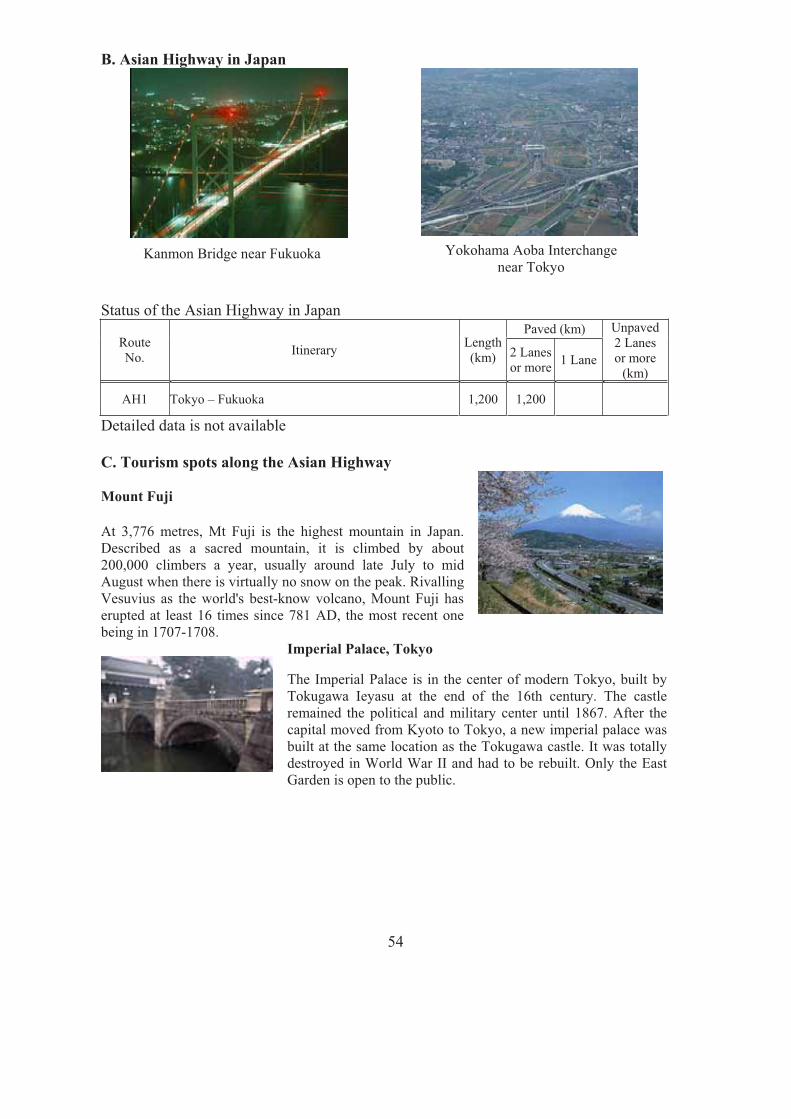
54
B. Asian Highway in Japan
Status of the Asian Highway in Japan Paved (km)
RouteNo.
ItineraryLength(km) 2 Lanes
or more1 Lane
Unpaved 2 Lanes or more
(km)
AH1 Tokyo – Fukuoka 1,200 1,200
Detailed data is not available
C. Tourism spots along the Asian Highway
Mount Fuji
At 3,776 metres, Mt Fuji is the highest mountain in Japan. Described as a sacred mountain, it is climbed by about 200,000 climbers a year, usually around late July to mid August when there is virtually no snow on the peak. Rivalling Vesuvius as the world's best-know volcano, Mount Fuji has erupted at least 16 times since 781 AD, the most recent one being in 1707-1708.
Imperial Palace, TokyoLACE, TOKYO
The Imperial Palace is in the center of modern Tokyo, built by Tokugawa Ieyasu at the end of the 16th century. The castle remained the political and military center until 1867. After the capital moved from Kyoto to Tokyo, a new imperial palace was built at the same location as the Tokugawa castle. It was totally destroyed in World War II and had to be rebuilt. Only the East Garden is open to the public.
Kanmon Bridge near Fukuoka Yokohama Aoba Interchange near Tokyo

55
Kiyomizu-dera, Kyoto
Kyoto was the imperial capital of Japan from its establishment in 794 until the transfer of government to Tokyo in 1868. Surrounded by magnificent hills, Kyoto is considered the spiritual home of the Japanese people. Kiyomizu-Dera Temple may be one of the most known Kyoto's temples throughout Japan for its very high platform. From this platform, you can have an extensive view of whole town of Kyoto city
Dazaifu, Fukuoka
Fukuoka's most famous Shinto shrine, it is dedicated to the 9th century scholar Suguwara No Michizane. Dazaifu was at that time an important administrative centre of government. The shrine was established in the beginning of the 10th century to propitiate Michizane's soul. Pupils and students visit it in droves to pray for examination success. It is one of the "Big Three" shrines in Fukuoka.
D. Sample itinerary
1. Arrive in the Asian Highway city of Tokyo. 2. Tour Tokyo. Visit the Tokyo Tower Observatory, Imperial Palace Plaza, drive through
Akihabara and visit the Asakusa Kannon Temple. 3. Drive up to Mount Fuji via AH1, Japan's highest mountain to enjoy a spectacular view from a
height of 2,300 metres. In the afternoon, visit Hakone for a cruise on Lake Ashi and Mount Komagatake Aerial cableway.
4. Morning drive through the Hakone mountains to Odawara. Drive to Nagoya along AH1. Explore Nagoya, visiting Nagoya Castle, and Tokugawa Art Museum.
5. Morning drive to Ise-Jingu Shrine, Japan's most sacred Shinto center. Then drive to the classical city of Kyoto.
6. Explore Kyoto, visiting Golden Pavilion, Nijo Castle and Kiyomizu-Dera. After lunch, visit Nara, the first permanent capital of Japan. Explore Todaiji Temple, colorful Kasuga Shrine with 3,000 lanterns, and Deer Park where many tame deer roam freely. Return to Kyoto.
7. Drive AH1 to the Asian Highway city of Fukuoka. 8. Tour Fukuoka, visiting Canal City Hakata, a large shopping and entertainment complex,
Momochi Seaside Park, a futuristic district along the waterfront, and Dazaifu Historic town. 9. Depart Fukuoka.
E. Government Department responsible for Asian Highway Network
Planning Division, Road Bureau, Ministry of Land Infrastructure and Transport, Tokyo. Tel: (81-3) 5253-8485; Fax: (81-3) 5253-1618; Web: http://www.mlit.go.jp/road .
F. Useful Contacts for travel and tourism information
Japan National Tourist Organization, 2-10-1 Yuurakuchou Chiyoda- ku, Tokyo, Japan. Tel: (81-3) 3216-1901; Fax: (81-3) 3214-7680; Web: www.jnto.go.jp .

56
14. Kazakhstan
A. Introduction
The Asian Highway routes link Kazakhstan to China, Kyrgyzstan, the Russian Federation, Turkmenistan and Uzbekistan. Aktau port on the Caspian Sea is important with a ferry to Baku, providing connections to Europe. Asian Highway routes in Kazakhstan have enormous potential for providing transit transport between Europe, Central Asia and China and between Central Asia and the Russian Federation.
In the short-term, Kazakhstan is focusing on the maintenance of the existing road network. The mid-term National Road Development Plan of Kazakhstan aims to modernize and rehabilitate the Republican Motor Road and construction of new roads and bridges. The Asian Development Bank, the Islamic Development Bank, the World Bank and the Saudi Fund for Development are assisting in the improvement of the road network.
Kazakhstan produces wool, cattle, and wheat, and is rich in coal, oil, gas, and such minerals as chromium, silver, tungsten, lead, zinc, and copper. The Baikonur Cosmodrome, a Russian-operated space-launch facility, is in central Kazakhstan.
Country Profile
Capital Astana
Area 2,717,300 sq km
Population 15,154,000 (2003)
Urban Population 56 per cent
GDP US$ 30 billion (2003)
GDP per Capita US$ 1,960 (2003)
Currency Tenge
Major Port Aktau
Total Length of Roads 87,153 km (2001)
Asian Highway route length
13,189 km
Number of Motor Vehicles
1,279,009 (2000)
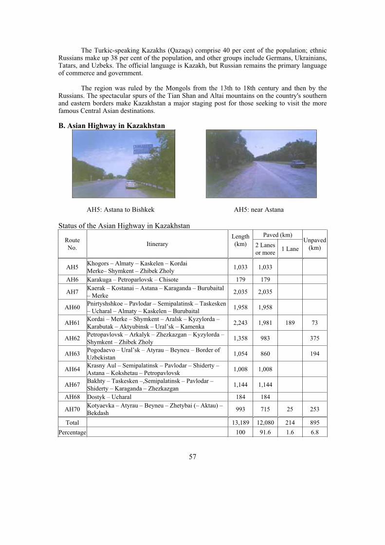
57
The Turkic-speaking Kazakhs (Qazaqs) comprise 40 per cent of the population; ethnic Russians make up 38 per cent of the population, and other groups include Germans, Ukrainians, Tatars, and Uzbeks. The official language is Kazakh, but Russian remains the primary language of commerce and government.
The region was ruled by the Mongols from the 13th to 18th century and then by the Russians. The spectacular spurs of the Tian Shan and Altai mountains on the country's southern and eastern borders make Kazakhstan a major staging post for those seeking to visit the more famous Central Asian destinations.
B. Asian Highway in Kazakhstan
Status of the Asian Highway in Kazakhstan Paved (km)
Route
No. Itinerary
Length
(km) 2 Lanes
or more 1 Lane
Unpaved
(km)
AH5 Khogors – Almaty – Kaskelen – Kordai
Merke– Shymkent – Zhibek Zholy 1,033 1,033
AH6 Karakuga – Petroparlovsk – Chisote 179 179
AH7 Kaerak – Kostanai – Astana – Karaganda – Burubaital
– Merke 2,035 2,035
AH60 Pnirtyshshkoe – Pavlodar – Semipalatinsk – Taskesken
– Ucharal – Almaty – Kaskelen – Burubaital 1,958 1,958
AH61 Kordai – Merke – Shymkent – Aralsk – Kyzylorda –
Karabutak – Aktyubinsk – Ural’sk – Kamenka 2,243 1,981 189 73
AH62 Petropavlovsk – Arkalyk – Zhezkazgan – Kyzylorda –
Shymkent – Zhibek Zholy 1,358 983 375
AH63 Pogodaevo – Ural’sk – Atyrau – Beyneu – Border of
Uzbekistan 1,054 860 194
AH64 Krasny Aul – Semipalatinsk – Pavlodar – Shiderty –
Astana – Kokshetau – Petropavlovsk 1,008 1,008
AH67 Bakhty – Taskesken –,Semipalatinsk – Pavlodar –
Shiderty – Karaganda – Zhezkazgan 1,144 1,144
AH68 Dostyk – Ucharal 184 184
AH70 Kotyaevka – Atyrau – Beyneu – Zhetybai (– Aktau) –
Bekdash 993 715 25 253
Total 13,189 12,080 214 895
Percentage 100 91.6 1.6 6.8
AH5: Astana to Bishkek AH5: near Astana

58
Asian Highway in Kazakhstan
0
500
1,000
1,500
2,000
2,500
AH5 AH6 AH7 AH60 AH61 AH62 AH63 AH64 AH67 AH68 AH70
Len
gth
(k
m)
Unpaved
Paved 1 Lane
Paved 2 Lanes
or more
1,033km
2,035km 1958km
2,243km
1,358km
1,054km1,008km
1,144km
184km
993km
179km
C. Tourism spots along the Asian Highway
Ishim River, Astana, (AH7/AH64)
Kazakhstan's capital was a tiny mining town until the 1950s, when plans were announced to turn 250,000 sq kilometres of Kazakhstan steppe into wheat and cotton fields. The capital was shifted from Almaty to Astana in 1997 due to its more central and less earthquake-prone location and better rail links with the Russian Federation.
Almaty (AH5/AH60)
Exposure to the outside world has turned Almaty into Central Asia's most cosmopolitan city with shops, hotels, parks and greenery. The Zailijski Alatau Mountains rise like a wall along Almaty's southern fringe. In 1854 Almaty acted as a frontier fort at the border of the Russian Empire.
Mausoleum of Khoja Ahmed Yasawi, Turkestan, (AH61)
The Mausoleum of Khoja Ahmed Yasawi, in the town of Yasi, now Turkestan, was built at the time of Timur (Tamerlane), from 1389 to 1405. Persian master builders experimented with architectural and structural solutions which were later used in the construction of Samarkand, the capital of the Timurid Empire. Today, it is one of the largest and best-preserved constructions of the Timurid period.
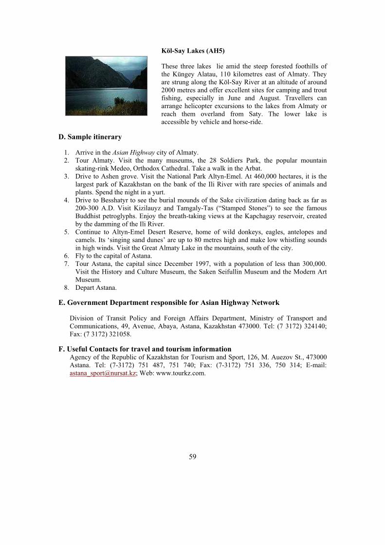
59
Köl-Say Lakes (AH5)
These three lakes lie amid the steep forested foothills of the Küngey Alatau, 110 kilometres east of Almaty. They are strung along the Köl-Say River at an altitude of around 2000 metres and offer excellent sites for camping and trout fishing, especially in June and August. Travellers can arrange helicopter excursions to the lakes from Almaty or reach them overland from Saty. The lower lake is accessible by vehicle and horse-ride.
D. Sample itinerary
1. Arrive in the Asian Highway city of Almaty. 2. Tour Almaty. Visit the many museums, the 28 Soldiers Park, the popular mountain
skating-rink Medeo, Orthodox Cathedral. Take a walk in the Arbat. 3. Drive to Ashen grove. Visit the National Park Altyn-Emel. At 460,000 hectares, it is the
largest park of Kazakhstan on the bank of the Ili River with rare species of animals and plants. Spend the night in a yurt.
4. Drive to Besshatyr to see the burial mounds of the Sake civilization dating back as far as 200-300 A.D. Visit Kizilauyz and Tamgaly-Tas (“Stamped Stones”) to see the famous Buddhist petroglyphs. Enjoy the breath-taking views at the Kapchagay reservoir, created by the damming of the Ili River.
5. Continue to Altyn-Emel Desert Reserve, home of wild donkeys, eagles, antelopes and camels. Its ‘singing sand dunes’ are up to 80 metres high and make low whistling sounds in high winds. Visit the Great Almaty Lake in the mountains, south of the city.
6. Fly to the capital of Astana. 7. Tour Astana, the capital since December 1997, with a population of less than 300,000.
Visit the History and Culture Museum, the Saken Seifullin Museum and the Modern Art Museum.
8. Depart Astana.
E. Government Department responsible for Asian Highway Network
Division of Transit Policy and Foreign Affairs Department, Ministry of Transport and Communications, 49, Avenue, Abaya, Astana, Kazakhstan 473000. Tel: (7 3172) 324140; Fax: (7 3172) 321058.
F. Useful Contacts for travel and tourism information Agency of the Republic of Kazakhstan for Tourism and Sport, 126, M. Auezov St., 473000 Astana. Tel: (7-3172) 751 487, 751 740; Fax: (7-3172) 751 336, 750 314; E-mail: [email protected]; Web: www.tourkz.com.
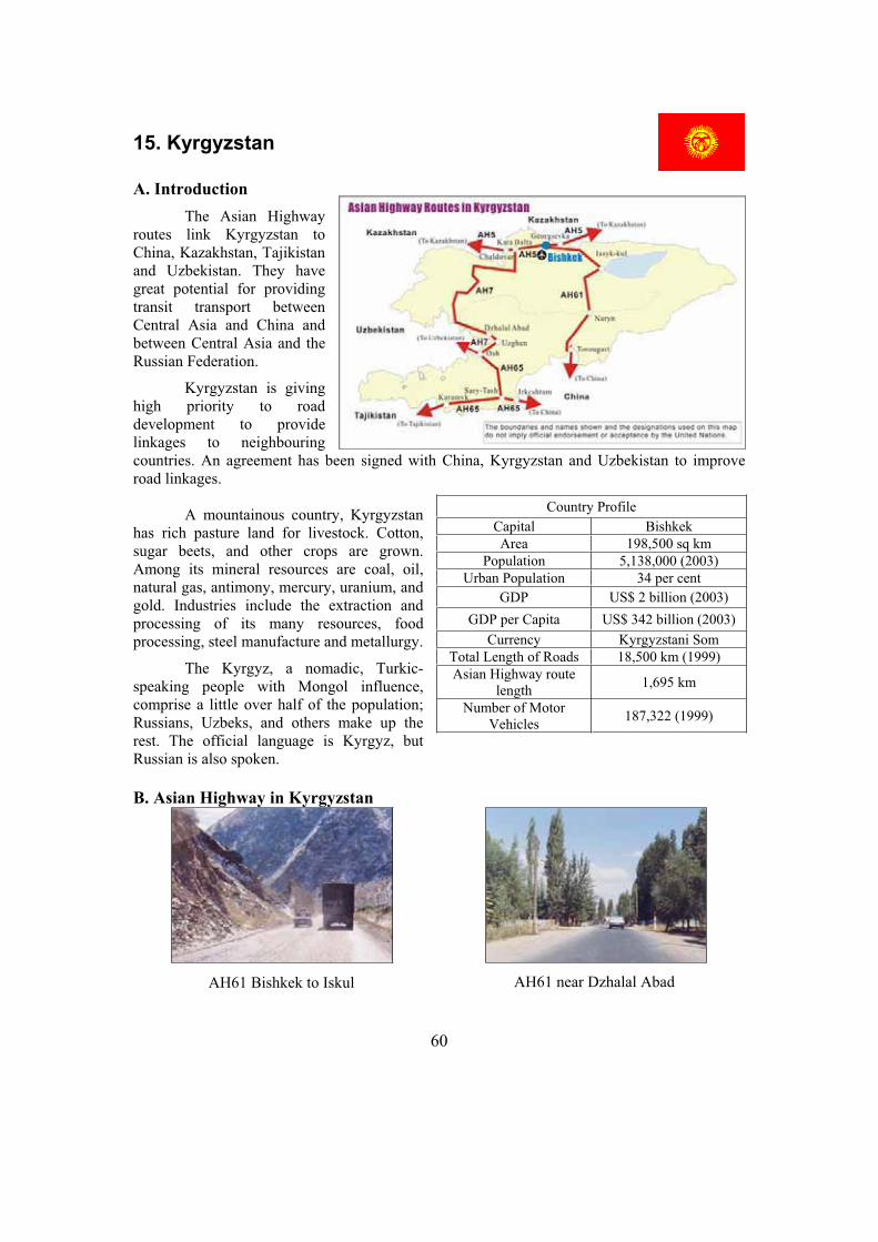
60
15. Kyrgyzstan
A. Introduction
The Asian Highway routes link Kyrgyzstan to China, Kazakhstan, Tajikistan and Uzbekistan. They have great potential for providing transit transport between Central Asia and China and between Central Asia and the Russian Federation.
Kyrgyzstan is giving high priority to road development to provide linkages to neighbouring countries. An agreement has been signed with China, Kyrgyzstan and Uzbekistan to improve road linkages.
A mountainous country, Kyrgyzstan has rich pasture land for livestock. Cotton, sugar beets, and other crops are grown. Among its mineral resources are coal, oil, natural gas, antimony, mercury, uranium, and gold. Industries include the extraction and processing of its many resources, food processing, steel manufacture and metallurgy.
The Kyrgyz, a nomadic, Turkic-speaking people with Mongol influence, comprise a little over half of the population; Russians, Uzbeks, and others make up the rest. The official language is Kyrgyz, but Russian is also spoken.
B. Asian Highway in Kyrgyzstan
Country Profile
Capital Bishkek
Area 198,500 sq km
Population 5,138,000 (2003)
Urban Population 34 per cent
GDP US$ 2 billion (2003)
GDP per Capita US$ 342 billion (2003)
Currency Kyrgyzstani Som
Total Length of Roads 18,500 km (1999)
Asian Highway route length
1,695 km
Number of Motor Vehicles
187,322 (1999)
AH61 near Dzhalal Abad AH61 Bishkek to Iskul

61
Status of the Asian Highway in Kyrgyzstan Paved (km)
Route No.
Itinerary Length(km) 2 Lanes
or more 1 Lane
Unpaved (km)
AH5 Georgievka – Bishkek – Kara Balta – Chaldovar 126 126
AH7 Chaldovor – Kara Balta – Osh – Border of Uzbekistan
626 564 62
AH61 Torougart – Naryn – Bishkek – Georgievka 539 421 118
AH65 Irkeshtam – Sary Tash (– Osh) – Karamyk 404 206 198
Total 1,695 1,317 378
Percentage 100 77.7 22.3
Asian Highway in Kyrgyzstan
0
100
200
300
400
500
600
700
AH5 AH7 AH61 AH65
Len
gth
(km
)
Unpaved
Paved 1 Lane
Paved 2 Lanes or more
126km
404km
539km
626km
C. Tourism spots along the Asian Highway
Bishkek (AH5)
Bishkek is the capital and industrial centre. A relaxed city of wide streets and handsome houses, it is a jumping-off point for the Tian Shan Mountains and Lake Issyk-Kul, and for the overland crossing into China via the Torugart Pass. The 4,800-metre snowcapped ramparts of the Kyrgyz Alatau range loom over the city.

62
Lake Issyk-Kul (AH61)
Folded between the peaks of the Küngey Alatau and the Terskey Alatau ranges, the huge Lake Issyk-Kul sits 1,600 metres above sea level. The world’s second-largest alpine lake, 170 kilometres long and 70 kilometres across, it is famous for its magnificent scenery and unique scientific interest.
D. Sample itinerary
1. Arrive in the Asian Highway city of Bishkek. 2. Drive from Bishkek along the northern shores of Lake Issyk-Kul to Cholpon-Ata (AH61).
En route, visit the 11th-century Burana Tower, an ancient Silk Route staging post, and the prehistoric petroglyphs at Cholpon-Ata. Tour the Issyk-Kul museum and cruise along the lakeshore to a health spa and resort.
3. Drive to Karakol, passing quaint rural villages. Tour the Orthodox Holy Trinity Church, Chinese mosque and Przhevalsky Memorial. Visit the Djety-Oguz, the famous “Valley of Seven Bulls” to see the glowing red, sandy cliffs. Drive to Lake Issyk-Kul and enjoy a breath taking sunset over the lake and its surrounding mountains.
4. Drive back to Bishkek, crossing Issyk-Kul's southern shores, completing the circumnavigation of the lake. Pass remote Kyrgyz villages against a backdrop of the Central Tien Shan Mountains. Stop in Balykchi and continue via Boom Gorge to Bishkek.
5. Depart Bishkek.
E. Government Department responsible for Asian Highway Network
Foreign Economic Relation Division, Ministry of Transport and Communications, 42 Isanova Street, Bishkek. Fax: (996-312) 664 781.
F. Useful Contacts for travel and tourism information
Kyrgyz State Agency for Tourism and Sport, 17 Togolok Moldo St., Bishkek 720033 Kyrgyz Republic. Tel: (996-312) 220-657; Fax: (996-312) 212-845; Web: http://homepage.kg/.
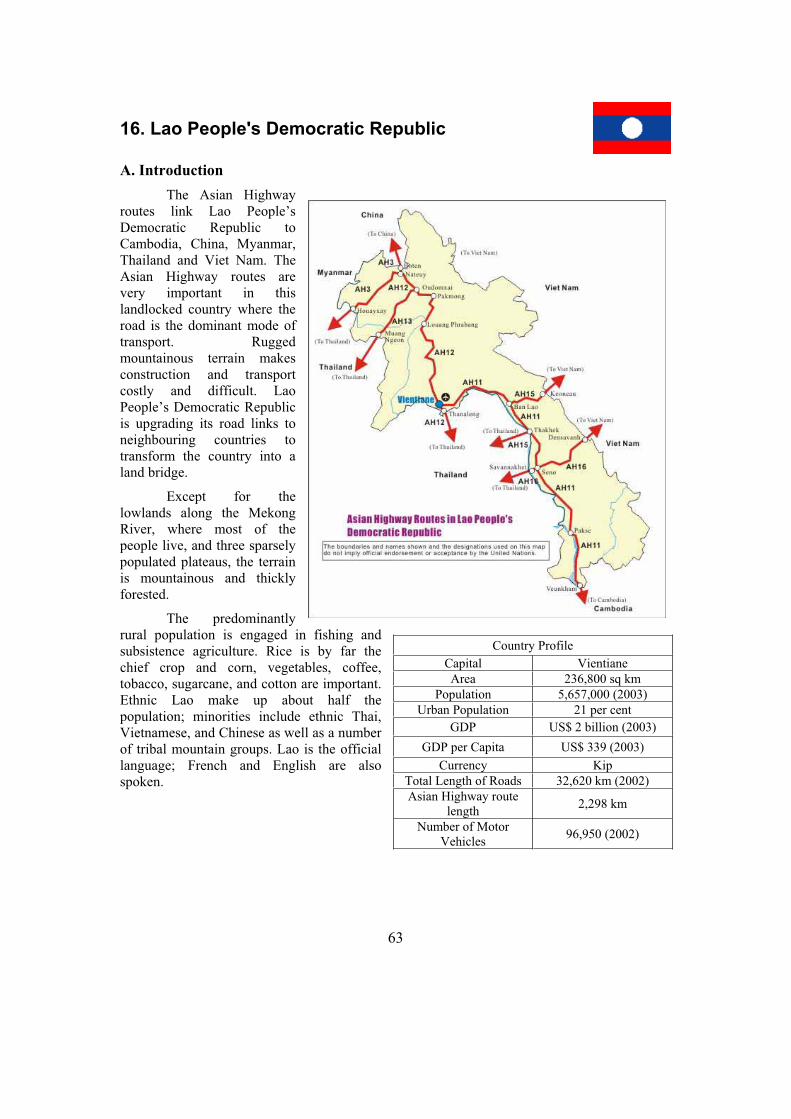
63
16. Lao People's Democratic Republic
A. Introduction
The Asian Highway routes link Lao People’s Democratic Republic to Cambodia, China, Myanmar, Thailand and Viet Nam. The Asian Highway routes are very important in this landlocked country where the road is the dominant mode of transport. Rugged mountainous terrain makes construction and transport costly and difficult. Lao People’s Democratic Republic is upgrading its road links to neighbouring countries to transform the country into a land bridge.
Except for the lowlands along the Mekong River, where most of the people live, and three sparsely populated plateaus, the terrain is mountainous and thickly forested.
The predominantly rural population is engaged in fishing and subsistence agriculture. Rice is by far the chief crop and corn, vegetables, coffee, tobacco, sugarcane, and cotton are important. Ethnic Lao make up about half the population; minorities include ethnic Thai, Vietnamese, and Chinese as well as a number of tribal mountain groups. Lao is the official language; French and English are also spoken.
Country Profile
Capital Vientiane
Area 236,800 sq km
Population 5,657,000 (2003)
Urban Population 21 per cent
GDP US$ 2 billion (2003)
GDP per Capita US$ 339 (2003)
Currency Kip
Total Length of Roads 32,620 km (2002)
Asian Highway route length
2,298 km
Number of Motor Vehicles
96,950 (2002)

64
B. Asian Highway in Lao People's Democratic Republic
Status of the Asian Highway in Lao People’s Democratic Republic
Paved(km) RouteNo.
Itinerary Length(km) 2 Lanes
or more1 Lane
Unpaved Ferry Missing
link Unknown
AH3 Boten – Nateuy – Houayxay 244.0 65 178 1 0 0
AH11Vientiane – Ban Lao – Thakhek – Seno – Pakse – Veunkham
823.0 777 46 0
AH12
Nateuy – Oudomxai – Pakmong – Louang Phrabang – Vientiane – Thanaleng
684.0 659 25 0 0
AH13 Oudomxai - Muang Ngeun 173.0 0 0 1 45 127
AH15 Keoneau – Ban Lao – Thakhek 133.0 132 0 1 0 0
AH16 Densavanh – Seno – Savannakhet 241.0 240 0 1 0 0
Total 0 2,298.0 1,873 0 249 3 45 127
Asian Highway in Lao People's Democratic Republic
0
100
200
300
400
500
600
700
800
900
AH3 AH11 AH12 AH13 AH15 AH16
Len
gth
(km
)
Unknown
Missing link
Ferry
Unpaved
Paved 1 Lane
Paved 2 Lanes or more244km
823km
684km
173km
133km
241km
AH12 in Vientiane AH12 Thai – Lao Friendship Bridge
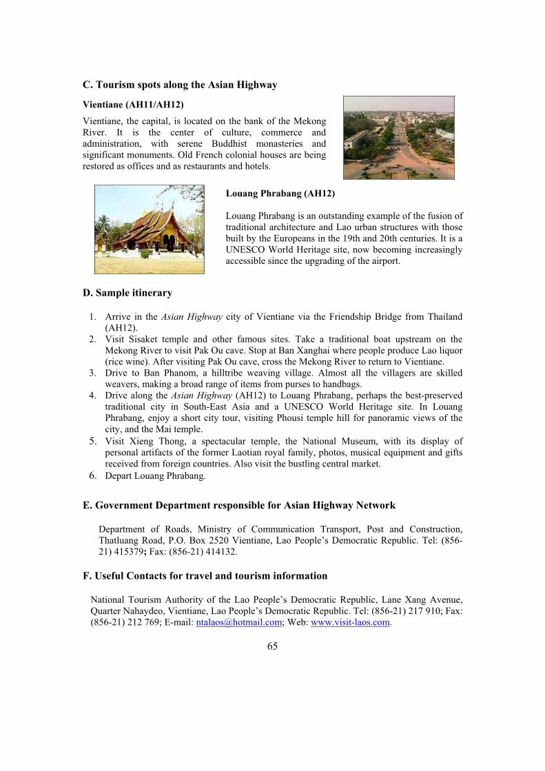
65
C. Tourism spots along the Asian Highway
Vientiane (AH11/AH12)
Vientiane, the capital, is located on the bank of the Mekong River. It is the center of culture, commerce and administration, with serene Buddhist monasteries and significant monuments. Old French colonial houses are being restored as offices and as restaurants and hotels.
Louang Phrabang (AH12)
Louang Phrabang is an outstanding example of the fusion of traditional architecture and Lao urban structures with those built by the Europeans in the 19th and 20th centuries. It is a UNESCO World Heritage site, now becoming increasingly accessible since the upgrading of the airport.
D. Sample itinerary
1. Arrive in the Asian Highway city of Vientiane via the Friendship Bridge from Thailand (AH12).
2. Visit Sisaket temple and other famous sites. Take a traditional boat upstream on the Mekong River to visit Pak Ou cave. Stop at Ban Xanghai where people produce Lao liquor (rice wine). After visiting Pak Ou cave, cross the Mekong River to return to Vientiane.
3. Drive to Ban Phanom, a hilltribe weaving village. Almost all the villagers are skilled weavers, making a broad range of items from purses to handbags.
4. Drive along the Asian Highway (AH12) to Louang Phrabang, perhaps the best-preserved traditional city in South-East Asia and a UNESCO World Heritage site. In Louang Phrabang, enjoy a short city tour, visiting Phousi temple hill for panoramic views of the city, and the Mai temple.
5. Visit Xieng Thong, a spectacular temple, the National Museum, with its display of personal artifacts of the former Laotian royal family, photos, musical equipment and gifts received from foreign countries. Also visit the bustling central market.
6. Depart Louang Phrabang.
E. Government Department responsible for Asian Highway Network
Department of Roads, Ministry of Communication Transport, Post and Construction, Thatluang Road, P.O. Box 2520 Vientiane, Lao People’s Democratic Republic. Tel: (856-21) 415379; Fax: (856-21) 414132.
F. Useful Contacts for travel and tourism information
National Tourism Authority of the Lao People’s Democratic Republic, Lane Xang Avenue, Quarter Nahaydeo, Vientiane, Lao People’s Democratic Republic. Tel: (856-21) 217 910; Fax: (856-21) 212 769; E-mail: [email protected]; Web: www.visit-laos.com.
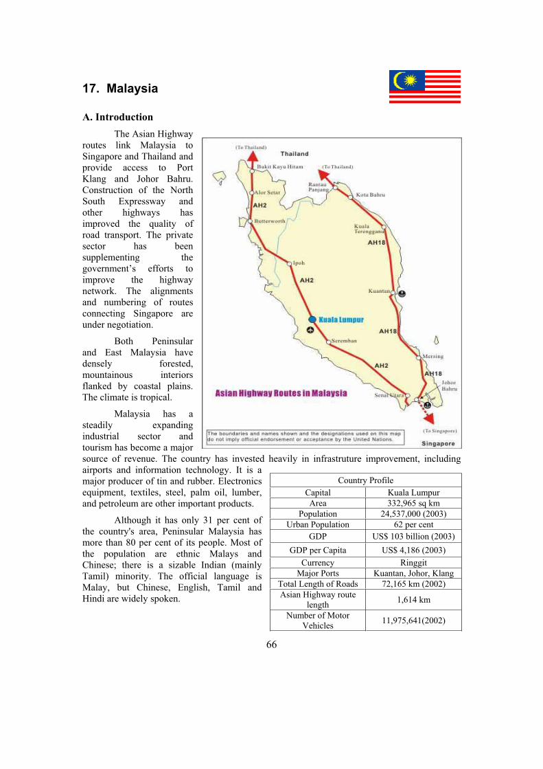
66
17. Malaysia
A. Introduction
The Asian Highway routes link Malaysia to Singapore and Thailand and provide access to Port Klang and Johor Bahru. Construction of the North South Expressway and other highways has improved the quality of road transport. The private sector has been supplementing the government’s efforts to improve the highway network. The alignments and numbering of routes connecting Singapore are under negotiation.
Both Peninsular and East Malaysia have densely forested, mountainous interiors flanked by coastal plains. The climate is tropical.
Malaysia has a steadily expanding industrial sector and tourism has become a major source of revenue. The country has invested heavily in infrastruture improvement, including airports and information technology. It is a major producer of tin and rubber. Electronics equipment, textiles, steel, palm oil, lumber, and petroleum are other important products.
Although it has only 31 per cent of the country's area, Peninsular Malaysia has more than 80 per cent of its people. Most of the population are ethnic Malays and Chinese; there is a sizable Indian (mainly Tamil) minority. The official language is Malay, but Chinese, English, Tamil and Hindi are widely spoken.
Country Profile
Capital Kuala Lumpur
Area 332,965 sq km
Population 24,537,000 (2003)
Urban Population 62 per cent
GDP US$ 103 billion (2003)
GDP per Capita US$ 4,186 (2003)
Currency Ringgit
Major Ports Kuantan, Johor, Klang
Total Length of Roads 72,165 km (2002)
Asian Highway route length
1,614 km
Number of Motor Vehicles
11,975,641(2002)
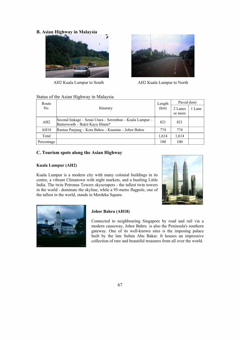
67
B. Asian Highway in Malaysia
Status of the Asian Highway in Malaysia Paved (km) Route
No. Itinerary Length(km) 2 Lanes
or more 1 Lane
AH2 Second linkage – Senai Utara – Seremban – Kuala Lumpur – Butterworth – Bukit Kayu Hitam*
821 821
AH18 Rantau Panjang – Kota Bahru – Kuantan – Johor Bahru 774 774
Total 1,614 1,614
Percentage 100 100
C. Tourism spots along the Asian Highway
Kuala Lumpur (AH2)
Kuala Lumpur is a modern city with many colonial buildings in its centre, a vibrant Chinatown with night markets, and a bustling Little India. The twin Petronas Towers skyscrapers - the tallest twin towers in the world - dominate the skyline, while a 95-metre flagpole, one of the tallest in the world, stands in Merdeka Square.
Johor Bahru (AH18)
Connected to neighbouring Singapore by road and rail via a modern causeway, Johor Bahru is also the Peninsula's southern gateway. One of its well-known sites is the imposing palace built by the late Sultan Abu Bakar. It houses an impressive collection of rare and beautiful treasures from all over the world.
AH2 Kuala Lumpur to North AH2 Kuala Lumpur to South

68
Kenyir Lake, Kuala Terengganu (AH18)
Kenyir Lake spans over 260,000 hectares, making it the largest man-made lake in South-East Asia. It consists of more than 340 islands, surrounded by a vast rain forest with unpolluted rivers, waterfalls, limestone formations and pre-historic caves. A variety of plants and wildlife make the area famous for jungle trekking.
Penang (AH2)
Penang (main island off Butterworth) is referred to as the Pearl of the Orient. One of the finest Buddhist temples in South-East Asia, the Kek Lok Si temple, was built over a span of 20 years. Housing the beautifully crafted "Pagoda of Ten Thousand Buddhas", it is set against gardens, a turtle pond, shrines and beautiful sculptures.
D. Sample itineraries
West Coast, Peninsula Malaysia
1. Arrive in the Asian Highway city of Kuala Lumpur. 2. Explore the capital with the British colonial buildings of the Dataran Merdeka, the
midnight lamps of the Petaling Street night-market, bustling streets and modern office towers.
3. Drive to Cameron Highlands. En route, visit Batu Caves, discovered 100 years ago. The caves, with their 100-metre-high vaulted ceiling, are regularly visited by Hindus on the festival of Thaipusam.
4. Explore Cameron Highlands, Pahang state's premier hilltop holiday spot and a favoured getaway spot of honeymoon couples.
5. Drive along the Asian Highway to Ipoh (AH2), in the midst of one of the world’s richest tin-mining regions. See the caves, the railway station with its Islamic architecture and the Town Hall building.
6. Depart Ipoh for the Asian Highway city of Penang. En route, visit the royal town of Kuala Kangsar and Taiping, one of the oldest towns in Malaysia.
7. Explore Penang, the Pearl of the Orient. Visit the Kek Lok Si Temple, Snake Temple, Penang Bird Park, Fort Cornwallis, Pantai Acheh Forest Reserve and Penang Hill.
8. Depart Penang
East Coast, Peninsula Malaysia
1. Arrive in the Asian Highway city of Kuala Lumpur. 2. Explore Kuala Lumpur (as in the itinerary above) 3. Drive to the Asian Highway city of Johor Bahru (AH2). 4. Relax and tour Johor Bahru, the southern gateway of Malaysia, with its shopping malls
and landmarks like the Grand Palace, with its distinct Anglo-Malay architecture. 5. Proceed along the Asian Highway city to Kuantan (AH18). Visit quaint fishing villages
along the way.6. Relax and tour the environs of Kuantan, a well-known ecotourism destination. Of
particular interest are the Tasik (Lake) Chini, Malaysia’s second largest natural lake, and the Taman (Park) Pertanian Indera Mahkota.

69
7. Drive to the Asian Highway city of Kuala Terengganu (AH18). 8. Explore Kuala Terengganu. The Tengku Tengah Zaharah mosque, on the estuary of Ibai
river, is built in such a way as to give an illusion that it is floating on water. See the state museum and the central market.
9. Drive to the Asian Highway city of Kota Bahru (AH18). 10. Explore Kota Bahru Museum, Siti Khadijah Central Market, the Brick Palace and the War
Museum. 11. Drive to Penang and explore (as above). 12. Depart Penang
E. Government Department responsible for Asian Highway Network
Highway Planning Unit, Ministry of Works, HPU 2nd Floor, Block A, Jln Sultan, Salahuddin 50580, Kuala Lumpur. Tel: (603) 27714210; Fax: (603) 27113975.
F. Useful Contacts for travel and tourism information
Ministry of Culture, Arts and Tourism, Level 6, 21, 34-36, Menara Dato' Onn, 45, Jalan Tun Ismail, Putra World Trade Centre, 50694 Kuala Lumpur, Malaysia. Tel: (60-3) 2693 7111; Fax: (60-3) 2693 0881; E-mail: [email protected]; Web: www.tourism.gov.my.

70
18. Mongolia
A. Introduction
The Asian Highway routes link Mongolia to China and the Russian Federation. Roads are the primary means of transport for people and freight. The Government is implementing the “Millennium Road” project, with East-West links and North-South links to improve road connections with neighbouring countries. It is getting support from the Asian Development Bank, the World Bank, the Kuwaiti Fund and the Government of Japan. The Asian Highway routes in Mongolia provide important transit routes for China and the Russian Federation.
With an average elevation exceeding 1,500 metres, mountain ranges and high plateaus cover most of the north west and the central south, and the Gobi desert lies in the south and east. Wide seasonal variations in temperature, rugged terrain, and an arid climate limit agriculture; nomadic year-round grazing of sheep, goats, cattle, horses, yaks, and camels has been the major occupation for centuries. A small industrial sector is based primarily on livestock processing and the manufacture of textiles and consumer goods. Some timber is cut in the north, and coal, copper, molybdenum, tin, tungsten, and gold are mined and processed.
The population is composed primarily of Khalkha Mongols; there are also minorities of Oirat Mongols, Kazakhs, Chinese, and Russians.
Country Profile
Capital Ulaanbaatar
Area 1.565 million sq km
Population 2,594,000 (2003)
Urban Population 57 per cent
GDP US$ 1.18 billion (2003)
GDP per Capita US$ 455 (2003)
Currency Togrog/Tugrik
Total Length of Roads 49,250 km (2002)
Asian Highway route length
4,286 km
Number of Motor Vehicles
142,800 (2002)

71
B. Asian Highway in Mongolia
Status of the Asian Highway in Mongolia Paved (km)
Route No. Itinerary Length(km) 2 Lanes
or more 1 Lane
Unpaved (km)
AH3 Altanbulag – Darkhan – Ulaanbaatar – Nalayh – Saynshan – Zamin-Uud
1,041 386 655
AH4 Ulaanbaishint – Hovd – Yarantai 725 11 714
AH32 Sumber – Choybalsan – Ondorhaan – Nalayh – Ulaanbaatar – Uliastay – Hovd
2,520 403 2,117
Total 4,286 800 3,486
Percentage 100 18.7 81.3
Asian Highway in Mongolia
0
500
1,000
1,500
2,000
2,500
3,000
AH3 AH4 AH32
Len
gth
(k
m)
Unpaved
Paved 1 Lane
Paved 2 Lanes or
more
1,041km
2,520km
725km
AH32 in Ulaanbaatar AH3 near Ulaanbaatar
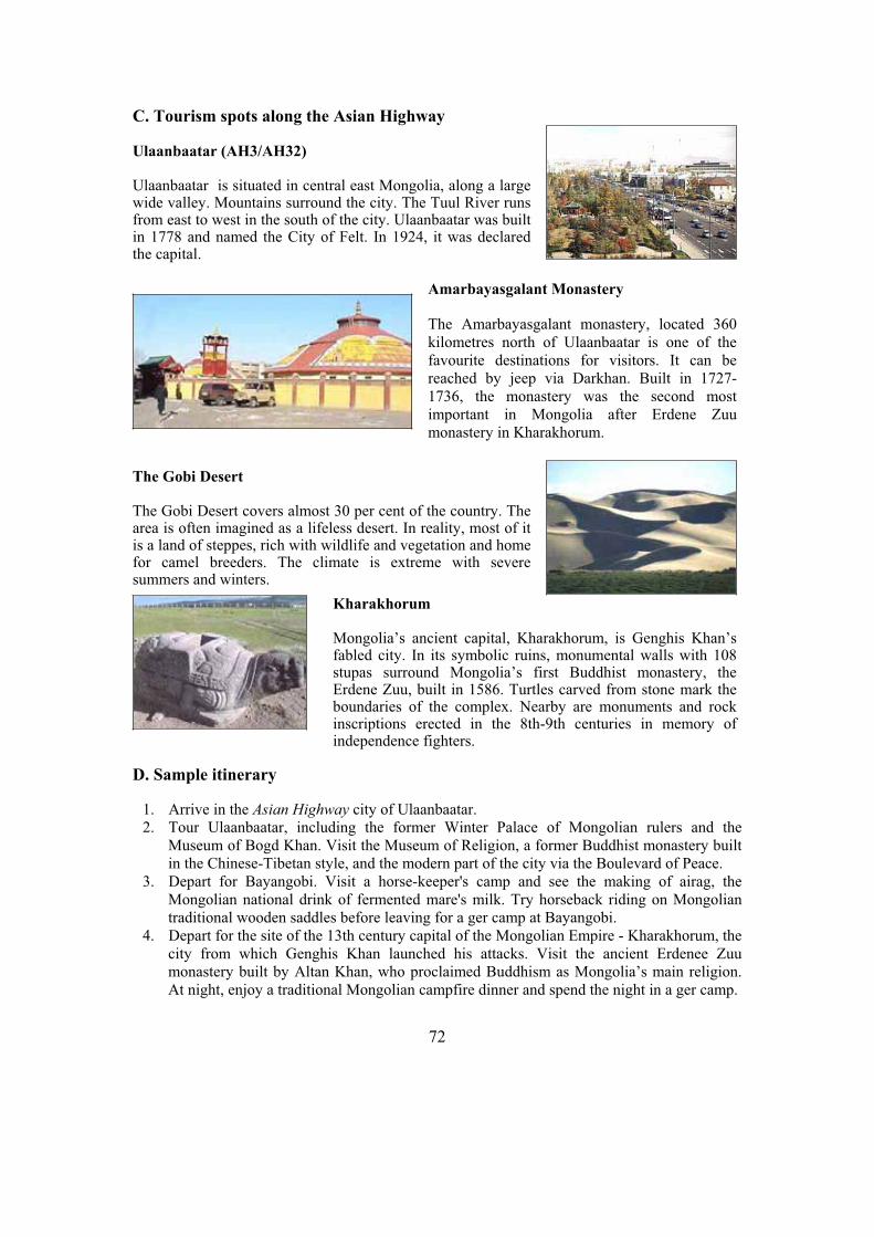
72
C. Tourism spots along the Asian Highway
Ulaanbaatar (AH3/AH32)
Ulaanbaatar is situated in central east Mongolia, along a large wide valley. Mountains surround the city. The Tuul River runs from east to west in the south of the city. Ulaanbaatar was built in 1778 and named the City of Felt. In 1924, it was declared the capital.
Amarbayasgalant Monastery
The Amarbayasgalant monastery, located 360 kilometres north of Ulaanbaatar is one of the favourite destinations for visitors. It can be reached by jeep via Darkhan. Built in 1727-1736, the monastery was the second most important in Mongolia after Erdene Zuu monastery in Kharakhorum.
The Gobi Desert
The Gobi Desert covers almost 30 per cent of the country. The area is often imagined as a lifeless desert. In reality, most of it is a land of steppes, rich with wildlife and vegetation and home for camel breeders. The climate is extreme with severe summers and winters.
Kharakhorum
Mongolia’s ancient capital, Kharakhorum, is Genghis Khan’s fabled city. In its symbolic ruins, monumental walls with 108 stupas surround Mongolia’s first Buddhist monastery, the Erdene Zuu, built in 1586. Turtles carved from stone mark the boundaries of the complex. Nearby are monuments and rock inscriptions erected in the 8th-9th centuries in memory of independence fighters.
D. Sample itinerary
1. Arrive in the Asian Highway city of Ulaanbaatar. 2. Tour Ulaanbaatar, including the former Winter Palace of Mongolian rulers and the
Museum of Bogd Khan. Visit the Museum of Religion, a former Buddhist monastery built in the Chinese-Tibetan style, and the modern part of the city via the Boulevard of Peace.
3. Depart for Bayangobi. Visit a horse-keeper's camp and see the making of airag, the Mongolian national drink of fermented mare's milk. Try horseback riding on Mongolian traditional wooden saddles before leaving for a ger camp at Bayangobi.
4. Depart for the site of the 13th century capital of the Mongolian Empire - Kharakhorum, the city from which Genghis Khan launched his attacks. Visit the ancient Erdenee Zuu monastery built by Altan Khan, who proclaimed Buddhism as Mongolia’s main religion. At night, enjoy a traditional Mongolian campfire dinner and spend the night in a ger camp.
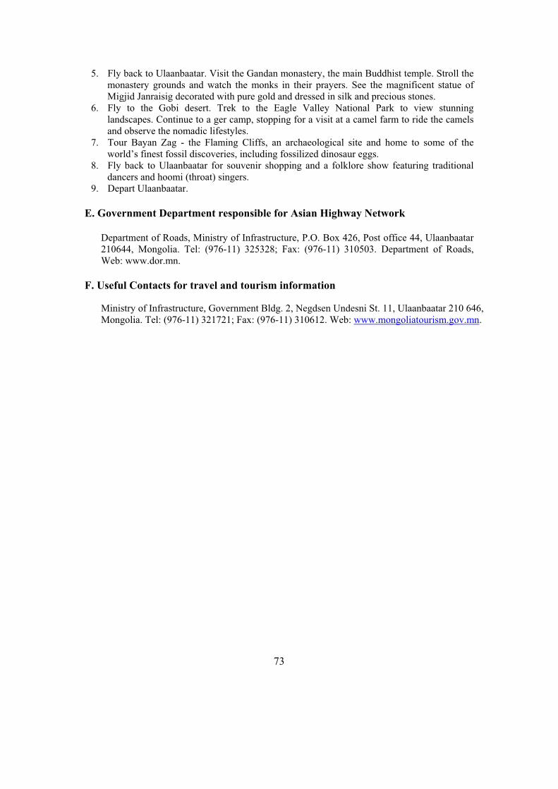
73
5. Fly back to Ulaanbaatar. Visit the Gandan monastery, the main Buddhist temple. Stroll the monastery grounds and watch the monks in their prayers. See the magnificent statue of Migjid Janraisig decorated with pure gold and dressed in silk and precious stones.
6. Fly to the Gobi desert. Trek to the Eagle Valley National Park to view stunning landscapes. Continue to a ger camp, stopping for a visit at a camel farm to ride the camels and observe the nomadic lifestyles.
7. Tour Bayan Zag - the Flaming Cliffs, an archaeological site and home to some of the world’s finest fossil discoveries, including fossilized dinosaur eggs.
8. Fly back to Ulaanbaatar for souvenir shopping and a folklore show featuring traditional dancers and hoomi (throat) singers.
9. Depart Ulaanbaatar.
E. Government Department responsible for Asian Highway Network
Department of Roads, Ministry of Infrastructure, P.O. Box 426, Post office 44, Ulaanbaatar 210644, Mongolia. Tel: (976-11) 325328; Fax: (976-11) 310503. Department of Roads, Web: www.dor.mn.
F. Useful Contacts for travel and tourism information
Ministry of Infrastructure, Government Bldg. 2, Negdsen Undesni St. 11, Ulaanbaatar 210 646, Mongolia. Tel: (976-11) 321721; Fax: (976-11) 310612. Web: www.mongoliatourism.gov.mn.
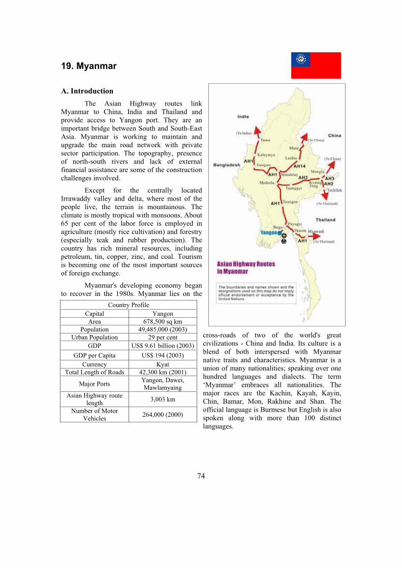
74
19. Myanmar
A. Introduction
The Asian Highway routes link Myanmar to China, India and Thailand and provide access to Yangon port. They are an important bridge between South and South-East Asia. Myanmar is working to maintain and upgrade the main road network with private sector participation. The topography, presence of north-south rivers and lack of external financial assistance are some of the construction challenges involved.
Except for the centrally located Irrawaddy valley and delta, where most of the people live, the terrain is mountainous. The climate is mostly tropical with monsoons. About 65 per cent of the labor force is employed in agriculture (mostly rice cultivation) and forestry (especially teak and rubber production). The country has rich mineral resources, including petroleum, tin, copper, zinc, and coal. Tourism is becoming one of the most important sources of foreign exchange.
Myanmar's developing economy began to recover in the 1980s. Myanmar lies on the
cross-roads of two of the world's great civilizations - China and India. Its culture is a blend of both interspersed with Myanmar native traits and characteristics. Myanmar is a union of many nationalities; speaking over one hundred languages and dialects. The term ‘Myanmar’ embraces all nationalities. The major races are the Kachin, Kayah, Kayin, Chin, Bamar, Mon, Rakhine and Shan. The official language is Burmese but English is also spoken along with more than 100 distinct languages.
Country Profile
Capital Yangon
Area 678,500 sq km
Population 49,485,000 (2003)
Urban Population 29 per cent
GDP US$ 9.61 billion (2003)
GDP per Capita US$ 194 (2003)
Currency Kyat
Total Length of Roads 42,300 km (2001)
Major Ports Yangon, Dawei, Mawlamyaing
Asian Highway route length
3,003 km
Number of Motor Vehicles
264,000 (2000)
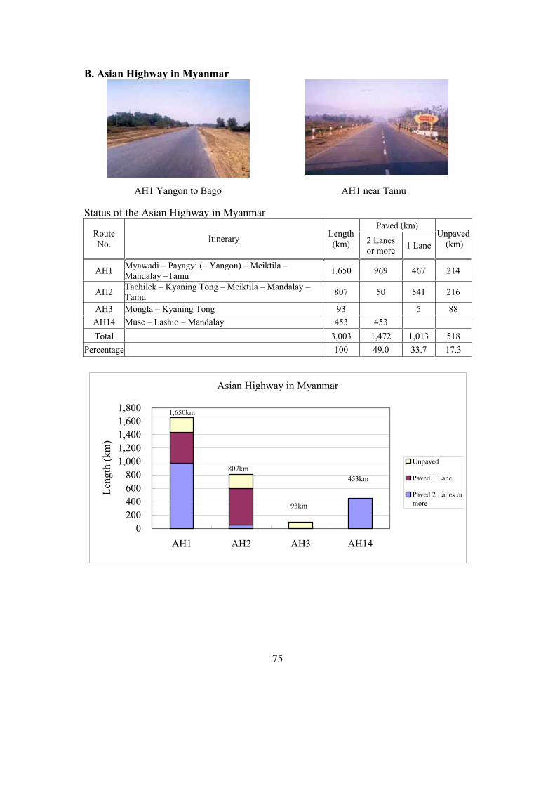
75
B. Asian Highway in Myanmar
Status of the Asian Highway in Myanmar Paved (km)
Route No.
Itinerary Length(km) 2 Lanes
or more 1 Lane
Unpaved (km)
AH1 Myawadi – Payagyi (– Yangon) – Meiktila – Mandalay –Tamu
1,650 969 467 214
AH2 Tachilek – Kyaning Tong – Meiktila – Mandalay – Tamu
807 50 541 216
AH3 Mongla – Kyaning Tong 93 5 88
AH14 Muse – Lashio – Mandalay 453 453
Total 3,003 1,472 1,013 518
Percentage 100 49.0 33.7 17.3
Asian Highway in Myanmar
0
200
400
600
800
1,000
1,200
1,400
1,600
1,800
AH1 AH2 AH3 AH14
Len
gth
(k
m)
Unpaved
Paved 1 Lane
Paved 2 Lanes or
more
1,650km
453km
93km
807km
AH1 Yangon to Bago AH1 near Tamu
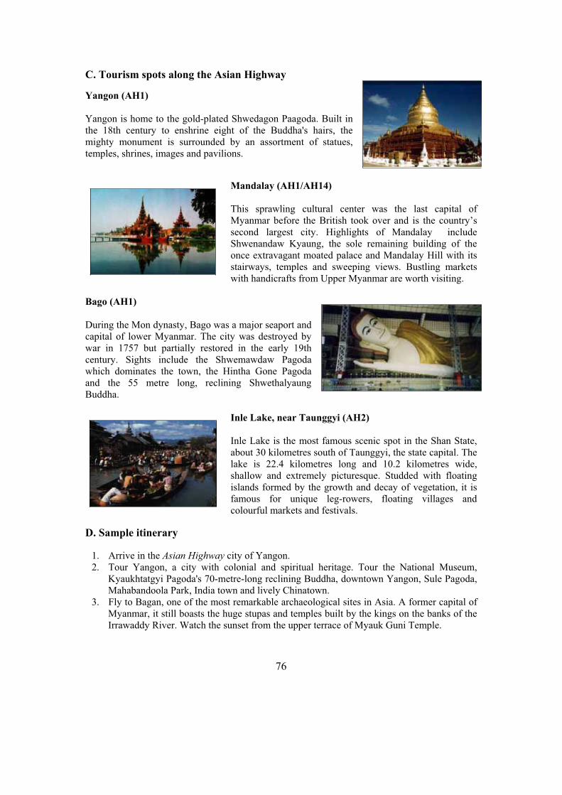
76
C. Tourism spots along the Asian Highway
Yangon (AH1)
Yangon is home to the gold-plated Shwedagon Paagoda. Built in the 18th century to enshrine eight of the Buddha's hairs, the mighty monument is surrounded by an assortment of statues, temples, shrines, images and pavilions.
Mandalay (AH1/AH14)
This sprawling cultural center was the last capital of Myanmar before the British took over and is the country’s second largest city. Highlights of Mandalay include Shwenandaw Kyaung, the sole remaining building of the once extravagant moated palace and Mandalay Hill with its stairways, temples and sweeping views. Bustling markets with handicrafts from Upper Myanmar are worth visiting.
Bago (AH1)
During the Mon dynasty, Bago was a major seaport and capital of lower Myanmar. The city was destroyed by war in 1757 but partially restored in the early 19th century. Sights include the Shwemawdaw Pagoda which dominates the town, the Hintha Gone Pagoda and the 55 metre long, reclining Shwethalyaung Buddha.
Inle Lake, near Taunggyi (AH2)
Inle Lake is the most famous scenic spot in the Shan State, about 30 kilometres south of Taunggyi, the state capital. The lake is 22.4 kilometres long and 10.2 kilometres wide, shallow and extremely picturesque. Studded with floating islands formed by the growth and decay of vegetation, it is famous for unique leg-rowers, floating villages and colourful markets and festivals.
D. Sample itinerary
1. Arrive in the Asian Highway city of Yangon. 2. Tour Yangon, a city with colonial and spiritual heritage. Tour the National Museum,
Kyaukhtatgyi Pagoda's 70-metre-long reclining Buddha, downtown Yangon, Sule Pagoda, Mahabandoola Park, India town and lively Chinatown.
3. Fly to Bagan, one of the most remarkable archaeological sites in Asia. A former capital of Myanmar, it still boasts the huge stupas and temples built by the kings on the banks of the Irrawaddy River. Watch the sunset from the upper terrace of Myauk Guni Temple.

77
4. Visit Nyaung Oo Market, the Shwezigon Pagoda and its golden stupa and Wetkyi-In Gubyaukgyi, a cave temple with mural paintings. Observe the process of traditional lacquerware, one of Myanmar's best-known handicrafts.
5. Drive to Mount Popa, an extinct volcano over 1,500 metres high. Rejoin the Asian
Highway for the drive to the former capital of Mandalay (AH1/AH14). 6. Tour Mandalay, Myanmar’s cultural capital. Visit the Kuthodaw Pagoda with its 729
marble stone slabs of Buddhist scriptures (known as the world’s biggest book), and the Kyauktawgyi Pagoda with its huge sitting Buddha.
7. Cruise down the Irrawaddy River to the former capital of Mingun, with its huge unfinished pagoda and home to the Mingun Bell, considered the world’s largest uncracked ringing bell. In the former capital of Ava, visit the Bagaya Monastery and the ruins of the Royal Palace and fort.
8. Fly from Mandalay to Heho in Shan State. Enjoy a scenic drive to Pindaya through the picturesque countryside. Visit Pindaya’s limestone cave with its maze of chambers displaying more than 8,000 Buddha statues and local handicraft workshops. Drive to Inle Lake.
9. Tour Inle Lake by boat. See the leg-rowing fishermen and the floating gardens, built up from strips of water hyacinth and mud and anchored to the bottom with bamboo poles. Visit a floating village at Ywama, the lake’s “downtown”.
10. Fly back from Heho to Yangon. 11. Visit Myanmar’s holiest monument, the Shwedagon Pagoda with its golden stupa covered
with 60 tons of pure gold leaf. Afternoon, shop at Bogyoke Market, formerly Scott’s Market.
12. Depart Yangon.
E. Government Department responsible for Asian Highway Network
Public Works, Ministry of Construction, 60, Shwedagon Pagoda Rd., Yangon, Myanmar. Tel: (95-1) 282639, 289233; Fax: (951) 289531.
F. Useful Contacts for travel and tourism information
Directorate of Hotels and Tourism, Ministry of Hotels and Tourism, No. 77-91, Sule Pagoda Road, Yangon, Myanmar. Fax: (95-1) 289 604/242 522; E-mail: [email protected];Web: www.myanmar.com/Ministry/Hotel_Tour .
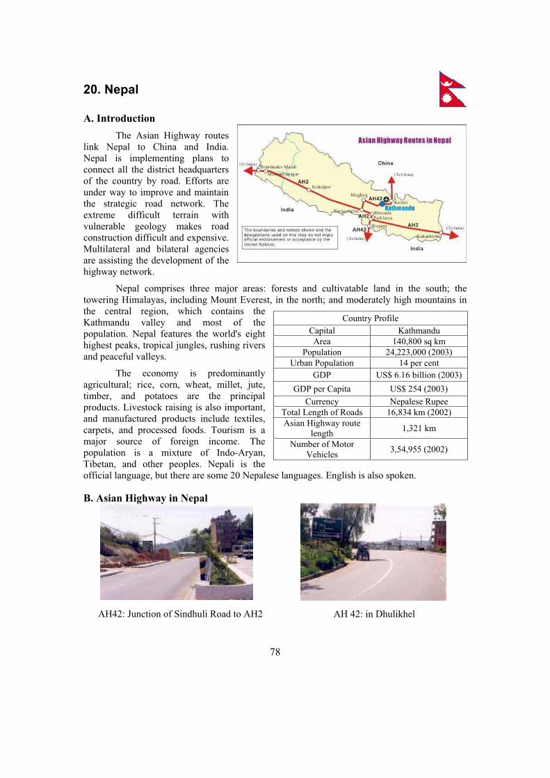
78
20. Nepal
A. Introduction
The Asian Highway routes link Nepal to China and India. Nepal is implementing plans to connect all the district headquarters of the country by road. Efforts are under way to improve and maintain the strategic road network. The extreme difficult terrain with vulnerable geology makes road construction difficult and expensive. Multilateral and bilateral agencies are assisting the development of the highway network.
Nepal comprises three major areas: forests and cultivatable land in the south; the towering Himalayas, including Mount Everest, in the north; and moderately high mountains in the central region, which contains the Kathmandu valley and most of the population. Nepal features the world's eight highest peaks, tropical jungles, rushing rivers and peaceful valleys.
The economy is predominantly agricultural; rice, corn, wheat, millet, jute, timber, and potatoes are the principal products. Livestock raising is also important, and manufactured products include textiles, carpets, and processed foods. Tourism is a major source of foreign income. The population is a mixture of Indo-Aryan, Tibetan, and other peoples. Nepali is the official language, but there are some 20 Nepalese languages. English is also spoken.
B. Asian Highway in Nepal
Country Profile
Capital Kathmandu
Area 140,800 sq km
Population 24,223,000 (2003)
Urban Population 14 per cent
GDP US$ 6.16 billion (2003)
GDP per Capita US$ 254 (2003)
Currency Nepalese Rupee
Total Length of Roads 16,834 km (2002)
Asian Highway route length
1,321 km
Number of Motor Vehicles
3,54,955 (2002)
AH 42: in Dhulikhel AH42: Junction of Sindhuli Road to AH2

79
Status of the Asian Highway in Nepal Paved (km) Route
No. Itinerary Length(km) 2 Lanes
or more 1 Lane
Unpaved (km)
AH2 Kakarbhitta – Pathlaiya – Narayanghat – Kohalpur – Mahendranagar – Bramhadev Mandi
1,024 1,024
AH42 Kodari – Kathmandu – Narayanghat – Pathlaiya –Birgunj
297 280 17
Total 1,321 1,304 17
Percentage 100 98.7 1.3
Asian Highway in Nepal
0
200
400
600
800
1,000
1,200
AH2 AH42
Len
gth
(km
)
Unpaved
Paved 1 Lane
Paved 2 Lanes or
more
1,024km
297km
C. Tourism spots along the Asian Highway
Pashupatinath, Kathmandu Valley (AH 42)
Pashupatinath is the holiest Hindu pilgrimage destination in Nepal, with linga images of Shiva, shrines, and temples. A gold-plated roof, silver doors, and woodcarvings of the finest quality decorate the pagoda construction. A circuit of the Pashupati area takes visitors past a 6th-century statue of the Buddha, an 8th-century statue of Brahma and numerous other temples.
Patan (AH42)
Patan, the second-largest city in the Kathmandu valley lies just across the Bagmati River. The city has superb temples and artisans whose handiwork provides the focus of the stunning Durbar Square, the largest display of Newari architecture in Nepal. It includes the Royal Palace and the two-tiered Jagannarayan Temple
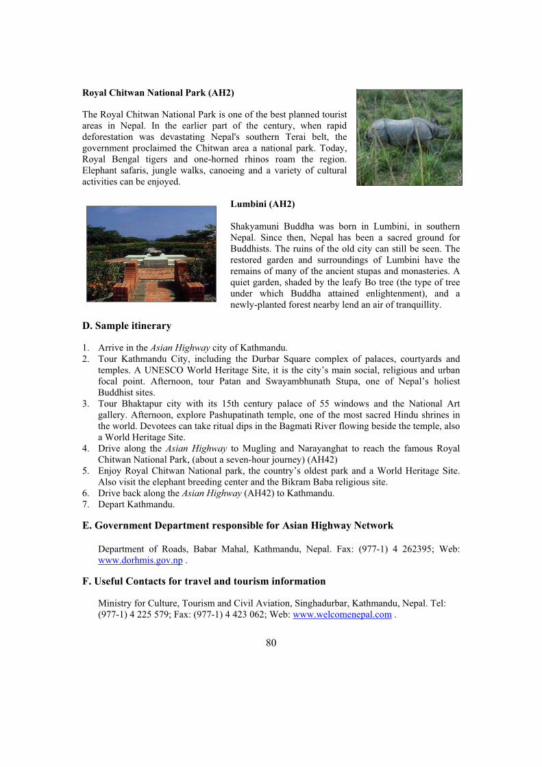
80
Royal Chitwan National Park (AH2)
The Royal Chitwan National Park is one of the best planned tourist areas in Nepal. In the earlier part of the century, when rapid deforestation was devastating Nepal's southern Terai belt, the government proclaimed the Chitwan area a national park. Today, Royal Bengal tigers and one-horned rhinos roam the region. Elephant safaris, jungle walks, canoeing and a variety of cultural activities can be enjoyed.
Lumbini (AH2)
Shakyamuni Buddha was born in Lumbini, in southern Nepal. Since then, Nepal has been a sacred ground for Buddhists. The ruins of the old city can still be seen. The restored garden and surroundings of Lumbini have the remains of many of the ancient stupas and monasteries. A quiet garden, shaded by the leafy Bo tree (the type of tree under which Buddha attained enlightenment), and a newly-planted forest nearby lend an air of tranquillity.
D. Sample itinerary
1. Arrive in the Asian Highway city of Kathmandu. 2. Tour Kathmandu City, including the Durbar Square complex of palaces, courtyards and
temples. A UNESCO World Heritage Site, it is the city’s main social, religious and urban focal point. Afternoon, tour Patan and Swayambhunath Stupa, one of Nepal’s holiest Buddhist sites.
3. Tour Bhaktapur city with its 15th century palace of 55 windows and the National Art gallery. Afternoon, explore Pashupatinath temple, one of the most sacred Hindu shrines in the world. Devotees can take ritual dips in the Bagmati River flowing beside the temple, also a World Heritage Site.
4. Drive along the Asian Highway to Mugling and Narayanghat to reach the famous Royal Chitwan National Park, (about a seven-hour journey) (AH42)
5. Enjoy Royal Chitwan National park, the country’s oldest park and a World Heritage Site. Also visit the elephant breeding center and the Bikram Baba religious site.
6. Drive back along the Asian Highway (AH42) to Kathmandu. 7. Depart Kathmandu.
E. Government Department responsible for Asian Highway Network
Department of Roads, Babar Mahal, Kathmandu, Nepal. Fax: (977-1) 4 262395; Web: www.dorhmis.gov.np .
F. Useful Contacts for travel and tourism information
Ministry for Culture, Tourism and Civil Aviation, Singhadurbar, Kathmandu, Nepal. Tel: (977-1) 4 225 579; Fax: (977-1) 4 423 062; Web: www.welcomenepal.com .

81
21. Pakistan
A. Introduction
The Asian Highway routes link Pakistan to Afghanistan, China, India and the Islamic Republic of Iran. They also provide links to Karachi, an important seaport for landlocked Afghanistan and the Central Asian Republics. The Government’s development programme aims to improve road density, maintain the road network and regulate the overloading of vehicles.
The Indus River runs the length of the country. Agriculture is the economic mainstay, with wheat, rice, cotton, and sugarcane the principal crops. Vast irrigation projects and the use of fertilisers have increased output, and the country is now self-sufficient agriculturally. The production of textiles, consumer goods, cement, and fertilisers, as well as oil refining and metal processing, are important components of Pakistan's expanding industrial base.
The area that is now Pakistan was the site of the Indus Valley civilisation, the earliest known culture on the Indian subcontinent. The territory's location placed it on the historic route from central Asia to India, and for thousands of years invaders, including Aryans, Persians, Alexander the Great, Seleucids, and Parthians, swept down on the settlements there.
The people are a mixture of many ethnic groups, with Punjabis the most numerous: Pathan tribes dominate the north west and Baluchis in the west. Urdu is the official language, while English and Punjabi, Pashto, Baluchi, and other ethnic languages are also spoken.
2 Excluding data for Jammu and Kashmir, the final status of which has not yet been determined.
Country Profile2
Capital Islamabad
Area 796,096 sq km
Population 153,578,000 (2003)
Urban Population 34 per cent
GDP US$ 74 billion (2003)
GDP per Capita US$ 482 (2003)
Currency Pakistani Rupee
Major Port Karachi
Total Length of Roads 257,000 km (2002)
Asian Highway route length
5,377 km
Number of Motor Vehicles
4,200,000 (2002)
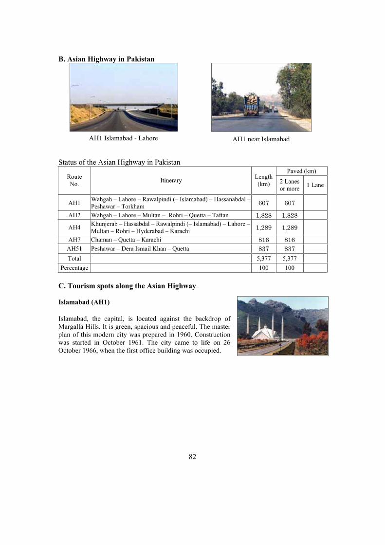
82
B. Asian Highway in Pakistan
Status of the Asian Highway in Pakistan Paved (km)
Route No.
Itinerary Length(km) 2 Lanes
or more 1 Lane
AH1 Wahgah – Lahore – Rawalpindi (– Islamabad) – Hassanabdal –Peshawar – Torkham
607 607
AH2 Wahgah – Lahore – Multan – Rohri – Quetta – Taftan 1,828 1,828
AH4 Khunjerab – Hassabdal – Rawalpindi (– Islamabad) – Lahore –Multan – Rohri – Hyderabad – Karachi
1,289 1,289
AH7 Chaman – Quetta – Karachi 816 816
AH51 Peshawar – Dera Ismail Khan – Quetta 837 837
Total 5,377 5,377
Percentage 100 100
C. Tourism spots along the Asian Highway
Islamabad (AH1)
Islamabad, the capital, is located against the backdrop of Margalla Hills. It is green, spacious and peaceful. The master plan of this modern city was prepared in 1960. Construction was started in October 1961. The city came to life on 26 October 1966, when the first office building was occupied.
AH1 Islamabad - Lahore AH1 near Islamabad
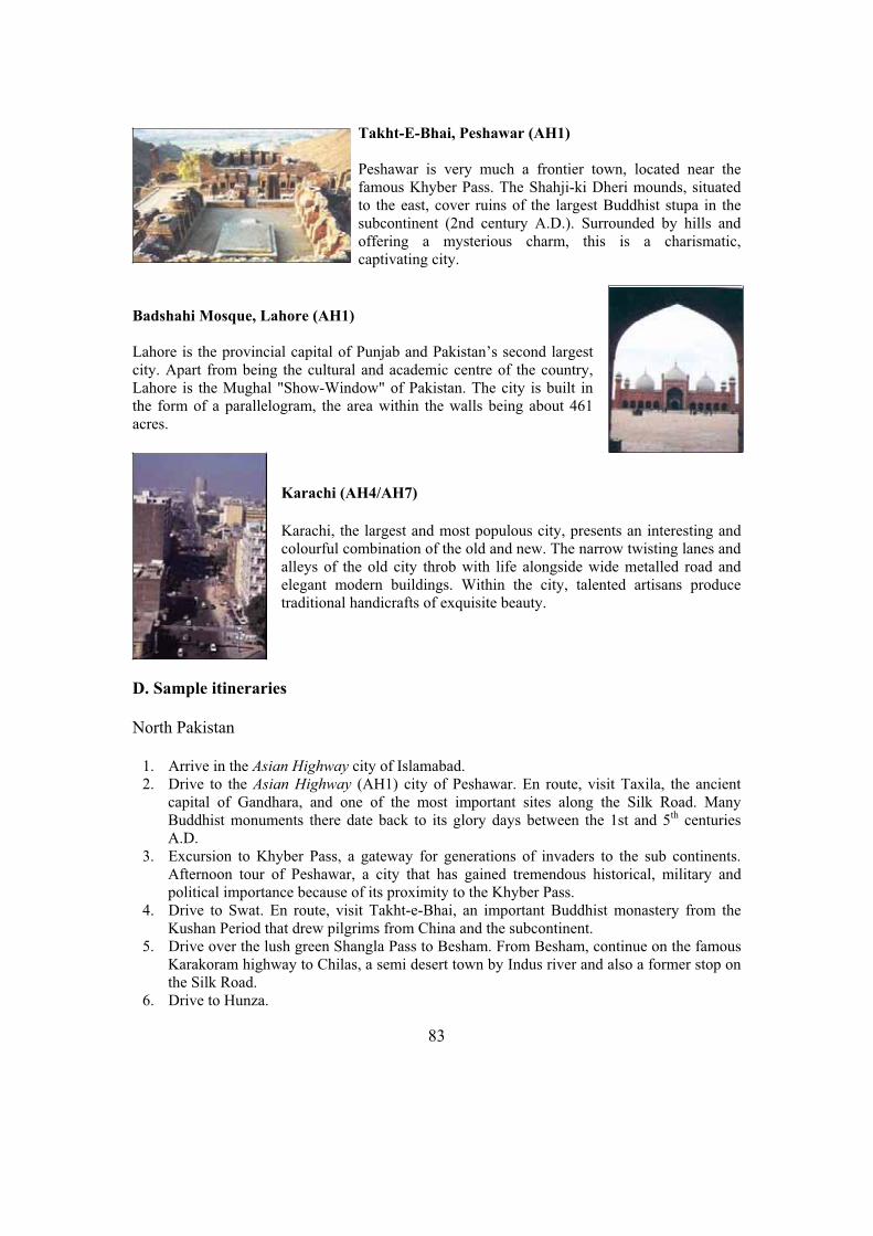
83
Takht-E-Bhai, Peshawar (AH1)
Peshawar is very much a frontier town, located near the famous Khyber Pass. The Shahji-ki Dheri mounds, situated to the east, cover ruins of the largest Buddhist stupa in the subcontinent (2nd century A.D.). Surrounded by hills and offering a mysterious charm, this is a charismatic, captivating city.
Badshahi Mosque, Lahore (AH1)
Lahore is the provincial capital of Punjab and Pakistan’s second largest city. Apart from being the cultural and academic centre of the country, Lahore is the Mughal "Show-Window" of Pakistan. The city is built in the form of a parallelogram, the area within the walls being about 461 acres.
Karachi (AH4/AH7)
Karachi, the largest and most populous city, presents an interesting and colourful combination of the old and new. The narrow twisting lanes and alleys of the old city throb with life alongside wide metalled road and elegant modern buildings. Within the city, talented artisans produce traditional handicrafts of exquisite beauty.
D. Sample itineraries
North Pakistan
1. Arrive in the Asian Highway city of Islamabad. 2. Drive to the Asian Highway (AH1) city of Peshawar. En route, visit Taxila, the ancient
capital of Gandhara, and one of the most important sites along the Silk Road. Many Buddhist monuments there date back to its glory days between the 1st and 5th centuries A.D.
3. Excursion to Khyber Pass, a gateway for generations of invaders to the sub continents. Afternoon tour of Peshawar, a city that has gained tremendous historical, military and political importance because of its proximity to the Khyber Pass.
4. Drive to Swat. En route, visit Takht-e-Bhai, an important Buddhist monastery from the Kushan Period that drew pilgrims from China and the subcontinent.
5. Drive over the lush green Shangla Pass to Besham. From Besham, continue on the famous Karakoram highway to Chilas, a semi desert town by Indus river and also a former stop on the Silk Road.
6. Drive to Hunza.

84
7. Drive by jeep to Hopper glacier in Nagar Valley. Afternoon visit the recently restored Baltit Fort, an architectural masterpiece and a major symbol of the Hunza Valley culture. Also visit the bazaar in Karimabad, the capital of Hunza.
8. Early morning drive by jeep to Duiker to watch the magnificent view of the Hunza valley at sunrise. Afternoon drive to the Asian Highway (AH4) city of Gilgit and visit the great Kargah Buddha, carved into the hillside nearby.
9. Fly back to Islamabad. 10. Depart Islamabad
Central to South Pakistan
1. Arrive in the Asian Highway city of Lahore 2. Tour Lahore, capital of the Punjab, built in the form of a parallelogram. Visit the
Mausoleum of the Mughal Emperor Jahangir, the Shalimar Gardens, Lahore Fort and the Thirteen Gates of Lahore.
3. Drive to the Asian Highway (AH2) city of Multan. En route, visit Harrapa, a lasting reminder of the golden days of the Indus Valley Civilization.
4. Explore Multan’s mausoleums and mosques. The museum is modest but contains a fine collection of coins, medals, postage stamps and manuscripts from the Islamic and pre-Islamic period. In the center of Multan Fort is a Memorial Obelisk, the only architectural remains of the British period.
5. Drive to Bahawalpur; en route visit mystic city of Uch. 6. Tour Bahawalpur, including an excursion to Derawar Fort. Bahawalpur is known for its
distinctly embroidered slippers and shoes and the filigree pottery. It has a marble mosque and a few British buildings like the Science College
7. Transfer to railway station for a train journey to the Asian Highway city of Rohri and further drive to Sukkur.
8. Drive to Mohenjodaro, the most important excavation site of the Indus Valley Civilization. Drive back to Sukkur and fly to the Asian Highway city of Karachi.
9. Tour Karachi, a tropical city on the Arabian Sea and the commercial capital of Pakistan. 10. Depart Karachi.
E. Government Department responsible for Asian Highway Network
Ministry of Communications and Railways, Block D, Pakistan Secretariat, Islamabad, Pakistan. Tel: (92-51) 9225401/2256337; Fax: (92-51) 9205454.
F. Useful Contacts for travel and tourism information
Federal Ministry for Minorities, Culture, Sports, Tourism and Youth Affairs, Room 217,
Block D, Pakistan Secretariat, Islamabad, Pakistan. Tel: (92-51) 921 0108; Fax: (92-51)
922 4697; Web: www.tourism.gov.pk.
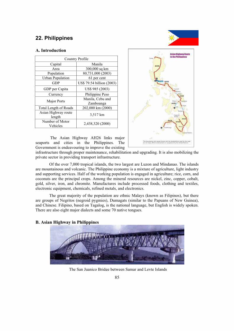
85
22. Philippines
A. Introduction
The Asian Highway AH26 links major seaports and cities in the Philippines. The Government is endeavouring to improve the existing infrastructure through proper maintenance, rehabilitation and upgrading. It is also mobilizing the private sector in providing transport infrastructure.
Of the over 7,000 tropical islands, the two largest are Luzon and Mindanao. The islands are mountainous and volcanic. The Philippine economy is a mixture of agriculture, light industry and supporting services. Half of the working population is engaged in agriculture; rice, corn, and coconuts are the principal crops. Among the mineral resources are nickel, zinc, copper, cobalt, gold, silver, iron, and chromite. Manufactures include processed foods, clothing and textiles, electronic equipment, chemicals, refined metals, and electronics.
The great majority of the population are ethnic Malays (known as Filipinos), but there are groups of Negritos (negroid pygmies), Dumagats (similar to the Papuans of New Guinea), and Chinese. Filipino, based on Tagalog, is the national language, but English is widely spoken. There are also eight major dialects and some 70 native tongues.
B. Asian Highway in Philippines
Country Profile
Capital Manila
Area 300,000 sq km
Population 80,731,000 (2003)
Urban Population 61 per cent
GDP US$ 79.54 billion (2003)
GDP per Capita US$ 985 (2003)
Currency Philippine Peso
Major Ports Manila, Cebu and
Zamboanga
Total Length of Roads 202,000 km (2000)
Asian Highway route length
3,517 km
Number of Motor Vehicles
2,438,320 (2000)
The San Juanico Bridge between Samar and Leyte Islands
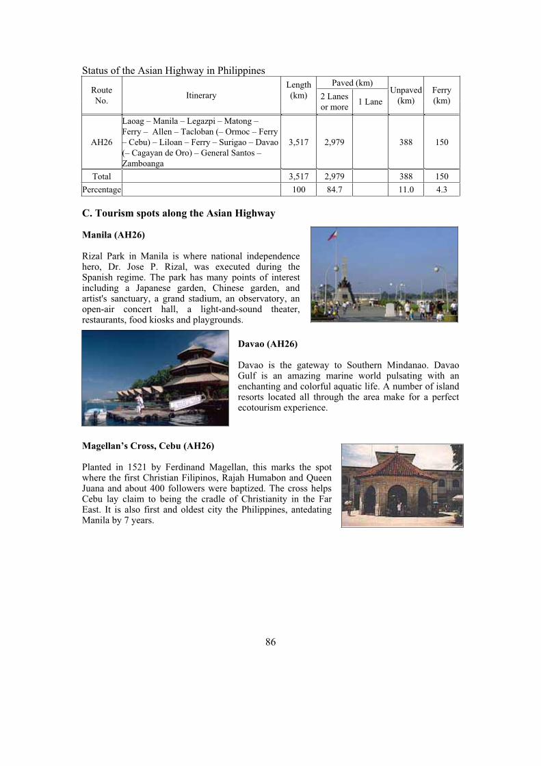
86
Status of the Asian Highway in PhilippinesPaved (km)
Route
No. Itinerary
Length
(km) 2 Lanes
or more1 Lane
Unpaved
(km)
Ferry
(km)
AH26
Laoag – Manila – Legazpi – Matong –
Ferry – Allen – Tacloban (– Ormoc – Ferry
– Cebu) – Liloan – Ferry – Surigao – Davao
(– Cagayan de Oro) – General Santos –
Zamboanga
3,517 2,979 388 150
Total 3,517 2,979 388 150
Percentage 100 84.7 11.0 4.3
C. Tourism spots along the Asian Highway
Manila (AH26)
Rizal Park in Manila is where national independence hero, Dr. Jose P. Rizal, was executed during the Spanish regime. The park has many points of interest including a Japanese garden, Chinese garden, and artist's sanctuary, a grand stadium, an observatory, an open-air concert hall, a light-and-sound theater, restaurants, food kiosks and playgrounds.
Davao (AH26)
Davao is the gateway to Southern Mindanao. Davao Gulf is an amazing marine world pulsating with an enchanting and colorful aquatic life. A number of island resorts located all through the area make for a perfect ecotourism experience.
Magellan’s Cross, Cebu (AH26)
Planted in 1521 by Ferdinand Magellan, this marks the spot where the first Christian Filipinos, Rajah Humabon and Queen Juana and about 400 followers were baptized. The cross helps Cebu lay claim to being the cradle of Christianity in the Far East. It is also first and oldest city the Philippines, antedating Manila by 7 years.

87
Laoag (AH26)
The city of Laoag is known as the ‘Sparkling Gem of Ilocandia’. Today, it is a major crossroads for trade and commerce in the Ilocos region. Though bustling with business, the city has retained pretty much an unhurried, laid-back lifestyle.
D. Sample itinerary
1. Arrive in the Asian Highway city of Manila. 2. Tour Manila, including Rizal Park, Walled City of Intramuros, ancient Fort Santiagos
Church and Casa Manila. Visit the Chinese Cemetery, Makati area, the luxurious suburb, and drive by Ayala Avenue, the Makati Commercial Center and Forbes Park.
3. Fly from Manila to Cebu, the country's oldest and third largest city. Take a ferry boat ride to Tagbilaran. Proceed to one of nature's wonders, the Chocolate Hills. Enjoy a scenic cruise down Loay River.
4. Return by ferry boat to Cebu. 5. Fly to the Asian Highway city of General Santos. Carry on to Kalsangi to tour the vast
pineapple plantation. Its cannery can process up to 1,000 tons of fresh pineapples a day. Drive to Lake Sebu, home to one of the country's colorful tribes, the T'bolis.
6. Explore Lake Sebu, along whose shores one of the most vivid market days in the Philippines are held. Observe the T'boli craftsmen at work on their brass and bronze designs, and the T'nalak weavers with their abaca fiber handicrafts. Physically fit visitors can explore one of the seven waterfalls in the area. Return to General Santos City.
7. Depart for the busy fish-port of General Santos and watch the pre-daylight drama of fishmongers getting ready to sell their catch. Drive towards the Asian Highway (AH26) city of Davao through the winding highway. Visit the Philippine Eagle Sanctuary.
8. Fly back to Manila. 9. Depart Manila.
E. Government Department responsible for Asian Highway Network
Department of Public Works and Highways, Project Management Office, 63 Visayas Avenue, Project 6, Quezon City, Philippines. Tel: (632) 4560847/9265768; Fax: (632) 9265768; Web: www.dpwh.gov.ph .
F. Useful Contacts for travel and tourism information
Department of Tourism, Office of the Secretary, T.M. Kalaw, Malate, Manila, Philippines. Tel: (63-2) 524 1751; Fax: (63-2) 521 7374; E-mail: [email protected]; Web: www.tourism.gov.ph .

88
23. Republic of Korea
A. Introduction
The Asian Highway routes in the Republic of Korea link the Democratic People’s Republic of Korea and the seaport of Pusan. Road transport is the dominant mode for passenger and freight traffic. There is strong demand for additional road infrastructure due to the rapidly increasing number of motor vehicles. By 2020 the Government is planning to construct around 6,000 kilometres grid pattern expressway network, 9 arterial expressway running east to west and 7 running north to south.
The land is largely mountainous. Some 3,420 islands, mostly uninhabited, lie off the coast. Of the peninsula's five major minerals gold, iron ore, coal, tungsten, and graphite - only the last two are found principally in the south. About 20 per cent of land is arable; rice, barley, wheat, corn, soybeans, and grain sorghums are extensively cultivated. The fishing waters off Korea are among the best in the world.
As one of the Four Tigers of East Asia, South Korea has achieved an incredible record of growth and integration into the high-tech modern world economy. Important
industrial advances were made in the 1960s, 1970s, and 1980s, and the Republic of Korea now has one of the most rapidly growing economies in Asia. Manufactured products include textiles, clothing, processed foods, electrical and electronic equipment, automobiles, chemicals, ceramics, and a variety of consumer products. The nation's rapid industrialization and urbanization in the 1960s and 1970s has been accompanied by a continuing migration of rural residents into the cities, particularly Seoul. Korean is the national language; English is widely taught.
Country Profile
Capital Seoul
Area 98,480 sq km
Population 48,020,000 (2003)
Urban Population 84 per cent
GDP US$ 507 billion (2003)
GDP per Capita US$ 10,567 (2003)
Currency South Korean Won
Major Ports Pusan
Total Length of Roads 96,037 km (2002)
Asian Highway route length
907 km
Number of Motor Vehicles
13,905,705 (2002)

89
B. Asian Highway in Republic of Korea
Status of the Asian Highway in the Republic of Korea
Paved (km) Route No.
Itinerary Length(km) 2 Lanes
or more 1 Lane
AH1 Pusan – Kyongju – Taejon – Seoul – Panmunjom 500 500
AH6 Pusan – Kyongju – Kangnung – Kansong – Border of DPRK 407 407
Total 907 907
Percentage 100 100
C. Tourism spots along the Asian Highway
Seoul (AH1)
Seoul, a historical and cultural city, has been the capital of the Republic of Korea for more than 600 years since the Joseon Dynasty was founded in 1392. About a quarter of the total Korean population live in Seoul, a center of politics and economy. The city is trying to develop itself into a hub of North-East Asia, under the master plan worked out in preparation for the 21st century.
Kyongju City (AH1/AH6)
The Kyongju Historic Areas contain a remarkable concentration of outstanding examples of Korean Buddhist art, in the form of sculptures, reliefs, pagodas, and the remains of temples and palaces. This form of unique artistic expression flowered between the 7th and 10th centuries.
AH1 Hobeop Junction in Daejeon AH1 near Osan between Daejeon and Seoul
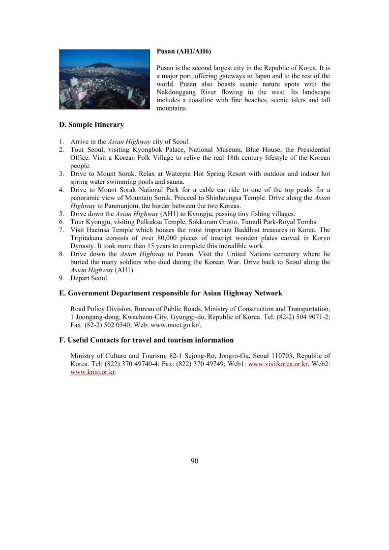
90
Pusan (AH1/AH6)
Pusan is the second largest city in the Republic of Korea. It is a major port, offering gateways to Japan and to the rest of the world. Pusan also boasts scenic nature spots with the Nakdonggang River flowing in the west. Its landscape includes a coastline with fine beaches, scenic islets and tall mountains.
D. Sample Itinerary
1. Arrive in the Asian Highway city of Seoul. 2. Tour Seoul, visiting Kyongbok Palace, National Museum, Blue House, the Presidential
Office. Visit a Korean Folk Village to relive the real 18th century lifestyle of the Korean people.
3. Drive to Mount Sorak. Relax at Waterpia Hot Spring Resort with outdoor and indoor hot spring water swimming pools and sauna.
4. Drive to Mount Sorak National Park for a cable car ride to one of the top peaks for a panoramic view of Mountain Sorak. Proceed to Shinheungsa Temple. Drive along the Asian
Highway to Panmunjom, the border between the two Koreas. 5. Drive down the Asian Highway (AH1) to Kyongju, passing tiny fishing villages. 6. Tour Kyongju, visiting Pulkuksa Temple, Sokkuram Grotto, Tumuli Park-Royal Tombs. 7. Visit Haeinsa Temple which houses the most important Buddhist treasures in Korea. The
Tripitakana consists of over 80,000 pieces of inscript wooden plates carved in Koryo Dynasty. It took more than 15 years to complete this incredible work.
8. Drive down the Asian Highway to Pusan. Visit the United Nations cemetery where lie buried the many soldiers who died during the Korean War. Drive back to Seoul along the Asian Highway (AH1).
9. Depart Seoul.
E. Government Department responsible for Asian Highway Network
Road Policy Division, Bureau of Public Roads, Ministry of Construction and Transportation, 1 Joongang-dong, Kwacheon-City, Gyunggi-do, Republic of Korea. Tel: (82-2) 504 9071-2; Fax: (82-2) 502 0340; Web: www.moct.go.kr/.
F. Useful Contacts for travel and tourism information
Ministry of Culture and Tourism, 82-1 Sejong-Ro, Jongro-Gu, Seoul 110703, Republic of Korea. Tel: (822) 370 49740-4; Fax: (822) 370 49749; Web1: www.visitkorea.or.kr, Web2: www.knto.or.kr.

91
24. Russian Federation
A. Introduction
The Asian Highway routes link the Russian Federation to Azerbaijan, Belarus, China, the Democratic People’s Republic of Korea, Finland, Kazakhstan, Mongolia and Ukraine. The Asian Highway routes also provide important access to the seaports of Vladivostok, Nahodka and St. Petersburg. Although road construction has been concentrated in the European part of the country, the new 10-year national highway programme pays more attention to development of the Asian part of the Russian Federation, including Siberia and the Russian Far East.
The “North-South” corridor, linking Scandinavia with the Caucasus, Central Asian and the Islamic Republic of Iran, and the East-West corridor linking Eastern Europe and the Far East through the Russian Federation are two important Asian Highway routes.
The Russian Federation stretches about 8,000 kilometres from the Baltic Sea to the Pacific Ocean. The biggest country in the world, the Russian Federation occupies 11.5 per cent of the world’s land-mass. It covers eleven time zones. Along with Moscow, St. Petersburg is an important administrative, business and cultural centre.
Country Profile
Capital Moscow
Area 17,075,200 sq km
Population 143,246,000 (2003)
Urban Population 73 per cent
GDP US$ 417.54 billion (2003)
GDP per Capita US$ 2,914 (2003)
Currency Russian Ruble
Major ports Vladivostok, Nahodka, St.
Petersburg
Total Length of Roads 922,000 km (2002)
Asian Highway route length
16,869 km
Number of Motor Vehicles
25,393,700 (2000)
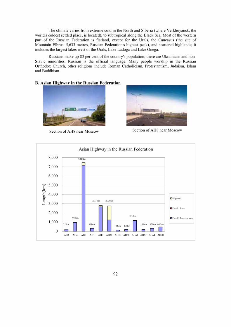
92
The climate varies from extreme cold in the North and Siberia (where Verkhoyansk, the world's coldest settled place, is located), to subtropical along the Black Sea. Most of the western part of the Russian Federation is flatland, except for the Urals, the Caucasus (the site of Mountain Elbrus, 5,633 metres, Russian Federation's highest peak), and scattered highlands; it includes the largest lakes west of the Urals, Lake Ladoga and Lake Onega.
Russians make up 83 per cent of the country's population; there are Ukrainians and non-Slavic minorities. Russian is the official language. Many people worship in the Russian Orthodox Church, other religions include Roman Catholicism, Protestantism, Judaism, Islam and Buddhism.
B. Asian Highway in the Russian Federation
Asian Highway in the Russian Federation
0
1,000
2,000
3,000
4,000
5,000
6,000
7,000
8,000
AH3 AH4 AH6 AH7 AH8 AH30 AH31 AH60 AH61 AH63 AH64 AH70
Len
gth
(km
)
Unpaved
Paved 1 Lane
Paved 2 Lanes or more
219km
7,443km
308km
2,777km 2,739km
124km 178km
1,173km
186km 326km 462km
934km
Section of AH8 near Moscow Section of AH8 near Moscow
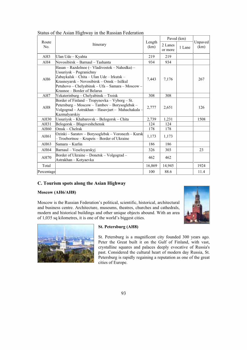
93
Status of the Asian Highway in the Russian Federation Paved (km)
Route No.
Itinerary Length(km) 2 Lanes
or more 1 Lane
Unpaved(km)
AH3 Ulan Ude – Kyahta 219 219
AH4 Novosibirsk – Barnaul – Tashanta 934 934
AH6
Hasan – Razdolnoe (– Vladivostok – Nahodka) – Ussuriysk – Pogranichny Zabaykalsk – Chita – Ulan Ude – Irkutsk – Krasnoyarsk – Novosibirsk – Omsk – Isilkul Petuhovo – Chelyabinsk – Ufa – Samara – Moscow –Krasnoe – Border of Belarus
7,443 7,176 267
AH7 Yekaterinburg – Chelyabinsk – Troisk 308 308
AH8
Border of Finland – Tropynovka – Vyborg – St. Petersburg – Moscow – Tambov – Borysoglebsk – Volgograd – Astrakhan – Hasavjurt – Mahachakala –Kazmalyarskiy
2,777 2,651 126
AH30 Ussuriysk – Khabarovsk – Belogorsk – Chita 2,739 1,231 1508
AH31 Belogorsk – Blagoveshchensk 124 124
AH60 Omsk – Chelrak 178 178
AH61 Ozinki – Saratov – Borysoglebsk – Voronezh – Kursk – Troebortnoe – Krupets – Border of Ukraine
1,173 1,173
AH63 Samara – Kurlin 186 186
AH64 Barnaul – Veseloyarskyj 326 303 23
AH70 Border of Ukraine – Donetsk – Volgograd – Astrakhan – Kotyaevka
462 462
Total 16,869 14,945 1924
Percentage 100 88.6 11.4
C. Tourism spots along the Asian Highway
Moscow (AH6/AH8)
Moscow is the Russian Federation’s political, scientific, historical, architectural and business centre. Architecture, museums, theatres, churches and cathedrals, modern and historical buildings and other unique objects abound. With an area of 1,035 sq kilometres, it is one of the world’s biggest cities.
St. Petersburg (AH8)
St. Petersburg is a magnificent city founded 300 years ago. Peter the Great built it on the Gulf of Finland, with vast, crystalline squares and palaces deeply evocative of Russia's past. Considered the cultural heart of modern day Russia, St. Petersburg is rapidly regaining a reputation as one of the great cities of Europe.
94
Vladivostok (AH6)
Vladivostok ("Lord of the East" in Russian) is located less than 100 kilometres east of the Chinese border. Today, businesses from all over the world have flooded in to take advantage of the city's position as a crossroads of North-East Asia.
Irkutsk (AH6)
Irkutsk is one of great economic and cultural centers in the eastern part of the Russian Federation. Formerly cut off by the rocky Urals, this distant Siberian city is today a city of youth and students. It abounds with institutes and colleges, vocational schools and libraries.
D. Sample itineraries
Central Region
1. Arrive in the Asian Highway (AH6) city of Irkutsk. 2. Tour Irkutsk – one of the oldest cities in Siberia. See the white stone churches in Siberian
baroque style, carved wooden houses, visit the art museum and the local Lore Museum. 3. Drive to Sludianka city. Enjoy the Siberian taiga forest with its slender birch trees and
mighty pines. 4. Drive to one of the highest peaks of the Baikal region, Cherskiy Peak, for a breathtaking
view of the snowy mountains of the Sayan and smooth surface of Baikal. The ascent with stops for rest takes about 3.5 hours. The descent is much quicker.
5. Enjoy a fascinating programme on the shore of Baikal. Take a train to Port Baikal along the Circumbaikal Loop. After a 30-minute boat ride, arrive at Listvyanka settlement.
6. Take a pedestrian, bicycle or horseback tour round the Listvyanka fishermen settlement with a visit to old St. Nicholas Church to understand the traditions and way of life of the local people. Visit the well-known museum of Baikal history. On the way back to Irkutsk, visit the open-air ethnographic museum.
7. Depart Irkutsk.
Moscow - St. Petersburg
1. Arrive in the Asian Highway city of Moscow. 2. Tour Moscow to see the Red Square, the historical center, Tverskaya Street, Christ the
Saviour Cathedral. 3. Visit the Kremlin, the former residence of Czars and Patriarchs, and the Armory with its
fabulous collection of Gold, silver, jewelry, Faberge eggs, carriages and Czarist thrones. Experience the legendary Moscow Metro with its mosaics and frescos.
4. Excursion to Kolomenskoye, the summer residence of Czars since the time of Ivan the Terrible.
5. Drive along the Asian Highway (AH8) to St. Petersburg.6. Tour St. Petersburg. Visit Peter and Paul’s Fortress, the oldest building in St. Petersburg and
former political prison, Alexander Nevsky Convent, once one of the country’s most revered monasteries, and St. Isaac's Cathedral.

95
7. Excursion to the Hermitage, with its enormous collection of Western art. There are also historical, Russian and Oriental sections definitely worth visiting.
8. Depart St. Petersburg.
E. Government Department responsible for Asian Highway Network
Ministry of Transport, Bochkova St. 4, Moscow 189085, Russian Federation. Tel: (7-095) 2878 087; Fax: (7-095) 287 9146; Web1: http://www.rosavtodor.ru/en/ , Web2: www.mintrans.ru .
F. Useful Contacts for travel and tourism information
Tourism Department, Ministry of Economic Development and Trade, 47, Myasnitskaya str., Moscow, Russian Federation. Tel: (7-095) 207-3602; E-mail: [email protected]; Web: www.russiatourism.ru/eng.

96
25. Singapore
A. Introduction
The Asian Highway links Singapore to Indonesia (by ferry) and Malaysia. Singapore has a comprehensive road network aimed at providing better connectivity to all commuters and to sustain economic growth. The Woodlands Checkpoint-West Coast Highway is the existing Asian Highway which is of primary class with six lanes. Inclusion of the Second Link-Tuas Check Point-West Coast Highway in the Asian Higwhay network is still under negotiation.
Singapore is largely a low-lying island with a tropical climate. It is almost entirely urbanized and densely populated. Lying on the equator, the thriving city-state that has become one of the juggernaut economies of Asia. Its port, at Keppel Harbor, is one of the world's largest and busiest. The economy is supported primarily by manufacturing, service industries like tourism, and trade. Shipbuilding is also important.
The population is mainly Chinese; Malays and Indians constitute large minorities. Malay, Chinese, Tamil and English are all widely spoken.
B. Asian Highway in Singapore
Country Profile
Capital Singapore
Area 692.7 sq km
Population 4,452,732 (July 2002 est.)
Urban Population 100 per cent
GDP US$ 95.94 billion (2003)
GDP per Capita US$ 21,547 (2003)
Currency Singapore Dollar
Major Ports Singapore
Total Length of Roads 3,149km (2002)
Asian Highway route length
19 km
Number of motor vehicles 706,956 (2002)
AH2: Woodlands Chekpoint
AH2: Bukit Timah Expressway

97
Status of the Asian Highway in SingaporePaved (km)
Route
No. Itinerary
Length
(km) 2 Lanes
or more 1 Lane
AH2 Singapore – Woodland 19 19
Total 19 19
Percentage 100 100
C. Tourism spots along the Asian Highway
Sentosa (AH2)
“Sentosa”, meaning peace and tranquility in Malay, is one of Singapore’s top recreational playgrounds. One of its highlights is Underwater World, a state-of-the-art leisure and educational attraction showcasing the rich variety of marine life to be found around the region.
The Esplanade (AH2)
The Esplanade is the country’s centre of culture and performing arts. It boasts theatres, concert halls, a library, galleries and restaurants. It has earned the nickname "Durian", as its shape resembles two halves of the yellow-green durian fruit from South-East Asia and the roofs bring to mind its prickly outer skin.
D. Sample itinerary
1. Arrive in the Asian Highway city of Singapore. 2. Tour Jurong Bird Park. Take the panorail ride for a panoramic view of the park and to the
world’s largest walk-in aviary. The famed bird show is claimed to be the first of its kind in this region and boasts a wide variety of performing birds.
3. Visit Sentosa Island, the Isle of Tranquility. Take a scenic cable car ride to Sentosa and catch a bird's eye view of Singapore's skyline and one of the world's busiest ports. The Underwater World is one of Asia's largest tropical oceanariums.
4. Spend a day shopping at Chinatown, Little India, Arab Street and the many shopping malls. Try the Night Safari, claimed to be the world's first wildlife park to be viewed by night.
5. Depart Singapore.
E. Government Department responsible for Asian Highway Network
Land Transport Authority, 460 Alexandra Road, #26-00 PSA Building, Singapore 119963. Tel: (65) 6375 7254; Fax: (65) 6377 7000; Web: www.lta.gov.sg; Ministry of Transport, Web: www.mot.gov.sg.
F. Useful Contacts for travel and tourism information
Singapore Tourism Board, Tourism Court 1 Orchard Spring Lane, Singapore 247729. Tel: (65) 6736 6622; Fax: (65) 6736 9423; Web: www.stb.com.sg.
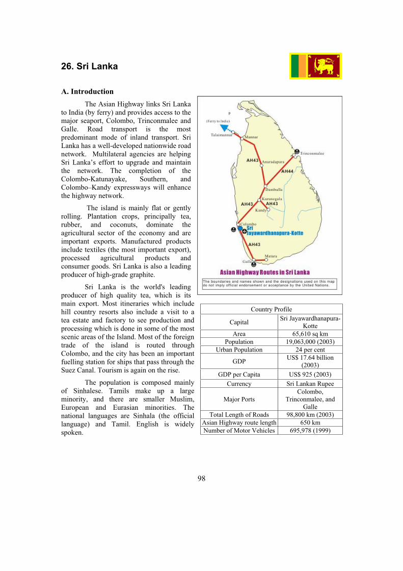
98
26. Sri Lanka
A. Introduction
The Asian Highway links Sri Lanka to India (by ferry) and provides access to the major seaport, Colombo, Trinconmalee and Galle. Road transport is the most predominant mode of inland transport. Sri Lanka has a well-developed nationwide road network. Multilateral agencies are helping Sri Lanka’s effort to upgrade and maintain the network. The completion of the Colombo-Katunayake, Southern, and Colombo–Kandy expressways will enhance the highway network.
The island is mainly flat or gently rolling. Plantation crops, principally tea, rubber, and coconuts, dominate the agricultural sector of the economy and are important exports. Manufactured products include textiles (the most important export), processed agricultural products and consumer goods. Sri Lanka is also a leading producer of high-grade graphite.
Sri Lanka is the world's leading producer of high quality tea, which is its main export. Most itineraries which include hill country resorts also include a visit to a tea estate and factory to see production and processing which is done in some of the most scenic areas of the Island. Most of the foreign trade of the island is routed through Colombo, and the city has been an important fuelling station for ships that pass through the Suez Canal. Tourism is again on the rise.
The population is composed mainly of Sinhalese. Tamils make up a large minority, and there are smaller Muslim, European and Eurasian minorities. The national languages are Sinhala (the official language) and Tamil. English is widely spoken.
Country Profile
Capital Sri Jayawardhanapura-
Kotte
Area 65,610 sq km
Population 19,063,000 (2003)
Urban Population 24 per cent
GDP US$ 17.64 billion
(2003)
GDP per Capita US$ 925 (2003)
Currency Sri Lankan Rupee
Major Ports Colombo,
Trinconmalee, and Galle
Total Length of Roads 98,800 km (2003)
Asian Highway route length 650 km
Number of Motor Vehicles 695,978 (1999)
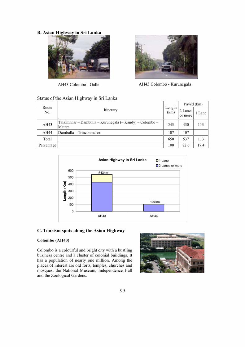
99
B. Asian Highway in Sri Lanka
Status of the Asian Highway in Sri Lanka
Paved (km) Route No.
Itinerary Length(km) 2 Lanes
or more 1 Lane
AH43 Talaimnnar – Dambulla – Kurunegala (– Kandy) – Colombo – Matara
543 430 113
AH44 Dambulla – Trinconmalee 107 107
Total 650 537 113
Percentage 100 82.6 17.4
Asian Highway in Sri Lanka
0
100
200
300
400
500
600
AH43 AH44
Le
ng
th (
Km
)
1 Lane
2 Lanes or more
543km
107km
C. Tourism spots along the Asian Highway
Colombo (AH43)
Colombo is a colourful and bright city with a bustling business centre and a cluster of colonial buildings. It has a population of nearly one million. Among the places of interest are old forts, temples, churches and mosques, the National Museum, Independence Hall and the Zoological Gardens.
AH43 Colombo - Galle AH43 Colombo - Kurunegala

100
Sacred City of Kandy (AH43)
Kandy was the last capital of the Sinhala kings whose patronage enabled the Dinahala culture to flourish for more than 2,500 years until the occupation of Sri Lanka by the British in 1815. It is also the site of the Temple of the Tooth Relic (the sacred tooth of the Buddha), which is a famous pilgrimage site.
Sigiriya
The ruins of the capital built by King Kassapa I (reigned 177-495 AD) lie on the steep slopes and at the summit of a granite peak standing some 370 m high. A series of galleries and staircases emerging from the mouth of a gigantic lion constructed of bricks and plaster provide access to the site.
D. Sample itinerary
1. Arrive in the Asian Highway city of Colombo. 2. City tour, featuring nearby Pettah, Colombo's busiest and most traditional bazaar, and
Cinnamon Gardens, the prestigious residential area. 3. Drive along the Asian Highway (AH43) to Pinnewela. Visit the elephant orphanage to see
the feeding or the daily river-bath. Later in Dambulla, visit the cave temples with statues of the Buddha and Hindu deities. Drive to Polonnaruwa, the former capital of the Sinhalese kings.
4. Drive along the Asian Highway (AH43) to Anuradhapura, a former royal capital. Visit the tallest pagoda of Sri Lanka and the temple of the holy Bo-tree. Afternoon, visit Mihintale where Buddhism began in Sri Lanka. In a series of flights, 1,840 granite steps lead up the hillside.
5. Drive to the Sigiriya rock. Worth the climb are the phenomenal frescoes of the Sigiriya Maidens. Continue along the Asian Highway (AH43) to the hill-city of Kandy where the palace of the last Sinhalese king has become a temple and the holiest shrine in Sri Lanka.
6. Visit the Botanical Garden Peradeniya. During World War II, it served as headquarters of Earl Mountbatten, Supreme Commander of the allied forces in South-East Asia. From Peradeniya the road ascends to 1,500 metres through tea country.
7. Leave for Hambantota. Afternoon, do a photo safari into the Bundala game park. 8. Leave Hambantota. At Dondora, reach the most southern point of the island. Visit the old
city of Galle and its well-preserved fort. Pass through resorts like Bentota, Beruwala, Kalutara. See the "toddy-tappers", young men who climb the trees to collect the sweet, milky sap of the coconut blossom, or one of the many turtle hatcheries. Reach Colombo.
9. Depart Colombo.
E. Government Department responsible for Asian Highway Network
Ministry of Highways, 9th Fl, Sethsiripaya, Battaramulla, Sri Lanka. Tel: (94-1) 887473/822402; Fax: (94-1) 862686; Ministry of Highways, Web: www.mohsl.gov.lk ;Road Development Authority, Web: www.rda.gov.lk .
F. Useful Contacts for travel and tourism information
Ministry of Tourism, No.64, Galle Road, Colombo 03, Sri Lanka. Tel:(94-1) 441 464; Fax: (94-1) 441 501; E-mail: [email protected]; Web: www.srilankatourism.org .

101
27. Tajikistan
A. Introduction
The Asian Highway routes link Tajikistan to Afghanistan,Kyrgyzstan, and Uzbekistan. Due to its mountainous topography, the highways play an important role in linking different parts of the country. The route AH7 in Tajikistan provides a link to the seaports in the Islamic Republic of Iran and Pakistan for Central Asia.
Development of modern transport corridors is under way to integrate transport and communications between states and regions and overcome economic isolation.
The economy is largely agricultural, producing cotton, wheat, barley, fruits, mulberry trees (for silk), and livestock. Mineral resources include coal, antimony, gold, and salt. Manufactured products are largely agriculture-related but also include textiles, carpets, and leather products, canned goods, and metalworking. Tajikistan has experienced strong economic growth since 1997. Continued privatization of medium and large state-owned enterprises will further increase productivity.
The majority of the population are Tajiks; Uzbeks and Russians are the largest minorities. The official language is Tajik, which is closely related to Persian (Farsi).
Country Profile
Capital Dushanbe
Area 143,100 sq km
Population 6,245,000 (2003)
Urban Population 28 per cent
GDP US$ 1.20 billion (2003)
GDP per Capita US$ 192 (2003)
Currency Somoni
Total Length of Roads 27,767 km (2001)
Asian Highway route length
1,925 km
Number of Motor Vehicles
134,000 (1999)

102
B. Asian Highway in Tajikistan
Status of the Asian Highway in TajikistanPaved (km)
Route No.
Itinerary Length(km) 2 Lanes
or more1
Lane
Unpaved (km)
Ferry (km)
MissingLink(km)
AH7 Border of Uzbekistan – Chavast – Dushanbe – Nizhniy Panj
497 413 83 1
AH65 Border of Kyrgyzstan – Vakhdat – Dushanbe – Tursunzade
433 404 29
AH66 Kulma Pass – Khorugh – Kulob – Vakhdat
995 854 108 33
Total 1,925 1,671 220 1 33
Percentage 100 86.8 11.4 0.1 1.7
Asian Highway in Tajikistan
0
200
400
600
800
1,000
1,200
AH7 AH65 AH66
Len
gth
(km
) Missing link
Ferry
Unpaved
Paved 1 Lane
Paved 2 Lanes or more
497km
995km
433km
Anjiei Ltd.
AH7: Dushanbe to AnjiAH7: Anzob Tunnel Dushanbe to Anji
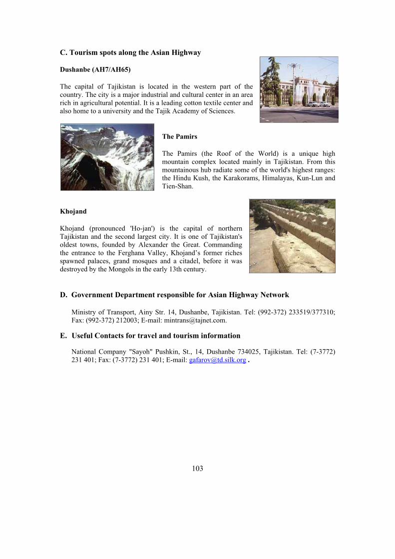
103
C. Tourism spots along the Asian Highway
Dushanbe (AH7/AH65)
The capital of Tajikistan is located in the western part of the country. The city is a major industrial and cultural center in an area rich in agricultural potential. It is a leading cotton textile center and also home to a university and the Tajik Academy of Sciences.
The Pamirs
The Pamirs (the Roof of the World) is a unique high mountain complex located mainly in Tajikistan. From this mountainous hub radiate some of the world's highest ranges: the Hindu Kush, the Karakorams, Himalayas, Kun-Lun and Tien-Shan.
Khojand
Khojand (pronounced 'Ho-jan') is the capital of northern Tajikistan and the second largest city. It is one of Tajikistan's oldest towns, founded by Alexander the Great. Commanding the entrance to the Ferghana Valley, Khojand’s former riches spawned palaces, grand mosques and a citadel, before it was destroyed by the Mongols in the early 13th century.
D. Government Department responsible for Asian Highway Network
Ministry of Transport, Ainy Str. 14, Dushanbe, Tajikistan. Tel: (992-372) 233519/377310; Fax: (992-372) 212003; E-mail: [email protected].
E. Useful Contacts for travel and tourism information
National Company "Sayoh" Pushkin, St., 14, Dushanbe 734025, Tajikistan. Tel: (7-3772) 231 401; Fax: (7-3772) 231 401; E-mail: [email protected] .

104
28. Thailand
A. Introduction
The Asian Highway routes link Thailand to Cambodia, Lao People’s Democratic Republic, Malaysia and Myanmar and to the major seaports of Bangkok and Laem Chabang. Thailand has a well-developed road network that will be the central part of a East West Corridor between South and South-East Asia, as well as a North-South corridor linking the ASEAN countries to China. The current road network development plan includes construction of an inter-city motorway network and upgrading of the main national trunk road to four lanes.
A fertile, thickly populated plain, the core of the country, rises to mountains and forests in the north and the Korat plateau in the north east and east; a narrow, mountainous peninsula extends southward into the Gulf of Thailand. The climate is tropical with monsoons.
Thailand's economy is primarily agricultural but manufacturing and tourism are major sources of foreign exchange earnings. Tourism is now becoming an increasingly important factor in the economic development programme. Rice is the main crop and the major factor in a normally favourable trade balance; rubber, teak, and tin are also valuable commodities.
Thais, ethnically related to the Shan of Myanmar and Lao of Lao People’s Democratic Republic, constitute 75 per cent of the population; there are large Chinese minorities. Thai is the national language but English is widely used in the business community.
Country Profile
Capital Bangkok
Area 514,000 sq km
Population 62,843,000 (2003)
Urban Population 31 per cent
GDP US$ 132 billion (2003)
GDP per Capita US$ 2,106 (2003)
Currency Baht
Major Ports Bangkok and Laem
Chabang
Total Length of Roads 249,243 km (2001)
Asian Highway route length
4,556 km
Number of Motor Vehicles
6,234,000 (1996)

105
B. Asian Highway in Thailand
Status of the Asian Highway in Thailand Paved (km)
Route No.
Itinerary Length(km) 2 Lanes
or more 1 Lane
Ferry (km)
AH1 Aranyaprathet – Kabin Buri – Hinkong – Bang Pa-in (– Bangkok) – Nakhon Sawan – Tak – Mae Sot
701 700
AH2 Sa Dao – Hat Yai – Bangkok – Bang Pa-in Nakhon Sawan – Tak – Chiang Rai – Mae Sai – Tachilek
1,549 1,549
AH3 Chiang Khong – Chiang Rai 117 116 1
AH12 Nong Khai – Udon Thani – Khon Kaen – Nakhon Ratchasima – Hin Kong
511 510
AH13 Huai Kon – Nan – Uttaradit – Phitsanulok – Nakhon Sawan
557
AH15 Nakhon Phanom – Udon Thani 243 242 1
AH16 Mukhdahan – Khon Kaen – Phitsanulok – Tak 708 707 1
AH18 Hat Yai – Sungai Kolok 268 268
AH19 Nakhon Ratchasima – Kabin Buri – Laem Chabang – Chonburi – Bangkok
458 458
Total 5,113 4,553 3
Percentage
C. Tourism spots along the Asian Highway
Grand Palace, Bangkok (AH1/AH2)
Built by King Rama I and completed in 1782, the magnificent Grand Palace complex houses the Temple of the Emerald Buddha, one of the most venerated sites in Thailand. On special occasions, the Grand Palace is the locale of important religious ceremonies usually presided over by the King or a leading member of the Royal Family.
AH1 Bangkok to Don Muang AirportAH1 near Bang Pa-in
106
Historic Town of Sukhothai (AH2)
Sukhothai was the capital of the first Kingdom of Siam in the 13th and 14th centuries. It has a number of fine monuments, illustrating the beginnings of Thai architecture. The great civilization which evolved in the Kingdom of Sukhothai absorbed numerous influences and ancient local traditions and is now a UNESCO World Heritage Site.
Golden Triangle, Chiang Rai (AH2/AH3)
Chiang Rai, Thailand's most northern province, is known for its tourist attractions, good weather and mild-mannered people. Nearby is a royal residence with beautiful gardens. A little further north, the Golden Triangle is where the borders of Lao People's Democratic Republic, Myanmar and Thailand meet.
Bang Pa-in Palace (AH1/AH2)
Bang Pa-in Palace dates back to the 17th century when King Prasat Thong originally constructed a palace on Bang Pa-In Island in the Chao Phraya River. The present palace dates from King Chulalongkorn (1868-1910) who built the Thai-style pavilion in the middle of a large pond.
D. Sample itineraries
North Thailand
1. Arrive in the Asian Highway city of Bangkok. 2. Leave Bangkok for the Asian Highway (AH2) city of Bang Pa-in for a scenic boat trip to
Ayutthaya, the former Thai capital with its ancient ruins and temples. Continue to Lopburi, and tour the city. Drive to the Asian Highway (AH13) city of Phitsanulok.
3. Visit Wat Phra Si Ratana Maha That and its highly revered Buddha statue. Drive to the ancient Thai capital of Sukhothai. Continue to the Asian Highway (AH2) city of Lampang, tour the old city on horse carriages. Visit Baan Sao Nat, a 100-year old teakwood mansion, and a temple where monks prepare herbal medicines.
4. In Lampang, visit the morning market and drive to Phayao which has the biggest natural lake in Thailand. Proceed to the Asian Highway (AH2) city of Chiang Rai.
5. Visit the hilltribe community project at Ban Lorcha. Drive via Mae Sai, the northernmost Thai town to the Golden Triangle, where the borders of Thailand, Myanmar and Lao People’s Democratic Republic converge. Enjoy a boat trip on the Mekong River.
6. Depart for Chiang Mai and visit the local handicraft centres. Visit Wat Doi Suthep, a famous landmark, tucked away in the mountains. The temple is reached by climbing 290 steps. Enjoy a typical Kantoke dinner with traditional dances.

107
7. Visit an elephant camp in Chiang Dao and watch the skilled elephants at work. Enjoy an elephant ride and bamboo rafting. Visit an orchid farm and in the afternoon transfer to Chiang Mai Railway Station for the overnight train to Bangkok.
8. Depart Bangkok.
North-East Thailand
1. Arrive in the Asian Highway city of Bangkok 2. Depart Bangkok for Saraburi. Visit Phra Buddha Badh with its shrine of the holy footprint
of the Buddha and large number of temple bells surrounding the compound. Continue to Khao Yai National Park. En route, visit Wat (Temple) Thep Phitak Punnaram with its huge seated Buddha statue.
3. Visit Kong Kaew waterfall with its original bamboo suspension bridge. Depart for the Asian Highway (AH12) city of Nakhon Ratchasima. Visit the Monument of Thao Suranari, who rallied her people to defeat Laotian invaders in 1826. Continue to the Asian Highway
city of Pimai. 4. Explore the National Museum and the magnificent Khmer temples. After lunch, continue
along the Asian Highway (AH12) to Khon Kaen to visit its museum, then proceed to the Asian Highway city of Udon Thani.
5. Visit prehistoric Ban Chiang with remains dating back to 4000 BC. Continue to the Asian
Highway (AH12) city of Nong Khai, a border town on the Mekong River overlooking Lao People’s Democratic Republic.
6. Fly back to Bangkok. 7. Depart Bangkok
E. Government Department responsible for Asian Highway Network
Department of Highways, Si Ayutthaya Road, Bangkok 10400, Thailand. Tel: 02-245 5500/02-583 9326; Fax: 02- 245 6864; Department of Highways: www.doh.mot.go.th; Ministry of Transport: www.mot.go.th .
F. Useful Contacts for travel and tourism information
Tourism Authority of Thailand, 1600 New Phetchaburi Road, Makkasan Ratchathewi, Bangkok 10400, Thailand. Tel: (66-2) 250 5500; Fax: (66-2) 250 5511; E-mail: [email protected]; Web1: www.tat.or.th; Web2: www.tourismthailand.org; Web3: www.experiencethailand.com.
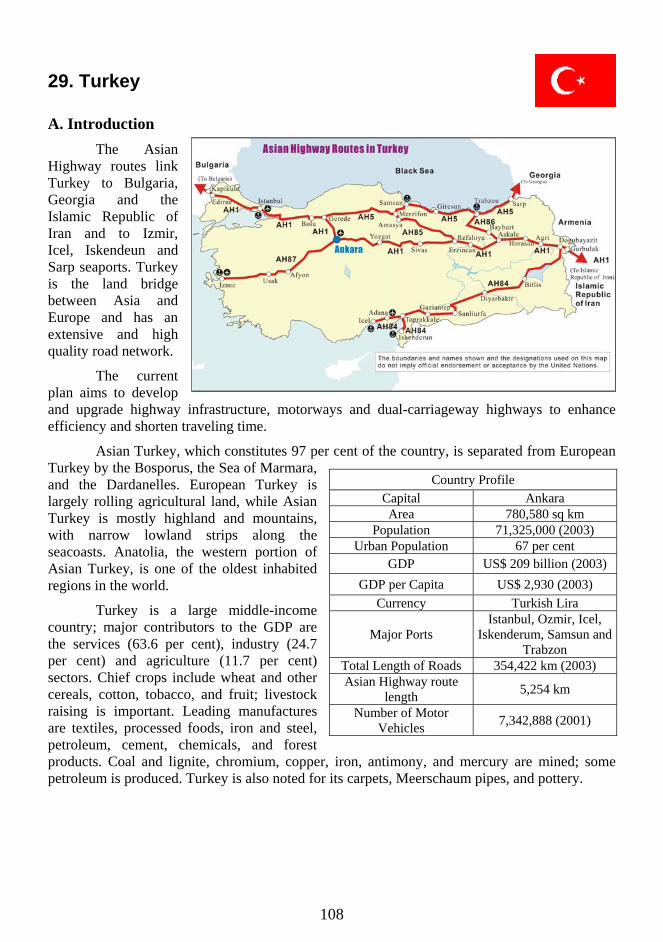
29. Turkey
A. Introduction The Asian
Highway routes link Turkey to Bulgaria, Georgia and the Islamic Republic of Iran and to Izmir, Icel, Iskendeun and Sarp seaports. Turkey is the land bridge between Asia and Europe and has an extensive and high quality road network.
The current plan aims to develop and upgrade highway infrastructure, motorways and dual-carriageway highways to enhance efficiency and shorten traveling time.
Asian Turkey, which constitutes 97 per cent of the country, is separated from European Turkey by the Bosporus, the Sea of Marmara, and the Dardanelles. European Turkey is largely rolling agricultural land, while Asian Turkey is mostly highland and mountains, with narrow lowland strips along the seacoasts. Anatolia, the western portion of Asian Turkey, is one of the oldest inhabited regions in the world.
Turkey is a large middle-income country; major contributors to the GDP are the services (63.6 per cent), industry (24.7 per cent) and agriculture (11.7 per cent) sectors. Chief crops include wheat and other cereals, cotton, tobacco, and fruit; livestock raising is important. Leading manufactures are textiles, processed foods, iron and steel, petroleum, cement, chemicals, and forest products. Coal and lignite, chromium, copper, iron, antimony, and mercury are mined; some petroleum is produced. Turkey is also noted for its carpets, Meerschaum pipes, and pottery.
Country Profile Capital Ankara Area 780,580 sq km
Population 71,325,000 (2003) Urban Population 67 per cent
GDP US$ 209 billion (2003) GDP per Capita US$ 2,930 (2003)
Currency Turkish Lira
Major Ports Istanbul, Ozmir, Icel,
Iskenderum, Samsun and Trabzon
Total Length of Roads 354,422 km (2003) Asian Highway route
length 5,254 km
Number of Motor Vehicles 7,342,888 (2001)
108
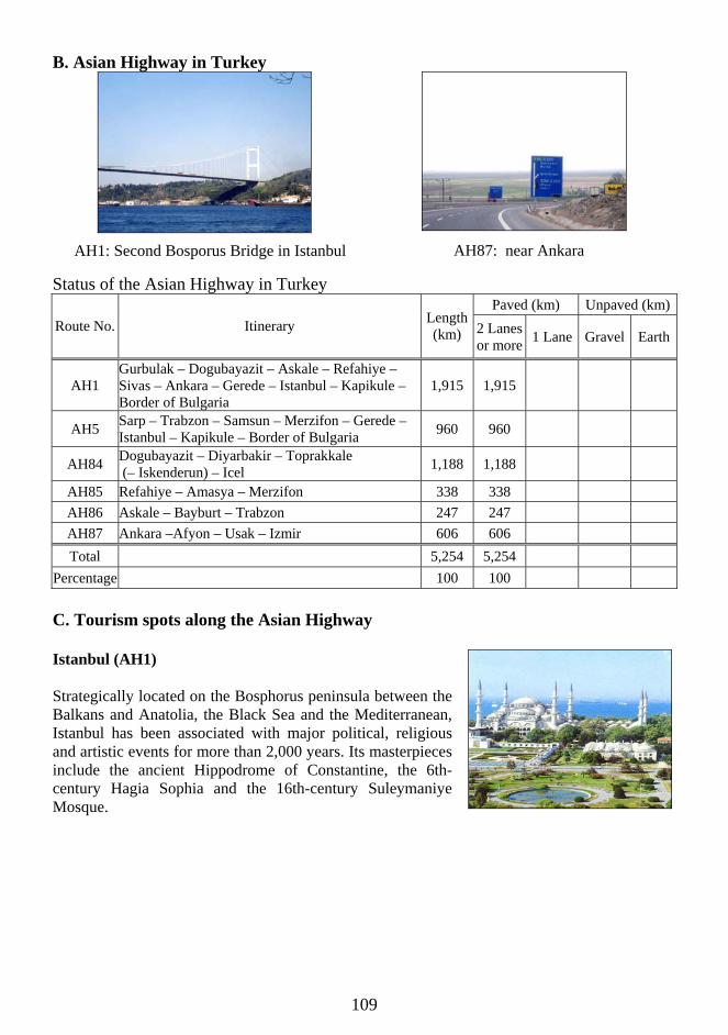
B. Asian Highway in Turkey
AH87: near Ankara
Status of the Asian Highway in Turkey
AH1: Second Bosporus Bridge in Istanbul
Paved (km) Unpaved (km) Route No. Itinerary Length
(km) 2 Lanesor more 1 Lane Gravel Earth
AH1 Gurbulak – Dogubayazit – Askale – Refahiye – Sivas – Ankara – Gerede – Istanbul – Kapikule – Border of Bulgaria
1,915 1,915
AH5 Sarp – Trabzon – Samsun – Merzifon – Gerede –Istanbul – Kapikule – Border of Bulgaria 960 960
AH84 Dogubayazit – Diyarbakir – Toprakkale (– Iskenderun) – Icel 1,188 1,188
AH85 Refahiye – Amasya – Merzifon 338 338 AH86 Askale – Bayburt – Trabzon 247 247 AH87 Ankara –Afyon – Usak – Izmir 606 606 Total 5,254 5,254
Percentage 100 100 C. Tourism spots along the Asian Highway Istanbul (AH1) Strategically located on the Bosphorus peninsula between the Balkans and Anatolia, the Black Sea and the Mediterranean, Istanbul has been associated with major political, religious and artistic events for more than 2,000 years. Its masterpieces include the ancient Hippodrome of Constantine, the 6th-century Hagia Sophia and the 16th-century Suleymaniye Mosque.
109

Ankara (AH1/AH87) Ankara lies in the center of Anatolia. The town, once an important trading center on the caravan route to the east, had declined in importance by the 19th century. It became an important center again when Kemal Atatürk chose it as the base from which to direct the War of Liberation. It was declared the capital on 13 October 1923.
Izmir (AH87) Izmir is Turkey's second largest seaport. Settled during the Bronze Age, it changed hands many times from the 7th to 15th century, when the Ottoman Turks conquered it. A busy commercial and industrial centre as well as gateway to the Aegean Region, it is dotted with idyllic fishing harbours, holiday villages and the ruins of ancient civilizations.
Icel (AH84) Icel lies on the eastern Mediterranean coast of Turkey. A rapidly developing city and the largest free-zone area on the Turkish Mediterranean. It occupies the site of an extremely ancient city. At the Yumuktepe tumulus, three kilometres west of the town, excavations have unearthed several successive settlements.
D. Sample itineraries South, North and East Turkey
1. Arrive in the Asian Highway city of Istanbul. 2. Fly to the Asian Highway city of Adana. Drive to Antakya, the biblical city
of Antioch. Visit Sokullu Mehmet Pasha caravanserai, Antakya Mosaic museum and the Grotto of St. Peter. The Castle of Antioch, set high above the city, offers a magnificent view over the city and the plain.
3. Drive to Adiyaman, the Asian Highway city of Gaziantep. 4. Drive to Nemrut Dag, a 2,150-metre mountain ordered to be built by the pre-Roman King
Antiochus I. See the huge heads of ancient gods and goddesses in what is now a World Heritage Site.
5. Drive to the Asian Highway (AH84) city of Diyarbakir, famous for its massive black basalt walls. Cross the Euphrates River, see the city walls, market and Ulu Cami.
6. Drive to Van, situated on the shores of Lake Van, the largest lake in Turkey and one of the world’s highest lakes at 1,670 metres above sea level.
7. Drive to the Asian Highway (AH1) city of Dogubayazit, the closest town to Mount Ararat, visit the 18th century Ishak Pasha Palace, built on a high valley overlooking the caravan route.
110

8. Drive to Kars. Visit Ani, an ancient city with ruins of eight churches, a convent, and a citadel along with the main cathedral which has alternately been a church or mosque.
9. Drive to Erzurum, the largest city in Eastern Anatolia, and an important transportation centre. Visit Islamic monuments from Seljuk, Mongol and Ottoman periods.
10. Drive to the Asian Highway (AH86) city of Trabzon on the Black Sea coast. 11. Tour Trabzon, famous for its natural and historical treasures. Visit St Sophia Church, the
most important historical building in Trabzon, now a museum. Several important Byzantine churches, some of which were later converted to mosques, are worth seeing.
12. Fly to Istanbul. 13. Depart Istanbul
Central and West Turkey
1. Arrive in the Asian Highway city of Istanbul. 2. Tour historic Istanbul, which is both the nearest European city to Asia and the nearest
Asian city to Europe. Visit famous icons like the Hippodrome, Blue Mosque, St. Sophia museum, and Topkapi Palace, the grand Ottoman structure that is now a renowned museum.
3. Explore the spice bazaar and enjoy a cruise of the Bosphorus strait, an unforgettable experience through one of the world’s great waterways. See ancient mosques, the Naval Museum, historic clock towers, parks and palaces.
4. Drive along the Asian Highway (AH1) to the city of Ankara 5. Tour Ankara, the capital of Turkey since 1923. Visit the Museum of Anatolian
Civilizations and Ataturk's Mausoleum, the memorial of the founder of Turkey. Gordion, a small town, two hours’ drive to the north, is where King Midas of the golden touch, is said to have been born.
6. Drive to the Asian Highway (AH87) city of Usak. Spend the night at a 19th-century caravanserai.
7. Drive to the Asian Highway (AH87) city of Izmir. 8. Tour Izmir, the largest export harbour in Turkey characterized by narrow streets, old
Ottoman hans and magnificent Levantine mansions, as well as old mosques, synagogues and churches.
9. Depart Izmir. E. Government Department responsible for Asian Highway Network
General Directorate of Turkish Highways, Ministry of Public Works and Settlement, Karayollari Genel Mudurlugu, Planlama Sb. Md. C-Block, Yucetepe, Ankara 06 100, Turkey. Tel: (90-312) 4158380; Fax: (90-312) 4171093; Web: http://ubak.gov.tr.
F. Useful Contacts for travel and tourism information
Ankara Tourism Information Office, Gazi Mustafa Kemal Bulvarı, No.121 Tandoğan, Ankara, Turkey. Tel: (312) 488 70 07 or (312) 231 55 72; Fax: (312) 231 5572; E-mail: [email protected]; Web: www.tourismturkey.org.
111

112
30. Turkmenistan
A. Introduction
The Asian Highway routes link Turkmenistan to Afghanistan, Azerbaijan, the Islamic Republic of Iran, and Uzbekistan and to Turkmenbashi seaport in the Caspian Sea which is an important connection for Central Asia and Europe.
The majority of the road network in Turkmenistan needs upgrading. The Government has plans to rehabilitate about 2,500 kilometress of roads by 2010 and upgrade the Ashgabat–Turkmenbashisection of AH5 to a six-lane road.
Turkmenistan was part of the kingdom of ancient Persia and was later (8th-19th century) ruled by the Arabs, the Seljuk Turks, Jenghiz Khan, Timur and the Timurids, and the Uzbeks. The Karakum desert occupies 90 per cent of the country; the Kara Kum canal provides irrigation and hydroelectricity.
Turkmenistan's natural gas deposits have made it one of the wealthiest of the Central Asian Republics. Among its other resources are oil, salt, phosphate, mirabilite, and sulphur. Karakul sheep (whose wool is made into carpets), cattle, and other livestock are raised, and silkworms are bred. Cotton is the chief crop; others include grains, sesame, and wine grapes. Industries include metalworking, oil refining, and many agriculturally related manufactures.
The Turkmens (or Turkomans), a Turkic-speaking people, comprise 60 per cent of the population; other groups include Russians, Uzbeks, Kazakhs, and Tatars. Turkmen is the official language, and Russian is widely spoken.
Country Profile
Capital Ashgabat
Area 488,100 sq km
Population 4,867,000 (2003)
Urban Population 45 per cent
GDP US$ 21.5 billion (2001
est.)
GDP per Capita US$ 4,700 (2001 est.)
Currency Turkmen manat
Major Port Turkemenbashi
Total Length of Roads 24,000 km (1999)
Asian Highway route length
2,204 km
Number of Motor Vehicles
N. A.

113
B. Asian Highway in Turkmenistan
Status of the Asian Highway in Turkmenistan
Paved (km) Unpaved (km)Route No.
Itinerary Length(km) 2 Lanes
or more1 Lane
AH5 Farap – Turkenabat – Mary – Tejen – Ashgabat – Serdar – Turkemenbashi
1,227 1,227
AH70 Bekdash – Turkmenbashi – Serdar – Gudurolun 499 475 24
AH75 Tejen – Sarahs 120 120
AH77 Tourghondi – Serkhetabat – Mary 315 315
AH78 Ashgabat – Chovdan Pass 43 43
Total 2,204 2,180 24
Percentage 100 98.9 1.1
C. Tourism spots along the Asian Highway
Ashgabat (AH5)
Ashgabat was founded by Russians in 1869. In subsequent years, this fortress attracted a host of merchants and entrepreneurs. The Turkmen Fine Arts Museum houses a collection of beautiful Turkmen carpets. One of them, among the largest and heaviest in the world, covers an area of 193.5 sq metres and weighs 885 kgs.
Parthian, Capital of Nisa (AH5)
Nisa is the most significant architectural monument located near the city of Ashgabat, in the suburbs of the village of Bagyr. It is the capital of the famous Parthian Kingdom that existed for almost 600 years up to the 3rd
century.
AH5: near Ashgabat to west AH78: in Ashgabat
114
Merv Archaeological Site (AH5)
Merv is the oldest and best-preserved of the oasis-cities along the Silk Route in Central Asia. The remains in this vast oasis span 4,000 years of human history. A number of monuments are still visible, particularly from the last two millennia.
D. Sample itinerary
1. Arrive at the Asian Highway city of Ashgabat. 2. Sightseeing tour of Ashgabat. Visit the Hippodrome, where famous Turkmen horse riders
prove their prowess, and the magnificent Carpet Museum, which showcases classic Turkmen carpets. Try sitting a loom and attempting this difficult art!
3. Excursion to Nisa, a city that bears the stamp of various civilizations. See the remains of ancient Parthian fortresses and temples.
4. Drive to Mary (AH5). Visit the History Museum which houses an extensive collection of artifacts from the numerous civilizations that flourished throughout ancient Turkmenistan
5. Excursion to ancient Marv, one of the most historic-cultural regions of the Central Asia. Visit the ruins of several former settlements in the area.
6. Transfer at Gaudan or Serakhs on the border with the Islamic Republic of Iran to continue along the Asian Highway and “The Silk Road”.
7. Depart Turkmenistan.
E. Government Department responsible for Asian Highway Network
Ministry of Transport, Karla Marksa ul 24, 744014 Ashkabad, Turkmenistan. Tel: (7-3632) 254615.
F. Useful Contacts for travel and tourism information
Turkmenistan Tourism, 17 Pushkin Street, Ashgabat, Turkmenistan. Tel: +3932 397771; Fax: +3632 396740; Turkmenistan State Committee for Tourism and Sport, 17, Pushkin Str., 744000 Ashgabat, Turkmenistan. Tel.: (99 312) 354777, 390066; Fax: (99 312) 390065.

115
31. Uzbekistan
A. Introduction
The Asian Highway routes link Uzbekistan to Afghanistan, Kazakhstan, Kyrgyzstan and Turkmenistan. These AH routes are also important in providing transit transport through Uzbekistan.
The northwest is largely made up of the Kyzyl Kum desert and borders the Aral Sea in the extreme north; the south east has fertile soil and touches on the Tian Shan mountains. The Amu Darya and Syr Darya rivers pass through the country, providing irrigation for its farms.
Major economic activities
include the growing of cotton and rice, stock-raising and machine building, textile manufacturing, metallurgy, and food processing. Oil, natural gas and coal are the major resources; there are also zinc, copper, tungsten and other ores. Various types of mineral water springs are spread out on the territory of Uzbekistan, which are said to provide effective treatment for various diseases.
The Uzbek, a Turkic-speaking people, make up the majority of the population; other groups include Russians, Tajiks, Kazakhs, and Tatars. Uzbek is the official language, but Russian and other ethnic languages are also spoken.
B. Asian Highway in Uzbekistan
Country Profile
Capital Tashkent
Area 447,400 sq km
Population 26,093,000 (2003)
Urban Population 37 per cent
GDP US$ 8.52 billion (2003)
GDP per Capita US$ 326 (2003)
Currency Uzbekistani sum
Total Length of Roads 181,121 km (2002)
Asian Highway route length
2,966 km
Number of Motor Vehicles
N. A.
AH74: Angren to Kakand AH5: near Tashkent
116
Status of the Asian Highway in Uzbekistan Paved (km) Unpaved (km)
Route No.
Itinerary Length(km) 2 Lanes
or more1 Lane
AH5 Chernyavka – Tashkent – Syrdaria – Samarkand – Navoi – Bukhara – Alat
677 677
AH7 Border of Kyrgyzstan – Andijon – Tashkent – Syrdaria – Khavast
531 531
AH62 Chernyavka – Tashkent – Syrdaria – Samarkand – Guzar – Termez
386 386
AH63 Oazis – Nukus – Bukhara – Guzar 1,194 950 244
AH65 Uzun – Termez 178 178
Total 2,966 2,722 244
Percentage 100 91.8 8.2
Asian Highway in Uzbekistan
0
200
400
600
800
1,000
1,200
1,400
AH5 AH7 AH62 AH63 AH65
Le
ng
th (
Km
)
Gravel
2 Lanes or more677km
178km
1,194km
386km
531km
C. Tourism spots along the Asian Highway
Tashkent (AH5)
The capital is Central Asia's hub with shimmering roots as a Silk Road city. The 2,000-year-old city is a major exporter to Eastern Europe of silk, cotton and textiles, as well as oil, coal, copper, sulphur, rice and manufactured products. Tashkent was an important commercial center during the Middle Ages.
Samarkand (AH5)
Most of Samarkand's high-profile attractions are the work of Timur and the Uzbek Shaybanids, who made the city Central Asia's economic, cultural and intellectual epicentre in the 14th and 15th centuries. One of Central Asia's most awe-inspiring sights is the Registan, an ensemble of majestic, tilting medressas.

117
Bukhara (AH63)
There are over 140 protected buildings in Bukhara, including the Labi-hauz, a 17th-century plaza built around a pool; three-domed bazaars; the 47 m high Kalan minaret, once the tallest building in Asia; and the mausoleum of Ismail Samani, the town's oldest structure and one of the most elegant in Central Asia.
D. Sample itinerary
1. Arrive in the Asian Highway city of Tashkent. 2. Tour Tashkent, visiting the 16th century Kukeldash Madrassah, which is being restored as
a museum, and the State Art Museum, which houses a collection of paintings, ceramics and the Bukharian royal robes.
3. Fly to Urgench and transfer to Khiva. 4. Tour Khiva, including the majestic monuments of the old city, Ichon-Qala, and the Juma
mosque with its 218 ornate carved wooden columns. The city claims to have the most minarets in Asia.
5. Drive to the Asian Highway city of Bukhara through the Karakum desert. Visit Tuprok Kala and Ayaz Kala, fortresses of the late Khorezmian kings.
6. Tour the holy city of Bukhara including Kalyan Minaret and the Arc Fortress. 7. Drive to Shakhrisabz, the birth city of Tamerlane, and continue along the Asian Highway
(AH5) city of Samarkand. 8. Tour Samarkand, the capital of Tamerlane's empire including the world famous Registan. 9. Drive along the Asian Highway (AH5) back to Tashkent. 10. Depart Tashkent.
E. Government Department responsible for Asian Highway Network
National Highway Administration “Uzavtoyul”, Pushkin St., 68 A, 700000 Tashkent, Uzbekistan. Tel: (998-71) 136 1088; Fax: (998-71) 136 0665.
F. Useful Contacts for travel and tourism information
Uzbektourism, 47 Khorezm str., Tashkent, Uzbekistan. Tel: (998-71) 133 54 14, 136 79 54; E-mail : [email protected]; Web: www.uzbektourism.uz.
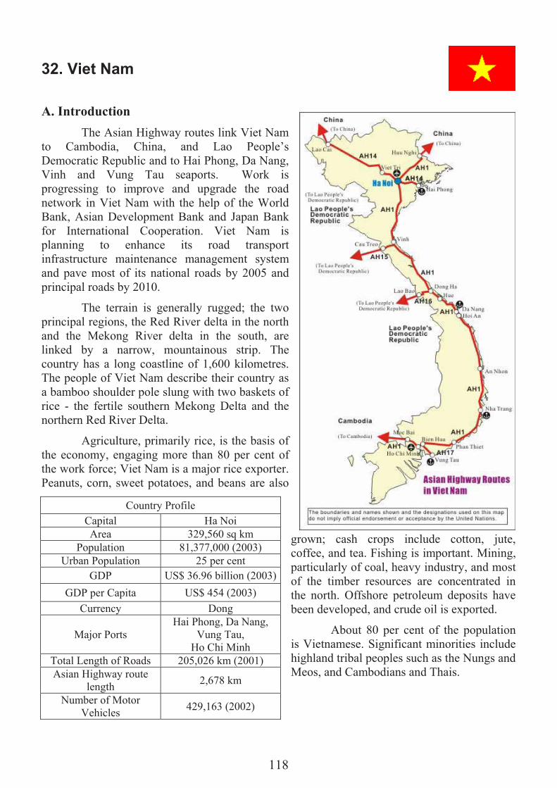
118
32. Viet Nam
A. Introduction
The Asian Highway routes link Viet Nam to Cambodia, China, and Lao People’s Democratic Republic and to Hai Phong, Da Nang, Vinh and Vung Tau seaports. Work is progressing to improve and upgrade the road network in Viet Nam with the help of the World Bank, Asian Development Bank and Japan Bank for International Cooperation. Viet Nam is planning to enhance its road transport infrastructure maintenance management system and pave most of its national roads by 2005 and principal roads by 2010.
The terrain is generally rugged; the two principal regions, the Red River delta in the north and the Mekong River delta in the south, are linked by a narrow, mountainous strip. The country has a long coastline of 1,600 kilometres. The people of Viet Nam describe their country as a bamboo shoulder pole slung with two baskets of rice - the fertile southern Mekong Delta and the northern Red River Delta.
Agriculture, primarily rice, is the basis of the economy, engaging more than 80 per cent of the work force; Viet Nam is a major rice exporter. Peanuts, corn, sweet potatoes, and beans are also
grown; cash crops include cotton, jute, coffee, and tea. Fishing is important. Mining, particularly of coal, heavy industry, and most of the timber resources are concentrated in the north. Offshore petroleum deposits have been developed, and crude oil is exported.
About 80 per cent of the population is Vietnamese. Significant minorities include highland tribal peoples such as the Nungs and Meos, and Cambodians and Thais.
Country Profile
Capital Ha Noi
Area 329,560 sq km
Population 81,377,000 (2003)
Urban Population 25 per cent
GDP US$ 36.96 billion (2003)
GDP per Capita US$ 454 (2003)
Currency Dong
Major Ports Hai Phong, Da Nang,
Vung Tau, Ho Chi Minh
Total Length of Roads 205,026 km (2001)
Asian Highway route length
2,678 km
Number of Motor Vehicles
429,163 (2002)
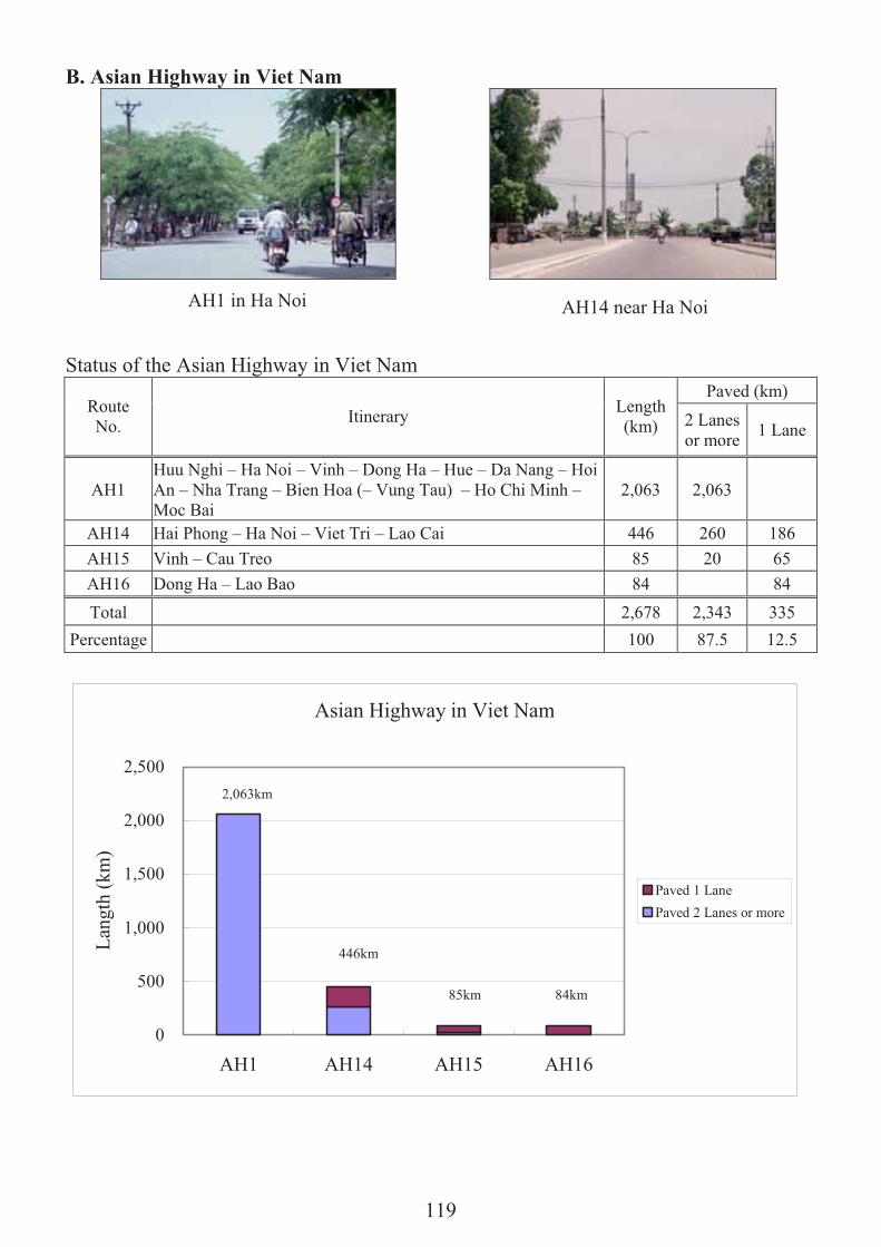
119
B. Asian Highway in Viet Nam
Status of the Asian Highway in Viet Nam
Asian Highway in Viet Nam
0
500
1,000
1,500
2,000
2,500
AH1 AH14 AH15 AH16
Lan
gth
(km
)
Paved 1 Lane
Paved 2 Lanes or more
2,063km
446km
85km 84km
Paved (km) Route No.
Itinerary Length(km) 2 Lanes
or more 1 Lane
AH1 Huu Nghi – Ha Noi – Vinh – Dong Ha – Hue – Da Nang – Hoi An – Nha Trang – Bien Hoa (– Vung Tau) – Ho Chi Minh – Moc Bai
2,063 2,063
AH14 Hai Phong – Ha Noi – Viet Tri – Lao Cai 446 260 186
AH15 Vinh – Cau Treo 85 20 65
AH16 Dong Ha – Lao Bao 84 84
Total 2,678 2,343 335
Percentage 100 87.5 12.5
AH1 in Ha Noi AH14 near Ha Noi

120
C. Tourism spots along the Asian Highway
Ha Noi (AH1/AH14)
Ha Noi is the political, economic, and cultural center. Founded in 1010, it preserves many ancient architectural works including the Old Quarter and over 600 pagodas. Hectares of lakes lie intertwined between the streets. Many traditional handicrafts are also practiced including bronze molding, silver carving, lacquer and embroidery.
Ho Chi Minh City (AH1)
Ho Chi Minh City, formerly known as Saigon, is the second most important city after Ha Noi. This region is criss-crossed by hundreds of rivers and canals, the largest being the Saigon River. Once praised as the "Pearl of the Far East," Ho Chi Minh City was known as an important trading center for Chinese, Japanese, and European merchants.
Vung Tau (AH1)
Vung Tau is an old port with 20 kilometres of beaches and calm waters. Five beaches scattered over the peninsula include Bai Truoc, with restaurants, kiosks, and hotels, and O Quan Beach, a peaceful cove with good winds enjoyed by surfers.
Hue (AH1)
A former ancient capital, the heritage city of Hue is in between Vietnam's two rice bowls, the Red river delta and the Mekong delta. It is renowned for its cultural heritage, the most famous of which is the ancient capital of Hue City and the tombs and temples left by the Nguyen Emperors.
D. Sample itinerary
1. Arrive in the Asian Highway city of Ho Chi Minh City 2. Tour Ho Chi Minh City. Visit the former Presidential Palace, the Notre Dame Cathedral,
Old Saigon Post Office and Thien Hau Pagoda in lively chinatown. Visit the Cu Chi Tunnels, an incredible underground network built by Vietnamese resistance fighters during the independence struggle.
3. Full day trip to the Mekong Delta. Take a boat trip along narrow waterways overhung with dense vegetation and try exotic fruits in one of the many orchards.
4. Drive along the Asian Highway to the cooler climes of Dalat, with its French chalets and pine forests. Visit the summer palace of Viet Nam’s last Emperor, Bao Dai, marvel at its Art Deco architecture, then continue on toe the old Dalat Railway Station, Xuan Huong Lake, the Central Market and Lam Ty Ni Pagoda.
5. Leave for Nha Trang, taking the road descending to the arid coastal city of Phan Rang. Visit the 13th century Po Klong Jarai Cham Towers.

121
6. Visit some of the nearby islands. Return to the mainland for the scenic drive along the Asian Highway to Qui Nhon.
7. Continue up the Asian Highway (AH1) to Hoi An, breaking the journey to visit My Lai Massacre Memorial near to Quang Ngai. Arrive in Hoi An, a major Asian trading port in the 17th and 18th centuries.
8. Browse for souvenirs in Hoi An. Drive to Hue, the former imperial capital. The route along the Asian Highway (AH1) passes through Da Nang before climbing over the Pass of Ocean Clouds and dropping down to the fishing village of Lang Co.
9. A boat trip on the romantically named Perfume River to visit Hue's best-known religious site, Thien Mu Pagoda, and the mausoleum of former emperor Minh Mang. Afternoon, visit the elaborate mausoleums of emperors.
10. Fly to the Asian Highway city of Ha Noi, the capital of Viet Nam and transfer to Hai Phong, Viet Nam's third largest city. Hai Phong still has many impressive examples of classic European colonial architecture in its town centre.
11. Take a hydrofoil trip to Cat Ba Island, the largest in the bay. From Cat Ba, enjoy a cruise among some of the 3,000 limestone islands scattered throughout the spectacular Ha Long bay, a World Heritage Site. Return to Hai Phong by hydrofoil in the afternoon.
12. Leave Hai Phong and return to Ha Noi along the Asian Highway (AH14). 13. Tour Ha Noi, a unique city with tree-lined boulevards, French colonial architecture,
lakes and oriental temples. Visit Ho Chi Minh's Mausoleum, the One Pillar Pagoda, the Fine Arts Museum, the Temple of Literature and the Old Quarter.
14. Depart Ha Noi.
E. Government Department Responsible for Asian Highway Network
International Relation Department, Ministry of Transport, 80 Tran Hung Dao Street, Ha Noi, Viet Nam. Tel: (84-4) 9422079; Fax: (84-4) 9421436.
F. Useful Contacts for travel and tourism information
Viet Nam National Administration of Tourism, 80, Quan Su Street, Ha Noi, Viet Nam. Tel: (84-4) 942 1063/2280/1061; Fax: (84-4) 942 4115; E-mail: [email protected];Web1:www.VietNamtourism.com; Web2: www.VietNam-tourism.com.

122
Annex
Sources of data and photographs
A. Sources of data
In the country profile tables, data following sources are used.
Area Statistical Yearbook for Asia and the Pacific 2001, ESCAP
Population 2003 ESCAP population data sheet, Emerging Social Issues Division
Urban population 2003 ESCAP population data sheet, Emerging Social Issues Division
GDP Poverty and Development Division, ESCAP
GDP per capita Derived based on above population and GDP data
Length of road Country repots prepared by the national experts for the Asian Highway, Statistical Abstract of Transport in Asia and the Pacific 2002 and World Road Statistics 2002, International Road Federation
Number of motor vehicles Country paper prepared by the national experts for the Asian Highway, Statistical Abstract of Transport in Asia and the Pacific 2002 and World Road Statistics 2002, International Road Federation
B. Sources of photographs
The source photographs of the Asian Highway in member countries are: national experts or focal points in member countries; ESCAP; and ESCAP consultant H. Nishimura. The photographs of the Asian Highway in Tajikistan are provided by Nippon Koei. The photographs of the Asian Highway in Japan are provided by Japan Highway Public Corporation.
ESCAP would like to acknowledge the following sources for their permission to use the photographs of tourism attractions in respective countries:
Countries & Cities Sources
Afghanistan
Herat Mosque http://www.afghan-web.com/
Armenia
Lake Sevan Ministry of Transport and Communications
Gumri Ministry of Transport and Communications
Azerbaijan
Baku IntePromo Inc
Ganja http://www.geocities.com/
Bangladesh
Dhaka Parjatan Corporation
Chittagong Dot Com, Bangladesh
Sylhet ESCAP
Cox's Bazar ESCAP
Bhutan
Thimphu World Tourism Organisation
Phuentsholing Bhutan Travel & Tourism Corporation
Cambodia
Phnom Penh Ministry of Tourism, Cambodia
The Temples of Angkor ESCAP
Tônlé Sap Lake Ministry of Tourism, Cambodia
Sihanoukville Ministry of Tourism, Cambodia
123
China
Beijing UNESCO Bangkok
Kunming Yunnan Provincial Tourism Administration
Shanghai China National Tourism Administration
Xi’an China National Tourism Administration
Democratic People’s Republic of Korea
Pyongyang Pacific Asia Travel Association
Pohyon Temple Pacific Asia Travel Association
Georgia
Tbilisi Georgia Parliamentary website
Poti Port of Poti, Georgia, website
India
Delhi Indian Embassy, Bangkok
Agra UNESCO, Bangkok
Ajanta Caves Indian Embassy, Bangkok
Madurai Indian Embassy, Bangkok
Indonesia
Jakarta Jakarta City Government Tourism Office
Borobudur Temple ESCAP
Lake Toba – Parapat ESCAP
Mount Bromo East Jawa Government Indonesia
Islamic Republic of Iran
Azadi cultural complex, Tehran Mahan Air, Bangkok
Persepolis Mahan Air, Bangkok
Esfahan Mahan Air, Bangkok
Mashhad Mahan Air, Bangkok
Japan
Mount Fuji Japan Highway Public Corporation
Imperial Palace, Tokyo Japan National Tourist Organization
Kiyomizu-dera,Kyoto Japan National Tourist Organization
Dazaifu, Fukuoka Fukuoka Prefecture
Kazakhstan
Ishim River, Astana Department of Tourism
Almaty Kazakhstan Embassy, Bangkok.
The Mausoleum of Khoja Ahmed Yasawi
Kazakhstan Embassy, Bangkok
Köl-Say Lakes Turkestan Travel Company
Kyrgyzstan
Bishkek www.kyrgyz-web.com
Lake Issyk-Kul United Institute of Geology, Geophysics and Mineralogy, Russia
Lao People's Democratic Republic
Vientiane ETC Asia Company Limited Thailand
Louang Phrabang UNESCO Bangkok
Malaysia
Kuala Lumpur Malaysia Tourism Promotion Board
Johor Bahru Malaysia Tourism Promotion Board
Kenyir Lake, Terengganu Terengganu State Secretariat Office, Malaysia
Penang Malaysia Tourism Promotion Board
Mongolia
Ulaanbaatar Mongolian Tourism Board
The Amarbayasgalant Monastery Mongolian Tourism Board
The Gobi Desert Mongolian Tourism Board
Kharakhorum Mongolian Tourism Board

124
Myanmar
Yangon http://www.myanmar.com
Mandalay http://www.myanmar.com
Bago http://www.myanmar.com
Inle Lake http://www.myanmar.com
Nepal
Pashupatinath, Kathmandu Valley Nepal Tourism Board
Patan Nepal Tourism Board
Royal Chitwan National Park Nepal Tourism Board
Lumbini Nepal Tourism Board
Pakistan
Islamabad Pakistan Embassy, Bangkok
Peshawar, Takht-E-Bhai Pakistan Embassy, Bangkok
Lahore, Badshahi Mosque Pakistan Embassy, Bangkok
Karachi ESCAP
Philippines
Manila Philippine Convention and Visitors Corporation
Davao Philippine Convention and Visitors Corporation
Magellan’s Cross, Cebu www.cebu-city.ph
Laoag Philippine Convention and Visitors Corporation
Republic of Korea
Seoul Korea National Tourism Organization, Bangkok
Kyongju City Korea National Tourism Organization, Bangkok
Pusan Korea National Tourism Organization, Bangkok
Russian Federation
Moscow Committee for Tourism of Moscow City Government
St. Petersburg Aeroflot Russian Airlines, Bangkok
Vladivostok GVC Group
Irkutsk http://www.irkutsk.org/
Singapore
Sentosa Singapore Tourism Board
Esplanade Singapore Tourism Board
Sri Lanka
Colombo http://www.colombocityguide.com/
Sacred City of Kandy Sri Lanka Tourist Board
Sigiriya http://sigiriya.org/
Tajikistan
Dushanbe http://www.geocities.com/
The Pamirs Telecomm Technology Ltd.
Khojand http://www.geocities.com/
Thailand
Grand Palace, Bangkok Tourism Authority of Thailand
Historic Town of Sukhothai Tourism Authority of Thailand
Golden Triangle, Chiang Rai Tourism Authority of Thailand
Bang Pa In Palace Tourism Authority of Thailand
Turkey
Istanbul Ministry of Culture and Tourism, Turkey
Ankara Ministry of Culture and Tourism, Turkey
Izmir Ministry of Culture and Tourism, Turkey
Icel Ministry of Culture and Tourism, Turkey
Turkmenistan
Ashgabat State Committee of Turkmenistan for Tourism and Sport
125
Parthian, Capital of Nisa Sikyakhat Tourist Company & Hotel
Merv Archaeological Site Latif Co.
Uzbekistan
Tashkent Department of marketing, research and advertising, "Uzbektourism" National Company
Samarkand UNESCO, Uzbekistan
Bukhara UNESCO, Uzbekistan
Viet Nam
Hanoi Vietnam National Tourism Administration
Ho Chi Minh City Vietnam National Tourism Administration
Vung Tau Vietnam National Tourism Administration
Hue Vietnam National Tourism Administration