united nations e/conf.97/6/ip. 45 economic and social
TRANSCRIPT

UNITED NATIONS E/CONF.97/6/IP. 45 ECONOMIC AND SOCIAL COUNCIL Seventeenth United Nations Regional Cartographic Conference for Asia and the Pacific Bangkok, 18-22 September 2006 Item 7 of the provisional agenda* INVITED PAPERS
DATA DEVELOPMENT IN BRUNEI DARUSSALAM
Submitted by Survey Department, Brunei Darussalam **
* E/CONF.97/1 ** Prepared by Mr. Hj Hohd Jamil bin Hj Mohd Ali and Mr. Hj Jali bin Hj Nudin,
Survey Department, Brunei Darussalam.

Jabatan UkurKementerian Pembangunan
E-mail : [email protected]
Tel : 2382171Fax : 2382900
Presented by :
Hj Mohd Jamil bin Hj Mohd AliHj Jali bin Hj NudinSurvey Department
Negara Brunei Darussalam
Data Development in Brunei Darussalam

Jabatan UkurKementerian Pembangunan
E-mail : [email protected]
Tel : 2382171Fax : 2382900
• Introduction
• Activites in Survey Department
• Data Development Progress
• Conclusion

Jabatan UkurKementerian Pembangunan
E-mail : [email protected]
Tel : 2382171Fax : 2382900
Introduction
• Brunei Darussalam is located 443 km north of equator with a total area of 5,765 sq. km
• The country has made an astounding leap to prosperity over the last quarter of a century
• Visitors to Brunei are able to see numerous on-going infrastructure projects.
• Despite the economic downturn in 1998, the Survey Department was able to progress significantly.

Jabatan UkurKementerian Pembangunan
E-mail : [email protected]
Tel : 2382171Fax : 2382900
Survey Department
• Survey Department is the national geospatial mapping agency and the custodian for all mapping data
• The Department published maps, plans, aerial photographs, digital plans, data, cadastral plans, topgraphical maps and Photomaps for the use of other government ministries, departments, private and genera publics
• Survey Department is the first and only Government Agency certified by ISO 9001since 1998

Jabatan UkurKementerian Pembangunan
E-mail : [email protected]
Tel : 2382171Fax : 2382900
Activities in Survey Department

Jabatan UkurKementerian Pembangunan
E-mail : [email protected]
Tel : 2382171Fax : 2382900
Cartographic Activities
Automated Cartography
• Expedite the process in preparing amore efficient customized maps usedfor project planning.
• Produce separate layers which enableonly specific information to be retrievedfrom the digital map database.
• Currently, the functionality of graphicaldatabase is limited to basic mapprinting, pan and zoom navigation,identifying information about a polygonfeature or line.
Existing printed map
1:10,0001:50,000
1:100,000
TOURIST MAP

Jabatan UkurKementerian Pembangunan
E-mail : [email protected]
Tel : 2382171Fax : 2382900
Digitizing Activities
• Most maps and plans are converted intodigital form and stores into graphical databasefor use of Land Information System
• All existing maps and plans are being digitizedusing Arc Info both on pc and w/s.
Digitized maps and plans :-
Cadastral (1:2,500)
Topographical (1:1,000 , 1:10,000 and 1: 50,000)
Geological maps (1:63,360)
Comprehensive Development Plan (1:10,000)
National Development Plan (1:100,000)
Utilities plan (various scale)
Topographical plan (1:2,500)

Jabatan UkurKementerian Pembangunan
E-mail : [email protected]
Tel : 2382171Fax : 2382900
Photogrammetric Activities
Aerial PhotographOrthophoto
• Photogrammetric activities mainly producing base topographic map
• In the past, most of the work are using analogue system
• Penciled photogrammetric plots were produced from stereo aerial photographs
• Late 1991, a project 1:10,000 digital mapping were first started
• Now, Digital Video Photogrammetry was used to produce orthophoto

Jabatan UkurKementerian Pembangunan
E-mail : [email protected]
Tel : 2382171Fax : 2382900
SPOT XSAcquisition Date: 13.04.1999
Resolution: 20 metres
SPOT5 (Mosaic Image)Acquisition Date: July-Sept 2003
Resolution: 2.5metres
Remote Sensing Activities
• Used of SPOT images to derive Land cover maps and to monitor changes in land use.
• Updating 1:50,000 map using remote sensing technology for the whole of Brunei

Jabatan UkurKementerian Pembangunan
E-mail : [email protected]
Tel : 2382171Fax : 2382900
Bathymetry Map Sedimentation Map
DEM Map Landcover
Remote Sensing Activities

Jabatan UkurKementerian Pembangunan
E-mail : [email protected]
Tel : 2382171Fax : 2382900
QUICKBIRDAcquisition Date: 17.01.2005
Resolution: 0.6 metres
Remote Sensing Activities

Jabatan UkurKementerian Pembangunan
E-mail : [email protected]
Tel : 2382171Fax : 2382900
GIS Activities
Data Dictionary
• A Data Dictionary was formulated to develop LIS
• This is to rationalize its current feature-coding system
• The new structure satisfies a wide range of uses of digital map data across GIS/LIS ranging from the generalized to the detailed
• Currently, all existing digital data are converted to the new featurecoding before they are stored in the library.

Jabatan UkurKementerian Pembangunan
E-mail : [email protected]
Tel : 2382171Fax : 2382900
Other Activities
• House Numbering system
The ministry of Development has taken positive step to establish asystematic and orderly house numbering scheme that would serve the whole country.
Adopting the house numbering concept that aims to form a uniformand methodical numbering system.
An information database related to the house numbering project isnow compiled and kept in Survey Department.
• Geographical names
A National committee on Geographical names.
Collecting geographical names, adopting rules for naming andinvestigating any proposed alteration of a place name.
Publishing approved name in the National Geographical Names Gazetteer
Jabatan UkurKementerian Pembangunan
E-mail : [email protected]
Tel : 2382171Fax : 2382900
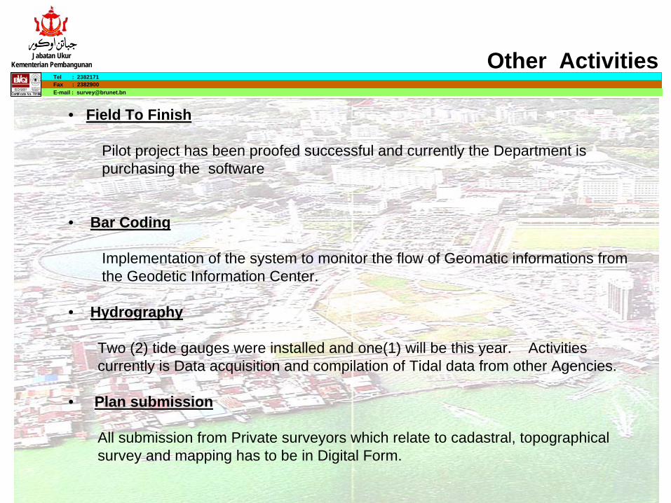
Other Activities
• Field To Finish
Pilot project has been proofed successful and currently the Department is purchasing the software
• Bar Coding
Implementation of the system to monitor the flow of Geomatic informations from the Geodetic Information Center.
• Hydrography
Two (2) tide gauges were installed and one(1) will be this year. Activities currently is Data acquisition and compilation of Tidal data from other Agencies.
• Plan submission
All submission from Private surveyors which relate to cadastral, topographical survey and mapping has to be in Digital Form.
Jabatan UkurKementerian Pembangunan
E-mail : [email protected]
Tel : 2382171Fax : 2382900
Data Development Progress

Jabatan UkurKementerian Pembangunan
E-mail : [email protected]
Tel : 2382171Fax : 2382900
ANNOTATION
BOUNDARY
CADAS
CTL_PT
TOL
GAZETTE
BUILDING
CONTOUR
ELECTRICAL
HYDRO
LANDUSE
MINERAL
MISCELLANEOUS
OILGAS
ROAD
SEWER
SOIL
TELECOM
TERRAIN
VEGETATION
MAPS
CADASTRAL
ARCSTORMUNIX
M A S T E R P LA N
U T IL IT IE S
R IV E R S
B U ILD IN G S
R O A D S
C A D A S T R A L
LA YE R S
M A P A P P E N D IX
DATA DICTIONARY
Graphic Data

Jabatan UkurKementerian Pembangunan
E-mail : [email protected]
Tel : 2382171Fax : 2382900
HouseNumbering
TOL
Toponomy
Map Isu
Mailing
Training
Personal
Geodetic
SP Geodetik
Inventory
Attendance
Convert
SD Query
Point DB
SPM
Lot Book
HOS TPOR
ErrorMessages
UserAdmin
JUAKontrak
NEI
22 ORACLE SYSTEMS
Aduan
BarCode
ICTHardware
DataProcessing
4 Proposed Systems
Cadastral 200
Cadastral 500
LEVEL
GEOPAN
SVY_SURVEY1
(NT4)
4 FOTRAN SYSTEM
ORACLE8.0.5
Applications

Jabatan UkurKementerian Pembangunan
E-mail : [email protected]
Tel : 2382171Fax : 2382900
ARCSTORMUNIX
ORACLE8.0.5
1:1000
1:10000
1:25000
1:50000
1:100000
DATABASE
TEXTUALSOURCE DATA
TEXTUALTEXTUALSOURCE DATASOURCE DATA
GRAPHICALSOURCE DATAGRAPHICALGRAPHICAL
SOURCE DATASOURCE DATA
MIGRATIONMIGRATIONMIGRATION
ARCSDE / ORACLE SPATIAL 10G (UNIX)
DATADATADATA APPLICATIONAPPLICATIONAPPLICATION
GRAPHIC DATA APPLICATIONS

Jabatan UkurKementerian Pembangunan
E-mail : [email protected]
Tel : 2382171Fax : 2382900
ARCSDE / ORACLE SPATIAL 10G1:1000
1:10000
1:25000
1:50000
1:100000
U S E R S
DATABASE
ARCGIS / INTEGRAPH / AUTODESK / MAPINFO
Jabatan UkurKementerian Pembangunan
E-mail : [email protected]
Tel : 2382171Fax : 2382900
Thank you
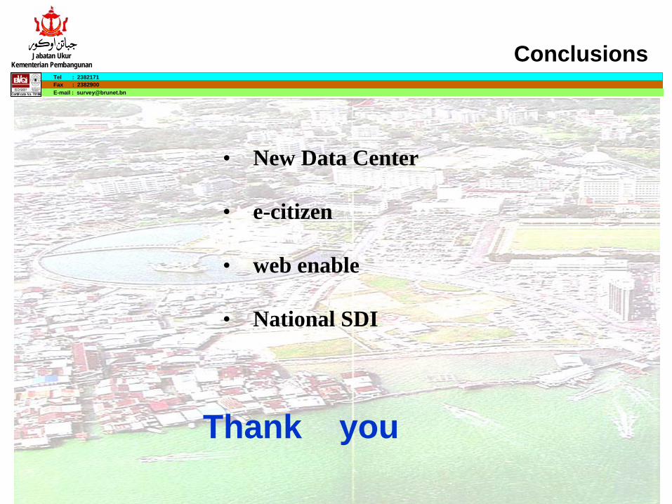
Conclusions
• New Data Center
• e-citizen
• web enable
• National SDI