txh2o summer 2014
DESCRIPTION
txH2O magazine features stories on current water resources research and outreach programs in Texas and priority water issues facing Texas.TRANSCRIPT

Texas A&M AgriLife ResearchTexas A&M AgriLife Extension Service Texas A&M University College of Agriculture and Life Sciences
Summer 2014
groundwaterExamining a valuable, but hidden, resource
Evaporation
Precipitation
Cloud Formation
Groundwater
Runoff
Water Table Unsaturated Soil
LakeInfiltration

Kevin Wagner Message from the Director
Groundwater is the largest source of water in Texas, comprising almost 60 percent of water use in the state. The Ogallala Aquifer alone supplies 40 percent of the water used in the state.
However, significant declines in water levels — some as much as 1,000 feet — have been observed throughout the state, and in many areas, these declines are expected to continue. Most groundwater meets federal requirements for safety; although in some areas of the state, naturally occurring salts, arsenic and radionu-clides prevent the water from meeting drinking water standards.
Despite these issues, groundwater is a significant strategy for meeting future water supply needs. In the 2012 state water plan, accessing new sources of ground-water is projected to provide more than 800,000 acre-feet of water annually by 2060.
With the growing water needs in the state and the continuing drought, many are predicting that groundwater will take center stage in the upcoming 2015 legislative session. This issue of txH2O examines some of these center stage issues in Texas groundwater today.
Stories look at popular topics such as desalinating brackish groundwater, which will provide additional drinking water for thirsty communities. Storage of water supplies underground where the water will not be subject to evaporation through aquifer storage and recovery is yet another important tool for helping Texans meet future water demands.
Understanding, managing and planning for groundwater presents significant challenges that organizations, courts and landowners throughout Texas are wrangling with.
Other articles examine innovative programs such as the Edwards Aquifer Habitat Conservation Plan and its Regional Water Conservation Program, and San Antonio’s Edwards Aquifer Protection Program and Austin’s Water Quality Protection Lands Program, which all have the objective of preserving ground-water.
Groundwater is an important component of solving Texas’ water needs. We all need to work together to make every drop of it count.
Kevin WagnerAssociate Director
Working to make every drop count
Published byTexas Water Resources Institute
EditorKathy Wythe
Texas Water Resources Institute
Art Direction
Audrey GuidryTexas A&M AgriLife Communications
Assistant Editors
Danielle KalisekLeslie Lee
Texas Water Resources Institute
Student Writer
Katie HeinrichTexas Water Resources Institute
On the cover:
Water cycle illustration. By Audrey Guidry, Texas A&M
AgrilLife Communications.
For more information and to subscribe to txH2O, visit our website at
twri.tamu.edu/txH2O

txH2O is published two times a year by the Texas Water Resources Institute (TWRI), which is part of Texas A&M AgriLife Research, the Texas A&M AgriLife Extension Service and the Texas A&M University College of Agriculture and Life Sciences. TWRI is funded in part by the U.S. Geological Survey and authorized by the Water Resources Research Act. To subscribe to txH2O or Conservation Matters, TWRI’s monthly e-mail newsletter, visit twri.tamu.edu.
Inside
The Seco Sinkhole in Medina County is one of the largest recharge features in the Edwards Aquifer. Photo courtesy of the Edwards Aquifer Authority.
Volume 9, number 1, Summer 2014
2 I Underground and under scrutiny A changing state increasingly turns to groundwater
5 I Groundwater 101
7 I Regional plan provides regional solutions Edwards Aquifer water conservation plan gets help from WCTC 10 I Is it time for Texas to welcome ASR? Texas weighs the cost and advantages of aquifer storage and recovery
14 I Everybody is talking about it Is brackish groundwater the most promising “new” water?
19 I Texas groundwater administration Intersection of management and planning present challenges
21 I Texas Well Owner Network Resources help landowners protect groundwater
23 I Protect our land, protect our water Rural conservation ensures cities’ water supplies benefits landowners
28 I Did you know? Q&A with Tiffany Dowell

2 txH2O Summer 2014
Story by Leslie Lee
The Frio River, located in the
Texas Hill Country, is spring-fed and
therefore affected by groundwater pumping. Photo from istock.com.
Underground and under scrutinyA changing state increasingly turns to groundwater
Nearly every aspect of Texas groundwater is complicated.
Unlike the clear movement of surface water to rivers and reservoirs following rains, the science of exactly how water moves down into aquifers and then within their geological features is more multifaceted. Consider that each aquifer in Texas has different geological and hydrological character-istics, and therefore varying recharge rates, water quality and regional needs, and the complexity heightens.
From a legal perspective, even some experts admit that the tangle of Texas laws wrapped around groundwater administration and management is at best intricate, and at worst a detriment to the state’s water security. And for landowners who depend on groundwater, all of these difficulties affect their bottom line; will they have enough water to support their needs?
One thing is clear: as Texas’ surface water supplies drop and the state’s population continues to grow, groundwater will see increased commercial, legal and scientific attention in the coming decades.
All eyes on groundwaterAcross the state, water providers that traditionally
relied on surface water are looking to groundwater because it’s seen as somewhat abundant, and it’s cheaper than other more technology-intensive options.
“Groundwater is important in Texas because it constitutes about 60 percent of the state’s water supply,” said Dr. Robert Mace, Texas Water Development Board (TWDB) deputy executive administrator for water science and conservation. “It also tends to be a drought-proof source of water, very affordable, distributed all over the state and good quality, not needing much treatment.”
According to the 2012 state water plan, ground-water supplies are projected to decrease 30 percent, from about 8 million acre-feet in 2010 to about 5.7 million acre-feet in 2060. This drop is primarily due to reduced supply from the depletion of the Ogallala Aquifer over time and reduced supply from the Gulf Coast Aquifer due to mandatory reductions in pumping to prevent land subsidence.
Summer 2014 txH2O 3
Many municipalities along the I-35 corridor are turning to groundwater, said Dr. Ronald Kaiser, professor and chair of the Texas A&M University Water Management and Hydrological Science Program.
“Imagine a city stretching from Waco to San Antonio, four miles wide on both sides of the interstate; that’s where much of Texas’ population growth is,” he said. “Most of the surface water in this area is fully allocated. So, what’s supporting this growth? Groundwater.”
Disputes over groundwater pumping in rural areas to support urban growth, Kaiser said, may be a growing issue facing Texas groundwater management.
“This is a real issue for San Antonio, the I-35 corridor, El Paso, Midland-Odessa and the areas west of I-35 where there’s very limited surface water to support the current influx of new growth, so it’s coming from groundwater, and those groundwater resources are in rural areas,” Kaiser said.
Changing methods for changing timesSome water-scarce regions are not only increas-
ingly turning to groundwater, but also to relatively new-to-Texans technologies, such as aquifer storage and recovery (ASR) and desalination of brackish groundwater.
“ASR is used throughout the world,” Kaiser said. “Texas has been slow to adopt it because of cost and the availability of reservoir storage.”
By injecting excess water into aquifers and pulling it back out in times of need, ASR systems store water more efficiently than surface reservoirs, because evaporation is avoided. However, the initial costs involved in developing ASR and the newness of the technology here have prevented widespread adoption. There are currently successful ASR projects in San Antonio and Kerrville, as well as a plant in El Paso that uses similar techniques.
“ASR has great potential, and I think Texas will adopt more of it,” Kaiser said. “This will be driven by drought, scarcity of surface water and a need to develop reliability.
“Texas has not faced absolute necessity yet, when it comes to water. Those days are coming to an end, and soon we will be driven by necessity. It’s easier to build ASR when you have no other options, and once we reach that point, we’ll see plenty of ASR projects.”
“Oftentimes, with climate extremes, we have long-term droughts that are punctuated by extreme flooding,” said Dr. Bridget Scanlon, senior research scientist at The University of Texas at Austin’s Bureau of Economic Geology. “So, we have too much water when we don’t need it and not enough when we do. I think we need to come up with more ways to manage water and manage these extremes, and ASR is one way to do that.”
Desalination of brackish groundwater, which is saltier than freshwater but much less so than seawater, is also a growing area of interest for water providers.
“The good news is we have huge amounts of brackish groundwater, but the bad news is it’s going to be expensive to obtain and treat,” Kaiser said.
In addition to expense, water providers looking at possibly using these supplies also must consider the geological features of the aquifers they’re pumping from, Scanlon said, and where the freshwater and brackish water are found in the aquifer. Thick layers of low-permeability rock separate the two in some aquifers and ensure that brackish use wouldn’t affect the freshwater.
“It’s important to look at each aquifer’s geology and determine if or how brackish water supplies are connected to freshwater, so that you know how extracting brackish water might impact freshwater,” Scanlon said.
Aquifer depletion brings consequencesIn addition to understanding geological charac-
teristics, understanding the science of recharge — how, when, how fast and where aquifers fill up from rainfall — is critical to groundwater management.
“We’re mining water and removing it from some aquifers faster than nature is putting it in,” Kaiser said. “Because groundwater recharge is complicated, we don’t always know how much is really being replenished, but right now we do know that we’re pulling more water out than nature is putting in.”
“Recharge is indeed complicated,” said Scanlon, who has extensively studied groundwater recharge in semi-arid climates, such as West Texas. Her research team measures chloride concentrations in groundwater to determine recharge, an extremely accurate method for semi-arid regions such as the Ogallala Aquifer region, but not for dynamic systems such as the Edwards Aquifer, she said.

4 txH2O Summer 2014
Underground and under scrutiny continued
The interdependence of groundwater and surface water deepens the consequences of aquifer depletion. Many rivers and streams in Texas are spring-fed, so increased pumping of groundwater will affect spring flows and consequently water bodies.
Groundwater management is no easy taskIn Texas, surface water is legally considered
public property and state-owned, while ground-water is considered private property — if it’s under your land, you own it. This approach to groundwater rights does not mirror the science involved, since hydrologically the two sources are connected. Most western states, with the exceptions of Arizona, California and Texas, manage surface water and groundwater conjunctively, Kaiser said.
Groundwater management in Texas is somewhat decentralized, with the 99 groundwater conser-vation districts around the state managing supplies — a role mandated by the Texas Legislature. Most aquifers include many districts, but there are some areas in Texas lacking any district.
Recent and pending court cases regarding groundwater add to the complexity. Some districts are waiting and watching lawsuit results before they determine appropriate future regulatory actions, Mace said.
Kaiser suggested that Texas should be moving to a regional approach to groundwater management. “A classic example of that is the Edwards Aquifer Authority, which has done an excellent job of bringing certainty to the water picture there.”
Kaiser said that there is a knowledge gap throughout Texas water discussions and average citizens alike when it comes to groundwater science.
“By and large, what Texans want is, when you turn the tap on, you want water to come out,” he said. “You don’t know where it came from, most of the time you don’t know how it was treated.
“It may take another decade or a continual drought in which a lot of wells run dry, but we will soon come to the realization that this current approach is not optimum. It’s a statewide problem, and it’s difficult for local units of government to solve basically a statewide problem.”
For more information and resources, visit txH2O online at twri.tamu.edu/txH2O.
“With aquifers that were recharged a long time ago, such as the Ogallala, we’re not dealing with responses to current conditions,” Scanlon said. “So, determining appropriate use can be difficult. Some people say we should just use less than the recharge, but in some places, like the High Plains, that would almost be zero water.”
Climate, land use and soil types are just some of the factors that influence groundwater recharge.
“Some regions of the Texas High Plains have Pullman clay loam soils, and there is almost no recharge through those soils because they are so tight, so fine-grained,” Scanlon said. “Even in times when those areas were flood-irrigated, the water didn’t go very deep. And the reason we know that is because we can track the nitrate from fertilizers that would move with the percolating water. We can look at that in the soil profile and see that it didn’t go deeper than 6 or 9 feet.”
Measuring surface water is simpler; it’s somewhat easy to see when it rains how much water is in a river or stream. But for groundwater recharge, there are significant unknowns, Kaiser said. Different from other Texas aquifers because of its high permea-bility, the Edwards Aquifer is an exception and recharges relatively quickly, he said.
“The Edwards is so unique; most of our other aquifers have very, very slow recharge. If it rains in College Station, let’s say 40 inches, we may only get 2 inches of that infiltrating into the aquifer. Most of it will runoff or be used by vegetation and go through evapotranspiration.”
More complete and accurate groundwater quality data is a need that may soon see increased focus. According to the Texas Groundwater Protection Committee’s Report to the 83rd Legislature, “the need for enhanced groundwater data is obvious — there have been high-profile incidents where comprehensive groundwater quality data could have avoided unnecessary federal involvement, litigation and associated expenses for the state.”
TWDB recently added more than 80 years of groundwater-level measurements to its Water Data for Texas website. The board currently maintains 184 well recorders in 79 counties.
Data on how groundwater will be affected by climate extremes and climate change is another growing need, Scanlon said.
“The strategic importance of groundwater for global water and food security will probably intensify as more frequent and intense climate extremes, droughts and floods increase variability in precipitation, soil moisture and surface water,” she said.

Summer 2014 txH2O 5
Story by Katie Heinrich
groundwater
Science of groundwaterAquifer: Aquifers are geological formations that can store, transmit and yield groundwater to a well or spring. Groundwater comes from nine major and 21 minor aquifers in Texas.Aquifer storage and recovery (ASR): A type of water management system, ASR is generally defined as the deliberate recharge and temporary storage of excess water in an aquifer with the intent of recovering the water for future use.Brackish groundwater: A type of naturally occurring salty groundwater, brackish ground-water contains dissolved solids measured in units of milligrams per liter. Water can be classified as fresh (less than 1,000 milligrams per liter), brackish (1,000–10,000 milligrams per liter) and saline (greater than 10,000 milligrams per liter). For comparison, seawater contains approximately 35,000 milligrams per liter of total dissolved solids. Confined aquifer: A confined aquifer is a layer of groundwater under pressure held between two layers of impermeable rock. The recharge area is limited to the land surface where the aquifer’s geologic material is exposed to the surface, perhaps long distances from the pumping location.Permeability: Permeability is a material’s ability to allow fluids to pass through it. Permeable materials, such as gravel and sand, allow water to move quickly through them, whereas impermeable material, such as clay, doesn’t allow water to flow freely.Recharge: Recharge is the process by which water is added to a groundwater source, typically by percolation through the soils.Unconfined aquifer: An unconfined aquifer has a confining layer of impermeable rock at its base and a layer of permeable geologic strata and/or permeable soil above it. The recharge area is all of the land area above the unconfined aquifer.
Groundwater administrationDesired future condition (DFC): A DFC is the desired, quantified condition of groundwater resources (such as water levels, spring flows or volumes) within a management area at one or more specified future times as defined by participating groundwater conservation districts (GCDs) within a groundwater management area (GMA) as part of the joint planning process. Groundwater availability model (GAM): A GAM estimates future trends in the amount of groundwater available in an aquifer. GAMs include comprehensive information on each aquifer, such as recharge; geology and how that conveys into the framework of the model; rivers, lakes and springs; water levels; aquifer properties; and pumping. The Texas Water Development Board (TWDB) is responsible for the GAM program. These models are important tools for GCDs and regional water planning groups to use in their management and regional water plans. Groundwater conservation district (GCD): A GCD is a local unit of government authorized by the Texas Legislature and ratified at the local level to manage and protect groundwater. There currently are 99 confirmed GCDs in Texas. Texas law authorizes GCDs to modify the rule of capture by regulating groundwater production through permitting of non-exempt water wells, well spacing requirements and other rules.Groundwater management area (GMA): A GMA is an area delineated and designated by TWDB for joint planning and managing groundwater resources. Each area is comprised of individual groundwater conservation districts. The decisions for current GMAs include groundwater availability using data collected from regional member districts and defining the quantity of allowed groundwater production.

6 txH2O Summer 2014
Groundwater 101 continued
Groundwater management plan: A groundwater management plan describes a district’s ground-water management goals. These goals include providing the most efficient use of groundwater, controlling and preventing groundwater waste and subsidence, and addressing conjunctive surface water man-agement issues, natural resource issues, drought conditions, conservation and groundwater recharge and desired future aquifer conditions.Modeled available groundwater (MAG): MAG is the amount of groundwater production, on an average annual basis, that will achieve a desired future condition. The desired future condition in a specific location may not be achieved if pumping quantities exceed the MAG volume long term.Regional water planning groups: As part of the state water planning process in Texas, 16 planning groups, representing a variety of interests, develop a regional water plan. All of the regional water plans are compiled to help develop the state water plan. The latest state plan was adopted in 2012. Water Data for Texas: Compiled by TWDB, the website contains groundwater data as well as information on reservoir levels and drought. It includes data from TWDB’s Recorder Well Program as well as U.S. Geological Survey and Edwards Aquifer Authority networks.
Agencies involved in groundwaterEdwards Aquifer Authority (EAA): EAA is a political subdivision of Texas that was established by the 73rd Legislature with the passage of the Edwards Aquifer Authority Act to manage, enhance and protect the Edwards Aquifer system. EAA participates in the Region L water planning group and is a member of GMAs 7, 9, 10 and 13. The EAA has regulatory jurisdiction in all of Bexar, Medina and Uvalde counties and portions of Atascosa, Caldwell, Comal, Guadalupe and Hays counties. Railroad Commission of Texas: The commission is the lead agency regulating the oil and gas industry. It regulates or is responsible for the disposal of oil and gas wastes by injection, the injection of fluid for enhanced oil recovery, and the underground storage of hydrocarbons; the surface storage and disposal of oil and gas wastes, brine retention facilities associated with brine mining, and underground hydrocarbon storage; oil-field cleanup, which is regulated by statewide rules and special orders; and groundwater contamination caused by oil and gas. Its groundwater advisory unit helps ensure that oil and gas do not mix with groundwater by providing technical assistance about surface casing requirements.
Texas Commission on Environmental Quality (TCEQ ): TCEQ performs groundwater quality planning and assessments; supports the interagency Texas Groundwater Protection Committee and the Texas Groundwater Protection Strategy; and manages the state’s plan for preventing groundwater pollution from pesticides and the state’s program for the identification of priority GMAs. It conducts regulatory groundwater protection programs that focus on the prevention of contamination and the identification, assessment and remediation of existing problems. It maintains a water well database. Texas Department of Licensing and Regulation (TDLR): TDLR regulates the construction of wells and the licensing requirements for water well drillers and pump installers. Water well drillers must submit drilling logs and other required information to TDLR and TWBD. The completion and plugging of such wells must comply with TDLR regulations. Local GCDs have the authority to enforce the plugging regulations for abandoned or deteriorated water wells within their boundaries.Texas Groundwater Protection Committee (TGPC): Working as an interagency committee, TGPC develops a comprehensive groundwater protection strategy that coordinates the activities of all the participating agencies and entities represented on the TGPC and documents what needs to be done to protect groundwater in Texas. The strategy includes guidelines for prevention of contamination and conservation of groundwater. Texas Water Development Board (TWDB): TWDB’s Groundwater Resources Division collects, interprets and provides accurate, objective information on the groundwater resources of Texas. It monitors groundwater levels and ground-water quality in nine major and 21 minor aquifers, conducts regional-scale groundwater modeling, and houses and maintains water well records. It also reviews and approves groundwater management plans and participates in the establishment of DFCs of aquifers in GMAs. Geologists and hydrologists with the Groundwater Resources Division also conduct investigations of aquifer and groundwater conditions to support the needs of citizens, policy makers and lawmakers of the state.
For more groundwater information, visit the TGPC’s Frequently Asked Questions at tgpc.state.tx.us/FAQs.php.Many of the definitions for these terms were taken from a Texas Well Owner Network publication and the websites of the Texas Water Development Board, Texas Commission on Environmental Quality and other organizations.

Summer 2014 txH2O 7
Story by Katie Heinrich
Photo courtesy of the Edwards Aquifer Authority.
regional plan provides regional solutionsEdwards Aquifer water conservation plan gets help from WCTC
Eight endangered species listings, years of stakeholder negotiations and one federally approved habitat conservation plan later, the Edwards Aquifer Authority (EAA) and its partners are providing stability to water management in the Edwards Aquifer region. The Edwards Aquifer Habitat Conservation Plan (EAHCP) seeks to strike a balance between protecting the endangered species and the ability to provide water from the aquifer for human use. The Water Conservation and Technology Center (WCTC) is helping make sure the plan succeeds.
Along with EAA, the cities of San Antonio through the San Antonio Water System (SAWS), San Marcos and New Braunfels; and Texas State University are leading the implementation of the plan. More than 39 stakeholder groups and individuals, including the Guadalupe-Blanco River Authority and the Texas Parks and Wildlife Department, participated in the Edwards Aquifer Recovery Implementation Program (EARIP), a voluntary initiative that developed the EAHCP. The U.S. Fish and Wildlife Service approved the plan in February 2013.
The eight federally listed endangered species provided for in the plan are the fountain darter, San Marcos salamander, San Marco gambusia, Texas blind salamander, Peck’s cave amphipod, Comal Springs dryopid beetle, Comal Springs riffle beetle and Texas wild rice. These eight species are only known to be found in the Comal and San Marcos springs, which depend directly on water in, or discharged from, the aquifer.
The EAHCP’s first phase includes extensive habitat protection measures to increase the viability of the species at the springs, plus four flow protection activities to provide water flow at the springs.
The Regional Water Conservation Program (RWCP), one of the four flow protection measures, was drafted to provide additional water to the aquifer through conservation activities. The other three flow measures found in phase I include the Voluntary Irrigation Suspension Program Option, the use of SAWS aquifer storage and recovery system, and emergency stage V critical period management deductions.
Contribution of water conservation savings The goal of the water conservation program is
to save 20,000 acre-feet of permitted or exempt Edwards Aquifer withdrawals, with 10,000 acre-feet of that savings remaining in the aquifer over the 15-year timespan of the habitat conservation plan. In exchange for technical assistance and incentives for implementing various conservation measures, each participating entity is required to commit that 50 percent of its achieved water savings will remain in the aquifer. To jumpstart the program, San Marcos, along with Texas State University and SAWS, committed to reduce pumping from the aquifer starting in 2011. WCTC Director Dr. Calvin Finch said they have essentially already “loaned” almost 10,000 acre-feet that will stay in the aquifer for 10 years or until newly conserved water can replace it. ]

8 txH2O Summer 2014
Regional plan provides regional solutions continued
The Regional Municipal Water Conservation
Plan is one component of the Edwards Aquifer
Habitat Conservation Plan to protect the
habitat for threatened or endangered species
found in the San Marcos and Comal springs.
Photo courtesy of the Edwards Aquifer
Authority.
WCTC involvementTo support this goal, the aquifer authority
selected the center, located in San Antonio and administered by the Texas Water Resources Institute and Texas Center for Applied Technology. Finch said the center is helping develop, coordinate and monitor the expanded conservation plans in small-to-middle-size communities, exempt well owners, schools or hospitals and large water suppliers in the region. Exempt well users are small acreage landowners who pump water directly from the aquifer.
Finch said the expertise of the center’s staff and their long-time involvement in the EARIP process are among the reasons it was selected to help implement the water conservation program. Finch also noted that the center has access to Texas A&M AgriLife Extension Service agents in each county of the region and strives to keep the implementation costs of the plans reasonable for participants.
Water conservation activitiesCurrently, the center is assisting water users in
the region in implementing four water conservation activities outlined in the program: 1) incorpo-rating high-efficiency plumbing, 2) identifying leak repairs, metering problems and other issues that result in lost water, 3) contributing to commercial/industrial technology changes with retrofit rebates, and 4) encouraging water reclamation and reuse, such as graywater, air conditioning condensate and rainwater harvesting.
Finch said these four activities were chosen because they have been successful when implemented by SAWS and other regional entities, and because it’s easy to monitor water savings.
He said the rebates and other activities will be paid by local water providers to homeowners or industries, and the RWCP will reimburse the providers.
The high-efficiency plumbing activity includes installation of Caroma high-efficiency toilets, designed in Australia. Research results show that using these toilets saves 12,600 gallons per toilet per year. Conversion to high-efficiency showerheads and aerators has also been shown to save 10,000 gallons per household per year, Finch said.
The center will also help smaller water suppliers with surveys of leak detection and lost water as well as implementing improvement plans. RWCP funds include cost-share for water surveys, meter replace-ments and leak repairs and assistance in identifying additional funding sources for the conversions.
Commercial/industrial users must have a cost and saving analysis performed by their firm’s engineers that will be verified by Texas A&M University System engineers before an incentive is paid. Finch said there is some flexibility on the incentive, but in the program, it is typically $900 per acre-feet of water saved.
Finch said homeowners like the water reclamation and reuse option because of the ease of retrofitting for graywater use. Graywater

Summer 2014 txH2O 9
systems need little infrastructure and save a lot of water, he said. There is a rebate for completing the graywater retrofit and a small rebate for a rainwater or condensate system with at least 2,000 gallons of storage.
Communities and exempt well ownersThe water conservation activities will be used in
four program components: a community assessment program for small-to-medium-size communities, a private well owner program, a regionwide school or hospital program and a large water supplier program.
Currently, Finch said the criteria for contacting communities to participate in RWCP activities are based on the amount of water they have jurisdiction over in the aquifer. He said the center will identify and contact at least nine communities who may not have funding or administrative staff to run a communitywide conservation program without the help of the RWCP.
“We thought this program would be ideal for those communities, because the program is able to provide funds so they can get access to new water,” Finch said.
Once a community is contacted, a water conser-vation assessment will be made. He said the center’s staff will then write a feasible program that meets the community’s conservation opportunities and interests at a reasonable cost and includes one or more of the four water conservation activities.
He said WCTC is already working with several interested and identified communities. The city of Uvalde began its conservation program March 8 by distributing high-efficiency toilets and offering industrial/commercial rebates as well as reuse incentives for both municipal and exempt water users. Universal City will be the next to follow in implementing a plan.
Finch said exempt well users are also a viable target for the RWCP. AgriLife Extension has a working relationship with private well owners and Finch hopes that with help from AgriLife Extension agents, the program can get more participation from these well owners in the region.
Finch likewise expects to use the four conser-vation activities in a regionwide conservation program, working with a large water user group such as schools, hospitals, restaurants or hotels.
By reaching out to communities in a five-county aquifer region — Hays, Comal, Bayer, Medina and Uvalde counties, Finch said WCTC is contributing to the goals of the habitat conservation plan by giving smaller communities and exempt well owners the opportunity to participate and contribute.
Moving forwardOverall, the cost of implementing the EAHCP is
more than $18 million a year for 15 years and will be funded mainly through an aquifer management fee increase. Of that $18 million, the water conservation program will cost $1.9 million a year.
Finch said one of the crucial parts of the habitat conservation plan is that it is individualized and flexible. “A key part of EAHCP is the adaptive management provision. If parts do not work, there will be an evaluation of all of the activities included in the conservation program,” he said. “The EAA, the implementing group and other stakeholders will look to see if their goals are being accomplished and if the program overall is where it is intended to be.
“The impacts of the activities and the effect of the spring flow on the endangered species will be closely monitored so that action can be taken to revise goals and/or activities to better protect the species as the program proceeds.”
For more information and resources, visit txH2O online at twri.tamu.edu/txH2O.
EARIP was one of 20 partnership
projects awarded the 2013 Partners in
Conservation Award by the
U.S. Department of the Interior. This
award recognizes projects that have
demonstrated exemplary natural
resources conservation efforts through
public-private cooperation. Dr. Robert
Gulley, former Texas A&M Institute of
Renewable Natural Resources program
manager, was integral in establishing
the start of the EARIP project and
served as the former program
coordinator for EARIP.

10 txH2O Summer 2014
Story by Danielle Kalisek
El Paso Water Utilities uses an
infiltration or spreading basin to
recharge the Hueco Bolson Aquifer.
Photo courtesy of El Paso Water Utilities.
Aquifer storage and recovery (ASR) has been described as an “easy” answer to “more” water by taking excess water, injecting it into aquifers and then pulling it back out in times of need, such as during drought. While some states to the east and west widely use ASR, that is not the case in Texas.
“In the 2012 Texas state water plan, ASR is only listed as 0.9 percent of new water resources — which is kind of disappointing,” said Dr. Calvin Finch, director of the Water Conservation and Technology Center. The center is administered by the Texas Water Resources Institute and Texas Center for Applied Technology.
“ASR is desirable because the storage is underground, and there’s no evaporation. Environ-mentally, it doesn’t change the surface of the land. With a surface reservoir, those are big issues — evaporation and environmental challenges,” he said.
Dr. Robert Mace, Texas Water Development Board (TWDB) deputy executive administrator for water science and conservation, said ASR shows up in six of the 16 regional water planning groups’ plans as a future water management strategy, but out of all the projects listed in the state water plan, ASR only accounts for about 81,000 acre-feet per year by 2060.
Although many communities are looking into ASR, currently there are two main, successful ASR locations in Texas: San Antonio and Kerrville.
Even though it is not common in Texas, current research and growing interest has some water experts optimistic about the state’s future of ASR.
Current ASR in Texas“San Antonio Water System takes the excess
permitted water from the Edwards Aquifer — a karst, limestone aquifer that is very erratic — when water levels are high and pumps it into the sand Carrizo Aquifer south of San Antonio, where it’s more stable,” Finch said. “Right now San Antonio Water System has about 90,000 acre-feet stored; its potential is about 120,000 acre-feet.”
Mace added that San Antonio’s production capacity is 60 million gallons per day.
Kerrville has a target storage of about 4,600 acre-feet and a production capacity of 2.65 million gallons per day. After a third injection well becomes operational, the city’s production potential will increase to 3.65 million gallons per day, Mace said. Kerrville takes water from the Guadalupe River and puts that into the Lower Trinity Aquifer.
“Kerrville will tend to take excess water out of the river in winter months when demand for water is lower and inject it into the Trinity Aquifer,” he said. “Then it can take that water and pull it out during peak summer demand months.”
In addition to the San Antonio and Kerrville ASR projects, some say El Paso also has an ASR system, although others consider it to fall under the broader term of managed aquifer recharge, which also includes San Antonio and Kerrville’s systems.
“The reason I don’t consider El Paso strictly ASR is because ASR requires that they use the same wells to take the water out that they use to put the water in,” Mace said. “El Paso has injection wells and infiltration basins where it takes wastewater treated to drinking water standards and puts it into the aquifer, then lets it flow through the aquifer for a distance until it comes out of an existing production well.”
Finch said El Paso is using a model more similar to what Israel is using, where treated wastewater is pumped back out three months later and 50 miles down the road.
Why isn’t ASR used more in Texas?The experts said ASR is not common in Texas
because of several reasons: unfamiliarity with the technology, lack of education, concerns about regaining control of water once underground, lack of expertise and policies.
“A lot of times water providers have a ‘me second’ attitude toward new technology; they don’t want to be the first ones to do it because there’s risk associated with adopting new technology,” Mace said. “Texas is a rule of capture state, so someone
Is it time for Texas to welcome ASR?Texas weighs the costs and advantages of aquifer storage and recovery

Summer 2014 txH2O 11
could put a well next door and pull that water out. So you’ve gone through the effort to put drinking water down into an aquifer, and a neighbor could just as easily suck it out.”
Finch agreed that technology and Texas water policies are a concern as well as knowledge of the geology, economics and the potential for contami-nation.
Typically, the key technical issue that drives ASR, Finch said, is identifying a receiving geological formation that can take the water needed to be stored. For example, water could easily be put into the Edwards Aquifer, which has lots of caves and cracks in it, but the water would be lost quickly.
Mace said, “It’s like Goldilocks and the three bears: It’s the story of looking for the porridge that’s just right; you need to find the geology that’s just right to let the water in there but doesn’t let it flow away too quickly.”
Dr. Gretchen Miller, assistant professor of water resources engineering in Texas A&M Univer-sity’s Zachry Department of Civil Engineering, agreed. “Knowing the chemical composition of the underlying formation, the injected water and the groundwater are essential prior to beginning ASR,” she said. “This information can be gained by taking rock cores and water samples and sending them for fairly conventional laboratory analysis.”
In addition, she said geophysical methods, such as those used in oil and gas exploration, hold a great deal of promise for determining aquifer suitability for ASR. Theoretically, storage capacity and the location of possible conduits for water migration could be determined with these types of tests once a target site is determined.
“In situations where freshwater is being injected into brackish aquifers, periodic geophysical surveys could possibly be used to track ‘bubble’ migration over time,” Miller said. She considers these methods to be a rich area for future ASR research and application.
“If you put the water down in the ground and it disappears, it’s kind of embarrassing to a water purveyor,” Finch said. “We don’t have a clear picture of what is going to happen. We have some consul-tants who are trying to do analyses for cities to say, ‘yes, you can put it down here, and here’s what’s going to happen,’ but for Texas, it’s a relatively new and untested technology.
“San Antonio Water System spent $250 million to build its ASR, so it’s not cheap, but it’s cheaper than a surface reservoir,” Finch said, “and if water disappeared or water got contaminated, that would set back the whole concept forever.”
Rep. Lyle Larson of San Antonio, who developed
HB 3013, known as the ASR bill, during the 2013 Legislature, said another issue is some members of the 16 regional planning groups are unfamiliar with ASR.
“If you look at it from a historical perspective, surface water has been the preferred way to store water, but because of increased population, demand for water and evaporation, we’re seeing an unprec-edented depletion in our surface water capacity,” Larson said. “A lot of that has to do with drought, but also on the demand for the water. We have to start figuring out some alternative approaches. That is why I filed the bill [HB 3013]; very few people in Texas were looking at ASR as a viable approach for storing water because of regulatory impediments.
“A lot of it is from an education standpoint. As people become aware that it’s being done, more and more people are encouraging us to pursue the legislation.”
Mace said other entities have considered ASR, including Austin, Corpus Christi, the Colony, Tarrant Regional Water District, Guadalupe Blanco River Authority, New Braunfels and Barton Springs Edwards Aquifer Conservation District, but in most cases they are continuing to look at it.
ASR elsewhereThere are more than 130 ASR systems in the
country right now, Larson said, and more and more are being developed because people are tired of seeing so much water lost to evaporation.
“We lose between 5 to 6 million acre-feet of water a year to evaporation in the state from the more than 188 major water supply reservoirs we have,” Larson said. “If you look at all the states west of us and a lot of the states east of us, they aren’t building surface water reservoirs anymore; they are storing their water subterranean into aquifers to get 100 percent yield. If you build it right and engineer it properly, you won’t lose any of the water.”
He gave the iconic example of Lake Travis during the 2011 drought. As the water levels were falling and it was being projected that Texas was running out of water, the city of Austin used 166,000 acre-feet of water in the lake; the year’s evaporation total was 206,000 acre-feet, Larson said.
“So we lost more [water] to evaporation than we actually used in the driest year in the state’s history,” he said. “That should tell us that we probably ought to start operating like the states west of us do and store the water underground.”
Larson added: “If you look to the west of us, there is a proliferation of ASR going from California to Washington to Oregon and Idaho, back down to Nevada and Arizona and New Mexico; so, they are developing. Then east of us, if you go up the eastern ]

12 txH2O Summer 2014
Is it time for Texas to welcome ASR? continued
The city of Kerrville has stored excess Guadalupe River water in its ASR
system since 1990. The city currently has
two ASR wells. Photo courtesy of
city of Kerrville.
seaboard, you have them from Florida and South Carolina all the way up the coast to New Jersey.”
He said Florida currently has 26 ASR facilities and is building 15 more. The largest ASR in the country is in Las Vegas and stores about 360,000 acre-feet of water — its winter allotment from Lake Mead — under the city.
“Because it’s situated in the desert, the city would have in excess of 50 percent evaporation, but it is storing its water [underground] and recovering it,” Larson said.
What research is being done?In the late-1980s through the mid-1990s, Mace
said TWDB received funding to help communities conduct planning studies to look at the potential for ASR at Kerrville, Laredo, the Brownsville Public Utilities Board and San Antonio, as well as the Sabine River Authority.
“In all cases, conditions looked favorable,” he said. “In fact, the Kerrville study turned into an actual project in Kerrville. That project has been a big success in Kerrville, where they’ve expanded it several times.”
Currently, Larson said, there are 13 study areas around Dallas for ASR sites — studies motivated by the 2011 drought’s evaporation losses due to the wind and sun.
“The good thing about locating it under a city like that is it can pass ordinances and restrict or put a moratorium on any well drilling in the incorporated area of the city, so the rule of capture wouldn’t come into play,” he said. “So there are some opportunities to build in that area.”
In addition, Larson said a subsidence issue in the Houston area needs to be evaluated geologically to see if the area is conducive to ASR, but there’s indications that if water is stored in the Gulf Coast
Aquifer, subsidence would also stop in that area. Las Vegas was able to eliminate subsidence once ASR was in place.
Ben Blumenthal, Texas Water Resources Institute graduate student researcher, is conducting ASR research through the institute’s water assistantship program funded by the U.S. Geological Survey and W.G. Mills Endowment. He is currently researching and developing groundwater models of horizontal and vertical wells with the assistance of his advisor, Dr. Hongbin Zhan, professor of hydrogeology in Texas A&M’s Department of Geology and Geophysics.
“Basically, by having a horizontal well, you can have higher injection and extraction rates compared to the traditional vertical well,” Blumenthal said. “The idea is essentially more with less, more injection and extraction per horizontal well with less wells required to reach a given ASR capacity. Fewer wells could translate into a cost savings upon accounting for the increased cost of horizontal wells.
“However, we’re still working on how many vertical wells can be replaced by a horizontal well in addition to cost differences between vertical and horizontal wells,” he said. “Reducing the cost of ASR is what we’re trying to accomplish.”
Blumenthal also said using a horizontal well could expand the use of ASR in salty aquifers. Because of buoyancy, freshwater injected into a saline aquifer is pushed to the top of the host aquifer and spreads out. Therefore, when an entity begins to harvest ASR water, salt water is also extracted. Such buoyancy effects are minimized in lower permeability (slow) aquifers. Horizontal wells are better suited for such aquifers because horizontal wells have more contact with the host aquifer than a traditional vertical well, he said. Greater formation contact facilitates greater

Summer 2014 txH2O 13
The Twin Oaks ASR Plant, operated by
SAWS, stores excess Edwards Aquifer water
in the Carrizo Aquifer and is the third largest
ASR facility in the nation, according to
SAWS. Photos by Leslie Lee.
injection/extraction rates and thus more vertical wells are replaced by one horizontal well.
“Improving the economics of ASR will allow the use of this technology in more areas, especially those currently deemed economically infeasible due to host aquifer issues. Giving more communities access to ASR is the goal of our research,” Blumenthal said.
Recently a new ASR project, Aquifer Storage and Recovery for Texas – A Research and Extension Initiative, was funded by the Texas A&M Engineering Experiment Station as part of the Water Seed Grants. Miller, who is the project’s principal investigator, said the goal is to develop a working group of Texas A&M University System experts including Texas A&M AgriLife Research and Texas A&M AgriLife Extension Service personnel capable of addressing future ASR technical needs in Texas.
Finch is involved in this team with Miller that also includes experts in microbiology, environ-mental engineering, hydrogeology, groundwater monitoring, wastewater management, human health and water conservation.
“We don’t have as much expertise [in Texas] on ASR as is required; that’s what we’re trying to develop,” Finch said.
Miller said the project will develop new ground-water modeling tools to help predict the potential for ASR to affect water quality in an aquifer, assess using ASR in several major Texas aquifers, and conduct outreach through delivery of short-courses and presentations on ASR around the state, as well as development and distribution of educational materials on ASR.
“There are a lot of different issues to address,” Finch said. “What aquifer characteristics work best? What are the economics of ASR? What policies and
legislation restrict use of ASR and what is needed to address them? What are potential contami-nation issues? What is the recovery potential of injected water and what will its condition be when withdrawn?”
“We hope that this will ultimately set the stage for the creation of an ASR center as part of the Water Conservation and Technology Center,” Miller said.
What does the future of ASR look like?There seems to be no doubt that ASR research
will continue, and the general consensus among experts is that ASR will begin to grow and become a more common technology for saving water in Texas’ future.
Finch hopes to accelerate the path toward having the expertise, research and teaching ability needed for ASR to grow in Texas.
“I hope we can continue our progress toward a day when we have that knowledge and are recognized as contributing the way we should be to getting the ASR technology used in the state,” he said. “There are a lot of opportunities out there, and it’s an important technology.”
“I see ASR as a viable alternative to a reservoir that loses 50 percent of the product to evaporation,” Larson said. “I think hopefully we’ll see a prolif-eration of ASR systems developing all over the state like you’re seeing in the western and eastern parts of our country.”
Mace agreed. “I think it will become more prevalent in the future. Some folks have suggested that perhaps instead of storing all of our water in reservoirs, maybe we store some of that underground to remove it from the ravages of evaporation.”
For more information and resources, visit txH2O online at twri.tamu.edu/txH2O.

everybody is talking about itIs brackish groundwater the most promising “new” water?
14 txH2O Summer 2014
Story by Kathy Wythe
texas Comptroller Susan Combs is writing about it, the Texas Legislature’s Joint Interim
Committee to Study Water Desalination is exploring it, and cities in the Rio Grande Valley, far West Texas and Central Texas are already using it.
As Texas’ population continues to multiply and with drought never far out of the picture, the use of brackish groundwater to meet future water supply needs is gaining interest in Texas water circles.
Brackish groundwater — or naturally occurring salty groundwater — is plentiful and widespread in Texas. “Almost every aquifer in the state has brackish groundwater, and there are 30 designated aquifers in the state,” said Dr. Sanjeev Kalaswad, team lead of innovative water technologies for the Texas Water Development Board (TWDB). Within these aquifers are more than 880 trillion gallons of brackish groundwater. If converted to freshwater, that amount of water could maintain Texas’ current water consumption levels for about 150 years, according to the Texas Comptroller’s Texas Water Report: Going Deeper for the Solution.
In the 2012 state water plan, five of the 16 regional water planning groups recommended groundwater desalination as one of their water management strategies to meet projected water needs in 2060. More planning regions are likely to recommend it for the 2017 plan.
To date, Texas has 34 municipal brackish groundwater desalination plants, providing about 73 million gallons of water a day. They range from small plants in the Rio Grande Valley to the largest inland desalination plant in the world — the Kay Bailey Hutchison Desalination Plant in El Paso.
El Paso’s is the most well-known desalination plant in Texas. It opened in 2007 and is managed by El Paso Water Utilities. The plant has the capacity to produce 27.5 million gallons of freshwater a day, increasing El Paso Water Utilities’ freshwater
production by approximately 25 percent, according to the utility. That is enough to meet the daily water needs of a community of 167,000 people.
The San Antonio Water System (SAWS) is building a brackish groundwater desalination plant that will pump brackish water from the Wilcox Aquifer in southern Bexar County. The plant will draw brackish water from 13 production wells and, through the reverse osmosis process, produce about 10 million gallons of water a day when it comes online in 2016.
According to SAWS, the plant will expand in 2021 and 2026 to provide an additional 10 million gallons a day and 5 million gallons a day, respectively.
The unknowns of brackish groundwaterHowever, before water entities can use brackish
groundwater more extensively in Texas, experts said additional understanding about this underground resource is needed.
“We do know in a broad sense that we do have lots of brackish groundwater,” Kalaswad said, adding that the state is mapping the location of brackish aquifers and characterizing the depth, amount and quality of brackish groundwater through the Brackish Resources Aquifer Characterization System (BRACS). BRACS was established in 2009 with funding from the Texas Legislature.
The program’s first study was of the Pecos Valley Aquifer in West Texas, and it is currently studying the Gulf Coast Aquifer in the Rio Grande Valley and two other aquifers in south-central Texas. Kalaswad said TWDB eventually hopes to conduct BRACS for all Texas aquifers.
“It is very important to get a very good idea of the source material before we start to think about desalination,” he said.
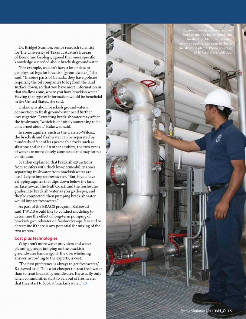
Spring/Summer 2014 txH2O 15
Reverse osmosis systems, shown here at the Kay Bailey Hutchison
Desalination Plant , is the most common technology used by Texas desalination plants. Photo courtesy
of El Paso Water Utilities.Dr. Bridget Scanlon, senior research scientist
for The University of Texas at Austin’s Bureau of Economic Geology, agreed that more specific knowledge is needed about brackish groundwater.
“For example, we don’t have a lot of data or geophysical logs for brackish [groundwater],” she said. “In some parts of Canada, they have policies requiring the oil companies to log from the land surface down, so that you have more information in that shallow zone, where you have brackish water.” Having that type of information would be beneficial in the United States, she said.
Unknowns about brackish groundwater’s connection to fresh groundwater need further investigation. Extracting brackish water may affect the freshwater, “which is definitely something to be concerned about,” Kalaswad said.
In some aquifers, such as the Carrizo-Wilcox, the brackish and freshwater can be separated by hundreds of feet of less permeable rocks such as siltstone and shale. In other aquifers, the two types of water are more closely connected and may form a continuum.
Scanlon explained that brackish extractions from aquifers with thick low-permeability zones separating freshwater from brackish water are less likely to impact freshwater. “But, if you have a dipping aquifer that dips down below the land surface toward the Gulf Coast, and the freshwater grades into brackish water as you go deeper, and they’re connected, then pumping brackish water would impact freshwater.”
As part of the BRACS program, Kalaswad said TWDB would like to conduct modeling to determine the effect of long-term pumping of brackish groundwater on freshwater aquifers and to determine if there is any potential for mixing of the two waters.
Cost plus technologiesWhy aren’t more water providers and water
planning groups jumping on the brackish groundwater bandwagon? The overwhelming answer, according to the experts, is cost.
“The first preference is always to get freshwater,” Kalaswad said. “It is a lot cheaper to treat freshwater than to treat brackish groundwater. It’s usually only when communities start to run out of freshwater that they start to look at brackish water.”]

16 txH2O Summer 2014
Everybody is talking about it continued
Dr. Bill Batchelor, professor and holder of the R. P. Gregory ’32 Chair in Texas A&M University’s Zachry Department of Civil Engineering, agreed that cost is a huge factor.
“Although costs have decreased a great deal over the past decades, desalination is still expensive compared to many alternatives such as conservation, reuse and developing new surface and groundwater supplies that do not require desalination,” Batchelor said.
In 2012, TWDB found the average cost to produce 1 acre-foot (about 326,000 gallons) of desalinated water from brackish groundwater ranged from approximately $357 to $782, or $1.25 to $2.60 for 1,000 gallons, which includes capital, operational and maintenance costs. The costs for El Paso Water Utilities to produce its desalinated water is 2.1 times more than its cost for fresh groundwater and 70 percent more than surface water, according to the utility.
Up to half of the cost is tied to the energy required for treatment. Kalaswad said 95 percent of the plants in Texas use an energy-intensive technology called reverse osmosis.
In reverse osmosis, the brackish water is pushed at high pressure through a semi-permeable membrane, causing freshwater to diffuse through the membrane and leaving behind the more salty water.
Driven by university and industry research, reverse osmosis technology has continually improved, making it more energy- and cost-efficient.
“Improvements in reverse osmosis membranes have resulted in much lower energy consumption and overall costs for reverse osmosis desalination,” Batchelor said. “The pace of improvements may slow, but I expect that they will continue.”
In addition to university research funded by other sources, TWDB has funded, with legislative appropriations, 12 brackish groundwater desalination demonstration projects, of which many dealt with reverse osmosis technology.
Hoping to save energy costs, Seminole, in West Texas, is testing using wind energy to operate its reverse osmosis desalination plant. Although the TWDB-funded project is not finished, Kalaswad said the results are promising, showing that wind energy could be a feasible alternative to traditionally generated energy.
Texas Sen. Craig Estes, chairman of the Joint
Interim Committee to Study Water Desalination, sees promise in developing new technologies that will help reduce the costs.
“Advanced technologies have the potential to improve the cost-benefit analysis for communities with brackish water supplies,” he said, “but at the end of the day, we will not see a significant increase in the use of brackish water desalination until it becomes the least expensive solution.”
Kalaswad said TWDB worked with the Texas Commission on Environmental Quality (TCEQ ) to determine if using computer models as surrogates for actual full-scale pilot studies of new reverse osmosis membrane types for brackish water is a valid option that could provide reliable results while saving significant money for water systems.
“Pilot demonstration studies are expensive and a burden on water providers,” he said.
According to Kalaswad and TCEQ , the models reliably predicted the performance of reverse osmosis membranes. “The use of computer models is a valid option for the water quality parameters that are defined in the models, and when evaluating more complex treatment schemes, such as various pretreatment and post-treatment options, are not required,” TCEQ experts wrote in an email.
This modeling is limited to water systems that don’t have any primary contaminant levels that exceed federally established health levels, according to TCEQ personnel. The model must demonstrate that the reverse osmosis membrane system will produce water that meets the target water quality goals and protects public health.
The TCEQ experts wrote that pilot demonstration studies may still be cost-effective for public water systems “if there are questions about the treatment technology or water sources.
“A pilot demonstration study allows the opportunity to test the efficacy of a treatment technology on a particular source [of] water. In some cases, results show that the treatment technology is not effective. In these situations, the study saved the public water system money that would have been wasted on a full-scale installation of the treatment technology and allowed for an alternate treatment technology to be selected.”
Disposal of the highly saline brine left over after the desalination process also adds to the costs, the experts said.
Summer 2014 txH2O 17
“The cost for disposing the produced brine can be a greater expense for inland desalination than for seawater desalination, where disposal offshore is usually the lower cost option,” Batchelor said.
Inland desalination plants dispose of their brine through deep well injection; discharge it to surface waters, a municipal sewer system, or an evaporation pond; or apply it onto land. TCEQ has different permits for each disposal method. To dispose of it by injection well, the plant must have a Class I well or Class V well permit, depending on the brine quality and water quality of the formation into which the waste is injected.
Kalaswad said it is expensive to install Class I injection wells for desalination concentrate disposal. A TWDB-funded feasibility study is looking at using existing Class II disposal wells permitted for oil and gas purposes for the concentrate.
Defining, regulating brackish groundwaterAnother hurdle that must be addressed before
brackish groundwater can be fully used, some believe, is the need to define and regulate it.
Experts said defining brackish groundwater might help better regulate it. No legal definition exists in Texas for brackish groundwater. Water is generally considered brackish if it contains total dissolved solids between 1,000 and 10,000 milligrams per liter. Some Texas Legislators introduced legislation in 2013 that would have defined brackish within those numbers, but it did not pass.
The same group of bills attempted to streamline the regulatory process for desalination and designate production zones for brackish groundwater. Currently, most groundwater conservation districts regulate and permit fresh groundwater and brackish groundwater the same.
“Groundwater conservation districts’ rules on pumping limits and exporting of water outside the district can have a big impact on a planned desalination project. In some instances, it has been a deal-breaker,” Kalaswad said.
Kalaswad referred to the recent decision by SAWS to reject three groundwater projects that would have piped groundwater from different areas in the state. One project could not guarantee that the water would be available in the future; the other two faced opposition from the district or citizens in the area.
“The goal of any legislation or regulation regarding groundwater should be to strike a balance between protecting our shared natural resources
while also defending private property rights,” said Estes, who is also vice chairman of the Texas Senate Natural Resources Committee. “Both water and private property rights are essential to the continued success of Texas.”
Looking ahead: turning more research into new technologies
The Texas Comptroller’s recent report urged innovative new technologies for new water, including brackish groundwater. The report recommended increasing state funding for innovative demonstration projects and establishing a $25 million prize program to reward successful innovative technology achievements.
Between now and January 2015, when the Texas Legislature goes into session, the Texas Joint Interim Committee to Study Water Desalination is reviewing research from a variety of sources. The committee’s goal is to not only study desalination, but to also make recommendations to encourage the use of brackish water, Estes said.
Areas in which improved technologies are needed include better membranes that reduce their potential for fouling and increase the flow of water through them at a given pressure, and disposal of the dissolved salt concentrate.
Researchers are also developing alternative desalination methods such as the energy-efficient technologies of forward osmosis and capacitive desalination.
In forward osmosis, water flows across a selectively permeable membrane from naturally brackish water to salty water prepared with specific salts. Freshwater can then be removed from the salty water by applying heat, preferably from a source that is currently going to waste, such as a power plant’s cooling-water discharge. According to the Comptroller’s report, forward osmosis plants are already in place in countries such as Gibraltar and Oman in the Persian Gulf.
Capacitive desalination is a process in which charged molecules in the water — or ions — are removed by electrostatic attraction to a solid surface that has an electrical potential, Batchelor said. After the ions of sodium and chloride are removed from the water and the desalinated water is produced, the electrical potential is removed or reversed and the ions are released into a waste brine for disposal. Then the surface can be charged again to repeat the cycle. ]

18 txH2O Summer 2014
Everybody is talking about it continued
The Kay Bailey Hutchison Desalination
Plant is currently the largest inland
desalination plant in the United States. Photo
courtesy of El Paso Water Utilities.
As far as new technologies for brine disposal, Batchelor said zero-liquid discharge systems offer promise for extending the range of places where desalination can be used and reducing the impacts of brine disposal, a major limitation for inland desalination.
“To achieve zero-liquid discharge, the flow of waste brine must be reduced. This can be achieved by using a number of reverse osmosis stages,” he said, adding that improvements in these stages could facilitate the acceptance of zero-liquid discharge.
“Energy recovery systems and use of alternative energy sources such as wind energy are additional areas in which improvements should be seen,” Batchelor said.
For example, forward osmosis can use waste heat. “The overall energy needs are not necessarily lower, but using energy that would otherwise be wasted is attractive,” Batchelor said.
“I think we will be doing more and more research in brackish [groundwater],” Scanlon said. “It’s very important. With projected increases in hydraulic fracturing in the Permian Basin and the Eagle Ford Shale, brackish water resources could be important resources for [that area]. I think they will be looking at that more and more.”
Kalaswad also believes the state will increasingly use brackish groundwater for future water supplies, even more than the projected 2 percent of total water supplies predicted in 2060 if the state continues experiencing drought. “The technology is there; it’s just a matter of availability of the resource and how much people are willing to pay for water.”
For more information and resources, visit txH2O online at twri.tamu.edu/txH2O.

Summer 2014 txH2O 19
Story by Kathy Wythe
Texas groundwater administration Intersection of management and planning presents challenges
There are two main parts of the complex, multi-faceted process that is groundwater adminis-tration in Texas: the management side and the planning side. It’s the intersection of the two that is presenting some potential hiccups as the 2017 state water plan is being compiled, according to experts.
Texas groundwater management historyBeginning with the Texas Legislature’s passage
of a 1949 bill establishing a process for designating underground water reservoirs and creating underground water conservation districts, ground-water conservation districts have been the state’s preferred method of managing groundwater.
There are 99 confirmed districts in Texas and each is in charge of developing a groundwater management plan. Most also issue permits that regulate groundwater pumping and well-spacing in its district boundaries. The districts, as well as counties not part of a groundwater conser-vation district, are divided into 16 groundwater management areas that mostly reflect aquifer boundaries.
As part of its groundwater management plan, each district must work with other districts in its groundwater management area to determine desired future conditions (DFCs) of its aquifers. DFCs are the desired, quantified conditions of groundwater resources, such as water levels, water quality, spring flows or volumes, at a specified time or times in the future or in perpetuity, according to the Texas Water Development Board (TWDB).
“Desired future conditions are the management goals for the aquifers,” said Dr. Robert Mace, TWDB deputy executive administrator for water science and conservation. “Sometimes we phrase that as ‘What do you want the aquifer to look like in the future?’ We want that look to extend as far as the planning horizon for water planning, which is 50 years.”
Mace said TWDB takes the DFC for each aquifer and runs groundwater availability models that convert each DFC into a volume number: the modeled available groundwater or MAG. The MAG is the amount of groundwater production, on an average annual basis, that will achieve the DFC.
“For example, districts within a groundwater management area may say that for the desired future condition of a certain aquifer, they want
springs flowing at 10 cubic feet per second during a drought of record,” he said. “We would run groundwater availability models to determine how much water can be pumped during a repeat of the drought of record and still maintain 10 cubic feet per second and that will turn into a volume number, for example, 100,000 acre-feet per year.”
If pumping exceeds the MAG volume over a number of years, the DFC may not be achieved.
Planning brings challenges On the planning side, the state has 16 regional
water planning groups that work on planning for both surface water and groundwater. Comprised of diverse interests, the groups develop regional water plans that outline water management strategies to ensure water supplies during drought for 50 years in the future and are adopted as part of the state water plan. The state water plan is compiled every five years by TWDB, using the regional plans, and is the go-to document for all water supply project planning in Texas.
Before 2005, groundwater conservation districts and regional planning groups came up with their own numbers for groundwater availability, Mace said. Districts used a number called total usable amount of groundwater and incorporated that number into their groundwater management plans.
“However, regional water planning groups also came up with groundwater availability numbers,” he said, “as well as projects based on those numbers. If a regional planning group planned to use more groundwater than a district’s total amount of usable groundwater availability, the district’s groundwater management plan could not be approved.”
The passage of HB 1763 in 2005 changed that. It regionalized decisions on groundwater availability, Mace said.
The law now requires groundwater conservation districts to work together with other districts in their groundwater management areas to establish DFCs for each aquifer in their management area, even if the aquifer is outside the district’s boundary. And, as the 16 regional water planning groups are working to develop their regional water plans for the 2017 state water plan, all of them, for the first time, have to use the MAG numbers from groundwater conservation districts as their measure of ground-water availability. ]

20 txH2O Summer 2014
Texas groundwater administration continued
“Before HB 1763, the regions trumped the districts,” Mace said. “Now the districts trump the regions.
“So what is happening now,” Mace said, “is that regional planning groups are seeing what those MAGs mean with respect to numbers they have been using in the past. In some cases, the districts have much lower groundwater availability numbers than the planning groups did in prior plans.”
Since some planning groups will now have less groundwater available to use when outlining recommended water management strategies to meet future water needs, they must find alternative sources of water to meet those needs rather than drilling a well, he said. And that can be a “challenge for them.”
“Water planners have to honor the MAGs,” Mace said.
Complicated process impacts regional workSouth Central Texas Regional Water Planning
Group (Region L) is one region addressing the discrepancy in the groundwater availability numbers. Con Mims, chair of Region L, said the region’s challenge in dealing with MAGs is twofold. Some groundwater conservation districts have permitted, exempted or grandfathered — collec-tively referred to as “allocated” — groundwater at levels that already exceed the MAG.
“There also is the situation where new ground-water projects being considered by Region L will cause a MAG to be exceeded,” Mims said in an email. “In both instances, Region L must, in its plan, reduce the amount of demand on that aquifer such that the amount taken does not exceed the MAG.”
Mims said in Region L, the MAG limitation most greatly affects planning in the Carrizo-Wilcox Aquifer.
“We have contacted each district involved with the aquifer to determine the amount of its MAG and how much water the district has allocated to date,” he said. “With this information, the amount of supply available for new (groundwater) projects, if any, is calculated. Where MAGs are exceeded or will be exceeded with new projects, the planning group has agreed for planning purposes to reduce all permitted, grandfathered and planned ground-water projects, proportionately, to meet the MAG limits. This results in having to identify alternate water supplies for some projects, even if the project is currently permitted.”
Another issue that the MAG has highlighted is that in some districts, the amount of water already permitted, if used completely, is higher than the MAG.
Mims said a district may be willing to allocate water in excess of a MAG if it believes that the DFC can still be met because not all of its permitted water is being used, the segment of the aquifer from which the water is being allocated is underused or for other reasons.
“Because groundwater conservation districts have sole authority to issue permits, Region L needs to be sensitive to that authority and must treat interests that are competing for limited groundwater supplies equitably in the planning process,” Mims said. “Writing a water plan that appears to cut back existing groundwater permits, limit water available for new permits and identify new supplies where none have thought to have been needed, all because of a planning restriction, can be tricky.
“Even without the MAGs, Region L, historically, has footnoted groundwater supplies in its plans stating that the amount being planned for is subject to being permitted by a groundwater conservation district, and backup supplies for the entity needing the water are identified in the plan,” he said.
In addition to the requirement that regional water plans have to include the districts’ DFCs and MAGs in the regional water plans, Mace said because the state has chosen this methodology for managing its aquifers, the state is not going to support, through financing, any activity that would violate districts’ DFCs.
“If a city wants to take advantage of the $2 billion [of the State Water Implementation Fund for Texas (SWIFT)], but the district’s MAG is too low to accommodate the project in that county, then the project is not going to be in the state water plan,” he said. “That means it will not benefit from the preferred financing terms that came out of the SWIFT.”
Although these potential hiccups are still being ironed out, the intersection of management and planning through DFCs and MAGs has positives and negatives, according to the experts.
“It is good in the sense that the overall process is bringing regional water planning into compliance to what the districts want to do and what they are actually doing,” Mace said. “However, it is bad from the perspective of the parties impacted by it, because groundwater tends to be a pretty affordable source of water, so if they can’t get groundwater, their alterna-tives are far more expensive.”
“I think this new way of defining available groundwater is good in that it forces the honoring of desired future aquifer conditions, at least from a regional water planning standpoint,” Mims said.
For more information and resources, visit txH2O online at twri.tamu.edu/txH2O.
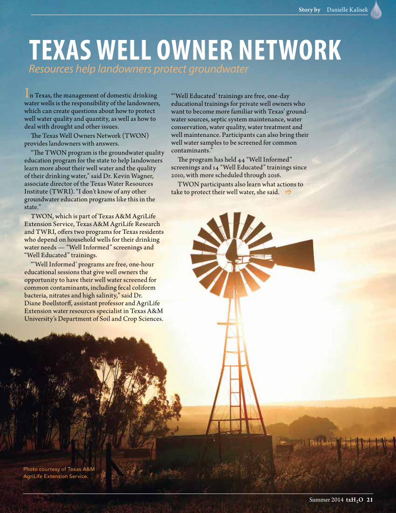
Summer 2014 txH2O 21
Story by Danielle Kalisek
Photo courtesy of Texas A&M AgriLife Extension Service.
In Texas, the management of domestic drinking water wells is the responsibility of the landowners, which can create questions about how to protect well water quality and quantity, as well as how to deal with drought and other issues.
The Texas Well Owners Network (TWON) provides landowners with answers.
“The TWON program is the groundwater quality education program for the state to help landowners learn more about their well water and the quality of their drinking water,” said Dr. Kevin Wagner, associate director of the Texas Water Resources Institute (TWRI). “I don’t know of any other groundwater education programs like this in the state.”
TWON, which is part of Texas A&M AgriLife Extension Service, Texas A&M AgriLife Research and TWRI, offers two programs for Texas residents who depend on household wells for their drinking water needs — “Well Informed” screenings and “Well Educated” trainings.
“‘Well Informed’ programs are free, one-hour educational sessions that give well owners the opportunity to have their well water screened for common contaminants, including fecal coliform bacteria, nitrates and high salinity,” said Dr. Diane Boellstorff, assistant professor and AgriLife Extension water resources specialist in Texas A&M University’s Department of Soil and Crop Sciences.
“‘Well Educated’ trainings are free, one-day educational trainings for private well owners who want to become more familiar with Texas’ ground-water sources, septic system maintenance, water conservation, water quality, water treatment and well maintenance. Participants can also bring their well water samples to be screened for common contaminants.”
The program has held 44 “Well Informed” screenings and 14 “Well Educated” trainings since 2010, with more scheduled through 2016.
TWON participants also learn what actions to take to protect their well water, she said.
texas well owner network
Resources help landowners protect groundwater
]

22 txH2O Summer 2014
Texas Well Owner Network continued
“By six months following the program, most of those needing to had pumped their septic systems, plugged deteriorated wells, removed hazards from their well house and moved contamination sources such as dog runs and livestock pens away from the well,” Boellstorff said. “Eighty-six percent planned to have their well water tested annually. On average, attendees valued their participation in the program at $834.
“Moreover, by protecting their own well water’s quality, participants are preventing contamination of aquifers, which can be extremely expensive to remediate.”
Numerous resources are also available online through the TWON website, twon.tamu.edu, to further help landowners answer well questions. Here is some basic information for well owners from some of the TWON resources.
Private Drinking Water Well Basics (SP-464)
Where is your well?Find and record the location of well(s) on your
property. Maintain a file of all well records; each well will have a unique well identification number assigned by the driller for reporting.
Pinpoint potential sources of contaminationThe wellhead should be at least:• 50 feet from any septic tank, cistern,
property boundary and/or nonpotable wells• 100 feet from the septic drain field or any leach field• 150 feet from any shelter or yard for livestock/pets,
feed storage area or pesticide or fertilizer storage• 250 feet from waste disposal systems
Test the waterOnce a year, sample well water and test for E. coli
or fecal coliform, nitrate and total dissolved solids. In addition, other contaminants such as arsenic and radionuclides are naturally occurring in parts of the state. Sample well water whenever contamination is suspected; if a change in color, taste or odor is noticed; after pump or well maintenance; or, if there is any change in health of those who drink the water.
To find a laboratory to test your water, call the local county health department or a Natural Environmental Laboratory Accreditation Program (NELAC) certified drinking water laboratory found online.
Well Owner Drought Response (SP-465)During severe drought periods, groundwater
resources are relied upon more heavily to provide water. Increased pumping plus the loss of recharge often results in lowered water table elevations. There are several recommended best management practices to protect the water supply.
• Monitor the pump.• If pumping causes the sound of “sucking air,” shut
down the pump and allow it to rest.• Depending on overall well depth, lowering the
pump may be an option.• Plan to sample well water on a regular basis during
drought; as the water table drops and pulls air (oxygen) into the aquifer, the chemistry of the water will change.
• Add a pumped water storage tank to provide needed water while allowing more time for the water level to recover, protecting the pump and supplying peak demand with a lower yield. Working with neighbors to schedule common or heavy water use may help.
• Practice water conservation to protect groundwater resources during drought.
Plugging Abandoned Water Wells (B-6238)Many wells around homes, farms, industrial sites
and urban areas have been abandoned without being properly plugged, creating a risk to humans, animals and the water supply.
An abandoned water well is a direct conduit from the surface to the aquifer below. Any surface contaminants can flow directly into the groundwater without natural filtration from soil. This puts the well, and other nearby wells, at risk.
According to state law, a well is considered abandoned if it has not been used for six consecutive months. However, it can be considered in-use if its equipment is in good condition or if it has been capped.
The landowner is legally responsible for plugging abandoned water wells and is liable for any water contamination or injury that results from an unplugged well. Before beginning the process of plugging an abandoned water well, seek advice from the local groundwater conservation district, a licensed water well driller and/or pump installer, or the Texas Department of Licensing and Regulation well driller/pump installer/abandoned well program.
For more information and resources The TWON website houses resources, frequently
asked questions, publications and contact information concerning well maintenance and lists the dates and locations of upcoming trainings and water well screenings. Visit twon.tamu.edu to learn more about these programs or to locate additional links to resources.

Summer 2014 txH2O 23
Story by Leslie Lee
Austin Water Utility’s Water Quality Protection Land program uses land easements and acquisitions to conserve land in aquifer recharge and contributing zones. Photo courtesy of Austin Water Utility.
PROTeCT OuR LAnD,
PROTeCT OuR WATeR
Rural conservation ensures cities’ water supplies, benefits landowners

24 txH2O Summer 2014
Protect our land, protect our water continued
Why would San Antonio residents care enough about rural land in the
two counties west of their city to vote tax dollars toward conserving it? Why would the city of Austin work to protect valuable nearby land from lucrative economic development? And, why should the average urban Texan give a second thought to the quality of the open spaces surrounding them? The answers lie in the science.
When rain falls in much of Medina and Uvalde counties, water seeps underground into the Edwards Aquifer and flows from west to east, eventually entering the portion of the aquifer on which San Antonio’s 1.3 million residents largely depend. In Austin, iconic Barton Springs and its segment of the Edwards rely on groundwater recharge from surrounding rural lands — recharge that could be severely diminished or contaminated if those lands are overdeveloped.
All across Texas, private, rural lands collect most of the rainfall the state receives, and it then flows to both groundwater and surface water supplies. Stewardship of this land helps provide not only water but also clean air and open spaces to urban populations.
“There is a strong connection between the health of our rural lands and the health of our cities,” said Blair Fitzsimons, chief executive officer of the Texas Agricultural Land Trust (TALT).
With this connection in mind, some water providers in Texas are investing in land conservation strategies usually associated with environmental groups or rural conservation organizations, and urban residents are supporting the work with votes, tax dollars and volunteer hours.
San Antonio voters bet on the landWhen San Antonians watch the evening news,
the daily aquifer level update is always part of the weather report. Many residents are well aware that the state of the Edwards Aquifer not only affects their landscape watering schedule but also the city’s ability to sustain water supplies for an ever-increasing population.
Local voters’ knowledge of groundwater’s critical importance is why three land conservation proposi-tions in the past 14 years have all passed, authorizing up to $225 million in sales tax revenue to be used to protect land in the aquifer’s recharge and contrib-uting zones, said Grant Ellis, special projects manager for the city’s Edwards Aquifer Protection Program.
The term recharge zone refers to the land where water from the surface actually seeps down into the aquifer, and the contributing zone is the area where rainfall flows to the recharge zone. Because the Edwards Aquifer’s geological makeup makes it both very vulnerable to pollution through its porous limestone layers and relatively quick to recharge its supplies with rainwater, the program protects both water quality and quantity.
In 2000, the first proposition authorized the program with $45 million, which enabled the purchase and protection of 6,500 acres in growing Bexar County, where real estate prices were higher than other counties.
“After that first proposition, officials and concerned citizens got together and said: ‘How can we extend this program, and how can we protect a little bit more of the recharge zone in a more effective and efficient manner?’” Ellis said.
City officials had a two-fold solution: look to neighboring rural counties that heavily contribute to recharging the aquifer and start using conservation easements instead of acquisitions there. A conser-vation easement is a perpetual legal agreement that allows landowners to retain title and management of their property, while forfeiting, donating or selling certain development rights to protect the land from commercial or residential development.
In San Antonio’s program, the city essentially purchases the landowners’ development rights. Easements can be a win-win for all parties involved: the aquifer is protected, while the landowners can continue operating their land for farming, ranching or wildlife — basically how they have always managed it — and have a new tool to help hold their families’ land together for future generations, Ellis said.
“And, that’s what many of these folks really want, so it’s a residual benefit of the program,” he said. “We’re protecting the open space for recharge purposes, and the landowners get to keep their land intact.”
With this new strategy in place, he said, the next two propositions passed in 2005 and 2010, each allowing the program to collect up to $90 million in sales tax revenue to protect land in three counties — Bexar, Medina and Uvalde. To date, the program has acquired or placed conservation easements on 119,847 acres of land in the aquifer’s recharge and contributing zones.

Summer 2014 txH2O 25
Austin Water Utility uses a variety of strategies and practices, including protective grates and
land conservation, to protect the water flowing into the Edwards Aquifer Barton Springs segment
through its recharge and contributing zones. Photo courtesy of Austin Water Utility.
]
“It’s been wildly successful in terms of the public response,” Ellis said. “About 70 percent of the water that San Antonians end up using from the Edwards originates in Medina and Uvalde counties, and I think that the voters just get it. San Antonians understand why the Edwards is such an important resource and why we need to protect it.
“So, with that basic understanding, we are able to ask ‘is this important to you?’ and time and time again, the voters have said ‘yes.’”
Conserving high-priority propertiesUnique among Texas aquifers in how it functions,
the highly permeable Edwards recharges much quicker than other aquifers, which can take hundreds or even thousands of years to recharge. In the recharge and contributing zones, streams and rivers, as well as karst features such as caves or fractures, are sensitive areas that have high permea-bility, and therefore protecting lands with those features is a priority, Ellis said.
The protection program, Ellis said, has always been science-based. It uses geospatial modeling and ground geological assessments to identify priority and sensitive recharge areas.
“Our geospatial model is based on the hydro-geology, permeability, biological components, location and size of a property,” he said.
Any risk of future development is also a major consideration when looking at properties, Ellis said. Development in Uvalde and Medina counties is different than that in Bexar. Though the development in these two counties involves more small-acreage ranchettes than shopping malls, he said, it still affects the aquifer by bringing increased impervious cover and septic tanks.
It is solely the landowners’ prerogative whether they wish to negotiate a conservation easement on their land, Ellis said. Landowners who are open to it then work with the program’s Land Acquisition Team, led by the Green Space Alliance, a local land trust, and the Nature Conservancy, a worldwide organization, through the rest of the process: property appraisal, conservation easement negotia-tions and final agreement and payment.
“We sit down with the landowners and discuss the property’s value as it would be with the conser-vation easement and what the city is willing to pay — and that’s a set price determined by a certified Texas Real Estate Land Appraiser familiar with conservation valuations,” Ellis said.
Every easement is different, because each landowner and property is unique, and the agreements are tailored to their needs, he said. Future commercial or residential development rights are forfeited, but some agreements maintain limited development rights, such as building a small number of additional homes on the land. No-development zones are included in agreements for properties that contain extra-sensitive features, such as sinkholes, streams or springs.
Barton Springs inspires Austin programA collection of such springs, located about 80
miles north of San Antonio, moved the city of Austin to also strategically protect land. The Barton Springs segment of the Edwards Aquifer stores and moves water from near the town of Kyle, north to its major discharge, Barton Springs, which is located in the middle of Austin, said Dr. Kevin Thuesen, environ-mental conservation program manager for Austin Water Utility’s Water Quality Protection Land program.
Not only does the segment contribute to the city’s water supplies, but Barton Springs itself is an Austin landmark. Located in Zilker Park, the Barton Springs pool covers three acres and has an average temperature of 70 degrees, drawing around 800,000 visitors every year, according to city officials. It contains the federally listed endangered Barton Springs salamander, as well as the Austin blind salamander, a candidate species for listing, and is a federally protected habitat.
Motivated by protecting both the iconic springs pool and the city’s water supplies, in 1998 Austin voters approved bonds for purchasing and conserving land in the segment’s watershed for water quality protection, Thuesen said. The resulting Water Quality Protection Land program acquires land using both purchasing and conservation easements. The program’s goal is to produce the optimum level of high-quality water from project lands to recharge the Barton Springs segment, he said.
Following additional bond measures passing again in 1998, and then in 2006 and 2012, today the program includes more than 26,000 acres of land — 17,000 acres in conservation easements.

26 txH2O Summer 2014
Protect our land, protect our water continued
The spring-fed Barton Springs Pool in Austin, Texas. Photo
from istock.com.

Summer 2014 txH2O 27
“I think Barton Springs has always been this natural, wonderful thing that citizens have always loved and rallied around and have wanted to protect,” Thuesen said. “It wasn’t a surprise that voters were in favor of conserving these sensitive lands that are frequently beyond the city limits and thus beyond ordinances that might otherwise help to protect them.”
Similar to San Antonio’s program, Austin only protects land in the Barton Springs segment’s recharge and contributing zones, which cover about half of Travis and Hays counties. They’ve carefully identified where the water that flows into Barton Springs originates, Thuesen said.
“And, the land we’ve acquired or acquired easements on is frequently connected. We can have more positive impacts if the land is contiguous.”
The Austin program also uses geospatial models and a variety of other factors to identify sensitive lands and offers acquisition or conservation easement agreements to willing landowners. Personnel are equipped with GIS (geographic information systems) software on mobile phones to do field work more efficiently, such as geological surveys and compliance plans, Thuesen said. They also provide technical and land management assistance as requested to landowners with conser-vation easements.
“Easements work really well for landowners who just really love the land and want to stay on it,” he said.
Protecting lands through easements and conser-vation management can benefit both the quality and quantity of water in the Barton Springs segment, Thuesen said. However, benefiting both can be a difficult balance.
“We must protect the aquifer from poor water quality, but also make sure it continues to get enough water,” he said. “Our land restoration work also helps protect water quality and quantity. We’re trying to restore the ecosystems back to their native savannas and prairies, using tools like prescribed fire.”
Although the water utility-owned lands are not parks, Thuesen said, there are public trails on two of the properties, and the public frequently visits the lands for educational events as well as volunteer work days for restoration efforts and many weekend events held throughout the year.
“Open space is also a big priority for people in Austin,” he said. “It’s one of the things that make Austin Austin, and it’s one of the reasons why people want to come here.”
easements can be mutually beneficialOpen spaces and water supply protection are just
two of the many positive impacts that rural lands provide to Texans, said TALT’s Fitzsimons.
“Rural working lands, such as farms, ranches and timberland, provide essential benefits that people who live in cities rely on, including drinking water, clean air, open space, storm-surge buffers and carbon sequestration,” she said. “Some people call those ecosystem services; we call them public benefits provided by private lands.”
TALT began protecting rural working lands in 2007, when leaders in agriculture and wildlife sectors came together to address the growing issue of land fragmentation in Texas.
“This group felt that landowners needed an additional tool to be able to deal with fragmentation and loss of land,” Fitzsimons said. “We started exploring conservation easements, which had really been more of a tool used by the environmental community to protect habitat and species.”
The land trust now has about 225,000 acres under easements. Fitzsimons said these agreements appeal to many landowners because retiring the commercial and residential development rights effectively decreases the value of the land, which helps landowners and their heirs pay estate taxes. Because the land value decreases, the estate taxes are much lower. Owners also appreciate the opportunity to ensure that their family’s land will remain intact, she said.
A strategy for the futureIncentivizing rural land conservation in order to
protect natural resources for all Texans should be a strategy used more often in the future by policy makers, Fitzsimons said.
Programs such as those used in San Antonio and Austin have proven effective, but finding funding sources can be difficult, she said. And, although those cities’ land conservation programs are ultimately aimed at groundwater, similar strategies could protect surface water sources.
“When it rains in Texas, which it hasn’t very much recently, but when it does rain, that rain falls predominately on privately owned land,” she said. “We want to find ways to incentivize the continued stewardship of those watersheds and streams and rivers that provide those water resources, because how that land is managed is really critical to those of us who live in the cities.”
For more information and resources, visit txH2O online at twri.tamu.edu/txH2O.

Did you know?
28 txH2O Summer 2014
Story by Kathy Wythe
Q Who owns groundwater in Texas?
A Landowners in Texas own the water beneath their property. Moreover, recent case law makes clear that a landowner owns not only the water that emerges from the ground, but the water in-place underground as well. This is in sharp contrast to surface water, which is owned by the state of Texas in trust for the public and may only be used after a permit is obtained.
Q What does the rule of capture mean?
A The rule of capture is the governing principle of Texas groundwater law. The rule of capture essentially provides that because a landowner owns the water beneath his property, the landowner has the right to pump as much water as he wishes even at the expense of his neighbor. Under the rule of capture, a landowner needs no permit to drill a well and pump groundwater, and he may pump as much water as he may beneficially use even if that causes his neighbor’s well to go dry. He may also sell the water withdrawn from the ground for use at any location. What is the remedy for a neighbor who is worried about his well going dry? Drill a bigger/deeper well. In light of this, many refer to Texas groundwater law as the “law of the biggest pump.” Two important limitations on the rule of capture, however, modify this general principal and are discussed below.
Q Does the rule of capture mean landowners can pump as much water from beneath their land as they want?
A Absolutely not, and this is something that is very important for Texas landowners to understand.
Although a landowner owns the water beneath his or her property, this does not give the landowner the right to capture a specific amount of groundwater, nor does it allow the landowner to commit acts that result in waste or subsidence. The exceptions fall into two categories.
Common law exceptions: Five common law exceptions to the rule of capture limit a landowner’s right to pump groundwater. First, a landowner may not “maliciously take water for the sole purpose of injuring his neighbor.” Second, a landowner may not “wantonly and willfully waste” groundwater. Third, a landowner may not negligently drill or pump from a well in a manner that causes subsidence on his neighbor’s property. Fourth, a landowner may not pump from a contaminated well. Finally, a landowner may not trespass onto another’s land in order to pump groundwater. If a landowner’s pumping falls within one of these exceptions, he is not protected by the rule of capture and may be required to cease pumping or be liable for damages.
Legislative exceptions: Due to a constitutional amendment in 1917 known as the Conservation Amendment, the Texas Legislature must preserve
Q&AW/ Tiffany DowelltxH2O asked Tiffany Dowell, assistant professor and Texas A&M AgriLife Extension Service specialist focusing on agricultural law, to answer some questions about groundwater law for our readers. To read more, follow Dowell’s blog, Texas Agricultural Law, at agrilife.org/texasaglaw/.

Summer 2014 txH2O 29
and conserve all of Texas’ natural resources, which includes regulating the drilling and pumping of groundwater. The Legislature decided that the “preferred method of groundwater management” in Texas is through local groundwater conservation districts (GCDs). These GCDs are able to enact rules and regulations, including requiring permits, metering and limitations on the amount of water that may be withdrawn in their area.
Q What is the most important information landowners should know about laws regarding groundwater and their land?
A I believe the most critical point is to understand whether they are covered by a GCD, and, if so, they must understand the rules of the district. Because each GCD across the state has its own rules and regulations, the laws regarding groundwater vary greatly across the state. For example, some districts limit the amount of water that may be produced, while other districts do not have limitations. Some districts require metering and reporting of water usage; others do not. Finally, certain wells may be drilled without obtaining a GCD permit in one district but would be improper without a permit in a different district.
Q Can landowners sell their groundwater?
A Yes. Texas landowners are permitted to sell, lease or transfer groundwater rights to whomever they choose, including other landowners, corpora-tions or even cities.
Importantly, GCDs may have requirements specifically for transfers of groundwater outside of the district’s boundaries. These requirements include requiring a permit from the district before a transfer can be made, production limits and transfer fees or taxes. Further, water purchasers must still comply with the GCD rules for the area where the water is pumped, regardless of where the water will be eventually utilized.
Q Can you briefly explain some of the recent court cases that have affected groundwater management and ownership, such as Edwards Aquifer Authority v. Day and McDaniel and Bragg v. Edwards Aquifer Authority?
A These two recent cases are extremely important with respect to groundwater ownership in Texas.
In 2012, the Day case affirmed the principal that a Texas landowner owns the water in-place under his property. In that case, two farmers owned land south of San Antonio and applied to the Edwards Aquifer Authority (EAA) for a permit for their existing water well seeking to pump 700 acre-feet per year. EAA granted a permit to pump only 14 acre-feet per year. The farmers filed suit claiming that the permit denial constituted a taking of private property, asserting an ownership interest in the groundwater beneath their property. The Texas Supreme Court sided with the farmers, finding that groundwater in-place is owned by landowners, and, as such, it constitutes a property right for which just compen-sation must be paid if the regulations constitute a taking. This case was the first express recognition by the Texas Supreme Court that landowners owned not only water that they produced from beneath their land but also water that remains in place beneath their property.
The Bragg v. Edwards Aquifer Authority case was just decided by the San Antonio Court of Appeals in August 2013 and is essentially a logical extension of the Day opinion. This case involved a Texas pecan producer who purchased land prior to the creation of EAA. Bragg planted two orchards in the 1980s. The first was irrigated with ground-water, and the second by other means. After EAA was created, Bragg sought permits to irrigate both orchards with groundwater by drilling a well for the second orchard and producing more water to irrigate the first. EAA denied the requested permit for the second orchard in its entirety and granted only the amount of water historically used for the first orchard. Bragg filed suit. The Court of Appeals found in favor of Bragg and held that the denial of the permits constituted a regulatory taking for which the landowner should be paid just compen-sation. This case illustrates that if regulations on groundwater owners go too far, a taking may occur, forcing payment to the landowner. EAA has filed a notice of appeal in the Texas Supreme Court seeking further appellate review of this decision.
For more information and resources, visit txH2O online at twri.tamu.edu/txH2O.

NON PROFIT ORG.U.S. Postage
PAIDBryan, TX
Permit No. 83
2260 TAMUCollege Station, TX 77843-2260
Change Service Requested
Texas A&M AgriLife Extension Service
Scan code with your smart phone
for more on txH2O!
Let ’s get social!facebook.com/txwri
twitter.com/txwri
instagram.com/txwri
pinterest.com/TxWRI/
scoop.it/u/texas-water-resources-institute