tropical cyclone assessment of mexico - transre
TRANSCRIPT
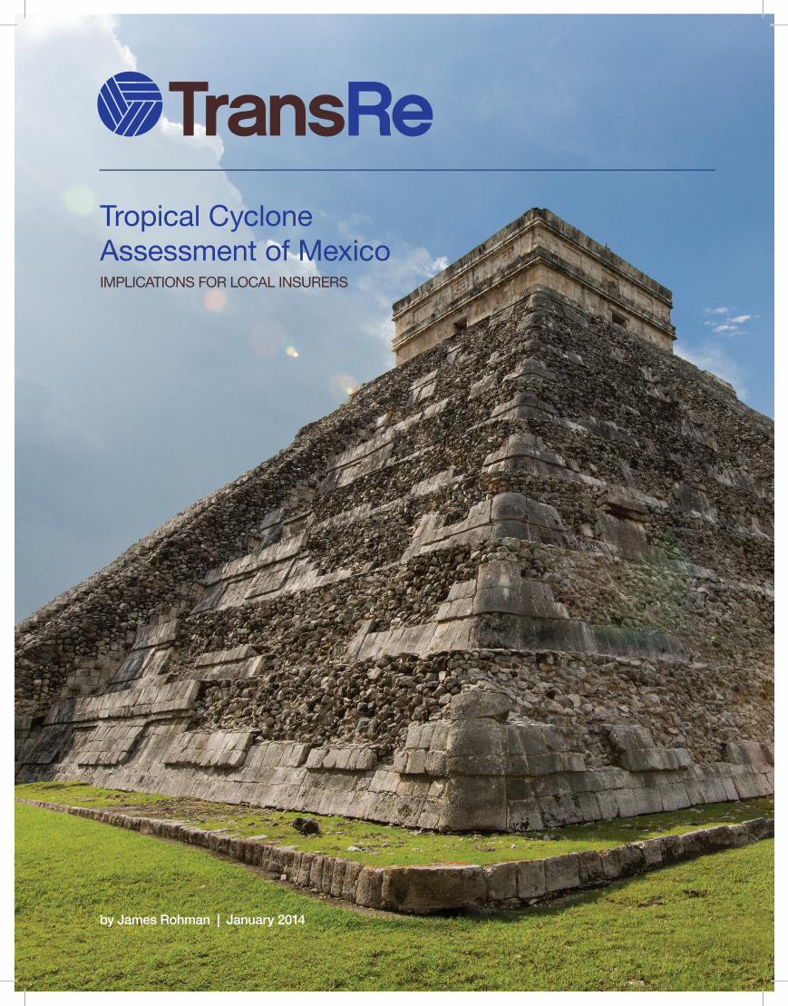
Tropical CycloneAssessment of MexicoIMPLICATIONS FOR LOCAL INSURERS
by James Rohman | January 2014

1 Tropical Cyclone Assessment of Mexico | TransRe White Paper
Figure 1. Mexico by state, for reference.
Figure 2. Landfalling hurricanes (all categories) by state, 1951-2000.
3 Tropical Cyclone Assessment of Mexico | TransRe White Paper
Introduction While extreme weather can cause widespread disruption and loss, the science of climatology is still evolving, and the correlations are not fully understood. However, insurers are in the business of risk management and protecting insurance buyers from their exposures. It is our job to understand and quantify the linkages as best we can. While society (and we) may hope for the best, we must also prepare for the worst. This paper will seek to highlight general developments in the understanding of tropical cyclone climatology as it affects both coasts of Mexico.
Mexico has Latin America’s second largest economy, with great potential for further growth. The economy has displayed resilience in the face of a global financial slowdown. The government has active plans to boost the country’s competitiveness and growth, particularly in the energy production and telecommunications sectors and 2014 projections are encouraging.
Mexico is susceptible to natural disasters along its Atlantic and Pacific coastlines. Both coasts are also more heavily populated and urbanized than they have been in the past, thanks to tourism and other economic activity. Mexico is particularly vulnerable to rainfall from hurricanes and tropical storms along the coasts - orographic lifting and adiabatic cooling from the Sierra Madres intensify local rainfall. To understand the causes, the first section of this paper summarizes the science behind both.
In recent years, Mexico has suffered a rise in the frequency and severity of tropical cyclones. The second section of this paper summarizes the rationale.
Public perception of these risks is changing. Combined with increasing private wealth, this will result in greater insurance penetration. Mexican insurers should understand the impact of the changing risk profile to their exposures. The final section of this paper highlights developments in this area.
1
2 Tropical Cyclone Assessment of Mexico | TransRe White Paper
Executive Summary • Mexico’s Atlantic and Pacific coasts have both been affected by more
extreme and destructive tropical cyclones in the past 15 years.
• This increased destructiveness has coincided with socioeconomic growth along Mexico’s coastlines.
• Pacific hurricanes make landfall twice as often (18%) as Atlantic hurricanes (9%).
• The combination of increased risks and increased insured values makes it ever more important to understand future trends and developments in tropical cyclone climatology.
• The probability for tropical cyclones along Mexico’s coasts can be analyzed by evaluating certain climate events.
• The El Niño phase of the El Niño Southern Oscillation (ENSO) is commonly associated with more tropical cyclones in the eastern Pacific basin, and less tropical cyclones in the Atlantic basin.
• La Niña conditions are associated with the opposite – fewer Pacific cyclones and more Atlantic cyclones.
• When the Madden-Julian Oscillation (MJO) produces westerly wind anomalies, this increases the chances of a tropical cyclone in the eastern Pacific and Gulf of Mexico basins by four times.
• Easterly wind MJO anomalies tend to produce less favorable conditions for tropical cyclone genesis.
• The positive phase of the Arctic Oscillation (AO) increases the likelihood of an active Atlantic hurricane season due to low surface pressure.
• The negative phase of the AO is associated with a less active Atlantic hurricane season.
• These climate events can be tracked and monitored on a variety of timescales to aid in the understanding of tropical cyclone climatology.
• TransRe is working to support insurers to better understand the causes and implications of the eastern Pacific and Atlantic hurricane seasons.

3 Tropical Cyclone Assessment of Mexico | TransRe White Paper
Introduction While extreme weather can cause widespread disruption and loss, the science of climatology is still evolving, and the correlations are not fully understood. However, insurers are in the business of risk management and protecting insurance buyers from their exposures. It is our job to understand and quantify the linkages as best we can. While society (and we) may hope for the best, we must also prepare for the worst. This paper will seek to highlight general developments in the understanding of tropical cyclone climatology as it affects both coasts of Mexico.
Mexico has Latin America’s second largest economy, with great potential for further growth. The economy has displayed resilience in the face of a global financial slowdown. The government has active plans to boost the country’s competitiveness and growth, particularly in the energy production and telecommunications sectors and 2014 projections are encouraging.
Mexico is susceptible to natural disasters along its Atlantic and Pacific coastlines. Both coasts are also more heavily populated and urbanized than they have been in the past, thanks to tourism and other economic activity. Mexico is particularly vulnerable to rainfall from hurricanes and tropical storms along the coasts - orographic lifting and adiabatic cooling from the Sierra Madres intensify local rainfall. To understand the causes, the first section of this paper summarizes the science behind both.
In recent years, Mexico has suffered a rise in the frequency and severity of tropical cyclones. The second section of this paper summarizes the rationale.
Public perception of these risks is changing. Combined with increasing private wealth, this will result in greater insurance penetration. Mexican insurers should understand the impact of the changing risk profile to their exposures. The final section of this paper highlights developments in this area.
2
3 Tropical Cyclone Assessment of Mexico | TransRe White Paper
Introduction While extreme weather can cause widespread disruption and loss, the science of climatology is still evolving, and the correlations are not fully understood. However, insurers are in the business of risk management and protecting insurance buyers from their exposures. It is our job to understand and quantify the linkages as best we can. While society (and we) may hope for the best, we must also prepare for the worst. This paper will seek to highlight general developments in the understanding of tropical cyclone climatology as it affects both coasts of Mexico.
Mexico has Latin America’s second largest economy, with great potential for further growth. The economy has displayed resilience in the face of a global financial slowdown. The government has active plans to boost the country’s competitiveness and growth, particularly in the energy production and telecommunications sectors and 2014 projections are encouraging.
Mexico is susceptible to natural disasters along its Atlantic and Pacific coastlines. Both coasts are also more heavily populated and urbanized than they have been in the past, thanks to tourism and other economic activity. Mexico is particularly vulnerable to rainfall from hurricanes and tropical storms along the coasts - orographic lifting and adiabatic cooling from the Sierra Madres intensify local rainfall. To understand the causes, the first section of this paper summarizes the science behind both.
In recent years, Mexico has suffered a rise in the frequency and severity of tropical cyclones. The second section of this paper summarizes the rationale.
Public perception of these risks is changing. Combined with increasing private wealth, this will result in greater insurance penetration. Mexican insurers should understand the impact of the changing risk profile to their exposures. The final section of this paper highlights developments in this area.

4 Tropical Cyclone Assessment of Mexico | TransRe White Paper
The Science of Mexican Tropical Cyclones The major factors driving Mexico’s tropical cyclone exposure are the El Niño Southern Oscillation, Madden-Julian Oscillation and Arctic Oscillation. El Niño Southern Oscillation (ENSO)
In cycles of 2-5 years, anomalous warm (El Niño phase) and cold (La Niña phase) patches of ocean water form off western South America. They affect 60% of global weather patterns, including flood/drought patterns in Brazil, USA, Africa, Indonesia, Australia and Southeast Asia.
Madden-Julian Oscillation (MJO)
A band of low-pressure develops in the Indian Ocean, travels east to dump rain on SE Asia and Australia, and continues east as an anomalous weather band. It is associated with large-scale variations in atmospheric/oceanic conditions, affecting droughts, monsoons and tropical cyclones.
Arctic Oscillation (AO)
AO is an index of non-seasonal sea-level pressure north of 20oN. The effects are explained by NASA climatologist Dr. James E. Hansen.
"The degree to which Arctic air penetrates into middle latitudes is related to the AO index, which is defined by surface atmospheric pressure patterns. When the AO index is positive, surface pressure is low in the polar region. This helps the middle latitude jet stream to blow strongly and consistently from west to east, thus keeping cold Arctic air locked in the polar region. When the AO index is negative, there tends to be high pressure in the polar region, weaker zonal winds, and greater movement of frigid polar air into middle latitudes."
AO influences the entire northern hemisphere, affecting North American and European populations, and also has a strong influence on tropical activity in the Atlantic basin.
Interaction between MJO and ENSO
MJO is highly variable from year to year, with periods of strong activity followed by weak or non-existent conditions. The atmospheric science community suspects that MJO is partially linked to the ENSO cycle. Typically, strong MJO activity is observed 6-12 months before the onset of El Niño, but is virtually absent during the maxima of some El Niño episodes. Meanwhile, MJO tends to be more active during La Niña periods. MJO can influence the ENSO cycle by contributing to the speed of development, and perhaps the overall intensity of El Niño episodes. In this way, MJO modulates ENSO. It is important to track both as they will affect global weather patterns.
3
4 Tropical Cyclone Assessment of Mexico | TransRe White Paper
The Science of Mexican Tropical Cyclones The major factors driving Mexico’s tropical cyclone exposure are the El Niño Southern Oscillation, Madden-Julian Oscillation and Arctic Oscillation. El Niño Southern Oscillation (ENSO)
In cycles of 2-5 years, anomalous warm (El Niño phase) and cold (La Niña phase) patches of ocean water form off western South America. They affect 60% of global weather patterns, including flood/drought patterns in Brazil, USA, Africa, Indonesia, Australia and Southeast Asia.
Madden-Julian Oscillation (MJO)
A band of low-pressure develops in the Indian Ocean, travels east to dump rain on SE Asia and Australia, and continues east as an anomalous weather band. It is associated with large-scale variations in atmospheric/oceanic conditions, affecting droughts, monsoons and tropical cyclones.
Arctic Oscillation (AO)
AO is an index of non-seasonal sea-level pressure north of 20oN. The effects are explained by NASA climatologist Dr. James E. Hansen.
"The degree to which Arctic air penetrates into middle latitudes is related to the AO index, which is defined by surface atmospheric pressure patterns. When the AO index is positive, surface pressure is low in the polar region. This helps the middle latitude jet stream to blow strongly and consistently from west to east, thus keeping cold Arctic air locked in the polar region. When the AO index is negative, there tends to be high pressure in the polar region, weaker zonal winds, and greater movement of frigid polar air into middle latitudes."
AO influences the entire northern hemisphere, affecting North American and European populations, and also has a strong influence on tropical activity in the Atlantic basin.
Interaction between MJO and ENSO
MJO is highly variable from year to year, with periods of strong activity followed by weak or non-existent conditions. The atmospheric science community suspects that MJO is partially linked to the ENSO cycle. Typically, strong MJO activity is observed 6-12 months before the onset of El Niño, but is virtually absent during the maxima of some El Niño episodes. Meanwhile, MJO tends to be more active during La Niña periods. MJO can influence the ENSO cycle by contributing to the speed of development, and perhaps the overall intensity of El Niño episodes. In this way, MJO modulates ENSO. It is important to track both as they will affect global weather patterns.

5 Tropical Cyclone Assessment of Mexico | TransRe White Paper
Increased Rainfall & The Sierra Madres
Much of the damage from hurricanes and tropical storms comes from the associated rainfall. As evidenced by 2013 Hurricane Raymond, 12-16 inches of rainfall can accumulate on the ocean-facing slopes of the Sierra Madres. This is due to orographic lift and adiabatic cooling. Orographic lift occurs when air masses are forced up to high elevations as they move over terrain. As the air mass gains altitude, adiabatic cooling occurs: as atmospheric pressure decreases, the internal air expands, the volume increases and temperature falls. Dew point is attained and rainfall will drop at a predictable altitude. These processes combine to intensify rainfall from incoming tropical cyclones along the Mexican coasts.
Hurricane Climatology of ENSO
El Niño events are associated with an increase in eastern North Pacific tropical cyclone activity, and a decrease in tropical cyclone activity in the Atlantic basin. Conversely, La Niña events area associated with a decrease in tropical cyclone activity in the eastern Pacific basin and an increase in tropical cyclone activity in the Atlantic basin.
ENSO affects both the intensity and propensity for landfall in the Atlantic Basin. During a La Niña phase, there is a 10% greater chance of tropical cyclone genesis, and 24% greater chance of tropical cyclone landfall. During an El Niño phase, there is 18% less chance of tropical cyclone genesis, and 42% less chance of tropical cyclone landfall.
Table 1. The relationship of ENSO and Atlantic tropical cyclone activity, 1950-2000. (ASO= August-September-October)
El Niño increases Pacific and decreases Atlantic frequency because of its im-pact on vertical wind shear; increased vertical wind shear acts to prevent tropical disturbances from developing into more convective cyclones, as displayed in Figure 3.
4
5 Tropical Cyclone Assessment of Mexico | TransRe White Paper
Increased Rainfall & The Sierra Madres
Much of the damage from hurricanes and tropical storms comes from the associated rainfall. As evidenced by 2013 Hurricane Raymond, 12-16 inches of rainfall can accumulate on the ocean-facing slopes of the Sierra Madres. This is due to orographic lift and adiabatic cooling. Orographic lift occurs when air masses are forced up to high elevations as they move over terrain. As the air mass gains altitude, adiabatic cooling occurs: as atmospheric pressure decreases, the internal air expands, the volume increases and temperature falls. Dew point is attained and rainfall will drop at a predictable altitude. These processes combine to intensify rainfall from incoming tropical cyclones along the Mexican coasts.
Hurricane Climatology of ENSO
El Niño events are associated with an increase in eastern North Pacific tropical cyclone activity, and a decrease in tropical cyclone activity in the Atlantic basin. Conversely, La Niña events area associated with a decrease in tropical cyclone activity in the eastern Pacific basin and an increase in tropical cyclone activity in the Atlantic basin.
ENSO affects both the intensity and propensity for landfall in the Atlantic Basin. During a La Niña phase, there is a 10% greater chance of tropical cyclone genesis, and 24% greater chance of tropical cyclone landfall. During an El Niño phase, there is 18% less chance of tropical cyclone genesis, and 42% less chance of tropical cyclone landfall.
Table 1. The relationship of ENSO and Atlantic tropical cyclone activity, 1950-2000. (ASO= August-September-October)
El Niño increases Pacific and decreases Atlantic frequency because of its im-pact on vertical wind shear; increased vertical wind shear acts to prevent tropical disturbances from developing into more convective cyclones, as displayed in Figure 3.

6 Tropical Cyclone Assessment of Mexico | TransRe White Paper
Figure 3. Effect of wind shear on a storm’s latent heat. Tropical cyclone damage increases with the square of wind speed, so more intense hurricanes translate to significantly more damage. In the US (where more data is available) the average damage per storm is $1.6B in La Niña years, but just $0.8B in El Niño years.
In the fifty years from 1951-2000, six major hurricanes struck Mexico’s Caribbean coast. They developed from the warm tropical Atlantic waters east of the Lesser Antilles during the cold/neutral La Niña phase. As they entered the Caribbean, their strength intensified due to favorable La Niña conditions. Most made double-strike landfall, hitting first on the Yucatan peninsula and making a second hit on the Tamaulipas/Veracruz coasts. For example, in September 1988, Hurricane Gilbert made landfall on the northeast Yucatan Peninsula as a Category 5 with sustained winds of 150mph, continued west-northwest across the Gulf and hit the south of Tamaulipas State. Torrential rains accompanied the storm over the coast and into the mountainous areas. Overall damage (including 60,000 destroyed homes) was estimated at US$2B. Adjusted for inflation, that would be US $3.8B in 2013 dollars. However, If Hurricane Gilbert hit the same regions today, insured damages would be in excess of US $6B due to inflation and population shifts/economic development.
It is important to note that ENSO isn’t the only climate factor to affect hurricane development. Other environmental conditions to consider include pre-existing vertical wind shear, sea surface temperatures, the Saharan Air Layer, and also the Arctic Oscillation and Madden-Julian Oscillation.
5

7 Tropical Cyclone Assessment of Mexico | TransRe White Paper
Hurricane Climatology of Arctic Oscillation
AO is strongly related to tropical cyclone activity in the Atlantic basin (to date its relationship with the Pacific has not been studied). 7 of the 10 most active Atlantic hurricane seasons occurred during positive AO phases. Those seven years averaged 13 tropical storms per season, compared to the long-term average of 8.1. Conversely, 7 of the 10 least active years occurred during negative AO phases, averaging just 4 tropical cyclones per year. Approximately 29% more tropical storms occur during AO positive phases, 15% more hurricanes occur during AO positive phases, and the storms have a 62% greater likelihood of landfall.
Table 2. Relationship of Arctic Oscillation tropical cyclone activity (1951-2000). (ASO=August-September-October).
Hurricane Climatology of Madden-Julian Oscillation
MJO strongly modulates tropical cyclone activity over the Gulf of Mexico and western Caribbean Sea as well as the eastern Pacific Ocean. MJO causes alternating periods of westerly and easterly wind anomalies over the tropical ocean basins. Tropical cyclone activity tends to vary strongly in association with these intraseasonal wind variations.
In the Gulf of Mexico, tropical cyclone formation during westerly MJO phases is over three times more likely than during easterly MJO periods. Hurricane genesis is four times more likely during westerly MJO periods. The distribution of tropical cyclone genesis events indicates a strong preference for Gulf of Mexico, western Caribbean and western Atlantic tropical cyclones to form during westerly MJO events. Hurricanes of Category 3 or greater also have a higher likelihood of occurring during the westerly MJO phase.
Figure 4. Tropical cyclones formations by MJO phase (tropical storm tracks in blue, hurricane tracks in red, 1949-1997). MJO Westerly anomaly is on the left, and MJO Easterly anomaly is on the right.
16
7 Tropical Cyclone Assessment of Mexico | TransRe White Paper
Hurricane Climatology of Arctic Oscillation
AO is strongly related to tropical cyclone activity in the Atlantic basin (to date its relationship with the Pacific has not been studied). 7 of the 10 most active Atlantic hurricane seasons occurred during positive AO phases. Those seven years averaged 13 tropical storms per season, compared to the long-term average of 8.1. Conversely, 7 of the 10 least active years occurred during negative AO phases, averaging just 4 tropical cyclones per year. Approximately 29% more tropical storms occur during AO positive phases, 15% more hurricanes occur during AO positive phases, and the storms have a 62% greater likelihood of landfall.
Table 2. Relationship of Arctic Oscillation tropical cyclone activity (1951-2000). (ASO=August-September-October).
Hurricane Climatology of Madden-Julian Oscillation
MJO strongly modulates tropical cyclone activity over the Gulf of Mexico and western Caribbean Sea as well as the eastern Pacific Ocean. MJO causes alternating periods of westerly and easterly wind anomalies over the tropical ocean basins. Tropical cyclone activity tends to vary strongly in association with these intraseasonal wind variations.
In the Gulf of Mexico, tropical cyclone formation during westerly MJO phases is over three times more likely than during easterly MJO periods. Hurricane genesis is four times more likely during westerly MJO periods. The distribution of tropical cyclone genesis events indicates a strong preference for Gulf of Mexico, western Caribbean and western Atlantic tropical cyclones to form during westerly MJO events. Hurricanes of Category 3 or greater also have a higher likelihood of occurring during the westerly MJO phase.
Figure 4. Tropical cyclones formations by MJO phase (tropical storm tracks in blue, hurricane tracks in red, 1949-1997). MJO Westerly anomaly is on the left, and MJO Easterly anomaly is on the right.

8 Tropical Cyclone Assessment of Mexico | TransRe White Paper
During westerly MJO phases, hurricane genesis in the eastern Pacific is over four times more likely to occur than during easterly periods. The genesis tends to occur closer to the coast, increasing the likelihood of landfall. Patterns can be identified from the historical record:
During the active 1995 Atlantic basin hurricane season (19 named storms) 5 tropical storms formed in a 7 day period (August 22-28) that coincided with a westerly MJO phase. During the following month (August 29-September 27), only one tropical cyclone formed during an easterly MJO phase.
A similar pattern was noted during the active 2008 season.
Summary of Conditions Table 3. Summary of the conditions expected from each climate event and phase.
7
8 Tropical Cyclone Assessment of Mexico | TransRe White Paper
During westerly MJO phases, hurricane genesis in the eastern Pacific is over four times more likely to occur than during easterly periods. The genesis tends to occur closer to the coast, increasing the likelihood of landfall. Patterns can be identified from the historical record:
During the active 1995 Atlantic basin hurricane season (19 named storms) 5 tropical storms formed in a 7 day period (August 22-28) that coincided with a westerly MJO phase. During the following month (August 29-September 27), only one tropical cyclone formed during an easterly MJO phase.
A similar pattern was noted during the active 2008 season.
Summary of Conditions Table 3. Summary of the conditions expected from each climate event and phase.

9 Tropical Cyclone Assessment of Mexico | TransRe White Paper
The Impact of Tropical Cyclones to Date The states along northwest (Sinaloa, Baja California) and south (Michoacan) Mexico are most frequently hit by storms, as are the Yucatan Peninsula and Tamaulipas on the Atlantic coast. In a study of 50 years of hurricane data (see table below) it was noted that Pacific hurricanes are only 25% more frequent than Atlantic hurricanes, but the rate of Pacific landfall is double that for Atlantic hurricanes.
Table 4. Percentage of landfalling hurricanes, 1951-2000.
Since 2000, the number of landfalling tropical cyclones has increased, exceeding the long term average in twelve of the past fourteen years. At the same time, the number of people affected, and the extent of the economic damage has also increased.
Table 5. Recent extreme tropical cyclone events in Mexico.
Even in quiet hurricane seasons, tropical development can be sparked at almost any time. After a quiet start to the 2013 hurricane season, Tropical Storm Manuel and Hurricane Ingrid struck southern and central Mexico within 24 hours of each other, displacing thousands and creating widespread damage. This was the first time since 1958 that two storms hit both coasts within 24 hours, demonstrating the ever-present threat of extreme weather.
8
9 Tropical Cyclone Assessment of Mexico | TransRe White Paper
The Impact of Tropical Cyclones to Date The states along northwest (Sinaloa, Baja California) and south (Michoacan) Mexico are most frequently hit by storms, as are the Yucatan Peninsula and Tamaulipas on the Atlantic coast. In a study of 50 years of hurricane data (see table below) it was noted that Pacific hurricanes are only 25% more frequent than Atlantic hurricanes, but the rate of Pacific landfall is double that for Atlantic hurricanes.
Table 4. Percentage of landfalling hurricanes, 1951-2000.
Since 2000, the number of landfalling tropical cyclones has increased, exceeding the long term average in twelve of the past fourteen years. At the same time, the number of people affected, and the extent of the economic damage has also increased.
Table 5. Recent extreme tropical cyclone events in Mexico.
Even in quiet hurricane seasons, tropical development can be sparked at almost any time. After a quiet start to the 2013 hurricane season, Tropical Storm Manuel and Hurricane Ingrid struck southern and central Mexico within 24 hours of each other, displacing thousands and creating widespread damage. This was the first time since 1958 that two storms hit both coasts within 24 hours, demonstrating the ever-present threat of extreme weather.
Year

10 Tropical Cyclone Assessment of Mexico | TransRe White Paper
Implications for Insurers (Models & Exposures) Climate Indices It is apparent that ENSO, MJO and AO have distinct effects on hurricane climatology on both coasts of Mexico. Each event corresponds to a greater or lesser percentage of tropical cyclone genesis in the Pacific and Atlantic Ocean basins. At TransRe, we track events and monitor forecasts from government and private sources to keep the most up-to-date predictions for each climate index.
Improving regional climate models is extremely important given the prospect of increased frequency and severity of tropical cyclones. These costs have already risen, with the 2013 losses being the most recent example, and this trend can be expected to accelerate based on observable data.
Mexico’s insurance industry must be fully prepared for the financial impact of these weather patterns. With an insurance penetration level of approximately 1.1% of GDP, and the likelihood that insured losses from tropical cyclones will grow significantly in the future, private insurers in Mexico should continue to manage their exposures very carefully if they are to actively contribute to the regeneration of the economy following such events.
How TransRe Can Make A Difference
We can help in a number of ways. We work with customers and brokers to design the right reinsurance program to protect balance sheets and income statements. We are working to understand the changes that are driving the increase in extreme weather events, and to incorporate predictive measures of ENSO, MJO and AO into reinsurance calculations. The same research can be used by insurers for catastrophe mitigation training and development of more efficient products.
9
10 Tropical Cyclone Assessment of Mexico | TransRe White Paper
Implications for Insurers (Models & Exposures) Climate Indices It is apparent that ENSO, MJO and AO have distinct effects on hurricane climatology on both coasts of Mexico. Each event corresponds to a greater or lesser percentage of tropical cyclone genesis in the Pacific and Atlantic Ocean basins. At TransRe, we track events and monitor forecasts from government and private sources to keep the most up-to-date predictions for each climate index.
Improving regional climate models is extremely important given the prospect of increased frequency and severity of tropical cyclones. These costs have already risen, with the 2013 losses being the most recent example, and this trend can be expected to accelerate based on observable data.
Mexico’s insurance industry must be fully prepared for the financial impact of these weather patterns. With an insurance penetration level of approximately 1.1% of GDP, and the likelihood that insured losses from tropical cyclones will grow significantly in the future, private insurers in Mexico should continue to manage their exposures very carefully if they are to actively contribute to the regeneration of the economy following such events.
How TransRe Can Make A Difference
We can help in a number of ways. We work with customers and brokers to design the right reinsurance program to protect balance sheets and income statements. We are working to understand the changes that are driving the increase in extreme weather events, and to incorporate predictive measures of ENSO, MJO and AO into reinsurance calculations. The same research can be used by insurers for catastrophe mitigation training and development of more efficient products.

11 Tropical Cyclone Assessment of Mexico | TransRe White Paper
Glossary
Adiabatic Cooling- The cooling and subsequent precipitation of an air-mass as it rises over a mountain range.
Arctic Oscillation (AO) - An index of the dominant pattern of sea-level pressure variations in the Northern hemisphere.
Easterly winds - Winds that blow from east to west.
El Niño – Anomalously warm phase of ENSO cycle.
El Niño Southern Oscillation (ENSO) – The 2-5 year Pacific Ocean cycle between El Niño and La Niña conditions that affects 60% of global weather.
La Niña - Anomalously cold phase of ENSO.
Madden-Julian Oscillation (MJO) – Major part of intraseasonal (30-90 days) variability in the tropical atmosphere. Travels east from the Indian Ocean.
Orographic Lifting – The gain in altitude of an air-mass as it travels along a mountain range.
Saharan Air Layer - An intensely dry, warm and occasionally dust-laden layer of the atmosphere which can influence the cooler, humid surface air of the tropical Atlantic Ocean.
Sierra Madre - The predominant mountain system in Mexico that runs the length of the country.
Surface Pressure- Atmospheric pressure at a location on the Earth’s surface.
Westerly winds- Winds that blow from west to east.
Wind Shear – The rate at which wind velocity changes from point to point in a given direction. High vertical wind shear results in decreased probability of strong tropical cyclones.
10
11 Tropical Cyclone Assessment of Mexico | TransRe White Paper
Glossary
Adiabatic Cooling- The cooling and subsequent precipitation of an air-mass as it rises over a mountain range.
Arctic Oscillation (AO) - An index of the dominant pattern of sea-level pressure variations in the Northern hemisphere.
Easterly winds - Winds that blow from east to west.
El Niño – Anomalously warm phase of ENSO cycle.
El Niño Southern Oscillation (ENSO) – The 2-5 year Pacific Ocean cycle between El Niño and La Niña conditions that affects 60% of global weather.
La Niña - Anomalously cold phase of ENSO.
Madden-Julian Oscillation (MJO) – Major part of intraseasonal (30-90 days) variability in the tropical atmosphere. Travels east from the Indian Ocean.
Orographic Lifting – The gain in altitude of an air-mass as it travels along a mountain range.
Saharan Air Layer - An intensely dry, warm and occasionally dust-laden layer of the atmosphere which can influence the cooler, humid surface air of the tropical Atlantic Ocean.
Sierra Madre - The predominant mountain system in Mexico that runs the length of the country.
Surface Pressure- Atmospheric pressure at a location on the Earth’s surface.
Westerly winds- Winds that blow from west to east.
Wind Shear – The rate at which wind velocity changes from point to point in a given direction. High vertical wind shear results in decreased probability of strong tropical cyclones.

12 Tropical Cyclone Assessment of Mexico | TransRe White Paper
Citations
Ezilon Maps.
Maloney and Hartmann (2002). ‘Modulation of Hurricane Activity in the Gulf of Mexico by the Madden-Julian Oscillation’. http://www.atmos.washington.edu/~dennis/Maloney%26HartmannScience.pdf
University of Illinois. ‘Interaction with El Nino’. http://ww2010.atmos.uiuc.edu/(Gh)/guides/mtr/hurr/enso.rxml
Larson et al. (2005). ‘Characteristics of Landfalling Tropical Cyclones in the United States and Mexico: Climatology and Interannual Variability’. http://journals.ametsoc.org/doi/pdf/10.1175/JCLI3317.1
E. Jauregui (2003). ‘Climatology of landfalling hurricanes and tropical storms in Mexico’. http://www.ejournal.unam.mx/atm/Vol16-4/ATM16401.pdf
Gottschalk et al. from NOAA. ‘Madden Julian Oscillation (MJO)’ http://www.cpc.ncep.noaa.gov/products/precip/CWlink/MJO/MJO_summary.pdf
11
12 Tropical Cyclone Assessment of Mexico | TransRe White Paper
Citations
Ezilon Maps.
Maloney and Hartmann (2002). ‘Modulation of Hurricane Activity in the Gulf of Mexico by the Madden-Julian Oscillation’. http://www.atmos.washington.edu/~dennis/Maloney%26HartmannScience.pdf
University of Illinois. ‘Interaction with El Nino’. http://ww2010.atmos.uiuc.edu/(Gh)/guides/mtr/hurr/enso.rxml
Larson et al. (2005). ‘Characteristics of Landfalling Tropical Cyclones in the United States and Mexico: Climatology and Interannual Variability’. http://journals.ametsoc.org/doi/pdf/10.1175/JCLI3317.1
E. Jauregui (2003). ‘Climatology of landfalling hurricanes and tropical storms in Mexico’. http://www.ejournal.unam.mx/atm/Vol16-4/ATM16401.pdf
Gottschalk et al. from NOAA. ‘Madden Julian Oscillation (MJO)’ http://www.cpc.ncep.noaa.gov/products/precip/CWlink/MJO/MJO_summary.pdf

13 Tropical Cyclone Assessment of Mexico | TransRe White Paper
Contacts
To discuss any of the contents of this paper, please contact:
James Rohman Global Catastrophe Management
T: 1 (212)-365-2438 E: [email protected]
To discuss the implications of this paper, and your reinsurance needs in response, please contact:
Javier Vijil Juan-Carlos Roa President, Latin America Senior Vice President and
Underwriting Manager, Latin America T: 1 (786)-437-3901 T: 1 (786)-437-3944 E: [email protected] E: [email protected] Marco Giovane Vice President and Marketing Manager, Latin America T: 1 (786)-437-2902 E: [email protected]
12
13 Tropical Cyclone Assessment of Mexico | TransRe White Paper
Contacts
To discuss any of the contents of this paper, please contact:
James Rohman Global Catastrophe Management
T: 1 (212)-365-2438 E: [email protected]
To discuss the implications of this paper, and your reinsurance needs in response, please contact:
Javier Vijil Juan-Carlos Roa President, Latin America Senior Vice President and
Underwriting Manager, Latin America T: 1 (786)-437-3901 T: 1 (786)-437-3944 E: [email protected] E: [email protected] Marco Giovane Vice President and Marketing Manager, Latin America T: 1 (786)-437-2902 E: [email protected]
, New York

14 Tropical Cyclone Assessment of Mexico | TransRe White Paper
Copyright and Disclaimers The material and conclusions contained in this document are for information purposes only and the authors offer no guarantee for the completeness of its contents. The statements in this document may provide current expectations of future events based on certain assumptions. These statements involve known and unknown risks, uncertainties and other factors which are not exhaustive. The authors of this document undertake no obligation to publicly revise or update any statements, whether as a result of new information, future events or otherwise and in no event shall Transatlantic Reinsurance Company or any of its affiliates or employees be liable for any damage and financial loss arising in connection with the use of the information relating to this document.
About TransRe
TransRe is the brand name for Transatlantic Holdings, Inc. and its subsidiaries (including Transatlantic Reinsurance Company). TransRe, wholly owned by Alleghany Corporation (NYSE-Y), is a reinsurance organization headquartered in New York with operations worldwide. Since 1978, TransRe has been offering its clients the capacity, expertise and creativity necessary to structure programs across the full spectrum of property and casualty risks.
Visit www.transre.com for additional information.
© 2013 Transatlantic Reinsurance Company. All rights reserved.
Transatlantic Reinsurance Company 80 Pine Street New York, New York 10005
