tridec and reveal projects: geoparsing and geosemantic knowledge model for trust and credibility...
TRANSCRIPT

REVEAL Project: Co-funded by the EU FP7 Programme Nr.: 610928 www.revealproject.eu © 2014 REVEAL consortium
Your Name – Your Company
your@email
www.yourwebsite.com
TRIDEC and REVEAL projects
Stuart E. Middleton
University of Southampton IT Innovation Centre
www.it-innovation.soton.ac.uk
REVEAL Project: Co-funded by the EU FP7 Programme Nr.: 610928 www.revealproject.eu © 2014 REVEAL consortium
Overview
1
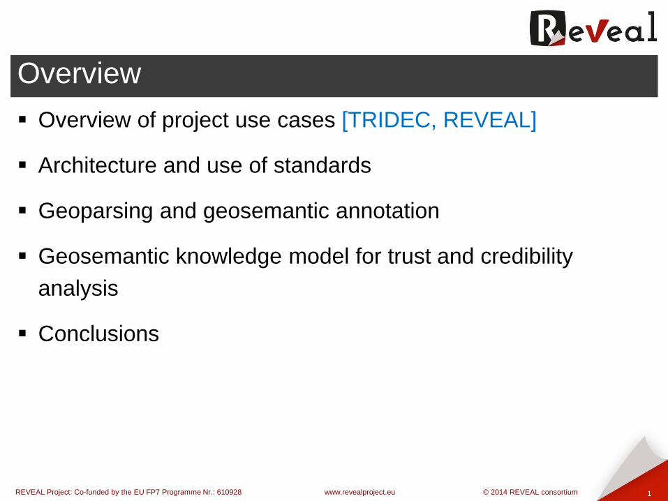
Overview of project use cases [TRIDEC, REVEAL]
Architecture and use of standards
Geoparsing and geosemantic annotation
Geosemantic knowledge model for trust and credibility
analysis
Conclusions
REVEAL Project: Co-funded by the EU FP7 Programme Nr.: 610928 www.revealproject.eu © 2014 REVEAL consortium
Overview of project use cases
2
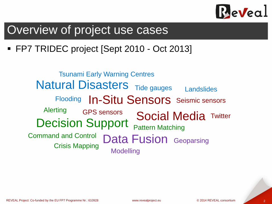
FP7 TRIDEC project [Sept 2010 - Oct 2013]
Natural Disasters Tsunami Early Warning Centres
Landslides
Flooding
Twitter Social Media
In-Situ Sensors Tide gauges
GPS sensors
Seismic sensors
Data Fusion Geoparsing
Alerting
Decision Support
Crisis Mapping
Pattern Matching
Modelling
Command and Control

REVEAL Project: Co-funded by the EU FP7 Programme Nr.: 610928 www.revealproject.eu © 2014 REVEAL consortium
Overview of project use cases
3
FP7 TRIDEC project [Sept 2010 - Oct 2013]
Natural Disasters Tsunami Early Warning Centres
Landslides
Flooding
Twitter Social Media
In-Situ Sensors Tide gauges
GPS sensors
Seismic sensors
Data Fusion Geoparsing
Alerting
Decision Support
Crisis Mapping
Pattern Matching
Modelling
Command and Control

REVEAL Project: Co-funded by the EU FP7 Programme Nr.: 610928 www.revealproject.eu © 2014 REVEAL consortium
Overview of project use cases
4
FP7 REVEAL project [Nov 2013 – Oct 2016]
News Events Journalists
Breaking News
Twitter Social Media
User forums
Data Fusion
Geoparsing
Decision Support Crisis Mapping
Provenance Linked Data
You Tube
Instagram Four Square Geo Semantics
Natural Language Processing
Signature detection
Verification

REVEAL Project: Co-funded by the EU FP7 Programme Nr.: 610928 www.revealproject.eu © 2014 REVEAL consortium
Overview of project use cases
5
FP7 REVEAL project [Nov 2014 – Oct 2017]
News Events Journalists
Breaking News
Twitter Social Media
User forums
Data Fusion
Geoparsing
Decision Support Crisis Mapping
Provenance Linked Data
You Tube Instagram Four Square Geo Semantics
Natural Language Processing
Signature detection
Verification Trust Credibility

REVEAL Project: Co-funded by the EU FP7 Programme Nr.: 610928 www.revealproject.eu © 2014 REVEAL consortium
Architecture and use of standards
6
W3C Standards
Sensor data Semantic Sensor Network Ontology (SSNO)
Communities Semantically-Interlinked Online Communities (SIOC)
Semantic Web, Linked Data RDF, OWL
OGC Standards
Sensors SensorML, SOS, SPS
Geometry OpenGIS, GeoSPARQL
Other
Open Street Map (OSM) OSM entities and tags including OpenGIS

REVEAL Project: Co-funded by the EU FP7 Programme Nr.: 610928 www.revealproject.eu © 2014 REVEAL consortium
Architecture and use of standards
7
Scalable architecture for geosemantic processing
Storm framework – scalable clustered deployment of processing bolts
HTTP endpoints – control storm topologies in real-time
RabbitMQ – communication backbone
Database layer
PostgreSQL + PostGIS database + planet OSM tables
OWLIM SE (under evaluation)

REVEAL Project: Co-funded by the EU FP7 Programme Nr.: 610928 www.revealproject.eu © 2014 REVEAL consortium
Geoparsing and geosemantic annotation
8
Exploiting OSM entity model as a knowledge-base
planet_osm_line roads, rivers ...
planet_osm_point bus stops, small buildings, stations ...
planet_osm_polygon admin areas, large buildings, parks ...
All with OSM tags and OpenGIS geometry
But ...
2+ trillion nodes impossible to hold in memory !!
Use spatial filtering based on dynamically declared focus areas
Compile inverted indexes and use information retrieval (IR)
techniques

REVEAL Project: Co-funded by the EU FP7 Programme Nr.: 610928 www.revealproject.eu © 2014 REVEAL consortium
Geoparsing and geosemantic annotation
9
Real-time geoparsing of social media streams
PostGIS spatial filtered lookups for focus area (e.g. a city boundary)
Compile an in-memory cache of location data
Loop in real-time
Match location name tokens to social media JSON content
stream (e.g. JSON tweet)
Add location annotations to JSON content
Send annotated JSON content to aggregator and situation
assessment picture building
Map reduce type architecture for distributed geoparsing

REVEAL Project: Co-funded by the EU FP7 Programme Nr.: 610928 www.revealproject.eu © 2014 REVEAL consortium
Geoparsing and geosemantic annotation
10
Exploiting linked open geospatial data
OSM location matches OSM ID set linkedgeodata.org URI’s
linkedgeodata.org URI linked dbpedia.org URI Semantic context
Semantic context Reports for decision support visualization
GeoServer WMS visualization

REVEAL Project: Co-funded by the EU FP7 Programme Nr.: 610928 www.revealproject.eu © 2014 REVEAL consortium
New York Hurricane Sandy 2012 Storm Surge Flooding
Middleton, S. Middleton, L. Modafferi, S. (2014) Real-time Crisis Mapping of Natural Disasters using Social Media. IEEE
Intelligent Systems, 02 Jan. 2014. IEEE computer Society Digital Library. IEEE Computer Society
11
Flooded Roads
Flooded Areas
Flooded Buildings
REVEAL Project: Co-funded by the EU FP7 Programme Nr.: 610928 www.revealproject.eu © 2014 REVEAL consortium
Geosemantic knowledge model for trust and credibility analysis
12
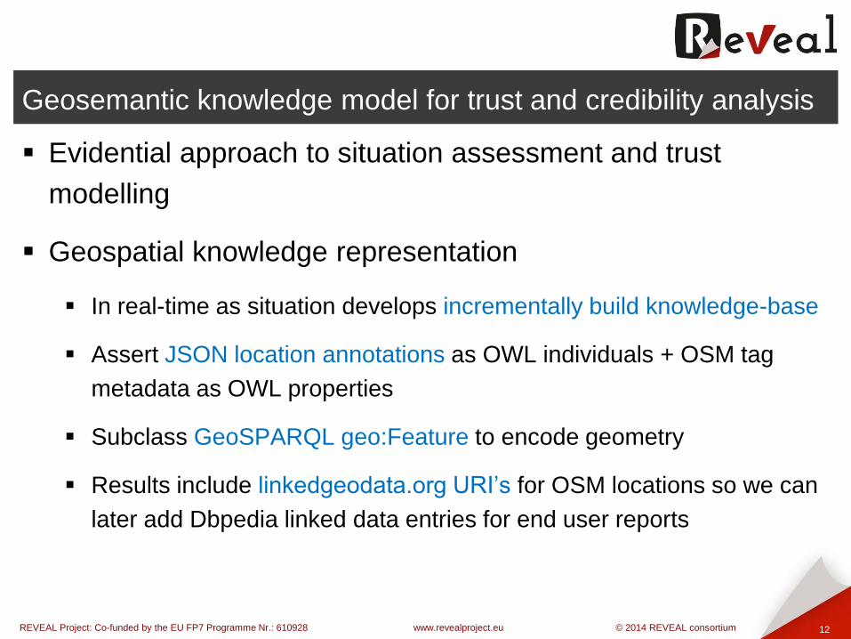
Evidential approach to situation assessment and trust
modelling
Geospatial knowledge representation
In real-time as situation develops incrementally build knowledge-base
Assert JSON location annotations as OWL individuals + OSM tag
metadata as OWL properties
Subclass GeoSPARQL geo:Feature to encode geometry
Results include linkedgeodata.org URI’s for OSM locations so we can
later add Dbpedia linked data entries for end user reports

REVEAL Project: Co-funded by the EU FP7 Programme Nr.: 610928 www.revealproject.eu © 2014 REVEAL consortium
Geosemantic knowledge model for trust and credibility analysis
13
Inference model for trust and credibility analysis
Using image features and location OSM features
Instagram (text) Geoparse owl_loc + owl_feature_props
Instagram (image) Image classifier owl_feature_props
features(text) == features(image) loc_credibility++
Using location geography
Tweet (text) Geoparse owl_loc + GeoSPARQL_geom
Instagram (text) Geoparse owl_loc + GeoSPARQL_geom
owl_loc ST_Dwithin( 500m ) owl_loc loc credibility++

REVEAL Project: Co-funded by the EU FP7 Programme Nr.: 610928 www.revealproject.eu © 2014 REVEAL consortium
Geosemantic knowledge model for trust and credibility analysis
14
Inference model for trust and credibility analysis
Using trusted lists of users
Tweet (text) Geoparse owl_loc + owl_author_prop
Trusted list (end user) owl_trusted_user
owl_loc_author IN [owl_trusted_user] trusted++
(Geo)SPARQL queries to filter relevant / credible / trusted results
SPARQL to classify owl_loc individuals that match known facts
about the breaking news story
GeoSPARQL to classify owl_loc individuals based on OpenGIS
geometry [nearby, connected_to, within_admin_area]

REVEAL Project: Co-funded by the EU FP7 Programme Nr.: 610928 www.revealproject.eu © 2014 REVEAL consortium
Geosemantic knowledge model for trust and credibility analysis
15
Experiences so far
Storm supports scalable incremental processing really well
Spatial filtering is key when dealing with Planet OSM database
owl:restriction’s allows incremental inference via 'class-individual
mirror' inference pattern
e.g. evidence arrives, end user axioms asserted such as trusted users
Open questions regarding geosemantic inference
Which triple store is best for GeoSPARQL? OWLIM-SE?
We have access to geometry in PostGIS and OWLIM-SE. Trade off
between efficiency of SQL and inference of GeoSPARQL?

REVEAL Project: Co-funded by the EU FP7 Programme Nr.: 610928 www.revealproject.eu © 2014 REVEAL consortium
Conclusions
16
Future work
1st year prototype storm deployment due Nov 2014
4 social media sources
Geoparsing locations in parallel on a storm cluster
Real-time situation assessment map visualization
Incremental geosemantic reasoning
Scalability testing – cluster deployment testing on location data from
several complete cities
Scientific evaluation - we will gather ground truth from journalists in a
real news room for several target breaking news stories in 2015

REVEAL Project: Co-funded by the EU FP7 Programme Nr.: 610928 www.revealproject.eu © 2014 REVEAL consortium
Many thanks for your attention!
17
Any questions?
Stuart E. Middleton
University of Southampton IT Innovation Centre
email: [email protected]
web: www.it-innovation.soton.ac.uk
twitter:@stuart_e_middle
Any questions?

REVEAL Project: Co-funded by the EU FP7 Programme Nr.: 610928 www.revealproject.eu © 2014 REVEAL consortium
Project partners & where to find us
18
The SAM project
”The research leading to these results has received funding
from the European Union Seventh Framework Programme
under grant agreement #610928. The positions expressed are
those of the authors and do not necessarily reflect the views of
the European Commission”

REVEAL Project: Co-funded by the EU FP7 Programme Nr.: 610928 www.revealproject.eu © 2014 REVEAL consortium
Axillary slide: Class-individual mirror inference pattern
19
<itinno:River> rdfs:subClassOf <geo:Feature>
<ns:river1> rdf:type <itinno:River>
<ns:river1> itinno:name "River Itchen"
<ns:river1> geo:hasGeometry <ns:geom4>
<ns:geom4> rdf:type <geo:Geometry>
<ns:geom4> geo:asWKT "POLYGON((...))"^^<http://www.opengis.net/def/sf/wktLiteral>
<itinno:NearbyRiverItchen> owl:equivalentClass [ a owl:Restriction;
owl:onProperty itinno:nearby;
owl:hasValue <river1>]
SELECT ?loc
WHERE {
?loc rdf:type <geo:Feature> .
?loc rdf:type <itinno:NearbyRiverItchen> .
?loc geo:hasGeometry ?g .
?g geo:asWKT ?wkt .
FILTER( geof:sfContains( ?wkt, "POLYGON((...))"^^<http://www.opengis.net/def/sf/wktLiteral> ) )
}