traffic signal operatios - toronto · traffic management centre traffic signal operations its...
TRANSCRIPT

TRAFFIC SIGNAL OPERATIONS
POLICIES &STRATEGIES
Transportation Services | May 2015

DOCUMENT CONTROL
Contact Information For more information related to this Policy, please contact:
Manager, ITS Operations Traffic Management Centre Transportation Services Division 5th Floor, 703 Don Mills Rd Toronto, ON M3C 3N3 Phone: 416-392-8826 Fax: 416-397-5777
Amendment History
No. Details Version Revision Date (YYYY/MM/DD)
1 Version 1 prepared Cheung, and Hao Le
by Rajnath Bissessar, Landy Version 1 2015/05/07

APPROVAL
The version of this document dated May 7, 2015 was approved by:
Original signed by M. Currie
Myles Currie Director, Traffic Management Centre Transportation Services Division 5th Floor, 703 Don Mills Rd Toronto, ON M3C 3N3
Date: November 4, 2015
Original signed by S. Buckley
Stephen Buckley General Manager Transportation Services Division Toronto City Hall 24th Floor E, 100 Queen St W Toronto, ON M5H 2N2
Date: November 13, 2015

Traffic Management Centre Traffic Signal Operations ITS Operations Policies and Strategies
Table of Contents
ABBREVIATIONS..........................................................................................................VI GLOSSARY .................................................................................................................VIII EXECUTIVE SUMMARY ............................................................................................ XIV
1. GUIDING PRINCIPLES............................................................................................ 1
1.1. Purpose of the Policy ................................................................................................ 1
1.2. Users of the Policy..................................................................................................... 1
1.3. Guiding Principles ..................................................................................................... 1
1.4. Road Classification System ...................................................................................... 1
1.5. Use of this Policy....................................................................................................... 2
1.6. Updating the Policy ................................................................................................... 2
2. TRAFFIC SIGNAL OPERATIONS RESPONSIBILITIES ......................................... 2
2.1. ITSO Responsibilities ................................................................................................ 2
2.1.1. TSOG ................................................................................................................... 2
2.1.2. RESCU/ATM......................................................................................................... 2
2.1.3. SSG...................................................................................................................... 3
2.2. DTO Responsibilities................................................................................................. 3
2.3. MTO Responsibilities ................................................................................................ 3
2.4. TPIM Responsibilities................................................................................................ 3
2.5. ITSC Responsibilities ................................................................................................ 4
2.6. EMC Responsibilities ................................................................................................ 4
3. ADMINISTRATION................................................................................................... 4
3.1. Education and Training ............................................................................................. 4
3.2. Archival Records ....................................................................................................... 5
3.3. Signal Timing Reports............................................................................................... 5
3.3.1. Current Signal Timing ........................................................................................... 5
3.3.2. Historical Signal Timing ........................................................................................ 5
3.4. Capacity Analysis Software ...................................................................................... 6
4. TRAFFIC CONTROL SYSTEMS.............................................................................. 6
4.1. Traffic Control Systems............................................................................................. 6
4.2. Adaptive Traffic Control System............................................................................... 7
4.3. Responsive Traffic Control System (RTCS)............................................................. 8
Transportation Services Division
i

Traffic Management Centre Traffic Signal Operations ITS Operations Policies and Strategies
4.4. System Monitoring and Performance....................................................................... 9
5. TRAFFIC SIGNAL OPERATIONS ........................................................................... 9
5.1. Warrant Analysis........................................................................................................ 9
5.1.1. Pedestrian Crossovers.......................................................................................... 9
5.1.2. Intersection and Midblock Pedestrian Signals ......................................................10
5.1.3. Exculsive Bicycle Signals.....................................................................................12
5.1.4. Traffic Signals ......................................................................................................12
5.2. Mode of Control ........................................................................................................13
5.3. Timing........................................................................................................................15
5.3.1. Minimum Green Interval.......................................................................................15
5.3.2. Amber Clearance Interval for Through Phase ......................................................16
5.3.3. All-Red Clearance Interval for Through Phase.....................................................16
5.3.4. Amber Clearance Interval for Left-Turn Phase.....................................................17
5.3.5. All-Red Clearance Interval for Left-Turn Phase....................................................17
5.3.6. Pedestrian Clearance and Walk Speed................................................................17
5.3.7. Vehicle Passage Time .........................................................................................18
5.4. Phasing......................................................................................................................19
5.4.1. Protected/Permissive Left-Turn Phasing ..............................................................19
5.4.2. Fully Protected Left-Turn Phasing........................................................................21
5.4.3. Protected/Permissive Right-Turn Phasing – with Right-Turn Green Arrow...........21
5.4.4. Fully Protected Right-Turn Phasing – with Right-Turn Green Arrow.....................22
5.4.5. Phasing for Offset Intersections ...........................................................................23
5.4.6. Sequence of Intervals in Pedestrian Phase..........................................................24
5.4.7. Single-Stage & Multi-Stage Pedestrian Crossing .................................................24
5.4.8. Pedestrian Priority Phase (PPP) ..........................................................................25
5.4.9. Leading Pedestrian Interval .................................................................................27
5.4.10. Delayed Vehicle Interval...................................................................................28
5.4.11. Bicycle Phase for Exclusive Bicycle Signals .....................................................28
5.5. Cycle Length .............................................................................................................29
5.6. Signal Timing Plans..................................................................................................30
5.6.1. Peak Period Plans ...............................................................................................30
5.6.2. Off-Peak Period Plans .........................................................................................31
Transportation Services Division
ii

Traffic Management Centre Traffic Signal Operations ITS Operations Policies and Strategies
5.6.3. Night Plans ..........................................................................................................31
5.6.4. Construction Timing Plans ...................................................................................32
5.6.5. TTC Diversion Timing Plans ................................................................................32
5.6.6. Emergency Timing Plans .....................................................................................33
5.6.7. Special Events Timing Plans................................................................................33
5.6.8. Weather-Related Timing Plans ............................................................................34
5.6.9. Other Timing Plans ..............................................................................................35
5.7. Signal Coordination..................................................................................................35
5.7.1. Design Strategy ...................................................................................................35
5.7.2. Traffic Signal Spacing ..........................................................................................37
5.7.3. Frequency of Signal Coordination Studies ...........................................................37
5.7.4. Travel Speed for Coordination .............................................................................37
5.7.5. Measures of Effectiveness ...................................................................................37
5.8. Cross-Jurisdictional Signal Coordination...............................................................38
5.9. Pre-emptions.............................................................................................................38
5.9.1. Railway Crossing Pre-emption.............................................................................38
5.9.2. Emergency Vehicle Pre-emption..........................................................................39
5.9.3. Transit Signal Priority...........................................................................................39
5.10. Miscellaneous Signals and Devices ........................................................................40
5.10.1. Pedestrian Countdown Signals.........................................................................40
5.10.2. Walk Rest Modifier ...........................................................................................41
5.10.3. Accessible Pedestrian Signals..........................................................................42
5.10.4. Pedestrian Crossing Time at a PXO.................................................................43
5.10.5. Reversible Lane Signals...................................................................................43
5.10.6. Changeable Lane Use Signs at Intersections ...................................................45
5.10.7. Automated Ramp Gates ...................................................................................45
5.10.8. Ramp Metering.................................................................................................46
5.10.9. Intersection Flash.............................................................................................47
5.10.10. Temporary Traffic Signals ................................................................................47
5.10.11. Portable Temporary Traffic Signals ..................................................................48
5.10.12. Active Advance Warning Flashers....................................................................48
5.10.13. Uninterrupted Power Supply.............................................................................50
Transportation Services Division
iii

Traffic Management Centre Traffic Signal Operations ITS Operations Policies and Strategies
5.10.14. Police Manual Control at Traffic Signals ...........................................................50
5.11. Arterial Coverage......................................................................................................51
REFERENCES.............................................................................................................. 52
Transportation Services Division
iv

5
10
15
20
25
Traffic Management Centre Traffic Signal Operations ITS Operations Policies and Strategies
LIST OF FIGURES Figure 5-1. Single Pedestrian Crossover (Single PXO) .............................................................10
Figure 5-16. Single-Stage Crossing (left) & Multi-Stage Crossing (right) – University Ave/Dundas
Figure 5-22. Walk Rest Modifier (WRM) operation relative to vehicle green, amber, and all-red
Figure 5- . WB Ramp Gate (top) & EB Ramp Gate (bottom) – Gardiner Expressway/Jameson
Figure 5-2. Split Pedestrian Crossover (Split PXO) ...................................................................10
Figure 5-3. Intersection Pedestrian Signals (IPS)......................................................................11
Figure 5-4. Midblock Pedestrian Signals (MPS) ........................................................................11
Figure 5- . Exclusive Bicycle Signals – Lawrence Ave/Brimley Ave..........................................12
Figure 5-6. Mode of Control – Fixed Time (FXT) .......................................................................13
Figure 5-7. Mode of Control – Semi-actuated (SA)....................................................................14
Figure 5-8. Mode of Control – Semi-actuated Pedestrian (SAP) ...............................................14
Figure 5-9. Mode of Control – Semi-actuated Vehicle (SAV).....................................................14
Figure 5- . Mode of Control – Pedestrian Actuated (PA).........................................................15
Figure 5-11. Types of Protected/Permissive Left-Turn Phasing.................................................20
Figure 5-12. Types of Fully Protected Left-Turn Phasing ..........................................................21
Figure 5-13. Protected/Permissive Right-Turn Phasing.............................................................22
Figure 5-14. Fully Protected Right-Turn Phasing.......................................................................23
Figure 5- . "Far-Right" Offset Intersection (left) & "Near-Right" Offset Intersection (right) .......24
St ..............................................................................................................................................25
Figure 5-17. Intersection with Pedestrian Priority Phase (PPP) – Yonge St/Dundas St .............26
Figure 5-18. Type 3 Pedestrian Priority Phasing (PPP).............................................................27
Figure 5-19. Leading Pedestrian Interval (LPI) ..........................................................................28
Figure 5- . Delayed Vehicle Interval (DLI)...............................................................................28
Figure 5-21. Pedestrian Countdown Signal (PCS) – Renforth Dr/Convair Dr ............................41
intervals ....................................................................................................................................41
Figure 5-23. Accessible Pedestrian Signal (APS) Pushbutton – Lawrence Ave/Brimley Ave.....43
Figure 5-24. Reversible Lane Signals – Jarvis St ......................................................................44
Ave ...........................................................................................................................................46
Figure 5-26. Ramp Metering Signal – Queen Elizabeth Way/Cawthra Rd (Mississauga, ON) ...47
Figure 5-27. Active Advance Warning Flashers (AAWF) – Warden Ave/Ellesmere Rd..............49
Figure 5-28. Toronto's Transportation Operations Centre (TOC)...............................................51
Transportation Services Division
v

Traffic Management Centre Traffic Signal Operations ITS Operations Policies and Strategies
Abbreviations
AODA Accessibility for Ontarians with Disabilities Act
APS Accessible Pedestrian Signal
ATCS Adaptive Traffic Control System
ATIS Advanced Traveller Information System
CCG Canadian Capacity Guide (for Signalized Intersections)
DTO District Traffic Operations
FDW Flashing Don't Walk
HCM Highway Capacity Manual (US)
HCS Highway Capacity Software
IMSA International Municipal Signal Association
IPS Intersection Pedestrian Signal (also known as Half Signals)
ITE Institute of Transportation Engineers
ITS Intelligent Transportation Systems
ITSO ITS Operations
LPI Leading Pedestrian Interval
LRV Light Rail Vehicle
MEA Municipal Engineers Association
MOC Mode of Control
MPS Midblock Pedestrian Signal
MTO Ministry of Transportation Ontario
NEMA National Electrical Manufacturers Association
NTOC National Transportation Operations Coalition
Transportation Services Division
vi

Traffic Management Centre Traffic Signal Operations ITS Operations Policies and Strategies
OACETT Ontario Association of Certified Engineering Technicians and Technologists
OEM Office of Emergency Management
OTC Ontario Traffic Council
PCS Pedestrian Countdown Signals
PPP Pedestrian Priority Phase
RESCU/ATM Roads Emergency Services Communications Unit/Active Traffic Management
RTCS Responsive Traffic Control System
RTGA Right-Turn Green Arrow
SSG Systems Support Group
TAC Transportation Association of Canada
TMC Traffic Management Centre
TOC Transportation Operations Centre
TRB Transportation Research Board (US)
TCS Traffic Control System
TSOG Traffic Signal Operations Group
TSP Transit Signal Priority
TTC Toronto Transit Commission
UPS Uninterrupted Power Supply
WRM Walk Rest Modifier
Transportation Services Division
vii

Traffic Management Centre Traffic Signal Operations ITS Operations Policies and Strategies
Glossary
Accessible Pedestrian
Signals (APS)
Signal devices designed to assist pedestrians who are visually and/or hearing impaired by providing information that they can interpret to understand when they may cross the intersection.
Adaptive Traffic Control System
(ATCS)
A traffic control system that automatically adjusts signal timing parameters in real-time to allow for signal operations that respond to actual, real-time traffic conditions.
Advanced Traveller
Information System (ATIS)
A system that acquires, analyzes, and presents information to assist travellers with their journey choices. Examples of ATIS include variable message signs (VMS), websites, social media, and conventional media.
Aries A system traffic signal system that is used to operate signals on Queens Quay and provide priority to streetcars.
Capacity The maximum rate at which vehicles can pass through a given point in an hour under prevailing conditions, known as the saturation flow rate, applied in conjunction with the ratio of time during which vehicles may enter the intersection. It is defined as c = s(g/C) where c is capacity, s is saturation flow rate, g is effective green time, and C is cycle length in seconds.
Controller (Timer) A device that controls traffic at an intersection by alternating the right-of-way between conflicting streams of vehicular traffic, or vehicular traffic and pedestrians crossing a roadway.
Coordinated Actuated
Signal operation in coordination with other intersections, and using vehicle, bicycle, and/or pedestrian detection to define signal timing.
Coordination The ability to coordinate multiple intersections to enhance the operation of one or more directional movements in a system.
Cycle Length The time required to complete a full sequence of signal indications.
Delay The additional travel time experienced by a driver, passenger, or pedestrian.
Delayed Vehicle Interval (DLI)
A pedestrian/vehicle timing option whereby vehicle green continues to be displayed during a "don't walk" interval at TSP locations where transit extensions are provided based on the transit vehicle being in the detection zone when the FDW terminates.
Transportation Services Division
viii

Traffic Management Centre Traffic Signal Operations ITS Operations Policies and Strategies
Detector A device used to count and/or determine the presence of a vehicle, bicycle, or pedestrian.
Double Cycle A cycle length that allows phases to be served twice as often as the Length other intersections in a coordinated system.
Effective Green The time during which vehicles in a given traffic movement proceed Time through the signalised intersection. It is equal to the total phase time
minus the lost time (where the total phase time equals the sum of the green, amber, and all red interval times).
Feathering A congestion mitigation strategy that spreads out the traffic queue along a corridor with excessive congestion.
Flashing Don’t The time provided for a pedestrian to clear the crosswalk, equivalent to Walk (FDW) the time required to cross the entire width of the intersection. It is also
known as the "pedestrian clearance interval".
Free Flow A flow of traffic unaffected by upstream or downstream conditions.
Fully Actuated A signal operation in which vehicle detectors at each approach to the Mode of Control intersection control the occurrence and length of every phase.
(FA)
Fully Signalised A type of operation at offset intersections that incorporate both of the Offset closely located minor street legs into the traffic signal installation.
Intersections
Fixed Time Mode A signal operation in which the vehicle signal indication changes of Control (FXT) automatically from the main street to the side street, and back, even if
there are no vehicles/pedestrians wishing to cross the main street.
Gating A congestion mitigation strategy the controls the inflow of traffic into sensitive areas (i.e. where queue routinely builds up).
Hardwire Interconnection between two controllers that is provided by multiple Interconnect electrical wires so that a steady voltage can be applied or removed to
indicate which pattern or plan is to be used.
Intersection A control device dedicated primarily to providing traffic gaps for Pedestrian Signal pedestrian right-of-way at an intersection. Main road traffic is fully
(IPS) signalised while the side road must be controlled with stop signs. They are also known as "Half Signals".
Leading A pedestrian timing option that starts the pedestrian "walk" interval Pedestrian several seconds before the adjacent through movement phase.
Interval (LPI)
Transportation Services Division
ix

Traffic Management Centre Traffic Signal Operations ITS Operations Policies and Strategies
Light Rail Transit vehicles used along streetcar or LRT routes. Vehicles (LRVs)
Lost Time The time in a signal phase (where the total phase time equals the green plus amber plus all red interval times) when no vehicles are able to pass through the signalised intersection. Lost time is comprised of two parts: start-up lost time and clearance lost time.
Main Traffic An in-house interval-based system traffic control system developed by Signal System the City in the 1960's that relies on second by second communications
(MTSS) to maintain coordination (i.e. a loss of communication results in a loss of signal coordination).
Measures of Measurable parameters that demonstrate the benefits, impacts, and Effectiveness cost-effectiveness of signal timing plan alternatives on road users for
(MOEs) the individual intersection, associated corridor and entire network.
Midblock A control device dedicated primarily to providing traffic gaps for Pedestrian Signal pedestrian right-of-way between intersections, at midblock locations.
(MPS) Main road traffic is fully signalised by pedestrian actuated two phase operation.
Offset The time relationship between the coordinated phase’s defined reference point and a defined master reference (i.e. master clock) point.
Offset A location where two minor streets intersect a major street at “nearly” Intersections the same location, operating like two T-intersections located very close
to each other on the arterial road.
Offset Transition A state of a controller to resynchronize traffic signals back to its coordinated operations every time a signal timing plan is changed.
Partially A type of operation at offset intersections that incorporate only one of Signalised Offset the minor street legs into the traffic signal installation and effectively
Intersections operate like a signalised T-intersection.
Passage Time A feature that extends the green interval based on the detector status once the phase is green.
Pedestrian A traffic signal phase that provides pedestrians with exclusive access to Priority Phase a signalised intersection while vehicular traffic is stopped in all
(PPP) directions.
Permissive A movement where vehicles are allowed to proceed if there are Movement available gaps in the conflicting flow.
Transportation Services Division
x

Traffic Management Centre Traffic Signal Operations ITS Operations Policies and Strategies
Pre-emption Upon actuation of a pre-defined pre-emption, the traffic signal controller terminates the current phase and serves a pre-defined pre-emption phase. The most common use of this operation in Toronto is to manipulate the normal operation of traffic signals to provide preferential treatment to rail, emergency and transit vehicles.
Protected / A compound movement protection at a signalised intersection that Permissive displays the protected phase before the permitted phase. Movement
Pedestrian A signal at a mid-block pedestrian crossing that is actuated by a Actuated (PA) pedestrian pushbutton. It provides pedestrians with a protected crossing
Signal opportunity by requiring motorists to stop at the signal.
Pedestrian A marked crosswalk accompanied with overhead flashing beacons Crossover (PXO) activated by a pedestrian pushbutton to provide pedestrians with a
crossing opportunity by requiring motorists to yield to pedestrians at the crosswalk.
Responsive A traffic control system that uses a field master or a central computer Traffic Control system to select a timing plan for a section of roadway based on filtered
System (RTCS) real-time traffic data.
Reversible Lane A lane in which traffic may travel in either direction, depending on certain conditions.
Semi-actuated A signal operation in which signals will not change to the side street Mode of Control unless a vehicle or pedestrian has been detected, and in which the side
(SA) street display and display time varies depending on whether a pedestrian call has been received or not.
Semi-actuated A signal operation in which signals will not change to the side street Pedestrian Mode unless a vehicle or pedestrian has been detected, and in which the side of Control (SAP) street will serve the pedestrian "walk" phase regardless of whether or
not a pedestrian call has been received.
SAP on Recall This feature is applicable to MTSS only. It is used at FXT intersections Mode of Control to allow for time to be added to the coordinated phase during offset
transition.
Semi-actuated A signal operation in which there is no pedestrian crossing across the Vehicle Mode of main street and side street display and display time varies depending
Control (SAV) on vehicle call.
Separate Traffic A signal phasing sequence which would have the traffic signals cycle Signal Phasing from the major street to permit traffic on only one of the minor street
legs to proceed, followed by traffic on the second minor street leg, then back to the major street.
Transportation Services Division
xi

Traffic Management Centre Traffic Signal Operations ITS Operations Policies and Strategies
Split Cycle Offset An adaptive traffic control system that determines its traffic timing plans Optimisation based on real-time information received from vehicle detectors located
Technique on the approaches to signalised intersections. (SCOOT)
Split Phase A signal phasing sequence where one approach is given exclusive right-of-way into the intersection followed by the opposing approach being provided exclusive right-of-way into the intersection.
Split Pedestrian A passive device that enables pedestrians to cross a road with more Crossover (SPXO) than four lanes. The pedestrian crosses the street in two stages – one
stage for each direction.
Traffic A section within the Transportation Services Division that is comprised Management of six units: Traffic Safety Unit, ITS Operations, ITS Capital Projects Centre (TMC) Planning & Delivery, Traffic Plant Installation & Maintenance,
Transportation Business Systems, and Signs & Markings.
Traffic Signals Electronic devices that are designed to assign the right of way to the various traffic and pedestrian movements at an intersection.
Transit Signal In Toronto, TSP is provided as transit pre-emption. Upon detection of Priority (TSP) an approaching transit vehicle at a traffic signal, the controller may
invoke timing changes (e.g. early green or green extension), or it may invoke phasing changes (e.g. servicing an actuated priority phase, inserting a phase into the cycle, or rotating the phase within the cycle), in order to reduce delay for an approaching transit vehicle.
Transportation A division within the City that maintains transportation infrastructure Services Division including roads, bridges, sidewalks, and boulevards within the four city
(TSD) districts. TSD is responsible for all aspects of traffic operations, roadway regulation, street maintenance, asset management, right of way occupation and snow removal.
TransSuite Traffic A hybrid traffic control system that relies on second-by-second Control System communication to monitor signal operations, but relies on field
(TransSuite TCS) equipment to maintain coordination (i.e. the field equipment can maintain signal coordination for about 24 hours if there is a loss of communication).
Transportation A unit within ITSO that collects and disseminates real-time traffic Operations information.
Centre (TOC)
Uninterrupted A device that provides emergency power to traffic plant when the Power Supply regular power source fails.
(UPS)
Transportation Services Division
xii

Traffic Management Centre Traffic Signal Operations ITS Operations Policies and Strategies
Urban Traffic Control (UTC)
A traffic control system that operates in tandem with SCOOT. UTC provides pre-determined signal timing plans and is used as a stopgap measure if SCOOT is not available.
Walk Rest Modifier (WRM)
A type of operation installed at semi-actuated signalised intersections to increase operational efficiency by allowing the signals to return to the main street "walk" display if the side street right-turn vehicle demand clears prior to the start of the main street amber.
Transportation Services Division
xiii

Traffic Management Centre Traffic Signal Operations ITS Operations Policies and Strategies
Executive Summary
INTRODUCTION
Toronto is the largest city in Canada and the fourth largest city in North America. It is a global centre for business, finance, arts and culture, and home to a diverse population of 2.8 million people. The City is served by a road network consisting of 40 km of expressways and over 5,600 km of roads. There are 2,288 traffic signals on the road network.
As the City's population increases, greater travel demand is creating more traffic congestion which poses a challenge to share road space among all road users – pedestrians, cyclists, transit, and vehicles. To mitigate traffic congestion on the transportation network, it is pertinent to have efficient traffic signal operations. In Toronto, day-to-day traffic signal operations are managed by the City’s Transportation Services Division. There are different units within Transportation Services who are responsible for various tasks that promote efficient traffic signal operations:
ITS Operations (ITSO) is responsible for the operation of the City's traffic control systems; implementation of signal timing changes, signal modifications, construction timings and special event timings; signal coordination studies; and the development of policies and procedures for signal operations.
District Traffic Operations (DTO) is responsible for signal warrant analysis, development of signal phasing for new signals and the development of construction timings.
Traffic Plant Installation & Maintenance (TPIM) is responsible for design, installation and maintenance of all electrical traffic control devices (traffic control signals, pedestrian crossovers, flashing beacons).
ITS Capital Projects Planning & Delivery (ITSC) is responsible for planning, procuring and project management of large-scale ITS projects to improve Toronto’s transportation network.
Electrical Maintenance Contractor (EMC) is contracted by the City to provide maintenance services to the traffic control devices for a predetermined period, normally four years.
All signals on the publicly owned road network are managed by the City. There are 55 signals that are owned by the province but these signals are managed by the City under an agreement with the Ministry of Transportation (MTO). The MTO is responsible for approving any operational changes and/or paying for any equipment upgrades.
In order to promote consistent, safe, and efficient control of traffic signals for all road users, the Traffic Signal Operations Policies and Strategies document was developed. These policies and strategies were developed based on research on standards, legislation, best practices, as well as stakeholder engagement. The standards include the Ontario Traffic Manual (OTM) Book 12, Manual for Uniform Traffic Control Devices (MUTCD) for Canada, and Transportation Association of Canada (TAC) Guidelines. The best practices are drawn from other North American cities comparable to Toronto and in-house studies conducted by the City. The
Transportation Services Division
xiv

Traffic Management Centre Traffic Signal Operations ITS Operations Policies and Strategies
stakeholders are the units within the City's Transportation Services Division who are involved with the day-to-day traffic signal planning and operations.
This document has been approved by senior management and will be distributed to all City units and external agencies who are involved with day-to-day traffic signal planning and operations. When conducting day-to-day signal planning and operations activities, these policies and strategies must be followed.
OVERVIEW
The Traffic Signal Operations Policies and Strategies is a comprehensive document that outlines policies and strategies from administrative-related items to technical elements that pertain to traffic signal operations. The document is divided into four sections:
Purpose and Guiding Principles – Outlines the purpose and principles that guide the City’s Traffic Signal Operations Policies and Strategies
Administration – Stipulates the City’s administrative-related policies and strategies that can influence consistent, safe, and efficient control of traffic signals
Traffic Control Systems – Stipulates the City’s policies and strategies relating to its traffic control systems
Traffic Signal Operations – Stipulates the City’s policies and strategies on various signal operations features that promote consistent, safe, and efficient control of traffic signals
PURPOSE AND GUIDING PRINCIPLES
The purpose of the Traffic Signal Operations Policies and Strategies is to provide guidance on various signal operations practices to promote consistent, safe, and efficient control of traffic signals within the city for all road users. The policies and strategies are driven by six guiding principles:
To ensure safety of all users of the road To encourage person throughput To encourage walking To minimize person delay To encourage transit usage To encourage cycling
ADMINISTRATION
Effective policies on training, record keeping, and software usage can influence consistent, safe, and efficient control of traffic signals. Continued support in education and training for City staff ensures that staff stay skilled and knowledgeable as traffic signal technology is changing at a rapid pace.
Transportation Services Division
xv

Traffic Management Centre Traffic Signal Operations ITS Operations Policies and Strategies
The City provides current and historical signal timing reports to the public for a fee mandated by the City Council. Current signal timing reports reflect the timings that are currently in effect at a signalised intersection for all periods, but cannot be presented as evidence in a court of law. Historical signal timing reports reflect timings that were in effect at a signalised intersection on a specific date/period/time within the past 15 years. They can be presented as evidence in a court of law and must be signed by a Professional Engineer. Records of signal timings, phase diagrams, maintenance records and system logs are kept for 15 years to conform to the City Archives policies and provincial legislation.
In order to develop cycle lengths, offsets, phase sequences, and other signal timing parameters that promote operational strategies of smooth and efficient traffic movement along an arterial, Transportation Services accepts the use of the latest version of Synchro software to conduct coordination studies; the latest version of Canadian Capacity Guide (CCG) software and Highway Capacity Software (HCS) to conduct intersection based capacity analysis; and the latest version of Aimsun software to conduct microsimulation modelling for transit priority and adaptive traffic control.
TRAFFIC CONTROL SYSTEMS
There are 2,288 traffic signals in Toronto, of which eight are on “local” control. The remaining 2,280 traffic signals are controlled by four signal control systems which are located at the City’s Traffic Management Centre (TMC):
TransSuite Traffic Control System (TCS), supplied by TransCore ITS Inc., controls 1,714 traffic signals.
Split Cycle offset Optimization Technique (SCOOT), supplied by Siemens Mobility Traffic Controls, controls 329 traffic signals.
Main Traffic Signal System (MTSS), an interval-based system developed in-house, currently controls 97 signals but will be decommissioned by December 2015 with the conversion of all MTSS signals to the TransSuite TCS.
Aries, supplied by Econolite Canada Ltd., controls eight signals on Queens Quay but will be decommissioned by June 2015 with the conversion of all Aries signals to the TransSuite TCS.
The consistent, safe, and efficient control of traffic signals is dependent on constant communication between the field devices and the central systems to monitor the field operations and to maintain signal coordination. All four systems are capable of providing signal coordination. However, signal coordination is not provided on Aries since all signals on Queens Quay operate uncoordinated to provide priority to the Harbourfront LRT streetcars. Cross-system coordination can be achieved between TransSuite TCS, MTSS and Aries. However, SCOOT cannot provide cross-system coordination with the other three systems because it is a traffic adaptive control system (ATCS) that changes cycle length, split, and offset frequently.
ATCS is used to respond to variability in demand along routes that is difficult to address with traditional methods. Another system, responsive traffic control system (RTCS), uses a field master or a central computer system to select a timing plan for a section of roadway based on filtered real-time traffic data. The City has plans to expand its TransSuite TCS into a RTCS to
Transportation Services Division
xvi

Traffic Management Centre Traffic Signal Operations ITS Operations Policies and Strategies
respond to sudden influx of traffic volume along the corridors, especially during nonrecurring congestion.
TRAFFIC SIGNAL OPERATIONS
There are various features of traffic control systems and various traffic signal operations strategies that can promote consistent, safe, and efficient control of traffic signals.
Warrant Analysis
Warrant analyses are comprehensive studies of traffic conditions and the physical characteristics of the site to determine which electronic traffic control device would benefit the midblock or intersection operation. The City considers warrant analysis for pedestrian crossovers (PXOs), midblock pedestrian signals (MPS), exclusive bicycle signals, and traffic signals. PXOs are designated crosswalks equipped with overhead yellow lights that warn motorists and cyclists that pedestrians will be crossing when the overhead flashers are activated by a push button. Drivers including cyclists must yield right-of-way to pedestrian in the crossover when the overhead flashers are activated. On the other hand, MPS and traffic signals provide right-of-way to a movement by stopping all conflicting movements. At midblock locations, the City first considers the implementation of PXOs if it is warranted. If the PXO warrant is surpassed, MPS is considered for implementation. At intersection locations, the City considers the implementation of traffic signals if it is warranted. At locations with high concentrations of bicycle movement, exclusive bicycle signals can be considered to compliment MPS or traffic signals.
Mode of Control
Once it has been determined that traffic signals is the most appropriate electronic traffic control device for the intersection, the mode of control (MOC) is determined. MOC is determined from the off-peak pedestrian and vehicle volumes at the intersection. There are five possible MOCs – fixed time (FXT), semi-actuated (SA), semi-actuated pedestrian (SAP), semi-actuated vehicle (SAV), and pedestrian actuated (PA).
Timings
Each traffic signal is controlled by a controller that is programmed with various timing parameters such as green, amber clearance, and all-red clearance intervals for motorists, and “walk”, “flashing don’t walk” (FDW), and “don’t walk” intervals for pedestrians. The “walk” plus FDW interval must equal the walk time for a pedestrian to complete the entire crossing using a walk speed of 1.0 m/s. This conforms to the Toronto Seniors Strategy (2013) to provide longer walk times across the city. Recognizing that Toronto has areas concentrated with senior pedestrians or pedestrians who use assistive devices for mobility, lower walk speeds (i.e. 0.9 m/s and 0.8 m/s) can be used to further extend crossing times at intersections in areas with high concentrations of these pedestrians.
Transportation Services Division
xvii

Traffic Management Centre Traffic Signal Operations ITS Operations Policies and Strategies
Phasing
Controllers are also programmed with phasing features. Each phase is associated with the control of one or more movements, such as through, left-turn, and right-turn movements, as well as movements serving different road users (i.e. motorists, pedestrians, cyclists and transit). Different phases are considered depending on the intersection configuration and site conditions to balance the different needs of road users.
Signal Timing Plans
Traffic conditions can vary depending on the time of day and day of the week. To address these variations, controllers are programmed with different signal timing plans that are employed at different times of day and days of week to best accommodate the intersection's 7-day 24-hour traffic conditions. The City implements the following plans at all signalised intersections – morning peak, afternoon peak, day off-peak, off-peak and night. The City also implements special plans at some intersections – weekend, shopping, expressway diversion, construction timing, TTC subway maintenance, emergency timing, special events, and weather-related. Each timing plan has a distinct cycle length, which is the time required to complete a full sequence of signal indications. The objective is to determine a reasonable cycle length that provides the desired level of vehicular capacity at the intersection, while being appropriate for the needs of other road users such as pedestrians.
Signal Coordination
Signal coordination is a fundamental part of the City's 2014-2018 Congestion Management Plan to keep the City's signal timing plans current and to ensure that they are responsive to the needs of all road users. Signal coordination studies are conducted on a five year cycle for major arterial roads, and on a ten year cycle for minor arterial roads. Within the five-year cycle, a one-time study may be required for a portion of the route if there are significant changes in traffic volumes or land use. Depending on the location of the route and depending on the time of day, signal coordination design strategies are developed to respond to conditions of the arterial. For example, peak period plans should encourage high person throughput at safe and reasonable speeds while off-peak period plans should provide adequate person throughput, balance overall delays and manage safe and reasonable speeds. The overall benefits of signal coordination are quantified using benefit-cost analysis and Measures of Effectiveness (MOEs) for individual intersections, route and network. Reported MOEs are vehicle delay (hr), stops (#), average speed (km/h), fuel consumed (L), and emissions (kg).
Pre-emption
To promote efficient and safe traffic signal operations, controllers can be programmed with special operations. Some signalised intersections are in close proximity to railways and fire halls that require preferential treatment to rail and emergency vehicles. This is achieved through pre-emption of normal signal operations to a different signal operation. The traffic signal controller would safely terminate the current phase and serve a pre-defined or set of pre-emption phases. In Toronto, priority can also be given to transit vehicles through transit signal priority (TSP) that operates like a pre-emption.
Transportation Services Division
xviii

Traffic Management Centre Traffic Signal Operations ITS Operations Policies and Strategies
Miscellaneous Devices and Features
Traffic signals can also be installed with various miscellaneous devices and features. For example, Pedestrian Countdown Signals (PCS), Walk Rest Modifier (WRM), and Accessible Pedestrian Signals (APS) can be used to better accommodate pedestrians. Active Advance Warning Flashers (AAWF) can be used to provide motorists with advance warning of signal indications ahead. Uninterrupted Power Supply (UPS) can provide electricity to a traffic signal during a power failure.
Devices that complement traffic signals such as Reversible Lane Signals, Changeable Lane Use Signals (CLUS), Automated Ramp Gates, and Ramp Metering, can be considered to help facilitate the flow of traffic through the road network by responding to variations in demand.
Temporary Traffic Signals
Road construction or lane occupation due to maintenance work, development or special events can cause reduction of road capacity. Construction timings, special event timings can be implemented to mitigate the impacts. As per OTM Book 12 (2012) and OTM Book 7 (2014), the City would install Temporary Traffic Signal (TTS) to facilitate construction staging and would allow contractors to install portable Temporary Traffic Signals (PTTS) at midblock locations within a construction zone.
Arterial Coverage
The Transportation Operations Centre (TOC) is operated by a contract operator but managed by City staff. Traffic conditions are monitored 24 hours a day, seven days a week in the TOC by operators. Signal timings are proactively changed by City staff from 6:00 a.m. to 7:00 p.m., Monday to Friday, to better manage traffic conditions resulting from emergencies, special events, and abnormal traffic conditions. Staff also attend the TOC during special events.
CONCLUSION
There are multiple units within the City and external agencies who are involved in the day-to-day traffic signal operations and planning. Often, they have conflicting goals and objectives that can cause inconsistent and inefficient traffic signal operations. This could impact the road user's travel experience on the City's road network. To promote consistent, safe, and efficient control of traffic signals within the city for all road users (i.e. pedestrians, cyclists, transit, and vehicles), the Traffic Signal Operations Policies and Strategies document was developed. These policies and strategies must be followed by those who are involved in the day-to-day traffic signal operations and planning so that units and agencies that may have conflicting goals and objectives, can agree on aspects pertaining to traffic signal operations.
The policies and strategies will be updated as required and will be subject to a comprehensive review every five years. However, since traffic signal technology changes at a rapid pace, the City reserves the right to change its Traffic Signal Operations Policies and Strategies at any time without any prior notice.
Transportation Services Division
xix

Traffic Management Centre Traffic Signal Operations ITS Operations Policies and Strategies
1. GUIDING PRINCIPLES 1.1. Purpose of the Policy
The purpose of Traffic Signal Operations Policies and Strategies is to provide guidance on various signal operations practices to promote consistent, safe, and efficient control traffic signals within the city for all road users.
1.2. Users of the Policy
This document will be used by stakeholders (i.e. units within the City's Transportation Services Division) who are involved with day-to-day traffic signal operations and planning: Transportation Districts – District Traffic Operations (DTO), District Traffic Planning (DTP) Traffic Management Centre (TMC) – Intelligent Transportation Systems Operations (ITSO) Public Realm (PR) – Pedestrian Projects Traffic Infrastructure Management Section (TIMS) – Pedestrian & Cycling Infrastructure City Planning – Transportation Planning
This document will also be used by external agencies that are involved with traffic signal operations and planning: Consultants working for the City or for developers Toronto Transit Commission (TTC) Metrolinx Ministry of Transportation Ontario (MTO)
1.3. Guiding Principles
The Policies and Strategies are driven by the following guiding principles: To ensure safety of all users of the road To encourage person throughput To encourage walking To minimize person delay To encourage transit usage To encourage cycling
1.4. Road Classification System
Traffic signal operations are implemented following the City's Road Classification System: 1. Expressway 2. Major Arterial Road 3. Minor Arterial Road 4. Collector Road 5. Local Road
Transportation Services Division
1

Traffic Management Centre Traffic Signal Operations ITS Operations Policies and Strategies
1.5. Use of this Policy
In this document, required policies and strategies are identified with "must", "shall", and "will" qualifiers, recommended policies and strategies are identified with "should” qualifiers, and guidelines are identified with "may" qualifiers. Recommended policies, strategies, and guidelines should be applied with engineering judgement while balancing the needs of all users.
1.6. Updating the Policy
Since traffic signal technology changes at a rapid pace, the City reserves the right to change its Traffic Signal Operations Policies and Strategies at any time without advance notice. The policies and strategies document will be updated as required and will be subject to a comprehensive review every five years.
2. TRAFFIC SIGNAL OPERATIONS RESPONSIBILITIES The following agencies play a role in traffic signal operations. Their respective signal operations responsibilities are as outlined below.
2.1. ITSO Responsibilities
ITS Operations (ITSO) is a unit within the City's Traffic Management Centre (TMC). There are three groups within ITSO: Traffic Signal Operations Group (TSOG), Roads Emergency Services Communication Unit/Active Traffic Management (RESCU/ATM), and Systems Support Group (SSG). Each group has their respective signal operations responsibilities.
2.1.1. TSOG
Reviewing complaints from public about network signal timing Managing computerised traffic signal operations Developing signal timing plans in consultation with the Districts for signal modification (e.g.
left-turn phase, APS, MOC) Developing pedestrian crossover (PXO) timings Undertaking signal coordination studies including development of auxiliary plans Developing and implementing special events timings Reviewing and implementing construction timings Transit signal priority (TSP) implementation in consultation with the Districts and TTC Developing signal standard operation practices and guidelines Training staff from DTO, DTP, City Planning, and TIMS on signal operation practices
2.1.2. RESCU/ATM
Detection of disruption to traffic flow along the City's expressways and arterial roadways Developing and implementing emergency routes timings
Transportation Services Division
2

Traffic Management Centre Traffic Signal Operations ITS Operations Policies and Strategies
Developing and implementing diversion routes timings Notification of appropriate emergency service providers and road users of any necessary
actions following disruption detection
2.1.3. SSG
Maintaining traffic control systems Malfunction monitoring and reporting Archiving and backup data System administration for signal operations software Coordinating support with systems suppliers
2.2. DTO Responsibilities
DTO units are located in each of the four Districts – Etobicoke/York, North York, Scarborough and Toronto/East York. The Districts are responsible for the following: Reviewing complaints from public about intersection signal timings Evaluating requests for traffic controls (flashing beacons, PXO's, traffic signals) and
preparation of City Council and Community Council reports relating to traffic controls Determining signal phasing Determining mode of control (MOC) for new signals and approving MOC changes for
existing signals Determining of construction timings for short and long-term construction Reviewing signal coordination studies for issues of local concerns Reviewing and approving TSP requests from the TTC Reviewing general requests from public, such as fixed time operation during Jewish High
Holidays, fire hall local pre-emption, etc.
2.3. MTO Responsibilities
For the signals owned by MTO but operated by the City under a maintenance contract, the MTO performs the following duties: Reviewing and approving signal timing changes Reviewing and approving any change in technology or operations that the TMC is
implementing (e.g. LED, FDW, phase-based controllers, PCS, WRM) Upgrading signal plant equipment as part of ramp reconstruction (e.g. UPS, overhead
detection) and advises the City of such upgrades
2.4. TPIM Responsibilities
TPIM is a unit within the TMC. It is responsible for the following: Selecting controller types, bearing in mind operational requirements of all users Writing and administering contracts for new signals and small to moderate ITS projects Contract administration for small to moderate ITS projects
Transportation Services Division
3

Traffic Management Centre Traffic Signal Operations ITS Operations Policies and Strategies
Liaising with the Electrical Maintenance Contractor for maintenance issues as per the signals maintenance contract
Liaising with the telecom provider Liaising with cellular wireless providers via Corporate IT Relocating and/or adjusting any traffic control device due to construction through ECS,
developments, movie shoots, high loads, etc.
2.5. ITSC Responsibilities
ITSC is a unit within the TMC. It is responsible for the following: Managing the procurement process for large-scale ITS projects Writing and administering contracts for large-scale ITS projects Contract administration for large-scale ITS projects
2.6. EMC Responsibilities
The EMC is contracted by the City to provide maintenance services to the traffic control devices for a predetermined period, normally four years. The EMC is responsible for the following: Performing routine and emergency maintenance services for all traffic control devices Programming controllers for signal modifications for special events, construction projects,
and system upgrades/conversions Field acceptance of work undertaken by other approved electrical contractors
3. ADMINISTRATION Effective policies on training, record keeping, and software usage can influence consistent, safe, and efficient control of traffic signals.
3.1. Education and Training
Policy Statement
The City shall provide training resources for traffic signal operations personnel. The City shall support, require, and reward operations personnel for attaining certifications from professional organizations. The City should maintain linkages to professional organizations such as TRB, ITS Canada, NTOC, ITE, IMSA, MEA and OACETT. Staff must be knowledgeable and consistent in the use of signal optimization software such as Synchro.
ITSO will provide training to appropriate City staff for new procedures and guidelines relating to traffic signal operations.
Transportation Services Division
4

Traffic Management Centre Traffic Signal Operations ITS Operations Policies and Strategies
3.2. Archival Records
Policy Statement
The City shall maintain a record of signal timings, phase diagrams, maintenance records and other control systems parameters for the periods stipulated by the City Archives and provincial/federal legislation.
3.3. Signal Timing Reports
Traffic signal timing reports reflect the timings that are in effect at a signalised intersection. The City researches, retrieves, analyses, and prepares the signal timing report for a fee mandated by the City Council. Once the request has been made, it will only be processed upon receipt of the relevant fee. There are two types of traffic signal timings reports in which the public can request: Current Signal Timing and Historical Signal Timing reports.
3.3.1. Current Signal Timing
Current signal timing reports reflect the timings that are currently in effect at a signalised intersection for all periods. They cannot be presented as evidence in a court of law. The normal turnaround time for a single intersection request is two weeks from the date of receipt of the payment. However, the actual turnaround time is subject to the availability of City resources.
Policy Statement
Current signal timing reports shall be prepared on receipt of payment of the relevant fee mandated by City Council. Current signal timing reports cannot be presented as evidence in a court of law and are not signed by City staff. Such reports are emailed to the requester.
3.3.2. Historical Signal Timing
Historical signal timing reports reflect timings that were in effect at a signalised intersection on a specific date/period/time within the past fifteen years. They can be presented as evidence in a court of law. The normal turnaround time for a single intersection request is eight weeks from the date of receipt of the payment. However, the actual turnaround time is subject to the availability of City resources.
Policy Statement
Historical signal timing reports shall be prepared on receipt of payment of the relevant fee mandated by City Council. Historical signal timing reports can be presented as evidence in a court of law. The historical signal timing report shall be signed by a Professional Engineer.
Transportation Services Division
5

Traffic Management Centre Traffic Signal Operations ITS Operations Policies and Strategies
3.4. Capacity Analysis Software
Capacity analysis software is used to develop cycle lengths, offsets, phase sequences, and other signal timing parameters that promote operational strategies of smooth and efficient traffic movement along an arterial. The City accepts the use of Synchro for route-based coordination studies. The City accepts the use of Canadian Capacity Guide (CCG) software and Highway Capacity Software (HCS) for intersection-based studies. Since Synchro, CCG software, and HCS cannot model transit signal priority (TSP) and adaptive traffic signal control effectively, the City accepts the use of microsimulation software such as Aimsun for TSP and adaptive traffic signal control modelling.
Policy Statement
Transportation Services only accepts capacity analyses using the latest version of the following software: Synchro for route-based coordination studies CCG software based on the latest version of CCG for intersection-based studies HCS based on the latest version of Highway Capacity Manual (HCM) for intersection-based
studies Aimsun for TSP and adaptive traffic signal control modelling
4. TRAFFIC CONTROL SYSTEMS
The City considers different types of signal control systems to promote consistent, safe, and efficient control of traffic signals.
4.1. Traffic Control Systems
The City has four central traffic control systems consisting of:
1. TransSuite Traffic Control System (TransSuite TCS) – TransSuite TCS is a hybrid traffic control system that relies on second-by-second communication to monitor signal operations, but relies on field equipment to maintain coordination (i.e. the field equipment can maintain signal coordination for about 24 hours if there is a loss of communication). TransSuite TCS does not directly control signal movements, but commands each intersection controller to follow a timing plan or timing pattern that resides within their local database and then verifies that the controllers adhere to the commanded patterns. Intersection controllers are monitored and controlled through a user interface. TransSuite TCS supports a variety of phase-based controllers.
2. Split Cycle Offset Optimisation Technique/Urban Traffic Control (SCOOT/UTC) – SCOOT is an adaptive traffic control system that determines its traffic timing plans based on real-time information received from vehicle detectors located on the approaches to
Transportation Services Division
6

Traffic Management Centre Traffic Signal Operations ITS Operations Policies and Strategies
signalised intersections. SCOOT can work with phase-based or interval-based controllers. UTC is a traffic control system that operates in tandem with SCOOT. UTC provides pre-determined signal timing plans and is used as a stopgap measure if SCOOT is not available.
3. Main Traffic Signal System (MTSS) – MTSS is an in-house interval-based system traffic control system developed by the City in the 1960's that relies on second by second communications to maintain coordination (i.e. a loss of communication results in a loss of signal coordination). This system will be decommissioned in 2015 and will be converted to TransSuite TCS.
4. Aries – Aries is a system traffic signal system that is used to operate signals on Queens Quay and provide priority to streetcars. It is a distributed closed loop system that monitors the field master controller which communicates with individual intersection controllers. Aries supports both NEMA and 2070 controllers. This system will be decommissioned in 2015 and will be converted to TransSuite TCS.
Policy Statement
The City should install all new traffic signals on TransSuite TCS unless the new signal falls within an existing SCOOT route. For example, any new signals installed on Don Mills Rd will operate on the SCOOT system because Don Mills Rd is an existing SCOOT route. All new signals should be placed in a control area (for TransSuite TCS) or in a region (for SCOOT) to facilitate coordinated operation, unless site specific conditions warrant for uncoordinated traffic signal operation.
No new signals shall be installed on MTSS or Aries since both systems will be decommissioned in December 2015.
TransSuite TCS and MTSS traffic control systems shall be coordinated when both systems are operational on the same route. Since SCOOT cannot communicate with other traffic control systems, care must be taken in designing the "breaks" between SCOOT and other traffic control systems.
Constant communication between the control devices and the central systems should be maintained for second-by-second system control and monitoring.
4.2. Adaptive Traffic Control System
Adaptive Traffic Control System (ATCS) is a traffic control system that automatically adjusts signal timing parameters in real-time to allow for signal operations that respond to actual, real-time traffic conditions. The ATCS is linked to detection systems that can detect vehicular traffic at upstream points. Using the detected volumes, an algorithm is used to predict traffic behaviour and thereby compute optimal signal timings at the downstream intersections. The City uses
Transportation Services Division
7

Traffic Management Centre Traffic Signal Operations ITS Operations Policies and Strategies
ATCS to respond to variability in demand along routes that is difficult to address with traditional methods. SCOOT is an ATCS.
Policy Statement
Adaptive traffic control should be installed along the road network that meets the following criteria outlined by the City: Traffic Volume Variation – Roadways with a high variability in traffic flows and roadways with
expressway interchanges benefit from ATCS’s ability to adapt to prevailing traffic conditions (e.g. include roads parallel to or intersecting with expressways)
Special Event Traffic – Areas where arterial roads serve special events (Rogers Centre, Air Canada Centre, Exhibition Place) benefit more from the ability of ATCS to respond to changing conditions
Network Type – Linear arterial routes provide more benefits than linear collector routes or grid ATCS networks
Traffic Volumes – Roadways with higher volumes benefit more road users with ATCS. Roadway Capacity – Roadways where congestion regularly occurs will benefit more from
ATCS than roadways which already operate satisfactorily on conventional systems Roadway Geometry – Roadways with high geometric standards (e.g. roads with exclusive
left-turn lanes) will benefit more from ATCS Roadway Side-friction – Roadways with little side friction (i.e. on-street parking, pedestrian
crossovers) benefit more from ATCS than those roads where side friction regularly affects traffic flow
Proximity to Existing ATCS Installations – Adding on to existing ATCS routes can improve overall crossing arterial performance and provide better alternative routes in case of traffic diversions and emergencies
Route Size – Larger ATCS routes are better able to cope with traffic fluctuations
4.3. Responsive Traffic Control System (RTCS)
Responsive Traffic Control System (RTCS) is a traffic control system that uses a field master or a central computer system to select a timing plan for a section of roadway based on filtered real-time traffic data. It selects a timing plan best suited to current conditions rather than time of day. Response times are usually in the order of a few minutes, and these timing plans are typically employed for a significant period of time (commonly exceeding one half hour). The City plans to use RTCS to allow for operations that respond to sudden influx of traffic volume along the corridors, especially during nonrecurring congestion.
Policy Statement
Traffic responsive control should be implemented on strategic corridors that serve as emergency routes or as alternatives to expressways.
Transportation Services Division
8

Traffic Management Centre Traffic Signal Operations ITS Operations Policies and Strategies
4.4. System Monitoring and Performance
Policy Statement
Preventive maintenance activities shall be conducted on a routine basis for all traffic signal systems equipment. Continuous malfunction monitoring shall be conducted on all critical traffic signal systems equipment and the ITSO Manager shall be notified of any malfunctions within a defined timeframe of detecting a failure or potential failure.
5. TRAFFIC SIGNAL OPERATIONS
The City considers different signal operation features to ensure consistency control of traffic signals across Toronto. The design of signal operations is oriented around the guiding principles established in the beginning of this document.
5.1. Warrant Analysis
Warrant analyses are comprehensive studies of traffic conditions and the physical characteristics of the site to determine which electronic traffic control device would benefit the midblock or intersection operation. The City considers warrant analysis for pedestrian crossovers (PXO's), midblock pedestrian signals (MPS), exclusive bicycle signals, and traffic signals.
5.1.1. Pedestrian Crossovers
Pedestrian crossovers (PXO's) are designated crosswalks that allow pedestrians to safely cross roads where there are no traffic signals. These crosswalks are equipped with overhead yellow lights that warn motorists and cyclists that pedestrians will be crossing when the overhead flashers are activated by a push button. Motorists and cyclists must yield the right-of-way to pedestrians in the crossover. In Toronto, there are single PXO's and split pedestrian crossovers (SPXO). SPXO's were developed by the City to address concerns with PXO's operating on roadways with more than four lanes. A split PXO operates as two PXO's with a refuge island in the centre of the road. In order to cross the roadway, a pedestrian pushes the button at the curb side, which activates the flashing signals for one half of the roadway only. Once the pedestrian crosses over to the centre median, the pedestrian pushes the button to activate the flashing signals for the other half of the road. Pedestrians would cross two or more lanes at a time and only one direction of traffic would be required to stop.
Transportation Services Division
9

Traffic Management Centre Traffic Signal Operations ITS Operations Policies and Strategies
Policy Statement
The DTO shall conduct a warrant analysis to determine whether the installation of PXO is warranted. The analysis shall follow the procedures developed by the City, which is based on Justification 6 of OTM Book 12 (2012) and the evaluation criteria outlined in OTM Book 15 (2010).
Figure 5-1. Single Pedestrian Crossover (Single PXO)
Figure 5-2. Split Pedestrian Crossover (Split PXO)
5.1.2. Intersection and Midblock Pedestrian Signals
Intersection Pedestrian Signals (IPS) and Midblock Pedestrian Signals (MPS) are traffic signals that are dedicated primarily to bring traffic to a stop so that pedestrians can cross the street without any conflict. These signals operate in pedestrian actuated two-phase operation and require the main street traffic be fully signalised. MPS are located along the main street with no side streets traversing, while IPS are located at four or three-legged intersections with the main street being controlled by traffic signals and the side street being controlled by stop signs. IPS is also known as "half signals".
Transportation Services Division
10

Traffic Management Centre Traffic Signal Operations ITS Operations Policies and Strategies
Policy Statement
Where the physical environment of traffic conditions have changed such that a particular PXO is no longer an appropriate form of control for a specific location, the DTO shall conduct a warrant analysis to determine whether the installation of MPS is more appropriate. The analysis shall follow elements outlined in OTM Book 15 (2010) and Justification 6 of OTM Book 12 (2012). Bicycles should be considered at MPS as per OTC Bicycle Traffic Signals Guide (2015).
The City does not install IPS.
Figure 5-3. Intersection Pedestrian Signals (IPS)
Figure 5-4. Midblock Pedestrian Signals (MPS)
Transportation Services Division
11

Traffic Management Centre Traffic Signal Operations ITS Operations Policies and Strategies
5.1.3. Exculsive Bicycle Signals
Exclusive bicycle signals are signal displays specific to bicycles that are typically not required at signalised intersections or special crossings. They are used to provide increased safety, throughput, or convenience to cyclists at minimal or no impact to conflicting or adjacent motorized traffic or pedestrians. Exclusive bicycle signals are installed with "Bicycle Signal" signs to indicate a difference between bicycle signals and the regular vehicular signals to minimize motorist confusion and thereby maximize safety.
Policy Statement
Exclusive bicycle signal heads should be installed at locations that warrant the need to control bicycle movements separate from vehicular and pedestrian traffic streams to maximize the safety and throughput of cyclists.
Figure 5-5. Exclusive Bicycle Signals – Lawrence Ave/Brimley Ave
5.1.4. Traffic Signals
Traffic signals are electronic devices that are designed to assign the right of way to the various traffic and pedestrian movements at an intersection. The objective is to advise road users of traffic regulations in order to encourage compliance with the law, warn of intersecting roadways or road hazards, and provide the necessary information for the users to safely navigate through the intersection.
Transportation Services Division
12

Traffic Management Centre Traffic Signal Operations ITS Operations Policies and Strategies
Policy Statement
The DTO shall conduct traffic signal warrant analysis to consider the installation of traffic signals at an existing intersection or mid-block location. The traffic signal warrant analysis shall follow the seven justifications outlined in OTM Book 12 (2012), with the exception of Justification 4 which is omitted. The DTO shall also consider bicycles and pedestrians in the analysis as per the OTC Bicycle Traffic Signals Guide (2015) and OTM Book 15 (2010).
5.2. Mode of Control
Mode of control (MOC) refers to the type of traffic signal operation at signalised intersections. The City uses six types of MOC:
1. Fixed Time (FXT) – FXT is a signal operation in which the vehicle signal indication changes automatically alternates between the main street to the side street, even if there are no vehicles on the side street and/or no pedestrians wishing to cross the main street. There is no vehicle detection on the through phase(s), and except at Accessible Pedestrian Signal locations, there are no pedestrian pushbuttons.
Figure 5-6. Mode of Control – Fixed Time (FXT)
MS-WLK MS-FDW DWALRAMBMS-GreenVeh Signal
Ped SignalFXT Signals
SS-WLK SS-FDW DWALRAMBSS-Green
Legend: MS = Main Street | SS = Side Street
2. Semi-actuated (SA) – SA is a signal operation in which the signal display will not change to the side street unless a vehicle or pedestrian has been detected. The side street signal display and vehicle green time varies depending on whether a pedestrian call has been received or not. Pushbutton activation is required for the “walk” indication to be displayed. Demand on a vehicle presence detector actuates the vehicle green display; the "don't walk" display will continue to be displayed for pedestrians. Vehicles receive a minimum green time. If there is continued vehicle presence on the detector, the side street green time can be extended to a predetermined maximum value. Demand on a pedestrian pushbutton actuates both the vehicle green display and the "walk" display for the pedestrian minimum green time, followed by a "flashing don't walk" display for pedestrians, while the vehicle green continues to be displayed.
3. Semi-actuated Pedestrian (SAP) – SAP is a signal operation in which signals will not change to the side street unless a vehicle or pedestrian has been detected, and in which the side street will serve the pedestrian "walk" phase regardless of whether or not a pedestrian call has been received. Pushbutton activation is not required for the "walk" display if a vehicle is present. Demand on either a vehicle presence loop detector or a pedestrian pushbutton will actuate both the vehicle green and pedestrian "walk" display.
Transportation Services Division
13

Traffic Management Centre Traffic Signal Operations ITS Operations Policies and Strategies
Vehicles and pedestrians receive the same amount of time regardless of the actuation source. There are no vehicle extensions.
Figure 5-7. Mode of Control – Semi-actuated (SA)
MS-WLK MS-FDW DWALRAMBMS-GreenVeh Signal
Ped SignalSA Signals (pedestrian/vehicle call)
SS-WLK SS-FDW DWALRAMBSS-Green
MS-WLK MS-FDW DWALRAMBMS-GreenVeh Signal
Ped SignalSA Signals (vehicle call only)
ALRAMBSS-Green
Legend: MS = Main Street | SS = Side Street
MS-FDWMS-GreenVeh Signal
Ped SignalSA Signals (no pedestrian/vehicle call with WRM)
MS-WLKMS-WLK
Figure 5-8. Mode of Control – Semi-actuated Pedestrian (SAP)
Legend: MS = Main Street | SS = Side Street
MS-FDWMS-GreenVeh Signal
Ped SignalSAP Signals (no pedestrian/vehicle call with WRM)
MS-WLKMS-WLK
MS-WLK MS-FDW DWALRAMBMS-GreenVeh Signal
Ped SignalSAP Signals (pedestrian/vehicle call)
SS-WLK SS-FDW DWALRAMBSS-Green
4. Semi-actuated Vehicle (SAV) – SAV is a signal operation in which there is no pedestrian crossing across the main street and there are no pushbuttons. Continued vehicle demand on a vehicle presence loop detector extends the vehicle green display up to a predetermined maximum value.
Figure 5-9. Mode of Control – Semi-actuated Vehicle (SAV)
Legend: MS = Main Street | SS = Side StreetMS-GreenVeh Signal
No Ped SignalSAV Signals (no vehicle call)
ALRAMBMS-GreenVeh SignalNo Ped Signal
SAV Signals (vehicle call)
ALRAMBSS-Green
5. SAP on Recall – SAP on Recall is a signal operation feature that is applicable to MTSS only. It is used at FXT intersections to allow for time to be added to the coordinated phase during offset transition. The coordinated phase is normally associated with main street approaches that have heavier traffic volumes that require more time to be provided in order to reduce main street delays and queuing.
Transportation Services Division
14

Traffic Management Centre Traffic Signal Operations ITS Operations Policies and Strategies
6. Pedestrian Actuated (PA) – PA is a signal operation at MPS only, where the mid-block pedestrian crossing is actuated by a pedestrian pushing a button. It provides pedestrians with a protected crossing opportunity by requiring motorists to stop at the signal.
Figure 5-10. Mode of Control – Pedestrian Actuated (PA)
DWALRAMBMS-GreenVeh Signal
Ped SignalPA Signals (pedestrian call)
MPC-WLK MPC-FDW DW
MPC-DWMS-GreenVeh Signal
Ped SignalPA Signals (no pedestrian call with WRM)
Legend: MS = Main Street | MPC = Midblock Pedestrian Crossing
Policy Statement
The City should determine the mode of control (MOC) for existing signals based on current off-peak pedestrian and vehicle volumes. The City should determine the MOC for planned signals based on projected off-peak pedestrian and vehicle volumes. MOC should be determined based on possible combinations of side street vehicle and pedestrian arrival rates outlined in Traffic Branch Operating Practices: Operating for Determining Mode of Control at Traffic Signals (1997).
The City uses the following MOCs – FXT, SA, SAP, SAV, and PA. The City does not use the fully actuated (FA) mode.
The City may consider installing FXT signals as the default MOC in areas with high pedestrian volumes, such as the downtown core.
5.3. Timing
Interval timing is the duration of time in which the signal indications do not change. The City defines the minimum interval timing for which the signal indications must not change to adequately serve the road users.
5.3.1. Minimum Green Interval
Policy Statement
The vehicle minimum green intervals shall be as follows: (a) Protected Turn Phases – Minimum of 6.0 seconds (b) Side Street Through Phases – Minimum of 7.0 seconds (c) Main Street Through Phases – Minimum of 12.0 seconds
…Continued on the next page…
Transportation Services Division
15

Traffic Management Centre Traffic Signal Operations ITS Operations Policies and Strategies
…Continued from the previous page…
In addition, when determining minimum vehicular green times, the percentage of heavy vehicles should also be reviewed on an intersection-by-intersection basis. A high percentage of trucks may necessitate increasing the minimum green time by time of day.
At SA or SAV intersections with a very wide main street and high bicycle traffic on the side street, the City should consider increasing the minimum green time as per OTC Bicycle Traffic Signals Guide (2015).
5.3.2. Amber Clearance Interval for Through Phase
Policy Statement
The purpose of amber clearance interval is to warn motorists of an impending change in the right-of-way assignment. The amber clearance interval shall be determined in accordance with the vehicle clearance equation shown in OTM Book 12 (2012). The minimum amber interval shall be three seconds. In the absence of current speed data, the posted speed shall be taken as the vehicle speed.
5.3.3. All-Red Clearance Interval for Through Phase
Policy Statement
The purpose of the all-red clearance interval is to provide additional time as a safety factor for a motorist that legally entered the intersection at the very last instant of the amber clearance interval to avoid conflict with traffic releasing from an adjacent opposing intersection approach. The all-red clearance interval is determined in accordance with the vehicle clearance equation shown in OTM Book 12 (2012). The minimum all-red clearance is 2.0 seconds. In the absence of current speed data, the posted speed is used as the vehicle speed.
If the bicycle all-red interval calculated using the OTC Bicycle Traffic Signals Guide (2015) exceeds the vehicular all-red interval, the all-red interval may be increased by up to 1.0 second above the vehicle all-red clearance interval to accommodate bicycle traffic. Though the resultant clearance interval may not be sufficient for cyclists and LRVs, cyclists and LRVs retain the right-of-way over conflicting traffic when they are caught within the intersection during the start of a conflicting phase, provided they are beyond the stop bar at the onset of the all-red clearance interval.
Transportation Services Division
16

Traffic Management Centre Traffic Signal Operations ITS Operations Policies and Strategies
5.3.4. Amber Clearance Interval for Left-Turn Phase
Policy Statement
The following amber clearance intervals are used: Fully Protected Left-Turns – 3.0 seconds Protected/Permissive Left-Turns – 3.0 seconds T-intersection – 3.0 seconds
5.3.5. All-Red Clearance Interval for Left-Turn Phase
Policy Statement
The following all-red clearance intervals are used: Fully Protected Left-Turns – 2.0 seconds (less than 3 lanes), 3.0 seconds (3 or more lanes) Protected/Permissive Left-Turns – 1.0 second T-intersection – 2.0 seconds
The minimum all-red clearance interval shall be 1.0 second for phase-based controllers. The minimum all-red clearance interval shall be 2.0 seconds for interval-based controllers for local timings to be compatible with system (MTSS) timings.
When concurrent exclusive left-turn bicycle lanes exist and the bicycle all-red interval calculated using OTC Bicycle Traffic Signals Guide (2015) exceeds the vehicular all-red interval, the all-red interval may be increased by up to 1.0 second above the vehicle all-red clearance interval to accommodate bicycle traffic. Though the resultant clearance interval may not be sufficient for cyclists and LRVs, cyclists and LRVs retain the right-of-way over conflicting traffic when they are caught within the intersection during the start of a conflicting phase, provided they are beyond the stop bar at the onset of the all-red clearance interval.
5.3.6. Pedestrian Clearance and Walk Speed
The minimum pedestrian "walk" interval is the time that allows pedestrians to notice the change of the signal indication and to cover a sufficient distance into the crosswalk. The minimum pedestrian clearance interval (i.e. Flashing Don't Walk – FDW) should allow pedestrians who entered the crosswalk at the very last moment of the "walk" interval to reach a designated pedestrian refuge or the other side of the roadway before the start of a conflicting green interval. The total "walk" plus FDW interval should be used to determine the walk speed across the entire crossing.
Transportation Services Division
17

Traffic Management Centre Traffic Signal Operations ITS Operations Policies and Strategies
Policy Statement
The pedestrian minimum "walk" and clearance intervals shall be determined in accordance to the modified form of the CCG method. The method is based on the provision of a minimum "walk" duration of seven seconds followed by minimum pedestrian clearance (i.e. Flashing Don't Walk – FDW) duration equal to a 1.2 m/s walk speed across the entire pedestrian crossing. The total "walk" plus FDW interval should equal to a 1.0 m/s walk speed across the entire crossing. The FDW does not extend into the amber or all-red interval.
The 1.0 m/s walk speed must be used to accommodate the general population. The DTO can reduce this 1.0 m/s walk speed across the entire crossing to accommodate older pedestrians or pedestrians using assistive devices. A value greater than 7.0 seconds can be used for the minimum "walk" duration in the following situations: Where pedestrian volumes are high and/or pedestrian storage is an issue (e.g. in the CBD or
at special events where pedestrians queue for the pedestrian signal and need additional time to enter the crossing)
Where APS are installed Where the pedestrian "walk" plus FDW interval equal walk speeds of
o 0.9 m/s in cases where at least 20% of pedestrians crossing the signalised intersection are older pedestrians (65 years of age or older)
o 0.8 m/s in cases where at least 20% of pedestrians crossing the signalised intersection use assistive devices for mobility.
5.3.7. Vehicle Passage Time
Vehicle passage time is a feature that extends the green interval based on the detector status when the vehicle green is displayed. The green interval is extended for each vehicle actuation up to the maximum green interval. The phase green display ends when the time from the last associated detector output exceeds the timer threshold setting (i.e. the passage timer “gapped out”). It is also known as gap, passage gap, vehicle interval, and unit extension.
Policy Statement
Vehicle passage time is also known as Gap, Passage Gap, Vehicle Interval or Unit Extension. The minimum vehicle passage time shall be as follows:
(a) Left-turn movements with setback loops – 2.0 seconds (b) Left-turn movements with stop bar loops – 2.5 seconds (c) Through/left-turn/right-turn movements on side street at semi-actuated intersections – 3.0
seconds. (d) Transit signal priority – 1.0 second
Transportation Services Division
18

Traffic Management Centre Traffic Signal Operations ITS Operations Policies and Strategies
5.4. Phasing
Signal phasing represents the fundamental method by which a traffic signal accommodates the various road users at an intersection in a safe and efficient manner. A phase is associated with the control of one or more movements. Each phase at an intersection has a set of timing, containing vehicle and/or pedestrian timing. Depending on the configuration of the intersection, the City may consider different phases for through, left-turn, and right-turn movements, as well as movements serving different road users (e.g. motorists, pedestrians, cyclists and transit).
5.4.1. Protected/Permissive Left-Turn Phasing
Protected/permissive left-turn phasing allows motorists to turn left during the permissive phase whereby vehicles are allowed to proceed on a green ball if there are available gaps in the conflicting flow. Motorists can also turn left during an protected left-turn phase initiated by a green arrow signal indication when vehicles have the right-of-way with no conflicting movements with pedestrians. The permissive phase may immediately follow the protected phase, or vice versa. There are several types of protected/permissive left-turn phases. The City uses protected/permissive leading (single direction) left-turn phasing, protected/permissive leading simultaneous left-turn phasing, and protected/permissive overlapped left-turn phasing.
Policy Statement
The DTO shall be responsible for evaluating left-turn phase requests. Justification for installing a left-turn phase is determined by following a set of "need criteria" and "impact criteria" outlined in the City's Traffic Signal Operations Practice: Left-Turn Phase Criteria (2000). These criteria were developed by the City to ensure requests are addressed in a consistent manner. "Need criteria" identify circumstances where a left-turn phase would be desirable. "Impact criteria" identify conditions where a left-turn phase would have unacceptable impacts on delay.
A protected/permissive left-turn phase should be installed for any of the following: a fixed duration by time of day specific durations by time of day 24 hours a day on specific days of the week. 24 hours every day.
A protected/permissive left-turn phase shall be callable and extendable when there is an exclusive left-turn lane.
With the exception of locations installed with left-turn TSP phases, a protected/permissive left-turn phase can be installed in a shared through/left lane for a fixed duration by time of day and shall not be callable or extendable. If not warranted, protected/permissive left-turn phases should be disabled during the Off-Peak, Evening and Night Plans to allow for lower cycle lengths.
At T-intersections, U-turn prohibition signs should be installed facing the through movement opposing the left turn.
Transportation Services Division
19

Traffic Management Centre Traffic Signal Operations ITS Operations Policies and Strategies
Figure 5-11. Types of Protected/Permissive Left-Turn Phasing
Protected/Permissive Leading (Single Direction) Left-Turn Phasing
Protected/Permissive Lagging (Single Direction) Left-Turn Phasing
Protected/Permissive Leading Simultaneous Left-Turn Phasing
Protected/Permissive Lagging Simultaneous Left-Turn Phasing
Protected/Permissive Overlapped Left-Turn Phasing
Transportation Services Division
20

Traffic Management Centre Traffic Signal Operations ITS Operations Policies and Strategies
5.4.2. Fully Protected Left-Turn Phasing
Fully protected left-turn phasing occurs when left-turns are only allowed when left-turn green arrows are displayed on the left-turn signal heads accompanied by "Left Turn Signal" signage. The City uses fully protected leading simultaneous left-turn phasing, and fully protected lagging simultaneous left-turn phasing.
Figure 5-12. Types of Fully Protected Left-Turn Phasing
Fully Protected Leading Simultaneous Left-Turn Phasing
Fully Protected Lagging Simultaneous Left-Turn Phasing
Policy Statement
The DTO shall be responsible for evaluating left-turn phase requests. Justification for installing a left-turn phase shall be determined by following a set of "need criteria" and "impact criteria" outlined in the City's Traffic Signal Operations Practice: Left-Turn Phase Criteria (2000). "Need criteria" identify circumstances where a left-turn phase would be desirable. "Impact criteria" identify conditions where a left-turn phase would have unacceptable impacts on delay.
A fully protected left-turn phase shall be installed when the left turn movement is permitted, for 24 hours a day, seven days a week, and shall only be installed for exclusive left-turn lanes. The phase may be callable and extendable.
5.4.3. Protected/Permissive Right-Turn Phasing – with Right-Turn Green Arrow
Protected/permissive right-turn phasing allows motorists to turn right during the permissive phase where turns can be made on green ball after yielding to pedestrians, and during an exclusive, protected right-turn phase initiated by a green arrow signal indication. The City installs protected/permissive right-turn phasing where there is a complementary left-turn phase green phase and an exclusive right turn lane.
Transportation Services Division
21

Traffic Management Centre Traffic Signal Operations ITS Operations Policies and Strategies
Figure 5-13. Protected/Permissive Right-Turn Phasing
Right-Turn Phase with Simultaneous Left-Turn Phase Protected/Permissive Right-Turn Phasing
Right-Turn
Simultaneous Left-Turn
Policy Statement
Protected/permissive right-turn phase shall be installed at locations where an exclusive right-turn lane exists there is a complementary left-turn phase during any time of day.
A protected/permissive right-turn phase should operate during the same time of day as its complementary left turn phase.
5.4.4. Fully Protected Right-Turn Phasing – with Right-Turn Green Arrow
Fully protected right-turn phasing occurs when right-turns are only allowed when right-turn green arrows (RTGA) are displayed on signal heads accompanied by "No Right Turn on Red Except with Green Arrow" prohibition signage. Fully protected right-turn phasing occurs when an exclusive, protected left-turn phase is initiated by a green arrow signal indication.
Policy Statement
Fully protected right-turn phasing shall be installed where there is more than one right-turn lane. A Right-Turn Green Arrow (RTGA) signal aspect with the "No Right Turn on Red Except with Green Arrow" prohibition signage shall be installed with a fully protected right-turn phase.
A fully protected right-turn phase can be considered at locations with only one right-turn lane where demand for both right-turn and conflicting pedestrian and/or bicycle traffic is critical.
Transportation Services Division
22

Traffic Management Centre Traffic Signal Operations ITS Operations Policies and Strategies
Figure 5-14. Fully Protected Right-Turn Phasing
5.4.5. Phasing for Offset Intersections
Offset intersections are locations where two minor streets intersect a major street at “nearly” the same location. They operate like two T-intersections that are located very close to each other on the arterial road. There are two types of offset intersections: “Far-Right” and “Near-Right” offset intersections.
Policy Statement
The City shall treat planned signalised offset intersections as two distinct T-intersections during the traffic signal warrant studies. Depending on the outcome of the traffic signal warrant studies, the City may operate the intersection as a fully signalised or partially signalised offset intersections.
For planned and existing fully signalised offset intersections, guidelines outlined in the Traffic Signal Control at Offset Intersections by the former Metropolitan Toronto (now City of Toronto) should be followed to improve safety and traffic operations on a site-by-site basis.
Separate Signal Phasing should be considered at offset intersections. If a special traffic signal phasing is considered, pedestrian movements should be restricted across the arterial (via pedestrian walk signals) to the crosswalks closest to the side street which is proceeding on a green signal. Pedestrian movements across the opposite leg should be restricted by a "don't walk" display.
Transportation Services Division
23

Traffic Management Centre Traffic Signal Operations ITS Operations Policies and Strategies
Figure 5-15. "Far-Right" Offset Intersection (left) & "Near-Right" Offset Intersection (right)
Arterial
Minor Leg 'B'
Minor Leg 'A'
Arterial
Minor Leg 'A'
Minor Leg 'B'
5.4.6. Sequence of Intervals in Pedestrian Phase
Policy Statement
Pedestrian phases follow the sequence: "walk" display, "flashing don't walk" (FDW) display, and "don't walk" display.
5.4.7. Single-Stage & Multi-Stage Pedestrian Crossing
A single stage pedestrian crossing occurs when pedestrians can cross the intersection in one single full crossing. A multi-stage pedestrian crossing occurs when a crosswalk is very wide and pedestrian flow can be better managed so that the impact on other movements is minimized with multi-stage pedestrian crossings.
Policy Statement
The City shall require single-stage crossings except in situations where a single-stage crossing would result in capacity issues due to the longer cycle length required, and where there are no additional safety issues being introduced. A multi-stage crossing should only be considered where there is sufficient pedestrian storage at the median or where there is staggered walk crossings. A pedestrian must be provided with enough time to cross each stage separately using the following walk speeds: 1.0 m/s to accommodate the general population 0.9 m/s in cases where at least 20% of pedestrians crossing the signalised intersection are
older pedestrians (65 years of age or older) 0.8 m/s in cases where at least 20% of pedestrians crossing the signalised intersection use
assistive devices for mobility
Transportation Services Division
24

Traffic Management Centre Traffic Signal Operations ITS Operations Policies and Strategies
Figure 5-16. Single-Stage Crossing (left) & Multi-Stage Crossing (right) – University Ave/Dundas St
5.4.8. Pedestrian Priority Phase (PPP)
Pedestrian Priority Phase (PPP), also known as exclusive pedestrian phase, scramble phase, or Barnes Dance, is used where the volumes of crossing pedestrians are extremely high and safety is impaired by the use of normal pedestrian display intervals parallel to the (vehicle) signal heads. "Walk" is indicated for one or more pedestrian movements while displaying red on all vehicle signal indications.
Policy Statement
Pedestrian Priority Phase (PPP) should be considered at locations that satisfy the following criteria outlined by the City: High pedestrian volumes (more than 2000 pedestrian crossings per hour for an 8-hour period)
or high ratio of pedestrians to motorized users such as drivers, passengers and surface transit riders (ratio of greater than one to one)
At intersection with low through traffic capacity, all-day turn restrictions, or peak period turn restrictions with low turn volumes during off peak times
Corner crowding and pedestrian circulation issues where allocation of additional corner space through reduction of curb radii is not an option or is insufficient
Short diagonal crossing distance (less than 30 metres)
…Continued on the next page…
Transportation Services Division
25

Traffic Management Centre Traffic Signal Operations ITS Operations Policies and Strategies
…Continued from the previous page…
Where majority of the above conditions are met, further analysis is required in order to determine and compare estimated level of impact on vehicular delay and level of improvements to pedestrian conditions (e.g. crowding, safety and delay).
Type 3 PPP is considered the only desirable option. It provides pedestrians with exclusive access to a signalised intersection by allowing conventional (north-south & east-west) and diagonal crossings across the intersection when all vehicular traffic is stopped, and concurrent pedestrian crossing with parallel traffic on the vehicle green time.
Other types of PPP (i.e. Type 1 or Type 2) are not recommended due to increased wait time for pedestrians and a subsequent expected increase in jaywalking. Special circumstances may warrant these operations and suitability can be assessed on a case by case basis.
APS must be installed at all PPP location. The message "Walk sign is on for all crossings" shall be emitted during the PPP walk indication.
Figure 5-17. Intersection with Pedestrian Priority Phase (PPP) – Yonge St/Dundas St
Transportation Services Division
26

Traffic Management Centre Traffic Signal Operations ITS Operations Policies and Strategies
Figure 5-18. Type 3 Pedestrian Priority Phasing (PPP)
5.4.9. Leading Pedestrian Interval
Leading Pedestrian Interval (LPI) is a pedestrian timing option in which the "walk" interval starts several seconds before the adjacent through movement phase thus providing a head start for pedestrians. The purpose of LPI is to provide pedestrians an advantage over turning vehicles at intersections where it is determined that pedestrians, wishing to enter the crosswalk, were being hindered by aggressive right turns. The LPI is used to improve motorist yielding behaviour toward pedestrians in a crosswalk. The LPI is particularly helpful for older pedestrians, as they may take longer to occupy the crosswalk following the start of a "walk" indication, making them less obvious to turning motorists.
Policy Statement
The City shall consider Leading Pedestrian Interval (LPI) at locations with a cumulative assessment score of 5 or more obtained when using the LPI Suitability Assessment Worksheet (Leading Pedestrian Interval Guidelines, 2014). Where locations have a score of less than 5 and Community Council chooses to recommend a LPI, a level of impact evaluation is recommended.
The LPI shall be calculated following the equation developed by the City, as outlined in the Leading Pedestrian Interval Guidelines (2014).The LPI shall provide a "walk" display of a minimum of 5.0 seconds and maximum of 10.0 seconds (excluding TSP extensions) prior to the vehicle green display for that direction of travel. It shall be accompanied with right-turn-on-red prohibitions for right-turn movements coming from an approach parallel to a crosswalk with an LPI.
Transportation Services Division
27

Traffic Management Centre Traffic Signal Operations ITS Operations Policies and Strategies
Figure 5-19. Leading Pedestrian Interval (LPI)
Conventional SA SignalMS-WLK MS-FDW DW
ALRAMBMS-GreenVeh SignalPed Signal
SA Signal with LPI (pedestrian call)
ALRAMBMS-GreenVeh SignalPed Signal
SA Signal with LPI (vehicle call only)DW
ALRAMBSS-GreenVeh SignalPed Signal
ALR (LPI)DWNS-FDWMS-WLK
Legend: MS = Main Street | SS = Side Street
5.4.10. Delayed Vehicle Interval
Delayed Vehicle Interval (DLI) is a pedestrian/vehicle timing option whereby vehicle green continues to be displayed during a "don't walk" interval. DLI allows vehicles to make the turn without pedestrians in the crosswalk. DLI can be used in the following situations: to extend the vehicle green time under adaptive control to extend the green time for transit vehicles at TSP locations to extend the vehicle green time for movements where vehicle turns are difficult due to the
high volume of conflicting pedestrians.
Policy Statement
The City prefers that a vehicle green and a FDW indication terminate together. However, the City allows vehicle green to be extended up to 16 seconds during a "don’t' walk" interval at some TSP locations. There is no policy for non-TSP locations and the City will be developing a new policy to include all situations.
Figure 5-20. Delayed Vehicle Interval (DLI)
Conventional SA SignalMS-WLK MS-FDW DW
ALRAMBMS-GreenVeh SignalPed Signal
SA Signal with DLI
ALRAMBMS-GreenVeh SignalPed Signal DWMS-FDWMS-WLK (7s)
Legend: MS = Main Street
5.4.11. Bicycle Phase for Exclusive Bicycle Signals
Bicycle phases are only considered in circumstances where they would provide increased safety, throughput or convenience to cyclists with minimal or no impact to other movements. Bicycle-specific phases include separate movements, leading or separate phases, and contra-flow bicycle movements.
Transportation Services Division
28

Traffic Management Centre Traffic Signal Operations ITS Operations Policies and Strategies
Policy Statement
Bicycle-specific phases with exclusive bicycle signal heads should be installed at locations with exclusive bicycle right-of-way.
The minimum green intervals for exclusive bicycle signals are the same as for other vehicular signals: Protected Turn Phases – Minimum of 6.0 seconds Side Street Through Phases – Minimum of 7.0 seconds Main Street Through Phases – Minimum of 12.0 seconds
The clearance intervals for exclusive bicycle signals are calculated using the same formula as for motor traffic clearances, with constants adjusted to reflect bicycle characteristics as per the OTC Bicycle Traffic Signals Guide (2015) suggested values. In order to maintain consistency with vehicular signals, the City uses a perception-reaction time value of one second.
5.5. Cycle Length
Cycle length is the time required to complete a full sequence of signal indications. The objective is to determine the lowest cycle length that provides the desired level of vehicular capacity at the intersection, while being appropriate for the needs of other road users such as pedestrians.
Policy Statement
In the downtown area where most intersections have three or four phases, the City maintains consistent cycle lengths between major and minor intersections with a maximum of 80 seconds in the morning and afternoon peak periods and 70 seconds in the off-peak period, except on arterials with long pedestrian crossing distances such as University Ave and Spadina Ave.
In suburban areas where intersections with more than four phases are more common, the City restricts the maximum cycle length at major intersections to the 125 – 135 seconds range, based on 1.0 m/s walk speed. If walk speed is reduced to 0.9 m/s, the range will increase at least 10 seconds. If walk speed is reduced to 0.8 m/s, the range will increase 20 seconds. In exceptional circumstances (e.g. at offset intersections, intersections with dual left turns or major intersections on ATSC), the City will consider a maximum cycle length up to 135 – 145 seconds. Depending on the nature of the corridor, a cycle length of up to 160 seconds can be used for traffic diversion plans only. For example, a cycle length of 160 seconds may be applicable to Lake Shore Blvd during a Gardiner Expressway closure, but will not be applicable to Yonge St under any situation.
Minor intersections on an arterial route may operate at longer cycle lengths to maintain signal coordination during the morning and afternoon peak periods. To minimize cycle lengths at minor
…Continued on the next page…
Transportation Services Division
29

Traffic Management Centre Traffic Signal Operations ITS Operations Policies and Strategies
…Continued from the previous page…
intersections, a double cycle strategy may be employed in the off-peak period if the cycle length at a major intersection is double the minimum cycle length at the minor intersection(s). For example, if the cycle length at a major intersection is 120 seconds, the nearby minor intersection cycle length could be 60 seconds.
For TransSuite TCS and MTSS, cycle lengths should be even numbers. This allows double cycling to be accommodated wherever the conditions exist. SCOOT has fixed increments between cycle lengths: 4 seconds for cycle lengths between 32 and 64 seconds, 8 seconds for cycle lengths between 64 and 128 seconds, and 16 seconds for cycle lengths above 128 seconds.
5.6. Signal Timing Plans
5.6.1. Peak Period Plans
Weekday Peak Period Plans are timing plans that run during the morning and afternoon peak periods. The typical morning peak period is from 6:30 a.m. to 10:00 a.m. and the typical afternoon peak period is from 3:00 p.m. to 7:00 p.m. on weekdays. However, analysis should be conducted to determine the peak periods that best accommodate the route's 24-hour traffic conditions.
Policy Statement
Peak hours shall be determined according to the traffic flow pattern for a particular route using continuous 24 hour data over a minimum 7 day period. Peak period plans should encourage high person throughput at safe and reasonable speeds.
For coordination between major and minor signalised intersections during peak periods, the following guidelines should be followed: Cycle lengths between major and minor signals should remain consistent Minor intersections can operate at longer than necessary cycle lengths to maintain
coordination Feasibility of gating (i.e. green time upstream close to downstream bottleneck) should be
reviewed when a queue routinely build up Where the percentage of traffic flow is greater than 55% in one direction, one way progression
in that direction is to be provided; otherwise two way progression is to be provided.
Transportation Services Division
30

Traffic Management Centre Traffic Signal Operations ITS Operations Policies and Strategies
5.6.2. Off-Peak Period Plans
Off-Peak Period Plans are timing plans that run during all times other than the peak period. Typical Off-Peak Period Plans can also run during the weekends and at night, unless Evening, Night or Weekend plans are in effect. Analysis should be conducted to determine the off-peak period.
Policy Statement
Off-peak period plans should provide adequate person throughput, balance overall delays and manage safe and reasonable speeds.
For coordination between major and minor signalised intersections during off-peak periods, the following should be followed: Operate major (fixed) signals with different cycle lengths from minor (semi-actuated) signal in
order to minimize pedestrian delay and jaywalking at minor intersections Maintain coordination between fixed and semi-actuated signals only if spacing is less than 150
metres or queue backup is likely between the fixed and semi-actuated signals Double cycle length between major and minor signals on major arterials if conditions permit Aim to equitably serve land uses such that queues and cycle failures are minimized Disable left-turn arrows if not required from capacity point of view
5.6.3. Night Plans
Night Plans are special timing plans that run during the night, typically from 10:00 p.m. to 6:00 a.m. every day. For coordination between major and minor signalised intersections during night periods, 24 hour arterial volume counts should be used to determine Night Plan hours.
Policy Statement
Night Plans should provide adequate person throughput, balance overall delays and ensure safe and reasonable vehicle speeds. Start and end times shall be determined according to the traffic flow pattern for a particular route using continuous 24 hour data over a seven day period.
The following guidelines should be followed: Signal coordination should be maintained on major arterials only, especially for those arterials
that have ramps to expressways Semi-actuated signals should operate in uncoordinated (free) mode on roadways other than
major arterials The cycle lengths at fixed-time signals should be kept to a minimum by disabling
protected/permissive left turn phases and operating other phases at or near their minimum required durations
Transportation Services Division
31

Traffic Management Centre Traffic Signal Operations ITS Operations Policies and Strategies
5.6.4. Construction Timing Plans
Construction Timing Plans are special timing plans that are implemented when there is planned construction/maintenance, or unplanned construction along a major arterial, a minor arterial road, or expressway. A minimum of five business days is required to allow adequate time for the implementation of the adjusted signal timing plan.
Policy Statement
For planned construction and unplanned construction of an emergency nature along a major arterial or minor arterial road, Construction Timing Plans shall be implemented on the arterial road to accommodate the reduction in capacity. Construction Timing Plans shall also be implemented on diversion routes to accommodate the overflow of traffic.
For planned construction, the DTO shall determine the Construction Timing Plan and provide the plan to ITSO at least five business days in advance of the implementation date. For unplanned construction, the DTO shall determine the Construction Timing Plan and provide the plan to ITSO immediately so that early implementation can be achieved. The DTO shall advise ITSO when these Construction Timing Plans are to be removed. ITSO should ensure that normal signal timing plans are restored when normal traffic conditions are restored.
For planned construction or maintenance on an expressway that results in the full or partial closure of an expressway, Construction Timing Plans shall be implemented on the parallel arterial roads to accommodate the diversion of traffic. ITSO shall determine and implement the Construction Timing Plans before the start of the planned construction or maintenance. ITSO shall remove the Construction Timing Plans when the construction is complete.
5.6.5. TTC Diversion Timing Plans
TTC Diversion Timing Plans are special timing plans that are implemented when there is a TTC closure, and shuttle bus services are required to temporarily provide service to transit users. ITSO develops and implements special timings plans in consultation with the TTC for the affected route.
Policy Statement
For planned TTC closures (e.g. subway closures, track replacement), the TTC should arrange with ITSO to identify routes for their shuttle bus services. ITSO should implement TTC Diversion Timing Plans that were previously developed in consultation with the TTC.
…Continued on the next page…
Transportation Services Division
32

Traffic Management Centre Traffic Signal Operations ITS Operations Policies and Strategies
…Continued from the previous page…
For unplanned TTC closures (e.g. smoke on track level, malfunctioning subway signals, station flooding, road closures), the TTC should immediately notify ITSO which routes have been affected. ITSO will implement any existing TTC Diversion Timing Plans. Provided the duration is medium- to long-term, ITSO will develop and implement new TTC Diversion Timing Plans if no TTC Diversion Timing Plans have previously been developed for the route.
5.6.6. Emergency Timing Plans
Emergency Timing Plans are special timing plans that are implemented when an emergency is declared by Office of Emergency Management (OEM) and evacuation of a specific area is required. Evacuation plans are effective if there is advance notice of an event, such as a hurricane, since the community has enough time to make plans and evacuate the affected area. Evacuation plans are less effective in an unplanned emergency such as an earthquake or terrorist attack that damages or disables major infrastructure.
Policy Statement
ITSO shall work with the Office of Emergency Management (OEM) and Toronto Police Services to develop and implement Emergency Timing Plans for evacuation routes. OEM shall declare an emergency for Emergency Timing Plans to be implemented by ITSO.
5.6.7. Special Events Timing Plans
Special events are one-day to week-long events that occur in Toronto and are major generators of traffic. These events can occur at CNE, BMO Field, Air Canada Centre, Rogers Centre, or Metro Toronto Convention Centre. Special Events Timing Plans are special timing plans that are implemented on parallel arterial roads to accommodate the diversion of traffic due to a special event. Jewish High Holidays and the weekly Shabbat are also considered special events, in which Orthodox Jews are prevented, by religious law, from operating any mechanical devices (including push buttons at traffic signals). To accommodate this observance, Special Events Timing Plans are implemented in close proximity to synagogues to allow these signals to cycle to serve pedestrians.
Policy Statement
For a planned full or partial closure of an expressway to accommodate a special event (such as Ride for Heart and Toronto Triathlon), Special Events Timing Plans shall be implemented on parallel arterial roads to accommodate the diversion of traffic.
…Continued on the next page…
Transportation Services Division
33

Traffic Management Centre Traffic Signal Operations ITS Operations Policies and Strategies
…Continued from the previous page…
ITSO shall work closely with major generators of traffic (e.g. CNE, BMO Field, Air Canada Centre, Rogers Centre, Metro Toronto Convention Centre) to develop Special Events Timing Plans. ITSO shall implement the Special Events Timing Plan at least 30 minutes before the start of the special event and remove the Plan more than 30 minutes after the conclusion of the event.
If the event occurs after normal working hours, ITSO staff shall be available at the TOC to monitor traffic conditions, liaise with ITSO field staff and event organiser, and adjust the special events timings to cope with the increased traffic on the arterials. ITSO shall remove the Special Events Timing Plans at least half an hour after the event is complete following verification with RESCU/ATM or field personnel.
ITSO may implement fixed time operations in close proximity to synagogues during High Holidays and the weekly Shabbat, provided that such fixed time operations have been approved by the relevant DTO.
5.6.8. Weather-Related Timing Plans
Weather-Related Timing Plans are special timing plans that are implemented to accommodate road users that are influenced by inclement weather conditions. In Toronto, inclement weather conditions can include heavy rain, thunderstorms, slush, ice, fog and snow. Any of these conditions could warrant a change in signal timing plan.
Policy Statement
Weather-related timings are not installed in Toronto on a global basis, because the City is faced with the following challenges: Weather and road conditions in the area are variable across the city. It is difficult to predict
locations that will be impacted by extreme weather, and when the storm will start and it will end.
Responsive timing changes (i.e. increasing the amber and all-red interval) can improve drivers’ ability to either pass through or stop at the intersection safely during extreme weather conditions. This requires constant communication between the central traffic control system and traffic signals (i.e. 100% communication). The City currently does not have this capability.
The City will consider installing Toronto weather-related timings in the future when the current challenges have been resolved.
In the interim, changes should be implemented at specific signalised intersections to deal with particular situations (e.g. a snow bank prevents pedestrians from accessing pushbuttons at a semi-actuated signalised intersection, vehicles missing the loop due to snow/ice obstruction in travel lane).
Transportation Services Division
34

Traffic Management Centre Traffic Signal Operations ITS Operations Policies and Strategies
5.6.9. Other Timing Plans
Other Timing Plans are special timing plans that do not fall under any of the timing plan categories above, and need to be developed to better accommodate road users. These may include Weekend Plans, Industrial Timing Plans, or Shopping Plans.
5.7. Signal Coordination
One of the fundamental parts of the City's Congestion Management Plan 2014-2018 (2013) is to maintain signal timing plans to ensure they are up-to-date and responsive to the needs of all road users. Signal coordination studies keep signal timing plans current and are valuable for optimizing roadway networks. The intent of coordinated traffic signals is to provide smooth flow of traffic along arterial streets in order to reduce travel times, stops, delay and fuel consumption. The policies and strategies below outline the City’s guiding principles for conducting coordination studies.
5.7.1. Design Strategy
Policy Statement
The City follows two approaches in developing signal coordination for arterial routes: Reactive Approach – Reacting to complaints/concerns about signal coordination Proactive Approach – Conducting a systematic review of intersections on a route (every 5 –
10 years, depending on road classification) to improve person throughput
Intersections along an arterial corridor should be coordinated to reduce travel time, stops, delays, and fuel consumption and to manage traffic volumes effectively. This encourages the use of arterial roads and discourages disruptive trips through residential neighbourhoods.
…Continued on the next page…
Policy Statement
Weekend Plans should be considered on corridors that have off-peak weekend traffic volumes that exceed off-peak weekday traffic volumes.
Industrial Timing Plans should be considered at intersections in close proximity to industrial areas to accommodate the influx of workers at the beginning of a shift or work day and the egress of workers at the end of the work day or shift change.
Shopping Plans should be considered at major retail centres on weekends, as well as the Christmas / New Year Holiday period. The DTOs are responsible for identifying the intersections where these plans should be implemented.
Transportation Services Division
35

Traffic Management Centre Traffic Signal Operations ITS Operations Policies and Strategies
…Continued from the previous page…
Hereunder are the City's guidelines for the design of traffic signal coordination for signalised intersections: Signals spaced less than 1 km apart are to be coordinated during the peak periods Signals spaced less than 0.8 km apart are to be coordinated during the off-peak periods Where the percentage of traffic flow is greater than 55% in one direction, one way progression
in that direction is to be provided; otherwise two way progression is to be provided. When favouring one direction, emphasis should be on coordinating relative to the start of green intervals
If a capacity problem exists in the heavier volume direction, then the lower volume direction should be favoured for the section of route and/or period during which the capacity issue occurs
For signals spaced 100 to 150 metres apart, the amber intervals should be synchronized under system control during all times of the day
In supersaturated conditions, consider signal coordination that reduces the bottleneck at the upstream intersection by "feathering"
Coordination studies may be considered as a speed management tool during off-peak periods. Where feasible, the creation of gaps for side street traffic for vehicles to exit driveways and unsignalised intersections can be considered, provided that it does not impede the flow of main street traffic. Coordination should be considered for bicycles when bicycles make up more than 50% of the traffic along a corridor.
For coordination between major and minor signalised intersections during peak periods, the following should be followed: Maintain consistent cycle lengths between major and minor signals Operate larger control areas or SCOOT regions Operate minor intersections at longer cycle lengths to facilitate coordination Allow for gating (i.e. green time upstream close to downstream bottleneck) where queue
routinely build up
For coordination between major and minor signalised intersections during off-peak periods, the following guidelines should be followed: Operate major (fixed) signals with different cycle lengths from minor (semi-actuated) signals
(i.e. recognize that pedestrians are not willing to wait long periods in the off-peak before deciding to jaywalk)
Maintain coordination between fixed and semi-actuated signals only if spacing is less than 150 metres or a queue is likely to form between the fixed time and semi-actuated signals
Double cycle length between major and minor signals on major arterials if conditions permit Aim to equitably serve land uses such that queues and cycle failures are minimized
When queue management is required, closely spaced signals on major crossing streets perpendicular to the arterial route are also reviewed during coordination studies.
Transportation Services Division
36

Traffic Management Centre Traffic Signal Operations ITS Operations Policies and Strategies
5.7.2. Traffic Signal Spacing
Policy Statement
The preferred signal spacing in Toronto should be more than 215 metres for a posted speed of 60 km/h. For posted speed of less than 60 km/h, staff may consider installing traffic controls with spacing less than 215 metres.
The City should consider the following mitigation measures: For signals spaced less than 100 metres apart, implement physical hardwire interconnect and
simultaneous amber indications, and/or limited vision signal heads For signals spaced 100 to 150 metres apart, implement simultaneous amber indications on
system control
5.7.3. Frequency of Signal Coordination Studies
Policy Statement
Signal coordination studies should be conducted on a five year cycle for major arterial roads, and on a ten year cycle for minor arterial roads. Within the five-year cycle, a one-time study may be required for a portion of the route if there are significant changes in traffic volumes or land use. Coordination studies shall apply to all non-adaptive traffic control systems.
5.7.4. Travel Speed for Coordination
Policy Statement
The posted speed should be used to establish signal coordination plans.
5.7.5. Measures of Effectiveness
Measures of Effectiveness (MOEs) are measurable parameters that demonstrate the benefits, impacts, and cost-effectiveness of signal timing plan alternatives on road users. The City uses MOEs for the individual intersections, associated corridors and the entire network to evaluate the effectiveness of signal coordination studies in Toronto.
Transportation Services Division
37

Traffic Management Centre Traffic Signal Operations ITS Operations Policies and Strategies
Policy Statement
Measures Of Effectiveness (MOEs) for individual intersections, routes and network for each timing plan shall measure vehicle delay (hr), stops (#), average speed (km/h), fuel consumed (L) and emissions (kg). In addition, an overall benefit-cost analysis must be provided.
Additional MOEs relating to passenger and pedestrian delay are reported if microsimulation software is used.
5.8. Cross-Jurisdictional Signal Coordination
Cross-Jurisdictional Signal Coordination occurs when two or more jurisdictional agencies collaborate to coordinate boundary traffic signals. They are used to enhance the operation of one or more directional movements from one jurisdiction to another.
Policy Statement
Signal coordination with adjacent jurisdictions is conducted where possible. A Memorandum of Understanding (MoU) between the agencies may be appropriate to establish the basis for joint implementation.
5.9. Pre-emptions
Pre-emption allows the normal signal operation to be pre-empted by a different signal operation. The traffic signal controller safely terminates the current phase and serves a pre-defined or set of pre-emption phases. The most common use of this operation in Toronto is to change the normal operation of traffic signals to provide preferential treatment to rail, emergency and transit vehicles.
5.9.1. Railway Crossing Pre-emption
Policy Statement
Pre-emption for railway crossings shall conform to Transport Canada guidelines. Pre-emption shall be provided at grade crossings where the railway design speed is 25 km/h or more. The pre-emption sequence shall be compatible with the railway crossing signals to provide for safe vehicle, pedestrian, and train movements. Railway crossing pre-emption is a critical component because trains cannot stop in time to accommodate traffic at a level crossing.
…Continued on the next page…
Transportation Services Division
38

Traffic Management Centre Traffic Signal Operations ITS Operations Policies and Strategies
…Continued from the previous page…
It is essential that the separate intersection and railway signal devices complement rather than conflict with each other.
The pre-emption of traffic signal operations by a warning system shall: provide sufficient time to clear the grade crossing of road traffic:
o before the arrival of railway equipment at the grade crossing where there is a warning system without gates
o or before the start of the descent of the gate arms where there is a warning system with gates
prevent movement of road traffic from the intersection towards the grade crossing have a minimum of four hours of continuous battery back-up power for all interconnected
devices.
5.9.2. Emergency Vehicle Pre-emption
Policy Statement
Emergency pre-emption should be provided to Fire Services’ vehicles at signalised intersections adjacent to or within close proximity of fire halls. The TMC pays for the installation cost for pre-emption at City-funded signals while the developer pays for the installation cost for pre-emption at development related signals.
When preparing pre-emption instructions, the following requirements should apply: The traffic signal cycles from the current display to the pre-emption display in a safe manner
when the pre-emption pushbutton is activated in the fire hall The minimum pedestrian clearance time is always provided if the pre-emption request is
received during a pedestrian signal display All traffic must be stopped before the pre-emption can start
At fire PE locations, the message "Emergency vehicle approaching, clear intersection immediately" should be emitted from APS buttons only during the relevant "walk" interval and when the pre-emption is active. The message stops when the signal returns to normal operation.
5.9.3. Transit Signal Priority
In Toronto, Transit Signal Priority (TSP) is provided as transit pre-emption. Upon detection of an approaching transit vehicle at a traffic signal, the controller may invoke timing changes (e.g. early green or green extension), or it may invoke phasing changes (e.g. servicing an actuated priority phase, inserting a phase into the cycle, or rotating a phase within the cycle), in order to reduce delay for the transit vehicle
Transportation Services Division
39

Traffic Management Centre Traffic Signal Operations ITS Operations Policies and Strategies
Policy Statement
Unconditional TSP is provided on transit routes and intersections selected by the TTC. TSP shall not shorten the walk time to below the minimum pedestrian clearance time. Amber and all-red intervals must not be shortened.
TSP installation requests shall be sent by the TTC to the relevant DTO for review. After review and approval, the DTO shall advise ITSO of the TSP approval. ITSO shall be responsible for the implementation of the approved TSP.
Where pedestrian complaints increase after the implementation of TSP, the DTO in consultation with TTC shall review the intersection's operations to determine the causes, to quantify the pedestrian delays, and to develop measures to reduce delays. Modifications to the priority algorithm or offset transition process may be considered at the location. Decommissioning TSP would be a last resort.
Depending on the frequency of the transit vehicles, signal coordination can be adversely affected, causing transit priority routes to remain in resynchronization mode (i.e. no signal coordination) for most of the day.
5.10. Miscellaneous Signals and Devices
5.10.1. Pedestrian Countdown Signals
Pedestrian Countdown Signals (PCS) are auxiliary devices that complement the FDW display. They are timers that provide numeric countdown displays that indicate the number of seconds that are remaining for pedestrians to complete their crossing. It starts counting at the beginning of the FDW display and finishes counting at the end of the FDW. The initial countdown display value is dependent on the length of the crosswalk. The purpose of PCS is to provide pedestrians with more information, so they can cross the street more safely.
Policy Statement
Pedestrian countdown signals (PCS) shall be installed at all signalised intersections and shall be active only during the FDW display. The PCS display shall not be shown during the "walk" display. PCS should not extend into the vehicle clearance intervals (i.e. amber and all-red).
Transportation Services Division
40

Traffic Management Centre Traffic Signal Operations ITS Operations Policies and Strategies
Figure 5-21. Pedestrian Countdown Signal (PCS) – Renforth Dr/Convair Dr
5.10.2. Walk Rest Modifier
Walk Rest Modifier (WRM) is a type of operation installed at semi-actuated signalised intersections to increase operational efficiency by allowing the signals to return to the main street "walk" display if the side street right-turn vehicle demand clears prior to the start of the main street amber. It reduces wait time for both side street vehicles and pedestrians, and provides more responsive operation to visually challenged pedestrians at signalised intersections that are equipped with APS.
Figure 5-22. Walk Rest Modifier (WRM) operation relative to vehicle green, amber, and all-red intervals
Legend: MS = Main Street | SS = Side Street
MS-FDWMS-GreenVeh Signal
Ped SignalSAP / SA Signals (no pedestrian/vehicle call with WRM)
MS-WLKMS-WLK
MS-WLK MS-FDW DWALRAMBMS-GreenVeh Signal
Ped SignalSAP / SA Signals (pedestrian/vehicle call)
SS-WLK SS-FDW DWALRAMBSS-Green
Policy Statement
Walk Rest Modifiers (WRM) shall be installed at all new semi-actuated signalised intersections except intersections equipped with a channelized right-turn lane on the side street. Current SA intersections, without the WRM, are being retrofitted when the next signal modification takes place.
Transportation Services Division
41

Traffic Management Centre Traffic Signal Operations ITS Operations Policies and Strategies
5.10.3. Accessible Pedestrian Signals
Accessible Pedestrian Signals (APS) are signal devices that assist pedestrians who are visually and/or hearing impaired by providing information that they can interpret to understand when they can cross the street. Information is communicated in a non-visual format such as audible and vibro-tactile indications to provide cues at both ends of a crossing. The City uses two different audible bird sounds: a "cuckoo" for the north/south direction and a "chirp" for the east/west direction.
Policy Statement
Accessible Pedestrian Signals (APS) shall be installed at all new traffic signals. If no geometric improvements are required, APS shall be installed at existing traffic signals within one year of receipt of a request from the public. APS shall be available 24 hours a day and 7 days a week, except at construction sites where APS may be disabled temporarily to accommodate construction staging. APS shall be installed at all signalised intersections by 2025 in compliance with Accessibility for Ontarians with Disabilities Act (AODA).
Following the City of Toronto Accessibility Design Guidelines (2004), APS should advise pedestrians with visual and/or hearing impairments through audible and vibro-tactile indications of the following: That the intersection is equipped with special signalised features for people who are visually
and/or hearing impaired Both audible and vibro-tactile indication of where pushbuttons may be found and
acknowledgement that the button has been pushed Direction for which each of the pushbuttons activates the APS feature When to start crossing the street
The audible sounds should occur only in the applicable "walk" interval and should not occur in the FDW interval. The audible signals shall not be activated when left-turn or right-turn phases are called.
At PPP locations, the message "Walk sign is on for all crossings" shall be emitted during the PPP "walk" indication. At fire PE locations, the message "Emergency vehicle approaching, clear intersection immediately" should be emitted from APS buttons only during the relevant "walk" interval and when the pre-emption is active. The message stops when the signal returns to normal operation.
In view of noise concerns, the City is not installing any more fixed-time APS. Existing fixed-time APS are being converted to Actuated APS when a signal modification takes place and when APS equipment is being replaced because of a malfunction. If a noise complaint is received, especially during overnight hours, ITSO will review and develop mitigation measures for implementation.
Transportation Services Division
42

Traffic Management Centre Traffic Signal Operations ITS Operations Policies and Strategies
Figure 5-23. Accessible Pedestrian Signal (APS) Pushbutton – Lawrence Ave/Brimley Ave
5.10.4. Pedestrian Crossing Time at a PXO
Policy Statement
Pedestrians must be provided enough time to cross the street at a PXO based on a walk speed of 1.0 m/s. At locations where at least 20% of pedestrians crossing at the PXO are older pedestrians (65 years of age or older), pedestrians must be provided with enough time to cross at a walk speed of 0.9 m/s. At locations where at least 20% of pedestrians crossing at the PXO use assistive devices for mobility, pedestrians must be provided with enough time to cross at a walk speed of 0.8 m/s.
5.10.5. Reversible Lane Signals
Reversible lanes are lanes on which traffic flows in one direction during certain times of day and in the opposite direction during other times of day. They are useful when both directions do not require additional capacity at the same time. Rather than adding capacity to both directions, directional lane capacity would be matched to the proportion of direction traffic flow. Fewer lanes need to be constructed and can be shared between the two directions, accommodating each direction as needed. The only reversible lane in Toronto is on Jarvis St.
Transportation Services Division
43

Traffic Management Centre Traffic Signal Operations ITS Operations Policies and Strategies
Policy Statement
Reversible lane signals should be timed with all-red clearance buffer intervals that allow enough phase time for vehicles travelling at the posted speed to completely clear the full length of the reversible lane before switching to the reverse direction. Adequate signage and overhead signals must be provided. The downward green arrow indicates right-of-way in the lane for through traffic approaching the display and a red "X" indicates that approaching traffic must not travel in the lane.
The only reversible lane in Toronto is on Jarvis St and the associated reversible lane displays operate as per the schedule below:
Monday to Friday 12:00:00 a.m. to 3:40:00 p.m. SBG, NBR 3:40:00 p.m. to 3:43:30 p.m. SBR, NBR (3.5 minutes all-red clearance buffer) 3:43:30 p.m. to 6:30:00 p.m. SBR, NBG 6:30:00 p.m. to 6:33:30 p.m. SBR, NBR (3.5 minutes all-red clearance buffer) 6:33:30 p.m. to 12:00:00 a.m. SBG, NBR
Saturday and Sunday All Day SBG, NBR
Figure 5-24. Reversible Lane Signals – Jarvis St
Transportation Services Division
44
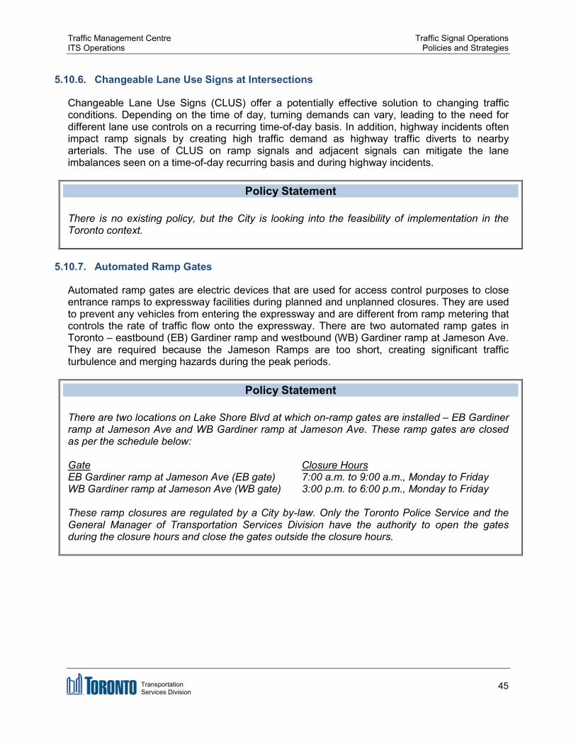
Traffic Management Centre Traffic Signal Operations ITS Operations Policies and Strategies
5.10.6. Changeable Lane Use Signs at Intersections
Changeable Lane Use Signs (CLUS) offer a potentially effective solution to changing traffic conditions. Depending on the time of day, turning demands can vary, leading to the need for different lane use controls on a recurring time-of-day basis. In addition, highway incidents often impact ramp signals by creating high traffic demand as highway traffic diverts to nearby arterials. The use of CLUS on ramp signals and adjacent signals can mitigate the lane imbalances seen on a time-of-day recurring basis and during highway incidents.
Policy Statement
There is no existing policy, but the City is looking into the feasibility of implementation in the Toronto context.
5.10.7. Automated Ramp Gates
Automated ramp gates are electric devices that are used for access control purposes to close entrance ramps to expressway facilities during planned and unplanned closures. They are used to prevent any vehicles from entering the expressway and are different from ramp metering that controls the rate of traffic flow onto the expressway. There are two automated ramp gates in Toronto – eastbound (EB) Gardiner ramp and westbound (WB) Gardiner ramp at Jameson Ave. They are required because the Jameson Ramps are too short, creating significant traffic turbulence and merging hazards during the peak periods.
Policy Statement
There are two locations on Lake Shore Blvd at which on-ramp gates are installed – EB Gardiner ramp at Jameson Ave and WB Gardiner ramp at Jameson Ave. These ramp gates are closed as per the schedule below:
Gate Closure Hours EB Gardiner ramp at Jameson Ave (EB gate) 7:00 a.m. to 9:00 a.m., Monday to Friday WB Gardiner ramp at Jameson Ave (WB gate) 3:00 p.m. to 6:00 p.m., Monday to Friday
These ramp closures are regulated by a City by-law. Only the Toronto Police Service and the General Manager of Transportation Services Division have the authority to open the gates during the closure hours and close the gates outside the closure hours.
Transportation Services Division
45

Traffic Management Centre Traffic Signal Operations ITS Operations Policies and Strategies
Figure 5-25. WB Ramp Gate (top) & EB Ramp Gate (bottom) – Gardiner Expressway/Jameson Ave
5.10.8. Ramp Metering
Ramp metering signal is a device that controls the rate of traffic flow onto an expressway. They are always used with an advance flasher to indicate that the ramp metering station is in operation. The purpose of ramp metering is to increase the capacity of an expressway segment at an on-ramp junction and to reduce the potentially disruptive impact of the ramp traffic on the heavier mainline expressway traffic by introducing on-ramp traffic into the expressway in a steady pattern.
Policy Statement
There is no existing policy, but the City is looking into the feasibility of implementation in the Toronto context.
Transportation Services Division
46

.
Traffic Management Centre Traffic Signal Operations ITS Operations Policies and Strategies
Figure 5-26. Ramp Metering Signal – Queen Elizabeth Way/Cawthra Rd (Mississauga, ON)
5.10.9. Intersection Flash
Flashing operations within a traffic signal cabinet are wired red-red and flashes all directions with red.
Policy Statement
Intersection flash shall be red in all directions. The City does not use flashing red for off-peak (night and weekends) time operations or when traffic volumes are low. Flashing red in all directions is used only when a traffic signal is initially activated, the signal will flash in all directions for a short period before
side street green is displayed there is a traffic signal equipment malfunction electricity is restored to a traffic signal after a disruption in the electricity supply or the traffic signal is placed “on flash” by the police while directing traffic.
5.10.10. Temporary Traffic Signals
Temporary traffic signals (TTS) are installed for a limited period of time before or during a construction period. They are normally comprised of traffic signal heads on span wires or temporary poles. They are used as an alternative to permanent traffic signals for limited periods prior to or during the re-construction of roadways. They must be used at entrances, truck access routes, pedestrian crossings, or fixed locations of work zone areas where it is required to temporarily replace existing signals. They have constant power supply and closely resemble normal signal installation.
Transportation Services Division
47

Traffic Management Centre Traffic Signal Operations ITS Operations Policies and Strategies
Policy Statement
Temporary traffic signals (TTS) must be considered at a work zone during a construction project where it is required to temporarily replace existing traffic signals. Also, TTS must be installed at construction zones where a section of the road is reduced to one lane and two-way traffic needs to be regulated by alternating the use of that lane. The planning and installation of TTS must follow OTM Book 12 (2012) and OTM Book 7 (2014) and must be reviewed by TPIM and approved by the DTO. The TTS must be installed by one of the City-approved contractors. However, the City does not have legal responsibility for installation, operation, or maintenance of TTS.
TTS signals in construction zones with one lane and two-way traffic shall be timed with adequate clearance to ensure that the last vehicle on green has enough time to traverse the single lane at the speed limit prior to the release of the opposing traffic.
5.10.11. Portable Temporary Traffic Signals
Portable temporary traffic signals (PTTS) are signal heads mounted on movable trailers that may be used as an alternative to traffic control persons for regulating vehicle traffic at work zones. They are used where lane control is required for all long duration work, short duration, or short duration work on roads with a normal posted regulatory speed of 70 km/h or higher. They cannot be used at intersections to emulate traffic signals and cannot be located in a place or manner that could be in conflict with any existing signals or traffic control systems. They do not have constant power supply and are approved on a project-by-project basis.
Policy Statement
Portable temporary traffic signals (PTTS) must not be used at intersections to emulate traffic signals and cannot be located in a place or manner that could be in conflict with any existing signals or traffic control systems. PTTS should be considered where lane control is required for all long duration work, short duration, or very short duration work on roads with a normal posted regulatory speed of 70 km/h or higher. The planning and installation of PTTS must follow OTM Book 7 (2014). The DTO's Work Zone Coordinator must be consulted before the PTTS is installed. However, the City does not have legal responsibility for installation, operation, or maintenance of PTTS.
5.10.12. Active Advance Warning Flashers
Active Advance Warning Flashers (AAWF) are static warning signs enhanced with flashing yellow lights that warn motorists that they will be approaching a signalised intersection that is showing a red display. They are located upstream of traffic signals under the following conditions: Limited Sight Distance – At intersections where the sight distance of the primary signal is
less than the stopping sight distance
Transportation Services Division
48

Traffic Management Centre Traffic Signal Operations ITS Operations Policies and Strategies
Minimum Speed – At intersections with approaches having a posted speed limit greater than or equal to 70km/h
Gateway – At the first signalised intersection along a road transitioning from a higher speed limit (highway) to a lower speed limit (arterial road)
Approach Grade – At intersections with an approach (posted) speed of 60km/h where the downhill grade is 7% or greater. At intersections with an approach speed of 50km/h where the downhill grade is 12% or greater
Truck Traffic – At intersection approaches with a significant proportion of heavy trucks Collision History – At locations where there is an overrepresentation of correctable
collisions
Policy Statement
AAWF shall be used sparingly. The installation of AAWF is warranted when one or more conditions outlined in the City's Active Advance Warning Flashers: Guidelines for Application and Installation (2006) document are met.
Figure 5-27. Active Advance Warning Flashers (AAWF) – Warden Ave/Ellesmere Rd
Transportation Services Division
49

Traffic Management Centre Traffic Signal Operations ITS Operations Policies and Strategies
5.10.13. Uninterrupted Power Supply
Uninterrupted Power Supply (UPS) is a device that provides emergency power to traffic plant when the regular power source fails. After 2013 ice storm, the City started a program to install UPS at critical traffic signals.
Policy Statement
A minimum of four hours of backup electricity supply shall be provided at critical signalised intersections to allow such intersections to operate normally in case of a power outage. An additional minimum of eight hours of backup electricity supply shall be provided at critical signalised intersections to allow such intersections to operate in all-red flash in case of a continuing power outage.
All signalised intersections with railway crossing pre-emption shall be installed with UPS. Subject to the availability of funding, UPS should be installed based on a priority list developed by the TMC.
5.10.14. Police Manual Control at Traffic Signals
Police Manual Control is an operational option that allows Toronto Police Service (TPS) Officers to manually control traffic signals through a police box that can be opened without opening the cabinet door. Only TPS officers have access to this box.
Policy Statement
During special events, or during an incident that requires intervention of the Toronto Police Service (TPS) Officers, TPS Officers shall have the authority to access the police box located at the front of a traffic control cabinet to place the traffic signals on manual control and manually control the signal from the police box place the traffic signals on all-red flash and manually direct traffic at the intersection or turn off the traffic signals (blank displays) and manually direct traffic at the intersection.
In situations that require TPS Officers to intervene, no one other than TPS Officers should have access the police box and control the movements of traffic and pedestrians at a traffic signal. Different keys shall be used for the police box and the cabinet.
In emergency situations when there are conflicts in displays or if there is a life threatening situation relating to signal timing/display that cannot be immediately resolved, ITSO staff can use the police box to put the signal into flash and must immediately notify TMC Dispatch for the signals maintenance contractor to attend the intersection.
Transportation Services Division
50

Traffic Management Centre Traffic Signal Operations ITS Operations Policies and Strategies
5.11. Arterial Coverage
One of the fundamental parts of the City's Congestion Management Plan 2014-2018 (2013) is to provide real-time traffic monitoring and congestion management. The Transportation Operations Centre (TOC) is a unit within ITSO that collects and disseminates real-time traffic information. Traffic conditions are monitored 24 hours a day, seven days a week at the TOC. The TOC is operated by a contract operator but managed by City staff. From 6:00 a.m. to 7:00 p.m., Monday to Friday, City staff proactively changes signal timings to better manage traffic conditions resulting from emergencies, special events, and abnormal traffic conditions and notifies the public about the signal timing adjustments via established advanced traveler information systems (ATIS).
Policy Statement
Traffic conditions are monitored 24 hours a day, 7 days a week by operators at the City's Transportation Operations Centre (TOC). ITSO staff is in the TOC from 6:00 a.m. to 7:00 p.m., Monday to Friday, to make signal timing changes to accommodate traffic diversion resulting from emergencies, special events, and abnormal traffic conditions. Stakeholders are notified of signal timing adjustments via established ATIS.
Figure 5-28. Toronto's Transportation Operations Centre (TOC)
Transportation Services Division
51
Traffic Management Centre Traffic Signal Operations ITS Operations Policies and Strategies
REFERENCES
Canadian Institute of Transportation Engineers, Canadian Capacity Guide for Signalized Intersections, 3rd Edition, February 2008. (Accessible via http://tac-atc.ca/sites/tac-atc.ca/files/site/doc/resources/report-capacityguide.pdf)
City of Toronto, Active Advance Warning Flashers (AAWF): Guidelines for Application and Installation, March 23, 2006.
City of Toronto, City of Toronto Accessibility Design Guidelines, 2004. (Accessible via https://www1.toronto.ca/static_files/equity_diversity_and_human_rights_office/pdf/accessibi lity_design_guidelines.pdf)
City of Toronto, Traffic Signal Operations Practice: Left-Turn Phase Criteria, June 28, 2000.
City of Toronto, Leading Pedestrian Interval Assessment and Implementation Guidelines, November 2014.
City of Toronto, Toronto Municipal Code Chapter 950, Traffic and Parking, § 950-1324 Schedule XXV: Entry Prohibited, 2015. (Accessible via http://www.toronto.ca/legdocs/municode/toronto-code-950-25.pdf)
Delcan & Lura Consulting for the City of Toronto Transportation Division, Toronto's Congestion Management Plan 2014 – 2018, 2013. (Accessible via https://www1.toronto.ca/City%20Of%20Toronto/Transportation%20Services/TMC/Files/PD F/Congestion%20Management/Congestion%20Management.pdf)
Metropolitan Toronto (now City of Toronto), Traffic Branch Operating Practices: Operating for Determining Mode of Control at Traffic Signals, 1997.
Metropolitan Toronto (now City of Toronto), Traffic Branch Operating Practices: Traffic Signal Control at Offset Intersections, November 1994.
Ontario Ministry of Transportation, Ontario Traffic Manual (OTM) Book 7: Temporary Conditions, January 2014.
Ontario Ministry of Transportation, Ontario Traffic Manual (OTM) Book 12: Traffic Signals, March 2012.
Ontario Ministry of Transportation, Ontario Traffic Manual (OTM) Book 15: Pedestrian Crossing Facilities, December 2010.
Ontario Traffic Council, OTC Bicycle Traffic Signals Guide, January 2015.
Transportation Association of Canada, Manual on Uniform Traffic Control Devices, 2009.
Transportation Research Board, High Capacity Manual 2010, March 2011.
Transportation Services Division
52