toronto parks & trails wayfinding strategy · wayfinding system strategy for toronto parks...
TRANSCRIPT

wayfinding system strategy for toronto
parks & trails (phase one)
Toronto Parks & Trails Wayfinding Strategyfinal reportdecember 2014

Wayfinding System Strategy for Toronto Parks & Trails (Phase One)
ii understanding

The City of Toronto’s Parks, Forestry & Recreation team has initiated an ambitious project to improve wayfinding across the City parklands.
The project aim is to implement a unified wayfinding system for parks and trails that provides consistent identification, orientation and navigation across parklands.

For further information please contact: Janette Harvey City of Toronto - Parks, Forestry & Recreation (416) 392-1339 [email protected]
Prepared for the City of Toronto by:
Steer Davies Gleave 1500-330 Bay Street Toronto, ON M5H 2S8
In association with: DIALOG
Completed in September 2014
All images by Steer Davies Gleave unless otherwise stated.
Chris Ronson, Transportation Services – Public Realm, Project Manager
Ed Fearon, PF&R – Standards & Innovation, Program Standards & Development Officer
Kim Statham, PF&R – Urban Forestry Policy & Planning, Program Standards & Development Officer
Jennifer Wing, Strategic Communications, Communications Advisor
Acknowledgments - Advisory Committee
Garth Armour, PF&R – Horticulture & Greenhouse Operations, Manager
Laura Atkins, PF&R – Policy & System Planning, Project Manager
Michael Bertuzzi, EDC – Visitor Services, Manager
Lorene Bodiam, PF&R – Community Development, Advocate for People with Disabilities
Trena Cesario, PF&R – Partnership Development, Business Development Officer
Halina Cieszynska, PF&R – Operational Effectiveness Unit, Change Leader
Tara Coley, PF&R – Standards & Innovation, Project Coordinator
Carol Cormier, PF&R – Standards & Innovation, Manager
Peter Sexton, PF&R – Policy & System Planning, Planner
Stewart McIntosh, PF&R – Planning Design & Development, Landscape Architect
Shannon Olliffe, City Clerk’s Office – Design Services, Supervisor
Wayne Reeves, EDC – Museum Services, Chief Curator
Brittany Reid, Toronto and Region Conservation Authority, Project Landscape Designer
Rob Richardson, PF&R – Partnership Development, Manager

3
Introduction
With more than 1,600 public parks and 600 km of trails Toronto’s parks network covers a substantial 13% of the City’s land area and is one of its greatest assets - essential to improving residents’ quality of life.
The City of Toronto’s Parks, Forestry & Recreation (PF&R) team has initiated an ambitious project to improve wayfinding across the City parklands. The project aim is to implement a unified wayfinding system for parks and trails that:
• Provides consistent identification, orientation and navigation in and around parks and trails;
• Encourages visiting, exploring and appreciation of Toronto’s natural assets;
• Serves all park and trail users regardless of their abilities;
• Reduces clutter and redundant infrastructure on parks and trails, thereby enhancing the natural environment; and
• Is economically sustainable and viable in the long term.
The project builds on the Toronto 360 (TO360) Wayfinding Strategy; an initiative to enhance pedestrian wayfinding around the city and improve connections between all transportation modes.
about this reportThis report summarizes the outcomes of the Toronto Parks & Trails Wayfinding (Phase One) study, which began in January 2014. The study aimed to establish a wayfinding strategy and design framework, and to provide strategic direction for subsequent implementation.
The report is structured as three sections, plus an introduction.
• Introduction briefly describes the study objectives and policy context.
• Section1“Understanding” summarizes the findings from on-site observations, including gaps and opportunities. It incorporates an overview of the challenges, a brief review of international best practices, and the results of stakeholder outreach activities.
• Section2“Designprinciples” describes the design framework and proposed system components, including an indicative sign family, digital components, placemaking considerations and integration with other signage and information systems.
• Section3“Delivery” describes the proposed pilot scheme set in the Lower Don Valley, a high-level project plan and budget implications.
Further information on the project process, consultation reports and materials, and presentations can be found on the project website.

4 introduction
Wayfinding in Toronto
Wayfinding encompasses all the ways in which people understand their surroundings and navigate from place to place. Wayfinding is more than signs - it also includes names, landmarks, conventions, maps and new media.
City wayfinding relates to the built and the natural environment and makes streets, neighbourhoods, and the city more ‘legible’, helping people to find their way. Wayfinding is more than signs—it includes names, maps, new media, and elements of the public realm such as lighting, street furniture and public art.
Many cities such as London, New York, Bogota, Vancouver and Moscow have recently developed wayfinding strategies in response to significant transportation challenges and/or major events such as the Olympics. The successful implementation of unified wayfinding systems is proven to deliver significant benefits to residents, businesses, and tourists.
to360 wayfinding strategyIn 2011 the City of Toronto launched the Toronto 360 (TO360) Wayfinding Strategy to develop a unified multi-modal wayfinding system for the city.
The Strategy is a three-phase process:
• PhaseOne(2011-2012): develop guiding principles, themes, and a conceptual design for the system.
• PhaseTwo(2014-2015): detailed design, implementation and evaluation of a pilot scheme in the Financial District.
• PhaseThree(2016andbeyond): creation of final design guidelines and city-wide implementation rollout.
toronto parks & trails wayfinding strategyThe Toronto Parks & Trails (TP&T) Wayfinding Strategy focus is on improving wayfinding in parklands managed by the City of Toronto.
The TP&T strategy is also a three-phase process:
• PhaseOne(2014-thisreport): establish a design framework and provide strategic direction for subsequent phases.
• PhaseTwo(2015): detailed design, implementation and evaluation of a Pilot scheme.
• PhaseThree(2016andbeyond):creation of final design guidelines and city-wide rollout.
The core objective of Phase One was to interpret and extend the TO360 wayfinding strategy and design principles to develop a common language for wayfinding to address the needs of park and trail users.
Main activities included:
• Background research of current and planned policy and signage initiatives;
• Interviews with over 20 stakeholders and special interest groups;
• Visual audits of eight case study parkland types across Toronto;
• Review of international examples;
• Pop-up consultation events in four locations to garner initial feedback from park users;
• Concept design for a family of signs, including function, content and placement; and
• Definition of a Pilot Scheme for Phase Two.

Wayfinding System Strategy for Toronto Parks & Trails (Phase One)
5
Key objectives
Parklands across the city serve as landmarks, destinations, and connectors. They are important to pedestrian and cycle movements –both generating and facilitating trips. The project is articulated around five key objectives.
Provide consistent identification, orientation
and navigation in and around parks and trails – including connections to/from the city
by all modes of transportation.
Promote the use of parks and trails for physical activity,
general recreation and relaxation and also facilitate their use as community hubs.
Address safety concerns at all levels including warning
of hazards, improved emergency information, pedestrian/cycle conflict management, and safe park and trail access for
users of all abilities.
identification, orientation and
navigation
raise awareness of what parks have to offer
improve perception of
park user safety
The parkland context provides an opportunity to promote interaction with
heritage and conservation, flora and fauna –resulting
in better appreciation of Toronto’s heritage and natural assets.
encourage visiting,
exploring and appreciation
Physical and psychological barriers and a frequent overestimation of walk distances/times have
been identified as some of the main deterrents for walking and exploration.
improve confidence to walk/explore
introduction

6
Directional policy & related projects
Various studies and related projects have highlighted the need for a unified wayfinding system for Toronto. The solution needs to adhere to existing policies, in particular those related to design guidelines and standards.
A policy review identified the objectives and strategies that underpin current wayfinding-related initiatives in Toronto.
Over a dozen policy and planning documents were reviewed and can be aggregated into a hierarchy of two categories:
Directionalpolicy: provides guiding policy direction for wayfinding and includes:
• Parks Plan (2013-2017)
• Toronto Walking Strategy
• Toronto 360 Wayfinding Strategy (Phase 1 - Principles)
• Accessibility for Ontarians with Disabilities Act (AODA, 2005) and City of Toronto Accessibility Design Guidelines (2004)
• Toronto Multi-Use Trail Design Guidelines (Draft)
• Toronto Safer City Guidelines
RelatedProjects: includes relevant projects, studies, and policy with specific wayfinding and signage strategies. The review included:
• Heritage Toronto Signs
• Pan Am Path
• Emergency Services wayfinding in parks
• Toronto 360 Wayfinding Strategy (Phase 2 - Design and pilot project implementation)
• Waterfront Trail
• Toronto Island Disc Golf
• Discovery Walks
Initial proposals to integrate with these and other existing and planned sign systems are included on page 38.
introduction
Parks Plan 2013 – 2017
Parks, Forestry and Recreation
parks plan (2013-2017)The Parks Plan will guide PF&R’s delivery of services between 2013-2017. The Plan recognizes the role of parks in offering
accessible outdoor leisure, recreation, and transportation routes that make Toronto an attractive place to live, work and visit. The plan balances encouraging public use and involvement in the park, while preserving parks for future generations.
Issues addressed in the Parks Plan that are relevant to the TP&T Wayfinding Strategy include:
• A growing and increasingly diverse population means more users, and more competition for use of limited park space;
• High demand for community involvement in park programming, design and decision making;
• Increasing involvement of partners and volunteers;
• Need to protect environmentally sensitive areas, and to preserve parks for future generations;
• The requirement to adapt facilities and services to comply with the Accessibility for Ontarians with Disabilities Act; and
• Need for data collection to provide consistent information on park use.
The TP&T Wayfinding Strategy should consider the importance of community involvement in developing, implementing and securing a parks wayfinding system.

Wayfinding System Strategy for Toronto Parks & Trails (Phase One)
7
toronto walking strategyThe Walking Strategy is supported by a number of other policies such as the Official Plan, the
Toronto Pedestrian Charter, International Charter for Walking, and other guidelines and programs, such as the Vibrant Streets policy. The walkable Toronto concept builds on a number of policies and documents that support walkable communities and the creation of urban environments that support increased pedestrian activity.
Objectives of the Walking Strategy of particular relevance to the development of the TP&T Wayfinding Strategy include:
• To support and nurture a culture of walking throughout the city;
• For all city sidewalks and walkways to be clear, accessible and easy to navigate;
• For public and private city building projects to provide opportunities to create a high-quality walking environment;
• To make walking easy and enjoyable through provision of tools for navigating the city on foot, such as signage and maps;
• To coordinate pedestrian-focused projects and initiatives across city divisions and agencies; and
• To transform areas poorly designed for walking, neighbourhood-by-neighbourhood, into places where people want to walk.
wayfinding system strategy (phase one)
for the city of toronto
Toronto 360° Wayfinding Strategyfinal report
T
toronto 360 wayfinding strategyThe Toronto 360 Wayfinding Strategy set out a design framework to inform the
implementation of a multi-modal wayfinding system in Toronto. The long-term vision is to provide the city with consistent wayfinding, and to enable project partners to adopt the principles for their own schemes. The strategy also aims to influence the city’s urban design to support intuitive wayfinding and movement.
Objectives from this strategy that are relevant to the TP&T Wayfinding Strategy include:
• Encourage exploration, wandering and discovery: wayfinding provides the tools for people to rediscover the city and to ‘get lost’ in the knowledge that they will find their way back; and
• Build confidence and trust to walk.
The TP&T Wayfinding Strategy should seek to integrate with the Toronto 360 Wayfinding Strategy where possible to create a seamless wayfinding system across the city.
introduction

8 introduction
aodaAccessibility for Ontarians with Disabilities Act (2005) establishes a regulatory framework for accessibility. These regulations apply to Toronto parks as public spaces. The Act lays out mandatory standards on accessibility in all areas of daily life. Public spaces must meet AODA standards for new construction and renovations. While many AODA policies relating to the design of public spaces do not directly affect deliverables of the TP&T Wayfinding Strategy, these policies do provide insight into barriers to accessibility in parks and can help inform signage and wayfinding to mitigate these barriers. Policies relevant to the TP&T Wayfinding Strategy include:
As a minimum requirement, signage for new or redeveloped recreational trails must be placed at each trail head and provide the following information to all trail users:
• Trail length
• Surface type on the trail
• Average and minimum trail width
• Average and maximum running slope
• Average and maximum cross slope, and
• Location of amenities, where provided.
A trail head refers to a point of access to a trail. Trail heads are commonly located close to a sidewalk or parking area. Organizations must identify which entrance/exit points to a recreational trail are trail heads to determine where the signage requirements will apply.
To help people with low or no vision and make the signage easier to read, the text on the signage must:
• Have high tonal contrast with its background, and
• Use a sans serif font for its characters.
Consultation with Toronto’s accessibility groups is a requirement for all new or redevelopment projects.
toronto multi-use trail design guidelines (draft)The Toronto Multi-Use Trail Design Guidelines have been developed to direct design of the Toronto off-road trail network. Guiding Principles that are relevant to this strategy include:
• Consistencyandexcellence: trails need to be consistently designed, constructed, and maintained, and to exceed existing best practice thresholds;
• Accessibility: all people are welcome on Toronto’s Multi-Use Trails, regardless of ability; and
• Sustainability: design, construction and maintenance shall be as sustainable as possible.
toronto safer city guidelinesThis document contains a great deal of information regarding best practices for creating safer public spaces, including parks. The Neighbourhood Parks and Playground section specifically refers to signage content such as park identification, location of facilities, identification of more/less isolated paths, how help can be found, and reporting of maintenance problems.

9
1 Understanding


11understanding
Torontohasover1,600publicparksacrossthecity
Toronto’s many parks differ in size, setting, features, facilities and amenities.
Part of a greater whole, the parks and trails form part of an extensive open space network of private and public spaces across the city.
The city also has approximately 300 kilometres of off-street, multi-use trails for hiking, biking and walking.

12
Case study areas
Eight case study parkland areas were selected for detailed observation. The areas exhibit many of Toronto parks typical characteristics and are representative of different settings and scales, park classifications and activities.
The case studies identified a diverse range of Toronto park and trail wayfinding challenges and opportunities. The data collected was used to inform development and testing of the TP&T wayfinding strategy.
Observations focused on the following considerations:
• Getting there (information from transit, bus, parking);
• Gateways (how do you know you are there);
• Understanding (welcome, context, park function/role, features, areas);
• Moving around, navigating the parks (washrooms, sport facilities);
• Activities (sports, playgrounds, commuter cycling, dog walking);
• Regulatory signs;
• Interpretation (places, views, flora & fauna, animal life, heritage); and
• Getting away (connecting back to transit/other parks).
Observations were initially made during early April with sites still recovering from a harsh winter and experiencing low level of public activity. Many sites were therefore revisited during spring.
cs1 humber arboretum
park nameHumber Arboretum
rationaleLarge city park.
Tri-party agreement (various stakeholders, wayfinding systems, branding), connected to the Humber Trail, Discovery Walk, natural environment trail improvements, concept master plan for improvements to a portion of the park completed in 2013.
cs2 garrison creek
park namesChristie Pits, Bickford Park, Art Eggleton Park, Trinity Bellwoods
rationaleVarious district, community and neighbourhood parks connected via Garrison Creek Discovery Walk.
Trinity Bellwoods is an example of an urban community park which is becoming a more attractive destination due to its success as a community facility and is being sought out beyond the local community.
understanding
13understandingunderstanding
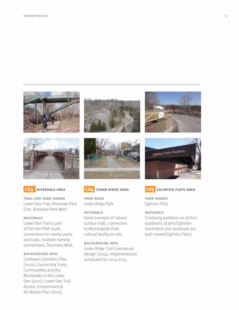
cs3 riverdale area
trail and park namesLower Don Trail, Riverdale Park East, Riverdale Park West
rationaleLower Don Trail is part of Pan Am Path route, connections to nearby parks and trails, multiple naming conventions, Discovery Walk.
background infoCorktown Commons Plan (2010); Connecting Trails, Communities and the Brickworks in the Lower Don (2011); Lower Don Trail Access, Environment & Art Master Plan (2013).
cs4 cedar ridge area
park nameCedar Ridge Park
rationaleGood example of natural surface trails, connection to Morningside Park, cultural facility on site.
background infoCedar Ridge Trail Conceptual Design (2014), implementation scheduled for 2014-2015.
cs5 eglinton flats area
park namesEglinton Flats
rationaleConfusing parkland on all four quadrants of Jane/Eglinton (northwest and southeast are both named Eglinton Flats).

14 understanding
cs6 downtown parks
park namesRoundhouse Park, Cloud Gardens, Berczy Park, Sculpture Garden Parkette
rationaleRoundhouse Park is surrounded by major landmarks & nearby attractions, interface with TO360 wayfinding system.
Cloud Gardens represents the urban context and Berczy Park is being redeveloped.
Sculpture Garden Parkette is a small urban park with temporary artwork exhibitions.
cs7 woodbine parks
trail and park namesMartin Goodman Trail, Woodbine Park, Ashbridges Bay Park, Pump House Park
rationaleWoodbine Parks area is an example of waterfront and beach setting and includes the multi-use Martin Goodman Trail (Waterfront Trail).
background infoImproving Safety and Awareness on the Martin Goodman Trail: map, signage and markings (implemented in 2012).
cs8 sentinel park area
park namesSentinel Park, Derrydowns Park
rationaleSentinel Park is poorly connected to nearby Derrydowns Park (selected for geographic diversity).
Derrydowns Park was observed only for connections and access to and from Sentinel Park.

15
Existing conditions
Toronto has a profusion of formal and informal signage and information systems. From humble road signs to interactive booths, all of these contribute to people’s understanding of the city with varying levels of success.
existing municipal signage in parks and trailsToronto already has a municipal park signage system in place. Its primary functions are to identify the park (name and address), to encourage positive/discourage negative behaviors, and enforce by-laws. These signs are visually consistent with the City of Toronto’s corporate identity program and can be easily related back to other municipal signage such as Fire Stations, Emergency Services, and Libraries. The majority of the signs show some level of deterioration due to:
• Weather: signs of poor water-proofing;
• Sunandlightexposure: faded graphics and colours; and
• Age: natural deterioration of timber and finishing.
Although the current system has been consistently implemented across the city, many redundant, duplicated, and outdated legacy municipal signs remain. Some of these can be traced back to pre-amalgamated Toronto and many show signs of poor or no maintenance over time – including graffiti, rust, fading, and in some cases, structural issues.

1616
Wayfinding System Strategy for Toronto Parks & Trails (Phase One)
discovery walksDiscovery Walks is a program of self-guided walks that link city ravines, parks, gardens, beaches and neighbourhoods.
Discovery Walk trailhead panels offer an overview of the walk and surrounding area. Most signs are faded and poorly maintained – making them unattractive and difficult to read. Some signs are in poor structural condition.
Discovery Walk discs provide route confirmation within parks and on-street. Discs have no route identification or destinations and are often installed in pairs of logo and directional arrow.
multi-use trailsVarious standard municipal and customized signs can be found on multi-use trails such as the Lower Don Trail and along the waterfront. Signage is focused on route identification, exits, destinations, and distances, as well as messaging on trail etiquette.
Signage systems include:
• Multi use recreational trail signage,
• Bikeway Network Wayfinding Signage,
• Martin Goodman Trail,
• Waterfront Trail (regional), and
• Trans Canada Trail (national).

1717
Wayfinding System Strategy for Toronto Parks & Trails (Phase One)
interpretationParks provide an opportunity to engage and reconnect citizens with nature. As such interpretive information regarding flora and fauna in parklands has been installed with various levels of consistency in placement, content and accessibility.
Examples include:
• Parkland naturalization,
• Toronto and Region Conservation Authority, and
• Legacy PF&R signage.
heritageParks and green spaces are often considered as suitable places to provide heritage information, both regarding the history of the park and more widely of surrounding neighborhoods.
Examples include:
• Heritage Toronto,
• Ontario Heritage Trust, and
• BIA/Neighbourhood initiatives.
1818
Wayfinding System Strategy for Toronto Parks & Trails (Phase One)
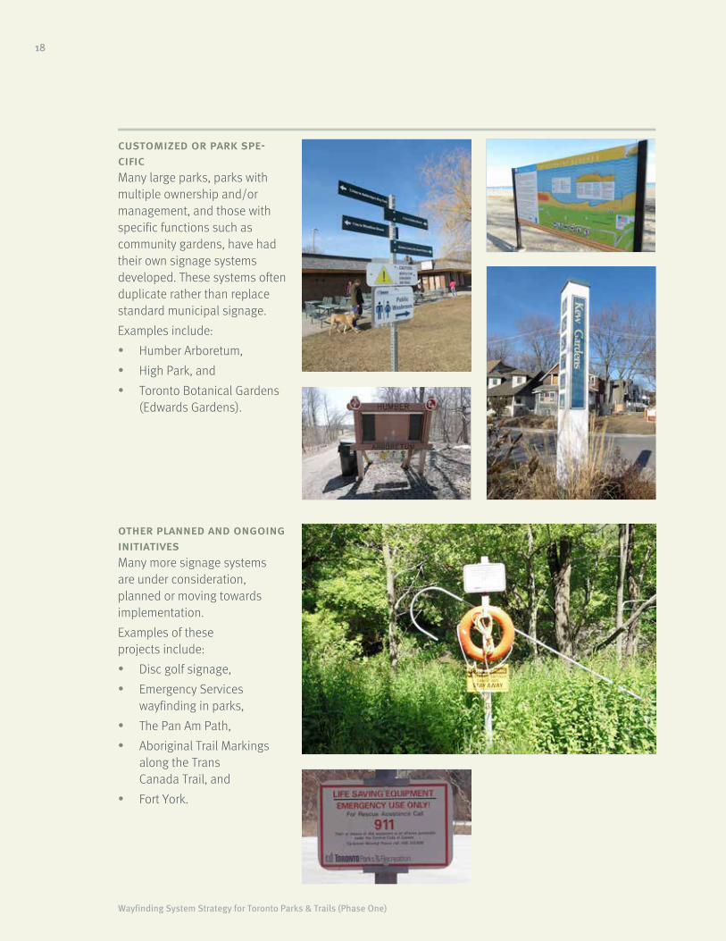
customized or park spe-cificMany large parks, parks with multiple ownership and/or management, and those with specific functions such as community gardens, have had their own signage systems developed. These systems often duplicate rather than replace standard municipal signage.
Examples include:
• Humber Arboretum,
• High Park, and
• Toronto Botanical Gardens (Edwards Gardens).
other planned and ongoing initiativesMany more signage systems are under consideration, planned or moving towards implementation.
Examples of these projects include:
• Disc golf signage,
• Emergency Services wayfinding in parks,
• The Pan Am Path,
• Aboriginal Trail Markings along the Trans Canada Trail, and
• Fort York.

19
Wayfinding opportunities
Extensive site visits and observations have identified important gaps in Toronto’s parks and trails current wayfinding, among them: attractiveness, clutter and repetition, information overload or shortage, accessibility considerations, and naming hierarchy.
Opportunities to address the identified gaps are expected to include the following considerations:
Gateways Consolidate, rationalize and re-present welcome and context information
Navigation Improve legibility, visibility and direction of and to key facilities, amenities and features within the parklands
Connect with the city Improve transitions between parklands and the city
Accessibility Meet the needs of all parklands users and improve understanding of route difficulty levels
Clutter Rationalize signs and reduce repetition
Robust and maintainableConsider location and design to ensure durability to extreme climatic conditions and minimize impact of vandalism
Modular and adaptableTo meet with the needs of Toronto’s varied parkland typologies

20 understanding
What are the priorities?
Helping people to understand, access, enjoy, appreciate, learn from and respect parklands requires a combined effort before, during and after visits.
plan
welcome orient
onwardjourney
extendedengagement
identify
promote inform
interpretation
Helping people to understand, access, enjoy, As illustrated by the graphic below, the focus appreciate, learn from and respect parklands of on-site wayfinding signage is primarily on requires the availability of information across identification, welcome and point-to-point multiple-platforms before, during and after visits. navigation in and around parklands. Some level
of trip planning and interpretative information Visitor information delivered via printed may also be provided while promotion, general and digital media will complement physical awareness raising and ongoing maintenance signage to maximise the system’s impact and requires use of other channels/media.will help deliver customised content which
may be required for specific audiences.

2121
Wayfinding System Strategy for Toronto Parks & Trails (Phase One)
Best Practice Review
A review of international wayfinding systems covering wayfinding strategies, signage elements, content, and system identity was undertaken to identify considerations that were relevant to Toronto.
understanding
Source images: SEGD/Futago
Source: TwoTwelve
Minimalintervention
Senseofarrival
battery point trail, hobart, tasmania, australia• Heritage & environment
walking trail.
• Minimal signage interventions with maximum impact on route, including use of brightly coloured markers and interpretive sign boards.
• The signage provides visual impact while being respectful of the environment.
durham parks & recreation, north carolina, usa• The aim was to unify parks
with a simple, fresh and distinctive visual identity and colour scheme.
• Signage system uses simple construction methods (with elements of modularity).
• The system helps to promote and unify the green spaces providing them with a distinct and easily recognizable identity.
• The visual identity helps to promote gateways and entrances while providing information on the amenities and facilities, and regulatory and statutory information.

2222 understanding
Simpleconstruction
Definedsenseofplace
nyc parks & high line, new york, usa• The aim was to unify and
refresh the agency’s image through a distinctive visual identity and flexible sign system.
• Simple modular signage products designed for large scale roll-outs.
• Playful elements including luminescent signage.
Source: SEGD/Pentagram
stockwell park, london, uk• Community led signage
system that reflects the diversity of area through artwork created by local residents.
• Modular system that provides flexibility through customization.
• Signs were given a tough clear lacquer coating to deter vandalism.
Source: designboom/hat-trick Design
mbc trail, brisbane, australia• A 150-km-long cycleway
wayfinding system delivered as a kit of parts which includes stainless steel posts and aluminium info panels that are easily removed and updatable.
• Distinctive signage communicates a clear hierarchy of information and visual identity.
Source: SEGD/Dot Dash

2323understanding
Colourcodedtrails
Interpretiveinterventions
Standardization
national mall & memorial parks, washington dc, usa• A standardized wayfinding
and signage system for 400 acres of multi-use parks and open space.
• Simply constructed sign system and iconography to provide a clear sense of place, identity and information.
• $2 million implementation cost.
Source: SEGD/Hunt Design
the parklands, sydney, australia• A family of wayfinding and
interpretive signs that use a strong aesthetic that reference elements of the sites industrial heritage.
• Simple construction and materials palette.
• Colour coding of trails and routes.
Source: SEGD/Dot Dash
islington greenspace, london, uk• A extension to the
pedestrian wayfinding system that provides a robust urban family of 300 products across 127 spaces.
• Sign elements include interpretive ‘wind-up’ audio and interchangeable information panels.
• $2.7 million signage implementation (est.).
Source: design week/fwdesign

24
Stakeholder interviews
We had conversations with over 30 stakeholder organizations and special interest groups, including City divisions; various trail, walking, cycling and park advocates; and representatives of accessibility, heritage and environmental programs.
* A full list of stakeholders can be found at the end of this document.
There was broad consensus on the current situation and the gaps that the new system will need to address. Some of the main topics and comments included:
toronto park signage needs an overhaul!Signs should be attractive and welcoming with a better balance between text and graphics. Different park types (urban, natural, neighbourhood, city) have differing needs.
identity, diversity, uniqueness of placeWayfinding needs to represent Toronto parks, balancing uniqueness with consistency/common language. Signs should be timeless, attractive and adaptable to change.
too much clutter! we need to consolidate...Simplify palette of materials, consolidate information and minimize repeat messaging to reduce visual and physical clutter.
positive and consistent messagingReduce regulatory signage, it invitesvandalism and reword messages to be more positive and consistent.
sustainable and low maintenanceConsider material longevity and sign placement to minimize maintenance. Designs should support cost effective delivery of seasonal or short term messaging.
make wayfinding accessible and safeSigns need to be visible in all weather conditions and be understood by all. Consider provision of pre-visit information (web), emergency number, identification, street and path naming and audio.
address user conflicts on paths and trailsConsider signage and physical design of paths and trails together to reduce user conflicts alongside a balance of road markings and signage. Consider how signage can educate about park etiquette and code of conduct.
prioritize trail distance, location, and exitsSigns need to communicate where you are in a park, how long a trail experience will be, how much longer to go, and how to get out of the park. A lack of knowledge discourages users.
need a park and trail information centreNeed for a (web based) centre for consolidated park and wayfinding information which should include wayfinding apps and links to digital resources such as Google. Retain a balance between new technology vs legacy - physical maps are still very popular.

25
Pop-up consultation
Community ‘pop-up’ consultations were hosted at four park locations across Toronto in mid June 2014 to garner input from park users.
Community “pop-up” consultations were hosted throughout the city in mid June to garner input from a diversity of park users at:
• Berczy Park,
• Trinity-Bellwoods Park,
• Don Valley Brick Works Park, and
• Toronto Island Ferry Terminal.
The objective of the “pop-up” consultation was to gather information on how communities interact with their parks through spontaneous dialogue and interaction, and observation of park use. The pop-up consultation forum also provided a means of testing preliminary ideas through direct engagement with users and panel interactions.
In summary:
• The public is generally supportive of the project.
• The public generally agrees with stakeholders comments and suggestions.
• Individuals provided feedback on international examples and material palette.

26
Open House
An Open House (Public Forum) event was held at Metro Hall in Toronto on July 30th. Eleven panels were displayed in the rotunda for all invited stakeholders and passers-by to learn about the wayfinding project, where we were in the process, and what we had heard.
The objective of the event was to gain feedback from participants on the information presented.
The first half of the evening was an open forum with consultants and City staff available to answer questions and interact with participants who wished to discuss content on the display panels. The second half of the evening was dedicated to a presentation by the consultant project team lead, followed by a more formal question and answer period. Participants were also given comment sheets to provide an opportunity for additional input on the information presented.
The majority of comments reflect the key messages conveyed at previous events. The need for accessible park signage and information; improved park connectivity and safety; consistent messaging; long term maintenance and cost; and community representation and involvement were some of the highlights from conversations and sticky notes.
The final consultation plan report of the project, covering summaries of the interviews, pop-up consultation and open house is available as a appendix to this document.

27
2 Design Principles

28 design principles
TO360 principles
The Toronto 360 Wayfinding Strategy provides a framework to inform the development of an updated Parks & Trails Wayfinding System. The framework is organized around five themes.
The framework is a summary of those Consistency for example has been rationalized elements that need to be considered through by the creation of a hierarchy of Points of the detailed design and implementation Interest (PoI) in Tiers 1 to 4 –providing a clear process to ensure system delivery is framework for stakeholder discussion.consistent with the strategy vision. Inclusivity considerations comprise the inclusion The principles under each theme comprise of braille and tactile information on the sign wide-ranging guidance—from standards prototype, choice of material (to avoid glare) and to project aspirations and user needs. graphics (to improve contrast and legibility).
As the TO360 pilot progresses through Transition across systems and third party implementation many principles have evolved inputs have been successfully channelled in specific guidelines and design definitions. through integration and coordination with
TTC and Metrolinx information systems.
consistency inclusivity sustainability transition being local
Consistency of The system should Consideration Connecting places Celebrating and content and cater to the needs of full life cycle and facilitating promoting the city presentation is of all user types. costing and third party input to and its districts. fundamental Physical access ability to adapt enable people to Empowering for effective to change. move seamlessly community Contrast wayfinding. Reduce clutter from one mode, participation
Accessibility Hierarchy system or area and input. Flexibility Technology to another. Conventions Landmarks Extendability Multi-modal Positioning Local character Future proof
Reciprocity Structures Historic names Route legibility Placemaking Fill the gaps
For more information about the design framework principles and themes and more generally about TO360 project, please visit the Toronto 360 Wayfinding Strategy website: www.toronto.ca/wayfinding

Wayfinding System Strategy for Toronto Parks & Trails (Phase One)
29design principles
Toronto Parks & Trails wayfinding principles
While the TO360 principles are broadly applicable to Toronto Parks & Trails Wayfinding they need to be translated into design decisions relevant to the needs of a parkland environment.
Additional and complementary principles for Parks & Trails signing include:
A user-based approach park user experience is the primary consideration for any sign design decisions.
Simplicity signs should be as simple as possible, avoiding non-essential information, e.g. marketing brands, logos, names of organizations, etc. which can be provided on other signs, perhaps near the trailhead.
Consistency a consistent approach to products and information delivery is required across parks.
Placement a balance between information and clutter needs to be considered at a local level, taking into account factors such as park size, location, accessibility and facilities/activities/amenities on offer.
Visual language and identity reflect Toronto parkland’s unique voice and design information and products to communicate parkland attributes.
Integrate with surroundings parks should be seen in the context of their surrounding areas and the connections that can be made through and beyond them. Integration with the TO360 wayfinding system is key.
Modular and easily updateable signage products should form a consistent family of parts with the flexibility to adapt depending on information need and park type.
Encourage interaction parks wayfinding should not be purely functional with the need for education and interpretation built into the system.
A sign for all seasons the product family should support seasonal responses to changing information needs inlcluding content, contrast and durability.
Source images: SEGD/Futago/Dot Dash/FW Design/FW Design/Pentagram

Wayfinding System Strategy for Toronto Parks & Trails (Phase One)
30 design principles
Phase One proposes a conceptual family of six basic products for implementation in a Parks & Trails Wayfinding Pilot aiming to maximize impact and effectiveness while rationalizing the required number of structures.
A Gateway where? At park & trail pedestrian and vehicular gateways/entrances
what? TP&T system identification
Park & Trail name
Address
Park features icons
Park overview map
Parks by-laws
Emergency contact
Accessibility/route difficulty levels
Indicative sign family
B Directional where? At decision points (path intersections) and secondary park entrances
what? TP&T system identification
Directions (inwards) park destinations and features
Directions (outwards) local area, transit stops, other parks
Trail-marking
Accessibility/route difficulty levels
Emergency contact
A
A
A
NOTE: Sign types shown on the following pages are for illustrative purposes only. These are intended to inform, not constrain, subsequent product or graphic design solutions.

Wayfinding System Strategy for Toronto Parks & Trails (Phase One)
31design principles
C Park Hubs where? At park hubs, i.e. inner gateways, and significant places such as ponds, path intersections/pedestrian access from parking
what? TP&T system identification
Park name
Address
Park features icons
Park overview map
Parks by-laws
Interpretation/interaction
Accessibility/route difficulty levels
Emergency contact
D Community facilities where? At entrances to internal parks facilities, such as sport grounds, community gardens, off-leash dog areas
what? TP&T system identification
Facility name
Facility features icons
Facility by-laws
Facility open times/days/seasons
Notice board
Accessibility/route difficulty levels
Emergency contact
A
B
C
D

32 design principles
E Trail marker where? At trail entrance-exit points, along trails, at frequent intervals and/or related to memorable places such as bridges and tunnels and at on-street segments of trails
what? Trail identification (multiple)
Trails users
Directions/distance/time to next entrance/exit or feature (e.g. pond, bridge, beach)
Trail etiquette
Accessibility/route difficulty levels
Emergency contact
F Interpretive panel where? At view points and significant places of natural, historical or cultural interest
what? Interpretive information
Interactive elements
E
E
F
F

33design principles
Digital components
The vision is for a digital wayfinding service to provide users with route, location and context specific information to enable them to explore Toronto’s parks & trails.
An appendix to this report presents a high-level evaluation of current and near future technologies with potential application to digital navigation – particularly for visually or learning impaired users. It identifies those technologies with the greatest potential for implementation as part of a controlled wayfinding pilot in the Lower Don Valley Park in Spring 2015, and sets out a functional specification that should form the basis of that pilot.
service conceptA digital wayfinding service to provide users with route, location and context specific information to enable them to explore the Lower Don Valley. The service should be scalable for future city-wide application.
pilot goals• Test and evaluate the potential of
current and near future technologies to deliver context specific information to park & trail users.
• Develop a scalable service/solution that has the potential for future roll-out across the city.
• Adopt technology and delivery methods appropriate for the local environment and the needs of the target user groups.
• Deliver end user information to complement physical signage installed within the pilot area taking advantage of delivery platforms such as smartphones and wearable technology.
recommended technologiesThere are a number of useful technologies that may not be directly relevant to this pilot, but may represent useful functions in different environments, such as in a more urban setting. Based on the assessment presented in the appendix, we recommend a combination of the following technologies, but note that their suitability should be discussed with the target user groups prior to implementation.
• Digital application (app) (front-end) in conjunction with either smartphone and/or wearable technology.
• Communications and infrastructure service consisting of:
• Global Positioning Service (GPS) for location and context information, plus dynamic wayfinding support;
• Near Field Communications (NFC)/Radio-frequency Identification (RFID) for point specific information; and
• Bluetooth beacons for location specific information delivery.
• Data management (back-end) solution to:
• Manage the front-end app content;
• Configure the Bluetooth beacons;
• House and configure the dynamic wayfinding engine; and
• Provide a management reporting service (for feedback etc.).
A combination of the above technologies offers the best overall support for the required service.

34 design principles
front-endUse of smartphones is widespread, and there are a number of services targeted at the visually impaired community that make either mass-market smartphones more accessible, or are specifically tailored towards visually impaired user needs. Consequently, there is logic in utilising the technology that people already have and combining it with an appropriate app to deliver the dynamic wayfinding and information service. As well as a smartphone, the concept of wearable technology is emerging and could provide significant future benefits for the user community.
communications and infrastructureGPS is prevalent in all smartphones, and could be automatically activated by an app for this service. It is a very familiar technology in routing systems, and would work well with off the shelf routing solutions such as MapQuest. Standard GPS would provide the service with a location, and would offer context information for the routing service.
NFCchips could be used (if required) as a standalone tool to offer the user highly location-specific information (to inform about a specific point of interest, or perhaps to alert users to a hazard). This is a low cost option and would enhance the environment, rather than act as a standalone service.
Bluetoothbeacons would provide the user with general point of interest information
when they are within the proximity of the transceiver. This means that users could be provided within information even if they are not walking on a particular pathway.
back-endA back end solution should be developed that will enable the client to manage the service, and receive management level feedback on the user experience.
A Bullseye NFC sticker (source: www.zipnfc.com)

35design principles
Public art and placemaking
Within the context of wayfinding public art can play an important role, helping to create memorable locations and reveal aspects of a place which may otherwise remain hidden.
Public art within a park environment can add to the stock of attractions that are on offer. The best artworks act as symbols for the park, points of reference for people to meet around, or destinations to reach. Within the context of wayfinding, public art can play an important role, helping to reveal aspects of the place which may otherwise remain hidden.
opportunitiesPublic art can take many different forms – from large civic sculptures through to small discrete incidental works. It may announce a point of arrival and congregation or it may promote quiet personal contemplation. Public art might not be a permanent artwork at all, it could be the creation of an unusual space, something to sit upon or a marker to guide you through the park, it could be a temporary installation to celebrate an event, it may raise questions, be ephemeral and transitory, it may change with the seasons.
The common thread is that it is a creative act involving the work of artists, produced and displayed for a specific site.
The Parks Plan 2013-2017 sets out a vision for the management and development of Toronto’s parks. Within the seven principles upon which the plan is built, and within the four themes, 12 directions and associated actions that constitute the plan it is possible to see many opportunities for the work of artists to help bring the vision to fruition. It is perhaps, in the role of placemaking1, that public art can make the biggest contribution.
placemakingOpportunities for placemaking vary with sites but may include the following:
• Entrance ways, park gates, railings;
• Focal points, landmarks, viewing structures;
• Gathering spaces, amphitheatres, play spaces;
• Information points, route markers, furniture; and
• Character areas, linkages.
Successful placemaking creates a strong and resonant image, specific to the area and grounded on the site. It should provide a unique identity, reflecting the values of a broad community yet be capable of personal interpretation and association. Placemaking is not about imposing ideas upon a site but rather allowing the site and its users to influence the outcome. The language of place making may be very direct or literal or it may be layered and ambiguous, revealed over time and open to speculation, but still centred upon the place. In developing a creative response to a site the following would generally be considered:
• How the site has changed over time, its history and its social context;
• People and events that may be associated with the site, the cultural context;
• The purpose and function of the site, now and in the future;
• The components, condition and potential of the site, the physical context; and
• The relationship between the site and the wider city context, what marks it out.
1 The process of creating squares, plazas, parks, streets and waterfronts that will attract people because they are distinctive, pleasurable or interesting.

36 design principles
In exploring these issues the fundamentals of good design practice must not be sacrificed, for the sake of a “big idea”.
The place must feel welcoming, legible, be easy to enter and leave, be accessible and comfortable to use. Successful placemaking needs to make allowance for future scenarios, certainly be true to its time, but recognize its roots and allow a diverse range of people to find a point of recognition in the work.
benefits• Individual artworks can help create
a strong identity for a place which in turn can enhance legibility and orientation across a broader area.
• As well as providing a strong image an artwork can interpret and promote the special qualities of a particular park, which will add to the visitor experience.
• A series of linked artworks across a park may encourage users to explore the place a little more extensively and to gain a deeper knowledge of the narrative(s) and stories of the park.
• Creating the work of art may offer user groups of the park the opportunity to become involved, extending a sense of ownership and pride in a place.
• Commissioning public art can be the start of a creative process focused upon the park where the notion of encounter, engagement and dialogue can take root, appealing to a wide cross section of users.
• Public artwork can also be a catalyst for a changing array of animations and events across seasons and sectors of the park, maintaining a sense of relevance and vitality within the city.
risks• Unpopular or inappropriate imagery can
have a negative impact upon a place and can lead to vandalism, a sense of unwanted imposition and rejection of the work.
• Public artwork, like all aspects of the environment will require maintenance; a lack of commitment to maintain works will result in degradation and a negative impact upon a park.
• Insufficient funding at the outset may encourage short cuts to be taken with fabrication or finishing which may create future maintenance liabilities.
• The notion of a single symbolic gesture embodied in an artwork may be at odds with the pluralistic and democratic mix of park users. It may be more effective, less confrontational and ultimately more culturally enriching to promote changing temporary works within the park setting. This requires proper curatorial expertise and appropriate levels of resourcing.
• People’s safety within a park is of fundamental importance. Artworks will need to be assessed for their performance against anticipated levels of use.

37design principles
Integration with other systems
Integration with existing systems is at the core of the Toronto Parks & Trails (TP&T) wayfinding strategy.
Integration with existing systems is a core The concept diagram below summarizes planned requirement of the TP&T Wayfinding Strategy. overlaps between the main wayfinding and Phase One identified opportunities to integrate signage projects currently sponsored by the City.third-party information such as Discovery Walks, Multi-use Trails and Emergency Services into the Parks & Trails Wayfinding System.
*Draft
parks & trailsto360
cycling wayfinding
Pedestrian signage
On-street cycling signage
Highway signageDigital wayfindingTransit information
Digital wayfinding
Pavement markings
Park & Trail signageInterpretive signage
Off-street cycling signage on multi-use trails
Content database Graphic language
Conventions including naming, distance, symbols

Wayfinding System Strategy for Toronto Parks & Trails (Phase One)
38 design principles
TP&T Wayfinding Strategy Integration with other systems
integrated coordinated system how?into tp&t? with tp&t?
Toronto 3600 (TO360) Wayfinding SystemTO360 and TP&T systems will share the design framework, content database and map asset
Discovery WalksDiscovery Walks routes to be incorporated on maps. Logo could be included on directional route markers/signs
Multi-use recreational trail signageTrail signage to be consistently presented under the TP&T system
Bikeway Network Wayfinding SignageBikeway Network route identifiers may feature on the off-street network
Martin Goodman Trail
Waterfront Trail TP&T signage will incorporate branded trails
Trans Canada Trail
Parkland naturalization
TP&T will feature interpretive informationToronto and Region Conservation Authority
Legacy PF&R signageTP&T will promote the reduction of redundant structures and clutter
Heritage Toronto
Heritage information may be incorporated Ontario Heritage Trust
on TP&T signs
BIA/Neighborhood initiatives
Humber Arboretum TP&T design principles are intended to act as guidance for custom signage systems - further integration may be possible through mutual
Toronto Botanical Gardens collaboration
Disc golf signage
Emergency WayfindingEmergency contact details in TP&T signs (level of integration tbd)
The Pan Am PathTP&T design principles are intended to act as guidance for custom signage systems
Various Trail Marking Initiatives
The table below summarizes initial proposals for This integration needs to be explored further different levels of integration with existing and though detailed design, and engagement with planned sign systems. potential project partners in Phase Two.

39
3 Delivery


41delivery
Phase Two will include consultation with stakeholders, detailed graphic and product design, leading to the the implementation of a pilot scheme in the Lower Don Valley.

42 delivery
lower don trail route 45 south
don valley
riverdale park east
riverdale park west
panam trail
Pilot scheme
The Pilot will enable sign designs, information, materials and finishes to be evaluated in context and inform design refinements and value engineering prior to a future citywide rollout.
pilot scheme rationaleThe implementation of a Parks & Trails Wayfinding Pilot Scheme is scheduled for 2015. The scheme will see the implementation of a pilot signage system that will allow sign designs, static and digital information, materials and finishes to be tested, and to inform design refinements and value engineering prior to a citywide rollout.
From an initial shortlist of eight case study areas, a section of the Lower Don Trail between Pottery Road and Lake Shore Boulevard East plus the adjacent parks of Riverdale Park East and West was selected for the Pilot based on the following rationale and opportunities:
• Broadly representative of issues observed across case study areas: naming, connections to/from city, access and navigation, clutter and poor maintenance;
• Connected to Lower Don Trail and Discovery Walks;
• Lower Don Valley masterplan with implementation underway;
• Funding availability; and
• Implementation prior to PanAm Games.
the lower don trailThe Lower Don Trail within the Pilot Area is a 4.7 kilometre section of trail that runs along the Don River, from Pottery Road to Corktown Common. It is used as a multi-use trail, designed for pedestrians and cyclists.
Works to improve conditions of the existing trail - and access into the surrounding trail network - are detailed as part of the Lower Don Trail Accessibility, Environment and Art Master Plan project, due for partial implementation during 2015.

43delivery
Ownership
Ravine name ?
Facilities ?
Connects to trail ?
Other parks?
What is offered?
Where is the farm?
Part of Discovery Walk?
Is it accesible (step free?)
Transit, Bike rental, Parking?
Park name
Basic info
Park name?
Ravine name ?
Where does this lead?
Facilities?
How far is Pottery Road?Connects to trail?
Part of PanAm Path?
Other parks?
Where is the farm?
Part of Discovery Walk?
Recreational route?
Is it difficult?
Is there a step free route?
Transit, Bike rental, Parking?
Parks and trail users require a broad range of informationto help them understand what facilities, features or activities are on offer in the park, where to find them and how to get to them.

pottery rd
lake shore blvdcherry st
riverdale parks
bloor st
pottery rd
queen st
dundas st
gerrard st
don valley pkw
y
lakeshore blvd
riverdale park east
riverdale farm
riverdale park west
beltline trail(not part of the pilot)
corktown commons
44 delivery
TP&T Wayfinding pilot area Discussion of issues
N
250m
Namingandidentification:a naming hierarchy is required to identify overlaps with the wider area, the trail, adjacent parks and park destinations.
Clutterandpoormaintenance:many signs in the Lower Don Trail and some in Riverdale Parks display signs of disrepair, graffiti, fading, or are overgrown with vegetation.
Poorintegrationandawarenessofotherparks/trails: Riverdale Park signs do not reference connections to the Lower Don Trail or vice versa.
Accessandnavigation:connections and exits to/from the Lower Don Trail are limited with very few step free routes. Routes are not graded and accessibility and path maintenance varies.
Connectionsto/fromthecity: parks & trails wayfinding signage should link back to city destinations and points of reference. Equally, access to parklands from the city requires additional support as routes are not intuitive.

Wayfinding System Strategy for Toronto Parks & Trails (Phase One)NOTE: Sign types shown are for illustrative purposes only.
45delivery
TP&T Wayfinding pilot area Preliminary sign locations
N
250m

46 delivery
Next steps
Implementation of a citywide upgrade of wayfinding signage and proposed complementary measures in parks and trails will not only require a significant capital investment but also commitment for long-term management and maintenance from the City.
phase one
Summarized by this report (completed September 2014). Phase One defined the wayfinding system framework, including design principles, concept sign family, information hierarchy, and concept graphic treatments, and the parameters for a pilot implementation.
phase two
Phase Two will result in the implementation of a pilot scheme following detailed graphic and product design development, procurement of product manufacture and installation.
The pilot scheme (described on pages 42-45) will be on a section of the Lower Don Valley from Pottery Road to Lake Shore Boulevard and includes the adjacent parks of Riverdale East and West. Implementation of wayfinding signage is expected in advance of the Toronto Pan Am & Parapan Am Games in July 2015.
Phase Two is also expected to include a Digital Pilot targeted, if not exclusively, to users with visual impairments (described on pages 33-34 of this document).
Integration with existing systems is a core requirement of the wayfinding strategy. Various opportunities were identified during Phase One to integrate third-party information such as Discovery Walks, Multi-use Trails and Emergency Services into the TP&T wayfinding system.
Engagement with owners of these systems and other organizations must continue through Phase Two to define how these should be included in the pilot.
Consultation with citizens and particularly local park users is also key to build support and to shape a solution that delivers to the required local outcomes.
Each of the tasks listed below is expected to involve meetings and/or consultations with stakeholders and City staff to understand, confirm and fulfil the necessary business requirements.
phase two evaluation
Following implementation of the Pilot, the City will evaluate the scheme’s impact and effectiveness, and the acceptance and adequacy of the design solutions. Key indicators must be aligned to the project objectives, including to:
• Improve confidence to walk and explore for all users;
• Raise awareness of what parkland has to offer (amenities/facilities/walks);
• Improve perception of park user safety;
• Confirm user awareness, perceptions, level of usage and demand for the wayfinding system – aiming to confirm acceptance and perceived usefulness;
• Improve ability of all park users to find their way around and to navigate to destinations within and beyond the park/ravine; and
• Improve aesthetics/functionality of wayfinding elements and their contribution to the parkland environment.
It is recommended that the pilot scheme evaluation be undertaken independently

47delivery
from the project development team. Primary research may include face-to-face surveys, mystery shopping and online surveys. Research should be conducted pre- and post- implementation to better measure change.
Evaluation of the digital system should be conducted separately although it will be used in conjunction with the physical signs. Small-sample primary research such as interviews and mystery shopping –possibly combined with tracking– will be most appropriate due to the specific needs of the audience. Usage analytic of an app. or mobile website could also provide useful insights on the usability of the different functions.
phase three
Upon successful completion and positive evaluation of the Phase Two Pilot, the City is expected to proceed with a citywide roll out of the system. The implementation may be delivered in packages driven by:
• City-sponsored implementation of schemes on priority trails and parks;
• Planned capital improvement packages;
• BIA or locally sponsored initiatives;
• Developer contributions; and
• Multi-agency agreements at municipal, provincial and/or federal level.
A Design Guideline document must be completed prior to citywide roll out of the system. This will include updated design specifications
based on any feedback from Phase Two. Signage product design in particular should be further refined to streamline the cost/quality product ratio and achieve economies of scale.
An internal management structure should be established to coordinate implementation, consistency, and ensure long-term maintenance, including repairs, renewals and updates.
cost implications
It is premature at this stage, to anticipate the global capital investment required to update wayfinding signage across all City parks and trails. A formal evaluation of implementation, management and maintenance costs should take place on completion of Phase Two.
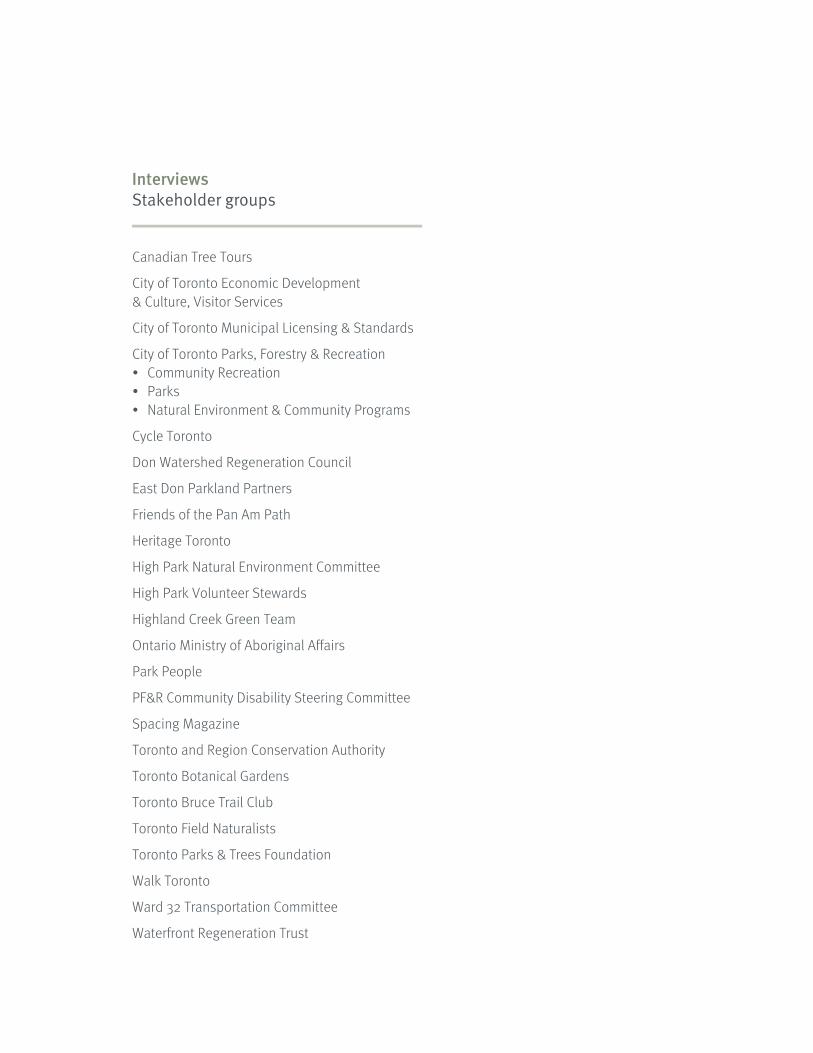
Interviews Stakeholder groups
Canadian Tree Tours
City of Toronto Economic Development & Culture, Visitor Services
City of Toronto Municipal Licensing & Standards
City of Toronto Parks, Forestry & Recreation• Community Recreation • Parks• Natural Environment & Community Programs
Cycle Toronto
Don Watershed Regeneration Council
East Don Parkland Partners
Friends of the Pan Am Path
Heritage Toronto
High Park Natural Environment Committee
High Park Volunteer Stewards
Highland Creek Green Team
Ontario Ministry of Aboriginal Affairs
Park People
PF&R Community Disability Steering Committee
Spacing Magazine
Toronto and Region Conservation Authority
Toronto Botanical Gardens
Toronto Bruce Trail Club
Toronto Field Naturalists
Toronto Parks & Trees Foundation
Walk Toronto
Ward 32 Transportation Committee
Waterfront Regeneration Trust


For further information please contact: Janette Harvey City of Toronto - Parks, Forestry & Recreation (416) 392-1339 [email protected]
Prepared for the City of Toronto by:
Steer Davies Gleave 1500-330 Bay Street Toronto, ON M5H 2S8
in association with: DIALOG