topographic maps. topographic map: topographic map: – a contour map -
TRANSCRIPT
Topographic Maps
• Topographic Map:–A contour map -
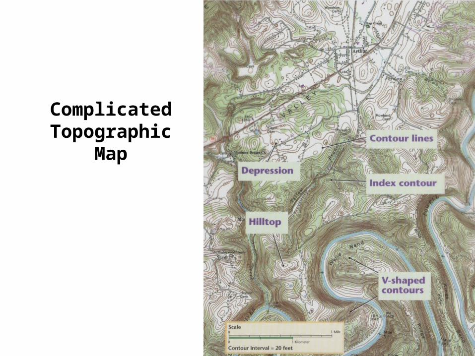
Complicated Topographic Map
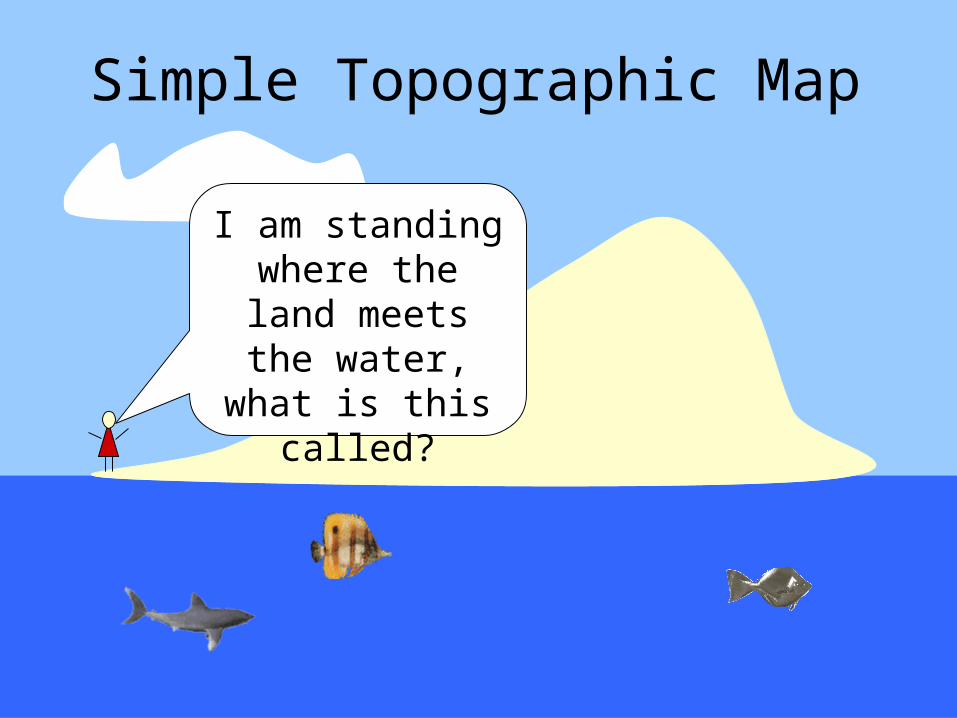
Simple Topographic Map
I am standing where the land
meets the water, what is
this called?
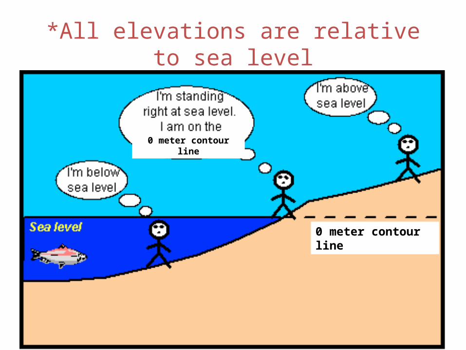
*All elevations are relative to sea level
0 meter contour line
0 meter contour line
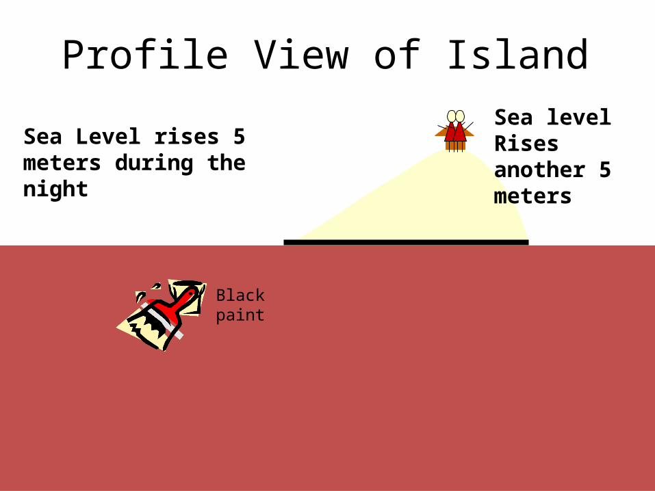
Profile View of Island
Sea Level
0 meters
Sea Level rises 5 meters during the night
Sea level Rises another 5 meters
Black paint
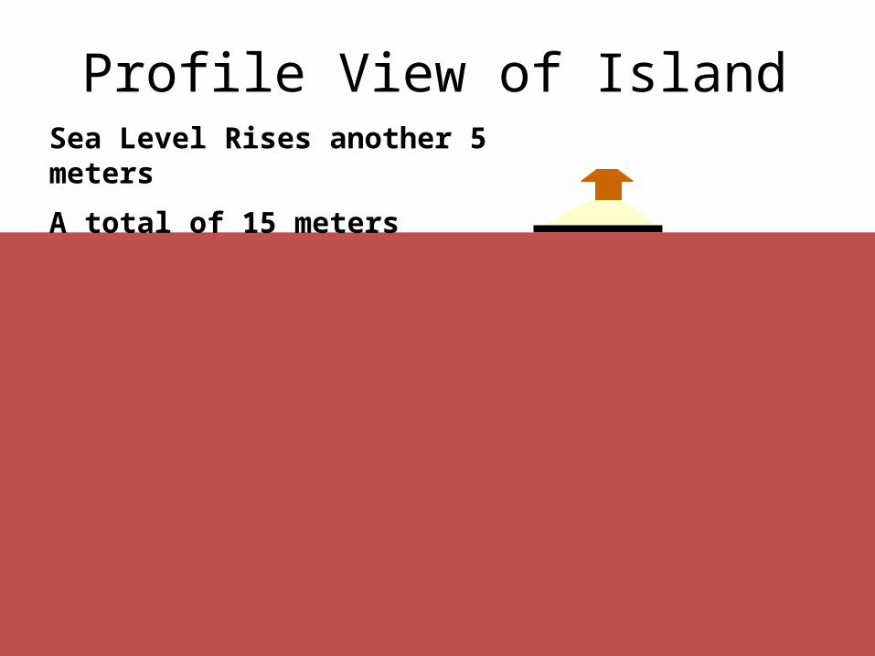
Profile View of Island
0 meters
Sea Level Rises another 5 meters
A total of 15 meters
0 meters
5 meters
10 meters
15 meters
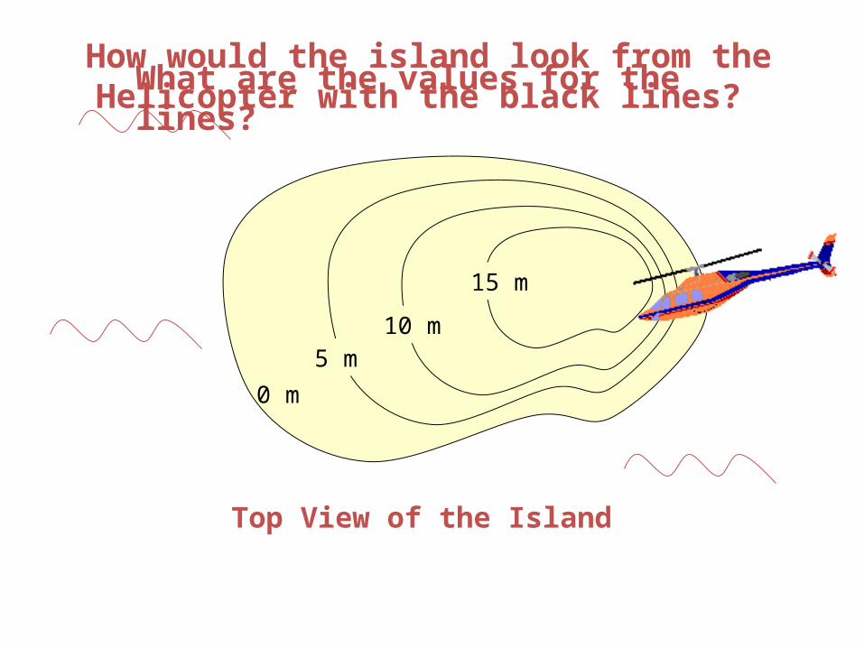
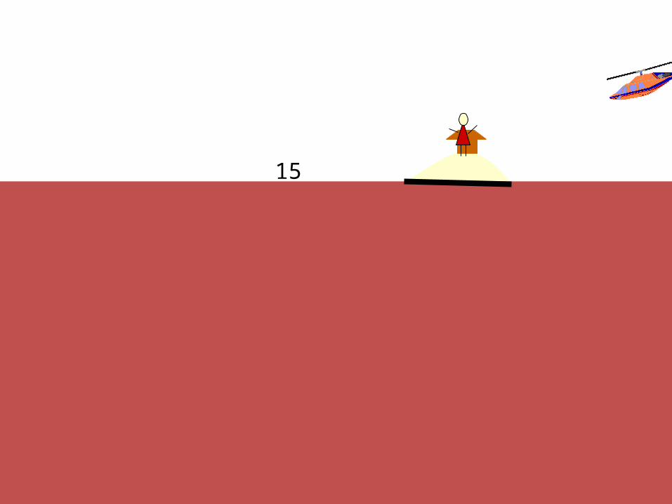
How would the island look from the Helicopter with the black lines?
15 m
0 m
10 m5 m
What are the values for the lines?
Top View of the Island

Contour Line Features
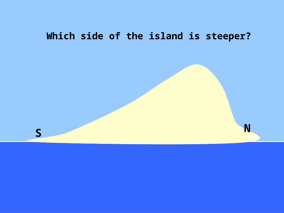
Which side of the island is steeper?
NS
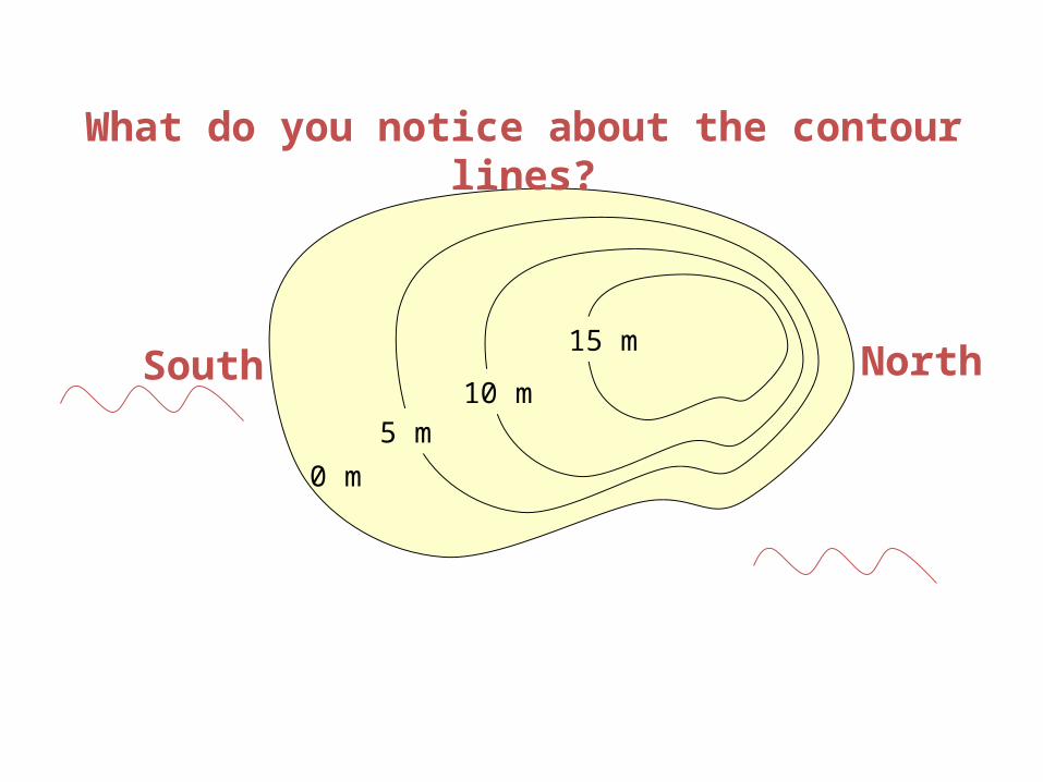
15 m
0 m
10 m5 m
What do you notice about the contour lines?
North
South
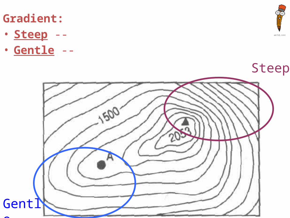
Gradient:• Steep --• Gentle --
Gentle
Steep
15 m
0 m
10 m5 m
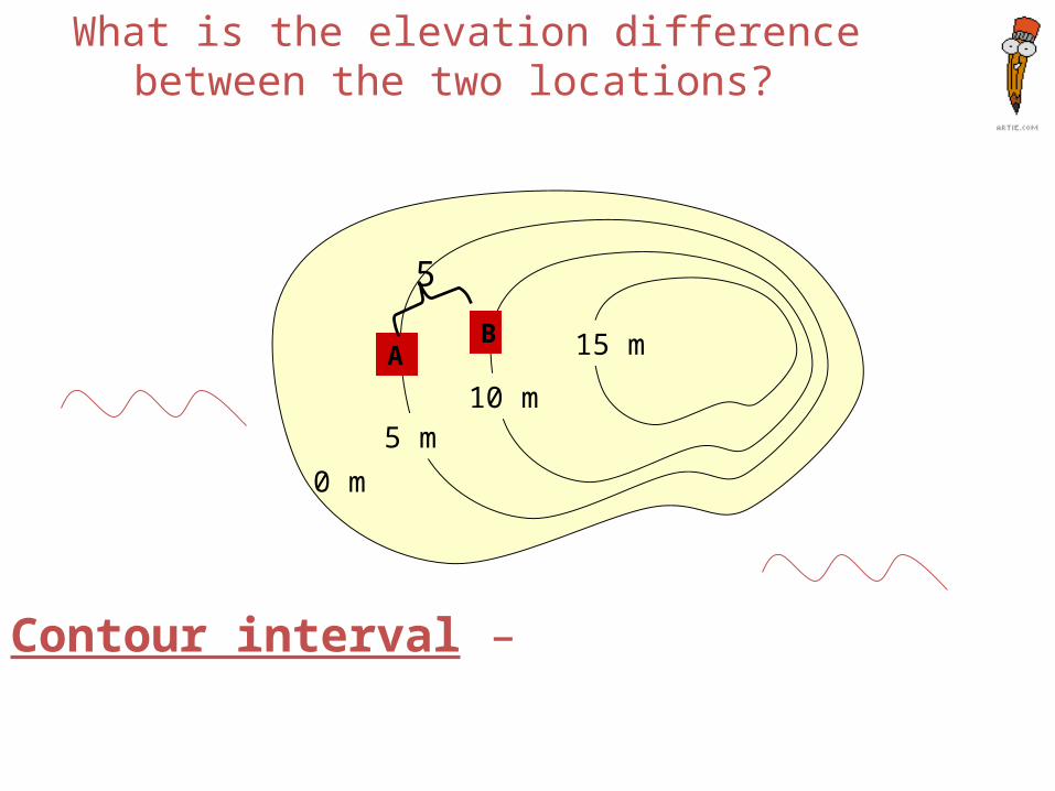
What is the elevation difference between the two locations?
Contour interval –
AB
5
15 m
0 m
10 m5 m
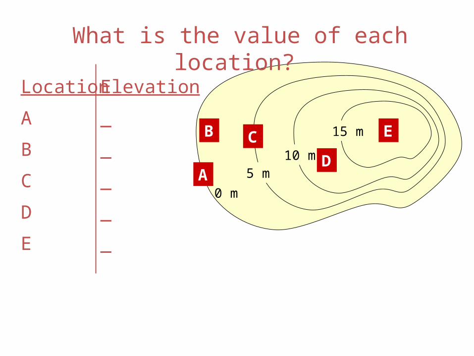
What is the value of each location?
C
A
E
D
B
Location
A
B
C
D
E
Elevation
_
_
_
_
_
Reading Topographic Maps
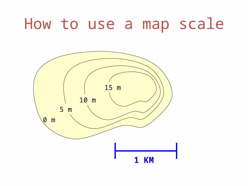
How to use a map scale
15 m
0 m
10 m5 m
1 KM
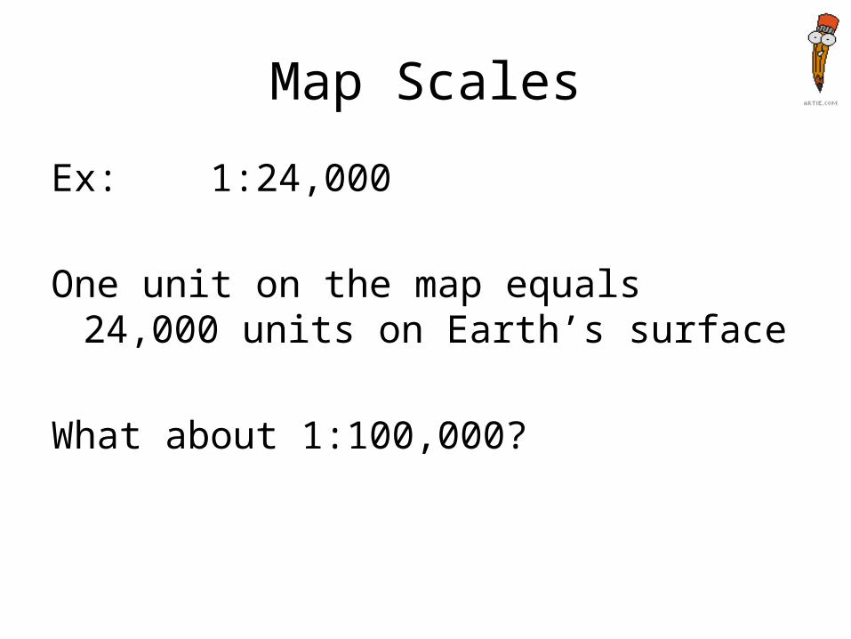
Map Scales
Ex: 1:24,000
One unit on the map equals 24,000 units on Earth’s surface
What about 1:100,000?
Reading Topographic Maps
• Contour lines are not all labeled
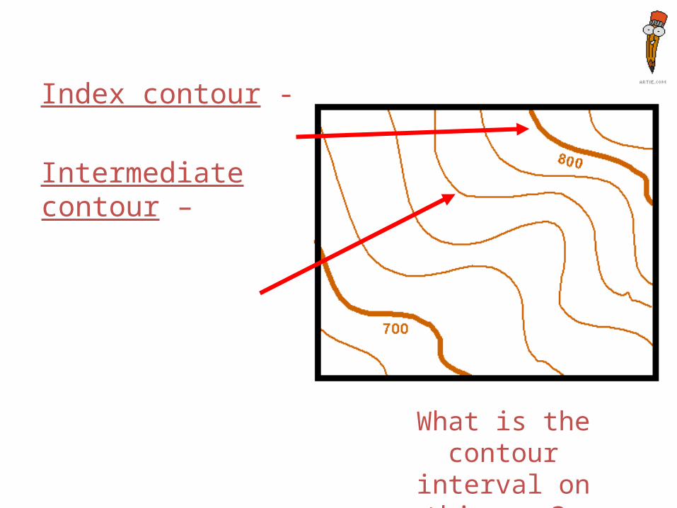
Index contour -
Intermediate contour –
What is the contour interval on this map?
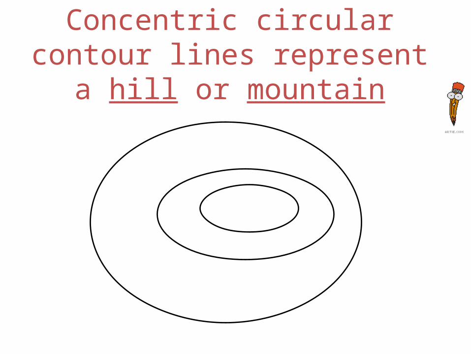
Concentric circular contour lines represent a hill or
mountain
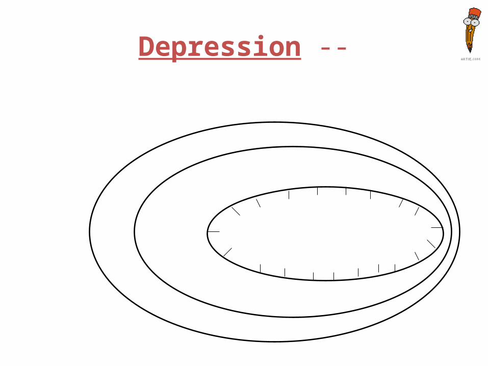
Depression --
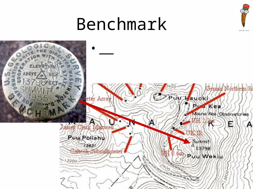
Benchmark • __
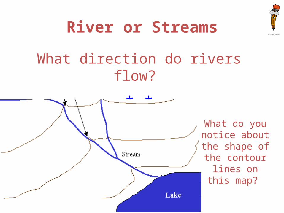
River or Streams
What direction do rivers flow?
*-*
What do you notice about the shape of the contour lines on this
map?
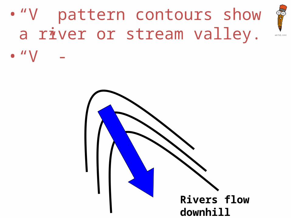
• “V” pattern contours show a river or stream valley. • “V” -
Rivers flow downhill
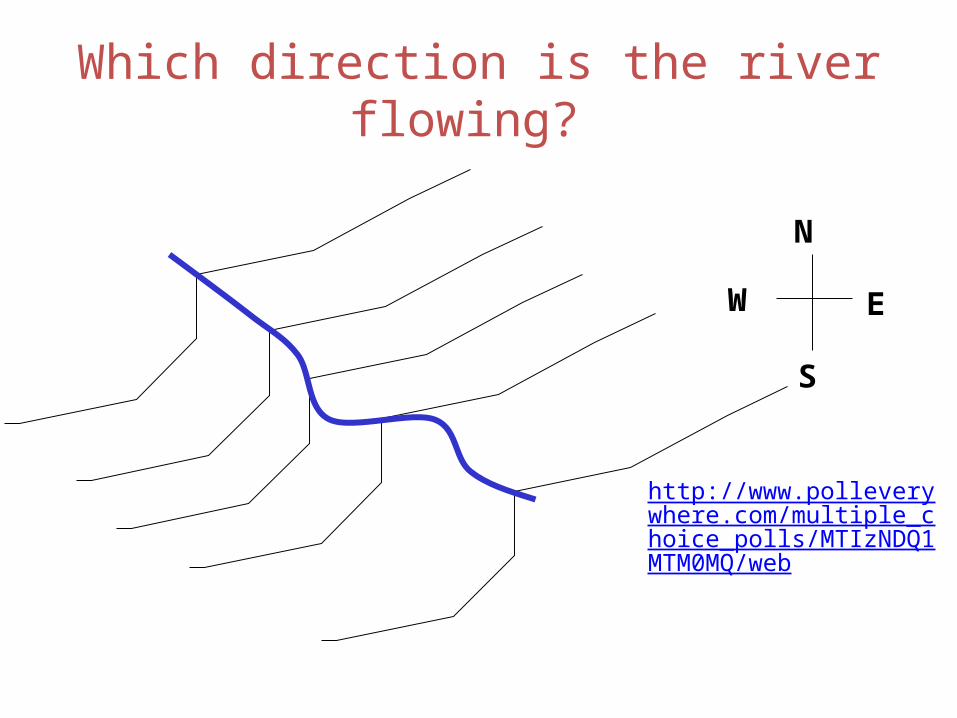
Which direction is the river flowing?
EW
N
S
http://www.polleverywhere.com/multiple_choice_polls/MTIzNDQ1MTM0MQ/web