tonga: climate resilience sector project · iee will be further enhanced through the development an...
TRANSCRIPT

Climate Resilience Sector Project (RRP TON 46351-002)
Initial Environmental Examination
TONGA: Climate Resilience Sector Project
Sub-project: Hahake Foreshore Protection Pilot
Engineering design and construction of hard and soft coastal protection measures along 8 km of coastline
from Nukuleka to Manuka
Prepared by the Ministry of Land, Environment, Climate Change and Natural Resources, Kingdom of Tonga, the Coordinating Implementing Agency for the
Asian Development Bank (ADB) This Initial Environmental Examination is a document of the Kingdom of Tonga. The views expressed herein do not necessarily represent those of ADB‘s Board of Directors, Management, or staff, and may be preliminary in nature.

Climate Resilience Sector Project (RRP TON 46351-002)
ABBREVIATIONS
ADB Asian Development Bank BOD Biochemical Oxygen Demand CBD Central Business District of Nuku’alofa City CBU Coastal Behaviour Unit DoE Department of Environment EAC Environment Assessment Committee EIA Environmental Impact Assessment EMP Environment Management Plan EMMP Environmental Management and Monitoring Plan EIA Environment Impact Assessment GCCA Global Climate Change Alliance GOT Government of Tonga IEE Initial Environment Examination JNAP Tonga Joint National Action Plan for Climate Change and
Disaster Risk Management Km Kilometre MLECCNR Ministry of Lands, Environment, Climate Change and Natural
Resources MOI Ministry of Infrastructure MOH Ministry of Health Msl Mean sea level M Metre MLSNRE Ministry of Lands, Survey, Natural resources and Environment NIIP National Infrastructure Investment Plan PM Project Manager PMU Project Management Unit CRSP Climate Resilience Sector Project

Climate Resilience Sector Project (RRP TON 46351-002)
Table of Contents
A. INTRODUCTION 1
B. Description of Sub-Project 2
I. Type of project 2
II. Project Category 3
III. Need for the project 3
IV. Consideration of alternatives 4
V. Location 5
VI. Size of operation 7
VII. Proposed schedule for Hahake Coastal Protection Project 7
VIII. Description of the proposed interventions (activities) 8
Intervention Monitoring and Evaluation: A description ...................................................... 21
C. DESCRIPTION OF THE ENVIRONMENT 22
I. Physical Resources 22
II. Ecological Resources 28
III. Economic Development: 36
IV. Social and Cultural Resources 37
D. Screening of Potential Environmental Impacts and Mitigation Measures 40
I. Impacts related to siting 40
II. Impacts related to construction 41
III. Impacts related to operation 44
E. Institutional Requirements and Environmental Monitoring Plan 47
F. Public Consultation and Information Disclosure 56
G. Findings and Recommendations 57
H. Conclusions 57
I. References 59

2
Table of Figures
Figure 1: Proposed location of interventions - Hahake Coastal Sub-project ................................ 3
Figure 2: Map of Tonga showing the island of Tongatapu (CTL, 2012a) ...................................... 5
Figure 3: Location of study site on the island of Tongatapu (CTL, 2012a) ................................... 6
Figure 4: Proposed locations for Sub-project interventions .......................................................... 6
Figure 5: Coastal Management Units as proposed in the CTL Study (CTL, 2012a) ..................... 8
Figure 6: Proposed location of rock gabion - Nukuleka................................................................. 9
Figure 7: Proposed gabion design................................................................................................. 9
Figure 8: Proposed location for groynes and sand replenishment .............................................. 11
Figure 9: "Sedi-tunnel" unit orientation operations to alter and experiment with finding the optimum littoral drift rate and groyne bay sediment volumes amounts ....................................... 12
Figure 10: Design criteria for each "Sedi-Tunnel unit" ................................................................ 12
Figure 11: Modular unit design of the 'Sedi-tunnel" groyne approach ........................................ 12
Figure 12: Sediment sources to the south of Whitehouse Point (intertidal and offshore) ........... 13
Figure 13: Potential long-term sources of sand ........................................................................... 14
Figure 14: Proposed location for coastal protection between Navutoka and Manuka villages ... 15
Figure 15: Low laying coast inward of Manuka ........................................................................... 15
Figure 16: Options appraised by CTL for road protection between Manuka and Navutoka ....... 16
Figure 17: Additional option for road protection between Manuka and Navutoka (Ministry of Infrastructure) .............................................................................................................................. 16
Figure 18: Failed seawall looking west to Manuka (left) and mangrove stands behind failed seawall ......................................................................................................................................... 18
Figure 19: Proposed intervention for seawall rehabilitation and mangrove panting and rehabilitation ................................................................................................................................ 19
Figure 20: Narrow location of "Green buffer" .............................................................................. 20
Figure 21: Example of how "Sedi-Tunnel" could be used to protect young mangroves ............. 20
Figure 22: Topography of the study area: Highlighting the low lying coastal area ...................... 22
Figure 23: Map of project location with three coastal orientations identified ............................... 23
Figure 24: Wave height rose (top left), wave period rose for offshore northeastern Tongatapu (Mead 2013a). ............................................................................................................................. 24
Figure 25: Underwater volcanic eruption 10km north-east of Nuku’alofa, 18th March2009 ..... 25
Figure 26: Windrose as recorded at Tongatapu airport (Geocare et al, 2012) ........................... 26
Figure 27: Historic inundation and expected maximum inundation in Eastern Tongatapu (CTL, 2012a) .......................................................................................................................................... 27
Figure 28: Conductivity of groundwater in Tongatapu................................................................. 27
Figure 29: Well and borehole data from study site ...................................................................... 28
Figure 30: The study site to the east (RHS) with the Fanga’uta Lagoon to the west (LHS) ....... 29
Figure 31: Habitat Survey sites as indicated in the EIA report (Geocare et al, 2012) ................. 29
Figure 32: Adopted Zoning Plan for the Fanga’uta Lagoon ........................................................ 35
Figure 33: Zoning adopted in Fanga’uta Lagoon Environmental Management Plan .................. 35
Figure 34: Location of lapita archeological site south of Nukuleka ............................................ 39
Figure 35: Location of archeological site. Proposed works are on the sandy coast to north-west ..................................................................................................................................................... 39

Climate Resilience Sector Project (RRP TON 46351-002)
A. INTRODUCTION
1. The Government of Tonga (GOT) has received assistance from the Climate Investment Fund for the Pilot Program on Climate Resilience through the Asian Development Bank (ADB) to support national initiatives and priorities in strengthening resilience to climate change adaptation. This program is referred to as the Strategic Program for Climate Resilience (SPCR) for the Kingdom of Tonga.
2. The SPCR for Tonga proposes to support a number of investments identified in the Joint National Action Plan on Climate Change Adaption and Disaster Risk Management (JNAP) and the National Infrastructure Investment Plan (NIIP) pilot approaches to pilot approaches to enhance climate change resilience.
3. The JNAP Activity 3.2 calls for Design site specific forms of coastal protection. In response the JNAP Secretariat engaged a consultant that outlined options for the protection and management of the coastal areas in the Eastern Tongatapu (CTL 2012a). This study resulted in a series of proposed for 5 investments in coastal infrastructure along the 8 kilometres of the Hahake (Eastern Tongatapu) coastline.
4. The overall aim of the Sub- project is to undertake shoreline protection using both hard and soft measures to protect the road and other related coastal infrastructure. Five separate interventions have been selected from the priorities identified in the above study to be supported by the SPCR. In addition, a comprehensive monitoring and evaluation methodology is proposed to guide and monitoring the effectiveness of investments. These interventions include rehabilitation of seawalls, construction of sea walls, installation of groynes and the planting of mangroves for shoreline protection and stabilization.
5. This report presents an Initial Environment Examination (IEE) of the proposed Sub-project Hahake Coast Protection: Engineering, design and construction of hard and soft protection along 8 km of coastline from Nukuleka to enhance resilience to climate change.
6. A draft Environmental Impact Assessment (EIA) was prepared by the Ministry of Lands, Environment and Natural Resources in June 2012 (Geocare et al, 2012). The draft EIA has been reviewed and key findings are incorporated into this IEE. In addition, the IEE is informed by additional studies for a more detailed design of the coastal infrastructure in the area (Meade et al, 2013a, 2013b, and 2013c).
7. This IEE is based on site visits, a review of secondary sources of information and review of the various design reports. Consultations were held with local communities during the EIA process in 2012. While environmental management aspects of the construction process have been an important part of the analysis, additional emphasis is placed on the longer term changes in the coastal line and related coastal processes and a comprehensive monitoring and evaluation process is recommended to ensure lessons learnt from these investments are incorporated into planning for adaptation to climate change both at the site, but also in other locations in Tonga.
8. Potential environmental impacts through siting, construction, and operations have been examined and mitigation strategies developed to ensure that minimization of environmental impacts. These measures and recommendations contained in this IEE will be further enhanced through the development an Environmental Management and Monitoring Plan (EMMP) that will need to be developed in conjunction with the detailed designs for each of the interventions.
9. In addition, the Global Climate Change Alliance: Pacific Small Island States (GCCA:PSIS) project, funded by EU through the Secretariat of the Pacific Community,

2
has allocated Euro500,000 for shore protection on this coast, with the funds to be expended by the end of 2014. A Consultant has very recently started assessing an appropriate project for SPC and a draft report is currently under consideration. This report proposes the provision of support by the GCCA-SPC project to undertake a modified design of the works proposed in Intervention 2 and 4 as outlined in this document. This IEE is based on the proposals outlined in the various reports of CTL (CTL, 2102a and CTL, 2012b) and note from the SPCR design team. It is important to clarify which agencies will fund each of the proposed interventions. It is further recommended that a holistic approach is adopted to the monitoring and evaluation of interventions in the project sites within the Eastern Tongatapu coastal area.
B. Description of Sub-Project
I. Type of project
10. The Sub-project will consist of hard and soft infrastructure interventions to protect the coastline and manage coastal erosion in selected sites on the 8 km of the Hahake (Eastern Tongatapu) coastline. It will also seek to build coastal monitoring and evaluation capacity within the Government of Tonga and undertake specific monitoring of the sub-project interventions. There are two sets of inventions as under this sub-project. These are:
a. Undertaking monitoring and evaluation of the Hahake Coastline to build capacity for shoreline management and protection in Tonga;and
b. Five interventions to protect and manage coastal erosion in the Hahake coastline. These are described in the table below:
11. The location of the proposed interventions are outlined in Figure 1 below (see key above for project sites)
Intervention Key (see Key Plan
below)
Affected Villages
Management Approach
CTL Report
Ref
Length (m)
Engineering Intervention
Estimated Cost US$
1 RGC Nukuleka Addressing Surge Impacts (Hard Structures)
3.3 600 Rock gabion construction
334,000
2 BRG Makaunga & Talafoa
Addressing Sediment Volumes (Soft Structures)
2.3 930 Beach recycling, groyne placement
140,000
3 HSW Navutoka Addressing Wave Impacts (Hard Structures)
4.4.2 320 Sea wall* 371,000
4 CRR Manuka Addressing Wave Impacts (Hard Structures)
4.4.2 550 Coral rock revetment
528,000
5 MR Manuka Addressing Wave Impacts (Soft Structures)
4.4.1 350 Mangrove rehabilitation with SediTunnel Units
325,000
Total 1,698,000

3
Figure 1: Proposed location of interventions - Hahake Coastal Sub-project
II. Project Category
12. This Sub-project is categorised as Environmental Category B in accordance with Environment Assessment Guidelines. Category B requires the production of an Initial Environmental Examination (IEE) for the Sub-project as it may have some impact on patches of mangroves, sandy beaches, the coastal environment and coastal processes. However, the restrictions, mitigation measures and monitoring requirements recommended in this report are likely to ensure that the environmental impacts of the works proposed by the project will not be significant.
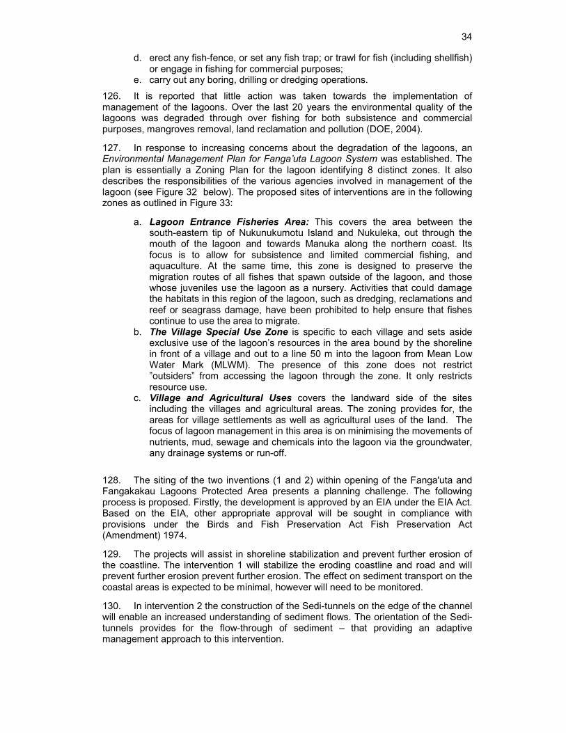
III. Need for the project
13. The shoreline on the eastern side of Tongatapu Island in the area of Nukuleka, Manuka, and Kolonga is part of lowest and most exposed areas on the island. This area has been subject to coastal erosion over the last 20 years.
14. The coastal land is partially protected by a road on low embankment along the shoreline, but the road embankment is being damaged by wave and storm surge events. It is reported that the current road is overtopped on average 3 or 4 times a year. However, whilst in the north of the study site overtopping is predominantly by waves, in the south of the site (e.g. Nukuleka) overtopping is reported to be caused by storm surges. All villages reported that flooding was an issue and that in some areas the road was a barrier to flood water drainage whether the flooding is caused by sea inundation or rain. There is no provision of drainage across the road, except one culvert at Nukuleka. All villages reported that improvements to land drainage and coastal protection were important issues for their future security.
15. In some locations, sand mining of beaches has reduced beach height and removed sediment from the system faster than it can be replenished. In addition, the ability of the system to generate sediments has been severely compromised by a significant reduction in the environmental quality of the reef environment, which is probably linked to high nutrient levels draining from the Fanga’uta coastal lagoon, diffuse source pollution and overfishing.

4
16. Failure to understand the dynamics of coastal processes has meant that attempts to put in place coastal protection have not yet led to sustainable long-term outcomes. There is still a lack of clear understanding of the coastal processes in the area. The Sub-project will seek to address this issue.
17. The JNAP identified the Design site specific forms of coastal protection as a priority activity (Activity 3.2). The JNAP Secretariat engaged a consultant, CTL, to undertake feasibility studies on the protection of the coastal road (CTL, 2012a; CTL 2012b) and identified proposed engineering interventions to prevent further coastal erosion and sea inundation on selected coastlines from Nukuleka to Manuka, on eastern side of Tongatapu. The report by the consultant presents an understanding of coastal morphology and evolution, hydrodynamics and sediment budget operating on the eastern side of Tongatpau, with particular reference to the coastal area between Nukuleka and Kolonga and surrounds. It provides a general review of the conditions of the inter-tidal, supra-littoral and sub-littoral areas of the site, concentrating on physical, oceanographic and ecological conditions (CTL, 2012a; CTL, 2012b).
18. The CTL study proposes a number of short term (0 – 5 yrs) and longer (5 – 20 yrs) term actions and alternatives for further model testing, piloting coastal protection approaches and investment in coastal protection (CTL 2012a, CTL 2012b). These studies resulted in a number of individual investment proposals in coastal protection and management to help reduce the coastal erosion and sand loss problems along the 8 kilometres of the Hahake coastline.
19. The reports provided by CTL have been considered by the Government of Tonga and the PPTA team and interventions for shoreline protection are proposed (see TA-8307: PPTA for Strategic Program on Climate Resilience- Appendix 3.14 Component 3 Sub-Projects - 2: Hahake Coast Protection). These proposed actions range from construction and rehabilitation of seawalls, through to installation of small-scale groynes, planting of mangroves and relocation of beach sand along the foreshore. The interventions proposed in this sub-project are based on the CTL studies and in some instances have been modified to meet the requests from the Government of Tonga. Each of the proposed interventions is described in more detail below.
IV. Consideration of alternatives
a) Alternatives to the project
20. With concerns to the long-term viability of the coastal villages, an alternative proposed in the EIA (Geocare et al, 2012) was to shift infrastructure inland, i.e. road, power and telephone lines as a possible alternative to relocation of the communities. However, both alternatives are likely to cause more hardship to communities. Furthermore there will be major issues on; land tenures, relocation and compensation costs and social impacts on people’s livelihood. The road has only recently been completed with support from the Chinese Government and consideration of relocation at this stage is an unlikely proposition. Secondly, the road is acting as a shoreline protection for a substantial area of the coastline and strengthening of this infrastructure would be ensure short to medium-term benefits.
21. An additional alternative identified in the EIA was the construction of a rock revetment along the entire coastline with a length ranging from 5.5 -8.0 kilometres. This may provide a long-term stable outcome although the environmental consequences have not been considered in detail. It is recognised that this may cause a loss of sand along the coastline. The cost estimates are in the range of US$8 million and are considered beyond the scope of the SPCR.
22. The EIA identifies a community preference for a full seawall solution along the whole coast. It is likely therefore that some further engagement with the community will

5
be needed to introduce the proposed works as a pilot stage for developing long-term solutions to the problems of erosion, both on this coast and elsewhere in Tonga with similar coastal situations.
b) Alternatives within the project
23. In determining designs of the various interventions consideration was given to various design alternatives. These alternatives considered the relative merits of the various options for coastal protection measures, for example relacing gabion baskets with rock revetments. These are outlined in the description of the proposed interventions.
c) The “no project” alternative
24. This alternative assumes that no financial assistance can be sourced for the proposed actions and coastal erosion is allowed to continue. Most of the coastal areas of the 5 communities are low lying with two areas in Manuka and Navutoka are exceptionally low and are regularly inundated, and the edge of the coastal road is eroding. This road provides the main lifeline for the communities on this coastline in term of travelling to capital Nuku’alofa, escape route from tsunamis, health services, banks, markets, police assistance, and supplies. The continued erosion and subsequent failure of this important transport corridor will have an immense impact on local people’s livelihood.
V. Location
25. The study location is on the island of Tongatapu, the largest island in the Tonga group (Figure 2).
Figure 2: Map of Tonga showing the island of Tongatapu (CTL, 2012a)

6
26. The site of the proposed interventions is on the Eastern part of Tongatapu Island, on the coastline that extends from Nukuleka in the south-west to the east past the village of Kolonga (Figure 3).
Figure 3: Location of study site on the island of Tongatapu (CTL, 2012a)
27. The coastal communities close to the proposed interventions are Nukuleka, Makaunga, Talafo’ou, Navutoka, Manuka and Kolonga, situated on the northern coastline of the eastern side of Tongatapu (Figure 3 and Figure 4). The villages frontages are less than 2m above sea level rendering them highly vulnerable to the impacts of climate change, disaster risks, including tsunamis, sea level rise, storm surge and coastal erosion. The location of the 5 proposed interventions are indicated in the figure below.
Figure 4: Proposed locations for Sub-project interventions

7
VI. Size of operation
28. The proposed interventions will be in 5 locations on the Hahake coastline. In total, they will cover a length of coastline approximately 2.75 km. Specific lengths of the various individual interventions range from 320 metres to 930 meters. The locations and the length of coastal interventions are outlined in the table below.
Key (see Key Plan
below)
Affected Villages
Management Approach Length (m)
Engineering Intervention
RGC Nukuleka Addressing Surge Impacts (Hard Structures)
600 Rock gabion construction
BRG Makaunga & Talafoa
Addressing Sediment Volumes (Soft Structures)
930 Beach recycling, groyne placement
HSW Navutoka Addressing Wave Impacts (Hard Structures)
320 Sea wall*
CRR Manuka Addressing Wave Impacts (Hard Structures)
550 Coral rock revetment
MR Manuka Addressing Wave Impacts (Soft Structures)
350 Mangrove rehabilitation with SediTunnel Units
Total
29. The monitoring and evaluation component will take place along the whole 8 km of the coastline in all areas affected by the coastal works.
VII. Proposed schedule for Hahake Coastal Protection Project
30. The Hahake Coastal Protection Subproject is proposed to be implemented over 3.5 years. The proposed timetable for the implementation of the proposed interventions is detailed in the timetable below. The monitoring program should be initiated in 2013, with design undertaken in Q1, 2014. Construction will commence in Q3 of 2014. In addition, it is recognized the Secretariat for the Pacific Community through the GCCA project is also undertaking project design to finance and implement some elements of the proposed interventions. The timetable outlined below takes into consideration the timing of these activities.
2013 2014 2015 2016
Q3
Q4
Q1
Q2
Q3
Q4
Q1
Q2
Q3
Q4
Q1
Q2
Q3
Q3
Q4
Monitoring SPC Project ADB TA8307 TON
PPTA
Long Term Consultant
Design SPC Project completed June
2013
ADB Project Procurement

8
2013 2014 2015 2016
Q3
Q4
Q1
Q2
Q3
Q4
Q1
Q2
Q3
Q4
Q1
Q2
Q3
Q3
Q4
SPC Project ADB Project Construction SPC Project ADB Project
VIII. Description of the proposed interventions (activities)
31. The purpose of the proposed interventions is to protect the coastline of five (5) coastal communities with five engineering solutions. The low topography along this part of the coastline allows coastal erosion to threaten infrastructure and properties The project site is about 26kms by road to the east of the capital Nuku’alofa.
32. This coastline has three main orientations identified as Coastal Behaviour Units (CBUs) for the purposes of the study. These coastal behavior units are presented in Figure 5 below. The coast is influenced mainly by the south-easterly trade winds, similar to most part of the island, with occasional cyclones passing through the area - often from the north-westerly direction. In addition, CBU – C is at mouth of the lagoon with much of the coastal processes related to water flows in and out of the lagoon.
Figure 5: Coastal Management Units as proposed in the CTL Study (CTL, 2012a)
Intervention 1: Rock Gabon wall to address surge impacts – Nukuleka Village - 600 meters (Key RGC)
33. The location of the proposed intervention (as displayed in Figure 1) is set out in detail in Figure 6. The engineering approach involves the creation of a 600m rock gabion defence extending from the southern limit of the existing coastal road (south of

9
34. Nukuleka) northwards to the limits of the village (Phase 1). Should the technique prove a success, an extension of this scheme northwards to the road junction is proposed.
35. Construction: A 600m length of rock gabion wall is proposed. This is to be constructed as a “stack” of 2 or possibly 3 baskets made from wire mesh (each of different sizes and containing different size limestone rock boulders/clasts). A gabion mattress will also be placed underneath the structure to a depth anticipated to be below the depth of scour to counter any lagoon current erosion impacts (see Figure 7). A geotextile membrane is also to be placed behind the wall structure.
Figure 7: Proposed gabion design
36. For this site, it is not recommended to construct a vertical faced wall as gabions are a flexible structure and construction movement can occur during backfilling, which may give the appearance of the wall leaning forward. Therefore, it is proposed that the gabion wall is designed to be inclined at circa 6 degrees from the vertical. This
Figure 6: Proposed location of rock gabion - Nukuleka

10
inclination improves stability and overcomes the potential of the wall visually looking as if it is leaning forward. It is proposed that a gabion basket of the following dimensions is constructed: 2m (width) x 1 m (length) x 1m (height).
37. Assuming a 600m length of gabion wall, this means that up to 600 gabion mattress will be required (i.e. 2 “stacked” gabion baskets). For strength and stability, the baskets will need to be tied together at top, bottom and sides by PVC tie wires which are cut from coils of wire supplied at 10 per cent of the gabions weight.
38. Rock Type to fill Gabions - All rock fill will be limestone from local quarries. The material should be tightly packed to minimize voids and the rockfill on the lagoon exposed “face” of the gabion. It needs to be hand packed to ensure it is robust. It is recommended that larger boulders/ clasts (circa 12-18 inch diameter) are used in the base basket with smaller boulders/clasts (circa 6 inch diameter) in the upper basket. This is reflected in the cross section of the scheme.
39. Gabion Mattresses - Most commonly, gabion mattresses are often made of the following size dimensions: 3m (wide) x 2m (long) x 0.3m (thick); Assuming a 600m length of gabion wall, this means that up to 200 gabion mattress will be required.
Intervention 2: Groyne and sand replenishment - Makaunga & Talafo’ou villages- Addressing Sediment Volumes- 930 meters (Key BRG)
40. This part of the coastline is characteristic of a sediment starved shoreline with very narrow beaches. Sand replenishment is proposed as a preferred option for this coastline for the short to medium term, to help address the issue of depleted sediment volumes in front of key vulnerable coastal communities in the study area. This approach involves placement of sediment trap structures supported by a concrete base on the sediment starved shoreline areas and the placement of additional sand to help increase volumes of beach sand and build beach. This in turn would offer an improved natural protection to coastal communities and existing infrastructure.
41. The approach is recommended as a cost effective short term (potentially long term) solution, though it can only be applied to areas where there is a clear understanding of sediment processes and budgets. The approach does not prevent erosion or short term fluctuations in beach profile however, it can be designed to “act with nature” and can be easily adapted to accommodate changing fluctuations in sediment transport rates or when new improved baseline data becomes available through the beach profile monitoring program.
42. The approach is implementable at the local level, uses local materials (constructed locally) and should have the support of the community in the construction, maintenance and monitoring of scheme performance. Community involvement will be important in ensuring the longer term success of the project.
43. The location of the proposed intervention (as outlined in Figure 1) is set out in detail in Figure 8. The engineering approach involves cycling beach material from Geomorphological Unit C1 (Whitehouse Point southwards) and moving material into 3 newly created “groyne bays” that are formed through the introduction of 4 concrete “Sedi-Tunnel” groynes. The approach is outlined below.

11
Figure 8: Proposed location for groynes and sand replenishment
44. The engineering approach is to combine sediment recycling with the construction of innovative concrete “unit” groynes (“Sedi-Tunnel groynes”) to help maintain sediment dynamics and to create sand filled groyne bays in front of vulnerable areas. This approach is innovative and unique to Tonga.
45. Each groyne is initially calculated to be up to 10m in length (see Figure 9). This comprises of up to 10 “Sedi-tunnel” units (each unit being circa 10m in length). Each unit shall rest on a purposely designed base unit about 5m lengths to facilitate ease of transport and to enable the modular concept of the “sedi-tunnel” to adapt to local situations through monitoring results.
46. With each unit being placed on a specific 1.2m wide concrete base (which may be buried 30cm beneath the beach surface on first installation), the opportunity to re-orientate each unit by 90 degrees is presented in the design (see Figure 9). This will enable different rates of littoral drift to be experienced through the groyne structure and makes the approach more environmentally friendly than any other design of groyne (timber or rock structures are designed to block 100% of sediment movement between groyne bays).
47. Figure 10 and 11 below displays the design criteria for each “Sedi-Tunnel” unit. Each unit is pre-cast locally and made of a re-enforced concrete mix. The design life of each unit (when exposed to salt water and encrusted with algae and marine crustaceans) is estimated to be circa 5 years. As a result, continued maintenance and “ownership” of such a scheme by the local communities of Makaunga and Talafo’ou is needed to ensure the scheme is a success and that unit replacements can be planned for the future.

12
Figure 9: "Sedi-tunnel" unit orientation operations to alter and experiment with finding the optimum littoral drift rate and groyne bay sediment volumes amounts
Figure 10: Design criteria for each "Sedi-Tunnel unit"
Figure 11: Modular unit design of the 'Sedi-tunnel" groyne approach

13
48. A readily available supply of sediment for this re-nourishment can be sourced from sediment moving from Geomorphological Unit B2 (in Coastal Behaviour Unit B), around Whitehouse Point to Geomorphological Unit C1 to assist in providing additional to sediment and beach profiling re-design.
49. It is proposed that accreted beach sands from Unit C1 are used to supplement each newly created groyne bay (Figure 12). Sand movement from source to destination is most likely to be transported by truck (for using sands from the intertidal or backshore area). Each groyne bay is likely to need an additional circa 500m3 of recycled material after a 5 year periods, however, exact amounts will require more field interrogation and be based on evaluation of the monitoring program.
Figure 12: Sediment sources to the south of Whitehouse Point (intertidal and offshore)
50. The engineering approach proposed could adhere to the following procedures:
a. Material will be loaded onto road trucks from the “source” site and transported to the “receiver” site compound and discharged into a temporary stockpile.
b. Excavate from stockpile (circa 25t excavator) and load into 10m3 dump truck;
c. Transport to groyne bay and discharge; d. Spread material to design profile using a dozer; e. Set up monitoring stations to help community record beach change and
other related observations.
51. Figure 13 below shows the potential locations of sediment sources for future supplements to sediment supplies. These are sites North of Atata Island dredge site, “Basin A” and the Fukave Island extraction site. The Atata dredge site is 13.75 km northwest of Nuku’alofa, Basin A is 7.3 km north of Nuku’alofa and the Fukave site 16.3 km to the northeast. All three are within economic distance for recharge projects on Tongatapu. However, any removal of sediment from other locations must be subject to appropriate environmental scrutiny. The requirement for additional sand will not be known until the evaluation of the monitoring has been undertaken on a regular basis.

14
Figure 13: Potential long-term sources of sand
52. Retention and replanting of Coastal Vegetation A key aspect of this intervention approach will be to ensure the impact on coastal vegetation habitat along the backshore of the “supply” areas (within CBU-C, C1) is minimized through retaining coastal vegetation that is known to play a major role in reducing the exposure and impacts of natural hazards in Tonga. Supplementary replanting of coastal vegetation may be required.
53. Monitoring and Maintenance Requirements A robust beach monitoring program will ensure a useful information base. This is because there is currently great uncertainty over littoral drift rates in the area and additional information need to be generated on changes associated with cyclone events and more contemporary coastal processes in the lagoon.
54. The beach monitoring results need to be used to better adapt the design (length and position) of groynes and hence the size of each groyne bay fronting the villages of Talafo’ou and Makaunga.
55. The approach is implementable at the local level and the support of the community towards construction, maintenance and monitoring of scheme performance is likely to be a major benefit to ensure longer term success of the project. Every effort to engage the community, at the start through to the completion of the project, is strongly recommended. A series of training events on shoreline monitoring and structure maintenance programs are recommended to ensure local communities take ownership of the scheme at the outset.
Intervention 3 and 4
Intervention 3: Key HSW – Navutoka village – Sea wall construction to address wave impacts – 320 meters (Key HSW)
Intervention 4: Key CRR – Manuka village – Coral Rock Revetment Addressing Wave Impacts - 550 metres - (Key CRR)
56. A larger scale engineered activity, comprising of the construction of two separate lengths of coastal protection (Intervention 3: Seawall - 320 m; and

15
Intervention 4: Coral rock revetment - 550 m), is proposed as a preferred technique to address the issue of reducing wave impact in front of the vulnerable stretches of Manuka and Navutoka. This approach falls under the “Hard Defence Strategy” Management Approach as identified in the Coastal Feasibility Report (CTI2012a). As a result, the design of the defence may generate down-drift erosion impacts caused by a localised alteration to sediment transport regimes. The location of the proposed intervention (as displayed in Figure 1) is set out in more detail in Figure 14.
Figure 14: Proposed location for coastal protection between Navutoka and Manuka villages
57. Coastal flood inundation rates shall be addressed under these approaches. The topographic nature of the coastal stretch varies, with 2 key “strategic locations” being very low lying. In addition to this, the backing hinterland, landward of the road, is topographically low and any breach to the sea defences and road in this location will result in significant flood inundation behind (as show in Figure 15). As a result of this, the coastal road is important as a defence feature along this frontage and efforts to protect the road from inundation, at strategic low sections is proposed here.
Figure 15: Low laying coast inward of Manuka

16
58. An improved coastal protection structure is proposed along the two “low lying” stretches of road, coupled with the introduction of a wave splash wall to protect the road. CTL proposed three options (see figure 16 below). In addition the Ministry of Infrastructure proposed an alternative structure, used successfully on the shore at Nuku’alofa, which does not make use of gabions (see Figure 17 below).
Figure 16: Options appraised by CTL for road protection between Manuka and Navutoka
Figure 17: Additional option for road protection between Manuka and Navutoka (Ministry of Infrastructure)

17
Proposed structure for intervention 3: Key HSW – Navutoka village – Sea wall construction to address wave impacts – 320 meters (Key HSW)
59. The design proposed in Figure 17 from the Ministry of Infrastructure is therefore recommended be used for 320 metres along to coast, and is proposed to be modified as follows:
a. the artificial beach at the toe is dispensed with, as it is unlikely to be stable. b. The toe of the wall requires erosion protection, and a Reno mattress
introduced c. The rock filter and geotextile filter layer to be extended beneath the rock
armour to tie in to the Reno mattress
60. Overtopping of the wall will occur in extreme events, and therefore protection from damage to the rear of the wall is desirable; a 5m wide planter strip of mangrove is therefore introduced, with a modified soil to suit mangrove establishment. This strip will also provide some control over runoff from flooding, which is believed to be high in nutrients sourced from agricultural fertilisers.
61. Landside Drainage: The coast road generally lies above the level of the inland area; consequently after heavy rainfall, or overtopping by storm surge, the land is subject to flooding which is slow to drain away. The CTL study recommended three culverts, additional to the one constructed at the time of the road construction. The costs of these culverts are included in the rock gabion construction (RGC).
62. Mangrove planting is seen as a useful approach in this option. The adoption of a prepared soil planter zone (as outlined in Intervention 5) will be an innovative approach to be adopted for the seawall section.
Proposed structure for Intervention 4: Key CRR – Navutoka village – Coral Rock Revetment Addressing Wave Impacts - 550 metres - (Key CRR)
63. The proposed option for construction in this section is Option 3 in Figure 16, despite this being the most expensive of the initial three concepts and least environmentally sensitive of these options. The proposed “footprint” of the defence is likely to extend onto the existing intertidal zone. Despite this, it is a robust approach to reducing wave overtopping and flooding along this vulnerable stretches of coast. In addition to the wall, improvements to road drainage (through culverting) are needed on the landward side of the road.
Intervention 3 and 4: Monitoring and maintenance
64. Maintenance costs for these more robust defences (over the two stretches of coast) should prove minimal over the next 10 years. This approach would, however, require upgrading and thus increasing maintenance costs in the longer term (post 15 years). The Government of Tonga needs to be aware of the longer term commitment to defence maintenance and monitoring that may be required after 2025. The technique may also result in downstream erosion impacts which could result in continued beach monitoring and maintenance costs over the next 10 years.
65. Finally, it is also recommended that the Ministry of Infrastructure are invited to a specifically designed “coastal engineering” training course designed and supported by the SPCR. This will have clear “hands on” modules to demonstrate how this technique can be designed, constructed, monitored and maintained

18
Intervention 5: – Manuka village – Soft and hard measures to address Wave Impacts incorporating Mangrove Rehabilitation with SediTunnel Units - 350 meters - (Key MR)
66. This intervention is proposed as a “pilot project” to promote a novel approach of reducing wave energy impacts. This is designed to help defend the existing road between Manuka and Navutoka using “Sedi-tunnels” backed by mangroves. The approach is implementable using local materials and should have the support of the community towards construction, maintenance and monitoring of mangrove growth, which is likely to be a major benefit to ensure longer term success of the activity.
67. The appropriateness of this approach, within this location, is that mangroves are already growing in areas behind a broken seawall despite the area being exposed to high wave energies and that mangroves grow more efficiently in protected more sheltered environments. The presence of mangroves on the northward ocean facing coast of Tongatapu has proven effective in protecting stretches of coast from serious damage during cyclones. For this pilot project, the failed seawall in this area (see Figure 18 ) is proposed to be re-instated along a 350m stretch of shoreline (using locally produced concrete pre-cast “Sedi –Tunnel” blocks) to enable more quiescent conditions to be created behind so that mangrove stands can be established.
Figure 18: Failed seawall looking west to Manuka (left) and mangrove stands behind failed seawall
68. This approach is in-line with the funding agencies (AusAid) desire to trial soft and hard climate resilient strategies to combat sea level rise. This approach has been successful in the area (i.e. natural growth habitat for mangroves) and provides an interesting case-study. The outcome will be to generate a “Green Buffer” area to help combat wave inundation which could be replicated at a larger scale along the whole Coastal Behaviour Unit to help protect the existing coastal road and the village community of Navutoka.
69. The approach is recommended as a low cost short term (potentially long term) solution, though can only be applied to areas where direct wave attack is reduced (through rehabilitation of a structure to reduce wave action).
70. The location of the proposed intervention (as displayed in Figure1) is set out in detail in Figure 19. The engineering approach involves the creation of a 350m pre-cast concrete unit low level walled defence, placed on the existing failed seawall footprint to the east of Manuka village. Should the technique prove highly successful, an extension of this scheme eastwards to provide protection to the existing coastal road is proposed (circa 1km in length).

19
Figure 19: Proposed intervention for seawall rehabilitation and mangrove panting and rehabilitation
71. The reason for this location for the pilot project is twofold:
a. There is an existing seawall “footprint” and so the environmental impact of building a new pre-cast block wall would be minimal;
b. The backing road level is recorded as being one of the lowest along the stretch from Kolonga to Manuka (circa 0.8m to 1m high) and so is more frequently overtopped than most other stretches of road.
72. The engineering approach is to combine a low crested wall construction with mangrove planting. This involves the construction of a 100m low crested concrete “unit” block wall (using “Sedi-Tunnel units” – see Section 2) to allow a reduced degree of wave overtopping and hence encourage sediment deposition within the wetland area between the old seawall and the coastal road. The philosophy behind the concept is that mangroves represent a key natural barrier to reducing wave energy, but in order to encourage mangrove stands to take hold they need to initially be protected from higher wave energies. The reasoning for using pre-cast concrete blocks (instead of a more robust wall structure) is to reduce costs and enable the pilot project to more easily adapt its design depending on changing wind directions or conditions. Securing the stability of the concrete unit wall will be assisted by creating connector “links” between each unit.
73. As displayed in Figure 19, the concrete units shall be located on the “footprint” of the old 1976 seawall. The units shall be linked together to ensure stability, and the void “tunnel” that is created shall be filled with old concrete material collected from the dismantling of the old seawall. This will reduce waste disposal costs and help anchor the blocks to avoid displacement during storms.
74. The wall shall be constructed as displayed in Figure 20 below whilst Figure 21 shows an example of the proposed Green Buffer mangrove planting scheme. It is recommended that the “Sedi-Tunnel” placement could also be configured so that the open faces are facing up and down (“sky to ground”). This way, mangrove seedlings could be planted within the cavity structure and filled with sediment to encourage mangrove growth within the concrete wall unit itself.

20
Figure 20: Narrow location of "Green buffer"
75. The multi-purpose benefit of the “Sedi-Tunnel” concrete unit design is that they can be very easily used to provide immediate shelter to mangrove seedlings within the “green buffer” zone identified in Figure 20. The main challenge of large scale mangrove planting schemes in higher energy environments is creating protection from storm waves and from unpenned pigs. The introduction of “lines” of “Sedi-Tunnel” units could provide the necessary protection to enable mangroves to establish themselves beyond their “sensitive and vulnerable” phase in the first 2 years of growth.
Figure 21: Example of how "Sedi-Tunnel" could be used to protect young mangroves

21
Intervention Monitoring and Evaluation: A description
76. A substantial three-year monitoring and evaluation program over a three year period is proposed. In the initial stage baseline monitoring will be undertaken, and then during and after construction the impacts monitoring. It will include:
• Installation of tide gauge to monitor wave and storm surge heights. • A daily diary of key indicators. • Weekly visual inspections of damage along the whole length, and movement
of groynes • Monthly profiling of beach sections and movement of sand • Monthly inspection of mangrove planting, and remedial planting where
required • Quarterly seawater sampling • Quarterly inspection of reef condition • Quarterly reporting on results of monitoring • Annual inspection by senior specialist, reporting on state of system and
recommendations for any actions to modify the pilot scheme • Development in Year 3 of proposals for further schemes to build on the pilot
scheme • Final Report on the pilot study, at the end of Year 3.
77. The monitoring will be in two parts:
a. Community led daily monitoring. The length can be divided into 100 or 200m lengths, each of which to be included separately in a diary. The involvement of the local schools in this monitoring would be appropriate. The information to be included in the daily report would be
• Wave levels over the previous 24 hours
• Rainfall levels over the previous 24 hours
• Any flooding of the land behind the road
• Any debris washed onto the road
• Any other comments
b. Technical monitoring, set up by the senior specialist, and including the remainder of the activities identified above.
78. The sum of US$100,000 has been included for monitoring equipment, consisting of:
a. 1 static sea-state monitoring unit including remote comms and installation b. 1 current meter c. 1 beach profiling system

22
C. DESCRIPTION OF THE ENVIRONMENT
I. Physical Resources
a) Topography and Soils
79. Tongatapu’s topography is flat with the highest elevation approximately 65m above sea level. The island gradually rises to the south east, whilst it dips to sea level in the north east and in the lagoons and the Nuku’alofa area. The island sits on volcanic and sedimentary rocks which are overlain by raised reef limestone.
80. The study area demonstrates this effect with its highest coastline at Kolonga on the east and lowest point towards Nukuleka in the west. The coastline of the study area consists of a low lying and narrow coastal plain to the west and gradually rising to the east, towards uplifted limestone of mid Miocene age at Kolonga. Most of the coast in the study site is below 2 m above sea level and are mostly flat with no rivers or streams (Figure 22 below). On the south-western side, the topography is mainly flat and the backshore area contains mangroves and associated lagoon assemblages.
Figure 22: Topography of the study area: Highlighting the low lying coastal area
81. The coastline in the study area can be sub divided into three sections with different orientations – see Figure 23 over page (CTL, 2012a, Geocare et al, 2012) . The coastline from Kolonga village to eastern margin of Manuka (A) is generally facing northeast while the coastline from Manuka to Niutao Point (B) is facing northwest and the section from Niutao Point to Nukuleka village (C) is facing westward (Figure 23) . This division is also recognized by the CTL report as it is referred to as 3 Coastal Behaviour Units (CBUs). These coastal orientations are believed to have different influences in relation to the littoral dynamics along this coastline.

23
Figure 23: Map of project location with three coastal orientations identified
b) Coastal processes
Coastal erosion
82. From reviewing aerial photography and through consultations with local communities, it is estimated that the coast has been subject to coastal erosion of up to 50m to 70m since the 1960s in some locations. In some sites erosion has been prevented by the coastal road, which is preventing further erosion and is acting as a sea wall. Although lenghts of the road were upgraded in 2011- the road remains under threat and more recent storms and coastal surges have uprooted trees whose root systems have been undermined by continuing erosional pressures. Attempts have been made in places to arrest erosion pressures, but these have been unsuccessful.
83. A review of coastal processes and erosion was undertaken by CTL (2012a) and Mead et al (2013b). They concluded:
a. Niutao Point to Nukuleka village (CBU –C) is influenced by the channel connecting the lagoons. Currents in and out of the lagoon with velocities up to 1.1 metres/second (Geocare, 2012). There are no detailed hydrodynamic models or sediment transport models for this area. Observations on the coastal erosion are provided by Mead et al, (2013a);
b. Nukuleka – estimated to have had erosion in the range of 20-30 metres and the loss of a mangrove fringe in the last 40 years (as reported by local people in Meade et al, 2013b) – Intervention 1;
c. Between Nukuleka and Makaunga/Talafo’ou villages, there is little evidence of change between 1968 and 2011 – Intervention 2;
d. Whitehouse Point (Nuitao point) to Manuka (CBU-B) proposed to be a westward flow of sediment (CTL 2012a);
e. Navutoka - The beach has retreated between 10 and 20 m along the water front of Navutoka since 1968, with the largest retreat in front of the row of dwellings on the seaward side of the road;
f. Manuka - An area of up to 25 m retreat between 1968 and 2011 is evident on the western part of Manuka Village, while the position of the beach on protrusion in the coast on the eastern side of the village has changed little since 1968;
g. Between East Manuka and Kolonga Villages (CBU-A);

24
h. East Manuka Point the beach has retreated between 5 and 15 m since 1968. To the west, the greatest retreat generally occurred between 1968 and 1980, while to the east of this stretch significant retreat also occurred between 1991 and 2011.
84. The lack of detailed coastal studies hinders the ability to predict the impact of the proposed works on the coast.
85. In relation to the location for sand for renourishment of the coast, both the CTL (2012a) and eCoast studies (Mead et al,2103a) identify Whitehouse point as the most suitable location for the supply of sand.
86. A single survey comprising a number of coastal profiles has been completed for the Hahake coastline (Geocare at al, 2012). A single coastal survey is insufficient to gauge changes in the coast and sediment transport processes. These profiles need to be re-surveyed on a regular basis including during different seasons. In addition, Meade et al (2013b) has provided a monitoring methodology. It is recommended that this methodology is incorporated into the proposed works and monitoring for the sites in and close to the proposed interventions. This will provide the opportunity for adaptive management of the proposed inventions.
Wave patterns
87. No nearshore wave information is available for Tongatapu, though some offshore wave information exists for a location close to the Tonga Ridge. Data exists for wave duration and period, height, wind speed and direction at this location. Upon initial review of the data by CTL, the maximum wave heights recorded (during cyclone events) were reported to exceed 5m, though contemporary wave height at this locations often averages at 2 to 2.5m with most waves coming mostly from a south easterly direction.
88. Wind data shows the predominance of the southeasterly winds, the consequent short period waves from the southeast, and the longer period southwest swells that originate mostly from the Tasman Sea and Southern Ocean (Figure 24 below). Given the orientation of the study site, most areas are well protected from these wave conditions, with the eastern part of the site between Kolonga and Manuka being the most exposed. However, the occasional cyclone can produce very large waves and often approaches from the north to northwest.
Figure 24: Wave height rose (top left), wave period rose for offshore northeastern Tongatapu (Mead 2013a).

25
c) Geology and Seismic Activity
89. Tonga is located in the vicinity of one of the world’s longest deep oceanic trench, the Tonga Trench, which is an active seismic zone due to friction caused by the occasional movement of the Pacific Plate, diving (subducting) under the Australian plate (Tonga-Kermadec Subduction Zone) along the Tonga Trench. A tremor of 7.9 on the Richter scale occurred on the 20th March 2009, 200 km north east of Nukualofa. A tsunami with a height of 0.8m was generated from this earthquake. Prior to this tremor, an underwater volcanic eruption took place 10km north –east of the capital, Nukualofa on the 18th of March 2009 (Figure 25). Earthquakes greater than 7 were recorded in 1853, 1865, 1881, 1908, 1977, and 2006. The coastal protection sub-project will be vulnerable to an earthquake induced tsunami as most of the coastal road in this area is less than one meter above high tide level.
Figure 25: Underwater volcanic eruption 10km north-east of Nuku’alofa, 18th March 2009
d) Climate
90. The climate in Tonga is tropical maritime, with mean annual temperature of 230
C and mean annual rainfall of 1, 600mm in the sub-project areas of Nuku’alofa with an average monthly rainfall of 136mm/day for 2008 (Refer table below). Most of the rainfall occurs between the hotter months of December to April/May. High humidity is expected from January to March.
Table- Monthly Rainfall in Nuku’alofa for the years 2007 and 2008 (Source: Meteorology Division, Ministry of Transport, 2009)
Jan Feb Mar Apr May Jun Jul Aug Sep Oct Nov Dec
Nuku’alofa
2007 32.0 129.0 261.0 243.0 336.0 16.0 145.0 139.0 111.0 122.0 149.0 91.0
2008 131.0 358.4 312.0 71.1 220.9 46.4 18.5 18.2 149.0 45.7 181.4 80.1
Wind patterns
91. The prevailing winds in Tonga consist mainly of the south-easterly winds (see figure 26), but cyclones pass through the area, generally from the northeast. Under ambient condition the wind speed is between 2.6/s and 7.5m/s (Figure 26). In extreme

26
wind condition the wind has been recorded to reach 26.3m/s from the northeast direction during cyclones.
Figure 26: Windrose as recorded at Tongatapu airport (Geocare et al, 2012)
Cyclones
92. The cyclone season in Tonga is typically between the months of November to April. It is estimated on average that approximately once every 10 years there is a damaging cyclone in Tongatapu. The average number of tropical cyclone that affected the SW Pacific per season varies between 8 and 10.
93. The low lying nature of the coast will result in the coastal area being inundated in the event of a cyclone. The historical level of inundation and expected maximum inundation of the project site is indicated in Figure 27 below. The coastal interventions presented in this sub-project will not prevent inundation of these low-lying coastal areas, however the strengthened infrastructure will provide more protection than currently exists.

27
Figure 27: Historic inundation and expected maximum inundation in Eastern Tongatapu (CTL, 2012a)
e) Groundwater
94. Figure 28 shows a map of the underground water conductivity for Tongatapu. The figure indicates that water on the north-eastern coastline is highly saline with about 3,000 microsiemens and above. Conductivity (salinity) increases slightly from west to east (appearing as yellow) for Manuka and towards Afa village.
Figure 28: Conductivity of groundwater in Tongatapu
95. Information from established boreholes close to the study area from the Geological Services Division is presented in Figure 29. It can be seen that there are no groundwater boreholes immediately within the coastal zone of the study area. Most groundwater needs are sourced further inland with no boreholes in the vicinity of the

28
coastline (source: Geology Department (CTL, 2012a). Household rainwater tanks provide water for daily household use.
Figure 29: Well and borehole data from study site
Air Quality
96. The proposed site is classified as rural. There are no major factories or developments that emit pollutants to the air. The area is quiet with light traffic for most of the day.
II. Ecological Resources
97. The ecological resources of the proposed location have been identified in the CTL report Consultancy to conduct Coastal Feasibility Studies, Coastal Design and Costing, of Six Communities on the Eastern side of Tongatapu: Report of Coastal Feasibility Studies (CTL 2012a) and the Environmental Impact Assessment of Four Proposed Coastal Engineering Interventions for Five Communities on Eastern side of Tongatapu (Geocare et al. 2012). Much of the information in the following section is drawn from these reports.
Estuarine, coastal and marine habitats
98. The coastal and marine environment of Tongatapu Island is dominated by coral reefs and related ecosystems. The reef systems consist of a large wide platform, shallower lagoons, intertidal areas and range of associated habitats including seagrasses and sandy beaches. Tongatapu also has a large lagoon system (see Figure 30 below) with a channel to the open ocean that flows adjacent to the study sites. The lagoon system habitats include mangroves, mudflats, and channels.

29
Figure 30: The study site to the east (RHS) with the Fanga’uta Lagoon to the west (LHS)
99. A series of detailed ecological transects were completed as part of the national EIA (Geocare et al. 2012). The 9 transects completed provide a useful baseline for the future monitoring of the impact of proposed interventions (see Figure 31 below). The general habitat findings are presented below. For a more detailed description of the survey results please see the report (Geocare et al. 2012).
Figure 31: Habitat Survey sites as indicated in the EIA report (Geocare et al, 2012)
100. Coral rubble and boulders were restricted to the Afa intertidal areas – inner-reef (Site 1). Live coral was quite rare. Encrusted algae was noted on the coral reef suggesting perhaps low reef fishes abundances since reef fishes feed on algae that grows on coral reefs. It may also be demonstrating the effects of high nutrient loads.

30
101. In terms of flora, sea grasses beds (Halodule sp & Halophila sp) dominated the inter-tidal areas around Manuka to Navutoka (Site 2 – 5). Algae (seaweed) dominated the area inside the lagoon (Talafo’ou to Nukuleka – sites 6-9). Sea grass was also found in the Lagoon but restricted towards shore (high tide mark). Red algae (Hypnea sp and Gracilaria sp) were found to be the dominant marine flora inside the lagoon with calcareous algae (Halimeda sp).
102. Fine to course sediment was found on all sites except sites at Afa and Kolonga which consisted mostly of dead corals and rubble.
103. Brown seaweed dominated the marine algae found at Afa to Kolonga intertidal areas. Calcareous algae (Halimeda sp.) is also present but in low density.
104. The seagrasses at Manuka and Navutoka (sites 3-4), tend to grow in high density toward the reef areas whereas most of the seagrasses at other sites are restricted to nearshore area (0-20m) and are also covered by epiphytes.
105. Echinoderms (i.e. sea urchin, sea cucumbers, sea stars) dominated the marine fauna recorded throughout the sites but were at low density except sea cucumbers which was found to be in abundance at Nukuleka.
106. The water in the lagoon is not well flushed and most of the coral found was limited mostly to the area around the entrance to the lagoon. No live coral was found in areas adjacent to Talafo’ou, Makaunga and Nukuleka (sites 6-9).
107. In summary, the coastal and marine habitats appear to be heavily influenced by the water emptying from the large lagoon of Tongatapu, namely the channel to the west of the sites 6-9. There are limited studies of the water flows of the lagoons, however it is expected that the influence of the water quality of lagoons on the coastal and marine habitats would decrease to the east towards sites 1-2.
108. The Fanga’uta and Fangakakau Lagoons are to the west of the proposed sites. Interventions 1 and 2 are located on the channel that connects the lagoon to the open sea. The lagoons are affected by land pollution, overfishing and mangrove deforestation and the water quality in the lagoon is reported to have deteriorated markedly over the last 20 years. The Fanga’uta and Fangakakau Lagoons were declared as a protected area under the Birds and Fish Preservation Act Fish Preservation Act (Amendment) 1974.
109. The Environmental Management Plan (EMP) for Fanga’uta Lagoon System was approved in 2001. However implementation has been limited to date. The EMP Zoning Plan was approved by cabinet. The JNAP calls for additional efforts to be placed on the management of the lagoon. There are numerous reports of a range of issues related to the management of the lagoon including overflow of septic tanks and other waste being discharged into the lagoon. The Environmental Management Plan proposed a number of zones in the Lagoon system (see Protected Areas section below for a more detailed description of the EMP and zoning).

31
a) Fisheries
110. The edible marine species in the study area are listed in the table below.
Table: Edible Marine Species in the local area Name Common & Local Name Scientific name and IUCN
threatened status Molluscs Bivalves • Giant clams
• Mussels
• Cockle
Gastropods • Trochus
• Greensnails
• Sea slugs
Smooth clams (Tokanoa) Scaly clams (Matahele) Bored clams (kukukuku) Red mussel (kuku) (Kaloa’a) (To’o) Top-shell (takaniko) Turbo shell(‘elili) Dolabellid sea cat (muli’one & ngo’ua)
Tridacna derasa (Vulnerable) T.squamosa (low risk) T.maxima (low risk) Modiolus spp Anadara (4 sp) Gafrarium (3 sp) Trochus niloticus (3 sp) Turbo marmorlatus Turbo spp ( 2 sp) Dollabella auricularia
Crustaceans • Lobsters
• Crabs
• Prawns
Lobster (‘uo) Slipper lobster (tapatapa)
Panulirus penicillatus P. longipes P.versicolor P.ornatus Scyllarides squamosus Parribacus caledonicus
Fin fish • Reef fish
• Mullet
16 families (Ika) Mullet (Kanahe)
Mugil sp (3 sp) Liza sp (3 sp)
Seaweed • Sea grape
• Angel-hair
Sea grape (limu fuofua) Jelly Brown sea weed (limu tanga’u)
Caulerpa racemosa C. toxifolia C.serrulata Cladoshiphon sp
Echinoderms • Sea
cucumbers
• Sea urchin
Dragon fish (lomu) Golden sandfish (Nga’ito) Snakefish (Te’epupulu) Chalkfish (Finemotu’a) Brown sandfish (Mula) Lollyfish (loli) Long Spiny urchin (Vana) Short spiny urchin (Tukumisi)
Stichopus horrens Holothuria lessonii H.coluber Bohadschia simils B.vitiensis H.atra
111. Lagoon fisheries: Within the lagoon to the west of the study site, the types of fishing conducted includes; dive spear fishing, net fishing, handline fishing and blast fishing. Other types include collecting sea cucumber, cockles and other shellfish and crabs.
112. The lagoon used to host a productive mullet fishery. However a decline in this fishery and number of other marine resources led to a ban in commercial fishing in the lagoon in 1975. This ban was lifted in 1981 and re-introduced in 1991 but catches continued to decline. On December 31, 2000, the sale of mullet and other marine products on the shore of the lagoon was banned. This appears to have some effect as the number of fishing operations in the lagoon was reduced. However, at the time of

32
this study, mullet and other products from the lagoon were seen to be on sale again in some of the villages in the eastern side of the lagoon and at the fish market in town.
Subsistence and Commercial Fisheries in the study site
113. Angel-hair Seaweed – Cladosiphon spp. – Limutanga’u (Tongan) The angel-hair seaweed known locally ‘Limutanga’u’ grows in Tongan coastal water on a seasonal basis. The spores are released during the winter period (April to July) and attach to coral rubble and seagrass for growth. Maturity is reached between August and November, which is when the seaweed is harvested. The mature seaweed not collected during the harvesting season is often washed onto the beach. This fishery is one of the major contributors to income for community fishers around the study areas during the harvesting season, which runs from early August to November on a yearly basis. The main areas harvested during last season are in sites 2 to 4.
114. Sea cucumbers – Holothuridae- Mokohunu (Tongan) Sea cucumbers are harvested for subsistence year around, focusing on only few species (i.e. dragon fish, lollyfish, snakefish, chalkfish). The commercial harvest focuses on a wider variety of species, and is conducted in open seasons as decreed by the government. This fishery was closed in the late 1990s and re-opened for commercial harvest from late 2008 until 2011.
115. In the 2012 surveys in the study areas, only 3 species of sea cucumber were recorded, with overall low abundance. During the last three years of commercial harvest, the participation level of the communities around the study areas was quite high, collecting sea cucumbers at the outer-reef and in the intertidal areas. The nature of this fishery allows all members of the household to participate, as it is easy to collect sea cucumbers at low tide, especially low value species.
b) Terrestrial ecosystems and terrestrial biodiversity
116. The original vegetation in Tongatapu was lowland primary rainforest which was cleared for agriculture hundreds of years ago. This has been replaced by secondary vegetation. According to Harding et al1, there are about 770 species of vascular plants recorded, 70 ferns (3 endemic), 3 gymnosperms (1endemic) and 698 angiosperms (9 endemic).
117. The flora of the project area is characterised by moist forests along the coastal fringes with species of Hibiscus, Calophyllum, Pometia, Casurina, Barringtonia and Scaevola the most common. Mangroves are dominated by Rhizophora, (3 species), Xylocarpus (2 species), Bruguiera gymnorrhiza and Lumnitzera littorea. Although examples of all these flora types can be found within the project area the coastal (landward) habitats have all been significantly altered by humans either through conversion to agriculture/plantation use and urban development of the villages that border the coastline. The only habitat that is not significantly altered in places is low lying swamp and wetland that remain behind the villages of Navutoka and Manuka and extending to close to Kolonga village.
118. In common with other areas of Tongatapu, unauthorized encroachment and reclamation of land contributes to the degradation of coastal and lagoon ecosystems. On the landward side there has been considerable alteration of the natural forest and wetland/swamps to plantation and agriculture.
119. Urbanisation has developed almost exclusively along the coastal margins reflecting the close ties with the marine environment and its resources. The development of villages has also coincided with an increase in population and a 1 Harding, Jo, Brown, C. and Jo Felicity ; Preliminary assessment of mosquitoes in the kingdom
of Tonga and threats to biodiversity.

33
consequence of this has been that more land has been converted to plantation/agriculture use and greater exploitation of the marine environment.
120. Analysis of land use maps for the study area indicates most of the coastal plain has been converted to coconut plantation or coconut scrub land with some additional conversion to crop land removing much of the natural broadleaf coastal forest and mangrove.
121. A list of medicinal and coastal plants found along the Hahake coastline as identified in the EIA (Geocare et al, 2012) are listed in the table below.
TONGAN NAMES SCIENTIFIC NAMES Volovalo Prenma asiatica
Touhuni Centella asiatica
Toa Casuarina equisetifolia
Lala Tahi Vitex trifolia
Milotahi Thespesia populnea
Fau Hibiscus tiliaceus
Fa Pandanus tectoricus
Feta’u Callophyllum inphyllum
Ovava Ficus oblique
Tepilo a Maui Geniostoma rupestre
c) Protected areas
122. There are two protected areas in proximity to proposed works. These are described in the following section
i. Pangaimotu Reef Reserve
123. The Pangaimotu Reef Reserve Pangaimotu Reef Reserve was established under the Parks and Reserves Act of 1988. The Pangaimotu Reef Reserve is a 48 hectare reserve located about 4.2 km to the northwest of Nukuleka. It is a shallow reef flat with coral rubble with a large eelgrass beds. The outer reef of the southern and eastern side extends all the way to the edge of the deep Piha Channel, to the east. A small group of mangrove trees can be seen on the northern side of the island. The shallow area and sea grass provide habitat for many shellfish, clams, sea urchins, snails, eels and sea cucumbers, which thrive on relatively high suspended sediments.
ii. Fanga'uta and Fangakakau Lagoons Protected Area
124. On Tongatapu, the Fanga'uta and Fangakakau lagoons were established as a Protected Area under the Birds and Fish Preservation Act of 1974. The site is reported to have a total area of 2,835 ha (DOE, 2004; DOE, 2006). The Act defined the boundaries of the site as the entire lagoon in Tongatapu, known as Fanga’uta and Fangakakau, being the area lying to the south of a straight line drawn from Niutao to the northernmost point of Nukunukumotu and including the straits known as Holeva and all mangroves and foreshore. The description above identifies the sub-project sites of interventions 1 and 2 as within the boundaries of the Protected Area.
125. Section 7 of the Act states that no person may, within a protected area, and without the prior consent in writing of the Prime Minister:
a. discharge or cause to be discharged into the protected area any effluent or noxious or toxic liquid or substance;
b. erect any harbour, wharf, pier, jetty or other building works, temporary or permanent;
c. cut, damage, remove or destroy any mangrove;
34
d. erect any fish-fence, or set any fish trap; or trawl for fish (including shellfish) or engage in fishing for commercial purposes;
e. carry out any boring, drilling or dredging operations.
126. It is reported that little action was taken towards the implementation of management of the lagoons. Over the last 20 years the environmental quality of the lagoons was degraded through over fishing for both subsistence and commercial purposes, mangroves removal, land reclamation and pollution (DOE, 2004).
127. In response to increasing concerns about the degradation of the lagoons, an Environmental Management Plan for Fanga’uta Lagoon System was established. The plan is essentially a Zoning Plan for the lagoon identifying 8 distinct zones. It also describes the responsibilities of the various agencies involved in management of the lagoon (see Figure 32 below). The proposed sites of interventions are in the following zones as outlined in Figure 33:
a. Lagoon Entrance Fisheries Area: This covers the area between the south-eastern tip of Nukunukumotu Island and Nukuleka, out through the mouth of the lagoon and towards Manuka along the northern coast. Its focus is to allow for subsistence and limited commercial fishing, and aquaculture. At the same time, this zone is designed to preserve the migration routes of all fishes that spawn outside of the lagoon, and those whose juveniles use the lagoon as a nursery. Activities that could damage the habitats in this region of the lagoon, such as dredging, reclamations and reef or seagrass damage, have been prohibited to help ensure that fishes continue to use the area to migrate.
b. The Village Special Use Zone is specific to each village and sets aside exclusive use of the lagoon’s resources in the area bound by the shoreline in front of a village and out to a line 50 m into the lagoon from Mean Low Water Mark (MLWM). The presence of this zone does not restrict ”outsiders” from accessing the lagoon through the zone. It only restricts resource use.
c. Village and Agricultural Uses covers the landward side of the sites including the villages and agricultural areas. The zoning provides for, the areas for village settlements as well as agricultural uses of the land. The focus of lagoon management in this area is on minimising the movements of nutrients, mud, sewage and chemicals into the lagoon via the groundwater, any drainage systems or run-off.
128. The siting of the two inventions (1 and 2) within opening of the Fanga'uta and Fangakakau Lagoons Protected Area presents a planning challenge. The following process is proposed. Firstly, the development is approved by an EIA under the EIA Act. Based on the EIA, other appropriate approval will be sought in compliance with provisions under the Birds and Fish Preservation Act Fish Preservation Act (Amendment) 1974.
129. The projects will assist in shoreline stabilization and prevent further erosion of the coastline. The intervention 1 will stabilize the eroding coastline and road and will prevent further erosion prevent further erosion. The effect on sediment transport on the coastal areas is expected to be minimal, however will need to be monitored.
130. In intervention 2 the construction of the Sedi-tunnels on the edge of the channel will enable an increased understanding of sediment flows. The orientation of the Sedi-tunnels provides for the flow-through of sediment – that providing an adaptive management approach to this intervention.

35
Figure 32: Adopted Zoning Plan for the Fanga’uta Lagoon
(Source: Environmental Management Plan for Fanga’uta Lagoon System, DOE, 2001) Figure 33: Zoning adopted in Fanga’uta Lagoon Environmental Management Plan
(Source: Environmental Management Plan for Fanga’uta Lagoon System, DOE, 2001)

36
III. Economic Development:
131. The study site is located close to 6 communities namely Bukuleka, Makaunga, Talafo’ou, Navutoka, Manuka and Kolonga on the northern coastline on the eastern side of Tongatapu Island.
132. Initial consultations have been conducted with communities (see participation and consultation section of this report). Stakeholder meetings were conducted with villagers from Nukuleka, Makaunga, Talafo’ou and Manuka villages. The discussion focussed on how the coastal margin had changed in living memory where feedback suggested that the foreshore had receded by up to 50 to 70m from the 1960s and had effectively been arrested by the road that now acts as a seawall. It appears that the current road is overtopped on average 3 or 4 times a year. All villages reported that flooding was an issue and that the road was a barrier to flood water drainage whether the flooding is caused by sea inundation or rain. All villages reported that improvements to land drainage and coastal protection were an important issue for future security.
a) Industries
133. There are no substantial industries on the region except 2 quarries, one each behind Talafo’ou and Kolonga townships. Both are still in operation however one quarry in Kologa is operating below the fresh water lens. These quarries may serve as a location for sourcing fill for the gabion baskets.
b) infrastructure facilities (e.g. water supply, sewerage, flood control)
134. In the coastal communities, each village has their own water supply system from groundwater and the systems are not interconnected. Water is supplied through transfer diesel pump from boreholes to elevated tanks, and then gravitationally feeds to households through 150mm -150mm diameter trunk mains and 40mm to 25mm distribution lines.
135. In addition, most of the houses and public buildings have rainwater tanks to meet daily drinking water needs. In times of drought, these supplies may need to be supplemented by the filling of the tanks from water supplies provided by trucks.
136. There is no urban main sewerage treatment provided. Septic tanks are used to treat sewerage from the households, schools and public building. Septic tanks should be emptied on a regular basis, however there are reports of some spillage from septic tanks. Sewer trucks owned by MOH and Waste Authority transport the sewerage to Tapuhia waste disposal area when septic tanks are full. However, pit latrines are still used on outskirts of the villages.
137. There are no flood control mechanisms in place in the study site. The area is generally flat and low lying and the soil is porous. However, there are reports of surface water ponding after large rain events. In addition, the construction of the foreshore road on parts of the coastline has impacted on the natural drainage. When overtopped seawater crosses the road. Also during cyclones and potentially tsunamis the road would be overtopped.
138. The project intervention is seeking to optimize the level of the coastal protection to assist in stabilization of the coast. In addition, the project intervention will place two additional drains along the road to enhance drainage.

37
c) transportation (roads, harbors, airports, and navigation)
139. There are no trains, airports, harbours or large navigation constructions in the project site. The coastal road is used for vehicular traffic. Local transport is provide by buses, trucks and cars that run along the roads to be protected under this project.
d) land use (e.g. dedicated area uses)
140. Analysis of land use maps for the study site indicate a greater proportion of the coastal plain has been converted to coconut plantation or coconut scrub land with some additional conversion to crop land removing much of the natural broadleaf coastal forest.
e) power sources and transmission
141. Mains power is provided to the villages through the national grid. Some of the power transmission lines are close to the coast. The proposed inventions will strength protection of the power related infrastructure.
f) agricultural development, mineral development, and tourism facilities
142. The coastal land is in a rural settting. Between the villages there are coconut plantations and small scale farming. It is not a major agricultural area. There are no tourist facilities on the coastal area. Although, it is anticipated that after successful beach replenishment additional tourists may be attract to the area. There are two small quarries in the area, set back from the coast.
IV. Social and Cultural Resources
a) population and communities (e.g. numbers, locations, composition, employment)
143. There are 371 households in the project area with a total population of 2,164 (census 2011) comprising 1,074 males and 1,090 females. The population growth rate is minimal. Please see the table below.
Population Nukuleka Makaunga Talafo’ou Navutoka Manuka
Total Households 51 70 75 128 47
Male 130 194 190 380 180
Female 135 192 195 410 158
Total Population 265 386 385 790 338
Annual rate growth
-0.2 -1.5 0.2 - 1.9 3.6
b) health facilities
144. There are no hospitals or large scale health facilities in the study site. There are no health clinics in the five communities where work will take place. Communities have access to health facilities in the neibouring villages of villages of Kolonga and Tatakamotonga. The project will have no negative impact on the existing local health facilities and the provision of health care. It will ensure access to the health centres through the maintenance and protection of the road.

38
c) education facilities
145. There are 2 preschools, 3 GPS Primary schools and 1 government secondary schools in the area (see table below). The schools are not expected to be impacted by the works.
Education facilities
Nukuleka Makaunga Talafo’ou Navutoka Manuka
1 (GPS Primary School)
0 3 1 GPS Primary School; 1 Government Secondary School 1 Preschool
2 1 GPS Primary
School 1 Preschool
0
d) socio-economic conditions (e.g. community structure, family structure, social well-being)
146. The villages belong to Lapaha District with 1 District Officer. Each village has a Town Officer who is responsible for conducting a monthly meeting (fono) and is responsible for the welfare of the people. District and Town Officers are under the responsibility of Ministry of Internal Affairs and elected by people every 3 years.
147. People typically live together in extended families where family members can take care of the children and elderlies.
148. The main livelihood activities in the area are from farming, fishing and handicrafts. There is unlikely to be in long-term impact by the proposed interventions. However, fishers may lose some localised short-term access to fishing grounds to the coast during construction. However, alternatives are available.
e) physical or cultural heritage
149. There are no sites or constructions that are identified as having physical or cultural heritage significance.
f) current use of lands and resources for traditional purposes by Indigenous people
150. The land and resources are used by all Tonga people, with areas allocated for local village use under the EMP for the Lagoons. There is traditional fishing and harvesting of seaweed and sea cucumbers. There is no special arrangements for peoples classified as Indigenous peoples.
g) structures or sites that are of historical, archaeological, paleontological, or architectural significance.
151. A lapita pottery site located approximately 1km south of Nukuleka viallge (see figure 34 and figure 35 below). This is estimated to be between (est. 2,500 -3,000 years old) (Dickson 2007, Burley 2012). Intervention 1 is located at a distance of over 1 km from this site. The proposed works will contribute to the integrity of the site through the stabilisation of the coastline to prevent further erosion on the road that has been constructed.
.

39
Figure 34: Location of lapita archeological site south of Nukuleka
Figure 35: Location of archeological site. Proposed works are on the sandy coast to north-west

40
D. Screening of Potential Environmental Impacts and Mitigation Measures
I. Impacts related to siting
152. Site selection was undertaken by the Government of Tonga as outlined in the JNAP with consultations with the local communities. In addition, there have been two consultancies to identify the location and scope of interventions (CTL 2012a; 2012b; and Meade et al., 2013a, 2013b and 2013c). The proposed locations of specific works are based on those studies.
a) Protected Areas
153. At least two of the sites of the proposed interventions are within the Fanga'uta and Fangakakau Lagoons Protected Area and an Environmental Management Plan has been approved by cabinet for these sites (2001). It is important that any developments follow the national system for approval of developments.
154. In relation to the Fanga’uta and Fangakakau Lagoons protected area, the following process is proposed. The Tongan Environment Assessment Committee (EAC) chaired by CEO Lands & Environment will review the proposed interventions and determine whether additional information is required on the development and whether an EIA needs to be carried out. Based on the decision of this EAC other approval will be granted in compliance with provisions under the Birds and Fish Preservation Act Fish Preservation Act (Amendment) 1974.
b) Coastal processes and geomorphology
155. The siting of the interventions is based on the investigations undertaken by the various consultants (CTL 2012a and b; and Meade et al.2013 a, b and c) and evaluated in the draft national EIA process (Geocare 2012). Most of the interventions are limited in scope and scale. However, due to the limited information on coastal processes underlying the siting, it is proposed that the implementation of these works will require the development and implementation of a comprehensive monitoring and evaluation system to contribute to understanding the coastal processes as the works progress and in the impacts of the developments during the implementation phase.
c) Social / cultural impacts
156. The site contains areas of archaeological significance to the south of the village of Nukuleka. The works will not interfere with these areas. In fact, the protection of the coastline is expected to prevent the erosion of the important archaeological site.
d) Resettlement Loss or Damage to Property
157. There will be no need for resettlement and it is anticipated there will be no damage to property.

41
II. Impacts related to construction
158. The most visible impacts from the implementation of these interventions will be during the construction phase. The coastal works to be undertaken will have a short-term impact on the coastline. The main impacts will be from sediment discharge associated with the construction. Potential sources of sediment discharge are from excavation work, construction of hard infrastructure, i.e. seawalls, revetment, laying of Sedi-blocks and the collection and transport of sand for beach recharge. In addition, there will be impacts from the transport of materials to the sites and the general works on the foreshores. These impacts can be minimised through mitigating measures, regular monitoring and special inspections during the construction phase.
159. Implementation of mitigation measures to minimize environmental impacts during construction will incorporated into the detailed design, bidding and contract process in the preconstruction phase. Relevant mitigation measures from the outline EMP will be incorporated into the bidding documents. The contractors must be fully briefed on their environmental obligations, and required to outline in their proposal how they will meet the specific mitigation requirements. Bid evaluators will assess the contractors‘ proposed methods of environmental mitigation and associated costs as part of the standard evaluation process.
160. Once the contract is awarded; the contractor will be required to submit a CEMP. This plan requires approval from the PMU prior to the commencement of any site activities, which will be stipulated in the contract documents. A site induction visit will be undertaken with the PMU prior to contract signing. The contract will outline penalties for any breaches of this plan, including the obligation for the contractor to pay for the remediation or restoration of any environmental damage
a) Habitat disturbance
161. The construction phase will involve the excavation of sediment from the intertidal zone and the construction of structure including of bases for the excavations (not dredging) of sediment within the littoral zone to provide for the base of the seawall, revetment and the base of the Sedi-tunnels. The construction phase will be limited in scope and defined by detailed design documents. It will also need to comply with the EMP for each intervention.
162. The construction of phase in the littoral zone may have some minor impact on the sandy beach areas, related ecosystem and ecology. This will be as a result of excavations. The impacts are expected to be temporary in nature.
163. There may be some impacts on mangroves that established behind a failed seawall that may need to be removed in the construction phase (intervention 5) however there will be significant additional planting in this site post construction. In addition, mangroves are proposed to be used on the landward side of seawall construction to provide additional shoreline protection and management of water run-off.
164. Seagrass beds occur sub-tidally in some of the areas and there may be a limited impact on seagrass beds from increased turbidity. However, this needs to be further investigated in the detailed design phase and appropriate mitigation adopted should this be identified as an issue.
165. Detailed sites plans for each of the 5 interventions will need to be developed based on habitat surveys, geomorphology and sediment transport regimes.

42
166. There is expected to be little impact on fisheries as a result of the short-lived disturbance on sediments. However, a monitoring of fisheries, sea cumber harvesting and seaweed should be undertaken as outlined in the OEMP.
167. There are no expected issues in relation to rare, threatened or endangered species, bio-diversity loss, or increased invasive species in the area.
b) Water quality, sediment and turbidity
168. During the construction phase the excavations (not dredging) of sediment within the littoral zone will take place to provide the a base for the foot of the seawall, revetment and the base of the Sedi-tunnels. This will disturb the sediment and there is potential for short-term impacts on turbidity, water quality and effects on ultraviolet and/or photo-synthetically active radiation on marine flora and fauna. It should be noted that in most areas the sediment is considered to be of a very course grained and course grained and therefore it is unlikely an extended plume will develop as the sediment released during excavation will fall from the water column quickly and within close range to the impact site.
169. A reduction in sediment suspended in the water column will be achieved through the construction taking place during low tide to minimize sediment suspension. In addition, sediment traps can be constructed in suitable locations to prevent the suspension of sediments during high tide. However, sediment traps may not be suitable at all locations due to wave action. The appropriateness of this approach will need to be considered in the detailed design phase and incorporated in to the EMP for each intervention.
170. Any sand and sediment stockpiled during the construction phase will need to be covered to ensure minimal runoff in the event of a tropical rain and/or storm which may have the potential to cause the sediment to be suspended in coastal water. This sediment will be replaced on the seaward side of construction when complete.
171. Any equipment operating in and close to the coastline will needs to managed to ensure minimization of any potential spill or threat to the environment. Measures should include, but not be limited to:
a. Fuel and oil to be handled with caution. In the case of a spill, every effort must be made that it does enter the foreshore.
b. Fuel tanks are to be stored in a bunded enclosure that can contain the contents of the tank.
c. Minor field servicing and refuelling shall not take place within 30m of the foreshore.
d. Spill clean-up kits are to be placed within the construction area and personnel trained to use it.
e. Major servicing is to be done at a confirmed work depot.
c) Land clearance
172. It is proposed that accreted beach sands from Whitehouse Point are used to supplement each newly created groyne bay in intervention 2. This site was identified in the feasibility studies as an area of coastal sand accretion. Sand movement from source to destination is most likely to be transported by truck using sands from the backshore area. It is estimated that 500m3 is required.
173. Prior to the works, a detailed plan for the operation must be developed and incorporated into the EMP for this Intervention by a qualified practitioner. This should include details on the identification of any vegetation of significant to be protected during the sand removal, detailed plans of the sand removal (including a site plan) and plans for revegetation and restoration of the site. This plan will be required for the EMP

43
for this invention and will be required to be submitted to DOE for approval prior to the commencement of works. The contractor will be required to meet all the requirements laid out under the approved plan. All measures to minimise erosion, sediment runoff and environmental disturbance should be incorporated into the operations. Reporting will be a crucial part of this process.
d) Coastal processes
174. During construction there will be some impact on coastal processes within the sites of interventions. These will be moderate in nature, however mitigation measures are required to ensure that these impacts are limited. Sand and sediment extracted in the process of is required to be stored away from the littoral zone where it can be washed either offshore or along the shore. Works should be halted in periods of high wind/wave energy and storms. Beach profiles will be required to be completed before and after the construction phase to ensure the changes in the movement of sediment can be monitored.
175. In those areas where the construction will be developed on the broken seawall, the contractor should ensure suitable treatment of the broken concrete and remnants of the sea wall. These remnants should either be incorporated into the new seawall or removed from the water. Any remnants remaining in the water should not interfere with coastal process on the coast.
e) Noise / Dust Emissions
176. Minimal noise will be created during construction. There will be limited impacts from trucks and equipment movements during the construction phase. Excavation equipment may generate noise during operations in daylight hours.
177. Limited dust emissions are expected. Construction activities may produce some dust, but again this will be limited and can be managed through appropriate construction procedures and appropriate levels of contract supervision.
178. The gabion baskets will be filled using limestone from local quarries. Delivery of quarry materials to the sites must be covered with a tarpaulin in a suitably certified vehicle. Any sediment emitted by filling process should be managed to ensure it does not add substantially to sediment runoff.
179. During the construction phase, activities such as establishing vehicular access, creating a fenced working area, stockpiling of materials, excavation and construction all have the potential to impact on the coastal area. However, it is noted that much of the area is directly accessible by a road that runs along much of the foreshore.
180. Stockpiling excavated material may be necessary during the construction process. The Contractor shall be required submit details of proposed access roadways and stockpiles to the PMU as part of the tendering process.
181. Any delivery of rocks and other material to the site should be undertaken during daylight houses to ensure minimization of noise impacts to local communities.
f) Waste management
182. Construction activities generate a range of wastes. Ensure that all personnel are aware of (i) Waste management practices on site, (ii) Process oily water through oil/water separators. Contractors need to follow the rules of the preferred waste management practice such as;
a. waste re-use; b. waste recycling; and

44
c. waste disposal.
183. All biodegradable wastes are to transferred to Tapuhia landhill. Ensure that all personnel are aware of waste management practices to be carried out on site.
g) Health and Safety
184. During construction, contractors will be required to implement safe work practices to protect the health of their own staff, government staff, and the general public. A health and safety plan will be prepared by the contractor and approved by the PMU prior to commencement of any on-site activities. This requirement will be stipulated in the contract documents. Appropriate personal protective equipment must be provided and worn at all times. Any excavated wells or trenches must be fenced off while exposed. Access of the general public will be limited in the construction sites. As some of the sites are located near an existing road, particular care needs to be taken with these constructions and the contractor will need to use temporary barriers to ensure there is no safety hazard for local land users or the general public.
III. Impacts related to operation
185. Once construction is complete, the main focus of the EMP will be monitoring of coastal process in the sites to ensure the works have had the intended impacts and to monitor the changes in coastal processes. In the operational phase, the environmental management obligations become the responsibility of MLECCNR. The Department of Environment will be responsible for ensuring compliance with the ongoing environmental management measures as described in the EMP.
186. The SPCR will support a range of capacity building activities, and it is proposed the elements of these focuses on the strengthening and building a team with the Government of Tonga to undertake comprehensive monitoring of coasts and coastal processes using the works on the Hahake coastline as the primary example.
a) Habitat disturbance
187. There should be no going disturbance of the habitats and biodiversity as a result of operations. However, the ongoing monitoring program should incorporate elements of habitat monitoring. Substantial movement of sediment as part of the coastal processes modified by these interventions may have specific local impact. This will require monitoring as part of the ongoing program.
188. In areas where mangroves have been planted ongoing monitoring and evaluation will be required. Additionally, the planting of mangroves within Sedi-tunnels is in innovate approach and the effectiveness of this approach will be need be monitored. It is proposed that a formal evaluation of this approach be undertake within the timeframe of the SPCR, within three years after planting. The planting of mangroves on the landward side of the seawall is an innovate approach that will require monitoring for effectiveness. It is proposed that a formal evaluation of this approach be undertake within the timeframe of the SPCR, i.e. within three years of planting.
b) Water quality, sediment and turbidity
189. At the completion of the construction phase water quality should quickly return to the pre-construction level. In some locations where coastal erosion of the road has decreased, water quality should improve as the source of sediment, i.e.eroding coastline and road, will have been contained.

45
c) Land clearance
190. It is not anticipated that there will be additional land clearance for the supply of sand in the first five years of operation. However, the monitoring program to be established under the EMP will be able to identify any requirements for additional works. Should additional sand be required for beach nourishment, it will be required to be subject to existing environmental regulations of the government of Tonga.
d) Coastal processes and geomorphology
191. The proposed interventions will have an impact on coastal process in the study site. It is difficult to predict impact, and thus without high quality modelling an adaptive management approach will be adopted to allow evaluation of the interventions and the development of an appropriate response as required.
192. An example is at the site of Intervention 2 where the Sedi-tunnels are able to be re-oriented to increase and decrease the flow-through of sediment. The effective operation of the Sedi-tunnels will require extensive temporal and spatial coastal data and on-going management interventions based on sound information.
193. A detailed monitoring plan has been developed for the GCCA –SPC2 intervention proposed for implementation in conjunction with the a modified proposal for Intervention 2. It is proposed that this monitoring and evaluation plan is further developed and incorporated into the EMP for the implementation of this Intervention.
e) Noise / Dust Emissions
194. During operations there should be no additional noise emissions other than the gentle lapping of waves against the seawall. There will be no dust emissions during the operational phase of the project.
f) Waste management
195. An unintended consequence of the establishment of a foreshore under Intervention 2 may be an increase in the number of tourists coming to the site. Should this be the case additional waste management facilities such as garbage bins may need to be installed to prevent waste being discharged onto the beach.
g) Health and Safety
196. The condition of the constructed structures will need to be monitored to ensure their stability and identify any sources of danger to communities living in the area and he general public. Any degradation of the structure must immediately be reported to the Department of Environment for action to be taken.
h) Climate change resilience
197. The proposed interventions will assist in protecting the current investments in coastal infrastructure and will provide short-term (0-5 years) solutions to addressing the challenges of climate change as outlined in the CTL (2012a) analysis. The revetments and other related infrastructure will protect the road and the few properties seawards of the road from erosion, but do not provide a great deal of long-term climate change resilience to the sites. They will however, reduce erosion/damage to the land/road behind them.
198. The proposed interventions will still be overtopped during cyclones, tsunami and other extreme events. It is important that the communities are aware of the
2 See document “ Monitoring and Evaluation Plan for two coastal erosion options for Eastern
Tongatapu, for Tonga. SPC-GCA:PSIS, eCoast, NZ. July 2013.

46
limitations of the current design and an early warning system contributes to the protection of lives. However, the installation of additional drains will assist in reducing the impacts of flooding in the area.
199. The use of a range of different approaches to address coastal protection and erosion will provide useful examples to Tonga on different techniques for coastal protection. These techniques will be evaluated and can be adopted in other suitable locations in Tonga to enhance climate change adaptation resilience.
200. The use of mangroves planted on the landward side of the coastal protection measures is an innovative approach being piloted by the SPCR. This approach has a number of benefits in coastal protection, management of storm water and biodiversity management. Monitoring, evaluation and adaptive management will contribute to enhancing the understanding of the viability of this approach.
201. A medium to long term plan needs to be developed to secure long-term resilience to climate change. This would include analysis of projections on sea-level rise in relation to the roads and the properties on the landward side of the road. Consideration will need to be made of the need to increase the height of the road and improving drainage in case of heavy rainfall. The coastal monitoring program to be established under this sub-project which will identify coastal processes to inform the elaboration of additional adaptation option. The long-term planning should also consider options for the development of alternative roads on the landward side of the site to facilitate access
i) Project Benefits
202. This Sub-project will secure existing infrastructure in the Hahake (Eastern Tongatapu) coastal area. It will secure the coastal road and protect important coastal infrastructure from erosive damage of wave action. In some locations this will lead to protection from overtopping during high tides and moderate storm surges.
203. Flexible adaptive management approaches using “Sedi-tunnels” to stabilise the coast using flexible will be trialled and evaluated. Should this approach be successful it can be adopted in other suitable locations in Tonga using locally constructed materials.
204. The use of gabion baskets, seawalls and revetment construction of a high quality should ensure the protection of the coastal road and associated infrastructure. It will provide demonstrations of three different approaches for coastal protection that are able to be compared and evaluated. These approaches can be used in other locations in Tonga as adaptive solutions to build climate change.
205. The use of mangroves planted on the landward side of the coastal protection measures is an innovative approach being piloted by the SPCR. This approach has a number of benefits in coastal protection, management of storm water and biodiversity management. Monitoring, evaluation and adaptive management will contribute to enhancing the understanding of the viability of this approach.
206. The measures proposed in the Sub-project will also enhance the scenic amenity of this part of the coast. This may draw additional tourists to the area providing additional livelihood opportunities for local communities.
207. The development and implementation of an effective monitoring and evaluation system will inform additional measures for coastal protection in the Hahake coastline and guide further investments.
208. There are opportunities to link this component with other activities implemented under the SPCR. It is recommended that monitoring and evaluation of the coastal processes is linked within the capacity building component of the SPCR in the form of

47
training courses and through the support of professional appropriate Tongan officials to undertake further studies at a suitable university.
E. Institutional Requirements and Environmental Monitoring Plan
209. It is proposed that each of the contractors appointed to undertake the Interventions 1-5 prepare a detailed construction phase EMP to elaborate the measures set out in this EMP. These plans are to be submitted to the PMU and approved by the Department of Environment and Climate Change and the ADB prior to implementation.
210. A compliance report on implementation of mitigation measures will be submitted by the Project Manager. An independent review of the compliance will be undertaken if the project management/supervisor successfully tendered for the construction contract.
211. An outline Environmental Management Plan and Monitoring Plan is presented below.
212. A Project Management Unit (PMU) based in DOECC will be responsible for the supervision of the EMMP. The PMU with the endorsement of the DoECC will ensure the detailed EMP is adequate. The supervising engineer will ensure timely remedial actions are taken by the contractor. Avenue to voice complaints in regards to the construction will be available to residents and to the DOE and ADB. A summary of responsibilities for monitoring and management during project implementation is depicted below.
Table: Summary of Responsibilities of Environmental Monitoring
Nature of Impacts
Project Stage
Responsible Organization
Responsibilities
Direct
Construction
Contractor Supervising Engineer
As detailed in the EMP As detailed in the EMP
Direct Operation Ministry of Lands, Environment, Climate Change and Natural Resources (MLECCNR)
Coastal management and supervision of works
Construction
Relevant Government Departments
MLECCNR
Direct
Operation
Relevant Government Departments
MLECCNR for monitoring and evaluation based on the agreed plan.

Climate Resilience Sector Project (RRP TON 46351-002)
OUTLINE ENVIRONMENTAL MANAGEMENT PLAN
Project activity
Potential Environmental Impacts
Proposed mitigation measures
Institutional
responsibility
Cost estimate
Pre-construction phase
Ensure all permissions for development within and adjacent to the Lagoon Protected Area
• Construction and operation may have potential impacts on Lagoon Protected Area
• Ensure compliance with Tonga Government laws and procedures
• Identify and plan for implementation of additional mitigation measures from the Government reviews and approval
Government of Tonga ADB
Minimal
Define appropriate specific siting of each intervention to minimize environmental impacts
• Construction on sensitive mangrove and coral areas
• Detailed surveys to identify critical habitats (if any) to avoid in siting process (coral, mangroves)
PMU Government of Tonga ADB
Surveys – 5 sites - $5,000
Construction phase
Construction of coastal infrastructure – 5 interventions increasing sediment in the water column
• Sediment suspended
in littoral zone during construction activities entering lagoon and foreshore covering substrate and smothering marine life
• Use of silt trap fences for works • Works in littoral zone to be conducted at low
tide • Construction on ebb tide at lagoon entrance • Any sand / sediment removed to be stored
above high water line • Limit area of ground being disturbed • Maintain regularly sediment control measure
Contractor MOI, DOE Contractor Contractor
Minimal (to be incorporated into works contract)

49
Project activity
Potential Environmental
Impacts
Proposed mitigation measures
Institutional
responsibility
Cost estimate
Contractor Removal of sand at Whitehouse point for placing near groyne construction site
• Disturbance and removal of vegetation during collection of sand from Whitehouse Point
• Map vegetation prior to works • Identify and mark significant floral
communities / plants to protect • Undertake replanting / replacement of
vegetated surface after sand removal
DOE Contractor
Vegetation Survey - $2,000
Storage of sand, materials and packing of gabion baskets
• Particle laden runoff from stockpiles and spoil heaps entering coastal environment may increase sediment load
• Particle runoff in packing gabion baskets entering coastal environment
• Potential for dust
entering atmosphere
• Stockpile to be sited away from drainage lines and surface run off routes
• Cover fine sediments on stock piles • Replace sediment on seaward side of
structure when construction completed • Spray water on exposed surfaces during dry
weather • Fill and quarry material trucks to be covered • Design works to properly collect and
discharge storm water runoff • Reinstate profile and flattening of stockpile
areas
Contractor DOE PMU
Minimal
Heavy machinery will be operating at the site
• Noise Impact on local households and community
• Noisy construction activities only to be completed during daylight hours
• Use of well-maintained machinery • Warn resident prior to activities
Contractor DOE PMU MOI
Minor
Operations may present a safety risk to local communities and construction staff
• Safety Risks to pedestrians and construction staff
• Use of signage • Traffic awareness to schools and members
of the public
Contractors PMU
Minor
Pollution and waste will be generated by
• Pollution emanating from solid and liquid
• Ensure that all personnel are aware of waste management practices on site.
Contractor
Minor

50
Project activity
Potential Environmental
Impacts
Proposed mitigation measures
Institutional
responsibility
Cost estimate
operations waste
• Segregation of all waste as appropriate. • Periodically assess further opportunities for
materials reuse/recycling by inspection of wastes.
• Ensure that waste storage and disposal is undertaken appropriately and effectively.
PMU, and DOE
Operations may generate hazardous waste materials that may spill
• Discharge of hazardous materials during construction activities may impact on the environment .
• (If not handled, stored or used appropriately, contamination of land, wetland, foreshore and the lagoon could occur.)
• Manage the selection, purchase, storage, handling and disposal of chemicals to ensure minimal environmental impact;
• Regularly inspect equipment that uses fuel, lubricants, and/or hydraulic fluid;
• Develop procedures and install equipment to contain, minimise and recover spills; and
• Provide staff with procedures and training in spill prevention and clean up.
Contractor PMU, and DOE to supervise
Minor
Operations will occur in public areas
• Potential implication for safety of construction personnel and members of the public
• Safety Induction Training • Safety Refresher Course • Install cautionary signs in hazardous areas • Use Personal Protection Equipment
Contractor Minor
Social Disturbances and Benefits
• Operations may impact on social amenity of public areas
• Respond to all enquiries, concerns and complaints expeditiously and thoroughly, and record them in the ‘complaints’ register.
Contractor
Minor

51
Project activity
Potential Environmental
Impacts
Proposed mitigation measures
Institutional
responsibility
Cost estimate
Operational phase
Operation of seawalls may impact on sediment transport process
Sediment movement may occur though coastal processes and impact on habitats
• Conduct regulator monitoring and evaluation
of impact on the state of sediment flow in the
DOE and related agencies
minor
Re-alignment of “Sedi-tunnels”
May cause sediment to be re-suspended
• Complete work at low tide • Ensure completed on ebb tide
DOR and related agencies
Minor
Project activity
Proposed mitigation measures
Parameters to be monitored
Location Measurements
Frequency
Responsi
bility
Cost
Pre-construction phase
Ensure all permissions for development within and adjacent to the Lagoon Protected Area
• Ensure compliance with Tonga Government laws and procedures
• Identify and plan for implementation of additional mitigation measures from the Government reviews and approval
• Appropriate permissions are obtained for the development
National level Approval documents
As required MLECCNR

52
Project activity
Proposed mitigation measures
Parameters to be monitored
Location Measurements
Frequency
Responsi
bility
Cost
Define appropriate specific siting of each intervention to minimize environmental impacts
• Detailed surveys to identify critical habitats (if any) to avoid in siting process (coral, mangroves)
• Identify important and critical habitats (coral, mangroves, sea grasses)
At 5 sites of interventions
Detailed habitat mapping
Pre-final siting – one survey
MLECCNR $10,000
Construction phase
Construction of coastal infrastructure – 5 interventions increasing sediment in the water column
• Use of silt trap fences for works
• Works in littoral zone to be conducted at low tide
• Construction on ebb tide at lagoon entrance
• Any sand / sediment removed to be stored above high water line
• Limit area of ground being disturbed
• Maintain regular sediment control measure
• Suspended materials / sediment
• Water transparency (Secchi disk)
• Ensure operations at low tide
All operational sites
• Water transparency (Secchi disk)
• Visual observations
Daily during operations
Contractor PMU MLECCNR
Removal of sand at Whitehouse point for placing near groyne construction site
• Map vegetation prior to works • Identify and mark significant
floral communities / plants to protect
• Undertake replanting / replacement of vegetated surface after sand removal
• Vegetation cover
• Important vegetation in place
Whitehouse point
Vegetation cover
Daily Contractor PMU MLECCNR
As part of contractor costs

53
Project activity
Proposed mitigation measures
Parameters to be monitored
Location Measurements
Frequency
Responsi
bility
Cost
Storage of sand, materials and packing of gabion baskets
• Stockpile to be sited away from drainage lines and surface run off routes
• Cover fine sediments on stock piles
• Replace sediment on seaward side of structure when construction completed
• Spray water on exposed surfaces during dry weather
• Fill and quarry material trucks to be covered
• Design works to properly collect and discharge storm water runoff
• Reinstate profile and flattening of stockpile areas
• Runnoff of sediment from storage and works
All works sites
Sediment runoff – visual
Daily Contractor PMU MLECCNR
As part of contractor costs
Heavy machinery will be operating at the site
• Noisy construction activities only to be completed during daylight hours
• Use of well-maintained machinery
• Warn resident prior to activities
Noise level Works sites Level of noise
Ongoing Contractor Included in contract cost
Operations may present a safety risk to local communities and construction staff
• Use of signage • Traffic awareness to schools
and members of the public
Appropriate signage
Works sites Level of community awareness
Ongoing Contractor Included in contract cost

54
Project activity
Proposed mitigation measures
Parameters to be monitored
Location Measurements
Frequency
Responsi
bility
Cost
Pollution and waste will be generated by operations
• Ensure that all personnel are aware of waste management practices on site.
• Segregation of all waste as appropriate.
• Periodically assess further opportunities for materials reuse/recycling by inspection of wastes.
• Ensure that waste storage and disposal is undertaken appropriately and effectively.
Waste discharged Recycling in place
Works sites Pollution discharged
Ongoing Contractor Included in contract cost
Operations may generate hazardous waste materials that may spill
• Manage the selection, purchase, storage, handling and disposal of chemicals to ensure minimal environmental impact;
• Regularly inspect equipment that uses fuel, lubricants, and/or hydraulic fluid;
• Develop procedures and install equipment to contain, minimise and recover spills; and
• Provide staff with procedures and training in spill prevention and clean up.
Waste discharged
Works sites Pollution discharged
Ongoing Contractor Included in contract cost
Operations will
• Safety Induction Training • Safety Refresher Course
Appropriate signage
Works sites Level of awareness
Ongoing Contractor Included in

55
Project activity
Proposed mitigation measures
Parameters to be monitored
Location Measurements
Frequency
Responsi
bility
Cost
occur in public areas
• Install cautionary signs in hazardous areas
• Use Personal Protection Equipment
Trained staff Use of protection equipment
and compliance
contract cost
Social Disturbances and Benefits
• Respond to all enquiries, concerns and complaints expeditiously and thoroughly, and record them in the ‘complaints’ register.
Mechanisms in place for community concerns to be recorded
Works sites Level of awareness and compliance
Ongoing Contractor Included in contract cost
Operational phase
Operation of seawalls may impact on sediment transport process
• Conduct regulator monitoring
and evaluation of impact on the state of sediment flow in the
• Beach profiles as outlined in survey protocol
Beach profiles as outlined in survey protocol
Beach profiles as outlined in survey protocol
3 monthly MLECCNR
Ongoing monitoring costs
Re-alignment of “Sedi-tunnels”
• Complete work at low tide • Ensure completed on ebb tide
• Beach profiles as outlined in survey protocol
• Sediment changes / re-suspension
Adjacent to “Sedi-tunnels”
Beach profiles as outlined in survey protocol
3 monthly MLECCNR
Ongoing monitoring costs

56
F. Public Consultation and Information Disclosure
213. Discussion and design of the Hahake Coastal Protection Sub-Project has taken place over the last two years. This included two feasibility studies and the design of proposed interventions. In addition, as part of the national EIA process stakeholder meetings and discussions in early 2012. The process to date is summarized below.
214. The first meeting on the EIA of the proposed interventions was held on the 7th of May 2012 at the Free Wesleyan Church of Tonga, at Navutoka village. Invitations were provided to the communities of Nukuleka, Makaunga, Talafo’ou, Navutoka and Manuka. The meeting was attended by 21 representatives including Town and District Officers, representatives of community groups and the District Member of Parliament.
215. Household surveys were conducted from the 8th to 15th May 2012 by the EIA team in the villages of Nukuleka, Makaunga, Talafo’ou, Navutoka and Manuka. A copy of the questionnaire and detailed results are presented in the EIA report (Geocare et al, 2012). About 244 households participated in this survey representing 74% of total number of households.
216. After the submission of the Draft Report to MLECCNR there was a request from the MLECCNR for further consultation to be conducted with the affected communities to present the results. Four meetings were held with communities between the 31July to 3rd August 2012 in the villages for villages of (i) Navutoka, (ii) Manuka, (iii) Talafo’ou and Makaunga and (iv) Nukuleka. The EIA reports that the communities were very pleased with this new approach and participate actively during these sessions.
217. In summary, community feedback from this process as outlined in the EIA can be summarized as follows:
a. Communities are very concerned about the continuing erosion of the coastline and welcome the interventions to address coastal erosion in the area. They are also aware that the coastal protection measures may result in a loss of the beach, but protection of the coastal foreshore is a priority.
b. Communities reaffirmed their preferences for the seawall design used in Nukualofa. They are however is aware that this is an expensive option (this was proposed as one of the alternatives in this IEE).
c. The proposed soft and hard option for east of Manuka was requested to be replaced by a revetment structure with land reclamation in the area behind for a possible recreational area for kids.
d. Gabion structures and sand replenishment with groynes are new to the community and their maintenance schedules could be an issue in future due to lack of finance. The option of doing nothing was frowned upon.
e. Coastal Trees - Protection of medicinal plants was important to other communities except Nukuleka which hardly have any medicinal plants on their coastline. Mitigation measure of replanting at a ratio of 1:4 was acceptable.
f. There was consensus amongst the communities in their requests to seek consideration from construction contractor to hire unskilled labours from each community, as work progresses along each coastline.
218. During the preparation of the SPCR, extensive consultation was undertaken with key government agencies and other consultants working on the design. Key issues of

57
environmental concern were discussed, particularly with MLECCNR, Ministry of Infrastructure and the Department of Natural Resources.
219. It is recommended that once final designs are completed for each of interventions, these are presented for consultation with the local communities. These final consultations should include presentation of the EMPs for each of the interventions.
G. Findings and Recommendations
220. The Hahake Coastal Protection Sub-Project will enhance coastal protection in the area of the 5 proposed inventions along the coastline. The coastal protection measures are relatively modest in nature, but will be protecting valuable land and coastal infrastructure in the coastal zone of the coastline. Without these measures coastal infrastructure including the coastal road may be quickly lost and households threatened.
221. The construction phase of the sub-project will present the highest environmental risk. A number of measures are proposed in the outline EMP that will mitigate the impacts of construction. In summary, all appropriate measures to minimise suspended sand entering the water column must be undertaken. The outline EMP also provides additional measures for mitigating other activities that may have an environmental footprint.
222. The operational phase is expected to have limited environmental consequences. However, it vital that the rigorous monitoring and evaluation program is developed and implemented. The monitoring must be undertaken in a systematic manner and the results of the monitoring evaluated regularly. Should issues arise related to sediment transport, these must be evaluated and if required a suitable course of action to reduce impacts identified and implemented. A monitoring framework has been proposed and the Government of Tonga needs to review and adopt as required.
223. Further studies are required as part of the detailed design process. These further studies should include implementation of a monitoring and evaluation scheme to enhance understanding of the coastal process on the Hahake coastline. In addition, in the siting phase of the implementation careful siting studies need to be undertaken to ensure that the siting of the proposed interventions minimize impact on habitats and coral and seagrass ecosystems.
H. Conclusions
224. The overall findings of the IEE are that the proposed works will not cause significant adverse environmental impacts if adequate mitigation measures are implemented. The proposed mitigation measures are prescribed conceptually in this IEE, as a brief EMP. A detailed EMP is to be developed by each contractor undertaking the prescribed works in the construction phase. Supervision of the EMP will be by PMU and MLECCNR, who will act on behalf the Government and will report regularly to the ADB, MOI and Ministry of Finance.
225. Environmental monitoring of the sub project will be undertaken during construction regularly on an agreed basis with the contractor and be based on the summary EMP and detailed EMPs for each intervention.

58
226. The operational phase will require the implementation of the active monitoring and evaluation program. This is essential to both the ongoing sustainability of the intervention, but also to ensure the lessons learnt from the interventions are integrated into the broader approach to coastal protection in Tonga – with the aim to build a cadre of trained professionals guiding coastal protection works in other locations in Tonga.
227. A number of the sites are located within and adjacent to the Fanga’uta and Fangakakau Lagoons and thus appropriate measures are needed to ensure the developments are within the legal framework of the Government of Tonga. The National Environment Assessment Committee is responsible for ensuring this compliance as outlined in this document.
228. Based on this IEE, it is concluded that the project will protect a range of coastal infrastructure that is in decay or under threat. Without the intervention proposed in the Sub-project there will be a serious degradation of the coastal road, coastline and related infrastructure.
229. However, longer-term plans need to be developed to ensure a comprehensive approach to adaptation to climate change in this area. This should include the consideration of a managed retreat of costal infrastructure over a period of 25-50 years.

59
I. References
• ADB, 2013. TA-8307 TON Preparing the Strategic Program for Climate Resilience
(SPCR). Nukaleka-Maneka-Kolonga Shore Protection, Draft for Discussion. Asian Development Bank, May 2013.
• CTL, 2012a. MEC Consultancy to conduct Coastal Feasibility Studies, Coastal Design and Costing, of Six Communities on the Eastern side of Tongatapu: Report of Coastal Feasibility Studies March 2012;
• CTL, 2012b. MEC Consultancy to conduct Coastal Feasibility Studies, Coastal Design and Costing, of Six Communities on the Eastern side of Tongatapu: Report of Coastal Feasibility Studies March 2012
• Burley D, Weisler MI, Zhao J-x High Precision U/Th Dating of First Polynesian Settlement. PLoS ONE 7(11): e48769. doi:10.1371/journal.pone.0048769; 2012
• Dickson, W, Chapter 10, Lapita sites on Fanga ‘Uta Lagoon, Tongatapu, Kingdom of Tonga, in Chapter 10 of 'Oceanic Explorations, Eds, Bedford, S; Sand, C; and Connaughton, S; .2007
• DOE, National Biodiversity Strategy & Action Plan, Department of Environment, Government of Tonga, June 2006
• DOE, 4th Review Biodiversity Strategy and Action Plan. Department of Environment, Government of Tonga, June 2010
• DOE, Action Plan for implementing the Convention of Biological Diveristy’s Program of Work on Protected Areas Kingdom of Tonga Submitted to the Secretariat of the Convention on Biological Diversity October 6, 2011
• DOE, Environmental Management Plan for Fanga’uta Lagoon System, Department of Environment, Government of Tonga, 2001
• DOE, 2004, Tonga Biodiversity Stocktaking, Technical Report 1, for the development of a National Biodiversity Strategy and Action Plan, (NBSAP), Department of Environment, August, 2004
• Ellison J. C., 1998. First Report on Development of Mangrove Environmental Management Plan for Tongatapu.
• GeoCare & Petroleum Consult Ltd, 2012. Environmental Impact Assessment of Four Proposed Coastal Engineering Interventions for Five Communities on Eastern side of Tongatapu, June 2012
• Hurley, D, Barton, A, Dickinson, W, Connaughton, S, Taché, K,. Nukuleka as a Founder Colony for West Polynesian Settlement: New Insights from Recent Excavations. Journal of Pacifc Archaeology– Vol. 1 No. 2 2010
• Mead, S. T., W. Hiliau and D. J. Phillips, 2013a. Review of Historical and Recent Studies Pertaining to Erosion of Eastern Tongatapu, Tonga. Report prepared for SPC – GCCA:PSIS, May 2013.
• Mead, S. T., W. Hiliau and D. J. Phillips, 2013b. Draft Design of Two Coastal Erosion Options for Eastern Tongatapu, Tonga. Report prepared for SPC – GCCA:PSIS, June 2013.
• Mead, S. T, W. Hiliau and D. J. Phillips, 2013c, Monitoring and Evaluation Plan for two coastal erosion options for Eastern Tongatapu, for Tonga. SPC-GCA:PSIS, eCoast, NZ. July 2013.
• Powell, G, Analysis of environment-related legislation in Tonga. – Apia. Samoa : SPREP, 2006.

60
No. Category Details 1. Identifier Component 3.4.2: Hahake (East Tongatapu) Coastal Protection 2. Description Construction and Monitoring of five sections of coastline using
different hard and soft engineering and bioengineering techniques to control coastline erosion, and limit sediment runoff. The measures are along the coastline for the villages of Nukuleka, Makaunga, Talafo’a, Nuvutoka and Manuka.
3. Rationale The Hahake coastline is suffering from active erosion, only mitigated by the construction of a coast road, which is now itself under threat from erosion. Also flood run-off from the land is believed to be responsible for deterioration of the coral reef.
4. Impact Component 3 is intended to develop climate resilient NIIP through mentoring/training of local counterparts and establishment of enabling framework for climate proofing critical infrastructure (including climate proof relevant building codes and engineering design). This initial implementation of physical investments will inform the development of the enabling framework. The long-term monitoring will identify more and less successful strategies for dealing with erosion, which is a problem throughout the country. Lessons learned from the construction and long-term monitoring will be incorporated into a shoreline protection manual, to be used for developing economic solutions for similar problems in the country.
5. Project Output The activity will provide guidance on a way forward for further erosion protection of the coastline.
6. Sub Activities Detailed design and procurement Year 1 Construction Year 2 Monitoring by Consultants Year2 to 3 Preparation of Design Guide Year 3 Monitoring by PMU Year 2 to 5
7. Inputs SEE ANNEX H FOR DETAILS
Resources/inputs organized in the following categories:
A: Investment Costs if any (by Year for maximum of 5 years)
B: Recurrent Costs (by government) (by Year for maximum of 5 years)
8. Component Link • Mangrove planting which is included as part of one of the interventions will be undertaken in consultation with the Component 1 project and Component 3 Ecosystem resilience project to enhance capacity in this area.
• Monitoring of sea state and beach profiling will be undertaken in conjunction with the MET Capacity building, and the equipment purchased for this project will be available for use on other monitoring work.
9. Other Projects • The EU proposed investment in shore protection along the same section of coastline will be carefully coordinated with this work.
• The AusAID investment proposed to assist in this project will be incorporated as a single project if it transpires.
• The ongoing project to develop understanding of storm surge, with expensive modeling of the coast of Ha’apai, will be taken into account in the design and monitoring phases of this project, and recommendations from this project can be adopted for development of a long-term plan for the Ha’apai shore protection.

61
10. Implementation The implementing agency will be the MLECCNR 11. Terms of
Reference TORs are provided for the Consultant Design, Procurement and Monitoring TA which will require: Lead Coastal Engineer Coastal Monitoring and Processes Specialist Civil Engineer Drainage Engineer Surveyors CAD Technician Procurement Specialist The full TOR are contained in Appendix 3.14
12. Contract Packages
The contract will be let as a single package for the construction works.
13. Indicators • Consultant Reports • PMU reports • PIU reports • ComP database/GIS/web page
14. Benefits Expected benefits • Reduction in building damage, road damage, household
income loss, statistical value of life loss, emergency costs, due to mitigating flood and wave effects
• Mangrove benefits such as improved breeding ground for fish, carbon sequestration and run-off nutrient filtering.
• Recreation and amenity benefits from preserving the shoreline and beaches.
Economic value/financial value is described in Appendix H. 15. Monitoring 1
Persons A total of 2164 people, 1074 males and 1090 females living in 371 households, are expected to benefit from this project. Total numbers of people benefiting from works completed will be used as an indicators, baseline is 0. The Community level monitoring is intended to engage schools and schoolchildren and encourage diary records of the state of the coastline, from which improvements in community life and coastline state can be identified. The participatory monitoring will be additional to the technical monitoring. Numbers of schoolchildren participating in monitoring will be used as an indicator, baseline is 0.
16. Monitoring 2 Mainstreaming
• The SPCR is totally embedded into national planning through its key links to senior levels of MLECCNR, coordination with and support to the JNAP-TWG, supervision of PIUs and capacity building of government/other persons through daily work and formal capacity building programs. Collaborations between PMU/JNAP and PIU and relevant Ministries will be monitored, using numbers of meeting and reporting documents as indicators. Baseline is 0.
• The subproject is intended to develop guidelines for coastal protection in similar coastal situations throughout the country. The monitoring program output will be a design manual for adoption on coastal protection, which will be developed in consultation with all stakeholders.
17. Monitoring 3 Response to CC
• As for the majority of SPCR components will be implemented of which the vast majority are Pilot projects to assess what would happen in terms of CCA/DRM if certain interventions were to be made. This enables government, civil society and vulnerable communities to be involved in design and implementation of large/small scale projects and to assess and learn from how

62
such activities provide added resilience to climate change and can therefore plan/implement additional works accordingly.
• Number of small-scale projects implemented in these communities.
• Number of households taking part in the school diary monitoring segment of the subproject.
18. Monitoring 4 Government
The interfacing of the PIU and the PMU will strengthen the ability to develop and deliver coastal protection. Successful completion of each of the five coastal protection works will be used as indicator, baseline is 0. Successful completion of a design manual for coastline protection and its adoption by Government will be used as an indicator.
19. Monitoring 5 Use of Models
• The PMU will be responsible for ensuring that there is a pipeline of assessed applications to the CCTF from priority vulnerable communities through the evaluation and processing of projects contained in existing ComPs.
• A long-term monitoring goal could be adoption of the coastal protection manual in other communities facing similar challenges.
20. Beneficiaries The total population of the villages affected by the shore protection works is 2164 people, living in 371 household: • All residents are expected to benefit from mitigating flood and
wave effects, including reduction in building damage, road damage, household income loss, statistical value of life loss, and emergency costs,
• All residents are expected to benefit from recreation and amenity improvement from preserving the shoreline and beaches.
• Wider Tongatapu communities and the nation overall are expected to benefit from run-off nutrient filtering and mangrove benefits such as improved breeding ground for fish and carbon sequestration.
21. Gender Several gender-specific activities are planned in relation to infrastructure project, including coastal protection works. These are described in Gender Action Plan Annex J and K, including: • Separate consultations with women prior to and during project
implementation to ensure that they receive sufficient information about the project and have opportunity to voice their views, needs and preferences with regard to the project.
• PMU conducting gender awareness training if and when required in order to rise gender awareness among staff of the implementing agencies, contractors, town leaders, and project area residents.
• Where appropriate, Memorandum of Understanding (MoU) between contractor/ implementation agency and the community, ensuring community requirements and cultural needs are met; MoUs would also ensure that minimum numbers of outside workforce spend time in the communities; and would specify guidelines for the workforce conduct in the communities
• Equal pay to men and women for work of equal type in accordance with national laws and international treaty obligations, and safe working conditions for both men and women workers
Training of PMU and project staff to be able to detect, intercept, respond and prevent (or refer cases) of sexual harassment, gender based violence and other problems that may emerge during project implementation.

63
22. Environment Details are provided in Annex I: Environmental Analysis and Environmental Mitigation Plan
23. Risks and Assumptions
Any Risks related to this activity/project. Any Assumptions made in relation to this activity/project • Community have identified in the EIA that they wish for hard
structures to protect their coastline. Engage communities and explain the nature of this pilot study and the practicalities and impacts o hard infrastructure
• Some of the coast protection measures are sensitive to damage by human and animal activities. Engage communities to adopt the works and provide oversight to limit such damage.
24. Lessons learnt