to: commissioners and interested persons from: …
TRANSCRIPT

~~ST~A~~O~F~~ro-~==--·=lli=E=RU=O=U=R~-=A=G~-cr==================================================-G-RA_Y_M_~---~-w-=-.r • CALIFORNIA COASTAL COMMISSION
~DIEGO AREA METROPOLITAN DRIVE, SUITE 103 DIEGO, CA 92108-4402
(619) 767-'1370
•
May 29,2001
Tue6e RECORD PACKET COPY
TO: COMMISSIONERS AND INTERESTED PERSONS
FROM: CHUCK DAMM, SOUTH COAST DEPUTY DIRECTOR DEBORAH N. LEE, DISTRICT MANAGER, SAN DIEGO DISTRICT DIANA LILLY, COASTAL PLANNER, SAN DIEGO DISTRICT
SUBJECT: Staff Recommendation on San Diego Unified Port District Port Master Plan Amendment No. 28 (Former Naval Training Center Land Transfer/Parking Lot). For Commission consideration and possible action at the Meeting of June 12-15, 2001)
SUMMARY OF STAFF RECOMMENDATION:
Staff is recommending that the Commission approve the proposed amendment transferring approximately 52 acres of land into the Port Master Plan. The new land area would be designated as "Industrial - International Airport". No long-term, specific use of the site has been identified at this time, and will be studied as part of the airport Master Plan, currently in progress. However, as an interim use, the site would be developed as a 2,200-space employee parking lot and staging area for taxi, shuttle vans and charter buses. In addition, an existing storm drain 30-inch storm drain would be upgraded to a 48-inch storm drain.
Although the existing Port Master Plan does not have specific standards regarding water quality Best Management Practices, the Port District has an adopted Stormwater Ordinance and Urban Runoff Action Plan that set forth requirements and prohibitions for discharge into San Diego Bay. In addition, project-specific BMPs would be incorporated into the coastal development permit for the storm drain project to ensure no adverse impacts to water quality or environmental resources would result from the proposed parking lot. In addition, Port District staff has agreed to work with Commission staff to incorporate certain provisions or aspects of their adopted water quality control plans into the Port Master Plan in the future. No adverse environmental impacts to sensitive habitat are expected to result from the proposed amendment.
Staff recommends that the Commission find the amendment. as submitted. consistent with the environmental protection policies of Chapter 8 of the Coastal Act.
The appropriate motion and resolution can be found on Page 2. The main findings for • approval of the amendment as submitted begin on Page 3.

Port Master Plan Amendment #28 Page 2
Port Master Plan Amendment Procedure. California Code of Regulations, Title 14, Section 13636 calls for port master plan amendments to be certified in the same manner as provided in Section 30714 of the Coastal Act for certification of port master plans. Section 13628 of the Regulations states that, upon the determination of the Executive Director that the master plan amendment and accompanying materials required by Section 13628(a) are sufficient, the master plan amendment shall be deemed submitted to the Commission for purposes of Section 30714 of the Coastal Act. The subject amendment was deemed submitted on April 10, 2001. Within 90 days after this submittal date, the Commission, after public hearing, shall certify or reject the amendment, in whole or in part. If the Commission fails to take action on the amendment submittal within the 90-day period, the proposed amendment is deemed certified. The date by which the Commission must take action, absent a waiver by the Port District of the 90-day period, is July 9, 2001.
Section 30700 of the Coastal Act states that Chapter 8 shall govern those portions of the San Diego Unified Port District located within the coastal zone, excluding any wetland, estuary, or existing recreation area indicated in Part IV of the Coastal Plan. The entire water area under the jurisdiction of the Port of San Diego is covered by Chapter 3 policies because San Diego Bay is mapped as an estuary and wetland in Part IV of the Coastal Plan, and on the maps adopted by the Commission pursuant to Section 30710 of the Act. Chapter 3 is also the standard of review for all projects appealable to the Coastal Commission. The proposed amendment involves changes to land use designations only; no changes in water designations are proposed. Construction of the interim employee parking area and new storm drain that would empty into the NTC boat channel is not an appealable project. Thus, the policies of Chapter 8 of the Coastal Act are the standard of review for the amendment.
STAFF RECOMMENDATION:
I. PORT MASTER PLAN SUBMITTAL- RESOLUTIONS
Following a public hearing, staff recommends the Commission adopt the following resolution and findings. The appropriate motion to introduce the resolution and a staff recommendation are provided just prior to the resolution.
MOTION: I move that the Commission certify the Port of San Diego Master Plan Amendment No. 28.
' • •
•
•

•
•
Port Master Plan Amendment #28 Page 3
STAFF RECOMMENDATION OF CERTIFICATION:
Staff recommends a YES vote. Passage of this motion will result in certification of the port master plan amendment and adoption of the following resolution and findings. The motion to certify passes only upon an affirmative vote of a majority of the Commissioners present
RESOLUTION TO CERTIFY PORT MASTER PLAN AMENDMENT:
The Commission hereby certifies the Port of San Diego .Master Plan Amendment No. 28 and adopts the findings set forth below on grounds that the amendment is consistent with Chapter 8 of the Coastal Act. Certification of the amendment complies with the California Environmental Quality Act because either 1) feasible mitigation measures and/or alternatives have been incorporated to substantially lessen any significant adverse effects of the amendment on the environment, or 2) there are no further feasible alternatives and mitigation measures that would substantially lessen any significant adverse impacts on the environment that will result from certification of the port master plan amendment
II. FINDINGS AND DECLARATIONS .
The Commission finds and declares as follows:
A. Previous Commission Action. The Commission certified the San Diego Unified Port District Master Plan on October 14, 1980. The Commission has reviewed twenty-seven amendments since that date.
B. Contents of Port Master Plan Amendments. California Code of Regulations Title 14, Section 13656 calls for port master plan amendments to be certified in the same manner as port master plans. Section 30711 of the Coastal Act states, in part, that a port master plan shall include all the following:
(1) The proposed uses of land and water areas, where known.
(2) The proposed design and location of port land areas, water areas, berthing, and navigation ways and systems intended to serve commercial traffic within the area of jurisdiction of the port governing body.
(3) An estimate of the effect of development on habitat areas and the marine environment, a review of existing water quality, habitat areas, and quantitative and qualitative biological inventories, and proposals to minimize and mitigate any substantial adverse impact

Port Master Plan Amendment #28
Page4 •
(4) Proposed projects listed as appealable in Section 30715 in sufficient detail to be able to determine their consistency with the policies of Chapter 3 (commencing with Section 30200) of this division.
(5) Provisions for adequate public hearings and public participation in port planning and development decisions.
The Commission finds that the proposed port master plan amendment conforms with the provisions of Section 30711 of the Coastal Act. The proposed changes in land uses and proposed projects are outlined in sufficient detail in the port master plan submittal for the Commission to make a determination of the proposed amendment's consistency with the Chapter 8 policies of the Coastal Act.
The proposed amendment was the subject of a Negative Declaration under the California Environmental Quality Act. The Negative Declaration associated with the plan amendment was subject to public review and hearing and was adopted by the Board of Port Commissioners on July 25, 2000 as Resolution #2000-165. A public hearing on the proposed master plan amendment was held and the amendment was adopted by the Board of Port Commissioners on July 25,2000 as Resolution #2000-166.
C. Standard of Review. Section 30710 states that Chapter 8 shall govern those portions of the San Diego Unified Port District, excluding any wetland, estuary, or existing recreation area indicated in Part IV of the Coastal Plan. In the past, the Commission has reviewed storm drain projects whose discharge points are located in bay waters as appealable projects if the discharge point is mapped as an estuary in the Coastal Plan. In the case of the proposed storm drain upgrade, the discharge point is located within the NTC boat channel, which was not mapped as an estuary. Thus, in this particular case, the policies of Chapter 8 of the Coastal Act are the standard of review for this portion of the proposed amendment.
Chapter 3 is also the standard of review for all projects appealable to the Coastal Commission. Section 30715 of the Act states that "Roads or highways which are not principally for internal circulation within the port boundaries" are appealable projects. The Commission has interpreted this to mean that new roads, or the addition of new lanes to existing roads not principally for internal port circulation are appealable projects. A number of traffic improvements to the roadway system around the proposed parking lot would be implemented under the proposed Master Plari Amendment, most of which would affect streets and driveways used for the parking area only. However, McCain Road is planned for use by the Port and by the City of San Diego and the public for access to the western portion of the NTC redevelopment project (formerly Camp Nimitz). The traffic study performed for the amendment indicates that re-striping McCain Road to 3 lanes or widening to 4 lanes may be necessary to accommodate full build-out of all planned development with the former Camp Nimitz area (City of San Diego, Port, etc.). Such a project would be considered an appealable development. However, the current
•
•

•
•
•
Port Master Plan Amendment #28 PageS
amendment does not include an expansion of McCain Road. Thus, the policies of Chapter 8 of the Coastal Act are the standard of review for the entire amendment.
D. Summary of Proposed Plan Amendment/History. The Naval Training Center (NTC), located west of the San Diego International Airport (Lindbergh Field) was operated as a military facility by the federal government from 1922 to 1997. Land uses at NTC during its operation as a military facility consisted of housing, training, recreation, administration, and support uses. In July 1993, the U.S. Navy declared its intention to close the base under the terms of the Base Closure and Realignment Act of 1990.
As part of the Base Closure and Realignment process, approximately 52 acres of land at the former Camp Nimitz site located north of North Harbor Drive, east of the boat channel, has been determined to be surplus. The proposed master plan amendment (and companion boundary adjustment) would incorporate the 52 acres of land into the Port Master Plan, thereby giving the Port coastal development permit authority over the site.
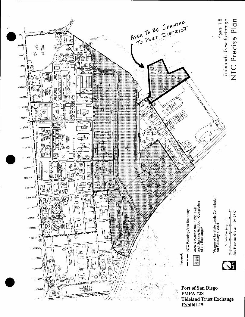
A portion of the land that has been transferred to the Port District is the subject of a pending property settlement and exchange between the Port, the City of San Diego, and the State Lands Commission to formally establish the boundaries of public trust lands on the former NTC. Historically there has been some uncertainty as the location of public trust lands at NTC, and the pending agreement would resolve this ambiguity. The agreement has been approved by the State Lands Commission but is not expected to be signed by the governor and executed until later in 2001.
Exhibit #9 shows the entire Tidelands Trust exchange area affecting the former NTC. The majority of the land shown has been transferred to the City of San Diego; the segment shown as outside the NTC Planning Area Boundary is the public trust land being granted to the Port District. The Tidelands Trust prohibits private sale or encumbering of state tidelands and limits development on tidelands to commerce, recreation, navigation, fishery-related uses, and other general State interest uses. Visitor-serving facilities such as hotels, restaurants, marinas, parks, airports, and preservation of lands in their natural condition are other allowable uses. The remaining land area being incorporated in the Port Master Plan through this amendment and the companion boundary amendment is not public trust land.
The new land area is proposed to be designated as "Industrial - International Airport". No long-term, specific use of the site has been identified at this time, and will be studied as part of the airport Master Plan, currently in progress. However, as an interim use, the site would be developed as an employee parking lot and staging area for taxi, shuttle vans and charter buses. In addition, an existing storm drain 30-inch storm drain would be upgraded to a 48-inch storm drain. These projects would be added to the PMP A project list as non-appealable projects. The only change in plan text would be to add language indicating that the 52 acres has been transferred to the Port and will be used for parking

Port Master Plan Amendment #28 Page 6
and future airport expansion. Existing plan text stating that it is anticipated that no additions will be made to the land area of the airport would be deleted.
The 52-acre parcel is currently a barren dirt field with minor improvements. The Port District's Airport Development Group has several temporary office trailers located in the southeast corner of the site, and there are some concrete pads on the site. The area was formerly part of NTC that was used as a storage area and training grounds. Historically the site was also used as a landfill. The Negative Declaration prepared for the amendment notes that the Disposal and Reuses of Certain Real Properties at Naval Training Center EIR/EIS ( 1988) identified that a single-layer remedial cap of the site would be protective of human health and the environment. The construction of the parking lot would provide a remedial cap of the site.
Currently, airport employees park on Harbor Island (900 spaces) at the Commuter Terminal (300 spaces), and in public parking spaces at the airport terminals. In addition, taxi and shuttle vans are now staged on Harbor Island and contribute to traffic congestion at the intersection of Harbor Island Drive and North Harbor Drive. The new project proposed in the subject PMP A would consist of the phased construction of an approximately 20-acre, 1 ,200-space parking lot. Depending on need, an additional 1,000 parking spaces for employees would be constructed in the a second phase east of the shuttle and charter bus staging area, north of Spruance Road.
Construction of the parking lot will include construction of asphalt concrete pavement, parking lot lighting, attendant booths for parking lot and staging areas, electrical and telephone systems for the attendant booths; fire alarm system, street lights, closed circuit television system, improvements to existing restrooms facilities, signage; landscaping. The roadway circulation to the parking lot would be a right-turn only onto McCain Road from Harbor drive (westbound), and then a right-turn onto Spruance Road. Project traffic heading east on Harbor Drive will exit using a reconfigured airport service road off Spruance Road.
The northern portion of the site was formerly used as a nesting area by the endangered California least tern. As part of the land transfer from the Navy, the Port purchased property in south San Diego Bay for establishment of a National Wildlife Refuge. The U.S. Fish and Wildlife Service filed a Record of Decision on January 11, 2000 removing the "least tern designation" from the project area. No development is proposed on the portion of the site that previously had the least tern designation, and the closest parking area proposed would be roughly 200 feet south of the former least tern area.
•
•
•
•
•
•
Port Master Plan Amendment #28 Page 7
E. Conformance with the Coastal Act. The proposed amendment would result in changes to land use categories and to the text and Precise Plan map in Planning District 2 (Harbor Island/Lindbergh Field). In order for the Commission to certify the proposed master plan amendment, the Commission must determine that the amendment conforms to the following applicable Chapter 8 policies of the Act:
1. Applicable Policies
Section 30708
All port-related developments shall be located, designed, and constructed so as to:
(a) Minimize substantial adverse environmental impacts.
(b) Minimize potential traffic conflicts between vessels.
(c) Give highest priority to the use of existing land space within harbors for port purposes, including, but not limited to, navigational facilities, shipping industries, and necessary support and access facilities .
(d) Provide for other beneficial uses consistent with the public trust, including, but not limited to, recreation and wildlife habitat uses, to the extent feasible.
(e) Encourage rail service to port areas and multicompany use of facilities.
2. Findings for Consistency with Chapter 8 of the Coastal Act
a. Environmental Impacts:
Water Quality
Existing policies in the Port Master Plan regarding water quality include the following:
X. THE QUALITY OF WATER IN SAN DIEGO BAY WILL BE MAINTAINED AT SUCH A LEVEL AS WILL PERMIT HUMAN WATER CONTACT ACTIVITIES
• Maintain a program of flotsam and debris cleanup. • Insure through lease agreements that Port District tenants do not contribute to water
pollution. • Cooperate with the Regional Water Quality Control Board, the County Health
Department, and other public agencies in a continual program of monitoring water quality and identifying the source of any pollutant.
• Adopt ordinances, and take other legal action and remedial action to eliminate sources of pollution.

Port Master Plan Amendment #28 Page 8
In September 2000, the Board of Port Commissioners adopted an Urban Runoff Action Plan to provide a coordinated, multi-year approach to the assessment and reduction of the flow of contamination into San Diego Bay. The Board has also adopted a stormwater ordinance into the Port District Code known as the San Diego Unified Port District Stormwater Management and Discharge Control which provides for the prevention, control, treatment, diversion and regulation of discharges into Bay waters. However, these plans have not been incorporated in the Port Master Plan itself.
Presently, the proposed parking lot site is a vacant dirt lot with some concrete pads. The existing drainage system is primarily surface runoff to the west and south. A small storm drain pipe at the southeast corner collects runoff from a small area. At the southwest corner of the site, a ditch collects a small amount of runoff and carries it westerly to a retention area between the City Sewage Pump Station and McCain Road. The balance of current runoff is sheet flow westerly to McCain Road, which is served by an existing storm drain system located on south side of Spruance Road that traverses 1000 feet west to the NTC Boat Channel. Immediate areas along Spruance Road also drain into the storm drain system. Remaining areas west of McCain Road drain via various underground pipes directly into NTC Boat Channel.
The new project proposed in the Master Plan would ultimately pave the entire 20-acre project site proposed for development with impervious surfaces (no development is proposed on the northern 32 acres of the site). A storm drain system would be placed throughout the site to carry storm runoff to the existing pipeline located along Spruance Road that discharges into the NTC Boat Channel. This storm drain would be upgraded and enlarged from 30 to 48 inches. An underground oil/water separator would be placed at the corner of McCain and Spruance to collect surface runoff from the parking lot. The Negative Declaration performed for the project determined that approximately 80% of the oil and gasoline would be separated from the storm water.
In addition, the Port has indicated that a condition requiring additional water quality Best Management Practices to be incorporated into the development will be placed on the coastal development permit for the proposed project. The condition would require the following:
Preparation of a drainage and runoff control plan for the site by a licensed engineer that includes the following requirements:
1. Drainage from all parking lot areas used for motor vehicle parking shall be directed through BMPs or suites of BMPs (such as oil/water separators, vegetative swales, or other media filter devices) effective at removing and/or mitigating pollutants of concern including petroleum hydrocarbons, heavy metals, and particulates. Selected BMPs (or suites of BMPs) shall be designed to treat, infiltrate or filter the stormwater runoff
•
•
•

•
•
•
Port Master Plan Amendment #28 Page9
from each runoff event up to and including the 85th percentile, 24-hour runoff event for volume based BMPs and/or the 85th percentile, 1 hour event, with an appropriate safety factor, for flow-based BMPs.
2. Parking lots susceptible to stormwater should be swept with a vacuum regenerative sweeper on a regular basis
3. The plan shall include provisions for maintaining the drainage and filtration systems, including BMPs, in a functional condition throughout the life of the approved development. Such maintenance shall include the following: ( 1) the drainage and filtration system shall be inspected, cleaned and repaired prior to the onset of the storm season, no later than September 30th each year and (2) should any of the project's surface or subsurface drainage/filtration or BMP structures fail or result in increased erosion, the applicant/landowner or successor-in-interest shall be responsible for any necessary repairs to the drainage/filtration system and restoration of the eroded area.
The Commission's water quality staff have reviewed the proposed project and the proposed condition, and determined that the Best Management Practices (BMPs) proposed will adequately mitigate any potential impacts to the environmental quality of San Diego Bay. The concern is that the proposed BMPs have not actually been incorporated in the Port Master Plan itself.
However, the Portis required to abide by the Port District's Stormwater Ordinance and Urban Runoff Control Plan. The Commission's water quality staff have also reviewed these plans and determined that the plans have adequate provisions requiring the implementation of Best Management Practices into all new projects. The Port District is also required to comply with the California Regional Water Quality Control Board's Order No. 2001-01 for Waste Water Discharge Requirements for Discharges of Urban Runoff From the Municipal Separate Storm Sewer Systems. Thus, even though these plans are not part of the Port Master Plan, the Commission can be assured that all new projects, as well as those particular projects included in the current amendment, will be required to implement adequate water quality BMPs to protect the quality of the natural environment.
Therefore, the Commission finds that the amendment as proposed is consistent with the environmental protection policies of the Coastal Act.
Least Terns
As noted above, the U.S. Department of Fish and Wildlife Service (USFWS) previously designated an approximately 25-acre portion of the land being incorporated in the Port Master Plan as a least-tern nesting site. The least tern site included an approximately 10-acre nesting colony site and an approximately 15 acre buffer area. Prior to the NTC base

Port Master Plan Amendment #28 Page 10
closure the navy managed the site for least tern nesting pursuant to a Memorandum of Understanding with the USFWS.
The first documented use of the site by least terns was in 1977. The site was used by least terns in eight of the subsequent 22 nesting seasons. According to a Record of Decision filed by the USFWS on January 6, 2000, the last known use of the site by terns was by five pairs in 1995. A total of only 51 young were fledged in the entire history of the colony. Maximum use was by 35 nesting pairs, producing 25 fledglings in 1977.
Because of the Port District's interest in acquiring the site for airport uses, the USFWS began negotiations with the Navy and the Port District in 1995 to determine an appropriate means to protect the functions of values of the least tern nesting site. In October 1998, the USFWS and the Port District signed an agreement where the Port District agreed to purchase an extensive acreage of privately owned California least tern habitat in south San Diego Baby, and convey the habitat through the State Lands Commission, to the USFWS for inclusion in the South San Diego Bay National Wildlife Refuge. The Port District also agreed to provide $900,000 for the enhancement of least tern habitat and perpetual management of the least tern in the refuge.
The agreement was subject to formal consultation under section 7 of the Endangered Species Act, and a Biological Opinion was issued in October 1998 concluding that the anticipated take of California least terns proposed, that is, the permanent loss of the NTC site, would not jeopardize the continued existence of the species. The USFWS agreed that the acquisition and permanent protection of habitat in the South San Diego Bay National Wildlife Refuge and provision of funds for least terns habitat enhancement and perpetual management adequately replaced the ecological functions and values of the NTC site.
On July 2, 1999, The Port District fulfilled its commitment to purchase least tern habitat in south San Diego Bay through the purchase of a 2,209-acre least tern habitat area, including approximately 600 acres of privately owned lands. On January 6, 2000, the U.S. Fish and Wildlife Service filed a Record of Decision stating that relocation of the least tern site to South San Diego Bay was the preferred alternative for disposal and reuse of NTC. The Decision was based on several environmental and social factors, including the fact that the NTC site had an intermittent history of low intensity use by nesting least terns and produced less than 1% of the total least tern recruitment in San Diego Bay during 1977-1998, and that the potential to conserve and recover least terns is greater at the south San Diego Bay site than at NTC. Therefore, the "least tern designation" was removed from the property.
Staff at the Port District surveyed the NTC site on May 23, 2001 to check for the presence of tern activity. Site preparations on the tern site, such as clearing the area of vegetation have not been performed since sometime prior to the USFWS decision. Currently, the entire site has abundant weedy vegetation growth that leaves limited bare
•
•
•
•
•
•
Port Master Plan Amendment #28 Page 11
soil suitable for least tern nesting. Although least terns are actively nesting at various existing San Diego Bay colony sites, no terns were observed at the NTC site. The extensive growth of vegetation appears to effectively preclude the use the site for nesting.
In conclusion, the proposed amendment does not involve any actual development on the site previously designated for least tern nesting. It is likely that the parking lot is far enough away from the nesting area that no impacts would result even if the birds did return to the site. Thus, given the USFWS decision to remove the least tern designation from the area, and the current lack of any sensitive species on the site, it does not appear that the transfer of land into the Port Master Plan for future use as an airport expansion area would potentially result in any adverse environmental impact. Therefore, the proposed amendment can be found consistent with the Coastal Act.
Traffic/Circulation
The proposed parking lot project would result in the relocation of existing parking on Harbor Island to the new proposed lot. The project is expected to reduce congestion at the intersection of Harbor Drive and Harbor Island Drive, and improve the level of traffic service along the airport frontage. The traveling public is expected to benefit as passenger service will be improved by the closer proximity of the taxi/shuttle van staging area, reducing delays experienced waiting for taxis, etc. at the airport terminals. The future expansion would also relocate flight personnel from the parking lots providing additional space for travelers.
Relocating employees, taxis, shuttle vans now parking on Harbor Island to the proposed site will cause a slight increase in traffic on Harbor Drive west of the airport. A traffic analysis conducted by Linscott Law & Greenspan (2000) which identified that the proposed maximum potential development of 2,200 parking spaces would generate approximately 5,120 Average Daily Trips (ADT). The traffic analysis took into consideration future proposed development of a hotel on Harbor Island and on the adjacent City NTC property. The study determined that the proposed parking lot and the other existing and proposed uses in the area would result in a Level of Service (LOS) D (a.m.) and LOS C (p.m.) for the intersection of Harbor drive/Terminal 2/Spanish Landing Park. Currently this intersection operates at LOS C a.m. and p.m. The City of San Diego considers these acceptable levels of service in this area. No significant impact to the ability of the public to access Spanish Landing Park is anticipated. Therefore, the proposed amendment can be found consistent with the Coastal Act.
F. Consistency with the California Environmental Quality Act (CEQA). As described above, the proposed amendment does not have the potential to result in resource damage in the form of individual or cumulative impacts to land use or sensitive resources. No significant, unmitigable environmental impacts were identified. The proposed amendment was the subject of an Environmental Impact Report under CEQA. The EIR was subject to public review and hearing and was adopted by the Board of Port

Port Master Plan Amendment #28 Page 12
Commissioners. The proposed amendment will not result in significant adverse impacts to the environment of the coastal zone and there are no feasible alternatives or feasible mitigation measures available which would substantially lessen any significant adverse effect which the amendment may have on the environment. The Commission therefore finds the amendment is consistent with the California Environmental Quality Act.
(G:\San Diego\Reports\Port\PMPA #28 stfrpt.doc)
•
•
•
•
•
•
• • • .... , • •. '·"" ""ll H r..JIV :-,~...:<~ l 111 L11c ;:,.111 lJL+..:~u l!llJ.lled" l'tJl"l Dt str.icL, record on file in t e Office of the District Clerk.
No. Pages: ~
Re Amendment of Port District ] ]
Master Plan - Former Naval ] ]
Training Center Land Transfer ]
RESOLUTION 2ooo-166
WHEREAS, the San Diego Unified Port District (District) anticipates that the
United States Navy (Navy), as part of the Base Realignment and Closure process for the
Naval Training Center (NTC), will transfer property to the District within the next few
weeks, said property consists of approximately Fifty Two (52) acres of Navy surplus land
located at the former NTC area of Camp Nimitz in the City of San Diego; and
WHEREAS, the District has an adopted Master Plan which has been certified by
the California Coastal Commission; and
WHEREAS, said Master Plan was prepared, adopted and certified pursuant to the
Port District Act, the California Coastal Act and other applicable laws; and
WHEREAS, a proposed Plan Amendment for the former Naval Training Center
Land has been prepared and processed; and
WHEREAS, a Final Negative Declaration pursuant to the California
Environmental Quality Act, State CEQA Guidelines, and Port District procedures relative
to said Amendment has been prepared and adopted and its contents considered and
certified, NOW, THEREFORE,
BE IT RESOLVED by the Board of Port Commissioners of the San Diego Unified
Port District, as follows:
That upon transfer of the said approximately Fifty Two (52) acre parcel of land
from the Navy to the District, the Master Plan of the Port District will be amended hy
Page 1 of 2
Port of San Diego PMPA#28 Resolution of Approval Exhibit #1

2000-166
incorporating therein the Malter Plan Amendment, to be placed on file in the office of the
District Clerk as Document No. 40913 , pertaining to said former Naval Training
Center Land Transfer.
BE IT FURTHER. RESOLVED that upon transfer of said approximately Fifty Two ,•
(52) acre pan:e1 of land from the Navy to the District, the Executive Director or his
designated representative is hereby authorized and directed to transmit said Master Plan
Amendment, together with all relevant factual information, the adopted Final Negative
Declaration, and the Coastal Act consisteney analysis to the California Coastal Commis·
sion for its review, approval and certification pursuant to the California Coastal Act, and
that said Amendment will take effect automatically and be deemed fully certified upon
Coastal Commission approval pursuant to Public Resources Code Section 30714. This
action by the Board of Port Commissioners constitutes formal adoption of the Coastal
Commission's ccrtif"acation of the referenced Amendment.
ADOPTED this 25th
sw 7/25/00
day of ____ ..:J:.;U.::.lY'------' 2000.
Page 2 of2
•
•
•

•
•
•
Document No. 4 0 913 Filed AUG 2 2 2000 SO UNIFIED PORT DISTRICT Clerk's Office
San Diego Unified Port District Proposed Master Plan Amendment
Former Naval Training Center Land Transfer
Existing/Proposed Plan Text and
Proposed Plan Graphics
February 23, 2000 (Revised July 10, 2000)
Note: Text to be deleted shown strieken and text to be added shown ynderljned .
Port of San Diego PMPA#28 Proposed Master Plan Amendment
Exhibit#2

TABLE 4 PORT MASTER PLAN
LAND AND WATER USE ALLOCATION SUMMARY
JAtm WATER .TOTAL USE ACRES USE ACRES ACRES %OF TOTAL
Revised
3!53.8 414.0 787.8 ~ ~ 26.2 Marine Servieea Berthing 23.1
Airport Related Commercial 38.0 Commercial Fishing 7.6 Commercial F'rahing Berthing 50.0 Commercial Recreation 278.3 Recreational Boat Berthing 330.6 Sportfishing 3.7 Sportfiahing Berthing 10.3
~ .12.11.1 193.3 ~ .Hlild 26% 152.9
Industrial Business. Park 113.7 Marine Related Industrial 332.8 Specialized Berthing 141.7 Marine Terminal 149.6 Terminal Berthing 51.6 International Airport 4+Y .!f1B.J.
264.0 278.1 542.1 10% 19.1
Park/Plaza 134.9 Open Bay/Water 278.1 Golf Course 98.2 Promenade 11.8
CONSERVATION 394.7 1053.6 1446.3 27% 304.9 Estuary 1053.6
Habitat Replacement 89.8
223.7 392.9 616.6 12% 4.9 Harbor Services 10.5
City Pump Station 0.4 Boat Navigation Corridor 272.0 Boat Anchorage 25.0
Fire Station 0.4 Ship Navigation Corridor 60.6 Streets 218.0 Ship Anchorage 24.8
MILITARY 25.9 125.8 161.5 3%
Navy School . 25.9 Navy Small Craft Berthing 6.2 Navy Ship Berthing 119.4
AREA UNDER STUDY 402.8 402.8
TOTAL LAND AREA ~ mu TOTAL WATER AREA 2860.3
MASTER PLAN LAND AND WATER ACREAGE TOTAL G8+.+ Wl...i 100'!6
IS

•
•
•
HARBOR ISLAND/LINDBERGH FIELD: Planning District 2
Precise Plan Concept
Planning District 2 embraces two different activities - the transportation hub of San Diego International Airport (Lindbergh Field) with its ancillary commercial and industrial activities, and Harbor Island with its public parks and tourist commercial orientation. Each serves an important function in the regional economy and, in some ways, they are associated together. Both have been intensely developed and are recognized as being stabilized for the future envisioned in the Master Plan.
Lindbergh Field is included in the Comprehensive Planning Organization's Regional Transportation Plan with the statement that it is "the site most suitable for serving the commercial air transportation needs of the San Diego region through 1995." The Master Plan retains Lindbergh Field in its present configuration, adding to the passenger terminal and making improvements in parking and access. Aviation related industries and commerce will also be retained.
Development of unleased parcels on Harbor Island is expected to be completed with the construction of the hotel on the east basin. Along Harbor Drive, from the Navy Estuary to the Coast Guard facility, planning concepts focus on providing a sense of entry into downtown San Diego for travelers coming via Lindbergh Field and Point Lama, with activities and landscape features that strengthen the image of San Diego as a pleasant place to v1s1t. Considerable attention must be paid to improvements in the general appearance of existing industrial uses and the planned expansion of these uses. Public park,
62
pedestrian promenade and open space are reserved on the bayside and in the circulation gateway of Harbor Island. Coastal access is enhanced by a shoreline park with leisure facilities, including restroom, and a 1 . 3 mile bayside public pathway.
Land and Water Use Allocations
The Harbor Island/Lindbergh Field Planning District contains an approximate total of aa5 .Q44 acres, consisting of about .6..1.6. +94 acres of tidelands and 180 acres of submerged tidelands. Table 8 summarizes the land and water use allocations proposed in the Precise Plan. As in the Shelter Island Planning District, a significant portion of the area is already developed and is under long term lease commitment. The east end of the Harbor Island peninsula is vacant and thus offers · development potential uncomplicated by the presence of structures or lease interest. A balanced allocation of use activities is provided within the major use categories of commercial, industrial, public recreation, and public facilities.

TABLE 8
HARBOR ISLAND/LINDBERGH FIELD: PLANNING DISTRICT 2
J.AtiD WATER miAL USE ACRES USE ACRES ACRES
Revised
COMMERCIAL 90.6 105.8 196.4
Airport Related Commercial 38.0 Commercial Recreation 52.6 Recreational Boat Berthing 105.8
INDUSTRIAL 580.0 .D.1.I 11.2 ~ M3Jl
Aviation Related Industrial 130.6 Industrial Business Park 33.1 Specialized Berthing 11.2 International Airport ~ ~
PUBLIC RECREATION 26.2 45.0 71.2
Open Space 7.5 Open Bay I Water 45.0 Park 16.4 Promenade 2.3
PUBLIC FACILmES 66.8 18.0 84.8
Harbor Services 1.3 Harbor Services 5.3 Streets 65.5 Boat Navigation Corridor 12.7
TOTAL LAND AREA +iU ~ TOTAL WATER AREA 180.0
PRECISE PLAN LAND AND WATER ACREAGE TOTAL
Note: Ooes not include: Leased Federal Land State Submerged Tidelands Leased Uplands
22.5 acres 41.3 acres 4.1 acres
63
CJ6 OF TOTAL Revised
~ ~
AlMt .§5
9%

•
•
I
J r ;: ~ J
• l j
• j • i 1
6~

/ i
I i ~
i .. >
•

•
•
•
The permit procedure includes vessel and owner documentation, equipment verification, and is subject to space available and compliance with District regulations. The use of this anchorage will be controlled by duly enacted regulations of the Board of Port Commissioners.
East Basin Industrial
East of Harbor Island, subarea 24, is a tract of land leased by General Dynamics Corporation and Lockheed Ocean Laboratory for aerospace and
.. oceanographic research and development. These sites are recommended for eventual redevelopment into a light, marine related industrial/business park to include such activities as scientific laboratories, office space, marine oriented businesses and light manufacturing plants, with some ancillary storage and warehousing where necessary to the conduct of primary industrial activities.
The bicycle path extends along Harbor Drive north of the industrial site for about one mile, where it connects with the Embarcadero path. A small half-acre land parcel between General Dynamics and the U.S. Coast Guard Station will be used for Harbor Services in association with the Convair Lagoon sediment remediation and monitoring.
Aviation Related Industrial
Subareas 25 and 28 have long-term commitments to the existing aviation related industrial uses. Present activities include the manufacture and assembly of aircraft components. and employee parking for a turbine plant located in Planning District 3. These aviation-related industrial uses will continue. The employee parking is being given consideration for relocation to the vicinity of Pacific Highway and Palm Street, upon the widening of Laurel Street.
Lindbergh Field
67
The Lindbergh Field subareas, 26 and 27, include the airport, runways, taxiways, aircraft parking aprons, control tower, passenger terminals, and public parking. It has been designated International Airport in the Master Plan and the primary uses would include the aforementioned. In addition, the uses typically included inside the terminals such as ticket sales, car rentals, air taxi, restaurants, and gift shop, would be permitted. Approximately 52 acres of former Naval Trajnjng Center property west of Lindbergh Fjeld has been transferred to the Port and will be used for parking and future airport expansion It is antieipatea that ne aaeUtiene will se made te the lana aFea ef the aiFpert.
The Port District is committed to maintaining Lindbergh Field as San Diego's regional airport until an alternative is found. An Airport Development Study was undertaken to provide a long-range development plan for Lindbergh Field in view of the continued increase in air traffic and the increased frequency of congestion in the passenger terminals, terminal roads, auto parking lots and the main access roads linking the airport to the City. As a first step, the District has adopted an Immediate Action Program. The Immediate Program has the following elements: ( 1) addition of an air terminal concourse, and associated aircraft apron areas; (2) modification of existing parking and airport roadway improvements; {3) modifications to the Harbor Drive interchange at Harbor Island Drive; {4) expansion of the airport fuel farm, and (5) regional access improvements including widening of Laurel Street.
The Master Plan proposes a new access road be constructed from Washington Street, along the north periphery of the airport, to the west side of the new West Terminal. Most of the road is located on land occupied by the U.S. Marine Corps Recruit Depot; however, the exact location, design and ownership will be decided at a later date, and is subject to negotiation with the U.S. Navy. It is not intended to serve as a shortcut or bypass between Point Loma and Hillcrest, so it has been narrowed as it enters Harbor Drive.

Project list • A listing of projects and appealable classifications is shown in Table 9.
TABLE 9: PROJECT LIST APPEALABLE .j.. FISCAL
HARBOR ISLAND/liNDBERGH FIELD: PLANNING DISTRICT 2 DEVELOPER {, YEAR
SUBAREA .J.
1. HOTEL COMPLEX: up to 500 rooms, restaurant, cocktail lounge, meeting 23 T y 1993-94 and conference space; parking; landscape
2. PORT ADMINISTRATION BUILDING RENOVATION: Renovate building; 29 p N 1993-95 Construct parking structure; install landscaping
3. AIRPORT ACCESS ROAD: Construct 27 p y 1995-96
4. FUEL FACILITY: Expansion to north side of airport 25 p N 1992-93
5. ACCESS ROADS: Revise airport internal road system 26 p N 1993-94
6. LAUREL STREET: Widen between Harbor Drive and Pacific Highway 27 p y 1994-95
7. NEW AIRPORT TERMINAL: Construct facility; apron; taxiway 26 p N 1993-95 • 8. ANCHORAGE FACILITY: Install perimeter marker buoys at Anchorage A-9 23 p y 1995-96
9. CONVAIR LAGOON: Sediment remediation 24 T N 1996-97
10. INTERIM EMPLOYEE PARKING LOT: Construct air~ort em(;11oyee ~arking 26 p N 2001-03 lot and staging area for taxis, shuttle vans and charter buses; reJ;?Iace storm drain
'
P- Port District N- No T- Tenant Y- Yes
(Revised 4/9/01)
• 68

j
) !
•
•
• scale
! Environ. Review
/
- I -----/ Pacific Ocean
--··~-~ . - - -...
Airport Employee Parking Lot
Site Location
lm •Date_. I 11S,M•r.2000 ;orn Chk I
Port of San Diego PMPA#28 Location Map
Rxhibit #3

NOIEii 1. F'EE PARCEL ~ SHO ..
SHADED. 2. ~ OF EASOCENT TO BE RESER'£0
SHOVIN 11-tUS:---3. BEARINGS /IHlJ DISTANCES
ARE BASED ON M CAL.W'ORNIA COOROINA TE SYSTEW ZONE 6 ( HAD 83 ). .
/
DATA TA8l.E: C1 N81'41'44"W-169.89' CZ N62"3J'J9"W-75.63' CJ N79"05'39"W-50.13' C4 S22'25'15"W-29.68'
~-45"3T20" C5 R•585.00'
L•465.81' T•246.05'
C6 S73'58'52'"W-53.50' C7 S12'35'43'"E-7a72' C8 S74'o40'o4Q"w-69.00' C9 S27'37'00"E-96.48'
CTO S12'25'55"E-36. 79' C11 S83'48'36"W-173.78'
Environ. Review I NTC Land Transfer
I ~
I ~~ ~=a: i: tl i! ~ I ~ ~
, •• 4110'
S/M)oll/010 /01G-0018
Port of San Diego PMPA#28 Land Transfer/ Approximate Location of Former Least Tern Site Exhibit#4

•
•
•
. .. . •) .~.~ ::
'l i .. :'
' .... J~~ I--s, r;
. {7 I
·-·
z -~
... -• -z 0:: )( 0 • (IJ
0::
<:(
:z:
Port of San Diego PMPA#28 Existing and Proposed Parking Lot Site Plan Exhibit #5

-<~!' ':J· .. : • ...
~ ..... f: .. . .. ..... ... .........
PARKING LOT
. ~·
HARBOR ISLAND WEST BASIN (MARINA)
H A R 8 0 R
~scale - Airport Employee Port of San Diego Parking Lot PMPA #28
Environ. Review 1 Proposed Parking Lot Detail Plan ,_____..;;_-~..... ______ -L ___________ Exhibit #6

•
•
•
. . .. .. ',', .,
'• I\ 1 I • ,, . .. .
'• . ,, ' . . • ' \\It I I
I ,, ,' ,, ,'
Ill ,, ,'
00 I
l ,, ','. ol I
" I
I
,, ,' 0 II I
·' ,, '\ • II I I
\I •
II \I I ,, ,' '
\0 I I
Port of San n· PMPA #28 Iego
Traffi c· c Irculaf Exhibit #7 Ion Plan
raJ 001 OS/24/01 TBU 18:34 FAX
Po\t ~L~~~.,r!2,!~go • (619) 686-6200 • P.O. Box 120488, San 11icgo, C.<~lifomia 92112·0486
www.portofsandlego.org
May24.2001 J~IUWJt~ MAY 2 4 2001
CAUFO~NIA COASTAl COMMISSION
SAN OIEGO COAST DISTRICT
Ms. Diana Lilly California. Coastal Commi65ion 7575 Metropolitan Drive. Suite 103 San Diego, CA 92108-4402
SUBJECT: NTC FORMER CALIFORNIA LEAST TERN COLONY SITE STATIJS
Dear Ms. Lilly:
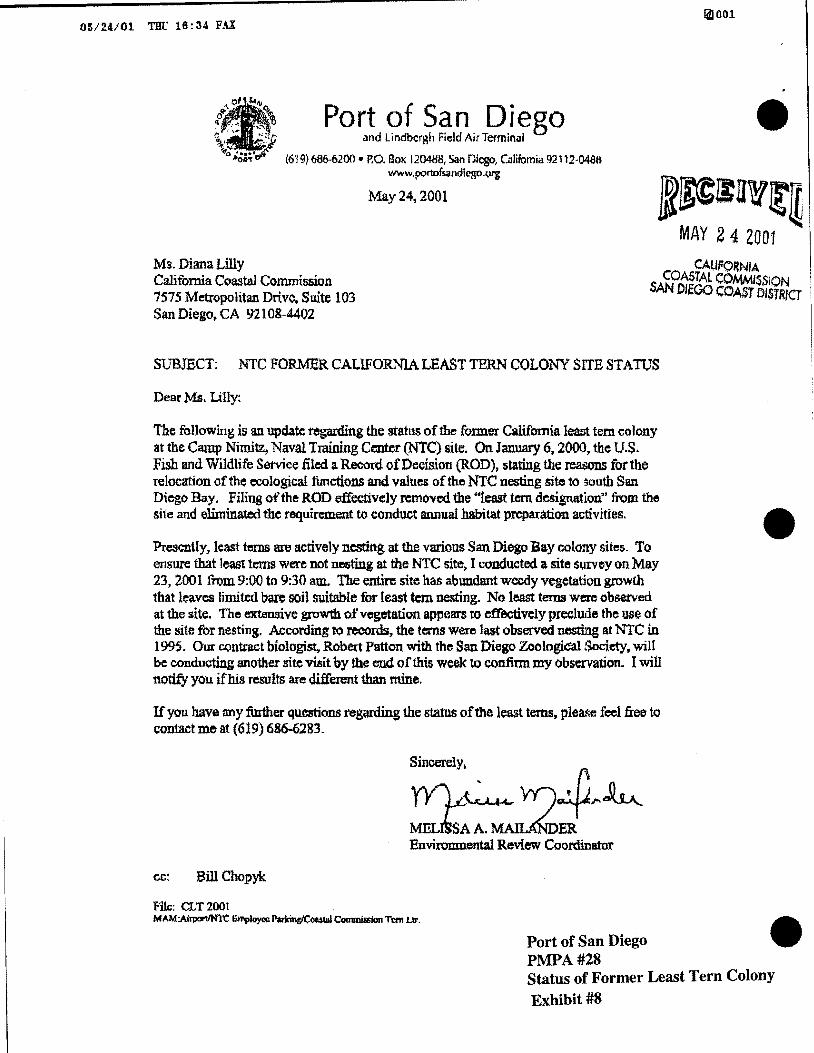
The following is an update regarding the status of the former California least tem colony at the Camp Nimitz, Naval Training Center (NTC) site. On January 6, 2000, the U.S. Fish and Wildlife Service tiled a. Record of Decision (ROD), stating the reaoons for the relocation of the ecological functions and values of the NTC nesting site to south San Diego Bay. Filing of the ROD effectively removed tbe '"least tern designation" from the site and eliminated the requirement to conduct annual .habitat preparation activities.
Presently, least bm1s are actively nesting at the various San. Diego Bay colony sites. To ensure that least terns were not nesting at the NTC site7 I conducted a site S1.1rvcy on May 23, 2001 from 9:00 to 9:30am. The ent.in: site has abundant weedy vegetation growth that leaves limited bare soil suitable for least tern nesting. No least terns were observed at the site. The extensive growth of vegetation appears to cffeoti.vely preclude the use of the site for nesting. According to records, the terns were last observed nesting at N!C in 1995. Our contract biologist, Robert Patton with the San Diego Zoologidal Society, will be conducting another site visit by the end of this week to confinn my observation. I will notify you ifhis results are different than mine.
If you have any :further qucmons regarding the status ofthe least terns, plea.<;e feel free to contact me at (619) 686-6283.
~~ .. '«)~~ MdsAA.~ER Environmental Review Coordinator
cc: Bill Chopyk
f':llc: CLT 2001 MAM:Aii'fXII'IIN'l't Employoc: P~~ C011111lisslon Tern Llr.
Port of San Diego PMPA#28
•
• Status of Former Least Tern Colony Exhibit #8
. J •
• /" / '_
c:=~~~~ __ F/C'~~>f -:.·,_-:;
i:i c Gl Cl
~
Port of San Diego PMPA#28
OJ (]) c ~ 0
Q) 0 ;:; ...c:: 0... Ol u
.:;:: >< UJ Q)
>< 0 Q_g c.~
(/)
u 1-z
~ a. :>
Cis o ~. (5 c:
~2 ~ 0 c: u c:
V> 0 c:::
Tideland Trust Exchange Exhibit #9

.
•
•
••