tiger 2014 awards
TRANSCRIPT

2 0 1 4 A W A R D S

Project Name (click to link) State TIGER Grant Project Phase
Seward Marine Terminal Expansion Plan AK $2,500,000 (rural)
Planning
Restoring Pathways to Economic Opportunities AL $125,000 Planning
Railroad Corridor Highway Crossing Plan AR $1,200,000 Planning
Tawa'ovi Community Streets and Infrastructure Project AZ $2,894,190 (rural)
Construction
Central Phoenix Multimodal Transportation Improvement Plan AZ $1,600,000 Planning
Eastside Access Improvements CA $11,800,000 Construction
Willowbrook/Rosa Parks Station Master Plan Implementation Project CA $10,250,000 Construction
57/60 Confluence Freight Corridor Project CA $10,000,000 Construction
Broadway Bridge Plan CA $1,500,000 Planning
San Francisco Bay Area Core Capacity Transit Study CA $1,000,000 Planning
Hollister Avenue Complete Streets Corridor Plan CA $236,000 Planning
Charter Oak Ranch Road Plan CO $1,200,000 Planning
Waterbury Active Transportation and Economic Resurgence (WATER) Project
CT $14,400,000 Construction
New England Central Railroad Freight Rail Project CT $8,183,563 (rural)
Construction
Long Bridge NEPA Documentation DC $2,800,000 Planning
Tamiami Trail / Everglades Restoration FL $20,000,000 (rural)
Construction
Downtown Dahlonega Complete Streets Corridor Improvements GA $5,100,000 (rural)
Construction
18th Street Viaduct Planning Project IA $1,000,000 Planning
US-95 Worley North Stage 2 ID $7,400,000 (rural)
Construction
Bronzeville Bridge to Chicago's Lakefront IL $18,760,000 Construction
Champaign-Urbana Multimodal Corridor Enhancement Project IL $15,705,327 Construction
Indianapolis Red Line Planning Studies IN $2,073,200 Planning
The Southwest Chief Route Improvement Project KS $12,469,963 (rural)
Construction
Mountain Parkway Extension KY $24,000,000 (rural)
Construction

Project Name (click to link) State TIGER Grant Project Phase
BT1 Infrastructure Expansion Project LA $10,000,000 Construction
Nicholson Corridor High Capacity Transit System Plan LA $1,765,341 Planning
Lafayette I-49 Corridor Plan LA $304,250 Planning
Ruggles Station Modernization MA $20,000,000 Construction
Fort Meade Multimodal Accessibility Project MD $10,000,000 Construction
Hanover Street Bridge Plan MD $1,100,000 Planning
Sarah Mildred Long Bridge Project ME, NH $25,000,000 Construction
M-1 Fixed Rail Streetcar Project MI $12,200,000 Construction
Interchange at US 10/CSAH 83 MN $10,000,000 Construction
St. Paul Rail to Multimodal Corridor Plan MN $100,000 Planning
Central Corridor Transit Enhancement and Job Access Project MO $10,300,000 Construction
New Route 47 Missouri River Bridge Project MO $10,000,000 (rural)
Construction
KC Workforce Connex Project MO $1,200,000 Planning
Three-County Roadway Improvements Program MS $17,885,750 (rural)
Construction
Poplar Airport Redevelopment and Regional Access Project MT $692,829 (rural)
Planning
Asheville East of the Riverway Multimodal Network NC $14,600,000 Construction
The Northeastern NC Rail Improvement Project NC $5,800,000 (rural)
Construction
Duke Belt Line Trail Master Plan NC $222,700 Planning
The Piedmont Study NC $200,000 Planning
Fort Berthold Comprehensive Regional Transportation Plan ND $1,000,000 (rural)
Planning
Central Omaha Bus Rapid Transit NE $14,960,000 Construction
Port Newark Container Terminal Access Improvement and Expansion Project
NJ $14,800,000 Construction
Santa Theresa Border Plan NM $400,000 (rural)
Planning
Washoe County Bus Rapid Transit NV $16,000,000 Construction

Project Name (click to link) State TIGER Grant Project Phase
Flamingo Corridor Improvements NV $13,300,000 Construction
Vision Zero: Saving Lives and Providing Opportunity Project NY $25,000,000 Construction
Computer Aided Dispatch/Automatic Vehicle Location (CAD/AVL) System Replacement Project
NY $15,050,000 Construction
Access to Opportunity: Transportation and Housing Study in the East Rockaways
NY $1,499,283 Planning
East 105th/East 93rd Transportation Corridor Plan OH $400,000 Planning
Riverside Drive/Gathering Place Multimodal Access Project OK $10,000,000 Construction
Regional Active Transportation Management (ATM) OR $10,125,000 Construction
Roosevelt Boulevard Multimodal Study PA $2,500,000 Planning
Lower Hill Redevelopment "cap" Design PA $1,551,632 Planning
Providence Streetcar RI $13,000,000 Construction
Providence Station Transit Center Plan RI $650,000 Planning
Wando Welch Terminal Rehabilitation SC $10,840,000 Construction
Seamless City Revitalization Project SC $10,000,000 Construction
MRC Railroad Reconstruction SD $12,686,089 (rural)
Construction
City of Chattanooga Rail Transit Implementation Plan TN $400,000 Planning
Houston Intelligent Transportation System TX $10,000,000 Construction
Land Use-Transportation Connections to Sustainable Schools TX $210,000 Planning
The Pioneer Corridor Plan UT $820,000 Planning
Broad Street Bus Rapid Transit VA $24,900,000 Construction
Norfolk International Terminals VA $15,000,000 Construction
Port of Seattle Terminal 46 Rehabilitation Project WA $20,000,000 Construction
Makah Tribe Oil Spill Response Access Dock Plan WA $1,101,904 (rural)
Planning
Forward Madison: Urban Footprint Scenario Planning WI $300,000 Planning
New River Parkway WV $10,000,000 (rural)
Construction

E A S T

W A T E R B U R Y A C T I V E T R A N S P O R T A T I O N A N D E C O N O M I C R E S U R G E N C E ( W A T E R ) P R O J E C T
A p p l i c A n t /S p o n S o r :
t o tA l p r o j e c t c o S t :
G r A n t F u n d i n G :
City of Waterbury
$20,400,000
$14,400,000
This TIGER grant will construct an integrated system of “active transportation” improvements to help revitalize Waterbury’s river/rail corridor neighborhoods and downtown center and drive the economic resurgence of the City and region. The project includes a reconstructed and expanded network of local complete streets and a comprehensive array of pedestrian/bicycle safety improvements and transit linkages, including a pedestrian/bicycle bridge connection to improve access from the riverfront to the train station and downtown. There were 643 bicycle and pedestrian accidents occurring between 2003-2007 in the area. These improvements will complement on-going City and State investments in downtown revitalization, including brownfield reclamation and provision of expanded transit options at the Waterbury train station.
p r o j e c t d e S c r i p t i o n
p r o j e c t H i G H l i G H t S
»» Increases access to employment opportunities for the market with the highest unemployment in Connecticut, consistent with the Department’s ladders of opportunity initiative. »» Catalyzes transit-oriented redevelopment of an underutilized industrial neighborhood adjacent to the train station and downtown»» Upgrades abandoned infrastructure to create transportation connections to jobs and services.
This project will improve mobility in Waterbury and stimulate development of the downtown and riverfront areas. Reconstruction of Freight and Jackson Streets and upgraded bicycle and pedestrian facilities will increase the access and mobility of city residents to jobs inside and outside of the city, thus enabling thousands of people in predominantly minority and low-income neighborhoods to reach mass transit options and access employment opportunities.
p r o j e c t B e n e F i t S
E A S T

Rural
N E W E N G L A N D C E N T R A L R A I L R O A D F R E I G H T R A I L P R O J E C T
A p p l i c A n t /S p o n S o r :
t o tA l p r o j e c t c o S t :
G r A n t F u n d i n G :
Connecticut Department of Transportation
$10,479,453
$8,183,563
This TIGER grant will fund the upgrade of 55 miles of weight and speed-restricted track along New England Central Railroad Corridor (NECR). New rail, ties, ballast and 10 upgraded grade crossings will allow NECR to safely accommodate 286,000 lb. rail cars at greater speed, improving efficiency and capacity.
p r o j e c t d e S c r i p t i o n
p r o j e c t H i G H l i G H t S
»» Improves the only rail access to the Port of New London, Connecticut.»» Complements similar investments in Massachusetts, New Hampshire, and Vermont, bringing the full 340 mile corridor between Montreal and New London to national standards.»» Reduces vehicular congestion by providing a competitive rail alternative for shippers.
By increasing weight and speed limits on the NECR corridor, 14 existing commercial and industrial businesses, with more than 750 employees along the rail line, will immediately benefit by improved access and carrying capacity, leading to greater employment opportunities for residents and an improved tax base for local municipalities. The Project is an essential part of the Connecticut State Rail Plan’s goal of increasing freight rail traffic by 25 percent by 2030 and ensuring statewide access to the upgraded 286,000 lb. capacity national rail system.
p r o j e c t B e n e F i t S
E A S T
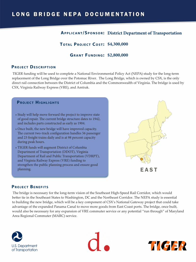
L O N G B R I D G E N E P A D O C U M E N T A T I O N
A p p l i c A n t /S p o n S o r :
t o tA l p r o j e c t c o S t :
G r A n t F u n d i n G :
District Department of Transportation
$4,300,000
$2,800,000
TIGER funding will be used to complete a National Environmental Policy Act (NEPA) study for the long-term replacement of the Long Bridge over the Potomac River. The Long Bridge, which is owned by CSX, is the only direct rail connection between the District of Columbia and the Commonwealth of Virginia. The bridge is used by CSX, Virginia Railway Express (VRE), and Amtrak.
p r o j e c t d e S c r i p t i o n
p r o j e c t H i G H l i G H t S
»» Study will help move forward the project to improve state of good repair. The current bridge structure dates to 1942, and includes parts constructed as early as 1904.»» Once built, the new bridge will have improved capacity. The current two-track configuration handles 56 passenger and 23 freight trains daily and is at 98 percent capacity during peak hours.»» TIGER funds will augment District of Columbia Department of Transportation (DDOT), Virginia Department of Rail and Public Transportation (VDRPT), and Virginia Railway Express (VRE) funding to strengthen the public planning process and ensure good planning.
The bridge is necessary for the long-term vision of the Southeast High-Speed Rail Corridor, which would better tie in the Southeast States to Washington, DC and the Northeast Corridor. The NEPA study is essential to building the new bridge, which will be a key component of CSX’s National Gateway project that could take advantage of the expanded Panama Canal to move more goods from East Coast ports. The bridge, once built, would also be necessary for any expansion of VRE commuter service or any potential “run through” of Maryland Area Regional Commuter (MARC) service.
p r o j e c t B e n e F i t S
E A S T

R U G G L E S S T A T I O N M O D E R N I Z A T I O N
A p p l i c A n t /S p o n S o r :
t o tA l p r o j e c t c o S t :
G r A n t F u n d i n G :
Massachusetts Bay Transportation Authority
$30,000,000
$20,000,000
TIGER funds will be used to upgrade Ruggles Station, an urban intermodal facility that serves MBTA commuter rail, bus, orange line subway, and private shuttles, as well as pedestrians and bicyclists. The station is located in the minority neighborhood of Roxbury, in proximity to nationally renowned medical and academic institutions, and is one of the busiest stations in the MBTA network. Elements of this project include constructing a new platform to allow for more inbound commuter trains, replacing elevators to meet accessibility standards, adding lighting and security call boxes, and providing pedestrian accessibility via tunnel.
p r o j e c t d e S c r i p t i o n
p r o j e c t H i G H l i G H t S
»» Decreases travel time by an average of 13 minutes and improves overall network reliability.»» Provides improved transportation choices to connect economically disadvantaged populations to centers of employment, education, and training in the Longwood Medical Area and throughout Boston.»» Returns track configuration to a State of Good Repair and upgrades facilities to meet Americans with Disabilities Act Accessibility Guidelines.
Currently, due to space limitations, only a portion of inbound trains stop at Ruggles station, requiring passengers to transfer from the commuter rail to the MBTA’s Orange Line at Back Bay Station, then travel back to Ruggles Station. The addition of a second platform will eliminate this capacity constraint. Furthermore, the second platform will increase accessibility, permit easier egress in the event of an emergency, and eliminate train crossovers, which slow down operations and increase conflict potential.
p r o j e c t B e n e F i t S
E A S T

H A N O V E R S T R E E T B R I D G E P L A N
A p p l i c A n t /S p o n S o r :
t o tA l p r o j e c t c o S t :
G r A n t F u n d i n G :
City of Baltimore
$1,800,000
$1,100,000
The City of Baltimore will utilize TIGER funds to create the Hanover Street Bridge Multimodal Corridor Plan. This study will identify feasible methods of rehabilitating or replacing Hanover Street Bridge, a nearly 100-year old bridge that connects Baltimore City to the Port of Baltimore, improve multimodal corridor accessibility and freight access and highlight ways to enhance access to economic opportunities and recreational amenities, quality of life, and safety throughout the corridor.
p r o j e c t d e S c r i p t i o n
p r o j e c t H i G H l i G H t S
»» Creates plans to improve a vital link for local and regional commuters and commercial users to meet current and future multimodal needs.»» Provides a unique opportunity to transform the existing barrier into a multimodal connection between the city center and the residential and recreational areas to the south.»» Supports the city’s comprehensive strategy to reinvest in transportation infrastructure to realize potential economic, health, and social benefits in South Baltimore.
The planning study will result in a corridor plan for the area designed to encourage development and private investment in the Middle Branch Waterfront and surrounding area. It will identify multimodal, bridge, and roadway typical sections that can best meet the needs of residents, businesses, and commuters. Transforming the existing Hanover Street Bridge over Middle Branch into a multimodal connection to the City center will open up new opportunities to the disadvantaged populations south of the city. The proposed solutions will aim to attract future development and private investment and prepare the corridor to become a gateway area of revitalization with improved connection to existing trails, parks, and other transit opportunities.
p r o j e c t B e n e F i t S
E A S T

F O R T M E A D E M U L T I M O D A L A C C E S S I B I L I T Y P R O J E C T
A p p l i c A n t /S p o n S o r :
t o tA l p r o j e c t c o S t :
G r A n t F u n d i n G :
Maryland State Highway Administration
$42,093,155
$10,000,000
This TIGER grant will help expand two-lane Maryland Route 175 on the grounds of Fort Meade between Odenton and Jessup, MD. The Maryland State Highway Administration is currently renovating intersections and widening the road at each end of the project area to accommodate an expected doubling of employment on Fort Meade by 2015 due to the 2005 Base Realignment and Closure (BRAC). The project will ensure a continuous widening of MD 175 and includes the addition of continuous sidewalk on one side of the road and a multi-use recreational hiker biker trail on the opposite side, as well as on-road bicycle lanes for commuting cyclists. The project also includes a new controlled access point to Fort Meade.
p r o j e c t d e S c r i p t i o n
p r o j e c t H i G H l i G H t S
»» Creates a vital connection for motorized and non-motorized users traveling to business and recreational activities in Fort Meade, Odenton Town Center, and adjoining counties.»» Improves safety by increasing capacity for roadway users and providing separate facilities for non-motorized roadway users.»» Increases capacity to accommodate BRAC-related traffic volumes resulting from the influx of additional workers, residents, and visitors.
By connecting two expanded sections of MD 175, the project will allow for a free flow of vehicle traffic and greater connectivity throughout the Fort Meade area. Expanding the roadway to six lanes with separate turning and through lanes will help reduce the risk of crashes that exists currently with vehicles jockeying for position as the roadway narrows to a single lane in each direction. It will also provide separate, safe facilities for non-motorized users who are currently exposed to high vehicular speeds and unsafe travel conditions.
p r o j e c t B e n e F i t S
E A S T

S A R A H M I L D R E D L O N G B R I D G E P R O J E C T
A p p l i c A n t /S p o n S o r :
t o tA l p r o j e c t c o S t :
G r A n t F u n d i n G :
Maine Department of TransportationNew Hampshire Department of Transportation
$158,500,000
$25,000,000
This TIGER grant will fund the rail components of the Sarah Mildred Long Bridge replacement over the Piscataqua River. The Sarah Mildred Long Bridge, a lift bridge connecting Maine and New Hampshire, currently handles both highway and rail traffic and is being replaced after 74 years. The replacement bridge will feature an integrated rail-highway deck for the lift span, maintaining rail access for the Portsmouth Naval Station.
p r o j e c t d e S c r i p t i o n
p r o j e c t H i G H l i G H t S
»» Reduces the need for bridge lifts by 64 percent, reducing disruptions to both highway and marine traffic.»» Provides redundancy for freight movement between Maine and New Hampshire in the event of closure of the I-95 bridge.»» Improves environmental outcomes by reducing vehicle delays and idling times by 68 percent.
Rail access is a critical need of Portsmouth Naval Station (PNS), as this is the only viable mode of transportation allowed by the U.S. Navy for PNS to transport spent nuclear fuel from its servicing of U.S. Navy submarines. The TIGER investment will ensure this access continues. The new bridge will also dramatically improve safe access to navigation on the river through increased horizontal and vertical clearances.
p r o j e c t B e n e F i t S
E A S T

P O R T N E W A R K C O N T A I N E R T E R M I N A L A C C E S S I M P R O V E M E N T A N D E X P A N S I O N P R O J E C T
A p p l i c A n t /S p o n S o r :
t o tA l p r o j e c t c o S t :
G r A n t F u n d i n G :
County of Essex, New Jersey
$53,869,000
$14,800,000
The TIGER project will demolish both dry and refrigerated warehouses and gate facilities, then pave all areas and construct new gates that include truck comfort and service stations at the Port of Newark. This will improve traffic flows in and out of the port gates and improve the driver experience when using the port by combining modern facilities with technology innovations, and will significantly update the storage capacity of the Port Newark Terminal for containerized goods. As the port was impacted by Superstorm Sandy, the project will consider options to accommodate future sea level rise.
p r o j e c t d e S c r i p t i o n
p r o j e c t H i G H l i G H t S
»» Reduces congestion, noise and emissions in adjacent neighborhoods.»» Improves efficiencies at gate and terminal capacity; necessary for driver shortages and increasing port traffic.»» Has regional public/private partnership and support.»» Uses innovative technologies at gate including RFID, Optical Character Recognition and Weight in Motion scales.»» Leverages other regional improvements including raising Bayonne Bridge, channel dredging and rail network improvements.
The expanded gate design will remove a bottleneck for truck entry and departure, allowing for a smooth flow of traffic, with stops becoming an exception rather than the norm. The traffic scheme for the new terminal access and internal yard traffic will eliminate two-way traffic and intersections in the terminal and at approaches to the terminal, significantly reducing the potential for traffic collisions and for major injury to traffic guards. Additionally, the project allows for increased traffic velocity through a new yard design to queue peak volume trucks within terminal property instead of along public roads. In the yard, 31 acres will be dedicated to the expansion of new terminal capacity and the removal of an asbestos laden warehouse building. This project is projected to add approximately 300 full-time equivalent employees though 2018 with an average salary of $84,000 to support the project and other expansion.
p r o j e c t B e n e F i t S
E A S T

COMPUTER AIDED DISPATCH/AUTOMATIC VEHICLE LOCATION (CAD/AVL) SYSTEM REPLACEMENT PROJECT
A p p l i c A n t /S p o n S o r :
t o tA l p r o j e c t c o S t :
G r A n t F u n d i n G :
Capital District Transportation Authority
$23,000,000
$15,050,000
TIGER funds will be used to help replace the Capital District Transportation Authority’s obsolete computer aided dispatch/automatic vehicle location (CAD/AVL) system with state-of-the-art Intelligent Transportation Systems (ITS). The current system has reached the end of its useful life, and many components are beyond repair due to the discontinuation of replacement hardware. The Transportation Authority’s CAD/AVL system serves approximately 280 fixed route and paratransit vehicles, 40 support vehicles, support equipment, and mobile data communications infrastructure at four radio frequency tower locations.
p r o j e c t d e S c r i p t i o n
p r o j e c t H i G H l i G H t S
»» Helps CDTA better track its fleet and equipment so it can better serve transit riders.»» Includes a comprehensive suite of ITS technologies to provide reliable communications and amenities such as automatic announcements, real time passenger information, passenger Wi-Fi, safety triggers, and other features to enhance the rider experience.»» Augments scheduling and real-time routing information for operators, ultimately improving transit service safety, reliability, and efficiency for riders.»» Integrated with a broader plan to achieve 40 miles of bus rapid transit (BRT) service in New York State’s Capital Region.
Upgrading the obsolete CAD/AVL system will improve overall network reliability, lower the number of unscheduled repairs, increase system efficiency, and extend each vehicle’s useful life. The project will also improve safety by providing more reliable communications between dispatch, operators, and supervisors, which is critical for incident and response management.
p r o j e c t B e n e F i t S
E A S T

A C C E S S T O O P P O R T U N I T Y : T R A N S P O R T A T I O N A N D H O U S I N G S T U D Y I N T H E E A S T R O C K A W A Y S
A p p l i c A n t /S p o n S o r :
t o tA l p r o j e c t c o S t :
G r A n t F u n d i n G :
New York City Department of Transportation
$2,074,104
$1,499,283
TIGER planning funds will be used for a comprehensive study of multimodal transportation access in the eastern portion of the Rockaway Peninsula, an economically distressed area still suffering from the impacts of Hurricane Sandy. Located at the far southeastern edge of the city, residents of this community have historically struggled to connect with jobs, education, health care, and social services – critical rungs on the ladder to the middle class. Through a partnership between the New York City Departments of Transportation (NYCDOT) and Housing Preservation and Development (HPD), the City seeks to develop Access to Opportunity, a comprehensive study of neighborhood and transportation connectivity and the relationship of the transportation network to current and future housing and economic development in the eastern half of the Rockaway Peninsula.
p r o j e c t d e S c r i p t i o n
p r o j e c t H i G H l i G H t S
»» Will guide over $200 million in City street infrastructure investments within the study area.»» Provides a holistic analysis of mobility needs and barriers to economic opportunity. The study will explore ways to address these issues through the redevelopment process with particular emphasis given to improving connections to public transportation, the broader street network, local retail corridors, and the rest of the city.»» Encourages investment by enhancing multi-modal connections to centers of employment, education, and services.
While rebuilding and storm protection in the Rockaways remain key concerns for residents and all levels of government, it is critical to consider socio-economic resiliency as well. The need for better access to jobs, educational opportunities, health care, and other services for residents of the study area well predated Hurricane Sandy. As 49 percent of households in the study area do not have access to a vehicle and 27 percent live below the poverty line, it is vitally important for the transportation network to provide high-quality transit services and safe and efficient pedestrian and bicycle connections.
p r o j e c t B e n e F i t S
E A S T

V I S I O N Z E R O : S A V I N G L I V E S A N D P R O V I D I N G O P P O R T U N I T Y P R O J E C T
A p p l i c A n t /S p o n S o r :
t o tA l p r o j e c t c o S t :
G r A n t F u n d i n G :
New York City Department of Transportation
$52,800,000
$25,000,000
This TIGER grant will fund a 3-part safety improvement program in New York City, comprised of safe pedestrian access to schools and transit, and safe bicycle access to jobs via completion of trail systems connecting distressed communities with employment centers. The program of improvements, including curb extensions, pedestrian islands, expanded sidewalks, and protected bike lanes was developed through a comprehensive planning and public engagement process involving multi-agency task force deliberations, and includes ongoing performance monitoring of impacts.
p r o j e c t d e S c r i p t i o n
p r o j e c t H i G H l i G H t S
»» The effort will target communities in need, as 80 percent of projects funds will be spent in areas eligible for HUD Community Development Block Grant funding.»» Leverages strong partnerships, with over 50 percent non-federal match.»» Empowers historically underserved communities with safe access to educational and employment opportunities through affordable modes of transportation.
This project promotes NYC DOT’s Vision Zero approach, working to reduce transportation related injuries, which currently occur an average of once every two hours. The project will utilize a range of improvements and methods that have been proven effective, and will provide reports on their effectiveness to improve accountability and transparency. The project improves safety, quality of life, and state of good repair for communities most affected by economic disparity.
p r o j e c t B e n e F i t S
E A S T

R O O S E V E L T B O U L E V A R D M U L T I M O D A L S T U D Y
A p p l i c A n t /S p o n S o r :
t o tA l p r o j e c t c o S t :
G r A n t F u n d i n G :
City of Philadelphia $5,000,000
$2,500,000
Although roughly 150,000 people per day use the Roosevelt Boulevard (US 1) in North East Philadelphia, it is not particularly suited for multiple modes of transportation. The Boulevard crosses two major parks, and is within a half mile walking distance of 76 schools, 36 parks, and 27 recreation centers. Short, indirect connections provide access to Temple University and Holy Family University. This TIGER grant will fund a plan to provide a detailed evaluation of alternative concepts for reconfiguration of the Boulevard. The project is built on ongoing efforts and will supports a bus rapid transit service (BRT) operating in a dedicated guideway, access management achieving effective separation of through traffic from local traffic, and significant modifications to provide safe pedestrian crossings and transit access, including grade separation in some cases. Once completed, Roosevelt Boulevard will be planned as a complete street.
p r o j e c t d e S c r i p t i o n
p r o j e c t H i G H l i G H t S
»» Plan will examine methods to restore connections among diverse neighborhoods and to regional employment, educational, and commercial destinations. »» Nearly 50 percent of North Philadelphia residents do not own a car, and another 40 percent have only one car. Planning for BRT would compete effectively with auto travel in terms of time, cost, and convenience providing a sustainable alternative for current users of the Boulevard as well as travelers using the parallel I-95 corridor.
An effective multimodal transportation solution would have dramatic effects on the region’s economic competitiveness and quality of life and offers competitive transportation alternatives for existing communities in North and Northeast Philadelphia. Implementing access management and extending BRT to the Northeast and Lower Bucks County would also make it easier to travel to Philadelphia from surrounding areas. This plan, once implemented, would also increase development opportunities to existing and emerging centers of commercial and industrial employment. The safety improvements examined in the plan would address a source of long standing inequity experienced between users of different modes using the Roosevelt Boulevard.
p r o j e c t B e n e F i t S
E A S T

L O W E R H I L L R E D E V E L O P M E N T “ C A P ” D E S I G N
A p p l i c A n t /S p o n S o r :
t o tA l p r o j e c t c o S t :
G r A n t F u n d i n G :
Sports & Exhibition Authority of Pittsburgh and Allegheny County$2,700,000
$1,551,632
TIGER funds will help plan the redevelopment of the Lower Hill District neighborhood by providing final design for a “cap” over Interstate 579 reconnecting the neighborhood to the central business district. The “cap,” once constructed, would create a new urban green open space, pedestrian connections and potential private development opportunities.
p r o j e c t d e S c r i p t i o n
p r o j e c t H i G H l i G H t S
»» Final design for construction of a “cap” over the interstate would create a 28 acre urban open space and pedestrian connections over the I-579 Crosstown Boulevard will connect the Hill District to Downtown.»» Creates plan for enhanced pedestrian connections, access and multi-modal choices to centers of employment, education and services between the two neighborhoods by removing the physical divide between the Hill District and downtown.
The project would help Pittsburgh plan ladders of opportunity connections for residents of a disadvantaged and disconnected community. Currently, an open air trench exists over the I-579 Crosstown Boulevard between Centre Avenue and Bigelow Boulevard. Final design of the “cap” would prepare Pittsburgh to remove barriers to connected systems of transportation, provide improved public open space opportunity, and create opportunity for private infill development.
p r o j e c t B e n e F i t S
E A S T

P R O V I D E N C E S T R E E T C A R
A p p l i c A n t /S p o n S o r :
t o tA l p r o j e c t c o S t :
G r A n t F u n d i n G :
City of Providence
$118,000,000
$13,000,000
TIGER funds will be used to construct a new urban circulator that will connect Rhode Island’s two largest employment hubs to the downtown core and adjacent neighborhoods. The route would pass through the City’s key redevelopment area, made available by the recent relocation of Interstate 195. The urban circulator will create a stronger multimodal transportation system by connecting the local, regional, and intercity transit services in Providence, including the Providence Station Rail Hub which is receiving a TIGER VI planning grant to identify layouts for a bus terminal adjacent to the station.
p r o j e c t d e S c r i p t i o n
p r o j e c t H i G H l i G H t S
»» Serves as a tool to catalyze, concentrate, and accelerate economic growth in Providence and throughout Rhode Island, which has as the worst unemployment rate in the nation.»» Project planners estimate supporting 6,000 permanent jobs over 20 years and improving the economic productivity of the recently cleared I-195 tract.»» Includes streetscape and sidewalk improvements throughout the corridor.
Like many cities in America, Providence suffered greatly from the recession that began in 2008. The Providence Streetcar will further economic recovery by creating ladders of opportunity for economically disadvantaged populations by creating jobs, connecting communities, and providing multi-modal connections to centers of employment and education. The project specifically supports enhanced access to several of Rhode Island’s workforce training programs for disadvantaged and minority populations. Furthermore, the streetcar will encourage transit usage, thereby saving fuel, reducing reliance on foreign oil, and decreasing greenhouse gas emissions by eliminating single occupant vehicle trips.
p r o j e c t B e n e F i t S
E A S T
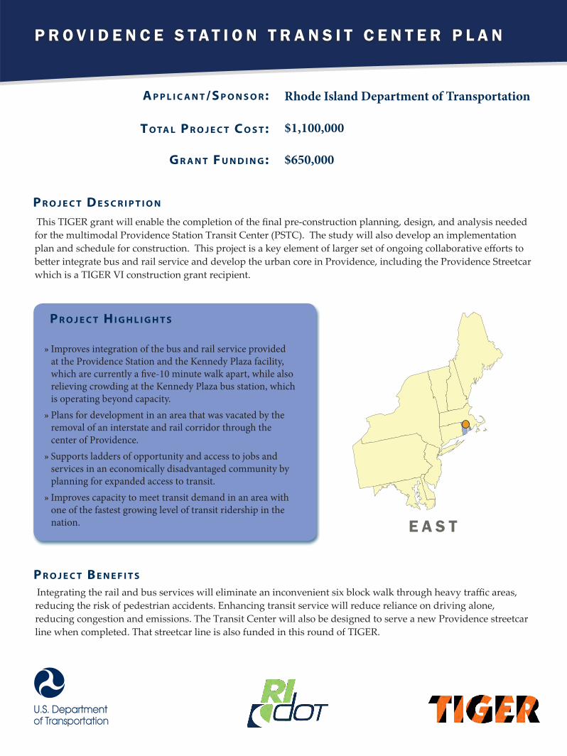
P R O V I D E N C E S T A T I O N T R A N S I T C E N T E R P L A N
A p p l i c A n t /S p o n S o r :
t o tA l p r o j e c t c o S t :
G r A n t F u n d i n G :
Rhode Island Department of Transportation
$1,100,000
$650,000
This TIGER grant will enable the completion of the final pre-construction planning, design, and analysis needed for the multimodal Providence Station Transit Center (PSTC). The study will also develop an implementation plan and schedule for construction. This project is a key element of larger set of ongoing collaborative efforts to better integrate bus and rail service and develop the urban core in Providence, including the Providence Streetcar which is a TIGER VI construction grant recipient.
p r o j e c t d e S c r i p t i o n
p r o j e c t H i G H l i G H t S
»» Improves integration of the bus and rail service provided at the Providence Station and the Kennedy Plaza facility, which are currently a five-10 minute walk apart, while also relieving crowding at the Kennedy Plaza bus station, which is operating beyond capacity. »» Plans for development in an area that was vacated by the removal of an interstate and rail corridor through the center of Providence.»» Supports ladders of opportunity and access to jobs and services in an economically disadvantaged community by planning for expanded access to transit.»» Improves capacity to meet transit demand in an area with one of the fastest growing level of transit ridership in the nation.
Integrating the rail and bus services will eliminate an inconvenient six block walk through heavy traffic areas, reducing the risk of pedestrian accidents. Enhancing transit service will reduce reliance on driving alone, reducing congestion and emissions. The Transit Center will also be designed to serve a new Providence streetcar line when completed. That streetcar line is also funded in this round of TIGER.
p r o j e c t B e n e F i t S
E A S T

S O U T H

R E S T O R I N G P A T H W A Y S T O E C O N O M I C O P P O R T U N I T I E S
A p p l i c A n t /S p o n S o r :
t o tA l p r o j e c t c o S t :
G r A n t F u n d i n G :
City of Birmingham
$300,000
$125,000
This TIGER grant will fund a planning project for the City of Birmingham which responds to important mobility, safety, and community-based issues facing the metropolitan area and local community– particularly low income and minority populations. The project will engage the public to examine an elevated interstate that bisects neighborhoods in downtown Birmingham, cutting lower income neighborhoods off from economic opportunities. The area is in disrepair, and has been identified as a major barrier to connectivity as well as economic development in the immediate area, which has high vacancy rates and lower property values.
p r o j e c t d e S c r i p t i o n
p r o j e c t H i G H l i G H t S
»» Examines an elevated interstate that bisects neighborhoods in downtown Birmingham, isolating low income communities from the opportunities available in the thriving city core.»» Explores stronger transportation connections within the city, and ways to provide access to healthier food choices and more land availability for retail development.»» Aligns with priorities outlined by residents in first citywide comprehensive plan in 50 years.
This project proposes to examine ways to revitalize downtown neighborhoods and improve quality of life, economic competitiveness, safety and partnership. The plan will engage the public to look at mitigating existing infrastructure conditions and rebuilding ladders of opportunity by removing existing barriers to better transportation options. The project will also study connections that create pathways to jobs and educational opportunities for low-income neighborhoods adjacent to the existing interstate.
p r o j e c t B e n e F i t S
S O U T H

R A I L R O A D C O R R I D O R H I G H W A Y C R O S S I N G P L A N
A p p l i c A n t /S p o n S o r :
t o tA l p r o j e c t c o S t :
G r A n t F u n d i n G :
City of Jonesboro
$1,500,000
$1,200,000
The City of Jonesboro will use this TIGER funding to conduct an environmental review and design plans for a railroad overpass on Highway 18. This planning project is part of a large comprehensive action plan to improve rail grade crossings within the City of Jonesboro, which handles approximately 60 trains per day through 44 rail grade crossings, contributing to significant delays for drivers and transit. The design plans will be for a single crossing at Highway 18 and the BNSF Railroad.
p r o j e c t d e S c r i p t i o n
p r o j e c t H i G H l i G H t S
»» Plans overpass to reduce delays and improve safety at a railroad crossing that sees 14,000 automobiles a day. Data from the transit system show that transit vehicles face an average of a nine minute delay at this crossing over 200 times per year.»» Designs connectivity improvements, including walkability and bikeability, for workers, emergency responders, and students at two local schools and the ASU-Newport Campus. »» Creates opportunity to significantly decrease accidents. Due to 117 accidents at grade crossings over the last 40 years, the City has evaluated all crossings to determine what improvements need to be made at each crossing.
The project, once constructed, is expected to reduce traffic accidents and enhance safety for all users and first responders. An overpass at this intersection addresses multiple challenges, including increased timely access to employment, increased safety, and decreased environmental impacts. If left unimproved, this rail crossing will continue to be blocked an average of two hours per day, affecting many of the 14,000 cars that travel through it each day.
p r o j e c t B e n e F i t S
S O U T H

Rural
T A M I A M I T R A I L / E V E R G L A D E S R E S T O R A T I O N
A p p l i c A n t /S p o n S o r :
t o tA l p r o j e c t c o S t :
G r A n t F u n d i n G :
Florida Department of Transportation
$190,000,000
$20,000,000
The money from this grant will be used to replace a portion of Tamiami Trail (US-41) with an elevated 2.6-mile bridge that will help restore natural storm water flows into the Everglades National Park (ENP) and Northeast Shark River, while preserving a critical transportation link between Southwest Florida and Miami. This TIGER funded project furthers the Administration’s efforts and the State of Florida’s commitment to restore the Everglades. The project has extensive stakeholder collaboration and support including the National Park Service, the US Army Corps of Engineers, state and local agencies and numerous conservation advocacy organizations.
p r o j e c t d e S c r i p t i o n
p r o j e c t H i G H l i G H t S
»» Maintains and enhances a key regional transportation link and hurricane evacuation route in an economically critical rural area. »» Increases peak and annual freshwater flow in the Everglades National Park by 35 percent and raises frequency of targeted water depths from 84 percent to 92 percent.»» Prevents flooding by making the road safer with a new bridge elevation of 13.13 feet above the Designed High Water level of 9.7 feet.
This 2.6-mile road project is the most cost-effective and critical step to resolving a major impediment to water flow into ENP since the construction of Tamiami Trail in 1928. Bridging this portion of Tamiami Trail will move forward one of the most integral projects in the Everglades. This new bridge will correct past errors and restore the environmental sustainability of the Everglades ecosystem, while enhancing South Florida’s economic competiveness, ensuring it is more safe and more resilient.
p r o j e c t B e n e F i t S
S O U T H

Rural
D O W N T O W N D A H L O N E G A C O M P L E T E S T R E E T S C O R R I D O R I M P R O V E M E N T S
A p p l i c A n t /S p o n S o r :
t o tA l p r o j e c t c o S t :
G r A n t F u n d i n G :
City of Dahlonega
$9,175,000
$5,100,000
The Downtown Dahlonega Complete Streets Corridor Improvements project will begin bringing to fruition the community’s vision of a revitalized downtown that connects surrounding neighborhoods to the historic business district’s services and shopping, and the University of North Georgia’s education facilities. The TIGER project will provide critical sidewalks, crosswalks, and pedestrian lighting; reduce conflict among transportation modes; and provide accessibility for bicycles and pedestrians to enhance safety. The project will reduce potential accidents and congestion in this important market center for rural North Georgia. Residents set these transportation choices as their highest priorities in public meetings and stakeholder input during the city’s extensive Downtown Master Plan process.
p r o j e c t d e S c r i p t i o n
p r o j e c t H i G H l i G H t S
»» According to the 2008 Dahlonega Downtown Master Plan, the downtown area produces 23 percent of all annual retail sales in Lumpkin County, and is home to 62 percent of the city’s businesses, yet it has severe problems due to a lack of pedestrian access. »» Installs sidewalks and bicycle facilities where none currently exist. Approximately 45 percent of the block segments within the proposed project area have no sidewalks at all.»» Area median household income in downtown Dahlonega is $26,190, and the percentage of Households with income less than $25,000 is 48 percent.
The plan promotes redevelopment opportunities through the design principles of Complete Streets and the Sustainable Sites Initiative. Overall, this project will solve multiple transportation deficiencies on the main downtown corridor area, addressing widespread mobility, character, and infrastructure issues in a busy, rural town. The Downtown Dahlonega Complete Streets Corridor Improvements will increase transportation alternatives and build pedestrian mobility and safety features to meet the TIGER goal of better quality of life, and more sustainable communities that provide ladders of opportunity to residents.
p r o j e c t B e n e F i t S
S O U T H
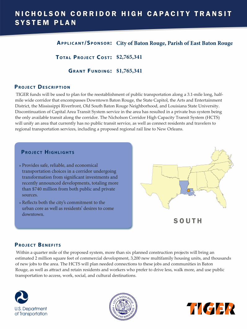
N I C H O L S O N C O R R I D O R H I G H C A P A C I T Y T R A N S I T S Y S T E M P L A N
A p p l i c A n t /S p o n S o r :
t o tA l p r o j e c t c o S t :
G r A n t F u n d i n G :
City of Baton Rouge, Parish of East Baton Rouge
$2,765,341
$1,765,341
TIGER funds will be used to plan for the reestablishment of public transportation along a 3.1-mile long, half-mile wide corridor that encompasses Downtown Baton Rouge, the State Capitol, the Arts and Entertainment District, the Mississippi Riverfront, Old South Baton Rouge Neighborhood, and Louisiana State University. Discontinuation of Capital Area Transit System service in the area has resulted in a private bus system being the only available transit along the corridor. The Nicholson Corridor High Capacity Transit System (HCTS) will unify an area that currently has no public transit service, as well as connect residents and travelers to regional transportation services, including a proposed regional rail line to New Orleans.
p r o j e c t d e S c r i p t i o n
p r o j e c t H i G H l i G H t S
»» Provides safe, reliable, and economical transportation choices in a corridor undergoing transformation from significant investments and recently announced developments, totaling more than $740 million from both public and private sources.»» Reflects both the city’s commitment to the urban core as well as residents’ desires to come downtown.
Within a quarter mile of the proposed system, more than six planned construction projects will bring an estimated 2 million square feet of commercial development, 3,200 new multifamily housing units, and thousands of new jobs to the area. The HCTS will plan needed connections to these jobs and communities in Baton Rouge, as well as attract and retain residents and workers who prefer to drive less, walk more, and use public transportation to access, work, social, and cultural destinations.
p r o j e c t B e n e F i t S
S O U T H

L A F A Y E T T E I - 4 9 C O R R I D O R P L A N
A p p l i c A n t /S p o n S o r :
t o tA l p r o j e c t c o S t :
G r A n t F u n d i n G :
Lafayette City Parish Consolidated Government$500,000
$304,250
TIGER will fund a corridor plan for the Interstate 49 Southern Corridor, alongside the I-49 connector, a 5.5 mile, elevated highway that will pass through the urban core of Lafayette. The plan seeks to prepare for improvements in the corridor concurrently with the planning of the connector. Specifically, the Corridor Plan will focus on connecting disadvantaged populations in the corridor with employment centers, expanding transit, and promoting economic development. Local partners will work with the Louisiana Department of Transportation to develop corridor plans concurrently with those of the connector, with the goal of preventing the need to fix problems created by the structure after it is built.
p r o j e c t d e S c r i p t i o n
p r o j e c t H i G H l i G H t S
»» The I-49 corridor represents 3.95 percent of all roadway miles in the Parish of Lafayette, but is the site of approximately 13 percent of all automobile crashes. The corridor also encompasses approximately 14.5 percent of all bike and pedestrian crashes in the Parish of Lafayette.»» More than 25 percent of the residents of the urban core area have no vehicles available, making it necessary for those residents to walk, bike, or use public transit.»» The Thruway will remain as a service road, once the I-49 Connector is completed. This will also result in a decrease of traffic along the Thruway from more than 70,000 vehicles a day to a projected 20,000 vehicles a day by 2040.
The plan has high levels of partnership from public and community groups, and builds on previous planning efforts, including the Blue Book designed by the University of Louisiana, an Action Plan created by the Lafayette City-Parish Council in partnership with local, state, and federal government, and an Economic Redevelopment plan. The corridor plan will take advantage of land use and transportation infrastructure to do so. It will tie plans to potential funding, and utilize innovative funding mechanisms. This will help mitigate potential issues of community disruption and isolation associated with the elevated freeway and build strong, sustainable communities. The proposal will enhance modal connectivity options with improved bicycle/pedestrian facilities as well as complete streets, and improve transit connectivity by adding connections to the Rosa Parks Transit Center. The project also seeks to leverage and extend the economic strengths of the area into low income communities, thereby reducing economic disparities and enhancing competiveness. In addition, the proposal will examine additions to and improvements of hurricane evacuation options, promoting safety.
p r o j e c t B e n e F i t S
S O U T H
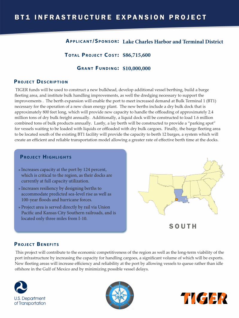
B T 1 I N F R A S T R U C T U R E E X P A N S I O N P R O J E C T
A p p l i c A n t /S p o n S o r :
t o tA l p r o j e c t c o S t :
G r A n t F u n d i n G :
Lake Charles Harbor and Terminal District
$86,715,600
$10,000,000
TIGER funds will be used to construct a new bulkhead, develop additional vessel berthing, build a barge fleeting area, and institute bulk handling improvements, as well the dredging necessary to support the improvements . The berth expansion will enable the port to meet increased demand at Bulk Terminal 1 (BT1) necessary for the operation of a new clean energy plant. The new berths include a dry bulk dock that is approximately 800 feet long, which will provide new capacity to handle the offloading of approximately 2.4 million tons of dry bulk freight annually. Additionally, a liquid dock will be constructed to load 1.6 million combined tons of bulk products annually. Lastly, a lay berth will be constructed to provide a “parking spot” for vessels waiting to be loaded with liquids or offloaded with dry bulk cargoes. Finally, the barge fleeting area to be located south of the existing BT1 facility will provide the capacity to berth 12 barges, a system which will create an efficient and reliable transportation model allowing a greater rate of effective berth time at the docks.
p r o j e c t d e S c r i p t i o n
p r o j e c t H i G H l i G H t S
»» Increases capacity at the port by 124 percent, which is critical to the region, as their docks are currently at full capacity utilization.»» Increases resiliency by designing berths to accommodate predicted sea-level rise as well as 100-year floods and hurricane forces.»» Project area is served directly by rail via Union Pacific and Kansas City Southern railroads, and is located only three miles from I-10.
This project will contribute to the economic competitiveness of the region as well as the long-term viability of the port infrastructure by increasing the capacity for handling cargoes, a significant volume of which will be exports. New fleeting areas will increase efficiency and reliability at the port by allowing vessels to queue rather than idle offshore in the Gulf of Mexico and by minimizing possible vessel delays.
p r o j e c t B e n e F i t S
S O U T H

Rural
T H R E E - C O U N T Y R O A D W A Y I M P R O V E M E N T S P R O G R A M
A p p l i c A n t /S p o n S o r :
t o tA l p r o j e c t c o S t :
G r A n t F u n d i n G :
Claiborne County, Mississippi
$18,780,037
$17,885,750
The TRI-Mississippi (Three-County Roadway Improvements Program for Southwest Mississippi) project will radically improve motor vehicle transportation reliability and safety in an economically-disadvantaged, rural region. The TIGER project aims to create a modernized, dependable network of “farm-to-market” roads that will allow the citizens of Claiborne, Franklin and Jefferson Counties to safely and quickly accomplish major transportation goals such as a fully-connected and safe county transportation system, rehabilitation of critical evacuation routes, and the creation of safe routes to local schools. This includes rehabilitating 41.16 miles of strategic county roads and replacing 18 bridges.
p r o j e c t d e S c r i p t i o n
p r o j e c t H i G H l i G H t S
»» Provides upgraded and safer access to employment and education centers for the 80 percent of the population living in rural areas in the region.»» According to the Mississippi Department of Employment Security, the current unemployment rate for the region is 12.3 percent, with Jefferson County topping out at almost 15 percent.»» There are 60 deficient bridges in the region, with more bridges deteriorating toward failing sufficiency ratings with every passing day. Dozens of regional bridges have reached the point of deterioration where they are posted at 6,000-pound weight limits, forcing school buses to seek detour routes and making crossings precarious for ambulances, fire trucks and other heavy vehicles.
The greatest opportunity presented by the TRI-Mississippi program is the improvement of the public’s access to the few, important economic drivers in the region: hospitals, schools, agriculture, forestry and utility operations. With no public transportation options, residents must rely on personal vehicles and roadway transportation. The poor state of the roads creates additional fuel and maintenance costs for the region, and hinders access to employment centers, especially the agriculture and forestry businesses in the area, many of which are forced to operate or transport on single-lane gravel roads and traverse failing timber bridges with heavy equipment.
p r o j e c t B e n e F i t S
S O U T H

A S H E V I L L E E A S T O F T H E R I V E R W A Y M U L T I M O D A L N E T W O R K
A p p l i c A n t /S p o n S o r :
t o tA l p r o j e c t c o S t :
G r A n t F u n d i n G :
City of Asheville
$29,200,000
$14,600,000
This TIGER funding will help complete an interconnected six mile network of pedestrian, bicycle, roadway, and streetscape improvements, including construction of three new greenways, a multimodal riverfront corridor, and conversion of a major street to a complete street. Many of the project elements are a part of the Asheville East of the Riverway Sustainable Neighborhood Project and will connect low and moderate income neighborhoods with jobs, neighborhood services, and community assets in Asheville’s rapidly developing riverfront area. The project includes intersection improvements that will improve traffic flow, intersection geometry for truck movements, and safety in the corridor. Other elements include four key bicycle and pedestrian facilities that complete an on- and off-road system connecting neighborhoods to the commercial centers of the area.
p r o j e c t d e S c r i p t i o n
p r o j e c t H i G H l i G H t S
»» Creates new bike-ped facilities and eliminates hazardous intersections, reducing vehicular, pedestrian, and bicycle accidents.»» Uses innovative financing, including “land-banking” city-owned assets to spur development and a business attraction strategy to spur economic growth.»» Leverages a TIGER II Planning Grant awarded to identify transportation issues as basis for project plan.
Asheville’s riverfront, a long underutilized asset in the city, is beginning to transform to a vibrant urban neighborhood. The roadway and greenway improvements will connect people in different neighborhoods to employment, education, and services opportunities in downtown Asheville, including the riverfront area. With the extension of the greenway network and access to transit, citizens will be able to get around the area without using a vehicle which will further reduce emissions, increase transportation choices, mobility and access.
p r o j e c t B e n e F i t S
S O U T H

D U K E B E L T L I N E T R A I L M A S T E R P L A N
A p p l i c A n t /S p o n S o r :
t o tA l p r o j e c t c o S t :
G r A n t F u n d i n G :
City of Durham
$297,700
$222,700
The TIGER grant will help create a master plan for developing the Duke Belt Line Trail, a bicycle and pedestrian trail that would tie the Durham Station Transportation Center to the Triangle’s bus and rail system, connecting neighborhoods north of downtown seamlessly to the regional mobility network. At the southwestern end of the proposed 2.2 mile Duke Belt Line Trail corridor lies a multi-modal hub comprised of the Durham Station Transportation Center and Durham Amtrak Station. Combined, these two stations are served by 18 local bus routes, four regional bus routes, two intercity bus operators and six intercity passenger trains. The 2013 City of Durham Comprehensive Plan stresses the important of bicycling, walking and transit to the overall vitality of the city and the health and quality of life of its citizens.
p r o j e c t d e S c r i p t i o n
p r o j e c t H i G H l i G H t S
»» The Duke Belt Line Trail would significantly increase bicycle and pedestrian access to the regional and intercity mass transportation system; linking people to jobs throughout the Triangle region and serving as a Ladder of Opportunity for those along the corridor. »» The Plan will include a detailed public participation strategy, which will include an outline of specific outreach tasks, the purpose of each task, and a schedule of public engagement activities. The strategy will serve as the blueprint for informing and engaging a diverse group of project stakeholders and area residents.»» Once constructed, the Duke Belt Line Trail will become part of a 28.5-mile-long North-South Trail running from The West Point on The Eno Park in Durham County to just past Beaver Creek in Wake County.
The Duke Belt Line Trail, once completed, will help alter the historic patterns of regional sprawl and disinvestment in urban neighborhoods, while creating a more vibrant, walkable and livable community. The master plan will ensure the project incorporates public participation, environmental and security concerns, and detailed analysis to create a project that will significantly enhance the overall mobility, livability, and economic competitiveness of the City of Durham and the Triangle region by connecting seamlessly to transportation options, increasing multimodal access, linking people to jobs throughout the region, attracting growth and driving sustainable redevelopment.
p r o j e c t B e n e F i t S
S O U T H

T H E P I E D M O N T S T U D Y
A p p l i c A n t /S p o n S o r :
t o tA l p r o j e c t c o S t :
G r A n t F u n d i n G :
North Carolina Department of Transportation
$2,695,000
$200,000
This TIGER grant will be used to begin a multi-modal corridor study to look at ways to improve transit connections and stations along the Carolinian and Piedmont rail lines. The proposal includes improvements to intercity rail, key terminals, and community-based connections in North Carolina. The study will examine overall accessibility to and within the region and how to support job creation along the rail corridor through improved multimodal linkage and access via motor-coaches and regional transit operations.
p r o j e c t d e S c r i p t i o n
p r o j e c t H i G H l i G H t S
»» Examines expanding transit connections and expanding options for users on a regional scale, building on benefits to communities along routes of limited buses operating to current rail stations. »» Improves accessibility to transit, including connections to rail, for western portion of state, which currently has no non-tourist passenger rail lines and suffers from limited public transportation options.
This study will plan for transportation options and improvements for the Charlotte region and communities along the Piedmont Corridor rail line, allowing them enhanced access to transit and passenger rail. The study will engage in regional collaboration to examine opportunities to connect two major rail lines with local transit networks operated by Charlotte Area Transit System, Capital Area Transit, Concord Kannapolis Area Transit, Durham Area Transit Authority, Piedmont Authority of Regional Transportation, and Salisbury Transit System. Once implemented, the study would lead to improved connectivity- especially for the non-driving population, increased transit ridership and reduced emissions, and enhanced quality of life for the region.
p r o j e c t B e n e F i t S
S O U T H

Rural
T H E N O R T H E A S T E R N N C R A I L I M P R O V E M E N T P R O J E C T
A p p l i c A n t /S p o n S o r :
t o tA l p r o j e c t c o S t :
G r A n t F u n d i n G :
North Carolina Department of Transportation
$11,631,000
$5,800,000
This TIGER grant will fund the rehabilitation of portions of a 52 mile rail corridor that will allow for the operation of 286,000-pound rail cars along its length. Approximately 17.5 miles of new rail will be installed, crossties and eight main line turnouts will be replaced, four highway grade crossings will be rehabilitated, and approximately 30 miles of roadbed will be surfaced.
p r o j e c t d e S c r i p t i o n
p r o j e c t H i G H l i G H t S
»» Improves sourcing and distribution options for current businesses serviced by rail by making available a modern, up‐to‐date rail corridor in northeastern North Carolina.»» Provides meaningful economic and job growth opportunities in a region of North Carolina that has faced chronically high unemployment and a general decline in industrial sector employment opportunities.»» Exhibits a strong partnership between the public sector and North Carolina and Virginia Railroad, which is contributing $3,031,000 to the project.
By enabling the North Carolina & Virginia railroad to handle higher capacity freight cars, this TIGER project significantly increases the mobility of freight in this region of North Carolina, improving the overall quality of life for its residence, and expanding the competitiveness of existing companies in the area using rail freight services.
p r o j e c t B e n e F i t S
S O U T H

R I V E R S I D E D R I V E / G A T H E R I N G P L A C E M U L T I M O D A L A C C E S S P R O J E C T
A p p l i c A n t /S p o n S o r :
t o tA l p r o j e c t c o S t :
G r A n t F u n d i n G :
City of Tulsa
$38,558,729
$10,000,000
This TIGER grant will help rebuild and rehabilitate a regionally significant roadway into a “complete street.” Riverside Drive Multi-Modal Access Project, comprised of five interrelated infrastructure improvements along Riverside Drive, will better connect to the Gathering Place, a 75-acre recreational park and natural area slated to open in 2017. Currently, the one mile stretch of Riverside Drive adjacent to the park site, which carries 26,400 vehicles daily, experiences routine flooding due to poor drainage infrastructure. The roadway also lacks safe pedestrian and bicycle crossings to the waterfront area. The project will reconstruct Riverside Drive including replacing a structurally deficient bridge over Crow Creek. The project also upgrades the vertical clearance of the only grade separated pedestrian crossing of Riverside Drive within the project limits to connect park and trail systems to nearby neighborhoods. The project relocates and enhances segments of the River Parks trail and creates new parking areas for area trails and the Gathering Place.
p r o j e c t d e S c r i p t i o n
p r o j e c t H i G H l i G H t S
»» Connects Tulsa residents to the planned Gathering Place public space along the Arkansas River.»» Improves the resiliency of Riverside Drive against future heavy rain events.»» Upgrades critical infrastructure, including the structurally deficient Crow Creek bridge crossing.»» Leverages support from a broad array of community stakeholders.
Collectively, the project will increase safety for all roadway users, restore the existing transportation infrastructure to a state-of-good-repair, and enhance multi-modal access to the Arkansas Riverfront. These improvements will transform Riverside Drive into a “complete street” that complements the City’s efforts to revitalize the waterfront area, while also enhancing a commuter route into Tulsa’s central business district.
p r o j e c t B e n e F i t S
S O U T H

S E A M L E S S C I T Y R E V I T A L I Z A T I O N P R O J E C T
A p p l i c A n t /S p o n S o r :
t o tA l p r o j e c t c o S t :
G r A n t F u n d i n G :
City of Columbia
$45,614,748
$10,000,000
TIGER funds will be used to complete the last four blocks of the Main Street Beautification Project and rehabilitate 16 blocks of North Main Street. Columbia undertook an extensive downtown streetscaping initiative from 2003-2010 that facilitated significant investment in the Main Street Corridor. The Seamless City Revitalization project seeks to upgrade and improve gaps in the roadway network to create a “seamless” revitalization along the Main Street Corridor. The project includes street repairs and pedestrian and bicycle improvements along the corridor to create an attractive, uniform, and safer downtown street.
p r o j e c t d e S c r i p t i o n
p r o j e c t H i G H l i G H t S
»» Creates continuous and convenient pedestrian and bicycle facilities, which is especially important because a majority of the residents along the thoroughfare do not own a vehicle»» Improves safety by providing upgraded roadway crossings and sidewalks and redesigned intersections that reduces the likelihood of crashes.»» Encourages investment along the corridor by enhancing multi-modal connections to centers of employment, education, and services.
The Seamless City Revitalization project improves mobility along the Main Street Corridor, which is the gateway into and out of Columbia. Design improvement and adaptive signals that dynamically adjust to corridor demands create more efficient vehicle traffic flow, resulting in travel time savings and emission reductions. Streetscaping improvements, including safer facilities for pedestrians and bicyclists and clearly defined public transit access points with bus shelters, will improve mobility along the corridor for all users and increase access to restaurants, retail stores, and businesses.
p r o j e c t B e n e F i t S
S O U T H

W A N D O W E L C H T E R M I N A L R E H A B I L I T A T I O N
A p p l i c A n t /S p o n S o r :
t o tA l p r o j e c t c o S t :
G r A n t F u n d i n G :
South Carolina State Ports Authority
$86,320,000
$10,840,000
This TIGER grant will pay for structural repairs of damaged piles at Wando Welch Terminal Wharf, which will address structural deficiencies and improve operations at the Wharf. Rehabilitating the Wando Welch terminal with items that include improving the berth and under the wharf for stability and upgrading the waterside and landside crane rails, beams and support pilings will allow for large vessels and increased capacity. The terminal was originally designed for 4,500 twenty-foot equivalent unit (TEU) vessels but larger TEU 9,200 vessels have caused structural damage.
p r o j e c t d e S c r i p t i o n
p r o j e c t H i G H l i G H t S
»» Repairs provide a cost effective option compared to dredging a different location in this region, as this wharf is currently in the deepest harbor in the South Atlantic»» Wando Welch is utilized by 11 international ship lines, transporting containerized goods in 9,200 TEU ships, but was designed to accommodate ships only half that size. »» This terminal handles 60 percent of South Carolina’s exports. »» Leverages partnership and support from SC DOT, MPO, Chamber, Manufacturers Alliance and legislators.
The Port of Charleston is one of few on the East Coast that has the ability to accommodate the largest container ships afloat today. Hence, Wando Welch has received repeated calls from ships that exceed the design capacity of the facility and overstressed the infrastructure. Rehabilitating the Wando Welch terminal to be able to support heavier loads, improving the berth and under the wharf for stability and upgrading the waterside and landside crane rails, beams and support pilings will improve the ability of the port to handle the most efficient ships, helping to reduce costs for shippers.
p r o j e c t B e n e F i t S
S O U T H

C I T Y O F C H A T T A N O O G A R A I L T R A N S I T I M P L E M E N T A T I O N P L A N
A p p l i c A n t /S p o n S o r :
t o tA l p r o j e c t c o S t :
G r A n t F u n d i n G :
City of Chattanooga
$700,000
$400,000
This TIGER grant will fund Chattanooga’s rail transit implementation plan that will evaluate the feasibility of using an existing 21-mile freight rail facility for passenger service. The plan will also look at an implementation strategy for a 23-mile long passenger rail system in the city. Repurposing this infrastructure for passenger rail would enhance rail and transit access in downtown Chattanooga and create more transportation options to the growing jobs centers.
p r o j e c t d e S c r i p t i o n
p r o j e c t H i G H l i G H t S
»» Repurposes underutilized rail infrastructure to expand non-driving options.»» Improves rail access to large employment centers as well as to the Chattanooga Municipal Airport.»» Connects economically disadvantaged communities with principal destinations for jobs, education, and commerce, creating ladders of opportunity.
If the plan is implemented the project would result in state of good repair benefits for the existing freight rail infrastructure, while simultaneously expanding transportation options for passenger travel. The project complements ongoing plans to revitalize the city through transit-oriented development, enhancing the city’s efforts to improve air quality by transforming to a more pedestrian- and transit-friendly community. The project will plan for a new station in downtown Chattanooga, with a vibrant station-area, integrated with nearby affordable housing, and bicycle and pedestrian networks.
p r o j e c t B e n e F i t S
S O U T H

H O U S T O N I N T E L L I G E N T T R A N S P O R T A T I O N S Y S T E M
A p p l i c A n t /S p o n S o r :
t o tA l p r o j e c t c o S t :
G r A n t F u n d i n G :
City of Houston
$24,096,050
$10,000,000
This TIGER grant will help the City of Houston expand existing Intelligent Transportation Systems infrastructure in order to monitor and manage arterial traffic in real-time. Expansion of the prototype system will provide travel information (roadside) and incident management capabilities along 150 arterial corridors by adding Dynamic Message Signs, closed circuit television cameras, count stations collecting real time traffic data, sites with enhanced signal detection to improve traffic flow, and additional WiMax to wirelessly communicate with each signal for coordination and central control. Together, this set of improvements will enhance mobility and increase safety.
p r o j e c t d e S c r i p t i o n
p r o j e c t H i G H l i G H t S
»» Improves vehicular flow saving up to 2 million gallons of fuel and cutting up to17,500 tons of CO2 annually.»» Reduces first responder response time and clearance of incidents by up to 20 percent.»» Enhances timing and signal adjustments based on current conditions and planned events.
This project will improve the existing arterial management system’s performance and operation, thereby improving mobility and safety for motorists, transit providers/ passengers, and pedestrians. Upon completion, this project will allow for greater traffic and incident management through providing real-time information, reducing travel delays and emissions, and improving capacity and accessibility to the community.
p r o j e c t B e n e F i t S
S O U T H

L A N D U S E - T R A N S P O R T A T I O N C O N N E C T I O N S T O S U S T A I N A B L E S C H O O L S
A p p l i c A n t /S p o n S o r :
t o tA l p r o j e c t c o S t :
G r A n t F u n d i n G :
North Central Texas Council of Governments
$300,000
$210,000
This TIGER grant will help create a regional program and implementation plan to promote connections and coordination between transportation agencies, local governments, and schools. The project will establish a structured dialogue and formalized partnership among all entities to improve multimodal transportation options to schools, advance long-term planning for school siting, improve transportation safety near schools, and encourage coordination between local governments, Independent School Districts, and transit agencies within the 12-county metropolitan planning area for resource efficiency and sustainability.
p r o j e c t d e S c r i p t i o n
p r o j e c t H i G H l i G H t S
»» Seeks innovative solutions through a multidisciplinary, integrated planning process with regional focus.»» Coordinates parallel planning efforts between related but traditionally separate entities»» Improves safety for disproportionately affected populations.»» Reduces congestion and improves environmental sustainability by promoting walking, bicycling, and transit.
There are very high pedestrian and bicyclist accidents within a half mile radius of schools in the region. The project seeks not only to improve critical aspects of bicycle/pedestrian access to schools, but also will advance community health, environmental quality, and economic vitality as communities’ accessibility to schools and school-related activities is increased. The proposal will target an awareness-building campaign to communities found to be most vulnerable to bicycle/pedestrian crashes in the Dallas region.
p r o j e c t B e n e F i t S
S O U T H
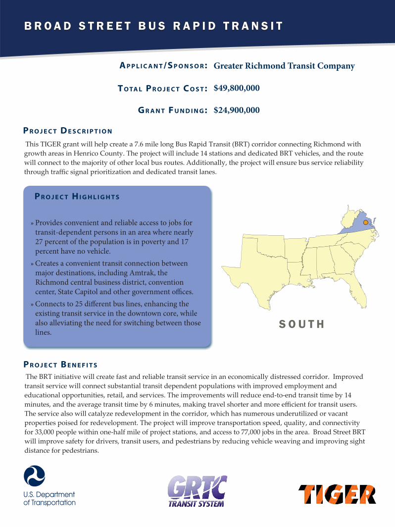
B R O A D S T R E E T B U S R A P I D T R A N S I T
A p p l i c A n t /S p o n S o r :
t o tA l p r o j e c t c o S t :
G r A n t F u n d i n G :
Greater Richmond Transit Company
$49,800,000
$24,900,000
This TIGER grant will help create a 7.6 mile long Bus Rapid Transit (BRT) corridor connecting Richmond with growth areas in Henrico County. The project will include 14 stations and dedicated BRT vehicles, and the route will connect to the majority of other local bus routes. Additionally, the project will ensure bus service reliability through traffic signal prioritization and dedicated transit lanes.
p r o j e c t d e S c r i p t i o n
p r o j e c t H i G H l i G H t S
»» Provides convenient and reliable access to jobs for transit-dependent persons in an area where nearly 27 percent of the population is in poverty and 17 percent have no vehicle. »» Creates a convenient transit connection between major destinations, including Amtrak, the Richmond central business district, convention center, State Capitol and other government offices.»» Connects to 25 different bus lines, enhancing the existing transit service in the downtown core, while also alleviating the need for switching between those lines.
The BRT initiative will create fast and reliable transit service in an economically distressed corridor. Improved transit service will connect substantial transit dependent populations with improved employment and educational opportunities, retail, and services. The improvements will reduce end-to-end transit time by 14 minutes, and the average transit time by 6 minutes, making travel shorter and more efficient for transit users. The service also will catalyze redevelopment in the corridor, which has numerous underutilized or vacant properties poised for redevelopment. The project will improve transportation speed, quality, and connectivity for 33,000 people within one-half mile of project stations, and access to 77,000 jobs in the area. Broad Street BRT will improve safety for drivers, transit users, and pedestrians by reducing vehicle weaving and improving sight distance for pedestrians.
p r o j e c t B e n e F i t S
S O U T H

N O R F O L K I N T E R N A T I O N A L T E R M I N A L S
A p p l i c A n t /S p o n S o r :
t o tA l p r o j e c t c o S t :
G r A n t F u n d i n G :
Virginia Port Authority
$31,000,000
$15,000,000
This TIGER grant will help fund the final piece needed to connect the Norfolk port directly to I-564, and to significantly reduce truck traffic from transiting through neighboring residential streets. It includes construction of a dedicated highway on/off ramp, a service gate for terminal personnel and redevelopment of eight acres of brownfield land for container storage. The current terminal truck gates are inadequate for today’s freight volumes, and trucks travelling to/from the terminal bisect neighborhoods, adding to congestion.
p r o j e c t d e S c r i p t i o n
p r o j e c t H i G H l i G H t S
»» Improves efficiency and safety at the only port on U.S. East Coast currently capable of handling 13,000 twenty-foot equivalent unit (TEU) vessels.»» Will allow truckers to move more than one load per day to/from port.»» Removes 740 trucks per day from nearby residential neighborhoods.»» Saves an estimated $4 million annually on highway maintenance costs.»» Wide-ranging support for the project has been demonstrated by regional partners including public officials from the City, County and Transportation Planning Organization, the railroad, trucking community, regional shipper’s association, the workforce and the nearby university.
This project provides a critical last-mile connection between one of the deepest port on the U.S. East Coast and the Interstate Highway System and, once completed, is projected to increase terminal capacity by 1.2 million twenty foot equivalent units (TEU), reduce heavy truck traffic on adjacent, congested neighborhood streets by 60 percent (740 round trip truck moves per day), and reduce total truck-highway miles by over 91.9 million miles through avoided cargo diversions. Beyond relieving congestion and pollution in the neighborhood, the project will greatly relieve port gate congestion, improve the efficiency of port operations, and has the potential to allow many truckers to move more than one load per day between the port and Virginia’s many exporters and distribution centers. The project will save $4 million on highway maintenance.
p r o j e c t B e n e F i t S
S O U T H

Rural
N E W R I V E R P A R K W A Y
A p p l i c A n t /S p o n S o r :
t o tA l p r o j e c t c o S t :
G r A n t F u n d i n G :
West Virginia Department of Transportation
$25,334,916
$10,000,000
This TIGER grant will help fund the construction of the New River Parkway. The new parkway will serve as the principal gateway to the area’s recreational resources, linking two units of the National Park Service, the New River Gorge National River and the Bluestone National Scenic River. It willalso provide direct access to the Hinton National Historic District, Bluestone Lake, Bluestone State Park and Pipestem State Park. With design standards similar to the Blue Ridge National Parkway, the New River Parkway will weave rich cultural, historical and natural resources together with local communities throughout the region. Compatible uses, commercial services and recreational facilities near or adjacent to the roadway will include safety pull-outs, scenic overlooks, rest areas, trail access ways, habitat preserves and historical and cultural sites.
p r o j e c t d e S c r i p t i o n
p r o j e c t H i G H l i G H t S
»» Protects natural and cultural resources and private property by providing safe and appropriate visitor access to the New River and its natural, cultural and scenic resources.»» Improves the accessibility of outdoor recreational experiences within the parkway corridor.»» Supports compatible and appropriate economic development within the parkway corridor and in the adjacent region.
The New River Parkway project will provide improved recreation access, resource protection, and economic stimulus by creating a scenic parkway that enhances resident and visitor experiences while providing safe and efficient accommodation of local residents and visitors and by serving their desires for river and recreation access. By providing a safer and more direct access to I-64, the New River Parkway will have a significant impact on the living and working environment for area residents and visitors alike. Access from Hinton to I-64 at Sandstone is currently limited during times of inclement weather. Other routes are substandard roadways. The New River Parkway offers a new transportation option that will resolve these issues.
p r o j e c t B e n e F i t S
S O U T H

C E N T R A L

1 8 T H S T R E E T V I A D U C T P L A N N I N G P R O J E C T
A p p l i c A n t /S p o n S o r :
t o tA l p r o j e c t c o S t :
G r A n t F u n d i n G :
City of Sioux City
$1,344,000
$1,000,000
This TIGER grant will fund planning and design work for a viaduct that will span several railroad tracks, beginning near the existing intersection of 18th and Steuben Streets and extending westerly over the Union Pacific and Canadian National/Illinois Central Railroad tracks. The proposed viaduct will complement Sioux City’s efforts to sustain and enhance the economic potential of the valley by supporting existing industrial traffic and preparing for projected growth in commercial freight. The project will also improve safety for residents by replacing at least two at-grade railroad crossings.
p r o j e c t d e S c r i p t i o n
p r o j e c t H i G H l i G H t S
»» Plan to reduce delays and congestion for more than 15,000 drivers daily.»» First step toward improving efficiency for more than 66.5 million tons of freight passing through Sioux City annually»» Project, when completed, will connect pedestrians and bicyclists to Floyd River Trail
The high number of rail crossings in one area (five tracks within 205 feet) is a safety and congestion issue in Sioux City. This new viaduct, once completed, will provide significant benefits including reduced delays for motorists travelling in this area; better rail switching operations; improved rail access for existing and future industries; and increased safety for all users. The new viaduct will also include accommodations for pedestrians and bicycles connecting the adjacent neighborhoods west of Floyd Boulevard to the trail along the west bank of the Floyd River.
p r o j e c t B e n e F i t S
C E N T R A L

C H A M P A I G N - U R B A N A M U L T I M O D A L C O R R I D O R E N H A N C E M E N T
A p p l i c A n t /S p o n S o r :
t o tA l p r o j e c t c o S t :
G r A n t F u n d i n G :
Champaign-Urbana Mass Transit District
$34,883,465
$15,705,327
The Champaign-Urbana Mass Transit District will construct Complete Street corridors connecting the Cities of Champaign and Urbana to the University of Illinois. By redesigning five corridors around the university, the project will improve transit travel between the cities and the campus, create new economic opportunities in the surrounding commercial areas, and improve local quality of life. The TIGER project includes a multimodal network of roads, on-street bike lanes, shared lane markings, bus-only lanes, and other transit services that will enhance mobility for residents and visitors, particularly non-drivers, persons with disabilities, senior citizens and economically disadvantaged populations.
p r o j e c t d e S c r i p t i o n
p r o j e c t H i G H l i G H t S
»» Improves critical linkages between the cities of Champaign and Urbana, the area’s major employers, health, and social service organizations. »» Over 80 percent of the jobs in the Champaign-Urbana area are located within approximately one mile of the project corridors
This project will improve mobility choices and increase access to jobs, healthcare, and services in the corridors that connect the downtown centers of Champaign and Urbana with the University of Illinois campus. By improving the condition of the existing transportation infrastructure, the project will create more efficient travel opportunities for pedestrians, bicyclists, transit riders, and vehicles. The project promotes development that is located and designed to be compact and contiguous to existing development and have a limited impact on the natural environment by protecting farmland and water quality.
p r o j e c t B e n e F i t S
C E N T R A L

B R O N Z E V I L L E B R I D G E T O C H I C A G O ’ S L A K E F R O N T
A p p l i c A n t /S p o n S o r :
t o tA l p r o j e c t c o S t :
G r A n t F u n d i n G :
City of Chicago
$23,450,000
$18,760,000
This TIGER grant will fund the new 41st Street Bridge that will connect Lake Park Crescent, a new mixed-income housing project development built as part of the Chicago Housing Authority’s Plan for Transformation, with Burnham Park and the Oakwood/41st Street Beach, recently created by the US Army Corps of Engineers as part of Lake Michigan shoreline reconstruction. The bridge will be a double-curved, inclined-arch structure, creating a unique aesthetic landmark for the community while providing functional and safe access to the Lakefront and its amenities.
p r o j e c t d e S c r i p t i o n
p r o j e c t H i G H l i G H t S
»» Provides persons with disabilities, pedestrians, and bicyclists with grade-separated access to the Lakefront and its amenities while reducing their exposure to automobile traffic on high volume streets.»» Diverts auto trips to other modes of travel, thereby reducing Carbon Dioxide (CO2) emissions . »» Coordinates with land use plans, including CHA efforts to transform former public housing sites into mixed-income neighborhoods and reconnect these isolated sites to their surrounding communities by re-establishing the street grid, filling in missing links, and providing access to employment, education and recreation opportunities.
The project will provide better access to Chicago’s lakefront for Bronzeville residents and will make walking and bicycling safer and more attractive for the 44 percent of residents who currently commute via walking, bicycling or transit and the nearly 40 percent of Bronzeville households without a car. More than 45 percent of Bronzeville residents have incomes below $25,000. Chicago’s Lakefront Trail is currently used by more than 60,000 people a day as a direct and safe route connecting bicyclists and pedestrians to downtown employment and education centers. Fifty percent of trail users report that they make trips for transportation purposes.
p r o j e c t B e n e F i t S
C E N T R A L

I N D I A N A P O L I S R E D L I N E P L A N N I N G S T U D I E S
A p p l i c A n t /S p o n S o r :
t o tA l p r o j e c t c o S t :
G r A n t F u n d i n G :
Indianapolis Public Transportation Corporation
$3,168,000
$2,073,200
This TIGER planning grant will enable the city of Indianapolis to complete the final pre-construction planning for the country’s first all-electric Bus Rapid Transit line. When completed, the Indianapolis Red Line will be a 28 mile route between the cities of Carmel and Greenwood, via downtown Indianapolis. The project will create more frequent and reliable transit service for Indianapolis and the surrounding communities, and will be integrated with other local transit-oriented development initiatives including HUD-funded intercity residential redevelopment.
p r o j e c t d e S c r i p t i o n
p r o j e c t H i G H l i G H t S
»» Expands high quality transit options that will be integrated with biking and walking path networks.»» Creates ladders of opportunity by connecting low and moderate income households to schools, jobs, hospitals and other critical services, as well as downtown amenities.»» Reduces reliance on cars, and cuts emissions, while also cleaning up a former brownfield site.»» Represents a critical step in an overall initiative to replace all diesel buses in Indianapolis with renewable or electric buses by 2025.
This innovative planning project, once built, will help make transit service in Indianapolis faster, more frequent and more reliable. This proposed higher-quality transit service would improve commutes for current transit riders, and would encourage many additional commuters to choose this more affordable and environmentally-friendly option rather than driving alone. The use of electric buses would cut transportation-related emissions and improve air quality.
p r o j e c t B e n e F i t S
C E N T R A L

Rural
T H E S O U T H W E S T C H I E F R O U T E I M P R O V E M E N T P R O J E C T
A p p l i c A n t /S p o n S o r :
t o tA l p r o j e c t c o S t :
G r A n t F u n d i n G :
City of Garden City
$24,269,963
$12,469,963
This TIGER project will restore bolted rail between Hutchinson, Kansas and Las Animas, Colorado--over which Amtrak’s Southwest Chief currently travels--to a much safer and higher performing standard featuring continuously welded rail, new turnouts, and panelized grade crossings. Improvements are being targeted to locations with the most urgent needs, preventing additional deterioration of service in the immediate future.
p r o j e c t d e S c r i p t i o n
p r o j e c t H i G H l i G H t S
»» Directly benefits more than 355,000 Amtrak passengers annually through increased reliability»» Reduces travel time along the corridor by approximately 30 minutes per train once built by increasing average speed, and avoids an additional 145 minutes in travel time caused by deterioration to the rail if left unimproved by 2035.»» Combines multiple sources of public and private funding from federal, state, and local government as well as Burlington Northern Santa Fe and Amtrak.
This project will make a substantial difference in the quality of passenger rail service in Kansas and eastern Colorado, which has declined in speed and reliability over the last 15 years. Good passenger rail service contributes significantly to the health and vitality of many rural communities along the route, providing mobility and access to economic opportunity.
p r o j e c t B e n e F i t S
C E N T R A L

Rural
M O U N T A I N P A R K W A Y E X T E N S I O N
A p p l i c A n t /S p o n S o r :
t o tA l p r o j e c t c o S t :
G r A n t F u n d i n G :
Kentucky Transportation Cabinet
$39,000,000
$24,000,000
This TIGER grant will help widen 2.4 miles of the Mountain Parkway from two to four lanes in remote Eastern Kentucky through the City of Salyersville’s largest commercial district. This will enhance safety, reduce travel time, ease access to public services and provide transportation choices.
p r o j e c t d e S c r i p t i o n
p r o j e c t H i G H l i G H t S
»» Reconstructs intersections to reduce conflict points and improve safety and creates sidewalks and a multi-use path for pedestrians and bicyclist.»» Eliminates outdated roadway design, functionally obsolete bridge structures, and passing restrictions»» Reduces congestion and improves residents’ access to healthcare in Lexington and Louisville.
The modernization of US Route 460 and US 460/KY Route 114 is anticipated to significantly reduce the accidents and injuries in this high-crash zone. Enhanced accessibility through a four-lane Mountain Parkway is critical to the creation of a more competitive and diverse Eastern Kentucky economy. It will also better connect the residents of this region to the urban centers to the west and make it easier for visitors to access recreation areas of Eastern Kentucky.
p r o j e c t B e n e F i t S
C E N T R A L

M - 1 F I X E D R A I L S T R E E T C A R P R O J E C T
A p p l i c A n t /S p o n S o r :
t o tA l p r o j e c t c o S t :
G r A n t F u n d i n G :
City of Detroit
$135,950,000
$12,200,000
This $12.2 million grant will leverage $88.75 million in primarily private and philanthropic local funding, as well as $25 million in previous TIGER funds to enable the M-1 rail coalition to complete a 3.1 mile downtown streetcar system. The streetcar will connect the downtown business district to the economic, cultural, civic, and entertainment assets along Woodward Avenue. Streetcar service will run every seven-10 minutes during peak periods. TIGER VI funds will be used to construct a vehicle storage maintenance facility and associated track, an optical fiber duct that runs along the streetcar route, and complete streets improvements.
p r o j e c t d e S c r i p t i o n
p r o j e c t H i G H l i G H t S
»» Brings significant growth and redevelopment potential to an important corridor in Detroit.»» Create ladders of opportunity, by connecting disadvantaged communities to jobs and educational opportunities through high quality transit options with more frequent service.
This streetcar will run along one of the most heavily populated and thriving corridors in Detroit with several areas along Woodward Avenue which contain many of the city’s economic, cultural, civic, and entertainment assets. The corridor is home to 40 percent of jobs in the city and improving access to the corridor will greatly strengthen the economic competitiveness of the area and create ladders of opportunity for Detroit area residents. As many as 1.8 million riders are predicted to use this more reliable, efficient transit service during the first year of operations, growing to 3 million in later years.
p r o j e c t B e n e F i t S
C E N T R A L

I N T E R C H A N G E A T U S 1 0 / C S A H 8 3
A p p l i c A n t /S p o n S o r :
t o tA l p r o j e c t c o S t :
G r A n t F u n d i n G :
Anoka County, Minnesota
$25,800,000
$10,000,000
This TIGER grant will pay for the removal of the signalized intersection at US 10/CSAH 83 in Anoka County; construction of an interchange at US 10/CSAH 83; construction of an overpass over the BNSF Railway tracks; widening of the CSAH 83 corridor; construction of a sidewalk and trail for pedestrian and bicycle use where no bicycle or pedestrian facilities currently exist; and closure of the non-signalized access points at Llama Street, Traprock Street, and private driveways along US 10.
p r o j e c t d e S c r i p t i o n
p r o j e c t H i G H l i G H t S
»» Reduces travel times and congestion for 36,000-39,000 vehicles per day.»» Eliminates an unsafe intersection for pedestrian and bicyclist where four fatalities have occurred since 2003.»» Improves emergency first responder times and access to medical facilities.
The BNSF railway runs parallel to US 10 and crosses CSAH 83 approximately 40 feet north of its intersection with US 10, resulting in unsafe queuing over the railroad tracks and dangerous conditions for vehicles and pedestrians alike. Conflicts at the intersection continue to grow as trains become longer and the number of daily trains steadily increases. Through the construction of an interchange and grade separated overpass, this project will improve traffic operations on both roadways and eliminate delays for emergency responders. The project will improve safety by reducing the likelihood of crashes, especially rear end crashes due to queuing at the traffic signal, and creating bicycle and pedestrian facilities where none currently exist.
p r o j e c t B e n e F i t S
C E N T R A L

S T . P A U L R A I L T O M U L T I M O D A L C O R R I D O R P L A N
A p p l i c A n t /S p o n S o r :
t o tA l p r o j e c t c o S t :
G r A n t F u n d i n G :
City of Saint Paul
$200,000
$100,000
This TIGER grant will help fund a design study and master plan for reusing the Canadian Pacific Rail Spur as a multimodal corridor for bicycles, pedestrians, and possibly transit. The 5 mile rail spur previously served a now-closed auto plant and is being studied for reuse. Additionally, the corridor area has business and employment centers, economically distressed neighborhoods, and numerous educational institutions within the surrounding area.
p r o j e c t d e S c r i p t i o n
p r o j e c t H i G H l i G H t S
»» Plans a connection to downtown Saint Paul with diverse neighborhoods and creates transportation options for residents to employment, education, and activity centers»» Would improve a transportation asset running through economically and racially diverse neighborhoods»» Compliments current studies to examine the best reuse of the rail line and prepares for the next stage of construction planning.
The plan will consider transportation alongside development of the corridor, preventing the need to retroactively fix problems caused in planning. The project will repurpose a transportation asset, enhance quality of life throughout the adjacent communities, and enhance economic competitiveness by attracting development and improving access to employment.
p r o j e c t B e n e F i t S
C E N T R A L
C E N T R A L C O R R I D O R T R A N S I T E N H A N C E M E N T A N D J O B A C C E S S P R O J E C T
A p p l i c A n t /S p o n S o r :
t o tA l p r o j e c t c o S t :
G r A n t F u n d i n G :
Bi-State Development Agency (Metro Transit)$12,900,000
$10,300,000
This TIGER project will fill a 1.6 mile gap between two existing stations in St. Louis’ MetroLink transit system by constructing a new light rail stop, the Cortex Station. It will also expand the Central West End LRT station, which is adjacent to the new station and is the busiest in the MetroLink system. Finally, it will create a bike trail that connects the new Cortex station to the regional Great Rivers Greenway trail network.
p r o j e c t d e S c r i p t i o n
p r o j e c t H i G H l i G H t S
»» Improves access to many jobs in the Cortex innovation district.»» Creates ladders of opportunity for low-income and zero-vehicle riders from economically disadvantaged communities in the area. »» Leverages ongoing investments in nearby Washington University medical school and the Wexford Science and Technology center.
The new Cortex station will improve access to transit, while improvements to the Central West End station will expand capacity to meet demand, particularly for disadvantaged populations. The connections to the non-motorized trail network will enhance accessibility throughout the metro area. Together these improvements will greatly support ladders of opportunity, enhancing the economy of the economically disadvantaged St. Louis area. By attracting new riders to transit, the project will also improve sustainability and reduce vehicle emissions.
p r o j e c t B e n e F i t S
C E N T R A L

K C W O R K F O R C E C O N N E X P R O J E C T
A p p l i c A n t /S p o n S o r :
t o tA l p r o j e c t c o S t :
G r A n t F u n d i n G :
Mid-America Regional Council
$1,525,000
$1,200,000
This TIGER grant will fund a four-part planning study/community engagement effort to improve job-housing connectivity via public transit. While the economy in the Kansas City Region is strong, the area has witnessed significant flight of employment opportunities from the central city to suburban locations, resulting in separation of and disconnection between job opportunities and working class neighborhoods. Only 17 percent of the jobs in the region are in the Central Business District, and only 18 percent are reachable via transit in 90 minutes or less, according to the Brookings Institute. The project would include extensive public outreach and future land use planning recommendations to shift the current patterns, especially in targeted, high impact areas.
p r o j e c t d e S c r i p t i o n
p r o j e c t H i G H l i G H t S
»» Develops plans to double the number of jobs accessible by transit in greater Kansas City, from 18 percent to 36 percent.»» Holds promise to improve east-west transportation services to link working class neighborhoods to growing employment centers.»» Includes extensive community outreach and involvement.
The proposal builds on strong partnerships and studies from the Brookings Institute, as well as leveraging previous investments from a 2010 HUD Sustainable Communities grant--which identified six key transportation corridors connected to the CBD-- and a TIGER 1 grant. The planning study has the ambitious goal of doubling the number of jobs accessible via transit in the region.
p r o j e c t B e n e F i t S
C E N T R A L

Rural
N E W R O U T E 4 7 M I S S O U R I R I V E R B R I D G E P R O J E C T
A p p l i c A n t /S p o n S o r :
t o tA l p r o j e c t c o S t :
G r A n t F u n d i n G :
Missouri Department of Transportation
$56,300,000
$10,000,000
This TIGER grant will help replace the decaying, 78 year-old Route 47 Deck and Warren Truss Bridge over the Missouri River in Washington, MO. With the bridge nearing the end of its useful life, its age and condition create an ongoing need for maintenance, resulting in substantial expense and inconvenience for taxpayers. The bridge replacement will ensure this vital community and economic link continues to serve not only the people of Franklin and Warren Counties, but the region as a whole.
p r o j e c t d e S c r i p t i o n
p r o j e c t H i G H l i G H t S
»» Improves travel efficiency and reliability by eliminating delays from traffic stoppages for oversized vehicles and agriculture equipment. »» Doubles the width of the bridge, allowing it to accommodate bicycle and pedestrian facilities that are not possible today, while providing the flexibility for additional lanes in the future. »» Creates a more pedestrian-oriented community by providing safe and easy connection to the famous Katy Trail, adjacent communities and popular recreation activities.
This project preserves a vital link to schools, health care, agricultural commerce, and emergency services on both sides of the Missouri River. Constructing a new, dependable bridge ensures reliability of the City of Washington’s transportation system. The new bridge will increase travel capacity and accommodate bicycle/pedestrian facilities which are not possible with the bridge’s current narrow configuration. Wider lanes and shoulders will give vehicles more maneuvering space for collision avoidance, improving safety for the traveling public.
p r o j e c t B e n e F i t S
C E N T R A L

Rural
F O R T B E R T H O L D C O M P R E H E N S I V E R E G I O N A L T R A N S P O R T A T I O N P L A N
A p p l i c A n t /S p o n S o r :
t o tA l p r o j e c t c o S t :
G r A n t F u n d i n G :
The Mandan, Hidatsa, and Arikara Nation (Three Affiliated Tribes)$3,942,000
$1,000,000
The Fort Berthold Comprehensive Regional Transportation Planning project, made possible with TIGER funds, includes a series of studies to accommodate changes to the transportation network for the Fort Berthold Indian Reservation caused by energy development. Current infrastructure does not adequately support the large number of workers who have moved to the reservation to work on oil and gas exploration and the sharp increase in heavy truck traffic which has led to meaningful congestion. The plan may update the Mandan, Hidatsa, and Arikara Nation (MHA Nation) Long-Range Transportation Plan, update the MHA Nation’s Safety Plan, develop a Strategic Highway Safety Plan, and prepare various inventories, assessments and feasibility studies in collaboration with neighboring cities, counties, state governments and regional planning organizations in support of improvements to aviation, railroad and pipeline infrastructure on the Fort Berthold Reservation.
p r o j e c t d e S c r i p t i o n
p r o j e c t H i G H l i G H t S
»» The Community Readiness Model is an innovative and transformative research methodology that was developed as a means of creating community change while integrating the culture of a community, the existing resources, and the level of readiness to more effectively address an issue.»» MHA Nation has worked closely in an innovative partnership with private oil companies drilling on the reservation, who have provided the Tribe with funding to help address problems with reservation roads.»» The development of public transit and ferry system plans, plans to improve and expand airports, planning and design for two new bridges, and prioritization of road improvements will increase transportation choices and access to services.
The studies and initiatives funded through TIGER will facilitate better access and improved movement of workers and goods, increasing the economic competiveness of the area. The proposed improvements will increase transportation choices and access to transportation services, providing community members access to affordable and convenient transportation choices that they currently do not have and enhancing quality of life.
p r o j e c t B e n e F i t S
C E N T R A L

C E N T R A L O M A H A B U S R A P I D T R A N S I T
A p p l i c A n t /S p o n S o r :
t o tA l p r o j e c t c o S t :
G r A n t F u n d i n G :
The Transit Authority of the City of Omaha
$30,583,680
$14,960,000
This TIGER grant will help construct an eight-mile bus rapid transit (BRT) system in Central Omaha. The project includes 14 station pairs that will be served by 8 state-of-the-art BRT vehicles. The corridor serves major retail, the University of Nebraska at Omaha, three major medical complexes, all of Omaha’s five Fortune 500 companies, and the dense, mixed use Midtown Crossing urban area. Today, local bus service operating on this alignment carries more than 11 percent of Metro’s daily passengers.
p r o j e c t d e S c r i p t i o n
p r o j e c t H i G H l i G H t S
»» Intersects with nearly every route in the transit system to serve as the spine of the regional transit network»» Connects members of disadvantaged and economically distressed communities with centers of employment, education, and training.»» Utilizes innovative technologies including Wi-Fi throughout the corridor, stations with solar power, and real-time arrival displays
Today, local bus service operating on this alignment carries more than 11 percent of Metro’s daily passengers. Construction of the BRT system will shorten travel along the corridor by 15.7 minutes, improving mobility and connectivity along the corridor. BRT implementation will improve the level of transit service in the community, reducing daily vehicle miles traveled (VMT) by 4,244,500 VMT per year. Sixteen percent of households within one-quarter mile of the proposed BRT route do not have access to a vehicle and will directly benefit from increased access to jobs, activity centers, and medical facilities. Construction of the BRT is projected to generate an additional $450 million in development, serve as a catalyst for infill development, and create 1,200 new long-term jobs.
p r o j e c t B e n e F i t S
C E N T R A L

E A S T 1 0 5 T H / E A S T 9 3 R D T R A N S P O R T A T I O N C O R R I D O R P L A N
A p p l i c A n t /S p o n S o r :
t o tA l p r o j e c t c o S t :
G r A n t F u n d i n G :
City of Cleveland
$594,000
$400,000
This TIGER grant will help complete a transportation plan for an eight mile north-south corridor along East 105th and East 93rd Streets that is connected to the planned $330 million Opportunity Corridor. The Opportunity Corridor will connect many of Cleveland’s distressed neighborhoods on the westside to employment and education centers on the east. This project holds the potential to spread some of those benefits to the northern and southern neighborhoods as well. This study will focus on improving transit, bicycle, and pedestrian facilities, while reshaping land use and development to foster economic opportunity and neighborhood revitalization along this corridor, which runs from the City’s northern boundary near I-90 and the Lake Erie shoreline to its southern boundary near I-480 and the City of Garfield Heights.
p r o j e c t d e S c r i p t i o n
p r o j e c t H i G H l i G H t S
»» Includes extensive plans for public engagement, including working with neighborhood organizations.»» Coordinates with existing plans to enhance benefits for over 72,000 residents in adjacent communities.»» Leverages extensive partnership and previous investments.
The study/plan will focus on largely African American neighborhoods characterized by low incomes, high poverty rates, poor building conditions, and health issues. The area has almost no bicycle infrastructure, crosswalk enhancements, or other streetscaping. This project holds the potential to leverage the anticipated economic benefits of the Opportunity Corridor project and spread them to economically distressed communities, improving quality of life, economic competitiveness, state of good repair, and safety.
p r o j e c t B e n e F i t S
C E N T R A L

Rural
M R C R A I L R O A D R E C O N S T R U C T I O N
A p p l i c A n t /S p o n S o r :
t o tA l p r o j e c t c o S t :
G r A n t F u n d i n G :
South Dakota Department of Transportation
$29,931,689
$12,686,089
This TIGER grant will help restore service to 41.6 miles of a state-owned branch rail line from Chamberlain to Presho, SD. It will replace obsolete 65-85 pound rail with modern 112 pound rail, repair bridges and culverts, and replace broken and damaged ties.
p r o j e c t d e S c r i p t i o n
p r o j e c t H i G H l i G H t S
»» Demonstrates a commitment to public and private partnership with match funding being provided by the state, Dakota Southern Railroad, and several shipping groups.»» Catalyzes new investment in grain handling facilities, bringing new jobs to a rural area.»» Enhances the competitiveness of grain exports through reduced shipping costs.
This project builds on the successful TIGER II project which rebuilt the rail between Mitchell and Chamberlain, SD. That project has already sparked the construction of Liberty Grain – a $32 million dollar grain facility east of Kimball. This project is expected to spur additional investment in transload facilities and help reduce costs to agricultural shippers in the area.
p r o j e c t B e n e F i t S
C E N T R A L
F O R W A R D M A D I S O N : U R B A N F O O T P R I N T S C E N A R I O P L A N N I N G
A p p l i c A n t /S p o n S o r :
t o tA l p r o j e c t c o S t :
G r A n t F u n d i n G :
City of Madison
$600,000
$300,000
This TIGER grant will help develop corridor transit-oriented development plans for three station areas to be served by the upcoming Bus Rapid Transit system. While Madison is experiencing economic growth, the growing minority population faces high rates of poverty and unemployment. The plan provides for public outreach and engagement efforts, including an advisory committee, work groups with community participants, and public input sessions to study the impacts of different scenarios on equity, connectivity, congestion, and the environment.
p r o j e c t d e S c r i p t i o n
p r o j e c t H i G H l i G H t S
»» Includes high levels of partnership with planning commissions, the metropolitan planning organization, the transit authority, and local advocacy groups.»» Builds on work completed through a HUD sustainable communities grant, which used a Fair Housing Assessment to identify barriers to opportunity, including geographic placement of people and employment and transit options.»» Includes a plan to train staff on Urban Footprint, a scenario planning tool that enhances the ability for public engagement and equitable planning, for future utility.
The proposed plan will improve access to opportunity by considering land use, transportation, and equity issues. By promoting transit oriented development, the plan, once implemented, is expected to reduce emissions, attract economic investment, and improve quality of life. This plan will also enhance safety by targeting areas with the highest number of crashes for improvements.
p r o j e c t B e n e F i t S
C E N T R A L

W E S T
!(
!(!(!(
!(
!(!(
!(
!( !(
!(
!(
!(
!(
!(
!(
!(
!(
!(
!(
!(
!(
!(
!(!(!(
!(
!(
!(
!(!(
!(!(
!(
!(
!(
!(
!(
!(
!(
!(
!(
!(!(
!(
!(
!(
!(
!(!(
!(
!(

Rural
S E W A R D M A R I N E T E R M I N A L E X P A N S I O N P L A N
A p p l i c A n t /S p o n S o r :
t o tA l p r o j e c t c o S t :
G r A n t F u n d i n G :
Alaska Railroad Corporation $3,000,000
$2,500,000
The TIGER grant will be used to develop a master plan for Alaska Railroad Corporation’s Seward port facilities, including conceptual/preliminary design of the port and upland support facilities and future west passenger dock replacement. It includes a passenger traffic study, freight traffic study, transportation connectivity study, master plan, and infrastructure improvement cost estimates.
p r o j e c t d e S c r i p t i o n
p r o j e c t H i G H l i G H t S
»» Allows Alaska Railroad Corporation to respond to an assessment that the west dock is nearing the end of its useful life. »» Develops strategy for ensuring regionally and nationally significant port continues to meet current and future demand. More than 130,000 people and two million tons of freight move through the existing terminals, serving a large regional community as far away as the North Pole.»» Helps port identify opportunities to improve efficiency and capacity at the Seward Marine Terminal.
The project includes transportation, engineering, land use, and market analyses to support the future planned growth of the Seward Marine Terminal and the larger region served by the Terminal. The project, once completed, will improve the transportation infrastructure and promote economic development in communities served by the Port.
p r o j e c t B e n e F i t S
W E S T

C E N T R A L P H O E N I X M U L T I M O D A L T R A N S P O R T A T I O N I M P R O V E M E N T P L A N
A p p l i c A n t /S p o n S o r :
t o tA l p r o j e c t c o S t :
G r A n t F u n d i n G :
City of Phoenix $3,200,000
$1,600,000
This TIGER grant will support planning, including an environmental assessment and conceptual engineering, for the South Central Transit Corridor, a five-mile light rail line opening on Central Avenue between downtown Phoenix and Baseline Road. The Phoenix City Council identified the light rail line as the locally preferred alternative for high-capacity transit service in fall 2013.
p r o j e c t d e S c r i p t i o n
p r o j e c t H i G H l i G H t S
»» Develops plan to support future all-day, high capacity transit service.»» Helps Phoenix increase overall reliability of transit system by studying opportunity to alleviate bus crowding and better accommodate future ridership growth in area with significant numbers of transit dependent communities.»» Implements streetscape and bus stop improvements to improve visibility and reduce the high number of conflicts and accidents, particularly for bicyclists.
The Central Phoenix Multimodal Transportation Improvement Plan will help identify improvements that will increase efficient connectivity for commuters. Data indicate that some bus trips in the study area experience passenger crowding as high as 160 percent of capacity, even with buses operating every 10 minutes. Planning high-capacity light rail transit through the region’s central core will help increase connectivity and reliability for transit users, especially since ridership is projected to increase.
p r o j e c t B e n e F i t S
W E S T

Rural
T A W A ’ O V I C O M M U N I T Y S T R E E T S A N D I N F R A S T R U C T U R E P R O J E C T
A p p l i c A n t /S p o n S o r :
t o tA l p r o j e c t c o S t :
G r A n t F u n d i n G :
The Hopi Tribe
$8,374,097
$2,894,190
The new Tawa’ovi Community is a groundbreaking, sustainable new community development anchored in effective transportation systems that could serve as a model for other tribal communities across the United States. The reduction of travel away from the local area for services, combined with the increased travel efficiency through the Hopi Reservation will provide reductions in fuel, wear, and potential for accidents for tribal members. The TIGER project also will allow tourists to experience Hopi culture in a non-disruptive manner. As a focal arts and cultural community, Tawa’ovi will concentrate on internal tribal economic growth while channeling tourist traffic to appropriate venues. The grant will develop the primary and secondary roadways into the planned Tawa’ovi Community.
p r o j e c t d e S c r i p t i o n
p r o j e c t H i G H l i G H t S
»» Continues previous collaboration that developed from a 2012 HUD Sustainable Communities Challenge Planning Grant.»» Increases quality of life for the Hopi through transportation improvements in an affordable, mixed use community that will provide housing, jobs and services for residents.
The lack of retail and other services in local communities leads to significant “commercial leakage” of resources outside the local economy. The pedestrian-focused mixed-use development at Tawa’ovi will facilitate development of these services, generating jobs and economic opportunity within the community. The Hopi unemployment rate as understood by Tribal sources is around 49 percent. Median household income is $34,016 compared to $51,310 for the State, with 35 percent of persons below poverty, compared to 15 percent for the State. Reduced driving time will also be a significant benefit resulting in Community members spending less time on the road and less on vehicle repair and gas because they will be able to live, work, buy goods and pay for services delivered right in Tawa’ovi.
p r o j e c t B e n e F i t S
W E S T

H O L L I S T E R A V E N U E C O M P L E T E S T R E E T S C O R R I D O R P L A N
A p p l i c A n t /S p o n S o r :
t o tA l p r o j e c t c o S t :
G r A n t F u n d i n G :
City of Goleta $700,000
$236,000
The City of Goleta, CA will use TIGER funds to design a Complete Streets corridor in the Old Town neighborhood. This 0.8 mile corridor along Hollister Avenue would connect the residents of Old Town to many areas of opportunity around Goleta, including to other modes of transportation (transit and rail) and the University of California-Santa Barbara. This project, once built, will bring bicycle and pedestrian facilities to an old core downtown neighborhood that is a disadvantaged community and will also bring the area in compliance with the Americans with Disabilities Act.
p r o j e c t d e S c r i p t i o n
p r o j e c t H i G H l i G H t S
»» Increases community health in Old Town Goleta by promoting active transportation with bicycle and pedestrian facilities.»» Supports business growth by making streets and sidewalks better places to walk, shop, and dine.»» Plan promotes improved access to large businesses and commercial centers to the east and west of Old Town, which provide employment opportunities for the wider community.»» Identifies and outlines improvements required to transform travel choices without increasing road congestion, pollution, or wear on the infrastructure.
The plan will focus on transforming the Hollister Corridor within the Old Town Goleta area into a Complete Streets corridor, providing improvements consisting of strong and safe multimodal connections, transportation infrastructure upgrades, visual and physical enhancements, improved pedestrian accessibility, dedicated bicycle lanes, and green infrastructure facilities such as rain gardens and bioswale medians to manage stormwater. The Hollister Avenue Corridor is the main east-west corridor through Goleta’s commercial core and the home to many minority working class families. The development of the plan will benefit the community through increasing the attractiveness and safety of the Hollister corridor for all modes of travel and spur economic development in Old Town Goleta.
p r o j e c t B e n e F i t S
W E S T

5 7 / 6 0 C O N F L U E N C E F R E I G H T C O R R I D O R P R O J E C T
A p p l i c A n t /S p o n S o r :
t o tA l p r o j e c t c o S t :
G r A n t F u n d i n G :
City of Industry
$37,329,781
$10,000,000
This TIGER project will greatly improve safety and efficiency in the Confluence Freight Corridor. The overall Confluence Project includes improving both the eastbound and westbound directions of SR-60 between the SR-57 connectors, and improvements to the Grand Avenue interchange. The project will construct an eastbound bypass off-ramp and on-ramp at Grand Avenue, add an eastbound mainline lane, re-align all on- and off-ramps, replace the Grand Avenue Overcrossing, and reconstruct the Grand Avenue & Golden Springs Drive intersection
p r o j e c t d e S c r i p t i o n
p r o j e c t H i G H l i G H t S
»» Reduces congestion and travel times by eliminating one on the top ten bottlenecks in Southern California. »» Eliminates roadway hazards that account for 27 accidents per mile per year involving trucks. »» Reduces traffic congestion by upgrading non-standard design and facilitating more efficient freight and passenger movement.
This project will reduce congestion, eliminate non-standard design features, reduce the need for multiple, immediate lane changes within the corridor, and reduce lane density within sections where lane changes are required, improving overall safety and eliminating a hazardous bottleneck for this important freight corridor.
p r o j e c t B e n e F i t S
W E S T

B R O A D W A Y B R I D G E P L A N
A p p l i c A n t /S p o n S o r :
t o tA l p r o j e c t c o S t :
G r A n t F u n d i n G :
City of West Sacramento $3,000,000
$1,500,000
The City of West Sacramento will complete the environmental documentation phase of a new Broadway Bridge crossing the Sacramento River and connecting the City of West Sacramento to the state’s capital, Sacramento. The TIGER project, once built, will provide a new multi modal corridor and relieve traffic congestion from U.S. 50’s Pioneer Bridge, which serves as the main thoroughfare for regional traffic. The new Broadway Bridge Plan will aim to bring significant economic development and revitalization to the area around the river, which includes several economically distressed neighborhoods.
p r o j e c t d e S c r i p t i o n
p r o j e c t H i G H l i G H t S
»» Plans an important riverfront loop that would anchor future expansion of the Downtown/Riverfront Streetcar and better connect to other regional transportation networks (RT Light Rail and Amtrak Capitol Corridor) for future residents and workers.»» Helps identify transportation solutions for significant development and revitalization to the area around the river, which includes several economically distressed neighborhoods and has the potential to bring significant economic resources to the area. »» Builds on previous federal investments-- in 2013 the Department of Housing and Urban Development awarded the Sacramento Housing and Redevelopment Agency a Choice Neighborhoods Planning Grant to assist in the development of a Neighborhood Transformation Plan for the revitalization of communities in the project area.
In West Sacramento, the Broadway Bridge will support the downtown employment center by planning a key connection for future residents of these infill areas to access jobs in the downtown area, including by walking or biking to work. The Broadway Bridge will improve economic competitiveness through reliable and timely access to employment centers, educational opportunities, services and other basic needs, as well as expanded business and market opportunities. The project will spur economic activity by connecting riverfront development opportunity areas in West Sacramento to the existing Downtown Sacramento employment center. Also, by enabling planned mixed-use development surrounding the project, the Broadway Bridge supports the creation of new employment centers on both sides of the river.
p r o j e c t B e n e F i t S
W E S T

E A S T S I D E A C C E S S I M P R O V E M E N T S
A p p l i c A n t /S p o n S o r :
t o tA l p r o j e c t c o S t :
G r A n t F u n d i n G :
Los Angeles County Metropolitan Transportation Authority $17,050,000
$11,800,000
The TIGER funded project includes streetscape, pedestrian, and bicycle access improvements proposed to be implemented in the Little Tokyo neighborhood of Downtown Los Angeles within a one-mile radius of the 1st/Central Station of the Regional Connector rail line, set to open for service in 2020. These access improvements will enhance the livability of this historic commercial and burgeoning residential district, and facilitate linkages to nearby Union Station and the integration of bicycle and pedestrian access to Metro rail and bus systems.
p r o j e c t d e S c r i p t i o n
p r o j e c t H i G H l i G H t S
»» Project includes crosswalk improvements at 23 intersections and streetscape improvements along five linear miles of city streets, the planting of 325 trees, sidewalk widening, repairs, and the installation of street furniture along key commercial corridors.»» A key objective of the program is to support first-last mile connections to places of employment and intra-jurisdictional local trips for work and recreational purposes. In addition to facilitating reductions in vehicle miles traveled, both projects will foster increased environmental sustainability and encourage more active lifestyles.
The streetscape and multimodal improvements will enhance the quality of life in a historic commercial and burgeoning residential district by facilitating linkages to local and regional transit systems, including the future Regional Connector 1st/Central Station and Union Station, the regional transportation gateway for commuter rail, intercity rail, and Metro and municipal bus services. In particular, this project will improve safety through traffic calming, streetscaping, and bicycle/pedestrian improvements for first-last mile connections to places of employment and intra-jurisdictional local trips for work and recreational purposes, as the Little Tokyo neighborhood has a history of pedestrian and bicycle crashes and injuries. The future Regional Connector light rail station will enable residents and workers for the first time to undertake a convenient, seamless “one-seat” ride via Metro to destinations spanning the entire County, from Long Beach to San Gabriel Valley cities east of Pasadena, and from East Los Angeles to Santa Monica.
p r o j e c t B e n e F i t S
W E S T
W I L L O W B R O O K / R O S A P A R K S S T A T I O N M A S T E R P L A N I M P L E M E N T A T I O N P R O J E C T
A p p l i c A n t /S p o n S o r :
t o tA l p r o j e c t c o S t :
G r A n t F u n d i n G :
Los Angeles County Metropolitan Transportation Authority $53,700,000
$10,250,000
This TIGER project will implement the master plan for the Willowbrook/Rosa Parks Station, the fourth busiest station in LA, with 22,500 passengers daily. The improvements include lengthening the Metro Blue Line station platform by 150 feet, upgrading existing and adding a new station entrance; relocation and expansion of the existing bus terminal closer to the station; pedestrian improvements; construction of new sheriff substation; construction of a multi-modal hub which includes resources for the station’s planned bike share program; construction of a 1.25 acre community plaza; and facility enhancements including lighting and signage
p r o j e c t d e S c r i p t i o n
p r o j e c t H i G H l i G H t S
»» Bicycle and pedestrian pathways will enhance transit station access through the neighboring disadvantaged community, creating ladders of opportunity by enabling transit-dependent residents to more easily access jobs, education, and services.»» Incorporates an acoustic wall to reduce traffic noise of the overhead freeway, as well as a multi-use community space, and a digital sign board for community events.»» Greatly improves transit rider experience through travel time savings as well as a much more attractive facility, which will incorporate Leadership in Energy and Environmental Design (LEED) certified elements and green infrastructure.
Improvements to Willowbrook/Rosa Parks station will create a more welcoming, open, and safe environment for the transit users, pedestrians, and bicyclists who access the station. By increasing capacity at the station, better integrating bus and rail service, and improving pedestrian and bicycle access, the project seeks to better connect Willowbrook residents- 98 percent of whom are minorities and a third of whom live below the poverty level, to a wider range of regional employment, educational, and cultural opportunities. The improvements will be of particular importance for employees, patients, and visitors to the Martin Luther King, Jr. Medical Campus. The project also aims to foster livability and economic vitality through promoting equitable development that retains the area’s unique culture and neighborhood character.
p r o j e c t B e n e F i t S
W E S T
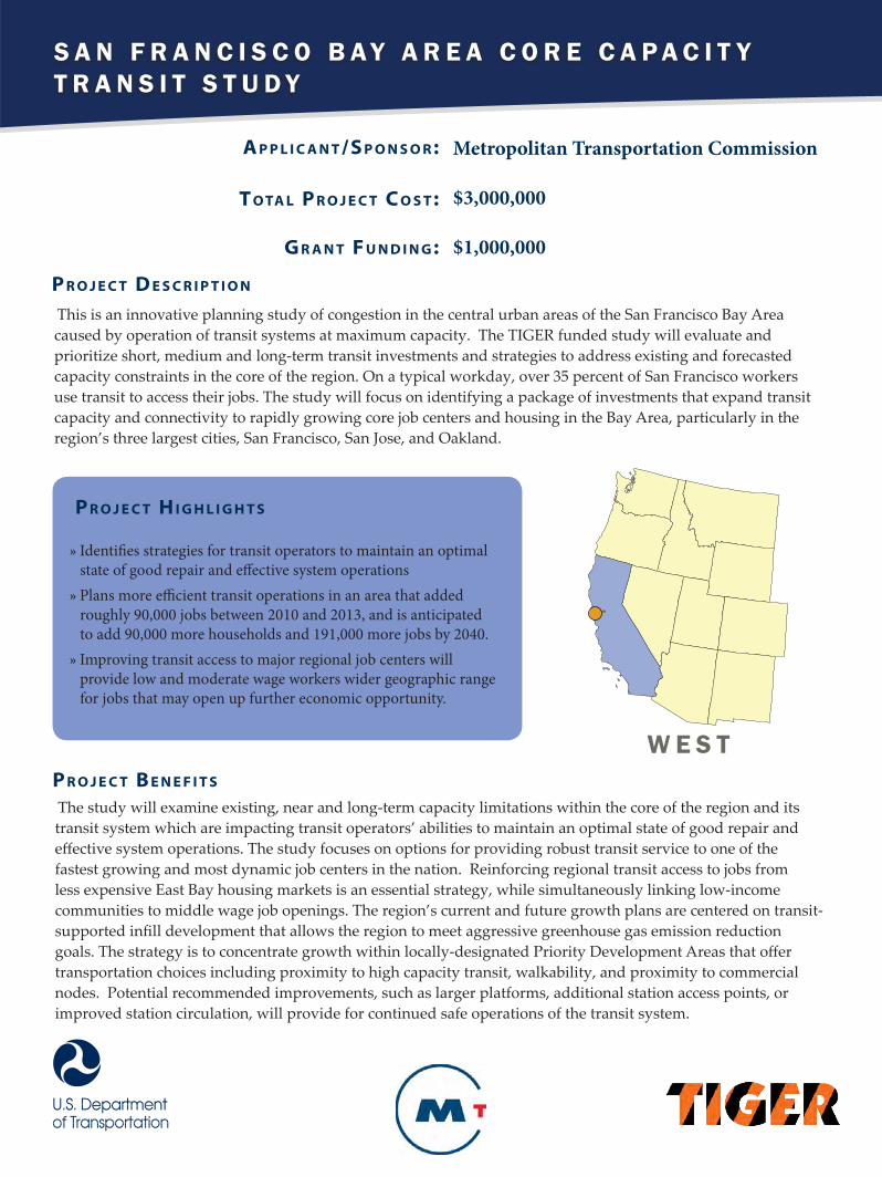
S A N F R A N C I S C O B A Y A R E A C O R E C A P A C I T Y T R A N S I T S T U D Y
A p p l i c A n t /S p o n S o r :
t o tA l p r o j e c t c o S t :
G r A n t F u n d i n G :
Metropolitan Transportation Commission
$3,000,000
$1,000,000
This is an innovative planning study of congestion in the central urban areas of the San Francisco Bay Area caused by operation of transit systems at maximum capacity. The TIGER funded study will evaluate and prioritize short, medium and long-term transit investments and strategies to address existing and forecasted capacity constraints in the core of the region. On a typical workday, over 35 percent of San Francisco workers use transit to access their jobs. The study will focus on identifying a package of investments that expand transit capacity and connectivity to rapidly growing core job centers and housing in the Bay Area, particularly in the region’s three largest cities, San Francisco, San Jose, and Oakland.
p r o j e c t d e S c r i p t i o n
p r o j e c t H i G H l i G H t S
»» Identifies strategies for transit operators to maintain an optimal state of good repair and effective system operations»» Plans more efficient transit operations in an area that added roughly 90,000 jobs between 2010 and 2013, and is anticipated to add 90,000 more households and 191,000 more jobs by 2040. »» Improving transit access to major regional job centers will provide low and moderate wage workers wider geographic range for jobs that may open up further economic opportunity.
The study will examine existing, near and long-term capacity limitations within the core of the region and its transit system which are impacting transit operators’ abilities to maintain an optimal state of good repair and effective system operations. The study focuses on options for providing robust transit service to one of the fastest growing and most dynamic job centers in the nation. Reinforcing regional transit access to jobs from less expensive East Bay housing markets is an essential strategy, while simultaneously linking low-income communities to middle wage job openings. The region’s current and future growth plans are centered on transit-supported infill development that allows the region to meet aggressive greenhouse gas emission reduction goals. The strategy is to concentrate growth within locally-designated Priority Development Areas that offer transportation choices including proximity to high capacity transit, walkability, and proximity to commercial nodes. Potential recommended improvements, such as larger platforms, additional station access points, or improved station circulation, will provide for continued safe operations of the transit system.
p r o j e c t B e n e F i t S
W E S T

C H A R T E R O A K R A N C H R O A D P L A N
A p p l i c A n t /S p o n S o r :
t o tA l p r o j e c t c o S t :
G r A n t F u n d i n G :
El Paso County, Colorado
$1,500,000
$1,200,000
This TIGER funded planning project will fund pre-construction activities for reconstruction of Charter Oak Ranch Road and Santa Fe Avenue leading to Gate 19 at the Fort Carson Army Post. To accommodate Fort Carson’s ongoing expansion, El Paso County is working with the Army to reopen Gate 19 to provide alternate access to the base’s military training infrastructure. The roads leading to Gate 19 are in substandard condition and are unable to support expected traffic resulting from the reopened gate. The project will develop conceptual design and preliminary engineering for rehabilitation of Charter Oak Ranch Road and Santa Fe Avenue.
p r o j e c t d e S c r i p t i o n
p r o j e c t H i G H l i G H t S
»» Improves safety and pavement conditions for Fort Carson Gate 19 access roads to accommodate added traffic volumes.»» Reduces commute time and congestion for soldiers and employees that must currently access Fort Carson via Gate 20 and backtrack up to five miles through the base to their destination.»» Provides more direct access to command stations located near Gate 19.
This plan aims to better connect economically disadvantaged populations in El Paso County with employment, training, and education centers at Fort Carson and adjacent areas. Reopening Gate 19 will reduce travel time and congestion for soldiers and commuters accessing the south portion of Fort Carson. The TIGER planning project will address design and pavement deficiencies on access roads to Gate 19 that create potential safety issues and would make travel inefficient and dangerous given the growing traffic demand. The roadway improvements will also increase transportation resilience for the road system and Fort Carson by adding an alternative access point onto and off the base in the event of a severe weather event, accident, or other incident.
p r o j e c t B e n e F i t S
W E S T

Rural
U S - 9 5 W O R L E Y N O R T H S T A G E 2
A p p l i c A n t /S p o n S o r :
t o tA l p r o j e c t c o S t :
G r A n t F u n d i n G :
Idaho Transportation Department
$9,250,000
$7,400,000
The U.S. 95, Worley North, Stage 2 (Worley Main Street) project will complete a 15 year, $190 million re-alignment and reconstruction effort to upgrade 28 miles of US 95 that was a narrow and winding road with virtually no shoulders, to a highway meeting current design and safety standards that is easier to operate and maintain. This TIGER project will specifically address the remaining highway deficiencies that exist on U.S. 95 through the City of Worley, Idaho, related to the large volume of heavy weight trucks, non-existent shoulders, channelization, bicycle and pedestrian provisions, intersection illumination, storm water runoff control, and accommodation for the hourly rural public transit service currently provided to the community.
p r o j e c t d e S c r i p t i o n
p r o j e c t H i G H l i G H t S
»» Completes a 15-year, $190 million project to improve traffic flow and safety on US 95.»» Estimated reduction of vehicle miles traveled by over 1,750,000 miles--or approximately 292,000 gallons of diesel, through redirection of truck traffic from more circuitous U.S. 195 to U.S. 95 as a result of safety and capacity improvements.»» Provides, safe, attractive and defined improvements to accommodate pedestrians walking between activities located on both sides of the highway, the Citylink Public transit system that connects Worley to the metropolitan areas to the north, and bicycles that use the corridor to connect with tourism activities such as the “Trail of the Coeur d’Alenes.”
The Worley project is the latest in a continuum of improvement projects on U.S. 95 south of the Coeur d’Alene and Post Falls, Idaho, urbanized area, which have brought more than 40 miles of this federally designated High Priority Corridor to a higher state of function and repair. By upgrading a 2.75 mile segment of U.S. 95 to present day standards with a far superior horizontal and vertical alignment, the highway will have a significantly lower maintenance cost-per-lane-mile than the previous facility. With continued improvements to U.S. 95, including the Worley project, growers will be able to take a much more efficient and cost effective route to the river barge system. From the Worley area, the trip to Lewiston is 15 to 20 miles shorter in Idaho than diverting to Washington State and 60 to 90 minutes faster due to topography and stopping with other interstate trucks at port of entry weigh stations when crossing the Idaho state line.
p r o j e c t B e n e F i t S
W E S T

Rural
P O P L A R A I R P O R T R E D E V E L O P M E N T A N D R E G I O N A L A C C E S S P R O J E C T
A p p l i c A n t /S p o n S o r :
t o tA l p r o j e c t c o S t :
G r A n t F u n d i n G :
Assiniboine & Sioux Tribes of the Fort Peck Reservation $968,829
$692,829
Relocation of the Poplar Airport presents an exciting opportunity to leverage tribal, federal and private funds to enhance the transportation system, improve housing, increase safety and create jobs in a tribal community that has long suffered from high unemployment, traffic injuries and deaths, health issues and an overall lack of economic opportunity. TIGER funding will be used to plan for multimodal transportation infrastructure linking residents to a new sustainable residential village and support quality of life amenities and businesses, while capturing economic opportunities along US Highway 2 which serves as a corridor to oil and gas development in eastern Montana and western North Dakota.
p r o j e c t d e S c r i p t i o n
p r o j e c t H i G H l i G H t S
»» Plans road catalysts for two regionally significant redevelopment including a commercial development and residential development area.»» Primary users include residents of the Fort Peck Indian Reservation, residents of Poplar, Fort Peck Tribal Transit patrons and travelers on US Highway 2, a growing corridor due to oil impact in eastern Montana and eastern North Dakota.
When the objectives of the Poplar Airport Redevelopment and Regional Access Project are achieved, the region will improve its existing transportation assets and enhance multimodal transportation network in this economically distressed and rural area. The project, when complete, will improve access to jobs, medical facilities, job training, counseling services and affordable housing represented within the project phases. The unemployment rate on the Fort Peck Indian Reservation is 57 percent, nearly eight times the national average. Of those employed on the Reservation, 43 percent are considered below the poverty level according to the 2005 American Indian Population and Labor Force Report.
p r o j e c t B e n e F i t S
W E S T

Rural
S A N T A T H E R E S A B O R D E R P L A N
A p p l i c A n t /S p o n S o r :
t o tA l p r o j e c t c o S t :
G r A n t F u n d i n G :
New Mexico Department of Transportation $500,000
$400,000
TIGER funds will be used to develop the Santa Teresa Border strategic plan, which will coordinate all maintenance, planning, and capital improvements ongoing and in the future. It is a critical step in establishing a comprehensive approach for developing feasible transportation options to improve the housing-job connection for the residents of the border area. A set of construction projects which are deemed most beneficial to the region will be recommended as part of the planning process. This will allow the NMDOT to immediately move forward with addressing the transportation needs of the area, and provide guidance on potential projects to the other regional transportation agencies.
p r o j e c t d e S c r i p t i o n
p r o j e c t H i G H l i G H t S
»» The plan will promote opportunities such as possible locations for second and third tier suppliers to international clients in Mexico and the creation of a strong and efficient gateway for international trade.»» As data collection is compiled and a shared database is developed, a strong foundation for a regional asset management program will be provided.»» The residents within the planning boundary spend more than 30 percent of their annual income on transportation alone due to lack of transportation options.
The Santa Teresa Border Strategic Plan will create a framework for communicating process, data collection, and recommendations for the current set of projects as well as those to come in the future. Encouraging the collaboration and regional prioritization of transportation improvements will stretch public dollars and capitalize on private dollars resulting in more benefit to the community. The project will promote new transit service connecting to the current and expanding employment centers in Santa Teresa. This will provide options for the regional residents who are currently underserved or not served at all by transit.
p r o j e c t B e n e F i t S
W E S T
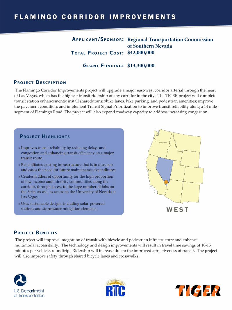
F L A M I N G O C O R R I D O R I M P R O V E M E N T S
A p p l i c A n t /S p o n S o r :
t o tA l p r o j e c t c o S t :
G r A n t F u n d i n G :
Regional Transportation Commission of Southern Nevada $42,000,000
$13,300,000
The Flamingo Corridor Improvements project will upgrade a major east-west corridor arterial through the heart of Las Vegas, which has the highest transit ridership of any corridor in the city. The TIGER project will complete transit station enhancements; install shared/transit/bike lanes, bike parking, and pedestrian amenities; improve the pavement condition; and implement Transit Signal Prioritization to improve transit reliability along a 14 mile segment of Flamingo Road. The project will also expand roadway capacity to address increasing congestion.
p r o j e c t d e S c r i p t i o n
p r o j e c t H i G H l i G H t S
»» Improves transit reliability by reducing delays and congestion and enhancing transit efficiency on a major transit route. »» Rehabilitates existing infrastructure that is in disrepair and eases the need for future maintenance expenditures.»» Creates ladders of opportunity for the high proportion of low income and minority communities along the corridor, through access to the large number of jobs on the Strip, as well as access to the University of Nevada at Las Vegas. »» Uses sustainable designs including solar-powered stations and stormwater mitigation elements.
The project will improve integration of transit with bicycle and pedestrian infrastructure and enhance multimodal accessibility. The technology and design improvements will result in travel time savings of 10-15 minutes per vehicle, roundtrip. Ridership will increase due to the improved attractiveness of transit. The project will also improve safety through shared bicycle lanes and crosswalks.
p r o j e c t B e n e F i t S
W E S T

W A S H O E C O U N T Y B U S R A P I D T R A N S I T
A p p l i c A n t /S p o n S o r :
t o tA l p r o j e c t c o S t :
G r A n t F u n d i n G :
Regional Transportation Commission (RTC) of Washoe County $52,570,000
$16,000,000
TIGER funds will be used to construct the 4th Street/Prater Way RAPID Transit Project. The project may also include upgraded electric buses and additional electric charging infrastructure. This urban transit project will connect downtown Reno and Sparks, Nevada, with enhanced, 24-hour bus rapid transit (BRT) service, accessible sidewalks, and bike lanes. RTC RAPID is already in use on a north-south arterial in the region, and this project will bring this enhanced service to the east-west 4th Street/Prater Way corridor.
p r o j e c t d e S c r i p t i o n
p r o j e c t H i G H l i G H t S
»» Promotes ladders of opportunity by connecting 6,700 corridor residents to more than 38,000 jobs, and by providing access to places of education like the University of Nevada, Reno and Truckee Meadows Community College. »» Passenger amenities such as real-time arrival information, off-board fare machines, level boarding platforms, and utility relocation will enhance the passenger travel experience, reduce boarding time, improve service efficiency, and eliminate obstructions to wheelchair mobility.»» Bicycle lanes and traffic calming features along the entire project area will increase mode choice and allow passengers to safely complete the first/last mile of their trip.
This project will encourage urban infill, enhance access to jobs, and facilitate improved economic vitality throughout the 4th Street/Prater Way arterial corridor. Additionally, it will improve environmental sustainability by transitioning personal vehicle traffic to modes with low or zero greenhouse gas emissions, and by using cold in-place recycling, which decreases energy consumption in the paving process and reduces the amount of new paving materials needed for construction.
p r o j e c t B e n e F i t S
W E S T

R E G I O N A L A C T I V E T R A N S P O R T A T I O N M A N A G E M E N T ( A T M )
A p p l i c A n t /S p o n S o r :
t o tA l p r o j e c t c o S t :
G r A n t F u n d i n G :
County of Washington, Oregon
$15,645,000
$10,125,000
The County of Washington in partnership with Oregon Department of Transportation will use TIGER funds to build an Active Traffic Management (ATM) project, an upgrade to their traffic management system that focuses on major freight and commuter routes. The project combines ATM systems on freeways, active traffic signal management, transit and truck signal priority improvements, bicycle detection and signal timing, and performance monitoring on arterials. By upgrading the traffic management of the county and on state-maintained roads, the project will reduce crashes, improve travel time reliability, and enhance transit operations between the Westside Computer and Electronics industry and the Portland Airport Distribution Centers.
p r o j e c t d e S c r i p t i o n
p r o j e c t H i G H l i G H t S
»» Will reduce congestion, improve safety, and provide a national model for Active Traffic Management solutions.»» Will provide an estimated 10 percent reduction in crashes along major freight and commuter thoroughfares.»» Will improve travel time certainty and reliability along on regionally and nationally significant highways that experience upwards of 12 hours of travel time uncertainty per day.
By improving the ITS system in the County, this project will allow for the free movement of people and goods in the region and help in reducing crashes, improving travel time reliability, and enhancing transit operations between the Westside Computer and Electronics industry and the Portland Airport Distribution Centers.
p r o j e c t B e n e F i t S
W E S T

T H E P I O N E E R C O R R I D O R P L A N
A p p l i c A n t /S p o n S o r :
t o tA l p r o j e c t c o S t :
G r A n t F u n d i n G :
Wasatch Front Regional Council
$1,530,000
$820,000
The Pioneer corridor plan will examine analyze corridor conditions to maximize capacity. The TIGER funded project plan will improve access to jobs and housing, increase efficient travel interactions between communities, and increase non-auto travel, reducing vehicle miles traveled. The plan will include extensive plans for community involvement.
p r o j e c t d e S c r i p t i o n
p r o j e c t H i G H l i G H t S
»» Includes community awareness-building advancing the broad visions developed through the Wasatch Choice for 2040, a process funded by a Sustainable Communities grant.»» Supports development of a master plan that maximizes underutilized capacities, integrates modes, and enhances existing infrastructure investments.»» Promotes reduced cost of transportation and housing.
The plan supports maintaining transportation assets in a state of good repair by addressing capacity and vulnerability issues, improving environmental sustainability and quality of life by increasing transit and bike/ped opportunities, and demonstrates innovation and partnership by building on existing efforts and relationships. The plan focuses on equity and opportunity by targeting investments to economically distressed areas in the corridor suffering from connectivity issues.
p r o j e c t B e n e F i t S
W E S T

Rural
M A K A H T R I B E O I L S P I L L R E S P O N S E A C C E S S D O C K P L A N
A p p l i c A n t /S p o n S o r :
t o tA l p r o j e c t c o S t :
G r A n t F u n d i n G :
Makah Tribe
$1,270,000
$1,101,904
This TIGER funded project plan will enhance safety and competitiveness in an economically distressed tribal community. The US Coast Guard requires the Makah Tribe to develop an emergency response facility. This project will aid the planning and design for a dock that will be used for oil spill prevention, a safe harbor and emergency response base of operations for a remote area that has experienced an emergency callout every three to four months since 1999.
p r o j e c t d e S c r i p t i o n
p r o j e c t H i G H l i G H t S
»» The plan will enhance safety for the community by preparing for emergency response to a known hazard.»» The plan, once executed, will provide ladders of opportunity through the Tribe’s commitment to use local members for construction projects and to paying fees to aid with training and job placement. »» The plan will assist in attracting financial investments for the dock construction.
The Tribe is responsible for all spill responses in the area, and more than 11,000 ships pass by annually, creating potential safety concerns regularly. The plan provides training and new opportunities for the Tribe and the community. This plan can assist the Tribe in preparing for oil spill prevention and emergency response base of operations and improve the conditions for the community.
p r o j e c t B e n e F i t S
W E S T

P O R T O F S E A T T L E T E R M I N A L 4 6 R E H A B I L I T A T I O N P R O J E C T
A p p l i c A n t /S p o n S o r :
t o tA l p r o j e c t c o S t :
G r A n t F u n d i n G :
Port of Seattle
$66,098,202
$20,000,000
This TIGER grant will be used to construct six elements for the Port of Seattle: 1. Rehabilitate deteriorated berth pile caps and dock deck panels; 2. construct a storm water system to treat terminal runoff; 3. pave 435,000 square yards of terminal area and install new lighting controls; 4. increase load capacity and extend crane rail at dock; 5. construct new road to grade-separate truck traffic from rail yard; 6. provide public amenities to access 13.8 acres of habitat around the terminal site.
p r o j e c t d e S c r i p t i o n
p r o j e c t H i G H l i G H t S
»» Upgrades existing infrastructure to accommodate super post-Panamax container ships, which will significantly increase the handling capacity of the Terminal. »» The port has an Office of Social Responsibility to support workforce development and small business outreach, especially to minority and women-owned business.»» This is a strategic port for the Department of Defense. »» Restores fish and wildlife habitat and improves treatment of stormwater runoff.
This project is a cost-effective alternative to rebuilding the dock. It will enhance the terminal which handles 20 percent of the port’s containers, and will help the port remain competitive with nearby Canadian ports. The first portion of the project will focus on rehabilitating deteriorated berth pile caps and dock deck panels.
p r o j e c t B e n e F i t S
W E S T