three railroad right of way retracement projects · three railroad right of way retracement...
TRANSCRIPT
1

Three Railroad Right of Way Retracement Projects
Point Douglas Trail – Denmark Township
Browns Creek Trail – Former MN Zephyr
Ramsey County – Warner Road Bridge
2
Point Douglas Trail
3
Two mile segment of former railroad Important trail system connection Political issues (acquisition, funding, etc.) Survey necessary to determine boundary and
identify encroachments, gaps, topography issues, etc.
Presentation will focus on the surveying issues

4

5
Acquisition and Survey The Trust for Public Land
Conservation project – conveyance through TPL Grant money partially funded acquisition and survey
Washington County Survey Estimate Research/Analyze record ownership – R/R and adjoiners Analyze all railroad maps, adjoining surveys, plats, etc. Locate all boundary evidence Analyze all evidence and make a boundary determination Estimate deemed too high (Cadillac vs. Chevrolet)
Private Surveying Firm Hired Agreed to do survey for the specified dollar amount

Railroad Corridor History
6
1881 – original tracks laid
1891 – tracks Pt. Douglas to Hastings removed & realigned
1891 – second set of tracks laid south of and parallel
1891 – deed recorded describing both 1891 centerlines
1917 – ROW map shows third set of tracks laid
1918 – ROW map shows track location information
1920’s-30’s – some tracks removed
1979 – tracks realigned in 1891 were removed
1981 – corridor acquired by private party

7
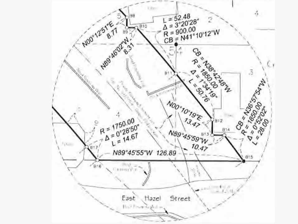
1917 Railroad Right of Way Map
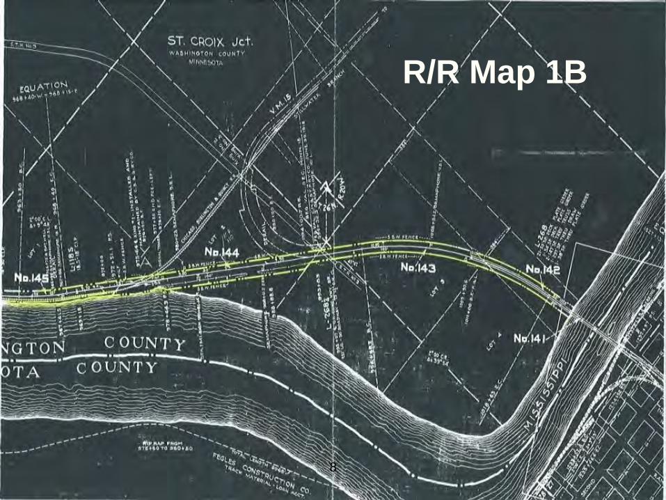
8
R/R Map 1B

9
R/R Map 1C
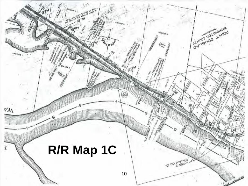
10
R/R Map 1C

Right of Way Evidence
11
Recorded deed descriptions
Railroad Right of Way maps
Right of Way at easterly end controlled by un-monumented plat of POINT DOUGLASS and two additions recorded 1849-1857
North ROW line in most of unplatted area is 50’ north and parallel with original track built in 1881 and removed in 1891
Most of South ROW line is 24’ south and parallel with track built/realigned in 1891 and removed in 1979
Right of Way Evidence (continued)
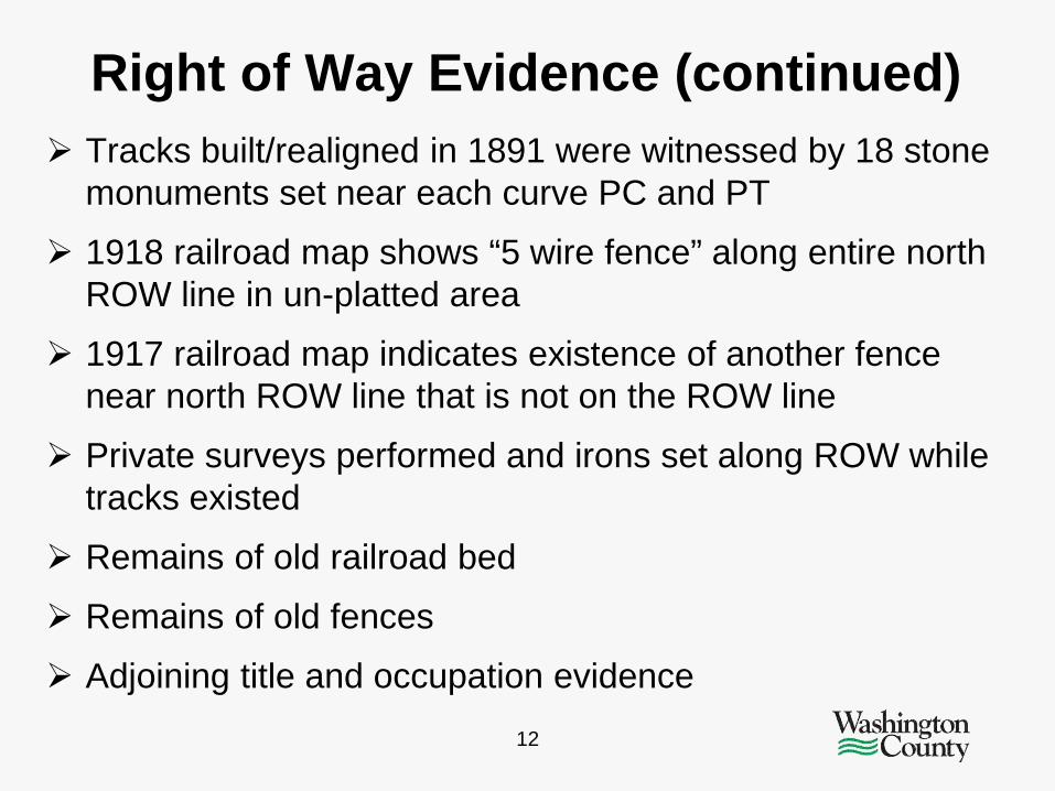
12
Tracks built/realigned in 1891 were witnessed by 18 stone monuments set near each curve PC and PT
1918 railroad map shows “5 wire fence” along entire north ROW line in un-platted area
1917 railroad map indicates existence of another fence near north ROW line that is not on the ROW line
Private surveys performed and irons set along ROW while tracks existed
Remains of old railroad bed
Remains of old fences
Adjoining title and occupation evidence

Record Deed Description All that tract or parcel of land in Washington County, Minnesota being the abandoned railroad right of way of Chicago, Milwaukee, St. Paul and Pacific Railroad Company from St. Croix Junction to the West line of Burris Street in Point Douglas, approximately 2.2 miles long and covering approximately 21.7 acres of widths varying from approximately 33 feet to 160 feet together with all culverts and right of way fencing thereon which right of way crosses the following tracts or parcels of land:
13

Performing the Survey
14
Private survey firm: Numerous changes made retracement complicated
Located centerline of current railroad bed
Located portions of fence (mostly down) near north ROW
Based ROW determination predominantly on current railroad bed and fence remains and prepared a preliminary survey
Concerns with the Survey
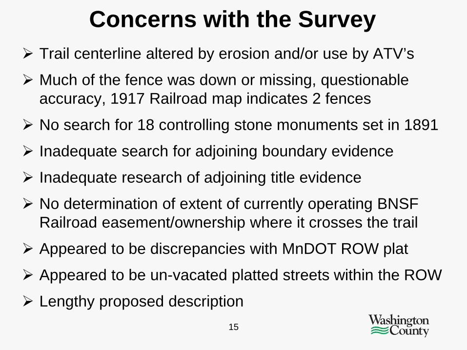
15
Trail centerline altered by erosion and/or use by ATV’s
Much of the fence was down or missing, questionable accuracy, 1917 Railroad map indicates 2 fences
No search for 18 controlling stone monuments set in 1891
Inadequate search for adjoining boundary evidence
Inadequate research of adjoining title evidence
No determination of extent of currently operating BNSF Railroad easement/ownership where it crosses the trail
Appeared to be discrepancies with MnDOT ROW plat
Appeared to be un-vacated platted streets within the ROW
Lengthy proposed description
16
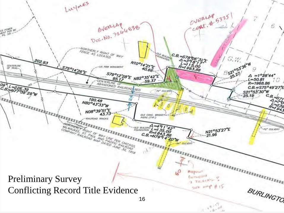
Preliminary Survey Conflicting Record Title Evidence

Proposed Legal Description
17
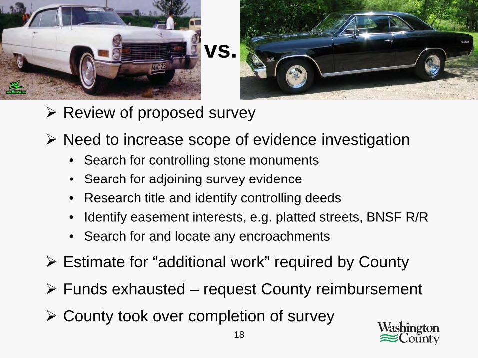
Cadillac vs. Chevrolet
18
Review of proposed survey
Need to increase scope of evidence investigation • Search for controlling stone monuments • Search for adjoining survey evidence • Research title and identify controlling deeds • Identify easement interests, e.g. platted streets, BNSF R/R • Search for and locate any encroachments
Estimate for “additional work” required by County
Funds exhausted – request County reimbursement
County took over completion of survey

19

20

21

22

23
24

25
Additional Evidence Found
3 original stone monuments set in 1891 to define location of PC’s and PT’s
10 iron monuments from 11 private surveys from 1960’s and 1970’s when tracks were still in place
Evidence of ROW location within adjoining title documents

26
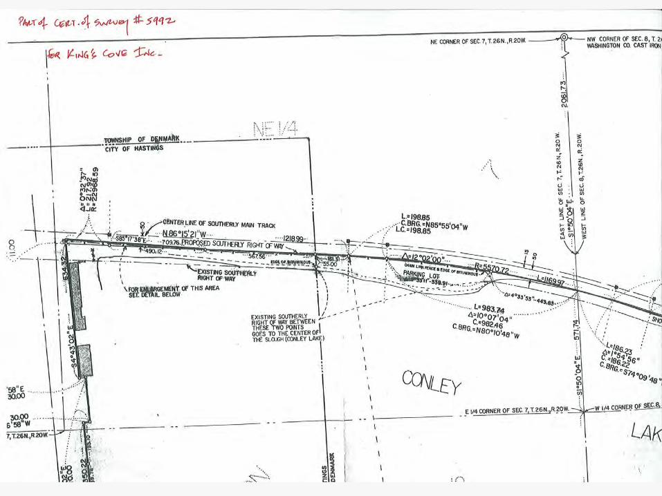
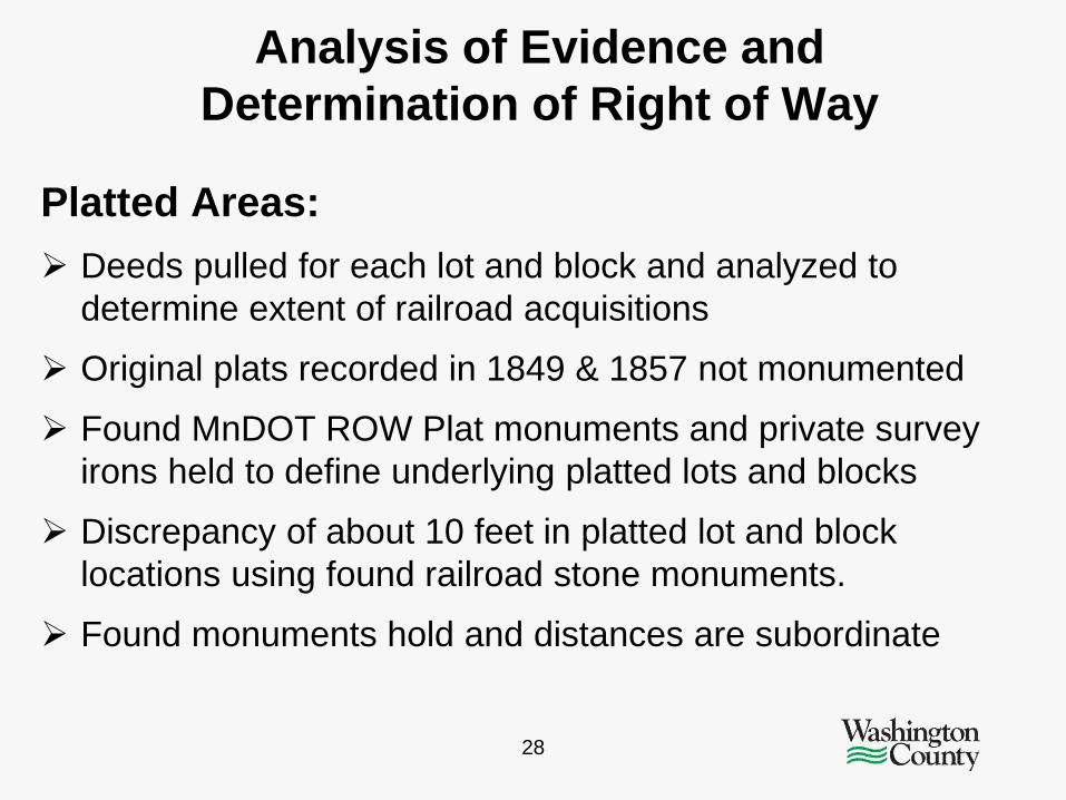
Analysis of Evidence and Determination of Right of Way
Southerly Right of Way Line: Southerly centerline computed per 1891 description
Found stones matched computed locations within .7 foot
Stones held for rotation of computed southerly centerline
Compared computed southerly centerline with existing “centerline” as located, 48 check points – average difference 1.5 feet, maximum difference 8.4 feet
Southerly right of way line established at 24 foot offset of computed centerline

Analysis of Evidence and Determination of Right of Way
27
Northerly Right of Way Line: Northerly centerline computed per 1918 Railroad Right of
Way map
10 found irons from 1960-1970 era surveys – 8 irons within 1 foot and 4 of 8 irons within 0.17 foot of 50’ offset of computed centerline
126 ROW fence shots – 112 within .45 foot, 14 deviate 7- 30 feet from computed 50 foot centerline offset
Analysis of Evidence and Determination of Right of Way
28
Platted Areas: Deeds pulled for each lot and block and analyzed to
determine extent of railroad acquisitions
Original plats recorded in 1849 & 1857 not monumented
Found MnDOT ROW Plat monuments and private survey irons held to define underlying platted lots and blocks
Discrepancy of about 10 feet in platted lot and block locations using found railroad stone monuments.
Found monuments hold and distances are subordinate
29
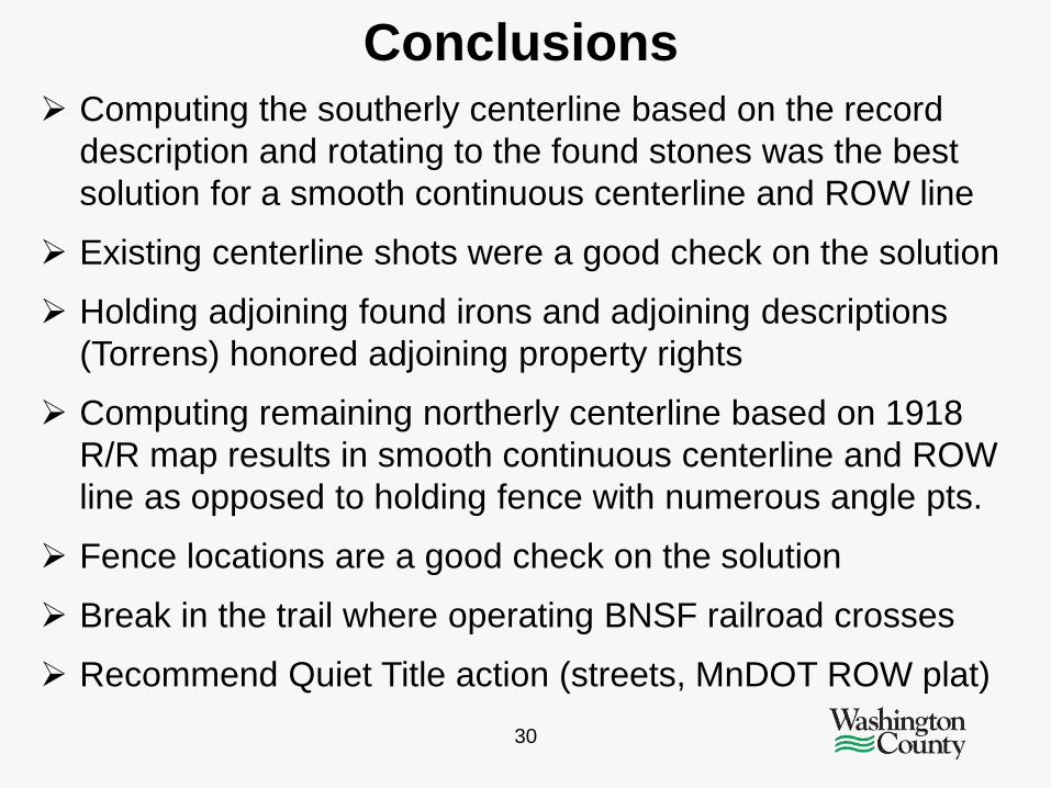
Conclusions
30
Computing the southerly centerline based on the record description and rotating to the found stones was the best solution for a smooth continuous centerline and ROW line
Existing centerline shots were a good check on the solution
Holding adjoining found irons and adjoining descriptions (Torrens) honored adjoining property rights
Computing remaining northerly centerline based on 1918 R/R map results in smooth continuous centerline and ROW line as opposed to holding fence with numerous angle pts.
Fence locations are a good check on the solution
Break in the trail where operating BNSF railroad crosses
Recommend Quiet Title action (streets, MnDOT ROW plat)
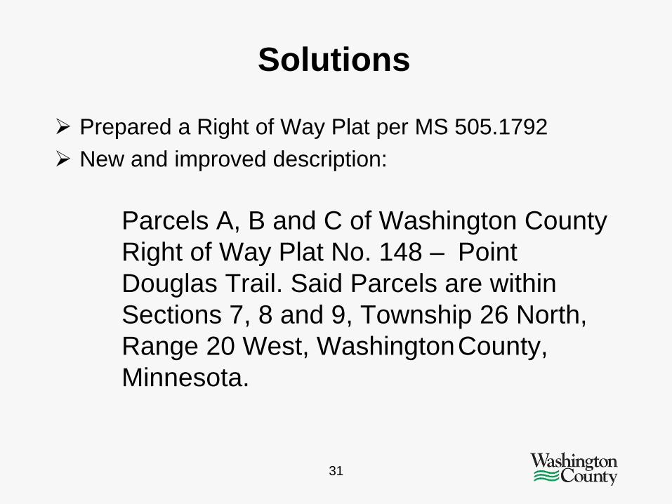
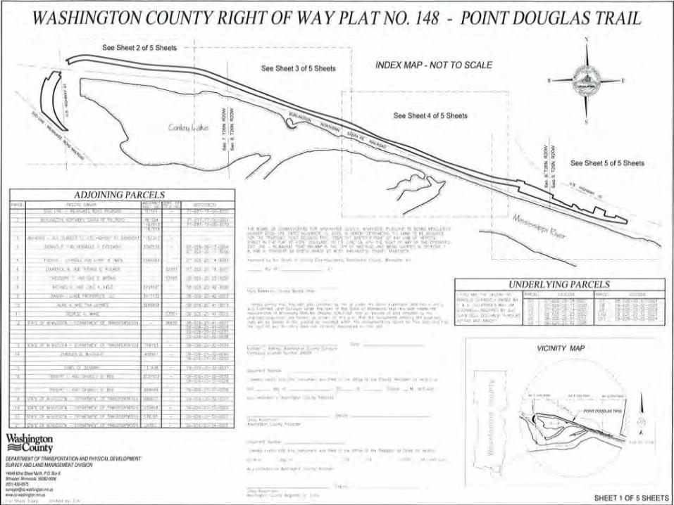
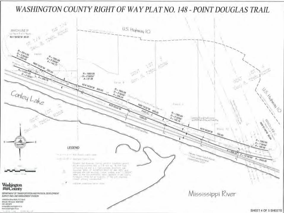
Prepared a Right of Way Plat per MS 505.1792 New and improved description: Parcels A, B and C of Washington County Right of Way Plat No. 148 – Point Douglas Trail. Said Parcels are within Sections 7, 8 and 9, Township 26 North, Range 20 West, Washington County, Minnesota.
31
Solutions
32

33

34
35

36

Questions - Comments?
37

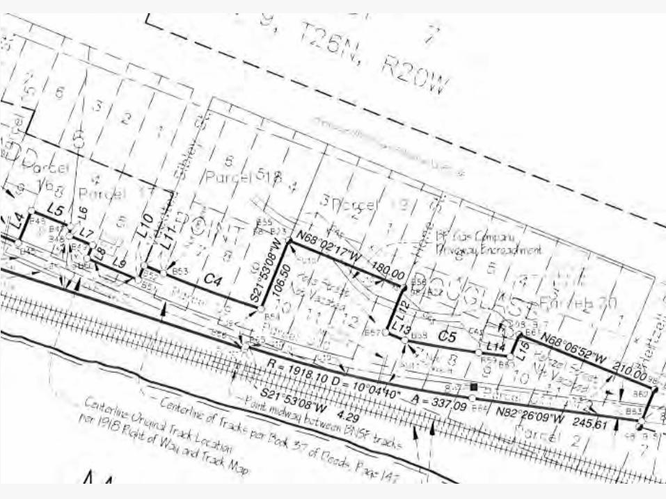
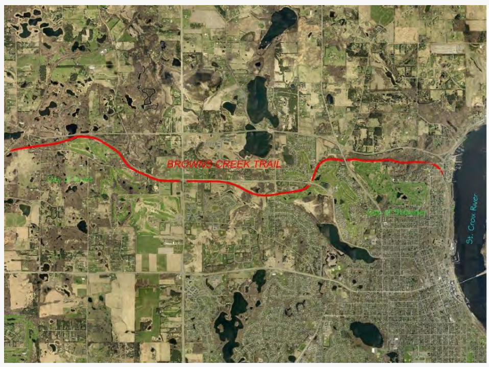
Browns Creek Trail
38
5.5 mile corridor - former MN Zephyr Dinner Train
Corridor acquired by MN DNR
Key connection from Gateway State Trail to downtown Stillwater riverfront
Political issues (acquisition, funding, etc.)
Survey necessary to determine boundary and identify encroachments, gaps, topography issues, etc.
DNR contracted with Washington County Surveyor to prepare Right of Way Plat of the corridor
39
Performing the Survey Researched/analyzed record ownership railroad & adjoiners
Analyzed railroad maps, adjoining surveys, plats, etc.
Located all known boundary evidence
Located centerline of existing railroad tracks
Poor fit between tracks and R/R map data – low speed track
Poor fit between R/R map data and adjoining surveys
Adjoining survey data was relied upon heavily
Analyzed all evidence and made boundary determination
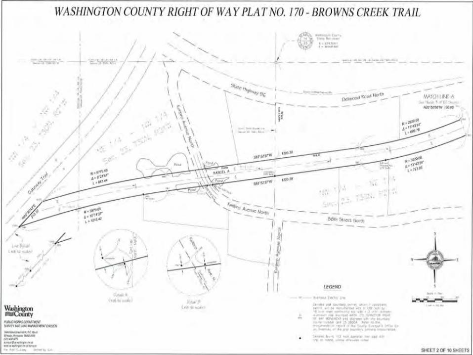
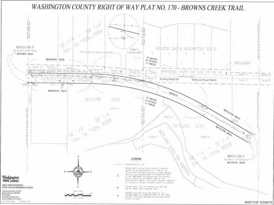
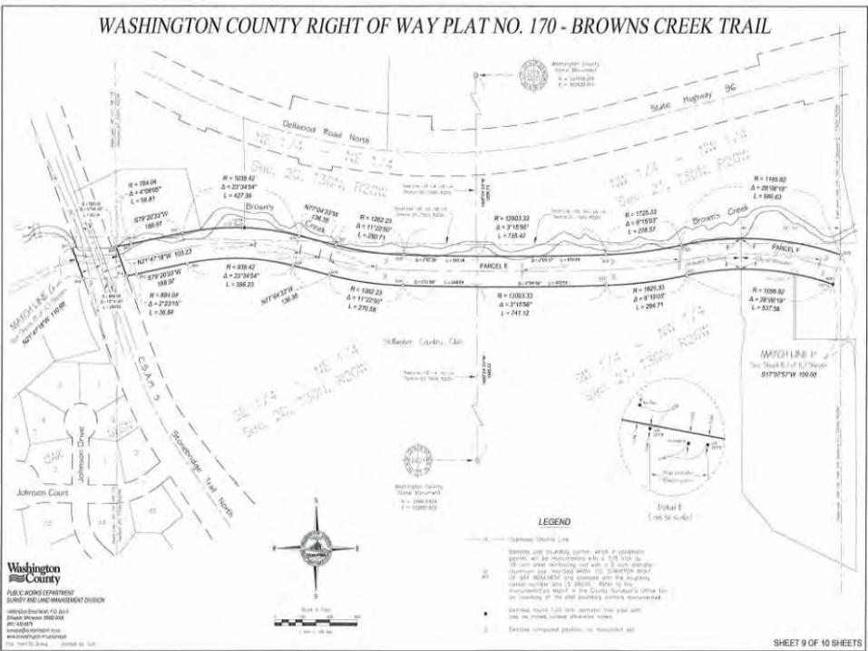
Preparing a Right of Way Plat per MS 505.1792
40

41

42

43

44
45

46

47

48
49

50

51
52

53

54
55

Questions - Comments?
56

Ramsey County Warner Road railroad bridge scheduled for replacement
Monuments called for in original pre-1900 deeds
Monuments shown on historic bridge and road surveys
Monuments necessary to determine divisions & ROW for 4 different R/R lines consisting of 9 different tracks
Research & comps put search area within 0.5’ of first monument found down 2’ in railroad ballast
Finding monuments dividing R/R property led to finding several R/R right of way monuments
Understanding importance, careful analysis of record documents & R/R plans, good survey work = success
57
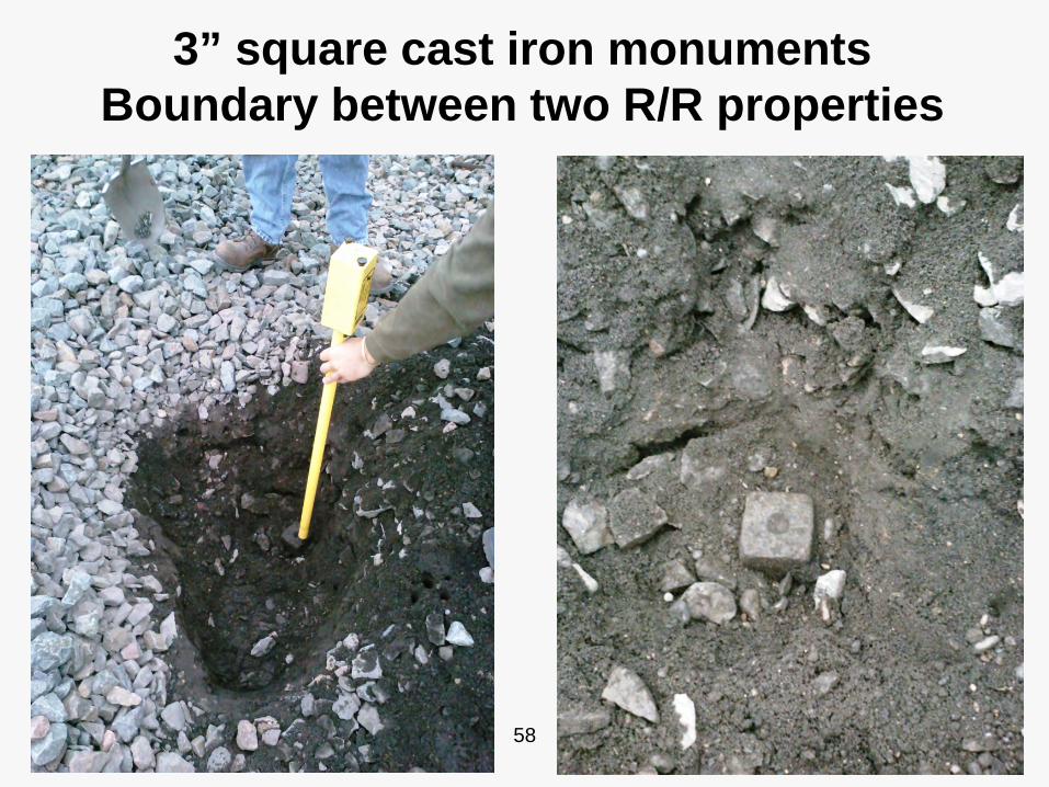
3” square cast iron monuments Boundary between two R/R properties
58

3” square cast iron R/R monuments at a 1/16th corner & on a N-S ¼ line
59

What did we learn?
60
No shortcuts to an accurate right of way survey
Need to research title, survey and railroad records
Need a thorough search for field evidence
Analyze all evidence to arrive at accurate conclusions
Evidence and answers will not be found on the Internet
Beware of middlemen or clients dictating costs of surveys
Make sure you understand what you’re getting into

Questions - Comments?
61