thedeepearth€¦ · the nation is largely under-explored and future success requires expanding the...
TRANSCRIPT

THEDEEPEARTH
© Australian Academy of Science 2012GPO Box 783, Canberra, ACT 2601
This work is copyright in all countries subscribing to the Berne Convention. Apart from fair dealing for the purposes of research, criticism or review as permitted under the Copyright Act 1968 no part may be reproduced by any means without written permission of the publisher. This publication is also available online at:http://www.science.org.au/policy/uncover.html/ ISBN: 978-0-85847-332-4Cover image: Dietmar Müller Published by the Australian Academy of ScienceGPO Box 783Canberra ACT 2601www.science.org.au Design and layout by Wordup! Websites and Graphic Design Printed and bound by New Millennium Print

Prepared by the UNCOVER group under the aegis of the Australian Academy of Science
THEDEEPEARTH

President’s ForewordAustralia’s resources industry is based on large, high-quality deposits discovered in the late 19th Century and the 20th Century - an exploration endeavour that was supported by high-quality pre-competitive research that mapped the surface of Australia. While demand for Australian minerals remains strong, it is of serious concern that discovery of new deposits has not kept pace with depletion, despite ongoing competitive exploration efforts.
The decline in exploration success is in large part due to the difficulty in exploring what lies beneath the regions of highly weathered rock (known as regolith) and sedimentary basins that cover approximately 80 per cent of Australia. There is no reason to believe the resource potential of this 80 per cent which lies under cover would be less than the exposed 20 per cent that has provided so much wealth.
New knowledge is needed to underpin future exploration; just as the work of State Geological Surveys and our universities in the second half of the 19th Century and 20th Century underpins today’s mining boom.
At the Academy’s 2010 Theo Murphy Think Tank, Searching the Deep Earth: The Future of Australian Resource Discovery and Utilisation, big-thinking young scientists identified scientific steps to help ensure we continue to be a global resources leader for the next 100 years at least.
When the Minister for Resources, Energy and Tourism the Hon. Martin Ferguson launched the Think Tank Proceedings, he threw down a challenge, “Deep earth exploration is the next frontier and it is a frontier that we must conquer if we are to continue to reap the economic benefits of our natural mineral wealth”.
In response, the Academy established the UNCOVER group. This self-funded group has spent a year and a half developing the recommendations of our 2010 Think Tank to define, facilitate and foster the national geoscience research necessary to lift the success rate of exploration over the medium to long term.
This collaboration is unprecedented. It includes Geoscience Australia, CSIRO, industry representatives, cooperative research centres, universities, state geological surveys, and geophysical survey and software development companies. The Academy considers facilitating such an important and “groundbreaking” collaboration to be a critical part of our mission to nurture Australian science and research excellence.
Searching the Deep Earth: A vision for exploration geoscience in Australia presents scientific goals to provide a holistic understanding of our continent so that we might better predict the location of large-scale mineral systems. The Academy therefore hopes this report will help guide national efforts to secure world-leading competitive exploration opportunities in the 21st Century.
Professor Suzanne Cory AC PresAA FRS President, Australian Academy of Science

Executive summary ...................................................................................................................................................................................................................................................................................................................................................................... 2
1 Introduction ............................................................................................................................................................................................................................................................................................................................................................................................ 5
2 The exploration geoscience research network for UNCOVER ............................................................................................................................................15
3 Characterising Australia’s cover —new knowledge to confidently explore beneath it ................................................................................................................................................................................19
4 Investigating Australia’s lithospheric architecture —a whole lithosphere architectural framework for mineral systems exploration ....................................................................................................................................................................................................................................................................................... 25
5 Resolving the 4D geodynamic and metallogenic evolution of Australia—understanding ore deposit origins for better prediction .......................................................................................................................................................................................................................................................................................................... 31
6 Characterising and detecting the distal footprints of ore deposits—towards a toolkit for minerals exploration ............................................................................................................................................... 35
7 Join UNCOVER ........................................................................................................................................................................................................................................................................................................................................................................... 40
UNCOVER implementation committee ................................................................................................................................................................................................................................................... 42
Contents

2 Searching the deep earth A vision for exploration geoscience in Australia
Executive summary
Australia’s resilient economy is supported through exploitation of its enormous natural resource wealth. Our international competitive advantage in minerals is based on large, high-quality deposits that were discovered in the last century. Demand for Australian minerals continues to expand, but discovery of new deposits has not kept pace with depletion, despite significant exploration effort. The lack of success has contributed to a reduction in the fraction of international exploration expenditure being spent in Australia.
We have almost exhausted our easily discovered near-surface resources. The decline in exploration success is in large part due to the difficulty of exploring beneath the regolith and sedimentary basins that cover approximately 80% of the continent. Much of the nation is largely under-explored and future success requires expanding the search and discovery space under cover at greater depth.
The Australian Academy of Science (the Academy) dedicated its 2010 Theo Murphy High Flyers Think Tank to the important national issue of the decline in exploration
success. Participants proposed an ambitious and integrated research program to enable Australia to uncover more of its mineral wealth.
The Hon Martin Ferguson AM MP, Australian Minister for Resources and Energy, launched the think tank proceedings—Searching the deep earth: the future of Australian resource discovery and utilisation—by saying, ‘ It is by no means an overstatement to say that Searching the deep earth… is at the heart of our nation’s continued prosperity’.1
A group of science leaders convened under the aegis of the Academy to address the decline in the success of Australian mineral exploration through the implementation of the think tank’s recommendations. Australia leads the world in exploration geoscience skill, a strategic capability that can be marshalled through strategic collaboration.
Here, we propose a new exploration geoscience researcher network and four important initiatives focused on the genesis, distribution and discovery of the nation’s mineral wealth. These are:

Searching the deep earth A vision for exploration geoscience in Australia 3
• Characterising Australia’s cover— new knowledge to confidently explore beneath the cover.
• Investigating Australia’s lithospheric architecture—a whole-of-lithosphere architectural framework for mineral systems exploration.
• Resolving the 4D geodynamic and metallogenic evolution of Australia—understanding ore deposit origins for better prediction.
• Characterising and detecting the distal footprints of ore deposits—towards a toolkit for minerals exploration.
This document, Searching the deep earth: a vision for Australian exploration geoscience, is a call to Australia’s earth scientists to cooperate in an innovative, structured and nationally coordinated strategic venture that brings competitive advantage to Australian
mineral exploration. The vision challenges research groups, Government surveys and explorers to participate in a cross-institutional joint research venture on a scale never before attempted.
The opportunity for the exploration industry is large and will bring new data, new interpretations, new understanding and new products for uncovering Australia’s mineral wealth.
The opportunity for the research and survey communities is mutual collaboration and a national approach to exploration geoscience in understanding the continent from mantle to the surface.
Researchers and their organisations have already begun aligning their research to this strategic national vision for exploration geoscience. We invite the earth science research community to participate in achieving this vision.
1 Searching the deep earth: the future of Australian resource discovery, proceedings launch at the Australian Academy of Science
http://minister.ret.gov.au/MediaCentre/Speeches/Pages/LaunchofTheoMurphyHighFlyersThinkTank2010Proceedings.aspx

© iS
tock
phot
o.co
m/1
8542
935

Searching the deep earth A vision for exploration geoscience in Australia 5
Introduction
Since the discovery of copper at Burra in South Australia in 1849 and gold at Ophir in New South Wales in 1851, the earth science community has been remarkably successful in supporting the further discovery and utilisation of Australian ore deposits.
Unfortunately, Australia is being seen increasingly as a mature mineral exploration destination. This perception has driven the increasingly globalised minerals industry to invest in exploration offshore. The perception is incorrect: our mineral-rich continent has yielded most of its wealth from only 20% of the exposed or near-exposed crust. The remaining 80%—an area of more than 7.5 million km2—is potentially as well-endowed, but this endowment is concealed by cover of varying depth. This vast, relatively underexplored area presents an enormous opportunity for the discovery of resources in Australia.
Recognising this opportunity, the Australian Academy of Science (the Academy) convened in 2010 the Theo Murphy High Flyers Think Tank—Searching the Deep Earth: The Future of Australian Resource Discovery and Utilisation—to identify ways to improve future mineral exploration success and outline a national roadmap for deep-earth exploration. The size of the continent and the dispersed nature of our research centres were recognised as significant challenges to the development of such a roadmap. Collaboration through a national exploration strategy is essential to achieve the vision and recommendations of the Searching the Deep Earth think tank.
Australia has a rich history of accumulated data and knowledge about the continent’s mineral endowment. This, combined with the application of novel technology and courageous investment decisions, has created a large fraction of our economic wealth. Our sustained focus on mineral production has helped build a world-leading earth science research community that consistently ranks as the nation’s highest-impact research discipline and extends across industry, government and academia.
Our earth science research community has exceptional capacity for innovation and the ability to address the mineral exploration challenge in Australia through coordination and collaboration around a common vision.
1

6 Searching the deep earth A vision for exploration geoscience in Australia
1.1 What is UNCOVER?
UNCOVER is a call to the broader geoscience community to come together to collaborate on a common vision.
The knowledge and data generated by the collaborators will have implications beyond minerals exploration—to areas such as energy and groundwater resources. Accordingly, we encourage researchers and industry in these domains to also share in the UNCOVER vision to the benefit of all. By focusing on mineral resources and their discovery, UNCOVER hopes to act as a catalyst for coordination and collaboration on a scale never before seen in the Australian earth science research community.
The benefits of collaborating to shape and achieve the UNCOVER vision include:
• an opportunity to shape the network
• shared ownership of the future science agenda
• an opportunity to convert the recommendations of the Searching the Deep Earth Think Tank into reality
• higher-impact science as a result of attaining the critical mass achieved through integrating currently dispersed multidisciplinary skills
• improved funding opportunities offered to collaborative networks
• a coherent voice when speaking to decision makers and other leaders
• improved communication and knowledge transfer, as well as the education and training of the next generation of science leaders
• a realisation of the vision for new discoveries under cover in Australia.
UNCOVER is a seminal opportunity to participate in the achievement of a national scientific vision for the future benefit of all Australia.

Searching the deep earth A vision for exploration geoscience in Australia 7
1.2 The challenge
Over the past century, rising global economic aspirations and demand for resources have been met in part by the enormous success of Australian mineral discovery and ore production, which have also yielded great national benefit.
But the balance between global demand and Australian supply has shifted markedly because of two important and simultaneous changes during the past three decades.
The industrialisation of large nations such as China and India has raised world demand for minerals to unprecedented levels. Increased demand will continue in the coming decades as living standards and expectations in these countries rise. The potential to meet this demand is huge. For example, per capita, China still uses less than one-third of the copper than that used by developed economies such as Germany and Japan, while India’s copper usage is less than one-tenth that of developed economies.
Figure 1 – Depth of cover for Australia’s major mineral deposits
Over the same period, exploration success for new economic mineral deposits in Australia has declined sharply. Our economy is now uncomfortably reliant on mineral discoveries dating well back into the last century. These deposits are being depleted much faster than the discovery rate for new deposits. Our national prosperity, derived from mineral wealth, is at risk if our economic mineral deposit pipeline cannot be renewed and expanded. We need improved predictive and detection capabilities for searching under cover to build investment confidence—a critical prerequisite for new mineral discoveries and national economic benefit.

8 Searching the deep earth A vision for exploration geoscience in Australia
1.3 Mineral systems: expanding the discoverable footprint of buried resources
Australia’s vastness and the relatively small footprint of most mineral deposits makes them difficult to detect. Fortunately, an ore deposit is a small part of a much larger entity—a mineral system—that encompasses the entire lithospheric pathway of mineralisation in space and time.
A mineral system includes the fluid and metal sources and energy drivers, the sites of mineral deposition and the exit(s) of depleted fluid (Figure 2). The generation of a mineral system is coupled to even larger time- and event-specific Earth-system processes (Figure 3). Consequently, a mineral system, as opposed to an actual deposit, offers explorers a much larger target. Mineral systems are characterised by interactions, feedbacks, thresholds and abrupt changes on a large spatial scale that encompasses great volumes of lithosphere. They are self-organised in geological time. Our challenge is to understand the larger mineral system and its measurable characteristics on various scales so as to predict and detect deposits within.
Australian industry, government and academic geoscience organisations are recognised as world leaders in understanding mineral systems. Several Australian exploration success stories undercover, such as Olympic Dam and Cannington, attest to this leadership. Once a mineral system is discovered, detailed exploration for and detection of the incorporated deposit(s) can occur with a higher degree of confidence. The multiscale mineral systems approach is thus a more rigorous and economically justifiable approach to narrowing the exploration search space than the traditional and lower-probability approach of attempting to drill for mineral deposits directly. The petroleum industry has used a parallel petroleum systems approach with remarkable success for decades to search for petroleum resources at depth.

Searching the deep earth A vision for exploration geoscience in Australia 9
Oredeposit
site
Fluid delivery pathway
Spent fluid discharge
Lateral dispersion Lateral dispersion
Traditional scale of knowledge focus
Required scale of knowledge focus
Figure 2 – Conceptual diagram of a mineral system. The traditional scale of research has been focussed on the ore deposit scale and its local environs. Ore deposits are, however, the locus of large energy and mass flux systems and their scale is many orders of magnitude greater than the ore deposit. By focussing our research at this mineral system scale we have expanded the discoverable footprint to a far larger volume of crust within which to vector and target for ore deposits (adapted from Jon Hronsky).

10 Searching the deep earth A vision for exploration geoscience in Australia
Figure 3 – Schematic illustration of how mineral systems are the result of processes that operate on a variety of scales, from the deposit to the entire earth’s lithosphere, to source, transport and concentrate metals in economic quantities near the surface of the earth. The footprint of the mineral system is potentially detectable at all of these scales.

Searching the deep earth A vision for exploration geoscience in Australia 11
Inset – schematic illustration of ore bodies near the surface of the earth and their detectable physical, chemical and mineralogical footprints through covering rocks and weathered profiles. The challenge is to refine and expand these detectable footprints to aid discovery of economic ore bodies under cover. Illustrations by Shiloh Gordon

12 Searching the deep earth A vision for exploration geoscience in Australia
1.4 Enabling science
Exploration targeting is a spatial exercise. Any knowledge must be represented spatially to maximise its predictive utility to locate mineral resources. Yet much of the geoscientific data required for understanding the geodynamic and metallogenic evolution of the continent are fragmented in disconnected datasets and literature. For example, all geological surveys and many universities collect geochronology, geochemical and isotopic data. Data holdings are dispersed and usually collected for specific regional projects. Rarely are these valuable data aggregated in a consistent, machine-readable way or available on a continental scale. Furthermore, our ability to generate large geoscience datasets is beginning to outstrip our ability to integrate and interpret them. Capturing and managing the geological uncertainty, incomplete evidence, and the scientific debate characteristic of creating an understanding of Australia and its mineral systems through time is a major challenge.
A multiscale platform can achieve the requisite data fusion and facilitate integrated interpretation. The Australian e-research community has built excellent parts of the needed toolkit, including the GPlates plate-tectonic reconstruction platform, the AuScope data grid, the Spatial Information Services Stack, the Underworld geophysical modelling software, and the National Data Grid. Massive investment has enabled an excellent, evolving data grid-based set of web services that makes geophysical and geological data discoverable and accessible.
We also need the enabling science research to tackle the fundamental physical and chemical processes associated with mineral systems and ore deposit formation. Much of this research will involve computationally intensive simulation, modelling and prediction. The work is therefore as much a challenge for mathematicians, computer scientists, chemists and physicists as it is for geoscientists. We must also invest in the infrastructure to manage these data and to enable the modelling and simulation environment in the interoperable ways needed.

Searching the deep earth A vision for exploration geoscience in Australia 13
The collective effort will build on the AuScope National Collaborative Research Infrastructure Strategy (NCRIS) research infrastructure, be open-source, free to use, represent a framework for commercial extensions and offer simple data exchange with other sources. A common and flexible toolkit will allow groups with different models, distinctive approaches and proprietary data to test alternative solutions and sources of uncertainty.
‘Big data’ is a modern concept central to endeavours from social media to geophysics. Rather than sampling just small parts of a dataset or a problem, a new option exists: study all of it, use all available data and involve multiple organisations. Applying data-driven modelling, numerical simulations, joint inversions and data assimilation to multidisciplinary datasets and hypotheses will significantly advance our understanding of the physics and chemistry governing ore formation and mineral system generation. Spatial use of these process insights will lead to more robust predictions about Australia’s undercover prospectivity.
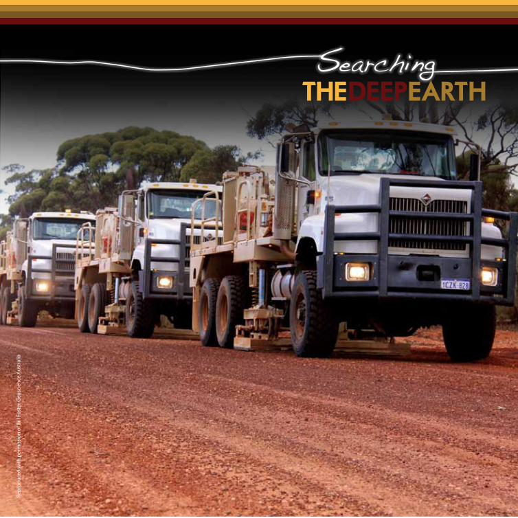
As the pipeline for new discoveries will be under cover, investment in improved technologies for deep drilling that are rapid, environmentally safe and cost effective is essential. These characteristics, together with the synchronous down-hole sensing and imaging and enhanced sample recovery, will make deep drilling under cover a realistic tool for companies, big and small. The Deep Exploration Technologies Cooperative Research Centre (DETCRC) is making progress in this arena. For example, DETCRC’s new coil-tube exploration drilling rig will provide a new tool to facilitate rapid and cheap data collection on a camp, regional and national scale. A nationally coordinated effort to undertake such ground truthing, including new drill programs (e.g. the Plan for Accelerating Exploration in South Australia, and the Exploration Incentive Scheme in Western Australia), will greatly facilitate the calibration of data and models. The collaboration of the UNCOVER network with this centre will be essential for both testing research-driven hypotheses and for the actual discovery of new ore deposits.

Repr
oduc
ed w
ith p
erm
issi
on o
f Tyl
er R
alei
gh
Searching the deep earth A vision for exploration geoscience in Australia 15
2 The exploration geoscience
research network for UNCOVER
UNCOVER begins by bringing exploration geoscience research scientists together to form a community that crosses institutional and geographic boundaries. UNCOVER leverages Australia’s world-class scientific exploration geoscience expertise in pursuit of a national strategic vision for minerals exploration in Australia. It ensures that Australia remains a centre of excellence for research, for the collection of geological survey precompetitive data, for resource services, and most importantly, for mineral exploration.
2.1 UNCOVER: a meeting of minds
A series of workshops and Gordon Conference-style meetings—starting with an anticipated first meeting in 2013—will help focus and refine the UNCOVER vision. These meetings will be the exploration geoscience research network’s first community-generating opportunity. They will bring together the different capabilities of exploration geologists, geophysicists, geochemists, numerical modellers and others, all of whom traditionally meet in their own separate forums. Participants will be from the research community and from industry, with everyone, from recent graduates to high-level decision makers, encouraged to take part.
The first meeting will also be an arena for detailed discussions about the UNCOVER science initiatives and action planning for the community. Researchers will have the opportunity to understand industry perspectives, from the juniors to large multinationals. Together, researchers and industry representatives participating in this and subsequent meetings will aim to further understand the exploration opportunities in Australia. The workshop will set early, attainable goals, and provide some rapid new exploration approaches for the industry. It will also develop longer-term research strategies that clearly identify the type of activities and large inter-organisation projects that should be developed to increase exploration
16 Searching the deep earth A vision for exploration geoscience in Australia
success in Australia out to 2020 and beyond. This forum will expose young geoscientists to the exploration challenge and will provide them with the opportunity to respond in their research directions, with the knowledge of the direct impact they can have for the good of the nation and its long-term prosperity.
Critically, these early meetings will nurture new links and collaborations between industry and researchers at all career stages. With cross-community agreement on the science needed, we envisage improved success in different institutions, and with funding bodies, as a result of a community-wide embracing of research projects and the teams to undertake them.
2.2 Education and technology transfer
A key element of the network is to provide mechanisms for rapid technology transfer between and within industry, government surveys and academia. The technology transfer will aid researchers to focus on problems critical to the minerals industry. The full impact of the outcomes of such research will only be realised if the industry is continually informed of outcomes and can effectively implement them in exploration practice. The network will initially facilitate a more rapid exchange of ideas and uptake of research outputs through two initiatives:
2.2.1 A national embedded researcher and exchange program.
Researchers, from postdoctoral to senior, will be placed in exploration teams to promote the rapid uptake of research products, to assist the team’s understanding of the commercial implications of their research, and to learn about industry needs. At the same time, exploration industry personnel will be placed in research teams to participate both in the research being developed, and to attain knowledge of how to apply the research findings. This exchange program enables a two-way flow in research: to support industry and to ensure that research outcomes have the best opportunity to impact exploration. The program is an expanded

Searching the deep earth A vision for exploration geoscience in Australia 17
version of the researcher-in-business initiative and is built on the industry and the research institution co-funding each researcher. The network also facilitates exchange for students and postdoctoral researchers to enable them to collaborate across institutions and to promote the integration of different research expertise and capabilities.
2.2.2 Early to mid-career mentoring, training and workshops.
The network provides connections between those in the community with the strongest track records of success in exploration and with scientific expertise in exploration geosciences research, with those who are at the early to mid-stages in industry or research. Mentoring by those who have played a key role in the discovery of major ore deposits in Australia will transfer knowledge of how those discoveries were made and the lessons that were learnt.
Because of Australia’s small and geographically dispersed earth science research community, a coordinated program of training courses and workshops is needed to communicate research outcomes. Training is important to ensure the uptake of knowledge and practical tools by industry. This may require innovative products such as new media, mobile applications for smart devices or the use of virtual laboratories for scenario planning and simulation—hallmarks of modern research translation and training.
In summary, the network promotes and provides mechanisms to discuss exploration challenges, to identify new research opportunities and to present research results to an informed and engaged audience. Building the exploration geosciences research network is an essential element for achieving the UNCOVER vision.

Repr
oduc
ed w
ith p
erm
issi
on o
f Phi
l McF
adde
n

Searching the deep earth A vision for exploration geoscience in Australia 19
3 Characterising Australia’s cover
—new knowledge to confidently explore beneath it.
3.1 Background and vision
We need to develop a new perception of cover as an exploration opportunity rather than an impediment. At a minimum, cover represents a barrier that masks the detectable signature of mineral systems. It can also act as a valuable dispersal medium in a mineral system, expanding the potential geographic footprint of a buried resource to make it more discoverable. Understood this way, cover becomes an exploration opportunity.
The ability to characterise the continental scale depth and the physical, mineralogical and chemical nature of cover, and the processes that formed and modified it, will deliver substantial national economic benefit by increasing the potential for resource discovery across the 80% of Australia covered by sedimentary basins and regolith. Translating this knowledge to spatially-mapped proxies will locate features in cover that enhance resource discoverability: depth, geometry, age and cover characteristics that promote geochemical, mineralogical and geophysical detection of buried ore systems.
The principal goal of this initiative is the targeted mapping of cover as a vector to discovery. This will increase the confidence of explorers to search where even thin (<30 m) cover has left still highly prospective and relatively easy-to-explore areas untouched. It also serves to open up new search spaces with deeper cover, as the cover itself is shown to be a useful medium for exploration.

20 Searching the deep earth A vision for exploration geoscience in Australia
The research effort will draw exploration to greenfields regions where:
1. Current detection techniques will be most effective.
2. The nature of the cover actually increases the footprint of buried resource.
3. Shallow burial enhances the economic value of a discovery.
Our knowledge of how cover basins and regolith formed and the processes that create the signatures of mineral deposits contained therein is still incomplete. Initiatives by the Cooperative Research Centre for Landscape Environments and Mineral Exploration, and by AMIRA International, have successfully addressed parts of this challenge, but a more concerted effort to characterise cover and regolith processes, particularly as applied to mineral exploration, is required.
Knowledge of the depth of cover alone is critical to the minerals industry for two reasons. First, the depth is a clear indication of how difficult it will be to explore successfully in an area. The effectiveness of different exploration tools decreases and the cost of drilling increases with depth. Second, cover thickness dictates the minimum size and grade of a potential target needed for economic viability. Deeper deposits are more expensive to mine, although sufficiently high-grade deposits under even 500–1000 m of cover can be viable.
We envisage a program of development to determine cover at the camp, local, regional and continental scale.
3.2 Key science challenges and opportunities
To spatially predict and detect mineral systems through cover and thereby improve the success rate of mineral exploration, it is critical to ask about what really poses the greatest challenge in the study of cover and what research will help industry capitalise on the opportunities that cover represents.

Searching the deep earth A vision for exploration geoscience in Australia 21
3.2.1 Depth of cover
Depth of cover can be envisaged as 4D landscape evolution, with key parameters being the thickness of in situ regolith versus transported regolith and the depth of the 3D/4D geometries of sedimentary basins. In situ regolith has been shown to be a very useful sampling medium in exploration, but determining the interface between in situ and transported regolith is a major exploration impediment that requires new logging tools and approaches. Measures of the depth of these interfaces have received relatively little study at the larger scales. Opening up new areas to exploration also requires translating cover knowledge to specific products. For example:
1. Local, regional and all-continent depth to the top of in situ (or base of transported) regolith.
2. Local, regional and all-continent depth to the top of fresh rock.
3. 3D (and eventually 4D time-stamped) geometries of sedimentary basins.
Creating these products requires the calibration of cover characteristics to physical properties that can be measured and interpreted from geophysical datasets on a regional scale. We envision a ‘big data’ process that will assemble, clean and organise data, automate and speed the calculation of depth-to-source signals from geophysics datasets and assist the calibration of those signals with geology.
3.2.2 Age of cover
Knowing the age of cover is central to defining what is cover or basement for different users, and is a primary indicator of the potential for the Characterising and detecting the distal footprints of ore deposits initiative (Section 6) in a given geological environment and context. Age assignments are needed for the timing and rates of landscape evolution, uplift, erosion, preservation, deposition and regolith formation in high-resolution regional settings.

22 Searching the deep earth A vision for exploration geoscience in Australia
3.2.3 Character of cover
Mapping the character of cover helps define the processes in the cover that produce or inhibit positive anomaly indicators. Understanding of metal mobility into and within the cover is critical to identifying those broader mappable cover characteristics that are most relevant to detecting buried mineral systems that host resources. This new knowledge will be critical for the Characterising and detecting the distal footprints of ore deposits initiative (Section 6).
Potentially appropriate characteristics of the cover include:
• Geophysical transparency: the capacity to read geophysical signatures in underlying basement through cover.
• Mineralogical persistence: the capacity of diagnostic minerals from underlying rocks to persist in cover and be detected near the surface.
• Chemical migration: the capacity of cover to promote migration of elements from basement to the near surface, to disperse them in a wide halo, or fix them in situ.
• Dispersal and transport: mapping regolith as in situ or transported. Vectors of surface transport could form a ‘national transported regolith provenance map’ linking anomalies with their source.
• Landform controls: erosional landscapes versus depositional landscapes; timings in landscape evolution; and scales, geometries and vectors of drainage catchment sampling.
• Aquifer and vegetation controls: their distribution and nature, facilitating hydrogeochemical and/or vegetation sampling as a reconnaissance tool.
• Geometry and geodynamics of basin fill: as a constraint on internal fluid migration within basins, and on the geodynamic character of the bounding crust and mantle.
Further research will improve our knowledge of cover characteristics and will create significant exploration opportunities.

Searching the deep earth A vision for exploration geoscience in Australia 23
3.2.4 Data assembly, analysis and calibration
The ability to access and spatially query data, information and knowledge that is relevant to mapping the character of cover is a key challenge. For example, the data required to produce a first-generation national cover map already exists in national-scale geophysical datasets and dispersed sources such as borehole drilling. The principal need in this example is a disciplined procedure to harvest, clean-up and organise these data so that they can be combined and processed as contiguous datasets. An important challenge is to engage the geoscience community in designing, building and applying new science to integrate these data, and to allow supercomputing methodologies to run simulations and process massive multiscale datasets that can be incorporated into nationally available platforms for industry.
Geophysical techniques provide indirect surrogates for measuring the regolith/fresh-rock interface or an unconformity of interest such as the base of a basin or base of transported regolith. The only direct depth assessment comes from drilling and borehole records, and outside active exploration areas, these are sparse. This limits the capacity to calibrate depth measures in the greenfields areas that are the objective of this national approach. Programs to support regional stratigraphic drilling through cover sequences to calibrate geophysical interpretations will continue to be important.
Repr
oduc
ed w
ith p
erm
issi
on o
f Bill
Fos
ter G
eosc
ienc
e Au
stra
lia

Searching the deep earth A vision for exploration geoscience in Australia 25
4 Investigating Australia’s lithospheric
architecture—a whole lithosphere architectural framework for mineral systems exploration
4.1 Background and vision
Australia’s continental lithosphere, which includes the crust and uppermost mantle, ranges from ~100 km thick to more than ~200 km thick. The traditional mineral exploration focus has been to understand the architecture of the upper crust, in particular the upper few kilometres, where strong temperature and pressure gradients establish favourable conditions for mineral deposits to form, and where mineral deposits can be effectively delineated and economically mined.
A growing body of evidence has shown that most major variation in upper crustal geology reflects the architecture and composition of the underlying deep crust and mantle lithosphere. We now know that the upper crust can be decoupled from the deeper lithosphere, resulting in parts of the accessible shallow crust being underlain by lithosphere with a very different history. Thus, knowledge of the whole lithosphere is fundamental to an understanding of continental assembly and evolution.
From a mineral exploration perspective, evidence suggests that some fundamental translithospheric structures or lineaments may be important to continental metallogeny and its spatial variation. Beginning with the seminal work of O’Driscoll, working from coarse contoured geophysical data and aerial photos, lineament analysis was integral to the targeting and discovery of Olympic Dam. The geoscience community now has multiple geophysical, isotopic and petrological tools to image the architecture of the entire lithosphere at a range of scales. Nevertheless, full understanding of the nature of this architecture remains elusive and controversial.

26 Searching the deep earth A vision for exploration geoscience in Australia
To target major new economic mineral deposits under cover, the global mineral exploration industry needs a better understanding of the architecture of the whole lithosphere that focuses magmas and fluids to produce large deposits or deposit clusters. Deep structures may determine the geochemical fertility of the lithosphere and concomitant variations in metallogenic endowment. They also exert control on the architecture, evolution and fluid flow in overlying volcanic and sedimentary basins in the upper crust, forming an articulated architecture on the scale of the whole lithosphere and serving as a first-order input for targeting decisions in covered terranes.
Our vision is to develop innovative scientific programs to image, understand and spatially represent the architecture and composition of the Australian continent, from the base of the lithosphere to detail in the uppermost crust. The control of this architecture on a range of known mineral systems can then be tested and form a key input to guide mineral exploration under challenging cover.
Decades of investment by the research community, governments and industry have led to images of the Australian continent derived from a large array of high-quality datasets, including a preliminary map of the Australian Moho, seismic tomography, reflection seismic transects, xenolith-based chemical tomography, multi-isotopic mapping of lithospheric blocks, and continent-scale gridded potential field datasets, making Australia a world-class laboratory for whole-of-lithosphere research. Despite these data and the accompanying knowledge of our lithosphere, much more work is needed to realise our vision for products that spatially represent the 3D understanding of Australian lithosphere that can be accessed and practically used by the exploration industry.
Searching the deep earth A vision for exploration geoscience in Australia 27
4.2 Key scientific challenges and opportunities
The foremost challenges to achieving our vision will be a shift from analysis of 2D regional lithospheric transects to constraining 3D lithospheric volumes, composition and geometry. This will be on scales ranging to the entire continent, and will lead to the development of new ways to represent the new understanding of Australia’s entire lithosphere, with inherent uncertainties, as meaningful products to the exploration industry.
Understanding the 3D architecture and composition of the Australian lithosphere requires large-scale collaborative efforts. These include:
4.2.1 A closer marriage of geology, geochemistry and geophysics
As geophysical data are best suited to imaging large volumes of rock at depth, we must be able to better interpret the observed geophysical (rock property) and geochemical data in terms of causative geology and mineralogy. How can we create 3D petrophysical models that match geological models of lithosphere? Continued advances in quantitative methods for joint interpretation of seismic, gravity, magnetic and electromagnetic data across a range of scales and composition-temperature-pressure conditions will be required. Calibration of interpretations through deep-drilling programs will be required to reduce uncertainty in such interpretations.

28 Searching the deep earth A vision for exploration geoscience in Australia
4.2.2 Multi-organisation programs to collect required geophysical datasets.
Two examples of the required geophysical datasets are outlined below.
1. Continued acquisition of relatively high-resolution data derived from specific locations or transects.
Examples include seismic and magnetotelluric (MT) traverses and data from xenocryst/xenolith samples. These data will provide the most-detailed evidence for the composition and structure of the lower crust/upper mantle, but only at specific locations. Much of the extant seismic and MT data were collected only to the base of the crust; the much thicker upper mantle lithosphere has not yet been observed. Efforts should be made to extend future surveys to greater depths. Petrologic and geochemical data (pressure–temperature profiles, concentrations of heat-producing elements) are required in key locations to constrain interpretations of geophysical data within a realistic geological framework.
2. Acquisition of relatively low-resolution data available over a broad area.
These data will provide the basis for interpolating between the detailed data types described above, to characterise large rock volumes. The low-resolution data include gravity, seismic tomography, heat flow and isotopic mapping of basement. Large-scale geochemical patterns will constrain our understanding of the high-pressure, high-temperature evolution of domains that are imaged at depth and not accessible at the surface. A well-supported program of deep drilling will retrieve basement samples to calibrate interpretations.
4.2.3 Characterising the architectural framework
While a whole of lithosphere approach is needed to understand the mineral systems, continued studies of the accessible upper crust will also be important to constrain all-lithosphere domains and evolution. While this has been a focus of government surveys and research groups for decades, first-order questions still remain:

Searching the deep earth A vision for exploration geoscience in Australia 29
• Which near-surface zones represent major lithospheric domain boundaries?
• How and when did these boundaries develop?
• How do major lithospheric domain boundaries evolve and propagate over geological time?
• What is the location and geometry of the continent’s ancient plate boundaries, their subduction polarity and timing, and the impacts of the marginal processes in more distal intraplate regions?
• What and where are the linkages and discontinuities evident between upper and lower crustal evolution?
• What is the chemical character of different lithospheric domains?
• How do mineral systems fit in this framework?
This work should evaluate the hypothesis that distinctive architectures and chemical domains at a range of scales, including whole lithosphere scale, play a critical role in the location of major mineral deposits.
Placing the new and rapidly changing understanding of the multiscale architecture and character of Australia’s lithosphere into a spatial and temporal framework is essential for its use as an input to exploration investment decisions. Innovative products are required that provide 3D representations of the modern Australian continental lithosphere. These products will need to spatially depict physical, structural and chemical attributes of lithospheric volumes, important internal surfaces, and the structure, nature and timing of major domain boundaries; be easily accessible to researchers and industry; and be easily updatable. They will be seamlessly integrated with the Characterising Australia’s cover (Section 3) initiative products, and with those of the Resolving the 4D geodynamic metallogenic evolution of Australia initiative (Section 5).

Repr
oduc
ed w
ith p
erm
issi
on o
f Fug
ro A
irbor
ne S
urve
ys P
ty L
td

Searching the deep earth A vision for exploration geoscience in Australia 31
5 Resolving the 4D geodynamic
and metallogenic evolution of Australia—understanding ore deposit origins for better prediction
5.1 Background and vision
A key aspect of targeting mineral systems under cover is the ability to assess the relative metallogenic potential of regions as early as possible in an exploration program. In what areas would expensive exploration under cover be warranted? How can we better predict locations of economically significant resources?
Decades of research into mineral systems reveal that they are often clustered in geological space and time. From a spatial perspective, clusters of mineralisation are often associated with specific architectures and geodynamic environments. From a temporal perspective, mineral systems favour certain times in Earth’s history.
Even with this knowledge, our predictive capability to determine the location of large mineral systems as opposed to weakly mineralised or barren regions in geologically similar terranes remains limited. Research is leading to an understanding that ore-forming periods are brief windows in the overall tectonic evolution of geological regions. What processes (ranging from metal source regions, to pathways for melts and fluids, to sinks for metal accumulation and mineral-deposit formation) need to coincide over brief periods of geological time to form significant accumulations of metal? Why are some terranes in Australia so well-endowed with metals? Why are some portions of these terranes better endowed than others? Why are some time periods of Australia’s history so well-endowed with mineral resources?

32 Searching the deep earth A vision for exploration geoscience in Australia
The vision for this initiative is to coordinate our research programs to resolve the 4D geodynamic and metallogenic evolution of Australia, making such data and knowledge accessible in standardised form to a 4D platform that can help predict mineralised rock volumes at a range of scales, from camp to national. Australia will be the first nation to deploy such capability, giving us a competitive local advantage and contributing to our international leadership in exploration geoscience.
5. 2 Key scientific challenges and opportunities
To resolve these questions and aid our predictive capability in covered terranes, we propose championing advances on the following fronts:
5.2.1 Increasing our knowledge of the geodynamic evolution of the Australian continent in 4D
Australia’s geoscience community is recognised as world class and a leader in many aspects of geodynamic research. The geodynamic evolution of multiscale architectural domains defined by the Investigating Australia’s lithospheric architecture initiative (Section 4) will be constrained by adding geochronological, palaeomagnetic and tectonic information for each lithospheric element, placing them in a spatial and temporal context.
Searching the deep earth A vision for exploration geoscience in Australia 33
5.2.2 Increasing our knowledge of mineral systems at multiple scales (from the ore body to the entire lithosphere)
Traditional research into ore deposits has focused largely on the deposit scale. More work is required at this scale to determine the nature and rate of processes that lead to large metal accumulations, and to characterise the ‘footprints’, or ‘haloes’, of mineral deposits. A major gap in our understanding of mineral systems is the deposit cluster, or camp to regional-scale controls on the location of mineral systems within the geodynamic evolution of the host terrane. Key questions remain as to why certain periods in the history of the evolution of the lithosphere, hydrosphere, biosphere and atmosphere were favourable for the source, transport and precipitation of large accumulations of mineral resources. Advancing this understanding will lead to first-order ground selection criteria when exploring under challenging cover.
5.2.3 Harnessing computational power to interpret very large datasets and simulate geodynamic and ore-forming processes at a multitude of scales
We cannot directly observe the processes that shaped the Australian continent. Moreover, they happened at rates and under conditions that cannot be readily reproduced in laboratories. Recent advances in computational geoscience and simulation now allow us to more fully couple thermodynamic, chemical, physical and mechanical properties to much more realistically simulate earth processes in four dimensions and at quantum to planetary scales. Simulations are essential to test models developed for the geodynamic and metallogenic evolution of the continent. Australia has the world-class capability and computational infrastructure to tackle this challenge.
Advances in these fields will provide unified 4D tectonic evolution models, reproducing the processes that developed and assembled the Australian continent and its mineral systems at multiple scales from its current surface to >100 km depth. This revolutionary understanding of the Australian land mass will enhance our ability to predict and detect large mineral systems under cover.

© iS
tock
phot
o.co
m/1
1804
468

Searching the deep earth A vision for exploration geoscience in Australia 35
6 Characterising and detecting the
distal footprints of ore deposits—towards a toolkit for minerals exploration
6.1 Background and vision
Exploration is an exercise in sequential volume reduction incorporating ground-selection decisions at multiple scales. Each decision recognises the signature, or footprint, of a system at the relevant scale. Therefore, effective exploration requires 1) an understanding of the multiscale expressions of ore deposits and their entire mineralising systems; 2) the basic data, derivative products and tools required to detect mineral systems at the appropriate scales; and 3) knowledge of the regional background.
Australia leads the world in economic geology research, much of which has been undertaken at deposit scale to understand near-field mineralisation footprints. Much of this research was undertaken at the mine and district scale only and has largely not taken into account the broader mineral systems that host the deposits. This knowledge is yet to be fully integrated in more widely accessible mineral system models that can be made available to explorers.
Our vision is to integrate ore deposit characterisation and proximal to distal footprints for all Australian ore deposit types on a mine to camp to regional to continent scale, and to undertake the research to develop footprints of mineral systems that may be much more subtle than the highly anomalous deposits residing within. These footprints are relevant only if they can be distinguished from regional background; otherwise explorers will never know what is anomalous and how important a characteristic is in vectoring to potential targets.

36 Searching the deep earth A vision for exploration geoscience in Australia
At the mine scale, mining companies realise they must fully understand an ore body in terms of mineral variability, mineral and trace element chemistry, textures, hardness, breakability and grinding characteristics, and relate this to processing and mining techniques to improve mining efficiency and environmental controls. This is the new and emerging discipline of ore body characterisation. The products of this research will help define the variability of primary footprints on the scale of the deposit. The challenge will be to expand such research to as large a scale as possible to expand the detectable footprints of high quality orebodies.
Fundamental research in multiscale footprints will constrain how mineralising systems are modified by secondary and tertiary processes, how they are expressed in the physical, chemical and mineral character of the rock record, and how they can be detected against regional background.
The DETCRC is exploring new enabling technologies that will sample at depth rapidly and cheaply. Advances in this area are critical to our ability to collect data that will detect and delineate mineral system footprints under cover.
6.2 Key scientific challenges and opportunities
6.2.1 Understanding the multiscale primary footprints of mineral systems, and particularly distal footprints that can be recognised under cover
For primary footprints, our goal is to understand the physical expression of the entire mineral system. This does not mean just the geochemical diffusion near a mineral deposit on the scale of hundreds of metres, but the thermal, physical, chemical and rock record expression of the fluid and metal pathways into and—most importantly for exploration under cover—exiting from the deposit itself as part of the wider system (Figure 2 and 3). This requires a paradigm shift in the research community.

Searching the deep earth A vision for exploration geoscience in Australia 37
6.2.2 Understanding the secondary and tertiary footprints of mineral systems
The primary footprints of a mineral system are later modified by post-mineralisation processes to create secondary footprints, including physical dispersion of indicator minerals by erosion, chemical dispersion by high-temperature fluids during metamorphism, or by meteoric waters during weathering. In covered terranes, ancient surfaces in basins, and multiple hydrological regimes, can further disperse the physical and chemical signatures of mineralisation over time to form tertiary footprints. A postmineralisation event has the potential to expand the combined footprint of the mineralising system and to dilute the footprint, making it harder to separate signal from background. Where ore bodies outcrop or subcrop, in the past these signals have been satisfactory for traditional prospecting. Future discovery in covered terranes, however, will require understanding primary, secondary and tertiary footprints through sampling that renders ancient surfaces in cover as transparent to prospecting technologies as the current landscape surface is today.
6.2.3 Reducing false positives through a better understanding of background signals
Current exploration targeting is plagued by false positive and negative anomalies, a key risk in expensive exploration under cover. To meet this challenge, we need better knowledge of regional background variations in geological, geochemical, petrophysical and mineralogical characteristics. The signature of a mineral system must be distinct from the regional background. The best way to overcome the false positive challenge is to identify coincident signals in independent datasets. Currently, drilling and sampling outside areas of active exploration is rare, so a nationally coordinated effort to support regional drilling and sample analysis to calibrate distal footprints will be critically important.
38 Searching the deep earth A vision for exploration geoscience in Australia
6.2.4 Detection of multiscale mineralisation processes as mappable proxies in geophysical data.
A key advance will be the recognition of unique datasets that can be applied at a range of scales to map the various facets of a mineral system, from metal and fluid source, to pathways, depositional sites and fluid exit conduits. To achieve this, we require more comprehensive data on low-level geochemical, thermal or geophysical anomalies. In exploring under postmineralisation cover where direct geochemical techniques may be challenged, translating mineral system characteristics to mappable geophysical parameters will be a major requirement.
6.2.5 Multidisciplinary ore body characterisation
The quality of an ore body discovery is not simply its size and grade; it is measured by variables that can critically affect the economics of extraction and metal production.
How do we better understand ore body character to optimise current resources and better recognise the expression of a high-quality deposit under cover? To tackle these issues we need multidisciplinary, team-based research that bridges traditionally disparate fields of geology, geochemistry, geophysics, geometallurgy, chemical engineering and mining engineering. Understanding complexity on the ore body scale will be critical in constraining studies of ore body processes in the Resolving the 4D geodynamics and metallogenic evolution of Australia initiative (Section 5), and in translating knowledge of such processes to the predictive regional scale. We need an integrated exploration platform where the characteristics and multiscale footprints of mineral systems and the data required to map them can be made accessible and spatially queried. The results of this research will thus provide a conceptual detection framework, practical sampling strategies and spatial products, and improved positive anomaly detection success rates against background that will guide exploration for giant new mineral districts.
Our overall distal footprint vision is to address these issues by building an integrated platform that will enable explorers to spatially query and map the characteristics and multiscale footprints of mineral systems against a known regional background. Through this effort, we will improve our understanding of the multiscale expressions of ore deposits, making exploration more effective and efficient.

© iS
tock
phot
o.co
m/1
7865
343
40 Searching the deep earth A vision for exploration geoscience in Australia
Join UNCOVER
In the aftermath of the 2010 Theo Murphy High Flyers Think Tank on the future of resource discovery, the Academy considered how best to implement the think tank’s recommendations in the national interest.
A national cross-sector initiative called UNCOVER was created through the dedicated participation of members of the exploration industry, university research groups, government geoscience agencies and cooperative research centres. UNCOVER embodies a mutual and collaborative agreement to support and expand a common vision for exploration geoscience research.
The scale of the mineral exploration challenge is continental, but so too is the potential for economic opportunity. At stake is nothing less than the replication of two centuries of mineral discovery successes that form a cornerstone of the nation’s economy. Australia’s foreseeable future prosperity depends on the discovery of new mineral deposits. Exploration geoscience research aligned to the UNCOVER vision will enable this.
UNCOVER relies on wide collective expertise, broader interests and increased capacity. Most importantly, it relies on you.
Exploration companies should use this vision to inform their future infrastructure needs. Tangible data products from this national program will support your exploration decisions in the search for the next generation of mineral discoveries. You should support the initiatives to serve your investment horizon, but also contribute to UNCOVER to influence, refine, support and drive the large data initiatives and research.
7
Searching the deep earth A vision for exploration geoscience in Australia 41
Geoscience research communities should see the vision as a catalyst to collaboration. The national economic imperative is interwoven with the scientific imperative for new knowledge. In proposing the Australian continent as a laboratory and these four programs as priorities, UNCOVER seeks your enthusiasm and participation. Your creativity will enhance and harness this research opportunity.
State and federal agencies should see this as a scientific basis to inform a vision for the future of Australia’s mineral resources sector. A sustainable resources sector depends in large part on intellectual and information infrastructure that can be realised through the adoption of UNCOVER, which helps to answer one question you are often asked to address: where will our resources sector be in 50 years?
The declining success in mineral exploration has significant implications for Australia. Our earth science research community has the vision, capability and capacity to address this most critical challenge. We invite you to become part of this initiative and to influence the future of mineral exploration in Australia.
42 Searching the deep earth A vision for exploration geoscience in Australia
UNCOVER implementation committee
Phil McFadden (Chair), Australian Academy of ScienceAndrew Barnicoat, Geoscience AustraliaRichard Blewett, Geoscience AustraliaDean Collett, Newcrest MiningBill Collins, University of NewcastleMark Dransfield, Fugro AirborneDes Fitzgerald, Intrepid GeophysicsBob Haydon, Auscope LtdRobert Hough, CSIROJon Hronsky, Western Mining Services Campbell McCuaig, University of Western AustraliaMike McWilliams, CSIRODietmar Müller, University of SydneyTom Whiting, Deep Exploration Technologies CRCPeter Woodgate, CRC for Spatial Information
The committee would like to thank James Johnson and Jon Claoué-Long for their contributions to the committee and the document. This project was coordinated and managed by Academy Project Officer, Fiona Leves.
To assist with the preparation of this document an exposure draft was released for comment and a series of workshops hosted to collect feedback. The committee would like to thank those who participated and contributed to shaping the vision.
Prepared by the UNCOVER group under the aegis of the Australian Academy of Science
www.science.org.au/policy/uncover.html