the military and dartmoor - assets.publishing.service.gov.uk · the battle of waterloo (1815) ended...
TRANSCRIPT
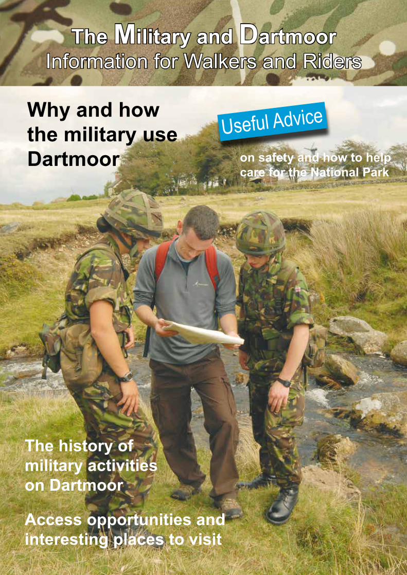
The Military and DartmoorInformation for Walkers and Riders
The history of military activities on Dartmoor
Access opportunities and interesting places to visit
Why and how the military use Dartmoor
Useful Advice
on safety and how to help care for the National Park

“Dartmoor is vital for preparing light Armed Forces’ fighting skills”The wildness of much of Dartmoor, so enjoyed by tourists, visitors and local people, provides the Military with the space and challenges it needs.
Rugged and remote, Dartmoor’s granite tors, steep sided valleys, bogs, and challenging weather make a demanding training ground for marines, paratroopers, infantry and other forces that mainly move on foot. These light forces benefit greatly from the same special qualities that Dartmoor’s walkers enjoy.
“Trained to bring peace but prepared for war”The Armed Forces are one of the means by which the Government achieves its foreign policy when diplomacy fails. The Military is the nation’s insurance policy, which hopefully remains the last resort. However, terrorism, nationalism and disaster are never too far away. Soldiers, sailors and airmen need to be ready to remove threats, support governments and protect British people.
“Train hard, fight easy”Soldiers train for a war and adapt for current operations. Combat skill proficiency and expertise can make the difference between winning and losing. Being the best is essential. Unlike league matches, soldiers only have one chance to get it right.
Training is the key to success. Progressive, demanding training wins battles and saves lives.
Providing Vital Training

“Defending the Country and the countryside”Servicemen and women need to work with the environment to survive. For example: camouflage requires an appreciation of nature; survival needs an understanding of wildlife; birds are excellent sentries; and sheep indicate enemy movements. Caring for the countryside is an essential part of military training. Soldiers require realistic training areas and need to keep them in good condition. There’s little point in defending the country if training destroys the countryside.
Sharing military training areas with others is necessary in Britain’s crowded islands. Much of the time troops are walking, observing and enjoying the Moor’s special qualities in the same way as walkers and riders.
Providing Vital Training
Only when there is live firing are the public excluded
for their own safety.

200 Years of Supporting the Military
“Our fighting forces have always benefited from the rigours of Dartmoor”In the early 1800s, unrest in Europe led to the creation of a militia to supplement regular forces. Troops gathered, drums beating and colours flying, to train on Dartmoor. Princetown’s gaol, purpose built in 1809, held French prisoners of war while officer prisoners were kept on trust in the market towns.
The Battle of Waterloo (1815) ended the threat from France until 1850 when there was a perceived threat of invasion by Napoleon III to invade. Troops from the large Plymouth Garrison marched and rode out to be brought to readiness on the Moor.
Soldiers continued to train on Dartmoor in preparation for the Crimean War (1854), the Zulu War (1879) and the 2nd Afghan War (1878-80).
Developments in artillery firepower led to the licensing in 1875 of north Dartmoor as a permanent training area. The Boer War (1880-1881 & 1899-1902) needed highly mobile artillery that could fire over hills and defeat entrenched enemy. Remains of the targets are still to be found.

200 Years of Supporting the Military
As the range, power and mobility of artillery improved, Dartmoor challenged soldiers to achieve the highest standards before they were deployed to Britain’s colonies and frequent campaigns.
In expectation of a war with Germany, volunteers were mobilised and together with the regulars honed their fighting skills against the abrasive Dartmoor weather and tors. Much of Dartmoor was requisitioned to support the national struggle.
Later in the Second World War (1939-45), American troops benefited from surviving Dartmoor in all its weathers, while preparing for the hardships of the invasion of Normandy and the fight across Europe to the Rhine.
After the War, Dartmoor was used to train the infantry. The rough ground and dangerous bogs, together with the unrelenting challenges of the weather, helped to develop a fighting force effectively deployed in Malaya, Korea, Suez and many other wars.
Royal Marines, based in the South West, gained their reputation on foundations built with Dartmoor’s granite. When they re-took the Falklands (1982) they had the advantage of having trained over similar ground and in similar weather conditions. They’d done it all before – on Dartmoor!

Training Modern Light Forces
“Be the best”Britain’s Armed Forces are recognised throughout the World for their high standards. Their ability to keep the peace, comfort injured children, rebuild schools or, when necessary, fight, is achieved through progressive, realistic and demanding training. Being the best wins battles, saves lives and deters potential enemies.
Dartmoor Training Area helps Servicemen and women to develop their individual weapon and fieldcraft skills, build up their teamwork and weld themselves into a capable force. The isolated and wild expanse of Dartmoor is similar to the terrain over which the Armed Forces have fought in the past and that over which they might have to fight again.
The rigours of Dartmoor also provide a sound foundation that can easily be adapted for deployments to jungle, mountain and desert areas.
“Successful training is progressive”A variety of methods are used for training Servicemen or women, which, combined like a jigsaw, produce the required high standards of individual, team and unit operational effectiveness. For example, lectures, films and books are used to explain and demonstrate the skills required. On the training area simulation, dry blank fire training and live fire provide essential experience.

Training Modern Light Forces
Training is progressive, building on each stage so as to create and maintain the required levels of military skills. Because of skill fade, people leaving, promotion and casualties, training has to be regularly repeated to maintain readiness.
For some units, such as 3 Commando Brigade Royal Marines, the standards have to be kept even higher so that they can be deployed at short notice.
“Soldiers and walkers enjoy Dartmoor for many of the same reasons”Much of what soldiers do is the same as civilian walkers. The difference is that troops use weapons and they do not get a choice of when they go out on the moor.
For soldiers and civilians, the wild moorlands of Dartmoor provide challenge. Everyone who walks deep into the moor has to be physically fit and competent in navigation, first aid, communication and survival as well as being environmentally aware. The Military takes these skills to higher levels as well as developing other abilities such as sniping, fieldcraft, target recognition and firing heavy weapons.
The character, tenacity, tolerence and determination developed on Dartmoor enables trained soldiers to be successful under different conditonsand climates.

Training Modern Light Forces
“Dartmoor is character building”Soldier and walker will undoubtedly agree that the rigours of Dartmoor build resource and initiative, and develop leadership.
“Live firing is a key skill” Dartmoor Training Area is shared with the public except when live firing is programmed. Firing live ammunition is vital for the troops to have confidence in their weapons and one another. Rifle firing is initially taught through lectures, films, drills and using a laser against a computer generated image. Having practised the fundamentals, soldiers practice basic accuracy by firing on fixed ranges, such as at Willsworthy. Soldiers then move on to firing in a position of kneeling, standing or sitting against moving targets and from behind various types of cover. Later they combine shooting skills with fieldcraft, the ability to move without being seen, in all weather conditions both by day and night.
“Dartmoor is the anvil on which the light forces’ bayonet is forged” Having trained the individual and crew, they must be brought together into teams that are capable of working together. Dartmoor provides the space and variety of terrain, remoteness and challenge for exercises with live ammunition and dry blank fire tactical exercises. Live fire tactical training uses radio-controlled targets to represent the enemy. Although the targets can’t fire back, each firer and his colleagues has to carry out accurately all of the drills and be aware of the safety precautions not only for themselves but also for those around them. Troops learn to have confidence in themselves, in their weapons and in the other members of their team.
Dry blank fire tactical training has the advantage of flexibility; allowing both sides to engage each other in free play. More realistic manoeuvres permit mistakes to be made, unlike live firing which has to be rigorously controlled to ensure safety. All phases of war can be practised including advancing to contact, patrolling, ambushing, attacking, defending and withdrawing.

Ten Tors
“A challenge for youth”Every May 2,400 teenagers in teams of 6 challenge themselves to walk to 10 tors on courses of 35, 45 or 55 miles within a weekend, starting and finishing at Okehampton Camp. In parallel, 250 less able teenagers undertake the Jubilee Challenge on foot or in wheel-chairs with routes of up to 15 miles.
“A life-changing experience, I’ve learnt a lot about myself”The Ten Tors Expedition demands careful planning, self-sufficiency, imagination, skilful navigation, endurance and teamwork. Participants learn first aid, survival and navigation skills. They develop self-reliance, independence, responsibility and confidence. Teamwork binds the groups together to overcome the challenges. It draws out the best from teenagers, developing character and a love for outdoor adventure.
“I owe my love of Dartmoor to the Ten Tors Challenge”Participants are encouraged to develop a respect for and desire to return to Dartmoor and similar areas of natural beauty. During the training and the Expedition the teenagers gain a greater appreciation of the beauty and fragility of Dartmoor’s landscape, cultural heritage, wildlife and inhabitants.
Ten Tors is organised by 43 (Wessex) Brigade, with support from the Royal Navy, Royal Air Force, Defence Training Estate, landowners, the Dartmoor National Park Authority and the Dartmoor Rescue Group. Running Ten Tors is a significant rehearsal for helping the South West’s communities to overcome disasters and emergencies.
http://events.exeter.ac.uk/tentors/

An Exemplary Steward of its
Responsibilities
“Defence Estates has regard to national park purposes.”Dartmoor Training Area works with its landlords and statutory bodies to manage its responsibilities for conservation and recreational opportunities.
The fundamental conflict between military training and national park purposes centres on the loss of access when live firing is programmed and the visual intrusion of associated infrastructure. However, most local people are sympathetic to the Armed Forces and recognise their need to train to high standards. They accept the strong tradition of military training on Dartmoor and the necessity of live firing.
Live fire training is programmed to avoid the guaranteed public access periods that cover most of the school holidays. The increase from 2 to 6 week’s warning of live firing has been received enthusiastically albeit that it has led to some restrictions on military
bookings. When there is no live firing, even though other military activities are taking place, the Military shares Dartmoor. Troops are required to be considerate of other users.
“The Military is a positive influence on Dartmoor’s environment.”Working closely with other bodies, the Military takes care not to damage Dartmoor. MOD funds surveys shared with all for the better management of Dartmoor. Supported by a voluntary conservation group, Dartmoor Training Area staff understand the cultural heritage, habitats and wildlife.
Much progress has been made jointly to reduce the impacts of military training, enhance conservation benefits and improve access arrangements. MOD is recognised as setting exemplary standards for habitat management, species recording, and environmentally sound land management.
Examples include: • Assistance to the National Park Authority with path maintenance and bridge building.

An Exemplary Steward of its
Responsibilities
• As a result of an MOD funded RSPB survey of breeding birds, rare bird breeding areas have been identified so that disturbance can be reduced.
“All parties continue to regard the Dartmoor Steering Group as a valuable and effective body.”The military use of Dartmoor is overseen at the highest level. Each year the Dartmoor Steering Group reports to the Secretaries of State for Defence and Environment. Its purpose is the best possible reconciliation of the requirements of military training, conservation and public access. Under an independent chairman, membership includes the Armed Forces, Dartmoor National Park Authority, Dartmoor Commoners’ Council, Duchy of Cornwall, English Heritage, Government Office of the South West and Natural England.
Discussions are far reaching and recent decisions have led to an increased notice of live firing, changes to range danger area boundaries to improve access opportunities, the introduction of a less visually intrusive field portaloo, and the landscaping of Okehampton Camp into the surrounding moorland.

The Military an Integral Part of Dartmoor
Ministry of Defence (MOD)The Armed Forces protect the nation, and its interests; securing everyone’s freedom to enjoy the countryside. Dartmoor provides the realistic training that multiplies troops’ effectiveness.
LandlordsMOD is grateful to a number of Dartmoor’s landowners for licences to train. In return it helps them to steward their estates.
Local CommunitiesThe Armed Forces make a significant contribution to the social and economic wellbeing of Dartmoor. Through discussion the views of local people are obtained from parish councils.
Non Governmental OrganisationsThe national priority of defence does not fit comfortably with the objectives of some organisations and the values of some individuals. Dartmoor Training Area engages with such groups and the public because we all care for Dartmoor.

The Military an Integral Part of Dartmoor
Statutory BodiesMany official bodies strive to care for and improve Dartmoor. Close relations are maintained with the Dartmoor Commoners’ Council, Dartmoor National Park Authority, English Heritage, Government Office South West and Natural England. Formally, these bodies meet with MOD through the Dartmoor Steering Group.
Tourists and VisitorsMOD assists the Dartmoor National Park Authority with public access where this does not conflict with live firing, security and tenants. Other users have as much right to enjoy Dartmoor as the Military. Meeting civilians adds to the realism of training.
Local FarmersThe Military depends on Dartmoor’s farmers to maintain the traditional landscape that provides an ideal light forces training environment. Dartmoor Training Area staff work closely with graziers and local farmers, who clear stock before live firing.
A Working EnvironmentDartmoor has been used for hunting, mining, tinning, rabbiting and peat cutting. Today farming, forestry, quarrying, tourism and military training are significant users of the moor. The working environment contributes to Dartmoor’s energy, community and uniqueness.

Enjoying Dartmoor
Before you go• You are responsible for your safety and those in your care.• Check the weather forecast.• Check firing times on north Dartmoor.• Plan your route carefully. • Know how to use your map and compass.• Prepare for rapidly-changing weather conditions.• Allow for river crossings not being possible.• Wear and carry appropriate equipment.• Take waterproofs and wear proper footwear. • Put spare clothing in a waterproof bag.• Take drinking water and spare food.• Leave your route with a responsible person.• Unless experienced, don’t walk alone.• Know the emergency procedures.
On the Moor• Observe the Countryside Code and byelaws.• Know where you are in case mist falls.• Put on waterproof clothing before you get wet. • Don’t hesitate to turn back or use your escape routes.• If in doubt of a river crossing, find another way over or round.
Afterwards• Inform the responsible person that you are off the moor.• Check for ticks.• Dry kit or apply after-sun!• Don’t drive if exhausted.• Have a drink and tell a yarn or few.• Plan another escapade.
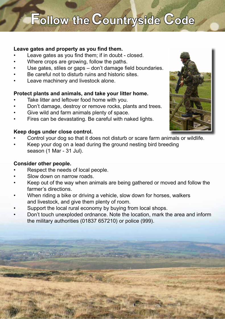
Follow the Countryside Code
Leave gates and property as you find them.• Leave gates as you find them; if in doubt - closed.• Where crops are growing, follow the paths.• Use gates, stiles or gaps – don’t damage field boundaries.• Be careful not to disturb ruins and historic sites.• Leave machinery and livestock alone.
Protect plants and animals, and take your litter home.• Take litter and leftover food home with you.• Don’t damage, destroy or remove rocks, plants and trees.• Give wild and farm animals plenty of space.• Fires can be devastating. Be careful with naked lights.
Keep dogs under close control.• Control your dog so that it does not disturb or scare farm animals or wildlife.• Keep your dog on a lead during the ground nesting bird breeding season (1 Mar - 31 Jul).
Consider other people.• Respect the needs of local people.• Slow down on narrow roads.• Keep out of the way when animals are being gathered or moved and follow the farmer’s directions.• When riding a bike or driving a vehicle, slow down for horses, walkers and livestock, and give them plenty of room.• Support the local rural economy by buying from local shops.• Don’t touch unexploded ordnance. Note the location, mark the area and inform the military authorities (01837 657210) or police (999).

Supporting Conservation
“Protecting Dartmoor is important to the Military”Realistic training needs a natural environment. MOD management identifies likely impacts of military training and plans set out mitigation measures. These include instructing troops to care for and be aware of the natural and historic environment.
“MOD supports the Dartmoor National Park Management Plan”Dartmoor’s forward looking Plan identifies goals and means to achieve the broad spectrum of measures required to protect and enhance Dartmoor’s special qualities.
Where compatible with national defence objectives, MOD works closely with landowners, the National Park Authority and other statutory bodies to achieve this vision for Dartmoor. The Dartmoor Military Conservation Group of ‘ologists provide expert advice to guide Dartmoor Training Area staff in caring for its responsibilities.
“MOD supports hill farmers”Sheep, cattle and ponies grazing the moor help to create a mosaic of different habitats. They also keep routes open for walkers. Farmers and soldiers have much in common; like soldiers they have to be hardy to tend their stock in all conditions, understand the terrain and weather, and be self sufficient.
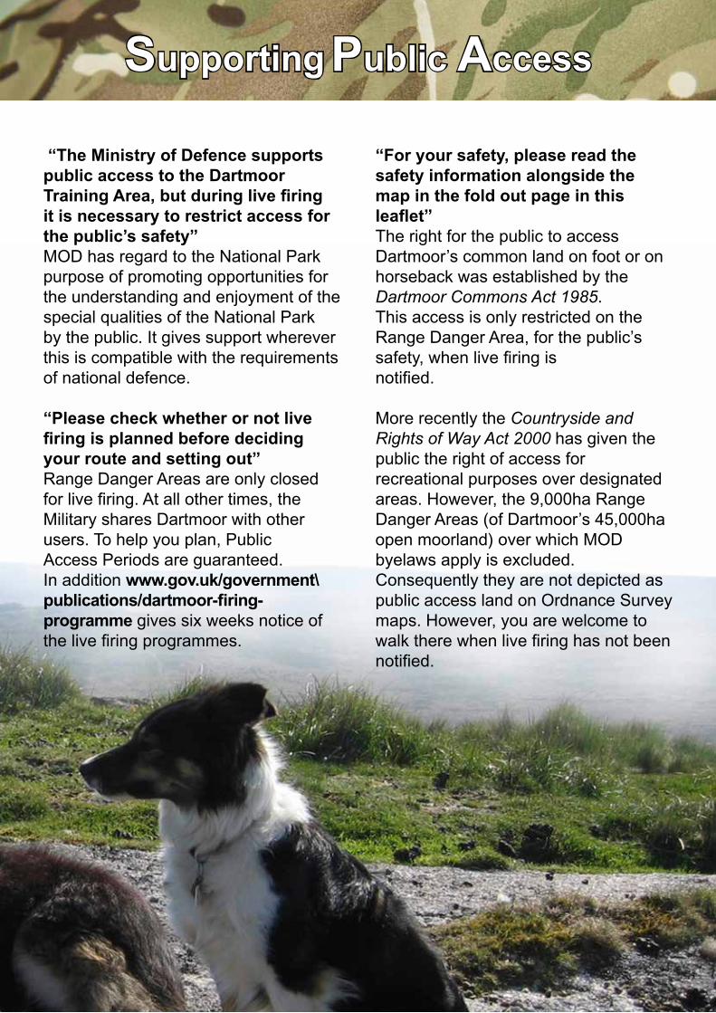
Supporting Public Access
“The Ministry of Defence supports public access to the Dartmoor Training Area, but during live firing it is necessary to restrict access for the public’s safety”MOD has regard to the National Park purpose of promoting opportunities for the understanding and enjoyment of the special qualities of the National Park by the public. It gives support wherever this is compatible with the requirements of national defence.
“Please check whether or not live firing is planned before deciding your route and setting out”Range Danger Areas are only closed for live firing. At all other times, the Military shares Dartmoor with other users. To help you plan, Public Access Periods are guaranteed. In addition www.gov.uk/government\publications/dartmoor-firing- programme gives six weeks notice of the live firing programmes.
“For your safety, please read the safety information alongside the map in the fold out page in this leaflet”The right for the public to access Dartmoor’s common land on foot or on horseback was established by the Dartmoor Commons Act 1985. This access is only restricted on the Range Danger Area, for the public’s safety, when live firing is notified.
More recently the Countryside and Rights of Way Act 2000 has given the public the right of access for recreational purposes over designated areas. However, the 9,000ha Range Danger Areas (of Dartmoor’s 45,000ha open moorland) over which MOD byelaws apply is excluded. Consequently they are not depicted as public access land on Ordnance Survey maps. However, you are welcome to walk there when live firing has not been notified.
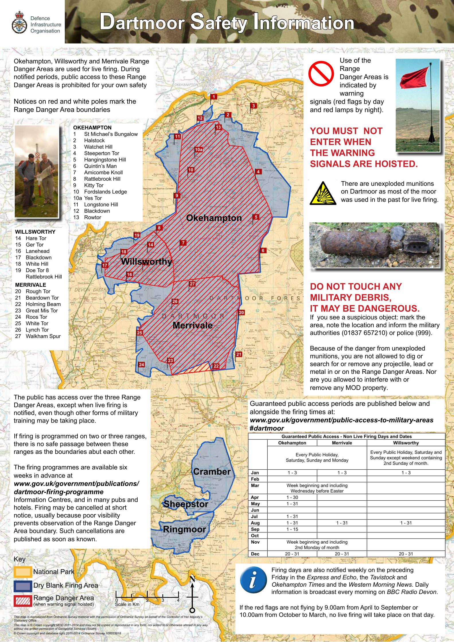
Dartmoor Safety Information
Use of the Range Danger Areas is indicated by warning
signals (red flags by day and red lamps by night).
YOU MUST NOT ENTER WHEN THE WARNING SIGNALS ARE HOISTED.
There are unexploded munitions on Dartmoor as most of the moor was used in the past for live firing.
DO NOT TOUCH ANY MILITARY DEBRIS, IT MAY BE DANGEROUS. If you see a suspicious object: mark the area, note the location and inform the military authorities (01837 657210) or police (999).
Because of the danger from unexploded munitions, you are not allowed to dig or search for or remove any projectile, lead or metal in or on the Range Danger Areas. Nor are you allowed to interfere with or remove any MOD property.
Okehampton, Willsworthy and Merrivale Range Danger Areas are used for live firing. During notified periods, public access to these Range Danger Areas is prohibited for your own safety
Notices on red and white poles mark the Range Danger Area boundaries
The public has access over the three Range Danger Areas, except when live firing is notified, even though other forms of military training may be taking place.
If firing is programmed on two or three ranges, there is no safe passage between these ranges as the boundaries abut each other.
The firing programmes are available six weeks in advance at www.gov.uk/government/publications/ dartmoor-firing-programme Information Centres, and in many pubs and hotels. Firing may be cancelled at short notice, usually because poor visibility prevents observation of the Range Danger Area boundary. Such cancellations are published as soon as known.
Firing days are also notified weekly on the preceding Friday in the Express and Echo, the Tavistock and Okehampton Times and the Western Morning News. Daily information is broadcast every morning on BBC Radio Devon.
If the red flags are not flying by 9.00am from April to September or 10.00am from October to March, no live firing will take place on that day.
Okehampton
Merrivale
Willsworthy
Ringmoor
Cramber
Guaranteed Public Access - Non Live Firing Days and DatesOkehampton Merrivale Willsworthy
Every Public Holiday, Saturday, Sunday and Monday
Every Public Holiday, Saturday and Sunday except weekend containing
2nd Sunday of month.
Jan 1 - 3 1 - 3 1 - 3 Feb Mar Week beginning and including
Wednesday before Easter Apr 1 - 30 May 1 - 31 Jun Jul 1 - 31 Aug 1 - 31 1 - 31 1 - 31 Sep 1 - 15 Oct Nov Week beginning and including
2nd Monday of month Dec 20 - 31 20 - 31 20 - 31
Sheepstor
Guaranteed public access periods are published below and alongside the firing times at: www.gov.uk/government/public-access-to-military-areas#dartmoor
National Park
Dry Blank Firing Area
Range Danger Area(when warning signal hoisted)
Key
Scale in Km0 2 3 4
N
This map is reproduced from Ordnance Survey material with the permission of Ordnance Survey on behalf of the Controller of Her Majesty’s Stationery Office. This map is © Crown copyright MOD 2011-2014 and may not be copied or reproduced in any form, nor added to or otherwise altered in any way without the written permission of Geospatial Services (South).© Crown copyright and database right 2011-2014 Ordnance Survey 100023818
WILLSWORTHY14 Hare Tor15 Ger Tor16 Lanehead17 Blackdown18 White Hill19 Doe Tor 8 Rattlebrook HillMERRIVALE20 Rough Tor21 Beardown Tor22 Holming Beam23 Great Mis Tor24 Roos Tor25 White Tor26 Lynch Tor27 Walkham Spur
OKEHAMPTON1 St Michael’s Bungalow2 Halstock3 Watchet Hill4 Steeperton Tor5 Hangingstone Hill6 Quintin’s Man7 Amicombe Knoll8 Rattlebrook Hill9 Kitty Tor10 Fordslands Ledge10a Yes Tor11 Longstone Hill12 Blackdown13 Rowtor
DefenceInfrastructureOrganisation
1

Okehampton Range
Aircraft CrashesAbout 45 aircraft have crashed onto Dartmoor, most during the 2nd World War. Amongst them was a Gloster Gladiator in Nov 1940 into High Willhays, a Hampden bomber into Hangingstone Hill in April 1941 and a Liberator into Slipper Stones in December 1943.
2. East Okement FarmAlso known as Hartor Farm, the Duchy of Cornwall property is the highest farm on Dartmoor. Let by MOD, tenants were provided with a bunker in which to shelter when artillery used to be fired over the farmhouse.
1. Boer War Trenches SX596924In about 1891, the South African Boers took cover in trenches instead of lining up to fight. Similar trenches were dug on Dartmoor, so that artillery could devise ways of defeating them.
Tinner’s HutsRather than walk to work every day, tin workers constructed simple overnight shelters from granite. The remains of many are marked on OS 1:25,000 maps.
1
2
3
4
5
6
7
11
Scale in Km
N0 1 2 3 4
8
9
10
© Crown copyright

Cotton GrassLook out for the fluffy cotton tails that grow in the boggy mires. If your first step is up to your ankle and the second to your knee, your third step should be backwards.
GraniteThis igneous rock of quartz, feldspar and mica has weathered over millions of years to form the distinctive tors. Imagine how much more loose rock (moorstone or clitter) there would have been before it was hauled away to help build the towns, villages, homesteads and walls around Dartmoor.
5. Cranmere Pool SX603858The boggy pond was the site of Dartmoor’s first letterbox. Walkers would leave a postcard and take the ones already there for posting when they returned to town.
Okehampton Range
3. Okehampton CampThe military camp was built in 1892 within Okehampton Castle’s park, where deer would have been farmed for food. The Camp housed soldiers in tents and 600 horses in stables. Examples of some of the original buildings can still be seen.
4. Black-a-Tor Copse SX5689The stunted oaks festooned with lichen are the remains of woods that once covered much of Dartmoor. Now protected as a National Nature Reserve, efforts are being made to regenerate the copse by protecting young trees from grazing sheep.
Boundary StonesIn days before maps, landowners and communities marked their boundaries with granite posts or marks on prominent rocks. Every 7 years most parishes beat the bounds; walking the boundary, making sure that their neighbour has not encroached, teaching the children the names of the stones and having a festival.

Okehampton Range
6. High Willhays and Yes TorThe highest points on the granite dome that stretches to the Scilly Isles are High Willhays and Yes Tor. Consider which is the higher as you enjoy the views to Bodmin Moor and Exmoor.
Lookouts and StablesAfter moving people and stock from the Danger Area, the clearers take post as lookouts. Their horse stables are always unlocked as emergency shelter.
LetterboxingToday this popular hobby involves careful map-reading, solving cryptic clues, fitness, determination and patience in order to find hidden boxes. There are over 5,000 on Dartmoor; each has a rubber stamp, which is used to mark the letterboxer’s book.
7. Loop RoadThe Loop Road that reaches 4km into the moor, was built by the Army in about 1900; the west side on an old peat cutter’s’ track. It provides the Military with routes for casualty evacuation, resupply and reduces wear on the moor. It also helps farmers to tend their stock and to keep it deep in the Moor.
Lichens and MossesString-of-sausage lichen festooning trees and lichen growing on rocks are indictors of the clean air of Dartmoor.
Moorland BirdsSkylark, stonechat, wheatear, whinchat, red grouse, reed bunting, ring ouzel, raven and buzzards are to be found on the moorland heath and its fringes.
Wading BirdsDunlin and golden plover nest in wet areas of the high moor. These cold weather birds, at the southern extremity of their breeding area, are likely to decrease as the climate warms.
Geoff Kaczanow ©
Geoff Kaczanow ©

10. Railway GunIn 1940 an 18” gun removed from HMS Furious and fitted to a railway carriage was fired from North Tawton station. Locals say that that the shell sounded like a dustbin rumbling overhead before exploding near OP22. The massive shell holes can still be seen near OP22 SX 601910.
Telephone BoxesReliable communication between exercise controllers, target operators and lookouts are essential. Many miles of telephone cable lie below Dartmoor’s surface with access points concealed behind strong steel doors.
11. Target RailwaysIn the late 1800s, the artillery trained against a realistic array of targets representing the enemy manoeuvring. Railway systems provided moving targets while men, concealed in bunkers, hauled up targets. Horses outside the danger area were also used to pull up targets using long cables.
Okehampton Range
8. NewtakesWalls were quickly thrown up to claim open moorland while the Duchy’s bailiff wasn’t looking. Irishman’s Wall was overthrown by commoners before it could be completed.
Observation PostsBunkers were used to protect artillery observers, who directed shells onto the target. Other bunkers sheltered men, who pulled up targets on receipt of telephoned commands. Of the 26 that were built, 5 remain as shelters and training objectives.
9. Peat CuttingPeat has been cut for fuel for centuries continuing until the 1950s. Commercial works were set up, eg at Kitty Tor SX 5687.

Willsworthy Range
2. Black Rock SX533853The life of Captain Hunter, Royal Engineers, MC and bar, is commemorated at Black Rock above the deep pool on the River Lyd by a plaque with a poem he wrote whilst on leave from the front during the First World War.
1. Widgery Cross SX539856Erected on Brat (or Bray) Tor by William Widgery, the artist, to commemorate Queen Victoria’s Golden Jubilee in 1887.
3. Ring OuzelsFour pairs of this rare summer visitor return to breed in Tavy Cleave each year. Closely related to the blackbird, it is recognisable by the white crescent on its breast.
Prehistoric Round Houses4,000 years ago prehistoric people lived in stone walled huts with bracken and grass roofs on a wooden frame. Although organic material has long since decayed, the granite walls remain as hut circles. Most are marked on OS 1:25,000 maps.
12
35
6
Geoff Kaczanow ©
Scale in Km
N0 1 2 3 4
4
8
7
© Crown copyright

5. Rifle RangesThe Army bought Willsworthy around 1905 to build rifle ranges for the Plymouth Garrison. In 1985 they were re-built to provide modern ranges including an electric target range.
6. Wheal Mary Emma SX533852Started in 1849 on the site of older surface tin workings, the shaft reached 132 feet with 12 miners employed. The mine closed in 1888 but you can still see the spoil heaps and the leat that took water to the wheel that powered the pumps and the stamps.
Willsworthy Range
FarmsReddaford (7) and Standon (8) have been farmed since at least the 13th century. MOD has restored the dry stone walls so the shape of the boundaries can still be seen. All are tenanted by local farmers, who accept that military training takes place across the farms. Historical surveys are on dartmoor-ranges.co.uk
InsectsWatch out for fritillary butterflies, damselflies that fold their wings at rest, and dragonflies that keep their wings open when perched on reeds.
Heather and WhortleberryOver the past 10 years, a reduction in grazing has allowed the heather and whortleberry to regenerate. During the whortleberries season in the 1800s, schools closed and children picked the berry for sale in markets.
4. Prisoner of War CampDuring the Second World War prisoners were going to be housed at Willsworthy but it was decided that it was too wet, bleak and cold for the enemy - so British soldiers were based there instead.
Geoff Kaczanow ©

Merrivale Range
RavensA few pairs of ravens remain breeding on Dartmoor’s tors. You can spot them in flight by their size, jagged wing tips, aerobatics and ‘cronk’ call. Some say the ravens that protect the Tower of London originated from Dartmoor.
Gorse and HeatherTypical of Dartmoor, there is more gorse and heather now that grazing has been reduced by agri-environmental schemes. It’s said that you can kiss a girlfriend in any month when the gorse is flowering – and it flowers throughout the year.
1
2
4
Geoff Kaczanow ©
Scale in Km
N0 1 2 3 4
3
© Crown copyright
Merrivale Range
1. Holming Beam Anti Tank Range SX593772The American Army’s 4th and 29th Divisions trained in the South West from 1943 in preparation for D Day. Many lived in tented camps around the Moor, where they trained. Anti tank guns were fired from Holming Beam at moving targets hauled by cables along a sunken trackway.
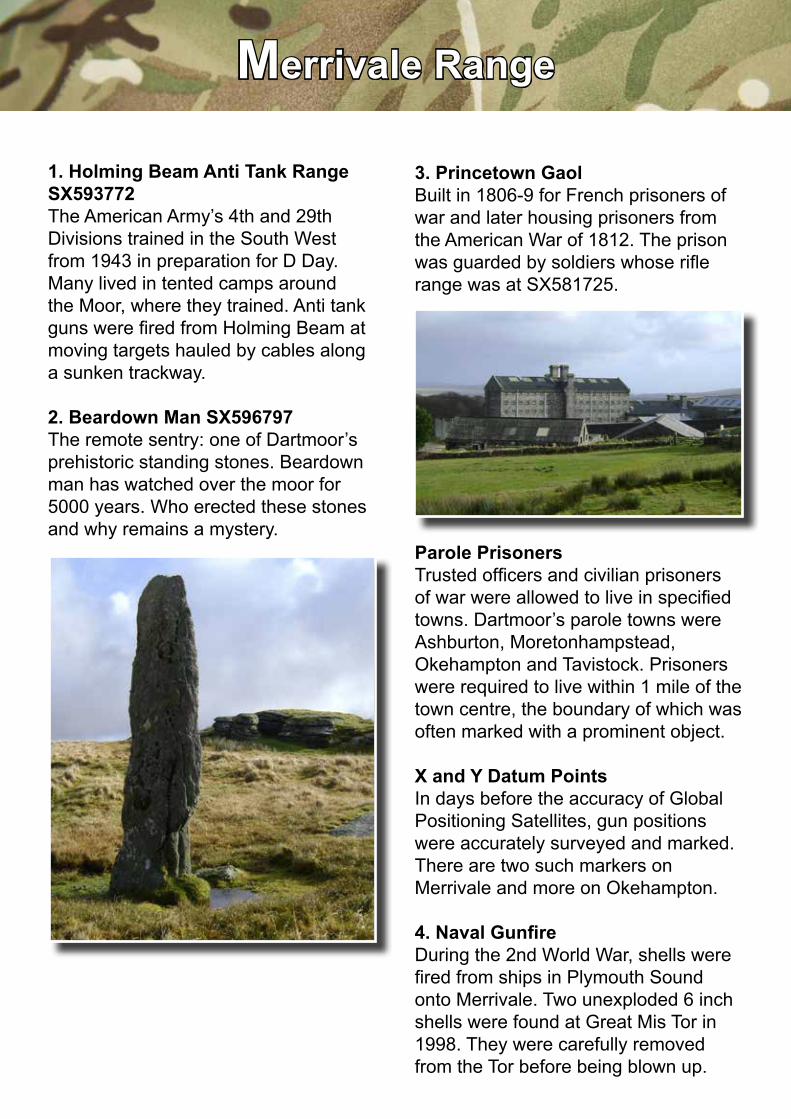
2. Beardown Man SX596797The remote sentry: one of Dartmoor’s prehistoric standing stones. Beardown man has watched over the moor for 5000 years. Who erected these stones and why remains a mystery.
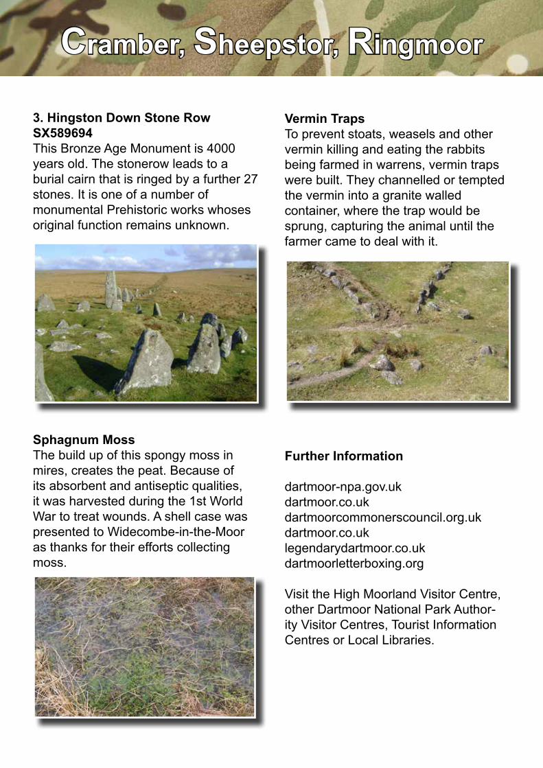
3. Princetown GaolBuilt in 1806-9 for French prisoners of war and later housing prisoners from the American War of 1812. The prison was guarded by soldiers whose rifle range was at SX581725.
Parole PrisonersTrusted officers and civilian prisoners of war were allowed to live in specified towns. Dartmoor’s parole towns were Ashburton, Moretonhampstead, Okehampton and Tavistock. Prisoners were required to live within 1 mile of the town centre, the boundary of which was often marked with a prominent object.
X and Y Datum PointsIn days before the accuracy of Global Positioning Satellites, gun positions were accurately surveyed and marked. There are two such markers on Merrivale and more on Okehampton.
4. Naval GunfireDuring the 2nd World War, shells were fired from ships in Plymouth Sound onto Merrivale. Two unexploded 6 inch shells were found at Great Mis Tor in 1998. They were carefully removed from the Tor before being blown up.

Cramber, Sheepstor, Ringmoor
1. Crazywell Pool SX582704Said to be bottomless, it was allegedly explored by local villagers who took all the church bell ropes and tied them together to fathom the dark depths. The Pool is also feared to foretell death. In truth, it is flooded tin works correctly called Claziwell.
2. Ditsworthy Warren House SX584662Rabbits were farmed in warrens, trapped, gutted, the meat sold and the pelts used for clothing.
ReavesDating back to the Bronze Age these boundaries of earth or stone divide the moor into ancient field systems. The banks are thought to separate the land allocated to individuals or communities for stock grazing or to keep stock off crops.
Tin WorkingWater was channelled to extract tin, leaving distinctive scars on the landscape. Later, pits and mines were dug, the ore crushed and the tin extracted in furnaces. Waterwheels were often used to power the machinery and blow air into the furnaces.
1
23
Scale in Km
N0 1 2 3 4
© Crown copyright
Cramber, Sheepstor, Ringmoor
3. Hingston Down Stone Row SX589694This Bronze Age Monument is 4000 years old. The stonerow leads to a burial cairn that is ringed by a further 27 stones. It is one of a number of monumental Prehistoric works whoses original function remains unknown.
Sphagnum MossThe build up of this spongy moss in mires, creates the peat. Because of its absorbent and antiseptic qualities, it was harvested during the 1st World War to treat wounds. A shell case was presented to Widecombe-in-the-Moor as thanks for their efforts collecting moss.
Vermin TrapsTo prevent stoats, weasels and other vermin killing and eating the rabbits being farmed in warrens, vermin traps were built. They channelled or tempted the vermin into a granite walled container, where the trap would be sprung, capturing the animal until the farmer came to deal with it.
Further Information
dartmoor-npa.gov.ukdartmoor.co.ukdartmoorcommonerscouncil.org.ukdartmoor.co.uklegendarydartmoor.co.ukdartmoorletterboxing.org
Visit the High Moorland Visitor Centre, other Dartmoor National Park Author-ity Visitor Centres, Tourist Information Centres or Local Libraries.

The Military and DartmoorInformation for Walkers and Riders
Designed and produced by Aspire Multi Media Centre, Warminster (9-03-269) Crown Copyright © 2011
on behalf of the Ministry of Defence
These maps are reproduced from Ordnance Survey material with the permission of Ordnance Survey on behalf of the Controller of Her Majesty’s Stationery Office.
Maps are © Crown copyright MOD 2011-2014 and may not be copied or reproduced in any form, nor added to or otherwise altered in any way without the written
permission of Geospatial Services (South).© Crown copyright and database right 2011-2014 Ordnance Survey 100023818
Providing challenging training to assist light Armed Forces achieve operational effectiveness
DefenceInfrastructureOrganisation
200 years of support for the Military
An integral part of the Dartmoor community; working with landowners, statutory bodies, farmers and local people
An exemplary steward of its responsibilities for conservation and public access