the map of america by pîrî reis - muslim heritage · the map of america by pÎrÎ reis this...
TRANSCRIPT

FSTC Limited 9 Conyngham Road, Victoria Park, Manchester, M14 5DX, United Kingdom Web: http://www.fstc.co.uk Email: [email protected]
Author: Professsor Sevim Tekeli Chief Editor: Lamaan Ball Release Date: January 2005 Publication ID: 4073 Copyright: © FSTC Limited 2005
IMPORTANT NOTICE: All rights, including copyright, in the content of this document are owned or controlled for these purposes by FSTC Limited. In accessing these web pages, you agree that you may only download the content for your own personal non-commercial use. You are not permitted to copy, broadcast, download, store (in any medium), transmit, show or play in public, adapt or change in any way the content of this document for any other purpose whatsoever without the prior written permission of FSTC Limited. Material may not be copied, reproduced, republished, downloaded, posted, broadcast or transmitted in any way except for your own personal non-commercial home use. Any other use requires the prior written permission of FSTC Limited. You agree not to adapt, alter or create a derivative work from any of the material contained in this document or use it for any other purpose other than for your personal non-commercial use. FSTC Limited has taken all reasonable care to ensure that pages published in this document and on the MuslimHeritage.com Web Site were accurate at the time of publication or last modification. Web sites are by nature experimental or constantly changing. Hence information published may be for test purposes only, may be out of date, or may be the personal opinion of the author. Readers should always verify information with the appropriate references before relying on it. The views of the authors of this document do not necessarily reflect the views of FSTC Limited. FSTC Limited takes no responsibility for the consequences of error or for any loss or damage suffered by readers of any of the information published on any pages in this document, and such information does not form any basis of a contract with readers or users of it.
The Map of America by Pîrî Reis

The Map of America by Pîrî Reis January 2005
Publication ID: 4073 Page 2 of 13 COPYRIGHT © FSTC Limited 2005
THE MAP OF AMERICA BY PÎRÎ REIS This article by Sevim Tekeli* was first published by the Turkish review Erdem 3 (Ankara 1985), pp. 673-
683. The copyright of the article belongs to Erdem. We are publishing it by permission of Erdem’s editor Imran Baba. Our thanks go to them for giving their permission to us.
The discovery of a new continent, America, through the efforts to reach India by sailing around the Cape of
Good Hope motivated great improvements in the field of marine geography in the 16th century. The
Ottomans were also included in these activities for good reasons because in the 16th century the Ottoman
Empire had expanded into three continents; the Black Sea and the Mediterranean were turned into Turkish
lakes and Ottoman fleets had started to win victories in the Red Sea and the Indian Ocean. As a result, it
became necessary for the Ottomans to improve themselves in marine geography.
A Turkish Admiral Pîrî Reis, with his two world maps and his book Kitâb-i Bahriyye, became one of the most
important representatives of marine geography not only in the Ottoman, Empire but in the world as well.
Towards the end of the 15th century, the wealth of European nations depended on sea trade. The nation
which knew the new shores and sea routes that the others did not know, gained dominance over sea trade
and naturally had the opportunity of becoming the richest nation of Europe. It was for this reason that the
Spanish had begun to keep all the maps drawn after Columbus' first trip and discovery of the New World in
the archives of Seville. Very few of these maps were allowed to be copied and then, only by the captains in
whom the Spanish had complete confidence. The important maps drawn by famous explorers such as
Columbus, Magellan and Cortes were copied, neither printed, nor engraved on copper or wood. The maps
that were in circulation were the ones that had slipped through this close surveillance. During this period,
quite a few maps and geography books were printed. However, the Spanish burnt them; on the pretext that
they were full of errors or that, they disclosed secret information. In the 16th century, the English and
French offered a reward of forty ingots of gold for a correctly drawn map of any part of America.1
With the disappearance of these maps from the archives of Seville, the map drawn in 1500 by Juan de la
Cosa who was with Columbus on his trip to America in 1492 became the oldest map of America found. In
this map, America was shown as the eastern coast of Asia.
The two other well-known maps are those of Cantina and Canneries and are of Spanish origin. Another map
that drew interest was the rough sketch by Columbus' son Bartholomea.2
The first map that was printed was the map of Contarini who drew the newly discovered land as the
extension of Asia.3 The second map that showed America was the large-scale world map of Martin
Waldseemüller, printed in 1507. Though it was based on the map drawn by Canneries in 1502, it differed
from the first map in that America was shown as a separate continent from Asia and was called "America."4
* Professor of the History of Science, Head of the Department of Philosophy and of the Chair of the History of Science, Faculty of Letters, Ankara University. 1 Brown, L.A., The Story of Maps, Canada 1953, 5th ed., p. 8. 2 Tooley, R. V., Maps and Map-Makers, London, 1952, 2nd ed., p. no. 110. 3 Tooley, p. no. 110. 4 Brown, p. 110.

The Map of America by Pîrî Reis January 2005
Publication ID: 4073 Page 3 of 13 COPYRIGHT © FSTC Limited 2005
Martin Waldseemüller was born in Radolfzell, educated at Freiberg University, and later appointed as a
priest at St. Die. Here, a small group working on cosmography, cartography, and philosophy was formed.
The Duke's secretary, Father Walter Ludd, founded a printing house to publish these studies.
Waldseemüller began his studies by putting together the copies of Ptolemy's maps in Basel and Strasbourg
libraries. However, he could not ignore the studies of the Spanish and Portuguese on this subject. He cast
Ptolemy aside for Amerigo Vespucci whom he admired and whose book Cosmographiae Introductio he
used, in drawing a map of South America. He paid homage to the great explorer calling his map
"America."5
While the maps mentioned above have been accepted as the oldest maps of America, in 1929 Halil Eldem
found a piece of a map in the Topkapi Place and took it to Ataturk who showed great interest in this map.
After many studies, this map, or portolano, was proved to be a part of the world map drawn in 1513 by the
famous Turkish Admiral Pîrî Reis.
Pîrî Reis had also mentioned the sources he referred to while drawing this map. One of them, as he
mentioned in Kitâb-i Bahriyye, is the map of Columbus. This map is most probably the map Columbus drew
in 1498 and sent to Spain. Although it was not very customary to have copies of the original then, there
were copies made of this map. However, today neither the original nor can any of its copies be found. The
only map that has survived until now is that of Pîrî Reis, who drew it using the map of Columbus as a
model.
Figure 1. The portrait of Pîrî Reis.
The Life of Pîrî Reis Although the exact date of his birth is not known, it is presumed that Muhyi al-Din Pîrî was born between
1465 and 1470 in Gallipoli, an important naval base along the Marmara coast. His father was Hajji Mehmed;
his uncle, one of the famous admirals of the period, Kemal Reis. When Pîrî was about eleven, he joined the
5 Brown, p. 157.
The Map of America by Pîrî Reis January 2005
Publication ID: 4073 Page 4 of 13 COPYRIGHT © FSTC Limited 2005
crew of his uncle who had started out as a pirate and then joined the Imperial Ottoman fleet. Between
1487 and 1493, Pîrî participated in many naval battles with his uncle. His independent career as naval
captain corresponds to his heroic performances in the sea battles between 1499 and 1502. It is probably
during one of these battles that he may have gotten hold of the Columbus Map.
After his uncle's death in 1511, he left the open seas to live in Gallipoli and started working on map
drawing. After a while, he joined in the crew of the great Turkish sailor Barbarossa Hayr al-Din.
In 1516-1517, Pîrî Reis was given command of several ships in the Ottoman campaign against Egypt. He
showed great prowess in capturing Alexandria which was then the naval base of Egypt. This victory caused
Pîrî to gain, the closer notice of Sultan Selim (1519-1520) and to present to him the world map which he
had completed in Gallipoli.
After the Egyptian campaign, Pîrî returned to Gallipoli and started to work on the Kitâb-i Bahriyye. In the
meanwhile, Selim had died and Sultan Suleyman the Magnificent had ascended the throne; Pîrî was given a
commission in the Turkish fleet.
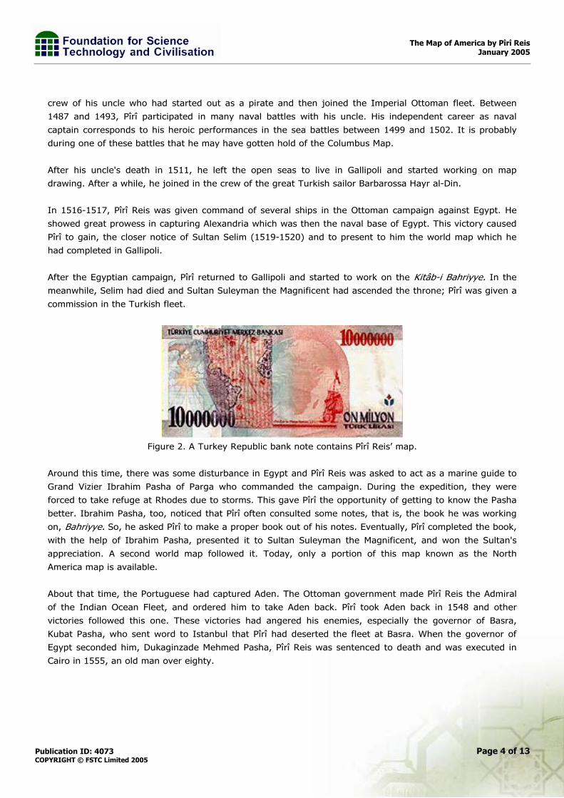
Figure 2. A Turkey Republic bank note contains Pîrî Reis’ map.
Around this time, there was some disturbance in Egypt and Pîrî Reis was asked to act as a marine guide to
Grand Vizier Ibrahim Pasha of Parga who commanded the campaign. During the expedition, they were
forced to take refuge at Rhodes due to storms. This gave Pîrî the opportunity of getting to know the Pasha
better. Ibrahim Pasha, too, noticed that Pîrî often consulted some notes, that is, the book he was working
on, Bahriyye. So, he asked Pîrî to make a proper book out of his notes. Eventually, Pîrî completed the book,
with the help of Ibrahim Pasha, presented it to Sultan Suleyman the Magnificent, and won the Sultan's
appreciation. A second world map followed it. Today, only a portion of this map known as the North
America map is available.
About that time, the Portuguese had captured Aden. The Ottoman government made Pîrî Reis the Admiral
of the Indian Ocean Fleet, and ordered him to take Aden back. Pîrî took Aden back in 1548 and other
victories followed this one. These victories had angered his enemies, especially the governor of Basra,
Kubat Pasha, who sent word to Istanbul that Pîrî had deserted the fleet at Basra. When the governor of
Egypt seconded him, Dukaginzade Mehmed Pasha, Pîrî Reis was sentenced to death and was executed in
Cairo in 1555, an old man over eighty.

The Map of America by Pîrî Reis January 2005
Publication ID: 4073 Page 5 of 13 COPYRIGHT © FSTC Limited 2005
The First World Map of Pîrî Reîs (1513)
The map that was found in the Topkapi Place in 1929, drawn on a piece of parchment 90x60 cm. in size,
was only a portion of the world map that Pîrî Reis drew in Gallipoli in 1513 and later presented to Sultan
Selim in 1517 in Egypt. This portion shows only the coasts of South Western Europe, West Africa, Middle
East and Central America.
Figure 3. Coordinates of Piri Reis’ map.
On the map, mountains were drawn in outlines and the rivers marked with thick lines, shallow places were
indicated with red dots and rocky places in the sea with crosses. Notes were added concerning different
regions, and the map was decorated with illustrations of special plants and animals.
This map is a portolano, with no lines of longitude and latitude, which aims at giving information about
coasts and islands. Instead of longitudes and latitudes, there are lines and two rose-compasses, one in the
North and the other in the South. Each of the roses is divided into 32 parts and these lines extend beyond
the rose frames; there are also two scales indicating mileage. The lines that are extended from wind roses
and scales are used in measuring the distances between the ports.
Generally, it was thought that these portolanos lacked mathematical basis. However, studies conducted on
this subject showed that in the map of Pîrî Reis, there were five projection centres on the Atlantic Ocean.
Lines of longitude and latitude can very easily be added to this map. He himself wrote in Bahriyye that this
map was drawn very accurately and added that if there was an error in a map, no matter how small, it
should not be used, for it could be misleading.
Pîrî Reis made use of 34 maps in drawing his own. Of these, twenty had no dates. Eight of them were maps
that were called jaferiya by Moslem geographers. Four were new maps drawn by the Portuguese and one

The Map of America by Pîrî Reis January 2005
Publication ID: 4073 Page 6 of 13 COPYRIGHT © FSTC Limited 2005
was the map of Columbus.6 In Kitâb-i Bahriyye, he mentions it at length saying that Columbus had
discovered the Antilles on one of his travels and that he had opened the sea-route of the Antilles. The map
of this had reached him (Pîrî) and he was announcing this to everyone.7
We also learn from one of the notes on the map that a Spaniard, who had participated in three of the four
expeditions, led and who was later taken prisoner by Kemal Reis, gave valuable information concerning the
discoveries of Columbus.8 Since the map of Columbus is lost, the only original document we have today is
the map of Pîrî Reis.
Figure 4. A section of the World Map produced by Pîrî Reis and presented to Sultan Selim I in 1517. (The
original is in Topkapi Palace Museum Library, no. H. 1824.)
In the fifth note on the map, he narrates how America was discovered. This section tells how these shores
and islands were found. "These coasts are called the shores of Antilia. They were discovered in the year
896 of the Arab calendar. But it was rumoured thus, that a Genoese infidel called Colombo, was the one
who discovered these places. For instance, a book came into the hands of the said Colombo, and he found
it said in this book that at the end of the Western Sea (Atlantic), that is, on its western side, there were
coasts and islands and all kinds of metals and also precious stones. The above-mentioned, having studied
6 Afetinan, 1983, pp. 27-28. 7 Afetinan, 1983, pp. 22. 8 Afetinan, 1983, pp. 28.

The Map of America by Pîrî Reis January 2005
Publication ID: 4073 Page 7 of 13 COPYRIGHT © FSTC Limited 2005
this book thoroughly, explained these matters one by one to the lords of Genoa and said: Come, give me
two ships, let me go and find these places. They said: O, unprofitable man, can an end or limit be found to
the Western Sea? Its vapour is full of darkness. The above-mentioned Colombo saw that no help was
forthcoming from the Genoese, so he sped forth, went to the Bey of Spain (King) and told his tale in detail.
They too answered like the Genoese. In short, Colombo petitioned these people for a long time, finally the
Bey of Spain gave him two ships, saw that they were well equipped and said: O, Colombo, if it happens as
you say, let us make you Kapudan (Admiral) to that country. Having said that, he sent the said Colombo to
the Western Sea. The late Ghazi Kemal had a Spanish slave. The above-mentioned slave told Kemal Reis
that he had been three times to that land with Colombo. He said:
First we reached the straits of Gibraltar, then from there straight south and west between the two. . . Having advanced straight four thousand miles, we saw an island facing us, but gradually the waves of the sea became foamless, that is, the sea was becalmed and the North Star- the seamen still call it star on their compasses-little by little veiled and became invisible; and he also said that the stars in that region are not arranged as here. They are seen in a different arrangement. They anchored at the island which they had seen earlier across the way. The population of the island came, shot arrows at them and did not allow them to land and ask for information. The males and females shot hand arrows. The tips of these arrows were made of fish bones, and the whole population went naked. Seeing that they could not land on that island they crossed to the other side of the island and they saw a boat. On seeing them, the boat fled and they (the people in the boat) dashed out on land. They (the Spaniards) took the boat. They saw that inside of it there was human flesh. It happened that these people were of that nation which went from island to island hunting men and eating them. They said Colombo saw yet another island, they neared it, and they saw that on that island there were great snakes. They avoided landing on this island and remained there seventeen days. People of this island saw that no harm came to them from this boat. They caught fish and brought it to them in their small boat (filika). .. These (Spaniards) were pleased and gave them glass beads. It appears that he (Colombo) had read in the book that in that region, glass beads were valued. Seeing the beads, they brought still, more fish. These (Spaniards) always gave them glass beads. One day they saw gold around the arms of a woman; they took the gold and gave her beads. They told them: 'bring more gold, and we will give you more beads. They went and brought them much gold. It appears that in their mountains, there were gold mines. One day, also, they saw pearls in the hands of one person. They saw that when they gave beads, many more pearls were brought to them. Pearls were found on the shores of this island, in a spot one or two fathoms deep. And also leading their ship with many logwood trees and taking two natives along, they carried them within that year to the Bey of Spain. But the said Colombo, not knowing the language of these people, they traded by signs, and after this trip, the Bey of Spain, sent priests and barley, taught the natives how to sow and reap and converted them to his own religion. They had no religion of any sort. They walked naked, lay there like animals. Now, these regions have been opened to all and have become famous. The names, which mark the places on the said islands and coast, were given by Colombo so that they may know these places. And also Colombo was a great astronomer. The coasts and the islands on this map are taken from
Colombo's map."9
9 Afetinan, 1983, pp. 30-31.

The Map of America by Pîrî Reis January 2005
Publication ID: 4073 Page 8 of 13 COPYRIGHT © FSTC Limited 2005
When Pîrî was drawing the coasts of America, he remained faithful to the map of Columbus and copied it
from several points. The Antilles and Cuba are shown as continents on his map as Columbus believed them
to be. When Columbus was near the coast of Cuba in 1494, he had the firm belief that Cuba was a
continent, and as a result, he had his conviction recorded by the notary public on board, Fernand Perez de
Luna, and asked all the crew to sign it. As we can observe from this document signed on the 12th June
1494, which declares that since it is quite evident that Cuba is a continent, thereafter whoever attempts to
contradict this statement shall be fined to 10,000 Maravedis pieces that his tongue shall be cut out in
addition.10 Because Columbus had named a cape on Trinidad "Galera", Pîrî also named this island "Kalera".
Pîrî as the Island of Spain called Haiti called by Columbus Hispanyola. Pîrî called the eleven islands on the
southeast of Haiti "Undizi Vergine" which shows that he preferred to use Italian, the mother tongue of
Columbus, instead of using "onze" which means eleven in Spanish.
Columbus had shown South America as a group of islands. Inspired by this, Pîrî too drew many imaginary
islands opposite Trinidad with a picture of a parrot on the side. He made use of the new Portuguese maps
when drawing South America. These are the maps drawn by Amerigo Vespucci and Juan de Solis before
1508. Some of the names of places on the South American coast, like Santa Agostini, San Magali, San
Francisco, Port Rali, Total Sante, Cap Frio, and Katenio show a close resemblance to their modern forms. All
the principal rivers in South America are marked on the map, though the names are not written. It is also
interesting that he should have shown the river La Plata on the map when Pinzo and Juan de Solis never
even took any notice of it. The land, which is shown as extending to the west from the south of South
America Cleary, indicates the Ptolemaic influence.
There are pictures of ships on the map. These are drawn for the purpose of indicating the discoveries of
explorers. For example, next to a picture near the island of Santiano, is a note stating that a Genoese called
Nation found this island. Again on the same map, towards the north, is a picture of a woman and a man
building an Ore on a fish, a boat and yet another big boat with three people in it. This is the legend of
Santo Brandon. But Pîrî does not neglect to point out that this legend comes down from the old Mappa
Mundi (world map) and not from the Portuguese. As a conclusion, it can be said that this map is a very
valuable historical map for two reasons. First of all, it was the most correct and scientific map of the time,
and secondly it was the only map which was drawn using Columbus' map-the original or the copy of which
does not exist today.
The Second World Map (1528)
Fifteen years after his first map, Pîrî Reis drew a second world map, also at Gallipoli today we have only a
small portion of it, 68x69 in size. On this portion, there are the northern parts of the Atlantic Ocean and the
newly discovered regions of North and Central America.
The map starts with Greenland in the north. Towards the south there are two pieces of land, the first is
called Baccalo, the second one further down is called Terra Nova and it is mentioned that the Portuguese
discovered these. Further south there is the peninsula of Florida drawn quite correctly and which Pîrî Reis
names San Juan Batisto. This name was given to Puerto Rico on the previous map. The pieces of land at
the side are the peninsulas of Honduras and Yucatan, discovered in 1517 and 1519 respectively.
10 Pîrî Reis, Kitâb-i Bahriyye, Istanbul 1935, pp. 442-423.

The Map of America by Pîrî Reis January 2005
Publication ID: 4073 Page 9 of 13 COPYRIGHT © FSTC Limited 2005
Cuba and Haiti are drawn quite accurately on the second map. One can read the words 'Tsla di Vana" over
Cuba. The errors on the previous map have been corrected on this one.
Figure 5. Part of Pîrî Reîs’ second “World Map” completed in 1528. (The original is in Topkapi Palace
Museum Library, no. Revan 1633.)
Figure 6. The drawing of Pîrî Reîs’ Cyprus Map on the stamp.
There are wind roses divided into 32 parts on this map instead of lines of longitude and latitude, besides
the measurements and the two sets of scales on the side divided into twenty. There is a note that says that
the distance between two sections is 50 miles and between two points 10 miles. Pîrî Reis also drew the
Tropic of Cancer over Cuba on this map and called it "gunusadisi". However, this line should have been
more to the north.
There is, moreover, a slight distortion on the map from the true positions, as we know today. This error
was committed, due to neglect in not taking into consideration the ten to thirteen degrees of difference in
angle on the contemporary compasses. This error is true for all western originated maps.
In this second map, the drawing of the coastlines shows greater improvement when compared with the
inaccuracies of the first one; only the parts of the world that were already discovered were shown; the

The Map of America by Pîrî Reis January 2005
Publication ID: 4073 Page 10 of 13 COPYRIGHT © FSTC Limited 2005
unexplored areas were left blank. This proves that Pîrî Reis observed the principles of scientific methods
and that he continued following the new discoveries very closely. This map can be considered as one of the
most successful maps of the period as far as cartographical techniques go.
Figure 7. The drawing of Piri Reis’ map stamp. The stamp reads: Lettre de Piri Reis Kalite.
Kitâb-i Bahriyye
Pîrî Reis made a book of all his notes, revised and expanded it, and, in 1525, he presented it to Suleyman
the Magnificent through Ibrahim Pasha. He analyzed the geographic works of his times and with his sharp
faculties of observation, he set down everything he came across in his travels. In the preface of his book,
he said that his purpose in writing such a book was to give information about ports, coast and islands by
drawing them on maps known as portolanos in the west. However, he added that no matter how big the
scales of maps were, it was impossible to show the vital and important details on them, and this lack of
vital information made him see the necessity of writing a book to supplement such information. This, then,
is the novelty Bahriyye brought to the science of navigation.
In the first two chapters, he explains why he wrote the Bahriyye. In chapters II, IV and V, he gives
information about storms, winds, the four directions and the compass. In chapters VI-VII, he studies the
maps and the pictures on the maps. In chapter VIII, he talks about the seas, in IX, about the discoveries of
the Portuguese and how they sailed to the Indian Ocean. Chapter X deals with Ethiopia (Abyssinia) and the
arrival of the Dutch and the Portuguese in the Red Sea from the Cape of Good Hope. In chapter XI, he talks
about "the ball of the earth". Chapter XII recounts the expeditions of the Portuguese to India, while the
next two, XIII and XIV, give information about the Chinese seas, the customs and the traditions of the
Chinese people and their skill in pottery. Chapter XV is about the Indian Ocean and the monsoons. In
chapters XX, XXII, and XXIII, he talks at length about the Atlantic Ocean and the discovery of America by
Columbus.

The Map of America by Pîrî Reis January 2005
Publication ID: 4073 Page 11 of 13 COPYRIGHT © FSTC Limited 2005
Figure 8. Map of Argentine of Pîrî Reis and today map of same area.
In the Bahriyye, there is detailed information about the Mediterranean. For example, one chapter deals with
Venice in particular: "The city of Venice extends to an area of 12 miles. The whole district consists of parts
of land and parts of an "ear" of the sea. The sea is at some places quite shallow and at others deep. The
people have put piles upon these shallow spots and upon them built their city. In time, more people began
to come there and to settle there by building houses over those piles. In the course of time, they increased
in number. The wise ones among them thought that they must see to it that the city they were building
must be able to stand for all time." Later he tells about the construction of the church and the tower built in
the name of St. Marco whose remains were brought forth from Alexandria. He also says that ships entering
the port should take a guide; otherwise, they would be stranded in shallow waters. Research work done on
this book reveals that there is not one single statement that is not based on facts, and this proves that the
Bahriyye is a valuable study on navigation.

The Map of America by Pîrî Reis January 2005
Publication ID: 4073 Page 12 of 13 COPYRIGHT © FSTC Limited 2005
Figure 9. Modern drawing of Piri Reis’ map.

The Map of America by Pîrî Reis January 2005
Publication ID: 4073 Page 13 of 13 COPYRIGHT © FSTC Limited 2005
Bibliography Adivar, Adnan, Osmanli Turklerinde Ilim, Istanbul 1982.
Afet, A., "Bir Turk Amirali, XVI. asrin buyuk ceografi: Pîrî Reis", Belleten, vol. 1, No. 2, pp. 333-348.
Afet Inan, A., Life and Works of Pîrî Reis, Ankara 1983.
Afet Inan, A., Pîrî Reis'in Hayati ve Eserleri, Ankara 1983.
Akcura, Yusuf, Pîrî Reis Haritasi Hakhnda Izahname-Die Karte des Pîrî Reis-Pîri Reis Map-Carte de Pîrî Reis, Istanbul 1935.
Alpaqut, H. and F. Kurtoglu, Mukaddime I-LV. Pîrî Reis: Kitâb-i Bahriyye, Istanbul 1936.
Brown, R. V., Maps and Map-Makers, London 1952. 2nd ed.
Durand, D. B., the Vienna-Kloslemeuburg Map Corpus, Leiden 1952.
Kahle, P., Pîrî Reis Bahriye, Das turkishe Segelhandbuch fur das Mittelldndische Meer uom Jahre 1521,
Band I. Text, Band II. "Obersetzung, Berlin-Leipzig 1926.
Kahle, P.,Pîrî Reis und seine Bahriye (Beitrage zur historischen Geographie), 1927.
Kahle, P., Die Verschollene Columbus Karte von 1498 in einer Turkischen Weltkarte von 1513, Berlin-
Leipzig 1933.
Selen, S-, "Pîrî Reis'in Simali Amerika Haritasi: (Die Nord Amerika Kartedes Pîrî Reis-1528)", Belleten, vol.
1. No. 2, pp. 515-528.
Senemoglu, Y., Kitâb-i Bahriyye, 2 vols. 1001 Temel Eser, 1979.
Tooley, R. V., Maps and Maps Makers, London 1952, 2nd edition.