the future of geospatial technology - maine gis user...
TRANSCRIPT
The Future of Geospatial Technology
Maine Municipal Association – Maine GIS User Group Technology Conference
Bangor, March 3, 2011
3/10/2011 Matthew Bampton

Three Questions
• Where are we now ?
• Where we did we come from ?
• Where are we going ?
3/10/2011 Matthew Bampton

A Short History of GIS
3/10/2011 Matthew Bampton
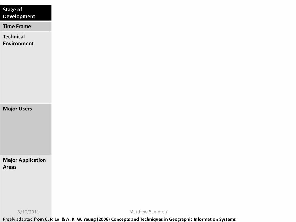
Stage of Development
The Formative Years Maturing Technology GIS Infrastructure
Time Frame 1960‐1980 1980‐Mid‐1990s Mid‐1990s‐Now
Technical Environment
• Mainframe Computers
• ProprietarySoftware
• Proprietary data structure
• Mostly Raster‐Based
• Mainframe and Minicomputers
• Georelational Data Structure• GUI• New Data Acquisition
Technology
• Workstations and PCs• Network/Internet• Multimedia• Open System Design• Data Integration• Enterprise Computing• Object‐Relational Model &
Database• Geodatabase• Mobile Computing
Major Users • Governments• Universities• Military
• Governments• Universities• Military• Utilities• Business
• Governments• Universities• Military• Utilities• Business• The General Public
Major Application Areas
• Land & Resource Management
• Census• Surveying &
Mapping
• Land & Resource Management
• Census• Surveying & Mapping• Facilities Management• Market Analysis
• Land & Resource Management• Census• Surveying and Mapping• Facilities Management• Market Analysis• Utilities• Location‐Based Services• Recreation• Customer Support
Freely adapted from C. P. Lo & A. K. W. Yeung (2006) Concepts and Techniques in Geographic Information Systems
3/10/2011 Matthew Bampton

Our Heroes Embark upon A Sacred & Magical Mission
They Face Terrible Obstacles, & Unending Struggle
But In The End They Triumph Against Impossible Odds & New Age Dawns
Or to put it another way . . . . .
3/10/2011 Matthew Bampton

Early GIS
3/10/2011 Matthew Bampton
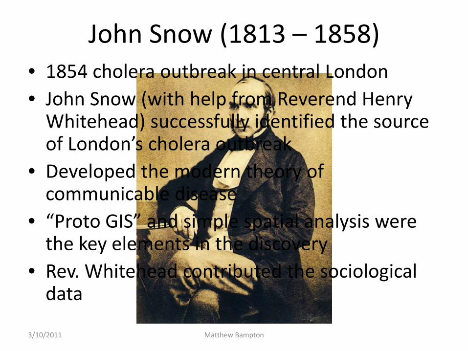
John Snow (1813 – 1858)• 1854 cholera outbreak in central London • John Snow (with help from Reverend Henry Whitehead) successfully identified the source of London’s cholera outbreak
• Developed the modern theory of communicable disease
• “Proto GIS” and simple spatial analysis were the key elements in the discovery
• Rev. Whitehead contributed the sociological data
3/10/2011 Matthew Bampton
“Proto GIS”
3/10/2011 Matthew Bampton

http://www.ph.ucla.edu/epi/snow/1846map/1846map.htm
The Latest Technology!
3/10/2011 Matthew Bampton

http://www.ph.ucla.edu/epi/snow/1846map/1846map.htm3/10/2011 Matthew Bampton

Water Pumps
Cholera Houses
Infected Houses
This Pump
www.ph.ucla.edu/epi/snow.html 3/10/2011 Matthew Bampton

The First Law of GeographyWaldo Tobler
3/10/2011 Matthew Bampton

“The first law of geography: everything is related to everything else, but near things are more related than distant things.”
Waldo Tobler, 1970
3/10/2011 Matthew Bampton
3/10/2011 Matthew Bampton

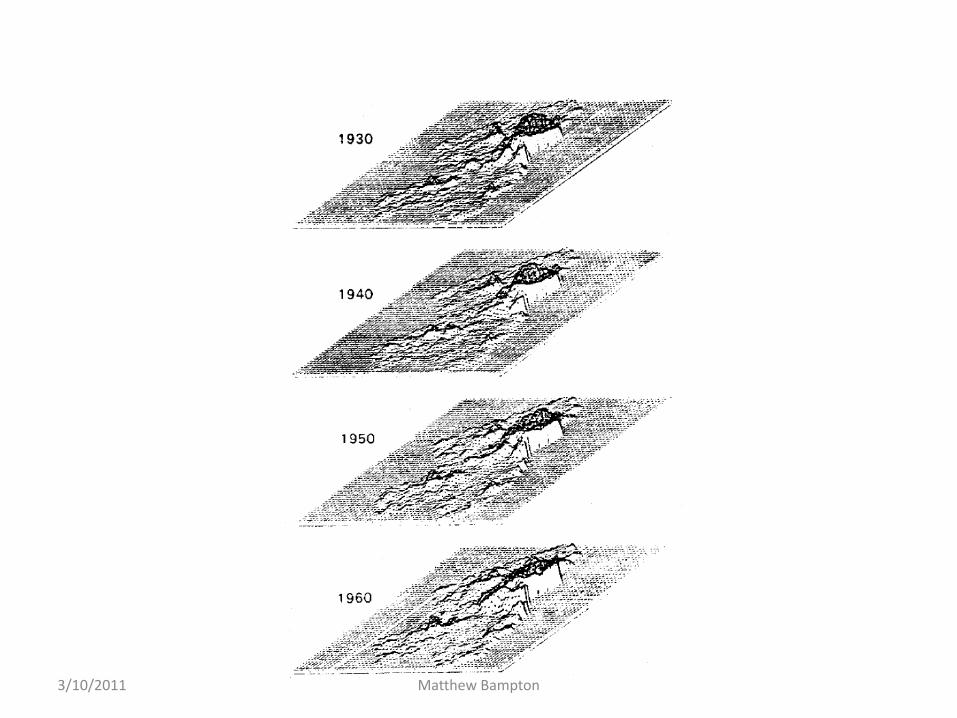
"The expectation of course is that the movie representations of the simulated population distribution in the Detroit
region will provide insights, mostly of an intuitive, rather than a formal nature, into the dynamics of urban growth".
Waldo Tobler, 1970
3/10/2011 Matthew Bampton

Central Business District
3/10/2011 Matthew Bampton
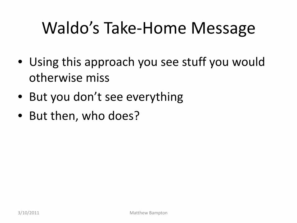
Waldo’s Take‐Home Message
• Using this approach you see stuff you would otherwise miss
• But you don’t see everything
• But then, who does?
3/10/2011 Matthew Bampton

A Couple of Examples From Tobler’s Work
3/10/2011 Matthew Bampton

US Migration Patterns
3/10/2011 Matthew Bampton

W. Tobler, 1995, “Migration: Ravenstein, Thornthwaite, and Beyond”, Urban Geography, 16(4):327‐343.
Migration in the United States, by state, 1975‐1980. States with a plus symbol were gaining, those with a minus sign were losing, people through internal migration. Omitting the state boundaries emphasizes the spatial coherence, and quickly renders it obvious. The zero net migration contour can easily be visualized.
3/10/2011 Matthew Bampton

How the Money Moves
3/10/2011 Matthew Bampton

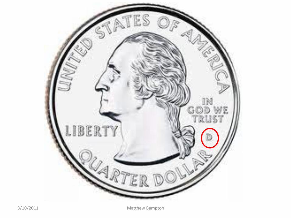
• In the United States the currency indicates where it was issued• For one dollar bills this is the Federal Reserve District code, a letter at the
beginning of the serial number.• You can check your wallet to estimate your interaction with the rest of the
country.
San Francisco3/10/2011 Matthew Bampton
3/10/2011 Matthew Bampton

A. BostonB. New YorkC. PhiladelphiaD. ClevelandE. RichmondF. Atlanta
G. ChicagoH. St. LouisI. MinneapolisJ. Kansas CityK. DallasL. San Francisco
http://www.federalreserve.gov/otherfrb.htm3/10/2011 Matthew Bampton

A Survey of Banknotes from McDonald’s Tills Nationwide Reveals
3/10/2011 Matthew Bampton

3/10/2011 Matthew Bampton
Some Thoughts
• There is an Extraordinary Potential Still to Be Explored in the Applications of Geospatial Technologies
• Our Capacity to Use Geospatial Technologies to Address Real‐World Needs is Growing Exponentially
• Public Awareness of Geospatial Technology is Expanding Rapidly
3/10/2011 Matthew Bampton

The Future
• Spatialization• Ubiquity• Citizen Sensors & Crowdsourcing
3/10/2011 Matthew Bampton

Spatialization
• An increasing number of data are spatialized– Commercial transactions
– Communications
– Transportation
3/10/2011 Matthew Bampton

Ubiquity
• Geospatial Technology Is Everywhere– CCTV
– GPS Enabled Camera‐Phones
– Bar‐coded products and packages
– Navigation tools
3/10/2011 Matthew Bampton

Citizen Sensors & Crowdsourcing
• Christmas Bird Count
• Crowdsourced Disease Mapping
3/10/2011 Matthew Bampton

Geospatial Technology & Social Change
3/10/2011 Matthew Bampton
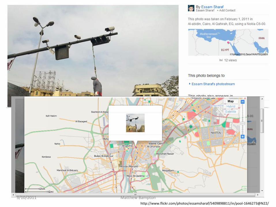
http://www.flickr.com/photos/essamsharaf/5409898811/in/pool‐1646273@N22/
3/10/2011 Matthew Bampton