the emerging lidar landscape - usda
TRANSCRIPT

March 10, 2015
Rick Chormann
State Geologist and Director
NH Geological Survey
The Emerging LiDAR
Landscape
NRCS State Technical Committee Meeting

Comparison of terrain models for Fresh Creek, Strafford County, NH:
NED 30-meter and 10-meter DEMs versus 1-meter LiDAR
30-meter DEM 10-meter DEM 1-meter DEM
The Emerging LiDAR
Landscape

Bonisteel et al. 2009
Data acquisition
by airborne Light
Detection and
Ranging System
(LiDAR)
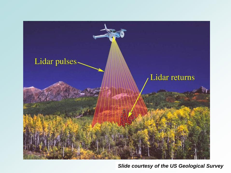
Slide courtesy of the US Geological Survey

LiDAR “Point
Cloud”

Green =
vegetation
return
Orange =
ground return Orange =
ground
return
Laser returns classified by spatial structure (+/- intensity)
Image courtesy of the National Aeronautics and Space Administration
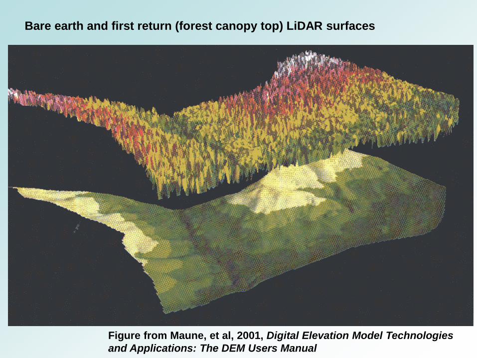
Bare earth and first return (forest canopy top) LiDAR surfaces
Figure from Maune, et al, 2001, Digital Elevation Model Technologies
and Applications: The DEM Users Manual

Near Breezy Point Warren


Thornton
Esker ridge
Fluted till surface Meltwater
Channels
Meander
Scar
Till (?) Slump


Application: Hazard Mapping


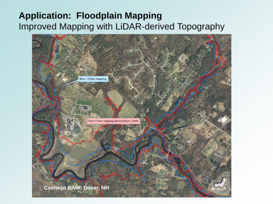
Application: Floodplain Mapping
Improved Mapping with LiDAR-derived Topography
Cocheco River, Dover, NH

Application: Coastal Change Predicted Inundation Area - 2100 Sea Level Rise Estimate of 6.3’
Hampton Harbor, Hampton,
NH

Hampton Police Station
Hampton Fire Substation

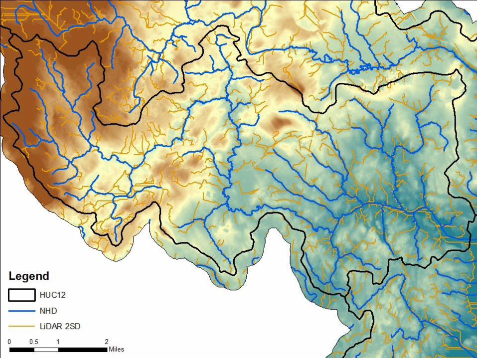
Application: Mapping of
Headwater Streams

Application: Forest Management
Source: Tom Spies and Keith Elsen, Oregon State University School of Forestry

Application: Broadband Planning
Source: NH Broadband Mapping & Planning Program, University of New Hampshire


http://lidar.unh.edu/map/

Questions ?