the alta/acsm (nsps) standards - cdn.ymaws.com · section 3.e.i. - rpp low uncertainty, but low...
TRANSCRIPT

1
19621986198819921997199920052011
2016–February23,2016
The ALTA/ACSM (NSPS) Standards
• Section1-Purpose• Section2-RequestforSurvey• Section3–SurveyStandards&StandardsofCare
• Section4–RecordsResearch• Section5-Fieldwork• Section6–PlatorMap• Section7–Certification• Section8–Deliverables• TableA
The 2016 ALTA/NSPS Standards
• It’sallabouttitleinsurance• Insuringtitlewithoutexceptionastomattersofsurvey
• The“Standardsurveyexception”
Section 1 - Purpose

2
Example1
Anyfacts,rights,interestsorclaimswhicharenotshownbythepublicrecordbutwhichcouldbeascertainedbyanaccuratesurveyoftheland…
The Standard Survey Exception
Example2
Encroachments,overlaps,boundarylinedisputes,orothermatterswhichwouldbedisclosedbyanaccuratesurveyandinspectionofthepremises.
The Standard Survey Exception
Example3
Rightsorclaimsofpartiesinpossession,boundarylinedisputes,overlaps,encroachments,andanymattersnotshownbythepublicrecordswhichwouldbedisclosedbyanaccuratesurveyandinspectionofthelanddescribedinScheduleA.
The Standard Survey Exception

3
TheTitleCommitment(akabinderorpreliminaryreport)is
• anoffertoissueatitlepolicysubjecttothestatedexceptions
• astatementoftermsandconditionsuponwhichtheissueriswillingtoissueitstitlepolicy
Title Insurance
TheTitleCommitment(akabinderorpreliminaryreport)isnot
• arepresentationastotheconditionofthetitle
• i.e.,itisnotanabstractoftitle
Title Insurance
• NSPSisthelegalsuccessororganizationtoACSM
• The2016StandardsarethenextversionoftheformerALTA/ACSMstandards
Section 1 - Purpose

4
AnALTA/NSPSLandTitleSurveymustinclude:i. Section5fieldworkii. Section6platormap(including
relationshiptorecorddocuments)iii. TableAitemsselectedbyclientiv. CertificationinSection7
Section 1 - Purpose
• Writtenauthorization• Dealingwithatypicalproperties
– Trailerparks– Non-feeinterests
• Easements• Leases
– etc.• Discussscopewithaffectedparties
Section 2 – Request for Survey
• Protectbothyouandtheclient• Specifyscope
– TableAitems– Exceptions/QualificationstoTableAitems– Titleworktobeprovided– Certification– Certifiedparties– Numberofrevisions– Utilities
Written Contracts
5
• Specifypaymentterms– Chargeinterestfornon-payment
• Otherstandardtermsandconditions– Limitationofliability– Ownershipofworkproduct– Provisionofcomputerfiles– Howandwheretoresolveadispute– Maystopworkfornon-paymentor?– Notresponsiblefor‘actsofGod’
Written Contracts
Written Contracts
A. EffectiveDate2/23/16B. Compliancewithjurisdictional
requirements– Conflictswithotherstandards
C. Thereisanormalstandardofcare
Section 3 – Survey Standards, etc.

6
D. BoundaryResolution
• AnALTA/NSPSLandTitleSurveyISaboundarysurvey
• Establishand/orretraceboundariesinaccordancewithappropriateboundarylawprinciples
Section 3 – Survey Standards, etc.
E. MeasurementStandards
i. RelativePositionalprecisiondefined– Anycornerofthepropertyrelativetoany
othercornerofthesurveyedproperty– Uncertaintyduetorandomerrorat95%
confidencelevel– Estimatedbycorrectlyweightedleast
squaresadjustment
Section 3 – Survey Standards, etc.
E. MeasurementStandards
ii. Uncertaintiesinlocation– Duetoreferencemonumentation– Duetorecorddocuments– Duetooccupation/possessionthatdiffers
fromtherecordlines– Relativepositionalprecision
Section 3 – Survey Standards, etc.

7
Whenthesurveyorhasdoubtastothelocationonthegroundofstreetorlotlines…forsuchreasonsasstreetandlotlinesbeingundefinableorindefinitebecauseofinsufficientmonuments…orwhereerrorsarefoundtoexistinthedescriptions…,thesurveyorshallclearlyindicatethenatureofthedifficultyordiscrepancyandgivehisprofessionalopinionasto[the]rangeandscopeofdifferencespossiblyinvolvedandtheeffect,underthecircumstances,ofsameonsurveyedpositions.
1962 A(L)TA/ACSM Standards
E. MeasurementStandards
iii. PrecisionandaccuracyPrecision==Accuracy!!
Section 3 – Survey Standards, etc.
E. MeasurementStandards
iv. ControllingRandomErrors1. Trainedpersonnel2. Compensateforsystematicerrors
includinginstrumentcalibration3. Errorpropagationandmeasurement
designtheory
Section 3 – Survey Standards, etc.

8
E. MeasurementStandards
v. MaximumallowableRPP• 2cmplus50ppm• ppmbasedondirectdistancebetween
testedpoints• Explainwhy-pursuantto6.B.x.-if2cm
plus50ppmisexceeded
Section 3 – Survey Standards, etc.
Theerrorellipsearoundanypointlocatedorsetonasurveyindicatestheuncertaintyinitslocation.
Angular
Section 3.E.i. - RPP
Target
OccupiedStation
AngularUncertainty
Theerrorellipsearoundanypointlocatedorsetonasurveyindicatestheuncertaintyinitslocation
Distance
Section 3.E.i. - RPP
Target
OccupiedStation
Distance Uncertainty

9
Theerrorellipsearoundanypointlocatedorsetonasurveyindicatestheuncertaintyinitslocation
ErrorEllipse
Section 3.E.i. - RPP
Locatedfrommultiplestationscomplicatesthesolution,thusleastsquares
Section 3.E.i. - RPP
Thesize(lengthofthesemi-majorandsemi-minoraxes),andorientationoftheerrorellipseareafunctionof:
• therandomerrorsinthemeasurements• theconfidencelevel(95%)
Section 3.E.i. - RPP

10
TheBellCurve
Section 3.E.i. - RPP
Range of Measurements
Mean (Average) of a series of measurements
Example–witharuler(lowprecision)
The“true”measurement,whichisactuallyunknown,couldrationallybeexpressedas,forexample,“299.56feet,plusorminus1.2feetwitha95%probability.”
Or…thereisa95%probabilitythatthetruemeasurementiswithin1.2feetof299.56feet.
Section 3.E.i. - RPP
Example–withanEDM(highprecision)
The“true”measurement,whichisactuallyunknown,couldrationallybeexpressedas,forexample,“299.56feet,plusorminus0.12feetwitha95%probability.”
Or…thereisa95%probabilitythatthetruemeasurementiswithin0.12feetof299.56feet.
Section 3.E.i. - RPP

11
TheBellCurve
• Highprobability(confidence)inthemeasurements
• Largeruncertainty(the“plusorminus”)
Section 3.E.i. - RPP
TheBellCurve
Section 3.E.i. - RPP
95% Confidence, high uncertainty
TheBellCurve
Givenanequalprecisioninthemeasurements…• Lessuncertainty(“plusorminus”)• Lowprobability(confidence)inthosemeasurements.
Section 3.E.i. - RPP

12
TheBellCurve
Section 3.E.i. - RPP
Low uncertainty, but low confidence
RPP-Thelengthofthesemi-majoraxis
Section 3.E.i. - RPP
R.P.P.isnotexpressedatapoint,butratheritisintherelationshipbetweenthetwopointsbeingtested.Thinkofcheckingtheprecisionofahousestaking.
Section 3.E.i. - RPP

13
Toachieveacceptablyprecisemeasurements…(Section3.E.iv.)
1. Usetrainedpersonnel2. Compensateforsystematicerrors
includinginstrumentcalibration3. Applyappropriateerrorpropagation
andmeasurementdesigntheory*
*AconsideredsurveydesignAppropriatelypreciseinstrumentsAppropriateprocedures
Section 3.E.iv. - Random Errors
IftheRPPforthelinebeingtestedexceedsorwillexceedtheallowable2cmfeetand50ppm,wecan…
1. Makeredundantmeasurements2. Usehigherprecisionequipment3. Developadifferentsurveydesign
Thesewillreducethesizeoftheerrorellipses
Section 3.E.iv. - Random Errors
Ifalinebeingtestedis800feetlong,theallowableRPPforthatlineis:
0.07feet+(50x800)/1,000,000=0.11feet
Isitreasonablypossibletolimitoursurveymeasurementuncertaintyto0.11feetin800feet?
Section 3.E.i. – RPP example
14
ToaddressRPP:1. Understandtheprimarysourcesofrandom
errorsinyourmeasurements2. Developreliableestimatesofthemagnitude
oftherandomerrorsfromeachofthosesources
3. Useacorrectly-weightedLeastSquaresadjustmenttoprocessthedata
Section 3.E.i. – RPP example
Theprimarysourcesofrandomerrorsinyourmeasurements
Inanangle(Electronictotalstation)• Pointing• Centeringtheinstrument• Centeringthetarget• Reading(fromthemanual)
Section 3.E.i. – RPP example
Theprimarysourcesofrandomerrorsinyourmeasurements
Inadistance(EDM)• Centeringtheinstrument• Centeringthetarget• Reading(fromthemanual)
Section 3.E.i. – RPP example

15
Theprimarysourcesofrandomerrorsinyourmeasurements
WithGPS(simplified)• Centeringtheinstrument(base)• Centeringthetarget(rover)• Reading(afunctionofalotoffactors:
Qualityofobservation(e.g.,PDOP,S/N,lengthofbaseline),observationtime,,integrityofcalibration,etc.)
Section 3.E.i. – RPP example
Developreliableestimatesofthemagnitudeofthoserandomerrors
• Statistically-based• NotWAGs
Section 3.E.i. – RPP example
Usethoseuncertaintiestorunacorrectly-weightedLeastSquaresadjustmentforaweighted(best-fit)solution
Section 3.E.i. – RPP example

16
PositionalTolerancemeasurementstandard:
• 0.02feetinurbanareaswherebuildingscanbeerectedalongthepropertyline• 0.04feetinurbanorsuburbanareas• 1footper5000feetofperimeterinruralareas
1962 A(L)TA/ACSM Standards
1962 A(L)TA/ACSM Standards
Itisexpectedthattheexerciseofprofessionaljudgmentbythesurveyorwillminimizedifferencesofopinionswithotherprofessionalsurveyorsexercisingequallyprudentjudgmentinsuchsituation.
Summarizing Uncertainties
Surveyors will be provided with appropriate and, when possible, legible data which can be relied uponincompletingthesurvey
Section 4 – Records Research

17
Requesttosetforth:• Recorddescriptionofpropertytobesurveyed
• Recorddescriptionofparenttractiforiginalsurvey
Section 4 – Records Research
‘Originalsurvey’definedasone“preparedforpurposesoflocatinganddescribingrealpropertythathasnotbeenpreviouslyseparatelydescribedindocumentsconveyinganinterestintherealproperty”
Section 4 – Records Research
Surveyormustbeprovidedwith:i. Mostrecenttitlecommitment(orother
acceptabletitleevidence)ii. Certainrecorddocuments
– Adjoiners– Easementsbenefittingsurveyedproperty(ScheduleAappurtenanteasements)
– Easementsburdeningtheproperty(ScheduleB2easements)
iii. Unrecordeddocumentsifdesiredbyclient
Section 4 – Records Research

18
Ifdocumentsarenotprovided,orifnon-publicorquasi-publicdocumentsarerequiredtocompletethesurvey,thesurveyorshallconductonlythatresearch:• requiredpursuanttothestatutoryor
administrativerequirementsofthejurisdictionwherethepropertyislocated
• negotiatedinthecontract
Section 4 – Records Research
• OnthegroundexceptpursuanttoTableAitem15
• Locatedtotheappropriatedegreeofprecisionbasedon– Planneduseifreported– Existinguse,ifnotreported
Section 5 – Fieldwork
A. MonumentsB. RightsofwayandaccessC. Linesofpossessionandimprovements
alongtheboundariesD. BuildingsE. EasementsandservitudesF. CemeteriesG. Waterfeatures
Section 5 – Fieldwork

19
A. Monumentsi. Location,size,characterandtypeof
foundmonumentsii. Location,size,characterandtypeof
monumentssetpursuanttoTableAitem1orjurisdictionalrequirements
iii. Location,descriptionandcharacteroflinesthatcontroltheboundaries
Section 5 – Fieldwork
B. Rightsofwayandaccessi. DistancetonearestR/Wlineifproperty
doesnotabutaR/Wii. Nameofwaysabuttingtheproperty,and
locationofedgesoftraveledwayexceptwhennoaccess
iii. Visibleevidenceofphysicalaccess
Section 5 – Fieldwork
B. Rightsofwayandaccessiv. Locationandcharacterofaccesstoor
acrossthepropertybyotherthanapparentoccupants
v. Potentiallyencroachingwaysofaccessvi. Evidenceandlocationofrightofwaylines
notdisclosedindocumentsvii. Evidenceofaccessto/fromadjoining
waters
Section 5 – Fieldwork

20
C. Linesofpossession&improvementsalongboundaries
i. Characterandlocationofevidenceofpossession
ii. Improvementswithin5feetofbothsidesoftheboundarylines,unlessaccessisrestricted(naturalvegetationnotincludedwithexceptions)
iii. Evidence,locationandextentofpossibleencroachments
Section 5 – Fieldwork
D. Buildings• Locationofallbuildingsobserved
Section 5 – Fieldwork
E. EasementsandServitudesi. Evidenceofeasements/servitudes
disclosedindocumentsprovidedii. Evidenceofeasements/servitudesnot
disclosed(withmoreexamples)iii. Surfaceindicationsofunderground
easements(withexamples)iv. Evidenceobservedonandabovethe
propertyofutilitieson,overandbeneaththeproperty(withexamples)
Section 5 – Fieldwork
21
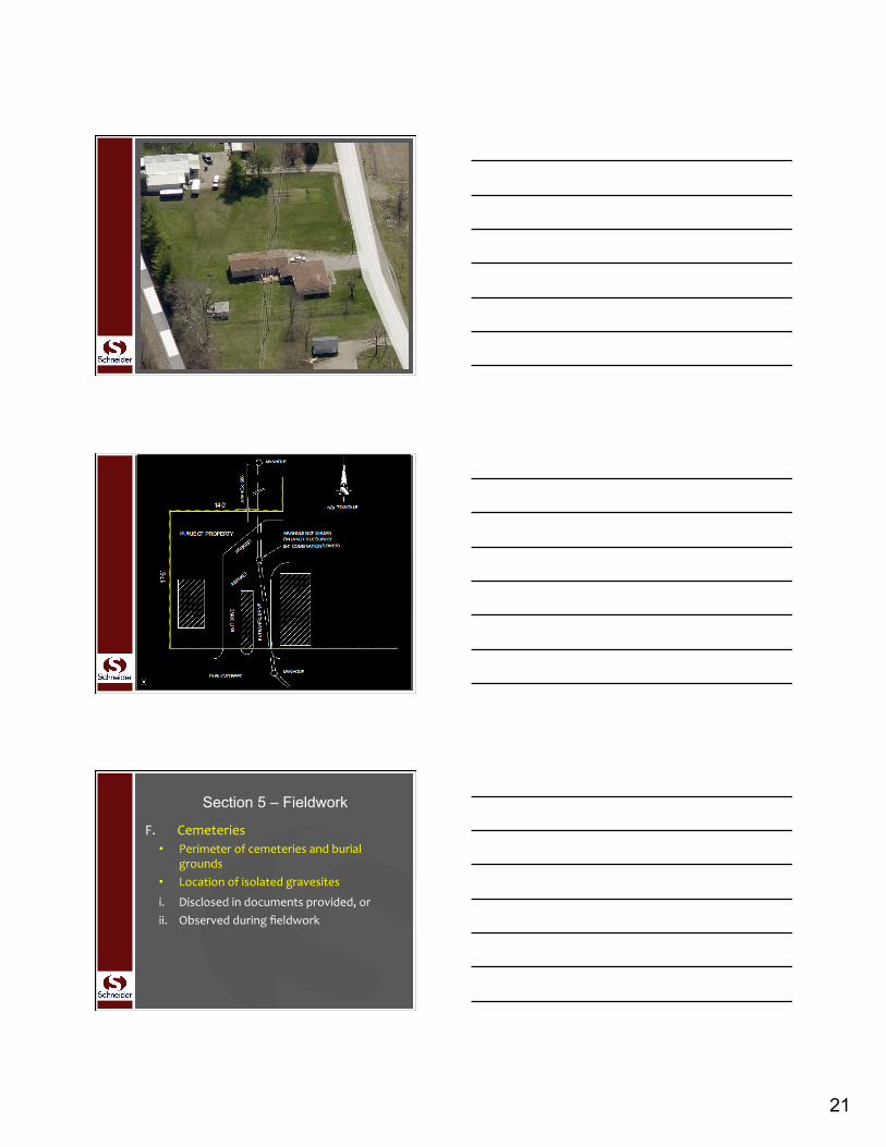
F. Cemeteries• Perimeterofcemeteriesandburial
grounds• Locationofisolatedgravesites
i. Disclosedindocumentsprovided,orii. Observedduringfieldwork
Section 5 – Fieldwork
22
G. WaterFeaturesi. Locationofwaterfeatureson,running
throughorwithin5feetoftheperimeter(withmoreexamples)
ii. Waterfeaturesformingaboundary(withcaveat)
Section 5 – Fieldwork
• Dimensionedtotheappropriatedegreeofprecisionbasedon– Planneduseifreported– Existinguse,ifnotreported
Section 6 – Plat or Map
A. EvidenceandlocationsgatheredpursuanttotheSection5Fieldwork
B. Boundary,Descriptions,DimensionsandClosure
C. Easements,Servitudes,RightsofWay,AccessandDocuments
D. Presentation
Section 6 – Plat or Map

23
A. Evidenceandlocations,andmonumentsandlinespursuanttoSection5,withaccompanyingnotes,ifdeemednecessary,orpursuanttosubsequentSection6requirements
Section 6 – Plat or Map
B. Boundary,Description,Dimensions,Closures
i. (a)Currentrecorddescription(b)Iforiginalsurvey,currentrecorddescriptionofparent
Section 6 – Plat or Map
B. Boundary,Description,Dimensions,Closures
ii. NewDescriptions• Whywasanewdescriptionprepared?• Avoidnewdescriptionsunlessdeemed
necessaryandappropriate• Howthenewdescriptionrelatestothe
record• Sameas?• Howdoesitdiffer?
Section 6 – Plat or Map
24
B. Boundary,Description,Dimensions,Closures
iii. CoursesandDistances• POBandPOC• Alldistancesanddirectionsinrecord
description• Alldistancesanddirectionsinanynew
description• Deedvs.measured/calculated• Grounddistances
Section 6 – Plat or Map
B. Boundary,Description,Dimensions,Closures
iv. Mathematicalclosure• Directions,distancesandcurvedata
necessarytocomputeraclosureofthesurveyedboundary
• Noteifrecorddescriptiondoesnotclosemathematically
• Notewheretherearedifferencesfromrecordbasisofbearings
Section 6 – Plat or Map
B. Boundary,Description,Dimensions,Closures
v. Remainderoflargertract• Ifsurveyedpropertyispartoflargertract,
showremainder• However,youdonotneedtosurveythe
largertract
Section 6 – Plat or Map

25
B. Boundary,Description,Dimensions,Closures
vi. Waterboundaries• Dateboundarywasmeasured• Whichattribute(s)werelocated• Caveat(boundaryissubjecttochange,
etc.)• Showorexplainifawareofrealignments
orchanges
Section 6 – Plat or Map
B. Boundary,Description,Dimensions,Closures
vii. Gaps/OverlapsandAdjoiners• Relationshiptoadjoiners• Interiorgaps/overlapswhenpropertyis
composedofmultipleparcels• Gaps/overlapstobedisclosedpriortoor
upondeliveryofplat/map
Section 6 – Plat or Map
B. Boundary,Description,Dimensions,Closures
viii. Whenintheopinionofthesurveyor• Resultsdiffersignificantlyfromtherecord• Fundamentaldecisionsrelatedto
boundaryresolutionarenotclearlyreflected
• Explainwithnotes
Section 6 – Plat or Map

26
B. Boundary,Description,Dimensions,Closures
ix. Locationofbuildingsdimensionedperpendiculartothoseperimeterboundariesdeemedappropriatebythesurveyor- Wherepotentiallyimpactedbysetback
lines- Asrequested
Section 6 – Plat or Map
B. Boundary,Description,Dimensions,Closures
x. ExplainsiteconditionsthatpreventedachievingacceptableRPP(see3.E.v.)- Relief- Vegetation- Improvements
Section 6 – Plat or Map
B. Boundary,Description,Dimensions,Closures
xi. Anotewherephysicalaccesswithin5feetoftheboundarieswasrestricted(see5.C.ii.)
Section 6 – Plat or Map

27
B. Boundary,Description,Dimensions,Closures
xii. Anoteidentifyingsourceoftitleevidenceprovidedtothesurveyor(seeSection4)
• Titlecommitment• Otherevidenceacceptabletothetitle
company
Section 6 – Plat or Map
C. Easements,Servitudes,RightsofWay,AccessandDocuments
i. Location,widthandrecordinginfoofallrightsofway,easements&servitudes
• Burdeningandbenefittingsurveyedproperty
• Ifplottable• Ifevidenceofsamewasprovidedtothe
surveyor
Section 6 – Plat or Map
C. Easements,Servitudes,RightsofWay,AccessandDocuments
ii. Summaryofallrightsofway,easements&servitudes
• Burdeningsurveyedproperty• Ifevidenceofsamewasprovidedtothe
surveyor• Recordinformation,whethershownor
notandanoteif:
Section 6 – Plat or Map

28
(a) Locationcannotbedeterminedfromrecord(b) Noobservedevidence(c) blanketeasement(d) Notonortouchingsurveyedproperty(e) Limitsaccess(f) Documentsareillegible(g) Surveyorhasinfothatithasbeenreleased
orterminated
WhichR/W,easementsandservitudesimpactwhichparcelwhenmultipleparcels
Section 6 – Plat or Map
C. Easements,Servitudes,RightsofWay,AccessandDocuments
iii. Noteifnophysicalaccessobserved
Section 6 – Plat or Map
C. Easements,Servitudes,RightsofWay,AccessandDocuments
iv. LocationsandwidthsofR/Wabuttingorcrossingsurveyedpropertyandsourceofsuchinfo
a) Whereavailablefromjurisdictionb) Wheredisclosedindocumentsprovided
tosurveyor(seeSection4)
Section 6 – Plat or Map

29
C. Easements,Servitudes,RightsofWay,AccessandDocuments
v. Identifyingtitlesandrecordingdataforallrecordedplats,fieldmaps,r/wmaps,orotherdocumentswhichthesurveyrepresents
Section 6 – Plat or Map
C. Easements,Servitudes,RightsofWay,AccessandDocuments
vi. Recordingdataidentifyingadjoiningtracts(namesnolongerrequired–SeeTableAitem13)
Recordingdataofadjoiningsubdivisions
Section 6 – Plat or Map
C. Easements,Servitudes,RightsofWay,AccessandDocuments
vii. Plattedsetbackorbuildingrestrictionlines
• Appearingonrecordedsubdivisionplats,or
• Disclosedindocumentsprovidedtothesurveyor
Section 6 – Plat or Map

30
D. Presentationi. Notlessthan8½by11
• Legiblestandardscale• Scaleindicatedinwordsandgraphically
Section 6 – Plat or Map
D. Presentationii. Plat/mapshallinclude
a) Boundarydistinguishableb) “Nobuildingsobserved”c) Northarrowd) Legende) Vicinitymapf) Detailswhennecessary
Section 6 – Plat or Map
D. Presentationii. Plat/mapshallinclude(continued)
g) NotesexplaininganymodificationsoradditionstoTableA
h) Projectnumber,name,registrationnumber,signature,seal,address,telephonenumber,companywebsiteandemailaddress.
Section 6 – Plat or Map

31
D. Presentationii. Plat/mapshallinclude(continued)
i) Datesofanyrevisionsj) Sheetnumberswhenmultiplesheetsk) Caption“ALTA/NSPSLandTitleSurvey”
Section 6 – Plat or Map
D. Presentationiii. Whenrecordationorfilingisrequired,
plat/maptobeproducedinrecordableform
Section 6 – Plat or Map
OnlytheunalteredcertificatecontainedinSection7
• ExceptasrequiredpursuanttoSection3.B.(localorstaterequirements)
• Dateoffieldwork• Dateofplat/map
Section 7 – Certification

32
• Specifywhatcertificationyouwilluseandwhoyouwillcertifytoinyourcontract
• HUD,FannieMae,etc.certifications?– SeparatesheetofpaperX-reftosurvey
• Additionalparties– Chargeafee?
Certifications
• SuccessorsandAssigns?– Onlyforlender
• Donotmakeexpressguaranteesorwarranties– ProfessionalLiabilityinsurancewillnotcoveryoufor…
Certifications
Certifications

33
• Copiestoclientandtitlecompany• Othercopiesasnegotiated• Durable,dimensionallystablematerial• Digitalimageinadditionto,orinlieuof,hard
copiespursuanttotermsofthecontract• Ifrecordationorfilingrequired,producedin
recordableformandrecordedorfiled
Section 8 – Deliverables
Maketheclientspecifyitemsandincludeincontract
Table A
• Twenty(20)items• Numberadditionalitems21(a),21(b),etc.
• Additionalitemsexplained(seeSection6.D.ii.(g))
• AnALTA/NSPSLandTitleSurveyisnotanengineeringdesignsurvey
Table A

34
1. Monuments• Setmonumentorwitness• “Majorcorners”• Unlessmarkedorreferencedbyexisting
monumentsorwitnessesincloseproximity
NOTE–Ifstateregulationsrequiremonumentation,thesurveyormustcomplywiththoseregulations(seeSection3.B.)
Table A
2. Address(es)ofsurveyedproperty• Ifdisclosedindocumentsprovided,or• Ifobserved
Table A
3. Floodzoneclassification• BasedonFIRMorstate/localequivalent• Scaledmaplocationandgraphicplotting
Table A

35
4. Grosslandarea• Otherareasifspecifiedbyclient
Table A
5. Verticalrelief• Source• Contourinterval• Datum• Benchmark
Table A
6. Zoninga) Ifsetforthinzoningreport/letter
providedtothesurveyorbyclientList:• Zoningclassification• Setbackrequirements• Heightandfloorspacearearestrictions• Parkingrequirements
Identifydateandsourceofreport/letter
Table A

36
6. Zoningb) Ifsetforthinzoningreport/letter
providedtothesurveyorbyclientandifnointerpretationisrequiredbythesurveyor
Graphicallydepict:• Setbackrequirements
Identifydateandsourceofreport/letter
Table A
7. Buildingdimensionsandareasa) Exteriordimensionsatgroundlevelb) Squarefootageof
a) Exteriorfootprintofbuildingsatgroundlevel
b) Otherareasspecifiedbytheclientc) Measuredheightatadesignatedlocation
Table A
8. Othersubstantialfeaturesobserved• Inadditiontothoserequiredpursuant
toSection5• Parkinglots• Billboards• Signs• Swimmingpools• Landscapedareas• Substantialareasofrefuse
Table A

37
9. Parking• Numberandtypeofclearlyidentifiable
parkingspaces• Parkingareas• Parkinglots• ParkingstructuresStripingonsurfaceparkingareasandlots
Table A
10. Wallsa) Asdesignatedbyclient,relationship
andlocationofcertaindivisionorpartywalls
b) Asdesignatedbyclient,plumbnessofcertainwalls
Clienttoobtainpermissions
Table A
11. UtilitiesLocationofutilitiesonorservingthepropertyasdeterminedby:a) Observedevidence(seeSection5.E.iv.)b) Plansrequestedbysurveyorand
obtainedfromutilitycompaniesorprovidedbyclient(referencesource)
c) Markingsrequestedbysurveyorpursuantto811orsimilarutilitylocaterequest
Table A

38
11. Utilities• Representativeexamples• See“Notetoclient,insurerandlender”
• Withoutexcavation,infomaybeincomplete,inaccurateandunreliable
• Utilitylocaterequestsmaybeignoredorresultinincompletemarkings
Table A
12. Governmentagencyrequirements• e.g.,
• HUD(Multi-familyorLEAN232)• BLMLeases
Table A
13. Namesofadjoiningowners• Accordingtocurrenttaxrecords• Ifmorethanoneowner,listfirstfollowed
by“etal”
Table A

39
14. Distancetonearestintersectingstreet
• Asspecifiedbyclient
Table A
15. Alternatetechnologiesandtools• RectifiedOrthos• Photogrammetricmapping• Remotesensing• LiDAR
Table A
15. Alternatetechnologiesandtools• Notapplicabletoboundariesorfeaturesin
closeproximitytoboundaries• Surveyorshall
• Discussprecisionandcompletenesswithclient,titlecompanyandlender
• Placeanoteontheplat/mapexplaining:• Source,date,precision• Otherrelevantqualificationsofsuch
data
Table A

40
16. Observedevidenceofrecentearthmoving,buildingconstructionorbuildingadditions
Table A
17. Proposedchangesinstreetrightofwaylines
• Ifmadeavailabletothesurveyorbythejurisdiction
Observedevidenceofrecentsidewalkconstructionorrepairs
Table A
18. Wetlands• Iftherehasbeenafielddelineationof
wetlandsconductedbyaqualifiedwetlandsspecialisthiredbytheclient
• Surveyorwilllocateobserveddelineationmarkers
• Noteifnoneobserved
Table A

41
19. Offsite(appurtenant)easements• Ifplottable,includeaspartofthe
surveypursuanttoSections5and6andapplicableTableAitems.
• Clienttoobtainnecessarypermissions
Table A
20. Professionalliabilityinsurance• Clientdesignatesamount(negotiated)• Insurancetobeineffectthroughout
thetermofthesurveyorscontractwiththeclient(onalandtitlesurvey,normallyonlyafewweeks)
Thisisnotrelatedtothelengthofthesurveyor’sliabilitywhichisdeterminedbystatestatutesoflimitationand/orrepose
Table A
21. Additionalitemsthatmaybenegotiatedwiththeclient(21(a),21(b),etc.)
Table A

42
Contactmeviaemail
Questions?
The Schneider Corporation
Gary R. Kent, PS Integrated Services Director 8901 Otis Avenue Indianapolis, IN 46216 Phone – 317-826-7134 [email protected]