terascan curriculum development and integration of seaspace technology into the classroom
TRANSCRIPT
TeraScan Curriculum Development and Integration of SeaSpace Technology into the Classroom

Remote Sensing Team
Kalyx McDonaldMississippi Valley State University
Courtney FarmerElizabeth City State University
Mentor: Mr. Je'aime Powell

Overview
• Abstract• Purpose • Introduction• Methodology• Conclusion• Future Research• Acknowledgements • Questions

Abstract
SeaSpace and Elizabeth City State University (ECSU) signed a Memorandum of Understanding (MOU) in February of 2012. SeaSpace is the world's leading provider of satellite ground stations and processing software for remote sensing applications. The MOU stated that ECSU would provide a training site for SeaSpace's technology and data products along with integration of the products into classroom curriculum. In return, SeaSpace would provide ground stations for receiving direct broadcast data from various telemetries. The ground stations include a 3.7m X/L band, a 3.6m C band, and a 5.0m L band dishes, along with accompanying computing hardware. The purpose of this project was to generate a training curriculum focused on the K-12 classroom, along with college courses, and outside governmental agencies. The curriculum contains one hour modules which as a whole could be presented as a 10 hour course that qualifies as one continuing education unit (CEU) for K-12 teachers and administrators. Example modules for “Introduction to Remote Sensing” and “Introduction to TeraScan” were also created.

Purpose
• Generate a curriculum focused on K-12 classes, college courses, & governmental agencies
• Make the curriculum meet qualifications of one CEU

Introduction - MOU
On February 7, 2012 SeaSpace and Elizabeth City State University (ECSU) signed a Memorandum of Understanding.

Introduction - SeaSpaceFounded in 1982

MOU
SeaSpace training guide
Curriculum
ECSU Course catalog
Modules
Methodology

CurriculumTarget Audience: K-12 Teachers, Governmental Agencies & Higher Ed faculty & students
Standard: SeaSpace Training Guide

Classes for IntegrationIntroduction to TeraScan
Introduction to Remote Sensing
RS 501: Geophysical Remote SensingRS 504: General Analytic Methods of Remote SensingRS 506: The principles of Microwave Remote Sensing
RS 503: Digital Image Processing and AnalysisCSC 160: Computer Science Majors Orientation SoftwareCSC 460: Senior Seminar in Computer Science

5E Methodology
Engage
Explore
ExplainElaborate
Evaluate

Example Modules
• Self running PowerPoint with voice overlay• Study guide• Assessment

Introduction to Remote Sensing
Assessment Questions
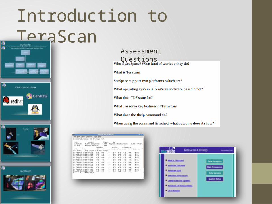
Introduction to TeraScanAssessment Questions

Conclusion
Created curriculum
Classroom Integration
Created modules

Future Research
• Installation of Ground Stations (July 2013)• Creation of remaining modules• University CEU course certification• Meet with faculty to integrate• Test modules with K-12, undergraduates, graduates,
government agency and officials• Schedule CEU courses

Acknowledgements
The 2013 Remote Sensing Team would like to thank
REU Principal Investigator: Dr. Linda Hayden
Mentor: Mr. Je'aime Powell

Questions