technical reference document c3 classification (land cover...
TRANSCRIPT

Regional statistics and Geographic Information Author: E4.LUCAS (ESTAT)
TechnicalDocuments 2018
LUCAS 2018
(Land Use / Cover Area Frame Survey)
Technical reference document C3 Classification
(Land cover & Land use)

Regional statistics and Geographic Information Author: E4.LUCAS (ESTAT)
TechnicalDocuments 2018
Table of Contents
1 Scope and Introduction ............................................................................................................................. 6
LUCAS survey classification comparison 2009 - 2012 ................................................................................... 7
LUCAS survey classification comparison 2012 - 2015 ................................................................................... 7
LUCAS survey classification comparison 2015 – 2018 ................................................................................... 9
Land cover and land use: general explications .............................................................................................. 9
Specific to the LUCAS classification ............................................................................................................. 10
The basic unit and the extended window of observation ........................................................................... 10
2 Land Cover Classification (LUCAS SU LC) ................................................................................................. 11
A00 ARTIFICIAL LAND .............................................................................................................................. 11
A10 ROOFED BUILT-UP AREAS ........................................................................................................... 11
A20 ARTIFICIAL NON-BUILT UP AREAS ............................................................................................... 13
A30 OTHER ARTIFICIAL AREAS ............................................................................................................ 14
B00 CROPLAND ........................................................................................................................................ 15
B10 CEREALS ...................................................................................................................................... 15
B20 ROOT CROPS ............................................................................................................................... 18
B30 NON-PERMANENT INDUSTRIAL CROPS ...................................................................................... 20
B40 DRY PULSES, VEGETABLES AND FLOWERS .................................................................................. 24
B50 FODDER CROPS ........................................................................................................................... 27
B70 PERMANENT CROPS: FRUIT TREES .............................................................................................. 30
B80 OTHER PERMANENT CROPS ........................................................................................................ 34
C00 WOODLAND ..................................................................................................................................... 37
C10 BROADLEAVED WOODLAND ....................................................................................................... 37
C20 CONIFEROUS WOODLAND .......................................................................................................... 39
C30 MIXED WOODLAND .................................................................................................................... 41
FOREST TYPES (LUCAS SU FT) .................................................................................................................. 43

Eurostat - LUCAS 2018 Technical document C3 - Classification
LUCAS2018_C3-Classification_20171208_web.doc 3/98
D00 SHRUBLAND ..................................................................................................................................... 55
D10 SHRUBLAND WITH SPARSE TREE COVER .................................................................................... 55
D20 SHRUBLAND WITHOUT TREE COVER .......................................................................................... 56
E00 GRASSLAND ...................................................................................................................................... 57
E10 GRASSLAND WITH SPARSE TREE/SHRUB COVER ........................................................................ 57
E20 GRASSLAND WITHOUT TREE/SHRUB COVER .............................................................................. 57
E30 SPONTANEOUSLY RE-VEGETATED SURFACES ............................................................................. 58
F00 BARE LAND AND LICHENS/MOSS ..................................................................................................... 60
F10 ROCKS AND STONES .................................................................................................................... 60
F20 SAND ........................................................................................................................................... 60
F30 LICHENS AND MOSS .................................................................................................................... 60
F40 OTHER BARE SOIL ........................................................................................................................ 61
G00 WATER AREAS .................................................................................................................................. 63
G10 INLAND WATER BODIES .............................................................................................................. 63
G20 INLAND RUNNING WATER .......................................................................................................... 64
G30 TRANSITIONAL WATER BODIES ................................................................................................... 65
G40 SEA AND OCEAN .......................................................................................................................... 65
G50 GLACIERS, PERMANENT SNOW ................................................................................................... 66
H00 WETLANDS ....................................................................................................................................... 67
H10 INLAND WETLANDS ..................................................................................................................... 67
H20 COASTAL WETLANDS .................................................................................................................. 68
3 Land Use Classification (LUCAS SU LU) .................................................................................................... 70
U100 Primary sector .................................................................................................................................. 70
U110 AGRICULTURE.............................................................................................................................. 70
U120 FORESTRY .................................................................................................................................... 73
U130 AQUACULTURE AND FISHING ..................................................................................................... 73
U140 MINING AND QUARRYING .......................................................................................................... 75
U150 OTHER PRIMARY PRODUCTION .................................................................................................. 75
U200 Secondary sector .............................................................................................................................. 76
U210 ENERGY PRODUCTION ................................................................................................................ 76
U220 INDUSTRY AND MANUFACTURING ............................................................................................. 76

4/98
U300 Tertiary sector, transport, utilities & residential ............................................................................. 81
U310 TRANSPORT, COMMUNICATION NETWORKS, STORAGE, PROTECTION WORKS ........................ 81
U320 WATER AND WASTE TREATMENT ............................................................................................... 83
U330 CONSTRUCTION .......................................................................................................................... 84
U340 COMMERCE, FINANCIAL, PROFESSIONAL AND INFORMATION SERVICES .................................. 84
U350 COMMUNITY SERVICES ............................................................................................................... 85
U360 RECREATION, LEISURE, SPORT .................................................................................................... 86
U370 RESIDENTIAL ................................................................................................................................ 86
U400 Unused and abandoned areas ......................................................................................................... 87
U410 Abandoned areas ........................................................................................................................ 87
U420 Semi-natural and natural areas not in use .................................................................................. 88
4 Index Land Cover ..................................................................................................................................... 89

Eurostat - LUCAS 2018 Technical document C3 - Classification
LUCAS2018_C3-Classification_20171208_web.doc 5/98
DOCUMENT CHANGE RECORD
ISSUE DATE CHANGE AUTHORITY / AUTHOR REASON FOR CHANGE AND AFFECTED SECTIONS
0.1 2014/04/24 Eurostat / E4.LUCAS
0.2 2014/12/02 Eurostat / E4.LUCAS
Comments from LUCAS contractors, in sequence of the kick-off meeting and request from JRC to code LC2 in case of (e.g.) bridges over non artificial areas.
0.3 2015/01/28 Eurostat / E4.LUCAS
Changes related to moving of B19e – Corn-Cob mix from other cereals into B16 – Maize (without need for species separation).
Minor corrections to U112 (species code was not mentioned for buckwheat and sorghum)
1.0 2015/02/27 Eurostat / E4.LUCAS Clarifications and corrections after the Project managers training
1.1 2016/07/29 Eurostat / E4.LUCAS Corrections mentioned in the FAQ document: FAQ29; FAQ30; FAQ31;FAQ105
1.2 2017/09/18 Eurostat / E4.LUCAS Subdivision of abandoned areas
1.3 2017/12/08 Eurostat / E4.LUCAS Fine-tuning
6/98
1 Scope and Introduction This document is part of a series of reference documents defining the framework of the Land Use / Cover Area frame statistical Survey (LUCAS). The LUCAS reference documents are continuously improved and adapted taking into account the experience from the implemented surveys and the requirements of the LUCAS data & information users.
This document gives detailed information about the land cover and land use classification system of the LUCAS survey. Information about the implementation of the survey in general and of all other parameters and the way how they should be surveyed can be found in reference document C-1 Instructions for Surveyors.
The LUCAS Survey classification has separate classification systems for land cover (LUCAS SU LC) and land use (LUCAS SU LU). Land cover is the physical cover of the Earth’s surface and land use is the socio-economic function of the land.
The same classification is applied in all EU countries in the LUCAS survey. It also allows comparisons in time. It is as much as possible compatible with the existing land cover/use systems (e.g. FAO, NACE and Farm Structure Survey).
Land cover
Land cover has 8 main categories, which are indicated by letter:
- A: Artificial land - B: Cropland - C: Woodland - D: Shrubland - E: Grassland - F: Bareland - G: Water - H: Wetlands
Every main category has subclasses, which are indicated by the combination of the letter of the category and digits. The most detailed class is to be used during the survey. Each class is described by the following characteristics:
- code and title of the class - short definition of the class - inclusions (“This class includes”) - exclusions (“This class excludes”) - the “Links with land use”.
Land use
Land use is the description of the same areas in terms of their socio-economic function. For rare and exceptional combinations, please consult the annexes of document C1. Land use classes are indicated by the combination of the letter “U” and three digits. Each class is described by the following characteristics:
- code and title - short definition of the class - inclusions (“This class includes”) according to the NACE classification1 (Rev. 2) if it is possible,
1 http://epp.eurostat.ec.europa.eu/cache/ITY_OFFPUB/KS-RA-07-015/EN/KS-RA-07-015-EN.PDF

Eurostat - LUCAS 2018 Technical document C3 - Classification
LUCAS2018_C3-Classification_20171208_web.doc 7/98
- and exclusions (“This class excludes”) with the respective land use code.
LUCAS survey classification comparison 2009 - 2012 The LUCAS 2012 Survey classification is not fundamentally different from the 2009 survey classification.
Main changes for land cover are the following:
- Energy crops (e.g. Miscanthus) are assigned to B84 Permanent Industrial Crops
- In the class B43 Fresh vegetables all roots-bulbs-tubers (carrots [Daucus carota], garlic [Allium sativum],onions [Allium cepa], radishes [Raphanus sativus], red beet [Beta vulgaris var. conditiva], shallots [Allium ascalonicum], turnips [Brassica rapa]) were moved to B23 Other root crops
- The forest types according to the EEA Forest Types (http://www.eea.europa.eu/publications/technical_report_2006_9) remains to be assigned under the condition that the woodland exceeds 0.5ha in size and 20m in width.
- Introduction of new LC classes:
o spruce (C21) and pine (C22) dominated coniferous and other coniferous (C23) woodland;
o this implies introduction of spruce (C31) and pine (C32) dominated as well as other woodland (C33).
- Due to the introduction of these new LC classes in woodland, the forest types codes have changed accordingly and the prefix “CX” was updated to “CXX”
- Introduction of new LC classes under F00 Bare land and lichens/moss:
o F10 Rocks, F20 Sands, F30 Lichens and Moss & F40 Other bare soil.
- Change in definition
o Wet forests are to be classified in CXX and not in HXX
o E00 is no longer including temporary grassland
Main changes for land use are the following:
- Suppression of classes:
o U150 Hunting has been suppressed (moved to special status in field form)
o U364 Nature Reserve has been suppressed (moved to special status in field form)
LUCAS survey classification comparison 2012 - 2015 The LUCAS 2015 Survey classification is not fundamentally different from the 2012 survey classification.
Main changes for land cover are the following:
- New class A30 Other built-up: includes all constructions not covered in the other AXX classes
- Class B77j was dropped as it referred to "Abandoned citrus orchards" (when abandoned is to be classified as a use)

8/98
- Clarified that turnips (as a root crop) are to be classified as B23e and not B23n. Also that B23 refers to species of turnips planted as root crops as opposed to rape and turnip rape (Brassica rapa var. oleifera) which are planted for their seed.
- Clarified that chervil (Anthriscus cerefolium) mentioned in B37d is the aromatic plant also known as "garden chervil". A previous mention to chervil in B43b was removed, as it referred to the root crop B23l – tuberous chervil.
- Clarified that B43f corresponds to cultivated mushrooms (including all cultivated truffle) whereas B43g refers to the collection of wild products (truffles in the wild included).
- B83 Nurseries now includes also forest nurseries. Sub-classification (B83a..f) was created for specialized nursery types.
- Cropland, and namely energy crops (B84) are no longer linked to U210 Energy production
- Harmonization of the woodland definition: in 2012 CXX included forest nurseries (now to be classified under B83) and young plantations, even if they do not reach a canopy of 10%. In order to have a coherent definition, areas below 10% of trees are to be classified according to the existing land cover.
- Disaggregation of G10-Inland water bodies into classes G11-Inland fresh water bodies and G12-Inland salty water bodies in order to better map to INSPIRE PLCC classes (namely PLCC 017 – Salty waters, which includes inland salty lakes)
- Disaggregation of G20-Inland running water into classes G21-Inland fresh running water and G22-Inland salty running water in order to better map to INSPIRE PLCC classes (namely PLCC 017 – Salty waters)
- Renaming of G30-Coastal waters to G30-Transitional waters, since in LUCAS coastal waters (also known as “open sea”) are not relevant. In fact, the definition for G30 in 2012 was already compatible with the definition for transitional waters under the Water Framework Directive (Directive 2000/60/EC).
Main changes for land use are the following:
- All NACE categories have been covered
- U111 Agriculture no longer includes NACE 81.3 Landscape care and maintenance (which is now included in U342)
- U120 Forestry now explicitly includes extraction of cork (cork oak trees)
- U130 Fishing refers only to commercial fishing
- New class U150 Other primary production
- For all industrial activities (U22X) it has been specified in which main INSPIRE category it has to be included: raw industry, heavy end product industry or light end product industry (Land use type)
- U226 Machinery and equipment now includes also wooden furniture (formerly U227) and excludes reproduction of recorded media (now U228)
- U227 no longer includes printing and reproduction (now U228), nor manufacture of furniture (U226)
- New class U228 Printing and reproduction (includes NACE 18 and NACE 58)
- Docks are part of the specific transport sector they belong to, as other related infrastructure (they were an exception before and were excluded from the specific transport sector)
Eurostat - LUCAS 2018 Technical document C3 - Classification
LUCAS2018_C3-Classification_20171208_web.doc 9/98
- New class U319 Electricity, gas and thermal power distribution (includes parts previously included in U210 Energy production, as far as the network is concerned)
- Split class U340 into U341 Commerce and U342 Financial, professional and information services
- Included class U363 Holiday camps into U341 Commerce
LUCAS survey classification comparison 2015 – 2018 The LUCAS 2015 Survey classification is not fundamentally different from the 2012 survey classification.
Main changes for land cover are the following:
- U410 Abandoned areas has been further subdivided :
U411 Abandoned industrial areas
U412 Abandoned commercial areas
U413 Abandoned transport areas
U414 Abandoned residential areas
U415 Other abandoned areas
Land cover and land use: general explications In general, the establishment of classifications follows some principles:
• Spatial consistency: the data shall be comparable over different regions and applicable to different regions. It means that the classification is applicable to any region, knowing that there will be classes without any entry because not all classes exist in all regions.
• Temporal consistency: Observation of stocks allows change detection over time, e.g. construction site of a road is a construction site and not yet a road.
• Compatibility with existing systems (e.g. FSS, NACE, FAO, INSPIRE). This means that when defining classes, existing classifications shall be taken into account. It does not mean that any class definition from another nomenclature can be taken one-to-one. There is a trade-off to be done.
• Independency from observation method. The observation method shall not interfere in the definition of the classification. On the contrary, the observation method shall be chosen to enable best the data collection according to the chosen classification. Of course, there is always a trade-off to be made due to time/budget constraints. This can imply the collection of data at different detail resolution level of the classification, if the data collection method does not allow retrieving the level of detail expected. For example remote sensing is hard to be used for the LUCAS classification at the 3rd level of detail.
• No gaps and no overlaps:
• exhaustive list of categories: no category “unclassified”
• each object belongs to only one category
It means that for any type of land cover or land use, the classification needs to provide a class. This implies that there shall be a possibility to include new classes, for example at a more detailed level. Hierarchical classifications provide for that.
• Hierarchy of the classification:
10/98
Another principle applied at the LUCAS classification is that of a hierarchy in the classification system. This allows collecting information at different levels of detail. If there is no information available for a certain category at a 3rd or 4th level of the classification, there is still the possibility to extrapolate data on the upper level.
Specific to the LUCAS classification In LUCAS, the concept of land is extended to inland water areas (lakes, rivers, coastal areas: estuaries, lagoons). The land concept does not embrace uses below the earth’s surface (mine deposits, subways, mushroom beds, underground levels of buildings).
In the LUCAS classification, there is a clear distinction between land COVER and land USE.
LAND COVER (LC) = physical cover (“material”) observed at the earth’s surface
LAND USE (LU) = socio-economic function of the observed earth’s surface
This separation enables a greater flexibility of the classification, i.e. it allows combining different LC and LU classes to retrieve specific information. For example: a sealed track within arable land that is mainly used by the farmer to access the fields can be retrieved by a combination of LC1=A22 (non built-up linear feature) with LU1=U312 (road) and LU2= U111 (agriculture).
Detailed definitions of the categories for both land use and land cover are to be found in the following chapters.
The basic unit and the extended window of observation As the LUCAS Survey is a point survey, the size of the point in the real world needs to be defined.
The “point” (or basic unit of observation) is in fact a circle with a radius of 1,5m corresponding to an identifiable point on an orthophoto.
As we have not only homogeneous classes that we would like to observe, for example forests (forest definition requires observing a certain area to define the crown coverage or canopy of the trees) or orchards (which may consist in more than one tree species etc.), the LUCAS observation framework also specifies an observation area, the “extended window of observation” which is the area defined by a 20m radius around the point, for specific classes.
There are many more rules defined for the data collection survey, which are detailed in the LUCAS Reference Document C1 - Instructions for Surveyors.
To aid in the identification of plant species, a Plant Identification Guide (LUCAS Reference Document C5) was produced.
Eurostat - LUCAS 2018 Technical document C3 - Classification
LUCAS2018_C3-Classification_20171208_web.doc 11/98
2 Land Cover Classification (LUCAS SU LC)
A00 ARTIFICIAL LAND Areas characterized by an artificial and often impervious cover of constructions and pavement.
A10 ROOFED BUILT-UP AREAS
Roofed constructions which can be entered by persons.
A11 Buildings with one to three floors
Roofed constructions with one to three floors or less than 10 meters of height in total. Only buildings of more than 3m of width are to be registered
This class includes
- Single-family houses
- Summer cottages
- Industrial or cultural buildings or stores
- Agricultural buildings
- Market halls
- Temporary constructions
- Visitor stations or centers
of less than 10 m of height
This class excludes
- small constructions, tool-sheds, etc. less than 3m wide
- industrial constructions or technical infrastructure without a roof
Links with Land Use
A11 U111 Small agricultural buildings, farms, stables, poultry yards A11 U120 Small buildings used for forestry purpose A11 U130 Small buildings used for fishery production A11 U140 Small buildings used for mining and quarrying purposes A11 U210 Small buildings used for energy production purposes A11 U22x Small industrial plants and buildings A11 U31x Small buildings used for transport purposes A11 U32x Small buildings used for waste and water treatment A11 U330 Small buildings in construction A11 U341 Small buildings used for commercial purposes A11 U342 Small buildings used for financial, professional and information services A11 U350 Small buildings used for community services A11 U36X Small buildings used for recreation A11 U370 Individual residential houses A11 U410 Abandoned buildings
A12 Buildings with more than three floors
Roofed constructions with more than three floors, or more than 10 meters of height in total.

12/98
This class includes
- Industrial buildings
- Stores
- Technical infrastructures
- Residential or cultural buildings
- Agricultural buildings
- Visitor centers
of more than 10 m of height
This class excludes
- industrial constructions or technical infrastructure without a roof
Links with Land Use
A12 U111 Tall agricultural buildings, farms, stables, poultry yards A12 U120 Tall buildings used for forestry purpose A12 U130 Tall buildings used for fishery production A12 U140 Tall buildings used for mining and quarrying purposes A12 U210 Tall buildings used for energy production purposes A12 U22X Tall industrial plants and buildings, coking plants, blast furnaces A12 U31X Tall buildings used for transport purposes: Railway stations, hangars,
airport buildings A12 U32X Tall buildings used for waste and water treatment A12 U330 Tall buildings in construction A12 U341 Tall buildings used for commercial purposes: garages, supermarkets,
banks, stores, hotels, restaurants, offices A12 U350 Tall buildings used for community services: Administrative
buildings, parliaments, ministries, town halls, law courts, fire brigade and police barracks, military buildings, hospitals, clinics, sanatoria, orphans, schools, universities, churches, monasteries
A12 U36X Tall buildings used for recreational purposes: e.g. Libraries, Museums, Cinemas, Theatres, Stadiums, Sport halls, Visitor Centers
A12 U370 Collective residential houses A11 U410 Abandoned buildings
A13 Greenhouses
Installations of glass, plastic or any other material which is translucent but impervious to water. If crops are identified inside the greenhouse, they should be registered using the corresponding land cover category (double codification greenhouse + crop)
This class includes
- All greenhouses, used or not
- Greenhouses temporarily uncovered in Spring or Summer
This class excludes
- Crops covered by protection fabric without raised structures
Links with Land Use
A13 U111 Greenhouses used for agricultural production A13 U113 Kitchen garden

Eurostat - LUCAS 2018 Technical document C3 - Classification
LUCAS2018_C3-Classification_20171208_web.doc 13/98
A13 U120 Forestry A13 U341 Greenhouses used for commercial purposes A13 U361 Greenhouses of botanical gardens A13 U410 Abandoned greenhouses
A20 ARTIFICIAL NON-BUILT UP AREAS
Non built-up areas characterized by an artificial and/or impervious cover of hard artificial materials, concrete, gravel
A21 Non built-up area features
Non built-up area features characterized by an artificial and/or impervious cover of hard artificial materials, concrete, gravel
This class includes
- Yards
- Farmyards
- Cemeteries
- Car parking areas (even if existing cover is "natural" as e.g. grass)
- Artificialised areas of railway station precincts and aerodromes
- Dams
- Quays
- Loading and unloading zones
- Dry docks
This class excludes
- Built up parking lots with several floors (A1X)
- Bare land in areas which are not artificial land (FXX)
Links with Land Use
A21 U111 Farmyards and parking areas attached to agricultural buildings A21 U120 Yards, parking areas attached to buildings used for forestry purpose A21 U130 Yards and parking areas attached to buildings used for fishery purpose A21 U140 Yards, parking areas, storage areas used for mining, quarrying A21 U210 Yards, parking areas, storage areas on industrial sites for energy production A21 U22X Yards, parking areas, storage areas on industrial sites A21 U31X Yards, parking areas, storage areas attached to railway stations, airports,
motorways, A21 U32X Yards, parking areas, storage areas attached to installations of waste and
water treatment A21 U330 Yards, parking areas, storage areas attached to installations for construction A21 U34X Parking areas of supermarkets, business, banks,… A21 U350 Parking areas of administrations; cemeteries A21 U36x Parking areas of leisure and recreation activities, tennis courts A21 U370 Yards and parking areas of residential zones A21 U410 Abandoned non built-up area features
A22 Non built-up linear features
Non built-up linear features characterized by an artificial and/or impervious cover of hard artificial material, concrete or gravel. Only linear features of more than 3m of width are to be registered

14/98
This class includes
- Roads (even if not sealed, or with "natural" cover as e.g. grass)
- Railways
- Airport runways
if wider than 3m
This class excludes
- Linear features less than 3m of width (not registered as land cover)
Links with Land Use
A22 U31X Roads, railways, airport runways
A30 OTHER ARTIFICIAL AREAS
Other artificial areas.
This class includes
- Bridges and viaducts
- Mobile homes
- Solar panels
- Power plants
- Electrical substations
- Pipelines
- Water sewage plants
- Open dump sites
This class excludes
- Roofed buildings (A1X)
Links with Land Use
A30 U210 Energy production (e.g. a power sub-station) A30 U311 Railway transport on a bridge A30 U312 Road transport on a viaduct A30 U318 Protection works A30 U321 Water supply and treatment A30 U322 Open dump site (waste treatment) A30 U410 Open dump site (abandoned)

Eurostat - LUCAS 2018 Technical document C3 - Classification
LUCAS2018_C3-Classification_20171208_web.doc 15/98
B00 CROPLAND Areas where crops are planted and cultivated.
B10 CEREALS
For detailed instructions on the identification of cereals see document C5-Plant Identification Guide
B11 Common wheat
Areas where common wheat (Triticum aestivum) is planted, whether as spring or as winter wheat
This class includes
- Spelt (Triticum spelta)
Links with Land Use
B11 U111 Agricultural production B11 U113 Kitchen garden
B12 Durum wheat
Areas where durum wheat (Triticum durum) is planted
This class includes
- Emmer (Triticum turgidum)
- Einkorn (Triticum monococcum)
Links with Land Use
B12 U111 Agricultural production B12 U113 Kitchen garden
B13 Barley
Areas where barley (Hordeum vulgare) is planted
Links with Land Use
B13 U111 Agricultural production B13 U113 Kitchen garden
B14 Rye
Areas where rye (Secale cereale) is planted
Links with Land Use
B14 U111 Agricultural production B14 U113 Kitchen garden
B15 Oats
Areas where oats (Avena sativa) is planted
Links with Land Use
B15 U111 Agricultural production

16/98
B15 U113 Kitchen garden
B16 Maize
Areas where maize (Zea mays) is planted
This class includes
- Corn-cob-mix (Zea mays L. harvested as humid grain)
Links with Land Use
B16 U111 Agricultural production B16 U113 Kitchen garden
B17 Rice
Areas where rice (Oryza sativa) is planted
Links with Land Use
B17 U111 Agricultural production B17 U113 Kitchen garden
B18 Triticale
Areas where triticale (x Triticosecale) is planted
Links with Land Use
B18 U111 Agricultural production B18 U113 Kitchen garden
B19 Other cereals
Areas where other cereals are planted. The surveyor must note the cereal species in the LC plant species field.
This class includes
- B19a - Sorghum (Sorghum bicolor)
- B19b - Buckwheat (Fagopyrum esculentum Mill.)
- B19c - Common, golden or proso millet (Panicum miliaceum L.)
- B19d - Canary grass (Phalaris canariensis L.)
- B19f - Quinoa (Chenopodium quinoa)
- B19g - Fonio (Digitaria spp.)
- B19h - Other cereals not specified elsewhere
- - Barnyard or Japanese millet (Echinocloa frumentacea);
- - Ragi, finger or African millet (Eleusine coracana) ;
- - Teff (Eragrostis abyssinica)
- - Koda or ditch millet (Paspalum scrobiculatum) ;
- - Pearl or cattail millet (Pennisetum glaucum) ;
- - Foxtail millet (Setaria italica)
This class excludes
- Common wheat (B11)
- Durum wheat (B12)
- Barley (B13)

Eurostat - LUCAS 2018 Technical document C3 - Classification
LUCAS2018_C3-Classification_20171208_web.doc 17/98
- Rye (B14)
- Oats (B15)
- Maize (B16)
- Rice (B17)
- Mixed cereals for fodder (B54)
Links with Land Use
B19 U111 Agricultural production B19 U113 Kitchen garden

18/98
B20 ROOT CROPS
B21 Potatoes
Areas where potatoes (Solanum tuberosum) are planted
This class includes
- Early potatoes and seeds
Links with Land Use
B21 U111 Agricultural production B21 U113 Kitchen garden
B22 Sugar beet
Areas where sugar beet (Beta vulgaris var. altissima) is planted
Links with Land Use
B22 U111 Agricultural production B22 U113 Kitchen garden
This class excludes
- Fodder beet (B23)
B23 Other root crops
Areas where other root crops are planted. The surveyor must note the root crop species in the LC plant species field.
This class includes
- B23a - Fodder beet (roots of Beta vulgaris)
- B23b - Fodder kale (Brassica oleracea L.)
- B23c - Swedes (Brassica napus L. var. napobrassica (L.) Robb.)
- B23d - Carrots (roots of Daucus carota L.)
- B23e - Turnips (roots of Brassica rapa L.)
- B23f - Jerusalem artichoke (Helianthus tuberosus L.)
- B23g - Sweet potatoes (Ipomoea batatas (L.) Lam.)
- B23h - Fodder parsnips (Pastinaca sativa L.)
- B23i - Yam (Discorea spp.)
- B23j - Manioc, Cassava (Manihot esculenta Crantz, syn. M. utilissima)
- B23k - Horseradish (Cochlearia armoracia)
- B23l - Tuberous chervil (Chaerophyllum bulbosum)
- B23m - Other tropical tubers
- - Taros (Colocasia esculenta),
- B23n - Other root or tuber crops not specified elsewhere
- Garlic (Allium sativum) ,
- Onions (Allium cepa) ,
- Radishes (Raphanus sativus) ,
- Red beet (Beta vulgaris var. conditiva) ,
- Shallots (Allium ascalonicum) ,

Eurostat - LUCAS 2018 Technical document C3 - Classification
LUCAS2018_C3-Classification_20171208_web.doc 19/98
- Mangolds and beet (Beta vulgaris var. alba)
This class excludes
- Potatoes (B21)
- Sugar beet (B22)
- Rape (Brassica napus) and turnip rape (Brassica rapa var. oleifera) (B32)
Links with Land Use
B23 U111 Agricultural production B23 U113 Kitchen garden

20/98
B30 NON-PERMANENT INDUSTRIAL CROPS
B31 Sunflower
Areas where sunflower (Helianthus annuus) is planted
Links with Land Use
B31 U111 Agricultural production B31 U113 Kitchen garden
B32 Rape and turnip rape
Areas where rape (Brassica napus) and turnip rape (Brassica rapa var. oleifera) are planted. It exludes other species of turnips planted as a root crops.
This class includes
- Turnip rape (Brassica rapa var. oleifera)
- Rape (Brassica napus)
This class excludes
- Turnips as root crops (B23e)
Links with Land Use
B32 U111 Agricultural production B32 U113 Kitchen garden
B33 Soya
Areas where soya beans (Glycine soja) are planted
Links with Land Use
B33 U111 Agricultural production B33 U113 Kitchen garden
Eurostat - LUCAS 2018 Technical document C3 - Classification
LUCAS2018_C3-Classification_20171208_web.doc 21/98
B34 Cotton
Areas where cotton (Gossypium spp.) is planted
Links with Land Use
B34 U111 Agricultural production B34 U113 Kitchen garden
B35 Other fibre and oleaginous crops
Areas where other fibre and oleaginous crops are planted. The surveyor must note the fibre and oleaginous crop species in the LC plant species field.
This class includes
- B35a - Flax (Linum usitatissimum straw)
- B35b - Hemp (Cannabis sativa straw)
- B35c - Poppy seeds (Papaver somniferum L.)
- B35d - Mustard seeds (Sinapis alba L., Sinapis nigra)
- B35e - Safflower (Carthamus tinctorius L.)
- B35f - Earth almond (Cyperus esculentus L.)
- B35g - Sesame (Sesamum indicum)
- B35h - Jute (Corchorus spp.)
- B35i - Ramie (Boehmeria nivea)
- B35j - Sisal (Agave sisalana)
- B35k - Kenaf (Hibiscus cannabinus)
- B35l - Bird rape (Brassica rapa var. silvestris)
- B35m - Castor beans (Ricinus communis)
- B35n - Other fibre and oleaginous crops not elsewhere specified
This class excludes
- Sunflower (B31),
- Rape seeds (B32),
- Soya (B33),
- Cotton (B34),
- Olive groves (B81)
Links with Land Use
B35 U111 Agricultural production B35 U113 Kitchen garden
22/98
B36 Tobacco
Areas where tobacco (Nicotiana tabacum) is planted
Links with Land Use
B36 U111 Agricultural production B36 U113 Kitchen garden
B37 Other non-permanent industrial crops
Areas where other non-permanent industrial crops re planted. The surveyor must note the non-permanent industrial crop species in the LC plant species field.
This class includes
- B37a - Chicory roots (Cichorium intybus var. sativum)
- B37b - Hops (Humulus lupulus)
- B37c - Medicinal plants
- Common balm (Melissa officinalis) ,
- Common lungwort (Pulmonaria officinalis) ,
- Common mallow (Malva silvestris) ,
- Marshmallow (Althaea officinalis) ,
- Poison hemlock (Conium maculatum) ,
- Pot marigold (Calendula officinalis) ,
- Purple foxglove (Digitalis purpurea) ,
- Soapwort (Saponaria officinalis) ,
- Sweet chamomile (Chamaemelum nobile) ,
- Valerian (Valeriana officinalis) ,
- Vervain (Verbena officinalis)
- B37d - Spices and aromatic plants
- Anise (Pimpinella anisum) ,
- Badain, star anise (Illicium verum) ,
- Basil (Ocimum basilicum) ,
- Coriander (Coriandrum sativum) ,
- Dill (Anethum graveolens) ,
- Tarragon (Artemisia dracunculus),
- Fennel (Foeniculum vulgare) ,
- Garden chervil (Anthriscus cerefolium) ,
- Cumin (Cuminum cyminum) ,
- Marjoram (Origanum spp.) ,
- Parsley (Petroselinum crispum),
- Rosemary (Rosmarinus officinalis) ,
- Spearmint (Mentha spp.) ,
- Sorrel (Rumex acetosa) ,
- Sage (Salvia officinalis),
- Thyme (Thymus vulgaris) ;
- B37e - Sugar cane (Saccharum officinarum)
- B37f - Other non-permanent industrial crops not specified elsewhere

Eurostat - LUCAS 2018 Technical document C3 - Classification
LUCAS2018_C3-Classification_20171208_web.doc 23/98
This class excludes
- Tobacco (B36)
- Permanent industrial crops (B84)
Links with Land Use
B37 U111 Agricultural production B37 U113 Kitchen garden

24/98
B40 DRY PULSES, VEGETABLES AND FLOWERS
B41 Dry pulses
Areas where dry pulses are planted
This class includes
- Dry peas, garden pea (Pisum sativum) ,
- Chickpea, garbanzo bean (Cicer arietinum) ,
- Cowpea (Vigna sinensis; Dolichos sinensis) ,
- Pigeon pea (Cajanus cajan)
- Field peas (Pisum arvense) ,
- Field beans (Vicia faba spp.) ,
- Lentils (Lens culinaris) ,
- Lentil vetches (Vicia ervilia)
- Vetches, spring or common vetch (Vicia sativa, Vicia villosa)
- Lupins (Lupinus spp.)
- Peanuts (Arachis hypogaea)
This class excludes
- Soya (B33)
Links with Land Use
B41 U111 Agricultural production B41 U113 Kitchen garden
B42 Tomatoes
Areas where tomatoes (Lycopersicon esculentum) are planted
Links with Land Use
B42 U111 Agricultural production B42 U113 Kitchen garden
B43 Other fresh vegetables
Areas where other fresh vegetables are planted. The surveyor must note the fresh vegetable species in the LC plant species field.
This class includes
- B43a – Brassicas
- Cabbages (Brassica oleracea spp.) ,
- Cauliflowers (Brassica oleracea var. botrytis)
- B43b - Leaf and stalked vegetables other than brassicas
- Artichokes (Cynara scolymus) ,
- Asparagus (Asparagus officinalis) ,
- Cardoons (Cynara cardunculus) ,
- Celery (Apium graveolens) ,
- Chicory (Cichorium intybus var. foliosum) ,
- Cress (Lepidium sativum) ,

Eurostat - LUCAS 2018 Technical document C3 - Classification
LUCAS2018_C3-Classification_20171208_web.doc 25/98
- Endives (Cichorium. endivia var. crispa) ,
- Garden orache (Atriplex hortensis) ,
- Leeks (Allium porrum) ,
- Lettuce (Lactuca sativa) ,
- Rhubarb (Rheum spp.) ,
- Purslane (Portulaca oleracea) ,
- Spinach (Spinacia oleracea) ,
- Rocket (Eruca sativa) ,
- Watercress (Nasturtium officinale)
- B43c - Leguminous vegetables, including production for tins
- Green beans (Phaseolus spp., Vigna spp.)
- Green peas (Pisum sativum)
- B43e - Vegetables cultivated for fruit other than tomatoes
- Melons (Cucumis melo)
- Cucumbers (Cucumis sativus)
- Egg-plants (Solanum melongena)
- Okras (Abelmoschus esculentus, Hibiscus esculentus) ,
- Peppers (Capsicum annuum, Capsicum fructescens, Pimenta officinalis)
- Pumpkins (Cucurbita spp.)
- Watermelons (Citrullus vulgaris)
- B43f - Cultivated mushrooms
- Boletus edulis
- Agaricus campestris
- Morchella spp.
- Truffle (e.g. Tuber magnatum) when cultivated
- B43g - Wild products
- Truffle
- Water chestnut
- B43h - Other fresh vegetables not specified elsewhere
This class excludes
- Tomatoes (B42),
- Strawberries (B45),
- Horseradish (B23)
Links with Land Use
B43 U111 Agricultural production B43 U113 Kitchen garden
B44 Floriculture and ornamental plants
Areas where flowers and ornamental plants are planted
This class includes
- Bulbs and tubers, cut-flowers
Alstroemeria, Amaranthus, Anemone, Anthurium, Campanula, Celosia, Centaurea, Cymbidium, Dendranthema, Dianthus, Echinops, Eryngium, Euphorbia, Forsythia, Gerbera, Gladiolus, Helianthus,
26/98
Hydrangea, Hyacinthus, Iris, Liatris, Lilium, Lysimachia, Muscari, Narcissus, Papaver, Paphiopedilum, Protea, Ranunculus, Rosa, Strelitzia, Tulipa, Veronica, Zantedeschia, Zinnia
- Cut- leafage
Acacia, Achillea, Alchemilla, Arbutus, Asparagus, Aspidistra, Aster, Camellia, Cedrus, Cornus, Cyperus, Erica, Gypsophilia, Hibiscus, Hosta, Ilex, Limonium, Melaleucea, Molluccela, Panicum, Pennisetum, Philodendrum, Physalis, Rhododendron, Ruscus, Salix, Sedum, Solidago, Solidaster, Syringe, Thuya, Trachelium, Viburnum, Weigela
- Ornamental plants
Abelia, Agapanthus, Araucaria, Azalea, Begonia, Berberis, Betula, Bougainvillea, Callistemon, Chamaecyparis, Chamaerops, Croton, Cupressus, Cycas, Cyclamen, Cymbidium, Deutzia, Dimorphoteca, Dracaena, Eounymous, Euphorbia, Euryops, Ficus, Forsythia, Grevillea, Hydrangea, Lavandula, Leptospermum, Lonicera, Morus, Myrtus, Olea, Paphiopedilum, Pelargonium, Petunia, Phoenix, Photinia, Pyracanta, Rosmarinus, Saintpaulia, Scindapsus, Spiraea, Syngonium, Viburnum, Washingtonia, Wisteria, Yucca
This class excludes
- Nurseries (B83)
Links with Land Use
B44 U111 Agricultural production B44 U361 Leisure (allotments) B44 U370 Ornamental plants in gardens of residential areas
B45 Strawberries
Areas where strawberries (Fragaria spp.) are planted
Links with Land Use
B45 U111 Agricultural production B45 U113 Kitchen garden
Eurostat - LUCAS 2018 Technical document C3 - Classification
LUCAS2018_C3-Classification_20171208_web.doc 27/98
B50 FODDER CROPS
B50 groups the agriculturally improved grassland and temporary pastures. These areas are tipically used for fodder or for grazing, and refer to areas wich are included in the agricultural rotation (which differentiates them from permanent grassland areas, not included in the rotation, that are to be classified either as E10 or E20).
B51 Clovers
The various species of clover (annual or perennial) cultivated alone or mixed with other clover species.
This class includes
- Crimson clover (Trifolium incarnatum L.)
- Red clover (Trifolium pratense L.)
- White clover (Trifolium repens L.)
- Egyptian clover (Trifolium alexandrinum)
- Persia clover (Trifolium resupinatum)
and mixes of clovers
This class excludes
- Mixes of clovers with other species (B53)
Links with Land Use
B51 U111 Agricultural production
B52 Lucerne
The various types of lucerne cultivated alone.
This class includes
- Lucerne (Medicago sativa L., Medicago falcata L. and hybrids)
Links with Land Use
B52 U111 Agricultural production
B53 Other leguminous and mixtures for fodder
Other leguminous or mixtures of predominantly leguminous (normally > 80 %) forage crops and grass plants, harvested green or as dried hay. It is accepted that legumes can be associated with graminaceous plants, i.e.
- at the time of the setting up when the germination of the legume is protected by an annual graminaceous plant
- at the time of the setting up with a view to an association between the two families of plants
Included here are: annual crops belonging to other families such as the cruciferous and that are not mentioned elsewhere, e.g. the California bluebell (Phacelia tanacetifolia Benth), if they are harvested green. The surveyor must note the dominant species in the LC plant species field.
This class includes

28/98
- B53a - Sainfoin (Onobrychis viciifolia Scop.)
- B53b - Sweet clover or Trefoil (Lotus corniculatus L.)
- B53c - Chickling vetch (Lathyrus sativus)
- B53d - Black medick (Medicago lupulina L.)
- B53e - Melilot (Melilotus alba Lam.)
- B53f - Serradella (Ornithopus sativus)
- B53g - Fenugreek (Trigonella foenum-graecum)
- B53h - Sulla (Hedysarium coronarium)
- B53i - Sweet lupins (Lupinus albus, Lupinus angustifolius, Lupinus luteus)
- B53j - California bluebell (Phacelia tanacetifolia)
- B53k - Other leguminous and mixtures for fodder not specified elsewhere
This class excludes
- Mix of cereals for fodder (B54)
- Temporary grassland (B55)
Links with Land Use
B53 U111 Agricultural production
B54 Mixed cereals for fodder
Mix of more than two cereals used in most cases for fodder, often as winter crop and harvested green.
This class includes
- Common wheat (B11),
- Durum wheat (B12),
- Barley (B13),
- Rye (B14),
- Oats (B15),
- Maize (B16),
- Triticale (B18),
- Other cereals (B19)
if mixed and harvested for fodder
This class excludes
- Common wheat (B11)
- Durum wheat (B12)
- Barley (B13)
- Rye (B14)
- Oats (B15)
- Maize (B16)
- Rice (B17)
- Triticale (B18)
- Other cereals (B19)
if only one or two species are sown and harvested for human consumption
Links with Land Use
Eurostat - LUCAS 2018 Technical document C3 - Classification
LUCAS2018_C3-Classification_20171208_web.doc 29/98
B54 U111 Agricultural production
B55 Temporary grasslands
Land occupied by temporary (and artificial) pastures, occupying the ground for at least one crop year and less than five years, the seeds being either pure or mixed grass, on cropland areas (ie, making part of the crop rotation). If the soil is ploughed and/if the grass is sown the same year, the grassland is very likely temporary and not permanent.
This class includes
- Italian ryegrass
- Other ryegrasses
- Cock’s foot
- Fescues
- Timothy
- Other temporary pastures on agricultural areas/cropland
This class excludes
- Permanent grassland (EXX)
- Mix of legumes with gramineous plants for fodder (B53)
- Mix of cereals for fodder (B54)
Links with Land Use
B55 U111 Agricultural production B55 U113 Kitchen garden

30/98
B70 PERMANENT CROPS: FRUIT TREES
B71 Apple fruit
Surfaces occupied by apple trees
This class includes
- Malus pumila
- Pyrus malus
- Abandoned apple orchards
Links with Land Use
B71 U111 Agricultural production B71 U113 Kitchen garden B71 U361 Amenities, museum, leisure (e.g. parks, botanical gardens) B71 U410 Abandoned
B72 Pear fruit
Surfaces occupied by pear trees
This class includes
- Pyrus communis
- Abandoned pear orchards
Links with Land Use
B72 U111 Agricultural production B72 U113 Kitchen garden B72 U361 Amenities, museum, leisure (e.g. parks, botanical gardens) B72 U410 Abandoned
B73 Cherry fruit
Surfaces occupied by cherry trees (for fruit)
This class includes
- Prunus cerasus
- Cerasus acida
- Abandoned cherry orchards
This class excludes
- Cherry trees for forestry / wood production (CXX + U120)
Links with Land Use
B73 U111 Agricultural production B73 U113 Kitchen garden B73 U361 Amenities, museum, leisure (e.g. parks, botanical gardens) B73 U410 Abandoned
B74 Nuts trees
Surfaces occupied by nuts trees (for fruit)

Eurostat - LUCAS 2018 Technical document C3 - Classification
LUCAS2018_C3-Classification_20171208_web.doc 31/98
This class includes
- Almonds (Prunus amygdalus)
- Chestnuts (Castanea spp.)
- Hazelnuts (Corylus avellana)
- Pistachios (Pistacia vera)
- Walnuts (Juglans spp.)
- Abandoned nuts trees orchards
This class excludes
- Nuts trees for forestry / wood production (CXX + U120)
Links with Land Use
B74 U111 Agricultural production B74 U113 Kitchen garden B74 U361 Amenities, museum, leisure (e.g. parks, botanical gardens) B74 U410 Abandoned
B75 Other fruit trees and berries
Surfaces occupied by other fruit trees and berries. The surveyor must note the fruit tree/berry species in the LC plant species field.
This class includes
- B75a - Apricot (Prunus armeniaca)
- B75b - Cornel (Cornus mas)
- B75c - Figs (Ficus carica)
- B75d - Juneberry (Amelanchier vulgaris)
- B75e - Kiwi (Actinidia chinensis)
- B75f - Loquat (Eriobotrya japonica)
- B75g - Medlar (Mespilus germanica)
- B75h - Mirabella (Prunus insititia var. syriaca)
- B75i – Peach, nectarine, platerine (Prunus persica; Amygdalus persica; Persica laevis)
- B75j - Persimons (Diospyros kaki)
- B75k - Plums (Prunus domestica)
- B75l - Pomegranates (Punica granatum)
- B75m - Oleaster (Eleagnus spp.)
- B75n - Quinces (Cydonia oblonga)
- B75o - Sloes (Prunus spinosa)
- B75p - Small fruits and berries
- Blackberries (Morus nigra)
- Black currants (Ribes nigrum)
- Blueberries (Vaccinium myrtillus)
- Cowberries (Vaccinium vitis-idaea)
- Cranberries (Vaccinium macrocarpon)
- Dangleberries (Gaylussacia spp.)
- Dewberries (Rubus arcticus)

32/98
- Gooseberries (Ribes uva-crispa)
- Mulberries (Morus alba; Morus rubra)
- Myrtle berries (Myrtus communis)
- Raspberries (Rubus idaeus)
- B75q - Tropical fruits
- Bananas (Musa spp.)
- Avocado (Persea americana)
- B75r - Other fruit trees and berries not specified elsewhere
- Abandoned orchards
This class excludes
- Apples (B71)
- Pears (B72)
- Cherries (B73)
- Nuts (B74)
- Strawberries (B45)
- Citrus fruits (B76, B77)
Links with Land Use
B75 U111 Agricultural production B75 U113 Kitchen garden B75 U361 Amenities, museum, leisure (e.g. parks, botanical gardens) B75 U410 Abandoned
B76 Oranges
Surfaces occupied by orange trees
This class includes
- Orange (Citrus sinensis)
- Bitter orange (Citrus aurantium)
- Abandoned orange orchards
Links with Land Use
B76 U111 Agricultural production B76 U113 Kitchen garden B76 U361 Amenities, museum, leisure (e.g. parks, botanical gardens) B76 U410 Abandoned
B77 Other citrus fruit
Surfaces occupied by other citrus fruit trees. The surveyor must note the citrus species in the LC plant species field.
This class includes
- B77a - Bergamot (Citrus bergamia)
- B77b - Citron (Citrus medica var. cedrata)
- B77c - Grapefruit and pomelo (Citrus maxima, Citrus grandis, Citrus paradisea)
- B77d - Lemons (Citrus limon)
- B77e - Limes (Citrus aurantifolia, Citrus limetta)
- B77f - Satsumas (Citrus unshiu)
- B77g - Mandarines (Citrus deliciosa, Citrus nobilis)
Eurostat - LUCAS 2018 Technical document C3 - Classification
LUCAS2018_C3-Classification_20171208_web.doc 33/98
- B77h - Clementines (Citrus clementina)
- B77i - Kumquats (Fortunella spp.)
- B77k - Other citrus fruit not specified elsewhere
- Abandoned citrus orchards
This class excludes
- Oranges (B66)
Links with Land Use
B77 U111 Agricultural production B77 U113 Kitchen garden B77 U361 Amenities, museum, leisure (e.g. parks, botanical gardens) B77 U410 Abandoned

34/98
B80 OTHER PERMANENT CROPS
B81 Olive groves
Surfaces occupied by olive groves
This class includes
- Olive (Olea europea)
- Abandoned olive groves
Links with Land Use
B81 U111 Agricultural production B81 U113 Kitchen garden B81 U361 Amenities, museum, leisure (e.g. parks, botanical gardens) B81 U410 Abandoned
B82 Vineyards
Surfaces occupied by vineyards
This class includes
- Vine (Vitis vinifera)
- Abandoned vineyards
Links with Land Use
B82 U111 Agricultural production B82 U113 Kitchen garden B82 U361 Amenities, museum, leisure (e.g. parks, botanical gardens) B82 U410 Abandoned
B83 Nurseries
Surfaces occupied by young plants for transplantation. The type of main plant/tree has to be noted in the species field.
This class includes
- B83a – Horticultural nurseries
- B83b - Vine and root-stock nurseries
- B83c - Fruit trees nurseries
- B83d - Ornamental plants nurseries
- B83e - Trees and bushes nurseries (for planting in gardens, parks, embankments)
- B83f - Forest tree nurseries
- B83g – Other, non-specialized nurseries
This class excludes
- Wildings / use of natural regeneration for transplanting (CXX)
Links with Land Use
B83a U111 Horticultural nurseries B83e U111 Production of ornamental trees and bushes for gardens, parks B83f U120 Forest tree nurseries

Eurostat - LUCAS 2018 Technical document C3 - Classification
LUCAS2018_C3-Classification_20171208_web.doc 35/98
B84 Permanent industrial crops
Surfaces occupied by permanent industrial crops. The surveyor must note the permanent industrial crop species in the LC plant species field.
This class includes
- B84a - Reeds, canary grass (Phalaris arundinacea) when cultivated and not natural
- B84b - Other plants for plaiting
- Osier
- Rushes
- Rattans
- B84c - Coffee
- B84d - Tea
- B84e - Other industrial plants for beverages
- Cocoa
- Mate
- B84f - Industrial plants for oil
- Coconut
- Palm
- B84g - Permanent aromatic plants
- Black or red pepper
- Cinnamon
- Cloves
- Ginger
- Vanilla
- Cardamom
- B84h - Permanent textile plants
- Abaca
- Agave
- Kapok
- B84i - Plants for rubber and tannin
- Hevea
- Red quebracho
- B84j - Rose trees cultivated for rose-oil production (not as ornamental plants)
- B84k - Other permanent industrial crops
- Lavender (Lavandula spp.)
- Citronella
- Sage
- Quinine
- Areca nuts
- Mulberries for silk production
- Carobs
- Stevia (Stevia rebaudiana)
- B84l - Miscanthus (Miscanthus giganteus)
- B84m - Willow

36/98
Links with Land Use
B84 U111 Agricultural production B84 U113 Kitchen garden

Eurostat - LUCAS 2018 Technical document C3 - Classification
LUCAS2018_C3-Classification_20171208_web.doc 37/98
C00 WOODLAND Areas covered by trees with a canopy of at least 10%. Also woody hedges and palm trees are included in this class.
NB: Height of trees at maturity and width of woody features have to be assessed
C10 BROADLEAVED WOODLAND
Areas with a tree canopy cover of at least 10% and composed of more than 75% of broadleaved species
This class includes
Stands with the following species
- Acacia (Acacia spp.)
- Alder (Alnus spp.)
- Ash (Fraxinus excelsior)
- Aspens (Populus tremula)
- Beech trees (Fagus sylvatica)
- Birch (Betula spp.)
- Carob (Ceratonia siliqua)
- Elm (Ulmus spp.)
- Eucalyptus (Eucalyptus globulus)
- Hedge (Acer campestre)
- Hornbeam (Carpinus betulus)
- Linden (Tilia spp.)
- Maple (Acer spp.)
- Palm trees of the Mediterranean and Macaronesian zones (Phoenix theophrasti, Phoenix canariensis)
- Poplars (Populus spp.)
- Oaks (Quercus spp.)
- Rowan (Sorbus aucuparia)
- Wild olive (Olea europaea, L. ssp. europaea var. sylvestris)
- Willows (Salix spp.)
This class excludes
- Forest tree nurseries (B83f)
- Young plantations or natural stands (< 10% canopy cover), dominated by shrubs (D10)
- Young plantations or natural stands (< 10% canopy cover), dominated by grass (E10)
Links with Land Use
C10 U111 Grazing (e.g. pigs/sheep grazing on oak acorns/cut branches) C10 U120 Forestry (wood production) C10 U341 Wooded areas connected to commercial areas C10 U350 Wooded areas connected to community services C10 U36x Wooded areas specifically managed for recreational purposes C10 U370 Wooded areas in residential areas (urban parks)

38/98
C10 U420 Not used wooded areas

Eurostat - LUCAS 2018 Technical document C3 - Classification
LUCAS2018_C3-Classification_20171208_web.doc 39/98
C20 CONIFEROUS WOODLAND
Areas with a tree canopy cover of at least 10% and composed of more than 75% of coniferous species.
C21 Spruce dominated coniferous woodland
Coniferous stands where >75% of the part of coniferous trees are spruce
This class includes
Stands with the following species
- Spruce (Picea spp.)
- Christmas trees (if spruce dominated)
This class excludes
- Forest tree nurseries (B83f)
- Young plantations or natural stands (< 10% canopy cover), dominated by shrubs (D10)
- Young plantations or natural stands (< 10% canopy cover), dominated by grass (E10)
- Christmas trees if not dominated by spruce.
Links with Land Use
C21 U111 Agricultural use: grazing (of fruit or leaves)C21 U120 Forestry (wood production)
C21 U341 Wooded areas connected to commercial areas C21 U350 Wooded areas connected to community services C21 U36x Wooded areas specifically managed for recreational purposes C21 U370 Wooded areas in residential areas (urban parks) C21 U420 Not used wooded areas
C22 Pine dominated coniferous woodland
Coniferous stands where >75% of the part of coniferous trees are pine species
This class includes
Stands with the following species
- Pines (Pinus spp.)
- Black pine (Pinus nigra, Arnold)
- Maritime pine (Pinus pinaster)
- Mediterranean stone pine, umbrella pine (Pinus pinea)
- Scots pine (Pinus sylvestris, L.)
- Siberian pine (Pinus sibirica)
- Weymouth pine (Pinus strobus)
Links with Land Use
C22 U111 Agricultural use: grazingC22 U120 Forestry (wood production) C22 U341 Wooded areas connected to commercial areas C22 U350 Wooded areas connected to community services C22 U36x Wooded areas specifically managed for recreational purposes C22 U370 Wooded areas in residential areas (urban parks)

40/98
C22 U420 Not used wooded areas
C23 Other coniferous woodland
Coniferous stands where none of the previously mentioned coniferous species (pine or spruce) is represented >75%
This class includes
Stands with the following species:
- Aleppo pine (Pinus halepensis)
- Brutia pine (Pinus brutia)
- Cedars (Cedrus spp.)
- Corsican pine (Pinus nigra var. maritima)
- Cypresses (Cupressus sempervirens)
- Douglas firs (Pseudotsuga menziesii)
- Firs (Abies spp.)
- Larches (Larix spp.)
- Mediterranean stone pine, umbrella pine (Pinus pinea)
- Pines (Pinus spp.)
- Spruce (Picea spp.)
- Xerophyte conifers
- Christmas trees (if not belonging to the other CXX classes)
This class excludes
- Forest tree nurseries (B83f)
- Young plantations or natural stands (< 10% canopy cover), dominated by shrubs (D10)
- Young plantations or natural stands (< 10% canopy cover), dominated by grass (E10)
Links with Land Use
C23 U111 Agricultural use: grazing (of fruit or leaves) C23 U120 Forestry (wood production) C23 U341 Wooded areas connected to commercial areas C23 U350 Wooded areas connected to community services C23 U36x Wooded areas specifically managed for recreational purposes C23 U370 Wooded areas in residential areas (urban parks) C23 U420 Not used wooded areas

Eurostat - LUCAS 2018 Technical document C3 - Classification
LUCAS2018_C3-Classification_20171208_web.doc 41/98
C30 MIXED WOODLAND
Areas with a tree canopy cover of at least 10% and composed of broadleaved and coniferous trees comprising both >25% of the tree canopy.
C31 Spruce dominated mixed woodland
Mixed stands where >75% of the coniferous trees are spruce
This class excludes
- Forest tree nurseries (B83f)
- Young plantations or natural stands (< 10% canopy cover), dominated by shrubs (D10)
- Young plantations or natural stands (< 10% canopy cover), dominated by grass (E10)
Links with Land Use
C31 U111 Agricultural use: grazing (of fruit or leaves) C31 U120 Forestry (wood production) C31 U341 Wooded areas connected to commercial areas C31 U350 Wooded areas connected to community services C31 U36x Wooded areas specifically managed for recreational purposes C31 U370 Wooded areas in residential areas (urban parks) C31 U420 Not used wooded areas
C32 Pine dominated mixed woodland
Mixed stands where >75% of the coniferous trees are pine
This class excludes
- Forest tree nurseries (B83f)
- Young plantations or natural stands (< 10% canopy cover), dominated by shrubs (D10)
- Young plantations or natural stands (< 10% canopy cover), dominated by grass (E10)
Links with Land Use
C32 U111 Agricultural use: grazing (of fruit or leaves) C32 U120 Forestry (wood production) C32 U341 Wooded areas connected to commercial areas C32 U350 Wooded areas connected to community services C32 U36x Wooded areas specifically managed for recreational purposes C32 U370 Wooded areas in residential areas (urban parks) C32 U420 Not used wooded areas
C33 Other mixed woodland
Mixed stands where less than 75% of the coniferous trees are spruce or pine trees
This class excludes
- Forest tree nurseries (B83f)
- Young plantations or natural stands (< 10% canopy cover), dominated by shrubs (D10)
- Young plantations or natural stands (< 10% canopy cover), dominated by grass (E10)
Links with Land Use

42/98
C33 U111 Agricultural use: grazingC33 U120 Forestry (wood production) C33 U341 Wooded areas connected to commercial areas C33 U350 Wooded areas connected to community services C33 U36x Wooded areas specifically managed for recreational purposes C33 U370 Wooded areas in residential areas (urban parks) C33 U420 Not used wooded areas

Eurostat - LUCAS 2018 Technical document C3 - Classification
LUCAS2018_C3-Classification_20171208_web.doc 43/98
FOREST TYPES (LUCAS SU FT)
For all points in CXX the surveyor has to indicate the forest cover code in the respective "LC plant species" field, according to the forest type classification of the European Environment Agency2.
CXX1 Boreal forest
Coniferous and mixed broadleaved-coniferous forest of the Boreal (climate) zone of Europe, known also as taiga. Two conifer species, Scots pine (Pinus sylvestris) and Norway spruce (Picea abies) dominate the boreal forest zone; both of them have quite broad habitat amplitudes and may grow from very dry to wet habitats. Pine generally prevails on drier soils, in areas with a more continental climate and with a high fire frequency. Spruce, on the other hand, prevails on more nutrient-rich, mesic-moist soils, in areas with a more oceanic climate and on sites with a low fire frequency. Birch species (e.g. Betula pubescens, Betula pendula) as well as other deciduous trees, such as aspen, rowan and grey alder can be frequently found growing amongst the conifers. Admixtures of spruce or pine with birch species are also typical of the pioneer stages of the forest succession.
This class includes
This class excludes
- Alpine forests in Scandinavia (CXX3)
Links with Land Use
CXX1 U111 Agricultural use: grazing CXX1 U120 Forestry (wood production) CXX1 U350 Wooded areas connected to community services CXX1 U36x Wooded areas managed for recreational purposes CXX1 U370 Wooded areas in residential areas (urban parks) CXX1 U420 Not used wooded areas
CXX2 Hemiboreal forest and nemoral coniferous forest and mixed broadleaved-coniferous forest
The hemi-boreal zone is a transitional zone between the boreal and temperate forest of nemoral Europe. It is characterized by the coexistence of boreal coniferous — on poor soils — and temperate broadleaved tree species (Fraxinus excelsior, Ulmus glabra, Tilia cordata, Quercus robur) on the most fertile soils. The structure and composition of hemiboreal forest is maintained by a complex admixture of natural and cultural disturbances.
The type is characterized by mixtures of Scots pine (Pinus sylvestris) and Norway spruce (Picea abies) with broadleaves deciduous trees such as Birch (Betula spp.), aspens (Populus tremula), alder (Alnus spp.) and rowan (Sorbus aucuparia). The broadleaved trees generally characterize early to mid-successional stages; with age the dominance of coniferous species increases.
This class includes
Links with Land Use
CXX2 U111 Agricultural use: grazing
2 See the document: European forest types. Categories and types for sustainable forest management reporting and policy. EEA Technical Report No 9/2006) downloadable at http://reports.eea.europa.eu/technical_report_2006_9/en

44/98
CXX2 U120 Forestry (wood production) CXX2 U350 Wooded areas connected to community services CXX2 U36x Wooded areas managed for recreational purposes CXX2 U370 Wooded areas in residential areas (urban parks) CXX2 U420 Not used wooded areas
CXX3 Alpine coniferous forest
Forests occurring in the alpine biogeographical region dominated by coniferous trees, mainly Norway spruce (Picea abies), Silver fir (Abies alba), Scots pine (Pinus sylvestris), Swiss stone pine (Pinus cembra), mountain pine (Pinus mugo, Pinus uncinata), Macedonian pine (Pinus peuce) and Bosnian pine (Pinus heldreichii). Included in this category is the forest vegetation of high altitudinal vegetation belts of the central European mountain ranges dominated by spruce (Picea abies), silver fir (Abies alba) and, under local microclimatic and edaphic conditions, termophilous pure Austrian pine (Pinus nigra) forests of the southern Alps.
This class includes
- Alpine forests in Scandinavia
This class excludes
- Boreal forests (CXX1)
Links with Land Use
CXX3 U111 Agricultural use: grazing CXX3 U120 Forestry (wood production) CXX3 U350 Wooded areas connected to community services CXX3 U36x Wooded areas managed for recreational purposes CXX3 U370 Wooded areas in residential areas (urban parks) CXX3 U420 Not used wooded areas
CXX4 Acidophilous oak and oak-birch forest
Acidophilous oakwoods and mixed oak‑birch forest characteristic of oligotrophic soils of the nemoral forest zone. The main areas of distribution of the class are the Atlantic and Continental biogeographical regions. Lowland to submountainous forests are dominated by acidophilous oaks (Quercus petraea and Quercus robur) and birch (Betula pendula). In the wide natural range of distribution of beech trees (Fagus sylvatica) oakwoods are pushed back to areas with poor acid soils, with variable soil moisture or thin soil layers. Pioneers such as birch (Betula pendula, Betula pubescens) are important during the regeneration phase in the western parts of the area of occurrence. In the eastern parts pine (Pinus spp.) and locally spruce (Picea
spp.) can form together with oak the tree layer. In the south‑western areas of occurrence some Mediterranean species can participate in the tree layer. Aspen (Populus tremula), rowan (Sorbus aucuparia), Norway maple (Acer platanoides), ash (Fraxinus excelsior), linden (Tilia cordata) and Wych elm (Ulmus glabra) can be found in the southern boreal region.
This class includes
Links with Land Use
CXX4 U111 Agricultural use: grazing CXX4 U120 Forestry (wood production) CXX4 U350 Wooded areas connected to community services CXX4 U36x Wooded areas managed for recreational purposes CXX4 U370 Wooded areas in residential areas (urban parks) CXX4 U420 Not used wooded areas

Eurostat - LUCAS 2018 Technical document C3 - Classification
LUCAS2018_C3-Classification_20171208_web.doc 45/98
CXX5 Mesophytic deciduous forest
Forests, typically with mixed canopy composition, on rich and moderately rich soils. The category includes forests dominated by mixtures of Hornbeam (Carpinus betulus), Sessile oak (Quercus petraea), Pedunculate oak (Quercus robur), ash (Fraxinus excelsior, Fraxinus angustifolia), hedge (Acer campestre) maple (Acer pseudoplatanus) and linden (Tilia cordata).
This class includes
Links with Land Use
CXX5 U111 Agricultural use: grazing CXX5 U120 Forestry (wood production) CXX5 U350 Wooded areas connected to community services CXX5 U36x Wooded areas managed for recreational purposes CXX5 U370 Wooded areas in residential areas (urban parks) CXX5 U420 Not used wooded areas
46/98
CXX6 Beech forest
Beech forests are characterised by the dominance of beech (Fagus sylvatica, L.) or its transitional hybrids with oriental beech (Fagus orientalis, Lipsky) in the eastern and southern parts of the Balkan Peninsula, and along the eastern periphery of the Carpathians. These latter were described as Balkan beech (Fagus moesiaca, Csecz.), Podolian or Moldovian beech (Fagus podolica, Yap.) and Crimean beech (Fagus taurica, Popl.). Specific elevation range (from lowlands to submountainous, 0 to 600(–800) meters above sea level) and the lack of conifers define this type often referred to as lowland and submountainous beech forest. Important additional tree species include Norvay maple (Acer platanoides), Sycamore Maple (Acer pseudoplatanus), birch (Betula pendula), hornbeam (Carpinus betulus), Sweet chestnut (Castanea sativa), ash (Fraxinus excelsior), aspen (Populus tremula), wild cherry (Prunus avium), oak (Quercus petraea, Quercus robur), rowan (Sorbus aucuparia), linden (Tilia cordata, Tilia platyphyllos), Wych elm (Ulmus glabra).
This class includes
Links with Land Use
CXX6 U111 Agricultural use: grazing CXX6 U120 Forestry (wood production) CXX6 U350 Wooded areas connected to community services CXX6 U36x Wooded areas managed for recreational purposes CXX6 U370 Wooded areas in residential areas (urban parks) CXX6 U420 Not used wooded areas

Eurostat - LUCAS 2018 Technical document C3 - Classification
LUCAS2018_C3-Classification_20171208_web.doc 47/98
CXX7 Mountainous beech forest
Mountainous beech forests are defined by the altitudinal range of distribution, by the dominance of Fagus and, in most cases, by the presence of coniferous species (Abies alba and/or Picea abies) as important components. Locally important additional tree species include Norvay maple (Acer platanoides), Sycamore Maple (Acer pseudoplatanus), birch (Betula pendula), hornbeam (Carpinus betulus), Sweet chestnut (Castanea sativa), ash (Fraxinus excelsior), aspen (Populus tremula), wild cherry (Prunus avium), oak (Quercus petraea, Quercus robur), rowan (Sorbus aucuparia), linden (Tilia cordata, Tilia platyphyllos), Wych elm (Ulmus glabra), oriental beech (Fagus orientalis, Lipsky) and Goat willow. (Salix caprea). depending on trophic status and/or successional phase.
This class includes
Links with Land Use
CXX7 U111 Agricultural use: grazing CXX7 U120 Forestry (wood production) CXX7 U350 Wooded areas connected to community services CXX7 U36x Wooded areas managed for recreational purposes CXX7 U370 Wooded areas in residential areas (urban parks) CXX7 U420 Not used wooded areas
48/98
CXX8 Thermophilous deciduous forest
Forest dominated by deciduous or semideciduous thermophilous species, mainly Downy Oak (Quercus pubescens); other oaks associate with or replace (Q. pubescens in submediterranean woods: Quercus faginea, Q. pyrenaica and Q. canariensis (Spain), Q. cerris (Italy), Q. frainetto, Q. trojana (Greece)). The species typically associated in these oak woods are maples (Acer monspessulanus, Acer opalus, Acer obtusatum) and, in eastern areas, Hop-hornbeam (Ostrya carpinifolia), Manna ash (Fraxinus ornus), Oriental hornbeam (Carpinus orientalis). Forest dominated by thermophilous deciduous oaks, under local microclimatic or edaphic conditions, are found also far north in the Atlantic region, Pannonic and Continental regions.
This class includes
- Other deciduous non-alluvial formations of meso- and supra‑Mediterranean zone, dominated by Fraxinus spp., Ostrya carpinifolia, Carpinus orientalis, Acer spp., Tilia spp., Carpinus betulus, Aesculus hippocastanus and Juglans regia
- Castanea sativa dominated forests, represented, for the most part, by old established and naturalised plantations.
Links with Land Use
CXX8 U111 Agricultural use: grazing CXX8 U120 Forestry (wood production) CXX8 U350 Wooded areas connected to community services CXX8 U36x Wooded areas managed for recreational purposes CXX8 U370 Wooded areas in residential areas (urban parks) CXX8 U420 Not used wooded areas

Eurostat - LUCAS 2018 Technical document C3 - Classification
LUCAS2018_C3-Classification_20171208_web.doc 49/98
CXX9 Broadleaved evergreen forest
Forests characteristic of the Mediterranean and warm temperate humid zones of Macaronesia biogeographical regions, dominated by broadleaved sclerophyllous or lauriphyllous evergreen trees. Broadleaved evergreen forests can be dominated by the evergreen sclerophyllous oaks (Quercus suber, Q. ilex, Q. rotundifolia, Q. coccifera, Q. alnifolia).
Cork oak and holm oak form the most widespread evergreen woodland in the Mediterranean Region.
Forest dominated by holm oak (Quercus ilex), are typical of the meso-Mediterranean level, but ingression
to the supra‑mediterranean level is also common. Holm oak woodland is often, but not necessary, calcicolous.
Cork oak (Quercus suber) dominated woodland has a west‑Mediterranean distribution and is associated to siliceous substrates. It is usually more thermophilous and hygrophilous than holm oak woodland. In some
areas, holm‑oak and cork‑oak woodland are closely related and the two oaks occur in mixed stands.
Arborescent formations dominated by Kermes oak (Quercus coccifera, Quercus calliprinos, Quercus pseudococcifera) or Golden oak (Quercus alnifolia); occurring in the Iberian Peninsula, Greece and eastern Mediterranean (Cyprus, Anatolia).
Thermo‑Mediterranean woodland dominated by arborescent tree layer, often open, of wild olive (Olea europaea ssp. europaea var. sylvestris), carob (Ceratonia siliqua) or a mixture of the two; found in southern Spain (Andalucia, Menorca, Maiorca), southern Italy (Puglia, Calabria, Sardinia, Sicilia), Crete, Cyprus and Turkey.
Woods, often riparian, formed by palm trees of the Mediterranean and Macaronesian zones, Phoenix theophrasti of Crete and western Anatolia, and Phoenix canariensis of the Canary Islands.
This class includes
Links with Land Use
CXX9 U111 Agricultural use: grazing CXX9 U120 Forestry (wood production) CXX9 U350 Wooded areas connected to community services CXX9 U36x Wooded areas managed for recreational purposes CXX9 U370 Wooded areas in residential areas (urban parks) CXX9 U420 Not used wooded areas
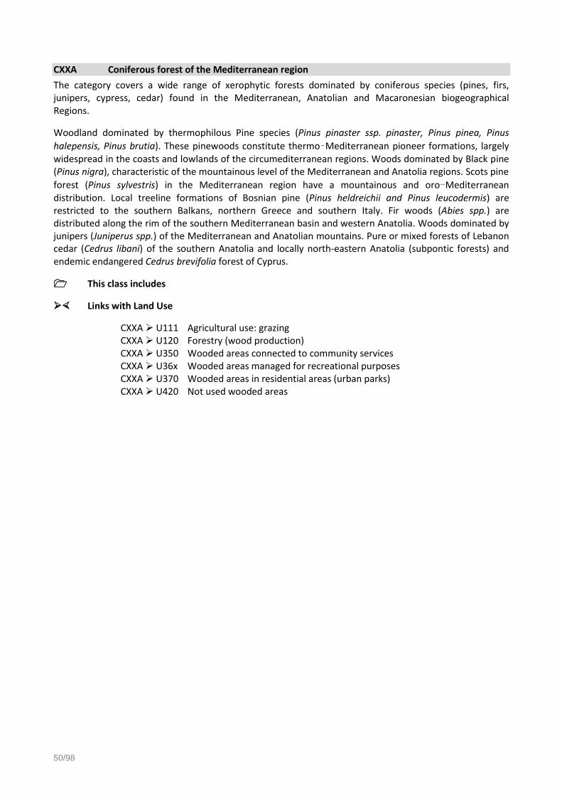
50/98
CXXA Coniferous forest of the Mediterranean region
The category covers a wide range of xerophytic forests dominated by coniferous species (pines, firs, junipers, cypress, cedar) found in the Mediterranean, Anatolian and Macaronesian biogeographical Regions.
Woodland dominated by thermophilous Pine species (Pinus pinaster ssp. pinaster, Pinus pinea, Pinus
halepensis, Pinus brutia). These pinewoods constitute thermo‑Mediterranean pioneer formations, largely widespread in the coasts and lowlands of the circumediterranean regions. Woods dominated by Black pine (Pinus nigra), characteristic of the mountainous level of the Mediterranean and Anatolia regions. Scots pine
forest (Pinus sylvestris) in the Mediterranean region have a mountainous and oro-Mediterranean distribution. Local treeline formations of Bosnian pine (Pinus heldreichii and Pinus leucodermis) are restricted to the southern Balkans, northern Greece and southern Italy. Fir woods (Abies spp.) are distributed along the rim of the southern Mediterranean basin and western Anatolia. Woods dominated by junipers (Juniperus spp.) of the Mediterranean and Anatolian mountains. Pure or mixed forests of Lebanon cedar (Cedrus libani) of the southern Anatolia and locally north-eastern Anatolia (subpontic forests) and endemic endangered Cedrus brevifolia forest of Cyprus.
This class includes
Links with Land Use
CXXA U111 Agricultural use: grazing CXXA U120 Forestry (wood production) CXXA U350 Wooded areas connected to community services CXXA U36x Wooded areas managed for recreational purposes CXXA U370 Wooded areas in residential areas (urban parks) CXXA U420 Not used wooded areas

Eurostat - LUCAS 2018 Technical document C3 - Classification
LUCAS2018_C3-Classification_20171208_web.doc 51/98
CXXB Mire and swamp forests
Coniferous or broadleaved forested wetlands, located mainly in Fennoscandia with scattered occurrences on peaty soils throughout Europe. Forested wetlands consist of a heterogeneous complex of wet and moist forest types, and they are characterized by a high water table of variable duration. The terminology used to characterize them differs between countries. In Sweden, for example, swamp forests are classified as forests and not as mires if the annual forest productivity exceeds 1 m3 per ha or if the tree layer has a crown projection exceeding 30 %. In Finland, however, the classification is based on botanical and hydrological criteria. As a consequence, wet and moist forests are assigned to the mire series regardless of forest productivity and tree cover. Therefore, many herb-rich vegetation types are included in this category.
The dominating trees are spruces (Picea spp.) and birches (Betula spp.) in swamps or pines (Pinus spp. in bogs. Swamp forests can be dominated by alder (Alnus spp.), birch (Betula spp.), pedunculate oaks (Quercus robur) or aspen (Populus tremula).
This class includes
This class excludes
- Peat bogs (H12)
Links with Land Use
CXXB U111 Agricultural use: grazing CXXB U120 Forestry (wood production) CXXB U350 Wooded areas connected to community services CXXB U36x Wooded areas managed for recreational purposes CXXB U370 Wooded areas in residential areas (urban parks) CXXB U420 Not used wooded areas

52/98
CXXC Floodplain forest
Alluvial and riparian woodlands and galleries close to main European river channels. These are species-rich often multi-layered communities characterised by different assemblages of forest dominant trees. Forest composition and structure largely depends on the frequency of flooding.
Included are those forest communities typically associated with alluvial or riparian woodlands that may constitute locally important forest types e.g. in Bulgaria, the dense forests of field elm and ashes associated to alluvial and riparian mixed forests.
Riparian forests of the boreal, boreo‑nemoral and nemoral zone growing on low‑lying areas and organic soils frequently flooded and close to river channels. Characteristically dominated by species of alder (Alnus spp.), birch (Betula spp.), aspens (Populus tremula) and willows (Salix spp.).
In the Mediterranean and Macaronesian regions additions local species (e.g. Fraxinus angustifolia, Platanus orientalis, Alnus orientalis, Nerium Oleander, Tamarix, Liquidambar and Flueggea tinctoria) exist.
This class includes
Links with Land Use
CXXC U111 Agricultural use: grazing CXXC U120 Forestry (wood production) CXXC U350 Wooded areas connected to community services CXXC U36x Wooded areas managed for recreational purposes CXXC U370 Wooded areas in residential areas (urban parks) CXXC U420 Not used wooded areas

Eurostat - LUCAS 2018 Technical document C3 - Classification
LUCAS2018_C3-Classification_20171208_web.doc 53/98
CXXD Non-riverine alder, birch or aspen forest
Non-riparian, non-marshy forest formations dominated by alder (Alnus glutinosa, Alnus incana, Alnus cordata), birch (Betula pendula, Betula pubescens, Betula celtiberica, Betula aetnensis) or aspen (Populus tremula).
This class includes
Links with Land Use
CXXD U111 Agricultural use: grazing CXXD U120 Forestry (wood production) CXXD U350 Wooded areas connected to community services CXXD U36x Wooded areas managed for recreational purposes CXXD U370 Wooded areas in residential areas (urban parks) CXXD U420 Not used wooded areas

54/98
CXXE Exotic forest
The class covers forest and self-sown stands of non‑native, often invasive, tree species.
This class includes
- Eucalyptus (Eucalyptus spp.)
- Douglas fir (Pseudotsuga menziesii)
- Sitca spruce (Picea sitkensis)
This class excludes
- Plantations of autochthonous species
Links with Land Use
CXXE U111 Agricultural use: grazing CXXE U120 Forestry (wood production) CXXE U341 Wooded areas connected to commercial areas CXXE U350 Wooded areas connected to community services CXXE U36x Wooded areas managed for recreational purposes(but not yet converted to
more natural stands) CXXE U370 Wooded areas in residential areas (urban parks) CXXE U420 Not used wooded areas

Eurostat - LUCAS 2018 Technical document C3 - Classification
LUCAS2018_C3-Classification_20171208_web.doc 55/98
D00 SHRUBLAND Areas dominated (at least 10% of the surface) by shrubs and low woody plants normally not able to reach more than 5m of height. It may include sparsely occurring trees with a canopy below 10%.
D10 SHRUBLAND WITH SPARSE TREE COVER
Areas dominated (at least 10% of the surface) by shrubs and low woody plants, including sparsely occurring trees with a canopy between 5 and 10 %.
This class includes
- Scrub land (pines, rhododendrons, maquis, matorral and deciduous thickets)
- Heathland with gorse, heather or broom
This class excludes
- Shrubland where tree canopy is at least 10% (CXX)
- Shrub-like crops
- Berries orchards(B75)
- Vineyards in production (B82)
Links with Land Use
D10 U111 Agricultural use: grazing D10 U112 Shrub areas in fallow land D10 U120 Forestry (Wood production) D10 U36x Leisure areas D10 U420 Natural shrubland areas and areas outside agricultural areas not used

56/98
D20 SHRUBLAND WITHOUT TREE COVER
Areas dominated (at least 10% of the surface) by shrubs and low woody plants. Sparsely occurring trees do not cover more than 5% of the area.
This class includes
- Scrub land (pines, rhododendrons, maquis, matorral and deciduous thickets)
- Dwarf shrub tundra with dwarf birches and willows
- Heather and dwarf juniper vegetation
- Garrigues with strawberry trees, thyme, white rock rose, lavender and rosemary
- Heathland with gorse, heather or broom
- Spiny mediterranean heaths (Phrygana spp.)
- Xerophytic areas with succulents
This class excludes
- Shrubland where tree canopy is at least 10% (CXX)
- Shrubland where tree canopy is between 5 and 10% (D10)
- Shrub-like crops
- Berries orchards (B75)
- Vineyards (B82)
Links with Land Use
D20 U111 Agricultural use: grazing D20 U112 Shrub areas in fallow land D20 U120 Forestry (Wood production) D20 U36x Leisure areas D20 U420 Natural shrubland areas and areas outside agricultural land not used

Eurostat - LUCAS 2018 Technical document C3 - Classification
LUCAS2018_C3-Classification_20171208_web.doc 57/98
E00 GRASSLAND Land predominantly covered by communities of grassland, grass-like plants and forbs.
This class includes permanent grassland and permanent pasture that is not part of a crop rotation (normally for 5 years or more), which can be used to grow grasses and other herbaceous forage naturally (self-seeded) or through cultivation (sown).
It may include sparsely occurring trees within a limit of a canopy below 10% and shrubs within a total limit of cover (including trees) of 20%. These can themselves be also grazed, provided that grasses and other herbaceous forage remain predominant as well.
E10 GRASSLAND WITH SPARSE TREE/SHRUB COVER
Land predominantly covered by communities of grassland, grass-like plants and forbs including sparsely occurring trees (the tree canopy is between 5 and 10% and the total of the tree+shrub canopy is between 5 and 20% of the area).
This class includes
- Dry grasslands
- Dry edaphic meadows
- Steppes with gramineae and artemisia
- Plain and mountainous grassland
- Wet grasslands
- Alpine and subalpine grasslands
- Saline grasslands
- Arctic meadows
This class excludes
- Temporary grassland and fodder crops (B5X)
- Spontaneously re-vegetated surfaces (E30)
Links with Land Use
E10 U111 Agriculture: permanent pastures, rough grazing, alpages, meadows E10 U120 Clear cuts within previously existing forests E10 U31X Associated areas of transport areas E10 U34X Grassland attached to commerce, finance or business areas E10 U350 Grassland attached to community service areas E10 U36X Grassland for recreation: public gardens, golf courses E10 U370 Grassland attached to residential areas E10 U4X0 Natural grassland or abandoned grassland outside agricultural areas not
used
E20 GRASSLAND WITHOUT TREE/SHRUB COVER
Land predominantly covered by communities of grassland, grass like plants and forbs without trees and shrubland (density of tree+shrub canopy is less than 5%).
This class includes

58/98
- Dry grasslands
- Dry meadows and steppes
- Plain and mountainous grassland
- Wet grasslands
- Alpine and subalpine grasslands
- Saline grasslands
- Arctic meadows
- Temporarily unstocked areas within forests (clear cuts) covered by grassland without sparse tree/shrub cover
This class excludes
- Temporary grassland and fodder crops (B5X)
- Spontaneously re-vegetated surfaces (E30)
Links with Land Use
E20 U111 Agriculture: Permanent pastures, rough grazing, alpages, meadows E20 U120 Clear cuts within previously existing forests E20 U31x Associated areas of transport areas (e.g. aerodromes) E20 U34x Grassland attached to commerce, finance or business areas E20 U350 Grassland attached to community service areas E20 U36x Grassland for recreation or sports: public gardens, golf courses, sports fields E20 U370 Grassland attached to residential areas E20 U410 Abandoned grassland outside agricultural areas (not used) E20 U420 Natural grassland
E30 SPONTANEOUSLY RE-VEGETATED SURFACES
It consists of mostly agricultural land which has not been cultivated this year or the years before. It has not been prepared for sowing any crop this year. This class can also be found on clear-cut forest areas, industrial “brownfields”, storage land and of course on abandoned or unused land etc.
Main case is agricultural land not providing a crop during the entire year or abandoned earlier agricultural surfaces. It is occupied by spontaneous vegetation in case of set-aside arable land, with some tall herbs or weeds. This class applies as well for former grassland or hedge margins which are currently not used anymore but covered by tall herbs fringes. There might be some bare land pockets or crop residues and spontaneous re-grown crops of the before management period.
Only surfaces which have not been deliberately sown and do not have any fodder crops like mixed cereals or are temporary grasslands classify for this land cover class.
This class includes
- Set aside land within agricultural areas
- Unused artificial land where revegetation is occouring
- Spontaneous secondary land cover in areas dominated by trees or shrubs
This class excludes
- Other legumes and mixtures for fodder (B53)
- Mixed cereals (B54)
- Temporary grassland (B55)
- Grassland without tree/shrub cover (E20)
- Bare land (FXX)

Eurostat - LUCAS 2018 Technical document C3 - Classification
LUCAS2018_C3-Classification_20171208_web.doc 59/98
Links with Land Use
E30 U112 Spontaneous vegetation on fallow land E30 U120 Clear cuts within previously existing forests E30 U140 Mining and quarrying if in use E30 U2XX Energy and industrial production surfaces with spontaneous vegetation
cover if still in use E30 U31X Transport, storage, water and waste treatment etc. surfaces with
spontaneous vegetation cover if in use E30 U420 Unused, spontaneously vegetated land

60/98
F00 BARE LAND AND LICHENS/MOSS Areas with no dominant vegetation cover on at least 90% of the area or areas covered by lichens/moss.
F10 ROCKS AND STONES
This class includes
- Inland rock cliffs
- Areas of rock outcrop and limestone parent
- Scree
- Block litter and mountain top debris
- Land covered with recent volcanic features
Links with Land Use
F10 U140 Scrapped or excavated areas for quarrying, mining purposes F10 U21x Rocky areas attached to energy production F10 U22x Rocky areas attached to industrial use F10 U31x Rocky areas attached to transport areas F10 U330 Construction sites F10 U34x Rocky areas attached to commercial services F10 U350 Rocky areas attached to community services F10 U36x Rocky areas used for recreational and leisure purposes F10 U370 Rocky areas attached to residential areas F10 U4x0 Rocky areas not used (inland rocks, top mountains)
F20 SAND
This class includes
- Areas of sand, shingle and mud: beaches, dunes, sand hills
- Gravel or sand banks above water level
This class excludes
- Intertidal areas (H23)
Links with Land Use
F20 U120 Clear cuts within previously existing forests F20 U140 Scrapped or excavated areas for quarrying, mining purposes F20 U21x Sandy areas attached to energy production F20 U22x Sandy areas attached to industrial use F20 U31x Sandy areas attached to transport areas F20 U330 Construction sites F20 U34x Sandy areas attached to commercial services F20 U350 Sandy areas attached to community services F20 U36x Sandy areas used for recreational and leisure purposes F20 U370 Sandy areas attached to residential areas F20 U420 Naural sandy areas not used
F30 LICHENS AND MOSS
Areas covered by lichens/moss even if these are covering more than 10% of the ground. No other vegetation is present with over 10% coverage.

Eurostat - LUCAS 2018 Technical document C3 - Classification
LUCAS2018_C3-Classification_20171208_web.doc 61/98
This class includes
- Areas covered by lichens, even if more than 10% of coverage
- Areas covered by moss, even if more than 10% of coverage
This class excludes
- Areas covered by lichens or moss where other vegetation is covering more than 10% of the ground (e.g. EXX, or DXX or CXX)
Links with Land Use
F30 U120 Clear cuts within previously existing forests F30 U140 Scrapped or excavated areas for quarrying, mining purposes F30 U21x Areas attached to energy production F30 U22x Areas attached to industrial use F30 U31x Areas attached to transport areas F30 U330 Construction sites F30 U341 Areas attached to commercial services F30 U350 Areas attached to community services F30 U36x Areas used for recreational and leisure purposes F30 U370 Areas attached to residential areas F30 U4x0 Areas not used (inland rocks, top mountains)
F40 OTHER BARE SOIL
This class includes
- Bare arable land
- Temporarily unstocked areas within forests (clear cuts) with bare soil
- Burnt areas
- Secondary land cover for tracks and parking areas/yards with bare land cover (if the soil is not sealed)
This class excludes
- Impervious cover (A2x)
- Dune grassland (E20)
- Dunes with heaths or scrub (DXX)
- Peat bogs (H12)
Links with Land Use
F40 U111 Agricultural bare land, tilled and/or prepared for seeding F40 U112 Fallow land with crop residues F40 U120 Clear cuts within previously existing forests F40 U140 Scrapped or excavated areas for quarrying, mining purposes F40 U21x Bare areas attached to energy production F40 U22x Bare areas attached to industrial use F40 U31x Bare areas attached to transport areas F40 U330 Construction sites F40 U34x Bare areas attached to commercial services F40 U350 Bare areas attached to community services F40 U36x Bare areas used for recreational and leisure purposes

62/98
F40 U370 Bare areas attached to residential areas F40 U4x0 Bare areas abandoned or not used

Eurostat - LUCAS 2018 Technical document C3 - Classification
LUCAS2018_C3-Classification_20171208_web.doc 63/98
G00 WATER AREAS Inland or coastal areas without vegetation and covered by water and flooded surfaces, or likely to be so over a large part of the year. If temporary dry, the outlines of the water areas have to be clearly visible on the orthophotos.
Temporarily submerged islands and sandbanks are to be assigned in FXX classes, with a remark “temporarily flooded”.
G10 INLAND WATER BODIES
Inland areas of still standing surface water. In order to comply with INSPIRE some sub-class is separate into fresh and salty water bodies. As in INSPIRE, the LUCAS definition does not distinguish between natural water bodies and artificial or heavily modified water bodies (which are mentioned as separate classes in the Water Framework Directive).
G11 Inland fresh water bodies
Inland areas of fresh water
This class includes
- Lakes
- Ponds
- Meres
- Reservoirs
with fresh water
Links with Land Use
G11 U111 Small ponds attached to agricultural use G11 U130 Fishing or collecting of water organisms (for commercial purposes) G11 U140 Gravel and sand extraction under water G11 U210 Energy production G11 U22x Industrial bodies of water, dockyards G11 U313 Bodies of water used for transport G11 U32x Decanters, reservoirs G11 U34x Bodies of water attached to commercial services G11 U350 Bodies of water attached to community services G11 U361 Swimming pools in recreation centers G11 U362 Swimming pools in sports centers G11 U370 Swimming pools in residential areas G11 U4x0 Abandoned or not used bodies of water
G12 Inland salty water bodies
Inland areas of salty or brackish water (e.g. in areas of geothermal activities or salty steppe lakes where evaporation is higher than water inflow.)
This class includes
- Lakes
- Ponds
- Meres

64/98
with salty water
Links with Land Use
G12 U111 Small ponds attached to agricultural use G12 U130 Fishing or collecting of water organisms (for commercial purposes) G12 U140 Gravel and sand extraction under water G12 U210 Energy production G12 U22x Industrial bodies of water, dockyards G12 U313 Bodies of water used for transport G12 U32x Decanters, reservoirs G12 U34x Bodies of water attached to commercial services G12 U350 Bodies of water attached to community services G12 U361 Swimming pools in recreation centers G12 U362 Swimming pools in sports centers G12 U370 Swimming pools in residential areas G12 U4x0 Abandoned or not used bodies of water
G20 INLAND RUNNING WATER
Inland channels of running water
G21 Inland fresh running water
Inland channels of fresh water
This class includes
- Rivers
- Streams
- Springs
- Canals
with fresh water
Links with Land Use
G21 U111 Agriculture G21 U130 Fishing or collecting of water organisms (for commercial purposes) G21 U140 Gravel and sand extraction under water G21 U313 Rivers, canals used for transport G21 U361-2 Recreation, leisure, sport G21 U4x0 Abandoned or not used
G22 Inland salty running water
Inland channels of salty or brackish water (e.g. in areas of geothermal activities, thermal springs, etc.)
This class includes
- Rivers
- Streams
- Springs
- Canals
with salty water

Eurostat - LUCAS 2018 Technical document C3 - Classification
LUCAS2018_C3-Classification_20171208_web.doc 65/98
Links with Land Use
G22 U111 Agriculture G22 U130 Fishing or collecting of water organisms (for commercial purposes) G22 U140 Gravel and sand extraction under water G22 U313 Rivers, canals used for transport G22 U361-2 Recreation, leisure, sport G22 U4x0 Abandoned or not used
G30 TRANSITIONAL WATER BODIES
These areas correspond to the transitional waters as defined in the water framework diective (Directive 2000/60/EC): bodies of surface water in the vicinity of river mouths which are partly saline in character as a result of their proximity to coastal waters but which are substantially influenced by freshwater flows.
It includes water surfaces in estuaries (the wide portion of rivers at their mouths subject to the influence of the sea into which the water course flows: the limit is fixed at the point where width is less than 5 km at high tide and greater than 3 km at low tide) and lagoons (water areas cut off from the sea by coastal banks or other forms of relief with, however, certain possible openings).
These areas are not part of the NUTS definition.
This class includes
- Estuaries
- Lagoons
Links with Land Use
G30 U130 Aquaculture G30 U313 Bodies of water used for transport G30 U361-2 Specific leisure, recreational or sports equipment G30 U420 Unused
G40 SEA AND OCEAN
Zone seaward of the lowest tide limit.
These areas are not part of the NUTS definition.
This class excludes
- archipelago of lands located inside sea/ocean areas
- sea water areas as part of port areas which include sea water to reach a zone >25 ha
Links with Land Use
G40 U130 Fishing or aquaculture G40 U313 Bodies of water used for transport G40 U361-2 Specific leisure, recreational or sports equipment G40 U420 Unused

66/98
G50 GLACIERS, PERMANENT SNOW
Areas covered by glaciers (generally measured at the time of their greatest expansion in the season) or permanent snow
Links with Land Use
A30 + G50 U361-2 Ski tows on glaciers G50 U420 Unused

Eurostat - LUCAS 2018 Technical document C3 - Classification
LUCAS2018_C3-Classification_20171208_web.doc 67/98
H00 WETLANDS Wetlands are areas that fall between land and water. These are areas that are wet for long enough periods that the plants and animals living in or near them are adapted to, and often dependent on, wet conditions for at least part of their life cycle.
Wetlands are defined as land that is:
- Inundated with water on a temporary or permanent basis.
- Inundated with water that is usually slow moving or stationary.
- Inundated with water that is shallow.
- Inundated with water that may be fresh, brackish or saline.
H10 INLAND WETLANDS
Wetlands located inland and having fresh water.
H11 Inland marshes
Inland marshes are wetlands usually saturated with fresh water around the year and seasonally flooded dominated by grasses or grasslike plants.
This class includes
- Inland marshes
- Reeds (inland)
This class excludes
- Peatbogs, fens (H12)
- Salt marshes (H21)
- Rice fields (B17)
- Plantations of plants for plaiting including reeds (B84)
Links with Land Use
H11 U321 Water supply and treatment H11 U4x0 Abandoned or Unused
H12 Peatbogs
Bogs accumulate acidic peat, a deposit of dead plant material—usually mosses.
This class includes
- Turf
- Peat bogs
- Fens
This class excludes
- Mire and swamp forests (CXX)
- Alluvial forests (canopy more than 10 %) (CXX)
- Lichens (F30)
Links with Land Use
H12 U140 Mining and quarrying: Peat extraction

68/98
H12 U4x0 Abandoned or Unused
H20 COASTAL WETLANDS
Wetlands located on marine coasts or having salty or brackish water, as well as areas of a marine origine (chemical deposits).
H21 Salt marshes
A salt marsh is a type of marsh that is a transitional intertidal area between land and salty or brackish water.
This class includes
- Salt marshes
- Marine reeds
This class excludes
- Inland marshes (H11)
- Salines (H22)
Links with Land Use
H21 U111 Grazing (e.g. in German West coast) H21 U4X0 Abandoned or Unused

Eurostat - LUCAS 2018 Technical document C3 - Classification
LUCAS2018_C3-Classification_20171208_web.doc 69/98
H22 Salines and other chemical deposits
Actively used or abandoned salt evaporation ponds and salt pans with clear parcels and embankment systems, naturally occurring salt surfaces, as well as other crystalline loose chemical residuals (e.g. lime, gypsum, soda etc.) not yet having the character of solid geological stone formation.
This class includes
- Active or abandoned salines
This class excludes
- Salt marshes (H21)
Links with Land Use
H22 U140 Salt extraction H22 U410 Abandoned
H23 Intertidal flats
Normally unvegetated mud, sand or rock flats located between high and low tide water marks.
This class includes
- Rock, sand and mud flats affected by tides
This class excludes
- Salt marshes (H21)
- Active or abandoned salines (H22)
- Stony beaches normally above the water level (F10)
- Sandy beaches (F20)
Links with Land Use
H23 U130 Fishing or collecting of water organisms (for commercial purposes) H23 U420 Unused

70/98
3 Land Use Classification (LUCAS SU LU)
U100 Primary sector
U110 AGRICULTURE
U111 Agriculture (excluding fallow land and kitchen gardens)
Areas used for agricultural purposes (NACE Section A01) and field construction (e.g. agricultural land terracing, drainage, preparing rice paddies etc. - NACE 43.12 as far as related to agricultural activites).
This class includes the production of crop products and production of animal products. This class includes growing of crops in open fields as well as in greenhouses. The preparation of products for the primary markets is included here. These areas are normally harvested with use of agricultural machinery (exc. delicate crops).
This class includes
- A01.1 Growing of non-perennial crops
- Growing of cereals (except rice), leguminous crops and oil seeds
- Growing of rice
- Growing of vegetables and melons, roots and tubers
- Growing of sugar cane
- Growing of tobacco
- Growing of fiber crops
- Growing of fodder crops (including temporary grassland)
- Growing of other non-perennial crops (including industrial reed beds)
- A01.2 Growing of perennial crops (except A01.29 which is U120 forestry)
- Growing of grapes
- Growing of tropical and subtropical fruits
- Growing of citrus fruits
- Growing of pome fruits and stone fruits
- Growing of other tree and bush fruits and nuts
- Growing of oleaginous fruits
- Growing of beverage crops
- Growing of spices, aromatic, drug and pharmaceutical crops
- A01.3 Plant propagation
- Growing of plants for planting
- Growing of plants for ornamental purposes, including turf for transplanting
- Growing of live plants for bulbs, tubers and roots; cuttings and slips; mushroom spawn
- A01.4 Animal production (includes raising (farming) and breeding of all animals, except aquatic animals)
- Raising of dairy cattle (including the grazing areas)
- Raising of other cattle and buffaloes (including the grazing areas)

Eurostat - LUCAS 2018 Technical document C3 - Classification
LUCAS2018_C3-Classification_20171208_web.doc 71/98
- Raising of horses and other equines (including the grazing areas)
- Raising of sheep and goats (including the grazing areas)
- Raising of swine/pigs
- Raising of poultry
- Raising of other animals (including the grazing areas)
- A01.5 Growing of crops combined with farming of animals (mixed farming)
- Crop growing in combination with farming of livestock at mixed activity units with a specialization ratio in either one of less than 66%
- A01.6 Support activities to agriculture and post-harvest crop activities
- Support activities for crop production
- Support activities for animal production
- Post-harvest crop activities
- Seed processing for propagation
This class excludes
- Any subsequent processing of the agricultural products beyond that needed to prepare them for the primary markets
- Manufacture of food products and beverages and tobacco products (U221)
- Manufacturing of textile products (U222)
- Fallow agricultural land (U112)
- Kitchen gardens (U113)
U112 Fallow land
Agricultural land (cropland) not used for the entire year for crop production, as part of the field rotation. Also, all agricultural land which is set aside long-term is included. If the land is grazed, it falls under agricultural production and must be classified as U111.
This class includes
- Set aside within agricultural areas
- Bare land for agricultural use (used in other years)
- Land with spontaneous natural growth (may be used as feed or ploughed in)
- Green fallow (land sown exclusively for production of green manure, possible species including clover (eg. annual sweet clover) (B51), vetches (vicia) (B41), buckwheat (B19b), winter green manure crops as oats (B15) and rye (B14), alfalfa=lucerne (B52), lupin (B41), millet (B19c), mustard (B35), sorghum (B19a) or soybean (B33))
This class excludes
- Grazing of lucerne, clover, sainfoin, trefoil (Lotus corniculatus), black medick (Medicago lupulina), etc (U111)
- Grazing (U111)
- Abandoned permanent crops (U410)
U113 Kitchen garden
Gardens, where the crops are planted heterogeneously and mainly for own consumption. These areas are mostly fenced (by metal fences or hedges) and mostly situated in residential areas or as allotment gardens.

72/98
This class includes
- Allotment gardens
- Kitchen gardens and fruit/nut trees (around the house)
This class excludes
- Industrial agriculture (U111)

Eurostat - LUCAS 2018 Technical document C3 - Classification
LUCAS2018_C3-Classification_20171208_web.doc 73/98
U120 FORESTRY
U120 Forestry
Areas used for forestry purpose (NACE A02 and A01.29)
This class includes the production of round wood, coppices and forest services. The extraction and gathering of wild growing non-wood forest products (for commercial purposes) is now classified under U150.
Besides the production of timber, forestry activities result in products that undergo little processing, such as firewood, charcoal (made by traditional processes) and round wood used in an unprocessed form (e.g. pit-props, pulpwood etc.). These activities can be carried out in natural or planted forests. This class can also include temporarely un-stocked areas (clear cuts) and firebreaks.
This class includes
- Growing of standing timber: planting, replanting, transplanting, thinning and conserving of forests and timber tracts
- Growing of coppice, pulpwood and fire wood
- Logging: felling of timber and production of wood in the rough such as pit-props, split poles, pickets or fuel wood (NACE A02.2)
- Support services to forestry (NACE A02.4)
- Growing of christmas trees (NACE A01.29)
- Growing of cork oak trees and extraction of cork
- Growing of rubber trees for latex, or growing of trees for sap
- Growing of trees for plaiting
- Operation of forest tree nurseries (NACE A02.10)
- Forest services (forest inventory, fire fighting, pest protection, transport of logs in the forest)
This class excludes
- Further processing of wood beginning with sawmilling and planning of wood (U227)
U130 AQUACULTURE AND FISHING
U130 Aquaculture and Fishing
Areas used for commercial fishing and aquaculture (NACE A03)
This class includes capture fishery and aquaculture, covering the use of fishery resources from marine, brackish or freshwater environments, with the goal of capturing or gathering fish, crustaceans, mollusks and other water organisms and products (e.g. aquatic plants, pearls, sponges).
This class includes
- Commercial fishing
- Aquaculture (e.g. fish farming)
This class excludes

74/98
- Leisure fishing (U362)

Eurostat - LUCAS 2018 Technical document C3 - Classification
LUCAS2018_C3-Classification_20171208_web.doc 75/98
U140 MINING AND QUARRYING
U140 Mining and quarrying
Areas used for mining and quarrying purposes (NACE Section B).
Mining and quarrying include the extraction of minerals occurring naturally as solids (coal and ores), liquids (petroleum) or gases (natural gas). Extraction can be achieved by different methods such as underground or surface mining, well operation etc. This section includes supplementary activities aimed at preparing the crude materials for marketing, for example, crushing, grinding, cleaning, drying, sorting, concentrating ores, liquefaction of natural gas and agglomeration of solid fuels.
This class includes
- Mining of coal and lignite
- Extraction of crude petroleum and natural gas
- Mining of metal ores
- Quarrying of stone, sand and clay
- Mining of chemical and fertiliser minerals
- Extraction of peat
- Extraction of salt
- Other mining and quarrying n.e.c.
- Mining support service activities
This class excludes
- Areas of waste disposal and treatment (U322)
- Processing of the extracted materials
- Coal, oil and metal processing (U223)
- Production of non-metal mineral goods (U224)
- Chemical and allied industries and manufacturing (U225)
- Usage of the extracted materials without a further transformation for construction purposes (U330)
U150 OTHER PRIMARY PRODUCTION
U150 Other primary production
Professional hunting, gathering of wild growing non-wood forestry products for commercial purposes, husbandry of migratory animals and any other primary production not included elsewhere.
This class includes
- Professional hunting (NACE A01.7)
- Gathering of mushrooms and other wild growing non-wood forest products (NACE A02.30)
- Husbandry of migratory animals
This class excludes
- Grazing of lucerne, clover, sainfoin, trefoil, black medick, etc (U111)
- Leisure activities (e.g. picking berries for own consumption) (U361)
76/98
U200 Secondary sector
U210 ENERGY PRODUCTION
U210 Energy production
Areas used for producing and generating energy (NACE D35.11, D35.21 and parts of D35.30).
This class includes the activity of producing electric power, steam, hot water and the like in energy production plants, based on fossil fuels, nuclear energy or renewable energy such as hydropower, solar and wind power as well as biogas. This class also includes the manufacturing of gas by purification, blending and other processes from gases and production of gas for the purpose of gas supply by carbonation of coal or from by-products of agriculture or from waste.
This class includes
- Production of electricity (including renewable energy)
- Manufacturing of gas by purification
- Production of steam
and the relevant attached areas
This class excludes
- Areas used for electricity, gas and thermal power distribution (U319)
- Operation of water and sewage utilities (U321)
- Typically long-distance transport of gas, water, etc. through pipelines (U315)
U220 INDUSTRY AND MANUFACTURING
According to INSPIRE , industry and manufacturing can be divided into:
Raw industry: industrial activities transforming the output of the primary sector into manufactured raw products
Heavy end product industry: activites transforming raw manufactured products into heavy manufactured products
Light end product industry: activites transforming raw manufactured products into light manufactured products
Therefore, for this class the surveyor must note the respective land use type (U22XR, U22XH or U22XL) in the LU Type field.
U221 Manufacturing of food, beverages and tobacco products
Areas used for production of food and beverage products (NACE C10, C11, C12).
This class covers only light end product industry and includes the processing of the products coming from the primary sector (e.g. agriculture, forestry …) into food for humans or animals. Some activities are considered manufacturing (for example, those performed in bakeries, pastry shops, and prepared meat shops etc. which sell their own production) even though there is retail sale of the products in the producers' own shop. This class also includes the manufacture of beverages and mineral water, as well as the processing of tobacco for final consumption.
This class includes
- U221L - Manufacture of food products

Eurostat - LUCAS 2018 Technical document C3 - Classification
LUCAS2018_C3-Classification_20171208_web.doc 77/98
- U221L - Manufacture of beverages
- U221L - Manufacture of tobacco products
- and the relevant attached areas
This class excludes
- Preparation of meals for immediate consumption, such as in restaurants (U341).
U222 Manufacturing of textile products
Areas used for manufacturing of textile products (NACE C13, C14, C15)
This class includes raw industry and light end product industry. Manufacture of wearing apparel is part of the light end product industry and includes: leather clothes, workwear, other outerwear, underwear, other wearing apparel and accessoires. It also includes the manufacture of wearing apparel made of fur, knitted and crocheted hosiery. Other light end product industry included in this class are the manufacture of luggage, handbags and the likem saddler and harness, the production of footwear and the production of carpets, rugs and other made-up textile articles (e.g. bed, table and kitchen linen).
The preparation and spinning of textile fibres as well as textile weaving, finishing of textiles, dressing and dyeing of fur and the transformation of hides into leather by tanning or curing and fabricating the leather into products for final consumption are included in raw industry.
This class includes
- U222R - Tanning and dressing of leather (NACE C15.11)
- U222R - Manufacture of textiles (NACE C13.1 – C13.91, parts of C13.95, C13.96 & C13.99)
- U222L - Manufacture of household linen, blankets, carpets and rugs, ropes, shoe laces (NACE C13.92 – C13.94, parts of C13.95, C13.96 & C13.99)
- U222L - Manufacture of wearing apparel (NACE C14)
- U222L - Manufacture of luggage, handbags, saddlery and harness (NACE C15.12)
- U222L - Manufacture of footwear (NACE C15.2)
- and the relevant attached areas
U223 Coal, oil and metal processing
Areas used for coal, oil and metal processing (NACE C19, C24, C25)
This class is covering mainly raw industry and includes the transformation of crude petroleum and coal into usable products (petroleum refining), manufacture of gases as products of petroleum refineries. It also includes the activities of smelting and/or refining ferrous and non-ferrous metals and the manufacture of "pure" metal products (such as parts, containers and structures). This class also includes manufacture of weapons and ammunition (NACE 25.4), which is classified as heavy end product industry.
This class includes
- U223R - Manufacture of coke and refined petroleum products
- U223R - Manufacture of basic metals
- U223R - Manufacture of fabricated metal products, except machinery and equipment
- U223H - Manufacture of weapons and ammunition (NACE C25.4)

78/98
- and relevant the attached areas
This class excludes
- The manufacture of petrochemicals from refined petroleum (U225)
- Manufacture of machinery and equipment (U226)
U224 Production of non-metal mineral goods
Areas used for manufacturing of non-metal mineral goods (NACE C23)
This class includes manufacturing activities related to a single substance of mineral origin. It includes the manufacture of glass and glass products (e.g. flat glass, hollow glass, fibres, technical glassware etc.), ceramic products, tiles and baked clay products, and cement and plaster, from raw materials to finished articles. The manufacture of shaped and finished stone and other mineral products is also included in this class. This class is covering exclusively raw industry.
This class includes
- U224R - Manufacture of glass and glass products
- U224R - Manufacture of refractory products
- U224R - Manufacture of clay building materials
- U224R - Manufacture of other porcelain and ceramic products
- U224R - Manufacture of cement, lime and plaster
- U224R - Manufacture of articles of concrete, cement and plaster
- U224R - Cutting, shaping and finishing of stone
- U224R - Manufacture of abrasive products and non-metallic mineral products not mentioned elsewhere
- and the relevant attached areas
U225 Chemical and allied industries and manufacturing
Areas used for industrial and manufacturing of chemical and related products (NACE C20-C22)
This class includes the transformation of organic and inorganic raw materials by a chemical process and the formation of products, also the production of basic pharmaceutical products and pharmaceutical preparations, medicinal chemical and botanical products, rubber and plastic products. This class is covering mainly raw industry, except for pharmaceutical preparations (NACE 21.20), which are part of the light end product industry .
This class includes
- U225R - Manufacture of chemicals and chemical products
- U225R - Manufacture of basic pharmaceutical products
- U225L - Pharmaceutical preparations
- U225R - Manufacture of rubber and plastic products
- and the relevant attached areas
U226 Machinery and equipment
Areas used for production of machinery and equipment (NACE C26-C32)
This class includes the manufacture of machinery and equipment: computers, electronic products, consumer electronics, measuring, testing and navigating equipment, magnetic and optical media, products that generate, distribute and use electrical power, of general-purpose and special machinery, of motor

Eurostat - LUCAS 2018 Technical document C3 - Classification
LUCAS2018_C3-Classification_20171208_web.doc 79/98
vehicles and transport equipment (boats, airplanes etc), the manufacture of furniture, other manufacturing.
This class includes
- U226L - Manufacture of computer, electronic and optical products (NACE C26)
- U226H - Manufacture of domestic appliances (NACE C27.5)
- U226L - Manufacture of other electrical equipment (other NACE C27)
- U226L - Manufacture of machinery and equipment not specified elsewhere (NACE C28.23), namely office machinery and equipment (except computers and peripheral equipment)
- U226H – Manufacture of machinery and equipment not specified elsewhere (other NACE C28), including engines, turbines, ovens, furnaces, cranes, elevators, cooling and ventilation equipment, agriculture and forestry machinery, etc.
- U226H - Manufacture of motor vehicles, trailers and semi-trailers (NACE C29)
- U226H - Manufacture of other transport equipment (NACE C30)
- U226L - Manufacture of furniture, including wooden furniture (NACE C31)
- U226L - Other manufacturing (NACE C32)
- and the relevant attached areas
This class excludes
- Areas where waste is sorted to prepare recycling of used material (U322)
- Repair and installation of machinery and equipment (U341)
U227 Wood based products
Areas used for production of wood-based products and of articles of cork, straw and plaiting materials (NACE C16, C17)
This class covers only raw industry and includes the manufacture of wood products and prefabricated wood buildings. The production processes include sawing, planning, shaping, laminating, and assembling of wood products. This class also includes the manufacture of pulp, paper and converted paper products.
This class includes
- U227R - Manufacture of wood and of products of wood and cork (except furniture)
- U227R - Manufacture of paper and paper products
- and the relevant attached areas
This class excludes
- Manufacture of wooden furniture (U226L)
- Printing and service activities related to printing (U228L)
U228 Printing and reproduction
Areas used for printing, reproduction and related services (NACE C18, I58)
This group covers only light end product industry and includes printing of products, such as newspapers, books, periodicals, business forms, greeting cards, and other materials, and associated support activities, such as bookbinding, plate-making services, and data imaging. Printing can be done using various

80/98
techniques and on different materials. This group also includes the reproduction of recorded media, such as compact discs, videos, software on discs or tapes, records etc. Also included are all other publishing activities in all possible formats (e.g. in print, elettronic format) : books, periodicals and other publishibg activities, software.
This class includes
- U228L - Printing of products
- U228L - Associated support activities such as bookbinding, plate-making services, and data imaging
- U228L - Reproduction of recorded media
- and the relevant attached areas

Eurostat - LUCAS 2018 Technical document C3 - Classification
LUCAS2018_C3-Classification_20171208_web.doc 81/98
U300 Tertiary sector, transport, utilities & residential
U310 TRANSPORT, COMMUNICATION NETWORKS, STORAGE, PROTECTION WORKS
U311 Railway transport
Areas used for railways transport (NACE 49.1, 49.2, parts of 52.2 as far as passengers are concerned)
This class includes
- All types of railways
- TGV traces
- Railway stations
- and the relevant attached areas
This class excludes
- Funiculars (U312)
- Tramways and tram stations (U312)
U312 Road transport
Land areas used for roads (NACE H49.3, H49.4, parts of H52.2 as far as passengers are concerned)
This class includes
- All types of areas used for road transportations (streets, roads, highways) and associated areas (e.g. rest areas)
- Car parking
- Bus stations
- Tramways and tram stations
- Funiculars
- and the relevant attached areas
U313 Water transport
Areas used for transport on water (NACE H50, parts of H52.2 as far as passengers are concerned)
This class includes
- Channels
- Rivers used for ship transportation
- Lakes
- Estuaries
- Areas used for harbors and ports
- and the relevant attached areas
This class excludes
- Areas used for storage of goods (U317)

82/98
U314 Air transport
Areas used for air transport (NACE H51, parts of H52.2 as far as passengers are concerned)
This class includes
- Airports for transportation of people and freight
- Airports with and without concrete runways
- and the relevant attached areas
This class excludes
- Areas used for storage of goods (U317)
U315 Transport via pipelines
Areas used for transport via pipelines (NACE H49.5, D35.12, D35.13, D35.22, D35.30). The surveyor must note the land use type in the respective LU Type field.
This class includes
- U315W - Transport of water via pipelines
- U315O - Transport of other material via pipelines
- Transport of gas
- Transport of oil
U316 Telecommunication
Areas used for postal services and telecommunication infrastructures (NACE H53, J61)
This class includes
- Postal and courier activities
- Telecommunications networks
This class excludes
- Production studios (TV, Movies), etc. (U342)
U317 Logistics and storage
Areas used for logistics and storage of goods and warehousing (NACE H52.1, parts of H52.2 as far as freights are concerned)
This class includes warehousing and support activities for transportation related to freight, such as operating of transport infrastructure (e.g. airports, harbours, tunnels, bridges, etc.), cargo handling.
This class includes
- Warehousing and storage
- Support activities for transportation related to freights.
This class excludes
- Attached areas used in other transport categories
U318 Protection infrastructures
Areas used for protection infrastructures

Eurostat - LUCAS 2018 Technical document C3 - Classification
LUCAS2018_C3-Classification_20171208_web.doc 83/98
This class includes
- Protection infrastructure against land slides or avalanches
- Dikes
U319 Electricity, gas and thermal power distribution
Areas used for electricity, gas and thermal power distribution (NACE D35.12, D35.13, D35.22, parts of D35.30), excluding pipelines.
This class includes
- Operation of electric and gas utilities
- Electric substations found along the distribution network
- Permanent infrastructure of mains (supply network)
This class excludes
- Transport via pipelines (U315)
U320 WATER AND WASTE TREATMENT
U321 Water supply and treatment
Areas used for water collection, treatment and supply (NACE E36, E37)
This class includes the collection, treatment and distribution of water for domestic and industrial needs. Collection of water from various sources, as well as distribution by various means is included. It also includes the operation of sewer systems or sewage treatment facilities that collect, treat, and dispose of sewage. Furthermore: recovering and purifying water: stations to raise water levels, for purifying waste water, decanters, spreader areas, storage (reservoir), extraction of water.
This class includes
- Water collection, treatment and supply
- Sewerage
This class excludes
- Distribution of water via pipeline (U315W)
U322 Waste treatment
Areas used for waste treatment (NACE E38, E39)
This class includes the collection, treatment, and disposal of waste materials. This also includes local hauling of waste materials and the operation of materials recovery facilities.
This class includes
- Waste collection, treatment and disposal activities; materials recovery (recycling)
- Remediation activities and other waste management services
This class excludes
- Incineration stations for energy production (U210)

84/98
U330 CONSTRUCTION
U330 Construction
Areas used for construction whatever the degree of completion (NACE F, except agricultural activites under F43.12)
This section includes general construction and specialized construction activities for buildings and civil engineering works. It includes new work, repair, additions and alterations, the erection of prefabricated buildings or structures on the site and also construction of a temporary nature. Thus, the construction of entire dwellings, office buildings, stores and other public and utility buildings, farm buildings etc., or the construction of civil engineering works such as motorways, streets, bridges, tunnels, railways, airfields, harbors and other water projects, irrigation systems, sewerage systems, industrial facilities, pipelines and electric lines, sports facilities etc.
This class includes
- Construction of buildings
- Civil engineering
- Specialised construction activities (e.g. demolition)
This class excludes
- Field construction related to agriculture (e.g. agricultural land terracing, drainage, preparing rice paddies etc.)
U340 COMMERCE, FINANCIAL, PROFESSIONAL AND INFORMATION SERVICES
U341 Commerce
Areas used for commercial activities, (NACE C33, G, I, L, D35.14 and D35.23)
This section includes wholesale and retail trade of any type of good, and rendering services incidental to the sale of merchandise. It includes the specialized repair of goods produced in the manufacturing sector with the aim to restore machinery, equipment and other products to working order, as well as the provision of general or rouine maintenance (i.e. servicing) on such products.
This section also includes the provision of short-stay accommodation for visitors and other travelers and the provision of complete meals and drinks fit for immediate consumption. This group also includes real estate activites and trade related to utilities.
This class includes
- Repair and installation of machinery and equipment
- Wholesale and retail trade
- Real estate activities
- Hotels and similar accommodation
- Food and beverage service activities
- Holiday and other short-stay accommodation (holiday apartment lots)
- Camping grounds, recreational vehicle parks and trailer parks (also closed holiday camps)
This class excludes
Financial, professional and information services (U342)

Eurostat - LUCAS 2018 Technical document C3 - Classification
LUCAS2018_C3-Classification_20171208_web.doc 85/98
U342 Financial, professional and information services
Areas used for financial and general business activities (NACE J59, J60, J62, J63, K, M, N and S (except religious activities)).
This section covers financial service activities, including insurance, reinsurance and pension funding activities and activities to support financial services. This section also includes, specialized professional (e.g. legal, accounting, consultancy, translation), scientific (reasearchers) and technical (e.g. architecture, engineering, advertising) activities, which require a high degree of training, and make specialized knowledge and skills available to users. This section includes support general business operations (employment and travel agencies, private security activities, service to buildings and landscape, office services) as well as media production services and activites of membership organisations (except religious activites).
Some services might be provided through community services in which case they fall under U350.
This class includes
- Financial and insurance activities
- Professional, scientific and technical activities
- Administrative and support service activities
This class excludes
- Protection works (U318)
- Veterinary services, if provided through community services (U350)
- Religious activites (U350)
U350 COMMUNITY SERVICES
U350 Community services
Areas used for public administration, local authorities, defense, education, health and social work, religion (NACE O, P, Q, U, S94.91), as well as other services if provided through community services.
This section includes activities of a governmental nature, normally carried out by the public administration, and extraterritorial, international organizations. This section includes education at any level or for any profession, public as well as private education. This section includes the provision of health and social work activities. Religious areas (like churches, graveyards) are falling under this category as well. Military areas belong also to this group.
This class includes
- Veterinary services, if provided through community services
- Public administration, defense (military) and activities of extraterritorial organisations and bodies)
- Education
- Human health and social work activities
- Religion

86/98
U360 RECREATION, LEISURE, SPORT
U361 Amenities, museums, leisure
Areas used for cultural purposes, amenities and leisure, recreation, amusement and show activities (NACE section R, except R93.1)
This class includes
- Creative, arts and entertainment activities
- Library, archives, museum and other cultural activities
- Gambling and betting activities
- Preservation of historical sites, including botanical and zoological gardens
- Amusement and recreation activities, including parks and beaches
U362 Sport
Areas used for sport activities (NACE R93.1)
This class includes
- Sporting activities
U370 RESIDENTIAL
U370 Residential
Areas used for housing purpose
This class includes
- Residential gardens
This class excludes
- Hotels (U341)
- Old people homes, children homes, prisons, monasteries, convents (U350)

Eurostat - LUCAS 2018 Technical document C3 - Classification
LUCAS2018_C3-Classification_20171208_web.doc 87/98
U400 Unused and abandoned areas
U410 Abandoned areas
This class consists of abandoned areas with signs or structures of previous use of any kind.
Areas belonging to the abandoned class are not in use and can't anymore be used for the original purpose without major reparation/renovation work.
U411 Abandoned industrial areas
This class consists of abandoned industrial areas with signs or structures of previous industrial use.
This class excludes
- Abandoned commercial areas
- Abandoned transport areas (e.g. railways)
- Abandoned residential areas
- Abandoned residential gardens
- Abandoned agricultural areas, mainly permananet crops (e.g. orchards, vineyards)
- Abandoned construction sites
- Abandoned mining areas
- Fallow land (U112)
- Construction sites (U330)
U412 Abandoned commercial areas
This class consists of abandoned commercial areas with signs or structures of previous commercial used.
This class excludes
- Abandoned industrial areas
- Abandoned transport areas (e.g. railways)
- Abandoned residential areas
- Abandoned residential gardens
- Abandoned agricultural areas, mainly permananet crops (e.g. orchards, vineyards)
- Abandoned construction sites
- Abandoned mining areas
- Fallow land (U112)
- Construction sites (U330)
U413 Abandoned transport areas
This class consists of abandoned transport areas with signs or structures of previous transport use.
This class excludes
- Abandoned industrial areas
- Abandoned commercial areas
- Abandoned residential areas
- Abandoned residential gardens

88/98
- Abandoned agricultural areas, mainly permananet crops (e.g. orchards, vineyards)
- Abandoned construction sites
- Abandoned mining areas
- Fallow land (U112)
- Construction sites (U330)
U414 Abandoned residential areas
This class consists of abandoned residential areas with signs or structures of previous residential use.
This class excludes
- Abandoned industrial areas
- Abandoned commercial areas
- Abandoned transport areas (e.g. railways)
- Abandoned agricultural areas, mainly permananet crops (e.g. orchards, vineyards)
- Abandoned construction sites
- Abandoned mining areas
- Fallow land (U112)
- Construction sites (U330)
U415 Other abandoned areas
This class consists of other abandoned areas not in U411, U412, U413, U414 with signs or structures of other previous use.
This class excludes
- Abandoned industrial areas
- Abandoned commercial areas
- Abandoned transport areas (e.g. railways)
- Abandoned residential areas
- Abandoned residential gardens
- Fallow land (U112)
- Construction sites (U330)
U420 Semi-natural and natural areas not in use
This class includes areas which are in natural / semi-natural state and no signs of any use are visible
This class excludes
- Unused land formerly developed, now vacant or derelict (U410) - Fallow land, Agricultural land which is temporarily not used (U112) - Grazed areas (U111)

Eurostat - LUCAS 2018 Technical document C3 - Classification
LUCAS2018_C3-Classification_20171208_web.doc 89/98
-
4 Index Land Cover
A
Abaca; B84
Abelmoschus esculentus; B43
Actinidia chinensis; B75
African millet; B19
Agaricus campestris; B43
Agave; B84
Agave sisalana; B35
Allium ascalonicum; B23
Allium cepa; B23
Allium porrum; B43
Allium sativum; B23
Almonds; B74
Althaea officinalis; B37
Amelanchier vulgaris; B75
Amygdalus persica; B75
Anethum graveolens; B37
Anise; B37
Anthriscus cerefolium; B37
Apium graveolens; B43
Apple trees; B71
Apricot; B75
Arachis hypogaea; B41
Areca nuts; B84
Artemisia dracunculus; B37
Artichokes; B43
Artificial pastures; B55
Asparagus; B43
Asparagus officinalis; B43
Atriplex hortensis; B43
Avena sativa; B15
Avocado; B75
B
Badain; B37
Bananas; B75
Barley; B13
Barnyard; B19
Basil; B37
Beet; B23
Bergamot; B77
Beta vulgaris; B22
Beta vulgaris , roots; B23
Beta vulgaris var. alba; B23
Beta vulgaris var. conditiva; B23
Bird rape; B35
Black currants; B75
Blackberries; B75
Blueberries; B75
Boehmeria nivea; B35
Boletus edulis; B43
Brassica napus; B32, B32
Brassica napus L. var. napobrassica (L.) Robb.; B23
Brassica oleracea L.; B23
Brassica oleracea spp.; B43

90/98
Brassica oleracea var. botrytis; B43
Brassica rapa L., roots; B23
Brassica rapa var. oleifera; B32, B32
Brassica rapa var. silvestris; B35
Brassicas; B43
Buckwheat; B19
Bulbs and tubers, cut-flowers; B44
C
Cabbages; B43
Cajanus cajan; B41
Calendula officinalis; B37
California bluebell; B53
Canary grass; B19
Canary grass; B84
Cannabis sativa straw; B35
Capsicum annuum; B43
Capsicum fructescens; B43
Cardamon; B84
Cardoons; B43
Carobs; B84
Carrots; B23
Carthamus tinctorius L.; B35
Cassava; B23
Castanea spp.; B74
Castor beans; B35
Cattail millet; B19
Cauliflowers; B43
Celery; B43
Cerasus acida; B73
Cereals, mix; B54
Chaerophyllum bulbosum; B23
Chamaemelum nobile; B37
Chenopodium quinoa; B19
Cherry trees; B73
Chestnuts; B74
Chickling vetch; B53
Chickpea; B41
Chicory; B43
Chicory roots; B37
Cicer arietinum; B41
Cichorium intybus var. foliosum; B43
Cichorium intybus var. sativum; B37
Cichorium. endivia var. crispa; B43
Cinnamon; B84
Citron; B77
Citronella; B84
Citrullus vulgaris; B43
Citrus aurantifolia; B77
Citrus aurantium; B76
Citrus bergamia; B77
Citrus clementina; B77
Citrus deliciosa; B77
Citrus fruit trees,other; B77
Citrus grandis; B77
Citrus limetta; B77
Citrus limon; B77
Citrus maxima; B77
Citrus medica var. cedrata; B77
Citrus nobilis; B77
Citrus orchards; B77
Citrus paradisea; B77
Citrus sinensis; B76
Citrus unshiu; B77
Clementines; B77

Eurostat - LUCAS 2018 Technical document C3 - Classification
LUCAS2018_C3-Classification_20171208_web.doc 91/98
Clover; B51
Cloves; B84
Cochlearia armoracia; B23
Cock’s foot; B55
Cocoa; B84
Coconut; B84
Coffee; B84
Colocasia esculenta; B23
Common balm; B37
Common lungwort; B37
Common mallow; B37
Common millet; B19
Common wheat; B11
Conium maculatum; B37
Corchorus spp.; B35
Coriander; B37
Coriandrum sativum; B37
Corn-cob-mix; B19
Cornel; B75
Cornus mas; B75
Corylus avellana; B74
Cotton; B34
Cowberries; B75
Cowpea; B41
Cranberries; B75
Cress; B43
Crimson clover; B51
Cucumbers; B43
Cucumis melo; B43
Cucumis sativus; B43
Cucurbita spp; B43
Cultivated mushrooms; B43
Cumin; B37
Cuminum cyminum; B37
Cut- leafage; B44
Cydonia oblonga; B75
Cynara cardunculus; B43
Cynara scolymus; B43
Cyperus esculentus L.; B35
D
Dangleberries; B75
Daucus carota , roots; B23
Dewberries; B75
Digitalis purpurea; B37
Digitaria spp.; B19
Dill; B37
Diospyros kaki; B75
Discorea spp.; B23
Ditch millet; B19
Dolichos sinensis; B41
Dry peas; B41
Dry pulses; B41
Durum wheat; B12
E
Earth almond; B35
Echinocloa frumentacea; B19
Egg-plants; B43
Egyptian clover; B51
Einkorn; B12
Eleagnus spp.; B75

92/98
Eleusine coracana; B19
Emmer; B12
Endives; B43
Eragrostis abyssinica; B19
Eriobotrya japonica; B75
Eruca sativa; B43
F
Fagopyrum esculentum Mill.; B19
Fennel; B37
Fenugreek; B53
Fescues; B55
Fibre, other; B35
Ficus carica; B75
Field beans; B41
Field peas; B41
Figs; B75
Finger; B19
Flax; B35
Flowers; B44
Fodder beet; B23
Fodder kale; B23
Fodder parsnips; B23
Foeniculum vulgare; B37
Fonio; B19
Fortunella spp.; B77
Foxtail millet; B19
Fragaria spp.; B45
Fresh vegetables, other; B43
Fruit trees and berries, other; B75
G
Garbanzo bean; B41
Garden chervil; B37
Garden orache; B43
Garden pea; B41
Garlic; B23
Gaylussacia spp.; B75
Ginger; B84
Glycine soja; B33
Golden millet; B19
Gooseberries; B75
Gossypium spp.; B34
Grapefruit; B77
Green beans; B43
Green peas; B43
H
Hazelnuts; B74
Hedysarium coronarium; B53
Helianthus annuus; B31
Helianthus tuberosus L.; B23
Hemp; B35
Hevea; B84
Hibiscus cannabinus; B35
Hops; B37
Hordeum vulgare; B13
Horseradish; B23
Humulus lupulus; B37
Hybrids of Medicago sativa L. Medicago falcata L.; B52
I
Illicium verum; B37
Ipomoea batatas (L.) Lam.; B23
Italian ryegrass; B55
J
Japanese millet; B19

Eurostat - LUCAS 2018 Technical document C3 - Classification
LUCAS2018_C3-Classification_20171208_web.doc 93/98
Jerusalem artichoke; B23
Juglans spp.; B74
Juneberry; B75
Jute; B35
K
Kapok; B84
Kenaf; B35
Kiwi; B75
Koda millet; B19
Kumquats; B77
L
Lactuca sativa; B43
Lathyrus sativus; B53
Lavender; B84
Leaf and stalked vegetables; B43
Leeks; B43
Leguminous and mixtures for fodder, other; B53
Leguminous vegetables; B43
Lemons; B77
Lens culinaris; B41
Lentil vetches; B41
Lentils; B41
Lepidium sativum; B43
Lettuce; B43
Limes; B77
Linum usitatissimum straw; B35
Loquat; B75
Lotus corniculatus L.; B53
Lucerne; B52
Lupins; B41
Lupinus albus; B53
Lupinus angustifolius; B53
Lupinus luteus; B53
Lupinus spp.; B41
M
Maize; B16
Malus pumila; B71
Malva silvestris; B37
Mandarines; B77
Mangolds; B23
Manihot esculenta Crantz; B23
Manihot utilissima; B23
Manioc; B23
Marjoram; B37
Marshmallow; B37
Mate; B84
Medicago falcata L.; B52
Medicago lupulina L.; B53
Medicago sativa L.; B52
Medicinal plants; B37
Medlar; B75
Melilotus alba Lam.; B53
Meliot; B53
Melissa officimalis; B37
Melons; B43
Mentha spp.; B37
Mespilus germanica; B75
Mirabellas; B75
Miscanthus; B84
Miscanthus giganteus; B84

94/98
Morchella spp.; B43
Morus alba; B75
Morus nigra; B75
Morus rubra; B75
Mulberries; B75
Musa spp.; B75
Mustard seeds; B35
Myrtle berries; B75
N
Nasturtium officinale; B43
Nectarine; B75
Nicotiana tabacum; B36
Non-permanent industrial crops, other; B37
Nuts trees; B74
O
Oat; B15
Ocimum basilicum; B37
Okras; B43
Olea europea; B81
Oleaginous crops, other; B35
Oleaster; B75
Olive groves; B81
Onions; B23
Onobrychis viciifolia Scop.; B53
Orange trees; B76
Origanum spp.; B37
Ornamental plants; B44, B44
Ornithopus sativus; B53
Oryza sativa; B17
Osier; B84
Other cereals; B19
Other cereals not specified elsewhere; B19
Other root crops; B23
Other root or tubers crops not specified elsewhere; B23
Other ryegrasses; B55
Other tropical tubers; B23
P
Palm; B84
Panicum miliaceum L.; B19
Papaver somniferum L.; B35
Parsley; B37
Paspalum scrobiculatum; B19
Pastinaca sativa L.; B23
Peach; B75
Peanuts; B41
Pear trees; B72
Pearl millet; B19
Pennisetum glaucum; B19
Pepper; B84
Peppers; B43
Permanent industrial crops; B84
Persea americana; B75
Persia clover; B51
Persica laevis; B75
Persimons; B75
Petroselinum crispum; B37
Phacelia tanacetifolia; B53
Phalaris canariensis L.; B19
Phaseolus spp; B43
Pigeon pea; B41
Pimenta officinalis; B43
Pimpinella anisum; B37
Pistachios; B74

Eurostat - LUCAS 2018 Technical document C3 - Classification
LUCAS2018_C3-Classification_20171208_web.doc 95/98
Pistacia vera; B74
Pisum arvense; B41
Pisum sativum; B41
Plums; B75
Poison hemlock; B37
Pomegranates; B75
Pomelo; B77
Poppy seeds; B35
Portulaca oleracea; B43
Pot marigold; B37
Potatoes; 18
Proso millet; B19
Prunus amygdalus; B74
Prunus armeniaca; B75
Prunus cerasus; B73
Prunus domestica; B75
Prunus insititia var. syriaca; B75
Prunus persica; B75
Prunus spinosa; B75
Pulmonaria officinalis; B37
Pumpkins; B43
Punica granatum; B75
Purple foxglove; B37
Purslane; B43
Pyrus communis; B72
Pyrus malus; B71
Q
Quebracho; B84
Quinces; B75
Quinine; B84
Quinoa; B19
R
Radishes; B23
Ragi; B19
Ramie; B35
Rape; B32
Raphanus sativus; B23
Raspberries; B75
Rattans; B84
Red beet; B23
Red clover; B51
Rheum spp.; B43
Rhubarb; B43
Ribes nigrum; B75
Ribes uva-crispa; B75
Rice; B17
Ricinus communis; B35
Rocket; B43
Rosemary; B37
Rosmarinus officinalis; B37
Rubus arcticus; B75
Rubus idaeus; B75
Rumex acetosa; B37
Rushes; B84
Rye; B13
S
Saccharum officinarum; B37
Safflower; B35
Sage; B37
Sago; B84
96/98
Sainfoin; B53
Salvia officinalis; B37
Saponaria officinalis; B37
Satsumas; B77
Secale cereale; B14
Serradella; B53
Sesame; B35
Sesamum indicum; B35
Setaria italica; B19
Shallots; B23
Sinapis alba L.; B35
Sinapis nigra; B35
Sisal; B35
Sloes; B75
Soapwort; B37
Solanum melongena; B43
Solanum tuberosum; B21
Sorghum; B19
Sorghum bicolor; B19
Sorrel; B37
Soya beans; B33
Spearmint; B37
Spelt; B11
Spices and aromatic plants; B37
Spinach; B43
Spinacia oleracea; B43
Star anise; B37
Stevia; B84
Strawberry; B45
Sugar beet; B22
Sugar cane; B37
Sulla; B53
Sunflower; B31
Swedes; B23
Sweet chamomile; B37
Sweet clover; B53
Sweet lupins; B53
Sweet potatoes; B23
T
Taros; B23
Tarragon; B37
Tea; B84
Teff; B19
Temporary grassland; B55
Thyme; B37
Thymus vulgaris; B37
Timothy; B55
Tobacco; B36
Tomato; B42
Trefoil; B53
Trifolium alexandrinum; B51
Trifolium incarnatum L.; B51
Trifolium pratense L.; B51
Trifolium repens L.; B51
Trifolium resupinatum; B51
Trigonella foenum-graecum; B53
Triticale; B18
Triticosecale; B18
Triticum aestivum; B11
Triticum durum; B12
Triticum monococcum; B12
Triticum spelta; B11
Triticum turgidum; B12
Tropical fruits; B75

Eurostat - LUCAS 2018 Technical document C3 - Classification
LUCAS2018_C3-Classification_20171208_web.doc 97/98
Tuber magnatum; B43
Tuberous chervi; B23
Turnip rape; B32
Turnips; B23
V
Vaccinium macrocarpon; B75
Vaccinium myrtillus; B75
Vaccinium vitis-idaea; B75
Valerian; B37
Valeriana officinalis; B37
Vanilla; B84
Verbena officinalis; B37
Vervain; B37
Vetches; B41
Vicia ervilia; B41
Vicia faba spp.; B41
Vicia sativa; B41
Vicia villosa; B41
Vigna sinensis; B41
Vigna spp; B43
Vineyards; B82
Vitis vinifera; B82
W
Walnuts; B74
Watercress; B43
Watermelons; B43
White clover; B51
Willow; B84
Y
Yam; B23
Z
Zea mays; B16
Zea mays L. harvested as humid grain; B19
