synthesis and local perspectives from a coastal geologist david l. revell university of california,...
TRANSCRIPT
Synthesis and Local Synthesis and Local Perspectives from a Coastal Perspectives from a Coastal
GeologistGeologist
David L. RevellDavid L. Revell
University of California, Santa CruzUniversity of California, Santa Cruz
[email protected]@es.ucsc.edu
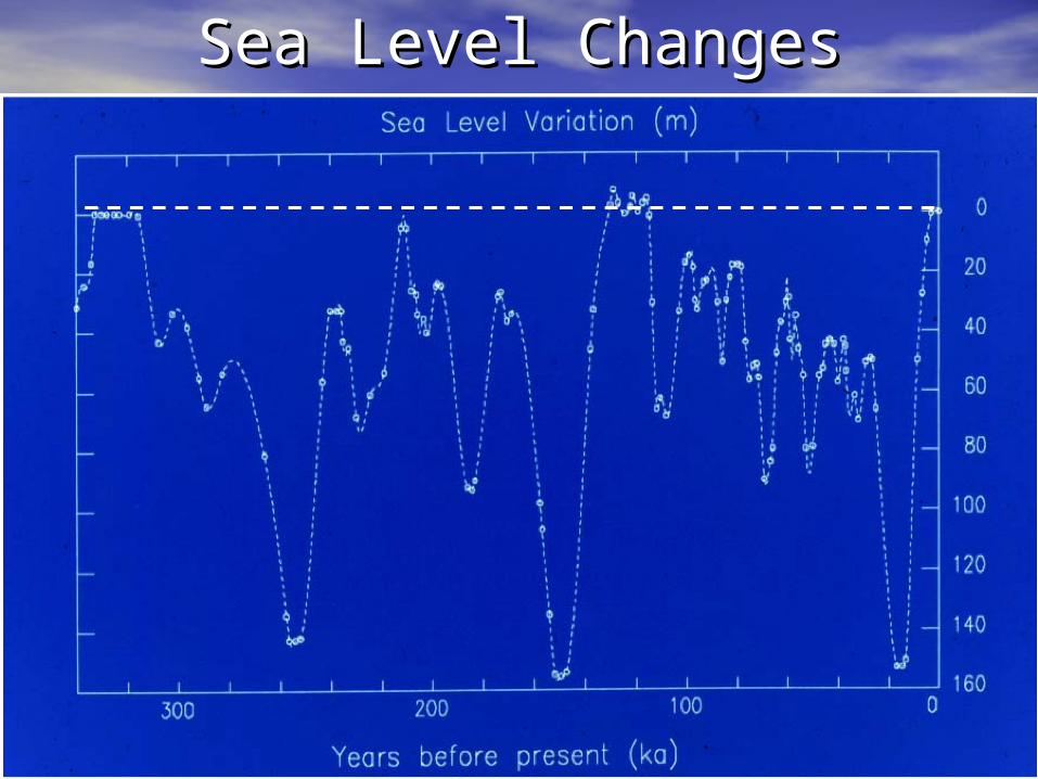
Sea Level ChangesSea Level Changes
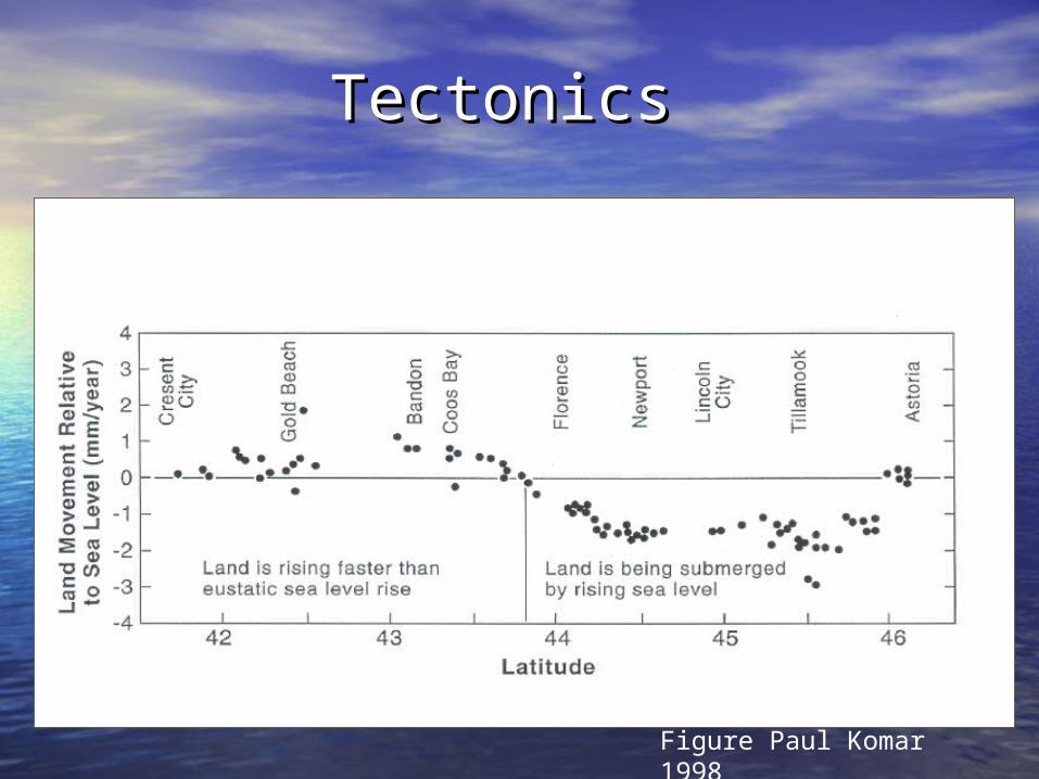
Tectonics Tectonics
Data from Vincent (1989) and Komar (1997)
Figure Paul Komar 1998
Coastal ProcessesCoastal Processes
West CoastWest Coast
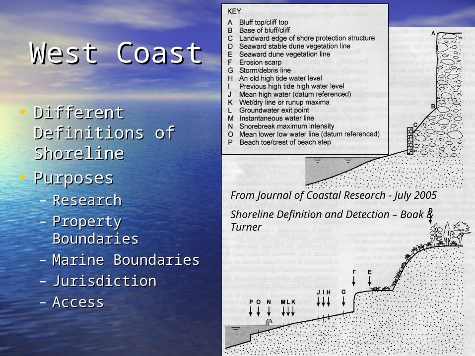
• Different Definitions Different Definitions of Shorelineof Shoreline
• PurposesPurposes– ResearchResearch– Property BoundariesProperty Boundaries– Marine BoundariesMarine Boundaries– JurisdictionJurisdiction– AccessAccess
From Journal of Coastal Research - July 2005
Shoreline Definition and Detection – Boak & Turner
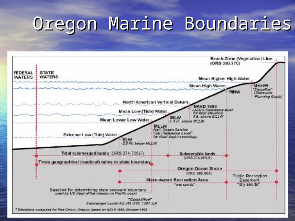
Oregon Marine BoundariesOregon Marine Boundaries
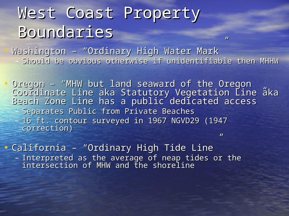
West Coast Property West Coast Property BoundariesBoundaries
• Washington – “Ordinary High Water Mark”Washington – “Ordinary High Water Mark”– Should be obvious otherwise if unidentifiable then MHHWShould be obvious otherwise if unidentifiable then MHHW
• Oregon – “MHW but land seaward of the Oregon Oregon – “MHW but land seaward of the Oregon Coordinate Line aka Statutory Vegetation Line aka Coordinate Line aka Statutory Vegetation Line aka Beach Zone Line has a public dedicated access”Beach Zone Line has a public dedicated access”– Separates Public from Private Beaches Separates Public from Private Beaches – 16 ft. contour surveyed in 1967 NGVD29 (1947 16 ft. contour surveyed in 1967 NGVD29 (1947
correction)correction)
• California – “Ordinary High Tide Line”California – “Ordinary High Tide Line”– Interpreted as the average of neap tides or the Interpreted as the average of neap tides or the
intersection of MHW and the shorelineintersection of MHW and the shoreline
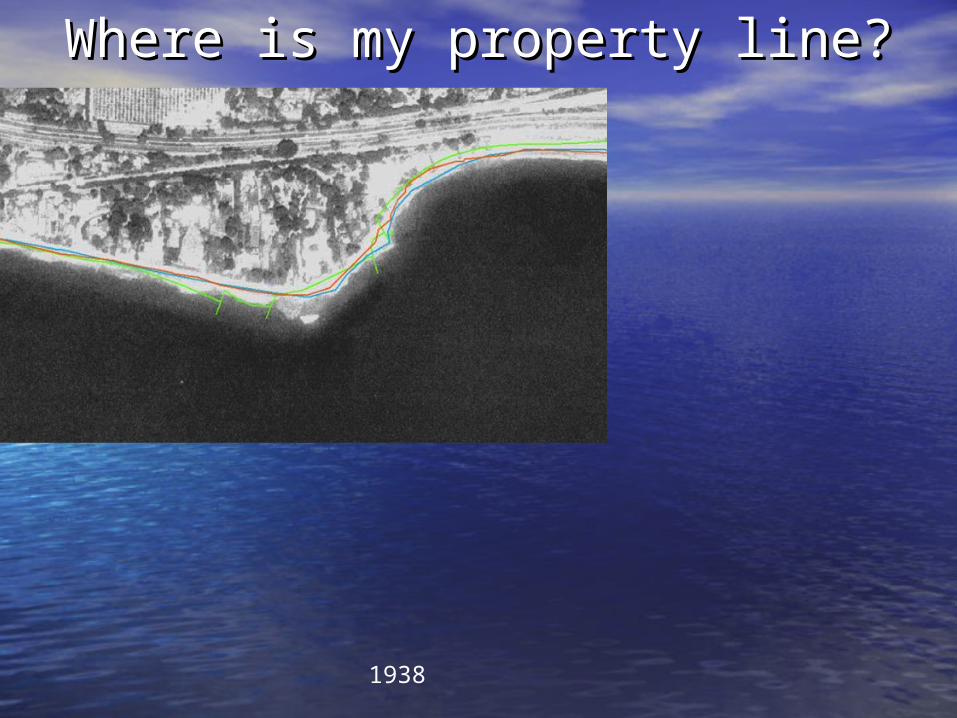
Where is my property line?Where is my property line?
1938
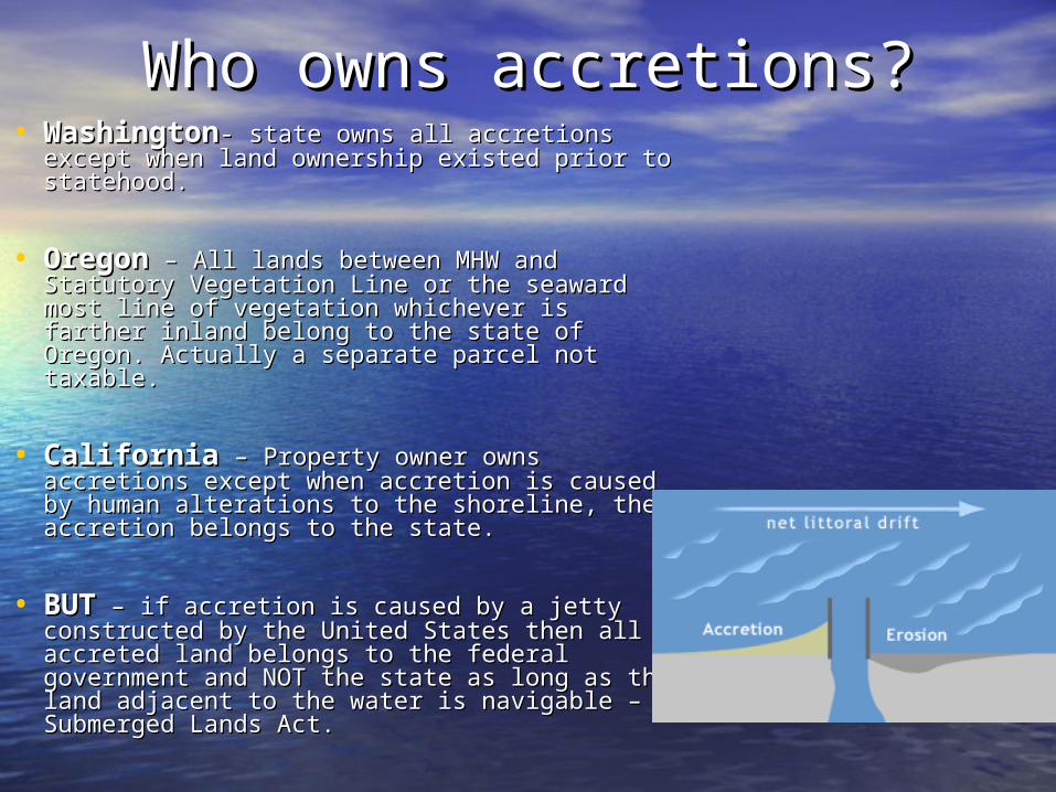
Who owns accretions?Who owns accretions?• WashingtonWashington- state owns all accretions - state owns all accretions
except when land ownership existed prior to except when land ownership existed prior to statehood.statehood.
• OregonOregon – All lands between MHW and – All lands between MHW and Statutory Vegetation Line or the seaward most Statutory Vegetation Line or the seaward most line of vegetation whichever is farther inland line of vegetation whichever is farther inland belong to the state of Oregon. Actually a belong to the state of Oregon. Actually a separate parcel not taxable.separate parcel not taxable.
• CaliforniaCalifornia – Property owner owns – Property owner owns accretions except when accretion is caused by accretions except when accretion is caused by human alterations to the shoreline, then human alterations to the shoreline, then accretion belongs to the state.accretion belongs to the state.
• BUTBUT – if accretion is caused by a jetty – if accretion is caused by a jetty constructed by the United States then all constructed by the United States then all accreted land belongs to the federal accreted land belongs to the federal government and NOT the state as long as the government and NOT the state as long as the land adjacent to the water is navigable – land adjacent to the water is navigable – Submerged Lands Act.Submerged Lands Act.
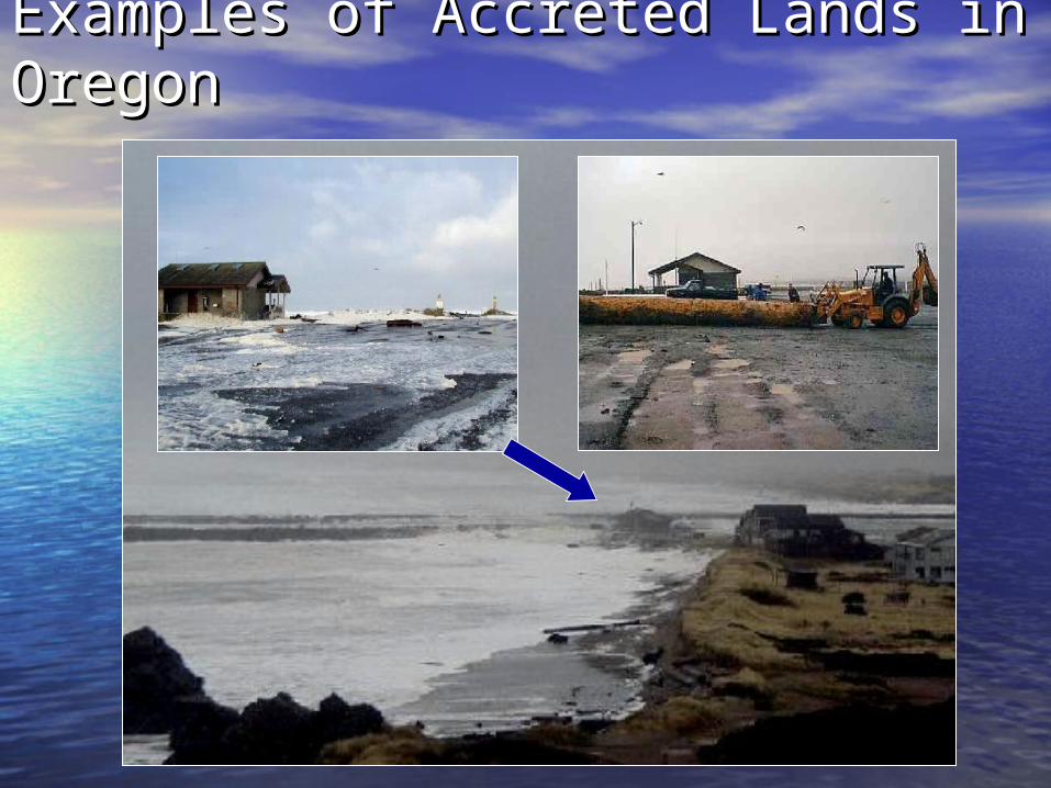
Examples of Accreted Lands in Examples of Accreted Lands in OregonOregon
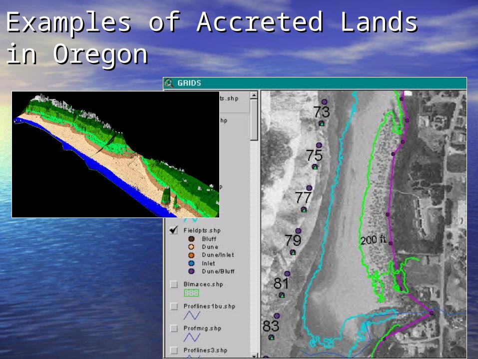
Examples of Accreted Lands in Examples of Accreted Lands in OregonOregon
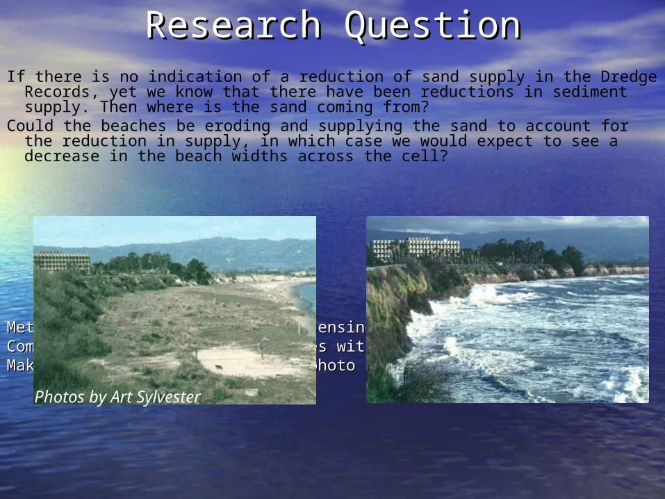
Research QuestionResearch QuestionIf there is no indication of a reduction of sand supply in the Dredge Records, yet
we know that there have been reductions in sediment supply. Then where is the sand coming from?
Could the beaches be eroding and supplying the sand to account for the reduction in supply, in which case we would expect to see a decrease in the beach widths across the cell?
Methods –photogrammetry, remote sensing, and field mapping.Methods –photogrammetry, remote sensing, and field mapping.Combine Air Photo based shorelines with datum based shorelinesCombine Air Photo based shorelines with datum based shorelinesMake water level adjustments to photo based shorelinesMake water level adjustments to photo based shorelines
Photos by Art Sylvester
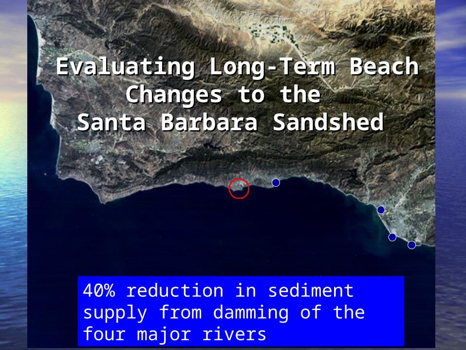
Evaluating Long-Term Beach Evaluating Long-Term Beach Changes to the Changes to the
Santa Barbara Sandshed Santa Barbara Sandshed
40% reduction in sediment supply from damming of the four major rivers
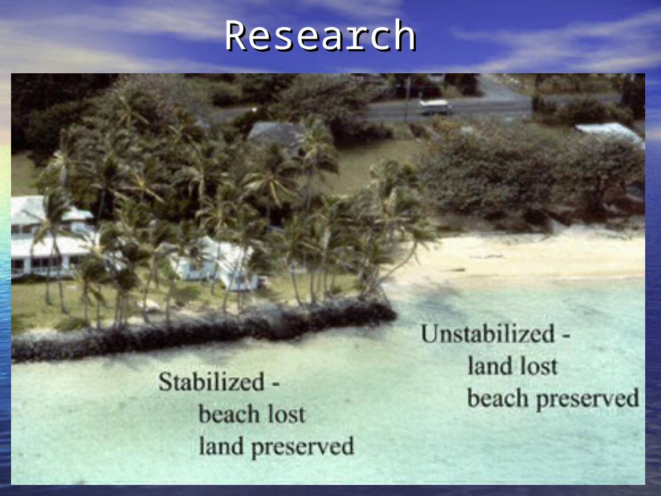
ResearchResearch