surveying - t. baker smith
TRANSCRIPT
+ Hydrographic & Geophysical Surveying- High Resolution Multi-beam Survey - Pre & Post Dredge Survey - Dock & Salvage Inspection - Search & Rescue Survey- Navigable Waterway Crossing Inspection- Pipeline Pre-Lay & Route Survey- Shallow Hazards Survey- Pipeline Inspection- Archaeological Resource Survey- Habitat and Seafloor Classification Survey- Near Shore & Beach Approach Hydrographic Survey- Site Assessments
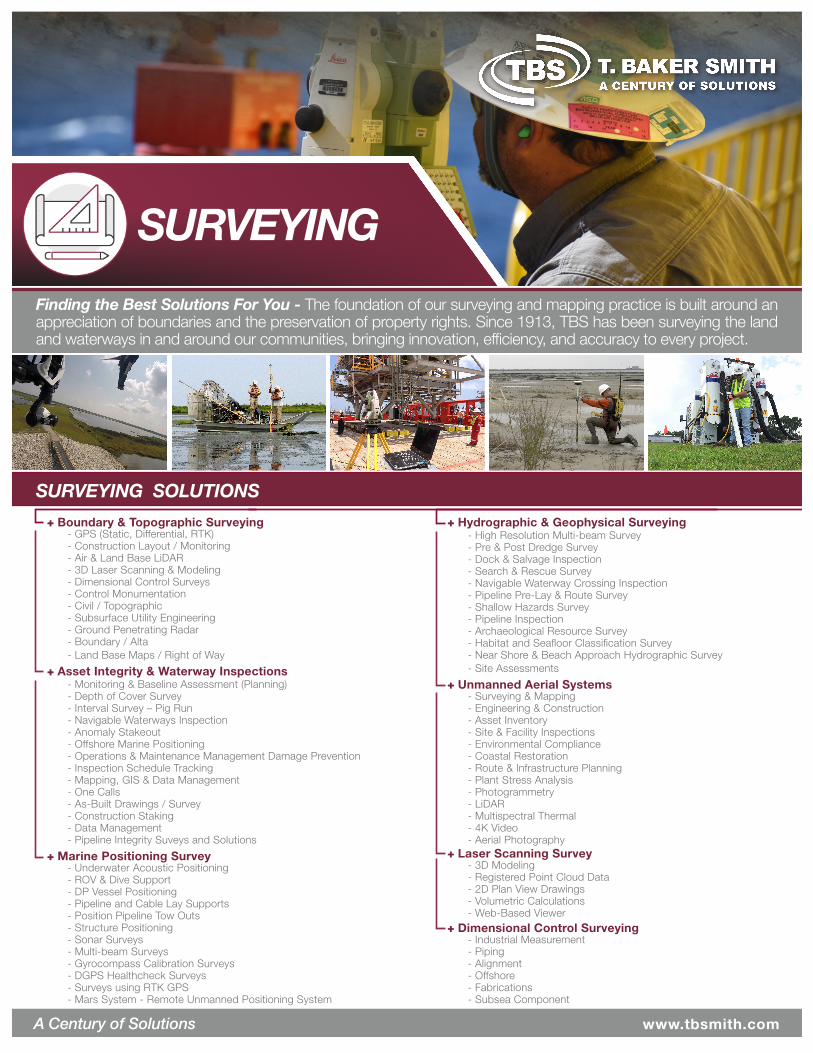
Finding the Best Solutions For You - The foundation of our surveying and mapping practice is built around an appreciation of boundaries and the preservation of property rights. Since 1913, TBS has been surveying the land and waterways in and around our communities, bringing innovation, efficiency, and accuracy to every project.
SURVEYING
A Century of Solutions www.tbsmith.com
+ Boundary & Topographic Surveying
SURVEYING SOLUTIONS
- GPS (Static, Differential, RTK) - Construction Layout / Monitoring - Air & Land Base LiDAR - 3D Laser Scanning & Modeling - Dimensional Control Surveys - Control Monumentation - Civil / Topographic - Subsurface Utility Engineering - Ground Penetrating Radar - Boundary / Alta - Land Base Maps / Right of Way
+ Asset Integrity & Waterway Inspections- Monitoring & Baseline Assessment (Planning) - Depth of Cover Survey - Interval Survey – Pig Run - Navigable Waterways Inspection- Anomaly Stakeout - Offshore Marine Positioning - Operations & Maintenance Management Damage Prevention - Inspection Schedule Tracking - Mapping, GIS & Data Management- One Calls - As-Built Drawings / Survey- Construction Staking- Data Management- Pipeline Integrity Suveys and Solutions
+ Unmanned Aerial Systems- Surveying & Mapping- Engineering & Construction- Asset Inventory- Site & Facility Inspections- Environmental Compliance- Coastal Restoration- Route & Infrastructure Planning- Plant Stress Analysis- Photogrammetry- LiDAR- Multispectral Thermal- 4K Video- Aerial Photography
+ Marine Positioning Survey- Underwater Acoustic Positioning- ROV & Dive Support- DP Vessel Positioning- Pipeline and Cable Lay Supports- Position Pipeline Tow Outs- Structure Positioning- Sonar Surveys- Multi-beam Surveys- Gyrocompass Calibration Surveys- DGPS Healthcheck Surveys- Surveys using RTK GPS- Mars System - Remote Unmanned Positioning System
+ Laser Scanning Survey- 3D Modeling- Registered Point Cloud Data- 2D Plan View Drawings - Volumetric Calculations- Web-Based Viewer
+ Dimensional Control Surveying- Industrial Measurement- Piping- Alignment - Offshore- Fabrications- Subsea Component
SURVEYING
EXPERIENCE
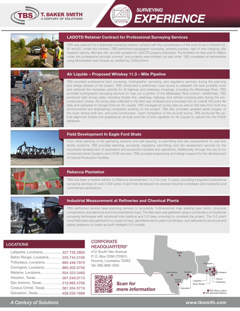
TBS was selected for a statewide surveying retainer contract with the concentration of the work to be in Districts 02, 61 and 62. Under this contract, TBS performed topographic surveying, property surveys, right of way mapping, title research reports, title take offs, and title updates for LADOTD projects statewide. The limitation for fees was $1 Million under this professional services contract, and projects were initiated via task order. TBS completed all deliverables using Microstation and Inroads as certified by CADconform.
TBS provided professional land surveying, hydrographic surveying, and regulatory services during the planning and design phases of the project. TBS conducted a preliminary route survey to establish the best possible route and obtained the necessary permits for all highway and waterway crossings, including the Mississippi River. TBS provided hydrographic surveying services to map out a portion of the Mississippi River bottom. Additionally, TBS produced right-of-way plats, including foreign line, waterway, highway, and railroad crossing plats during the pre-construction phase. All survey data collected in the field was reviewed and processed into an overall GIS point file daily and uploaded to Google Drive for Air Liquide. TBS managed all survey data as well as GIS data from both the environmental and engineering companies working on the project. TBS also provided updated aerial imagery of the route during both pre- and post-construction. Upon completion of the as-built survey, TBS produced the as-built alignment sheets and prepared an as-built point file of both pipelines for Air Liquide to upload into the PODS database.
From initial planning of the gathering systems and well spacing, to permitting and site assessments for pad and facility locations, TBS provided planning, surveying, regulatory, permitting, and site assessment services for the successful development of exploration and production facilities and operations. Additionally, through the use of our Unmanned Aerial Systems and LIDAR services, TBS provided engineering and design support for the development of Central Production Facilities.
TBS has been a trusted advisor to Rebecca Development, LLC for over 15 years, providing integrated professional surveying services on over 3,500 acres of land that developed into several industrial complexes and residential and commercial subdivisions.
TBS performed several laser-scanning surveys to accurately 3-dimensional map existing pipe racks, structural components, and electrical and instrumentations trays. The field data was gathered using a combination of traditional surveying techniques with advanced total stations and 3-D laser scanning to complete the project. The 3-D point cloud field data was gathered in a couple of days, georeferenced to plant coordinates, and delivered to structural and piping designers to create as-built intelligent 3-D models.
LADOTD Retainer Contract for Professional Surveying Services
Air Liquide – Proposed Whiskey 11.3 – Mile Pipeline
Field Development In Eagle Ford Shale
Rebecca Plantation
Industrial Measurement at Refineries and Chemical Plants
www.tbsmith.comwww.tbsmith.comA Century of Solutions
LOCATIONSCORPORATE HEADQUARTERS*412 South Van AvenueP. O. Box 2266 (70361)Houma, Louisiana 70363Tel: 985.868.1050
Scan formore information
Lafayette, Louisiana.................... Baton Rouge, Louisiana............. Thibodaux, Louisiana................. Covington, Louisiana.................. Metairie, Louisiana...................... Houston, Texas........................... San Antonio, Texas..................... Corpus Christi, Texas.................Galveston, Texas.........................
337.735.2800 225.744.2100 985.446.7970 985.302.0730 504.323.3460 281.240.0113 210.892.4700361.334.5719409.220.1669
Houston
Houma
ThibodauxLafayette
Baton Rouge
Metairie
Covington
Corpus Christi
Dallas
✶
Galveston
San Antonio
✶
TBS Office LocationTBS Associate Presence ✶