surveying i. lecture 1. -...
TRANSCRIPT
Surveying I.
Lecture 1.
Outline
Introduction
Historical Surveying
Surveying - Science and Profession
Methods of height determination
Levelling
The surveyors’ level

Introduction
Course details: • First part of a two-semester-course
• 4 hours/week (equally divided between lectures and practicals)
Communication:• Activities involve lectures, practicals, tutorials and a field practice
• Lectures - provide the theoretical background of the topics
• Practicals - practical sessions, in which You’ll carry out measurements and process them.
• Tutorials - if there’s a need for additional guidance in the preparation for assessments. Please note that You have to arrange an appointment in due time.
• Field practice - a 9-day-long intensive course after the course Surveying II.
Introduction
Attendance:
• Please attend all scheduled lectures, seminars and practicals
• Please note: attendance falling below 70% may lead to failing the course irrespective of the academic performance.

Classroom tests:
• Altogether 4 classroom assessments:• Practicals 1-4 (10 points)• Using a theodolite – must pass• Practicals 10-11 (10 points)• Theory (involving the topics of the lectures) – 80 points
Introduction
Course Evaluation:Excellent (5) 87-99 good (4) 75-87 satisfactory (3) 62-74 pass (2) 50-61 fail (1) 0-49
You’re required to achieve a minimum of 50% in each classrom test to pass the course.
Introduction
Learning resources:
• Some of the lecture notes are available for download on the website of the department:
http://www.geod.bme.hu/index_e.html
• However You shall write own notes during the lectures, too.
• You’ll be suplied with computational sheets, field notes etc. during the course.
• Textbook:
A. Bannister - S. Raymond - R. Baker: Surveying (Seventh Edition, Prentice Hall, 1998)
Cca. 16000 HUF

Website
Lecture notes can be downloaded from:
http://www.geod.bme.hu/index_e.html

Website
Outline
Introduction
Historical Surveying
Surveying - Science and Profession
Methods of height determination
Levelling
The surveyors’ level
Historical Surveying
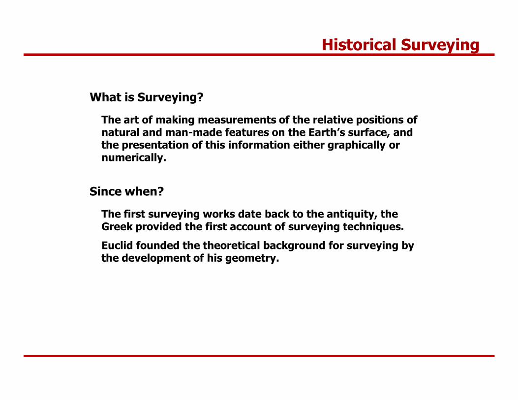
What is Surveying?
The art of making measurements of the relative positions of natural and man-made features on the Earth’s surface, and the presentation of this information either graphically or numerically.
Since when?
The first surveying works date back to the antiquity, the Greek provided the first account of surveying techniques.
Euclid founded the theoretical background for surveying by the development of his geometry.

Historical Surveying
Eratosthenes (ca. 250 BC)
„Spherical Earth”

Historical Surveying
Outline
Introduction
Historical Surveying
Surveying - Science and Profession
Methods of height determination
Levelling
The surveyors’ level
Surveying - Science and Profession
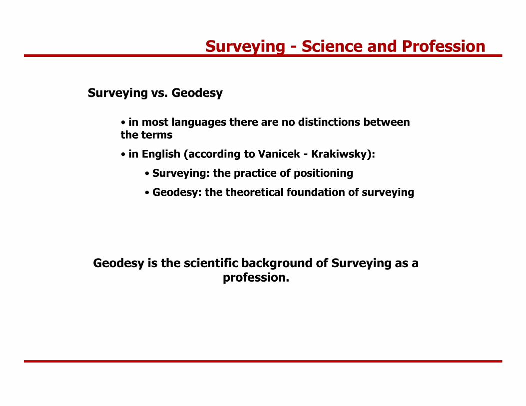
Surveying vs. Geodesy
• in most languages there are no distinctions between the terms
• in English (according to Vanicek - Krakiwsky):
• Surveying: the practice of positioning
• Geodesy: the theoretical foundation of surveying
Geodesy is the scientific background of Surveying as a profession.
Surveying - Science and Profession
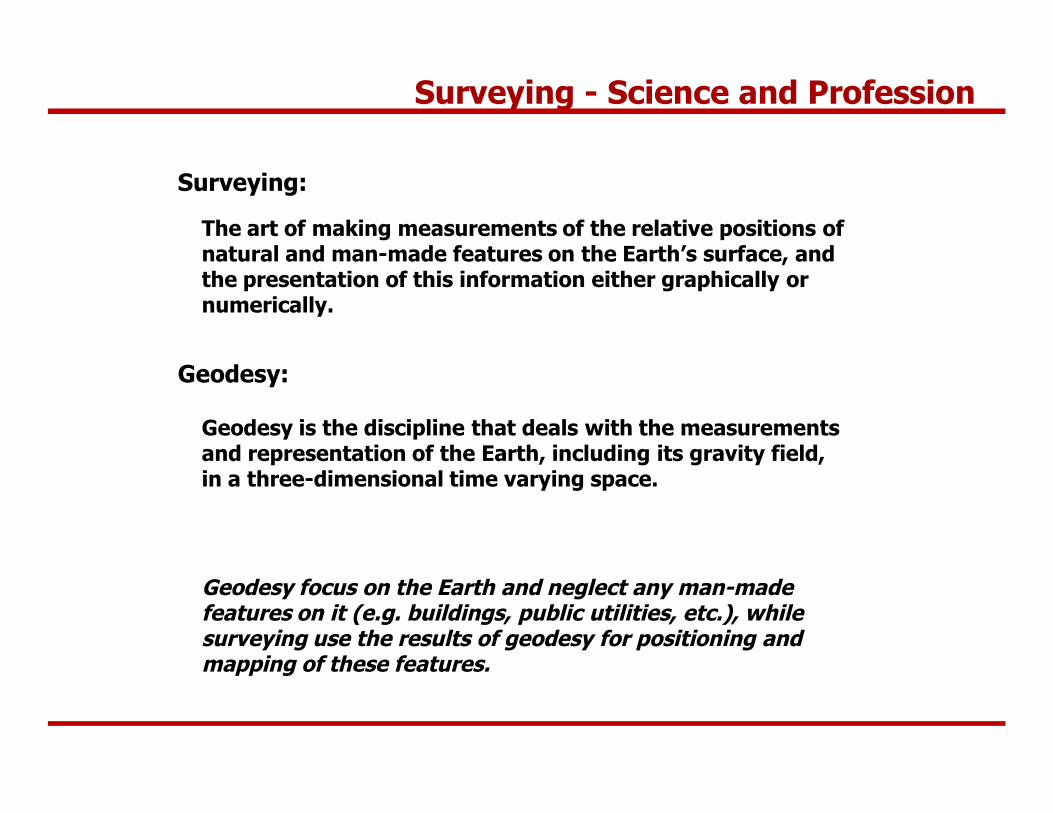
The art of making measurements of the relative positions of natural and man-made features on the Earth’s surface, and the presentation of this information either graphically or numerically.
Surveying:
Geodesy:
Geodesy is the discipline that deals with the measurements and representation of the Earth, including its gravity field, in a three-dimensional time varying space.
Geodesy focus on the Earth and neglect any man-made features on it (e.g. buildings, public utilities, etc.), while surveying use the results of geodesy for positioning and mapping of these features.
How to achieve this?
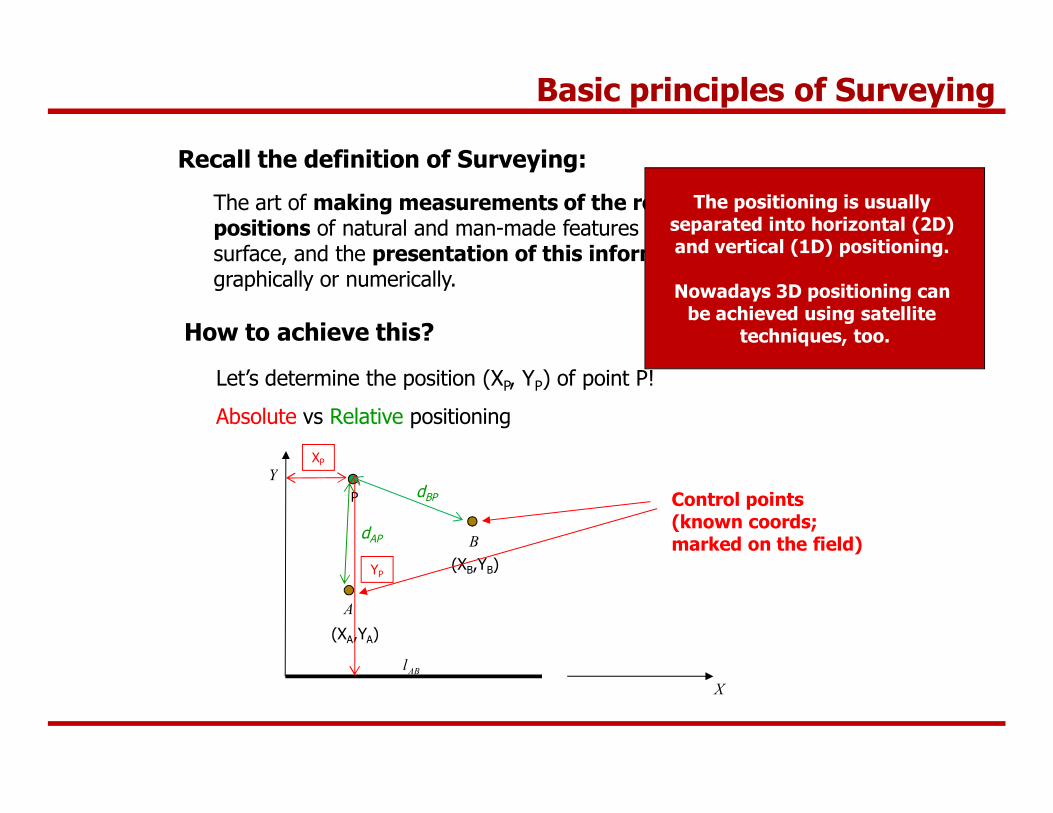
Recall the definition of Surveying:
The art of making measurements of the relative positions of natural and man-made features on the Earth’s surface, and the presentation of this information either graphically or numerically.
Let’s determine the position (XP, YP) of point P!
Absolute vs Relative positioning
A
B
X
Y
ABl
The positioning is usually separated into horizontal (2D) and vertical (1D) positioning.
Nowadays 3D positioning can be achieved using satellite
techniques, too.
(XA,YA)
(XB,YB)
P
XP
YP
dBP
dAP
Control points(known coords;marked on the field)
Basic principles of Surveying
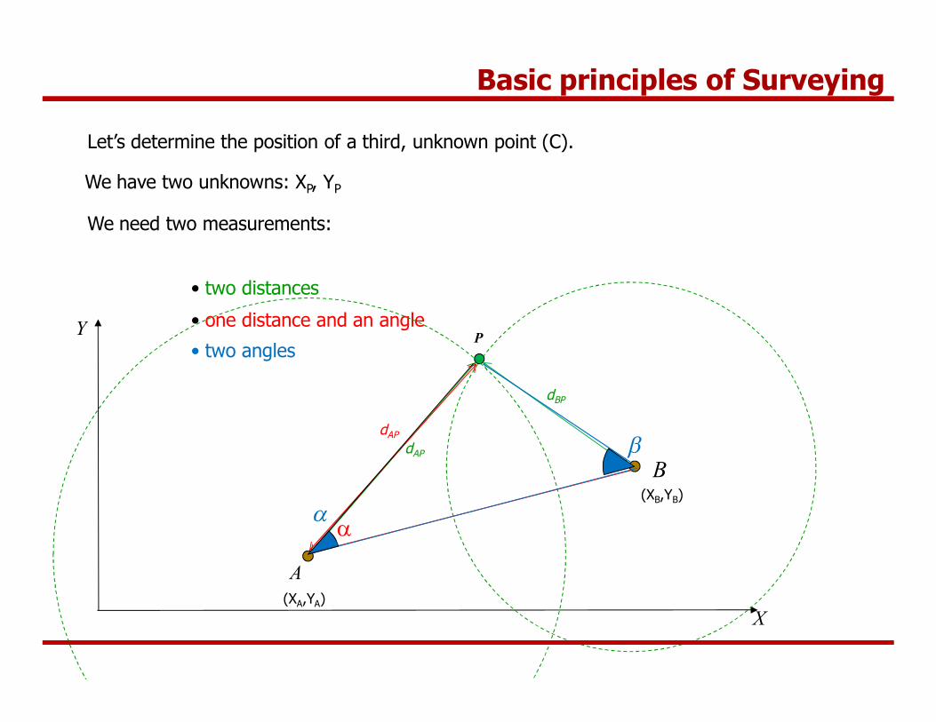
Let’s determine the position of a third, unknown point (C).
We have two unknowns: XP, YP
We need two measurements:
• two distances
• one distance and an angle
• two angles
A
B
X
Y
(XA,YA)
(XB,YB)
P
dBP
dAP
dAP
a
a
b
Basic principles of Surveying
a
b
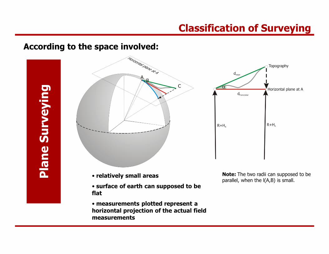
Classification of Surveying
According to the space involved:
• relatively small areas
• surface of earth can supposed to be flat
• measurements plotted represent a horizontal projection of the actual field measurements
Note: The two radii can supposed to be parallel, when the l(A,B) is small.
Pla
ne
Surv
eyin
g
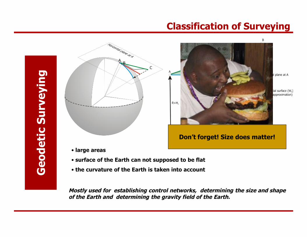
Classification of Surveying
Geo
deti
c Su
rvey
ing
• large areas
• surface of the Earth can not supposed to be flat
• the curvature of the Earth is taken into account
Mostly used for establishing control networks, determining the size and shape of the Earth and determining the gravity field of the Earth.
Don’t forget! Size does matter!
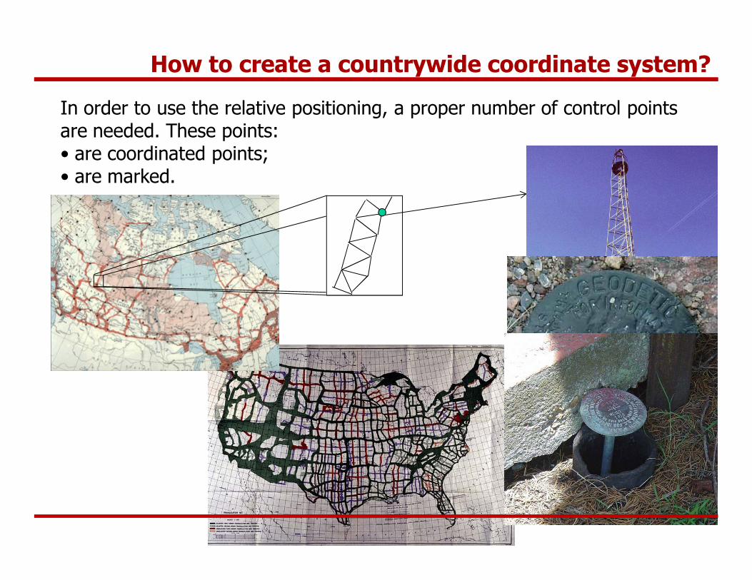
In order to use the relative positioning, a proper number of control points are needed. These points:• are coordinated points;• are marked.
How to create a countrywide coordinate system?

Control Networks
Why is it necessary to have a common countrywide coordinate system?
Many engineering tasks cover a large area (highways, bridges, tunnels, channels, land registry, etc.), where the common coordinate system (reference system) should be available.
The Control Network provide us with control points given in the same refence system (coordinate system).
Thus measuring the relative positions of unknown points using these control points, the coordinates of the new points can be computed in the same reference system.

The role of Surveying in Civil Engineering Practice
Surveyors are needed:
• to maintain the geometric order during the construction process
What is this?
Laying them in the appropriate geometry, outstanding structures can be created!
Wrong geometry – the structure is not functional!
• to provide fundamental data for the design and planning process
• to provide quantity control during the construction process (for example: earthwork quantities)
• to monitor the structure after the construction (subsidence, deformations, etc.)

Surveying activities during the construction process
Before Construction Under construction After construction
Planning anddata collection
Observationsin the field
Processing theobservations
(office)
Drawing maps, plans or providing
numerical data
Presentingdocumentation
to the client
Setting out on eachphase
of construction
Field checks ofconstruction
Providing dataand services to
the client
Final (as-built)plan or map
on the construction
Presenting documentation
to the client
The role of Surveying in Civil Engineering Practice
Deformation Monitoring/Load Tests
Outline
Introduction
Historical Surveying
Surveying - Science and Profession
Methods of height determination
Levelling
The surveyors’ level

Methods of height determination
Question 1:What does the height (elevation) of a point mean?
Question 2:What does it mean, when point B is at a higher elevation than point A?
Answer 1:The height of a point represents its energy level above a reference level.
Answer 2:For example water flows from point B to point A.
Methods of height determination
Definition of height systems:
• The potential energy of a point should be represented by the height of a point. Hence water should flow from the higher elevation towards the lower elevation.
• Should have metric unit.
What should be the reference of height determination? What is the 0 level?
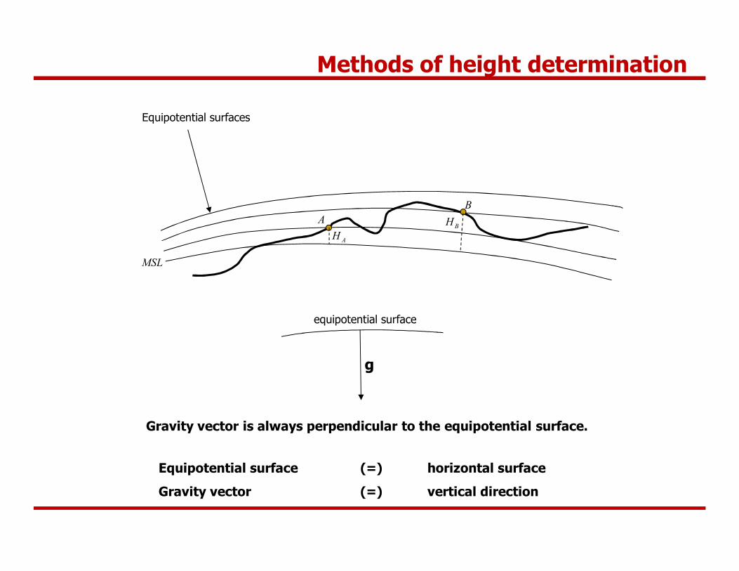
• Since the height systems should represent the potential energy level, we need a reference surface, which is an equipotential surface of Earth’s gravity field.
• The surface of calm water forms an equipotential surface
• Mean Sea Level – Kronstadt (Baltic Sea) is used in Hungary (formerly Triest, Adriatic Sea).
Methods of height determination
MSL
AB
AHBH
Equipotential surfaces
Equipotential surface (=) horizontal surface
Gravity vector (=) vertical direction
Gravity vector is always perpendicular to the equipotential surface.
g
equipotential surface
Methods of height determination
A
B
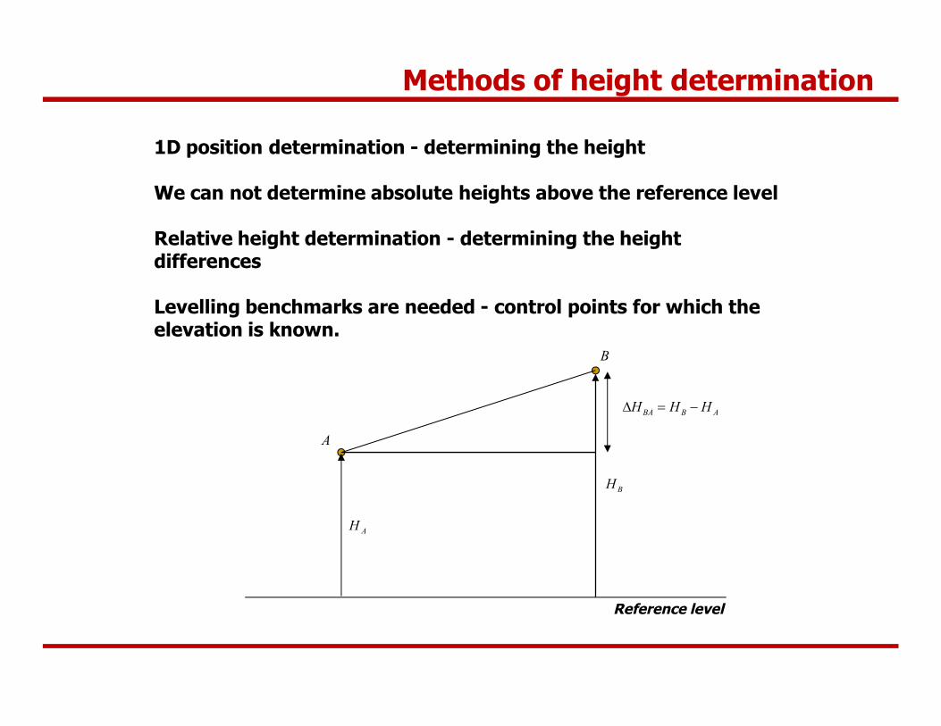
1D position determination - determining the height
We can not determine absolute heights above the reference level
Relative height determination - determining the height differences
Levelling benchmarks are needed - control points for which the elevation is known.
Reference level
AH
BH
ABBA HHH

A
B
Reference level
AH
BH
ABBA HHH
Methods of height determination
• measuring the slope and slope distance between the points
Levelling
a
ABl
Trigonometrical height determination
How can we determine the height difference?
Two solutions:
• setting a horizontal plane, and measuring the offset from this plane
1

Outline
Introduction
Historical Surveying
Surveying - Science and Profession
Methods of height determination
Levelling
The surveyors’ level

The principle of levelling
A
B
(lA)
(lB)
dA
DHAB
lA
dB
lB
DHAB=lA-lB=(lA)-dA-(lB)+dB
When dA=dB (spherical approximation, equal distance to A and B)
DHAB=(lA)-(lB)
Line of sight
Levelling
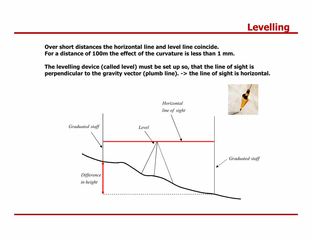
Over short distances the horizontal line and level line coincide.For a distance of 100m the effect of the curvature is less than 1 mm.
The levelling device (called level) must be set up so, that the line of sight is perpendicular to the gravity vector (plumb line). -> the line of sight is horizontal.
sightoflineHorizontal
heightinDifference
staffGraduated
staffGraduated Level
Levelling
Outline
Introduction
Historical Surveying
Surveying - Science and Profession
Methods of height determination
Levelling
The surveyors’ level
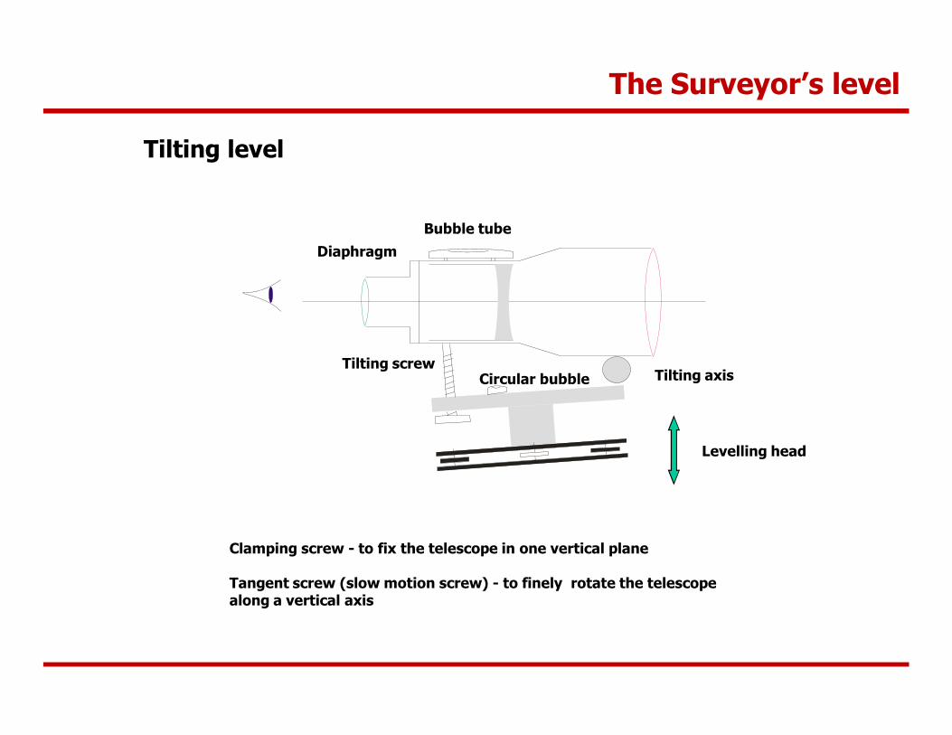
The Surveyor’s level
Tilting level
Levelling head
Tilting screw
DiaphragmBubble tube
Tilting axis
Clamping screw - to fix the telescope in one vertical plane
Tangent screw (slow motion screw) - to finely rotate the telescope along a vertical axis
Circular bubble
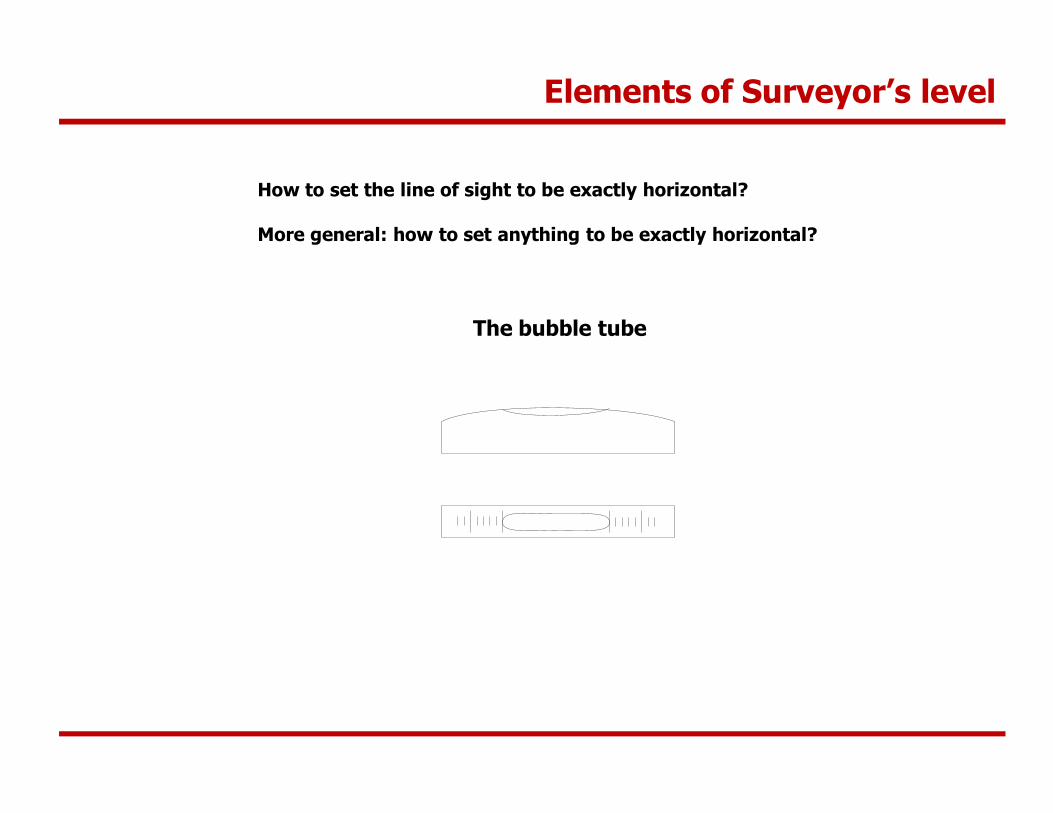
Elements of Surveyor’s level
How to set the line of sight to be exactly horizontal?
More general: how to set anything to be exactly horizontal?
The bubble tube
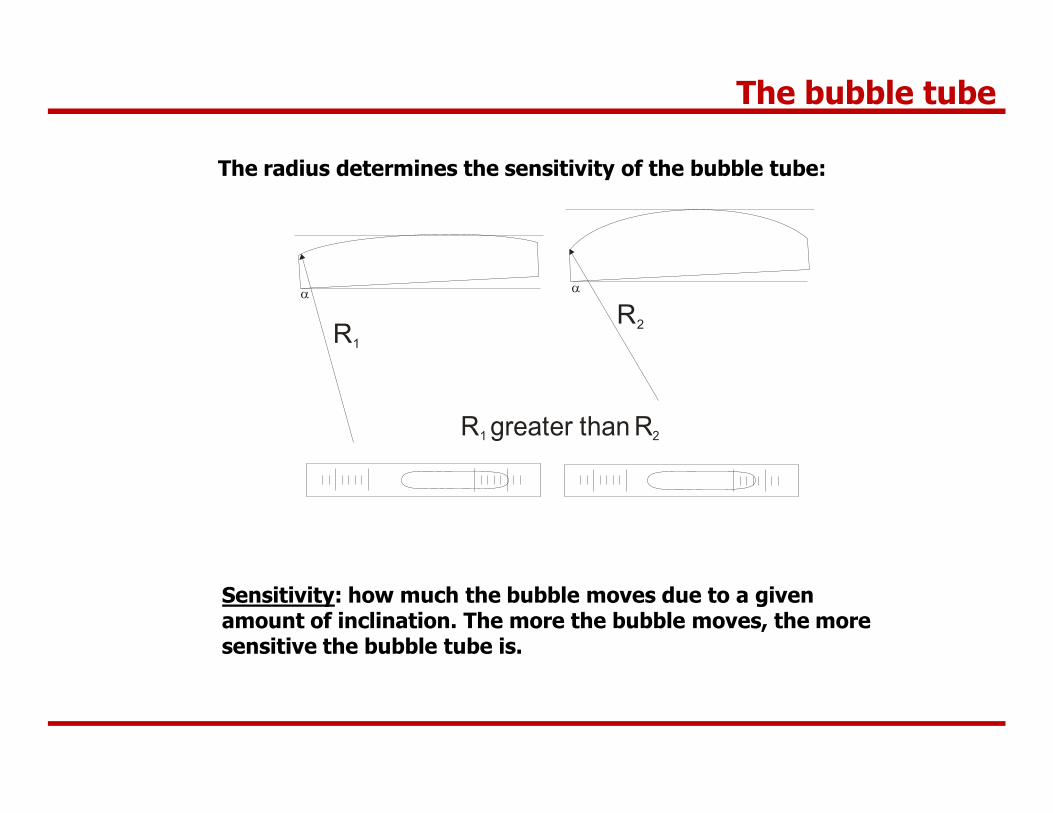
The bubble tube
The radius determines the sensitivity of the bubble tube:
R2R1
a a
R greater than R1 2
Sensitivity: how much the bubble moves due to a given amount of inclination. The more the bubble moves, the more sensitive the bubble tube is.
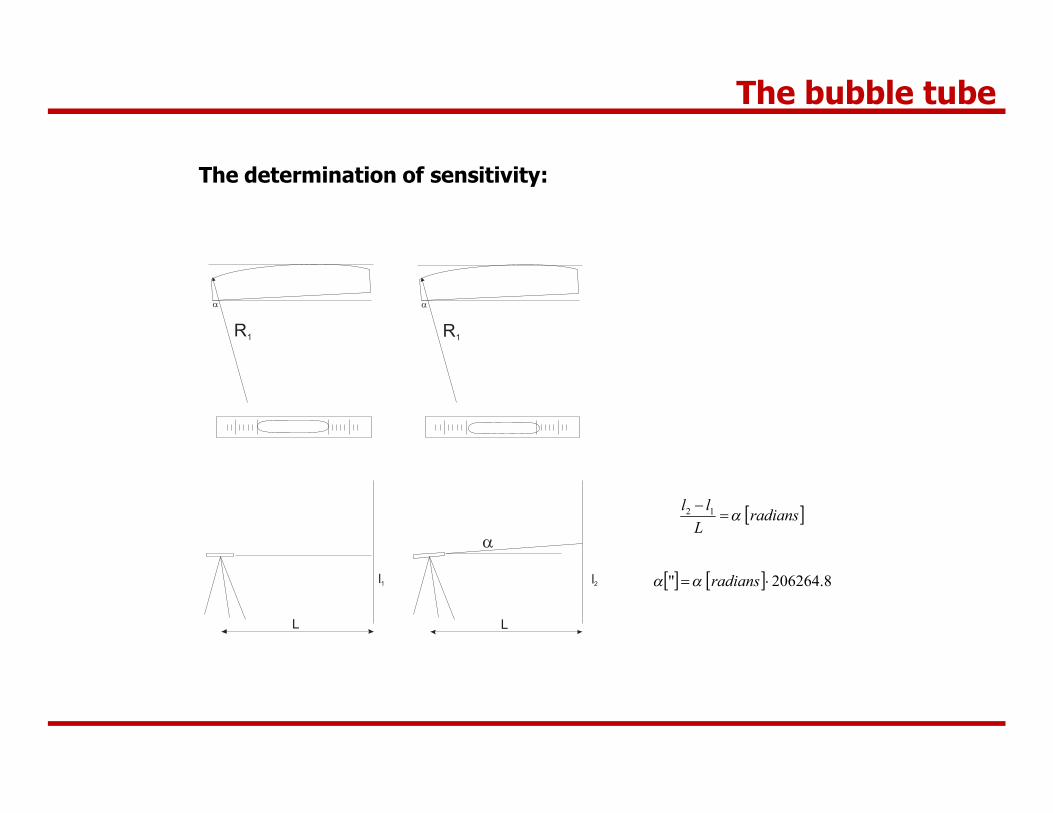
The bubble tube
The determination of sensitivity:
R1
a
L
l1
R1
a
L
l2
a radians
Lll
a 12
8.206264" radiansaa