survey123 for arcgis: an introduction - sched · survey123 for arcgis: an introduction mark scott,...
TRANSCRIPT
Survey123 for ArcGIS: An IntroductionMark Scott, Solutions engineer, Esri-Northeast
Local Government Team
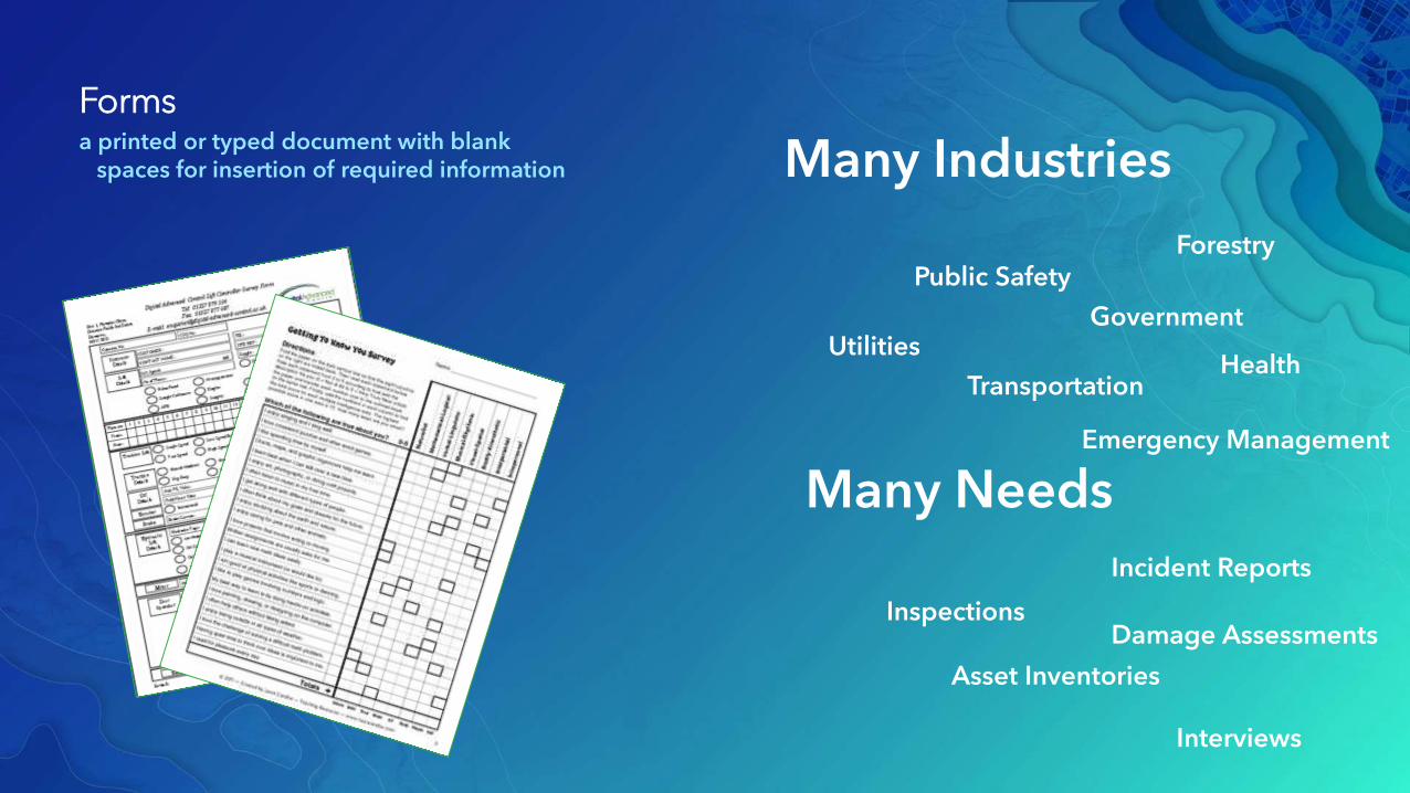
Formsa printed or typed document with blank
spaces for insertion of required information
Inspections
Asset Inventories
Incident Reports
Interviews
Damage Assessments
Many Needs
Many Industries
Utilities
Transportation
Government
Health
Emergency Management
Public SafetyForestry

Smart Forms for ArcGISEasily convert paper forms into Digital Smart ArcGIS Forms

Why Smart Forms in ArcGIS?
• Reduce Errors
• During Data Capture
• Transcribing data from paper to digital
• Boost Field Data Capture productivity
• Precompute responses
• Associate photos with alphanumeric data
• Data: From the field to the office in Real Time
• All data captured is georeferenced


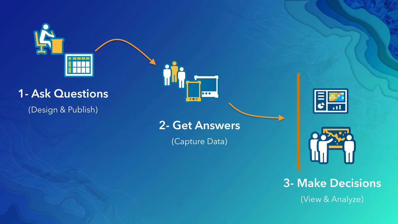
1- Ask Questions
(Design & Publish)
2- Get Answers
(Capture Data)
3- Make Decisions
(View & Analyze)

1: Ask Questions (Tools for authoring your surveys)
• Survey123 Web Designer:
- Build smart forms graphically right from your web browser
- Very easy to get started.
- Ideal for simple forms
• Survey123 Connect:
- A downloadable desktop tool. Works in combination with Microsoft Excel.
- Requires learning and familiarity with XLSForms specification
- Complete smart form capabilities
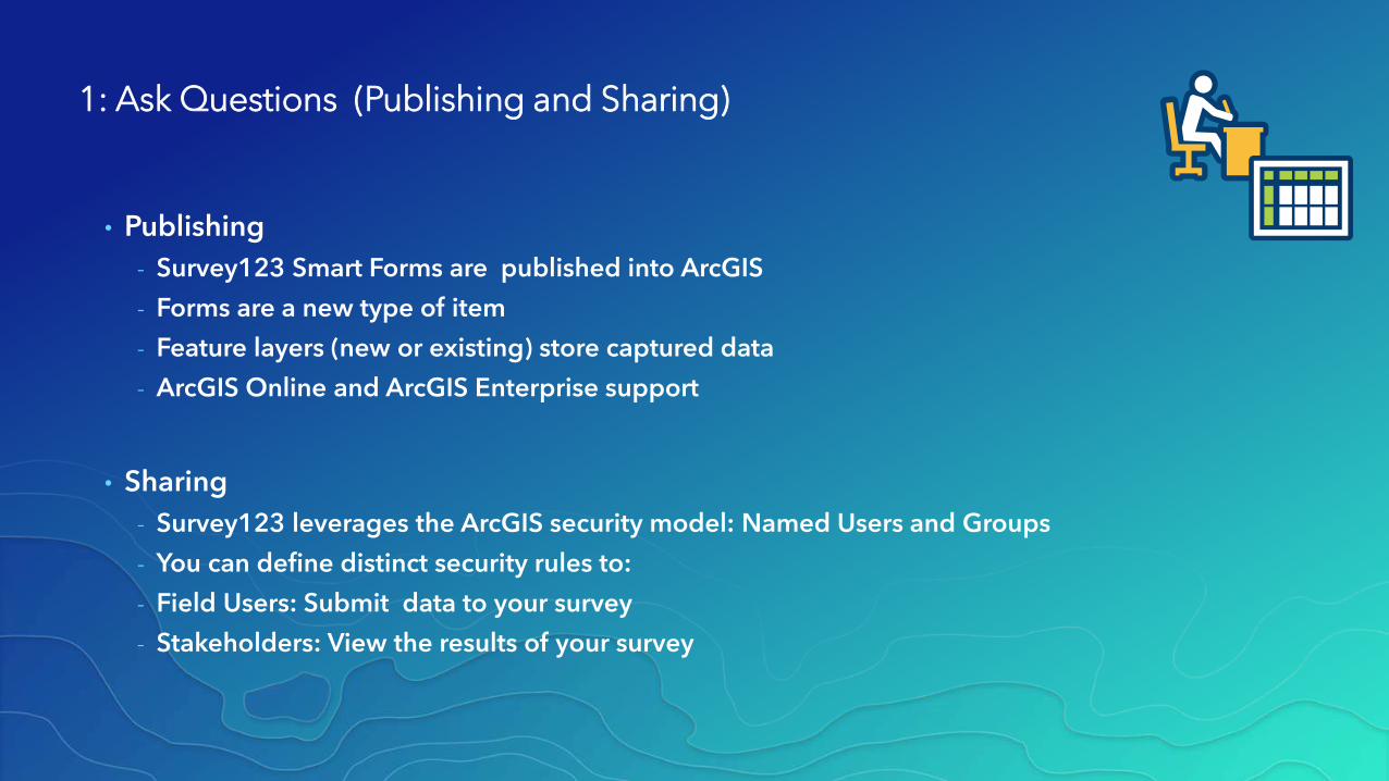
1: Ask Questions (Publishing and Sharing)
• Publishing
- Survey123 Smart Forms are published into ArcGIS
- Forms are a new type of item
- Feature layers (new or existing) store captured data
- ArcGIS Online and ArcGIS Enterprise support
• Sharing
- Survey123 leverages the ArcGIS security model: Named Users and Groups
- You can define distinct security rules to:
- Field Users: Submit data to your survey
- Stakeholders: View the results of your survey
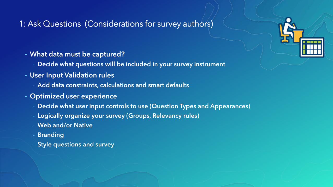
1: Ask Questions (Considerations for survey authors)
• What data must be captured?
- Decide what questions will be included in your survey instrument
• User Input Validation rules
- Add data constraints, calculations and smart defaults
• Optimized user experience
- Decide what user input controls to use (Question Types and Appearances)
- Logically organize your survey (Groups, Relevancy rules)
- Web and/or Native
- Branding
- Style questions and survey
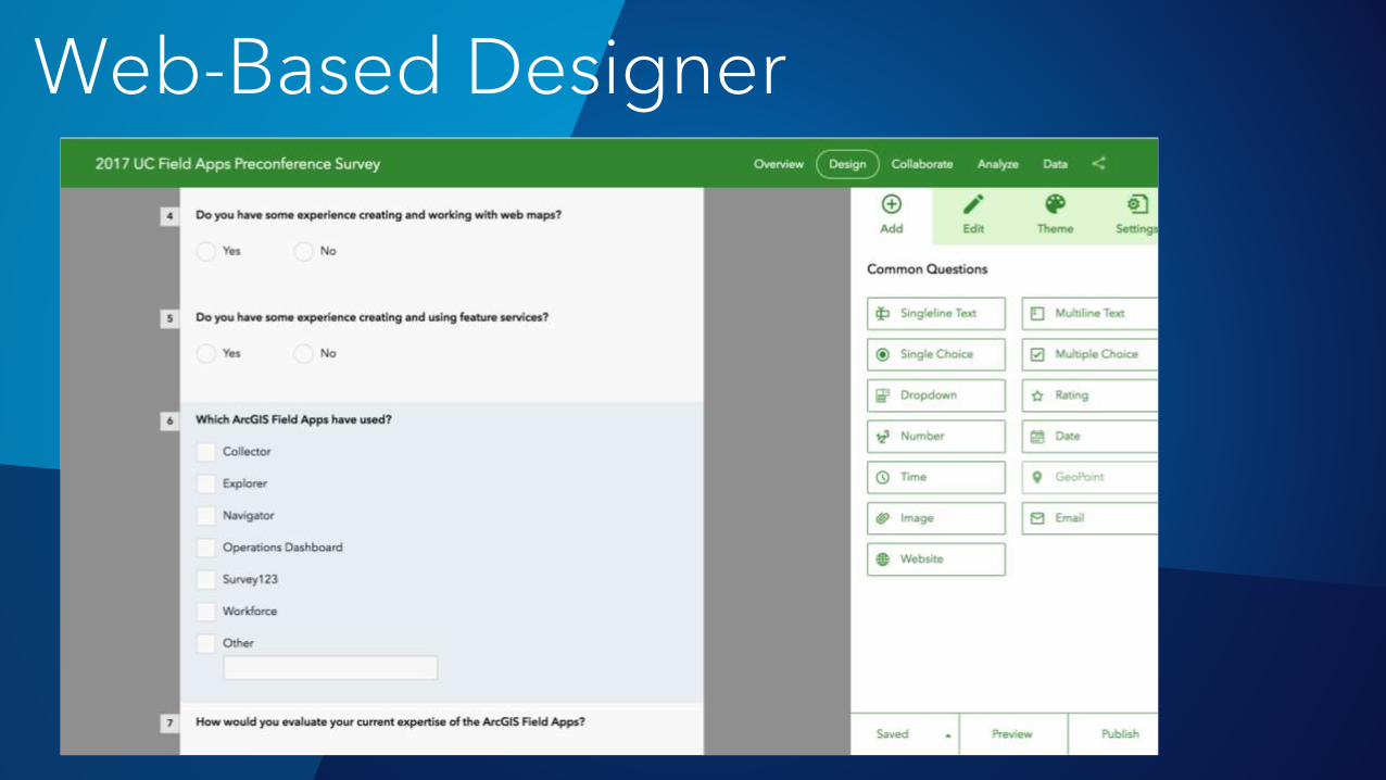
Web-Based Designer
1- Ask Questions
(Design & Publish)
2- Get Answers
(Capture Data)
3- Make Decisions
(View & Analyze)

2: Get Answers
• Survey123 WebForms
- Capture data from a web browser. Can be embedded within a web site.
- Nothing to install.
- Online only. Add new data only.
• Survey123 Field App
- Available for download (Google Play,iOS, Windows, Mac)Leverage device sensors (external GPS, camera etc)
- Can work Online and Offline
- Can add new data and update existing features.
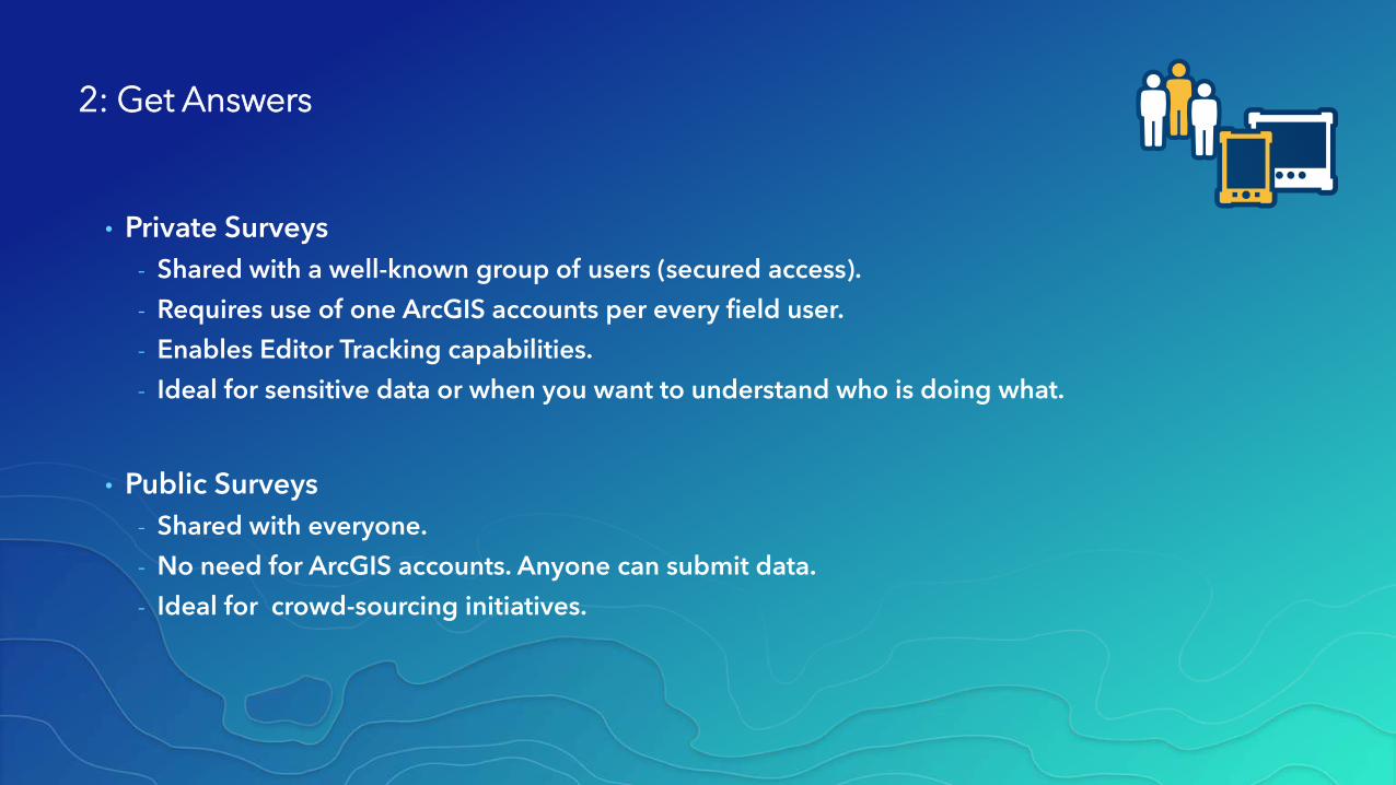
2: Get Answers
• Private Surveys
- Shared with a well-known group of users (secured access).
- Requires use of one ArcGIS accounts per every field user.
- Enables Editor Tracking capabilities.
- Ideal for sensitive data or when you want to understand who is doing what.
• Public Surveys
- Shared with everyone.
- No need for ArcGIS accounts. Anyone can submit data.
- Ideal for crowd-sourcing initiatives.

Survey123 Field App

1- Ask Questions
(Design & Publish)
2- Get Answers
(Capture Data)
3- Make Decisions
(View & Analyze)

3: Make Decisions
• Ready to use Reporting tools
- Understand data submission patterns
- Create detailed survey reports
- Aggregate survey data
- Selectively download data

ArcGIS
Operations Dashboardfor ArcGIS
Insights for ArcGIS
Story Mapsfor ArcGIS
Web AppBuilder
for ArcGISSurvey123 for
ArcGIS
Visualization
Analysis
QA/QC
Decisions at a Glance
3: Make Decisions
• Real-Time data collection
- Survey123 submitted data is immediately available for visualization and analysis
• All data stored in ArcGIS Feature Services
• Multiple Uses of data

Survey Data & Results

1- Ask Questions
(Design & Publish)
2- Get Answers
(Capture Data)
3- Make Decisions
(View & Analyze)


Survey 123 Demonstrations

Survey123 User Forum in GeoNet
https://geonet.esri.com/groups/survey123

Survey123 Blog in GeoNet
https://geonet.esri.com/groups/survey123/blog

YouTube Survey123 PlaylistArcGIS Channel
https://survey123.arcgis.com/YouTubePlaylist