subjective collective atlas nele bergmans
DESCRIPTION
DALE context and spacesTRANSCRIPT

Nele Bergmans
Subjective collective atlas
DALE context and space(s)
spring 2016


PUZZLE
Dale
Elad
Lade
Edal
Aled
Dela
The valley is a puzzle wich can we interpreted in a lot
of diff erent ways. Every pair of eyes, every other mind,
will lay the pieces diff erently and new layers of this
city will appear. By classifying, dividing, tearing
apart, abstracting, putting back togehter, erasing,
creating, analysing precisly, assuming, googling,
drawing rapidly, pooring plaster, melting soap and
scanning, it was possible to make the Dalepuzzle.
This booklet describes Dale i Sunnfjord, located beside
Dalsfjord, 1081 people living there, surrounded by
mountains and tunnels, and seen and analyzed with the
eyes and brain of a 21 year old Belgian Architectural
student, being in Norway for the fi rst time.
4 | dale noreg remote places
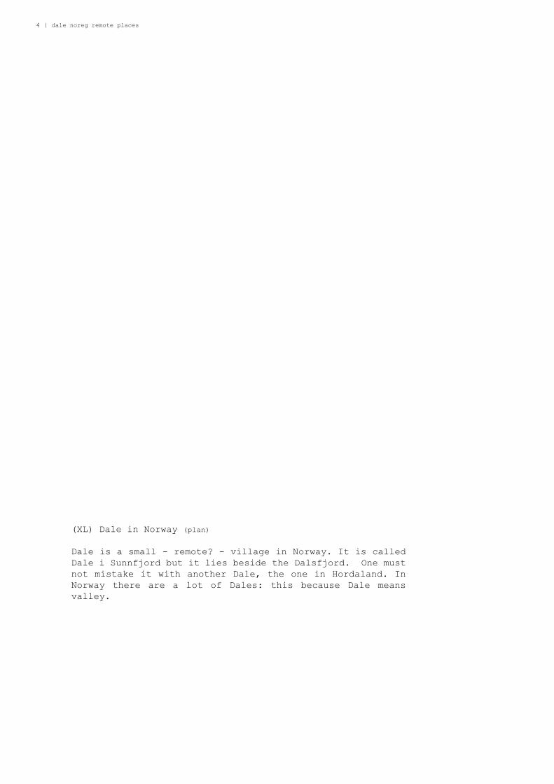
(XL) Dale in Norway (plan)
Dale is a small - remote? - village in Norway. It is called
Dale i Sunnfjord but it lies beside the Dalsfjord. One must
not mistake it with another Dale, the one in Hordaland. In
Norway there are a lot of Dales: this because Dale means
valley.
Nele Bergmans | 5
6 | dale noreg remote places
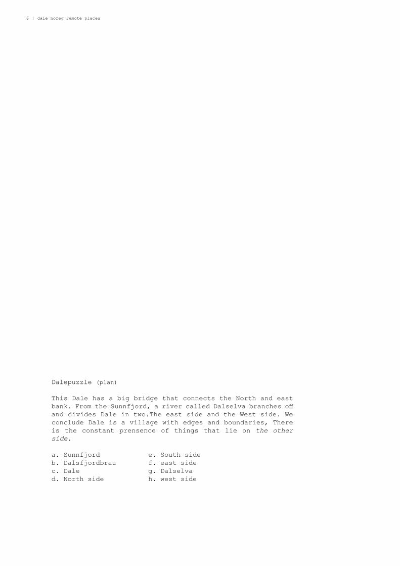
Dalepuzzle (plan)
This Dale has a big bridge that connects the North and east
bank. From the Sunnfjord, a river called Dalselva branches off
and divides Dale in two.The east side and the West side. We
conclude Dale is a village with edges and boundaries, There
is the constant prensence of things that lie on the other
side.
a. Sunnfjord e. South side
b. Dalsfjordbrau f. east side
c. Dale g. Dalselva
d. North side h. west side

Nele Bergmans | 7
b
a
c
d
e
f
gh
12
3
4
56
78
9
10
11
12
13
14
15
8 | dale noreg remote places
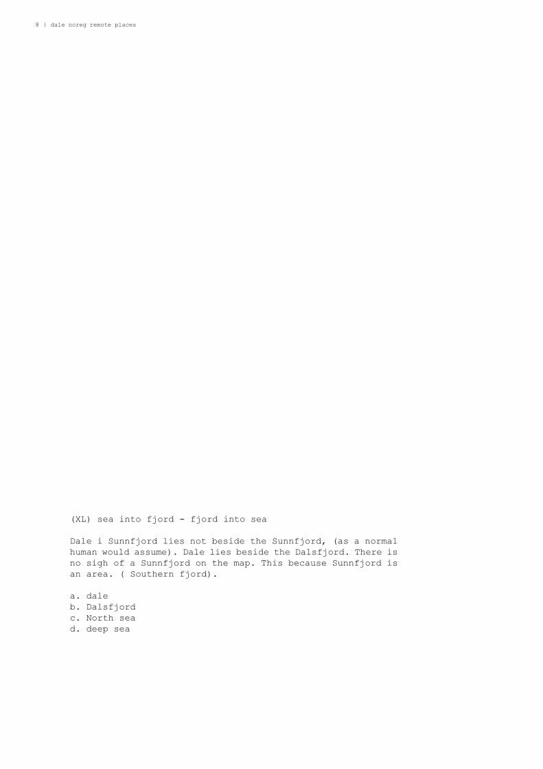
(XL) sea into fjord - fjord into sea
Dale i Sunnfjord lies not beside the Sunnfjord, (as a normal
human would assume). Dale lies beside the Dalsfjord. There is
no sigh of a Sunnfjord on the map. This because Sunnfjord is
an area. ( Southern fjord).
a. dale
b. Dalsfjord
c. North sea
d. deep sea
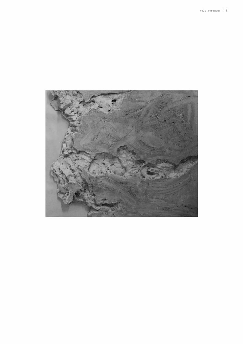
Nele Bergmans | 9
a
bc
10 | dale noreg remote places
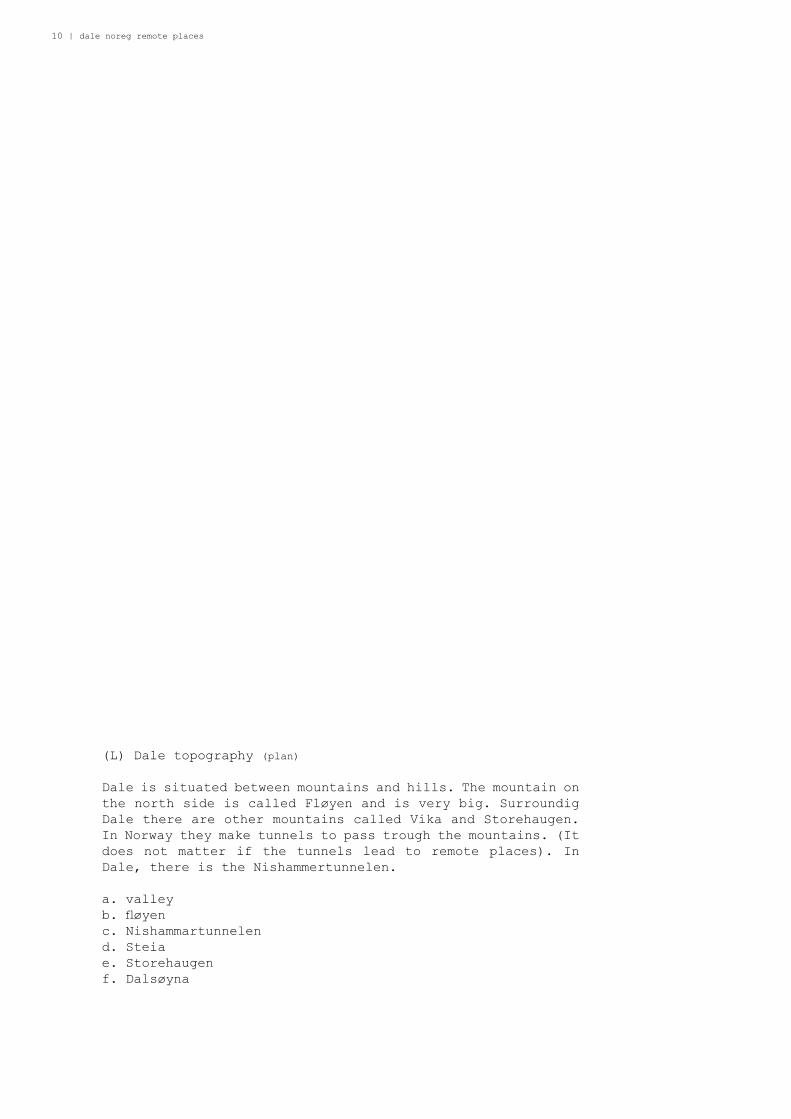
(L) Dale topography (plan)
Dale is situated between mountains and hills. The mountain on
the north side is called Fløyen and is very big. Surroundig
Dale there are other mountains called Vika and Storehaugen.
In Norway they make tunnels to pass trough the mountains. (It
does not matter if the tunnels lead to remote places). In
Dale, there is the Nishammertunnelen.
a. valley
b. fl øyen
c. Nishammartunnelen
d. Steia
e. Storehaugen
f. Dalsøyna

Nele Bergmans | 11
f
a
b
c
d
e
12 | childhood space(s)
(L) Dale topography (perspective)
These tunnels are ofcours not visible from a perspective
view. But they are there. The fi rst one just in front of the
bridge, and then the other one just after the bridge.
a. Nishammertunnelen 1
b. Nishammertunnelen 2
c. Mountains that need tunnels

student name (change in master) | 13
b
c
a
c

14 | dale noreg remote places
(M) best view is ofcourse on top
The best view over the valley is not for the inhabitants,
it is for the visiting artists. Dale is apperently remote,
but they have an art center. Nordic Arts Center, NDK, where
artist from all over the world can have a stay. Dale is an
international remote Norwegain village.
a. valley
b. NDK
c. Residential units for artists
d. Studiospace for artists
e. nive view for artists

Nele Bergmans | 15
a
e
c
d
b
e
e
16 | dale noreg remote places
(M) 3 terretories
If one looks closely at Dale, 3 bigger terretories exist
beside each other. If one wants to change territory, one must
do this passing the famous roundabout. ( Norwegian villages
don’t have roundabouts usually) This might be the true center
of Dal.
a. territory of industrail use
b. territory of harbour and highest density
c. territory for families with children
d. roundabout
e. possible crossing point

Nele Bergmans | 17
c
e
d

18 | dale noreg remote places
(M) small map of territory a
Territoy a is the industrial area wich means: buildings that
not have living as main function. The buildings are bigger
that in other territoiries and there is a lot of asphalt. But
also some nice places like the little beach and place where
boats used to arrive and leave. (This is not typical Norwegian
nor remote, this is how every village is usually orginased)
a. dale post h. byggsenter
b. kommune i. nice little beach
c. cafe j. big storage buildings
d. COOP k. some houses
f. the roundabout
g. esso
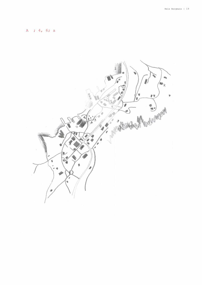
Nele Bergmans | 19
A ; 4, 6; a
a
b
c
f
d
g
h
i
j
k
20 | dale noreg remote places
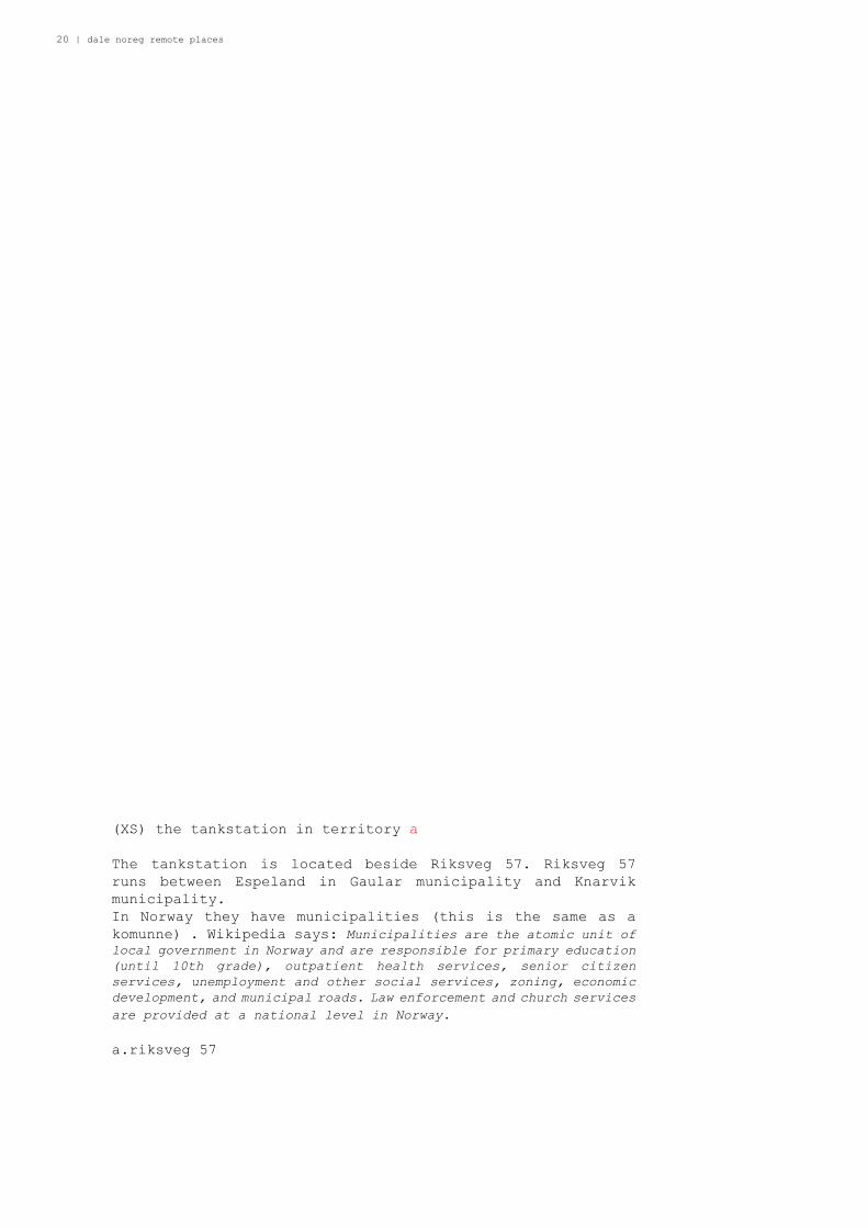
(XS) the tankstation in territory a
The tankstation is located beside Riksveg 57. Riksveg 57
runs between Espeland in Gaular municipality and Knarvik
municipality.
In Norway they have municipalities (this is the same as a
komunne) . Wikipedia says: Municipalities are the atomic unit of local government in Norway and are responsible for primary education
(until 10th grade), outpatient health services, senior citizen
services, unemployment and other social services, zoning, economic
development, and municipal roads. Law enforcement and church services
are provided at a national level in Norway.
a.riksveg 57
Nele Bergmans | 21
A ; 4, 6; a
a

22 | dale noreg remote places
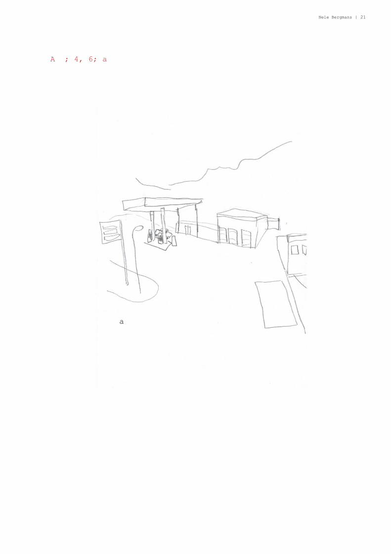
(XS) view of riksveg 57 in territory a
The road system in Norway is not so diffi cult. They have
diff erent Riksveg, wich means national road, and they are
for long distance travelling. They are always topped with
concrete.
a. Riksveg 57
b. Yksnebjørvegen
c. Nishammartunnelen
d. little beach next to Byggcenter
Nele Bergmans | 23
A ; 4, 6; a
a
b c
d

24 | dale noreg remote places
(XS) fi eld of activity in territory a
This lung of activity catches attention when looking at Dale’s
map, because a lot of names appear in google maps. We conclude
there are a lot of important things gathered here.
a. COOP market
b. kommune
c. Allmuen kafè & interiør/ Allmuen as
d. graveyard

Nele Bergmans | 25
A ; 6; a
a
b
cd
e
e
e
e

26 | dale noreg remote places
(XS) investigation ground area in territory a
The industrial character of territory a is also made by the
presence of the car. Everything should be accessible. (Yes,
also in Norway between beautiful nature and fjords, cars get
a high priority) Here an investigation of the ratio grass/
asphalt/builing
a. grass
b. asphalt parking space
c. asphalt road
d. building

Nele Bergmans | 27
A ; 6; a
a
b
c
d

28 | dale noreg remote places
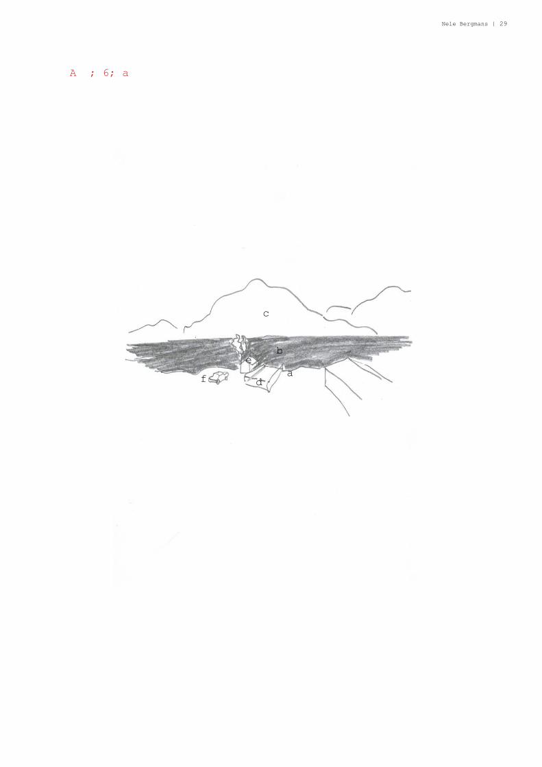
(XS) sight so Dalsfjord in territory a
These are the elements seen from the dock in territory a. The
boundary (the fjord) the in-between (boats growing bigger and
smaller) and the other side (Floyen).
a. boundary
b. in-between
c. other side
d. dock
e. little house beside dock
f. car
Nele Bergmans | 29
A ; 6; a
a
b
c
d
e
f

30 | dale noreg remote places
(M) territory b
Territory b is a territory of high density, and it is defi ned
by the harbour. Most of the houses can see the fjord from
their window, wich makes it nice to live. This is often the
case in Norway, because they have such varying topography,
every house can have a nive view into a vally or onto the sea.
a. harbour
b. houses with view to fjord
c. fi elds
d. territory a

Nele Bergmans | 31
A ; 8,9 ; b
a
b
b
b
c
d

32 | dale noreg remote places
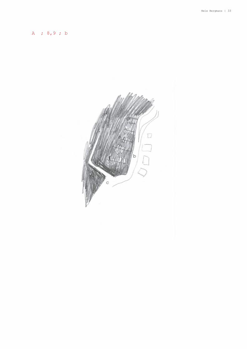
(XS) defi ning elements in territory b
Territory b is the territory the harbour. A lot of people
come here especially on sunny days. The road alongside the
harbour ends just after the harbour as there is no longer a
need for the road. Before they build the big Dalsbrau, you
had to use boats to cross the fjord. Nowadays there are less
boats needed in Norway due to road/bridge/tunneldevelopment.
a. harbour
b. road
c. end of the road
Nele Bergmans | 33
A ; 8,9 ; b
a
b
c
g
34 | dale noreg remote places
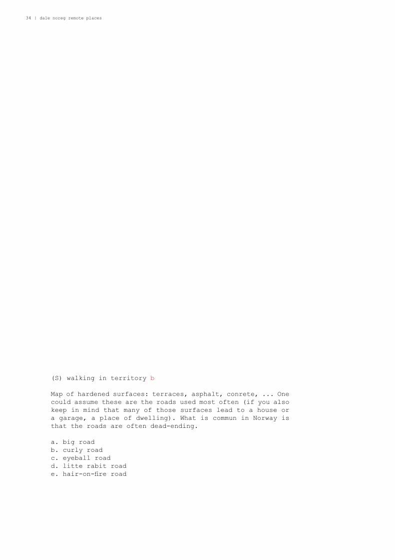
(S) walking in territory b
Map of hardened surfaces: terraces, asphalt, conrete, ... One
could assume these are the roads used most often (if you also
keep in mind that many of those surfaces lead to a house or
a garage, a place of dwelling). What is commun in Norway is
that the roads are often dead-ending.
a. big road
b. curly road
c. eyeball road
d. litte rabit road
e. hair-on-fi re road

Nele Bergmans | 35
A ; 8,9 ; b
a
bc
de

36 | dale noreg remote places
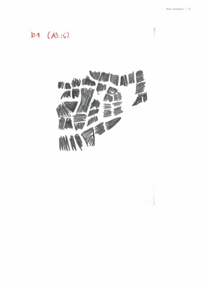
(S) boundaries on paper in territory b
Map of property. Properties lie close to each other, one
fi lling in the space that the other did not want. This way
strange forms appear. Some are lucky: they are very big but
other smaller ones can be luckier because they lie next to
the water: this is an subjective opinion.
a. traingular property
b. biggest property
c. long properties
d. squeezed property
e. not defi ned as property so open space used by the three
properties that lie beside it
Nele Bergmans | 37
a
b
c
d
e
38 | dale noreg remote places
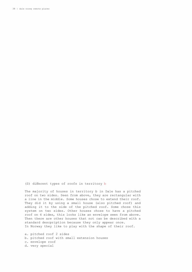
(S) diff erent types of roofs in territory b
The majority of houses in territory b in Dale has a pitched
roof on two sides. Seen from above, they are rectangular with
a line in the middle. Some houses chose to extend their roof.
They did it by using a small house (also pitched roof) and
adding it to the side of the pitched roof. Some chose this
system on two sides. Other houses chose to have a pitched
roof on 4 sides, this looks like an envelope seen from above.
Then there are other houses that not can be described with a
standard descpription because they only appear once.
In Norway they like to play with the shape of their roof.
a. pitched roof 2 sides
b. pitched roof with small extension houses
c. envelope roof
d. very special
Nele Bergmans | 39
c
a
b
d
d
d

40 | dale noreg remote places
(S) mowing the lawn in territory b
map of diff erent techniques used for mowing the lawn. One can
do it in stripes, very short. One can do it with an unknown
technique that leaves no stripes. One can just let it grow
wild. Garden in Norway are usually not so big. They have
nature surrounding them in every direction so they don’t need
a big garden. This way, villages can be more compact.
a. mown in stripes
b. very equally mown, no traces
c. wild

Nele Bergmans | 41
a
b
c

42 | dale noreg remote places
(M) map of territory c
Territory c is defi ned by the bend in the river Dalselva. It
is a housing area for families. They have the biggest and
quietest garden. This territory is also close to the center
(the roundabout) so this is an ideal position. Further down
to the south there are some more houses to be found, but they
don’t belong to the territory anymore.
a. the bend
b. enclosed big garden
c. housing street
d. other houses further away, almost Dingemoen

Nele Bergmans | 43
A ; 11,13 ; c
d
c
b
a
44 | dale noreg remote places
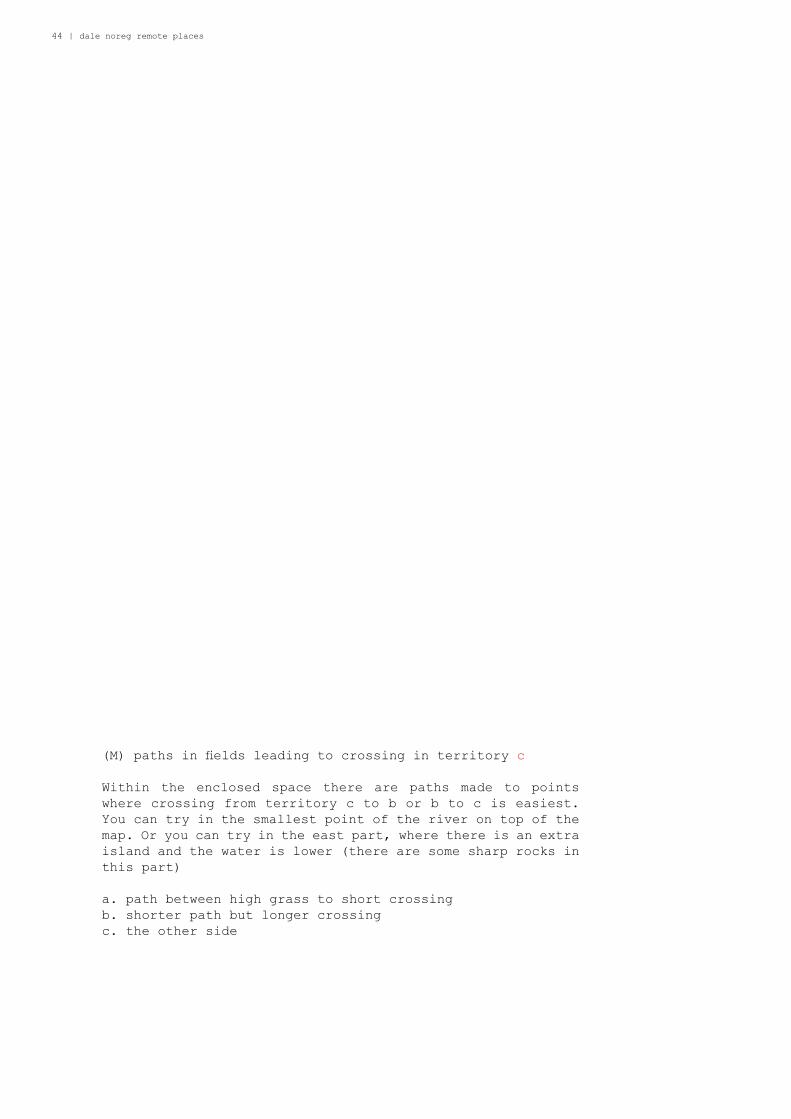
(M) paths in fi elds leading to crossing in territory c
Within the enclosed space there are paths made to points
where crossing from territory c to b or b to c is easiest.
You can try in the smallest point of the river on top of the
map. Or you can try in the east part, where there is an extra
island and the water is lower (there are some sharp rocks in
this part)
a. path between high grass to short crossing
b. shorter path but longer crossing
c. the other side
Nele Bergmans | 45
A ; 11,13 ; c
ab
c
46 | dale noreg remote places
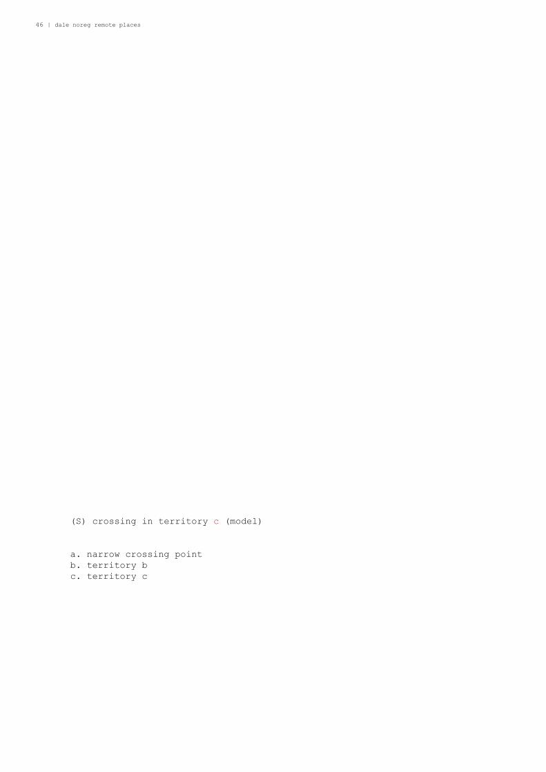
(S) crossing in territory c (model)
a. narrow crossing point
b. territory b
c. territory c

Nele Bergmans | 47
A ; 11,13 ; c
a
b
c
48 | dale noreg remote places
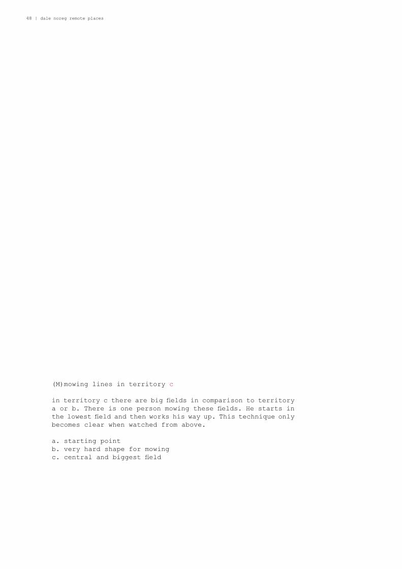
(M)mowing lines in territory c
in territory c there are big fi elds in comparison to territory
a or b. There is one person mowing these fi elds. He starts in
the lowest fi eld and then works his way up. This technique only
becomes clear when watched from above.
a. starting point
b. very hard shape for mowing
c. central and biggest fi eld

Nele Bergmans | 49
A ; 11,13 ; c
a
b
c

50 | dale noreg remote places
(M)roofs in territory c
By seeing similarities in roofscape in territory a b and c, we
can conclude that in Norway almost every house has a pitched
roof. Also garages and postboxes get a pitched roof. It could
be that there are pitched roofs for washing lines and waiting
rubber boots.

Nele Bergmans | 51
A ; 11,13 ; c

52 | dale noreg remote places
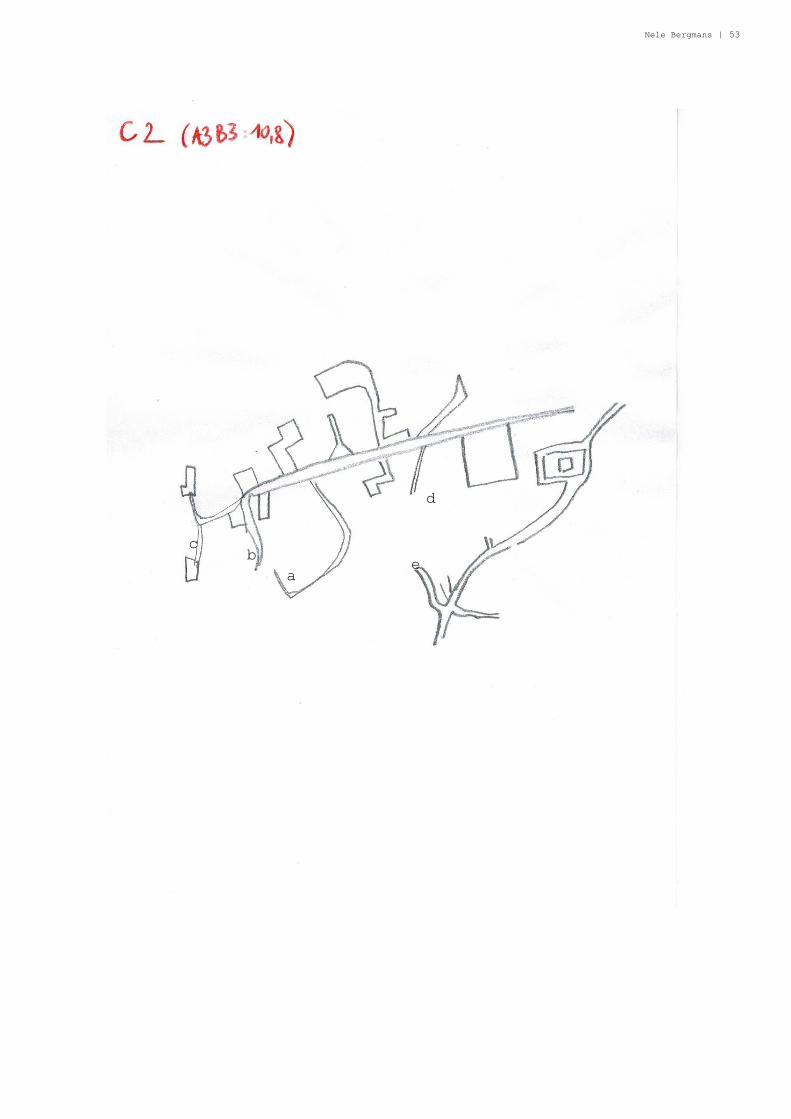
(M)roads in territory c
Roads are not often straight because it’s diffi cult with the
variety of levels. Territory c is the ultimate example of
weird curling, dead ending roads in Norway.
a. dead end
b. dead end
c. dead end
d. dead end
e. dead end
Nele Bergmans | 53
A ; 11,13 ; c
a
bc
d
e
54 | dale noreg remote places
(M)forgetting about territory a b and c
After closer investigation was noticed that there are other
territories with much more specifi c properties. These territories
are made by the Norwagians, the fl ajer municipality, the Dale
people. It is a suplement to the previous puzzle. Dough
complete other categoratisation of territory, some elements
stay the same.
a. roundabout
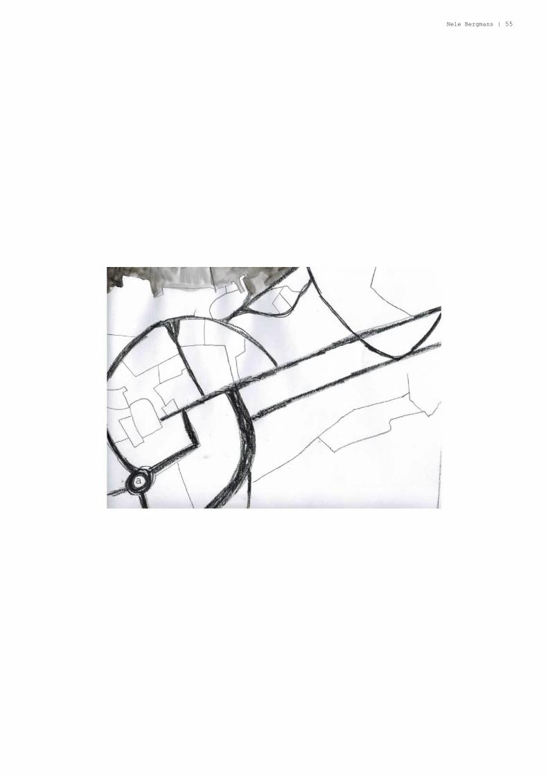
Nele Bergmans | 55
a

56 | dale noreg remote places
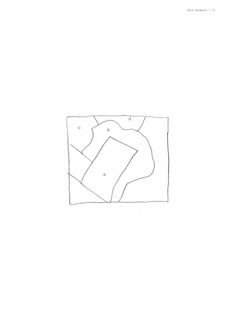
(M)earthworks
Area close to Dingemoen preserved for sport activities. West
of the banana: housing area. Up: Industrial area near Dale.
a. Sportfi eld
b. banana
c. housing area
d. industrial area
Nele Bergmans | 57
a
bc
d

58 | dale noreg remote places
(M)center purpose
A fl exible center is wanted. This area will be for fl ats,
houses, offi ce space, catering, ... They want to be able to
change in accordance to the developments in the future.

Nele Bergmans | 59

60 | dale noreg remote places
(M)Marina
Area with boat houses. They want to preserve this area, it
should no be open for densifi cation and they want to make this
area more accessible.

Nele Bergmans | 61

62 | dale noreg remote places
(M)cemetery
a. burial ground for the future
b. possible fl ooted area
c. cemetery

Nele Bergmans | 63
cb
a
64 | dale noreg remote places
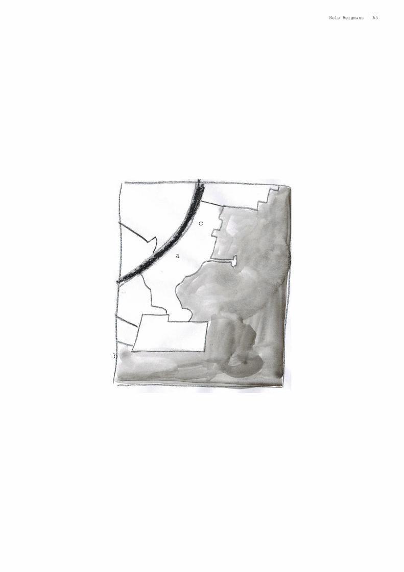
(S)Beach zone Dale north
This plan shows the territories is Dale north. The beach
zone they want to protect, as well as the zone next to the
fjord. There are old factories, they want them to re-develop
(some of them) others are too old. This will become a private
property of the kumune, no housing will be placed. This is
their guideline in developing Dale and surroundings.
a. old factory
b. beach
c. zone of preservation
Nele Bergmans | 65
a
b
c

66 | dale noreg remote places
Nele Bergmans | 67

68 | dale noreg remote places

Nele Bergmans | 69

70 | dale noreg remote places
(M)public and private services
Suffi cient space for development of public services is the
main goal for the future of this area. This is considered
as a sustainable densifi cation, and a good balance between
landscape and building.

Nele Bergmans | 71

72 | dale noreg remote places

Nele Bergmans | 73

74 | dale noreg remote places

Nele Bergmans | 75
76 | dale noreg remote places
DALEPUZZLE

Nele Bergmans | 77
6
10
11
1414141414141414141414141414141414141414141414141414141414141414
10
666666666