status of esa’s doppler wind lidar mission...
TRANSCRIPT

ESA UNCLASSIFIED - For Official Use
Status of ESA’s Doppler Wind Lidar Mission Aeolus Anne Grete Straume, A. Elfving, D. Wernham, T. Kanitz, F. de Bruin, F. Buscaglione, J. von Bismarck, W. Lengert and further Aeolus project colleagues in ESA-ESTEC and ESA-ESRIN
14th International Winds Workshop
Jeju City, South Korea, 23-27 April 2018

ESA UNCLASSIFIED - For Official Use ESA | 20/04/2018 | Slide 2
Outline
Aeolus in ESA’s Earth Observation Program
Mission objective and measurement principle
Data product, processing, data access and use
Mission status and on-ground verification
Product CAL/VAL
Data assimilation and NWP impact assessment preparations
Conclusions

ESA UNCLASSIFIED - For Official Use ESA | 20/04/2018 | Slide 3
ESA’s Earth Observation Satellites

ESA UNCLASSIFIED - For Official Use ESA | 20/04/2018 | Slide 4
Aeolus Mission Objectives Scientific objectives
To improve the quality of weather forecasts
To advance our understanding of atmospheric dynamics and climate processes
Explorer objectives
Demonstrate space-based Doppler Wind Lidar potential for operational use
Observation means
Provide global profiles of winds in the troposphere and lower stratosphere
Spin-off product: Atmospheric backscatter and extinction profiles
Payload
ALADIN: Atmospheric LAser Doppler INstrument

ESA UNCLASSIFIED - For Official Use ESA | 20/04/2018 | Slide 5
Mission characteristics
Orbit: sun-synchronous
Mean altitude: ~320 km
Local time: 18:00 ascending node
Inclination: 96.97o
Repeat cycle: 7 days / 111 orbits
Orbits per day: ~16
Profiles per day: ~64000
Mission lifetime: 3 years

ESA UNCLASSIFIED - For Official Use ESA | 20/04/2018 | Slide 6
Measurement principle (1/2)
UV Doppler wind Lidar operating at 355 nm and 50 Hz PRF in continuous mode, with 2 receiver channels (HSRL):
Mie receiver (aerosol & cloud backscatter)
Rayleigh receiver (molecular backscatter)
The line-of-sight is pointing 35o off nadir to derive horizontal
wind component orthogonal to ground track to avoid
satellite velocity contamination
Spacecraft regularly pointed to nadir for calibration (1/3 orbit per week)
HLOS

ESA UNCLASSIFIED - For Official Use ESA | 20/04/2018 | Slide 7
Aeolus measurement principle (2/2)
Mie channel: Aerosol/cloud
backscatter Imaging
technique
Rayleigh channel: Molecular
backscatter Double-edge
technique
600 m/s
< 100 m/s
30 m/s

ESA UNCLASSIFIED - For Official Use ESA | 20/04/2018 | Slide 8
Aeolus data processing and distribution (1/2)
AISP L2B vHLOS
L0 L1A L1B
L2A β, σ
? Wind Velocity
Data preparation
ECMWF Met Centres Science
Air quality Forecasts Science
T & p, calibration
L2C v

ESA UNCLASSIFIED - For Official Use ESA | 20/04/2018 | Slide 9
Aeolus data products
1. Primary product (L2b): Horizontally projected LOS (HLOS) wind profiles (no vector)
– Approximately zonal at dawn/dusk (6 am/pm) – 87 km observation from 3 km subsamples – scene classified – 0-30 km altitude in 24 vertical layers – Random errors: < 1-2(PBL), 2(Trop), 3-5 (Strat) m/s – Bias: < 0.7 m/s – L2c product: ECMWF forecast wind vectors after assimilation of Aeolus L2B winds, not to be used for assimilation!!)
2. Spin-off product (L2a): Optical properties profiles
– co-polar β, σ, lidar ratio – <85 km observation averages from 3 km subsamples

ESA UNCLASSIFIED - For Official Use ESA | 20/04/2018 | Slide 10
Aeolus L2B winds, test dataset 1 Oct. 2015
Molecular (Rayleigh) winds Particle backscatter (Mie) winds
L2B algorithm development: J. de Kloe (KNMI), M. Rennie (ECMWF), G.J. Marseille (KNMI)
Courtesy M. Rennie (ECMWF)

ESA UNCLASSIFIED - For Official Use ESA | 20/04/2018 | Slide 11
Data processing and distribution (2/2)
Data processing from L1-L2 at ECMWF
Users get Aeolus L2B winds in NRT (for use in assimilation) from ESA Data Dissemination Server in ESA
Earth Explorer (EE) binary format + BUFR convertor
EUMETSAT in BUFR format (still to be implemented)
Data quality monitoring at ECMWF
ECMWF assimilates Aeolus L2B winds, model forecast wind vectors at
Aeolus measurement location -> L2C product

ESA UNCLASSIFIED - For Official Use ESA | 20/04/2018 | Slide 12
Aeolus Data Dissemination Server
http://aeolus-ref-addf.eo.esa.int/addf/ Automatic download of data can be set up with scripts (see help pages) Aeolus wiki’s: ESA: https://wiki.services.eoportal.org/tiki-index.php?page=Aeolus%20Wiki (coming soon) ECMWF: https://software.ecmwf.int/wiki/display/AEOL/

ESA UNCLASSIFIED - For Official Use ESA | 20/04/2018 | Slide 13
Aeolus data use
N
W
AMV vector wind AMV wind projected on Aeolus HLOS Aeolus horizontal line-of-sight
For comparing AMV vector winds and Aeolus HLOS winds, a projection to Aeolus HLOS using L2B “LOS_Azimuth” (φ) is needed
A westerly wind will be negative in descending and positive for ascending orbits in the Aeolus L2B wind product
Flight direction
φ

ESA UNCLASSIFIED - For Official Use ESA | 20/04/2018 | Slide 14
Expected Aeolus impact
Horanyi et al, 2014, IFS total energy error reduction based on thinned u observations from aircraft. Impact shown is limited to aircraft coverage areas
From Rennie 2018, https://www.epj-conferences.org/articles/epjconf/pdf/2018/11/epjconf_ilrc28_02015.pdf

ESA UNCLASSIFIED - For Official Use ESA | 20/04/2018 | Slide 15
Aeolus schedule Initial satellite functional tests
SVT1 @ASU
Sine vibr.
04/02/17
Acoustic Launcher sep. test
S.A. integr. @ITS
S.A. deploy, etc. EMC Test
20/12/17 27/10/17
TVAC Preparations
Thermal Balance – Thermal Vacuum incl. IST2&3
19/05/17
@CSL O2 unload &
packing
02/07/18 VV12 Aeolus Launch, 21 August 2018
Launch campaign
@CSG
QAR Process incl. Board Meeting
Contingency
12/06/18
Batt, RCS&ICS Checks, Alignm.
LVA FitC
Final satellite
funct. tests
SVT2
25/01/18 23/04/18
SA Installation
@ITS
26/02/18
23/05/18
SPT2 & KIP/MIP
ESA UNCLASSIFIED - For Official Use ESA | 20/04/2018 | Slide 16
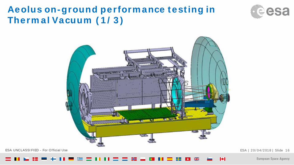
Aeolus on-ground performance testing in Thermal Vacuum (1/3)

ESA UNCLASSIFIED - For Official Use ESA | 20/04/2018 | Slide 17
Aeolus on-ground performance testing in Thermal Vacuum (2/3)

ESA UNCLASSIFIED - For Official Use ESA | 20/04/2018 | Slide 18
Aeolus on-ground performance testing in Thermal Vacuum (3/3)

ESA UNCLASSIFIED - For Official Use ESA | 20/04/2018 | Slide 19
High-level questions before on-ground test Are the lasers still operational? (1st time after mechanical tests)
Both lasers turned On
How do the laser function with the satellite cooling system? (1st time ever)
Both lasers were operated at high energy, stable
Are the lasers still aligned? (1st time after mechanical tests)
Light received through internal and emission path
Are the spectrometers still function? (1st time after mechanical tests)
Spectral measurements performed with both channels
Can on-ground characterization equipment be aligned to Aladin for all test cases?

ESA UNCLASSIFIED - For Official Use ESA | 20/04/2018 | Slide 20
Non-conformance still under investigation
Emit transmission increased for both Laser transmitters
Receive transmission decreased Current hypothesis “losses caused by on-ground characterization
equipment”, not yet proven. Tiger Team assessing test outcome and re-characterizing on-ground test set-up.
Frequency stability more noisy than expected
Conclusions expected in May intermediate results show system requirements still met in most cases
(random error slightly above 2 m/s at some altitudes)

ESA UNCLASSIFIED - For Official Use ESA | 20/04/2018 | Slide 21
Aeolus CAL/VAL teams • Data calibration and
validation will be performed by teams world wide using: Correlative ground-
based (remote sensing) wind and aerosol observations
Airborne observations
Comparison to models
• Gaps: Tropics and SH

ESA UNCLASSIFIED - For Official Use ESA | 20/04/2018 | Slide 22
Aeolus CAL/VAL Announcement of Opportunity call reopened 15 March 2018
https://earth.esa.int/aos/AeolusCalVal

ESA UNCLASSIFIED - For Official Use ESA | 20/04/2018 | Slide 23
“Aeolus Exploitation for NWP and Future Needs for Satellite Wind Observations” Joint ESA and EUMETSAT Workshop
29 May 2019 at EUMETSAT
Programme: Aeolus mission and products
Expected impact of Aeolus in global models
Expected impact of Aeolus in limited area models
Preparations for assimilation and impact analysis of Aeolus at ECMWF, KNMI, MetOffice, DWD, MeteoFrance, Norwegian Meteorological Institute
Aeolus lessons learnt
Follow-on concepts
Plenary discussion on impact assessment coordination in Europe, future satellite winds, synergies and gaps, possible Aeolus-2

ESA UNCLASSIFIED - For Official Use ESA | 20/04/2018 | Slide 24
Conclusions Aeolus will be the first Doppler Wind lidar in space
Aeolus is scheduled for launch on 21 August 2018
Commissioning phase: 3 months, first data for CAL/VAL teams ~L+2 months
Aeolus data release is expected around L+6 months
Mission lifetime: 3 years (lifetime beyond 4 years not expected)
Aeolus L2B product will be delivered within 3 hours of sensing in
ESA Earth Explorer binary format from ESA (NRT)
BUFR format by EUMETSAT (NRT to be confirmed)
NWP monitoring, assimilation and impact experiments will be done at ECMWF under ESA funding
The potential for an Aeolus follow-on will be followed up by Aeolus Mission Manager via an Aeolus Mission Advisory Committee

ESA UNCLASSIFIED - For Official Use ESA | 20/04/2018 | Slide 25
[email protected] https://aeolusweb.wordpress.com/
http://www.esa.int/esaLP/LPadmaeolus.html https://wiki.services.eoportal.org/tiki-index.php?page=Aeolus%20Wiki (coming soon)
Movie wind profile curtain

ESA UNCLASSIFIED - For Official Use ESA | 20/04/2018 | Slide 26
Spares

ESA UNCLASSIFIED - For Official Use ESA | 20/04/2018 | Slide 27
ESA Aeolus campaigns
WindVal I and II in 2015 and 2016

ESA UNCLASSIFIED - For Official Use ESA | 20/04/2018 | Slide 28
WindVal II Iceland 2016
Courtesy M. Rennie (ECMWF) and U. Marksteiner and O. Reitebuch (DLR)
28
Flight through jet stream (remnants of TC Karl, 27/9/2016)
Scotland
AUX_MET temperature
AUX_MET forward modelled attenuated backscatter
L2B Rayleigh geolocations
No transmission expected through optically thick cloud

ESA UNCLASSIFIED - For Official Use ESA | 20/04/2018 | Slide 29
Aeolus campaigns data, A2D airborne demonstrator, processed with Aeolus L2B proc.
29
L2B Rayleigh LOS wind (m/s)
ECMWF model LOS wind (m/s)
DLR A2D Rayleigh winds
(O-B) i.e. (L2B – ECMWF)
N.B. all non-missing results shown
Courtesy M. Rennie (ECMWF) and U. Marksteiner (DLR)

ESA UNCLASSIFIED - For Official Use ESA | 20/04/2018 | Slide 30
2-µm Doppler wind lidar (2 µm wavelength, (c) ) • Horizontal resolution: 8.4 km (scan mode) • Vertical resolution: 100 m • Sensitive to particles with µm-size
(good coverage in cirrus clouds in the upper troposphere)
RASTA* (95 GHz, 3.2 mm wavelength, (d) ) • Horizontal resolution: <0.2 km
• Vertical resolution: 60 m • Sensitive to particles with mm-size
(good coverage in water clouds in the mid and lower troposphere)
Data courtesy of J. Delanoë, J. Pelon and Q. Cazenave (LATMOS / IPSL / UVSQ) *Schäfler et al., The North Atlantic Waveguide and
Downstream Impact Experiment, BAMS, accepted (2018)
Comparison of DLR 2-µm and LATMOS/IPSL RASTA
wind data over the complete common flight leg
(Courtesy O. Reitebuch et al., DLR)
Aeolus WindVal II, Iceland-Greenland, 2016