statement of environmental effects - … · 1.4 structure of the see 11 2 site context 12 ... in...
TRANSCRIPT

Statement of Environmental Effects
227 Railway Terrace Schofields
FINAL
Coles Group Property Developments Ltd

Contact:
Liz Densley
[email protected] 0438 744384
Sydney
02 9387 2600
Level 6
332 – 342 Oxford Street
Bondi Junction NSW 2022
www.elton.com.au
[email protected] Sydney | Canberra | Darwin
ABN 56 003 853 101
Prepared by Linda Rodriguez
Reviewed by Liz Densley
Date 20 December 2017
Document name SEE - V8 - 20 December Consolidated
Version Final

EXECUTIVE SUMMARY 5
Definitions 7
1 INTRODUCTION 9
1.1 Proposal overview 9
1.2 Property description 9
1.3 Regulatory framework 11
1.4 Structure of the SEE 11
2 SITE CONTEXT 12
2.1 Strategic Planning Context 12
2.2 Description of the Site 14
2.3 Site analysis 15
2.4 Surrounding Development 16
3 BACKGROUND 17
3.1 Previous Development Applications 17
3.2 Pre-Application Meetings 18
5 ASSESSMENT 33
5.1 Environmental Planning Instruments 33
5.1.1 State Environmental Planning Policy (Sydney Regional Growth Centres) 2006 34
5.1.2 SEPP No 55-Remediation of Land 37
5.1.3 State Environmental Planning Policy (Infrastructure) 2007 37
5.1.4 State Environmental Planning Policy (Educational Establishments and Child Care Facilities) 2017 37
5.1.5 State Environmental Planning Policy 64 – Advertising and Signage (SEPP 64) 37
5.2 Blacktown City Council Growth Centre Precincts Development Control Plan 2010 42
5.2.1 Part 2.0 Precinct Planning Outcomes 43
5.2.2 Part 5.0 Centres Development Controls 44
5.2.3 Schedule 1 Alex Avenue Precinct 49
5.3 Development Contributions 53
5.4 Planning Agreements 59
5.5 Environmental, Social and Economic Impacts 59
5.5.1 Built Form and Town Centre Integration 59
5.5.2 Pedestrian Connectivity 60
5.5.3 Traffic and Parking Management Plan 60
5.5.4 Engineering Considerations 61
5.5.5 Trolley Containment 62
5.5.6 Safety and Security 63
Contents

5.5.7 Aboriginal Heritage Assessment 63
5.5.8 Social and Economic Impact 64
5.6 Suitability of the Site for the Development 64
5.7 Submissions 64
5.8 The Public Interest 65
5.9 Concept Development Applications 65
6 CONCLUSION 67
APPENDIX 69

_ Elton Consulting 5
Elton Consulting has prepared this Statement of Environmental Effects (SEE) to support the
Development Application (DA) on behalf of Coles Group Property Developments Pty Ltd (CGPD) (the
Applicant) for a retail development in Schofields.
The land to be developed is described as 227 Railway Terrace, Schofields being Lot 30 DP 1191922
(21,170 m2) and part of the Pelican Road reserve to be acquired under an agreement with Blacktown
City Council identified as Lot 2 in proposed plan of subdivision (3,490 m2). The total area to be
developed is 24,596 m2. The site is vacant.
The land to be developed for retail purposes is zoned B2 Local Centre under the State Environmental
Planning Policy (Sydney Regional Growth Centres) 2006 (Growth Centres SEPP). A small portion of
Lot 30 DP 119122 is zoned SP2 Infrastructure and R3 High Density Residential. Both these areas will
be accommodated within the proposed Jacqui Avenue road reserve in accordance with the Indicative
Layout Plan.
Approval is being sort for a concept development of the site in two stages under clause 83B of the
Environmental Planning and Assessment Act.
Stage 1 comprises:
» construction and use of:
• a Coles supermarket
• Liquorland store
• specialty retail shops
• child care centre
• parking for 356 spaces (provided at grade and basement parking);
• bulk earthworks to accommodate basement parking;
• pylon signs and building signage; and
• other ancillary development.
» subdivision of the site into five lots being lots for the retail development and associated land uses,
a lot for the approved McDonald’s restaurant, a lot for that part of the site that is within the Town
Plaza, a lot for road widening of Railway Terrace and a lot for Jacqui Avenue and Minerva Road.
Stage 2 comprises construction and use of approximately 250 m2 of retail and commercial shops in
accordance with the Growth Centres DCP to activate Railway Terrace.
The elevations from Railway Terrace and Jacqui Avenue and general arrangement of the site are
illustrated in Figures A and B (refer also Appendix A).
Executive Summary

6 _ Elton Consulting
Figure A Front Elevation (top) Jacqui Avenue Elevation (bottom)
Source: Christiansen O’Brien Architects DA-06 Appendix A (illustrative purposes only)
Figure B General Arrangement Site Plan Stage 1
Source: Christiansen O’Brien Architects DA-01-1 Proposed Site Plan Stage 1 Appendix A

_ Elton Consulting 7
The proposal represents an orderly and economic development of the Site and will achieve a high
level of amenity within the town centre. The Site layout and building location responds to the
characteristics of the Site and responds to the desired future character envisaged for the town centre.
In preparing the DA, the Applicant has worked closely with Blacktown City Council in response to the
issues raised in two Pre-Application Meetings and specific issues raised in relation to the design and
location of the future roads. The outcome is a well resolved development that is consistent with the
planning controls applicable to the Site.
The DA once approved, will replace a previous scheme for a similar retail development including a
supermarket and speciality shops which was approved by the JRPP in 2014 (JRPP 11-1987).
The development proposal addresses all relevant heads of consideration under section 79C of the
Environmental Planning and Assessment Act, 1979. The development proposal is considered to
achieve the desired outcomes of the Growth Centres SEPP and Blacktown City Council Growth Centre
Precincts Development Control Plan 2010 and should be approved for the following reasons:
» The development is consistent with the land use zone and objectives.
» The development proposal achieves a high level of urban design and public benefit to the local and
wider community.
» The design responds positively to the site conditions, represents high quality urban layout and will
not impact upon the amenity of residents in the locality.
» The proposal is in the public interest.
Definitions
For the purpose of this SEE, the following terms mean:
Applicant means Coles Group Property Developments Ltd.
Approved Scheme means the development as approved in JRPP-11-1987.
CGPD Land means 227 Railway Terrace, Schofields being Lot 30 DP 1191922.
DA means this Development Application.
Dyldam means Landmark Schofields Estate Pty Ltd pursuant to an equitable interest arising from a
Contract for Sale of Land dated 7 July 2017.
Dyldam Site means the land adjoining the Site to the north and being the land comprised in Lot 25
DP 1191922.
EP&A Act means Environmental Planning and Assessment Act, 1979.
Growth Centres SEPP means the State Environmental Planning Policy (Sydney Regional Growth
Centres) 2006.
Growth Centres DCP means Blacktown City Council Growth Centre Precincts Development Control
Plan 2010.
ILP means the Indicative Layout Plan prepared by the Department of Planning and Environment in
2010 and published in the Growth Centres DCP, Figure 2-1.
McDonalds Lot means the area identified as Lot 2 on the Proposed Plan of Subdivision for the CGPD
Land.
Proposed Lot 2 Pelican Road means part of the Pelican Road reserve to be acquired under an
agreement with Blacktown City Council identified as Lot 2 in proposed plan of subdivision.

8 _ Elton Consulting
Section 94 Plan means Section 94 Contributions Plan No.20 – Riverstone & Alex Avenue Precincts in
force as at 9 December 2015.
SEE means this Statement of Environmental Effects to support the DA.
Site means the CGPD Land and Proposed Lot 2 Pelican Road.
Town Plaza means the area identified on the Proposed Plan of Subdivision for the CGPD Land, as
nominated by in the Growth Centres DCP and determined by GIS provided by Council.

_ Elton Consulting 9
1.1 Proposal overview
This SEE has been prepared by Elton Consultation on behalf of the Applicant to support a concept DA
in accordance with clause 83B of the Environmental Planning and Assessment Act for a development
and subdivision at the Site.
The DA seeks approval for:
» development and use of a supermarket and specialty shops, including liquor
» a child care centre
» construction of associated carparking
» identification signage
» subdivision for the purposes of a McDonald’s restaurant (DA 11-1988)
» subdivision to facilitate the future road widening and future delivery of public roads and part of the
proposed Town Plaza
1.2 Property description
The Site to be developed under the DA includes the following parcels:
» Lot 30 DP 1191922 Area: 2.11 ha
» Proposed Lot 2 Pelican Road Area: 3,490 m2
Lot 30 is owned by the Applicant. The Applicant has entered into an agreement with Blacktown City
Council to purchase Proposed Lot 2 Pelican Road.
The Site is located within the Alex Avenue Precinct forming part of the North West Growth Centre and
within the proposed local centre. Future roads are proposed over portions of the CGPD Land which
will bound the Site by Railway Terrace (which is an existing road proposed to be widened, impacting
the site), Jacqui Avenue (new road to the south) and Minerva Road (extension of new road to the
east). Pelican Road will be closed and subdivided by Council, with Proposed Lot 2 Pelican Road to be
acquired by the Applicant.
Despite the area and configuration of the existing lots, the development footprint has been
determined having regard to the ILP for the local centre, including the proposed roads indicated
above which has given rise to a number of issues relating to the dedication of land to support the
outcomes articulated in the Growth Centre DCP.
The CGPD Land has an existing approval for a retail development including supermarket and specialty
shops (JRPP 11-1987) and a separate approval for a McDonald’s restaurant (DA 11-1988).
The SEE has been prepared based on the architectural plans provided by Christiansen O'Brien Pty Ltd
Architects and technical and supporting documentation from a number of consultants and should be
read in conjunction with supporting information provided as follows:
1 Introduction

10 _ Elton Consulting
Christiansen O’Brien Architects DA Package Appendix A
Drawing No Rev Drawing Title DA00 DA Cover Sheet and Location Plan SV01 DA Existing Survey Plan EX01 DA Existing Site Plan (with proposed roads) DA01 DA Proposed Site Plan - Stage 2 DA01-1 DA Proposed Site Plan - Stage 1 DA02 DA Proposed Basement Plan DA03 DA Proposed Ground Floor Plan Part 1- Stage 2 DA03-1 DA Proposed Ground Floor Plan Part 1- Stage 1 DA04 DA Proposed Ground Floor Plan Part 2- Stage 2 DA04-1 DA Proposed Ground Floor Plan Part 2- Stage 1 DA05 DA Proposed Roof Plan DA06 DA Proposed Elevations DA07 DA Proposed Sections DA08 DA Proposed Signage Plan Part 1 DA09 DA Proposed Signage Plan Part 2 FS01 DA Schedule of Finishes and Colours SA01 DA Site Analysis Plan Part 1 SA02 DA Site Analysis Plan Part 2 SD01 DA Shadow Diagrams AR01 DA Area Plan L01 DA Proposed Subdivision Plan
Document Title Prepared by Refer to
Transport Impact Assessment PeopleTrans Appendix B
Geotechnical Report Geo-Logix Pty Ltd Appendix C
Environmental Report –
Detailed Site Investigation
Geo-Logix Pty Ltd Appendix D
Acoustic Report Renzo Tonin & Associates Appendix E
CPTED Performance Indesign Access Appendix F
Access Report Ergon consulting Appendix G
Infrastructure Henry & Hymas Appendix H
AHIMS Search - Appendix I
PAM Minutes Blacktown City Council Appendix J
Waste Management Plan Christenson O’Brien Architects Appendix K
Landscape Plan Conzept Landscape
Architecture
Appendix L
NCCC Capability Report Vic Lilli and Partners Appendix M
Town Plaza Concept Plan Christiansen O’Brien Architects Appendix N
The development is generally consistent with JRPP-11-1987 approved in 2014 in so far as it seeks
approval for a similar retail development and subdivision. The inclusion of the additional land in
Proposed Lot 2 Pelican Road has enabled the development proposal to be refined and improved. The

_ Elton Consulting 11
SEE and accompanying plans and documentation are sufficiently detailed to enable the thorough merit
assessment under s 79C of the EP&A Act of the land use activity proposed under the DA.
1.3 Regulatory framework
The proposal has been assessed against the applicable State and local planning policies under section
79C of the EP&A Act. The controls defining the future development of the Alex Avenue Precinct, are outlined in the Growth Centres SEPP, specifically, the applicable Alex Avenue and Riverstone Precinct
Plan 2010 and the Growth Centre DCP.
1.4 Structure of the SEE
This SEE has been structured to assist in the assessment of the DA as follows:
Section 2 – Site Context – provides a description of the Site context, including identification of the
Site, existing development on the Site, and surrounding development as well as the Site analysis.
Section 3 – Background - provides an overview of the DA history of the Site and includes the
consultation with Council.
Section 4 - Proposed Development – provides a detailed description of the proposed development.
Section 5 – Assessment of planning considerations; provides an assessment of relevant matters
under section 79C of the EP&A Act.
Section 6 – Conclusion.

12 _ Elton Consulting
2.1 Strategic Planning Context
In May 2017 the Department of Planning and Environment released the North West Land Use and
Infrastructure Implementation Plan (Implementation Plan). The Implementation Plan updates the
strategic framework for the Priority Growth Area that was initially established in the North West
Structure Plan in 2006. The Implementation Plan is guided by the NSW Government’s 20-year
metropolitan plan A Plan for Growing Sydney.
Of particular note is the identification of the growth corridor (shown in orange in the figure below)
between Rouse Hill and Marsden Park through Schofields. Schofields Railway Station is proposed to
become a public transport interchange and a key transport node supporting higher densities. Refer
Figures 1a and 1b below.
In addition to planned rapid bus along Schofields Road, the Implementation Plan includes a potential
rail extension of the Sydney Metro Northwest between Rouse Hill and Marsden Park. Refer Figure 2
below.
Figure 1a North West Priority Growth Area Land Use Plan
Source: Department of Planning and Environment, North West Land Use and Infrastructure Implementation Plan May 2017
2 Site Context

_ Elton Consulting 13
Figure 1b Schofields Road Corridor
Source: Department of Planning and Environment, North West Land Use and Infrastructure Implementation Plan May 2017
Figure 2 Regional Rail Connections
Source: Department of Planning and Environment, North West Land Use and Infrastructure Implementation Plan May 2017

14 _ Elton Consulting
Schofields Town Centre – Planned Precinct
Schofields Town Centre was announced as a new Planned Precinct on 1 June 2017 by the Minister for
Planning. As part of this process DPE will review the urban development potential for Schofields
Planned Precinct within a 1 km radius of Schofields Station, Figure 3.
Figure 3 Schofields Planned Precinct
Source: http://www.planning.nsw.gov.au/Plans-for-your-area/Priority-Growth-Areas-and-Precincts/Schofields-Town-Centre/
The process is in the early stages and DPE will be undertaking further consultation with the
community, landholders, Blacktown City Council and other government agencies to understand their
needs, priorities and values for consideration within the masterplan. Input from these groups along
with any technical studies required will help shape the vision and inform the Schofields Town Centre
Precinct Plan.
2.2 Description of the Site
The Site is located immediately east of the Schofields Railway Station. The land to be developed
includes part of the Pelican Road reserve which is to be closed and subdivided by Council, with
Proposed Lot 2 Pelican Road to be acquired by the Applicant and extends from the eastern edge of
the future Town Plaza to Minerva Road.
The Site is identified in Figure 4 below.
Subject Site

_ Elton Consulting 15
Figure 4 Subject Site
Source: NearMaps 2017
2.3 Site analysis
The CGPD Land is vacant and has been previously cleared of large trees. There is no evidence of a
change of the topography on Lot 30 DP 1191922. Pelican Road has been subject to grading to
accommodate the road itself. As a result, Lot 30 DP 1191922 has retained the natural contours and
falls predominantly to the south west. Proposed Lot 2 Pelican Road which forms part of the Site, and
the south-east part of Lot 30, fall to the east and south-east. Council has retained that part of Pelican
Road which intersects with the new extension of Minerva Road. This will enable drainage directly to
the drainage reserve acquired by Council for that purpose to the east of Minerva Road.
Detailed Site Analysis Plans addressing the existing character of the Site and design response are
attached in Appendix A.
A Survey Plan has been prepared and attached in Appendix A. The Survey Plan is accompanied by a
Lot Plan illustrating the relationship between the development area and the future and existing road
reserves.
Subject Site
Schofields Railway Station

16 _ Elton Consulting
2.4 Surrounding Development
The wider area of Schofields is undergoing significant transformation as the urban footprint envisaged
in the North West Growth Centre is being realised. The immediate area surrounding the Site
accommodates a mix of rural land and associated dwellings as well as more concentrated forms of
residential development, particularly to the east and south-east.
There is a single storey dwelling located directly to the north of the Site at 88 Pelican Road. The area
to the east of this dwelling is vacant, and relatively flat.
Railway Terrace runs north-south at the western boundary, and a new railway station has been
constructed directly to north-west of the Site on the opposite side of Railway Terrace. It is also noted
that a Woolworths supermarket development was constructed and has commenced operation
approximately 75 metres north of the Site. The Woolworths supermarket development was approved
as part of a staged development to include partial construction of a road and specialty stores.
Figure 5 identifies the Site in the context of the surrounding development showing the Site looking
south from the entrance to Schofields Railway Station. The Woolworths supermarket development is
out of frame on the left, however, the Woolworths café, the use satisfying the activation requirement
of the Growth Centres DCP, is in the foreground.
Figure 5 Local Context looking south
Subject Site

_ Elton Consulting 17
The following section provides an overview of the existing approvals and includes the consultation
undertaken with Council to inform the new DA.
3.1 Previous Development Applications
JRPP-11-1987 – Staged Retail Development and Subdivision
A notice of determination was issued by Council (JRPP-11-1987) on 2 September 2014 following
determination by the JRPP of a development application for the construction of a staged retail
development, including a Coles supermarket, liquor store and speciality shops with associated on-site
parking and signage, a drainage lot and roads. The approval included approval for the subdivision of
the site into 2 lots, one of which was known as proposed Lot 2 and identified as the site of a future
McDonald’s restaurant.
McDonalds DA 11-1988
A notice of determination was issued by Council on 19 November 2015 for the construction of a
McDonald’s restaurant and associated parking, landscaping and signage. The land to which the
approval relates is to be created as a separate parcel, subdivision of which was approved by the
development determination JRPP-11-1987 (refer above).
Revised Proposal
Following Council’s resolution to close Pelican Road and the Applicants agreement with Council to
acquire the Proposed Lot 2 Pelican Road, the development footprint has been revised as part of the
subject application, to improve the development outcome on the Site taking advantage of the
additional Site area.
In summary, the revised development proposal for which consent is sought in this DA includes:
» Reconfiguration of Coles supermarket and site layout
» inclusion of additional land by the Proposed Lot 2 Pelican Road
» Amendment to staging, including all parking provisions as part of stage 1
» Additional specialty stores orientated to activate street frontage
» Child care centre site proposed for stage 1
» Amendment to the configuration of the approved McDonalds Lot
» Reconsideration of access
» Additional lots to accommodate the Town Plaza, road widening and the future dedication of Jacqui
Avenue
As indicated above, minor changes to the configuration of the McDonalds Lot and subsequently the
layout of the Site have been necessary. While the McDonald’s restaurant built form remains the same
size, the access, carparking and lot boundaries have been adjusted to accommodate the more
efficient design and layout of the Site.
3 Background

18 _ Elton Consulting
Given the interdependency of the two approvals, DA11-1988 will by necessity require a modification
under s96 of the EP&A Act to address the inconsistencies created by the revised development
proposal.
JRPP-11-605 Woolworths Supermarket
A Woolworths supermarket development was approved on land to the north of the Site and was the
first development in the town centre. JRPP-11-605 was approved by the NSW Land and Environment Court (LEC) under Section 34 of the Land and Environment Court Act 1979 on 2 February 2012.
Development consent was granted for the following:
» Demolition of existing structures on the site
» Bulk earthworks
» Construction of a supermarket, speciality shops, parking and signage.
The approach taken in terms of the issues associated with development for a greenfield retail land use
within the Alex Avenue Precinct was considered in the assessment of the Applicant’s earlier DA (JRPP-
11-1987) and has again provided a reference point for the revised development proposal.
3.2 Pre-Application Meetings
A Pre-application Meeting (PAM) was held with Council on 29 March 2017 in relation to a draft
concept for the Site. It was recommended that a second PAM be held once plans were further
developed.
The issues raised in March 2017 were considered and the development concept evolved accordingly.
A second PAM was held on 24 October 2017 with Council in relation to a further revised concept.
It is considered that the development proposal addresses the key concerns raised in the PAMs as
summarised in the following tables. It should be noted that while every effort has been made to
address the issues raised by Council in the PAM held on 24 October 2017, the minutes were not
received until 5 December 2017. The PAM minutes included a recommendation for an additional PAM
to discuss:
» Drainage
» The Town Plaza
» Acquisition of Pelican Road, and
» Any other design issues.
Working closely with technical consultants, and individual Council staff as relevant, the Applicant
considers that the issues above have been resolved to the extent that sufficient information has been
included in the DA to enable the assessment of the development proposal.
Council requires that a copy of the minutes from PAM are submitted with any subsequent DA and are
therefore attached in Appendix J.

_ Elton Consulting 19
Table 1 Summary and response to issues raised in PAM held 29 March 2017
Issue Response
Revisiting the McDonald’s site » The Applicant has collaborated with the proponent of the approved McDonald’s on the Site, in terms
of the configuration of parking and access, with consideration given to the consent that has been
issued for the McDonald’s restaurant (DA 11-1988) approved on 19 November 2015).
» This DA seeks to approve subdivision for the purposes of the McDonalds Lot. A section 96 application
will be lodged for the McDonald’s Lot to seek approval for a minor reconfiguration to parking and
entry arrangements and other consequential amendments. We understand that the proponent of the
McDonalds Lot does not intend to alter the built form of the restaurant and therefore is as shown on
the drawings in Appendix A.
Town Plaza » Council noted in the PAM minutes that the Town Plaza would remain in private ownership consistent
with condition 14.8 of JRPP-11-1987. It is noted that the Town Plaza is actually jointly owned by the
Applicant, Dyldam and Council.
» As the ownership of the Town Plaza is currently fragmented and the Section 94 Plan does not
currently address the land acquisition of the Town Plaza, consideration has been given to the
activation and relationship between the Town Plaza and the Site.
» The Town Plaza in the context of the proposed development was discussed during the PAM, and
included the level of detail that would be required in terms of the activation of this area in the future
DA.
» Activation of the future Town Plaza has been incorporated into the development proposal and a row
of specialty shops in vicinity along the Railway Terrace frontage is proposed as part of stage 2.
» The issue of Section 94 Plan is discussed further in Section 5.
» The revised proposal provides a higher level of activation of both Railway Terrace and Jacqui Avenue
than the Approved Scheme, and includes pedestrian entry to link across Jacqui Avenue to service future
residential uses to the south (zoned High Density Residential).

20 _ Elton Consulting
Issue Response
Activation of Streets » A row of specialty shops in vicinity along the Railway Terrace frontage is proposed as part of stage 2.
» The approved McDonald’s restaurant activates the primary frontage of Railway Terrace and Jacqui
Avenue to the south west corner of the Site. Council and the JRPP previously accepted that this
element adequately activated the Site.
» Despite the proposed at grade parking, the proposed development achieves adequate activation of
the Site, where it proposes speciality retail along the street frontages as well as internally.
Noise Attenuation » The reconfiguration of loading and access addresses this issue by providing increased separation
between the loading dock and the Dyldam Site.
» A comprehensive Acoustic Report has been provided in Appendix E in support of the proposed
development. It is however, noted that the land to the north of the Site is zoned B2 Local Centre and
expressly prohibits residential development other than in the form of shop top housing. Further the
objectives of the zone promote retail and commercial uses above others. Finally, there is no record
of a DA having been lodged for the development of the Dyldam site and assessing the likely future
impacts including noise is problematic. The Acoustic Report does, however, provide an assessment
of the noise impact of the proposed development.
» Noise walls are to be incorporated as indicated in the Acoustic Report, to mitigate acoustic impacts to
more sensitive future neighbouring uses.
» Additional noise attenuation measures to reduce impact of noise generated from the overall operation
of the Site are included in the Acoustic Report and will be incorporated in the future operation and
construction of the development.

_ Elton Consulting 21
Issue Response
Traffic and access » Swept path diagrams and details relating to the loading dock capacity, truck waiting areas and the
safe operation of the loading/service area have been provided to support the DA and accompany the
Traffic Impact Assessment in Appendix B.
» Splay corners have been provided on all boundary corners.
» The access point to and from Railway Terrace is left in and left out only as discussed in the PAM.
Although Council indicated that its preference is for access to be provided from side or rear of Site,
the access from Railway Terrace is consistent with the Approved Scheme and Growth Centres DCP.
» Access from Minerva Road is located sufficiently clear of the proposed roundabout in accordance with
the Australian Standards, as shown on the swept path diagrams provided in the Traffic Impact
Assessment in Appendix B.
» Separate service entry to the loading/service area via Minerva Road has been incorporated into the
proposed development.
Passive Surveillance » A CPTED Report has been provided in support of the proposed development. Refer to Appendix F.
» The importance of passive/active surveillance and security to be incorporated into the proposed
development is acknowledged due to proximity to Schofields Railway Station.
» The arrangements adopted in the proposed development include sufficient passive surveillance from
the active street interface achieved by the speciality retail and commercial shops proposed along the
frontages. The recommendations in the CPTED Report will be adopted in the proposed development
and ongoing management of the uses on the Site.
Public domain (public art, seating,
lighting)
» Details of the design elements incorporated for the public domain are provided in the Landscape Plan
Appendix L.

22 _ Elton Consulting
Table 2 Summary and response to issues raised in PAM held 24 October 2017
Issue Response
Planning
McDonald’s site » As result of the alignment of boundaries proposed in the Proposed Subdivision Plan for the Site a
forthcoming section 96 application will be lodged for the minor changes to the approved McDonald’s
restaurant on the Site, including minor reconfiguration to parking and entry arrangements and other
consequential amendments.
Parking allocations » Detailed parking allocation schedule and required parking rates pertaining to the various uses sought
under stage 1 and 2 of the development proposal has been provided in the Transport Impact
Assessment in Appendix B, demonstrating compliance with the minimum requirements of the
relevant controls.
Design of southern elevation » The facades are well articulated with sufficient extent of glazing to enable passive surveillance from
active street frontages.
» A signature corner and signage statement has been incorporated into the corner of Jacqui Avenue
and Minerva Road.
» The extent and design of business identification signage is appropriate in the context of the town
centre.
» Detailed design of architectural elements, materials and finishes has been provided with the DA
submission.
Noise Attenuation » As discussed in the previous table, a comprehensive Acoustic Report has been provided in Appendix
E in support of the development proposal and provides an assessment of the noise impact of the
proposed development.
Town Plaza » Council advised via the PAM minutes that further consultation was recommended with the City
Architect in relation to the design for the Town Plaza. Given that the Applicant controls less than
10% of the total area of the Town Plaza with Council and Dyldam controlling the majority of the land,
coupled with an understanding that Council were yet to prepare conceptual designs for the Town
Plaza, further consultation on this matter was not considered necessary prior to the lodgement of the
DA. The Applicant, however, is prepared to work with Council to deliver the space subject to the
necessary VPA agreement being in place.

_ Elton Consulting 23
Issue Response
Engineering
Construction of half width of adjoining
roads
» PAM minutes indicate that the Applicant is to construct and pay for half width Railway Terrace, partial
road construction of Jacqui Avenue contained within CGPD Land, partial road construction of Minerva
Road within the CGPD Land and partial construction of Manchester Drive.
» The development does not have frontage to Manchester Drive and therefore this requirement is
considered unreasonable and is not proposed as part of the DA.
» The Applicant understands that it may have a responsibility for the construction of roads to the
extent necessary to facilitate the proposed development.
Traffic Signals and Roundabout » Council advise that the proposed development will facilitate the delivery of the signalised intersection
at the corner of Railway Terrace and Jacqui Avenue and a roundabout at Minerva Road and Jacqui
Avenue.
» We note that both these items are listed in the Section 94 Plan and accordingly should be considered
for works in kind offsets against section 94 contributions.
Manchester Drive » As identified above, the Site does not front Manchester Drive and this road is not required to facilitate
the orderly and economic development of the Site in the short term.
Railway Terrace » The western half of Railway Terrace will be constructed by Council under the Section 94 Plan (item
R1.2). The Applicant is responsible for the eastern side. The Applicant will submit that this road is
proposed to be constructed to a standard significantly higher than that that would be apportioned to
the proposal given its function as an arterial road and will seek to have the total contribution
apportioned to the development reduced to accommodate this. A VPA offer has been prepared to
accompany the DA to address this issue.
OSD » Council has indicated that a temporary on-site detention system will be required to support the
development. Any OSD provided will be designed to be a permanent OSD measure.
» Given that OSD will be provided, Section 2 Water Cycle Management Facilities, of the Section 94 Plan
does not apply.

24 _ Elton Consulting
Issue Response
Traffic » A Traffic Impact Assessment has been provided to justify parking layout, entry and exit points and
number of parking spaces.
» Parking demonstrates compliance with the relevant parameters of the relevant Australian Standards
including; AS2890:1:2004, AS2890.2 and AS2890.6.
» The PAM minutes confirm that Council is working on the signal plan for the intersection with Railway
Terrace and Manchester Drive. It is noted that this signalised intersection does not appear as an
item in the Section 94 Plan.
» A heavy vehicle route has been included in the Traffic Impact Assessment and further demonstrated
by swept path diagrams and detailed loading and service arrangements provided in the Traffic
Impact Assessment. Refer to Appendix B.
City Architect » The City Architect was not in attendance. The matter of the Town Square and further consultation is
addressed above.
Property » The Applicant will continue to work with Council to complete the acquisition of Proposed Lot 2 Pelican
Road prior to the determination of the DA. Nots that Council has resolved to close the road and the
process to complete the closure (consistent with the ILP) is underway.

The proposal seeks to develop the Site in two stages under the provisions of section 83B of the EP&A
Act. Under section 83B a development application may set out concept proposal for the development
of a site. In this instance approval is being sought for the carrying out of works as outlined in stage 1
with subsequent detail for development of stage 2 at a later date.
An overview of each stage of the development and more detailed description of the works are
provided below. The staging plan has been provided in Appendix A.
Stage 1
Stage 1 approval is sought for the construction of a new retail development incorporating the
following:
» A new Coles Supermarket
» A Liquorland store
» Specialty retail shops
» Provision for street based retail to provide street activation to Town Plaza
» Child care centre site to accommodate up to 67 children (consent sought for land use only)
» Parking for approx. 351 spaces, provided on grade and basement parking
» Provision for vehicular access to the site from Railway Terrace, Jacqui Avenue and Minerva Road
» Bulk earthworks to accommodate the basement parking
» Proposed business identification signage, directional and other signage and two (2) 12m high pylon
signs and business signs at the main vehicular entrances to Railway Terrace and Jacqui Avenue
» Subdivision of Lot 30 DP 1191922 into five lots to create the McDonalds Lot and future road
widening and reserve for roads and Town Plaza.
Stage 2
Stage 2 will be subject to a separate application and include:
» Specialty shops
The Site Plan illustrated in Figures 6a and 6b below shows the general arrangement of stages 1 and
2 the proposed development. Figure 7 shows the Area Plan and floor area for each of the proposed
elements of the development.
4 Proposed Development

26 _ Elton Consulting
Figure 6a Site Plan Stage 1
Source: Christiansen O’Brien Architects DA-01-1 Site Plan Stage 1 Appendix A

Figure 6b Site Plan Stage 2
Source: Christiansen O’Brien Architects DA-01 Site Plan Stage 2 Appendix A

28 _ Elton Consulting
Figure 7 Area Plan
Source: Christiansen O’Brien Architects AR01 Area Plan Appendix A
Built Form
The design and arrangement of the development has been prepared by Christensen O’Brien Architects
and is provided in detail in Appendix A. The development responds to the Site and the layout
accommodates the importance of Railway Terrace as a significant Town Centre road. The layout
takes advantage of the Site and is respectful of adjoining future land use, particularly the R3 Medium
Density residential land to the south (as yet undeveloped). Loading and access to the basement
carpark is via Minerva Road which is buffered to the east by a drainage reserve.
The relief and treatment of the Jacqui Avenue frontage is responsive to the need to avoid extensive
blank walls. The overall height of the building on this frontage is limited to ensure that the northerly
aspect from the future residential development on Jacqui Avenue can be retained. The built response
to the site is detailed in the Site Analysis Plans in Appendix A.

Compliance with the National Construction Code
A report has been prepared by Vic Lilli & Partners to identify the extent of compliance achieved by the
architectural documentation against the relevant provisions of the National Construction Code of
Australia (NCC) 2016 and adopted standards (Appendix M).
The report considers the following:
» Coles supermarket,
» Retail and childcare tenancies on ground level, and
» One level of underground resident car parking.
The report provides a NCC analysis to assist in the process of design development and to assist the
consent authority in the determination of the Development Application relating to the works.
It is recommended that the following matters comply with the NCC utilising either the deemed to
satisfy’ provisions or via an alternative solution under the performance requirements:
1. The retail fire compartment will exceed the maximum compartment size of 5,000m²
specified in NCC Clause C2.2.
2. The travel distance to an exit in the car parking level exceeds the maximum of 40m (up to
55m) permitted by NCC Clause D 1.4.
3. The distance of travel a point of choice between alternative exits in the car parking level
exceeds the maximum of 20m (up to 30m) permitted by NCC Clause D 1.4.
4. The external hydrant booster valve assembly and any pump rooms are required to be
located and installed in compliance with AS 2419.1-2005.
A fire engineered alternative solution is proposed to demonstrate compliance with the NCC
performance requirements for these items.
The report concludes that, subject to the above recommendations, the proposed building is capable of
achieving compliance with the requirements of the National Construction Code of Australia (NCC) 2016
and relevant adopted standards without undue modification to the design or appearance of the
building.
Landscaping
A detailed Landscaping Plan has been prepared by Conzept Landscape Architects and is attached in
Appendix L. The Landscaping Plan includes a play area set aside in the north of the site adjoining
the proposed Town Plaza that will facilitate the activation of the Town Plaza and provide a link
through the site to the retail development.
A wide entry treatment is also proposed mid-block on Railway Terrace, again to activate the street
and draw pedestrian movement through the carpark.
Hours of Operation
The proposed hours of operation are as follows:
The Coles supermarket is proposed to operate:
Monday to Saturday 6:00am to midnight
Sunday 7:00am to 10:00pm
The Liquorland is proposed to operate:
Monday to Wednesday 9:00am to 9.00pm
Thursday to Friday 9.00am to 10.00pm

30 _ Elton Consulting
Saturday 8.00am to 10.00pm
Sunday 10:00am to 8:00pm
Centre (excluding child care) core trading hours are proposed to operate:
Monday to Wednesday 9:00am to 5.30pm
Thursday 9.00am to 9.00pm
Friday 9.00am to 5.30pm
Saturday 9.00am to 5.00pm
Sunday 10:00am to 4:00pm
Loading dock is proposed to operate Monday to Sunday from 7:00am to 10:00pm.
Signage
The development proposal also seeks approval for the erection of business identification signage and
a 12m pylon sign to Railway Terrace main entrance and a 12m pylon sign to Jacqui Avenue. Detailed
plans of all the signage proposed for stage 1 have been provided in Appendix A.
The pylon signage has been designed to incorporate the names of the anchor tenants Coles and
Liquorland. The pylon signage is consistent in height and bulk with the approved Woolworths signage
maintaining consistency across the town centre.
In response to a previous requirement by Council, Coles propose to incorporate a smart parking
system. The system is activated by sensors in the ground and a real time digital display will appear
on the sign indicating the availability of parking. The system has been proven to assist in managing
traffic in carparks where there are multiple options available.
Child Care Centre
Approval is sought in stage 1 for a child care centre, with detailed design and configuration subject to
a future application. The area made available is sufficient to accommodate a 67 place child care
centre under the criteria set out in the State Environmental Planning Policy (Education Facilities and
Child Care Centres) 2017 and accompanying Guidelines published by the Department of Planning and
Environment.
The child care centre site includes 420 m2 of internal space, 469 m2 of outdoor area sufficient to
accommodate 67 children under the Planning Guidelines. A total of 11 parking bays have been
allocated; 7 dedicated parking bays for drop off and 4 car parking spaces for staff parking located in
the basement. The provision of a child care centre in this location will assist in the activation of the
new town centre and provide access to child care for both employees within the retail centre and
surrounding area and is located less than 200 m from Schofields Railway Station.
Stage 2 of the proposed development will be the subject of a separate DA in accordance with section
83B(3)(a) of the EP&A Act.
The layout for the child care has been prepared having regard to the road frontages, existing approval
for the McDonald’s restaurant and the surrounding existing and future land uses.
Subdivision
The proposal includes the subdivision of the Site (being Lot 30 DP 1191922 as shown in Figure 8 and
Appendix A) as follows:
Lot 8 – The largest lot (approx. 1.32 ha) proposed to accommodate the retail developments in both
stages 1 and 2 and associated parking.
Lot 7 – McDonalds Lot is proposed to accommodate the McDonald’s restaurant (approx. 2,619 m2).

Lot 6 – Proposed road reserve (approx. 4,322 m2) to accommodate the creation of part of the road
reserve for Jacqui Avenue and Minerva Road.
Lot 5 – Proposed road reserve (approx. 865 m2) to accommodate the widening of Railway Terrace.
Lot 4 - Proposed creation of future Town Plaza (approx. 100 m2).
Lots 1-3 on the proposed plan of subdivision for Pelican Road. Council have resolved to close Pelican
Road and are enter into an agreement to sell 3,490 m2 of Pelican Road to the Applicant. The area in
Lot 1 will be retained by Council and will form part of the extension of Minerva Road. Lot 3 will also
be retained by Council for the Town Plaza.
Existing Lot 17 DP 1191922 has been acquired by Council for drainage.
Access Arrangements
The DA has been prepared in consultation with Council’s engineers using road design and specification
for Railway Terrace, Jacqui Avenue and Minerva Road prepared by Council. In doing so the Applicant
has made the assumption that Council will facilitate the land acquisition of Part of Lot 2 DP 26987 to
enable the construction of the road and associated infrastructure, including the traffic signals at
Railway Terrace and Jacqui Avenue and roundabout at Jacqui Avenue and Minerva Road.
The Applicant has also considered an alternative option for access should the timeframe proposed by
Council fall out of sync with the development of the Site. The Traffic Assessment in Appendix B,
confirms that there is sufficient width within the proposed Jacqui Avenue road reserve falling within
Lot 30 DP 1191922 to accommodate access to the basement carpark and loading dock without the
need to rely on the adjoining land. This is the approach that was adopted for the Woolworths
Development JRPP-11-605.
Voluntary Planning Agreement
The Applicant has offed to enter into a Voluntary Planning Agreement (VPA) with Council to facilitate
the dedication of land for road widening and the dedication of land for public roads. This is discussed
further in Section 5.

32 _ Elton Consulting
Figure 2 Subdivision Plan
Source: Land Partners Appendix A

The following section provides an assessment of the proposed development against the relevant
matters for consideration under section 79C of the Environmental Planning and Assessment Act 1979
(EP&A Act).
Section 79C provides the matters that need to be considered in the determination of a development
application to the extent that the matters listed therein are relevant to the particular development
application.
(1) Matters for Consideration General
(a) the provisions of:
(i) any environmental planning instrument, and
(ii) any proposed instrument that is or has been the subject of public consultation
under this Act and that has been notified to the consent authority (unless the
Secretary has notified the consent authority that the making of the proposed
instrument has been deferred indefinitely or has not been approved), and
(iii) any development control plan, and
(iiia) any planning agreement that has been entered into under section 93F, or any
draft planning agreement that a developer has offered to enter into under section
93F, and
(iv) the regulations (to the extent that they prescribe matters for the purposes of this
paragraph), and
(v) any coastal zone management plan (within the meaning of the Coastal Protection
Act 1979),
that apply to the land to which the development application relates,
(b) the likely impacts of that development, including environmental impacts on both the
natural and built environments, and social and economic impacts in the locality,
(c) the suitability of the site for the development,
(d) any submissions made in accordance with this Act or the regulations,
(e) the public interest.
5.1 Environmental Planning Instruments
Section 79C (1)(a)(i) requires the consideration of applicable environmental planning instruments.
The following key State Environmental Planning Policies (SEPPs) apply to the development at the site:
» State Environmental Planning Policy (Sydney Region Growth Centres) 2006
» SEPP No 55-Remediation of Land
» State Environmental Planning Policy (Infrastructure) 2007
5 Assessment

34 _ Elton Consulting
» State Environmental Planning Policy (Educational Establishments and Child Care Facilities) 2017
» State Environmental Planning Policy 64 – Advertising and Signage (SEPP 64)
These are addressed below.
5.1.1 State Environmental Planning Policy (Sydney Regional Growth Centres) 2006
The Growth Centres SEPP is the principle environmental planning instrument governing land use and
development on the Site.
The proposed development has been assessed against the general and relevant requirements
pursuant to Parts 4, 5, 6 and 7 of the Growth Centres SEPP and the proposed development will not
contravene the controls contained within the Growth Centres SEPP.
Provided below is an assessment of the proposed development against relevant statutory provisions of
the Growth Centres SEPP, specifically, the applicable Alex Avenue and Riverstone Precinct Plan 2010
(Appendix 4 of the SEPP).
Land Use Zones and permissibility
The Site is zoned under the Growth Centres SEPP. The CGPD Land is affected by the following zones:
» B2 Local Centre zone affects almost all of the CGPD Land and all of the area proposed to be
developed including Pelican Road. Shops, carparking and child care centres are permissible uses in
the B2 zone.
» SP2 Infrastructure zone applies to a very small area of the CGPD Land that was excluded from the
proposed drainage reserve when the corner was splayed to accommodate the intersection of
Minerva Road and Jacqui Avenue. It is noted that the zone on the published map sheet North
West Growth Centre Land Zoning Map - Sheet LZN_005 identified the SP2 use as Local Roads.
This is a minor inconsistency with the ILP and the land has been acquired by Council under clause
5.1 for drainage purposes.
» R3 Medium Density Residential zone affects a small area to the south of the CGPD Land. Again,
this part of the CGPD Land is proposed to be developed to create Jacqui Avenue, consistent with
the ILP.
The approximate location of the development area and outline of the CGPD Land is illustrated in
Figure 8 below.

Figure 3 Zoning map
Source: North West Growth Centre Land Zoning Map - Sheet LZN_005
The objectives of the B2 zone are included below:
» To provide a range of retail, business, entertainment and community uses that serve the needs of
people who live in, work in and visit the local area.
» To encourage employment opportunities in accessible locations.
» To maximise public transport patronage and encourage walking and cycling.
» To provide for residential development that contributes to the vitality of the local centre.
» To ensure that residential development within the centre does not detract from the primary
function of the centre being to provide for retail, business, entertainment and community uses.
» To facilitate active retail, commercial, entertainment and community facility uses at ground level of
mixed use developments.
» To encourage development which will contribute to the economic growth of, and creation of
employment opportunities within, the City of Blacktown.
The proposed uses of the development proposal are permitted within the B2 zone, and the development proposal has been designed so that any development does not encroach upon the area
zoned for drainage or residential to the south.
It is also considered that the development proposal achieves the above objectives in the following ways:
» It includes retail facilities that will service the future residents of the Alex Avenue Precinct, as well
as commuters using Schofields Railway Station.
» It will facilitate a number of employment opportunities, both during the construction of each stage
of the development, and its ongoing operation.
» The Site’s location within close proximity to Schofields Railway Station will maximise the use of the
services by commuters.
» The development includes the closed portion of Pelican Road to ensure the town centre is not
fragmented by the road.
Site Development Area (inc. Pelican Road)
Lot 30 DP 1191922

36 _ Elton Consulting
» The provision of additional retail development at the north-western corner of the Site will further
enhance activation and fulfil the objectives of the Growth Centres DCP.
» The proposed development, one of the first proposed within the new Alex Avenue Precinct,
provides a vibrant mix of active retail, commercial and community uses (child care centre) at
ground level, and will act as a catalyst for the further development of this precinct.
Other relevant provisions
Subdivision and Minimum Lot Size
Clause 2.6 of the Growth Centres SEPP provides that subdivision is permissible with consent and there
is no minimum lot size.
Clause 4.3 – Height
Clause 4.3 of the Growth Centres SEPP requires a maximum permitted height of 18.5m. The proposal
seeks a development which will not exceed 12.6 m in height (i.e highest point of parapet to the
supermarket), thus complying with the development standard.
Clause 4.4 – Floor Space Ratio (FSR)
The Site is primarily zoned B2 Local Centre. Clause 4.4 of the Growth SEPP prescribes a maximum
FSR of 3.5:1. The development is well under the FSR.
The FSA is calculated as the ratio of the GFA of all buildings to the site area.
The site area excludes land to be used for public roads.
Total GFA – Stage 2 – 7,949.5 m2 (including the McDonald’s restaurant).
Total site area – 12,422 m2 (15,919 m2 plus 3,490 m2 Pelican Road minus 5,188 m2 to the dedicated
as public road).
The FSR is 0.64:1.
Relevant acquisition authority
Clause 5.1 identified the relevant acquisition authority for certain land. The objective of this clause is
stipulated as follows;
» to identify, for the purposes of section 27 of the EP&A Act, the authority of the State that will be
the relevant authority to acquire land reserved for certain public purposes if the land is required to
be acquired under Division 3 of Part 2 of the Land Acquisition (Just Terms Compensation) Act 1991
(the owner-initiated acquisition provisions).
The portion of the Site which is zoned SP2 Infrastructure (Local Road) is identified as land reserved
for future acquisition by Council. As noted above, this land has been dedicated but for a drainage
purpose rather than local road.
There are no other lands impacted by this provision.
Heritage Conservation
Clause 5.9 of the Growth Centres SEPP provides for the conservation of environmental and Aboriginal
heritage significance. There are no items of environmental heritage significance. An AHIMS search
did not show listing of Aboriginal heritage on the site. This is discussed further below in section 5.5.6.
Public Infrastructure
Clause 6.1 of the Growth Centres SEPP relates to public infrastructure, and states that consent must not be granted for a development unless it is satisfied that any public utility infrastructure that is

essential for the proposed development (ie. water supply, electricity and sewage) is available or that
adequate arrangements have been made to make that infrastructure available when required. The
Applicant is currently working with Council and utility providers to relocate services from Pelican Road.
5.1.2 SEPP No 55-Remediation of Land
State Environmental Planning Policy No. 55 (SEPP 55) relates to the remediation of contaminated
lands. This policy states that a consent authority must not consent to the carrying out of any
development on land unless it has considered whether the land is contaminated.
Phase 1 Contamination Report was prepared by Douglas Partners for JRPP-11-1987, which identifies
that no specific contamination is present on the site. This has been reviewed by GeoLogix in the
Detailed Site Investigation in Appendix D. The proposed development is considered to comply with
the provisions of SEPP 55. Notwithstanding, it is acknowledged that a standard condition will be
imposed on any consent issued requiring that all work stop should any unexpected contamination be
identified during construction and remediation of the site will be required prior to any works
recommencing.
5.1.3 State Environmental Planning Policy (Infrastructure) 2007
The State Environmental Planning Policy Infrastructure (ISEPP) assists the NSW Government, local
councils and the communities they support by simplifying the process for providing infrastructure in
areas such as education, hospitals, roads, railways, emergency services, water supply and electricity
delivery.
The development proposed is considered traffic generating development for the purposes of clause
104 and Schedule 3 of the ISEPP being shops with a development area greater than 2,000 m2.
Prior to determination of a development application, the consent authority must notify the RMS. The
RMS have 21 days in which to make a comment after which time the consent authority may assume
concurrence and determine the application.
5.1.4 State Environmental Planning Policy (Educational Establishments and Child Care Facilities) 2017
The NSW Government has introduced a new education-based State Environmental Planning Policy
(Educational Establishments and Child Care Facilities) (Child Care SEPP).
The Child Care SEPP applies where stage 1 of the development proposal seeks to provide provision for
a child care centre which will accommodate up to 67 children. It is proposed that a separate approval
will be necessary for the detailed design and layout of the child care centre.
5.1.5 State Environmental Planning Policy 64 – Advertising and Signage (SEPP 64)
State Environmental Planning Policy No 64 (SEPP 64) applies to all signage, which can be displayed
with or without development consent under an environmental planning instrument and is visible from
any public place or public reserve. SEPP 64 applies to the development proposal, as the majority of
signage is visible to the surrounding road network. It is noted that SEPP 64 will apply in the event of
any inconsistency with another environmental planning instrument.
This Policy aims:
(a) to ensure that signage (including advertising):

38 _ Elton Consulting
(i) is compatible with the desired amenity and visual character of an area, and (ii) provides effective communication in suitable locations, and (iii) is of high quality design and finish, and
(b) to regulate signage (but not content) under Part 4 of the Act, and (c) to provide time-limited consents for the display of certain advertisements, and (d) to regulate the display of advertisements in transport corridors, and (e) to ensure that public benefits may be derived from advertising in and adjacent to transport corridors.
Part 3 of SEPP 64 which relates to advertisements does not apply to this application, as the proposed
signs are appropriately defined as “business identification signs‟. In accordance with Part 2 of SEPP
64, the compliance of the development proposal with the aims of the policy and the assessment
criteria in Schedule 1 needs to be assessed.
A total of 115 signs are included in the Signage Schedule on the Proposed Signage Plans in Appendix
A. Details of the proposed signage viewed from the public domain are provided on the plans and in
summary as follows;
West (Railway Terrace) elevation
» Internally illuminated wall mounted building identification sign
» 12m double sided, illuminated and digital Pylon Sign to Railway Terrace vehicular entrance
South (Jacqui Avenue) elevation
» 12m double sided, illuminated and digital Pylon Sign to vehicular entrance
» Internally illuminated wall mounted business identification sign
» Internal illuminated wall mounted business identification sign addressing the corner
East (Minerva Road) elevation
» Internal illuminated wall mounted business identification sign addressing the corner
West (carpark) elevation of Coles building
Building identification sign mounted above the main entry to the building
Internal carpark (opposite Coles building)
» Staging panel sign with internally illuminated letters
The proposed signs satisfy the stated objectives under the SEPP 64 and also satisfies the assessment
criteria specified under Schedule 1 of SEPP 64. The compliance of the proposal with the aims of SEPP
64 and the criteria in Schedule 1 is summarised as follows:

Table 3 Schedule 1 of SEPP 64 – Assessment Criteria
Criteria Requirements Compliance
1.Character of the Area • Is the proposal
compatible with the
existing or desired future character of the area or
locality in which it is
proposed to be located?
• Is the proposal consistent with a
particular theme for outdoor advertising in
the area or locality?
The pylon signs are 12 m in height
and commensurate to signs for equivalent developments in the area,
including the Woolworths supermarket sign in the immediate
vicinity.
The proposed business identification signs are compatible with the design
of the building and the nature of the
proposed use of the site.
2. Special Areas • Does the proposal
detract from the amenity
or visual quality of any environmentally sensitive
areas, heritage areas,
natural or other conservation areas, open
space areas, waterways, rural landscapes or
residential areas?
Not relevant to this application. The
subject site is not within a heritage conservation area or other area of
scenic environmental significance
3. Views and Vistas • Does the proposal
obscure or compromise
important views?
• Does the proposal dominate the skyline and
reduce the quality of
vistas?
• Does the proposal respect the viewing
rights of other
advertisers?
The proposal will not lead to any lessening of existing views and vistas
from the public domain.

40 _ Elton Consulting
Criteria Requirements Compliance
4. Streetscape, setting and landscape
• Is the scale, proportion and form of the proposal
appropriate for the
streetscape, setting or
landscape?
• Does the proposal
contribute to the visual
interest of the streetscape, setting or
landscape?
• Does the proposal reduce
clutter by rationalising and simplifying existing
advertising?
• Does the proposal screen
unsightliness?
• Does the proposal
protrude above buildings, structures or tree
canopies in the area or
locality?
• Does the proposal require ongoing
vegetation management?
The proposal will not alter the nature
of existing site improvement or
character.
The pylon signs will consolidate signage and thus aid to reduce visual
clutter of additional signage for the other proposed retail/commercial
tenancies on the site.
5. Site and Building • Is the proposal
compatible with the scale, proportion and
other characteristics of
the site or building, or both, on which the
proposed signage is to be
located?
• Does the proposal respect important
features of the site or
building, or both?
• Does the proposal show innovation and
imagination in its relationship to the site or
building, or both?
The proposal will be appropriate to the use of the site on which it is
proposed to be located.
The pylon signs will aid patrons visiting the town centre as the digital
parking display sign will inform
parking capacity at the main
vehicular entries.
6. Associated devices and logos with advertisements and advertising structures
• Have any safety devices,
platforms, lighting devices or logos been
designed as an integral
part of the signage or structure on which it is to
be displayed?
Refer to the plans in Appendix A for a detailed illustration of the
proposed signs. There are no devices
or logos that would be inconsistent with the intent of the signage to
ensure appropriate public recognition of the range of services that will be
available within the Centre.

Criteria Requirements Compliance
7. Illumination • Would illumination result
in unacceptable glare?
• Would illumination affect safety for pedestrians,
vehicles or aircraft?
• Would illumination
detract from the amenity of any residence or other
form of accommodation?
• Can the intensity of the
illumination be adjusted,
if necessary?
• Is the illumination
subject to a curfew?
The signage will be internally
illuminated and designed to comply
with the relevant Australian Standard governing the obtrusive effects of
outdoor advertising.
8. Safety • Would the proposal
reduce the safety for any
public road?
• Would the proposal
reduce the safety for
pedestrians or bicyclists?
• Would the proposal reduce the safety for
pedestrians, particularly children, by obscuring
sightlines from public
areas?
The proposal will be designed and
constructed to relevant standards. The signage is located wholly within
the site boundaries and will not
obstruct the public footway.
The proposed signage will not
provide any flashing or animated
elements which may result in a
traffic hazard.
The signage locations are
appropriately placed at the main vehicular entries to aid way finding
for motorists and assists to reduce congestion where digital display
updates parking capacity on the site.

42 _ Elton Consulting
5.2 Blacktown City Council Growth Centre Precincts Development Control Plan 2010
The Growth Centres DCP provides for development within the Blacktown Growth Areas and contains a
number of development controls that will assist in guiding the development of the Site.
It has been prepared to provide additional objectives, controls and guidance to applicants proposing
to undertake development in the Blacktown City Council Growth Centre Precincts, and for Council
reference in the assessment of development applications. This Growth Centres DCP is consistent with
and supports those controls by providing more detail in relation to how development is to occur in the
Precinct.
Part 2 provides more generally the precinct planning outcomes and has been considered to the extent
that it applies to the proposed development.
Part 5 of the Growth Centres DCP outlines principles, objectives and design controls to achieve quality,
consistency and coordination in the development of the Local and Neighbourhood Centres.
Schedule 1, Alex Avenue Precinct, provides the provisions for land within the Alex Avenue Precinct and
thus applies to the development of Site. Schedule 1 of the Growth Centres DCP includes an “Indicative
Layout Plan” which sets out the desired layout for the Alex Avenue Town Centre (Figure 10). The
proposed development has been designed taking this desired layout into account. A detailed
assessment of the proposed development against the relevant controls pursuant to Parts 2 and 5 and
Schedule 1 of the Growth Centres DCP is provided below.

Figure 4 Alex Avenue Indicative Layout Plan
Source: Department of Planning and Infrastructure
5.2.1 Part 2.0 Precinct Planning Outcomes
This part of the DCP defines Precinct wide planning outcomes. The relevant clauses have been
addressed in the following table.
Key Development
control
Compliance
Part 2.0 Precinct Planning Outcomes
2.2 Indicative Layout Plan
Controls – development
applications to be generally in accordance
with ILP
The proposed development has been arranged to be consistent with
the ILP.
2.3 Subdivision site analysis
Approx. location of subject site

44 _ Elton Consulting
Key Development
control
Compliance
2.3.1 Flooding and water
cycle management
» The water cycle management has been addressed by Henry &
Hymas and associated plans and documentation in Appendix
H.
» The water management solution includes OSD for the Site with
a small area draining across that part of Pelican Road to be
contained within Minerva Road east to the reserve for drainage
to the east parallel to Minerva Road.
2.3.2 Salinity and soil
management
» The Site is outside the area of potential salinity and soil
aggressivity risk figure in the Alex Avenue Precinct Schedule. A
Geotechnical Assessment was undertaken by GeoLogix in
Appendix C.
2.3.3 Aboriginal and
European heritage
» This is addressed in the assessment below. There are no known
Aboriginal sites or items of European heritage identified on the
Site.
2.3.6 Site contamination » A Phase 1 assessment was undertaken for JRPP-11-1987 and
no contamination recorded. Refer to Appendix D and Section
5.1 above.
5.2.2 Part 5.0 Centres Development Controls
Part 5 of the Growth Centres DCP relates to Centres Development Controls and outlines principles,
objectives and design controls to achieve quality, consistency and coordination in the development of
the Local and Neighbourhood Centres.
The design of the proposed shopping centre has addressed the objectives of Part 5 for the town centre in the following ways:
» The development proposal will provide retail facilities that will progressively serve the needs of the
wider community.
» The development proposal will promote an active and vibrant local centre, by proposing active
uses to the street, as well as internally.
» The development proposal will provide significant employment opportunities both during
construction of the proposal, and with its operation.
» The design of the proposal appropriately addresses the frontages of the retail development, their
integration with internal spaces, and the public domain.
» The Site is well-located in relation to public transport, directly opposite Schofields Railway Station
and rail/bus interchange.
Schedule 1 of the Growth Centres DCP relates specifically to Alex Avenue Precinct and provides a
planning vision for the local centre as follows:
The local centre will be the main focus of activity and daily life for the Precinct, providing for
community interaction and delivering services and facilities to meet the needs of all residents.

The retail development proposed in this DA will provide the opportunity for interaction by activating
part of the Town Plaza, facilitating the development of roads and providing retail and commercial
development opportunities within close proximity to the developing residential areas and transport.
A detailed assessment of the development proposal against the relevant controls pursuant to Section
5 and Schedule 1 of the Growth Centres DCP is provided below.
Key Development
control
Compliance
Section 5 Centres Development Controls
5.2.1 Streetscape and architectural design
Controls - active frontage
and street address
Complies
» The proposal seeks to provide a supermarket and specialty retail
shops orientated to the street frontage of Railway Terrace and
Jacqui Avenue. The shops are orientated at ground floor level
which will create an active interface to the public domain, both
internal and external to the site.
» Vehicular basement parking access is via a secondary frontage
to east of the site (proposed new Minerva Road) and not the
primary active frontage (i.e. Railway Terrace to the west and
proposed Jacqui Avenue to the south).
» The primary means of pedestrian access to the supermarket is
internal via the future Town Plaza from the Railway Station.
This links through along the front of the shopping centre to
Jacqui Avenue.
» A secondary pedestrian flow is through the carpark connecting
to Railway Terrace and the shopping centre entry.
» The orientation of the proposed shopping centre is considered
an appropriate response to site characteristics, providing the
main focus towards the proposed town square and railway
station.
» The provision of additional retail tenancies at the site boundaries
to Railway Terrace will provide further activation of these
frontages to the town centre and railway station in the longer
term and fulfil the objectives of the Growth Centres DCP.
Controls – building
facades Complies
» The facades are well articulated with sufficient extent of glazing
to enable passive surveillance from active street frontages.
» Although the supermarket façade along proposed Jacqui Avenue
does not provide for glazing along the whole length of the
façade, the wall has been embellished with graphics and new
shops in between the McDonald’s restaurant and the Coles
supermarket with frontage to Jacqui Avenue.
» The extent and design of the business identification signage is
appropriate in the context of the town centre and commensurate
to that of the Woolworths development to the north.

46 _ Elton Consulting
Key Development
control
Compliance
» Pedestrian linkages are provided through the site for commuters
to and from Schofields Railway Station and patrons within the
Site.
» Entrance to the main Coles supermarket building incorporates a
variety of architectural features including a distinctive skillion
roof form combined with signage which ensures the main
entrance is recognisable. Extensive glazing to the front elevation
ensures passive surveillance internally and provides visual
interest in the façade.
» Further detailed discussion relating to built form provided
beneath the table.
Controls – Landscape
design and public spaces
Complies
» Design layout allows for the provision of appropriate landscaping
and street tree planting which will serve to screen the at grade
parking from the public domain and soften impact of the built
form from the street as well as internally within the Site.
» Detailed landscape plan has been provided in Appendix L.
Controls – solar access
and weather protection
Complies
» Awnings are provided at the entry from the future Town Plaza,
to shopfronts along Railway Terrace, at main entries to the Coles
supermarket and along the Jacqui Avenue frontage.
» Shade sail structures are provided throughout the at grade car
parking.
» Shadow diagrams demonstrating compliance have been provided
in Appendix A.
5.2.2 Building bulk, scale and design
Floors above the second
floor are to be set back a minimum of 4 metres
from the boundary of the property with any public
street.
N/A
» The development proposal for stages 1 and 2 are single storey
only with a mezzanine plant level incorporated into the Coles
building.
Zero side setbacks are
required on the ground floor and first floor and
the side wall shall
contain no windows or other openings (except
where the side setback is to a public street, where
the façade controls in
clause 5.2.1 apply).
Complies
» The proposed Coles supermarket and speciality shops are built
to the boundaries at the ground floor level, the facades of which
incorporate glazing addressing the public domain to the active
street frontage.

Key Development
control
Compliance
Buildings are to include distinctive roof forms
that contribute to the
architectural design of a building. Elements such
as parapets, skillion roofs and eaves should be
utilised where
appropriate.
Roof forms should not
result in excessive bulk
or overshadowing.
Complies
» The main supermarket building provides a combination of
parapet and skillion roof forms which provides for a modulated
design however is not excessively bulky and will not result in
excessive overshadowing of the public domain or future adjacent
residential development.
» The plant room has been concealed behind the concrete
panelling and will not be readily visible from the public domain.
» The proposed buildings do not breach the 18.5m height limit and
thus the building minimises its overshadowing and bulk and
scale from the public domain.
Ground floors are to
have a minimum floor to ceiling height of 3.3
metres.
Complies
» The ground floor of the supermarket and specialty retail and
commercial shops are able to achieve the minimum ceiling
height of 3.3m as demonstrated in the Section Plans provided in
Appendix A.
5.2.3 Signs
The preferred locations
for business or building identification signs
include:
» Fascia signs,
located on the front
or side fascia of an
awning;
» Under-awning
signs; Flush wall
mounted signs
(e.g. above
windows or doors);
» Projecting wall
signs, where there
is no awning or the
fixture of the sign
to the awning is not
appropriate due to
the style of the
awning.
Complies
» Business identification signage for the supermarket and liquor
store include flush wall, parapet and two free standing pylon
signs considered appropriate in the context of the town centre
and commensurate to surrounding comparable development.
» Detailed design and location of business identification signage is
provided on the plans submitted as well as under the SEPP 64
assessment earlier this SEE.
» Details of signage is attached in Appendix A.
5.2.4 Acoustic and Visual Privacy
Development in the
centre must comply with
DECCW’s noise
Complies

48 _ Elton Consulting
Key Development
control
Compliance
attenuation requirements and the controls for visual
and acoustic privacy in
Clause 4.3.4
» A comprehensive Acoustic Report has been provided in support
of the development proposal Refer Appendix E.
» The reconfiguration of loading and access from the Approved
Scheme addresses this issue by providing increased separation
between the loading dock and the Dyldam Site.
» Noise walls are to be incorporated to mitigate acoustic impacts
to more sensitive future neighbouring uses as indicated in the
Acoustic Report.
» Additional noise attenuation measures to reduce impact of noise
generated from the overall operation of the Site are included in
the Acoustic Report and could be incorporated in the future
operation and construction of the proposed development.
5.2.4 Acoustic and visual privacy
Development in the
centres must comply with
DECCW’s noise attenuation requirements
and the controls for visual and acoustic privacy in
clause 4.2.9.
Complies
» The Site is located a sufficient distance from the Schofields
Railway Station and thus will not impact upon the amenity of
visitors to the shopping precinct.
» The noise created by the surrounding road network is
addressed in the Acoustic Report provided with the DA in
Appendix E.
5.2.5 Safety, surveillance and maintenance
The principles of Crime
Prevention through Environmental Design
(CPTED) in Appendix E
are applicable to all development within
centres.
Complies
» The development proposal has been designed having regard to
the principles contained within the Crime Prevention Through
Environmental Design (CPTED) guidelines prepared by the
NSW Police Service. A CPTED report has been provided with the
DA. Refer Appendix F.
» Detailed discussion addressing this clause is provided beneath
the table.
5.2.6 Site Servicing
Services and structures
such as transformers,
waste collection, storage and deposit areas, and
loading bays are generally to be located to the rear
of the property.
Service areas are not permitted on active street
frontages.
Complies
» Loading and service areas of the proposed development are
appropriately concealed from the public domain and located
where they will have the least impact on future residential uses.
» The development proposal provides for a trolley containment
system which ensures the satisfactory containment of trolleys
on the Site to minimise the impacts of shopping trolley
abandonment in the community.
5.2.7 Traffic circulation, parking and access

Key Development
control
Compliance
On-site car and bicycle parking is to be provided
in accordance with the standards set out in Table
5-1.
Complies
» The development proposes a total of 351 car parking spaces,
which is in excess of Council’s car parking requirements by 4 car
parking spaces.
» The total includes 13 disabled car parking spaces which is a total of
1 space per 26 parking spaces provided on-site. Parking has also
been provided for seniors, people with prams, motorcycles and
short term parking.
» Secure bicycle parking (5 spaces) has been provided in the
basement and 12 publicly accessible spaces are available at the
front of the shopping centre.
» Parking rates provided in the Transport Impact Assessment
Report demonstrating compliance with the minimum parking
requirements. Refer Appendix B
Basement, semi-basement
or decked parking is preferred over large
expanses of at-grade
parking.
Complies
» Both at grade and basement parking is proposed as part of
stage 1.
» Primary vehicular access to the car park is to be from the
southern side of the Site, with secondary vehicular access to be
from the west (Railway Terrace) and east (Minerva Road).
» Servicing of the Site is from the east (Minerva Road) to avoid
conflict with the McDonald’s restaurant to the south-west and
noting that this is the primary access point for the town centre.
» A Transport Impact Assessment Report and swept path
diagrams have been provided with the DA which demonstrate
compliance in this regard. Refer Appendix B.
At grade or decked
parking areas are to be
located behind building lines.
Outdoor parking areas are
to be screened and landscaped to minimise
their visual dominance
within the centre
» At grade parking is provided behind the proposed specialty
shops and main Coles supermarket building which are
orientated to the street frontage. Combined with proposed
landscaping, the parking will be effectively screened from the
public domain external of the Site.
5.2.3 Schedule 1 Alex Avenue Precinct
The proposed development relates specifically to the local centre. The desired future layout of the
local centre is shown in Figure 11.

50 _ Elton Consulting
Figure 5 Desired future layout of the Local Centre
Source: Extract BCC Growth Precincts DCP Schedule 1 Figure 3-3 amended to show the Site
The relevant controls in the Precinct Schedule are addressed in the following table.
Schedule 1 Alex Avenue Precinct
Key development principles
3.2.1 Function and land
use mix
Complies
» The site is identified as a ‘Local Centre’ with medium to high
density residential/mixed use and shop top housing around the
railway station.
» Although there is currently no residential development on the
Site, the proposal seeks to provide retail components at ground
level (supermarket and specialty retail shops) which achieves
active frontages to Railway Terrace and Jacqui Avenue and
Minerva Road and therefore complies with the objectives of the
clause. Further, the arrangement of the development on the

Schedule 1 Alex Avenue Precinct
Site, FSR and height controls do not prevent an increase in
development density to be realised at a later date.
» Main street frontage is activated as the ground floor fronting the
street is activated by retail across all street frontages. Loading
and access to the basement parking from Minerva Street limit
the opportunity for activation at this part of the Site, however,
the drainage reserve to the east will provide a sense of
openness.
» Primary vehicular access to the car park is to be from the
southern side of the Site (Jacqui Avenue), with secondary
vehicular access to be from the west (Railway Terrace) and east
(Minerva Road)
» Loading of the Site is to be from the east to avoid conflict with
the McDonald’s restaurant to the south-west and noting that this
is the primary access point for the town centre.
» The retail floor area is below the maximum 25,000-30,000m2
and the bulk and scale of the proposed development has been
kept to a minimum.
» Employment opportunities will be maximised in the local centre
by providing large format retail (supermarket) and range of
specialty retail shops.
» The proposed development also includes provision for a child
care centre to serve the future needs of the community
surrounding the Alex Avenue Precinct.
» The arrangement of the development on the Site will not inhibit
future re-development with frontage to Railway Terrace at some
later date.
3.2.2 Design layout Complies
» Provides a large format retail premises (supermarket and
specialty retail) which will have access from the primary street
frontage, and will not present blank walls or inactive facades to
the public domain.
» Provides an interconnected street block network with a mix of
block sizes to maximise pedestrian movement through the Site.
» Noise and amenity considerations have informed the layout and
location of the various uses proposed. An Acoustic Report has
been provided with the DA to support this claim. Refer
Appendix E.
» The development proposal is considered consistent with the ILP.
» Opportunities for crime have been minimised through the design
of the development, including large extents of glazing to shop
faces fronting the street as well as internal to the site to achieve
passive surveillance. A CPTED Report has been provided in
support of the proposal. Refer Appendix F.

52 _ Elton Consulting
Schedule 1 Alex Avenue Precinct
» Primary vehicular access to the car park is to be from the
southern side of the Site, with secondary vehicular access to be
from the west (Railway Terrace) and east (Minerva Road).
» Loading of the Site is to be from the east (Minerva Road) to
avoid conflict with the McDonald’s restaurant to the south-west
and noting that this is the primary access point for the town
centre.
» Loading has been provided at the rear of the Site to:
> Comply with the DCP requirements and location for services;
> Keep loading away from the primary active street frontages; and
> Allow access from the rear streets allocated for the service access
route.
3.2.3 Public domain Complies
» A future Town Plaza is located adjacent to Schofields Railway
Station on the main street, and forms an entry and meeting
point for visitors to the town centre.
» The Applicant has provided some conceptual plans for the
integration of the site with the Town Plaza in Appendix A.
Further detail of public domain cannot be provided at this stage
because Council is yet to prepare conceptual designs for the
space.
» A second entry statement is proposed between the future shops
in stage 2. This area has been designed to assist is activating
the Railway Terrace frontage and encourage pedestrian
movement through the Site.
» Provision for landscaping is appropriately integrated into the
local centre as identified in the Landscaping Plan in Appendix
L.
» Good amenity is provided through the design of the proposed
development, including adequate provision for shade structures
such as awnings to shopfronts, shade structures within the
carpark, landscaping to screen the carpark from the public
domain and good provision for light, ventilation and pedestrian
circulation.
3.2.4 Built form Complies
» The proposal provides for a low scale development which will
not exceed the FSR or maximum building height requirements.
» Buildings which address the street are of appropriate widths,
minimising blank walls and large expanse of buildings and
provides a good balance of urban scale.
» The buildings will be integrated with the adjacent future
residential areas and the public domain.

Schedule 1 Alex Avenue Precinct
3.2.5 Transport Complies
» The proposal enables provision for a future Town Plaza to the
north-west of the Site adjacent to the Schofields Railway Station
and other public transport modes along Railway Terrace
encouraging pedestrian movement and circulation within the
town centre.
» The layout of the town centre is pedestrian friendly with good
sightlines and through links.
» The proposal incorporates smart parking solutions to assist
parking management on the Site and create an easier and
efficient parking experience for visitors of the town centre.
5.3 Development Contributions
The proposed development is within the land area to which the Section 94 Plan applies.
The Section 94 Plan outlines Council’s policy regarding the application of section 94 of the EP&A Act.
Section 94B provides that a consent authority may impose a condition under section 94 of a kind allowed by and determined in accordance with a contributions plan. The contributions plan
demonstrates the nexus between the proposed development and the demand for amenities and facilities.
Under the Section 94 Plan contributions are payable, dependent on the type and location of
development, for the following categories of public amenities and facilities:
» Water Cycle Management Facilities;
» Traffic and Transport Management Facilities;
» Open Space and Recreation Facilities; and
» Community Facilities & Combined Precinct Facilities.
The three general principles in applying section 94 contributions are:
1. A contribution must be for, or relate to, a planning purpose;
2. A contribution must fairly and reasonably relate to the subject development; and
3. The contribution must be such that a reasonable planning authority, duly applying its statutory
duties, could have properly imposed.
Open Space and Recreation Facilities
The Section 94 Plan does not provide a nexus or mechanism to trigger a contribution for either of
Open Space and Recreation Facilities or Community Facilities & Combined Precinct Facilities. This is
consistent with the consent for the Approved Scheme.
The requirement for the payment of section 94 contributions for Water Cycle Management Facilities
and Traffic and Transport Management Facilities is discussed below.

54 _ Elton Consulting
Water Cycle Management Facilities
The Approved Scheme was assessed under an earlier version of the Section 94 Plan. Under this
consent condition 4.2.1 requires the payment of development contributions as follows:
Contribution Item Base Amount Relevant CP Base Date
Stormwater Quantity $841,119 20 1.3.10
Stormwater Quality $48,561 20 1.3.10
Traffic Management $300,012 20 1.3.10
In addition to a condition relating to section 94 contributions, the Approved Scheme also requires the
construction of temporary On-site detention (OSD) to manage stormwater and water quality within
the CGPD Land in condition 6.11.2.
The Section 94 Plan has been revised and amended since that time with the current version
commencing on 9 December 2015. The SEE addresses the relationship between the Section 94 Plan
and the proposed development in the context of the current Section 94 Plan.
Section 2.2 of the Section 94 Plan now reads as follows (emphasis added):
The stormwater quality management approach has been amended since the exhibition of the precinct
planning material and draft contributions plan. In keeping with WSUD principles of at source control,
while not unduly placing financial imposts on individual lots, regional stormwater treatment measures
are now generally only provided for low density residential areas. Medium and high density
residential and commercial and industrial areas are now required to provide full stormwater
treatment on lot to comply with the specified pollutant reduction targets.
The proposal is a retail development within the B2 Local Centre zone under the Growth Centres SEPP.
The development proposal includes on site management of water consistent with the requirements of
Council as detailed in the plans and documentation prepared by Henry & Hymas in Appendix G.
The Section 94 Plan states that:
One of the fundamental responsibilities of any Council in imposing contributions under section 94 is to
ensure that the contributions levied are reasonable. That is, the works and facilities to be provided
must be as a direct consequence of the development on which the contributions are levied. In keeping
with this responsibility, section 94 contributions levied on development as a result of this Plan are
limited to providing amenities and services to the minimum level necessary to sustain an acceptable
form of urban development.
Where the amenities and services can be accommodated within the development, it is unreasonable
that Council also require a contribution on the basis that the facilities, in this case drainage, cannot be
said to either be a direct consequence of the development or necessary to enable the development.
The proposed OSD works satisfy the requirement for water cycle management facilities and a
contribution under section 2 of the Section 94 Plan is not applicable.
A small area of the Site drains to the south-east across the proposed Minerva Road reserve and
directed to the adjoining drainage reserve via the land owner by Council within the Pelican Road
reservation. The Section 94 Plan does not enable the collection of contributions for this part of the
developable area.
Traffic and Transport Management Facilities
The Section 94 Plan provides a nexus between development and the need to provide or upgrade
traffic and transport management facilities.

As identified above the consent for the Approved Scheme includes a condition that the developer pay
a contribution for traffic management facilities.
Appendix B and E of the Section 94 Plan provides catchment maps and accompanying works
schedules for the traffic and transport management facilities proposed to be funded by and delivered
under the Section 94 Plan. In correspondence to Council in December 2016, and the PAM held in
March 2017, the Applicant drew to Council’s attention the fact that the (then) preliminary design for
the upgrade of Railway Terrace as depicted in the Section 94 Plan did not include a signalised
intersection at Railway Terrace and Manchester Drive. At this time (March 2017) Council confirmed
that the design drawings for Railway Terrace were being finalised and proposed to replace the
roundabout with traffic signals.
The Section 94 Plan has not been amended to accommodate this change (Figure 12 below).
Figure 6 Traffic upgrades delivered under the Section 94 Plan
Source: Extract Appendix B 3 of 6 Section 94 Plan
Under the Section 94 Plan the delivery of the following infrastructure will be required.
» Re-construction of eastern side of half width road along Railway Terrace fronting the Site.
It is noted that consultation with Council has resulted in the plans prepared to accommodate road
widening of 4.785 m which will result in 865 m2 of land required to be transferred to Council. It is
noted that the land acquisition is not included in the Section 94 Plan. Further, the development
standard in the Section 94 Plan is inconsistent with that of the Growth Centres DCP.

56 _ Elton Consulting
The nexus in the Section 94 Plan is not made. The standard of road required to be constructed
under the Section 94 Plan exceeds that which is identified in the DCP and beyond what would be
reasonably required for a development in the order of that proposed. It is submitted that the
construction of Railway Terrace above a standard reasonable for a development of this nature,
should be apportioned across the entire catchment.
The Applicant has made an offer under a Voluntary Planning Agreement (VPA) to address these
issues and enable the development to proceed consistent with the intent of the planning controls.
» Construction of round-about at the corner of the proposed road along the southern boundary of
the site (Jacqui Avenue) and the proposed north-south road at the sites eastern boundary (Minerva
Road).
This is a Section 94 Plan item and will be fully funded under the Section 94 Plan. The Applicant
estimate that they own 70% of the land need to deliver this DCP road and will be responsible for
the dedication of the land equal to half the area required for the construction of the road from
Minerva Road to Railway Terrace along Jacqui Avenue.
While the proposal shows the construction of Jacqui Avenue, the signalised intersection at the
corner of Railway Terrace and Jacqui Avenue and the roundabout, the Applicant submits that the
delivery this infrastructure work is not driven by the development proposal.
In this instance, the Applicant has worked with Council to identify the infrastructure on the basis
that it is understood Council propose to proceed with the upgrades in the short term. However, in
a manner similar to that of the neighbouring Woolworths development, CPDG have sufficient land
within the Jacqui Avenue road corridor to construct an access wholly on the land consistent with
the approach taken for Manchester Avenue.
The mechanism for Council to undertake the works in Railway Terrace and require the work in
relation to the roundabout in Jacqui Avenue is unclear.
Again, the Applicant has made an offer under a VPA to address these issues and enable the
development to proceed consistent with the intent of the planning controls.
Railway Terrace is a Town Centre Road in the DCP Schedule 1 as illustrated in Figure 13 below.
However, the Section 94 Plan show this as a collector and provides that a collector road shall have a
reserve of 20 m and a carriageway of 11 m or a collector – widened – 11 m carriageway and 23 m
wide reserve. The inconsistence between the DCP and the Section 94 Plan should not provide a
burden on the Applicant. Again, it is submitted that these matters can be addressed in a VPA.

Figure 7 Railway Terrace Section
Source: Growth Centre DCP Schedule 1
In previous correspondence to Council (dated 28 December 2016) the Applicant stated that:
In accordance with the [JRPP-11-1987] approval, it is noted that CGPD are burdened with both the
dedication of land plus the funding of half the construction costs. Council have estimated this cost to
be $1.29 million. Based on CGPD estimates of construction costs this seems excessive, particularly
having regard to the fact that the dedication of the land for road widening will cost the project
another circa $0.25 million. Before entering into any agreement with Council CGPD would like the
opportunity to view a full cost breakdown for these works.
It is also noted that the Development Contribution payable under condition 4.2.1 of the DA of $1.19
million includes an amount in excess of $300K for Traffic Management. Appendix B of the Contribution
Plan No.20 (9 December 2015) identifies that this contribution is towards infrastructure including
traffic signals at the intersection of Railway Terrace and Jacqui Avenue, part of Railway Terrace as a
regional road and a roundabout at the intersection of Jacqui Avenue and Minerva Street. CGPD would
like to confirm the extent to which these works, particularly the traffic signals, will be offset against
Council proposed $1.29 million development contribution.
The consent for the Approved Scheme includes a condition 6.11.1.10 that Railway Terrace be
constructed for the full frontage at half width only. Given that the frontage does not extend to
Manchester Drive, the traffic signals should not form part of the development costs.
In relation to the other roads, the Applicant’s correspondence went on the say:
JRPP11-1987 – Other Road Infrastructure
CGPD has reviewed the costs associated with the delivery of the development under the current DA
and considers the costs associated with the dedication of land as per the ILP for Jacqui Avenue and

58 _ Elton Consulting
Minerva Street (circa $1 million) and subsequent construction (circa. $1 million) to be inequitable
having regard to the intent of SEPP (Sydney Growth Centres) 2006 and Blacktown DCP.
Given the R3 Medium Density Residential zoning, the creation of Jacqui Avenue plus the associated
development costs should equally burden both lots 1 & 2 in DP 26987. In accordance with the plans
provided by Council, Jacqui Avenue disproportionally burdens the CGPD Lot1 DP26987.
Minerva Street appears to be at full cost to CGPD. While CGPD acknowledges that the adjoining land
is a proposed drainage reserve and zoned SP2 limiting any development, the road link clearly provides
a longer term benefit for the broader precinct and, therefore, it is reasonable that the cost of
providing this link is apportioned between Council and CGPD.
To this end, we would propose that there is an opportunity to offset the land dedication cost of
Minerva Street with any acquisition by CGPD of Pelican Road or against any other proposed
contribution to Council.
Dedication of land for roads
The consent for the Approved Scheme includes a condition 12.9.1 that land for road widening of
Railway Terrace be dedicated at no cost to Council.
In calculating the contribution formula, the Section 94 Plan includes the value of the estimated credit
for land to be dedicated (L2 in the formula). Although Council have indicated that additional 865 m2
of land is required to facilitate the construction of Railway Terrace, the Section 94 Plan does not
specify this land dedication.
The developable area proposed by the Applicant excludes the land required by Council for road
widening (as shown as Lot 5 on the Proposed Subdivision Plan). This parcel of land has been valued
at $216,250 (at a rate of $250 per m2). The Applicant is prepared to negotiate the dedication of the
land shown as Lot 5 on the Proposed Subdivision Plan for that purpose subject to reasonable
compensation being paid. This may be able to be facilitated via the VPA.
Subdivision Roads
The way in which subdivision roads, that is new roads required to be built to support development as
provided by the ILP, are dedicated is different from that acquisition of roads for road widening.
The development proposal facilitates the partial construction of two new local roads; Jacqui Avenue
and Minerva Road.
Jacqui Avenue and Minerva Road
The proposed carriageway for Jacqui Avenue and Minerva Road are 11 m and 15.4 m respectively as
required by the Growth Centres SEPP. The ILP shows these roads to be traversing both Lot 30
DP1191221 and Lot 2 DP26987.
As discussed above, the proposal has included the work within the proposed Jacqui Avenue road
reserve consistent with plans provided by Council on the assumption that arrangements will be made
to acquire the land needed to construct the traffic signals at the intersection of Jacqui Avenue and
Railway Terrace and the roundabout at Jacqui Avenue and Minerva Road. These items are both
identified in the Section 94 Plan.
An alternative option for access has been considered in the event that the delivery of the
infrastructure under the Section 94 Plan by Council is delayed or out of sync with the development of
the subject Site. This would involve the construction of a road within that part of Jacqui Avenue in
Lot 30 DP 1191922 in a manner similar to the arrangement at the Woolworths site.
It is understood that being a “subdivision road” under the Section 94 Plan, the Application would be
responsible for the construction and dedication of 50% of the new road given that the road will

traverse two adjoining properties. As the Applicant owns an area greater than 50%, the dedication of
the additional land area required for the road can be considered in the VPA process.
The Applicant acknowledges that the entire area of Minerva Road is within Lot 30 DP 1191922,
however, the construction of the roundabout will require that Council acquire land from Lot 2 DP
26987 to facilitate the construction of the piece of infrastructure.
If the alternative option is considered to be the preferred option, that is access is provided within Lot
30 DP 1191922, the Applicant will seek to dedicate the land required for Jacqui Avenue and any civil
works undertaken to be offset against the section 94 contribution for Traffic and Transport.
Town Plaza
The Applicant will retain ownership of 100m2 of the Town Plaza consistent with the advice in the PAM
and previous condition of consent. The remaining area is owned by Council and Dyldam with Council
retaining the largest portion. The Town Plaza is not addressed in the Section 94 Plan.
The Application is willing to work with Council to facilitate the development of the Town Plaza.
Concept designs have been prepared to assist in the consideration of the public domain and activation
of this part of Council’s land (Appendix N).
In the event that Council consider it desirable to deliver the Town Plaza in conjunction with this DA,
consideration could be given to this through the VPA.
5.4 Planning Agreements
There are no Planning Agreements, draft or otherwise, that would preclude determination of this DA.
The mechanism of a planning agreement is anticipated as a means for the Applicant to offer to
dedicate land not covered by Council’s Section 94 Plan and carry out certain works, and for the value
of such contributions to be taken into account in determining the applicable monetary contribution
payable.
5.5 Environmental, Social and Economic Impacts
The following section deal with the impacts of the development.
5.5.1 Built Form and Town Centre Integration
The proposed development, both as stage 1 and stage 2, has been designed to accord with the
provisions of the Growth Centres DCP, and in particular those outlined in Schedule 1 – Alex Avenue
Precinct.
Activation has been maximised through the orientation of the stage 1 buildings to all road frontages
as well as internal to the Site. Additional activation is provided to Railway Terrace through the
provision of a covered area between two future retail shops.
The graphic street wall to the Jacqui Avenue elevation as well as the different materials and finishes
along the elevation provide articulation in the façade at this elevation as demonstrated in Figure 8
below.

60 _ Elton Consulting
Figure 8 Front Elevation (top) and Jacqui Avenue Elevation (bottom)
Source: Christiansen O’Brien Architects DA-06 Appendix A (for illustration only, refer to plans)
A Landscape Plan has been provided with the DA in Appendix L, which indicates landscaping
proposed along the Site’s frontages to Railway Terrace and Jacqui Avenue, as well as internally within
the Site, which will soften the appearance of the car park from the public domain as part of stage 1.
Landscaping will also effectively screen the loading dock and service areas from Minerva Road
proposed along the south-eastern corner of the property boundary.
5.5.2 Pedestrian Connectivity
The proposed development has sought to maximise the pedestrian connectivity between the Site and
the Schofields Railway Station, through the provision of a covered walkways from the Site to the Town
Plaza to link to the pedestrian crossing to the railway station. Pedestrian linkages are provided
through the car park, with weather protection provided via shade sails.
The proposed stage 2 of the development will maintain these linkages, with retail shops proposed
along Railway Terrace, separated at the point where this frontage meets the internal pedestrian
access through the carpark.
The Site is designed to contribute to strong pedestrian links throughout the entire town centre.
A strong link is provided through the middle of the Site, from the southern end of the Site at the
proposed McDonald’s restaurant, through the centre of the Site to the former Pelican Road, and
extending north-west through the town centre towards the future Town Plaza and Schofields Railway
Station.
Secondary links also exist east-west via Railway Terrace.
5.5.3 Traffic and Parking Management Plan
A Transport Impact Assessment has been provided by People Trans (refer Appendix B). The
Transport Impact Statement sets out an assessment of the anticipated transport implications of the
proposed development, including consideration of the following:
» the active transport requirements (pedestrians and cyclists)
» the public transport in the vicinity of the Site
» the adequacy of the proposed parking supply (cars, motorcycles, bicycles) and layout
» the service vehicle requirements
» the transport generating characteristics of the proposed development
» the suitability of the proposed access

» the transport impact of the proposed development on the surrounding road network.
Based on the analysis and discussions presented within this Transport Impact Statement, the
following conclusions are made:
» The proposed development generates a parking requirement of 351 spaces.
» The proposed supply of 360 spaces meets the Council requirements.
» The proposed parking layout is consistent with the dimensional requirements as set out in
Australian/New Zealand Standard for Off Street Car Parking (AS/NZS2890.1:2004 and
AS/NZS2890.6:2009).
» A total of 4 loading docks (plus a compactor) are proposed within a single loading area with access
from Minerva Road. Loading access has been designed for up to a 19.0m semi-trailer to enter and
exit the Site in a forward direction. The loading dock hours proposed are 7:00am to 10:00pm
Monday to Sunday. The proposed loading arrangements are considered satisfactory in accordance
with the relevant Australian Standards.
» The Site is expected to generate up to 401 and 965 vehicle movements in the AM and PM peak
hours respectively.
» There is adequate capacity in the surrounding road network to cater for the traffic generated by
the proposed development.
» The right turn from Railway Terrace to Manchester Drive is likely to queue beyond the available
storage and this means that the right turn from Railway Terrace to Jacqui Avenue is a critical road
network requirement. The proposed right turn storage for the right turn from Railway Terrace to
Jacqui Avenue is considered adequate to cater for the proposed development.
» If Council cannot acquire the required land to provide a two-lane cross-section on Jacqui Avenue,
the intersection of Railway Terrace / Jacqui Avenue could continue to function satisfactorily as a
one-lane arrangement until the required land could be acquired. It is recommended that the full
cross-section of Jacqui Avenue be provided prior to allowing connection through to other
developments to the east of the Schofields town centre.
» A construction management plan should be prepared for the development prior to commencement
of work.
5.5.4 Engineering Considerations
Civil engineering, stormwater and flood risk management
External road works and stormwater plans have been prepared for the proposal, and are included at
Appendix H.
The proposed external roads layout for stage 1 have been prepared, taking into account required
upgrades to the roads surrounding the Site required under the ILP, as well as the forthcoming
acquisition of Proposed Lot 2 Pelican Road.
These road works are outlined above, and are considered to be appropriate in the context of the
surrounding development (i.e. where all surrounding sites are yet to be developed).
Civil works are also proposed to respond to the existing topography of the Site and to allow the
proposed stormwater system to operate effectively under gravity. This includes grading of the Site,
resulting in cut and fill across the entire Site. These works are illustrated in the internal grading and
earthworks (Stage 1) plan included at Appendix H.
A stormwater plan and report is also included at Appendix H.

62 _ Elton Consulting
Geotechnical suitability
A Geotechnical Assessment has been prepared by Geo-Logix and is included at Appendix C.
Access
An Access Report has been prepared by Ergon Consulting and is included in Appendix F.
5.5.5 Trolley Containment
The development proposal provides for a trolley containment system which ensures the satisfactory
containment of trolleys on the Site to minimise the impacts of shopping trolley abandonment in the
community.
The trolley perimeter system is designed to deter people from taking trolleys outside of the trolley
perimeter, reducing trolley loss and abandonment and helping to ensure Coles has sufficient trolleys
available for its customers.
The trolley perimeter system consists of 3 main parts:
» A perimeter antenna dug into the ground around the site, which emits a low level electronic signal
(the radio frequency is less than that of a mobile phone).
» An electronic castor that replaces one of the wheels on the Coles trolleys.
» A hand-held unlocking device operated by the Coles store.
Trolleys can move around freely inside the designated perimeter area shown in red – which includes
the store, the shopping centre and the full car park. Most customers won’t even notice the trolley
perimeter system has been installed.
When someone tries to leave the shopping centre or car park and crosses the antenna, the electronic
caster on the wheel automatically locks, to deter people from taking trolleys off site. The antenna
transmits a signal to a height of up to 2 metres above ground level, so even trolleys lifted into the air
will still lock.
Once locked the braking lock on the wheel needs to be reset by using a hand held controller before
the trolley can be returned to service.

5.5.6 Safety and Security
The proposal has been designed having regard to the principles contained within the Crime Prevention
Through Environmental Design (CPTED) guidelines prepared by the NSW Police Service. A CPTED
Report has been provided in Appendix E. The key design and operational measures are outlined
below:
» The design of the development will allow for informal surveillance from within the Site and to the
surrounding public domain by having a number of pedestrian entry points.
» The multiple building entries are designed to give patrons a sense of address and shelter.
» Landscaping on the Site will be designed to enhance the public domain as well as avoid the
obstruction of views into the Site.
» In order to minimise opportunities for concealment, the development proposal has been designed
to include clear pedestrian sight lines and create active entries to the active elevations of the
proposed development as well as avoiding “alcove areas‟ along the building facades.
» The design maximises the use of natural lighting in internal and external areas. Artificial lighting
will be provided internally and externally to provide clear visibility during night time trading to
maximise visibility and safety.
5.5.7 Aboriginal Heritage Assessment
The Department of Environment, Climate Change and Water NSW (now Office of Environment and
Heritage) have prepared a Due Diligence Code of Practice for the Protection of Aboriginal Objects in
New South Wales (the Code). The Code sets out the reasonable steps that an organisation need to
take in order to determine whether Aboriginal objects area, or are likely to be present in an area.
The National Parks and Wildlife Act 1974 (NPW Act) provides that a person who exercises due
diligence in determining that their actions will not harm Aboriginal objects has a defence against
prosecution for the strict liability offence if they later unknowingly harm an object without an AHIP.
The Code states that “The standards in this code can be used or adapted by proponents to inform the
initial assessment of the environmental impacts of an activity on Aboriginal heritage. An environmental
impact assessment which meets all of the requirements of this code will satisfy the due diligence test.”
The generic due diligence process has been followed as identified in section 8 of the Code as follows:
1 Will the activity disturb the ground surface or any culturally modified trees? Yes.
2.Are there any:
a) relevant confirmed site records or other associated landscape feature information on AHIMS?
and/or
b) any other sources of information of which a person is already aware? and/or
c) landscape features that are likely to indicate presence of Aboriginal objects?
There is an Approved Scheme on the CGPD Land. There is no evidence of earlier cultural heritage
records.
The site is relatively flat and has no significant drainage lines or creek corridors. There are no
topographical or geological features consistent with Aboriginal places or sites in other areas. In
following the Code, an AHIMS search was undertaken. The AHIMS search results are attached at
Appendix I. The search showed that there are no Aboriginal sites recorded in or near Lot 1 DP
26987 (former title description) and no Aboriginal places have been declared in or near the location.

64 _ Elton Consulting
On this basis, and acknowledging that should any artefacts be uncovered during the excavation of the
Site the provisions of the NPW Act will apply further Aboriginal Archaeological Assessment is not
considered necessary and the development can proceed.
5.5.8 Social and Economic Impact
It is considered that the proposed development will generate a positive social and economic impact on
the future community surrounding the Alex Avenue Precinct for reasons summarised as follows:
» The proposed development is well designed and will introduce a well resolved and attractive
development within the town centre.
» The area that will be made available for the future Town Plaza will provide an informal meeting
location for residents, and an attractive area for those leaving Schofields Railway Station once it is
established in its final format in conjunction with the Dyldam Site.
» As a Greenfield development, significant local employment opportunities will be created as a result
of the proposed development, both during construction and after completion. The centre is
expected to generate employment for 95 staff.
» The proposal will provide an effective retail offering for future residents of the Alex Avenue
Precinct as well as the existing surrounding areas.
» The height and scale of the development will be in keeping with its purpose and will not impose
any negative environmental impacts nor will it result in adverse amenity impacts to future
neighbouring properties, such as solar access, visual privacy, acoustic nuisance or bulk and scale.
» Significant new employment opportunities, both during construction and then operation thereafter
of the shopping centre.
» The proposal will act as a catalyst for further development of the area.
» The high quality design of the proposed retail facility will draw custom from surrounding areas,
enlivening the town centre.
5.6 Suitability of the Site for the Development
The site is zoned B2 Local Centre and permits a retail premises with development consent. The
development proposal is of a suitable size and configuration to accommodate the proposed
development as demonstrated through the SEE.
5.7 Submissions
It is anticipated that the DA will be notified in accordance with Blacktown Development Control Plan
2006: Part K – Notification of Development Applications.
Two (2) letters of objection were received by Council during the notification period for the previous
Development Application. One objection related to concerns raised by Woolworths requesting Pelican
Road be closed. This has been directly addressed in this DA which contemplates the closure and
acquisition of Pelican Road by the Applicant.
The second objection received by a private property owner sought the retention of Pelican Road as it
provides access to private properties including a child care centre nearby. However, Council’s position
is that Pelican Road be removed where it is not consistent with the requirements of Schedule 1 of the
Growth Centres DCP.

Any submissions received are required to be considered by the consent authority under Section 79C of
the EP&A Act.
5.8 The Public Interest
The development proposal is considered to be in the public interest as it is entirely consistent with the
adopted provisions of:
» the Growth Centres SEPP.
» the Growth Centres DCP
While the proposal includes a change to the anticipated road pattern, traffic implications are
satisfactorily resolved and the development proposal otherwise complies with the provisions of the
SEPP and DCP.
Each of these documents were subject to public scrutiny in their preparation and as such reflect the
broader public interest. In the absence of a more up to date policy, it is considered that the proposal
is entirely reasonable and consistent with this policy context.
5.9 Concept Development Applications
The proposed development is proposed to be constructed in two (2) stages, under the provisions of
section 83B of the EP&A Act. Section 83B is outlined below;
83B Concept development applications
(1) For the purposes of this Act, a concept development application is a development application that
sets out concept proposals for the development of a site, and for which detailed proposals for the site
or for separate parts of the site are to be the subject of a subsequent development application or
applications.
(2) In the case of a staged development, the application may set out detailed proposals for the first
stage of development.
(3) A development application is not to be treated as a concept development application unless the
applicant requests it to be treated as a concept development application.
(4) If consent is granted on the determination of a concept development application, the consent
does not authorise the carrying out of development on any part of the site concerned unless:
(a) consent is subsequently granted to carry out development on that part of the site following a
further development application in respect of that part of the site, or
(b) the concept development application also provided the requisite details of the development on
that part of the site and consent is granted for that first stage of development without the need for
further consent.
The terms of a consent granted on the determination of a concept development application are to
reflect the operation of this subsection.
(5) The consent authority, when considering under section 79C the likely impact of the development
the subject of a concept development application, need only consider the likely impact of the concept
proposals (and any first stage of development included in the application) and does not need to
consider the likely impact of the carrying out of development that may be the subject of subsequent
development applications.

66 _ Elton Consulting
In order for the development proposal to result in a positive economic impact on the Alex Avenue
Town Centre and surrounding areas, it is important for a greenfield development of this nature to be
designed to respond to the surrounding nodal points and transport movement to maximise ease of
access for customers. Otherwise, given the developing nature of the surrounding area, unless
designed and staged appropriately, patronage to the development will be insufficient. The town centre
will evolve over time along with the surrounding population. Most importantly, the town centre
development must perform economically at all times and therefore the gradual staging of retail
density is necessary. These initial 2 stages will, firstly, secure the prosperity through the introduction
of anchor uses such as a supermarket and a select retail offering. The second stage will increase retail
density and activity in the centre toward that which is contemplated in the vision of the Town Centre
under the Growth Centres DCP.
Given the existing nature of the Site, and the planned future development of the area, it is considered
that a staged approach is appropriate in this instance. It is not economically feasible for the Applicant
to construct the entire development in the short term. It is envisaged that stage 2 will be a medium-
term expectation.
The staging of the proposal is permitted under section 83B of the EP&A Act and is consistent with the
Court issued approval for the nearby Woolworths supermarket development (JRPP-11-605) approved
by the Land & Environment Court of NSW on 2 February. The consent for the Approved Scheme was
also approved as a staged development (JRPP-11-1987).
It is anticipated that Council determine this application as a concept development and will condition its
subsequent consent accordingly, consistent with the previous recommendation.
Both stages 1 and 2 proposed as part of this DA are illustrated in the architectural plans at Appendix
A and compliance with relevant policies and guidelines is discussed through this SEE.
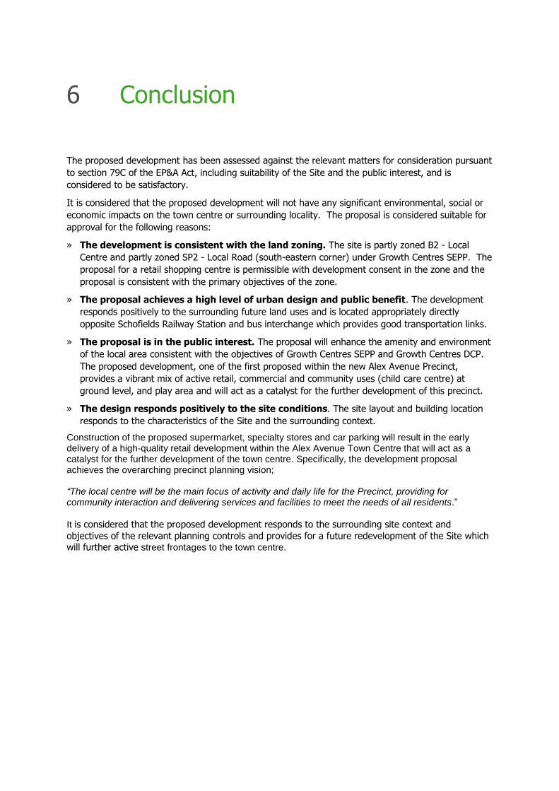
The proposed development has been assessed against the relevant matters for consideration pursuant
to section 79C of the EP&A Act, including suitability of the Site and the public interest, and is
considered to be satisfactory.
It is considered that the proposed development will not have any significant environmental, social or
economic impacts on the town centre or surrounding locality. The proposal is considered suitable for
approval for the following reasons:
» The development is consistent with the land zoning. The site is partly zoned B2 - Local
Centre and partly zoned SP2 - Local Road (south-eastern corner) under Growth Centres SEPP. The
proposal for a retail shopping centre is permissible with development consent in the zone and the
proposal is consistent with the primary objectives of the zone.
» The proposal achieves a high level of urban design and public benefit. The development
responds positively to the surrounding future land uses and is located appropriately directly
opposite Schofields Railway Station and bus interchange which provides good transportation links.
» The proposal is in the public interest. The proposal will enhance the amenity and environment
of the local area consistent with the objectives of Growth Centres SEPP and Growth Centres DCP.
The proposed development, one of the first proposed within the new Alex Avenue Precinct,
provides a vibrant mix of active retail, commercial and community uses (child care centre) at
ground level, and play area and will act as a catalyst for the further development of this precinct.
» The design responds positively to the site conditions. The site layout and building location
responds to the characteristics of the Site and the surrounding context.
Construction of the proposed supermarket, specialty stores and car parking will result in the early delivery of a high-quality retail development within the Alex Avenue Town Centre that will act as a catalyst for the further development of the town centre. Specifically, the development proposal achieves the overarching precinct planning vision; “The local centre will be the main focus of activity and daily life for the Precinct, providing for community interaction and delivering services and facilities to meet the needs of all residents.”
It is considered that the proposed development responds to the surrounding site context and
objectives of the relevant planning controls and provides for a future redevelopment of the Site which will further active street frontages to the town centre.
6 Conclusion

68 _ Elton Consulting

Document Title Prepared by Refer to
Architectural Drawings Christiansen O’Brian Architects Appendix A
Transport Impact Assessment PeopleTrans Appendix B
Geotechnical Report Geo-Logix Pty Ltd Appendix C
Environmental Report –
Detailed Site Investigation
Geo-Logix Pty Ltd Appendix D
Acoustic Report Renzo Tonin & Associates Appendix E
CPTED Performance Indesign Access Appendix F
Access Report Ergon consulting Appendix G
Infrastructure Henry & Hymas Appendix H
AHIMS Search - Appendix I
PAM Minutes Blacktown City Council Appendix J
Waste Management Plan Christenson O’Brien Architects Appendix K
Landscape Plan Conzept Landscape
Architecture
Appendix L
NCCC Capability Report Vic Lilli and Partners Appendix M
Appendix

Drawing No Rev Drawing Title
DA00 DA Cover Sheet and Location Plan
SV01 DA Existing Survey Plan
EX01 DA Existing Site Plan (with proposed roads)
DA01 DA Proposed Site Plan - Stage 2
DA01-1 DA Proposed Site Plan - Stage 1
DA02 DA Proposed Basement Plan
DA03 DA Proposed Ground Floor Plan Part 1- Stage 2
DA03-1 DA Proposed Ground Floor Plan Part 1- Stage 1
DA04 DA Proposed Ground Floor Plan Part 2- Stage 2
DA04-1 DA Proposed Ground Floor Plan Part 2- Stage 1
DA05 DA Proposed Roof Plan
DA06 DA Proposed Elevations
DA07 DA Proposed Sections
DA08 DA Proposed Signage Plan Part 1
DA09 DA Proposed Signage Plan Part 2
FS01 DA Schedule of Finishes and Colours
SA01 DA Site Analysis Plan Part 1
SA02 DA Site Analysis Plan Part 2
SD01 DA Shadow Diagrams
AR01 DA Area Plan
Proposed Subdivision Plan Land Partners
A Architectural Drawings


B Traffic Impact Assessment

C Geotechnical Report

D Environmental Report – Detailed Site Investigation

E Acoustic Report

F CPTED Report

G Access Report

Stormwater and Design Document
Drawing No. Drawing Name Rev
17B01_DA_C000 COVER SHEET, DRAWING SCHEDULE, & LOCALITY SKETCH 02
17B01_DA_C100 GENERAL ARRANGEMENT PLAN 02
17B01_DA_C101 DETAIL PLAN, SHEET 1 OF 3 04
17B01_DA_C102 DETAIL PLAN, SHEET 2 OF 3 04
17B01_DA_C103 DETAIL PLAN, SHEET 3 OF 3 04
17B01_DA_C110 TYPICAL SECTIONS 01
17B01_DA_C115 BASEMENT RAMP 1 PLAN AND SECTIONS 01
17B01_DA_C116 BASEMENT RAMP 2 PLAN AND SECTIONS 01
17B01_DA_C200 STORMWATER PIT LID SCHEDULE 01
17B01_DA_C201 OSD PLAN 02
17B01_DA_C202 OSD SECTIONS AND DETAILS 02
17B01_DA_C210 STORMWATER LONGSECTIONS SHEET 1 OF 3 02
17B01_DA_C211 STORMWATER LONGSECTIONS SHEET 2 OF 3 02
17B01_DA_C250 STORMWATER CATCHMENT PLAN 02
17B01_DA_C251 MUSIC MODELLING CATCHMENT PLAN 02
17B01_DA_C252 STORMWATER DETAIL CATCHMENT PLAN 02
17B01_DA_C600 MINERVA ROAD DETAIL PLAN 01
17B01_DA_C601 MINERVA ROAD LONGSECTIONS 01
17B01_DA_C602 MINERVA ROAD TYPICAL SECTIONS 01
17B01_DA_BE00 CUT AND FILL EARTHWROKS PLAN 01
17B01_DA_BE01 EARTHWORKS SECTIONS 01
17B01_DA_SE01 SEDIMENT AND EROSION CONTROL PLAN 02
17B01_DA_SE02 SEDMENT AND EROSION DETAILS 02
H Infrastructure

I AHIMS Search

J PAM Minutes

K Waste Management Statement


L Landscape Plan

M NCCC Capability Report

N Town Plaza Concept
