standard operating procedures - georgia environmental protection
TRANSCRIPT

Macroinvertebrate Biological Assessment of
Wadeable Streams in Georgia
STANDARD OPERATING PROCEDURES
March 2007
Georgia Department of Natural Resources
Environmental Protection Division
Watershed Protection Branch
Version 1.0

TABLE OF CONTENTS
Chapter 1 Introduction and Background Information 1.1 Introduction……………………………………………………………………………………..… 1-1 1.2 Laws and Regulations…………………………………………………………………………….. 1-2 1.3 Site Selection……………………………………………………………………………………... 1-2 1.3.1 Monitoring Plans and Watershed Assessments…………………………………………….. 1-4 1.4 When to Sample………………………………………………………………………… .….…… 1-4 1.4.1 Severe Weather Events……………………………………………………………….…….. 1-5 1.5 REFERENCES…………………………………………………………………………………… 1-6 Chapter 2 Macroinvertebrate Biological Assessment Field Procedures 2.1 Physical Characterization……………………………………………………………………….... 2-2 2.1.1 Reach Delineation…………………………………………………………………………... 2-2 2.1.2 GPS Coordinates…………………………………………………………………………..... 2-3 2.1.3 Visual-Based Physical Habitat Assessment……………………………………………….... 2-4 2.1.4 Physical Characteristics/Water Quality Field Data Sheet………………………………….. 2-6 2.1.5 Stream Cross Sectional Measurement……………………………………………………… 2-11 2.1.6 Velocity/Discharge Measurement………………………………………………………..… 2-14 2.1.6a Flow Meter…………………………………………………………………………….. 2-15 2.1.6b Float Method…………………………………………………………………………... 2-15 2.1.6c Quality Control/Quality Assurance……………………………………………………. 2-16 2.1.7 Modified Wolman Pebble Count………………………………………………………….... 2-16 2.2 Water Quality Chemistry Protocol……………………………………………………………….. 2-18 2.2.1 Water Chemistry Collection Protocol-“Grab Method”…………………………………….. 2-19 2.2.2 Water Chemistry Collection Protocol –“Clean Hands” Method for Metals……………….. 2-21 2.2.2a Quality Control/Quality Assurance……………………………………………………. 2-23 2.2.3 In-situ Measurements(Multiprobe)…………………………………………………….…… 2-23 2.2.3a Quality Control/QualityAssurance…………………………………………………….. 2-24 2.2.4 In-situ Turbidity Measurements……………………………………………………………. 2-24
2.2.4a Quality Control/Quality Assurance…………………………………………………… 2-24 2.3 Georgia Macroinvertebrate Collection Protocol (GMCP) for Wadeable Streams……….………. 2-24 2.3.1 Aquatic Dip Net – 20 Jab Method……………………………………………………….…. 2-24 2.4 Labels and Chain-of-Custody………………………………………………………………….…. 2-29 2.5 REFERENCES…………………………………………………………………………………… 2-32 Appendices Appendix 2A Forms……………………………………………………………………………. 2A-1 Appendix 2B Supplemental Information…………………………………………………………. 2B-1

Chapter 3 Macroinvertebrate Biological Assessment Sorting and Subsampling Procedures 3.1 Macroinvertebrate Laboratory Sorting and Subsampling………………………………………... 3-1 3.1a Quality Control/Quality Assurance for Subsampling……………………………………….. 3-6 3.1a1 % Sorting Efficiency……………...……………………………………………………. 3-6 3.1a2 Duplicate Subsample…………………………………………………………………... 3-7 3.1a3 Complete Sample………………………………………………………………………. 3-7 3.1b Quality Assurance for Evaluating Consistency……………………………………………... 3-8 3.2 Sample Recharging……………………………………………………………………………….. 3-8 3.3 REFERENCES…………………………………………………………………………………… 3-8 Appendices Appendix 3A Forms…………………………………………………………………………….... 3A-1
Chapter 4 Macroinvertebrate Biological Assessment Identification Procedures 4.1 Macroinvertebrate Laboratory Identification…………………………………………………….. 4-1 4.1a Archive……………………………………………………………………………………… 4-4 4.1b Voucher Collection………………………………………………………………………….. 4-5 4.2 Laboratory Quality Control/Quality Assurance………………………………………………….. 4-5 4.2a Taxonomic Quality Control/Quality Assurance…………………………………………….. 4-5 4.2b Taxonomic Quality Control/Quality Assurance Calculations………………………….…… 4-6 4.3 REFERENCES…………………………………………………………………………………… 4-8 Appendices Appendix 4A Forms…………………………………………………………………………….... 4A-1
Chapter 5 Macroinvertebrate Biological Assessment Data Analysis Procedures 5.1 Ecoregional Divisions in Georgia………………………………………………………………… 5-1 5.1a Piedmont Ecoregion (45)……………………………………………………………………. 5-1 5.1b Southeastern Plains Ecoregion (65)…………………………………………………………. 5-2 5.1c Blue Ridge Ecoregion (66)………………………………………………………………….. 5-4 5.1d Ridge and Valley Ecoregion (67)…………………………………………………………… 5-5 5.1e Southwestern Appalachians Ecoregion (68)………………………………………………… 5-6 5.1f Southern Coastal Plain Ecoregion (75)……………………………………………………… 5-6 5.2 GA EPD Multi-Metric Index……………… 5-11 5.2a Protocol for Tolerance Values/Habitat/FFG for GA EPD…………………………………... 5-14 5.3 Guidelines for using Old Macroinvertebrate Data with the New Metrics.……………………….. 5-19 5.4 REFERENCES…………………………………………………………………………………… 5-20 Appendices Appendix 5A Metric Equations….……………………………………………………………….. 5A-1

List of Tables and Figures
Tables Table 2-1 DNR Macroinvertebrate Bioassessment Chemical Parameters…………………………… 2-19 Table 2-2 Prioritized List of Habitat Types for Sampling and Sampling Reallocation……………… 2-28 Table 5-1 List of Ecoregions and Subecoregions for the State of Georgia…………………………... 5-9 Table 5-2 Metric Stress Response……………………………………………………………………. 5-12 Table 5-3 Stream Rating Based on Numeric Rating ………………………………………………... 5-14 Figures Figure 2-1 GA DNR Sampling Process Organizational Chart……………………………………….. 2-1 Figure 2-2 Stream Channel Cross Section……………………………………………………………. 2-14 Figure 2-3 Particle Schematic…………………………………………….…………………………... 2-17 Figure 2-4 Pebble Count Transects…………………………………………………………………... 2-17 Figure 5-1 Level III and IV Ecoregions Map for the State of Georgia………………………………. 5-10
1-2

Chapter 1

Georgia Department of Natural Resources
Environmental Protection Division
Introduction and Background
Information

1.1 Introduction The Standard Operating Procedures (SOP) Manual is designed to describe and document the Georgia Department of Natural Resources (GADNR), Environmental Protection Division’s (EPD) operations associated with aquatic macroinvertebrate biological monitoring in wadeable streams. The primary purpose of this document is to establish and maintain uniform methodology and quality control guidance for biological data collected within the state. Compliance with these procedures is essential to produce reliable biological data. This document is intended for use as a training resource for all Ambient Monitoring Unit sampling employees as well as a technical manual to be used as a reference for study plans and reports. Deviations from this SOP manual should receive prior approval from EPD staff and be explained and documented. Resident biota in a water body functions as continual monitors of environmental quality. They are capable of detecting the effects of episodic and cumulative pollution, as well as the effects of altering available habitat. Any stress (biological, chemical, or physical) imposed on an aquatic ecosystem manifests its impact on the biological organisms present in that ecosystem such that the organisms may not sufficiently recover to reestablish their pre-stress community structure (Loeb and Spacie, 1994). Aquatic macroinvertebrates are good indicators of contamination because they are resident monitors of pollution and are less able to migrate from the impairment. Since macroinvertebrates must persist in the contaminant field, they indicate past conditions as well as current conditions. Therefore, the structure and function of resident biota is a direct measurement of the condition of the aquatic ecosystem. Other advantages of using benthic macroinvertebrates include: (1) large number of species offering a spectrum of responses to perturbations; (2) well developed qualitative sampling and analytical methods; (3) simple inexpensive equipment requirements; (4) the responses of many common species to different types of pollution have been established; (5) macroinvertebrates are well suited to experimental studies of perturbation; and, (6) the taxonomy of many groups is well known and identification keys are available (Hauer and Lamberti 1996). When simultaneously monitoring the chemical, physical, and biological integrity of a water body, the ecological integrity or health of the aquatic ecosystem can be determined (USEPA, 1990). Both biological and chemical methods play critical roles in a successful pollution control program. They should be considered complementary rather than mutually exclusive approaches that will enhance overall program effectiveness when used appropriately (Plafkin et al., 1989). In turn, the ecological condition of an aquatic ecosystem provides an evaluation for determining whether or not the water body is, or is not, impaired. In turn, with these tools, aquatic biologists are able to evaluate the ecological condition for determining whether or not the waterbody is impaired.
1-1

1.2 Laws and Regulations The condition of surface waters in the Unites States is covered by a number of regulations regarding monitoring and control of identified pollutants, non-point sources of pollutants, the maximum load of both point and non-point pollutants, and the development of new and better monitoring strategies.
Section 101(a) of the Clean Water Act (CWA) states the restoration and maintenance of the chemical, physical, and biological integrity of the nation’s waters as its primary objectives. Section 305 (b) of the CWA requires states to regularly report the condition of their waters (EPA 1997). This is accomplished by conducting ambient water monitoring to determine changes in water quality over time, designating the sources of water quality problems, and determining if pollution control programs are working.
A point source is defined as any discernible, confined, and discrete conveyance, including but not limited to any pipe, ditch, channel, tunnel, conduit, well, discrete fissure, container, rolling stock, concentrated animal feeding operation, or vessel or other floating craft, from which pollutants are or may be discharged (EPA 1992a). According to section 502(14) of the CWA, nonpoint sources are defined as sources of water pollution that do not meet the legal definition of a “point source”. Section 319 of the 1987 CWA indicates that states are; “(1) required to conduct statewide assessments of their waters to identify those that were either impaired (did not fully support state water quality standards) or threatened (presently meet water quality standards but are likely not to continue to meet water quality standards fully) because of Nonpoint Source Programs (NPS’s); (2) required to develop NPS management programs to address the impaired or threatened waters identified in their nonpoint assessments; and, (3) entitled to receive annual grants from the EPA to assist them in implementing their NPS management programs once the EPA has approved the assessments and programs” (EPA 1997).
Total maximum daily loads (TMDLs) allocate allowable loads among different pollutant sources (both point- and nonpoint-) so that appropriate control actions can be taken, water quality standards may be achieved, and human health and aquatic resources can be protected (EPA 1994a). TMDLs are a significant issue throughout the nation and it is important to understand the relationship between nonpoint sources and biological assessments and criteria. The total maximum daily load (TMDL) program is designed to identify those waters that do not meet non-point source water quality standards, required by section 303 (d) of CWA (EPA 1997). States are required to develop TMDL’s for each chemical parameter and a priority ranking for those waters not meeting water quality standards. The TMDL program helps to identify and establish controls to reduce nonpoint source pollution. 1.3 Site Selection When selecting sample sites one should take into consideration the specific monitoring issue (e.g. short-term impacts or long-term trends), possible point and non-point influences in the watershed of the stream to be sampled, structural influences (bridges,
1-2

dams) that may fall into the selected reach, accessibility, and safety. Before any sampling is conducted, an initial reconnaissance inspection should be accomplished to determine if the selected sample locations are feasible. The field investigator should fill out a Waterbody Reconnaissance Report (see p.2A-2) during this time. Sampling locations immediately above or below the confluence of two streams, or a stream and a point/non-point source discharge, should be avoided as mixing does not occur immediately. Unless the stream is extremely small or turbulent, an in-flow will usually flow along the stream bank with little lateral mixing for some distance. This could result in two very different biological populations and an inaccurate assessment of stream conditions. This can be avoided by sampling the area where mixing has occurred. If the study is to determine the distance of effects caused by a pollution source then a series of sampling stations at points of increasing distance from the impact source(s) can be set up. These stations will provide a basis for delineating impact and recovery zones. Sampling near the mouths of tributaries entering large waterbodies should be avoided because these areas will have habitat more typical of the large waterbody (Karr et al., 1986). Streams in different regions of the state can have structures that deviate greatly from the morphology of a “typical” stream. What follows is an attempt to help you determine how to sample those streams. Braided streams - all of the braids in the 100-meter reach should be sampled; the jabs should be divided among the braids as evenly as possible. Swampy - some of the streams in South Georgia can spread out and be swampy in appearance, these should only be sampled if the main channel is discernible and the wet areas outside of the channel are at most only a few inches deep. The jabs in these streams should be collected within the channel and not the shallow backwater areas. Tidal – these should be sampled only at low tide; this is the only time true discharge can be calculated. This will also allow you to collect the freshwater organisms that may have been hiding from possible salt influence at high tide. It should be noted here that salt influence could be easily determined during reconnaissance by taking a conductivity reading at high tide. This reading is important because until the Wildlife Resources Department (WRD) or the Coastal Resources Division (CRD) develops metrics for estuarine fish, salt influenced tidal sites do not need to be sampled for fish. Valid conductivity readings must be taken and presented to allow for fish sample exclusion for watershed assessments (WSA’s) and watershed protection plans (WPP’s). Blackwater – Some of the subecoregions are dominated by, or completely made up of, blackwater streams. These are sampled the same way as other streams in the area; the only distinction that determines a difference in sampling protocols is high gradient or low gradient. Locally modified sites, such as small impoundments (man and beaver made) and bridge areas, should be avoided unless these data are needed to assess their effects. Bridges and impoundments may alter the water flow or cause sediment deposition, which may result in major changes within the macroinvertebrate population diversities. Due to the fact that material is often thrown from bridges, it is advisable to sample the waterbody at least 100 meters upstream of the bridge to reduce the chance of influence. Being upstream at least 100 meters minimizes the effect on stream velocity, depth, and overall habitat quality.
1-3

The sampling reach should be representative of the characteristics of the stream. No major tributaries should be discharging within the sampling reach. When selecting the 100 meter reach, every effort should be made to avoid sampling in areas where beaver dams are present. The presence of beaver dams may result in inaccurate data. 1.3.1 For Monitoring Plans and Watershed Assessments County and topographic maps should be used to locate all possible access points within the scope of the study. It is also strongly encouraged that a pre-submittal meeting be scheduled with EPD staff to discuss the components of the Monitoring Plan. This will cut down on the amount of time spent in transit for revisions. 1.4 When to Sample Reproductive periods and different life stages of aquatic insects are related to the abundance of particular food supplies (Cummins and Klug, 1979). Peak emergence and reproduction typically occur in the spring and fall, although onset and duration vary somewhat across the United States. During peak reproduction, approximately 80 percent of the macroinvertebrates will be too small to be captured in sufficient numbers to accurately characterize the community. Additionally, food source requirements for early instars are different from those of later instars. Therefore, the biologically optimal sampling season would occur when the habitat is utilized most heavily by later instars and the food resource has stabilized to support a balanced indigenous community (Plafkin et al., 1989). Biologically optimal periods start in the fall and continue through winter. Georgia’s Index Period for sampling is mid-September through February. If the study objective is to document stream conditions due to improvement of wastewater treatment, removal of a treatment system, etc., then the biological evaluation could be limited to one sampling event during periods of greatest environmental stress such as low flow, high temperature periods for point source discharges or high flow, runoff periods for nonpoint source discharges. Assessment of worst-case conditions may be needed under certain permitting regulations, or as a follow-up to sampling during biologically optimal periods, where impairment is detected (Plafkin et al., 1989). In evaluating the success of a Best Management Practice (BMP), it is necessary to compare pre-improvement biological conditions to post-improvement biological conditions. Thus, sampling strategies should be designed to allow such comparison. Reasons for sampling during the specific index period: 1. Watershed assessments to evaluate general ecosystem health. 2. Problem identification of specific sites. 3. Trend monitoring efforts. 4. Measuring BMP effectiveness.
1-4

1.4.1 Severe Weather Events Macroinvertebrate communities can be heavily influenced by severe weather events such as rain and drought. Sampling immediately after a major rain event (>1 inch) should be avoided because of the increased velocities and scour, both of which can cause drift of the macroinvertebrates. Collection of samples from affected streams should be postponed at least two weeks after a major rain event to allow the macroinvertebrate communities to stabilize. Drought can have just as profound of an effect on macroinvertebrate communities; caused by both reduction of dissolved oxygen from high temperatures and of available living space from decreased flow. Streams that have extremely low flow due to severe drought should not be sampled. Additionally, streams that exhibit increased water levels due to drought relief caused by increased rains should not be sampled until two to three weeks of sustained higher flows have passed. This will allow proper colonization and stabilization of the recently wetted habitats. Sampling of fish and macroinvertebrate communities in a reach should not be done concurrently. The process of sampling one of the communities will invariably disturb the other. If fish are sampled first then two weeks should be allowed for stabilization of the macroinvertebrate communities. If macroinvertebrates are sampled first there would be substantially less wait time for the fish communities to stabilize due to the higher mobility of fish. Catastrophic events such as fish kills or spills can occur at any time. Therefore, the evaluation of these sites might not occur during specific index periods. Some pages are intentionally left blank to allow for copying of field and laboratory sheets. This document is to be considered a living document and may be updated as new data and procedures become available. Updates will be posted on the website listed below. If you have any questions or comments about this manual, please contact the Ambient Monitoring Unit at: Georgia Environmental Protection Division Watershed Protection Branch Watershed Planning and Monitoring Program Ambient Monitoring Unit 4220 International Parkway Suite 101 Atlanta, Georgia 30354 Phone: 404-675-6236 Fax: 404-675-6244 http://www.gaepd.org/
1-5

1.5 References Cummins, K.W., and M.J. Klug. 1979. Feeding ecology of stream invertebrates.
Annual Review of Ecological Systematics 10:147-172. Hauer, R. F. and Lamberti, G. A. edited by. 1996. Methods in Stream Ecology.
Academic Press, San Diego, California, 161 – 162; 339 –370; 647 – 665 pp. Loeb, S. L. and A. Spacie. 1994. Biological monitoring of aquatic systems.
Lewis Publishers. Plafkin, J.L., M.T. Barbour, K.D. Porter, S.K. Gross, and R.M. Hughes. 1989. Rapid
bioassessment protocols for streams and rivers: benthic macroinvertebrates and fish. EPA/440/4-89-001. Office of Water, U.S. Environmental Protection Agency, Washington, DC.
(USEPA) U.S. Environmental Protection Agency. 1990. Biological criteria: National
program guidance for surface waters. Office of Water Regulations and Standards, Washington, D.C. EPA/440/5-90-004.
(USEPA) U. S. Environmental Protection Agency January 1992a. Managing
Nonpoint Source Pollution. U. S. Environmental Protection Agency, Office of Water, Washington, DC. EPA-506/9-90.
(USEPA) U.S. Environmental Protection 1994a. Biological criteria. National program guidance for surface waters. Gibson, G.R. (editor). U. S. Environmental Protection Agency, Office of Science and Technology, Agency, Washington, D.C. EPA 440/5-90-004.
(USEPA) U. S. Environmental Protection Agency August 1997. State Source Water Assessment and Protection Programs Guidance: Final Guidance. U. S. Environmental Protection Agency, Office of Water, Washington, DC. EPA816- R-97-009.
1-6

Chapter 2

Georgia Department of Natural
Resources
Environmental Protection Division
Macroinvertebrate Biological
Assessment Field Procedures

Figure 2-1: GA DNR Sampling Procedure Organizational Chart
2-1

These procedures are designed and intended for the assessment of wadeable streams only. The monitoring protocols used in Georgia consist of three basic components: physical characterization, water quality, and a biosurvey of the aquatic benthic macroinvertebrates. The physical characterization evaluates habitat quality using key structural parameters (habitat assessment, pebble count, cross section, and flow) and can be used in conjunction with water quality data to determine potential sources and/or probable causes of impairment. If a degraded community is discovered from the results of the biosurvey, physical information will aid interpretation of effects relative to the biotic potential of a site. Conducting a pebble count will establish a representation of a stream’s substrate composition at the time of sampling and can be used during future studies to detect changes related to sediment loading. If impairment is detected, the investigator provides an estimation of the probable cause and source(s) on the Physical Characterization and Water Quality Field Data Sheet (see p. 2A-12). For the order of operations on field procedures, please refer to flow chart on p. 2-1 (Figure 2-1). 2.1 Physical Characterization 2.1.1 Reach Delineation The sampling location on a stream should be a minimum of 100 meters upstream from a road or bridge crossing. Being upstream at least 100 meters minimizes the effect on stream velocity, depth, and overall habitat quality. The sampling reach should be representative of the characteristics of the stream. No major tributaries should be discharging within the sampling reach. When selecting the 100 meter reach, every effort should be made to avoid sampling in areas where beaver dams are present. The presence of beaver dams may result in inaccurate data. Once a location has been selected, the first step of the GA DNR Macroinvertebrate Bioassessment Protocol is to establish a reach of 100 meters. This can be done either during site reconnaissance or before any sampling has been conducted. Equipment/Materials:
- Meter tape (either 100 m or 50 m) - Flagging tape or Flags - Flagging stakes
Procedure:
1.) The lower portion of the selected reach (the downstream end) is the zero mark. Flag off this location with brightly colored flags or flagging tape (Flagging tape can be tied around trees, bushes, or other overhanging material. Just make sure it is visible while sampling in the stream.). If the Waterbody Reconnaissance Report (see p. 2A-2) has not been completed during a previous visit, do so now.
2-2

2.) Either tie off the meter tape or have another assessor hold the meter tape as you walk along banks to measure the reach. Make sure not to walk in sampling reach prior to sampling. Closely follow the channel (In rare cases vegetation may prevent field assessors from walking along the bank, in these cases use great caution not to disturb the sampling reach as you walk along the waters edge.). If the reach is being delineated at least three weeks before the sample date then the person marking off the reach can walk up the stream channel. In cases of high sinuosity, the reach should follow the sinuous channel.
3.) Mark the 50m mark either with bright colored flags or flagging tape. Flagging
tape can be tied around trees, bushes, or other overhanging material. Just make sure it is visible while sampling in the stream.
4.) Continue to walk along the bank to measure the reach. Depending on the length
of your meter tape, you may need to tie off again at the fifty or have another field assessor hold the tape at the 50-meter mark.
5.) Mark the 100m mark with either brightly colored flags or flagging tape (This will
be your upper portion of the reach, the upstream end.). Flagging tape can be tied around trees, bushes, or other overhanging material.
6.) Walk back with the meter tape in hand to the zero meter mark. Making sure not to
walk in the sampling reach. 2.1.2 GPS Coordinates Equipment/Materials:
- Pebble Count Field Sheet (p. 2A-26) - GPS unit - Pencils - Clipboard
After the reach has been delineated, the GPS coordinates at the start of the reach should be recorded. The latitude and longitude should be recorded in both decimal degrees and degrees, minutes, seconds. This eliminates possible difficulties with coordinate conversions. Make sure to legibly record the coordinates on all associated field sheets After sampling the site, make sure all field sheets are completed with the correct latitude and longitude, making sure not to transpose numbers. Try to take the coordinate readings at the zero meter mark on the bank (near water’s edge). If you receive a message of poor satellite reception, move further up the bank to take readings. If the unit still indicates poor satellite reception, move to the top of the bank or a nearby clearing in close proximity to the zero mark. On the Pebble Count Field Sheet (see p. 2A-26) record the coordinate location description. For example, in most cases the reading will be taken at the zero meter mark. Note from which bank the coordinates were taken (left bank or right bank). Record the direction and distance of the location in the coordinate location
2-3

description (when not at the zero meter mark). For some units, you may be able to record the Position Dilution of Precision (PDOP) and differential correction. Most readings will have an error of at least ± 10-15 feet. Record any error given by the unit. 2.1.3 Visual-Based Physical Habitat Assessment The habitat assessment process involves rating the ten parameters as Optimal, Suboptimal, Marginal, or Poor based on the criteria included on the Habitat Assessment Field Data Sheets (see p. 2A-4). The optimal category describes criteria for each parameter that meets natural expectations. The suboptimal category includes criteria that is less than desirable, but satisfies expectations in most areas. The marginal category includes judgement criteria describing moderate levels of degradation with severity at frequent intervals in the area. The final category, poor, encompasses criteria for streams having been substantially altered with severe degradation characteristics. Equipment/Materials:
- Habitat Assessment Field Data Sheet (High Gradient or Low Gradient) (p. 2A-4) - Habitat Assessment Average (High Gradient or Low Gradient) (p. 2A-8) - Supplemental Information (High Gradient or Low Gradient) (Appendix 2B) - Pencils - Clipboards
(The following procedure was developed by Columbus State University (2000) and part of this method was taken from Barbour et al. (1999).) The habitat assessment is conducted after the reach has been delineated and the GPS coordinates taken. For Quality Assurance/Quality Control (QA/QC) purposes, each biologist individually performs the assessment and the results are recorded on the Habitat Assessment form (see p. 2A-4). The habitat assessment should be conducted by two to three investigators (preferably three). This will help reduce the subjectivity of the assessment. The appropriate Habitat Assessment field sheet should be filled out separately by each investigator. The investigator completing the physical characterization / water quality field sheet can complete the habitat assessment at the same time. The habitat assessment is conducted by walking the entire 100 meter reach prior to sampling. (Walk along the banks when conducting the assessment so as not to disturb the habitat.) If the total habitat scores deviate 30 or more points from one another, then the biologists should take the time to discuss their individual parameter scores while at the sampling location. If three or more people are conducting the assessment and one of the total habitat scores deviates 30 or more points from the other assessors’ scores, then the team leader has the option to discard the outlier before calculating the average total habitat score. (Retain all original data sheets for each site.) All personnel conducting the habitat assessments will be trained in a consistent manner to ensure both standardization and proper performance of the evaluations. Field validation,
2-4

conducted at least once per year, will involve comparison of independent habitat evaluations by all investigators of a particular field site. Streams are assessed for habitat based on high (riffle/run) or low (glide/pool) gradients. The choice of using the high or low gradient field data sheet will depend on: (1) Location of sample site within the state; (2) The presence or absence of riffles; and, (3) Best professional judgment. During drought conditions or low flow conditions, high or low gradient is based on whether there should or should not be riffles. One way to determine this is, in high gradient streams, there may be areas where small gravel and cobble is in the stream, indicating it was once a riffle at higher flow. High gradient (riffle/run prevalent) streams are those in moderate to high gradient landscapes that sustain water velocities of approximately 1.0 ft/sec or greater. These streams have substrates primarily composed of coarse sediment particles (i.e. gravel or larger) or frequent coarse particulate aggregations along the stream reaches. Low gradient (glide/pool prevalent) streams are those in low to moderate gradient landscapes that have water velocities rarely greater than 1.0 ft/sec, except during storm events. These streams have substrates of fine sediment or infrequent aggregations of coarser (i.e. gravel or larger) sediment particles along the stream reaches (Barbour and Stribling 1995). Generally the streams north of the fall line are high gradient and those below the fall line are low gradient. However, there are always exceptions to the rule. Areas near and around the fall line are examples of where a low gradient stream may occur above the fall line or a high gradient stream may occur below the fall line. Thus, it is important to determine whether the stream has riffles, or should have riffles under normal flow conditions. The habitat parameters evaluated are related to overall aquatic life use and are a potential source of limitation for the aquatic biota (Plafkin et al., 1989). The physical parameters of the habitat assessment are broken into primary, secondary, and tertiary categories. Primary parameters describe those instream physical characteristics that directly affect the biological community. Primary conditions include epifaunal substrate/available cover, embeddedness, velocity/depth regime, and pool substrate/variability. Secondary parameters include channel alteration, sediment deposition, channel flow status, frequency of riffles, and channel sinuosity. These parameters relate to channel morphology, which controls the behavior of stream flow and the sediment deposits, which the stream collects. The tertiary parameters in the habitat assessment matrix pertain to the riparian vegetation and stream bank structure. These include bank stability, bank vegetative protection, and the riparian vegetative zone. The stability of a streambank indirectly affects the type of habitat available within a stream. Vegetated banks reduce the amount of sediment that washes from the streambank by absorbing energy from the raindrops, binding soil particles, and reducing the velocity of runoff water. Less sediment to cover rocks and logs results in more habitats available for colonization by invertebrates. All parameters are usually evaluated over the designated area (100 meters) of stream (Plafkin et al. 1989; Ball 1982; Platts et al. 1983). Make sure to completely fill out the Habitat Assessment form (see both high and low gradient forms (see p. 2A-4 to 2A-7) and the average Habitat Assessment form (see p. 2A-8 to 2A-10)) and use the correct form based on stream type. Remember to
2-5

determine left bank and right bank by looking downstream. Supplemental information has been provided (see p. 2B-1 to 2B-20), which will help with the breakdown of the point scale for individual parameters. New investigators should use this information in conjunction with the Habitat Assessment form if questions arise at a site. 2.1.4 Physical Characteristics/Water Quality Field Data Sheet The Physical Characteristics and Water Quality Field Data Sheet (see p. 2A-12) is completed after the reach has been delinated and the GPS coordinates recorded. The Physcial Characteristics and Water Quality Field Data Sheet can be completed by one person at the same time the habitat assesment is being conducted. Modifications to the sheet may be necessary once sampling is complete. For example, when accessing the stream from the bank, the invesigator may not have noticed an oil slick. Thus, this would need to be recorded. All personnel present during sampling should be consulted for additional observations that may have been overlooked by the principal investigator. Make sure to fill out the Physical Characteristics and Water Quality Field Data Sheet completely before leaving the sampling location. Equipment/Materials :
- Physical Characteristics/Water Quality Field Data Sheet (p. 2A-12) - Pencils - Clipboard
Procedures: (The following procedure was developed by Columbus State University (2000) and Barbour et al. (1999).)
1. Site Location/Map: The first step for assessing the physical parameters is to draw a map of the stream reach. Include items such as large trees on each bank, large snags, undercut banks, other available habitats and features that are deemed important by the investigator. The hand-drawn map is useful to illustrate major landmarks, channel morphology, vegetative zones, buildings, and other features that might be used to aid in data assessment.
2. The next step is to fill in the rest of the field sheet completely for all parameters.
The following are general comments for each of the field parameters that should be measured/observed and documented on the Physical Characteristics and Water Quality Field Data Sheet:
2-6

a. Stream Characterization:
i. Subsystem Classification: The stream subsystem is marked to indicate whether the stream is perennial or intermittent in nature and if the stream is tidally influenced.
ii. Stream Type: Coldwater and warmwater streams are different.
Many states have established temperature criteria that differentiate these two stream types. Clearwater and Blackwater sites may require separate biocriteria in Georgia. Thus, it is important to determine and mark which stream type is present.
iii. Stream Origin: Note the origination of the stream under study, if
it is known. Examples are glacial, montane, swamp, bogs, and spring fed. As the size of the stream or river increases, a mixture of origins of tributaries is likely.
b. Weather Conditions: Note the present weather conditions on the day of
the survey and those immediately preceding the day of the survey. This information is important to interpret the effects of a storm event on the sampling effort.
c. Riparian Zone/Instream Features:
i. Watershed Features:
1. Predominant Surrounding Land Use: Observe the
predominant land use type in the vicinity. Document the predominant land-use type in the catchment. Note any other land uses that may not be predominant but may potentially affect the water quality. Land use maps can be used to determine the percentage of each type of land use. This information may be recorded in the database (can use GIS to determine this information). On the field sheet, if livestock are present, note the type of livestock, accessibility to the stream, and also note any crops planted (if determinable).
2. Local Watershed Nonpoint Source Pollution: This
refers to the problems and potential problems existing in the watershed. Nonpoint source pollution is defined as diffuse agricultural and urban runoff. Indicate if there is no evidence, some evidence, or obvious sources of nonpoint pollution on the field sheet.
2-7

a. Indicate in the notes section on the field data sheet any instream impact that is visible. For example: Agricultural runoff, Permitted or Illegal discharge, Runoff from road crossing, Fjord in stream, Storm water, Landfill, Stream alteration, Construction, Feedlots, Constructed wetlands, Septic Systems, Dams & Impoundments, Mine seepage, and Logging. Indicate if the possible impairment results from recent or previous activity.
3. Canopy Cover: Estimate the percentage to which the
stream is shaded by overhanging branches. Look straight up, and then scan back and forth to determine how much of the sky is blocked by trees. An exposed stream may experience increased water temperature that may be limiting to some organisms and may be favorable to nuisance algal blooms, which along with the elevated temperature can cause a decreased dissolved oxygen level. A fully shaded stream can inhibit the growth and reproduction of herbaceous aquatic and riparian plants, inhibit primary production, and increase available habitat. (A densiometer may be used in place of visual estimation.)
4. Local Watershed Erosion: The existence of, or potential
for, detachment of soil within the local watershed (the portion of the watershed or catchment that directly affects the stream reach) and its movement into the stream should be noted. Erosion can be rated through visual observation of watershed and stream characteristics (turbidity noted in water quality section). Indicate whether there is no erosion, moderate erosion, or heavy erosion.
ii. Instream Features: Instream features are measured or evaluated
in the sampling reach and catchment as appropriate.
1. High Water Mark: Estimate the vertical distance from the bankfull margin of the stream bank to the peak overflow level, as indicated by debris hanging in riparian or floodplain vegetation, and deposition of silt or soil. In instances where bank overflow is rare, a high water mark may not be evident.
2. Estimated stream width: In order to determine stream
width, estimate the distance (or measure) from bank to bank at different locations of the stream. Estimate an
2-8

average stream width, which is representative of the reach, and record measurement in meters.
3. Estimated Stream Depth: Estimate the vertical distance
from the top of the water surface to the stream bottom at a representative depth in runs, pools, and riffles (when present).
4. Portion of reach Represented by Stream Morphological
Types: The proportion represented by riffles, runs, and pools should be noted to describe the morphological heterogeneity of the reach.
5. Mean Velocity: Record the average of stream velocity in a
representative run area. If equipment for measuring velocity is not available, use the float method. Stream velocity can have a direct influence on the health, variety, and abundance of aquatic communities. The velocity of water flowing through the system influences the amount of dissolved oxygen in the water and the movement of materials and food particles through the system. High water velocities may result in scour and drift, reducing both the abundance and types of macroinvertebrates present. Low water velocities may result in increased sediment embeddedness caused by silt deposition. The presence of dams, channelization, terrain, runoff, and other factors can affect velocity. (For float method refer to Velocity/Discharge Procedures p. 2-14)
6. Reach Length: For the GA DNR Macroinvertebrate
Bioassessment Program the reach length will be 100 meters.
7. Channelized: Indicate whether or not the area around the
sampling station is channelized. Natural, sinuous channelization caused by normal hydrological forces is not considered here. Look for spoil banks, straightening of stream, channel cross section appears box-cut, presence of riprap or other artificial stabilization, and diversions.
8. Dredging: Indicate if the stream channel has been dredged.
9. Dam Present: Indicate the presence of a dam upstream or
downstream of the sampling area that may alter the flow regime, drift, or movement of biota.
2-9

10. Beaver Activity Based on Observations: Observe the watershed and indicate whether there is active beaver activity, previous activity or no activity. However, when selecting the 100 meter reach, every effort should be made to sample in areas without beaver dams. Beaver dams may result in inaccurate data being collected.
11. Livestock Damage Based on Observations: Observe the
watershed and indicate if there has been livestock damage to the stability of the bank. Estimate the amount of observed damage to banks from livestock entering/exiting the channel within the stream reach. Indicate whether there has been no damage; the bank is stable, moderate damage, high damage, or severe damage due to livestock only.
d. Riparian Vegetation: An acceptable riparian zone includes a buffer strip which extends a minimum of 18 m (Barton et al. 1985) from the stream on either side. The acceptable width of the riparian zone may also be variable depending on the size of the stream. Streams over 4 meters in width may require larger riparian zones. Document the vegetation within the riparian zone for dominate type and species, if known. Also indicate whether brush, forest, grass, or exposed represent the riparian zone best. (Some of the common trees found in Georgia include river birch, laurel oak, southern red oak, post oak, willow, red maple, sycamore, locust, hickory, red cedar, cypress, sweet gum, and slash, loblolly, and longleaf pine.)
e. Aquatic Vegetation: Document the general type and relative dominance
of aquatic plants. List the species, if known. An estimation of the extent of aquatic vegetation is made. Aquatic vegetation provides refugia and food for aquatic fauna. It is also an ecological assemblage that responds to perturbation.
f. Sediment/Substrate:
i. Sediment Odors: Disturb the sediment in a pool or other
depositional area and note any odors described (or include any other odors not listed) which are associated with sediment odors observed in the sampling area.
ii. Sediment Oils: Note the term which best describes the relative
amount of any sediment oils observed in the sampling areas.
iii. Sediment Deposits: Note the deposits described (or include any other deposits not listed) which are present in the sampling area. Also indicate whether the undersides of rocks not deeply
2-10

embedded are black (which generally indicates low dissolved oxygen or anaerobic conditions).
iv. Organic Substrate Components: Indicate relative abundance of
the three substrate types listed. This may not add up to 100%.
v. Inorganic Substrate Components: Visually estimate the relative proportion of each of the seven substrate/particle types listed that are present over the sampling reach. This should add up to 100%.
g. Water Quality:
i. Water Odors: Note those odors described (or include any other
odors not listed) that are associated with the water in the sampling reach.
ii. Water Color: Circle the color described (or include any other color
not listed) that is associated with the water in the surrounding area. Planktonic algae, suspended solids, dyes, chemical discharges, etc., may cause color variations.
iii. Water Surface Oils: Note whether any oils are present on the
water surface. Evaluate the water surface for oils before disturbing the sediment. If possible, indicate whether oils are a result of bacterial growth, petroleum, etc.
iv. Water Clarity (Turbidity): Note the term, which, based upon
visual observation, best describes the amount of material suspended in the water column. Turbidity is defined as a cloudy condition in water, due to the suspension of silt or finely divided organic matter, that affects light penetration and the productivity of algae and aquatic plants. The settling of solids alters the nature of the substrate.
v. Water Chemistry: For in-situ and grab methods chemical data see
water chemistry procedures (p. 2-18). 2.1.5 Stream Cross-Sectional Measurement Procedure The cross-section is conducted after the water samples have been collected. With a three to four member team, this can be sampled at the same time the benthic macroinvertebrates are being collected, thus being very careful not to disturb the habitat. If using a two-member team, this would be conducted post macroinvertebrate sampling. The section of the stream to be measured should be as uniform as is available within the reach. The location should be as unobstructed as possible and be as proximal to the 50-meter mark of the sampled reach as is feasible within the reach.
2-11

Note: If discharge measurements are to be conducted, take this into account when selecting the cross section location as both can be performed at the same location. Equipment/Materials:
- Stakes (rebar) - 4 lb. sledge hammer (or regular hammer) - 100 meter tape - Meter stick or Surveying Rod (m) - Line level - Compass - Camera - Pencils - Channel Cross-Section Field Sheet (p. 2A-22) - Clips to hold tape measure - Clipboard
Procedures: (Columbus State University developed this protocol (2000) and used the USDA RM-245 method.)
1. Determine if the 50 m mark in the reach is a representative area for the cross sectional measurements. If not, determine a representative area that is near the 50 meter mark. Make sure to record the location on the Channel Cross-Section Field sheet (p. 2A-22).
2. Establish monuments for measurement points (using stakes). First, determine the
lowest bank in the reach. On that side of the stream, drive the re-bar stake; this will be point A (Figure 2-2). Record the height of the stake (point A) above the surface of the ground; record this under “pin height” on Channel Cross-Section Field sheet (p. 2A-22). Gently brush away any leaves or other organic matter around the stake (monument) before taking this measurement. [The stake on the lower bank can also be used as a permanent monument if multiple samples will be taken at this location. Drive the re-bar stake in the top edge of the stream bank leaving approximately 3-6 centimeters exposed. Spray paint exposed end of stake with a bright color (i.e. hunter orange) and place survey cap on the top of monument. This will allow the cross-section to be established easier and will allow comparability of the data over time.]
3. Secure one end of your 100 meter tape to the rebar and move it across the stream
to the opposite bank, the highest bank, (this will be point B), secure to another stake (This can also be done with a nylon line or camline). This line (tag line) is the fixed point in the landscape to which you will relate your stream cross-section.
2-12

Clip the line level to the meter tape to make sure the line is level. It is critical that the tag line be as level as possible!
4. Establish your tag line so that it is perpendicular to the streamflow.
5. Establish at least one benchmark, but two or three is preferable. The benchmark
is something prominent and distinctive in the area of each cross sectional site to use to find the site at a later date (i.e. manhole cover, boulder, tree, building). Note the direction and distance to Point A on the Channel Cross-Section Field sheet.
6. Record the distance from Point A – (the lower bank rebar) to Point B – (the higher
bank rebar). Also record the width of the active stream channel.
7. Use the compass to measure direction from Point A to Point B. Record on field sheet. Be as accurate as possible. (Record left to right or right to left bank; look downstream to establish left or right bank.)
8. Once the tag line has been established and located, divide the active channel
width (Point A to Point B) by 10 to determine the minimum number of intervals for measurements (should be rounded to nearest centimeter). Enough measurements should be made so that the topographic heterogeneity of the channel is captured. To capture the topographic heterogeneity of the channel, the intervals may need to be divided up further. At least ten measurements must be recorded. Use a meter stick or surveying rod held against tag line for vertical distance measurements. Measure from top of tag line to water surface for elevation and then from water surface to substrate for depth. Record all measurements on field sheet. Record the horizontal distance from the monument (using the meter tape).
9. Record (in remarks section) the locations of various depositional features or other
channel characteristics as measurements are taken across the stream. For example LB=Left Bank, WDJ=Woody Debris Jam, etc. (See field sheet for more examples, p. 2A-23.) Make sure to fill in a remark for each measurement. Thus, in some cases, water may be recorded.
10. After all measurements have been recorded, pictures should be taken. If possible,
take the picture with the tag line visible so it can be used as a reference in the picture. Take photos of the cross section setup from the following vantage points: facing upstream, facing downstream, facing the left bank, and facing the right bank. Photos should also be taken of the benchmarks to allow for ease of locating the cross section point on return possible visits. More photos can be taken if the investigator determines it may be of use. (For example: eroded banks, log jams, sedimentation, etc.) Record the picture numbers on the Channel Cross-Section field sheet in the appropriate location. (Left bank and right bank is determined by looking downstream.)
2-13

Return Trips:
11. During subsequent site visits and upon arrival at a previous cross-sectional site, locate benchmark(s) and consult field sheets for location of site from benchmark(s).
12. Perform horizontal and vertical measurements as given in Figure 2-2.
1 2 3 4 5 6 7 8 9 10
AB
Tag Line
Figure 2-2: Stream Channel Cross Section 2.1.6 Velocity/Discharge Measurements This measurement can be taken with a flow meter or by using the float method. The flow meter used should conform to USGS/ISO methods for wading discharge measurements. Follow the manufacturers instruction manual for flow meter use. (Use of a flow meter for this measurement is preferable, and is required, if loading analysis is considered a possibility) Equipment/Materials:
- Flow meter - Wading Rod OR - Tennis ball with holes or orange - Stopwatch AND - Pencils
2-14

- Velocity/Discharge Field Sheet (p. 2A-24) - Meter stick - 100 meter tape - Clipboard
Procedures: 2.1.6a Flow Meter Discharge readings should be conducted at the same location and time as the cross section and using the same tape measure to determine the location of each measurement station. The section of the stream to be measured should have as uniform of a profile as possible with minimal solid obstructions (i.e. rocks, woody debris, vegetation, etc.), as these objects will interfere with the velocity readings. The location should be as representative as possible to the rest of the stream and be as close to the 50-meter mark of the sampled reach as possible. The cross section should be divided into at least 12 sections. This would result in at least 14 measurements (including the starting-edge and ending-edge measurements); the 12 in-stream measurements should be made at the section division points. For example: If the stream has a width of 8’(96”), with a minimum of 12 measurable sections, each section would be 8” wide (96/12). The first in-stream measurement should be at the second edge of the first section (the first edge being the starting-edge measurement); this would put it at 8” from the starting-edge measurement. Every subsequent measurement (8” apart) would be at the edge of the remaining segments. Velocity/discharge readings should be conducted after the chemical data samples have been collected. With a three to four member team, this can be conducted at the same time the benthic macroinvertebrates are being collected, being careful to disturb the habitat as little as possible. 2.1.6b Float Method To perform the float method, use an orange, a tennis ball with holes in it, or other material that sinks at least halfway into the water. Measure and mark a two meter section of the stream. Two observers will provide the best results. One places the float into the channel upstream of the two points and calls out when it crosses the upstream point. The downstream observer starts the timer. When the float passes the lower point, the timer is stopped and the time is recorded. Repeat the procedure six times at different distances from the bank, within the marked two meter stretch, to get a rough average of velocities. Record the average of the six velocity measurements in m/sec for the mean surface velocity measurement on the Physical Characterization and Water Quality field data sheet (p. 2A-12). Remember: this measurement can be done at the same location as the cross section. If the float method is used, discharge (Q) can be calculated using a simple formula. The average velocity of the measured section must first be multiplied by 0.85 to get an estimate of the water velocity (V) at 0.6 depth. This number is then multiplied by the total area (A) of the cross section (this can be determined by adding together the areas of
2-15

2-16
the incremental cross section measurements).
The formula for discharge using the float method is: Q=AV 2.1.6c Quality Control/Quality Assurance (QC/QA) Proper maintenance and diagnostics, according to manufacturer specifications, should be conducted and documented on a regular basis. 2.1.7 Modified Wolman Pebble Count The pebble count is conducted after the macroinvertebrates are sampled, so as not to disturb the habitat. For field teams of 3 to 4 individuals, the pebble count can be conducted after the cross-section and discharge measurements while the other team members are sampling the macroinvertebrates. The individual(s) will stay behind the macroinvertebrate collection individuals. Equipment/Materials:
- Clipboard - Pencils - Small Calipers (need for all areas) - Large Calipers (need for North GA Streams) - Pebble Count Field Sheet (p. 2A-26) - Meter stick (or other measurement device for measuring large cobble) - Calculator - Sand card
Procedures: This method can be used in conjunction with a Rosgen Level II assessment procedure in the conduct of a watershed-wide assessment, or as a stand-alone method of characterizing particle size distribution in running waters. For GA DNR purposes the pebble count will be a stand-alone method of characterizing particle size distribution in wadeable streams. (This procedure was developed by Columbus State University (2000) and was taken from Harrelson et al. (1994) and Rosegn (1996) methods.) 1. The stream or stream reach of interest is located in the field by the crew. After a
thorough visual assessment of channel characteristics is made, a representative section, based upon the best professional judgment of the crew leader, is selected for analysis as the assessment reach (AR). This section should most closely characterize the channel condition and form within the reach of interest. Unusual conditions, atypical channel forms (i.e. short, transitional areas between longer homogeneous channel reaches) or other disturbances should be avoided unless assessing atypical areas is the purpose of the work.

2. An estimate of the distribution of channel features (i.e. riffles, pools, runs, steps,…etc.)
within the AR or reach of interest (ROI) is made. 3. A total of 20 zig-zag transects are proportionally distributed through the AR or ROI.
Within each zig-zag transect (see Figure 2-4), a total of 5 particles are measured, spanning the width of the wetted channel and point bars. Particles are measured with calipers, or with a sand card, along the intermediate axis as illustrated in Figure 2-3. A hash mark is made on the Pebble Count field sheet in the appropriate size class. A total of 100 particles are counted throughout the AR or ROI. The angle of the zig-zag depends upon the meander pattern of the stream reach being sampled. Stream reaches that exhibit little or no sinuosity do not require as sharp of an angle as highly sinuous reaches.
A = Long AxisB = Short AxisC = Intermediate Axis
CA
B
Figure 2-3 Particle Schematic
2-1
Figure 2-4 Pebble Count Transects
7

4. Particles are selected at equally spaced intervals across the transects. Thus, if the
transect is 10 feet wide, then a particle is selected for analysis at two feet intervals. This can be estimated by eye or a tape can be drawn across the channel to guide particle selection.
In order to avoid bias when selecting a particle, the operator does not look down. Looking straight ahead, reach down with the index finger extended. Pick up the first particle encountered by that leading finger and measure as described in step 4.
Measure embedded particles, or those too large to be moved, in place. During these
situations, measure the smaller of the two exposed axes.
Make sure to place a hash mark on the pebble sheet for each measurement. If a second individual is recording the data, the pebble count should be repeated to the person that is measuring for accuracy.
5. The total number of particles should be checked on the pebble count field sheet, before leaving the field. Add up the total number of each particle. A total of 100 particles must be counted for the entire reach.
6. Make sure the Pebble Count field sheet is completely filled out. Calculate the %
cumulative numbers for each of the major particle categories: Silt/Clay, Sand, Gravel, Cobble, Boulder, and Bedrock. (For example, you counted 100 particles and 20 of the particles were in the gravel category (20/100 X 100 = 20%), thus 20 percent of the particles are gravel.)
2.2 Water Quality Chemistry Protocol Water samples can be collected either after the habitat assessment and physical characterization portions of the assessment are finished or while the reach is being delineated if enough people are on hand. (If the reach is being delineated at the time of sampling it must be done along the bank in a manner that will least disturb the sample area.) The important point is: Water chemistry samples should be collected before anyone in the group has disturbed the stream in the intended reach. The samples should be taken in mid-channel at the zero mark, being careful not to disturb the downstream side. Chemical sampling is collected prior to making any other measurements. The grab sample should be collected in an area with cross-sectional homogeneity where the water is well mixed. Since turbulence and water velocity principally govern mixing, the selection of a site immediately downstream of a riffle area (in high gradient streams) will ensure good vertical mixing. Horizontal mixing occurs in constrictions in the channel. Collect the grab sample first. Prior to collecting the grab sample, put the guard on the water quality multiprobe unit and let it stabilize to take a reading of the air temperature. After you have collected all your grab samples record the air temperature and place the water quality multiprobe unit into the stream and wait for it to stabilize before taking readings. If the multiprobe is equipped with a circulator ensure
2-18

that it is functioning and on at this time. While the water quality multiprobe unit is stabilizing, the in-situ turbidity can be measured. (See p. 2-19 to 2-23 for both grab and in-situ sampling methods.) The parameters that will be measured are total kjeldahl nitrogen (TKN), ammonia (NH3), nitrate-nitrite (NO2-NO3), total phosphorus, ortho-phosphate, total organic carbon (TOC), total alkalinity, hardness, suspended solids, Clean Metals (ICP/MS), water temperature (ºC), depth (m), specific conductance (µmhos/cm), salinity, dissolved oxygen (mg/L), dissolved oxygen (%), pH, and turbidity (NTU). The following sampling methods are examples that can be used. However, any EPA/EPD method can be used. Other chemical parameters are required for Watershed Assessments (WSA) and Watershed Protection Plans (WPP). Refer to the WSA and WPP guidelines at www.gaepd.org for more information. Refer to Table 2-1 for bottle size, preservative, and holding time for parameters. The grab method procedure and clean hand technique (to be used for collecting Clean metals) are given in the following pages.
Table 2-1: DNR Macroinvertebrate Bioassessment Chemical Parameters Parameters *Bottle Preservative Holding Time
Total Suspended Solids 7 days Alkalinity
Half-Gallon No preservative14 days
Clean metals (ICP/MS) 500 mL plastic HNO3, <2 pH 6 months Total Kjeldahl Nitrogen (TKN)
Ammonia (NH3) Nitrate-Nitrite (NO2-NO3)
Total Organic Carbon (TOC)
250 mL plastic
H2SO4, pH <2
28 days
Ortho-phosphate Total Phosphorus
250 mL plastic H2SO4, pH <2 28 days
*Bottle size should be determined by the lab conducting the tests 2.2.1 Water Quality Chemistry Collection Protocol – “Grab Method” This procedure is to be used for collection of water samples for nutrient analyses from small shallow streams of 20 ft width or less. This is a two-person procedure and as such should not be modified to accommodate collection by a single sampler. Depth and velocity of water should be carefully considered in determining whether the sample can be safely taken by wading to mid-channel. Procedure as dictated below may be modified somewhat as circumstances dictate. However, sample hands person must not contaminate their hands by contact with other surfaces and must be the only person to touch the sample bottle.
2-19

Equipment/Materials:
- Appropriate size, clean polyethylene sample bottle filled with appropriate, pre-measured preservative solutions for parameters to be measured (nitric acid and sulfuric acid) Gloves and safety goggles must be worn when adding preservative to samples.
- Gloves (clean, non-talc polyethylene, latex, vinyl, or PVC; various lengths and shoulder-length)
- Storage bags (clean, zip-type, non-vented, colorless polyethylene [various sizes]) - Cooler (clean, nonmetallic, with white interior for shipping sample) - Ice or chemical refrigerant packs (to keep samples chilled in the cooler during
transport and/or shipping) - Printed labels - Pencils - Clipboards - In-situ and Grab Sample Water Chemistry Field Sheet (p. 2A-14) - Water Chemistry Analysis Chain of Custody (p. 2A-28)
Procedures: This procedure was taken from EPA method #1669 (EPA July 1996 & EPA June 1999).
1. All sample bottles should be double bagged in plastic zip lock bags and stored in the cooler chest. The chemical samples are taken at the downstream end of the reach to be sampled (0 meter mark), prior to making any other measurements (biological sampling, morphological or habitat measurements). To minimize contamination from trace metals in the atmosphere, and other potential sources of contamination, water samples should be collected from sites that are as far as possible (e.g., at least several hundred feet) from any metal supports, bridges, wires, poles, or heavily traveled roads. Ideally this would be at the start of the reach, which should be at least 100 meters upstream of any bridge or road crossing.
2. The team should approach the site from down current and downwind to prevent
contamination of the sample. One team member will be designated “sample hands” and will handle the sample container, and not touch anything else. The other team member will be designated “bag hands” and will touch everything else (but not the sample container) to prevent contamination of the sample.
3. At the site, all sampling personnel must put on gloves before sampling, with
"sample hands" donning shoulder-length gloves. Make sure to rinse the gloves in the stream before collecting the sample. "Bag hands" must unzip the bags. Next, "sample hands" removes the bottle. "Bag hands" then rolls top of bags and holds. “Sample hands” moves to mid channel of stream and facing upstream submerges the bottle with the cap on. Samples…or the sample should be taken well below the surface to eliminate chance of collecting surface film. “Sample hands” removes top from bottle under water allowing it to fill then, while the bottle is still inverted so
2-20

that the mouth of the bottle is underwater, "sample hands" replaces the cap of the bottle. Once the bottle lid has been replaced, "bag hands" unrolls the plastic bags, and "sample hands" opens the inside bag, places the bottle inside it. "Bag hands" zips the plastic bags. This procedure is then repeated for each of the samples. Metal samples are collected with new clean gloves each time a sample is taken.
4. Documentation: The sample label is completed after each sample is collected.
This includes any comments, and anything unusual observed, concerning both the sample and the sampling process. The Chain of Custody Record will also be completed, annotating the time of collection, and identification number of each sample. Record the sample identification number (same as site number) and number of bottles collected on the In-situ and Grab Sample Water Chemistry Field Sheet.
5. After all bottles have appropriate labels affixed (and preservative added if needed),
and are re-bagged, samples are placed back in the cooler chest on ice. Gloves and safety goggles must be worn when adding preservative to samples.
2.2.2 Water Chemistry Collection Protocol – “Clean Hands” Method for Metals This procedure is to be used for collection of water samples for low level metals analyses from small shallow streams of 20 ft width or less. This is a two-person procedure and as such should not be modified to accommodate collection by a single sampler. Depth and velocity of water should be carefully considered in determining whether the sample can be safely taken by wading to mid-channel. Procedure as dictated below may be modified somewhat as circumstances dictate. However, clean hands person must not contaminate their gloves by contact with other surfaces and must be the only person to touch the sample bottle. Equipment/Materials:
- Clean Metals Sample Bottle Kit (certified metals free bottle double bagged with two pair of gloves) -- Storage bags should be: clean, zip-type, non-vented, colorless polyethylene [various sizes] -- Gloves should be: clean, non-talc polyethylene, latex, vinyl, or PVC
- Clean Metals Field Blank - Cooler (clean, nonmetallic, with white interior for shipping sample - Ice or chemical refrigerant packs (to keep samples chilled in the cooler during
transport and/or shipping) - Printed labels - Pencils - Clipboard - In-situ and Grab Sample Water Chemistry Field Sheet (p. 2A-14) - Water Chemistry Analysis Chain of Custody (p. 2A-28)
2-21

Procedures: (This procedure was taken from EPA method #1669 (EPA July 1996 & EPA June 1999).
1) Samplers decide who will be the “clean hands” and who will be the “dirty hands”.
2) “Clean hands” person opens the outer bag of the metals sampling kit. 3) “Clean hands” reaches in and retrieves one pair of gloves from the outer bag.
“Clean hands” should only touch cuff portion of clean hands gloves. 4) “Clean hands” person rolls top of bags to seal them and assist “dirty hands” in
putting on first pair of gloves. 5) “Clean Hands” reopens bag and dirty hands (with gloves on) retrieves second
pair of gloves from outer bag. “Dirty hands” should only touch cuff portion of clean hands gloves.
6) “Clean hands” rolls top of bag and holds under arm or transfers to “dirty hands” who holds under arm.
7) “Dirty hands” assists clean hands in putting on second pair of gloves. Contact with outside surface of clean hands gloves should be limited to the clean sample bottle.
8) “Dirty hands” then unrolls bottle bag. 9) “Clean Hands” unseals the inner bottle bag and retrieves metals bottle from
inner bag with minimal contact with bags. 10) “Clean hands” moves to mid channel of stream and facing upstream submerges
metals bottle with cap on. Sample should be taken well below the surface to eliminate chance of collecting surface film.
11) “Clean hands” removes top from bottle allowing it to fill then recaps bottle before bringing it back to surface.
12) “Dirty hands” unrolls bottle bags and “clean hands” places filled sample bottle in inner bag and seals it.
13) “Dirty hands” compresses bags to expel air and closes outer bag. 14) Sample label is prepared prior to sampling and taken to sample location.
Sample label is placed in the outer bag. Sample is put on ice. Notes:
a) Sample contact with air must be kept to a minimum. It is important that bags be sealed or rolled immediately after opening to keep air out. In addition, the sample bottle should not be opened at any time except when submerged in the stream.
b) Clean Hands (wearing gloves) should not touch any surface other than the outside of the sample bottle or the inner bag.
c) A clean metals field blank should be collected at each sampling location.
2-22

2.2.2a Quality Control/Quality Assurance (QC/QA) This procedure was taken from EPA method #1669 (EPA July 1996 & EPA June 1999). A clean metal field blank will be collected at the first sample site for each trip, if more than ten samples are taken per trip then the first blank will be collected at the first site and then another blank collected at the eleventh site sampled. Field blanks are collected to demonstrate that sample contamination has not occurred during field sampling and sample processing. Field blanks are conducted at the stream bank. The clean hand/dirty hand method is used. A prepared blank will be opened to air for about 15 seconds, closed up, and then placed back into the zip bags. The field blank is then taken back to the laboratory and analyzed with the other samples. To minimize contamination from trace metals in the atmosphere, water samples should be collected from sites that are as far as possible (e.g., at least several hundred feet) from any metal supports, bridges, wires, poles, or heavily traveled roads. Ideally this would be at the start of the reach, which should be at least 100 meters upstream of any bridge or road crossing. 2.2.3 In-situ measurements (Multi-probe) The in-situ water quality multiprobe unit can be any brand that conforms to the EPD/EPA methods. The parameters to measure are: water temperature (ºC), depth (m), specific conductance (uhoms/cm), salinity, dissolved oxygen (mg/L), dissolved oxygen (%), and pH. Prior to grab sampling, the probe, with guard, should be laid aside to measure air temperature. You may also use another approved method to collect the air temperature. Record the air temperature on the In-situ and Grab Sample Water Chemistry Field Sheet (see p. 2A-14). Equipment/Materials:
- Water Quality Multiprobe - Data logger - Weighted sensor guard - Cable - Storage cup - Calibration cup - Maintenance kit (spare DO membranes, DO electrolyte, pH reference, and o-ring
grease) - Data logger battery charger - DI water (deionized) - pH buffer (4.0, 7.0, or 10.0 depending on sampling sites; only need a two point
calibration) - Kimwipes - Conductivity solution - Calibration Sheet (see p. 2A-16) - Pencils - In-situ and Grab Sample Water Chemistry Field Sheet (see p. 2A-14)
2-23

The readings should be taken in mid-channel at the zero mark, being careful to not disturb the downstream side. The unit is then placed in the middle of the channel and left to stabilize. Either walk out of the stream and let the unit stabilize or stand out of the way and be very still. Record this data on the In-situ and Grab Sample Water Chemistry Field Sheet. Once the data has been recorded place storage cup on unit and put away to prevent damage to instrument. 2.2.3a Quality Control/Quality Assurance (QC/QA) The water quality multiprobe units are to be calibrated prior to sampling each day, either the evening before or the morning of sampling. The units should than be calibrated once you have returned to the lab. These calibrations will be your starting and ending value for each sampling day. This is to prevent data from being collected using an erroneous calibration. An erroneous calibration can possibly result in invalidation of collected data. Follow manufacturer guidelines for calibration. For quality control/quality assurance, follow manufacturer maintenance and cleaning procedures periodically. 2.2.4 In-situ Turbidity measurements Turbidity can be measured with any turbidity meter that follows the EPA/EPD guidelines. GA DNR currently is using an in-situ method. The turbidity measurement can be taken while the water quality multiprobe unit is stabilizing; however the water sample would need to be taken prior to stabilization of the water quality multiprobe unit. Otherwise the unit would be disturbed and the reading incorrect. The water sample should be collected in a one liter bottle near the zero meter mark. Collect the sample in a representative area in the reach. Mix sample gently, but thoroughly to ensure a representative sample before taking the measurement. Make sure the sample is not allowed to settle. In streams that are not uniform, collect several locations at varying depths and combine the samples into a single, well-mixed composite sample before measurement. 2.2.4a Quality Control/Quality Assurance (QC/QA) For quality control/quality assurance follow all safety, calibration, measurement techniques, and cleaning techniques in the instruction manual. When measuring very low turbidity, follow procedure for orienting sample cells and dilution water for testing the turbidimeter (see manufacturer instruction manual for details). 2.3 Georgia Macroinvertebrate Collection Protocol (GMCP) for Wadeable Streams 2.3.1 Aquatic Dip Net – 20 Jab Method After the water chemistry data has been collected, the next step is to collect the benthic macroinvertebrates using a D-frame net. Samples are collected throughout the 100-meter reach. Make sure the sampled habitats are distributed throughout the reach.
2-24

Macroinvertebrate collection should be conducted with two team members. One individual will collect the samples using a D-frame net. The other member will keep up with the number of jabs, compiling the material in the sieve bucket, checking large debris for organisms, and elutriating the sieve bucket to reduce the amount of silt in the sample. After sampling is complete, the debris will be placed into plastic sample containers and the Benthic Macroinvertebrate Field Data sheet (see p.2A-20) and the internal and external sample labels must be filled out completely. Equipment/Materials:
- Standard aquatic dip net, D-frame dip net, 500 µm openings, 0.3 meter width (~1 foot)
- Sieve bucket, with 500 µ opening mesh (with Table 2-2 affixed to the bucket) - 95 percent ethanol - Sample containers - Labels - Forceps - Pencils - Clipboard - Benthic Macroinvertebrate Field Data Sheet (p. 2A-20) - Grease pencils
Procedures: Habitat: riffles, woody debris/snags, undercut banks/rootwads, leafpacks, soft
sediment/sandy substrate, and submerged macrophytes (when present)
Area: 20 jabs, each 1-m in length Mesh size: 500-µm Index Period: Fall/Winter (mid September – February)
1. The sample reach should consist of a 100-meter instream segment having no major tributaries discharging into the assessment reach. Sampling should be conducted at least 100-meters upstream of any road or bridge crossing to minimize the effects on stream velocity, depth, and overall habitat. If the objective is to assess overall watershed conditions, which include bridge/road stressors, sampling should be targeted to a reach at least 100 meters downstream of bridge crossings.
2. Sampling is conducted from downstream to upstream by jabbing the D-frame net
into productive and stable habitats at 20 different locations. A single jab consists of forcefully thrusting the net into a productive habitat for a linear distance of 1-meter. A kick consists of “kicking” or disturbing the substrate upstream of a stationary D-frame net for a linear distance of 1-meter.
3. Different types of habitats should be sampled according to the following
guidelines. Unique habitat types (i.e., those consisting of less than 5 percent of
2-25

stable habitat within the sampling reach) should not be sampled. The following are specific sampling techniques for different productive and stable habitats:
a.) Riffles – Riffle areas are made up of cobble/gravel rock substrates and/or stable woody debris. A riffle area is characterized by three components: (1) a change in elevation, (2) oxygenation of the water, and (3) the riffle area is audible. Six riffle kicks should be collected in areas of different water velocities, i.e. three in fast, three in slow. Usually not a common feature of most coastal or low gradient streams. Sample by holding the bottom rim of the dip net against the substrate downstream of the riffle and perpendicular to the flow while disturbing the substrate just upstream of the net with feet and hands to dislodge organisms. If the net moves, it may allow organisms to drift under the net, if this happens the kick should be repeated in a different riffle. Gently rub (with your hands) any loose debris off rocks and sticks so that all organisms are captured. When all rocks have been "washed off", kick the streambed in the area just upstream of the net, this will dislodge any burrowing organisms, or those clinging to the substrate.
b.) Woody debris/Snags – Snags and other woody debris that have been
partially or fully submerged and show evidence of decomposition provide excellent colonization habitat. Submerged, woody debris is sampled by jabbing in medium-sized snag material (sticks and branches). Collect samples from different logs and/or stick clumps. The 1-meter section of this habitat is estimated. The snag habitat may be kicked first to help dislodge organisms, but do so only after placing net in water downstream of the snag. Material too large to go into the sample should be rubbed clean into the net in a similar manner as the rocks in a riffle. Accumulated woody material in pool areas can also be considered as snag habitat. Large materials (e.g., logs) are usually avoided since they are not generally productive.
c.) Banks/Rootwads - Collect jabs in different locations exhibiting a variety of
bank types, incorporating both left and right banks and areas with different flow regimes. When banks have roots, plants, and snags associated with them, they are sampled in a fashion similar to snags. When the banks consist of unvegetated or soft soil, they are sampled by bumping the net along the substrate rather than dragging the net through soft substrates; this will reduce the amount of detritus (defined as sticks, leaves, and/or pieces of bark) through which you would have to pick. After placing the net downstream, the bank habitat can also be kicked first in order to help dislodge organisms.
d.) Leaf packs - Accumulations of deciduous leaf material on snags, root wads,
large substrate particles; one large handful of well-conditioned (i.e., partially broken down) leaves should be gathered for each of the three samples; new leaf fall that has not become conditioned should be avoided, if possible.
2-26

e.) Soft sediment/sandy substrate – This may be a common stream habitat in
watersheds experiencing substantial land use changes, bank instability, and accelerated channel erosion. Using your foot, thoroughly disturb the substrate in an area of approximately 0.3 square meters, and sweep the D-frame net through the suspended materials. For this type of habitat in a strong current, place the net on the bottom (with opening upstream), and disturb the same area upstream of the net, allowing the current to move the materials into the net.
f.) Submerged macrophytes – These are aquatic plants that are rooted on the
bottom of the stream. They are sampled in deep water by drawing the net through the vegetation from the bottom to the surface of the water. In shallow water, they are sampled by bumping the net along the bottom in the rooted area. This habitat is generally not present. If present, add a maximum of three jabs to total number (i.e., total number of jabs could potentially be 23).
4. Although sampling techniques remain the same for both low gradient and high
gradient streams, the number and kind of samples vary. Table 2-2 on p.2-28 describes the differences. The following explains how to reallocate jabs from missing habitats.
a) When habitats are not present, jabs will be reallocated using the priority list given in Table 2-2. This allows an equal level of effort, 20 (+3) jabs or kicks, to be obtained at biomonitoring sites. Macrophyte jabs are not included as part of the reallocation of habitat and are not reallocated if the habitat is missing. Example: if the riffle habitats are completely absent from the sample reach, then the six jabs would be equally dispersed among the remaining available habitats shown in Table 2-2, starting with
woody debris/snags. Each habitat down the list in Table 2-2 would receive an extra jab until the six jabs were reallocated. When all remaining
habitats have been increased by one jab, go back to the top of the list and begin distributing the remaining jabs the same way, adding one more to woody debris/snags, one more to undercut bank/root mats, and so on until all jabs have been reallocated.
5. The collected sample is washed by running clean stream water through the net 2-3
times; transfer the sample to the sieve bucket. Samples should be cleaned and transferred to the sieve bucket at least every three to four jabs, more if necessary. Do not let the net become so clogged with debris that it results in the diversion of water around the net rather than through the net. If clogging occurs, discard the sample in the net and recollect that portion of the sample in a different location.
6. As the sample is added to the sieve bucket (500um open mesh), it should be further
washed to remove fines. All jabs will be composited in the sieve bucket, resulting
2-27

in a single, homogenous sample. Mix the sample by hand while sieving, removing large debris from the sample after rinsing and inspecting for organisms. Place any detected organisms back into the sieve bucket. Do not attempt to inspect small debris. Using the grease pencil, mark the habitats sampled on the habitat table (Table 2-2) that is affixed to the sieve bucket, so as to keep up with which habitats have been sampled.
Table 2-2: Prioritized List of Habitat Types for Sampling and Sample Reallocation HIGH GRADIENT STREAMS
Priority Habitat Type Number of Samples 1 Fast Riffle 3 2 Slow Riffle 3 3 Woody debris/Snags 5 4 Undercut Banks/Rootwads 3 5 Leaf Packs 3 6 Soft Sediment/Sand 3 Macrophytes (if any) 3
LOW GRADIENT STREAMS Priority Habitat Type Number of Samples
1 Woody debris/Snags 8 2 Undercut Banks/Rootwads 6 3 Leaf Packs 3 4 Soft Sediment/Sand 3 Macrophytes (if any) 3
7. Transfer the sample from the sieve bucket to the sample container(s) and preserve
in 95 percent ethanol. The stream water present in the sample will cut the ethanol to 70-80%. Forceps may be needed to remove organisms from the sieve screen and dip net.
8. The sample containers are labeled with the following information externally and
internally: log number/identification number; site designation; stream name; preservative type; reallocation; designation as a quality control site; date of collection; number of bottles; and, collectors' initials. Chain-Of-Custody (C-O-C) forms should include the following information: location; date and time; preservative; site designation; sampling gear; and sampler’s name. Proper C-O-C procedures are necessary for tracking sample possession from the field to the lab. Sample containers can either be labeled in the field or at the truck. Containers must be labeled before leaving a sampling location. (See Labels and Chain-of-Custody section for an example, p. 2-29.)
9. Field notes should be taken on the overall habitat condition (in addition to habitat
assessment), weather, observations on condition of the macroinvertebrate and fish communities, and other wildlife observed. Notes on the stable habitats sampled should be recorded on the habitat assessment sheets (i.e., the proportion of snags,
2-28

macrophytes…etc. sampled; type of substrate; condition of habitats). This information should be recorded on the Benthic Macroinvertebrate field data sheet (p. 2A-20) and stored in the laboratory.
2.4 Labels and Chain-of Custody After sampling is complete, make sure to pack up all equipment and sample bottles. Once you have returned to your vehicle you will need to fill macroinvertebrate bottles with ethanol, affix labels, and fill out Chain-of-Custody (C-O-C) forms. If your water sample bottles have not been preserved ahead of time, you will need to preserve the samples with the proper acid. The following are examples of labels, C-O-C sheets, and naming methods to be used. Other sheets may be used as long as they contain all pertinent information. Equipment/Materials:
- Printed Labels - In-situ and Grab Sample Water Chemistry Field Sheet (p. 2A-14) - Water Chemistry Analysis Chain of Custody (p. 2A-28) - Macroinvertebrate Chain of Custody (p. 2A-30) - Water Sample Labels - Macroinvertebrate Sample Labels - Pencils - Clipboard - 95 percent ethanol
Procedures:
1.) Preserve the macroinvertebrates in 95 percent ethanol, which will be cut to approximately 70%, since you have already added 1/4 - 1/5 volume of stream water.
2.) Once you have preserved your samples, the sample containers are labeled with the
following information externally and internally: log number/identification number; site designation; stream name; preservative type; reallocation; if designated as a quality control site; date of collection; number of bottles; and, collectors’ name.
2-29

Example Label:
PROJECT NAME
HERE Stream Macroinvertebrate Sample
Log # / ID #________________ Site # _______________
Stream _________________________ Preservative Ethanol
QC Yes_____No_____ Reallocation Yes____ No____
Collected by ____________________________________
Date _________ Time __________ Bottle_____ of_____
Macroinvertebrate samples are assigned a unique inventory number used to identify the sample bottles and are recorded on bench sheets, logbooks, chain-of-custody, QA/QC records, and any other time the sample is documented or discussed.
YYYYMMDDNN
Where:
YYYY is the year
MM is the month DD is the day of the month NN is the bottle number for the day (starts with 01 for the first bottle of each day) For Example:
If you collected 2 bottles from the first stream, 3 bottles from the second stream, and 1 bottle from the third stream sampled on October 01, 2005. The first site’s bottle numbers would be 2005100101 and 2005100102; the second site’s bottle numbers would be 2005100103, 2005100104, 2005100105; and the third site’s bottle number would be 2005100106. By using this system, log numbers (identification numbers) will not be repeated.
3.) The water samples can be preserved either before sampling or after. If you choose
to preserve after sampling, then you will need to preserve as soon as you return to your vehicle. Preserve with either sulfuric or nitric acid depending upon which parameters you will be analyzing, refer to EPA/EPD methods for appropriate preservatives. The sample containers are labeled with the following information
2-30

externally: log number/site #; stream name; preservative type; parameter that will be tested; if designated as a quality control site; date of collection; number of total bottles for sample location; and, collectors’ name.
Example Label:
PROJECT NAME
HERE Laboratory Name: Water Chemistry Sample CLEAN METALS: Preservative: HNO3, <2 pH
Stream Name ___________________________
Site # / Log # _________________ QC: Yes___ No____
Collected by ____________________________________
Date ____________ Time __________ Bottle ____ of____
4.) Chain-Of-Custody (C-O-C) forms should include the following information: location; date; time; preservative; site designation; sampling gear used; and, sampler’s name. Proper C-O-C procedures are necessary for tracking sample possession from the field to the lab. Sample containers can either be labeled in the field or at the truck. Containers must be labeled before leaving a sampling location. The chain-of-custody forms need to be filled out before leaving the sampling location.
a. For the water chemistry samples, you will have two forms for Chain of
Custody. The first form is the In-situ and Grab Sample Water Chemistry Field Sheet. On this form the sampler will sign over the samples to the team leader include date and time, the date and time delivered or sent to the laboratory should be recorded. The second form (see p. 2A-28) is the Water Chemistry Analysis Chain of Custody. This form includes the parameters being analyzed, date, time, site number, stream name, number of bottles, and is signed by the team leader and the laboratory. (The chain of custody form can be designed based on your laboratory requirements.)
b. The macroinvertebrate chain of custody (see p. 2A-30) gives the following
information: date; time; sample identification; stream name; site number; contact information; preservative; and collection method. This form is to be signed, initialed, dated for each method conducted: collected, sample recharged with fresh alcohol to prevent decay, subsampled, quality control for sort residue, identification, and quality control for identification.
2-31

2.5 References
Barbour, M. T., J. Gerritsen, B.D. Snyder, and J.B. Stribling. 1999. Rapid Bioassessment Protocols for Use in Streams and Wadeable Rivers: Periphyton, Benthic Macroinvertebrates and Fish, Second Edition. U.S. Environmental Protection Agency; Office of Water: Washington, D.C. EPA 841-B-99-002.
Columbus State University. 2000. Quality Assurance Project Plan (QAPP): Ecoregions
Reference Site Project for Wadeable Streams in Georgia. Prepared for: Georgia Environmental Protection Division (GAEPD) and U.S. Environmental Protection
Agency (USEPA). Harrelson, C.C., C.L. Rawlins, and J.P. Potyondy. 1994. Stream Channel Reference
Sites: An Illustrated Guide to Field Technique. Gen. Tech. Rep. RM-245. Fort Collins, CO: U.S. Department of Agriculture, Forest Service, Rocky Mountain Forest and Range Experiment Station. 61 pp.
Rosgen, D.L. 1996. Applied River Morphology. Wildland Hydrology, Pagosa Springs, Colorado. pp. 5-1 through 5-34.
Sampling Ambient Water for Trace Metals at EPA Water Quality Criteria Levels, July 1996, U.S. Environmental Protection Agency. EPA 821/R-96-008.
United States Environmental Protection Agency. Office of Water: Washington, D.C. June
1999. Methods and Guidance for Analysis of Water. EPA 821-C-99-004. USDA, General Technical Report, RM-245, “Stream Channel Reference Sites: An
Illustrated Guide to Field Technique”.
2-32

Appendix 2A Forms

2A-1
This Page Intentionally Left Blank

2A-2
WATERBODY RECONNAISSANCE REPORT Pg 1 of 2
STREAM NAME: SITE# (or ID#): DATE:
PROJECT: REASON FOR SURVEY: TIME:
COUNTY: NEAREST CITY:
LATITUDE (D,M,S): LONGITUDE (D,M,S):
LATITUDE (DD): LONGITUDE (DD):
INVESTIGATORS: FORM COMPLETED BY:
POINT OF ASSESSMENT:
ASSESSMENT TYPE: LOOKING OVER BRIDGE STANDING BY CREEK IN CREEK OTHER:____________________
STREAM SAMPLING (TYPE CONDUCTED) METHOD: GA RAPID BIOASSESSMENT PROTOCOL
STREAM CONDITION: REFERENCE CONDITION IMPAIRED CONDITION NOT YET DETERMINED POTENTIAL REFERENCE CONDITION POTENTIAL IMPAIRED CONDITION
STREAM ANALYSIS: CONTINUAL MONITORING METRIC REFINEMENT OTHER:____________________
ACCESSIBILITY OF SITE:
ENTER STREAM AT: ROAD CROSSING BRIDGE CROSSING THROUGH WOODS OTHER:____________________
IS ACCESS ON PRIVATE PROPERTY OR PUBLIC PROPERTY? COMMENTS:
IF PRIVATE PROPERTY, ADDITIONAL INFORMATION NEEDED:
CAN YOU DRIVE UP TO THE STREAM? YES NO IF NOT, ESTIMATE DISTANCE FROM ROAD TO SITE_________
CAN YOU DRIVE TO A BRIDGE CROSSING? YES NO IF NOT, ESTIMATE DISTANCE TO BRIDGE CROSSING________
ARE THERE PROPERTY BOUNDARIES OR FENCES TO CROSS? YES NO TYPE?_____________________________________
HAS A TRAIL BEEN HACKED TO STREAM SITE? YES NO HAS THE STREAM REACH BEEN FLAGGED? YES NO
WHAT IS THE CONDITION OF THE NEAREST ROAD TO STREAM SITE? IS 4-WD REQUIRED?
DRIVING DIRECTIONS:
DIRECTIONS TO SAMPLE REACH:
COMMENTS:

2A-3
WATERBODY RECONNAISSANCE REPORT Pg 2 of 2
STREAM CHARACTERIZATION STREAM SUBSYSTEM: PERENNIAL INTERMITTENT TIDAL (May need to take a quick macroinvertebrate sample to determine tidal, also look at location)
STREAM TYPE: CLEARWATER BLACKWATER
IF UNSURE BLACKWATER (Need to do the following for determination): pH:________ DO mg/L:_______ %DO:_______ TYPE OF VEGETATION PRESENT:_______ COLOR OF SAND:_______ Temp:________ Conductivity:_______ FIELD MEASUREMENTS TAKEN AT TIME OF RECON (Take measurements if Reference Condition): None pH:________ DO mg/L:________ %DO:________ Temp:________ Conductivity:________
WEATHER CONDITIONS
NOW: STORM(HEAVY RAIN) RAIN(STEADY RAIN) SHOWERS(INTERMITTENT) _____%CLOUD COVER CLEAR SUNNY
PAST 24 HOURS: STORM(HEAVY RAIN) RAIN(STEADY RAIN) SHOWERS(INTERMITTENT) ____%CLOUD COVER CLEAR SUNNY
CHANNEL FLOW STATUS: WATER REACHES BASE OF BOTH LOWER BANKS >75% 25-75% LITTLE WATER
STREAM FLOW: RECENT FLOODING RECENT DROUGHT DRY CREEK BED NORMAL FLOW CONDITION
HEAVY RAIN IN LAST 7 DAYS? YES NO
INSTREAM: FEATURES/HABITAT/LAND USE CHANNELIZED? YES NO DAM PRESENT? YES NO TYPE:____________
WADEABLE? YES NO APPROXIMATE STREAM DEPTH(FT):______ DEPTH:______
PREDOMINANT STREAM SUBSTRATE: BEDROCK COBBLE/GRAVEL GRAVEL/SAND SAND/SILT OTHER:__________
HABITAT TYPE(%): RIFFLES__________ WOODY DEBRIS/SNAGS__________ UNDERCUT BANKS/ROOTS__________ SOFT/SANDY SEDIMENTS__________ LEAF PACKS__________ AQUATIC VEGETATION/MACROPHYTES:__________
EXCESSIVE ALGAE PRESENT: YES NO
IS INSTREAM IMPACT VISIBLE? YES NO OTHER IMPACTS:____________________
IF YES, WHAT ARE POSSIBLE SOURCES OF IMPACT IN STREAM REACH? (CIRCLE THOSE THAT APPLY) PETROLEUM DAM AGRICULTURAL RUNOFF FJORD IN STREAM ILLEGAL DISCHARGE STORMWATER LANDFILL PERMITTED DISCHARGE SOIL EROSION BEAVER ACTIVITY CONSTRUCTION LOGGING RUNOFF FROM ROAD CROSSING STREAM ALTERATION LIVESTOCK EROSION
NEW IMPACTS (If Reference Condition, if dramatic changes, may not be able to sample as reference) SILVICULTURAL: YES NO (1 to 2 years) CLEARCUTTING: YES NO (1 to 2 years)
CONSTRUCTION: YES NO (1 to 2 years) COMMENTS:__________________________________
OTHER________________________________________ OTHER:_______________________________________
LAND USE IN SURROUNDING AREA (Catchment) (CIRCLE FOR ALL THAT APPLY)
FORESTED AGRIC-PASTURE ACRIC-ROW CROPS RESIDENTIAL INDUSTRIAL LIVESTOCK WETLAND SILVICULTURAL COMMERCIAL OTHER:_____________________ OTHER:____________________
PHOTOS (IF TAKEN) PHOTO(S) TAKEN? YES NO Photo Numbers:
PHOTO DESCRIPTION(S):

2A-4
HABITAT ASSESSMENT FIELD DATA SHEET—HIGH GRADIENT STREAMS (FRONT)
STREAM NAME: SITE (or ID) #: LAT (DD): LONG (DD): LAT (D,M,S): LONG (D,M,S): INVESTIGATORS: FORM COMPLETED BY:
PROJECT: DATE ________
TIME AM PM
REASON FOR SURVEY:
FIELD SEASON:
COMMENTS:
Condition Category
Habitat Parameter
Optimal
Suboptimal
Marginal
Poor
1. Epifaunal Substrate/ Available Cover
Greater than 70% of substrate favorable for epifaunal colonization and fish cover; mix of snags, submerged logs, undercut banks, cobble or other stable habitat and at stage to allow full colonization potential (i.e., logs/snags that are not new fall and not transient).
40-70% mix of stable habitat; well-suited for full colonization potential; adequate habitat for maintenance of populations; presence of additional substrate in the form of newfall, but not yet prepared for colonization (may rate at high end of scale).
20-40% mix of stable habitat; habitat availability less than desirable; substrate frequently disturbed or removed.
Less than 20% stable habitat; lack of habitat is obvious; substrate unstable or lacking.
SCORE
20 19 18 17 16
15 14 13 12 11
10 9 8 7 6
5 4 3 2 1 0
2. Embeddedness
Gravel, cobble, and boulder particles are 0-25% surrounded by fine sediment. Layering of cobble provides diversity of niche space.
Gravel, cobble, and boulder particles are 25-50% surrounded by fine sediment.
Gravel, cobble, and boulder particles are 50-75% surrounded by fine sediment.
Gravel, cobble, and boulder particles are more than 75% surrounded by fine sediment.
SCORE
20 19 18 17 16
15 14 13 12 11
10 9 8 7 6
5 4 3 2 1 0
3. Velocity/Depth Regime
All four velocity/depth regimes present (slow-deep, slow-shallow, fast-deep, fast-shallow). (Slow is < 0.3 m/s, deep is > 0.5 m.)
Only 3 of the 4 regimes present (if fast-shallow is missing, score lower than if missing other regimes).
Only 2 of the 4 habitat regimes present (if fast-shallow or slow-shallow are missing, score low).
Dominated by 1 velocity/ depth regime (usually slow-deep).
SCORE
20 19 18 17 16
15 14 13 12 11
10 9 8 7 6
5 4 3 2 1 0
4. Sediment Deposition
Little or no enlargement of islands or point bars and less than 5% of the bottom affected by sediment deposition.
Some new increase in bar formation, mostly from gravel, sand or fine sediment; 5-30% of the bottom affected; slight deposition in pools.
Moderate deposition of new gravel, sand or fine sediment on old and new bars; 30-50% of the bottom affected; sediment deposits at obstructions, constrictions, and bends; moderate deposition of pools prevalent.
Heavy deposits of fine material, increased bar development; more than 50% of the bottom changing frequently; pools almost absent due to substantial sediment deposition.
SCORE
20 19 18 17 16
15 14 13 12 11
10 9 8 7 6
5 4 3 2 1 0
5. Channel Flow Status
Water reaches base of both lower banks, and minimal amount of channel substrate is exposed.
Water fills >75% of the available channel; or <25% of channel substrate is exposed.
Water fills 25-75% of the available channel, and/or riffle substrates are mostly exposed.
Very little water in channel and mostly present as standing pools.
Pa
ram
eter
s to
be e
valu
ated
in sa
mpl
ing
reac
h
SCORE
20 19 18 17 16 15 14 13 12 11 10 9 8 7 6
5 4 3 2 1 0

2A-5
HABITAT ASSESSMENT FIELD DATA SHEET – HIGH GRADIENT STREAMS (BACK)
Condition Category
Habitat Parameter
Optimal
Suboptimal
Marginal
Poor
6. Channel Alteration
Channelization or dredging absent or minimal; stream with normal pattern.
Some channelization present, usually in areas of bridge abutments; evidence of past channelization, i.e., dredging, (greater than past 20 yr) may be present, but recent channelization is not present.
Channelization may be extensive; embankments or shoring structures present on both banks; and 40 to 80% of stream reach channelized and disrupted.
Banks shored with gabion or cement; over 80% of the stream reach channelized and disrupted. Instream habitat greatly altered or emoved entirely. r
SCORE
20 19 18 17 16 15 14 13 12 11 10 9 8 7 6
5 4 3 2 1 0 7. Frequency of Riffles (or bends)
Occurrence of riffles relatively frequent; percent of the reach covered by riffles 76-100%; variety of habitat is key. In streams where riffles are continuous, placement of boulders or other large, natural obstructions are important.
Occurrence of riffles less common; 51-75% of the reach covered by riffles.
Occasional riffle or bend; bottom contours provide some habitat; 26-50% of the reach covered by riffles.
Generally all flat water or shallow riffles; poor habitat; 25% or less of the reach covered by riffles.
SCORE
20 19 18 17 16
15 14 13 12 11
10 9 8 7 6
5 4 3 2 1 0
8. Bank Stability (score each bank) Note: determine left or right side by facing downstream.
Banks stable; evidence of erosion or bank failure absent or minimal; little potential for future problems. <5% of bank affected.
Moderately stable; infrequent, small areas of erosion mostly healed over. 5-30% of bank in reach has areas of erosion.
Moderately unstable; 30-60% of bank in reach has areas of erosion; high erosion potential during floods.
Unstable; many eroded areas; "raw" areas frequent along straight sections and bends; obvious bank sloughing; 60-100% of bank has erosional scars.
SCORE ___ (LB)
Left Bank 10 9
8 7 6
5 4 3
2 1 0
SCORE ___ (RB)
Right Bank 10 9
8 7 6
5 4 3
2 1 0
9. Vegetative Protection (score each bank)
More than 90% of the streambank surfaces and immediate riparian zone covered by native vegetation, including trees, understory shrubs, or nonwoody macrophytes; vegetative disruption through grazing or mowing minimal or not evident; almost all plants allowed to grow naturally.
70-90% of the streambank surfaces covered by native vegetation, but one class of plants is not well-represented; disruption evident but not affecting full plant growth potential to any great extent; more than one-half of the potential plant stubble height remaining.
50-70% of the streambank surfaces covered by vegetation; disruption obvious; patches of bare soil or closely cropped vegetation common; less than one-half of the potential plant stubble height remaining.
Less than 50% of the streambank surfaces covered by vegetation; disruption of streambank vegetation is very high; vegetation has been removed to 5 centimeters or less in average stubble height.
SCORE ___ (LB) Left Bank 10 9 8 7 6 5 4 3 2 1 0
SCORE ___ (RB) Right Bank 10 9 8 7 6 5 4 3 2 1 0 10. Riparian Vegetative Zone Width (score each bank riparian zone)
Width of riparian zone >18 meters; human activities (i.e., parking lots, roadbeds, clear-cuts, lawns, or crops) have not impacted zone.
Width of riparian zone 12-18 meters; human activities have impacted zone only minimally.
Width of riparian zone 6-12 meters; human activities have impacted zone a great deal.
Width of riparian zone <6 meters: little or no riparian vegetation due to human activities.
SCORE ___ (LB) Left Bank 10 9 8 7 6 5 4 3 2 1 0
Pa
ram
eter
s to
be e
valu
ated
bro
ader
than
sam
plin
g re
ach
SCORE ___ (RB) Right Bank 10 9 8 7 6 5 4 3 2 1 0
Total Score __________

2A-6
HABITAT ASSESSMENT FIELD DATA SHEET—LOW GRADIENT STREAMS (FRONT)
STREAM NAME: SITE (or ID) #: LAT (DD): LONG (DD): LAT (D,M,S): LONG (D,M,S): INVESTIGATORS: FORM COMPLETED BY:
PROJECT: DATE ________
TIME AM PM
REASON FOR SURVEY:
FIELD SEASON:
COMMENTS:
Condition Category
Habitat Parameter
Optimal Suboptimal
Marginal
Poor
1. Epifaunal Substrate/ Available Cover
Greater than 50% of substrate favorable for epifaunal colonization and fish cover; mix of snags, submerged logs, undercut banks, cobble or other stable habitat and at stage to allow full colonization potential (i.e., logs/snags that are not new fall and not transient).
30-50% mix of stable habitat; well-suited for full colonization potential; adequate habitat for maintenance of populations; presence of additional substrate in the form of newfall, but not yet prepared for colonization (may rate at high end of scale).
10-30% mix of stable habitat; habitat availability less than desirable; substrate frequently disturbed or removed.
Less than 10% stable habitat; lack of habitat is obvious; substrate unstable or lacking.
SCORE
20 19 18 17 16
15 14 13 12 11
10 9 8 7 6
5 4 3 2 1 0
2. Pool Substrate Characterization
Mixture of substrate materials, with gravel and firm sand prevalent; root mats and submerged vegetation common.
Mixture of soft sand, mud, or clay; mud may be dominant; some root mats and submerged vegetation present.
All mud or clay or sand bottom; little or no root mat; no submerged vegetation.
Hard-pan clay or bedrock; no root mat or vegetation.
SCORE
20 19 18 17 16
15 14 13 12 11
10 9 8 7 6
5 4 3 2 1 0
3. Pool Variability
Even mix of large-shallow, large-deep, small-shallow, small-deep pools present.
Majority of pools large-deep; very few shallow.
Shallow pools much more prevalent than deep pools.
Majority of pools small-shallow or pools absent.
SCORE
20 19 18 17 16
15 14 13 12 11
10 9 8 7 6
5 4 3 2 1 0
4. Sediment Deposition
Little or no enlargement of islands or point bars and less than <20% of the bottom affected by sediment deposition.
Some new increase in bar formation, mostly from gravel, sand or fine sediment; 20-50% of the bottom affected; slight deposition in pools.
Moderate deposition of new gravel, sand or fine sediment on old and new bars; 50-80% of the bottom affected; sediment deposits at obstructions, constrictions, and bends; moderate deposition of pools prevalent.
Heavy deposits of fine material, increased bar development; more than 80% of the bottom changing frequently; pools almost absent due to substantial sediment deposition.
SCORE
20 19 18 17 16
15 14 13 12 11
10 9 8 7 6
5 4 3 2 1 0
5. Channel Flow Status
Water reaches base of both lower banks, and minimal amount of channel substrate is xposed. e
Water fills >75% of the available channel; or <25% of channel substrate is exposed.
Water fills 25-75% of the available channel, and/or riffle substrates are mostly exposed.
Very little water in channel and mostly present as standing pools.
Para
met
ers t
o be
eva
luat
ed in
sam
plin
g re
ach
SCORE
20 19 18 17 16 15 14 13 12 11 10 9 8 7 6
5 4 3 2 1 0

2A-7
HABITAT ASSESSMENT FIELD DATA SHEET – LOW GRADIENT STREAMS (BACK)
Condition Category
Habitat Parameter
Optimal Suboptimal
Marginal
Poor
6. Channel Alteration
Channelization or dredging absent or minimal; stream with normal pattern.
Some channelization present, usually in areas of bridge abutments; evidence of past channelization, i.e., dredging, (greater than past 20 yr) may be present, but recent channelization is not present.
Channelization may be extensive; embankments or shoring structures present on both banks; and 40 to 80% of stream reach channelized and disrupted.
Banks shored with gabion or cement; over 80% of the stream reach channelized and disrupted. Instream habitat greatly altered or removed entirely.
SCORE
20 19 18 17 16
15 14 13 12 11
10 9 8 7 6
5 4 3 2 1 0
7. Channel Sinuosity
The bends in the stream increase the stream length 3 to 4 times longer than if it was in a straight line. (Note - channel braiding is considered normal in coastal plains and other low-lying areas. This parameter is not easily rated in these areas.)
The bends in the stream increase the stream length 2 to 3 times longer than if it was in a straight line.
The bends in the stream increase the stream length 1 to 2 times longer than if it was in a straight line.
Channel straight; waterway has been channelized for a long distance.
SCORE
20 19 18 17 16
15 14 13 12 11
10 9 8 7 6
5 4 3 2 1 0
8. Bank Stability (score each bank)
Banks stable; evidence of erosion or bank failure absent or minimal; little potential for future problems. <5% of bank affected.
Moderately stable; infrequent, small areas of erosion mostly healed over. 5-30% of bank in reach has areas of erosion.
Moderately unstable; 30-60% of bank in reach has areas of erosion; high erosion potential during floods.
Unstable; many eroded areas; "raw" areas frequent along straight sections and bends; obvious bank sloughing; 60-100% of bank has erosional scars.
SCORE ___ (LB)
Left Bank 10 9
8 7 6
5 4 3
2 1 0
SCORE ___ (RB) Right Bank 10 9 8 7 6 5 4 3
2 1 0
9. Vegetative Protection (score each bank) Note: determine left or right side by facing downstream.
More than 90% of the streambank surfaces and immediate riparian zone covered by native vegetation, including trees, understory shrubs, or nonwoody macrophytes; vegetative disruption through grazing or mowing minimal or not evident; almost all plants allowed o grow naturally. t
70-90% of the streambank surfaces covered by native vegetation, but one class of plants is not well-represented; disruption evident but not affecting full plant growth potential to any great extent; more than one-half of the potential plant stubble height remaining.
50-70% of the streambank surfaces covered by vegetation; disruption obvious; patches of bare soil or closely cropped vegetation common; less than one-half of the potential plant stubble height remaining.
Less than 50% of the streambank surfaces covered by vegetation; disruption of streambank vegetation is very high; vegetation has been removed to 5 centimeters or less in average stubble height.
SCORE ___ (LB)
Left Bank 10 9
8 7 6
5 4 3
2 1 0
SCORE ___ (RB) Right Bank 10 9 8 7 6 5 4 3
2 1 0
10. Riparian Vegetative Zone Width (score each bank riparian zone)
Width of riparian zone >18 meters; human activities (i.e., parking lots, roadbeds, clear-cuts, lawns, or crops) have not impacted zone.
Width of riparian zone 12-18 meters; human activities have impacted zone only minimally.
Width of riparian zone 6-12 meters; human activities have impacted zone a great deal.
Width of riparian zone <6 meters: little or no riparian vegetation due to human activities.
SCORE ___ (LB)
Left Bank 10 9
8 7 6
5 4 3
2 1 0
Para
met
ers t
o be
eva
luat
ed b
road
er th
an sa
mpl
ing
reac
h
SCORE ___ (RB)
Right Bank 10 9 8 7 6 5 4 3
2 1 0
Total Score __________

2A-8
HIGH GRADIENT HABITAT ASSESSMENT AVERAGE: STREAM NAME: SITE (or ID) #: LAT (DD): LONG (DD): LAT (D,M,S): LONG (D,M,S): INVESTIGATORS: FORM COMPLETED BY:
PROJECT: DATE ________
TIME AM PM
REASON FOR SURVEY:
FIELD SEASON:
COMMENTS:
Habitat Parameter Scores
Habitat Parameter Scores
Habitat Parameter Scores
AVERAGE ASSESOR :
ASSESOR :
ASSESOR :
1. Epifaunal Substrate/ Instream Cover _______
1. Epifaunal Substrate/ Instream Cover _______
1. Epifaunal Substrate/ Instream Cover _______
__________
2. Embeddedness _______
2. Embeddedness _______
2. Embeddedness _______
__________
3. Velocity/Depth Combinations _______
3. Velocity/Depth Combinations _______
3. Velocity/Depth Combinations_______
__________
4. Sediment Deposition_____
4. Sediment Deposition_____
4. Sediment Deposition_____
__________
5. Channel Flow Status_____
5. Channel Flow Status_____
5. Channel Flow Status_____
__________
6. Channel Alteration______
6. Channel Alteration______
6. Channel Alteration______
__________
7. Frequency of Riffles_____
7. Channel Flow Status_____
7. Channel Flow Status_____
__________
8. Bank Stability LB_______ RB _______
8. Bank Stability LB_______ RB _______
8. Bank Stability LB_______ RB _______
LB________ RB________ Total_______
9. Bank Vegetative Protection LB_______ RB _______
9. Bank Vegetative Protection LB_______ RB _______
9. Bank Vegetative Protection LB_______ RB _______
LB________ RB________ Total_______
10. Riparian Vegetative Zone LB_______ RB _______
10. Riparian Vegetative Zone LB_______ RB _______
10. Riparian Vegetative Zone LB_______ RB _______
LB________ RB________ Total_______
Total Score: _______
Total Score: _______
Total Score: _______
Comments: Comments: Comments:
TOTAL
AVERAGE SCORE:
__________

2A-9
This Page Intentionally Left Blank

2A-10
LOW GRADIENT HABITAT ASSESSMENT AVERAGE: STREAM NAME: SITE (or ID) #: LAT (DD): LONG (DD): LAT (D,M,S): LONG (D,M,S): INVESTIGATORS: FORM COMPLETED BY:
PROJECT: DATE ________
TIME AM PM
REASON FOR SURVEY:
FIELD SEASON:
COMMENTS:
Habitat Parameter Scores
Habitat Parameter Scores
Habitat Parameter Scores
AVERAGE ASSESOR :
ASSESOR :
ASSESOR :
1. Epifaunnal Substrate/ Available Cover _______
1. Bottom Substrate/ Available Cover _______
1. Bottom Substrate/ Available Cover _______
__________
2. Pool Substrate Characterization _______
2. Pool Substrate Characterization _______
2. Pool Substrate Characterization _______
__________
3. Pool Variability _______
3. Pool Variability _______
3. Pool Variability _______
__________
4. Sediment Deposition_____
4. Sediment Deposition_____
4. Sediment Deposition_____
__________
5. Channel Flow Status_____
5. Channel Flow Status_____
5. Channel Flow Status_____
__________
6. Channel Alteration______
6. Channel Alteration______
6. Channel Alteration______
__________
7. Channel Sinuosity _____
7. Channel Flow Status_____
7. Channel Flow Status_____
__________
8. Bank Stability LB_______ RB _______
8. Bank Stability LB_______ RB _______
8. Bank Stability LB_______ RB _______
LB________ RB________ Total_______
9. Bank Vegetative Protection LB_______ RB _______
9. Bank Vegetative Protection LB_______ RB _______
9. Bank Vegetative Protection LB_______ RB _______
LB________ RB________ Total_______
10. Riparian Vegetative Zone LB_______ RB _______
10. Riparian Vegetative Zone LB_______ RB _______
10. Riparian Vegetative Zone LB_______ RB _______
LB________ RB________ Total_______
Total Score: _______
Total Score: _______
Total Score: _______
Comments: Comments: Comments:
TOTAL
AVERAGE SCORE:
__________

2A-11
This Page Intentionally Left Blank

2A-12
Physical Characterization and Water Quality Field Data Sheet (Front)STREAM NAME: SITE # (ID): LATITUDE (DD): LONGITUDE (DD): LATITUDE (D,M,S): LONGITUDE (D,M,S): INVESTIGATORS:
FORM COMPLETED BY:
PROJECT:
DATE:_______ TIME:_______
AM PM
REASON FOR SURVEY:
SITE LOCATION/MAP Draw a map of the site and indicate the areas sampled:
Subsystem Classification Perennial Intermittent Tidal
STREAM CHARACTERIZATION
Stream Origin Other____________ Swamp & Bog Spring Fed Unsure
Stream Type (mark one from each group)
Coldwater Warmwater
Clearwater Blackwater WEATHER CONDITIONS
Now Past 24 hours storm (heavy rain) rain (steady rain) showers
(intermittent) _____% _____% cloud cover clear/sunny
Has there been a heavy rain in the last 7 days?
Yes No Air Temperature_______0 C Other______________________________

2A-13
PHYSICAL CHARACTERIZATION/WATER QUALITY FIELD DATA SHEET (BACK) RIPARIAN ZONE/ INSTREAM FEATURES
Predominant Surrounding Land Use Forest Commercial Pasture Industrial Agricultural Planted Pine (Silviculltural) Residential Cropland________________ Clear Cut Other__________________ Livestock____________________________________
Local Watershed NPS Pollution No evidence Some potential sources Obvious sources ___________________
Canopy Cover
Open (0-10%) Partly open (11-45%) Partly shaded (46-80%) Shaded (81-100%)
Local Water Erosion
None Moderate Heavy BEAVER ACTIVITY BASED ON OBSERVATIONS:
Active Beaver Dam Affecting Stream Inactive Beaver Dam Affecting Stream Active Beaver Dam/Cutting Evident But Little Effect
LIVESTOCK DAMAGE BASED ON OBSERVATIONS: No Livestock Damage Stable (0-25% Damage, Little/No Erosion) Moderate (25-50%) Damage, < 50% Plant Biomass
Remains)
High Water Mark __________m Estimated Stream Width _______________m Estimated Stream Depth
Riffle _____________m Run ___________m Pool ______________m
Reach Morphological Types (% in reach): Riffle ______________m Run ___________m Pool _______________m
Average Surface Velocity ________________m/sec (at thalweg) Estimated Reach Length 100m Channelized? Yes No Full Partial Dredging? Yes No Dam Present? Yes No If Present: Upstream Downstream In Reach
Old Beaver Dam/ Activity, Little Effect Inactive Beaver Dam, Little Effect on Stream No Beaver Activity Evident
High (51-75 % Damage, <25% Plant Biomass
Remains) Severe (76-100% Damage, Little/No Plant Biomass
Remains)
RIPARIAN VEGETATION (18 meter buffer)
Indicate the dominant type and record the dominant species present:
Trees Shrubs Grasses Herbaceous dominant species present: __________________________________________________________________
Check one that best applies: Brush – dominated by alders, willows, et. Forested – dominated by tress with brushy understory Grass- bank covered with tall grasses, sedges, etc. Exposed – bare rock, soil, rock, etc.
AQUATIC VEGETATION Indicate the dominant type and record the dominant species present Rooted emergent Rooted submergent Rooted floating Free Floating Floating Algae Attached Algae
dominant species present __________________________________________________ Portion of the reach with vegetative cover __________%
SEDIMENT/ SUBSTRATE Odors Deposits Normal Sewage Petroleum Chemical Anaerobic None Other_____________________
Oils
Absent Slight Moderate Profuse
Sludge Sawdust Paper fiber Sand Relict shells Other_________________
Looking at stones which are not deeply embedded, are the undersides black in color?
Yes No WATER QUALITY
Water Odors Normal/None Sewage Petroleum Chemical Fishy Other________________
Water Color Tannic Clear Green (Algae) Other _________________
Water Surface Oils Slick Sheen Globs Flecks None Other_________________________
Turbidity (visual measurement) Clear Slightly turbid Turbid Opaque Water color Other________
ORGANIC SUBSTRATE COMPONENTS (does not necessarily add up to 100%)
INORGANIC SUBSTRATE COMPONENTS (should add up to 100%)
Substrate Type
Characteristic % Composition in Sampling Area
Substrate Type Diameter % Composition in Sampling Reach
Bedrock Detritus sticks, wood, coarse plant materials (CPOM)
Boulder > 256 mm (10”)
Cobble 64-256 mm (2.5” –10”) Muck-Mud black, very fine organic (FPOM)
Gravel 2-64 mm (0.1”-2.5”) Sand 0.06-2mm (gritty) Silt 0.004-0.006mm
Marl grey, shell fragments
Clay <0.004mm (slick)
Comments:__________________________________________________________

2A-14
In-situ and Grab Sample Water Chemistry Field Sheet STREAM NAME: SITE # (ID): LATITUDE (DD): LONGITUDE (DD): LATITUDE (D,M,S): LONGITUDE (D,M,S): INVESTIGATORS:
FORM COMPLETED BY:
PROJECT:
DATE:_________ TIME:_________
AM PM
REASON FOR SURVEY:
Depth Calibration for Water Quality Multiprobe
Initial Reading Adjust To Temperature Final Reading ∆ Initial to Final
In-situ Field Chemistry Data
Unit used: Water Temperature: º C Depth (m): Specific Conductance: (µmhos/cm) Salinity: Dissolved Oxygen (mg/L): Dissolved Oxygen: % pH: Air Temperature: º C
In-situ Turbidity Measurement
Unit used: Turbidity: NTU
Name of Lab to Send Grab Samples: Sample ID #: # of Bottles Collected:
Parameters Total Suspended Solids Alkalinity No preservative Half-Gallon bottle Clean Metals (ICP/MS) Preservative: HNO3, <2 pH 500mL plastic bottle Metals blank collected at this site? Yes or No Alkalinity No preservative 250 ml bottle Total Kjeldahl Nitrogen (TKN) Ammonia (NH3) Nitrate-Nitrite (NO2-NO3) Total Organic Carbon (TOC) Preservative H2SO4, pH <2 250 ml bottle Ortho-phosphate Total Phosphorus Preservative H2SO4, pH <2 250 ml bottle
Sampled by (signature): Date/Time: Team Leader/Received (signature): Date/Time:
Date/Time Delivered to Name of Lab Here: Date/Time Delivered or Sent to Name of Lab Here:

This Page Intentionally Left Blank
2A-15

DataSonde Calibration Form
Project: ____________________________ Unit: _____________________
Sampling Date: ___________________ Serial #: ___________________ Calibration Date: __________________ Handheld# _________________ Calibrated By: ____________________ Set-up @_______________ on _________________ Start Time: ___________ Warm-up @_______________on________________ End Time: ____________
Parameter Initial
Reading Cal. Std.
Value Temp Final
Reading∆ Std. Lot#
% Saturation 100.00 Dissolved Oxygen (mg/L) pH 4.00 (Standard Units) 4.00 pH 7.00 (Standard Units) 7.00 pH 10.00 (Standard Units) 10.00
Conductivity (µmhos) 1412 Battery (Volts) Barometric Pressure (mm Hg) Altitude Notes: Initial When Completed
2A-16

This Page Intentionally Left Blank
2A-17

TURBIDIMETER CALIBRATION & TURBIDIMETER SECONDARY STANDARDS STANDARDIZATION SHEET
Project: ____________________________ Portable Turbidimeter Instrument Calibration Date: __________________ Model #: Calibrated By: ____________________ Start Time: ___________ Standardized Date:___________________ End Time: ____________ Standardized By:___________________
Turbidimeter Calibration
Primary Standards Initial
Reading Cal. Std. ValueFinal
Reading ∆ <0.1 NTU 0 20 NTU 20 100 NTU 100 800 NTU 800
Turbidimeter Standardization
Secondary Standards Initial
Reading Determined
Value Final
Reading ∆ Range: Range: Range: Notes:
Initial When Completed
2A-18

This Page Intentionally Left Blank
2A-19

BENTHIC MACROINVERTEBRATE FIELD DATA SHEET
STREAM NAME: SITE # (or ID#):
LATITUDE (DD): LONGITUDE (DD):
LATITUDE (D,M,S): LONGITUDE (D,M,S):
INVESTIGATORS:
FORM COMPLETED BY:
PROJECT:
DATE _______ TIME_______ AM PM
REASON FOR SURVEY:
Field Collector of Benthos: Field Processor of Benthos: HABITAT TYPES Indicate the percentage of each habitat type present
Riffles ________% Snags________% Banks/ root mats_____ % Soft/Sandy sediment_____% Leaf packs_____ % Submerged Macrophytes_____ %
SAMPLE COLLECTION
Gear used: D-frame, 500 µm net How were the samples collected? Wading Indicate the number of jabs/kicks taken in each habitat type. Riffles (fast)_____ Riffles (slow)________ Snags_______ Banks/ root mats________ Soft/Sandy sediment________ Leaf packs_______ Submerged Macrophytes_______ Other ( )_____ Total # of Jabs:____________ # of Jabs Reallocated (if any):_________________ Total # of Bottles collected:_____________________
GENERAL COMMENTS
QUALITATIVE LISTING OF AQUATIC BIOTA Indicate estimated abundance: 0 = Absent/Not Observed, 1 = Rare, 2 = Common, 3= Abundant, 4 = Dominant Periphyton 0 1 2 3 4 Slimes 0 1 2 3 4 Filamentous Algae 0 1 2 3 4 Macroinvertebrates 0 1 2 3 4 Macrophytes 0 1 2 3 4 Fish 0 1 2 3 4
FIELD OBSERVATIONS OF MACROBENTHOS Indicate estimated abundance: 0 = Absent/Not Observed, 1 = Rare (1-3 organisms), 2 = Common (3-9 organisms), 3= Abundant (>10 organisms), 4 = Dominant (>50 organisms) Porifera 0 1 2 3 4 Anisoptera 0 1 2 3 4 Trichoptera 0 1 2 3 4Hydrozoa 0 1 2 3 4 Zygoptera 0 1 2 3 4 Plecoptera 0 1 2 3 4Platyhelminthes 0 1 2 3 4 Hemiptera 0 1 2 3 4 Megaloptera 0 1 2 3 4Turbellaria 0 1 2 3 4 Coleoptera 0 1 2 3 4 Sialidae 0 1 2 3 4Hirudinea 0 1 2 3 4 Lepidoptera 0 1 2 3 4 Corydalidae 0 1 2 3 4Oligochaeta 0 1 2 3 4 Tipulidae 0 1 2 3 4 Other 0 1 2 3 4Isopoda 0 1 2 3 4 Empididae 0 1 2 3 4 Amphipoda 0 1 2 3 4 Simuliidae 0 1 2 3 4 Decapoda 0 1 2 3 4 Tabanidae 0 1 2 3 4 Gastropoda 0 1 2 3 4 Culicidae 0 1 2 3 4 Bivalvia 0 1 2 3 4 Chironomidae 0 1 2 3 4 Ephemeroptera 0 1 2 3 4
2A-20

This Page Intentionally Left Blank
2A-21

Channel Cross-Section Field Sheet (Front) Stream Name: __________________________ Site # (or ID #): ___________________ Date/Time: ___________/__________ AM PM Project: _____________________________________________________ Reason for Survey:_______________________________ Investigators: _______________________________________ Recorder: ___________________________ Measurer: _______________________________ Compass Direction of Tag Line ____________º_ LB to RB RB to LB Lower Bank Monument (Point A): Left Bank Right Bank Location Comments: ______________________________________________________________________________________________________ Distance from A to B: ________(m) Active Stream Channel Width: _______(m) Distance from Top of monument (A) to tag line________(m) Pin Height: _______________(m) Benchmark 1____________________________________ Benchmark 2_______________________________ Benchmark 3_______________________________ Camera/Film #____________________ Photo #’s: US______________ DS______________ LB______________ RB __________________ Other/# /Location________________________ Other/#/Location__________________________ Station/Distance (m)
(From Monument) Elevation
(m) Depth
(m) Remarks Station/Distance (m)
(From Monument) Elevation
(m) Depth
(m) Remarks
COMMENTS:_____________________________________________________________________________________________________________ ________________________________________________________________________________________________________________________________________________________________________________________________________________________________________________
2A-22

2A-23
____________________________________________________________________________________________________________
Channel Cross-Section Field Sheet (Back) FIGURE 1: STREAM CHANNEL CROSS SECTIONAL DIAGRAM
ABBREVIATIONS (FOR REMARKS):
LB=Left Bank RTOB=Right Top of Bank REOW=Right Edge of Water RB=Right Bank RBF=Right Bankfull LEOW=Left Edge of Water LTOB=Left Top of Bank LBF=Left Bankfull TH=Thalwag
RPIN=Right Monument LPIN=Left Monument BPIN=Bank Pin BM=Benchmark FS=Fore Sight BS=Back Sight HI=Height of Instrument TOR=Top of Riffle BOR=Bottom of Riffle TOP=Top of Pool BOP=Bottom of Pool WDJ=Woody Debris Jam
WA = Water CB=Cobble Bar LEOB=Left Edge of Bank DCB=Dry Creek Bed REOB=Right Edge of Bank LBEOB=Left Bank Edge of Bedrock LBB=Left Bank Bedrock RBB=Right Bank Bedrock RBEOB=Right Bank Edge of Bedrock SB= Channel (sand bar) EOC=Edge of Channel CB=Cobble
1 2 3 4 5 6 7 8 9 10
AB
Tag Line
RK=Rock LUW=Log Under Water BD=Boulder BR=Bedrock LL=Leaf Litter GB=Gravel Bar TR=Tree Root
Other(s):_____________________________________________________________________________________________________

2A-24
Velocity/Discharge Field Sheet Stream Name:_____________________________Site # (or ID#):_____________________________Date/Time:_________/__________ Investigators:_____________________________________________ Recorder/Field Measurer_________________________________
Project: _________________________________________________ Reason for Survey:_____________________________________ Latitude (DD): _____________Longitude (DD):______________Latitude (D,M,S):_______________Longitude (D,M,S):______________ Weather:___________________ Rain in last 24 hrs? [ ] Y [ ] N Tape reading at Starting Edge:_________ Ending Edge:_________ Standard: Discharge - ft3/s Velocity – ft/s Width – ft Area – ft2 Metric: Discharge – m3/s Velocity – cm/s Width – m Area – m2
Note: Units on measurements will depend on choice to use metric or standard.
Pre-Deployment Diagnostics Setup Parameters
Recorder Status/Memory H2O Tº %Battery Raw Data Time
Changed Averaging time (sec) Data Collection Mode Salinity
Y N
Units: Metric
Standard General Discharge
Stn1 Location: Stn2 Location: Stn3 Location: Stn4 Location: Stn5 Location: Stn6 Location:
Reading depth 0.2 0.6 0.8 0.2 0.6 0.8 0.2 0.6 0.8 0.2 0.6 0.8 0.2 0.6 0.8 0.2 0.6 0.8Depth
Velocity Stn Disch AveStnV
Stn7 Location: Stn8 Location: Stn9 Location: Stn10 Location: Stn11 Location: Stn12 Location:
Reading depth 0.2 0.6 0.8 0.2 0.6 0.8 0.2 0.6 0.8 0.2 0.6 0.8 0.2 0.6 0.8 0.2 0.6 0.8Depth
Velocity Stn Disch AveStnV
Stn13 Location: Stn14 Location: Stn15 Location: Stn16 Location: Stn17 Location: Stn18 Location:
Reading depth 0.2 0.6 0.8 0.2 0.6 0.8 0.2 0.6 0.8 0.2 0.6 0.8 0.2 0.6 0.8 0.2 0.6 0.8Depth
Velocity Stn Disch AveStnV
Stn19 Location: Stn20 Location: Stn21 Location: Stn22 Location: Stn23 Location: Stn24 Location:
Reading depth 0.2 0.6 0.8 0.2 0.6 0.8 0.2 0.6 0.8 0.2 0.6 0.8 0.2 0.6 0.8 0.2 0.6 0.8Depth
Velocity Stn Disch AveStnV
Total Discharge: Mean Velocity: Tot. Width: Tot. Area:

2A-25
This Page Intentionally Left Blank

2A-26
PEBBLE COUNT FIELD SHEET Stream Name:______________________________ Site # (or ID#):_____________________________Date/Time:_________/_______AM PM Investigators:_____________________________________________ Recorder__________________ Field Measurer_______________
Project: _________________________________________________ Reason for Survey: ______________________________________ GPS UNIT: ______________________________ GPS [ ]Y [ ] N Differential Correction? [ ]Y [ ]N Pdop: _______ Error: _________ Latitude (DD): ___________________________________________Longitude (DD):___________________________________________ Latitude (D,M,S):_________________________________________ Longitude (D,M,S):__________________________________ ______ Coordinate Location Description: ___________________________________________________________________________________ Weather:___________________ Rain in last 24 hrs? [ ] Y [ ] N Camera/Film No.__________ Photo #’s: US_______DS______LB______RB______Other________Location of Picture______________
Total Transects: Inches Particle Millimeter Particle Count TOTAL # % Cum
Silt/Clay <.062 S/C Very Fine .062-.125 S
Fine .125-.25 A Medium .25-.50 N Coarse .50-1.0 D Very Coarse 1.0-2.0 S
.08-.16 Very Fine 2-4
.16-.24 Fine 4-6 G
.24-.31 6-8 R
.31-.47 Medium 8-12 A
.47-.63 12-16 V
.63-.94 Coarse 16-24 E .94-1.26 24-32 L 1.26-1.9 Very Coarse 32-48 S 1.9-2.5 48-64 2.5-3.8 Small 64-96 C3.8-5.0 96-128 O 5.0-7.6 Large 128-192 B 7.6-10 192-256 L 10-15 Small 256-384 B15-20 384-512 L 20-40 Medium 512-1024 D
40-160 Lgr -Very Lgr 1024-4096 R Bedrock BDRK
TOTALS

2A-27
This Page Intentionally Left Blank

Water Chemistry Analysis Chain of Custody
Laboratory Name: _____________________________COLLECTED BY: _____________________ PROJECT CONTACTS: _______________________________ Investigators: _______________________________________Latitude (DD): _____________________________ Longitude (DD): _____________________________
DATE COLLECTED
TIME COLLECTED
STATION NUMBER
PROGRAM:
PROJECT:_____________________________________________________________________________________________________________________________ * SAMPLE SITE DESCRIPTION:
* Include site # and stream name in this section. FIELD DATA: LABORATORY DATA:
PARAMETER STORET CODE Value PARAMETER STORET
CODE PARAMETER
H2O Temperature deg. C 00010 Turbidity NTU 00076 CLEAN Metals (ICP/MS) Air Temperature deg. C 00020 Color PCU 00080 MPP Metals
Field Conductivity umho/cm 00094 Specific Cond. umho/cm 00095 Mercury Dissolved Oxygen mg/L 00300 BOD – 5 day mg/L 00310 Semi-Volatiles Dissolved Oxygen % pH units 00403 Volatiles pH units 00400 Tot. Alkalinity mg/L CaCO3 00410 Pesticides (chlorinated) Depth ft. 00003 Hardness mg/L CaCO3 00900 PCB’s
Gage Height ft. 00065 Suspended Solids mg/L 00530 Ortho Phosphorous Photic Zone m. 00204 Tot. Dissolved Solids mg/L 70300 Cyanide (total) Secchi Disk m. 00078 Ammonia mg/L (N) 00610 Oil & Grease Tapedown ft. 82580 Nitrate + Nitrite mg/L (N) 00630 Total Phenols Stream Flow cfs 00061 Tot. Kjeldahl Nitrogen mg/L (N) 00625 Salinity mg/ml 00096 Tot. Phosphorous mg/L (P) 00665 Cl2 (total) mg/L 50060 Chloride mg/L 00940 Cl2 (free) mg/L 50064 COD mg/L 00335 Turbidity NTU Tot. Organic Carbon mg/L 00680 Fecal Coliform MPN/100ml 31615 Total Number of Bottles: Delivered by & Date: Received by & Date: Lab Label
2A-28

This Page Intentionally Left Blank
2A-29

Type of Analysis Requested Contact Names:
Address: Fax #:
Macroinvertebrate Chain of Custody Project Name:
Sample Check-in: Comments:
Page ____ of _____
Stream Name & Site #:
Pre
serv
ativ
e (Y
/N):
Eth
anol
Num
ber o
f Con
tain
ers
Rec
harg
ed #
1
Rec
harg
ed #
2
Sor
ted
QC
of S
ort R
esid
ue
Iden
tific
atio
n
QC
of I
dent
ifica
tion
(Inte
rnal
)
QC
of I
dent
ifica
tion
(Ext
erna
l)
Collection Method Log Number
Date: Time: Sample Identification # Initials and Date
D-frame net 20 Jab
D-frame net 20 Jab
D-frame net 20 Jab
D-frame net 20 Jab
D-frame net 20 Jab
D-frame net 20 Jab
Sampled by (signature): Date/Time: Relinquished by Team Leader (signature): Date/Time: Relinquished Macros (signature): Date/Time:
Team Leader/Received (signature): Date/Time: Received by Lab (signature): Date/Time: Macros received by (signature): Date/Time:
Returned Macros (signature): Date/Time: Relinquished Macros (signature): Date/Time: Returned Macros (signature): Date/Time:
Lab Received (signature): Date/Time: Macros for Iding Received by: Date/Time: Lab received Macros (signature): Date/Time:
Date/Time: Date/Time: Date/Time:
Date/Time: Date/Time: Date/Time:
2A-30

This Page Intentionally Left Blank
2A-31

Appendix 2B
Supplemental Information

SUPPLEMENTAL INFORMATION: High Gradient (Riffle/Run Prevalent) Streams (This supplemental information is to be used as a guideline for determining the habitat scores for each parameter.)
I. Epifaunal Substrate/Available Cover [High Gradient (Riffle/Run Prevalent) Streams] Measures availability of actual substrates that are available as refugia, feeding, or sites for spawning & nursery functions for aquatic organisms. A wide variety and/or abundance of submerged structures in the stream provides macroinvertebrates with a large number of niches, thus increasing habitat diversity. Riffle areas are critical for maintaining a healthy variety of insects in most riffle prevalent streams. Check habitat types which occur at this site: fallen trees/large woody debris, deep pools, shallow pools, large rocks, undercut banks, thick root mats, dense macrophyte beds, leaf packs, and riffles. A. Stable and available habitat(s) expected for stream type make up >70% of reach. Stream exhibits a well-developed riffle-run complex.
1. 7 habitats common; stable substrate dominated by softball size cobble stones 20 2. 5 habitat types common, additional habitat types rare; stable substrate
dominated by boulder stones 18 3. Less than 4 habitat types present; stable substrate dominated by a mixture of
gravel stones and boulders/bedrock and/or stable woody debris 16
B. Stable and available habitat(s) expected for stream type make up >40-70% of reach 1. 7 habitats common; stable substrate dominated by softball size cobble stones 15 2. 5 habitat types common, additional habitat types rare; stable substrate
dominated by boulder stones 13 3. Less than 4 habitat types present; stable substrate dominated by a mixture of
gravel stones and boulders/bedrock and/or stable woody debris 11 C. Stable and available habitat(s) expected for stream type make up 20-40% of reach
1. 7 habitats common; stable substrate dominated by softball size cobble stones 10 2. 5 habitat types common, additional habitat types rare; stable substrate
dominated by boulder stones 8 3. Less than 4 habitat types common, additional habitat types rare; stable substrate
dominated by a mixture of cobble and gravel stones and/or stable woody debris 7 D. Stable and available habitat(s) expected for stream type make up <20% of reach. Riffles or runs are virtually nonexistent, no cobble substrate.
1. 2 habitat types present, additional habitat types rare; substrate dominated by large boulders, short runs 5
2. 1 habitat type common, additional habitat types rare; substrate dominated by rock and sand with long runs, no riffles 3
3. 1 habitat type; substrate dominated by rock and sand with short runs, no riffles 2
4. 1 habitat type rare; substrate dominated by rock and sand, no runs or riffles 1 5. 0 habitat types present; substrate dominated by sand with no riffles or runs 0
2B-1

II. Embeddedness [High Gradient (Riffle/Run Prevalent) Streams] Measures the degree to which cobble, boulders, and other rock substrate are surrounded by fine sediment. Embeddedness relates directly to the suitability of the stream substrate as habitat for macroinvertebrates. Fine sediments/sands range from 0.062 mm to 2 mm in size. Silt particles measure less than 0.062 mm. Sediment and silt particles smaller than 2 mm can be distinguished using “texture by feel” techniques employed in soil surveys. A. Little or no embeddedness present by fine silt and/or sediment surrounding and covering rocks
1. < 10% embeddedness 20 2. 10% embeddedness by sediment 19 3. 10% embeddedness by sediment and silt 18 4. 20% embeddedness by sediment 17 5. 20% embeddedness by sediment and silt 16
B. Fine sediment and silt surrounds and fills 25-50% of the living spaces around and in between gravel, cobble, and boulders
1. 30% embeddedness by sediment 15 2. 30% embeddedness by sediment and silt 14 3. 40% embeddedness by sediment 13 4. 40% embeddedness by sediment and silt 12 5. 50% embeddedness by sediment 11
C. Fine sediment and silt surrounds and fills 50-75% of the living spaces around and in between gravel, cobble, and boulders
1. 50% embeddedness by sediment and silt 10 2. 60% embeddedness by sediment 9 3. 60% embeddedness by sediment and silt 8 4. 70% embeddedness by sediment 7 5. 70% embeddedness by sediment and silt 6
D. Fine sediment and silt surrounds and fills more than 75% of the living spaces around and in between gravel, cobble, and boulders
1. 80% embeddedness by sediment 5 2. 80% embeddedness by sediment and silt 4 3. 90% embeddedness by sediment 3 4. 90% embeddedness by sediment and silt 2 5. 100% embeddedness by sediment 1 6. 100% embeddedness by sediment with a thick layer of silt on its surface 0
2B-2

III. Velocity/Depth Regime [High Gradient (Riffle/Run Prevalent) Streams] Measures a stream’s characteristic velocity/depth regime. There are 4 combinations of velocity and depth that are characteristic to high quality riffle/run prevalent streams. These are: (1) slow-deep, (2) slow-shallow, (3) fast-deep, and (4) fast-shallow. The depth criteria used to distinguish shallow from deep is 0.5 meter; the velocity criteria used to distinguish slow from fast is 0.3 m/sec. A. A complex stream system that exhibits a heterogeneous combination of all velocity/depth patterns. 1. All 4 velocity/depth regimes are present 20
2. All regimes present, but one or more may not be well-defined 18 3. All regimes present, but all may not be well-defined 16
B. Stream is less heterogeneous displaying some of the velocity/depth patterns. 1. Only 3 of the 4 velocity/depth regimes are present 15 2. 3 of the 4 regimes are present, but one or more may not be well-defined 13 3. All regimes present except for the fast-shallow regime 11 C. Stream becomes more homogeneous. Light sediment deposition is resulting in the loss of certain velocity/depth patterns. 1. Only 2 of the 4 velocity/depth regimes are present 10 2. 2 of the 4 regimes are present, but may not be well-defined 8 3. The fast-shallow or slow-shallow regime is missing 6 D. A simple stream system that is heavily affected by sediment deposition, restricting water flow, resulting in a monotonous velocity/depth pattern.
1. Only 1 of the 4 velocity/depth regimes is present, usually dominated by the slow-deep regime 5
2. Potential velocity/depth regime exists but is not clearly defined 3 3. None of the velocity/depth regimes are present 0
2B-3

IV. Sediment Deposition [High Gradient (Riffle/Run Prevalent) Streams] Relates to the amount of sediment that has accumulated and the changes that have occurred to the stream bottom as a result of deposition. Sediment deposition may cause the formation of islands, point bars (areas of increased deposition usually at the beginning of a meander that increases in size as the channel is diverted toward the outer bank), shoals, or result in the filling of pools. Depositional material comes from both the overall watershed, and bank erosion (Barbour and Stribling 1995). The growth or appearance of bars/islands where they did not previously exist may be an indication of upstream erosion. High levels of sediment deposition create an unstable and continually changing environment that becomes unsuitable for many organisms (FL DEP 1996). A. No enlargements of islands/point bars present or less than 20% bottom affected by sand or silt accumulation.
1. No sediment deposition detected; especially in pools 20 2. Less than 20% sediment deposition with accumulation in pools only 18 3. Less than 20% sediment deposition with accumulation in runs and pools 17 4. Less than 20% sediment deposition with few, old, small point
bars or islands made up of coarse gravel in stream channel 16
B. 20-50% bottom affected by sand or silt accumulation; slight deposition in pools; some new increase in bar and island formation.
1. 20-30% sediment deposition with gravel and/or sand 15 2. 20-30% sediment deposition with sand and/or silt 14 3. 40-50% sediment deposition with gravel and/or sand 12 4. 40-50% sediment deposition with sand and/or silt 11
C. 50-80% bottom affected with moderate deposition in pools. Number of shallow pools increases. Habitats smothered by sand, silt, and possibly coarse gravel. Deposits of fresh, fine, gravel, sand, and silt observed on old and new point bars, islands, and behind obstructions. Formation of few new bars/islands is evident and old bars are deep and wide; deposition at bends obvious. 1. 60-70% sediment deposition with gravel and/or sand 10
2. 60-70% sediment deposition with sand and/or silt 9 3. 70-80% sediment deposition with gravel and/or sand 7 4. 70-80% sediment deposition with sand and/or silt 6
D. More than 80% bottom affected with heavy deposition from coarse and fine gravel and sand at stream bends, constrictions, and/or pools. Extensive deposits of fine sand and/or silt on old and new bars, islands, and along banks in straight channels. Few pools are present due to siltation. Only larger rocks in riffle areas remain exposed.
1. 80-90% sediment deposition; pools almost absent due to substantial deposition; bottom silt may move with almost any flow above normal 3 2. 90-100% sediment deposition; pools almost absent 1 3. 100% sediment deposition; pools absent due to substantial deposition;
bottom silt moves with almost any flow above normal 0
2B-4

2B-5
V. Channel Flow Status [High Gradient (Riffle/Run Prevalent) Streams] This is the degree to which the channel is filled with water during base or average annual flow periods. This is a seasonal parameter. A decrease in water will wet smaller portions of the streambed, thus decreasing available habitat for aquatic organisms. Use the vegetation line on the lower bank as your reference point to estimate channel flow status.
exposed (100% channel full)
A channel cross-section may help the investigator(s) estimate what percentage of the available channel is full. Stretch a tape very tightly across the channel. Level and secure tape at the base of both lower banks. A. Water reaches the base of both lower banks and minimal amount of channel substrate is
20 1. > 95% channel is full 18
2. 90-95% channel is full 16 B. Water fills > 75% of the available channel (or <25% of channel substrate is exposed)
1. 90% of channel is full 15 2. 85% of channel is full 13 3. 80% of channel is full 11
C. Water fills 25-75% of the available channel and/or riffle substrates are mostly exposed
1. 75% of channel is full 10 2. 60-65% of channel is full 9 3. 50% of channel is full 8 4. 35-40% of channel is full 7 5. 25% of channel is full 6
1. 20% of channel is full D. Very little water in the channel and mostly present as standing pools
5 2. 10% of channel is full 4 3. < 10% of channel is full 3 4. Water present as isolated standing pools 1 5. Channel is dry 0

VI. Channel Alteration [High Gradient (Riffle/Run Prevalent) Streams]
2B-6
A. Stream follows a normal and natural meandering pattern. Alteration is absent.
Measurement of large-scale alteration of instream habitat that affects stream sinuosity and causes scouring. Channel alteration is present when: (1) artificial embankments, riprap, and other forms of artificial bank stabilization or structures are present; (2) when the stream is very straight for significant distances; (3) when dams and bridges are present; and, (4) when other changes have occurred.
1. No evidence of disturbance with bends/runs frequent; bend angles average > 60° 20 2. No evidence of disturbance with bends/runs frequent;
bend angles average between 60°- 40° 18 3. No evidence of disturbance with bends/runs frequent; bend angles average < 40° 16
B. Some stream straightening, dredging, artificial embankments, or dams present but NO evidence of recent alteration activities. May have been channelized in the past more than 20 years ago, but mostly recovered.
1. Bridge abutment present but disturbance is more than 20 years old; no other channel disturbance present 15
2. 10% of reach or less has channel disturbance other than bridge 14 3. 20% of reach has channel disturbance 13 4. 30% of reach has channel disturbance 12
5. 40% of reach has channel disturbance more than 20 years old 11 C. Somewhat channelized; 40-80% of the area has been straightened, dredged, or otherwise altered; disturbance may be less than 20 years old.
1. 40% of reach has channel disturbance 10 2. 50% of reach has channel disturbance 9 3. 60% of reach has channel disturbance 8
4. 70% of reach has channel disturbance 7 5. 80% of reach has channel disturbance 6 D. More than 80% of the stream site has been straightened, dredged, or otherwise altered; banks most likely box-cut; instream habitat highly altered.
1. 90% of reach has channel disturbance 5 2. Channel reach 100% disturbed; straight with no artificial embankments 3
3. Channel reach 100% disturbed; straight with artificial embankments 2 4. Channel reach 100% disturbed; straight with natural and artificial embankments 1
5. Banks 100% shored by gabion and/or cement 0

2B-7
VII. Frequency of Riffles [High Gradient (Riffle/Run Prevalent) Streams] Estimates the frequency or occurrence of riffles as a measure of sinuosity. Riffles are a source of high-quality habitat and diverse fauna; therefore, an increased frequency of occurrence enhances the diversity of the stream community. Subtract the length of non-riffle areas from the length of the reach (or add the length of all the riffles, whichever is easiest). If the selected reach is unrepresentative of the rest of the stream please make a note of it on the habitat assessment sheets. This measurement can be conducted while the reach is being delineated. A. Occurrence of riffles relatively frequent to continuous. Deep pools may be present and riffles are deep enough to allow passage of fish.
1. Percent of reach made up of riffles 96-100% 20 2. Riffle percent = 91-95% 19 3. Riffle percent = 86-90% 18 4. Riffle percent = 81-85% 17 5. Riffle percent = 76-80% 16
B. Occurrence of riffles common; adequate depth in pools and riffles.
1. Riffle percent = 71-75% 15 2. Riffle percent = 66-70% 14 3. Riffle percent = 61-65% 13 4. Riffle percent = 56-60% 12 5. Riffle percent = 51-55% 11
C. Occasional or infrequent riffle; variable bottom contours may provide some habitat.
1. Riffle percent = 46-50% 10 2. Riffle percent = 41-45% 9 3. Riffle percent = 36-40% 8 4. Riffle percent = 31-35% 7 5. Riffle percent = 26-30% 6
D. Generally all flat water or some shallow riffles; essentially a straight and uniform depth stream; riffles are not deep enough to provide free passage for fish.
1. Riffle percent = 20-25% 4 2. Riffle percent > 20% with some shallow riffles 2 3. Riffle percent > 20% with no shallow riffles, water completely flat 0
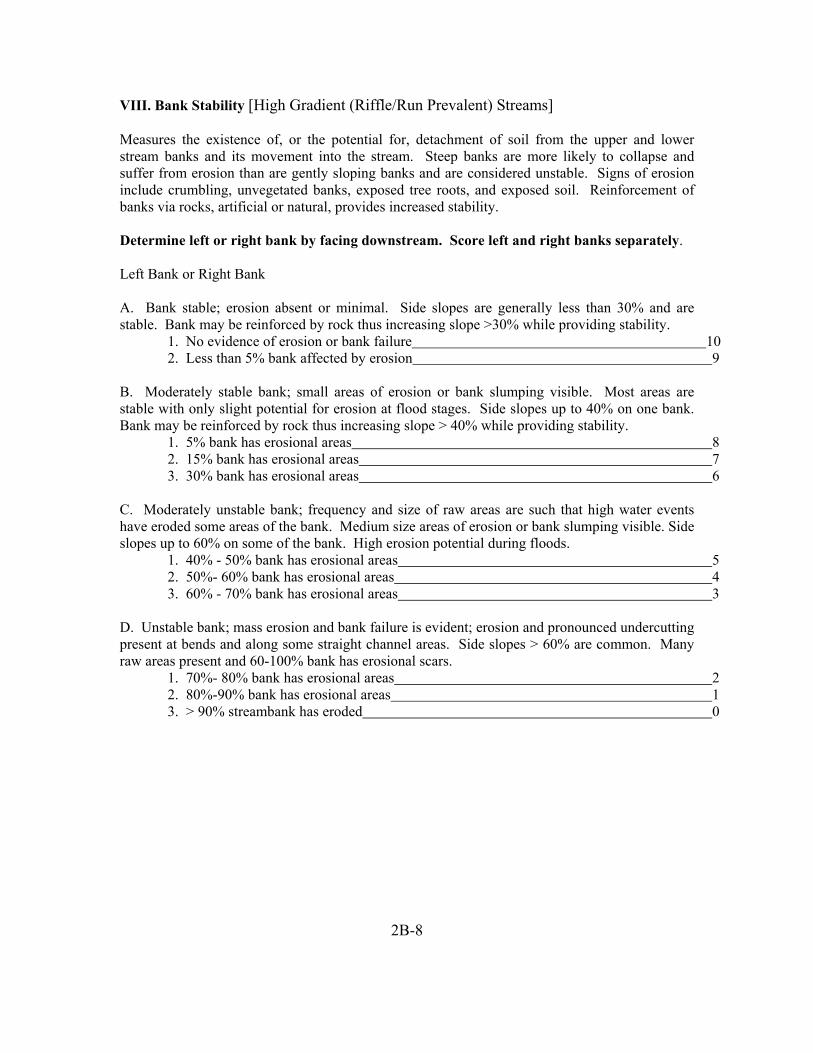
VIII. Bank Stability [High Gradient (Riffle/Run Prevalent) Streams] Measures the existence of, or the potential for, detachment of soil from the upper and lower stream banks and its movement into the stream. Steep banks are more likely to collapse and suffer from erosion than are gently sloping banks and are considered unstable. Signs of erosion include crumbling, unvegetated banks, exposed tree roots, and exposed soil. Reinforcement of banks via rocks, artificial or natural, provides increased stability. Determine left or right bank by facing downstream. Score left and right banks separately. Left Bank or Right Bank A. Bank stable; erosion absent or minimal. Side slopes are generally less than 30% and are stable. Bank may be reinforced by rock thus increasing slope >30% while providing stability.
1. No evidence of erosion or bank failure 10 2. Less than 5% bank affected by erosion 9
B. Moderately stable bank; small areas of erosion or bank slumping visible. Most areas are stable with only slight potential for erosion at flood stages. Side slopes up to 40% on one bank. Bank may be reinforced by rock thus increasing slope > 40% while providing stability.
1. 5% bank has erosional areas 8 2. 15% bank has erosional areas 7 3. 30% bank has erosional areas 6
C. Moderately unstable bank; frequency and size of raw areas are such that high water events have eroded some areas of the bank. Medium size areas of erosion or bank slumping visible. Side slopes up to 60% on some of the bank. High erosion potential during floods.
1. 40% - 50% bank has erosional areas 5 2. 50%- 60% bank has erosional areas 4 3. 60% - 70% bank has erosional areas 3
D. Unstable bank; mass erosion and bank failure is evident; erosion and pronounced undercutting present at bends and along some straight channel areas. Side slopes > 60% are common. Many raw areas present and 60-100% bank has erosional scars.
1. 70%- 80% bank has erosional areas 2 2. 80%-90% bank has erosional areas 1 3. > 90% streambank has eroded 0
2B-8

IX. Bank Vegetative Protection [High Gradient (Riffle/Run Prevalent) Streams] Measures the amount of the stream bank that is covered by vegetation. This parameter supplies information on the ability of the bank to resist erosion, the uptake of nutrients by existing vegetation, the control of instream scouring, and stream shading. Banks that have full, natural plant growth are better for fish and macroinvertebrates than banks without vegetative protection or those shored up with concrete or riprap. Four factors to consider when scoring bank vegetative protection: (1) Is the vegetation native and natural, or planted and introduced?; (2) Is the upperstory, understory, and ground cover vegetation well balanced?; (3) What is the standing crop biomass?; and ,(4) During which season are you conducting this assessment? Determine left or right bank by facing downstream. Score left and right banks separately. Left Bank or Right Bank A. More than 90% of streambank surfaces are covered by healthy, living vegetation. A variety of vegetation present (e.g., trees, shrubs, understory, or nonwoody macrophytes). Any bare or sparsely vegetated areas are small and evenly dispersed.
1. 100% plant cover on streambank 10 2. > 90% plant cover on streambank 9
B. A variety of vegetation is present and covers 70-90% of streambank surface, but one class of plants is not well-represented. Some open areas with unstable vegetation are present. Disruption evident but not affecting full plant growth potential.
1. 90% plant cover but one class of plants is not well represented 8 2. 80% plant cover with a few barren or thin areas present 7 3. 70% plant cover with a few barren or thin areas present with fewer plant species 6
C. 50-70% of streambank surface covered by vegetation; typically composed of scattered shrubs, grasses, and forbes. Thin or bare spots visible and/or closely cropped vegetation with less than ½ plant stubble height remaining.
1. 70% vegetation cover; typically of shrubs, grasses, and forbes 5 2. 60% vegetation cover; typically of shrubs, grasses, and forbes 4 3. 50% vegetation cover; typically of shrubs, grasses, and forbes 3
1. 40% vegetation cover with many bare spots/rock
D. Less than 50% of streambank surface covered by vegetation; 5 cm/2 in or less in average stubble height remaining. Any shrubs or trees on bank exist as individuals or widely scattered clumps.
2 2. 20% vegetation cover with many bare spots/rock 1 3. No vegetation cover on streambank 0
2B-9

X. Riparian Vegetation Zone Width [High Gradient (Riffle/Run Prevalent) Streams] Measures the width of natural vegetation from the edge of the upper streambank out through the floodplain. The riparian vegetative zone serves as a buffer zone to pollutants entering a stream from runoff, controls erosion, and provides stream habitat and nutrient input into the stream. Look for breaks in the riparian zone, which allow sediment to pass through the zone. When evaluating this parameter, walk around in the riparian area and pay close attention to the amount of natural vegetation present and how deep it extends through the floodplain. Determine left or right bank by facing downstream. Score left and right banks separately.
2B-10
Left Bank or Right Bank
A. Width of riparian zone > 18 meters (approx. 60 ft or more); human activities (e.g. parking lots, roadbeds, timber harvest activity resulting in removal of vegetation, active grazing fields, paths, lawns, or crops) have not impacted zone.
1. With no breaks 10 2. With breaks but rare 9
B. Width of riparian zone 12-18 meters (approx. 40-60 ft); human activities (e.g. parking lots, roadbeds, timber harvest activity resulting in removal of vegetation, active grazing fields, paths, lawns, or crops) have impacted zone only minimally.
1. With no breaks 8 2. With breaks but rare 7 3. With breaks common 6
C. Width of riparian zone 6-12 meters (approx. 20-40 ft); human activities (e.g. parking lots, roadbeds, timber harvest activity resulting in removal of vegetation, active grazing fields, paths, lawns, or crops) have impacted zone a great deal. 1. With no breaks 5
2. With breaks but rare 4 3. With breaks common 3
D. Width of riparian zone < 6 meters (approx. 20ft or less); little or no riparian vegetation due to human activities (e.g. parking lots, roadbeds, timber harvest activity resulting in removal of vegetation, active grazing fields, paths, lawns, or crops).
1. With no breaks 2 2. With breaks but rare 1 3. With breaks common 0

SUPPLEMENTAL INFORMATION: Low Gradient (Glide/Pool Prevalent) Streams (This supplemental information is to be used as a guideline for determining the habitat scores for each parameter.) I. Epifaunal Substrate/Available Cover [Low Gradient (Glide/Pool Prevalent) Streams] Measures availability of actual substrates that are available as refugia, feeding, or sites for spawning & nursery functions for aquatic organisms. A wide variety and/or abundance of submerged structures in the stream provide macroinvertebrates with a large number of niches, thus increasing habitat diversity. Check habitat types which occur at this site: fallen trees/large woody debris, deep pools, shallow pools, undercut banks, thick root mats, macrophyte beds, sand, and leafpacks. A. Stable and available habitat(s) expected for stream type make up >70% of reach
1. 7 habitats common 20 2. 6 habitat types common, additional habitat types rare 19 3. 5 habitat types common, additional habitat types rare 18 4. 4 habitat types common, additional habitat types rare 17 5. Less than 4 habitat types present 16
B. Stable and available habitat(s) expected for stream type make up >50% of reach
1. 7 habitats common 15 2. 6 habitat types common, additional habitat types rare 14 3. 5 habitat types common, additional habitat types rare 13 4. 4 habitat types common, additional habitat types rare 12 5. Less than 4 habitat types present 11
C. Stable and available habitat(s) expected for stream type make up <50% of reach a. 7-3 habitats common
1. 7 habitats common 10 2. 6 habitat types common, additional habitat types rare 9 3. 5 habitat types common, additional habitat types rare 8 4. 4 habitat types common, additional habitat types rare 7 5. 3 habitat types common, additional habitat types rare 6
b. 2-0 habitats common
1. 2 habitat types present, additional habitat types rare 5 2. 2 habitat types only and common 4
3. 1 habitat type common, additional habitat types rare 3 4. 1 habitat type only and common 2 5. 1 habitat type rare 1 6. 0 habitat types present 0
2B-11

2B-12
II. Pool Substrate Characterization [Low Gradient (Glide/Pool Prevalent) Streams]
Evaluates the type and condition of bottom substrates found in pools. Firmer sediments and rooted aquatic plants support a wider variety of organisms than a pool substrate dominated by mud or bedrock and no plants. A. Mixture of substrate materials, with gravel and firm sand prevalent; root mats and/or submerged vegetation common. Substrate consists of:
1. Gravel, firm sand, root mats, and submerged vegetation 20 2. Gravel, root mats, and submerged vegetation 19 3. Gravel, root mats or submerged vegetation 18 4. Firm sand, root mats, and submerged vegetation 17 5. Firm sand, root mats or submerged vegetation 16
B. Mixture of soft sand, mud, or clay; mud may be dominant; some root mats and/or submerged vegetation present. Substrate consists of:
1. Firm and soft sand, root mats, and submerged vegetation 15 2. Firm and soft sand, root mats or submerged vegetation 14 3. Soft sand, mud, clay, root mats and/or submerged vegetation common 13 4. Soft sand, mud, clay, root mats and/or submerged vegetation sparse 12
and/or submerged vegetation 5. Soft sand/mud, soft sand/clay, or clay/mud with sparse root mats
11
C. All mud or clay or sand bottom; little or no root mat; no submerged vegetation. Substrate consists of:
1. All sand bottom with few root mats 10 2. All mud bottom with few root mats 9 3. All clay bottom with few root mats 8 4. All sand bottom with no root material 7 5. All mud or clay bottom with no root material 6
D. Hard pan clay or bedrock; lacking root mats and vegetation. Substrate consists of:
1. All hard pan clay with sparse root mats or vegetation 4 2. All bedrock with sparse root mats or vegetation 3 3. All hard pan clay with no root mats or vegetation 1 4. All bedrock with no root mats or vegetation 0

III. Pool Variability [Low Gradient (Glide/Pool Prevalent) Streams] Rates overall mixture of pool types according to size and depth thus accommodating a diverse aquatic community consisting of a variety of species and age classes. In rivers with low sinuosity (few bends) and monotonous pool characteristics, very little instream habitat variety exists to support a diverse community. The four basic types of pools are: (1) large-shallow; (2) large-deep; (3) small-shallow; and, (4) small-deep. Any pool dimension (e.g., length, width) greater than half the cross-section of the stream is a large pool. Small pools have length and width dimensions less than half the width of the stream. Pools with depths greater than 1.0 m are deep. Shallow pools are less than 1.0 m deep. Reaeration is defined as the oxygen transfer from the atmosphere to the stream. Reaeration points are any areas where the stream surface is disturbed (e.g., dams, water falling over snags, logs, or other debris). A. All pool sizes (area and depth) present and mixed. 1. All sizes evenly mixed and below areas of reaeration 20
2. All sizes evenly mixed but can be found below and above reaeration areas 18 3. All sizes evenly mixed not below areas of reaeration 16
B. Majority of pools are large-deep; very few shallow.
1. Large and small deep pools evenly mixed and all below areas of reaeration 15 2. Majority of pools are large-deep and below areas of reaeration 14 3. Large and small deep pools evenly mixed and above and below areas of reareation 13 4. Majority of pools are large-deep and found above and below areas of reaeration 12 5. Majority of pools are large-deep and not below areas of reaeration 11
C. Shallow pools are much more prevalent than deep pools. 1. Large and small shallow pools evenly mixed and all below areas of reaeration 10 2. Majority of pools are large-shallow and below areas of reaeration 9 3. Large and small shallow pools evenly mixed and above and below areas of reareation 8 4. Majority of pools are large-shallow and found above and below areas of reaeration 7 5. Majority of pools are large-shallow and not below areas of reaeration 6
D. Majority of pools small-shallow or pools absent
1. Majority of pools are small-shallow and all below areas of reaeration 5 2. Majority of pools are small-shallow and above and below reaeration areas 3 3. Majority of pools are small-shallow and all above areas of reaeration 2 4. Pools absent 0
2B-13

IV. Sediment Deposition [Low Gradient (Glide/Pool Prevalent) Streams] Relates to the amount of sediment that has accumulated and the changes that have occurred to the stream bottom as a result of deposition. Sediment deposition may cause the formation of islands, point bars (areas of increased deposition usually at the beginning of a meander that increases in size as the channel is diverted toward the outer bank), shoals, or result in the filling of pools. Depositional material comes from both the overall watershed and bank erosion (Barbour and Stribling 1995). The growth or appearance of bars/islands where they did not previously exist is an indication of upstream erosion. High levels of sediment deposition create an unstable and continually changing environment that becomes unsuitable for many organisms (FL DEP 1996). A. No enlargements of islands/point bars present or less than 20% bottom affected by sand or silt accumulation.
1. No sediment deposition detected; especially in pools 20 2. Less than 20% sediment deposition with accumulation in pools only 18 3. Less than 20% sediment deposition with accumulation in runs and pools 17
bars or islands made up of coarse gravel in stream channel 4. Less than 20% sediment deposition with few, old, small point
16
B. 25-50% bottom affected by sand or silt accumulation; slight deposition in pools; some new increase in bar and island formation.
1. 20-30% sediment deposition with gravel and/or sand 15 2. 20-30% sediment deposition with sand and/or silt 14 3. 40-50% sediment deposition with gravel and/or sand 12 4. 40-50% sediment deposition with sand and/or silt 11
C. 50-80% bottom affected with moderate deposition in pools. Number of shallow pools increases. Habitats smothered by sand, silt, and possibly coarse gravel. Deposits of fresh, fine, gravel, sand, and silt observed on old and new point bars, islands, and behind obstructions. Formation of few new bars/islands is evident and old bars are deep and wide; deposition at bends obvious. 1. 60-70% sediment deposition with gravel and/or sand 10
2. 60-70% sediment deposition with sand and/or silt 9 3. 70-80% sediment deposition with gravel and/or sand 7 4. 70-80% sediment deposition with sand and/or silt 6
D. More than 80% bottom affected with heavy deposition from coarse and fine gravel and sand at stream bends, constrictions, and /or pools. Extensive deposits of fine sand and/or silt on old and new bars, islands, and along banks in straight channels. Few pools are present due to siltation. Only larger rocks in riffle areas remain exposed.
1. bottom silt may move with almost any flow above normal
80-90% sediment deposition; pools almost absent due to substantial deposition; 3
2. 90-100% sediment deposition; pools almost absent 1 3. 100% sediment deposition; pools absent due to substantial deposition; bottom silt moves with almost any flow above normal ___________________________________0
2B-14

V. Channel Flow Status [Low Gradient (Glide/Pool Prevalent) Streams]
2B-15
exposed. (100% channel full) _______________________________________________
This is the degree to which the channel is filled with water during base or average annual flow periods. This is a seasonal parameter. A decrease in water will wet smaller portions of the streambed, thus decreasing available habitat for aquatic organisms. Use the vegetation line on the lower bank as your reference point to estimate channel flow status.
A channel cross-section may help the investigator(s) estimate what percentage of the available channel is full. Stretch a tape very tight across the channel. Level and secure tape at the base of both lower banks. A. Water reaches the base of both lower banks and minimal amount of channel substrate is
20 1. > 95% channel is full 18
2. 90-95% channel is full 16
B. Water fills > 75% of the available channel (or <25% of channel substrate is exposed).
1. 90% of channel is full 15 2. 85% of channel is full 13 3. 80% of channel is full 11
C. Water fills 25-75% of the available channel and/or riffle substrates are mostly exposed.
1. 75% of channel is full 10 2. 60-65% of channel is full 9 3. 50% of channel is full 8 4. 35-40% of channel is full 7 5. 25% of channel is full 6
D. Very little water in the channel and mostly present as standing pools.
1. 20% of channel is full 5 2. 10% of channel is full 4 3. < 10% of channel is full 3 4. Water present as isolated standing pools 1 5. Channel is dry 0

2B-16
1. No evidence of disturbance with bends/runs frequent; bend angles average > 60°
VI. Channel Alteration [Low Gradient (Glide/Pool Prevalent) Streams]
Measurement of large-scale alteration of instream habitat that affects stream sinuosity and causes scouring. Channel alteration is present when: (1) artificial embankments, riprap, and other forms of artificial bank stabilization or structures are present; (2) when the stream is very straight for significant distances; (3) when dams and bridges are present; and (4) when other changes have occurred.
A. Stream follows a normal and natural meandering pattern. Alteration is absent. 20
2. No evidence of disturbance with bends/runs frequent; bend angles average between 60°- 40° 18
3. No evidence of disturbance with bends/runs frequent; bend angles average < 40° 16 B. Some stream straightening, dredging, artificial embankments, or dams present but NO evidence of recent alteration activities. May have been channelized in the past more than 20 years ago, but mostly recovered.
1. Bridge abutment present but disturbance is more than 20 years old; no other channel disturbance present 15
2. 10% of reach or less has channel disturbance other than bridge 14 3. 20% of reach has channel disturbance 13 4. 30% of reach has channel disturbance 12
5. 40% of reach has channel disturbance more than 20 years old 11
1. 40% of reach has channel disturbance
C. Somewhat channelized; 40-80% of the area has been straightened, dredged, or otherwise altered; disturbance may be less than 20 years old.
10 2. 50% of reach has channel disturbance 9 3. 60% of reach has channel disturbance 8
4. 70% of reach has channel disturbance 7 5. 80% of reach has channel disturbance 6 D. More than 80% of the stream site has been straightened, dredged, or otherwise altered; banks most likely box-cut; instream habitat highly altered.
1. 90% of reach has channel disturbance 5 2. Channel reach 100% disturbed; straight with no artificial embankments 3
3. Channel reach 100% disturbed; straight with artificial embankments 2 4. Channel reach 100% disturbed; straight with natural and artificial embankments 1
5. Banks 100% shored by gabion and/or cement 0

2B-17
VII. Channel Sinuosity [Low Gradient (Glide/Pool Prevalent) Streams]
Measure of meandering or sinuosity. A high degree of sinuosity provides for diverse habitat and fauna, and the stream is better able to handle surges when the stream fluctuates as a result of storms. The absorption of this energy by bends protects the stream from excessive erosion and flooding.
Divide the distance between bends by the average width of the stream to estimate the run-to-bend ratio. In general, low sinuosity suggests steeper channel gradient, uniform cross section shapes, limited bank cutting, and limited pools. High sinuosity is associated with lower gradients, asymmetrical cross sections, overhanging banks, and bank pools on the outside curves. Channel sinuosity should be determined over a channel reach long enough to make the value meaningful. Use a distance of 20 times the bankfull width to determine sinuosity. Sinuosity can best be measured using aerial photography. A. Occurrence of bends relatively frequent.
1. Run-to-bend ratio = 1-2 20 2. Run-to-bend ratio = 3-4 19 3. Run-to-bend ratio = 5 18 4. Run-to-bend ratio = 6 17 5. Run-to-bend ratio = 7 16
B. Occurrence of bends infrequent.
1. Run-to-bend ratio = 8 15 2. Run-to-bend ratio = 10 14 3. Run-to-bend ratio = 11 13 4. Run-to-bend ratio = 13 12 5. Run-to-bend ratio = 15 11
C. Occasional bend; variable bottom contours may provide some habitat.
1. Run-to-bend ratio = 16 10 2. Run-to-bend ratio = 18 9 3. Run-to-bend ratio = 20 8 4. Run-to-bend ratio = 22 7 5. Run-to-bend ratio = 24 6
D. Essentially a straight and uniform depth stream.
1. Run-to-bend ratio = 25 4 2. Run-to-bend ratio = 30 2 3. Run-to-bend ratio > 30 0

2B-18
VIII. Bank Stability [Low Gradient (Glide/Pool Prevalent) Streams] Measures the existence of or the potential for detachment of soil from the upper and lower stream banks and its movement into the stream. Steep banks are more likely to collapse and suffer from erosion than are gently sloping banks and are therefore considered unstable. Signs of erosion include crumbling, unvegetated banks, exposed tree roots, and exposed soil. Reinforcement of banks via rocks, artificial or natural, provides stability. Determine left or right bank by facing downstream. Score left and right banks separately. Left Bank or Right Bank A. Bank stable; erosion absent or minimal. Side slopes are generally less than 30% and are stable. Bank may be reinforced by rock thus increasing slope >30% while providing stability.
1. No evidence of erosion or bank failure 10 2. Less than 5% bank affected by erosion 9
B. Moderately stable bank; small areas of erosion or bank slumping visible. Most areas are stable with only slight potential for erosion at flood stages. Side slopes up to 40% on one bank. Bank may be reinforced by rock thus increasing slope > 40% while providing stability.
1. 5% bank has erosional areas 8 2. 15% bank has erosional areas 7 3. 30% bank has erosional areas 6
C. Moderately unstable bank; frequency and size of raw areas are such that high water events have eroded some areas of the bank. Medium size areas of erosion or bank slumping visible. Side slopes up to 60% on some of the bank. High erosion potential during floods.
1. 40% - 50% bank has erosional areas 5 2. 50%- 60% bank has erosional areas 4 3. 60% - 70% bank has erosional areas 3
D. Unstable bank; mass erosion and bank failure is evident; erosion and pronounced undercutting present at bends and along some straight channel areas. Side slopes > 60% are common. Many raw areas present and 60-100% bank has erosional scars.
1. 70%- 80% bank has erosional areas 2 2. 80%-90% bank has erosional areas 1 3. > 90% streambank has eroded 0

IX. Bank Vegetative Protection [Low Gradient (Glide/Pool Prevalent) Streams] Measures the amount of the stream bank that is covered by vegetation. This parameter supplies information on the ability of the bank to resist erosion as well as some additional information on the uptake of nutrients by the existing vegetation, the control of instream scouring, and stream shading. Banks that have full, natural plant growth are better for fish and macroinvertebrates than banks without vegetative protection or those shored up with concrete or riprap.
2B-19
1. 100% plant cover on streambank
Four factors to consider when scoring bank vegetative protection: (1) Is the vegetation native and natural, or planted and introduced?; (2) Is the upperstory, understory, and ground cover vegetation well balanced?; (3) What is the standing crop biomass?; and, (4) During which season are you conducting this assessment?
Determine left or right bank by facing downstream. Score left and right banks separately. Left Bank or Right Bank A. More than 90% streambank surfaces is covered by healthy, living vegetation. A variety of vegetation present (e.g., trees, shrubs, understory, or nonwoody macrophytes). Any bare or sparsely vegetated areas are small and evenly dispersed.
10 2. > 90% plant cover on streambank 9
1. 90% plant cover but one class of plants is not well represented
B. A variety of vegetation is present and covers 70-90% of streambank surface, but one class of plants is not well-represented. Some open areas with unstable vegetation are present. Disruption evident but not affecting full plant growth potential.
8 2. 80% plant cover with a few barren or thin areas present 7 3. 70% plant cover with a few barren or thin areas present with fewer plant species 6
C. 50-70% of streambank surface covered by vegetation; typically composed of scattered shrubs, grasses, and forbes. Thin or bare spots visible and/or closely cropped vegetation with less than ½ plant stubble height remaining.
1. 70% vegetation cover; typically of shrubs, grasses, and forbes 5 2. 60% vegetation cover; typically of shrubs, grasses, and forbes 4 3. 50% vegetation cover; typically of shrubs, grasses, and forbes 3
1. 40% vegetation cover with many bare spots/rock
D. Less than 50% streambank surface covered by vegetation; 5 cm/2 in or less in average stubble height remaining. Any shrubs or trees on bank exist as individuals or widely scattered clumps.
2 2. 20% vegetation cover with many bare spots/rock 1 3. No vegetation cover on streambank 0

X. Riparian Vegetation Zone Width [Low Gradient (Glide/Pool Prevalent) Streams] Measures the width of natural vegetation from the edge of the upper streambank out through the floodplain. The riparian vegetative zone serves as a buffer zone to pollutants entering a stream from runoff, controls erosion, and provides stream habitat and nutrient input into the stream. Look for breaks in the riparian zone, which allow sediment to pass through the zone. When evaluating this parameter, walk around in the riparian area and pay close attention to the amount of natural vegetation present and how deep it extends through the floodplain. Determine left or right bank by facing downstream. Score left and right banks separately. Left Bank or Right Bank A. Width of riparian zone > 18 meters (approx. 60 ft or more); human activities (e.g. parking lots, roadbeds, timber harvest activities resulting in removal of vegetation, active grazing fields, paths, lawns, or crops) have not impacted zone.
1. With no breaks 10 2. With breaks but rare 9
B. Width of riparian zone 12-18 meters (approx. 40-60 ft); human activities (e.g. parking lots, roadbeds, timber harvest activities resulting in removal of vegetation, active grazing fields, paths, lawns, or crops) have impacted zone only minimally.
1. With no breaks 8 2. With breaks but rare 7 3. With breaks common 6
C. Width of riparian zone 6-12 meters (approx. 20-40 ft); human activities (e.g. parking lots, roadbeds, timber harvest activities resulting in removal of vegetation, active grazing fields, paths, lawns, or crops) have impacted zone a great deal. 1. With no breaks 5
2. With breaks but rare 4 3. With breaks common 3
D. Width of riparian zone < 6 meters (approx. 20ft or less); little or no riparian vegetation due to human activities (e.g. parking lots, roadbeds, timber harvest activities resulting in removal of vegetation, active grazing fields, paths, lawns, or crops).
1. With no breaks 2 2. With breaks but rare 1 3. With breaks common 0
2B-20

This Page Intentionally Left Blank
2B-21

Chapter 3

Georgia Department of Natural Resources
Sorting and Subsampling Procedures
Environmental Protection Division
Macroinvertebrate Biological Assessment

3.1 Macroinvertebrate Laboratory Sorting and Subsampling
- Forceps
- 95 percent ethanol for storage of specimens -
Upon receipt by the laboratory samples are logged in on the Macroinvertebrate “Log-in” sheets. Macroinvertebrate Chain-of-Custody (C-O-C) sheets are completed prior to sample delivery to the lab. These forms are filled out in the field and used to keep track of samples through field collection, laboratory processing (subsampling), taxonomic identification, and laboratory quality assurance/quality control. Logging in samples requires recording the sample name/number; project name/number; number of containers per sample; date collected; and, date received by the laboratory.
Equipment/Materials:
- Macroinvertebrate Log in sheets (p. 3A-2) - Macroinvertebrate Chain-of-Custody (p. 3A-4) - Macroinvertebrate Level of Effort Subsampling Sheet (p. 3A-10) - Watch or clock - 500 µ mesh screen sieve bucket (30 mesh) - Two standardized gridded screens (595 micron screen, 30 squares, each 36 cm2)
[Caton, L. W. (1991)] - Two White plastic holding trays for gridded screen [Caton, L. W. (1991)] - Two 6 cm scoops [Caton, L. W. (1991)] - Two 36 cm2 metal dividing frames [Caton, L. W. (1991)] (“cookie cutters”) - Surgical Scissors - Alcohol proof marker - White plastic or enamel pan for sorting - Light source - Magnification source - No. 80 sieve (8” diameter sieve) - Aluminum foil and/or plastic wrap - Spray bottle (for water to moisten sample) - Sort residue labels - Unsorted sample remains labels - Duplicate subsample sort residue interior/exterior labels - Complete subsample sort residue interior/exterior labels - Interior subsampling vial labels
- Specimen vials with caps or stoppers
Pencils, or India ink pens - Sorting Efficiency for Benthic Macroinvertebrate Samples Sheet: Quality Control
Check (p. 2A-12) Procedures: To facilitate processing and identification, a randomized 200-organism subsample (±20%) is sorted and preserved separately from the remaining sample. The target
3-1

number for a subsample is 200 organisms. Since each grid selected must be counted in its entirety there is an allowance of ± 20% that gives a range of 160-240 organisms to allow for counts that go over, or fall under, 200. It must be stressed however that the target number is 200; the closer a subsampler can get to 200 the better. Documentation for the level-of-effort, or proportion of sample processed is recorded on the Macroinvertebrate Level of Effort Subsampling Sheet.
1. All primary samples should be sorted in a single laboratory to enhance quality control. Samples should be preserved and stored at room temperature until ready for processing.
3. A standardized gridded screen designed by Larry Caton, OR-DEQ (Caton 1991)
can be divided into 30 marked squares, each square should be a uniform 36 cm2. The grids are marked off with an alcohol proof marker in each of the trays. The gridded screen fits into another slightly larger tray (white plastic tray) so that water may be added to the sample to allow for even distribution. Place the gridded screen inside the tray and pour the sample onto the screen. Add enough water to spread the sample evenly over the screen then lift the screen out of the tray, the sample contents will settle onto the screen. Make sure the sample material spreads equally into the corners of the pan. Samples too large to be effectively sorted in a single pan may be thoroughly mixed in a container with some water, and half of the homogenized sample placed in each of two gridded pans. (Specifications for these trays can be found in the article Caton 1991.)
2. Thoroughly rinse sample in a sieve bucket (500µ mesh screen) to remove
preservative and fine sediment. Any large organic material (whole leaves, twigs, algal or macrophyte mats) not removed in the field should be rinsed, visually inspected, and discarded. Rinse large organic material thoroughly and rub gently over sieve bucket before discarding to dislodge any organisms that may be attached to the material. Inspect material for attached organisms before discarding. If the samples have been preserved in alcohol, it will be necessary to soak the sample contents in water for approximately 15 minutes in order to hydrate the benthic organisms. This will prevent them from floating on the water surface during sorting. If the sample was stored in more than one container, the contents of all containers for a given sample should be combined at this time. Care must be taken to avoid crushing or damaging the invertebrates while rinsing. Before removing sample from the container(s) verify internal and external labels. The original sample external labels should be peeled off and affixed to the back of the macroinvertebrate C-O-C (p. 3A-4) form once subsampling has been completed.
4. Note the presence of large (i.e. crayfish, mussels, snails,…etc.) or obviously
abundant organisms on the Macroinvertebrate Level of Effort Subsampling Sheet (see p. 3A-10). Do not remove as part of the subsample unless they occur in one of the randomly selected grids. Also note the type of sample, collection date, project number, station number, log number, and any comments regarding
3-2

the sample (i.e., description of material in sample -- sand, fine organics), preparation time (rinse time of subsample), and sorting time on the Macroinvertebrate Level of Effort Subsampling Sheet.
5. Use a random numbers generator to select numbers that correspond to squares
within the gridded pan. When selecting random numbers, take into account the tray number (if one or two trays are used), column number, and row number. (i.e. Tray 1, Column 1, Row 5 = 1:1:5)
7.
6. If the sample is large enough to be distributed onto two or more screens, each grid
square should have a unique number such that all grid squares in all screens have an equal probability of being selected for sorting. For example, each tray is numbered and the columns and rows of the tray are numbered.
A minimum of four grids must be selected for each subsample. Remove all material (organisms and debris) from the four grid squares. Removal of material is accomplished by placing the 36-cm2 metal dividing frame in the selected grid and using surgical scissors to cut around the edge (being careful not to cut organisms) of the frame. Then, the square is scooped out using the 6-cm scoop. Inspect the grid for any remaining organisms. Any organism that is lying over a line separating two grids is considered to be on the grid containing its head. In instances where it may not be possible to determine the location of the head (worms for instance), the organism is considered to be in the grid containing the majority of its body. Be careful not to disturb the subsampling device between each grid removal. This will aid in minimizing the accidental redistribution of organisms between each subsampling process.
8. If the density of organisms is high enough so that many more than 240 organisms
are contained in the first four grids of the initial tray(s) (this is called the first level), transfer the contents of these four previously selected grids to a second gridded pan (this is called second level). Randomly select grids for this second level of sorting as was performed for the first level of sorting. If the density of organisms is again high enough that more than 240 organisms are contained in these four grids, transfer the contents of the grids to a third gridded pan (this would be the third level) and continue as before. This process would be continued until the target number ±20% (160-240) is obtained from at least four grids. When the targeted subsample amount, ± 20% organisms (160-240), is found, the subsample is completed. If less than 160 organisms are found, continue randomly selecting and sorting grids one at a time until the targeted subsample number, ± 20 percent organisms, is found. All selected grids must be completely sorted. Remove and count all the macroinvertebrates from these grids. Only count individuals that can be identified to family level. Exceptions to this rule are Copepods, Nemata, Hirudina, Cladocera, Ostrocoda, and Neoloricata; these should be counted even though they may not be identified down to family level. At times, it may be possible to identify these organisms to a lower taxonomic level. Do not discard any damaged macroinvertebrates. They must be accounted
3-3

for (these should be noted on the Macroinvertebrate Bench Sheet during identification).
9. The material is placed into a shallow white pan for sorting and a small amount of
water or ethanol is added to facilitate sorting. Large debris can be visually inspected, under magnification and light, for organisms and removed at this time. Sorting of the remaining material pulled from the selected grids should be performed with a dissecting microscope; this ensures that small critical organisms such as Annelids or Chironomids are not missed. Decanting the material from the white pan into a Petri dish in small increments is probably the easiest way to methodically work through the material. Between each subsample, be careful not to disturb the subsample pan (this will cause a redistribution of specimens and could possibly change the probability of selection). It may be necessary to rinse individual squares in a sieve, depending on silt and organic material. Use an 8” diameter No. 80 sieve to prevent loss of very small organisms.
10. The total number of grids for each subsorting level should be noted on the
Macroinvertebrate Level of Effort Subsampling Sheet. Each grid selected for sorting must be completely sorted.
If a sorted subsample goes over 240 organisms read 11 and 12:
11. When a sample has been sorted and there are 241-260 individuals the sample is
not resorted. This is to allow for the possibility that some organisms may be damaged or miscounted during sorting. The sample can then be identified. If after identification and recounting the subsample still contains 241-260 organisms, then random numbers are used to deselect down to 240 organisms. This is accomplished by starting at the top of the first bench sheet and working to the end of the bench sheets (i.e. the first taxa listed is number 1 through the total number of individuals for that taxa).
12. When a sample has been sorted and there are more than 260 individuals the sample is resorted. The macroinvertebrates are spread across the standardized gridded screen without debris. Using the random number generator select grids as before. Do not scoop the bare organisms from the grids because this will damage them. Use forceps to collect the organisms from each of the selected grids until the target number +/- 20% is obtained. Use great caution since organisms can be lost or damaged during this process. Use the same subsampling procedure as before, making sure that once a grid has been selected it is completely picked for organisms.
Again, it must be stressed that the target is 200, not 240 organisms.
13. To help prevent desiccation of the sample and damage to specimens cover the sample with aluminum foil or plastic wrap. Periodically moisten the sample with water to prevent the top layer from drying out. At the end of the day, if the
3-4

subsample has not been completed, carefully place the gridded screen back in the white plastic tray and cover with aluminum foil or plastic wrap. Use caution so as not to mix debris in squares already removed. Note: The “cookie cutter” can be used (along with other items) to hold the spaces of the selected squares.
15. Save the remaining unsorted sample debris residue in a separate container labeled "unsorted sample remains". This container should include internal and external labels with the original sample label information. Also include length of storage information on the label. The laboratory or benthic section supervisor determines archival length. However, this material should be saved at least until the sample is completely finished (i.e. identified and the subsample Quality Control check performed).
17. Once a subsample has been finished the level of effort is calculated.
14. Save the sorted debris residue (“sort residue”) in a separate container. Add
internal and external labels that include the words "sorted residue" in addition to all prior sample label information. Preserve the sample in 95 percent ethanol and number the container (i.e. 1 of 2, 2 of 2). This will be saved for the subsample Quality Control check.
16. Place specimens sorted as the subsample (200-organisms) into glass vials, and
preserve in 95 percent ethanol. Organisms from the sorting process will be segregated into separate vials according to the categories: midges, worms, insects, molluscs, and crustaceans to be further identified later (See identification procedures). Label the vials inside with the project name, lot name, station identification, stream name, collection date, taxonomic group, sorter, and vial number if more than one vial is used. If more than one vial is required, each should be labeled separately and numbered (i.e. 1 of 2, 2 of 2). For convenience in reading the labels inside the vials, insert the labels left-edge first.
1st level = the initial subsample 2nd level = the resubsample (Performed when over the target number + 20%) 30 or 60 = Depends on if need 1 or 2 Caton trays for the sort; 30 grids per tray
(1st Level) (2nd Level)
# Grids selected x # Grids selected = LOE 30 or 60 30 or 60
The LOE is recorded on the Macroinvertebrate Level of Effort Subsampling Sheet (p. 3A-10).
18. Midges (Chironomidae) should be mounted on slides in cytoseal or other
appropriate medium (e.g., Euperal, CMCP-10 or CMC-10). Slides should be labeled with the site identifier, date collected, and a space for the first initial and last name of the taxonomist responsible for identifying them. Slides will be stored in slide boxes. Label the slide boxes with site identifier, stream name, and
3-5

date collected. Oligochaetes should also be mounted on slides and should be appropriately labeled as with the midges.
Note: Any entirely sorted reference condition sample that falls 20% below the designated subsample size is excluded from further analyses (less than 160 organisms for 200-organism subsample). This is not applicable for sampling done as a requirement for watershed assessments.
3.1a Quality Control/Quality Assurance for Subsampling
3.1a1 % Sorting Efficiency
1. In each lot; which is defined as all the samples for a special study, basin study, ecoregion, subecoregion, bioregion, entire index period, etc.; ten percent of sorted samples are resorted by laboratory Quality Assurance personnel. Ten percent of the “sort residues” are randomly selected per individual sorter. The “sort residue” is completely checked for organisms. The “sort residue” is inspected under a dissecting microscope in the same manner the original material was sorted. Only sort small amounts of the “sort residue” at one time as not to overlook previously missed organisms. The number of organisms collected, comments, and taxa missed are recorded on the Sorting Efficiency for Benthic Macroinvertebrate Samples: Quality Control Check
laboratory sheet (p. 3A-12).
2. The Quality Assurance personnel will calculate the sorting efficiency for each sample {[(number of organisms originally sorted) / (number of organisms recovered by Quality Control checker + number organisms originally sorted)] x 100 = %}.
4. Sorters in-training will have 100 percent of their samples checked until sorting
efficiency reaches 90%. A minimum of five samples will be Quality Control checked by the QC personnel. The results of the Quality Control check are entered on the Sorting Efficiency for Benthic Macroinvertebrates: Quality Control
3. The sorting efficiency should be ≥ 90% to pass. Subsamples with a sorting
efficiency less than 90% are considered to fail. When a subsample fails, two more subsamples are Quality Control checked per individual sorter.
Check sheet (p. 3A-12). Then, once the sorter passes initial training samples, 10% of samples will be Quality Control checked per each lot.
5. Once a site has been Quality Control checked the level of effort is recalculated
based on the new total of individuals for that site. Evaluating consistency (=precision) – evaluating consistency of the subsampling procedure (The following is not required for Watershed Assessments or Protection Plans.)
3-6

3.1a2 Duplicate subsample (A second subsample conducted after the initial subsample)
1. A lot is defined as all the samples for a special study, basin study, ecoregion, subecoregion, bioregion, entire index period, etc. A duplicate subsample will need to be sorted from five percent of all sites (in each designated lot). A duplicate subsample is a second subsample from the same sample. Once the initial subsample has been completed, do not remove the remaining sample material from the subsample trays. The Duplicate sample is pulled from this remaining material.
2. Indicate on the random number sheet at what point the Duplicate subsample is
started. Follow the procedure above (under Procedures of Subsampling) for subsampling. Make sure to keep vials from each of the subsamples separate and label the vials appropriately.
3. Complete a separate Macroinvertebrate Level of Effort Subsampling Sheet (see p. 3A-10) and please record that a duplicate subsample was conducted (indicate this on the “purpose” line on page 1).
4. Calculate the LOE as instructed in the subsampling procedure.
3.1a3 Complete sample (sorting of the remainder of the sample after the initial subsample)
1. A lot is defined as all the samples for a special study, basin study, ecoregion, subecoregion, bioregion, entire index period, etc. A complete sample will need to be sorted from five percent of all sites (in each designated lot). A complete sample is performed once the initial subsample has been completed. There is no need to fill out the random number sheet for the complete subsample as it consists of picking the remaining grids that are left in a sample after a normal subsample is conducted. However, make sure to fill out the random number sheet for the initial subsample like usual. Follow the procedure for subsampling outlined under Procedures of Subsampling. Make sure to keep vials separate and label vials appropriately.
2. Once the normal subsample has been conducted, completely subsample the rest of
the entire tray. Make sure to keep vials and labeling information separate.
3. Complete a separate Macroinvertebrate Level of Effort Subsampling Sheet. On the
Macroinvertebrate Level of Effort Subsampling Sheet please indicate complete subsample (write on the purpose line and on other, after subsample total organisms).
3-7

4. Calculate the LOE as instructed in the subsampling procedure. 3.1b Quality Assurance for Evaluating consistency For duplicate samples and complete samples, include these samples in the total number of samples subsampled by an individual person for a particular lot. For each lot of samples, 10% are to be Quality Control checked. (Follow Quality Control procedure as previously outlined) Note: Do not repeat the same 5% of samples for both Duplicate and Complete subsampling quality control. Randomly select sites for Duplicate subsamples first, then those samples can not be selected for Complete samples. 3.2 Sample Recharging If the samples are to be held more than three weeks before sorting is conducted the samples need to be drained, rinsed with water, and recharged with fresh ethanol. If the samples are to be held more than six weeks then they should be recharged twice, once at three weeks after collection and again at six weeks after collection. Recharging removes excess silt, ethanol diluted from water leeching out of the sample debris, foul odors, and any discoloring compounds (such as chlorophyll). The samples should be drained through a number 30 sieve stacked on top of a number 80 sieve; this is to prevent the loss of any small organisms. After draining: fill the sample with water; tighten the lid; gently invert the sample a few times; drain as before; and, repeat once more. Once rinsing has been completed, wash any debris in the sieves back into the sample with a little bit of water then fill the sample bottle with ethanol. After the second recharge event the samples should not need recharging as long as there is a definite alcohol odor when the samples are opened. 3.3 References Barbour, M. T., J. Gerritsen, B.D. Synder, and J. B. Stribling. 1999. Rapid
Caton, Larry W. 1991. Improved subsampling methods for the EPA “Rapid
Bioassessment Protocols for Use in Streams and Wadeable Rivers: Periphyton, Macroinvertebrates and Fish, 2nd Edit. EPA 841-B-99-002. U.S. Environmental Protection Agency; Office of Water; Washington, DC.
Bioassessment” benthic protocols. Bulletin of the North American Benthological Society, 8(3): 317-319.
3-8

Appendix 3A
Forms

3A-2
This Page Intentionally Left Blank

3A-2
Project Name: ____________________________________ BENTHIC SAMPLE LOG-IN Page #: ____________
Date of Completion/ Initials Sample ID Code
Date Collected
Collected By
Number of Containers
Site # Stream Name Date Received
by Lab Subsampling Mounting Identification Chironomidae ID

3A-3
This Page Intentionally Left Blank

3A-4
Type of Analysis Requested
Contact Names:
Address:
Fax #:
Macroinvertebrate Chain of Custody Project Name:
Sample Check-in: Comments:
Page ____ of _____ Stream Name & Site #:
Rec
harg
ed #
2
QC
of S
ort R
esid
ue
(Inte
rnal
)
Iden
tific
atio
n
QC
of I
dent
ifica
tion
(Ext
erna
l)
Log Number Pre
serv
ativ
e (Y
/N):
Eth
anol
Num
ber o
f Con
tain
ers
Rec
harg
ed #
1
Sor
ted
QC
of S
ort R
esid
ue
(Ext
erna
l)
QC
of I
dent
ifica
tion
(Inte
rnal
)
Collection Method
Date: Time: Sample Identification # Initials and Date
D-frame net 20 Jab
D-frame net 20 Jab
D-frame net 20 Jab
D-frame net 20 Jab
D-frame net 20 Jab
D-frame net 20 Jab
Sampled by (signature): Date/Time: Relinquished by Team Leader (signature): Date/Time: Relinquished Macro's (signature): Date/Time:
Team Leader/Received (signature):
Date/Time: Received by Lab (signature): Date/Time: Macro's received for subsampling by (signature):
Date/Time:
Returned Macro's & sort residue (signature):
Date/Time: Relinquished Macro's (signature): Date/Time: Returned Macro's (signature): Date/Time:
Lab Received (signature):
Date/Time: Macro's for ID-ing Received by: Date/Time: Lab received Macro's (signature): Date/Time:
Date/Time: Date/Time: Date/Time:
Date/Time: Date/Time: Date/Time:

3A-5
This Page Intentionally Left Blank

3A-6
Project Name: Macroinvertebrate Chain of Custody For QA/QC (Internal only)
Project Name: _______________________________
Stream Name & Site #: Contact Names:
Address: Fax #:
Page ____ of _____
Relinquished Sort Residue (signature): Date/Time: Returned Sort Residue (signature): Date/Time: Relinquished Macro's For QC (signature): Date/Time:
Sort Residue QCed By (signature): Date/Time: Received Sort Residue (signature): Date/Time: Macro's received for ID QC (signature): Date/Time:
Returned Macro's after QC (signature): Date/Time: Date/Time: Date/Time:
Lab Received Macro’s after QC(signature): Date/Time: Date/Time: Date/Time:
Additional Comments: ________________________________________________________________________________________________________________________________________________________________________________________________________________________________________________________________________________________________________________________________________________________________________________________________________________________________________________________________________________________________________________________________________________________________________________________________________________________________________________________________________________________________________________________________________________________________________________________________________________________________________________________________________________________________

3A-7
This Page Intentionally Left Blank

3A-8
Project Name: Macroinvertebrate Chain of Custody For QA/QC (External only)
Project Name: _______________________________
Stream Name & Site #: Contact Names:
Address: Fax #:
Page ____ of _____
Relinquished Sort Residue (signature): Date/Time: Returned Sort Residue (signature): Date/Time: Relinquished Macro's For QC (signature): Date/Time:
Sort Residue QCed By (signature): Date/Time: Received Sort Residue (signature): Date/Time: Macro's received for ID QC (signature): Date/Time:
Returned Macro's after QC (signature): Date/Time: Date/Time: Date/Time:
Lab Received Macro’s after QC(signature): Date/Time: Date/Time: Date/Time:
* Always attach a copy of the original Chain-of-Custody form, with the sample identification information with this form. Additional Comments: ________________________________________________________________________________________________________________________________________________________________________________________________________________________________________________________________________________________________________________________________________________________________________________________________________________________________________________________________________________________________________________________________________________________________________________________________________________________________________________________________________________________________________________________________________________________________________________________________________________________________________________________________________________________________

This Page Intentionally Left Blank
3A-9

MACROINVERTEBRATE LEVEL OF EFFORT SUBSAMPLING SHEET(Page1)
Project:
Purpose:
Site #:
Stream Name:
Date Sampled : By:
Target Number of Organisms: 200
Date Subsampled: Sorter(s):
Total # Organisms:
Type of Sample (Gear): D - Frame Net, 20 Jab Method
Total # Vials:
Total # of Bottles for Sort Residue:
Indicate the appropriate subsampling levels used and the number of grids picked in each (by marking with an X); and calculate the Level of Effort:
Initial Sample (1st level):
Tray 1 (30 grids) Tray 2 (30 grids) 1
2 3 4 5 6
7 8 9 10 11 12
13 14 15 16 17 18
19 20 21 22 23 24
25 26 27 28 29 30
Total # organisms for initial sample: _______ _______________________________________________________________
2 3 4
Re-subsample (2nd level):
Tray 1 (30 grids) Tray 2 (30 grids) 1
5 6
7 8 9 10 11 12
13 14 15 16 17 18
19 20 21 22 23 24
25 26 27 28 29 30
Total # organisms for resubsample_______ _______________________________________________________________
1 2 3 4 5 6
7 8 9 10 11 12
13 14 15 16 17 18
19 20 21 22 23 24
25 26 27 28 29 30
1 2 3 4 5 6
7 8 9 10 11 12
13 14 15 16 17 18
19 20 21 22 23 24
25 26 27 28 29 30
3A-10

MACROINVERTEBRATE LEVEL OF EFFORT SUBSAMPLING SHEET (Page2)
Calculation:
# Grids selected (1st Level) (2nd Level)
x # Grids selected = LOE
30 or 60 30 or 60 LOE = _____________
Sorting Time: Preparation Time (Rinse Time): ______________________
Date Start Time
End Time
Hours: Minutes Date Start
Time End Time
Hours: Minutes
Total Time
Total Time for Subsample: Indicate the presence of large or obviously abundant organisms (add additional comments below):
Other comments (i.e., condition of specimens, odor of sample, condition of sample, organic material in sample, sand type, fine organics, etc.):
3A-11

Project & Reason: _____________________________________
Stream Name: __________________ Site #: ________________
Date Macro’s sampled: ____________ By: __________________
Original Sorter(s): ______________ Sorting Date: ___________
QC Checker: _________________ QC Check Date: ___________
# organisms # organisms recovered by originally sorted checker + # organisms originally sorted ÷ X 100=_____________% % Sorting Efficiency 90% or greater; sample passes _________ <90%, sample fails; action taken: ____________________________________
_____________________________________________________________________________________________________________________________________________________________________________________________________________________________________________________________________________________________________________________________________________________________________________________________________ Missed Macroinvertebrates & Additional Comments: ___________________________________________________________________________________________________________________________________________________________________________________________________________________________________________________________________________________________________________________________________________________________________________________________________________________________________________________________________________________________________________________________________________________________________________________________________________________________________________________________________________________________________________________________________________________________________________________________________________________________________________________________________________________________________________________________________________________________________________________________________________________________________
Sorting Efficiency for Macroinvertebrate Samples:Quality Control Check
3A-12

This Page Intentionally Left Blank
3A-13

Chapter 4

Environmental Protection Division
Macroinvertebrate Biological
Assessment
Georgia Department of Natural Resources
Identification Procedures

4.1 Macroinvertebrate Laboratory Identification
- Macroinvertebrate Bench Sheet (p. 4A-4)
- Chironomidae Macroinvertebrate Box Bench Sheet (p. 4A-10)
- Macroinvertebrate Chain-of-Custody (i.e. in Subsampling Procedures, p. 3A-4)
-
Equipment/Materials:
- Mounting Time Sheet (p. 4A-2)
- Macroinvertebrate Identification Time Sheet (p. 4A-6)
- Macroinvertebrate Bench Sheet – Chironomidae (p. 4A-8)
- Macroinvertebrate Log In Sheets (i.e. in Subsampling Procedures, p. 3A-2) Macroinvertebrate QA/QC Bench Sheet – re-identification (p. 4A-12)
- Macroinvertebrate Taxonomy: Quality Control Check form (p. 4A-14) - Macroinvertebrate Taxonomy Quality Control/Quality Assurance Calculations
form (p. 4A-16) - Forceps
- Compound microscope with phase contrast for identification of mounted organisms
- 95 percent ethanol for storage of specimens
- Scalpel and blades
- Clock or watch
- Specimen vials with caps or stoppers - Dissecting microscope for organism identification with magnification of 10-40x - Fiber optic light source
- Appropriate taxonomic keys
- Slides and cover slips - Slide boxes - Internal/External Labels
Procedures:
1. Identification is to the lowest practical level (generally genus or species) by a qualified taxonomist using a dissecting microscope for most organisms. Midges (Family Chironomidae), Oligochaeta (i.e. Families Tubificidae and Naididae) and Polychchaeta (marine worms) are mounted on slides in an appropriate medium and identified using a compound microscope. If oligochatea and chironomidae are mounted, keep a record of the time necessary for mounting on the Mounting Time Sheet (p. 4A-2).
2. Each taxon found in a sample is recorded and enumerated on the
Macroinvertebrate Bench Sheets (p. 4A-4). Any difficulties encountered during identification (i.e., missing gills) are noted on these sheets. (Every specimen in the sample is to be identified to the lowest, practical taxonomic level. If a
4-1

specimen cannot be identified because it is too damaged, is an adult (except those groups that have aquatic adult stages), or pupa, they may be placed in a vial and labeled junk or unidentifiable.) The life-stage (adult, larval, or nymphal) for all taxa will be recorded for each site. The larval or nymphal stages will be identified for all taxonomic groups. Adult stages of Coleopterans, Hemipterans, Crustaceans, Mollusks, and Gastropodas will be identified, as well. Pupae, emergent and damaged, will be recorded, but not identified, and not counted in the total numbers. (A target level of identification will be provided on the EPD website as a separate document www.gaepd.org).
3. Only individuals that can be identified to the family level will be counted in the
total. Copepods, Nemata, Hirudina, Cladocera, Ostrocoda, Neoloricata, and Planaria are the exceptions and are counted even when they cannot be identified to family level. However, at times it is possible to identify these organisms to a lower taxonomic level. (At this time GAEPD does not identify worms past class Oligochaeta. However, with proper training, worms will be identified in the future. If your lab has a qualified taxonomist, identify Oligochaeta and Polychaeta to lowest practical level.) Mites, ticks, fleas, and springtails are not counted in the sample. Make a note of these organisms on the appropriate bench sheet. However, if more than 10 water fleas are found in a sample, they are counted.
5. Record the taxonomic references used in the identification process on the Macroinvertebrate Bench Sheets. A list of primary and secondary taxonomic references will be provided on the EPD website as a separate document www.gaepd.org. Also record the time necessary for identification on the Macroinvertebrate Identification Time Sheet (see pg 4A-6).
4. On the Macroinvertebrate Bench Sheet, each taxon is followed with a Taxonomic
Certainty Rating (TCR) 1 to 5, with 1 being most certain and 5 being uncertain; any rating 2-5 must be explained (i.e., missing legs, gills…etc.).
6. After identification, place specimens into separate glass vials containing 95
percent ethanol according to the categories: worms, insects, molluscs, crustaceans, and junk. Label the vials internally and externally with the serial code, station descriptor (sample ID code and collection date), taxonomic group, sorter, vial number, taxonomist, and date identified (depending on what the laboratory requirements are and sample identification codes may depend on what is needed on the vial label). If more than one vial is needed, each should be labeled separately and numbered (i.e. 1 of 2, 2 of 2). For convenience in reading the labels inside the vials, insert the labels left-edge first.
4-2

i.e. Vial Label
Stream Name Site Number
Date Sampled Sorter
Date Sorted Taxonomic Group Taxonomist Name
Date Identified
7. Chironomidae Mounting/Labeling
Stream Name
TCR Ranking
A. Chironomidae will be mounted on slides and stored in slide boxes. B. Slide boxes will be labeled with Stream Name, Site Number, and Box
number. C. Chironomidae will be mounted two per slide with either CMCP-10 or
CMC-10 mounting solution. D. During the mounting process, track the time needed for mounting on the
Mounting Time Sheet (see pg 4A-2). E. Tape will be used on the left hand of the slide to label the slide with the
stream name, site identification number, collection date, taxonomist name, identification date, TCR (if not a TCR of 1), and slide number.
i.e. Chironomidae Label
Site Number Collection Date
Taxonomist Name Date Identified
Slide Number
F. On the slide, the chironomidae on the left (the first chrionomidae) will be labeled number one and the second will be labeled number two. Use a black sharpie and circle the number.
G. Label the slides prior to identification.
4-3

8. Once identification is completed for a sample, add the totals up and record these on the Macroinvertebrate Bench Sheet. (For sites over the 240 (target number of 200 + 20%), please refer to subsampling procedures (previous section) on how to deselect specimens using random numbers before entering data in the database or ecological condition worksheet for data analysis.)
9.
10.
H. There are corresponding chironomidae forms to record the slide numbers and either number 1 or 2 chironomidae on the form. (Chironomidae Macroinvertebrate Box Bench Sheets p. 4A-10).
I. Once identification of Chironomidae is complete, then fill out the Macroinvertebrate Bench Sheets – Chironomidae (p. 4A-8) using the Chironomidae Macroinvertebrate Box Bench Sheets. This way the Chironomidae will be better organized for data entry.
*Note: The method used for mounting/labeling chironomidae can also be used for oligochaeta.
For Watershed Assessments and Protection Plans use the metric spreadsheets and also enter taxa list in the Excel© spreadsheet provided on the EPD website (www.gaepd.org). These taxa lists are to be turned in along with the Watershed Assessment reports and every two years with the Annual Certification of the Watershed Protection Plans implementation reports.
(For EPD employees only enter the data into Ecological Data Application System (EDAS), an Access© database, for analysis.
4.1a Archive 1. For archival, the specimen vials, grouped by station and date, will be; placed in
jars, filled with denatured 95 percent ethanol, and tightly capped. The ethanol level in these jars will be examined biannually and replenished as needed. This should be performed prior to ethanol loss from the specimen vials. A label will be placed on the vial indicating: (1) sample identifier; (2) date identified; (3) denatured 95 percent ethanol used as preservative; (4) stream name; (5) site number; (6) date sampled; (7) number of vials; (8) vial number; and, (9) archival date. Samples are to be stored in a secure location for a minimum of five years.
4-4

4.1b Voucher Collection
1. A voucher collection must be maintained to help resolve questions regarding the
accuracy of taxonomic identifications. This collection should be used for quality assurance/quality control and should be identified by another laboratory for taxonomic proficiency. These specimens should be properly labeled, preserved, and stored in the laboratory for future reference. Specimen labels should include the name(s) of the verifying person(s). Senior taxonomists must QA/QC 10% of the sample identifications. (Voucher collections are not required for Watershed assessments and Protection Plans, but are very beneficial for any laboratory conducting identifications.)
4.2 Laboratory Quality Control/Quality Assurance
2. Information on samples completed (through the taxonomic process) will be recorded on the Macroinvertebrate Log In Sheets and Macroinvertebrate Chain of Custody form to track the progress of each sample within the sample lot (see Subsampling Procedures). The tracking of each sample will be updated as each step is completed (i.e., subsampling and sorting, mounting of midges and worms, and taxonomy).
1. After the laboratory processing is completed for a given sample, all sieves, pans, petri dishes, trays…etc., that have come in contact with the sample will be rinsed thoroughly, examined carefully, and picked free of organisms or debris
3. A library of taxonomic literature is essential in aiding identification of specimens. References that should be available in the laboratory are provided on the EPD website (www.gaepd.org).
4. Samples are to be signed in and out using the Macroinvertebrate Chain-of
Custody form. The mounting/identification date and name of the taxonomist should be filled in on the Macroinvertebrate Log In Sheet. Examples of these forms can be found in the subsampling section (previous section).
4.2a Taxonomic Quality Control/Quality Assurance: All personnel performing macroinvertebrate identifications will be trained in a consistent manner. The taxa identifications will be standardized to ensure accuracy.
1. In each lot; which is defined as all the samples for a special study, basin study,
ecoregion, subecoregion, bioregion, entire index period…etc., ten percent of the identified samples in each lot should be re-identified by laboratory QC personnel or a qualified co-worker.
4-5

2. Randomly select ten percent of the identified samples per individual sorter. The
identified sample is completely re-identified ignoring the original identification of the original identifier, so as not to bias ones opinion. The identifications are recorded on Macroinvertebrate QA/QC Bench Sheets (p. 4A-12).
3. Identifiers in training will have all samples 100 percent QA/QC checked until
each receives 90% pass for % Correctly Identified and 10% for Precision of counts & % difference in enumeration (see calculations below) for five samples consecutively. After an identifier in training passes five samples, then ten percent of the identified samples in each lot should be re-identified by laboratory QC personnel or a qualified co-worker.
4. Once a site has been QC checked, the level of effort is recalculated based on the
new total of organisms for that site.
4.2b Taxonomic Quality Control/Quality Assurance Calculations
5. Ten percent of sites, for a lot, should be sent off to be QA/QC checked by a second laboratory.
2. This calculation will compare taxa on presence/absence basis. Percentages of comparability between the two data sets will be calculated based on the number of taxa correctly identified divided by the total number of taxa.
% Correctly Identified = [(Total Taxa - Incorrect Taxa) / Total Taxa] *100
First Calculation: Presence/Absence (ADEM 1996):
1. After re-identification, the Macroinvertebrate Bench Sheets and Macroinvertebrate QA/QC Bench Sheets are compared for missed taxa and recorded on the Macroinvertebrate Taxonomy: Quality Control Check form (p. 4A-14).
Results of the taxonomic verifications should be logged on the Macroinvertebrate
Taxonomy: Quality Control Check form and the calculations are logged on the
4-6

Macroinvertebrate Taxonomy Quality Assurance/Quality Control Calculations
Second Calculation: Precision of counts (Stribling et al. 2003):
laboratory
3. The purpose of this calculation is to emphasize substantial difference in samples where counts differ substantially and to determine the reason or reasons for the miscounts. Enumeration differences will affect the calculation of taxonomic precision. Some examples of enumeration errors are counting a mollusk shell when it is not occupied by a specimen, counting worms without their heads, etc.
4.
Form (p. 4A-16). 3. The identification efficiency must be ≥ 90% to pass. Identifications less than 90%
are considered to fail. When a sample fails, two more identification samples must be QC checked for the failing taxonomist.
1. One aspect of taxonomic data quality is the final count of specimens for each
taxon in the sample; this is not the rough count during subsampling, but the final count after identification.
2. Precision of counts is determined by calculating % difference in enumeration
(PDE):
PDE = [│n1 – n2│ / (n1 + n2 )] * 100
PDE = % difference in enumeration n1 = number of specimens counted in a sample by the 1st taxonomist or laboratory n2 = number of specimens counted in a sample by the 2nd taxonomist or
Results of the count verifications should be logged on the Macroinvertebrate Taxonomy: Quality Control Check form and the calculations should be logged on the Macroinvertebrate Taxonomy Quality Assurance/Quality Control Calculations form.
The count efficiency must be ≤ 10% to pass. Counts greater than 10% are considered to fail. When a sample fails, two more identification samples must be QC checked for the failing taxonomist.
Third Calculation: % Taxonomic Disagreement (Stribling et al. 2003):
1. The number of agreements between two taxonomists or laboratories are compared to determine the % Taxonomic Disagreement (PTD).
4-7

PTD = [1 – (comppos/N)] * 100
3. If one taxonomist identifies the specimen at species level, but the other leaves the specimen at genus level this will be scored as an agreement. However if one taxonomist identifies the specimen at genus level and the re-identification is at family, this would not be counted as agreement because one identification met the target and the other did not.
2. PTD calculation:
PTD = % taxonomic disagreement comppos = the number of agreements (positive comparisons) N = total number specimens in the larger of the 2 counts
4. The lower the percent taxonomic disagreement value, the greater the overall
taxonomic precision of a sample. When a large number of specimens are in disagreement the samples may need to be isolated and evaluated further for corrective re-identifications.
5. The percent taxonomic disagreement efficiency should be ≤ 10% to pass. Percent
taxonomic disagreements greater than 10% are considered to fail. When a sample fails, two more identification samples are QC checked.
4.3 References
Freshwater macroinvertebrate biological monitoring. Field Operations Division,
Alabama Department of Environmental Management. 1996. Standard operating procedures and quality assurance manual for biological monitoring: Volume II-
Montgomery, Alabama.
Stribling, James B., Stephen, R. Moulton II., Lester, Gary, T. 2003. Determining the quality of taxonomic data. Journal of North American Benthological Society. 22(4):621-631
4-8

Appendix 4A
Forms

This Page Intentionally Left Blank
4A-1

MOUNTING TIME SHEET Project:
Purpose:
Site #:
Stream Name:
Date Sampled :
By:
# Chironomidae Slides:
Chironomidae Slide Box #:
# Oligochaete Slides:
Oligochaete Slide Box #:
Chironomidae Mounting Time: Start Time End Time Hours:
Minutes Start Time End Time Hours:
Minutes Total Time
Total Time for Chironomidae Mounting: Oligochaete Mounting Time: Start Time End Time Hours:
Minutes Start Time End Time Hours:
Minutes Total Time
Total Time for Oligochaete Mounting: Comments (i.e., condition of specimens, etc.):
4A-2

This Page Intentionally Left Blank
4A-3

PROJECT:______________________________________________ Macroinvertebrate Bench Sheet
Notes about this site: __________________________________________________________ Total # of Vials_____________________ __________________________________________________________________________ Total # of Individuals for site __________ ___________________________________________________________________________ Total # of Individuals for page__________
Total # of Taxa for site__________ Stream Name: ________________________________________ Site Number _______________________ Chironomidae Box # _______ Taxonomist: _________________________________________________ # of Taxa per page______________ Page ________ of _______ ORDER ___________ Family _____________Subfamily ___________ Genus ________________ Species _____________ # in VC_____ Total Number ______________ TCR 1 2 3 4 5 (Explain 2-5 in notes) Book & Date _________________ Life Stage A L N or N/A VC_____ Notes_____________________________________________________________________________________________________________ ORDER ___________ Family _____________Subfamily ___________ Genus ________________ Species _____________ # in VC_____ Total Number ______________ TCR 1 2 3 4 5 (Explain 2-5 in notes) Book & Date _________________ Life Stage A L N or N/A VC_____ Notes____________________________________________________________________________________________________________ ORDER ___________ Family _____________Subfamily ___________ Genus ________________ Species _____________ # in VC_____ Total Number ______________ TCR 1 2 3 4 5 (Explain 2-5 in notes) Book & Date _________________ Life Stage A L N or N/A VC_____ Notes_____________________________________________________________________________________________________________ ORDER ___________ Family _____________Subfamily ___________ Genus ________________ Species _____________ # in VC_____ Total Number ______________ TCR 1 2 3 4 5 (Explain 2-5 in notes) Book & Date _________________ Life Stage A L N or N/A VC_____ Notes_____________________________________________________________________________________________________________ ORDER ___________ Family _____________Subfamily ___________ Genus ________________ Species _____________ # in VC_____ Total Number ______________ TCR 1 2 3 4 5 (Explain 2-5 in notes) Book & Date _________________ Life Stage A L N or N/A VC_____ Notes_____________________________________________________________________________________________________________ ORDER ___________ Family _____________Subfamily ___________ Genus ________________ Species _____________ # in VC_____ Total Number ______________ TCR 1 2 3 4 5 (Explain 2-5 in notes) Book & Date _________________ Life Stage A L N or N/A VC_____ Notes_____________________________________________________________________________________________________________ ORDER ___________ Family _____________Subfamily ___________ Genus ________________ Species _____________ # in VC_____ Total Number ______________ TCR 1 2 3 4 5 (Explain 2-5 in notes) Book & Date _________________ Life Stage A L N or N/A VC_____ Notes____________________________________________________________________________________________________________ Signature ___________________________ Completion Date ____________ Verified (QC) _________________ Date _________
4A-4

This Page Intentionally Left Blank
4A-5

4A-6
MACROINVERTEBRATE IDENTIFICATION TIME SHEET
Project:
Purpose:
Site #:
Stream Name:
Date Sampled :
By:
Date Subsampled: Sorter(s):
Total # Organisms:
Type of Sample (Gear): D - Frame Net, 20 Jab Method
Total # Vials::
Identification By:
Hours:
Minutes Start Time Hours:
Minutes
Total Identification Time:
Start Time End Time End Time Total Time
Total Time for Identification: Comments (i.e., condition of specimens, etc.):

This Page Intentionally Left Blank
4A-7

PROJECT:______________________________________________ MACROINVERTEBRATE BENCH SHEET – Chironomidae
Notes about this site:__________________________________________________________ Total # of Vials_____ __________________________________________________________________________ Total # of Individuals for site ________ ___________________________________________________________________________ Total # of Individuals for page_________
Total # of Taxa for site_____ Stream Name: ___________________________ Site Number _________________ # of Taxa per page_______ Chironomidae Box # ____
Taxonomist: ________________________________________ 1st 100 2nd 100 3rd 100 or 200 total Page _____ of _____ ORDER Diptera Family Chironomidae Subfamily_______________ Genus _________________ Species _________________ # in VC____ Total Number ___________________ TCR 1 2 3 4 5 (Explain 2-5 in notes) Book & Date ID from Epler 2001___ Life Stage L VC_________ Notes _________________________________________________________________________________________________________ ORDER Diptera Family Chironomidae Subfamily_______________ Genus _________________ Species _________________ # in VC____ Total Number ___________________ TCR 1 2 3 4 5 (Explain 2-5 in notes) Book & Date ID from Epler 2001___ Life Stage L VC_________ Notes _________________________________________________________________________________________________________ ORDER Diptera Family Chironomidae Subfamily_______________ Genus _________________ Species _________________ # in VC____ Total Number ___________________ TCR 1 2 3 4 5 (Explain 2-5 in notes) Book & Date ID from Epler 2001___ Life Stage L VC_________ Notes _________________________________________________________________________________________________________ ORDER Diptera Family Chironomidae Subfamily_______________ Genus _________________ Species _________________ # in VC____ Total Number ___________________ TCR 1 2 3 4 5 (Explain 2-5 in notes) Book & Date ID from Epler 2001___ Life Stage L VC_________ Notes _________________________________________________________________________________________________________ ORDER Diptera Family Chironomidae Subfamily_______________ Genus _________________ Species _________________ # in VC____ Total Number ___________________ TCR 1 2 3 4 5 (Explain 2-5 in notes) Book & Date ID from Epler 2001___ Life Stage L VC_________ Notes _________________________________________________________________________________________________________ ORDER Diptera Family Chironomidae Subfamily_______________ Genus _________________ Species _________________ # in VC____ Total Number ___________________ TCR 1 2 3 4 5 (Explain 2-5 in notes) Book & Date ID from Epler 2001___ Life Stage L VC_________ Notes _________________________________________________________________________________________________________ ORDER Diptera Family Chironomidae Subfamily_______________ Genus _________________ Species _________________ # in VC____ Total Number ___________________ TCR 1 2 3 4 5 (Explain 2-5 in notes) Book & Date ID from Epler 2001___ Life Stage L VC_________ Notes _________________________________________________________________________________________________________ Signature _________________________ Completion Date _________ Verified (QC Mgr) ___________________ Date _________
4A-8

This Page Intentionally Left Blank
4A-9

4A-10
CHIRONOMIDAE MACROINVERTEBRATE BOX BENCH SHEET PROJECT:________________________________________
Notes about this site:___________________________________________________ Total # of Vials_____ ___________________________________________________________________ Total # of Individuals for site_____ ____________________________________________________________________ Total # of Individuals for page_____ Stream Name: ________________________Site Number _______________ # of Taxa per page_______ Chironomidae Box # ____ Taxonomist: ________________________________________________ Total # of Taxa for site_____ Page _____ of _____ Slide Number Box Number
1.) Subfamily Genus Species 2.) Subfamily Genus Species
Slide Number Box Number
1.) Subfamily Genus Species 2.) Subfamily Genus Species
Slide Number Box Number
1.) Subfamily Genus Species 2.) Subfamily Genus Species
Slide Number Box Number
1.) Subfamily Genus Species 2.) Subfamily Genus Species
Slide Number Box Number
1.) Subfamily Genus Species 2.) Subfamily Genus Species
Slide Number Box Number
1.) Subfamily Genus Species 2.) Subfamily Genus Species
Slide Number Box Number
1.) Subfamily Genus Species 2.) Subfamily Genus Species

4A-11
This Page Intentionally Left Blank

Quality Assurance/Quality Control Macroinvertebrate Bench Sheet – re-identification PROJECT: __________________________
Notes about this site: __________________________________________________________ Total # of Vials_____________________ __________________________________________________________________________ Total # of Individuals for site __________ ___________________________________________________________________________ Total # of Individuals for page__________
Total # of Taxa for site__________ Stream Name: ________________________________________ Site Number _______________________ Chironomidae Box # _______ Taxonomist: _________________________________________________ # of Taxa per page______________ Page ________ of _______ ORDER ___________ Family _____________Subfamily ___________ Genus ________________ Species _____________ # in VC_____ Total Number ______________ TCR 1 2 3 4 5 (Explain 2-5 in notes) Book & Date _________________ Life Stage A L N or N/A VC_____ Notes ________________________________________________________________________________________________________________ ORDER ___________ Family _____________Subfamily ___________ Genus ________________ Species _____________ # in VC_____ Total Number ______________ TCR 1 2 3 4 5 (Explain 2-5 in notes) Book & Date _________________ Life Stage A L N or N/A VC_____ Notes ________________________________________________________________________________________________________________ ORDER ___________ Family _____________Subfamily ___________ Genus ________________ Species _____________ # in VC_____ Total Number ______________ TCR 1 2 3 4 5 (Explain 2-5 in notes) Book & Date _________________ Life Stage A L N or N/A VC_____ Notes ________________________________________________________________________________________________________________ ORDER ___________ Family _____________Subfamily ___________ Genus ________________ Species _____________ # in VC_____ Total Number ______________ TCR 1 2 3 4 5 (Explain 2-5 in notes) Book & Date _________________ Life Stage A L N or N/A VC_____ Notes ________________________________________________________________________________________________________________ ORDER ___________ Family _____________Subfamily ___________ Genus ________________ Species _____________ # in VC_____ Total Number ______________ TCR 1 2 3 4 5 (Explain 2-5 in notes) Book & Date _________________ Life Stage A L N or N/A VC_____ Notes ________________________________________________________________________________________________________________ ORDER ___________ Family _____________Subfamily ___________ Genus ________________ Species _____________ # in VC_____ Total Number ______________ TCR 1 2 3 4 5 (Explain 2-5 in notes) Book & Date _________________ Life Stage A L N or N/A VC_____ Notes ________________________________________________________________________________________________________________ ORDER ___________ Family _____________Subfamily ___________ Genus ________________ Species _____________ # in VC_____ Total Number ______________ TCR 1 2 3 4 5 (Explain 2-5 in notes) Book & Date _________________ Life Stage A L N or N/A VC_____ Notes ________________________________________________________________________________________________________________ Signature ___________________________ Completion Date ____________ Verified (QC) _________________ Date __________
4A-12

This Page Intentionally Left Blank
4A-13

4A-14
Macroinvertebrate Taxonomy: Quality Control Check (Page 1)
For Internal re-identification
Stream Name: _____________________________ Site #: _____________________________
Original Sorter(s): __________________________ Sorting Date: _______________________
Project:
Date Stream sampled: ______________________ By: _________________________________
Subsample QC? Yes or No Subsample QC By Date: ______________________________
Original Taxonomist: __________________________ Date of Id: ________________________
Taxonomy QC by: _____________________________ Date of QC: ______________________
Count Errors: Taxa # Counted Correct # Taxa # Counted Correct #
Total # of Count Errors

4A-15
Macroinvertebrate Taxonomy: Quality Control Check (Page 2)
Misidentification Errors: Wrong Identification Correct Identification # Wrong Identification Correct Identification #
Total # of Misidentification Errors
Additional comments________________________________________________________________________ ________________________________________________________________________________________________________________________________________________________________________________________________________________________________________________________________________________________________________________________________________________________________________

(Page 1) Macroinvertebrate Taxonomy Quality Assurance/Quality Control Calculations
For Internal re-identification
Original Sorter(s): _________________________ Sorting Date: _________________
Project: ________________________________________________
Stream Name: _____________________________ Site #: _____________________
Date Stream sampled: ______________________ By: _________________________
Subsample QC? Yes or No QC By/Date: _____________________________
Original Taxonomist: ______________________ Date of Id: ____________________
Taxonomy QC by: __________________________ Date of QC: __________________
First Calculation: Presence/Absence % Correctly Identified = [(Total Taxa - Incorrect Taxa) / Total Taxa] *100 %Correctly Identified = _______ 90% or greater; sample passes _________
<90%, sample fails; action taken: ____________________________________ ________________________________________________________________________________________________________________________________________________________________________________________________________________________________________________________________________________________________
Second Calculation: Precision of counts
PDE = ______
PDE = % difference in enumeration
n2 = number of specimens counted in a sample by the 2nd taxonomist or laboratory
>10%, sample fails; action taken: ________________________________________________________________________________________________________________________________________________________________________________________________________________________________________________________________________________________________
PDE = [│n1 – n2│ / (n1 + n2)] * 100
n1 = number of specimens counted in a sample by the 1st taxonomist or laboratory
10% or less; sample passes _________
4A-16

(Page 2)
Macroinvertebrate Taxonomy Quality Assurance/Quality Control Calculations Third Calculation: % Taxonomic Disagreement
PTD = [ 1 – (comppos/N)] * 100] PTD = ______
PTD = % taxonomic disagreement comppos = the number of agreements (positive comparisons) N = total number specimens in the larger of the 2 counts 10% or less; sample passes _________ >10%, sample fails; action taken : ________________________________________________________________________________________________________________________________________________________________________________________________________________________________________________________________________________________________
4A-17

Chapter 5

Georgia Department of Natural
Resources
Environmental Protection Division
Macroinvertebrate Biological
Assessment Data Analysis Procedures

5.1 Ecoregional Divisions in Georgia A critical element in the development of EPA approved bioassessment methodology is the selection of unimpaired/least impacted "reference" sites. Variations among natural surface waters throughout the country prevent the establishment of a single reference condition nationwide. Most states are too heterogeneous for single reference sites. It would be unrealistic to expect the biotic community of a South Georgia blackwater stream to be the same as a north Georgia trout stream. Therefore, some type of framework should be utilized or to standardize the recording of the complexity of biological and habitat information depicting reference conditions within the state. Glenn Griffith and associates of the USDA – Natural Resources Conservation Service, developed the following information. Their project was financed in part through a grant from the US EPA under the provisions of Section 319(h) of the Federal Water Pollution Control Act as amended. A Level III and IV Ecoregions map of Georgia (Figure 5-1, p. 5-10), indicating the location of the subecoregions, follows the descriptions of the ecoregion and subecoregions. The map and information that follows is cited as:
Griffith, G.E., J.M. Omernik, T. Foster, and J.A. Comstock. 2001. Ecoregions of Georgia. U.S. Environmental Protection Agency, National Health and Environmental Effects Research Laboratory, Corvallis, OR.
The following are descriptions of Georgia’s ecoregions and subecoregions. The GA EPD multi-metric index uses subecoregions to determine the final index score and stream health rating. Table 5-1 is included on page 5-9 and lists all subecoregions that have metric indices developed for the state of Georgia. 5.1a Piedmont Ecoregion (45) Considered the non-mountainous portion of the old Appalachian Highland by physiographers, the northeast-southwest trending Piedmont ecoregion comprises a transitional area between the mostly mountainous ecoregions of the Appalachians to the northwest, and the relatively flat coastal plain to the southeast. It is a complex mosaic of Precambrian and Paleozoic metamorphic and igneous rocks with moderately dissected irregular plains and some hills. The soils tend to consist of a finer texture than is commonly found in coastal plain regions. Once largely cultivated, much of this region has reverted to pine and hardwood woodlands, and, more recently, spreading urban- and suburbanization. 45a. The Southern Inner Piedmont contains more areas of higher elevation and greater relief than 45b, but is generally lower, has less relief, and contains different types of rocks and soils than 45d. The rolling to hilly, well-dissected upland contains mostly schist, gneiss, and granite bedrock. In the western portion, west of Atlanta, mica schist and micaceous saprolite are typical. To the east, biotite gneiss is more common. The region is now mostly forested, with major forest types of oak-pine and oak-hickory, and less loblolly-shortleaf pine forest than 45b. Open areas consist primarily of pasture,
5-1

although some small areas of cropland do exist. Hay, cattle, and poultry are the main agricultural products. Urban/suburban land cover has greatly increased within this ecoregion over the past twenty years. 45b. The Southern Outer Piedmont consists of lower elevations, less relief, and less precipitation than 45a. Loblolly-shortleaf pine is the major forest type, with less oak-hickory and oak-pine than in 45a. Gneiss, schist, and granite are the dominant rock types, covered with deep saprolite and mostly red, clayey subsoils. The majority of soils are Kanhapludults. The southern boundary of the ecoregion occurs at the Fall Line, where unconsolidated coastal plain sediments are deposited over the Piedmont metamorphic and igneous rocks. 45c. The Carolina Slate Belt originates in the Carolinas, and extends into Georgia. The mineral-rich metavolcanic and metasedimentary rocks with slatey cleavage are finer-grained and less metamorphosed than most Piedmont regions. It tends to be less rugged; less dissected, contains wider valleys than other Piedmont areas, and generally contains more silt and silt-clay soils. 45d. The Talladega Upland of the Georgia Piedmont consists of dissected hills and tablelands that are mostly forested and exist at higher elevations than 45a and 45b. The geology is distinctive, consisting of mostly phyllite, quartzite, slate, metasiltstone, and metaconglomerate. This represents a contrast to the high-grade metamorphic and intrusive igneous rocks of 45a and 45b. The climate of 45d is slightly cooler and wetter than the other ecoregions (45a, b, c) of the Georgia Piedmont. Oak-hickory-pine is the natural vegetation type. 45h. The Pine Mountain Ridges, a small, narrow region in the southwest portion of the Georgia Piedmont, contains quartzite-capped, steep-sloped ridges that rise 300-400 feet above the Piedmont surface to elevations over 1300 feet. Pine Mountain and Oak Mountain are the primary linear ridges trending southwest to northeast, and several other smaller ridges and mountains between these, including Bull Trail Mountain, Indian Grave Mountain, Salter Mountain, and Huckleberry Pinnacle, add to the region’s more mountainous appearance. The Flint River has cut narrow, steep gorges, up to 400 feet deep, through the ridges. Streams in this region are often of higher gradient than surrounding areas of 45b, and contain more rock and gravel substrates. 5.1b Southeastern Plains Ecoregion (65) These irregular plains with broad interstream areas contain a mosaic of cropland, pasture, woodland, and forest. Natural vegetation is composed primarily of oak-hickory-pine and Southern mixed forest. The Cretaceous or Tertiary-age sands, silts, and clays of the region contrast geologically with the Paleozoic limestone, shale and sandstone of ecoregions 67 and 68, and also with the even older metamorphic and igneous rocks of the Piedmont (45). Elevations and relief are greater than in the Southern Coastal Plain (75), but generally less than in much of the Piedmont. Streams in this area are relatively low gradient and are sandy-bottomed.
5-2

65c. The Sand Hills of Georgia form a narrow, rolling to hilly, highly dissected, coastal plain belt stretching across the state from Augusta to Columbus. The region is composed primarily of Cretaceous and some Eocene-age marine sands, as well as clays deposited over the crystalline and metamorphic rocks of the Piedmont (45). Many of the droughty, low-nutrient soils formed in thick beds of sand. However, soils in some areas consist of more loamy and clayey horizons. On the drier sites, turkey oak and longleaf pine are dominant, while shortleaf-loblolly pine forests and oak-pine type forests are common throughout the region. 65d. The dissected irregular plains and low, gently rolling hills of the Southern Hilly Gulf Coastal Plain developed over diverse bands of sand, clay, and marl formations. The heterogeneous region has a mix of clayey, loamy, and sandy soils. It has more rolling topography, higher elevations, and more relief than 65g and 65k, and streams exist on a higher gradient. The natural vegetation is mostly oak-hickory-pine forest. A transition into southern mixed forest begins to the south. Land cover is comprised primarily of mixed forest and woodland, pine plantations, and small areas of pasture and cropland. 65g. The Dougherty Plain is mostly flat to gently rolling and is influenced by the near-surface limestone. The karst topography contains sinkholes, springs, and consists of fewer streams in the flatter part of the plain. The northwestern boundary is gradational, with slopes becoming more gentle and lower relief found towards the center of the subecoregion. On the southeast, the Pelham escarpment marks the boundary with the Tifton Upland (65h). Landcover is primarily cropland and pasture, with small areas of mixed forest. Crops such as peanuts and pecans are common, and cotton production has increased dramatically in recent years. Natural forest cover consists of pines/hardwood mix, including; longleaf pine, red oaks, and hickories. Many shallow, flat-bottomed depressions are scattered throughout the subecoregion. These are a result of the dissolution of the underlying limestone (carbonate rock) by active groundwater. The wetter, poorly drained depressions contain blackgum, sweetgum, water oak, and a few pines and cypress. Many of the limesink ponds and marshes act as biological oases in the mostly agricultural landscape. 65h. The Tifton Upland of Georgia has more rolling, hilly topography than is found in 65g or 75e. It consists of a mosaic of agricultural land, pasture, and some mixed pine/hardwood forests. Soils are well drained, brownish, loamy, and are often found to contain iron-rich or plinthic layers. They support crops of cotton, peanuts, soybeans, and corn. On the west side of the region, the Pelham Escarpment has bluffs and deep ravines with cool microclimates that support several rare plants and animals, as well as species with more northern affinities. 65k. In contrast to the more forested Sand Hills (65c) that formed mostly on light-colored Cretaceous sands, the Coastal Plain Red Uplands formed on reddish Eocene sand and clay formations. Soils, for the most part, are well drained, have a brown or reddish brown, loamy or sandy surface layer, and have red subsoils. The majority of the area is cropland or pasture, with some woodland present on steeper slopes. The Fort
5-3

Valley Plateau falls within this subecoregion, a relatively small agricultural area with less relief, flat-topped interfluves, and less dissection than found in other parts of the 65k. 65l. Also called the Vidalia Upland in Georgia, the Atlantic Southern Loam Plains is generally lower, flatter, more gently rolling than 65k, has more cropland, and, consists of finer-textured soils than are found in 75f. Similar to 65h, it has an abundance of the agriculturally important Tifton soils, but the region also contains forested areas that are more sloping or are low, flat, and poorly drained. Parallel to some of the major stream courses are some excessively drained, dunal sand ridges with xeric vegetation such as longleaf pine/turkey oak forests, and some distinctive evergreen shrubs, such as rosemary and woody mints. 65o. The Tallahassee Hills/Valdosta Limesink ecoregion combines two slightly different areas, both influenced by underlying limestone. The Floridan aquifer is thinly confined in this region, and streams are often intermittent or in parts flow underground in the karst landscape. In the west, the Tallahassee Hills portion has rolling, hilly topography that is more forested than 65h. Clayey sands weathered to a thick red residual soil are typical. Relief decreases towards the east, and the Valdosta Limesink area has more solution basins with ponds, lakes, and swampy depressions, as well as areas with more cropland. The soils are typically brownish. Mixed hardwoods and pine are found on the clayhill upland soils, while longleaf pine/xerophytic oak types occur on the sandy, well-drained areas. 5.1c Blue Ridge Ecoregion (66) The Blue Ridge varies from narrow ridges to hilly plateaus to more massive mountainous areas with high peaks. The mostly forested slopes, high-gradient, cool, clear streams, and rugged terrain occur on a mix of igneous, metamorphic, and sedimentary geology. Annual precipitation of over 80 inches can occur on the well-exposed high peaks. The southern Blue Ridge is one of the richest centers of biodiversity in the eastern U.S. It is one of the most floristically diverse ecoregions, including; shrub, grass, heath balds, hemlock, cove hardwoods, and oak-pine communities. Black bear, whitetail deer, wild boar, turkey, grouse, songbirds, many species of amphibians and reptiles, thousands of species of invertebrates, and a variety of small mammals are found here. 66d. The Southern Crystalline Ridges and Mountains contain the highest and wettest mountains in Georgia. These occur primarily on Precambrian-age igneous and high-grade metamorphic rocks. The common crystalline rock types include gneiss, schist, and quartzite, covered by well-drained, acidic, brownish, loamy soils. Some mafic and ultramafic rocks also occur here, producing more basic soils. Elevations of this rough, dissected region range from 1800 to 4000 feet, with Brasstown Bald Mountain reaching 4,784 feet. Although there are a few small areas of pasture and apple orchards, the region is predominantly covered by forest.
5-4

66g. The Southern Metasedimentary Mountains contain rocks that are generally not as strongly metamorphosed as the gneisses and schists of 66d. The geologic materials are mostly late Pre-Cambrian and include slate, conglomerate, phyllite, metagraywacke, metasiltstone, metasandstone, and quartzite, with some schist and gneiss. Although the highest peaks are lower than in 66d, and parts of the region have more open, low hills, there are some isolated masses of rugged mountains, such as the biologically diverse Cohutta Mountains, Rich Mountains, and Fort Mountain. 66j. The Broad Basins is drier, and has lower elevations and less relief than the more mountainous Blue Ridge regions (66g, 66d). It also has less bouldery colluvium than those two surrounding regions and more saprolite. The primary soil type consists of deep, well drained, loamy to clayey Ultisols. Although this rolling foothills region is mostly forested, it has more pasture than adjacent regions, and some narrow areas of row crops and truck crops on terraces and floodplains. Much of the pasture and corn crops support local cattle, hog, or poultry operations. 5.1d Ridge and Valley Ecoregion (67) Sometimes called the Great Valley in Georgia, this is a relatively low-lying region between the Blue Ridge (66) to the east and the Southwestern Appalachians (68) on the west. As a result of extreme folding and faulting events, the roughly parallel ridges and valleys come in a variety of widths, heights, and geologic materials, including limestone, dolomite, shale, siltstone, sandstone, chert, mudstone, and marble. Springs and caves are relatively numerous. Land cover is mixed and present-day forests cover about 50% of the region. Forested ridges, and valleys containing pasture and cropland, are typical in many parts of ecoregion 67. Its diverse habitats contain many unique terrestrial and aquatic flora and fauna. 67f. The Southern Limestone/Dolomite Valleys and Low Rolling Hills form a heterogeneous region composed predominantly of limestone and cherty dolomite. Landforms are primarily composed of undulating valleys and rounded ridges and hills containing many caves and springs. Soils vary in their productivity, and land cover includes: oak-hickory and oak-pine forests; pasture; intensive agriculture; and, urban and industrial area. Along the Coosa River floodplain, biota more typical of coastal plain regions can be found due to the valley and riverine connection to ecoregion 65 in Alabama. & 67i. The Southern Dissected Ridges and Knobs contain crenulated, broken, and hummocky ridges. Although shale is common, there is a mixture and interbedding of geologic materials, including cherts; siltstone, sandstone, and quartzose limestone. Oak forests and pine forests are typical for the higher elevations of the ridges, with oak-hickory and a number of more mesic forest species on the lower slopes, knobs, and draws. (67f & i were combined to form one subecoregion for the GA EPD multi-metric index.) 67g. The Southern Shale Valleys consist of undulating to rolling valleys and some low, rounded hills and knobs that are dominated by shale. The soils were formed from materials weathered from shale, shaly limestone, and clayey sediments, and tend to be
5-5

deep, acidic, moderately well drained, and slowly permeable. The steeper slopes are used for pasture or have reverted to brush and mixed forest land. Small fields of hay, corn, soybeans, tobacco, and garden crops are grown on the foot slopes and bottom land.
67h. The Southern Sandstone Ridges encompass the major sandstone ridges, but these ridges also have areas of shale, siltstone, and conglomerate. The steep, forested ridges tend to have narrow crests, and the soils are typically stony, sandy, and of low fertility. The chemistry of streams flowing down the ridges can vary greatly depending on the geologic material. In Georgia, most of the sandstone ridges are relatively narrow. Oak-hickory-pine forests are the dominant land cover.
5.1e Southwestern Appalachians Ecoregion (68) These low mountains contain a mosaic of forest and woodland with some cropland and pasture. The eastern boundary of the ecoregion, along the abrupt escarpment next to the Ridge and Valley (67), is relatively smooth and only slightly notched by small, eastward flowing stream drainages. The mixed mesophytic forest is restricted mostly to the deeper ravines and escarpment slopes. The summit, or tableland, forests are dominated by mixed oaks with shortleaf pine. 68c. The Plateau Escarpment is characterized by steep, forested slopes and high velocity, high gradient streams. Local relief is often 1000 feet or more. The geologic strata include; Mississippian-age limestone, sandstone, shale, and siltstone; and, Pennsylvanian-age shale, siltstone, sandstone, and conglomerate. Streams have cut down into the limestone, but the gorge talus slopes are composed of colluvium with huge, angular, slabby blocks of sandstone. Vegetation community types in the ravines and gorges include; mixed oak and chestnut oak on the upper slopes, more mesic forests on the middle and lower slopes (beech-yellow poplar, sugar maple-basswood-ash-buckeye), some rare hemlock along rocky streamsides, and, river birch along floodplain terraces. & 68d. The Southern Table Plateaus include Sand Mountain and Lookout Mountain in northwest Georgia. Major characteristics include: 1. Pennsylvanian-age sandstone caprock; 2. shale layers; and, 3. coal-bearing strata. This ecoregion is lower in elevation, has a slightly warmer climate, and has more agriculture than the Cumberland Plateau (68a) to the north. Although the Georgia portion is mostly forested, primarily with mixed oak and oak-hickory communities, elevations decrease to the southwest in Alabama where there is more cropland and pasture. The plateau surface is less dissected with lower relief compared to the Plateau Escarpment (68c), and it is slightly cooler with more precipitation than in the nearby lower elevations of 67f. (68 c & d were combined to form one subecoregion for the GA EPD multi-metric index, due to the small size of these subecoregions.) 5.1f Southern Coastal Plain Ecoregion (75) From a national perspective, the ecoregion appears to be mostly flat plains. However, it is a heterogeneous region also containing barrier islands, coastal lagoons, marshes, and swampy lowlands along Georgia’s coast and the Atlantic coast. This ecoregion is
5-6

generally lower in elevation with less relief and wetter soils than ecoregion 65. Once covered by a variety of forest communities that included longleaf pine, slash pine, pond pine, beech, sweetgum, southern magnolia, white oak, and laurel oak, land cover in the region now consists primarily of slash and loblolly pine with oak-gum-cypress forest existing in some low lying areas. Citrus groves, pasture for beef cattle, and urban areas are also present. 75e. The Okefenokee Plains consist of flat plains and low terraces developed on Pleistocene-Pliocene sands and gravels. These plains have slightly higher elevations and less standing water than 75g (Okefenokee Swamps) although there are numerous swamps and bays. There are some highly acidic softwater lakes; with most containing low clarity, darkly colored water, but the color is variable depending on rainfall. Soils in the subecoregion are somewhat poorly to poorly drained. The subecoregion is predominantly covered by coniferous forest and young pine plantations. Areas of forested wetland are also present. 75f. The Sea Island Flatwoods are poorly-drained, flat plains with lower elevations and less dissection than 65l. Pleistocene sea levels rose and fell several times creating different terraces and shoreline deposits. Spodosols and other wet soils are common, although small areas of better-drained soils add some ecological diversity. Trail Ridge is located in this subecoregion, forming the boundary with 75g. Loblolly and slash pine plantations cover much of the region. Water oak, willow oak, sweetgum, blackgum and cypress occur in wet areas. 75g. The Okefenokee Swamps did have enough streams of the appropriate size and could have been evaluated (Olson 2002). However, because the subecoregion exists almost entirely within a national wildlife refuge, there was no need to find reference sites for determining the amount of human impact on streams within the refuge. Also, because the swamp is a unique landscape within Georgia, reference sites are not needed for comparison to other streams in different subecoregions. For these reasons, this sub-ecoregion was excluded from the study area. 75h. The Bacon Terraces include several relatively flat, moderately dissected terraces with subtle, east-facing scarps. The terraces, developed on Pliocene-Pleistocene sands and gravels, are dissected in a dendritic pattern by much of the upper Satilla River basin. Cropland is located on the well-drained soils found along the long, narrow, flat to gently sloping ridges paralleling many of the stream courses. The broad flats of the interfluves are often poorly drained and covered in pine, while bottomland forests, are found in the wet, narrow floodplains. 75j. The Sea Islands/Coastal Marsh contains the lowest elevations in Georgia and is a highly dynamic environment affected by ocean wave, wind, and river action. Mostly sandy soils occur on the barrier islands, while organic and clayey soils occur in the freshwater, brackish, and salt marshes. Maritime forests of live oak, red cedar, slash pine, and cabbage palmetto grow on parts of the sea islands, and various species of cordgrass, saltgrass, and rushes are dominant in the marshes. The coastal marshes, tidal creeks, and
5-7

estuaries are important nursery areas for fish, crabs, shrimp, and other marine species. Parts of the region have a long history of human alterations. Native Americans cultivated corn, melons, squash, and beans; a Spanish mission period during the 1500-1600's included crops of citrus, figs, peaches, olives, artichokes, and onions; and a plantation agriculture economy in the late 1700's through the 1800's produced indigo, rice, sugar cane, and sea island cotton.
5-8

Table 5-1: List of Ecoregions and Subecoregions for the State of Georgia (Griffith et al. 2001)
Ecoregion # Ecoregion Type
Subecoregion # Subecoregion Type
a Southern Inner Piedmont
b Southern Outer Piedmont
c Carolina Slate Belt
d Talladega Upland
45 Piedmont
h Pine Mountain Ridge c Sand Hills d Southern Hilly Gulf Coastal Plain g Dougherty Plain
h Tifton Upland
k Coastal Plain Red Uplands
l Atlantic Southern Loam Plains
65 Southeastern Plains
o Valdosta Limesink Tallahassee Hills/
d Southern Crystalline Ridges and Mountains
g Southern Metasedimentary Mountains 66 Blue Ridge
j Broad Basins
f & i Southern Limestone /Dolomite Valleys and
Low Rolling Hills & Southern Dissected Ridges and Knobs
g Southern Shale Valleys 67 Ridge and
Valley
h Southern Sandstone Ridges
68 Southwestern Appalachians c & d Plateau Escarpment & Southern Table
Plateaus Tidal
Condition Tidal Sites – sites from f & j
e Okefenokee Plains
f Sea Island Flatwoods h Bacon Terraces
75 Southern Coastal Plains
j Sea Islands/Coastal Marsh – non tidal
5-9

Figure 5-1: Level III and IV Ecoregions Map for the State of Georgia (Griffith et al. 2001)
5-10

5-11
5.2 GA EPD Multi-Metric Index
Data collected is entered into Ecological Data Application System (EDAS), an Access© based database, for analysis. The data analysis determines the index scores, thus determining the numeric rankings, narrative descriptions, stream health ratings, and management decisions (Table 5-2). Data analysis will be used in the near future to determine if streams should be on the 303(d) list. EPD will also use this data for many other projects. For Watershed Assessments and Watershed Protection Plans an Excel© spreadsheet has been developed (and is available on the website www.gaepd.org) to calculate the index score; which determines the stream ranking, narrative description, and stream health rating of each of the sampling locations. Chemical, physical, and biological data for reference streams are also available on the website (www.gaepd.org). For Watershed Assessments and Protection Plans, use the metric spreadsheets and also enter the taxa list in the Excel© spreadsheet provided on the EPD website. These taxa lists, along with the metric spreadsheets for each site, are to be turned in along with the Watershed Assessment (WSA) report and every two years with the Annual Certification of the Watershed Protection Plans Implementation report.
When calculating certain metrics, each taxon is counted even if it is possible they could be the same genus or species. This could result from not being able to identify the organisms to a lower taxonomic level due to damage to the organism or a lack of taxonomic proficiency. This may affect the metrics that use taxa numbers. For example, Perlodidae, Isoperla sp., and Isoperla clio are counted as three separate taxa.
For the macroinvertebrate biotic indices, Georgia is divided into 23 subecoregions. The tidal sites are also separated into a category, thus giving the state of Georgia 24 discrete macroinvertebrate indices. GA EPD will continue to refine and calibrate the macroinvertebrate indices. As more data is collected and analyzed, the metrics may be adjusted. The formulas for each individual metric can be found in Appendix 5A.
In order to analyze the sample data collected, determine which index to use, based on the sample location in the state. To calculate the index, fill in the information on the metric calculation sheets (i.e. HBI, %Tolerant taxa, %Predator, EPT taxa, Simpson’s Diversity Index) in the Excel© file for the subecoregion in question. A separate file will need to be completed for each sample location. On the first metric work sheet, fill in the site name or identification number. Fill in the numbers of individuals of a particular family, functional feeding group, habit, etc.; as well as taxa numbers, total number of individuals per site, tolerance values, etc. for each of the metric worksheets. There will be 5 to 8 metrics per index. These metrics combine to make up a multi-metric index comprised of five metric categories: Richness; Composition; Tolerance/Intolerance; Functional Feeding Group; and, Habit. Do not cut and paste data from other spreadsheets as this may include entries that have no relevance to the sheet and can influence the outcome of the metric calculation.

5-12
Once data has been filled in for each of the metric worksheets, the metrics will be standardized and all calculations will be tabulated. Standardization scores are based on whether your metric increases or decreases with stress (Table 5-2). Each metric is then scored on a 100-point scale. The calculation for standardization was determined from the results of the GA EPD Ecoregion project (Gore et al. 2004 and Gore et al. 2006). The results can be found in the ranking classification worksheet in the metric spreadsheet (www.gaepd.org). Tolerance values, North Carolina tolerance values (for use with the NCBI metric), functional feeding groups, and habit can be found in the GA EPD Macroinvertebrate Taxa List, which is available on the website (www.gaepd.org) (Taxa list is formatted for legal size paper).
Table 5-2: Metric Stress Response (Hughes 2006)
Metric Category
Metric Stress Response
Ephemeroptera, Plecoptera, & Trichoptera (EPT) Taxa
Decrease*
Plecoptera Taxa Decrease* Coleoptera Taxa Decrease**
Diptera Taxa Decrease* Chironomidae Taxa Decrease*
Tanytarsini Taxa Decrease** Margalef’s Index Decrease***
Shannon-Wiener Index Decrease**
Richness
Simpson's Diversity Index Increase**** % EPT Decrease*
% Amphipoda Decrease** % Chironomidae Increase*
% Coleoptera Decrease** % Diptera Increase*
% Gastropoda Decrease** % Isopoda Increase**
% NonInsect Increase* % Odonata Increase**
% Plecoptera Decrease* % Tanytarsini Decrease* % Oligochaeta Increase* % Trichoptera Decrease*
% Orthocladiinae / TC Decrease* % Tanypodinae / TC Increase*
% Hydropsychidae / Total Trichoptera
Increase*
% Hydropsychidae / Total EPT Increase*
Composition
% Cricotopus sp. & Chironomus sp. / TC
Increase*

5-13
Metric Category Metric Stress
Response Tolerant Taxa Increase*
% Tolerant Individuals Increase*
Intolerant Taxa Decrease* % Intolerant Individuals Decrease* % Dominant Individuals Increase*
Dominant Individuals Increase* Beck’s Index Decrease*
Hilsenhoff’s Biotic Index (HBI) Increase*
Tolerant /Intolerant North Carolina Biotic Index
(NCBI) Increase*****
% Scraper Decrease* Scraper Taxa Decrease****** % Collector Decrease******
Collector Taxa Decrease****** % Predator Decrease******
Predator Taxa Decrease****** % Shredder Decrease*
Shredder Taxa Decrease**** % Filterer Increase*
Functional Feeding Group
Filterer Taxa Decrease* Clinger Taxa Decrease*
% Clinger Decrease* Burrower Taxa Decrease* Sprawler Taxa Decrease*
Habit Swimmer Taxa Decrease*
* (Barbour et. al. 1999)
** (Barbour et. al. 1996)
*** (general literature)
**** (Jessup and Stribling 2002)
***** (Lenat 1993)
****** (Gerritsen and Leppo 2000) The percentile, numeric ranking, narrative description, stream health rating, and management decision will remain constant throughout the subecoregions (Table 5-3). However, based on the reference condition, the index scores change based on the percentiles. All these values can be determined using the metric spreadsheet. Each subecoregion has a unique index associated with it based on the taxa identified in samples previously collected from the reference and impaired sites. These collections were taken

5-14
during the previously mentioned Ecoregions project. This index can be found on the website for each subecoregion (www.gaepd.org).
Table 5-3: Stream rating based on Numeric Ranking (Gore et al. 2006)
Percentile
Numeric Ranking
Narrative Description
Stream Health Rating
Management Decision
Above 95th 1 Very good
Below 95th,
Above 75th
2 Good
A Continue periodic
monitoring to detect change baseline
reference condition
Below 75th,
Above 25th
3 Fair B
Frequent monitoring critical to detect
change in ecological status, lower range
especially Below 25th,
Above 5th 4
Poor
Below 5th 5 Very poor
C
Frequent monitoring necessary to determine
remediation needs and if remediation has been successful
5.2a Protocol for Tolerance Values/Habit/FFG for GA EPD A GA EPD taxa list is provided on the website (www.gaepd.org), which includes tolerance values, functional feeding groups, and habit. This information is needed to calculate metric scores. However, taxa may be encountered that are not on this list, but do occur in Georgia. This may be due to the level of identification or that it was not identified for the Ecoregions project. A hierarchal priority list was developed to determine the tolerance values, habit, and functional feeding group of a taxon. If a taxon does not occur on the taxa list, follow the priority list depending on what taxonomic level you identified the taxon. For example, if a specimen has been identified to genus level, start with the priority list of genus level. First, refer to the value in the Rapid Bioassessment Procedures (RBP) manual for SE (North Carolina), if that value is not available, then refer to the RBP Average Species in SE (North Carolina), if that value is not available then refer to the RBP (Mid-Atlantic Coastal Streams Workgroup) MACS Genus Value, if that value is not

5-15
available than refer to RBP Average species anywhere in US (If not listed in SE take average all species for that genus for all regions), if not available refer to RBP Nearest Geographically (genus value) Midwest (Ohio) and if this is available this is your tolerance value. The other taxonomic levels work in the same manner as well as habit and functional feeding group. The complete, hierarchical priority list follows:
Order of Priority for Tolerance Values Family Level RBP SE (North Carolina) ↓ RBP MACS ↓ RBP Average SE genera and species average
(Take the average of all genera and species that have a SE value) ↓ RBP Average Countrywide genera/species (If no SE values take the average of all genera and species for the other regions in the RBP) ↓ RBP Nearest Geographically (Family value) Midwest (Ohio) ↓ RBP If there are values for both Upper Midwest (Wisconsin) and Northwest (Idaho) then average the two ↓ RBP Upper Midwest (Wisconsin) genus value ↓ RBP Northwest (Idaho) genus value ↓ Best Professional Judgment
Genus Level RBP SE (North Carolina) ↓ RBP Average Species in SE (North Carolina) ↓ RBP MACS Genus Value ↓ RBP Average species anywhere in US (If not listed in SE take average all species for that genus for all regions) ↓ RBP Nearest Geographically (genus value) Midwest (Ohio)

5-16
↓ RBP If there are values for both Upper Midwest (Wisconsin) and Northwest (Idaho) then average the two ↓ RBP Upper Midwest (Wisconsin) genus value ↓ RBP Northwest (Idaho) genus value ↓ Tribe, Subfamily, Family value, or Superfamily (At this level, go to Family Level and follow that procedure) ↓ Best Professional Judgment
Species Level RBP SE (North Carolina) species value ↓ RBP MACS species value ↓ RBP SE (North Carolina) genus value ↓ RBP SE Average Species Value
↓ RBP if MW, UM, or NW is listed for that particular species than use Nearest Geographically (see below) ↓ RBP average species value any region (If not listed for SE, then take the average of all species of that genus for all other regions) ↓ RBP MACS genus value ↓ RBP Nearest Geographically (genus value) Midwest (Ohio) ↓ RBP If there are values for both Upper Midwest (Wisconsin) and Northwest (Idaho) then take the genus average ↓ RBP Upper Midwest (Wisconsin) genus value ↓ RBP Northwest (Idaho) genus value ↓ Tribe, Subfamily, Family value, or Superfamily (Once get to this level, go to Family Level and follow that procedure) ↓ Best Professional Judgment

5-17
Order Level If nothing else use the Order Level (or Best Professional Judgment) RBP SE (North Carolina) ↓ RBP MACS ↓ RBP Average SE family, genera, and species average (Take the average of all family, genera, and species that have a SE value) ↓ RBP Average Countrywide family/genera/species (If no SE values take the average of all genera and species for the other regions in the RBP) ↓ Best Professional Judgment Complexes Species complex When listed as species complex or species group
RBP SE species value listed for that species use that value (RBP SE Species Value) ↓ RBP SE Genus Value ↓ RBP SE Average Species (take an Average all species for that genus for the SE) Species/species complex When listed as species/species complex or species/species group
RBP SE value, take the average of the two SE values (RBP SE Average Complex (or group) Value) ↓ When no SE value given for either species than take RBP SE Genus Value ↓ When no SE value given for either species and no SE Genus Value, then take the RBP SE species average for all species of that Genus
Exceptions for species/species complex: When one listed for MAC and one not listed at all, then drop down to SE Genus value And If one listed and one not listed for SE 1st take Average species for that Genus, if several SE species values are listed
Genus/Genus complex
Listed as Genus/Genus complex or Genus/Genus Group

5-18
RBP SE Average, if have both Genera than take the average of them (RBP SE Average Genus (or group) Complex Exceptions for Genus/Genus complex:
If one is listed for SE, but the other genus priority list would indicate to take MACS Family Value; then take the SE Average Genus/Species for entire Family (Average Genus/Species Complex) (Average for Family) And If one listed for SE, but other not listed and Average taken to get that value, which would include the other genus that is part of the complex, then use the RBP Average Genus/Species Complex And
If there are two different regions (1 genus listed for 1 region and 1 genus listed
for a different region), average the two different regions for those two genera
(Average Genus Complex, don’t specify regions).
Order of Priority for FFG and Habit FFG and Habit/Behavior RBP value ↓ Merritt and Cummins value ↓ If have species, but none listed can go to genus or family if everything else listed is the same in RBP, similarly for genus, - go to family, etc. (Do not use if several different ones occur, leave as unidentified) ↓ If have species, but none listed can go to genus or family if everything else is the same in Merritt and Cummins, also can use that value if says generally; same for genus go to family, etc. (Do not use if several different ones occur, leave as unidentified) The above protocol is for the general tolerance value in the taxa list. The North Carolina tolerance value is the column in the RBP listed as Southeast (NC). This value is used for the North Carolina Biotic Index. The tolerance values cannot be modified for use with this index. If a value is not listed in the Southeast (NC) column, the specimen is not included as part of the North Carolina Biotic Index.

5-19
5.3 Guidelines for Using Old Macroinvertebrate Data with the New Metrics
Three requirements must be met in order to successfully re-evaluate older data using the new metrics.
3.)
Prior to 2005, WSAs and WPPs were conducted using the Ecological Condition Worksheet (GAEPD 2004 SOP). These metrics were best professional judgment and have been refined to decrease the variability within subecoregions. Instead of a single set of metrics for the whole state, it was found that each subecoregion had its own unique set of metrics that best reflected the health of the streams in that specific subecoregion. Now that subecoregion specific metrics are available, it is advisable that the original taxa list data be entered into the new metrics to get a “new” score for the sample. The new score would give a more comparable measurement of the health of the stream at the time of sampling and bring “older” data in line with newer/future data; thus allowing for easier assessment of trends at each study site over the span of the WSA and WPP. Please note: re-evaluation is recommended, not required. Re-entry of the raw data into the new metrics will allow comparability with new/future data. Requirements for re-evaluation of old site data with the new metrics:
These requirements are:
1.) The sampling method for the site must have followed the 20(+3) jab sampling procedures. If fewer than 20 jabs were collected, re-evaluation feasibility must be determined on a case-by-case basis.
2.) The subsampling procedures call for the selection of 200 organisms (±20%) to be
picked from the sample for identification and use in the metrics. If more than the allowed number of specimens (240) for a site were identified, then use a random numbers method to either deselect, or select, 240 organisms. Ex: If the sample had less than 480 identified organisms it would be easier to randomly deselect individuals down to 240, if the sample has 480 or more identified organisms then it would be easier to randomly select 240 individuals from the taxa list.
If metric spreadsheets are not available, reference data can be obtained from EPD. The Ecological Condition Worksheet (GA EPD 2004 SOP) can be used for metric analysis until the new metric spreadsheets become available, at which time the data should be recalculated. These spreadsheets will be posted on the EPD website (www.gaepd.org).

5-20
5.4 References Barbour MT, Gerritsen J, Snyder BD, and Stribling JB. 1999. Rapid bioassessment
protocols for use in streams and wadeable rivers: periphyton, macroinvertebrates and fish, 2nd edition. U.S. Environmental Protection Agency; Office of Water; Washington, D.C. EPA 841-B-99-002. 322p.
Barbour MT, Gerritsen J, Griffith GE, Frydenborg R, McCarron E, White JS, and Bastian
ML. 1996. A framework for biological criteria for Florida streams using benthic macroinvertebrates. Journal of the North American Benthological Society 15:
Natural Resources, Atlanta, Georgia.
185-211. Georgia EPD Standard Operating Procedure for Bioassessment. [Draft 2004] Georgia
Department of Natural Resources. Gerritsen J, and Leppo EW. Tetra Tech, Inc. 2000. Development and testing of a
biological index for warmwater streams of Arizona. Arizona Department of Environmental Quality.
Gore, James A., Middleton, Amanda, Hughes, Duncan L., Rai, K Uttam K. and
Brossett, P. Michele. (DRAFT) 2006. A Numerical Index of Health of Wadeable Streams in Georgia Using A Multimetric Index for Benthic Macroinvetebrates: Ecoregion Reference Site Project- Phase III Final Report. Georgia Department of Natural Resources, Atlanta, Georgia.
Gore, James A., Olson, John R., Hughes, Duncan L. and Brossett, P. Michele. 2004.
Reference Conditions for Wadeable Streams in Georgia with a Multimetric index for the Bioassessment and Discrimination of Reference and Impaired Streams: Ecoregion Reference Site Project – Phase II Final Report. Georgia Department of
Griffith, G.E., J.M. Omernik, T. Foster, and J.A. Comstock. 2001. Ecoregions of
Georgia. U.S. Environmental Protection Agency, National Health and Environmental Effects Research Laboratory, Corvallis, OR.
Hughes D.L. 2006. Development of Biological Reference Conditions of
Wadeable Streams in the Major Ecoregions and Subecoregions of Georgia [Master’s thesis]. Columbus, GA. Columbus State University. 346 p.
Jessup BK, and Stribling JB. Tetra Tech, Inc. 2002. Further evaluation of the Wyoming
stream integrity index, considering quantitative and qualitative reference stream criteria. U.S. Environmental Protection Agency, Region 8.
Lenat DR 1993. A biotic index for the southeastern United States: derivation and list
of tolerance values, with criteria for assigning water-quality ratings. Journal of the North American Benthological Society 12(3): 279-290.

5-21
sites for stream bioassessment. Thesis (M.S. in environmental science)— Olson, John Robert. 2002. Using GIS and land use data to select candidate reference
Columbus State University, 2002. Includes bibliographical references (leaves[93]-99).
Maxted, J. R., Barbour, M. T., Gerritsen, J., Poretti, V., Primrose, N., Silvia, A., Penrose,
D., and Renfrow, R. 2000. Assessment framework for mid-Atlantic coastal plain streams using benthic macroinvertebrates. Journal of North American Benthological Society 19(1):128-144.
Merritt, R. W. and Cummins, K. W. (Editors). 1996. An Introduction to the Aquatic Insects of North America. Kendall/Hunt Publishing Company, Dubuque, Iowa.
Thorp, James and Covich, Alan. (Editors). 1991. Ecology and Classification of North American Freshwater Invertebrates. Academic Press, New York, New York.

Appendix 5A Metric Equations

5A-1
Metric Equations Richness Metrics:
Ephemeroptera, Plecoptera, Trichoptera Taxa (EPT Taxa)
• The taxonomic level of Order can be found in the GA EPD Macroinvertebrate Taxa List (This list can be found on the EPD website www.gaepd.gov).
EPT Taxa = #of Ephemer. taxa + #of Plecoptera taxa + #of Trichoptera taxa
• The taxonomic level of Order is used to determine if an individual is considered to be Ephemeroptera taxa, Plecoptera taxa, & Trichoptera taxa or not Ephemeroptera taxa, Plecoptera taxa, & Trichoptera taxa.
Plecoptera Taxa Plecoptera Taxa = # of Plecoptera taxa
• The taxonomic level of Order is used to determine if an individual is considered to be Plecoptera taxa or not Plecoptera taxa.
•
Coleoptera Taxa
The taxonomic level of Order can be found in the GA EPD Macroinvertebrate Taxa List.
• The taxonomic level of Order can be found in the GA EPD Macroinvertebrate Taxa List.
Coleoptera Taxa = # of Coleoptera taxa (note – do not count adult and larvae as separate taxa)
• The taxonomic level of Order is used to determine if an individual is considered to be Coleoptera taxa or not Coleoptera taxa.
Diptera Taxa
Diptera Taxa = # of Diptera taxa
• The taxonomic level of Order is used to determine if an individual is
considered to be Diptera taxa or not Diptera taxa. • The taxonomic level of Order can be found in the GA EPD Macroinvertebrate
Taxa List.

5A-2
Chironomidae Taxa
Chironomidae Taxa = # of Chironomidae taxa
•
Tanytarsini Taxa
• The taxonomic level of Family is used to determine if an individual is
considered to be Chironomidae taxa or not Chironomidae taxa. The taxonomic level of Family can be found in the GA EPD Macroinvertebrate Taxa List.
Tanytarsini Taxa = # of Tanytarsini taxa
Margalef’s Index
• The taxonomic level of Tribe is used to determine if an individual is
considered to be Tanytarsini taxa or not Tanytarsini taxa. Tanytarsini is a tribe in the family of Chironomidae.
• The taxonomic level of Tribe can be found in the GA EPD Macroinvertebrate Taxa List.
Dm = (S-1)
LN = natural log
• Do not count larvae and adult for Coleoptera as separate species. • Species represent any level of taxonomic identification.
LN(N) Dm = Margalef’s Index (Diversity) S = Number of Species in a site N = Total number of Individuals in a sample
Shannon-Wiener Index (base-e) Shannon-Wiener (base-e) = - Σ ((pi) * LN(pi))
• • ni = number of a species
pi = ni/N (relative abundance for each species)
• N = total number of all species • LN = natural log (base e)

5A-3
Simpson’s Diversity Index: D = Σ n(n-1) N(N-1)
n = total number of organisms of a particular species (no matter what level of taxonomic identification)
% EPT = 100 * (# of Ephemeroptera + # of Plecoptera + # of Trichoptera)
N = total number of organisms of all species (total # of individuals in sample)
Composition Metrics: % Ephemeroptera, Plecoptera, Trichoptera (%EPT)
• The taxonomic level of Order can be found in the GA EPD Macroinvertebrate Taxa List.
Total Individuals in sample
• The taxonomic level of Order is used to determine if an individual is considered to be Ephemeroptera taxa, Plecoptera taxa, & Trichoptera taxa or not Ephemeroptera taxa, Plecoptera taxa, & Trichoptera taxa.
% Amphipoda
%Amp = 100 * [# Individual Amphipods / Total Individuals in sample]
• The taxonomic level of Order is used to determine if an individual is considered to be Amphipoda or not Amphipoda.
• The taxonomic level of Order can be found in the GA EPD Macroinvertebrate Taxa List.
% Chironomidae
• The taxonomic level of Family can be found in the GA EPD Macroinvertebrate Taxa List.
%Chir = 100 * [# Individual Chironomidaes / Total Individuals in sample]
• The taxonomic level of Family is used to determine if an individual is considered to be Chironomidae or not Chironomidae.

5A-4
% Coleoptera
%Coleoptera = 100 * [# Individual Coleoptera / Total Individuals in sample]
% Diptera
• The taxonomic level of Order is used to determine if an individual is
considered to be Coleoptera or not Coleoptera. • The taxonomic level of Order can be found in the GA EPD Macroinvertebrate
Taxa List.
%Diptera = 100 * [# Individual Diptera / Total Individuals in sample]
• The taxonomic level of Order is used to determine if an individual is considered to be Diptera or not Diptera.
• The taxonomic level of Order can be found in the GA EPD Macroinvertebrate Taxa List.
% Gastropoda
% Gastropoda = 100 * [# Individual Gastropoda / Total Individuals in sample]
• The taxonomic level of Class is used to determine if an individual is considered to be Gastropoda individual or not a Gastropoda individual.
• The taxonomic level of Class can be found in the GA EPD Macroinvertebrate Taxa List.
% Isopoda % Isopoda = 100 * [# Individual Isopoda / Total Individuals in sample]
• The taxonomic level of Order is used to determine if an individual is considered to be Isopoda individual or not an Isopoda individual.
•
The taxonomic level of Order can be found in the GA EPD Macroinvertebrate Taxa List.

5A-5
% Non-Insect
%NonIns = 100 * [# Individual Non-Insect / Total Individuals in sample]
• The taxonomic level of Class is used to determine if an individual is considered to be an Insect or not Insect.
•
% Odonata
The taxonomic level of Class can be found in the GA EPD Macroinvertebrate Taxa List.
%Odonata = 100 * [# Individual Odonata / Total Individuals in sample]
% Plecoptera
• The taxonomic level of Order is used to determine if an individual is
considered to be Odonata or not Odonata. • The taxonomic level of Order can be found in the GA EPD Macroinvertebrate
Taxa List.
%Plec = 100 * [# Individual Plecoptera / Total Individuals in sample]
• The taxonomic level of Order is used to determine if an individual is considered to be Plecoptera or not Plecoptera.
% Tanytarsini
• The taxonomic level of Order can be found in the GA EPD Macroinvertebrate Taxa List.
%Tanytarsini = 100 * [# Individual Tanytarsini / Total Individuals in sample]
• The taxonomic level of Tribe is used to determine if an individual is
considered to be Tanytarsini or not Tanytarsini. Tanytarsini is a tribe in the family of Chironomidae.
• The taxonomic level of Tribe can be found in the GA EPD Macroinvertebrate Taxa List.

5A-6
% Oligochaeta
%Oligo = 100 * [# Individual Oligochaeta / Total Individuals in sample]
% Trichoptera
• The taxonomic level of Subclass is used to determine if an individual is
considered to be Oligochaeta or not Oligochaeta. • The taxonomic level of Subclass can be found in the GA EPD
Macroinvertebrate Taxa List.
%Tri = 100 * [# Individual Trichoptera / Total Individuals in sample]
• The taxonomic level of Order is used to determine if an individual is
considered to be Trichoptera or not Trichoptera. • The taxonomic level of Order can be found in the GA EPD Macroinvertebrate
Taxa List.
% (Orthocladiinae / Total Chironomidae) %(Ortho/TC) = 100 * # Individual Orthocladiinae
• The taxonomic level of Subfamily is used to determine if an individual is considered to be Orthocladiinae or not Orthocladiinae.
• The taxonomic level of Family and Subfamily can be found in the GA EPD Macroinvertebrate Taxa List.
Total Chironomidae in sample
• The taxonomic level of Family is used to determine if an individual is considered to be Chironomidae or not Chironomidae.
% (Tanypodinae / Total Chironomidae) %(Tany/TC) = 100 * # Individual Tanypodinae
Total Chironomidae in sample
•
• The taxonomic level of Subfamily is used to determine if an individual is considered to be Tanypodinae or not Tanypodinae.
• The taxonomic level of Family is used to determine if an individual is considered to be Chironomidae or not Chironomidae. The taxonomic level of Family and Subfamily can be found in the GA EPD Macroinvertebrate Taxa List.

5A-7
% (Hydropsychidae / Total Trichoptera) %(Hydro/TT) = 100 * # Individual Hydropsychidae
Total Trichoptera
• The taxonomic level of Family is used to determine if an individual is considered to be Hydropsychidae or not Hydropsychidae.
• The taxonomic level of Order is used to determine if an individual is considered to be Total Trichoptera or not Trichoptera.
• The taxonomic level of Family and Order can be found in the GA EPD Macroinvertebrate Taxa List.
% (Hydropsychidae / Total Ephemeroptera + Plecoptera + Trichoptera)
%(Hydro/(EPT)) = 100 * # Individual Hydropsychidae
• The taxonomic level of Order is used to determine if an individual is considered to be Ephemeroptera taxa, Plecoptera taxa, & Trichoptera taxa or not Ephemeroptera taxa, Plecoptera taxa, & Trichoptera taxa.
• The taxonomic level of Order and Family can be found in the GA EPD Macroinvertebrate Taxa List.
(# of Epheme. + # of Plecoptera + # of Trichoptera)
• The taxonomic level of Family is used to determine if an individual is considered to be Hydropsychidae or not Hydropsychidae.
% (Chironomus + Cricotopus / Total Chironomidae)
%(Chiro+Crico/TC)= 100 * (# Indiv. Chironomus + # Indiv. Cricotopus) Total Chironomidae in sample
• The taxonomic level of genus is used to determine if an individual is
considered to be Chironomus and Cricotopus or not Chironomus and Cricotopus.
• The taxonomic level of Family is used to determine if an individual is considered to be Chironomidae or not Chironomidae.
• The taxonomic level of Family and genus can be found in the GA EPD Macroinvertebrate Taxa List.

5A-8
Tolerance/Intolerance Metrics:
Tolerant Taxa
Tolerant Taxa = # of Tolerant taxa
• Tolerant Individuals have a tolerance value ≥ 7
individuals. (Do not count adult and larvae for beetles as two separate taxa.)
• Tolerance scores can be found in the GA EPD Macroinvertebrate Taxa List.
* Please note it is the number of tolerant taxa not the number of tolerant
% Tolerant Individuals
• Tolerant Individuals have a tolerance value ≥ 7 •
%TolInd = 100 * [# Tolerant Individuals / Total Individuals in sample]
Tolerance scores can be found in the GA EPD Macroinvertebrate Taxa List.
Intolerant Taxa Intolerant Taxa = # of Intolerant taxa
• Intolerant Individuals have tolerance values ≤ 3.
• Please note it is the number of tolerant taxa not the number of tolerant individuals. (Do not count adult and larvae for beetles as two separate taxa.)
% Intolerant Individuals
• Tolerance scores can be found in the GA EPD Macroinvertebrate Taxa List.
%IntolInd = 100 * [# Intolerant Individuals / Total Individuals in sample]
• Tolerance values can be found in the GA EPD Macroinvertebrate Taxa List.
• Intolerant Individuals have a tolerance value ≤ 3.
% Dominant Individuals % Dominant Individuals = 100 * # Individual for Dominant Taxa
Total Individuals in sample
•
Determine the dominant taxa (max individuals per taxa) in a site.

5A-9
Dominant Individuals
• Determine the dominant taxa (largest number of individuals per taxa) in a site.
Beck’s Index
Dominant Individuals = # Individuals in sample for the Dominant taxa
• C1 Taxa = # of Taxa with Tolerance values ≤ 1. •
Beck’s Index = [2*(C1 Taxa)] + (C2 Taxa)
C2 Taxa = # of Taxa with Tolerance values > 1 and ≤ 4.
Hilsenhoff Biotic Index HBI= Σ ni ai N
North Carolina Biotic Index
N = Number of total organisms ni = number of specimens in each taxonomic group ai = the pollution tolerance score for that taxonomic group
(Tolerance scores can be found in the GA EPD Macroinvertebrate Taxa List.)
NCBI= Σ ni nci
N N = Number of total organisms ni = number of specimens in each taxonomic group nci = the North Carolina pollution tolerance score for that taxonomic group
• To calculate the NCBI only use the individuals that have a North Carolina
tolerance value in the GA EPD Macroinvertabrate Taxa List. Exclude all individuals that do not have a NC tolerance value when calculating this metric.
• North Carolina tolerance scores can be found in the GA EPD Macroinvertebrate Taxa List under the column heading NCTV.

5A-10
Functional Feeding Group Metrics:
% Scraper %Scraper = 100 * [# Individual Scraper / Total Individuals in sample]
• Scraper is a functional feeding group. •
Functional feeding groups can be found in the GA EPD Macroinvertebrate Taxa List.
Scraper Taxa Scraper Taxa = # of Scraper taxa
•
• The functional feeding group is used to determine if an individual is
considered to be a Scraper taxa or not a Scraper taxa. The functional feeding group can be found in the GA EPD Macroinvertebrate Taxa List.
% Collector
• Collector is a functional feeding group.
%Coll = 100 * [# Individual Collector / Total Individuals in sample]
• Functional feeding groups can be found in the GA EPD Macroinvertebrate Taxa List.
Collector Taxa
Collector Taxa = # of Collector taxa
• The functional feeding group is used to determine if an individual is considered to be a Collector taxa or not a Collector taxa.
•
The functional feeding group can be found in the GA EPD Macroinvertebrate Taxa List.

5A-11
% Predator
• Predator is a functional feeding group. •
%Pred = 100 * [# Individual Predator / Total Individuals in sample]
Functional feeding groups can be found in the GA EPD Macroinvertebrate Taxa List.
Predator Taxa
Predator Taxa = # of Predator taxa
•
% Shredder
• The functional feeding group is used to determine if an individual is
considered to be a Predator taxa or not a Predator taxa. The functional feeding group can be found in the GA EPD Macroinvertebrate Taxa List.
• Functional feeding groups can be found in the GA EPD Macroinvertebrate Taxa List.
%Shed = 100 * [# Individual Shredder / Total Individuals in sample]
• Shredder is a functional feeding group.
Shredder Taxa Shredder Taxa = # of Shredder taxa
• The functional feeding group is used to determine if an individual is considered to be a Shredder taxa or not a Shredder taxa.
• The functional feeding group can be found in the GA EPD Macroinvertebrate Taxa List.
% Filterer %Filt = 100 * [# Individual Filterer / Total Individuals in sample]
• Filterer is a functional feeding group. • Functional feeding groups can be found in the GA EPD Macroinvertebrate
Taxa List.

5A-12
Filterer Taxa
Filterer Taxa = # of Filterer taxa
Habit Metrics:
• The functional feeding group is used to determine if an individual is
considered to be a Filterer taxa or not a Filter taxa. • The functional feeding group can be found in the GA EPD Macroinvertebrate
Taxa List.
Clinger Taxa Clinger Taxa = # of Clinger taxa
• The functional feeding group is used to determine if an individual is considered to be a Clinger taxa or not a Shredder taxa.
• The functional feeding group can be found in the GA EPD Macroinvertebrate Taxa List.
% Clinger %Clinger = 100 * [# Individual Clingers / Total Individuals in sample]
• Functional feeding groups can be found in the GA EPD Macroinvertebrate Taxa List.
• Clinger is a functional feeding group.
Burrower Taxa Burrower Taxa = # of Burrower taxa
• The habit is used to determine if an individual is considered to be a Burrower taxa or not a Burrower taxa.
• The habit can be found in the GA EPD Macroinvertebrate Taxa List.

5A-13
SprawlerTaxa
Swimmer Taxa
Sprawler Taxa = # of Sprawler taxa
• The habit is used to determine if an individual is considered to be a Sprawler taxa or not a Sprawler taxa.
• The habit can be found in the GA EPD Macroinvertebrate Taxa List.
• The habit can be found in the GA EPD Macroinvertebrate Taxa List.
Swimmer Taxa = # of Swimmer taxa
• The habit is used to determine if an individual is considered to be a Swimmer taxa or not a Swimmer taxa.