spatial planning guidelines: a professional …...spatial planning guidelines: a professional...
TRANSCRIPT

Spatial planning guidelines: a professional association's viewpoint
Dr.-Ing. Pietro Elisei
ISOCARP VP – Awards, Communication & Marketing www.isocarp.org
Urbasofia managing director www.Urbasofia.eu

ABOUT ISOCARP
Independent NGO on spatial planning, based in The Netherlands Founded in 1965 to bring together highly qualified planners in an international network 700 individual and institutional members in 80 countries worldwide Members of practice, academia and politics: ISOCARP tripple perspective Recognized by the UN, UNCHS, Council of Europe, consultative status with UNESCO Objectives
improvement of planning practice through the creation of a global network encouragement of professional knowledge exchange promoting the planning profession stimulating and improving planning research, training and education enhancing public awareness and understanding of major planning issues at a global level.

• ISOCARP Events
Workshop cities in alphabetical order:
Amsterdam: How to build the city in a cooperative way?
Antwerp: How to rework the productive city?
Brussels: How to build an international capital with local inhabitants?
Delft: How to create a sustainable knowledge region?
Deventer: How to implement a (national) legal framework through local integrated
planning?
Dortmund: Ruhr Region, Germany: How to leverage economic growth from spatial
projects?
Eindhoven: How to react when traditional industries move away?
Groningen: How to sustain water and energy resources?
Maastricht: How to overcome national borders?
Rotterdam: How to develop unprecedented port-city synergy?
Schiphol -Amsterdam: How to connect in a globalized world?
Wageningen: How to feed the world’s metropolises?
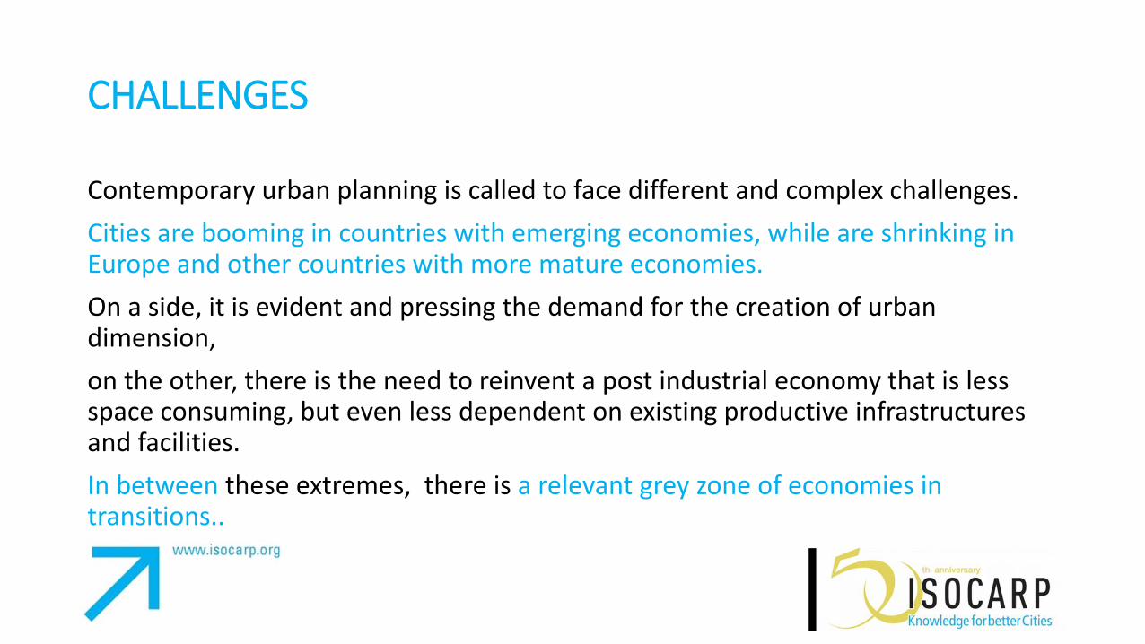
CHALLENGES
Contemporary urban planning is called to face different and complex challenges.
Cities are booming in countries with emerging economies, while are shrinking in Europe and other countries with more mature economies.
On a side, it is evident and pressing the demand for the creation of urban dimension,
on the other, there is the need to reinvent a post industrial economy that is less space consuming, but even less dependent on existing productive infrastructures and facilities.
In between these extremes, there is a relevant grey zone of economies in transitions..

URBANIZATION

SHR
INKI
NG
CIT
IES

Normative planning tools very often, independently on context, are not capable to manage the urban transformations.
There is the need in present urbanism to focus more on the way of designing participatory planning processes capable to set up shared, coherent, sustainable and effective solutions.
Enlarged decision making, pragmatic contextualization of innovative technologies and a re - conceptualization of the role of public space can help professionals to find answers to the many and pressing challenges daily breeding in the urban realms.

BEFORE DESIGNING GUIDELINES… WHAT DO WE NEED TO SUSTAINABLY/EFFECTIVELY INTERVENE IN THE CITIES? AND HOW? MORE STRATEGIC THINKING AND EFFECTIVE POLICY SCHEMES! MODELLING THE CITIES AND OPEN DATA APPROACHTOWARDS SMART CITIES PUBLIC SPACE DESIGN THE PERSPECTIVE, BE CREATIVE, PROVIDE A GOVERNANCE INFRASTRUCTURE!
WHAT DO WE NEED TO SUSTAINABLY/EFFECTIVELY INTERVENE IN THE CITIES? AND HOW?

ECONOMIC REGENERATION
Public-private partnerships and
public-private-people partnerships
for the re-functionalization of
different areas.
Involvement of local public
authorities:
Supporting services for
populations
Providing incentives for local
entrepreneurs
Organizing events
Local
Community Public
Authorities
Private
Stakeholders
Services
Incentives
PPP PPPP Comm.
Actions

SOCIAL EXCLUSION
Involvement of minorities and
other socially disadvantaged
groups in the decision-making
process
Partnerships with public
institutions and NGOs –
addressing specific problems:
Development of educational
programmes
Development of
programmes meant to re-
integrate the residents in the
job market
Local
Community
Dis-
advantaged
Groups
NGOs
Public
Institutions
Tackling Social Exclusion
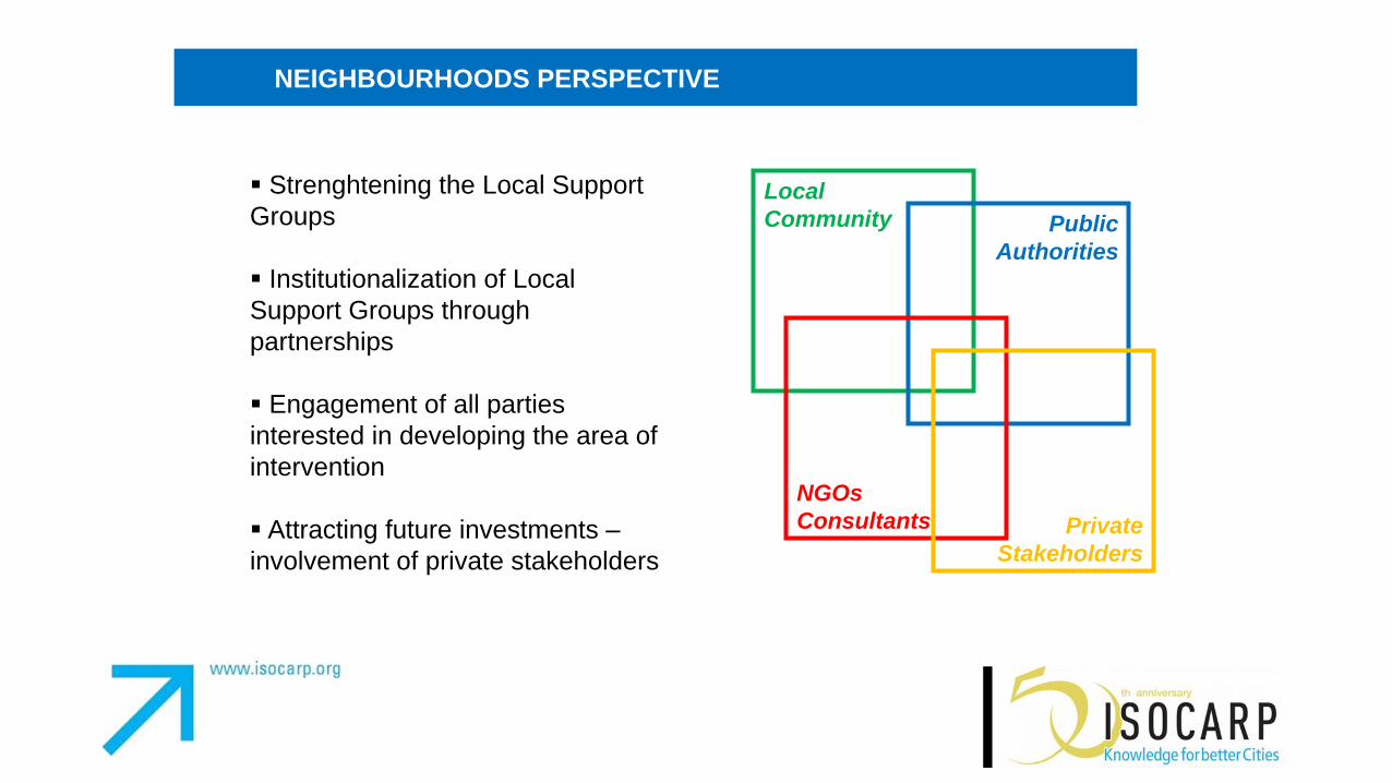
NEIGHBOURHOODS PERSPECTIVE
Strenghtening the Local Support
Groups
Institutionalization of Local
Support Groups through
partnerships
Engagement of all parties
interested in developing the area of
intervention
Attracting future investments –
involvement of private stakeholders
Local
Community Public
Authorities
NGOs
Consultants Private
Stakeholders
MORE STRATEGIC THINKING AND EFFECTIVE POLICY SCHEMES!

INCEPTION PHASE
Desk analysis
Field analysis
Operational analysis
Networking + State of the Art
A CLEAR FRAMEWORK OF AVAILABLE DATA, CURRENT PLANNING TOOLS AND POOL OF LOCAL ACTORS CHARACTERIZING THE PARTNER CITIES PLANNING ARENAS
URBAN PROGRAMM
ING
URBAN CENTERS
TERRITORIAL/URBAN AGENDAS POSTER PLANS
Planning process results: strategic documents are ready
A PHISICAL SPACE FOR U.C. IS IDENTIFIED URBAN TASK FORCES OPERATIONAL IN THE U.C.
Local workshop with local actors (participated planning process)
CITIES KNOWLEDGE PLATFORM
http://www.seecityplatform.net/


MODELLING THE CITIES AND OPEN DATA APPROACHTOWARDS SMART CITIES

• Assesses energy behaviors of buildings from integration of existing geographic information (e.g. cadastral data and topographic data) in order to perform large-scale energy assessments, creating energy maps ( “ecomaps”) and energy pre-certification of buildings.
• Energy maps ("eco-maps", "energy density maps") are an innovative and particularly useful tool for a large array of specialists, public workers, researchers and industry, who can use them for example in:
• Analyzing the possibilities for large scale urban renewal, especially in what concerns the development or extension of district heating networks and the creation of energy strategies for hard-to-tackle or deprived urban areas;
• Prioritizing city-wide investments and assisting decisions on development area locations based on provided information on the state of the art energy-wise as well as nearby energy opportunities for developers.
Scenario 1: Energy maps
http://www.sunshineproject.eu/

Example Energy Map for Ferrara pilot city http://sunshine.graphitech-projects.com/

Diversely-abled citizens needing customised routing instructions.
Professionals who need to have high precision solar potential assessment.
City administrations that need to define policies in terms of heat dispersion and solar potential at urban level, and that has to create noise maps according to EU Directive 2002/49/EC.
Citizens, who can access and directly update real-time data
i-SCOPE Services’ Target Users
Diversely-abled Citizens needing customised routing instructions
Professionals who need to have high precision solar potential assessment
City Administrations that need to define policies in terms of hear dispersion and solar potential at urban level, and that has to create noise maps according to EU Directive 2002/49/EC
Citizens, who can access and directly update real-time data
Citizens
Professionals
Cities
Citizens
http://www.iscopeproject.net/

PUBLIC SPACE
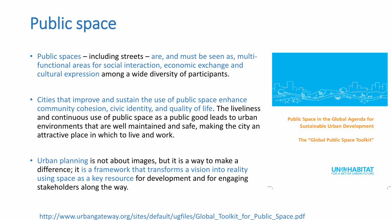
Public space
• Public spaces – including streets – are, and must be seen as, multi-functional areas for social interaction, economic exchange and cultural expression among a wide diversity of participants.
• Cities that improve and sustain the use of public space enhance community cohesion, civic identity, and quality of life. The liveliness and continuous use of public space as a public good leads to urban environments that are well maintained and safe, making the city an attractive place in which to live and work.
• Urban planning is not about images, but it is a way to make a difference; it is a framework that transforms a vision into reality using space as a key resource for development and for engaging stakeholders along the way.
http://www.urbangateway.org/sites/default/ugfiles/Global_Toolkit_for_Public_Space.pdf

…TOWARDS HYBRID SPACES
The most obvious sign of this change is that in many Western countries, it no longer makes perfect sense to speak of being online or offline. When the internet was young and just beginning to be a part of our daily lives, it required a certain portion of will to go on the web.
slow internet connections with expensive minute rates 90’s
social media and web 2.0 First 10 years of XXI century
Even with your mobile phone turned off and your laptop shut down, you still leave digital footprints that other can follow Nowadays
http://www.cifs.dk/scripts/artikel.asp?lng=2&id=2022
HSs?
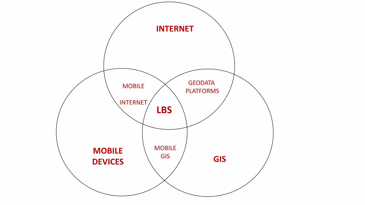
MOBILE DEVICES GIS
INTERNET
MOBILE GIS
GEODATA PLATFORMS
MOBILE
INTERNET
LBS

GIS
INTERNET
MOBILE DEVICES Mobile
GIS
Mobile internet
PLACE Internet
of places
Dynamic mapping of
people and things
LBS
Augmented places
Real time tracking
Real time services
DYNAMIC (SMART)
H-LBS
PLACE AS ENVIRONMENT OF DYNAMISMS Movement of people Interaction of things/devices Interaction with other tracking technologies …

DESIGN THE PERSPECTIVE, BE CREATIVE, PROVIDE A GOVERNANCE INFRASTRUCTURE!

WA
TER
FRO
NT
REG
ENER
ATI
ON
ENTR
EPR
ENEU
RSH
IP
TOU
RIS
M
KAVALA’S STRATEGIC TERRITORIAL AGENDA
PLANNING TOOLS: COHESION POLICY FUNDS, CLLD, ITI, PPP/PPPP,
NATIONAL/REGIONAL PROGRAMMES, LOANS, PRIVATE INVESTMENT…
KAVALA
Knowledge and Attitude to Valorizing Amazing Local Assets

PRIORITY 0 – KAVALA URBAN CENTER
1. The Kavala Urban Center (KUC) is a tool for public participation and support to the local community (creating and implementing own urban development projects responding to the community’s needs).
2. The KUC Core Group will coordinate with the UTF for the implementation of the Strategic Agenda of Kavala, but it will also develop new initiatives
3. The KUC will activate on an European level: it will be in constant contact and cooperation with all administrative layers, facilitating the link between local needs and European, national, regional and local funding and tools
URBAN TASK
FORCE
City Hall
UC Core
Group
URBAN CENTER
AG
END
A IM
PLE
MEN
TATI
ON
LOCAL
REGIONAL
NATIONAL
EU
Direct link, New projects, New funding

POSTER PLANS KAVALA

• Dr.-Ing. Pietro Elisei
• ISOCARP VP – Awards, Communication & Marketing www.isocarp.org
• Urbasofia managing director www.Urbasofia.eu