southold conservation agenda
DESCRIPTION
The Group for the East End environmental advocacy group put together this report based on what it describes as a "professional scientific survey of Southold Town residents."The report includes survey answers, as well as maps and model's of the town's natural systems.TRANSCRIPT
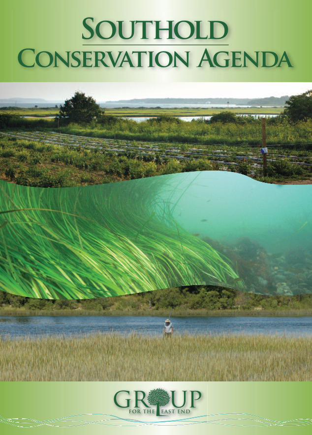
SoutholdConservation Agenda
Residents are invited to help shape the future of Southold Town. TheTown Board has launched Southold 2020, The New ComprehensivePlan for Southold Town, seeking residents’ visions and ideas of wherethe Town should be heading and how it can get there. Through aprocess of public meetings, drafts and revisions, the Board will create a “concise plan for guidance on town policies” aimed at “identifying and protecting important resources” and ensuring “future development& growth are in line with Southold’s vision.” The process is planned to run for a year with a January 2011 presentation of the final draft document scheduled before the Town Board.
With a dozen topics covering land use, economic development, agriculture, housing, transportation, and more, all residents should find something they care about. Become an informed participant in the public process and speak up for the issues and concerns that are important to your future. For more information on getting involved call the Town Planning Department at (631) 765-1938 or [email protected] to sign up for regular e-mail updates.You can get a head start on the issues by reading the Local WaterfrontRevitalization Plan (LWRP); the Town’s last major planning document.It features maps and information on flood prone areas, erosion, archeological, scenic and cultural resources, farmland preservation efforts and efforts to preserve Southold’s rural character. The LWRP will serve as a starting point for the new Comprehensive Plan. Local libraries have printed copies or go to http://southoldtown.northfork.net/Planning/LWRP-2004/LWRP.htm
HELP SHAPE THE FUTURE
For more information, or to become a member:Group for the East End
P.O. Box 1792, Southold, NY 11971 (631) 765-6450 x 216
www.EastEndEnvironment.org
This brochure was prepared by Group for the East End.
We protect and restore the environment of eastern
Long Island through education, citizen action and
professional advocacy. We inspire people to embrace
a conservation ethic.
Project Manager & Text: Jeremy SamuelsonProject Funding:
Long Island Community Foundation
Graphic Design: Diane Hewett, DCH Graphics
Photos: Carissa Katz, Jeremy Samuelson,Diane Hewett, Chris Pickerell;
www.seagrassli.orgPrinting:
Searles GraphicsSpecial Thanks to:
All those on the North Fork who participated in our survey,shared your environmental concerns and have welcomed
Group for the East End in to yourcommunity. Also, the Long Island
Community Foundation for significant grant funding and
support in community outreach;Chris Pickerell of Cornell Cooper-ative Extension; John Sepenoski,
Technical Coordinator forSouthold Town; Nancy Kelley of The Nature Conservancy; John Halsey of Peconic LandTrust; Pierce Rafferty of theHenry L. Ferguson Museum;
Nick Spofford of the Fishers IslandConservancy; Suffolk County
Department of Health, particularly Ronald Paulsen;
Suffolk County Water AuthorityCEO Stephen Jones,
U.S. Geologic Survey and U.S. Department of Agriculture.

RAIN CLOUD
PeconicBay
Long IslandSound
SURFACE SEEPAGERUNOFFRUNOFF
EVAPORATIONTRANSPIRATION
PRECIPITATION
NORTH SOUTH
Salt Water
Salt Water
0‘
-50’
-100’
-150’
-200’
-250’
-300‘
-350’
SEALEVEL
GROUNDWATERUNDERFLOW
Freshwater/SaltwaterInterface
Vertical scale greatly exaggerated
Travel time of water in years.
1 MILE0
1 KILOMETER0
Upper Glacial Aquifer
Magothy Aquifer
WATER TABLEWATER TABLEWATER TABLE
FRESHGROUNDWATER
FLOW
200 years
100 years
50 years
25 years
5 years
Southold receives about 46 inches ofrain and snow each year. Just overhalf percolates down to the aquifer,the saturated soils that hold ourdrinking water supply. Evaporationand transpiration (the process bywhich plants “sweat” water throughtheir leaves) return much of this precipitation to the atmosphere. Collectively these processes arecalled evapotranspiration. The remain-ing rain and snowmelt flows acrosshard surfaces such as paved road
endings and parking lots and theninto our ponds, creeks, harbors andbays. Unfortunately, along the way itpicks up large quantities of chemicalpollutants and trash and carries itinto these surface waters.
Water that percolates into the aquifercan take decades to return to theearth’s surface, often seeping backinto our local creeks, bays, ponds andestuaries as groundwater underflow.
The water cycle is completed when water evaporates from surfacewaters and combines with watervapor formed by evapotranspirationto produce clouds that produce precipitation. From a conservationstandpoint, it’s important to recog-nize that the water cycle serves as aconveyor belt that can carry surfacepollutants and soil pollutants into our local surface waters.
THE WATER CYCLE
Dear Neighbor,
For 38 years, Group for the East End has worked to protect the naturalenvironment of Eastern Long Island through professional advocacy,community action and education.
As a Southold resident and President of Group for the East End, I knowhow important a healthy environment is to my neighbors and friends. So when it came to setting our priorities for the future, I wanted to heardirectly from the local community.
To make this happen, with the support of the Long Island CommunityFoundation we conducted a town-wide scientific poll to identify the conservation issues of greatest concern and interest to Southold residents.
In large numbers residents told us they were very concerned about clean drinking water and the effects of ground and surface water contamination. They also told us they were interested in energy conservation, renewable energy resources and traffic.
We produced this brochure to provide you with some well-researched information about the environmental concerns of many Southolders. We offer some concrete recommendations for protecting the local environment and planning the most sustainable future. I hope this information gives you a better understanding of our local resources and the actions we can take as a community to preserve and restore the local environment.
We invite you to learn more about Group for the East End atwww.EastEndEnvironment.org. When you visit please consider becoming a member of the Group. Your tax-deductible contribution to Group for the East End ensures that we remain a professional voice for conservation in Southold and throughout Eastern Long Island.
Thank you.
Sincerely,
Robert S. DeLuca President
Increased nutrient levels are a major threat to thePeconic Estuary. They enter the water through poorly maintained septic systems,lawn care products, contaminated groundwater and agricultural fertilizers.

SOUTHWEST NORTHEAST
100’
0‘
-100’
-200’
-300’
-400’
-500’
-600’
-700’
-800’
-900’
-1000’
-1100’
RIVERHEAD SOUTHOLDTown Line
BedrockLLOYD AQUIFER
Raritan Clays
MAGOTHY AQUIFER
Long Island MainlandFlow System
Cutchogue Flow System
Greenport Flow System
Orient Flow System
Orie
nt P
oint
Elev
. Fee
tWATER TABLE
Fresh Water
Salt Water
MAGOTHY AQUIFER
UPPER GLACIAL AQUIFER SaltwaterInterface
Clay Unit Clay Unit
EVAPORATION
Hydrogeologic Framework of the North Fork, U.S. Geological Survey, 2004
In Southold fresh water is pumpedfrom the saturated layers of soil, sand,gravel, and clay beneath our feet. Depending on where you are alongthe North Fork the supply of freshwater may be only a few feet thick orit could be more than 100 feet thick.The point at which dry soil meetsthese saturated soils is called thewater table.
The depth of the water table – howfar a person must dig to find water –depends on the amount of rechargefrom precipitation and the size andshape of the land. Additional precipi-tation and hydrologic pressure from a rising tide can also bring the watertable closer to the surface. The effectof recharge on the local aquifer canbe seen in the changing levels oflocal freshwater ponds. Heavilypaved or built areas can substantiallyreduce recharge and increase the amount of precipitation that
becomes runoff, carrying pollutantsdirectly into our surface waters instead of recharging the aquifer.
Like huge mechanical straws, publicand private wells draw fresh water to the surface. Water in the surround-ing soil is pulled toward the base ofthe well shaft. High volume wells frequently create a cone of depressionthat can leave nearby wells dry ordraw saltwater into the fresh wateraquifer. Once a well is fouled by salt – a common issue facing shallowprivate coastal wells – it is very difficult to remove.
Freshwater recharge from precipitationensures there is sufficient pressure to keep saltwater from spoiling theaquifer. Such intrusion is less of athreat at higher elevations where the freshwater “lens” is thickest.Conversely, nearshore areas usuallyhave a thinner lens of fresh water and
a greater risk of saltwater intrusion.When recharge is sufficient, freshwater percolates into wetlands, creeksand harbors creating areas of reducedsalinity that serve as important nurseries for finfish and shellfish.
Rebates: An Idea that Works Hundreds of antiquated home fuel tanks andseptic systems are spread across Southold,adding chemicals and unwanted nutrients to the groundwater. Group for the East End hashelped other local communities address theseproblems through cash incentive programs thatpay property owners to retire buried fuel tanksand failing septics. Similar incentives in Southoldcould stimulate local business while helping the environment.
WELLS: THE PROCESS DOWN BELOWEnvironmentally Sensible
Landscapes
• Grass cut no shorter than 3”stays greener in dry months and discourages weeds
• Minimizing lawn area helps preserve wildlife habitat
• If you must fertilize, use “slow release,” and only theminimum amount needed
• Irrigate early or late in the day to prevent wastethrough evaporation
• Keep native soils and vegetation
• Go organic: use only organicpest and weed controls
THE WATER BENEATH OUR FEET

p. 4-7 (fold-out map #1) 6 5/8.... 6 1/2... 6 1/2... 6 3/8.
Try
SOU
TH
OLD
TO
WN
LINE
BB
BB
BB
BB
BB
BB
BB
BB
BB
BB
BB
BB
BBHH
HH
HH HH
HH
WW
WW WW
WW
WW
WW
WW
WW
WW
WW
WW
WW
WW
WWWW
WWWW
WW
WWWW
WW
HH
HH
HH
HH
HH
HH
HH
HHHH
HH
HH
HH
HH
Private Conservation Lands – Peconic Land Trust, The Nature ConservancyDevelopment Rights – Owner Voluntarily Sold Rights to Further Development of Their LandSubdivision Reserve Lands – Land Protected as Condition of Subdivision ApprovalPublic Parks and PreservesUnprotected Farmlands, Woodlands, Grasslands and WetlandsUnprotected FarmlandDeveloped or Divided for DevelopmentNo Dischage Zones for Boat Effluent – Peconic Estuary, Harbors, Bays and CreeksPeconic Eelgrass Beds 1930sPeconic Eelgrass Beds 2009Suffolk County Water Authority Properties – Owned or LeasedReserves with Hiking TrailsSeaview Trails Bicycle Trails
Breakwater BeachDist. Park
Bailie BeachDist. Park
MATTITUCKMATTITUCKINLETINLET
MATTITUCKINLET
CUTCHOGUECUTCHOGUEHARBORHARBOR
CUTCHOGUEHARBOR
LAURELLAURELLAUREL
MATTITUCKMATTITUCKMATTITUCK
CUTCHOGUECUTCHOGUECUTCHOGUE
NEWNEWSUFFOLKSUFFOLK
NEWSUFFOLK
SOUTHOLDSOUTHOLDSOUTHOLD
GREENPORT VILLAGEGREENPORT VILLAGEGREENPORT VILLAGE
EAST MARIONEAST MARIONEAST MARION
ORIENTORIENTORIENT
PECONICPECONICPECONIC
HOG NECK BAYHOG NECK BAYHOG NECK BAY
HASHAMOMUCKHASHAMOMUCKPONDPOND
HASHAMOMUCKPOND
TOWNTOWNCREEKCREEKTOWNCREEK
GOOSEGOOSECREEKCREEKGOOSECREEK
DAMDAMPONDPONDDAMPOND
LONG BEACHLONG BEACHBAYBAY
LONG BEACHBAY
ORIENTORIENTHARBORHARBORORIENTHARBOR
STIRLINGSTIRLINGBASINBASIN
STIRLINGBASIN
PIPESPIPESCOVECOVEPIPESCOVE
SOUTHOLD BAYSOUTHOLD BAYSOUTHOLD BAY
LAURELLAURELLAKELAKE
LAURELLAKE
Goldsmith’s InletCounty Park
Peconic DunesCounty Park
Horton PointLighthouse
HashamomuckBeach
ArshamomaquePond Preserve
Cedar BeachCounty Park
Arshamomaque Preserve
Moore’s Woods
Truman Beach
Orient East MarionPark Dist.
Orient PointCounty Park
Orient BeachState Park
Inlet PondCounty Park
Silver Lake
Klipp Park
The e PePeconic WaWatershed is homome e to 111 Rare and Prototected Spececies, one reason n ththe EPA designateded the Pecoconinics an EsEstuary of Nationanal SiSignificance in 199393.
Up to 10 perercent of Southold’s Community Preservation Fund may be used for stewawardship of preserved land. Encourage the Town Board to ensure managagement plans are in place for all protected lands.
Prescription Drugs in our Drinking WaterBecause our bodies do not absorb all of the medicines we consume, our septic systems can “recharge” trace amounts of medications into our drinking water supply. Several medications including over-the-counter pain relievers and cholesterol-lowering prescription drugs have begun to show up in routine water testing from all types of wells.
At present, there is no readily available filtering technology that can remove these pharmaceuticals from our drinking water nor is there adequate information to identify potential impacts related to the presence of these products in the environment. Our only means of limiting the amount of medications found in our water supply is to eliminate flushing these products down the drain.
Southold Town should join the handful of communities on Long Island that have expanded their Stop Throwing Out Pollutants (S.T.O.P.) events to include safe medication disposal programs where expired or unwanted medications can be turned over for destruction. Southold currently has two S.T.O.P. Days a year when residents can dispose of chemicals and other toxic items that should not be mixed with regular trash. In the mean-time, Eastern Long Island Hospital in Riverhead is accepting some types of prescriptions for safe disposal. See the “Do Your Part to Protect Natural Resources” section for more details.
Transportation: A Regional SolutionEast End residents are taxed more than $60 million annually for the MTA's Long Island Rail Road, far more than we receive in services. Only months after increasing taxes and raising fares, the Metropolitan Transit Authority has proposed to virtually eliminate rail service to the North Fork. In response, local, regional and State lawmakers are exploring creating an East End transportation network. Professional, independent assessments price regional train and shuttle bus service — running every 30 minutes — at $40 million annually. For more informa-tion on the East End Shuttle proposal or to get involved in improving public transportation on the East End, visit www.EastEndShuttle.org.
Eelgrass, The Canary in the EstuaryEighty years ago the shallows of the Peconic Estuary were thick with a dark green
carpet of eelgrass that covered nearly 9,000 acres of bottomland. In 2000, just over 1,500 acres remained, primarily to the east of Shelter Island. Since then eelgrass beds have continued to thin and even disappear completely.
Today’s bay bottom is largely devoid of the complex habitat critical to many native and migratory species. Without thick beds of seagrass to serve as nurseries and protective cover for young fish, populations of everything from scallops to flounder to horseshoe crabs must overcome steeper odds to survive. The ripple effects are felt hundreds of miles offshore as stocks of prey species decline. The effects inshore are devastating too. Fewer scallops means less filtering of the nutrients and pollution that scientists believe are choking seagrass beds. The cycle accelerates and local fisheries and ways of life are lost.
There is hope, however, that with help from scientists, conservation advocates, and reduced nutrient loads in the Peconic Bay and LI Sound, seagrass beds can make a comeback. Today, several organizations are tackling the problem from a variety of angles. Scientists from Cornell Cooperative Extension have 9 transplant sites within Southold Town that have raised over 10,000 new shoots of eelgrass. A similar effort around Plum Island has grown to 4,500 shoots in under two years.
These apparent successes come after many setbacks and it is too early to know if success will continue. Diseases and algal blooms such as brown tide continue to impact local sea grasses and unexplained die-offs are still common several years after initial success. What is clear is that poor water quality is the biggest threat to seagrass beds and the rich sea life they support. See the “Do Your Part to Protect Natural Resources” section for more information on reducing your impacts on seagrass beds. And visit www.SeaGrassLI.org for information on restoration efforts and research.
Estutuaries are e the most proroduductive ecosystetems on e earth, contntaining more lilifefe per square inch thanan the mosost lush rainforesesest canopy, and ththey are e essential l for 75% to 95%5%5%5% of commercialally and d rerecreationonally used finfnfisisisish h and shellfish.h.
Nitrogen and PathogensAccording to the Federally sponsored Peconic Estuary Program and Management Plan, nitrogen and pathogens (potentially harmful bacteria) present a significant threat to the Peconic Estuary system. The western portion of the Peconic Estuary and several bays further east are already exhibiting dissolved oxygen stresses due to high nitrogen levels. Groundwater carries nitrogen from fertilized areas and septic systems through the aquifer and eventually into surface waters. Rising nutrient levels can fuel explosive algae growth, reduce clarity, lower dissolved oxygen levels and, ultimately, suffocate fish.
Federal regulations now require all local governments to address pollution from stormwater runoff. As systems are updated and redesigned however, it is critical that routine cleaning and mainte-nance of these systems be budgeted. Stormwater recharge systems only work if they are regularly cleaned and maintained. Of course, the best way to reduce nitrogen loading and keep other contaminants out of the Estuary and the Sound is to limit or eliminate pollutants from our homes and lives.
GrGreeeen BoBoating
• SwSwitch t to non-toxixic,c,c,c, water soluablele antifreezeze
• UsUse only biodegradadadadable boat soap (NENEVER use e didish soap onon yoyour boaoats)
• AnAnchoror only in desesignated areaeas anand alwaways avoid e e e eelelgrass bedsds
• HoHonor NoNo Discharargegegege ZonesEvEven trereated boat t wawawawaste mustst bebe pumumped-out.
• SeSearch “ “Peconic pupupupump-out” on the w web and clilickck the first lilink for a a list of free e pupump-out opoptions s across thehe E E E East End oror vivisisit our r office to pipipipickck up a map ofof Pecononic pump ouououout stations.
Natural Resources
MAP PANELS FPO... ACTUAL SIZE= 26 INCHES WIDE ... USE CROPS/FOLDS FROM AI FILE

Finished size: 6.625 wide x 9.25 high
p. 8-11 (fold-out map #2) 6 3/8.... 6 1/2... 6 1/2... .6 5/8
SOU
THO
LD TO
WN
LINE
e
s
Existing and Proposed Water MainsGroundwater Divide Arrows Indicate Major Direction of Groundwater FlowFlow System BoundariesWell Moratorium BoundarySuffolk County Water Authority Properties Owned or LeasedSuffolk County Water Authority Well Fields
>100 ft75 ft50 ft25 ft<10 ft
Thickness of Fresh Water
The True Cost of Public WaterDespite Southold’s limited freshwater capacity, experts stress that management should focus on water quality not water quantity. Throughout Suffolk County, the Water Authority uses advanced filtering systems (granular activated carbon, greensand, and resin) on 25% of the water pumped. In Southold, the numbers are nearly 100%. The difference stems from the lingering effects of historic agricultural operations that utilized many chemicals that have been outlawed in the last 30 years. Unfortunately, many of these products can still be found in local wells because they can take centuries to move through our drinking water supply.
This filtering technology for public supply wells averages $40,000 per well, per year. Accordingly, the cost to pump and filter 1,000 gallons of water in Southold is approximately $1.45, compared to a county-wide average of $0.16. Fortunately for Southold customers, state law requires that all utility customers pay the same rate for service.
According to the Suffolk County Water Authority, drinking water pumped from beneath natural open space is significantly higher in quality than that pumped from beneath either developed or agricul-tural areas. As such, costs to deliver this water are significantly lower. These data reflect the critical importance of continuing to preserve undeveloped natural areas for the benefit of our water supply as well as the character of our community.
LAURELLAURELLAUREL
MATTITUCKMATTITUCKMATTITUCK
CUTCHOGUECUTCHOGUECUTCHOGUE
NEWNEWSUFFOLKSUFFOLK
NEWSUFFOLK
SOUTHOLDSOUTHOLDSOUTHOLD
GREENPORT VILLAGEGREENPORT VILLAGEGREENPORT VILLAGE
EAST MARIONEAST MARIONEAST MARION
ORIENTORIENTORIENT
PECONICPECONICPECONIC
Rainwater that f fell 400 years ago on the North Fork’s first large-scale farmrmining operations (nearar what is now North Road), is only now percolating into L Lonong Island Sound and Pecoconic Estuary, according to the U.S. Geologic Survey. Sampmples of that 400-year-old watater show the first traces of nitrates from local agriculture e and remind us s that what we putut on the ground and into our water will be with us for a very long time.
Southold’s Aquifer
ArAreaeas withthin the blue e lines are isolatated aqaquiuifers – – f fresh waterer s s supply systemems – – tytypically unconnected d d from the adadjoining wawater supppplilieses in all but ththe wewettest ofof years
Seararch on Google™ for “S“Suffolklk C Couounty ininvavasives lilist” and followowowow t the first link k toto learn abobout identifyiyingng and controlol-ling i invasivive plants thahat t t t have spread frfromom gardedens to naturaral l l areas and arare dedeststroyingng our complexexexex n native plant cocommmmunitities. On the sasasasame web pagage yoyou u can findnd a link to thehehehe Nation’s firsrst “D“Do o Not SeSell List” of ininvavavavasive specieses.
One Town, Eight Flow SystemsOn parts of Long Island fresh water extends as deep as 1,000 feet through three distinct aquifers – or layers of saturated soils – the Upper Glacial, the Magothy and the Lloyd. Hydrologists agree Suffolk County has sufficient water quantity to meet our needs. However, concerns stem from the chemical contaminants we flush down our drains, spread on our lawns or put into the aquifer through the recharge process. The North Fork presents a series of particular challenges.
Near Jamesport, the Magothy Aquifer contains some fresh water. However, farther east, fresh water is limited to the upper most reaches of the Upper Glacial aquifer. This smaller lens of freshwater is the result of several factors: the narrow width of the North Fork; the low profile of the land, and; the isolating effects of the saltwater bays that divide our freshwater lenses into several separate pieces. In reality, the fresh water under Orient, – called the “Orient flow system” – is completely isolated from the Greenport flow system by Dam Pond. Similarly, the Green-port system is isolated to the southwest by Hashamomuck Pond. The Cutchogue flow system is isolated by Mattituck Creek and James Creek.
Residents in the westernmost portion of Town are a part of the Long Island mainland flow system. Not surprisingly, the fresh water aquifers of Fisher’s Island and Plum Island are each completely isolated from the North Fork. Throughout Town, the aquifer is thinner and more vulnerable to salt water intrusion in outlying peninsulas and low-lying shoreline areas.
The Development CycleWhen farm fields and woodlands are turned into subdivisions and strip malls, the need for infrastructure and services increases. Existing roads must carry additional traffic. New roads, stoplights and intersections must be built and paid for. Schools must chose between increasing class sizes or hiring more teachers and borrowing money to expand buildings. Either way, budgets and taxes rise. Municipal and emergency services are forced to do more with less or to expand their budgets, personnel and facilities.
After these hard choices are made, upgrades and maintenance for sewage treatment, stormwater filtering systems and land protection frequently go unfunded, compromising the environment and its critical economic value. Over time, more money is needed to restore degraded resources and bring back the economic value of our fisheries and farmlands, and sustain the value of our local recreation and tourist-based economy.
As the development cycle continues, property owners will bear all the long-term costs of infrastructure, services and environmental restoration. Yet, ironically, more development is still offered by some as a means of lowering taxes and making housing more affordable. Successfully planning for a sustainable future must break the development cycle, incorporate an understanding of the true costs of development over time and address these costs in making the land-use decisions that shape our future.
o
AcAccocording toto the EPA “BeBeBeBetwtween 1950 a and 202000, the U.U.S. populatioion n nearly doubleded whwhile the pupublic demanand for water momorere than trtripled. Ameriricacacacans nonow use anan average of 10100 gallons of wawater each d day – enougugh h h h to fill 1,600 drdrininking glalasses.”
Source Data for All Maps: Suffolk County Department of Real Property, Suffolk County Health Department, Suffolk County Water Authority, Town of Southold, US Geological Survey, The Nature Conservancy, Peconic Land Trust, Cornell Cooperative Extension, Peconic Estuary Program
Unsafe To Drink: A Cautionary TaleSince 1997, it is illegal to drill wells or use the groundwater from underneath a roughly 2,000-foot wide strip that starts at the Town’s recycling facility along Route 48 and runs north to Long Island Sound. The ban is the only way the Suffolk County Health Department can ensure that a variety of contaminants including benzene, freon, vinyl chloride, MTBE, and other chemicals that were illegally dumped in the Town’s old landfill do not end up in homes, businesses or on farm fields. A cleanup removed much of the toxic waste but could not recover contamination that had already percolated into the aquifer and begun migrating north in a narrow band toward the Sound. Hydrologists estimate that it could be hundreds of years before this contamination is no longer detectable in test wells. In the meantime, the Suffolk County Water Authority pumps clean water from wells outside the moratorium area to all homes and businesses, including the Town’s recycling center, within the moratorium boundary.
Save Water, Save EnergyA recent EPA study highlights the connection between water use and electricity use, finding that a faucet fed by a private well uses as much energy in five minutes as a 60-watt light bulb left on for 14 hours. Reducing water waste reduces energy consumption and helps fight climate change.

*Henry L. Ferguson Museum Land Trust
Fishers IslandTown Easement
SubdivisionReserves
Water Utility/Museum
Public Preserve
Private Conservation Lands* Unprotected Natural AreasWater UtilitiesDeveloped or Divided for DevelopmentEel Grass Beds 1930sEel Grass Beds 2009
DO YOUR PART TO PROTECTNATURAL RESOURCES
Test Your Drinking WaterThe Suffolk County Department of Health recommends property owners test private wells at least every two years. County or State certified labs can test your water. The county tests for over 100 potential contaminants, including microbes, metals, inorganic chemicals, volatile organics, and petroleum derivatives. If your well is near a former agricultural area, they may test for carbamate pesticides. County testing costs $100 while commercial testing costs over $300. Samples must be collected by a professional. Should testing reveal problems, the health depart-ment recommends possible remedies including relocating or altering the depth of your well.
Call (631) 852-5810 or visit www.co.suffolk.ny.us to request a county test or a list of state approved commercial labs. On the web look up “Health Services” in the Department Directory;scroll down to “Office of Water Resources.” Click on this link and then scroll down to “PrivateWells;” click on the link to the “Private Water Testing Program.”
While Fishers Island remains a placeunto itself, many of the most pressingecological issues facing these 3,000acres are familiar to residents of the North Fork — coastal erosion,control and eradication of invasiveplants, and drinking water quality.However, the very nature of the Island brings additional challengesand magnifies the impacts of our landand resource management decisions.
For example, every drop of water thatflows from a faucet or hose on FishersIsland comes from the isolated aquifer— the saturated layers of earth thatunderlie the Island.
Accordingly, this fresh water lens isvulnerable to every lawn chemical,fertilizer and pesticide that is sprayedor applied to keep a lawn green or a flower free from insects. What doesn’t soak into the earth washesinto the Island’s harbors and bayswhere it disrupts natural systems by triggering explosive plant growthor poisoning the plants and animalsthat form our food web.
Island residents wanting to learn moreor get involved can contact either the Fishers Island Conservancy atwww.FishersIslandConservancy.orgor the Henry L. Ferguson Museumand Land Trust at www.Ferguson-Museum.org. Both organizationshave been critical to documentingand restoring Fishers Island’s precious natural resources. There is also plentyof great info at the Group’s web site www.EastEndEnvironment.org.
Consider the Source Learn where your water comes from. If you have a private well, have it tested every twoyears, see “Testing Your Drinking Water.” Water Authority customers can locate theirpump station and read annual reports atwww.scwa.org. For community well field customers, their well operator is required to file annual testing reports with the EPA, copiesof which are usually available through yourhomeowners’ or neighborhood association.
S.T.O.P. “Stop Throwing Out Pollutants” NEVER discard toxics — gasoline, oil, paints,aerosols, cleaners or lawn care products — into the soil or the drain. Call the Southold Recycling Center at (631) 734-7685 forS.T.O.P. dates and details. Residents can alwaysdrop off florescent and compact fluorescent(CFL) light bulbs and electronics, which requirespecial handling and should never be mixedwith regular trash. Visit http://southoldtown.northfork.net/collection_center.htm for details.
Prescriptions Proper prescription disposal limits the levels of medication in our drinking water supply.Southold Town does not yet accept medicationsat their S.T.O.P. Days, as some L.I. towns do.Until then, Eastern Long Island Hospital inGreenport is the closest accepting facility. Call (631) 477-5191 for details on their Safe Medication Disposal Program or go to www.elih.org, click on “services” then “Community Resources” then “Medications”and then click “Medication Disposal.”
Eat for the Estuary Local finfish and shellfish are fresher, have fewer “food miles” and help support local producers. Sustainability guides are online:www.edf.org/seafood and http://blueocean.org/seafood/seafood-guideor visit our office for a free wallet sized copy.
Buy “Water Sense” Products The EPA now labels everything from kitchen fixtures to irrigation equipment. More information at www.epa.gov/watersense/index.html
Pick Up Pet Waste It’s easy to do the right thing and it has a big impact. Bacterial contamination from untendedpet waste can pose a threat to human healthand the health of our local waterways. Visitwww.EastEndEnvironment.org to view our Pet Waste Fact Sheet.
Upgrade Oil Tanks Replace buried home heating oil tanks with an indoor or a contained above-ground tank.
Clean Your Pipes Aging septic systems threaten local water quality. Have your system pumped every threeyears and replace failing cesspools. Regularmaintenance greatly enhances the life of yoursystem. Visit www.EastEndEnvironment.orgto view our Septics Fact Sheet.
Reduce Shore Hardening Bulkheads, seawalls, or revetments can contribute to the loss of beaches and may causeadditional erosion on neighboring properties.Replant native beach grasses and encouragewetlands restoration to minimize flooding and erosion. More information at: https://habitat.noaa.gov/restorationtechniques/public/shoreline_tab1.cfm
Contain Home Runoff Install and maintain catch basins and drains to keep yard and driveway runoff from washinginto the street and into the bay.
Join Group for the East End Help us protect and restore our critical naturalresources. Call (631) 765-6540 x 216 or visitwww.EastEndEnvironment.org.

SoutholdConservation Agenda
Residents are invited to help shape the future of Southold Town. TheTown Board has launched Southold 2020, The New ComprehensivePlan for Southold Town, seeking residents’ visions and ideas of wherethe Town should be heading and how it can get there. Through aprocess of public meetings, drafts and revisions, the Board will create a “concise plan for guidance on town policies” aimed at “identifying and protecting important resources” and ensuring “future development& growth are in line with Southold’s vision.” The process is planned to run for a year with a January 2011 presentation of the final draft document scheduled before the Town Board.
With a dozen topics covering land use, economic development, agriculture, housing, transportation, and more, all residents should find something they care about. Become an informed participant in the public process and speak up for the issues and concerns that are important to your future. For more information on getting involved call the Town Planning Department at (631) 765-1938 or [email protected] to sign up for regular e-mail updates.You can get a head start on the issues by reading the Local WaterfrontRevitalization Plan (LWRP); the Town’s last major planning document.It features maps and information on flood prone areas, erosion, archeological, scenic and cultural resources, farmland preservation efforts and efforts to preserve Southold’s rural character. The LWRP will serve as a starting point for the new Comprehensive Plan. Local libraries have printed copies or go to http://southoldtown.northfork.net/Planning/LWRP-2004/LWRP.htm
HELP SHAPE THE FUTURE
For more information, or to become a member:Group for the East End
P.O. Box 1792, Southold, NY 11971 (631) 765-6450 x 216
www.EastEndEnvironment.org
This brochure was prepared by Group for the East End.
We protect and restore the environment of eastern
Long Island through education, citizen action and
professional advocacy. We inspire people to embrace
a conservation ethic.
Project Manager & Text: Jeremy SamuelsonProject Funding:
Long Island Community Foundation
Graphic Design: Diane Hewett, DCH Graphics
Photos: Carissa Katz, Jeremy Samuelson,Diane Hewett, Chris Pickerell;
www.seagrassli.orgPrinting:
Searles GraphicsSpecial Thanks to:
All those on the North Fork who participated in our survey,shared your environmental concerns and have welcomed
Group for the East End in to yourcommunity. Also, the Long Island
Community Foundation for significant grant funding and
support in community outreach;Chris Pickerell of Cornell Cooper-ative Extension; John Sepenoski,
Technical Coordinator forSouthold Town; Nancy Kelley of The Nature Conservancy; John Halsey of Peconic LandTrust; Pierce Rafferty of theHenry L. Ferguson Museum;
Nick Spofford of the Fishers IslandConservancy; Suffolk County
Department of Health, particularly Ronald Paulsen;
Suffolk County Water AuthorityCEO Stephen Jones,
U.S. Geologic Survey and U.S. Department of Agriculture.