southernization-map directions - wikispaces directions . map 1 directions using your atlas, label...
TRANSCRIPT
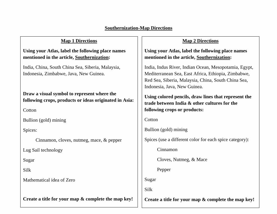
Southernization-Map Directions
Map 1 Directions
Using your Atlas, label the following place names mentioned in the article, Southernization:
India, China, South China Sea, Siberia, Malaysia, Indonesia, Zimbabwe, Java, New Guinea.
Draw a visual symbol to represent where the following crops, products or ideas originated in Asia:
Cotton
Bullion (gold) mining
Spices:
Cinnamon, cloves, nutmeg, mace, & pepper
Lug Sail technology
Sugar
Silk
Mathematical idea of Zero
Create a title for your map & complete the map key!
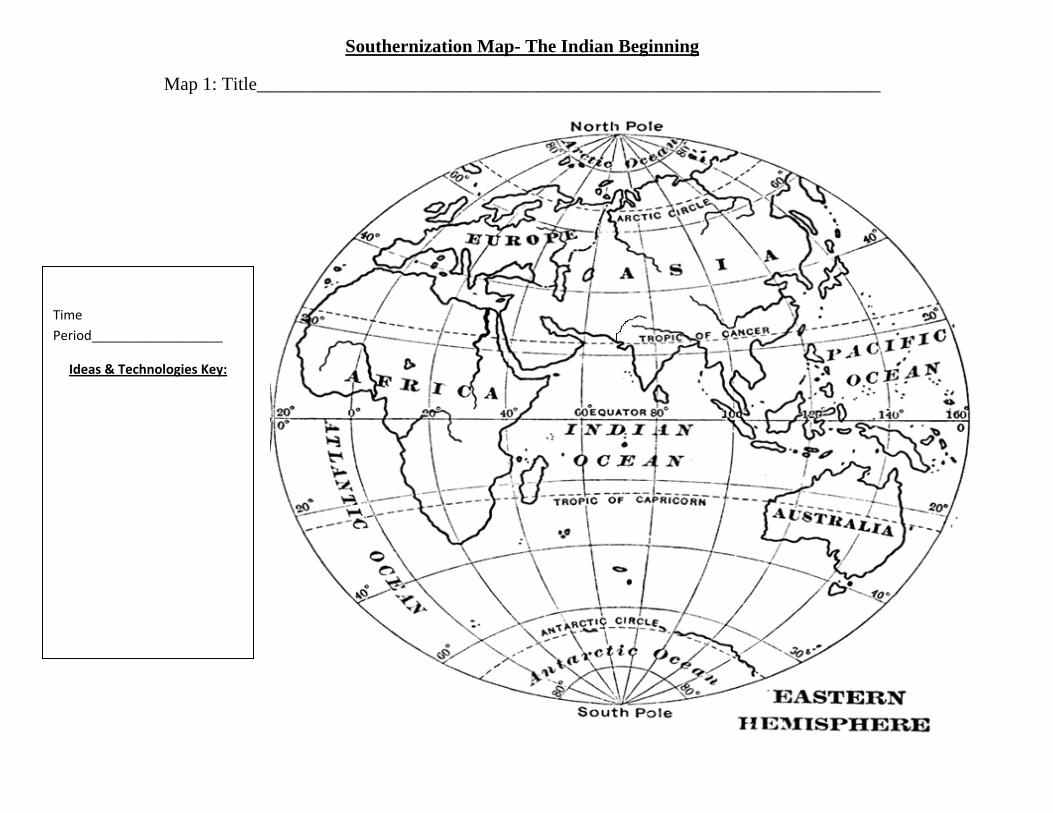
Map 2 Directions
Using your Atlas, label the following place names mentioned in the article, Southernization:
India, Indus River, Indian Ocean, Mesopotamia, Egypt, Mediterranean Sea, East Africa, Ethiopia, Zimbabwe, Red Sea, Siberia, Malaysia, China, South China Sea, Indonesia, Java, New Guinea.
Using colored pencils, draw lines that represent the trade between India & other cultures for the following crops or products:
Cotton
Bullion (gold) mining
Spices (use a different color for each spice category):
Cinnamon
Cloves, Nutmeg, & Mace
Pepper
Sugar
Silk
Create a title for your map & complete the map key!
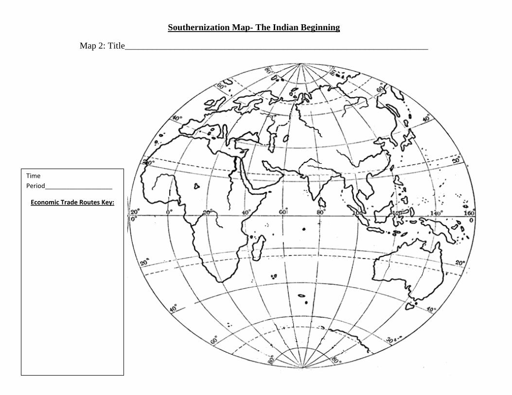
Southernization Map- The Indian Beginning
Map 1: Title___________________________________________________________________
Time Period__________________
Ideas & Technologies Key:
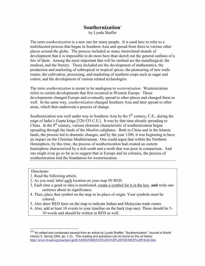
Southernization Map- The Indian Beginning
Map 2: Title___________________________________________________________________
Time Period___________________
Economic Trade Routes Key:
Southernization1
by Lynda Shaffer
The term southernization is a new one for many people. It is used here to refer to a
multifaceted process that began in Southern Asia and spread from there to various other
places around the globe. The process included so many interrelated strands of
development that it is impossible to do more here than sketch out the general outlines of a
few of them. Among the most important that will be omitted are the metallurgical, the
medical, and the literary. Those included are the development of mathematics; the
production and marketing of subtropical or tropical spices; the pioneering of new trade
routes; the cultivation, processing, and marketing of southern crops such as sugar and
cotton; and the development of various related technologies.
The term southernization is meant to be analogous to westernization. Westernization
refers to certain developments that first occurred in Western Europe. Those
developments changed Europe and eventually spread to other places and changed them as
well. In the same way, southernization changed Southern Asia and later spread to other
areas, which then underwent a process of change.
Southernization was well under way in Southern Asia by the 5th
century, C.E., during the
reign of India’s Gupta kings [320-535 C.E.]. It was by that time already spreading to
China. In the 8th
century, various elements characteristic of southernization began
spreading through the lands of the Muslim caliphates. Both in China and in the Islamic
lands, the process led to dramatic changes, and by the year 1200, it was beginning to have
an impact on the Christian Mediterranean. One could argue that within the Northern
Hemisphere, by this time, the process of southernization had created an eastern
hemisphere characterized by a rich south and a north that was poor in comparison. And
one might even go so far as to suggest that in Europe and its colonies, the process of
southernization laid the foundation for westernization.
Directions:
1. Read the following article.
2. As you read, label each location on your map IN RED.
3. Each time a good or idea is mentioned, create a symbol for it in the key, and write one
sentence about its significance.
4. Then, place that symbol on the map in its place of origin. Your symbols must be
colored.
5. Also draw RED lines on the map to indicate Indian and Malaysian trade routes.
6. Also, add at least 10 events to your timeline on the back (top one). These should be 5-
10 words and should be written in RED as well.
1[1]
An edited and condensed excerpt from an article by Lynda Shaffer, “Southernization” Journal of World
History 5, Spring 1994, pp. 1-21. This reading and questions can be found on the url below.
http://www.b-ssd.org/teachers/grifr/ASSIGNMENTS%20AND%20THEMES%20PAGE.htm
The Indian Beginnings
Southernization was the result of developments that took place in many parts of Southern Asia,
both on the Indian subcontinent and in Southeast Asia. By the time of the Gupta kings, several of
its constituent parts already had a long history in India. Perhaps the oldest strand in the process
was the cultivation of cotton and the production of cotton textiles for export.
Cotton was first domesticated in the Indus River Valley some time between 2300 and 1760
B.C.E., and gradually the Indians began to develop sophisticated dyeing techniques. During this
time, Indus River Valley merchants are known to have lived in Mesopotamia, where they sold
cotton textiles.
In the 1st century C.E., Egypt became an important overseas market for Indian cottons. By the
next century, there was a strong demand for these textiles, both in the Mediterranean and in East
Africa, and by the 5th century, they were being traded in Southeast Asia. The Indian textile trade
continued to grow throughout the next millennium. Even after the arrival of European ships in
Asian ports at the turn of the 16th century, it continued unscathed. According to one textile
expert, “India virtually clothed the world,” by the mid-1700s. The subcontinent’s position was
not undermined until Britain’s Industrial Revolution, when steam engines began to power the
production of cotton textiles.
Another strand in the process of southernization, the search for new sources of bullion, can be
traced back in India to the end of the Mauryan Empire [321-185 B.C.E.]. During Mauryan rule,
Siberia had been India’s main source of gold, but nomadic disturbances in Central Asia disrupted
the traffic between Siberia and India at about the time that the Mauryans fell. Indian sailors then
began to travel to the Malay Peninsula and the islands of Indonesia in search of an alternative
source, which they most likely ‘discovered’ with the help of local peoples who knew the sites.
[This is generally the case with bullion discoveries, including those made by Arabs and
Europeans.] What the Indians, and others later on, did do was to introduce this gold to
international trade routes.
The Indians’ search for gold may also have led them to the shores of Africa. Although its
interpretation is controversial, some archaeological evidence suggests the evidence of Indian
influence on parts of East Africa as early as 300 C.E. There is also one report that gold was being
sought in East Africa by Ethiopian merchants, who were among India’s most important trading
partners.
The 6th century Byzantine geographer Cosmas Indicopleustes described Ethiopian merchants who
went to some location inland from the East African coast to obtain gold. “Every other year they
would sail far to the south, then march inland, and in return for various made-up articles they
would come back laden with ingots of gold.” The fact that the expeditions left every other year
suggests that it took 2 years to get to their destination and return. If so, their destination, even at
this early date, may have been Zimbabwe. The wind patterns are such that sailors who ride the
monsoon south as far as Kilwa can catch the return monsoon to the Red Sea areas within the same
year. However, if they go beyond Kilwa to the Zambezi River, from which they might go inland
to Zimbabwe, they cannot return until the following year.
Indian voyages on the Indian Ocean were part of a more general development, more or less
contemporary with the Mauryan Empire, in which sailors of various nationalities began to knit
together the shores of the “Southern Ocean”, a Chinese term referring to all the waters from the
South China Sea to the eastern coast of Africa. During the period, there is no doubt that the most
intrepid sailors were the Malays, peoples who lived in what is now Malaysia, Indonesia, the
southeastern coast of Vietnam, and the Philippines.
Sometime before 300 B.C.E., Malay sailors began to ride the monsoons, the seasonal winds that
blow off the continent of Asia in the colder months and onto its shores in the warmer months.
Chinese records indicate that by the 3rd
century B.C.E., “Kunlun” sailors [the Chinese term for
Malay seamen] were sailing north to the southern coasts of China. They may also have been
sailing east to India, through the straits now called Malacca and Sunda. If so, they may have been
the first to establish contact between India and Southeast Asia.
Malay sailors had reached the eastern coast of Africa at least by the 1st century B.C.E., if not
earlier. Their presence in East African waters is testified to by the peoples of Madagascar, who
still speak a Malay-Polynesian language. Some evidence also suggests that Malay sailors had
settled in the Red Sea area. Indeed, it appears that they were the first to develop a long-distance
trade in a southern spice. In the last century B.C.E., if not earlier, Malay sailors were delivering
cinnamon from South China Sea ports to East Africa and the Red Sea.
By about 400 C.E., Malay sailors could be found 2/3rds
of the way around the world, from Easter
Island to East Africa. They rode the monsoons without a compass, out of sight of land, and often
at latitudes below the equator where the northern pole star cannot be seen. They navigated by the
wind and the stars, by cloud formations, the color of the water, and swell and wave patterns on
the ocean’s surface. They could discern the presence of an island some 30 miles from its shore
by noting the behavior of the birds, the animal and plant life in the water, and the swell and wave
patterns. Given their manner of sailing, their most likely route to Africa and the Red Sea would
have been by way of the island clusters, the Maldives, the Seychelles, etc.
Malay ships used balance lug sails, which were square in shape and mounted so that they could
pivot. This made it possible for sailors to tack against the wind, that is, to sail into the wind by
going diagonally against it, first one way and then the other. Due to the way the sails were
mounted, they appeared triangular in shape, and thus may be the prototype of the Arab triangular
sails which were then used to tack against the wind.
Indian traders and shippers and Malay sailors were also responsible for opening up an all-sea
route to China. The traders’ desire for silk drew them out into dangerous waters in search of a
more direct way to its sources. By the 2nd
century C.E., Indian merchants could make the trip by
sea, but the route was slow, and it took at lest 2 years to make a round trip. Merchants leaving
from India’s eastern coast rounded the shores of the Bay of Bengal and went on to the coast of
Vietnam and on to China with the monsoon winds.
It was also during this time period that the Indians discovered how to crystallize sugar. There is
considerable disagreement about where sugar was first domesticated. Some believe that the plant
was native to New Guinea and domesticated there, and others argue that it was domesticated by
Southeast Asian peoples living in what is now southern China. In any case, sugar cultivation
spread to the Indian subcontinent. Sugar, however, did not become an important item of trade
until the Indians discovered how to turn sugarcane juice into granulated crystals that could be
easily stored and transported. This was a momentous development, and it may have been
encouraged by Indian sailing, for sugar and clarified butter [ghee] were among the dietary
mainstays of Indian sailors.
The Indians also laid the foundation for modern mathematics during the time of the Gupta
Empire. Western numerals, which the Europeans called Arabic since they acquired them from
the Arabs, actually came from India. The Arabs still call them ‘Hindi’ numbers. The most
significant feature of the Indian system was the invention of the zero as a number concept. The
oldest existing work that used the zero in the modern way is a mathematical work attached to a
text on astronomy, which is dated 499 C.E.
The Indian zero made the place value system of writing numbers superior to all others. Without
it, the use of this system, base ten or otherwise, was fraught with difficulties and did not seem any
better than alternative systems. With the zero, the Indians were able to perform calculations
rapidly and accurately, to perform much more complicated calculations, and to discern
mathematical relationships more aptly. These numerals, and the mathematics the Indians
developed with them, are now universal – just one indication of the global significance of
southernization.
As a result of these developments, India acquired a reputation as a place of marvels, a reputation
that was maintained for many centuries after the Gupta dynasty fell. As late as the 9th century,
Amr ibn Bahr al Jahiz [c. 776-868], one of the most influential writers of Arabic, had the
following to say about India:
“As regards the Indians, they are among the leaders in astronomy, mathematics – in particular,
they have Indian numerals – and medicine; they alone possess the secrets of the latter, and use
them to practice some remarkable forms of treatment. They have the art of carving statues and
painted figures. They possess the game of chess, which is the noblest of games. They make
swords, and excel in their use. They have splendid music. They possess a script capable of
expressing the sounds of all languages, as well as many numerals. They have a great deal of
poetry, many long treatises, and a deep understanding of philosophy and letters. They are
intelligent and courageous. Their sound judgment and sensible habits led them to invent pins,
cork, toothpicks, and the dyeing of hair. They were the inventors of astronomical reckoning
which was subsequently adopted by the rest of the world. When Adam descended from Paradise,
it was to their land that he made his way.”
Directions:
1. Read the following article.
2. As you read, label each location on your map IN BLUE.
3. Each time a good or idea is mentioned, create a symbol for it in the key, and write one
sentence about its significance.
4. Then, place that symbol on the map in its place of origin. Your symbols must be
colored.
5. Also draw BLUE lines on the map to indicate Chinese trade routes.
6. Also, add at least 10 events to your timeline on the back (2nd one). These should be 5-
10 words and should be written in BLUE as well.
The Southernization of China
These Southern Asian developments began to have a significant impact on China after 350 C.E.
The Han dynasty had fallen in China in 221 C.E., and for more than 350 years thereafter, China
was ruled by an ever-changing collection of regional kingdoms. During these centuries in which
Buddhism became increasingly important in China, Buddhist monasteries spread throughout the
disunited realm, and cultural exchange between India and China grew accordingly. By 581, when
the Chinese empire was reunited under the Sui dynasty, processes associated with southernization
had already had a major impact on China. The influence of southernization continued during the
Tang dynasty [618-906] and the Song dynasty [960-1279]. One might even go so far as to
suggest that the process of southernization underlay the revolutionary social, political, economic,
and technological developments of the Tang and Song.
The Chinese reformed their mathematics, incorporating the advantages of the Indian system, even
though they did not adopt the Indian numerals at that time. They then went on to develop an
advanced mathematics, which was flourishing by the time of the Song dynasty. Cotton and
indigo became well established, giving rise to the blue-black peasant garb that is became common
in China. Also in the Song period, the Chinese first developed cotton canvas, which they used to
make a more efficient sail for ocean-going ships.
Although sugar had long been grown in some parts of southern China, it did not become an
important crop in this region until the process of southernization was well under way. The
process also introduced new varieties of rice. The most important of these was what the Chinese
called “Champa rice”, since it came to China from Champa, a Malay kingdom located on what is
now the southern coast of Vietnam. Champa rice was a drought-resistant, early ripening variety
that made it possible to extend cultivation up well-watered hillsides, thereby doubling the area of
rice cultivation in China.
In southern China, the further development of rice production brought significant changes in the
landscape. Before the introduction of Champa rice, rice cultivation had been confined to
lowlands, deltas, basins, and river valleys. Once Champa rice was introduced and rice cultivation
spread up the hillsides, the Chinese began systematic terracing and made use of sophisticated
techniques of water control on mountain slopes. Between the mid-8th and early 12
th century, the
population of southern China tripled, and the total Chinese population doubled. According to the
Song dynasty household registration figures for the 1100’s, there were 100 million people in
China by the 1st decade of the 12
th century.
Before the process of southernization, northern China had always been predominant,
intellectually, socially, and politically. The imperial center of gravity was clearly in the north,
and the southern part of China was perceived as a frontier area. However, southernization
changed this situation dramatically. By 600, southern China was well on its way to becoming the
most prosperous and most commercial part of the empire. The most telling evidence for this is
the construction of the Grand Canal, which was completed around 610, during the Sui Dynasty.
Even though the rulers of the Sui dynasty had managed to put the pieces of the empire back
together, and rule the whole of China again from a single northern capital, they were dependent
on the new southern crops. Thus it is no coincidence that this dynasty felt the need to build a
canal that could deliver southern rice to northern cities, and northern military regiments to the
south.
The Tang dynasty, when Buddhist influence in China was especially strong, saw two exceedingly
important technological innovations – the invention of printing and gunpowder. These
developments may also be linked to southernization. Printing seems to have developed within the
walls of Buddhist monasteries between 700 and 750, and southwestern China was one of the
earliest centers of the art. The invention of gunpowder in China by Taoist alchemists in the 9th
century may also be related to the linkages between India and China created by Buddhists. In
644, an Indian monk identified soils in China that contained saltpeter and demonstrated the purple
flame that results from its ignition. As early as 919 C.E., gunpowder was used as an igniter in a
flamethrower, and the 10th century also saw the use of flaming arrows, rockets, and bombs thrown
by catapults.
By the time of the Song dynasty, the Chinese also had perfected the ‘south-pointing needle,’
otherwise known as the compass. Various prototypes of the compass had existed in China from
the 3rd
century B.C.E., but the new version developed during the Song dynasty was particularly
well suited for navigation. Soon Chinese mariners were using the south-pointing needle on the
oceans, publishing ‘needle charts’ for the benefit of the sea captains, and following ‘needle
routes’ on the Southern Ocean.
Once the Chinese had the compass, they, like Columbus, set out to find a direct route to the spice
markets of Southeast Asia. Unlike Columbus, they found them. They did not bump into an
obstacle, now known as the Western Hemisphere, on their way, since it was not located between
China and the Spice Islands. If it had been so situated, the Chinese would have found it some 500
years before Columbus.
Cities on China’s southern coast became centers of overseas commerce. Silk remained an
important export, and by the Tang dynasty it had been joined by porcelain, which was developed
in China sometime before 400 C.E. China’s southern ports were also exporting to Southeast Asia
large quantities of ordinary consumer goods, including iron hardware, such as needles, scissors,
and cooking pots. Until the British Industrial Revolution of the 18th century, no other place
equaled the iron production of Song China.
Directions:
1. Read the following article.
2. As you read, label each location on your map IN GREEN.
3. Each time a good or idea is mentioned, create a symbol for it in the key, and write one
sentence about its significance.
4. Then, place that symbol on the map in its place of origin. Your symbols must be
colored.
5. Also draw GREEN lines on the map to indicate Muslim trade routes.
6. Also, add at least 10 events to your timeline on the back (3rd one). These should be 5-
10 words and should be written in GREEN as well.
The Islamic Caliphates [Empires]
In the 7th century C.E., Arab cavalries, recently converted to the new religion of Islam, conquered
eastern and southern Mediterranean shores that had been Byzantine [and Christian], as well as the
Persian empire of what is now Iraq and Iran. In the 8th century they went on to conquer Spain and
Turkish areas of Central Asia, as well as northwestern India. Once established on the Indian
frontier, they became acquainted with many of the elements of southernization.
The Arabs were responsible for the spread of many important crops, developed or improved in
India, to the Middle East, North Africa, and Islamic Spain. Among the most important were
sugar, cotton, and citrus fruits. Although sugarcane and cotton cultivation may have spread to
Iraq and Ethiopia before the Arab conquests, only after the establishment of the caliphates did
these southern crops have a major impact throughout the Middle East and North Africa.
The Arabs were the first to import large numbers of enslaved Africans in order to produce sugar.
Fields at the northern end of the Persian Gulf were the most important sugar-producing areas
within the caliphates, but before this land could be used, it had to be desalinated. To accomplish
this task, the Arabs imported East African slaves. The Arabs were responsible for moving
sugarcane cultivation and sugar manufacturing westward from southern Iraq into other relatively
arid lands. Growers had to adapt the plant to new conditions, and they had to develop more
efficient irrigation technologies. By 1000 or so, sugarcane had become an important crop in
much of the Middle East and Spain. By this time, cotton had also become a major crop in the
Islamic empires, with cotton industries producing for both local and distant markets.
Under Arab auspices, Indian mathematicians followed the same routes as the crops. By 825,
mathematicians within the Islamic empires drew upon the Indian tradition, as well as the Greek
and Persian. On this foundation, Muslim scientists of many nationalities made remarkable
advances in both algebra and trigonometry.
The Arab conquests also led to an increase in long-distance commerce and the ‘discovery’ of new
sources of bullion. Soon after the Abbasid caliphate established its capital at Baghdad in the
700s, the caliph remarked, “This is the Tigris River; there is no obstacle between us and China;
everything on the sea can come to us.” By this time, Arab ships were plying the maritime routes
from the Persian Gulf to China, and they soon outnumbered all others using these routes. By the
9th century they had acquired the compass [in China, most likely], and they may well have been
the first to use it for marine navigation, since the Chinese do not seem to have used it for this
purpose until after the 10th century.
Directions:
1. Read the following article.
2. As you read, label each location on your map IN BLACK.
3. Each time a good or idea is mentioned, create a symbol for it in the key, and write one
sentence about its significance.
4. Then, place that symbol on the map in its place of origin. Your symbols must be
colored.
5. Also draw BLACK lines on the map to indicate Mongol trade routes.
6. Also, add at least 10 events to your timeline on the back (bottom one). These should be
5-10 words and should be written in BLACK as well.
Developments after 1200: The Mongolian Conquest and the Southernization
of the European Mediterranean
By 1200 the process of Southernization had created a prosperous south from China to the
Muslim Mediterranean. Although mathematics, the pioneering of new ocean routes, and
“discoveries” of
bullion are not inextricably connected to locations within forty degrees of the equator, several
crucial elements in the process of southernization were closely linked to latitude. Cotton generally
does not grow above the fortieth parallel. Sugar, cinnamon, and pepper are tropical or subtropical
crops, and the fine spices will grow only on particular tropical islands. Thus for many centuries
the more southern parts of Asia and the Muslim Mediterranean enjoyed the profits that these
developments brought, while locations that were too far north to grow these southern crops
were unable to participate in such lucrative agricultural enterprises.
The process of southernization reached its zenith after 1200, in large part because of the
tumultuous events of the thirteenth century. During that century in both hemispheres there were
major transformations in the distribution of power, wealth, and prestige. In the Western
Hemisphere several great powers went down. Cahokia (near East St. Louis, Illinois), which for
three centuries had been the largest and most influential of the Mississippian mound-building
centers, declined after 1200, and in Mexico Toltec power collapsed. In the Mediterranean the
prestige of the Byzantine empire was destroyed when Venetians seized its capital in
1204. From 1212 to 1270 the Christians conquered southern Spain, except for Granada. In West
Africa, Ghana fell to Sosso, and so did Mali, one of Ghana’s allies. But by about 1230 Mali, in
the process of seeking its own revenge, had created an empire even larger than Ghana’s. At the
same time Zimbabwe was also becoming a major power in southern Africa.
The grandest conquerors of the thirteenth century were the Central Asians. Turkish
invaders established the Delhi sultanate in India. Mongolian cavalries devastated Baghdad, the
seat of the Abbasid caliphate since the eighth century, and they captured Kiev, further weakening
Byzantium. By the end of the century they had captured China, Korea, and parts of mainland
Southeast Asia as well.
Because the Mongols were pagans at the time of their conquests, the western Europeans
cheered them on as they laid waste to one after another Muslim center of power in the Middle
East. The Mongols were stopped only when they encountered the Mamluks of Egypt at
Damascus. In East Asia and Southeast Asia only the Japanese and the Javanese were able to
defeat them. The victors in Java went on to found Majapahit, whose power and prestige then
spread through maritime Southeast Asia.
Both hemispheres were reorganized profoundly during this turmoil. Many places that had
flourished were toppled, and power gravitated to new locales. In the Eastern Hemisphere the
Central Asian conquerors had done great damage to traditional southern centers just about
everywhere, except in Africa, southern China, southern India, and maritime Southeast Asia. At
the same time the Mongols’ control of overland routes between Europe and Asia in the thirteenth
and early fourteenth centuries fostered unprecedented contacts between Europeans and peoples
from those areas that had long been southernized. Marco Polo’s long sojourn in Yuan Dynasty
China is just one example of such interaction.
Under the Mongols overland trade routes in Asia shifted north and converged on the
Black Sea. After the Genoese helped the Byzantines to retake Constantinople from the Venetians
in 1261, the Genoese were granted special privileges of trade in the Black Sea. Italy then became
directly linked to the Mongolian routes. Genoese traders were among the first and were certainly
the most numerous to open up trade with the Mongolian states in southern Russia and Iran. In the
words of one Western historian, in their Black Sea colonies they “admitted to citizenship” people
of many nationalities, including those of “strange background and questionable belief,” and they
“wound up christening children of the best ancestry with such uncanny names as Saladin,
Hethum, or Hulugu.”
Such contacts contributed to the southernization of the Christian Mediterranean during
this period of Mongolian hegemony. Although European conquerors sometimes had taken over
sugar and cotton lands in the Middle East during the Crusades, not until some time after 1200 did
the European-held Mediterranean islands become important exporters. Also after 1200 Indian
mathematics began to have a significant impact in Europe. Before that time a few western
European scholars had become acquainted with Indian numerals in Spain, where the works of al-
Kharazmi, al-Battani, and other mathematicians had been translated into Latin. Nevertheless,
Indian numerals and mathematics did not become important in western Europe until the thirteenth
century, after the book Liber abaci (1202), written by Leonardo Fibonacci of Pisa (ca. 1170–
1250), introduced them to the commercial centers of Italy. Leonardo had grown up in North
Africa (in what is now Bejala, Algeria), where his father, consul over the Pisan merchants
in that port, had sent him to study calculation with an Arab master.
In the seventeenth century, when Francis Bacon observed the “force and virtue and
consequences of discoveries,” he singled out three technologies in particular that “have changed
the whole face and state of things throughout the world.” These were all Chinese inventions—the
compass, printing, and gunpowder. All three were first acquired by Europeans during this time of
hemispheric reorganization.
It was most likely the Arabs who introduced the compass to Mediterranean waters, either
at the end of the twelfth or in the thirteenth century. Block printing, gunpowder, and cannon
appeared first in Italy in the fourteenth century, apparently after making a single great leap from
Mongolian-held regions of East Asia to Italy. How this great leap was accomplished is not
known, but the most likely scenario is one suggested by Lynn White, Jr., in an article concerning
how various other Southern (rather than Eastern) Asian technologies reached western Europe at
about this time. He thought it most likely that they were introduced by “Tatar” slaves. Lama
Buddhists from the frontiers of China whom the Genoese purchased in Black Sea marts and
delivered to Italy. By 1450 when this trade reached its peak, there were thousands of
these Asian slaves in every major Italian city.
Yet another consequence of the increased traffic and communication on the more
northern trade routes traversing the Eurasian steppe was the transmission of the bubonic plague
from China to the Black Sea. The plague had broken out first in China in 1331, and apparently
rats and lice infected with the disease rode westward in the saddlebags of Mongolian post
messengers, horsemen who were capable of traveling one hundred miles per day. By 1346 it had
reached a Black Sea port, whence it made its way to the Middle East and Europe.
During the latter part of the fourteenth century the unity of the Mongolian empire began
to disintegrate, and new regional powers began to emerge in its wake. Throughout much of Asia
the chief beneficiaries of imperial disintegration were Turkic or Turko-Mongolian powers of the
Muslim faith. The importance of Islam in Africa was also growing at this time, and the peoples of
Southeast Asia, from the Malay peninsula to the southern Philippines, were converting to the
faith.
Indeed, the world’s most obvious dynamic in the centuries before Columbus was the
expansion of the Islamic faith. Under Turkish auspices Islam was even spreading into eastern
Europe, a development marked by the Ottoman conquest of Constantinople in 1453. This
traumatic event lent a special urgency to Iberian expansion. The Iberians came to see themselves
as the chosen defenders of Christendom. Ever since the twelfth century, while Christian
Byzantium had been losing Anatolia and parts of southeastern Europe to Islam, they had been
retaking the Iberian peninsula for Christendom.
One way to weaken the Ottomans and Islam was to go around the North African Muslims
and find a new oceanic route to the source of West African gold. Before the Portuguese efforts,
sailing routes had never developed off the western shore of Africa, since the winds there blow in
the same direction all year long, from north to south. (Earlier European sailors could have gone to
West Africa, but they would not have been able to return home.) The Portuguese success would
have been impossible without the Chinese compass, Arabic tables indicating the declination of
the noonday sun at various latitudes, and the lateen sail, which was also an Arab innovation. The
Portuguese caravels were of mixed, or multiple, ancestry, with a traditional Atlantic hull and a
rigging that combined the traditional Atlantic square sail with the lateen sail of Southern Ocean
provenance. With the lateen sail the Portuguese could tack against the wind for the trip
homeward.
The new route to West Africa led to Portugal’s rounding of Africa and direct
participation in Southern Ocean trade. While making the voyages to West Africa, European
sailors learned the wind patterns and ocean currents west of Africa, knowledge that made the
Columbian voyages possible. The Portuguese moved the sugarcane plant from Sicily to Madeira,
in the Atlantic, and they found new sources of gold, first in West Africa and then in East Africa.
Given that there was little demand in Southern Ocean ports for European trade goods, they would
not have been able to sustain their Asian trade without this African gold.
Conclusion
By 1200, the process of southernization had created a prosperous south from China to the Islamic
Mediterranean, based on mathematics, the pioneering of new ocean routes and ‘discoveries’ of bullion and
crops such as sugar, cotton and spices.
In the 17th
century, Francis Bacon singled out three technologies that changed the face and state of things
throughout the world. These were all Chinese inventions – the compass, printing and gunpowder. It is
most likely that the Arabs introduced the compass into Mediterranean waters. Block printing and
gunpowder appeared first in Italy in the 1300s, probably through the Mongols.
The rise of Europe’s northwest began with the appropriation of those elements of southernization that were
not confined by geography. In the wake of their southern European neighbors, they became partially
southernized, but they could not engage in all aspects of the process due to their distance from the tropical
sources of cotton, sugar and spices. Full southernization, and the wealth we now associate with
northwestern Europe, came about only after their outright seizure of tropical and subtropical territories as
they rounded Africa and participated in the Southern Ocean trade.
In conclusion, many scholars now argue that Europe’s northwest did not rise until it was reaping the profits
of southernization. Therefore, the rise of the North Atlantic powers should not be oversimplified so that it
appears to be an isolated and solely European phenomenon, with roots that spread no farther afield than
Greece. Rather, it should be portrayed as one part of a hemisphere-wide process, in which a northwestern
Europe ran to catch up with a more developed south – a race not completed until the 18th
century.
Questions for Shaffer’s Article on “Southernization”
1. What is Ms. Shaffer’s thesis in the article?
2. What does the author mean by “Southernization”?
3. How is the “South” defined in her article?
4. List the ideas, the agricultural, mineral, and manufactured products and the inventions that she
associates with “Southernization.”
5. What places were the ideas, agriculture, minerals, and manufactured products associated with.
6. What were the major contributions of Indians, Malays, Chinese, and Arabs to hemispheric
development?
7. According Shaffer, what role did the Arabs and Mongols play in the spread of “Southernization”?
8. Why does she say that northwestern Europeans were most fully participating in the
“Southernization” process only after they acquired tropical colonies?
9. Do you agree with her thesis? Why or why not?