southam solar farm - dr-luminous-assets-temp.storage...
TRANSCRIPT
Southam Solar FarmENVIRONMENTAL AND COMMUNITY STRATEGY

ENVIRONMENTAL AND COMMUNITY STRATEGY SOUTHAM SOLAR FARM ii

ENVIRONMENTAL AND COMMUNITY STRATEGY SOUTHAM SOLAR FARM iii
The present global and national trend towards renewable energy is predominantly based on initiatives and targets to reduce the demand for non-renewable fossil fuels and cut greenhouse gas emissions. The Climate Change Act commits the Government to cutting national greenhouse emissions by at least a 34% in 2020 and by 80% in 2050. The proposed development will make a valuable contribution towards cutting greenhouse gas emissions and assist with the Government’s objectives of greater sustainability through renewable energy production and carbon reduction.
In addition to the environmental benefits associated with generating low carbon electricity, our proposal delivers a number of other outcomes that will benefit the local environment and community. This document summarises the environmental and community initiatives that are proposed as part of the planning application, and demonstrates how these can be achieved in harmony with renewable energy generation.
This project is being co-developed by three parties - Luminous Energy, BELECTRIC UK and Big60Million (the Applicant). In our view an important part of developing successful solar farms is ensuring that we deliver net positive environmental benefits, by enhancing the natural environment in and around our sites. This starts with diligence in site selection and the integration of tailored biodiversity and ecological enhancements to maximise the wider benefits that can be achieved for the use of the site to generate solar power.
Big60Millions’s aims for Southam Solar Farm include:
• To implement a range of on-site habitat improvements to encourage wildlife;
• To make improvements to landscape features that will improve the visual amenity of the site and the surrounding area;
• To engage with local schools and enable children to learn about renewable energy and learn about the ecological features of the site;
• To provide an attractive investment opportunity to local people by issuing bonds which are securitised against Southam Solar Farm;
• To improve existing access to the countryside for local people; and
• To implement a habitat management plan to ensure that the ecological potential of the site is maximised for Southam Solar Farm’s lifetime.
The aim

ENVIRONMENTAL AND COMMUNITY STRATEGY SOUTHAM SOLAR FARM iv
Big60Million Ltd is a new type of Community Benefit Energy Company, which was created by Belectric to provide the opportunity for the 60 Million residents of the UK to benefit from solar farms - in particular those which they are located closest to.
Big60Million’s approach is to open investment in solar farms to the 60 Million residents of the UK by creating Big60Million Solar Bonds which cost only £60 each, marketing them initially to local residents who live closest to specific solar farms, and then to promote the opportunities nationally.
Responsibilities on this project:
• Issuing bonds allowing local people to invest in the solar farm;
• Offering funds for the use of local projects in need of financial support; and
• Ensuring the benefits to the local environment are greater than before the solar farm is constructed.
Luminous Energy Ltd is based in Chippenham, Wiltshire and specialises in the planning and development of large-scale photovoltaic power plants, from initial site selection to connection and commissioning.
We determine the feasibility of potential sites, negotiate the commercial and legal terms for the project, organise grid connection with Distribution Network Operators, and manage the entire planning application process.
Responsibilities on this project:
• Initial feasibility studies;
• Liaison with the Local Planning Authority;
BELECTRIC UK is based in Iver, Buckinghamshire and is leading the way photovoltaic power plants are de-signed, manufactured, installed, operated, and main¬tained. We take a comprehensive approach to systems integration, design and installation processes, and building mutually beneficial and trusting relationships with our partners.
The company is part of the international Belectric group, renowned for producing high quality solar technology. We currently provide solar energy for more than a million people worldwide.
Responsibilities on this project:
• Technical input to the planning application;
• Construction of the solar farm;
• Provision of operations and maintenance services for the duration of the project (25 years); and
• Decommissioning at the end the project’s life span.
• Project management of planning application and preparation of supporting documentation; and
• Liaison with statutory consultees and the local community.
Big60Million Ltd
Luminous Energy Ltd
BELECTRIC UK Ltd
ENVIRONMENTAL AND COMMUNITY STRATEGY SOUTHAM SOLAR FARM v
Contents
1 PROPOSED DEVELOPMENT 01
2 SITE SELECTION
3 THE SURROUNDING AREA
05
11
4 THE SITE 15
5 LANDSCAPE PROPOSALS 21
6 ACCESS & RECREATION 27
7 ECOLOGY 33
8 COMMUNITY AND EDUCATIONAL BENEFITS 39
9 SUMMARY 47

ENVIRONMENTAL AND COMMUNITY STRATEGY SOUTHAM SOLAR FARM
Image taken from a Big60Million Solar Farm
ENVIRONMENTAL AND COMMUNITY STRATEGY SOUTHAM SOLAR FARM
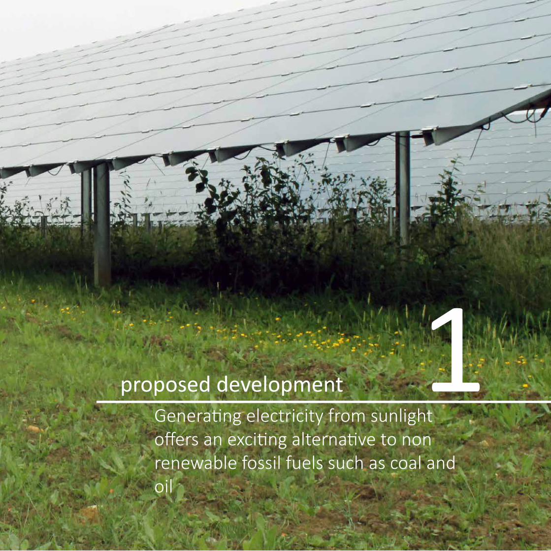
proposed developmentGenerating electricity from sunlight offers an exciting alternative to non renewable fossil fuels such as coal and oil
1

ENVIRONMENTAL AND COMMUNITY STRATEGY SOUTHAM SOLAR FARM 2
Site Location Plan
Drawn by: AD
Date: 25.06.14
Checked by: IH
L.0291_08-A
@ A3
I T 01285 641717 I F 01285 642348 I www.pegasuspg.co.uk I © Copyright Pegasus Planning Group Ltd. © Crown copyright. All rights reserved. 2014 Emapsite Licence number 0100031673. Ordnance Survey Copyright Licence number Licence number 100042093. Promap Licence number 100020449.Pegasus Environmental is part of Pegasus Planning Group Ltd. Drawing prepared for planning. All Queries to be reported to Pegasus for clarification.
0 1 km
1:25,000
KEY
Site Boundary
Elms Farm
>
N(
Revisions Date
A - First Issue 25.06.14
Site Location Plan © Crown copyright and database rights 2014 Ordnance Survey 0100031673
ENVIRONMENTAL AND COMMUNITY STRATEGY SOUTHAM SOLAR FARM 3
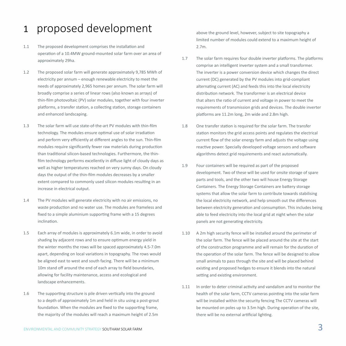
1 proposed development1.1 The proposed development comprises the installation and
operation of a 10.4MW ground-mounted solar farm over an area of approximately 29ha.
1.2 The proposed solar farm will generate approximately 9,785 MWh of electricity per annum – enough renewable electricity to meet the needs of approximately 2,965 homes per annum. The solar farm will broadly comprise a series of linear rows (also known as arrays) of thin-film photovoltaic (PV) solar modules, together with four inverter platforms, a transfer station, a collecting station, storage containers and enhanced landscaping.
1.3 The solar farm will use state-of-the-art PV modules with thin-film technology. The modules ensure optimal use of solar irradiation and perform very efficiently at different angles to the sun. Thin-film modules require significantly fewer raw materials during production than traditional silicon-based technologies. Furthermore, the thin-film technology performs excellently in diffuse light of cloudy days as well as higher temperatures reached on very sunny days. On cloudy days the output of the thin-film modules decreases by a smaller extent compared to commonly used silicon modules resulting in an increase in electrical output.
1.4 The PV modules will generate electricity with no air emissions, no waste production and no water use. The modules are frameless and fixed to a simple aluminium supporting frame with a 15 degrees inclination.
1.5 Each array of modules is approximately 6.1m wide, in order to avoid shading by adjacent rows and to ensure optimum energy yield in the winter months the rows will be spaced approximately 4.5-7.0m apart, depending on local variations in topography. The rows would be aligned east to west and south facing. There will be a minimum 10m stand off around the end of each array to field boundaries, allowing for facility maintenance, access and ecological and landscape enhancements.
1.6 The supporting structure is pile driven vertically into the ground to a depth of approximately 1m and held in situ using a post-grout foundation. When the modules are fixed to the supporting frame, the majority of the modules will reach a maximum height of 2.5m
above the ground level, however, subject to site topography a limited number of modules could extend to a maximum height of 2.7m.
1.7 The solar farm requires four double inverter platforms. The platforms comprise an intelligent inverter system and a small transformer. The inverter is a power conversion device which changes the direct current (DC) generated by the PV modules into grid-compliant alternating current (AC) and feeds this into the local electricity distribution network. The transformer is an electrical device that alters the ratio of current and voltage in power to meet the requirements of transmission grids and devices. The double inverter platforms are 11.2m long, 2m wide and 2.8m high.
1.8 One transfer station is required for the solar farm. The transfer station monitors the grid access points and regulates the electrical current flow of the solar energy farm and adjusts the voltage using reactive power. Specially developed voltage sensors and software algorithms detect grid requirements and react automatically.
1.9 Four containers will be required as part of the proposed development. Two of these will be used for onsite storage of spare parts and tools, and the other two will house Energy Storage Containers. The Energy Storage Containers are battery storage systems that allow the solar farm to contribute towards stabilising the local electricity network, and help smooth out the differences between electricity generation and consumption. This includes being able to feed electricity into the local grid at night when the solar panels are not generating electricity.
1.10 A 2m high security fence will be installed around the perimeter of the solar farm. The fence will be placed around the site at the start of the construction programme and will remain for the duration of the operation of the solar farm. The fence will be designed to allow small animals to pass through the site and will be placed behind existing and proposed hedges to ensure it blends into the natural setting and existing environment.
1.11 In order to deter criminal activity and vandalism and to monitor the health of the solar farm, CCTV cameras pointing into the solar farm will be installed within the security fencing The CCTV cameras will be mounted on poles up to 3.5m high. During operation of the site, there will be no external artificial lighting.
ENVIRONMENTAL AND COMMUNITY STRATEGY SOUTHAM SOLAR FARM

ENVIRONMENTAL AND COMMUNITY STRATEGY SOUTHAM SOLAR FARM
site selectionThe 33kv lines crossing the site wereidentified with available capacity to support a solar farm
2

ENVIRONMENTAL AND COMMUNITY STRATEGY SOUTHAM SOLAR FARM 6
Date: 28/05/2014
0 1,000 2,000500 m
Scale: @ A3
Constraints Plan
Ref: CC.005_02-AProduced: KB Approved: DB
4
8
1
7
9
6
3
5
10
2
11
434000
434000
436000
436000
438000
438000
440000
440000
442000
442000
2540
00
2540
00
2560
00
2560
00
2580
00
2580
00
2600
00
2600
00
2620
00
2620
00
©C
row
nco
pyrig
ht,A
llrig
hts
rese
rved
.201
4Li
cenc
enu
mbe
r010
0031
673
N
Notes:
Revisions:1. First Issue (28.05.2014)
Luminous Energy LtdLuminous Energy Ltd, The Old Bakehouse,
21 Timber Street, Chippenham,Wilts SN15 3BS
t: 0333 5770190e: [email protected]
CC.005 Elms Farm
1:40,000
KeySite Boundary
Alternative Sites
Substation
33kV EHV Line
1km 33kV EHV Line Buffer
SUSTRANS National Route
Grade I Listed Building
Grade II* Listed Building
Grade II Listed Building
Scheduled Monument
Conservation Area
Local Nature Reserve (LNR)
Site of Special Scientific Interest(SSSI)
Ancient Woodland
Slope Aspect Constraint
Post 1988 Agricultural Land Classification
Grade 3b
Grade 4
Agricultural Land Classification (DEFRA)
GRADE 2
GRADE 3
GRADE 4
GRADE 5
1km
2km
3km
Note:This plan has considered designations from the Stratford-on-Avon Local Plan (2006).
Slope aspect assessment carried out using Ordnance SurveyTerrain 5 DTM data. Aspect constraint identified as any slopesubtending 270 degrees through North and around to 90 degrees.Flat or <2 degree slopes are not included as a constraint.
5km
Environment Agency Flood Zone 2
Local constraints and alternative sites considered © Crown copyright and database rights 2014 Ordnance Survey 0100031673

ENVIRONMENTAL AND COMMUNITY STRATEGY SOUTHAM SOLAR FARM 7
2.1 The site was selected on the basis of an extensive and robust examination of potential site options. The site was selected by Luminous Energy as an appropriate place for a solar farm for the reasons set out below.
Available grid capacity
2.2 As a result of conversations with various Distribution Network Operators (DNOs) in Autumn 2013, Luminous Energy became aware that capacity constraints were becoming prevalent in the 33kv networks across much of England, especially in areas with characteristics similar to Belectric’s current development and construction criteria.
2.3 Following conversations with Western Power Distribution (WPD - the DNO for Wales, the south west of England and the midlands, including the area of the proposed development) in October 2013, Luminous Energy became aware that grid capacity was available in the 33kv lines emanating from Warwick and Harbury Bulk Supply Points (BSPs).
Designations and ‘Best and Most Versatile’ land
2.4 Land within the Green Belt, which extends to the north, east and west of Warwick, was excluded based on BELECTRIC UK’s
2 site selectioncurrent construction and development criteria; development of this scale was not considered to be appropriate within this designation. Consequently the 33kv lines running out of Harbury Bulk Supply Point were considered suitable for the next stage of sieve mapping to identify potential sites that matched the criteria set out above. This area includes parts of Stratford-on-Avon District and parts of Warwick District, and is referred to as the study area hereafter.
2.5 The Solar Trade Association has published best practice guidance, which includes ten commitments for solar farm developers. With regard to agricultural land, use of land that is not “Best and Most Versatile” is encouraged:
“Ground-mounted solar should ideally utilise previously developed land, brownfield, contaminated land, industrial land and preferably agricultural land of classification 3a, 3b, 4, and 5 (in most instances avoiding use of the “Best and Most Versatile” cropland where possible).”
2.6 A total of eleven greenfield sites were identified within the study area in addition to the Application Site. An explanation of why these alternative sites were not taken forward is available in the Planning, Design and Access Statement. Each of the sites are marked on the plan shown on the adjacent page which also includes the relevant constraints within 2km of the Application Site that are applicable to BELECTRIC UK’s current development and construction criteria.
2.7 The vast majority of agricultural land within 5km of the site is shown to comprise land of undifferentiated Grade 3 quality on the Provisional Agricultural Land Classification (ALC) Plan (1983) for the Midlands and Western region. Out of the 11 alternative sites identified, nine are shown on the Provisional ALC Plan for the Midlands and Western region (1983) as comprising land of undifferentiated Grade 3 quality. There are some areas of Grade 4 land within 1km of the 33kv lines, although these are generally in areas comprising Flood Zone 2 and 3 (and therefore excluded based upon the search criteria described above). One potential site shown as Grade 4 on the Post 1988 Agricultural
Note: refer to Section 2.2 of Planning, Design and Access Statement for further details

ENVIRONMENTAL AND COMMUNITY STRATEGY SOUTHAM SOLAR FARM 8
2 site selection
Land Classification Map (England) was identified within the search area, but was not taken forward as it lies within the boundary of a proposed new settlement at Gaydon/Lighthorne Heath, as published in Stratford-on-Avon District’s Core Strategy New Proposals Consultation (2013).
2.8 Several areas of land were identified as Grade 3b on the Post 1988 Agricultural Land Classification Map (England) within the search area. One of these areas is to the east of Bishop’s Itchington, and was not considered appropriate due to its proximity to a significant number of residential properties. The other area is around Junction 12 of the M40, where a potential site was identified but not taken forward as it is approximately 2km from the nearest point of connection to the grid.
2.9 Two brownfield sites over 10ha were identified on the National Land Use Database (2009) within Stratford-on-Avon District and Warwick District: The Horticultural Research Institute, Warwick Road, Wellesbourne and the Former Southam Cement Works, Southam Road, Long Itchington. The latter of these sites is situated within the study area although a sufficient area of land could not be identified due to current quarrying activities, unworked land reserved for potential future quarrying, and previously quarried land with unsuitable topography or onsite water features.
2.10 An ALC survey of the site was conducted in June 2014 and revealed the soil to be 92% Grade 3a, 6% Grade 2 and 2% non agricultural (refer to the Agricultural Land Classification Report for further details). However, the Agriculture chapter of the Environmental Statement notes the following:
“A proportion of the land within the site area is managed for biodiversity purposes rather than food production. Approximately 9.8 ha are not subject to artificial inputs and grassland is limited to one late cut for HLS purposes (the resultant conserved grass is sold to a local farmer as reserve fodder, which may or may not be required each year in relation to a livestock enterprise). Areas of flowering and seeding species attract wild birds and insects but do not produce crops for the food chain. A further 1 ha is in rotation for HLS purposes and is left uncropped in rotation with
Commercial or industrial roofspace
2.12 BELECTRIC UK has a team dedicated to PV installations on commercial and industrial roofspace, however there are currently significant barriers to the deployment of rooftop PV installations, as acknowledged by DECC in the UK Solar Strategy Part 2: Delivering a Brighter Future (2014).
Outcome
2.13 Luminous Energy then carried out a ‘sieve mapping’ exercise informed by grid capacity, topography and relevant designations to identify potential sites within the areas that matched the criteria set out above.
2.14 Luminous Energy endeavoured to contact the landowners of the indentified potential sites, and/or viewed sites where possible from PRoWs or public highways. The reasons these alternative sites were not taken forward are discussed in the Planning, Design and Access Statement. The various reasons include:
• The landowner was not interested in leasing land for solar farm development;
• Considering the site to be inappropriate following a site visit due to visual impacts on railway lines, Public Rights of Way or roads; and
• Unable to contact landowner.
arable crops. Accordingly, whilst approximately 28.3 ha of agricultural land identified as BMV is affected by the proposed solar development, more than one third is managed primarily for environmental purposes rather than food production, including the area of Grade 2 land.”
Topography
2.11 The relatively flat topography of the Application Site in the context of the surrounding landscape was another key reason for it being selected. This is because the visual impacts of solar farms tend to be greater on sloping landscapes and more easily avoided or mitigated against in flatter areas
ENVIRONMENTAL AND COMMUNITY STRATEGY SOUTHAM SOLAR FARM 9
Track
Pond
121.6m
Elms Farm
Pond
Pond
125.7m
Track
Track
Pond
Path (um)
Path (um)
Track
Pond
Allotment Gardens
Path (um)
Pond
121.3m
Issues
Path (um)
Ponds
Wind PumpPond
Christmas Hill
119.7mGATE
GATE
GATE
TARN
TARN
100200
Allotment Gardens
0 250m
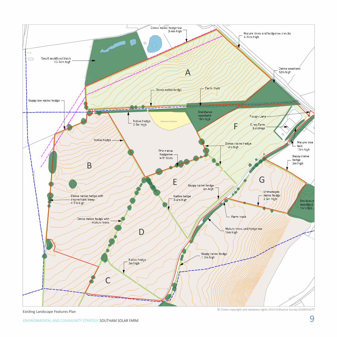
Existing Landscape Features Plan
A
B
C
D
E
F
G
© Crown copyright and database rights 2014 Ordnance Survey 0100031673
ENVIRONMENTAL AND COMMUNITY STRATEGY SOUTHAM SOLAR FARM
ENVIRONMENTAL AND COMMUNITY STRATEGY SOUTHAM SOLAR FARM
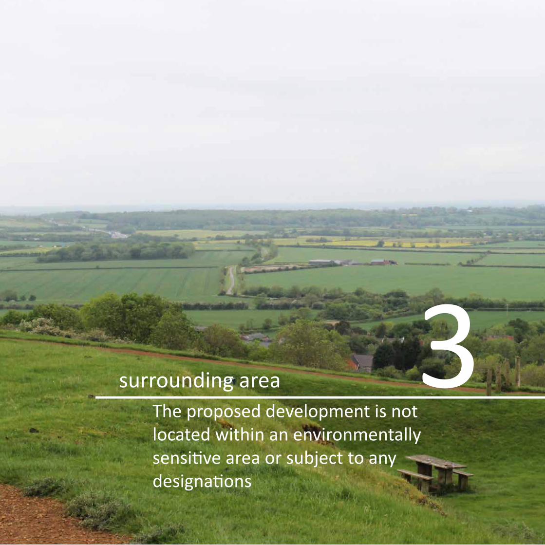
surrounding areaThe proposed development is not located within an environmentally sensitive area or subject to any designations
3

ENVIRONMENTAL AND COMMUNITY STRATEGY SOUTHAM SOLAR FARM 12
Landscape Designations Plan
Drawn by: AD
Date: 25.06.14
Checked by: IH
L.0291_09-A
@ A3
I T 01285 641717 I F 01285 642348 I www.pegasuspg.co.uk I © Copyright Pegasus Planning Group Ltd. © Crown copyright. All rights reserved. 2014 Emapsite Licence number 0100031673. Ordnance Survey Copyright Licence number Licence number 100042093. Promap Licence number 100020449.Pegasus Environmental is part of Pegasus Planning Group Ltd. Drawing prepared for planning. All Queries to be reported to Pegasus for clarification.
0 2 km
1:40,000
KEY
Site Boundary
Special Landscape Area
Elms Farm
>
N(
5km
Revisions Date
A - First Issue 25.06.14
2km
Landscape Designations Plan © Crown copyright and database rights 2014 Ordnance Survey 0100031673

ENVIRONMENTAL AND COMMUNITY STRATEGY SOUTHAM SOLAR FARM 13
3 the surrounding area3.1 The Application Site is set within a generally rural, agricultural
landscape, located on the brow of a low ridge that runs roughly north to south to the west of Bishop’s Itchington. The site is located 300 metres to the west of the settlement of Bishop’s Itchington, and 1.7 kilometres to the south of the settlement of Harbury. Other smaller settlements within the vicinity of the site are Chesterton and Chesterton Green (2.5 kilometres and 3 kilometres to the west respectively), Lighthorne Heath (3 kilometres to the south west) and Gaydon (3.6 kilometres to the south).
3.2 A PRoW that runs from Chesterton to Bishop’s Itchington crosses the site to the south of Parcel A. A PRoW runs eastwards from the Centenary Way Long Distance Path to the west of the Site, to Cross Green and Bishop’s Itchington. The PRoW runs adjacent to the southern boundary of Parcel C.
3.3 Within the immediate context of the Site within 1 kilometre, there are a number of other PRoW. These are:
• The Centenary Way Long Distance Path follows a roughly north to south route, running 90 metres to the west of the Site. To the south of the Application Site, The Centenary Way turns south west towards the M40.
• A bridleway follows a route from the Centenary Way to the south west of the Site, to the south west corner of Parcel B. It remains outside the Site, running north, and crossing through the fields to the west of the Site, towards Parson’s Farm and Bush Heath Lane.
• At the junction of Parcels C and D, a PRoW footpath runs south to the east of the field boundary hedgerow towards Christmas Hill and Christmas Hill Farm.
• A PRoW runs to the east of Plough Lane and Bush Heath Lane in roughly a south east to north westerly direction from Bishop’s Itchington towards the Centenary Way to the south of Harbury. It runs approximately 250 metres to the east of the Application Site.
• A PRoW footpath runs to the west of the Gaydon Road, along the eastern edge of Itchington Holt, to Piper’s Hill and on to Cross Green and Bishop’s Itchington. The PRoW runs to 150 metres from the eastern boundary of Parcel G.
3.4 In the wider context of the Site, the matrix of PRoW extends in all directions, although mainly to the south and west of the Site towards Lighthorne and Chesterton.
3.5 Other Long Distance Paths within the wider context include the Oxford Canal Walk that runs to 5.3 kilometres to the east of the Site. The Macmillan Way runs to 10 kilometres to the south of the Site and the D’arcy Dalton Way runs to 9 kilometres to the south east.
3.6 The Site does not fall within or contain a Conservation Area. The nearest Conservation Areas are at Harbury, Lighthorne and Ladbroke. These are 2 kilometres, 3 kilometres and 3.5 kilometres from the Application Site respectively.
3.7 The M40 motorway runs south east to north west approximately 2 kilometres to the south west of the Site.The B4451 runs from Gaydon to Bishop’s Itchington and on to Southam, running approximately 430 metres to the east of the Site. The B4451 connects with the B4452 to the east of Harbury. The B4452 runs west to Harbury, running 1.8 kilometres north of the Site, before turning north. The B4100 runs parallel and to the south of the M40 approximately 2 kilometres to the south west of the Site.
3.8 Plough Lane is roughly aligned with the eastern boundary of Parcel A, running from Bishop’s Itchington, connecting with Bush Heath Lane, and on to Harbury. There is a network of minor roads linking Chesterton, Harbury and Lighthorne to the west, and Ladbroke, Bishop’s Itchington, Fenny Compton and Northend to the east of the Site.
3.9 The Chilterns railway line London – Birmingham via Leamington Spa runs approximately 1.4 kilometres to the north east of the Site.
3.10 There are no buildings, Listed or otherwise, within the redline boundary of the Application Site. The closest Listed Buildings are the Church of Saint Michael, and Rambler Cottage, both Grade II buildings within Bishop’s Itchington and approximately 500 metres from the Site.
ENVIRONMENTAL AND COMMUNITY STRATEGY SOUTHAM SOLAR FARM
ENVIRONMENTAL AND COMMUNITY STRATEGY SOUTHAM SOLAR FARM
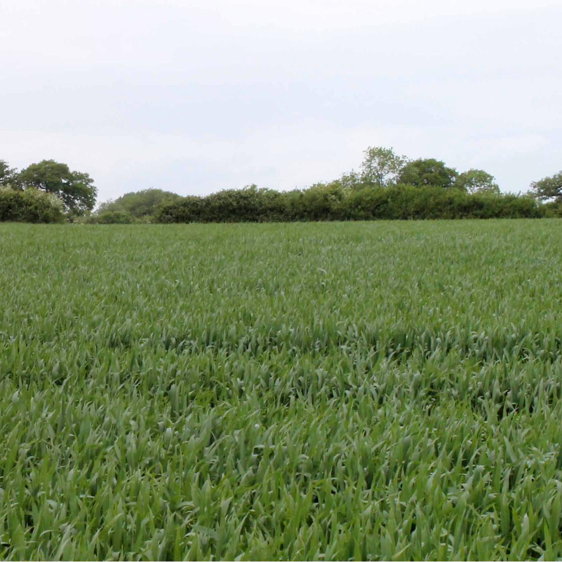
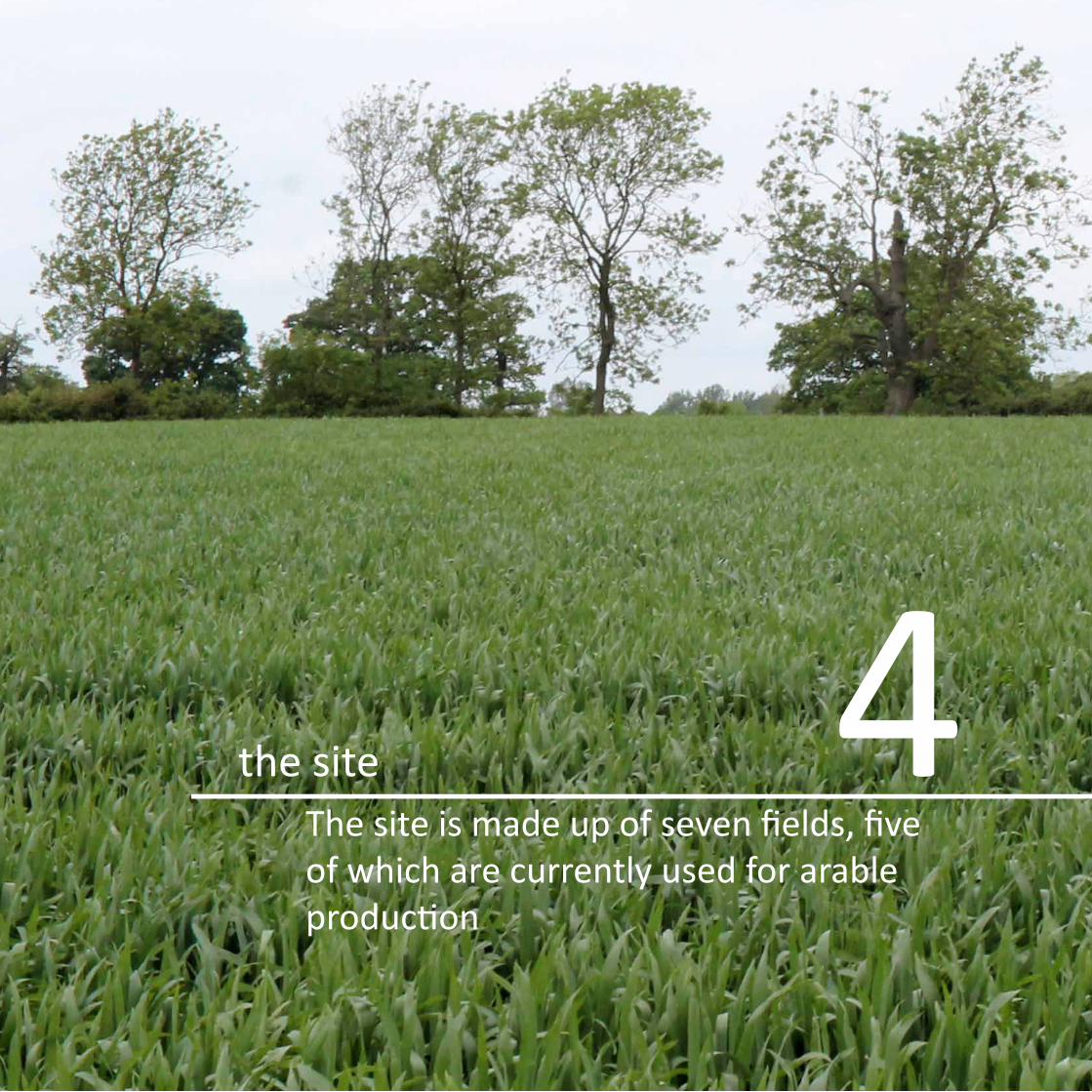
the siteThe site is made up of seven fields, five of which are currently used for arable production
4
ENVIRONMENTAL AND COMMUNITY STRATEGY SOUTHAM SOLAR FARM 16
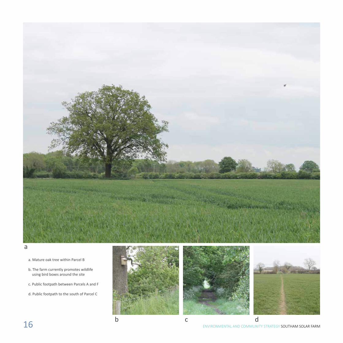
a. Mature oak tree within Parcel B
b. The farm currently promotes wildlife using bird boxes around the site
c. Public footpath between Parcels A and F
d. Public footpath to the south of Parcel C
a
dcb

ENVIRONMENTAL AND COMMUNITY STRATEGY SOUTHAM SOLAR FARM 17
4.1 The Application Site is not covered by any statutory landscape designations. The northern edge of the Cotswold AONB is located approximately 8km to the south of the Application Site.
4.2 The Application Site comprises five entire fields and parts of two other fields, constituting a total area of approximately 29 hectares. The fields and part fields are named parcels A to G within this assessment (see Landscape Features Plan shown on previous pages). Parcels A and F are currently grassland with areas of uncultivated land. Parcels B, C, D, E and G are arable (wheat) fields. The Application Site is overall fairly level, gently sloping from south to north, although Parcel G slopes down from west to east.
4.3 The hedgerow and tree heights stated below within the Parcel descriptions are approximate heights.
4.4 Parcel A is the northernmost field within the Application Site. Parcel A is a medium sized field bounded to the north east by mature trees and hedgerow (height 4 – 14 metres), adjacent to Plough Lane. The northern and western boundaries of Parcel A are dense native hedgerow (height 3 - 4 metres). There is a woodland block located
A pond lies to the south west corner of Parcel B The site boundaries are predominantly made up of well maintained hedgerows
4 the site
adjacent to the western end of the northern boundary of Parcel A (height 10 – 14 metres). The southern boundary of Parcel A comprises fairly dense native hedgerow (height 3 – 4 metres) that runs adjacent to a PRoW running between Chesterton and Bishop’s Itchington. The PRoW runs along a grassy farm track that extends from the Application Site’s western boundary to Plough Lane in the east. Along the eastern section of Parcel A’s southern boundary hedgerow there is an irregular shaped small woodland plantation (height 12 metres).
4.5 Parcel B is part of a large irregular shaped arable field. The southern boundary is currently open. The other field boundaries comprise native hedgerow with variable densities of mature trees along the hedgerow boundaries. The hedgerows are generally fairly dense (height 3 – 7 metres) There is an individual mature oak tree within the western half of the parcel. The internal field boundary between parcels B and D and the western external boundary are well populated with mature trees within the hedgerow.
4.6 Parcel C comprises the northern section of a regular shaped medium sized arable field. A PRoW runs along the open southern

ENVIRONMENTAL AND COMMUNITY STRATEGY SOUTHAM SOLAR FARM 18
Part of the site currently being used for arable purposes

ENVIRONMENTAL AND COMMUNITY STRATEGY SOUTHAM SOLAR FARM 19
Some hedgerows are broken in places Allotment to the south of Parcel A
4 the siteboundary of Parcel C. The western and northern boundaries comprise fairly dense native hedgerow (height 3 – 5 metres). Parcel C forms a small triangular shaped field. The highest point of the Application Site is approximately within the field boundary junction of Parcels C and D.
4.7 Parcel D is a medium sized rectilinear arable field bounded by native hedgerow on all sides. Parcel D’s eastern boundary is unmanaged gappy hedgerow (height 1 – 3 metres) with intermittent trees. To the north, west and south the hedgerows are fairly dense. The northern internal field boundary hedgerow (height 2 – 6 metres) between Parcels D and E has intermittent trees within the northern section.
4.8 Parcel E is a medium sized rectilinear arable field. The south eastern boundary comprises gappy native hedgerow (height 4 metres). However the farm track from Elms Farm buildings and Plough Lane runs adjacent to the south east boundary, and has a large number of mature trees and hedgerow flanking the south eastern side of the farm track opposite Parcel E. The northern boundary of Parcel E that divides Parcel E from the field outside the Application Site is thin native hedgerow (height 1 – 3 metres)
with intermittent mature trees. The north eastern hedgerow is denser but also of average height 1 – 3 metres.
4.9 Parcel F is an irregular shaped grass field to the north east of Parcel E. The eastern boundary is located adjacent to Elms Farm buildings and comprises dense native hedgerow (height 3 – 4 metres). The south eastern field boundary is mostly open and quite overgrown with herbaceous vegetation, although there are young hedgerow transplants planted along sections of this boundary. Similarly to Parcel E the farm track from Elms Farm buildings runs adjacent to the south eastern boundary. On the south eastern edge of the farm track there is a dense hedgerow (height 2 – 7 metres) with intermittent mature trees. The hedgerow along the internal field boundary to the south west is fairly dense and of height 1 – 3 metres. The northern boundary comprises the woodland block (height 15 metres) and narrow tree belt adjacent to the PRoW to the south of Parcel A.
4.10 Parcel G is a small rectilinear field on the eastern side of the farm track leading south west from Elms Farm buildings. The northern boundary is the mature tree cover and hedgerow on the south eastern edge of the farm track leading south west from Elms Farm buildings. The northern and southern Parcel G boundary hedgerows are between 2 and 4 metres in height and the northern boundary hedgerow is quite gappy.
4.11 There is a small allotment area (outside the site boundary) to the south of Parcel A and to the north of Parcel E.

ENVIRONMENTAL AND COMMUNITY STRATEGY SOUTHAM SOLAR FARM 20Image taken from a Big60Million Solar Farm
ENVIRONMENTAL AND COMMUNITY STRATEGY SOUTHAM SOLAR FARM
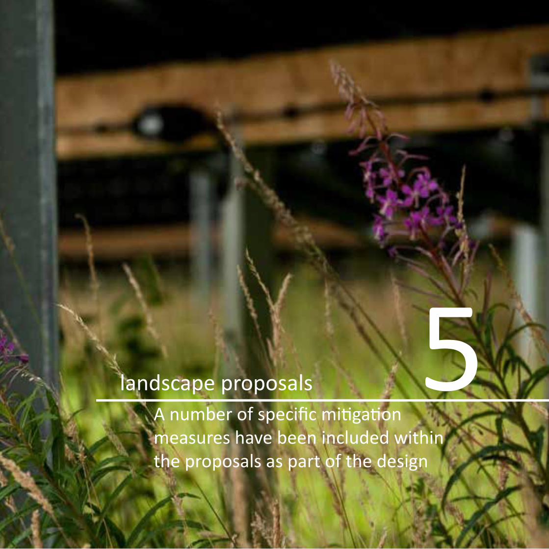
landscape proposalsA number of specific mitigation measures have been included within the proposals as part of the design
5

ENVIRONMENTAL AND COMMUNITY STRATEGY SOUTHAM SOLAR FARM 22
Landscape Mitigation Plan © Crown copyright and database rights 2014 Ordnance Survey 0100031673
ENVIRONMENTAL AND COMMUNITY STRATEGY SOUTHAM SOLAR FARM 23
5 landscape proposals5.1 A number of specific mitigation measures have been included in the
proposals as part of the design. The objectives are to:
• Help integrate the development into its surroundings;
• Help to screen views from the most sensitive locations; and
• Provide landscape and ecological enhancements using land within the site and beyond the immediate site boundary.
5.2 The proposed development has been located within areas of farmland that benefit from a generally intact and mature structure of hedgerows and trees so as to minimise its visibility within the surrounding area.
5.3 The layout of the arrays has been designed to fit within the existing field pattern, with appropriate buffers of land along all boundaries, so that the existing structure of ditches, hedgerows and trees will remain undisturbed. This would also help to reduce potential visual impacts and integrate the development into the landscape, as well as allowing the existing structure of the farmed landscape to be returned to its former character upon decommissioning of the solar farm.
5.4 The method of construction allows for minimal disturbance to the ground and existing levels, and the land underneath the arrays would be maintained as grassland, retaining some of its character. Associated structures and fencing have been designed in neutral, recessive colours to minimise their visibility and impact on the landscape, while no lighting is proposed during the operational phase of the project to avoid impact on the rural character of the landscape after dark.
5.5 A range of measures designed to reduce the landscape and visual impact of the development have been incorporated into the design and layout of the solar farm and are shown on the Landscape Mitigation Plan, presented opposite.
5.6 These landscaping enhancement amount to:
• Approximately 372 metres of native hedge planting. Native hedge planting will be at 5 per linear metre in a double staggered row equating to approximately 1,860 new hedgerow plants.
• Approximately 18 new trees.
• Repair and enhancement of over 630 metres of existing hedgerow.
Species rich grasses
• As well as naturally regenerated grassland the site would be over seeded with grass seed containing a minimum of 5% wild flower seed mix to increase its bio-diversity.
Hedgerows
• A new stretch of hedgerow would be planted along the northern edge of the footpath that runs immediately to the south of Parcel C and along the former field boundary of Parcel B.
• Existing hedgerows around the site would have new planting in strategic locations to fill any gaps. Additionally, vegetation and hedgerow trees would be allowed to develop, where glimpsed views may be possible. New planting would be a mix of locally appropriate species; the choice of fast growing and native planting is particularly suitable for the area recognised in the published landscape assessments.
Trees
• Standard and heavy standard trees are proposed to be planted within the hedgerows along the northern boundaries of Parcel B and Parcel G. These trees will be planted at 2.5-4.25m high to provide a dense screen.

ENVIRONMENTAL AND COMMUNITY STRATEGY SOUTHAM SOLAR FARM 24
5 landscape proposals
Bird Seed Mix
• Areas of Parcel A that are currently sown with Bird Seed Mix will be reinstated.
5.7 The benefits of such improved tree and hedgerow cover will be to:
• Provide greater physical continuity in the landscape;
• Strengthen characteristic features of the local area;
• Improve the visual amenity of the site and its surroundings;
• Strengthen the field pattern of the site and its surroundings;
• Establish and strengthen linkages between woodland areas;
• Enhance the habitat on the site with long term preservation of the land; and
• Create more shelter and encourage and support wildlife and flora.

ENVIRONMENTAL AND COMMUNITY STRATEGY SOUTHAM SOLAR FARM 25
Existing view

ENVIRONMENTAL AND COMMUNITY STRATEGY SOUTHAM SOLAR FARM 26Image of a public footpath which runs to the west of the site

ENVIRONMENTAL AND COMMUNITY STRATEGY SOUTHAM SOLAR FARM 27
access and recreationThe public rights of way in the vicinity of the site are well connected to the wider area and will be unaffected by the development
6

ENVIRONMENTAL AND COMMUNITY STRATEGY SOUTHAM SOLAR FARM 28
Stiles connect public footpaths around the site

ENVIRONMENTAL AND COMMUNITY STRATEGY SOUTHAM SOLAR FARM 29
6.1 Access during the construction phase is proposed via the existing gateway off Plough Lane leading into the farm buildings in the eastern extent of the site.
6.2 A temporary construction compound will be set up for the duration of the estimated 16 week construction phase. The construction compound will require the laying of Box Trakpanel (a temporary roadway and walkway system) on the existing ground surface. The construction compound is of a temporary nature and will be fully dismantled and removed after the construction period. At the end of the construction period the area will be immediately restored to its original condition.
6.3 Due to the flat topography and vegetation there would be limited visibility of the solar farm from the public footpaths surrounding the site. Overall it is considered that there would be few locations within the footpath network in the vicinity of the site from where the solar farm would be visible. Even the footpath that runs through the site is well screened from the proposed development along much of its length.
6.4 Therefore it can be seen that visibility of the proposed development would be confined to localised sections of footpath within the immediate context of the site. Effects would be short term and generally for footpath users. Effects on visual amenity would reduce after the first year of operation as newly planted vegetation begins to establish and therefore screen the proposed development.
6.5 For users of highways, specifically Plough Lane, it is considered that views of the solar farm would be filtered, oblique and transient, and the solar farm is not anticipated to be a notable detractor within the landscape.
6.6 As part of the Southam Solar Farm proposals the opportunity will be taken to strengthen and enhance the hedges that provide shelter and screening along the boundaries of the site. Native species of local character will be used.
6.7 In general the footpaths located in the local landscape have views of the site restricted by intervening vegetation or built form.
6 access and recreation
Vegetation restricts views for the majority of the lengths of footpaths in close proximity to the site
Public footpaths have clear signage

ENVIRONMENTAL AND COMMUNITY STRATEGY SOUTHAM SOLAR FARM 30
Site access for construction would be through the existing gateway to Elms Farm
ENVIRONMENTAL AND COMMUNITY STRATEGY SOUTHAM SOLAR FARM 31
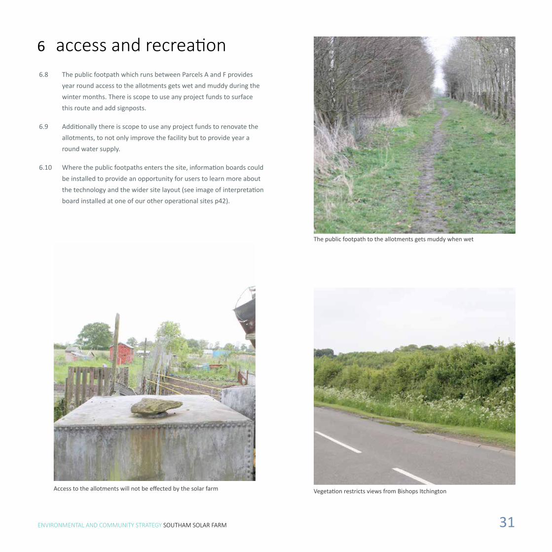
The public footpath to the allotments gets muddy when wet
Vegetation restricts views from Bishops ItchingtonAccess to the allotments will not be effected by the solar farm
6 access and recreation6.8 The public footpath which runs between Parcels A and F provides
year round access to the allotments gets wet and muddy during the winter months. There is scope to use any project funds to surface this route and add signposts.
6.9 Additionally there is scope to use any project funds to renovate the allotments, to not only improve the facility but to provide year a round water supply.
6.10 Where the public footpaths enters the site, information boards could be installed to provide an opportunity for users to learn more about the technology and the wider site layout (see image of interpretation board installed at one of our other operational sites p42).

ENVIRONMENTAL AND COMMUNITY STRATEGY SOUTHAM SOLAR FARM 32Image from a recently constructed Big60Million Solar Farm

ENVIRONMENTAL AND COMMUNITY STRATEGY SOUTHAM SOLAR FARM 33
ecologyEcological enhancements will increase the biodiversity and habitat on the site
7

ENVIRONMENTAL AND COMMUNITY STRATEGY SOUTHAM SOLAR FARM 34
Information boards from a Big60Million Solar Farm educates visitors about the positive benefits of the solar farm for local ecology

ENVIRONMENTAL AND COMMUNITY STRATEGY SOUTHAM SOLAR FARM 35
7 ecology Overview
7.1 An Extended Phase 1 habitat survey was undertaken on the site in May 2014. The survey recorded habitats within the site and aimed to establish the presence or potential presence of protected and notable species.
7.2 The site comprises five arable and two semi-improved grassland fields intersected with hedgerows with narrow arable margins and small pockets of woodland. The site is bordered by hedgerows, plantation woodland and lines of mature trees. The arable fields contained a well-established cereal crop at the time of survey.
7.3 The site was considered likely to support an assemblage of breeding birds typical of the habitats and the region. The boundary habitats of the site were also considered to have the potential to support bats, amphibians, reptiles, badgers and some invertebrates.
7.4 Precautionary measures are recommended to protect habitats and species during the construction phase of the development, including Reasonable Avoidance Measures for badgers, reptiles and amphibians. The majority of boundary hedgerows, field margins and hedgerow trees will be retained as part of the proposed development and appropriate buffers applied within the project design. Other proposed mitigation and enhancement measures include the reversion of arable land to more species diverse grassland, planting of native species hedgerow, and the installation of bird and bat boxes, along with the renovation and management of onsite ponds to increase their suitability for amphibians.
7.5 Implementation of these measures will lead to a net biodiversity gain at a local level. With appropriate layout and design measures in place, it is considered that adverse effects on protected and notable species can be avoided.
7.6 Big60Million solar farms are designed to benefit the environment. The solar modules are elevated, leaving more than 95% of the land to be used for nature and, where appropriate, co-production of food. So many species of animals, birds and insects are suffering due to changes in their habitats caused by intensive agricultural use, industrialisation, and climate change. Our approach is to make
Big60Million solar farms a protected sanctuary for struggling species by delivering the environment they need to prosper in.
Grassland
7.7 Two broad areas of grassland will be created:
Area A – comprising a four metre wide strip of herb-rich meadow grassland around the perimeter of the Site (along boundary hedgerows) which will be sown with a meadow mix and allowed to develop a varied height and tussocky structure valuable to small mammals, birds and invertebrates.
Area B – comprising the main ex-arable body will be seeded (with the exception of land immediately beneath the panels which will be allowed to vegetate naturally) and managed through grazing.
Wild Bird Seed Mix Sowing and Enhancement
7.8 A further area within the northern field (part of which has previously been seeded with a mix designed to attract birds) will be re-sown with wild bird seed mix once the solar farm has been constructed. The seed mix is likely to be Campaign Mix South (KCAM2), which is currently sown in areas of the northern field and comprises seeds such as millet, sorghum, linseed and triticale.
7.9 The overall benefits of habitat creation will be to:
• Improve the site and the surrounding area to enable both plants and wildlife to flourish;
• Consolidate and strengthen the value of wildlife corridors;
• Encourage new species of fauna and flora to establish themselves on site and in the surrounding area;
• Strengthen the position of those species of flora and fauna already present on and around the site;
• Enhance wildlife margins alongside existing hedgerows in order to manage and enhance the biodiversity of these features;
• Enhance and safeguard key habitats such as trees and hedgerows for the benefit of wildlife;
• Significantly increase the amount of hedgerow and trees in the immediate area.
ENVIRONMENTAL AND COMMUNITY STRATEGY SOUTHAM SOLAR FARM 36
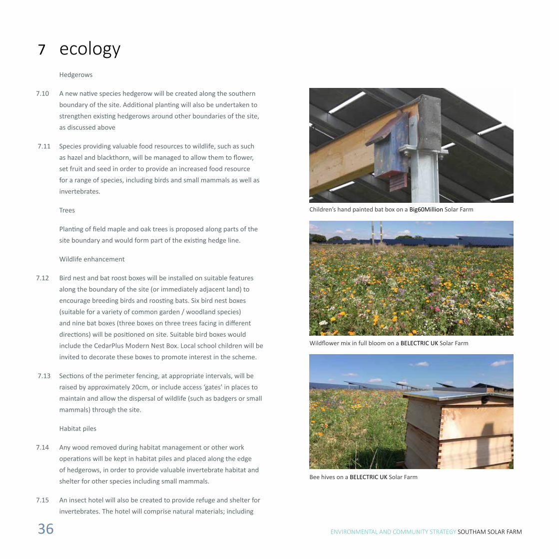
Children’s hand painted bat box on a Big60Million Solar Farm
Wildflower mix in full bloom on a BELECTRIC UK Solar Farm
Bee hives on a BELECTRIC UK Solar Farm
7 ecology Hedgerows
7.10 A new native species hedgerow will be created along the southern boundary of the site. Additional planting will also be undertaken to strengthen existing hedgerows around other boundaries of the site, as discussed above
7.11 Species providing valuable food resources to wildlife, such as such as hazel and blackthorn, will be managed to allow them to flower, set fruit and seed in order to provide an increased food resource for a range of species, including birds and small mammals as well as invertebrates.
Trees
Planting of field maple and oak trees is proposed along parts of the site boundary and would form part of the existing hedge line.
Wildlife enhancement
7.12 Bird nest and bat roost boxes will be installed on suitable features along the boundary of the site (or immediately adjacent land) to encourage breeding birds and roosting bats. Six bird nest boxes (suitable for a variety of common garden / woodland species) and nine bat boxes (three boxes on three trees facing in different directions) will be positioned on site. Suitable bird boxes would include the CedarPlus Modern Nest Box. Local school children will be invited to decorate these boxes to promote interest in the scheme.
7.13 Sections of the perimeter fencing, at appropriate intervals, will be raised by approximately 20cm, or include access ‘gates’ in places to maintain and allow the dispersal of wildlife (such as badgers or small mammals) through the site.
Habitat piles
7.14 Any wood removed during habitat management or other work operations will be kept in habitat piles and placed along the edge of hedgerows, in order to provide valuable invertebrate habitat and shelter for other species including small mammals.
7.15 An insect hotel will also be created to provide refuge and shelter for invertebrates. The hotel will comprise natural materials; including

ENVIRONMENTAL AND COMMUNITY STRATEGY SOUTHAM SOLAR FARM 37
Sheep grazing on a BELECTRIC UK solar farmBirds nesting beneath the panels on a BELECTRIC UK solar farm
7 ecology Beehives
7.16 Beehives will be installed within the site area, and would assist with the pollination of local flowering crops such as oilseed rape on surrounding agricultural land. Bees (along with other invertebrates) will also benefit from the areas of hedgerow planting and extensive herb-rich grassland creation, which will provide sources of pollen and nectar.
Sheep
7.17 Grassland within the main body of the site beneath the solar panels will be grazed. Grazing will be reduced or removed during the summer months to allow meadow species to maximise opportunities to flower and set seed. The fields would be subject to light intermittent grazing by sheep between late August (after the chicks of any ground-nesting species have fledged) and late February. Removing sheep from the field between March and early August will allow summer flowering plants to set seed.
Ponds
7.17 Two ponds are present within the application site. One of these was confirmed as supporting great crested newts (GCNs) in 2013. These ponds form part of a cluster of waterbodies in the wider area. Both were heavily shaded by surrounding brambles and the pond supporting GCNs was at a relatively later stage of succession when surveyed in 2014, becoming completely overgrown by reedmace which would, in time, cause the pond to lose its remaining open water.
7.18 As un-managed waterbodies undergo natural succession over time, becoming more shaded or overgrown or even drying out, their habitat value to great crested newts may decline. Pond habitat enhancement and management work is proposed which will maintain its value for great crested newts over the longer-term. The proposed pond habitat enhancement and management work will involve targeted vegetation removal to re-establish and maintain a balanced mix of terrestrial and marginal vegetation cover, shade and areas of open water which will be attractive to amphibians (along with other species groups including invertebrates).
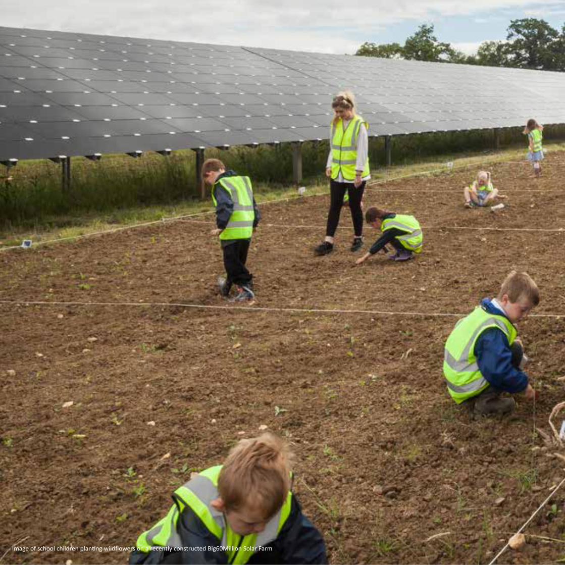
ENVIRONMENTAL AND COMMUNITY STRATEGY SOUTHAM SOLAR FARM 38Image of school children planting wildflowers on a recently constructed Big60Million Solar Farm

ENVIRONMENTAL AND COMMUNITY STRATEGY SOUTHAM SOLAR FARM 39
community and educational benefits
Big60Million has been created to give 60 million UK residents the opportunity to benefit from some of the highest quality solar farms in the world
8

ENVIRONMENTAL AND COMMUNITY STRATEGY SOUTHAM SOLAR FARM 40
Local school children preparing the soil to plant wildflower mixes at a Big60Million Solar Farm

ENVIRONMENTAL AND COMMUNITY STRATEGY SOUTHAM SOLAR FARM 41
8 community and educational benefits
8.1 Big60Million is a Community Benefit Energy Company that provides the opportunity for the 60 Million residents of the UK to directly benefit from new solar farms constructed by BELECTRIC UK closest to their local communities. The company recently launched its first solar farm on a 3.8MW project near Willersey, Gloucestershire.
Financial Benefits
8.2 Every day solar farms convert daylight into electricity. Revenue is generated from a 20-year inflation-linked subsidy paid for every kWh of renewable energy produced, and by selling the electricity into the national grid. As a result, solar farms produce steady cash flows which enable the capital costs required to construct the projects be repaid, and to deliver reliable returns to investors.
8.3 Big60Million’s approach is to open this investment opportunity to the 60 Million residents of the UK by creating Big60Million Solar Bonds specific to each project which cost only £60 each, marketing them initially to local residents who live closest to specific solar farms, and then to promote the opportunities nationally.
8.4 Big60Million Solar Bonds are linked to individual projects, and offer a fixed rate of return based on the economics of each project. These returns are typically 5-7% (before tax), paid each year for five years after which time investors can have their initial investment returned in full, or have first rights to reinvest their money in a further bond issue. Big60Million stand behind being able to deliver the returns on investment, by pledging the assets of each Big60Million Solar Farm as security to bond holders. We believe this is the right way to do business.
8.5 Big60Million would like to actively support local projects and initial discussions have been held with Bishops Itchington Parish Council regarding possible projects that could be appropriate. The Applicant acknowledges that financial contributions cannot be weighed into the consideration of the planning application.
Social Benefits
8.6 Our aim is to see the local communities benefiting from each solar farm in as many ways as possible. We will look to partner with local schools and colleges to develop educational programmes, help us implement and develop the biodiversity initiatives, as and provide a platform for learning all about solar energy. As an example, at our first Big60Million solar farm in the Cotswolds our bird, bat and hedgehog boxes were kindly painted by the pupils of a local primary school who also helped us plant a seed bank for future generations of wild flowers. We are also seeking to work with local groups to develop community growing schemes within the solar farm, to produce low cost, high quality organic food for the local area.
8.7 Our reasons for providing these benefits are clear: We face spiralling energy bills, energy and resource insecurity, climate change, and destruction of so many natural habitats. By sharing the benefits of solar farms with as many people we can make a positive difference. We only have one planet, and the sun is a free, plentiful resource which can be sustainably harvested to deliver solutions to so many of our societies challenges, solar farm by solar farm.
8.8 For more information and to see information on Big60Million’s first solar farm open for investment, visit www.Big60Million.co.uk

ENVIRONMENTAL AND COMMUNITY STRATEGY SOUTHAM SOLAR FARM 42
Habitat Management Plan created for a Big60Million Solar Farm following input from the local community. There would be opportunites for the local community to participate in delivering the Habitat Management Plan for Southam Solar Farm should planning permission be granted

ENVIRONMENTAL AND COMMUNITY STRATEGY SOUTHAM SOLAR FARM 43
8.9 As part of the Southam Solar Farm proposals, opportunities will be explored for educational and community benefits to encourage the teaching of local school children and residents about solar farms, renewable energy, and the wildlife benefits associated with the management of the site.
Community allotment proposals in a Big60Million Solar Farm
Local school children’s hand painted bird and bat boxes located in a Big60Million Solar Farm
8 community and educational benefits
During an open day a member of BELECTRIC’S team educates members of the local community about a Big60Million Solar Farm
Potential investors from the local community learn about a Big60Million Solar Farm during an open day

Image from a recently constructed BELECTRIC UK Solar Farm

summarySoutham Solar Farm has the potential to bring a range of environmental benefits to the site and its immediate surroundings. It also provides financial and educational opportunities for the local community
9

ENVIRONMENTAL AND COMMUNITY STRATEGY SOUTHAM SOLAR FARM 46
Image of a thin film array taken from a Big60Million Solar Farm

ENVIRONMENTAL AND COMMUNITY STRATEGY SOUTHAM SOLAR FARM 47
9.1 Big60Million takes a holistic approach to solar farm development, incorporating the natural elements of a specific site into every design. The focus is on constructing a system that will be appropriate to the location, using existing features such as dense hedges to provide screening. Southam Solar Farm aims to enhance the biodiversity value of the area, by using locally appropriate seed mixes under and around the solar arrays to grow grasses and wild flowers.
9.2 The site comprises five entire fields and parts of two other fields, predominantly bounded by mature vegetation and covers an area of approximately 29 hectares. The proposed development is not located within an environmentally sensitive area or subject to any designations. The site comprises 96% Grade 3a and 6% Grade 2 agricultural land. Over one third of this land is not used for arable production.
9.3 The solar farm will use state-of-the-art PV modules with thin-film technology. The modules ensure optimal use of solar irradiation and perform very efficiently at different angles to the sun. Thin-film modules require significantly fewer raw materials during production than traditional silicon-based technologies. Furthermore, the thin-film technology performs excellently in diffuse light of cloudy days as well as higher temperatures reached on very sunny days. On cloudy days the output of the thin-film modules decreases by a smaller extent compared to commonly used silicon modules resulting in a comparative increase in electrical output.
9.4 The thin-film solar module mounting technique requires minimal ground disturbance and does not result in the creation of large areas of impervious surfaces. It has been calculated that less than 1% of the overall site will be covered with an impermeable surface with the solar farm in place.
9.5 The site and immediate surroundings will be enhanced with mitigation measures including the planting of hedgerows, use of a special seed mix to form meadows and implementation of other biodiversity enhancement measures, including the placement of bird boxes and bee hives on specific areas of the site. Many species of birds nest in adjacent hedgerows and could utilise the wooden beams under the solar modules. Small animals and insects would be
attracted to the grasses under the solar arrays. The areas under the modules also provide protection from the weather for animals.
9.6 The overall benefits of habitat creation will be to:
• Improve the site and the surrounding area to enable both plants and wildlife to flourish;
• Consolidate and strengthen the value of wildlife corridors;
• Encourage new species of fauna and flora to establish themselves on site and in the surrounding area;
• Strengthen the position of those species of flora and fauna already present on and around the site;
• Enhance wildlife margins alongside existing hedgerows in order to manage and enhance the biodiversity of these features;
• Enhance and safeguard key habitats such as trees and hedgerows for the benefit of wildlife;
• Significantly increase the amount of hedgerow and trees in the immediate area.
9.7 The proposed landscape mitigation seeks to maintain and where possible enhance the character of the site. Although the fields would contain the components of a solar farm, the proposals are for a restricted period of 25 years, after which the site will revert back to agricultural use.
9.8 The existing boundary vegetation will be preserved and infilled where needed. New trees and hedgerows will be planted which as well as strengthening the landscape fabric of the site will assist in restricting views of the site from the surrounding landscape.
9 summary
ENVIRONMENTAL AND COMMUNITY STRATEGY SOUTHAM SOLAR FARM 48
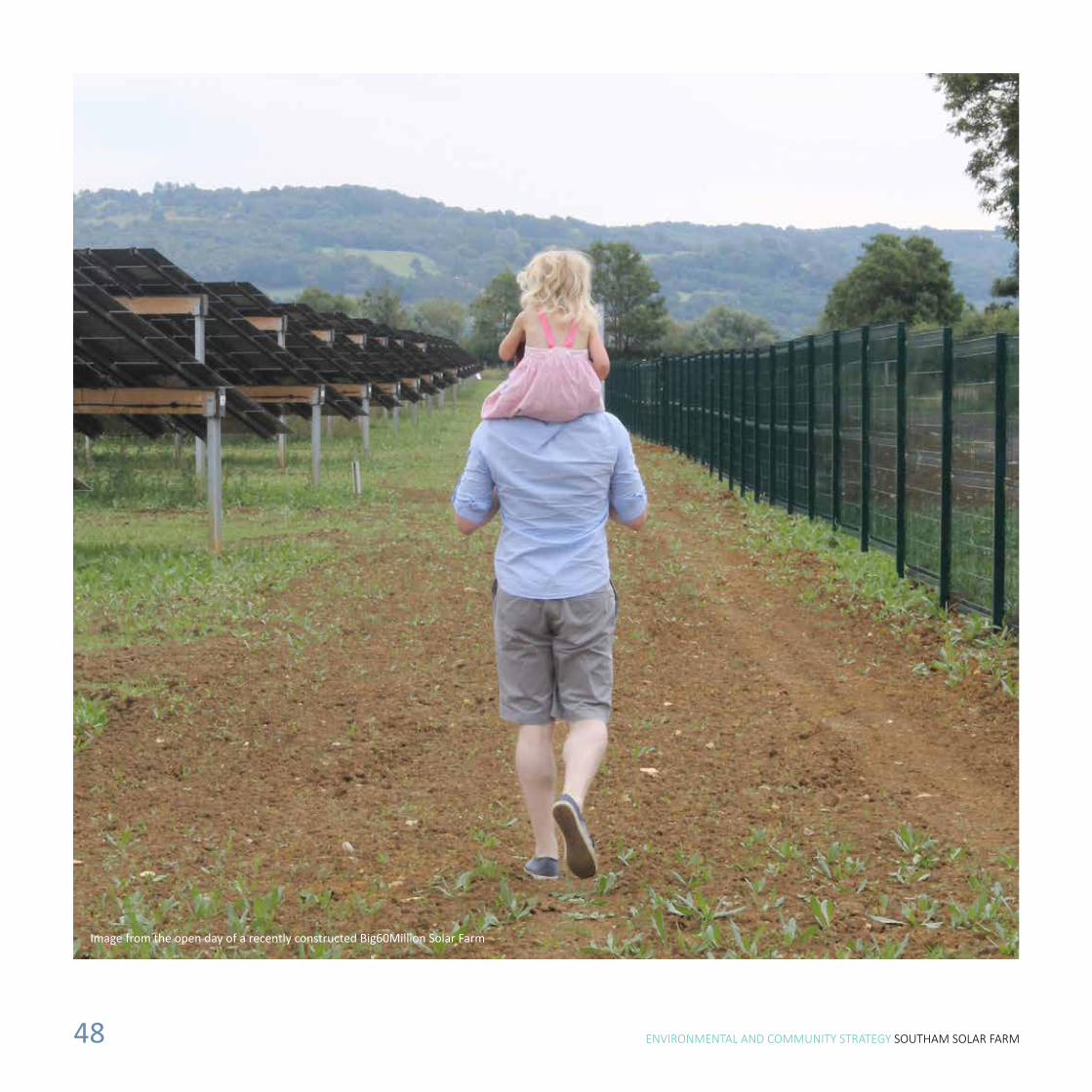
Image from the open day of a recently constructed Big60Million Solar Farm
ENVIRONMENTAL AND COMMUNITY STRATEGY SOUTHAM SOLAR FARM 49
9.9 Big60Million is a Community Benefit Energy Company that provides the opportunity for the 60 Million residents of the UK to directly benefit from new solar farms constructed by BELECTRIC UK closest to their local communities.
9.10 Big60Million’s vision is to see local communities benefiting from solar farms in as many ways as possible. It is intended that Southam Solar Farm will partner with local schools and colleges to develop educational programmes and biodiversity initiatives; the first collaboration saw bird, bat and hedgehog boxes painted by the pupils of Willersey CofE Primary School. Big60Million also initiates community growing schemes within its solar farms, to produce low cost, high quality organic food for the local area.
9.11 Southam Solar Farm will be one of the first Big60Million solar farms allowing local people to invest in the project and receive an attractive return on investment.
9.12 The UK Government is explicit in its support in the transition to a secure, safe, low-carbon, affordable energy system and to mobilise commitment to ambitious action on climate change internationally. Southam Solar Farm provides an opportunity to help towards securing the UK’s clean power supply, increase local biodiversity, create habitat and improve public access around the site.
9.13 This combined with Big60Million’s vision for communities to invest in local solar farms along with educational initiatives for local school children will help create a legacy for our planet and children.
9 summary

Prepared for Big60Million by LUMINOUS ENERGY Ltd.
COPYRIGHT The contents of this document must not be copied or reproduced in whole or in part without the written consent of Luminous Energy Crown copyright.