smart highway smart city - llm.gov.my 7 (llm)-smart highway.pdf · •smart highway, smart city...
TRANSCRIPT

ABU BAKAR B. HASHIM
PENGARAH MEKANIKAL & ELEKTRIK
LEMBAGA LEBUHRAYA MALAYSIA
Smart Highway

Latest ITS Talk of The Town
• SMART HIGHWAY, SMART CITY
• IOT – Internet of Things
• Big Data
• Crowd Sourcing
• Autonomous Vehicles
• V2V – Vehicle to Vehicle communication.
• V2I – Vehicle to Infra communication.

Main ITS features Of Smart Highway

Main ITS Features of Smart Highway
Change of direction?
• Are we inline with the latest needs / requirements?
• What happen to the system invested?
• Do we have to change the whole system?

Overall System Implemented In MalaysiaTraffic Control Status Description Remarks
1) Intelligent Light √ a) Telemanagement LightingHPSV Type year 2002 by LLM- Pkg USJ to Nilai ( ELITE )- Sg. Besi to Nilai ( PLUS )b) Intensity light based on vehicle detection, rain fall and parameter setting.
- Handed over to PLUS- Converted back to conventional
type due to costly maintenanceand obsolete parts
2) Dynamic Navigation √ Mobile Navigation - Crowd sourcing apps ( eg. Waze )- Maps ( Google maps )
3) Ramp Metering NA
4) Central Back Office √ Tolling System - RFID System

Overall System Implemented…cont.Traffic Information Status Description Remarks
Travel Time Forecast √ a) Websiteb) Mobile Appsc) LLMTMC
- Logical maps on LLMTMC- Single key in multiple output
Transit Information NA
Emergency Notice √ a) Websiteb) Mobile Appsc) Highway information
Systemd) Highway Information
Kioske) Variable Message Sign
- Highways website- Highways Provided
Service Area Parking NA
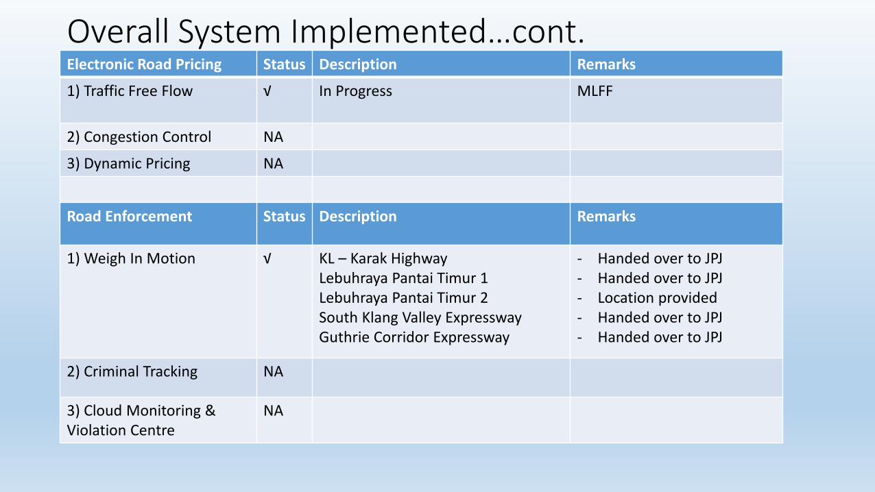
Overall System Implemented…cont.Electronic Road Pricing Status Description Remarks
1) Traffic Free Flow √ In Progress MLFF
2) Congestion Control NA
3) Dynamic Pricing NA
Road Enforcement Status Description Remarks
1) Weigh In Motion √ KL – Karak HighwayLebuhraya Pantai Timur 1Lebuhraya Pantai Timur 2South Klang Valley ExpresswayGuthrie Corridor Expressway
- Handed over to JPJ- Handed over to JPJ- Location provided- Handed over to JPJ- Handed over to JPJ
2) Criminal Tracking NA
3) Cloud Monitoring & Violation Centre
NA
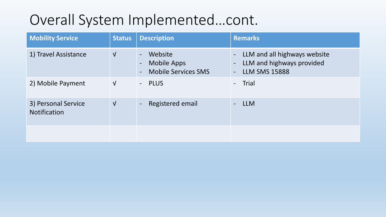
Overall System Implemented…cont.Mobility Service Status Description Remarks
1) Travel Assistance √ - Website- Mobile Apps- Mobile Services SMS
- LLM and all highways website- LLM and highways provided - LLM SMS 15888
2) Mobile Payment √ - PLUS - Trial
3) Personal Service Notification
√ - Registered email - LLM

List of Smart Highway Method
1) Smart Lighting
2) LLMTraffic Info – Mobility Services, crowd sources GPS
3) Non stop Tolling System – MLFF
4) Parking Information System
5) Public Transport ( Passenger Information System ( PIS )
6) Improving the operation and travelling times, Ramp metering
7) Improving road safety – Glow Line

Smart lighting

Smart Lighting ( Telemanagement Lighting )HistoryName : Telemanagement Lighting ( HPSV Lighting )Project : Lembaga Lebuhraya Malaysia
Handed Over to PLUSYear : Early 2002Highway : Lebuhraya Utara - Selatan ( Sg. Besi to Nilai IC )
Lebuhraya Utara Selatan Hubungan Tengah ( Subang to Nilai )

Traffic Control And
Surveillance System

Requirements in the Concession Agreements:
To Implementation Traffic Control and Surveillance System with four ( 4 ) major functions;
a) Information collectionb) Information processingc) Information dissemination andd) Decision execution and enforcement

20092008
Mandatory Implementation of TCSS in Concession Agreement
Shah Alam Expressway: First Highway with TCSSResearch &
Recommendations by JICA
“Concession company is required to provide TrafficSurveillance and Control System (TCSS) infrastructure foreffective and organized management of highway”
1996 1998 1999 2001 2002 2003 2004 2005 2007199519941988
Implementation of Standalone Systems
Implementation of Integrated SystemsInitial Study
Some History of TCSS Implementation:

Pusat Pengurusan Trafik LLM ( LLMTMC )
20091988 1996 1998 1999 2001 2002 2003 2004 2005 2007 200819951994
• To provide real time supervision and managementfor all toll highway networks under the jurisdictionof the Malaysian Highway Authority
• To disseminate INTEGRATED traffic information tothe public
• To serve as the national emergency control andsupervision centre
• To define all relevant standard in the design andimplementation of traffic management centre toenable the smooth integration of traffic control &surveillance functions of all highway networks
• To serve as the centre for the integration of tollhighways to other road networks (municipalities,non-privatized roads) on a national level

Officially Launched – April 2017

Pusat Pengurusan Trafik LLM- Traffic Information SystemSOP LLM/M/T1-08• Concessionaires shall give early
information of any minor or majorincidents, common or uncommon events within 15 minutes to LLMTMC.
• Information of the heavy congestion status with more than 2 km.
• Information of the schedule events programs such as maintenance, roadworks, convoy, sports and etc..
Travelling Time & Logical Map• LLMTMC Travelling Time & Logical Map
• To created Travelling Time and Congestion Status• Data calculation based on gazetted speed limit of the highways
• Data Input • Manual - base on km and GIS coordinate• Auto Generated – VDS System
• Data Dissemination• Website• Mobile Apps• Variable Message Sign (VMS) or mini VMS• Dynamic Road Sign ( DRS )
• Accuracy Data• More reliable on the system functioning and interval of the equipment setup.
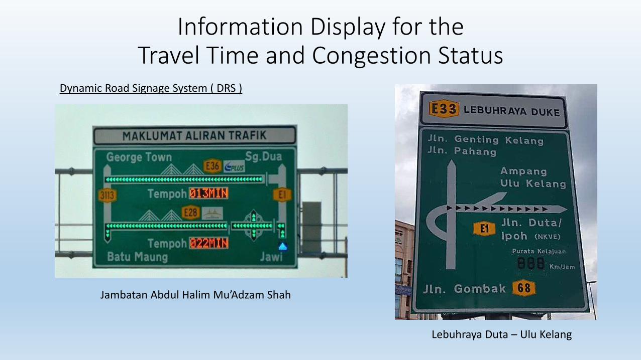
Information Display for the Travel Time and Congestion Status
Jambatan Abdul Halim Mu’Adzam Shah
Lebuhraya Duta – Ulu Kelang
Dynamic Road Signage System ( DRS )

Certificate Malaysia Book of Record on
First Dynamic Road Signage Application

What to do next?
• To make sure the VDS / VIDS system running good and reliable all the time
• To make sure and maintain system stability .
• To make sure the integration and data accuracy from Remote Control Centre to LLMTMC are in order.
• To fully utilize and execute of VDS / VIDS data system for statistic of traffic volume data, congestions data, travel time and travel speed data.
• Able to generated data on congestion map and accessible.
• To look into crowd sourcing.

Practice by Other Countries
China Japan

Mobile Services

Some initiatives (Mobile Service)
• MHA – LLMInfoTraffic
• PLUS – Plus Expresways
• Penang Bridge
• PSKLM - Travel Smarter

Traffic Info – Mobility Services
• Information Services Provided;• Traffic Information; Incident,
• Scheduling works; maintenance
• Hotline Number
• CCTV Images
• Toll rate
• Highway facilities; R&R, Layby
• Sharing of information
• Social media; Facebook, twitter
Mobile Services: WAP, Apps. (Android & Iphone), SMS – 15800
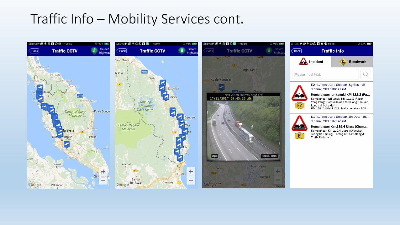
Traffic Info – Mobility Services cont.
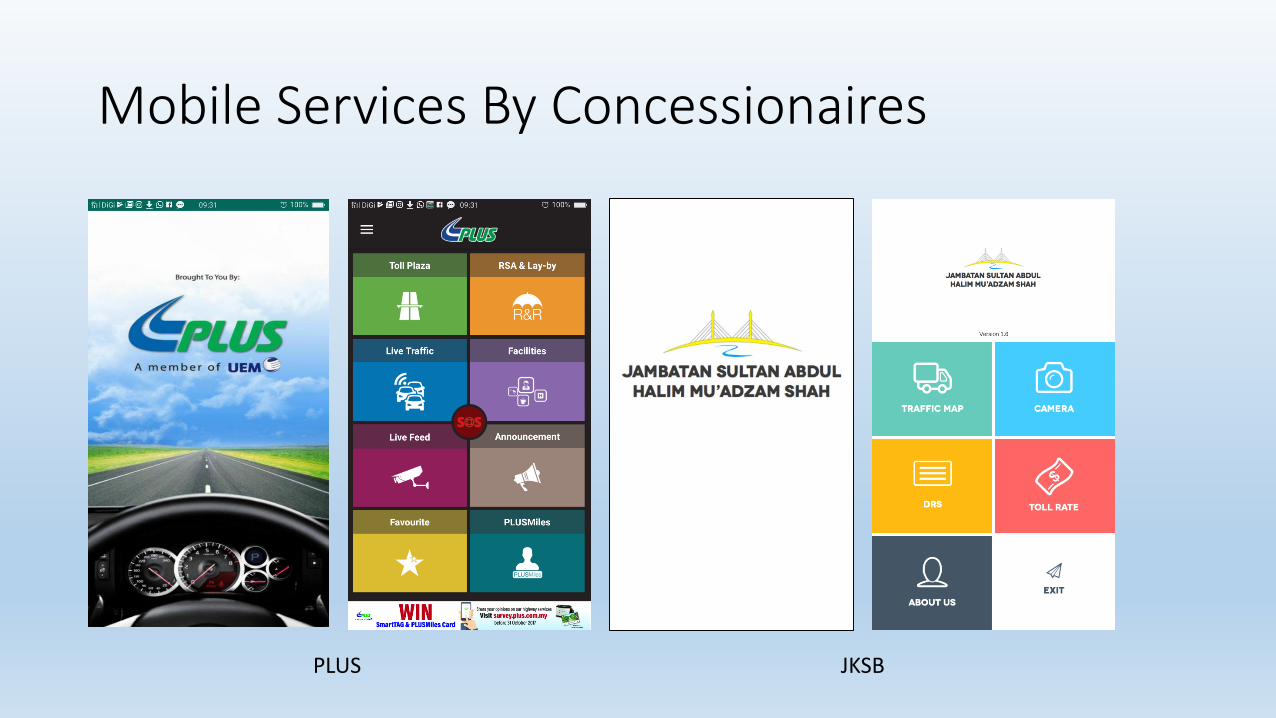
Mobile Services By Concessionaires
PLUS JKSB

Mobile Services; Technology move towards crowd sourcing.
• Pre Trip and On Trip Information
• Traffic status based on user info sharing
• Real time coordinate, POI and traffic condition

Are We Already OK?
• Crowed based apps • not governed by the authority – no body responsible.
• Apps provided by Concession Companies and MHA • without navigation, not so interactive and user friendly?
• Information is confirmed by the operator.
• Preferred apps?
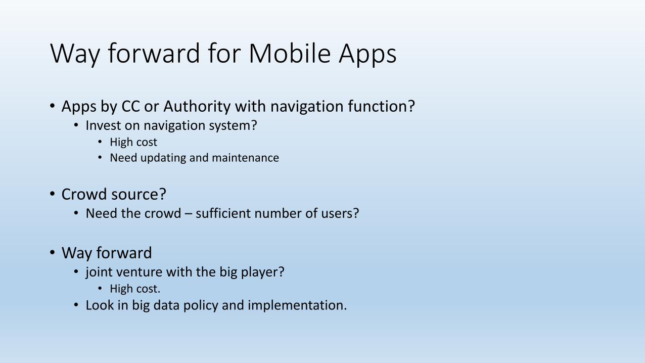
Way forward for Mobile Apps
• Apps by CC or Authority with navigation function?• Invest on navigation system?
• High cost• Need updating and maintenance
• Crowd source?• Need the crowd – sufficient number of users?
• Way forward • joint venture with the big player?
• High cost.
• Look in big data policy and implementation.

Multi Lane Free Flow

Full ETC Implementation
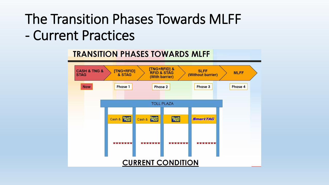
The Transition Phases Towards MLFF- Current Practices
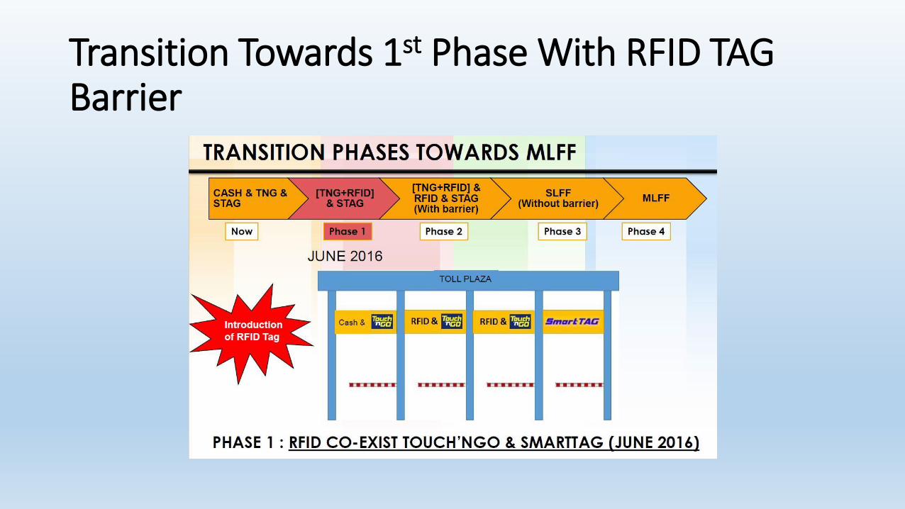
Transition Towards 1st Phase With RFID TAG Barrier

Transition Towards 2nd Phase With RFID TAG Barrier

Transition Towards 3rd Phase Single Lane Free FlowWith RFID TAG Without Barrier
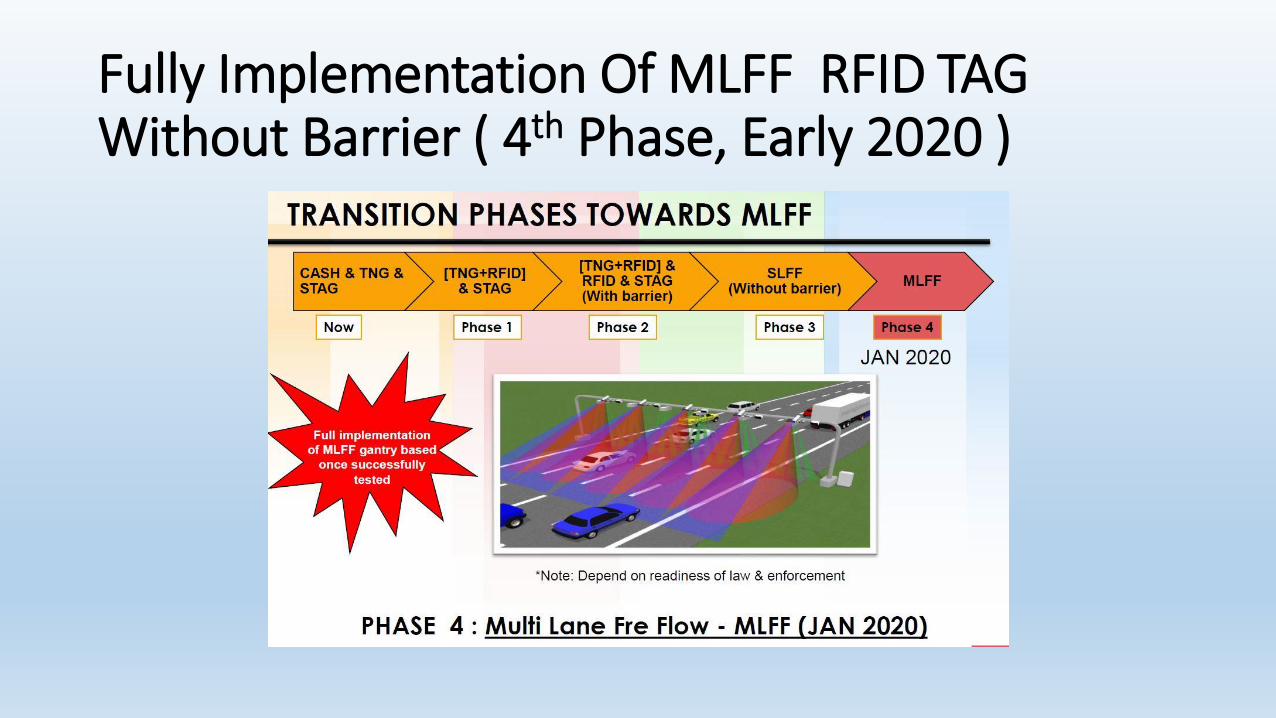
Fully Implementation Of MLFF RFID TAG Without Barrier ( 4th Phase, Early 2020 )

Why We Need MLFF Implementation
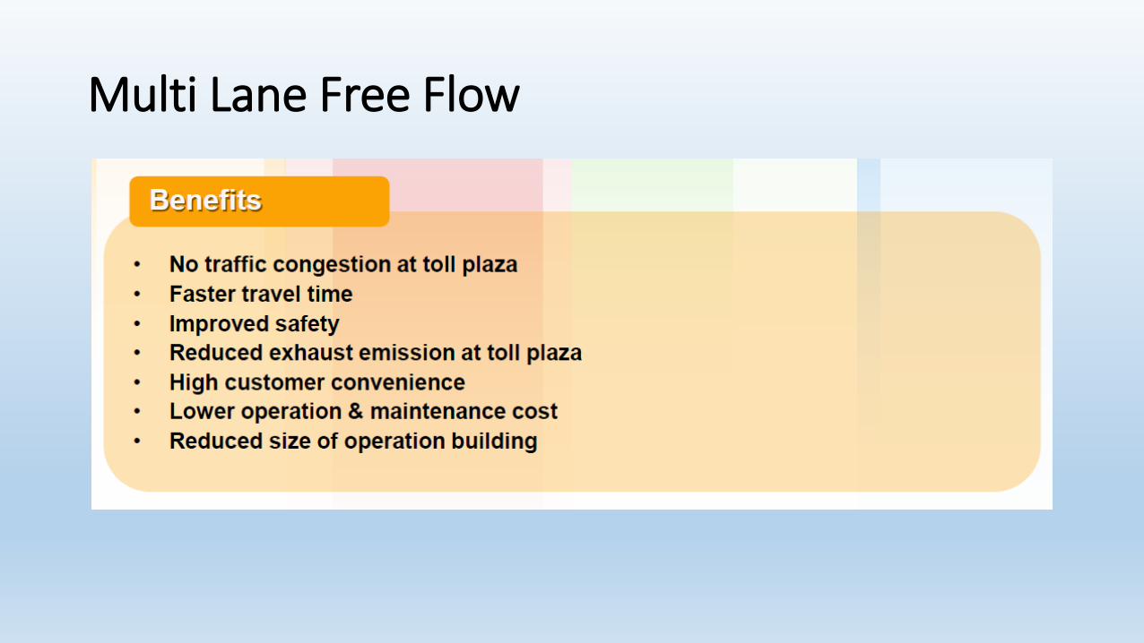
Multi Lane Free Flow

Part of Proof of Concept MLFFDate : February 2017Location : Temerloh LPT1Speed Test : 180km/h – 200km/hResult Test : System detected with 200km/h
Detection Count Base On Speedtest
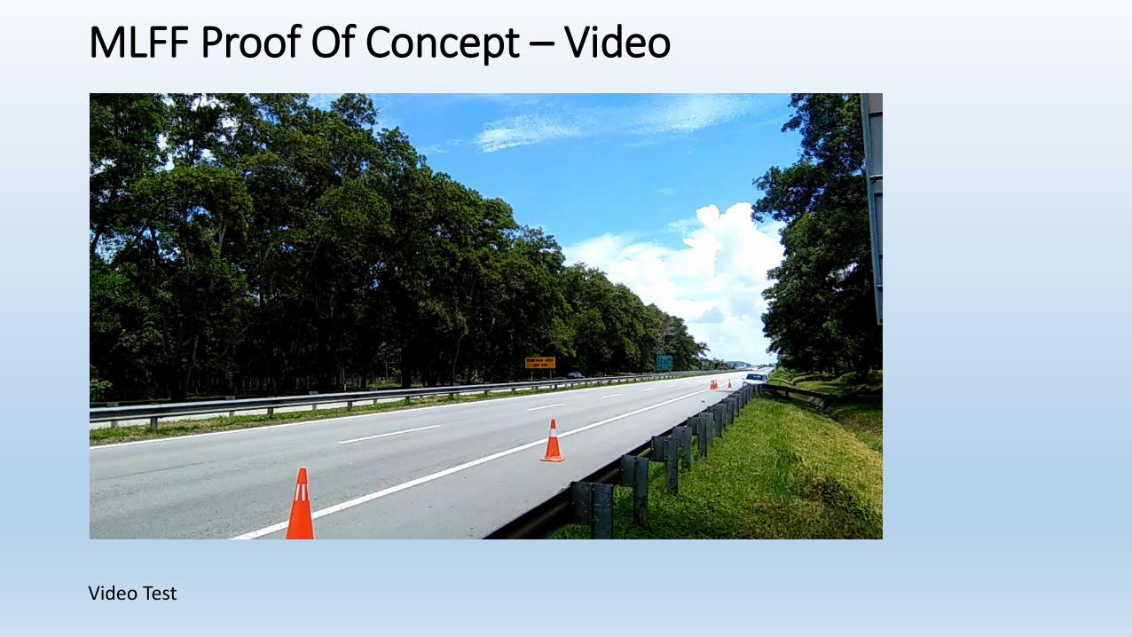
MLFF Proof Of Concept – Video
Video Test

WEIGHT IN MOTION• Highway Locations
1) KL – Karak Highway - Handed over to JPJ
2) Lebuhraya Pantai Timur 1 - Handed over to JPJ
3) Lebuhraya Pantai Timur 2 - Location provided
4) South Klang Valley Expressway - Handed over to JPJ
5) Guthrie Corridor Expressway - Handed over to JPJ

Initiatives Required to be done by The Concession Companies• Upgrade the TCSS facilities base on the new technology and practices
( eg; Fibre backbone, CCTV, VMS and etc.)
• To add TCSS facilities at the strategic location base on needs and requirement from time to time.
• Create innovative ideas to enhance the current operation and practice
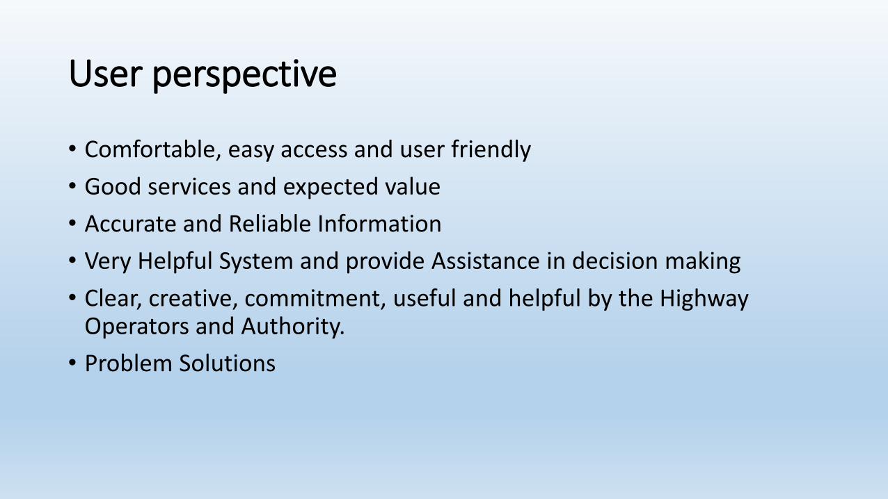
User perspective
• Comfortable, easy access and user friendly
• Good services and expected value
• Accurate and Reliable Information
• Very Helpful System and provide Assistance in decision making
• Clear, creative, commitment, useful and helpful by the Highway Operators and Authority.
• Problem Solutions
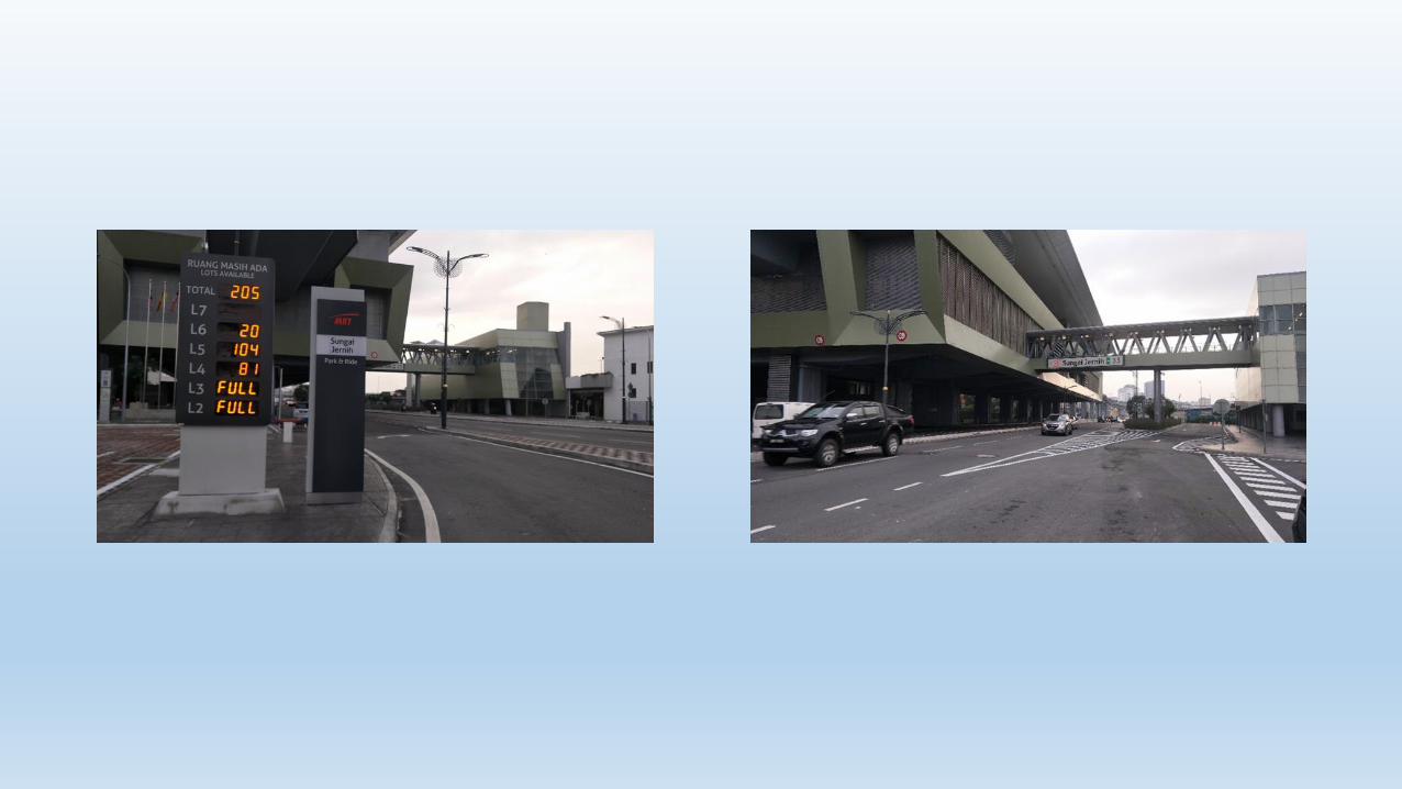
Parking information system

Parking Information System
• To give information on Parking Area Services;• Location R & R and Layby Service Area• As early information or user notification• Information can be delivered via mobile, web, VMS and etc..• Integrated information with other party related..eg. MRT or
Rail, Shopping Mall or Exibition Center nearby highway

Third party services on
the highway

Third party services on the highway
• Passenger Information System ( PIS ) by Prasarana Rapid KL Bus
• Highway route for Rapid KL Bus;• Lebuhraya Damansara – Puchong ( Partially )
• Lebuhraya Sg. Besi ( Partially )
1. Passenger Information System ( PIS )
2. Automatic Enforcement System ( AES )• Enforcement on speed and traffic light selected location by jabatan
Pengangkutan Jalan ( JPJ )

Passenger Information System

Passenger Information System
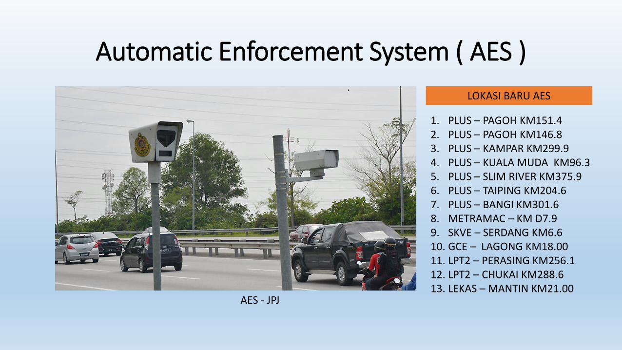
Automatic Enforcement System ( AES )
AES - JPJ
LOKASI BARU AES
1. PLUS – PAGOH KM151.42. PLUS – PAGOH KM146.83. PLUS – KAMPAR KM299.94. PLUS – KUALA MUDA KM96.35. PLUS – SLIM RIVER KM375.96. PLUS – TAIPING KM204.67. PLUS – BANGI KM301.68. METRAMAC – KM D7.99. SKVE – SERDANG KM6.610. GCE – LAGONG KM18.0011. LPT2 – PERASING KM256.112. LPT2 – CHUKAI KM288.613. LEKAS – MANTIN KM21.00

Way forward
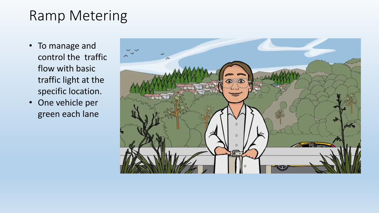
Ramp Metering
• To manage and control the traffic flow with basic traffic light at the specific location.
• One vehicle per green each lane

Benefits of Ramp Metering
• Reduce congestion on freeway
• Maintain more steady traffic flow and regular travel speeds on freeway
• Allow more cars to use the freeway
• Increase safety by helping to reduce crashes associated with stop and go traffic and high-speed merging
• Allow merging vehicles to enter freeway traffic more smoothly
Case Study by Others Country
• Benefits of Ramp Management
• Ramp management strategies produce benefits in many areas:
• Safety—Ramp management improves the flow and mix of vehicles that enter and exit freeways, reducing disruptions that can lead to collisions. Ramp metering is particularly effective at breaking up large platoons of vehicles, thereby smoothing traffic flow.
• Mobility and Reliability—Ramp management can reduce congestion, which in turn increases travel speeds and reduces travel times. The 1995 FHWA study of ramp metering in North America found that implementing ramp management strategies in Detroit increased average speeds and volumes by 8 and 14 percent, respectively.
• Environmental Benefits—FHWA studies have shown that ramp management, by reducing congestion and delay, also decreases the total vehicle pollutants released into the environment. In Minneapolis, MN, ramp metering reduced overall emissions by 1,052 metric tons (1,160 tons) annually, according to the study Twin Cities Ramp Meter Evaluation: Executive Summary, sponsored by Mn/DOT in 2001.
• Institutional Efficiency—In addition to the tactical benefits, ramp management also promotes institutional cooperation by serving as a conduit through which agencies can collaborate to address transportation needs. Because ramps often join facilities operated by multiple agencies, ramp management can break down barriers that exist between the agencies, enabling them to work together more effectively on other issues as well.
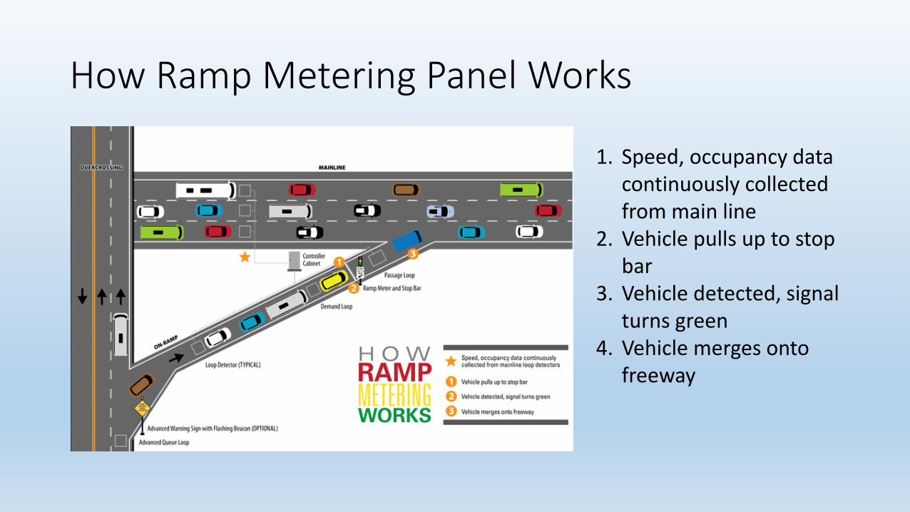
How Ramp Metering Panel Works
1. Speed, occupancy data continuously collected from main line
2. Vehicle pulls up to stop bar
3. Vehicle detected, signal turns green
4. Vehicle merges onto freeway
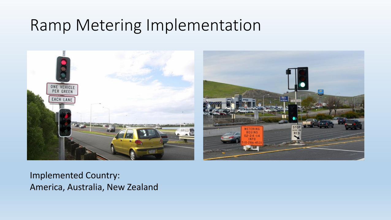
Ramp Metering Implementation
Implemented Country:America, Australia, New Zealand

New Innovative Tecnology

Glow Line In The Dark• The new innovative technology to enhances on safety and guidance driving night time.• Selected location with high potential accident or risky area.

Conclusion
• Lets move forward in providing precise and timely information to the users towards achieving better services for the comfort and safety of the road users.
• In order to become SMART HIGHWAY

Terima kasih