slandail project
TRANSCRIPT
slandail.eu
SlándáilSecurity System for Language and Image AnalysisFP7 Project No: 607691
Shane Finan (TCD)Introduction to Slándáil: Trust and Emergency ManagementPrinting House, TCD, May 12th 2015

slandail.eu
Slándáil – Security System for Language and Image Analysis
Slándáil is a collaborative project between organisations across the
EU. The goal is to improve the use of social media in enhancing the
response of disaster related agencies.
Web www.slandail.eu
Email [email protected]
Digital Newsletter Sign-up (coming soon!)
www.slandail.eu/slandail-digital-magazine
Twitter.com/slandailfp7 || facebook.com/slandail
slandail.eu
Introduction to Slándáil

slandail.eu
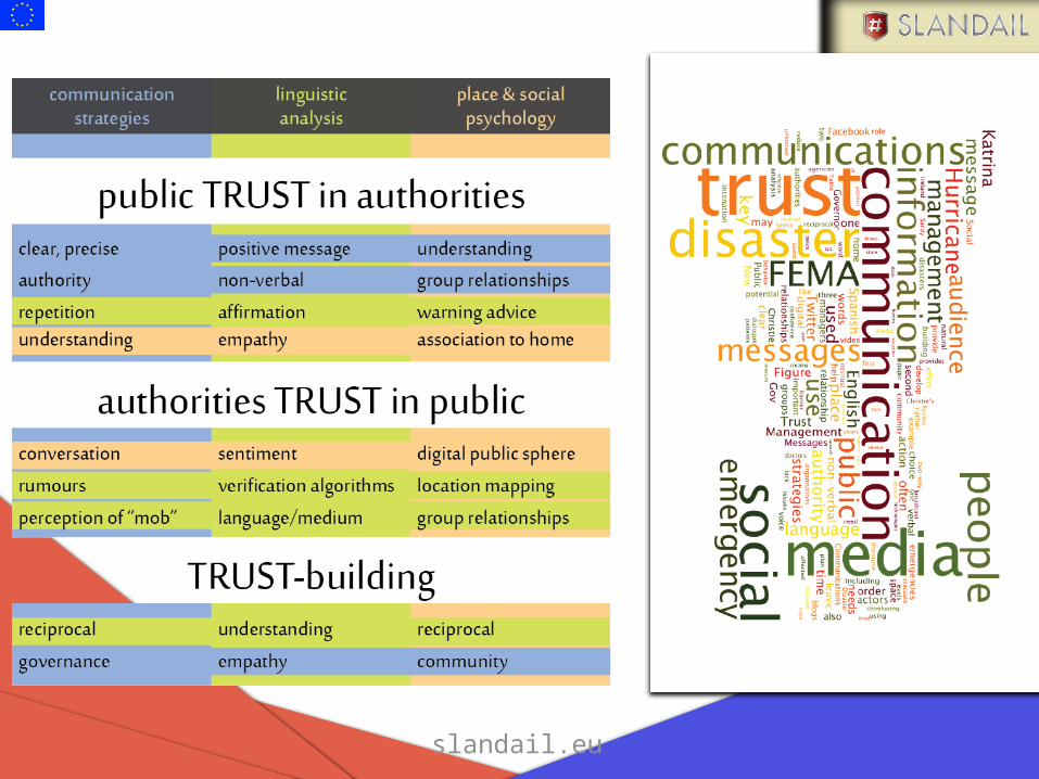
Introduction to Trust
slandail.eu
Introduction to Trust

slandail.eu
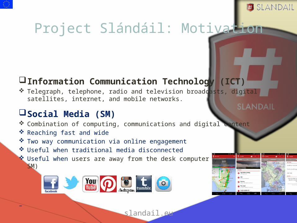
Project Slándáil: Motivation
slandail.eu
Project Slándáil: Motivation
Information Communication Technology (ICT) Telegraph, telephone, radio and television broadcasts, digital satellites, internet, and mobile
networks.
Social Media (SM) Combination of computing, communications and digital content Reaching fast and wide Two way communication via online engagement Useful when traditional media disconnected Useful when users are away from the desk computer (via mobile SM)
–
slandail.eu
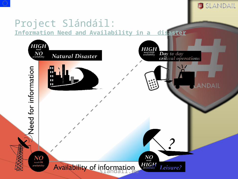
Project Slándáil: Information Need and Availability in a disaster

slandail.eu
Project Slándáil: MotivationConverting social media data into information
Data should be factually correct and ethically sourced

slandail.eu
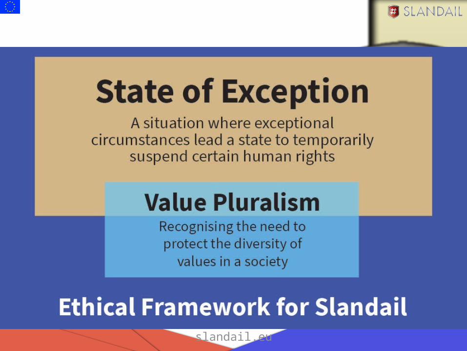
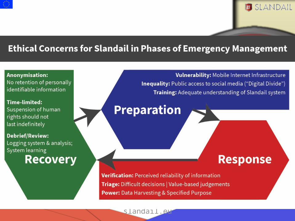
Slándáil: Ethical Issues
slandail.eu
Duty of Care in Crisis Planning and Response
• Dr Damian Jackson• Irish School of Ecumenics, Trinity College Dublin
slandail.eu
Ethics and Slándáil
?What is Ethics?
slandail.eu
slandail.eu
slandail.eu
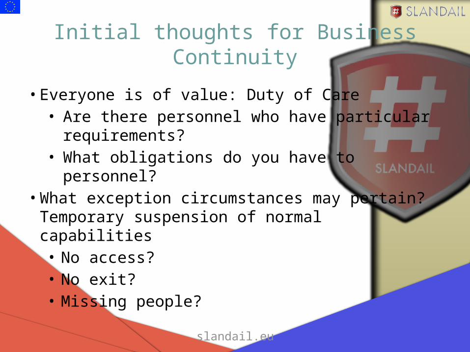
Initial thoughts for Business Continuity
• Everyone is of value: Duty of Care• Are there personnel who have particular
requirements?• What obligations do you have to personnel?
• What exception circumstances may pertain? Temporary suspension of normal capabilities• No access?• No exit?• Missing people?

slandail.eu 16
Business Continuity:Phases of Crisis Response
Mitigationand Preparation
Plan for effects
Consider diversity
Training
Organise decision-making
Response
Prioritise people
Cooperate with responders
Normal capabilities temporarily changed
Post-response
Review plans
Debrief and Evaluation
slandail.eu
SlándáilSecurity System for Language and Image AnalysisFP7 Project No: 607691
Prof. Khurshid AhmadProject Coordinator, Trinity College DublinDublin, Friday 1st May, 2015Printing House, TCD, May 12th 2015
slandail.eu

slandail.eu
Project Slándáil: MotivationSocial media should help civil protection agencies in dealing with people quickly and effectively.
People can use social media to help the agencies.
slandail.eu
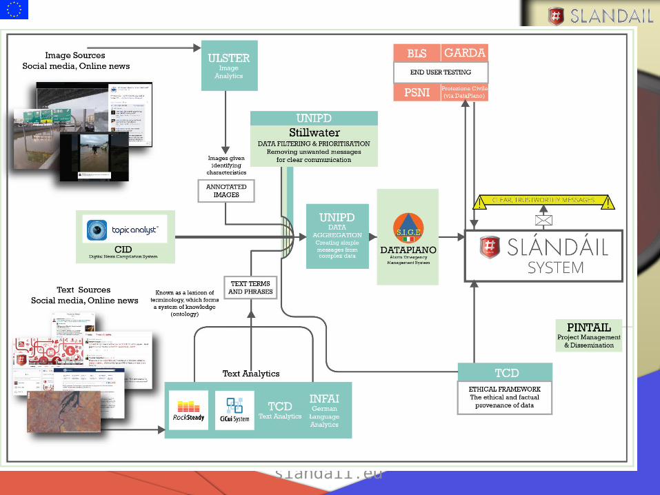
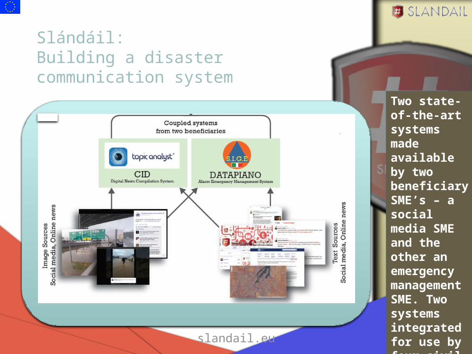
Slándáil: Building a disaster communication system
Two state-of-the-art systems made available by two beneficiary SME’s – a social media SME and the other an emergency management SME. Two systems integrated for use by four civil protection agencies.

slandail.eu
INSPIRE Geoportal
• EU member states required to provide access to data infrastructure through geo-portal implementation
• Allows spatial data sets and services to be viewed subject to access restrictions and within the INSPIRE directive framework
• Additional functionality in later releases with full implementation required by 2019
“main objective of this project is to provide the operational version of the INSPIRE Geoportal at European level, including integration interfaces for discovery and view services from member state portals and thus to foster the harmonization of member states' national Geoportals implementations through the adoption of open standards and open source products”
2. http://www.planetek.it/eng/projects/inspire_geoportal#sthash.Ey19WFlm.dpuf
slandail.eu
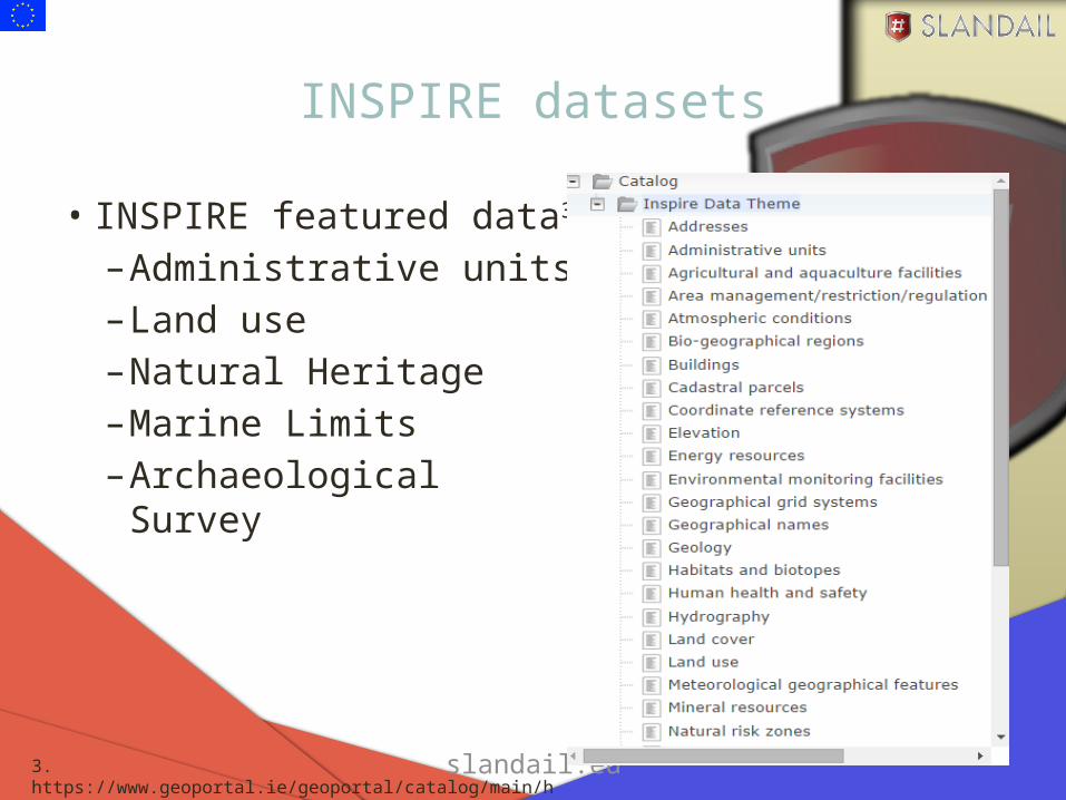
INSPIRE datasets
• INSPIRE featured data3
–Administrative units–Land use–Natural Heritage –Marine Limits–Archaeological Survey
3. https://www.geoportal.ie/geoportal/catalog/main/home.page

slandail.eu
Geoportal implementation for EU member states
https://www.geoportal.ie/geoportal/
slandail.eu
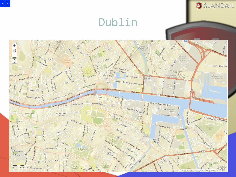
Dublin
slandail.eu
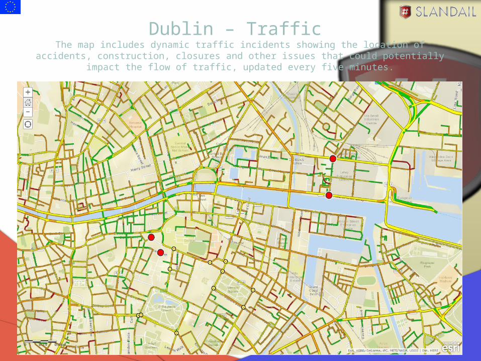
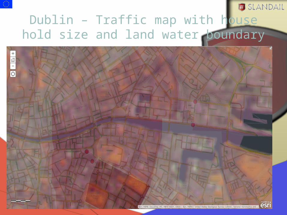
Dublin – Traffic The map includes dynamic traffic incidents showing the location of accidents, construction, closures
and other issues that could potentially impact the flow of traffic, updated every five minutes.
slandail.eu
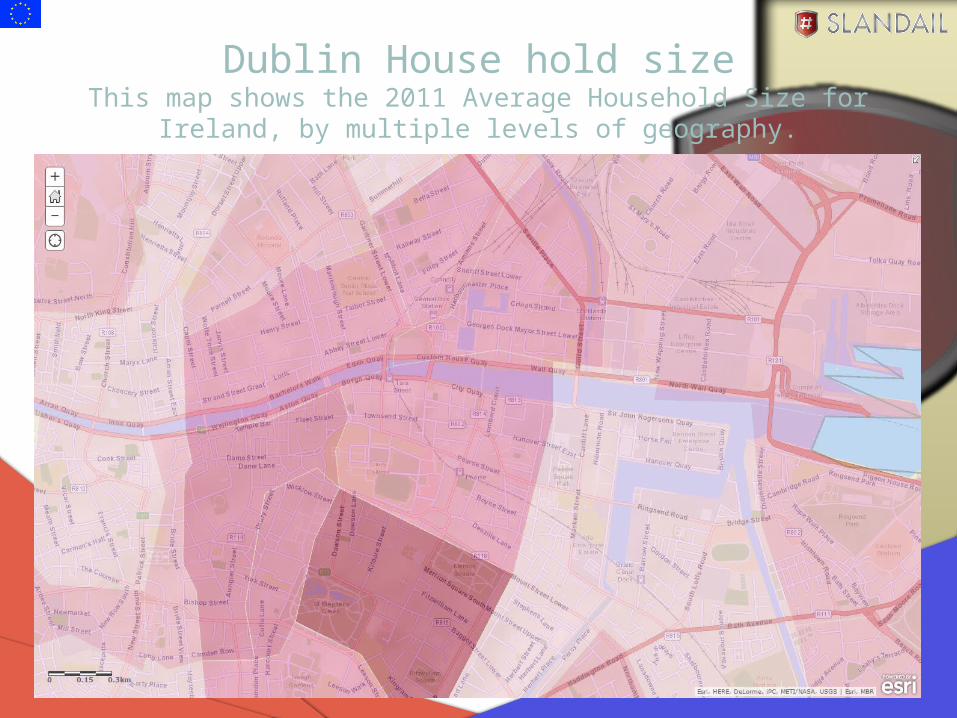
Dublin House hold sizeThis map shows the 2011 Average Household Size for Ireland, by multiple
levels of geography.

slandail.eu
Dublin House hold sizeThis map shows the 2011 Purchasing Power Per Capita for Ireland, by multiple levels of geography. Purchasing Power describes the disposable income (income without taxes and social security contributions, including received transfer
payments) of a certain area's population. The Purchasing Power Per Capita figures are in Euro per capita.
slandail.eu
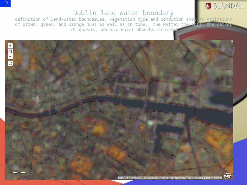
Dublin land water boundarydefinition of land-water boundaries, vegetation type and condition show as variations of brown, green, and
orange hues as well as in tone. the wetter the soil, the darker it appears, because water absorbs infrared
slandail.eu
Dublin – Traffic map with house hold size and land water boundary

slandail.eu
• his Esri image service contains global Landsat imagery from 1990-2010 at 30 meter resolution. This combination offers added definition of land-water boundaries and highlights subtle details not readily apparent in the visible bands alone. Inland lakes and streams can be located with greater precision when more infrared bands are used. With this band combination, vegetation type and condition show as variations of brown, green, and orange hues as well as in tone. Generally, the wetter the soil, the darker it appears, because water absorbs infrared.
• Band Combination: 4 5 3 (Near infrared (4), Near infrared (5), Red (3) into RGB)• Time Enabled: Yes. (Start Time Field: GLS_START_DATE; End Time Field: GLS_END_DATE)• Data Source: This image service was compiled from Global Land Survey (GLS) datasets: 1990, 2000, 2005 and 2010. GLS datasets are created by the U.S. Geological Survey (USGS) and the National
Aeronautics and Space Administration (NASA) using Landsat images. These global minimal-cloud cover, orthorectified Landsat data products support global assessments of land-cover, land cover-change, and ecosystem dynamics such as disturbance and vegetation health

slandail.eu
Project Novelty
Slándáil System will be unique in that it could
– (a) aggregate the information in different modalities (text and images),
– (b) deal with multi-lingual/cross-cultural communications during a disaster,
– (c) treat ethical and factual provenance of data during a disaster (states of exception doctrine)
and Slándáil System was designed, implemented and tested with user involvement at all stages.