sky coordination systems & celestial sphere
TRANSCRIPT

Astronomy & Space Science Association
in
University of Kelaniya
Astro Night 2014
Lecture 2
Coordination Systems in the
Sky & Celestial Sphere
Eranga JayashanthaHon. mentd Dip in Astronomy & Astrophysics ( IOAA – China )
National Representative at Space Generation Advisory Council ( UN )
Sri Lanka national Astrophysics Olympiad Team Trainer at Institute of Physics Sri Lanka
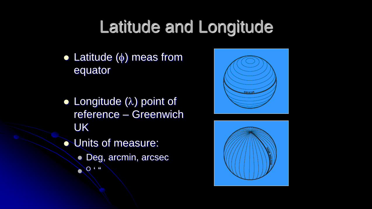
Latitude and Longitude
Latitude (f) meas from
equator
Longitude (l) point of
reference – Greenwich
UK
Units of measure:
Deg, arcmin, arcsec
O ‘ “

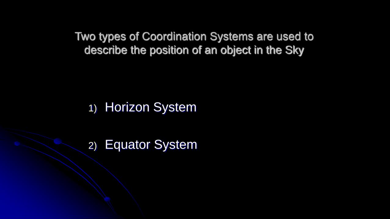
Two types of Coordination Systems are used to
describe the position of an object in the Sky
1) Horizon System
2) Equator System
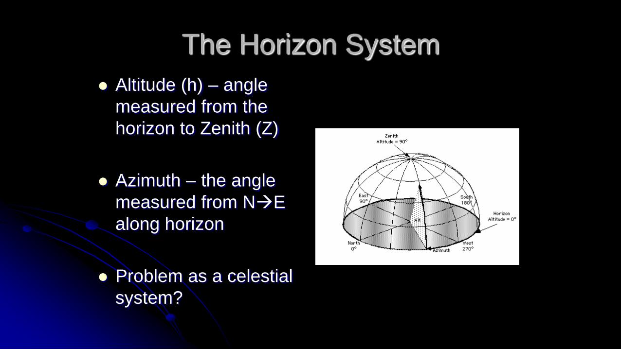
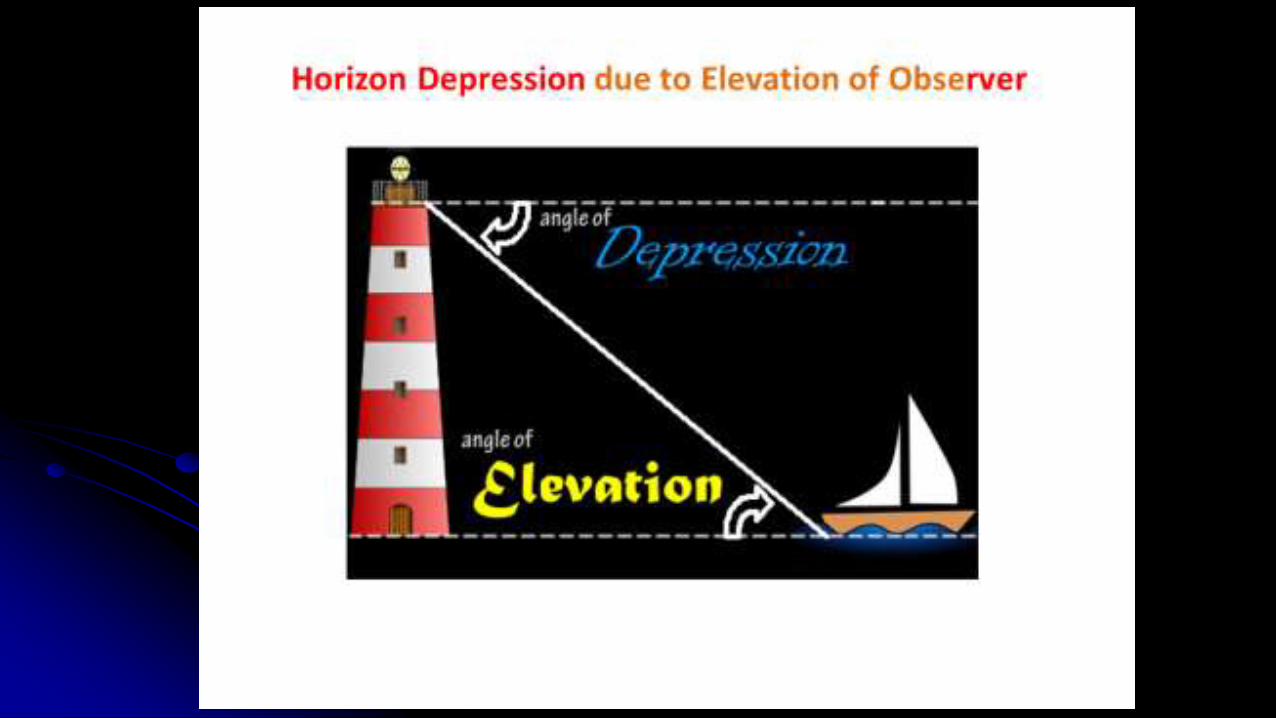
The Horizon System
Altitude (h) – angle
measured from the
horizon to Zenith (Z)
Azimuth – the angle
measured from NE
along horizon
Problem as a celestial
system?

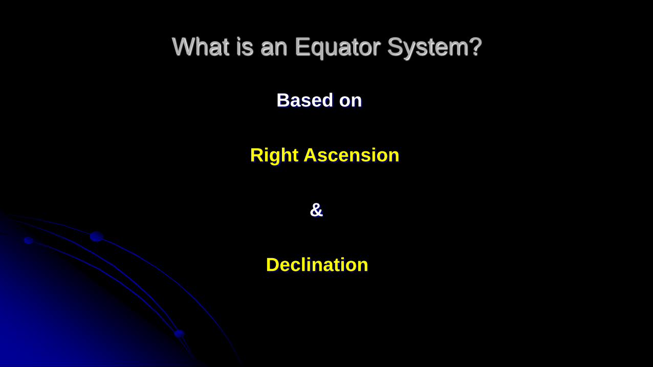
What is an Equator System?
Based on
Right Ascension
&
Declination

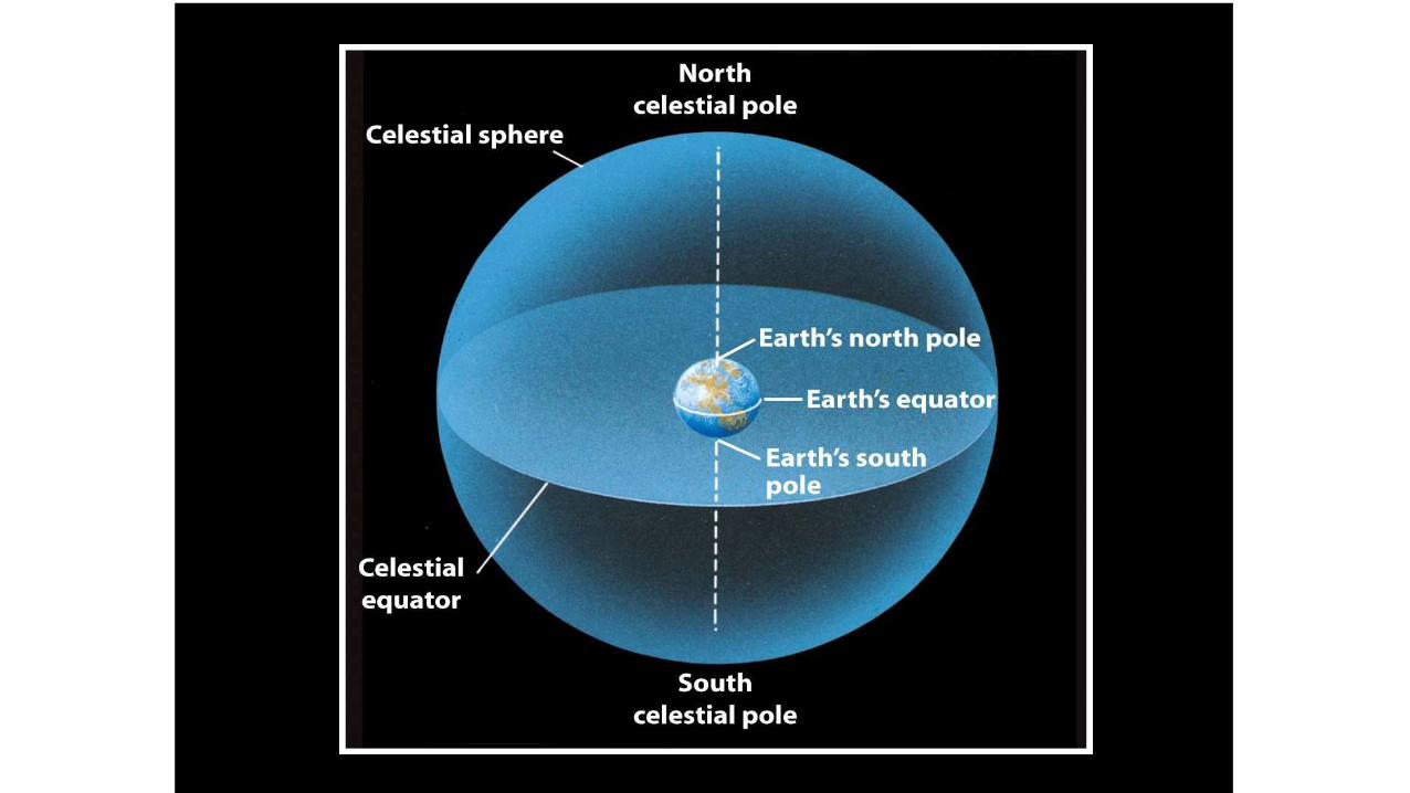
Celestial Sphere
Imaginary sphere where stars
reside
Extension of Earth’s equator,
poles
Celestial Equator
Celestial poles
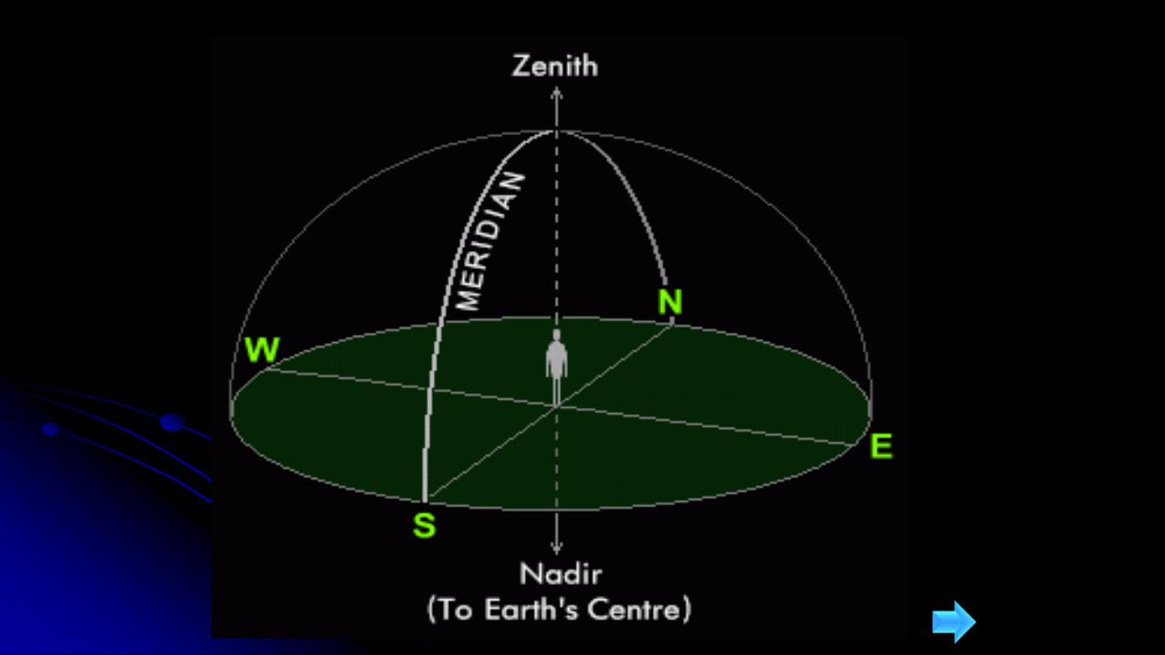
Zenith & Nadir


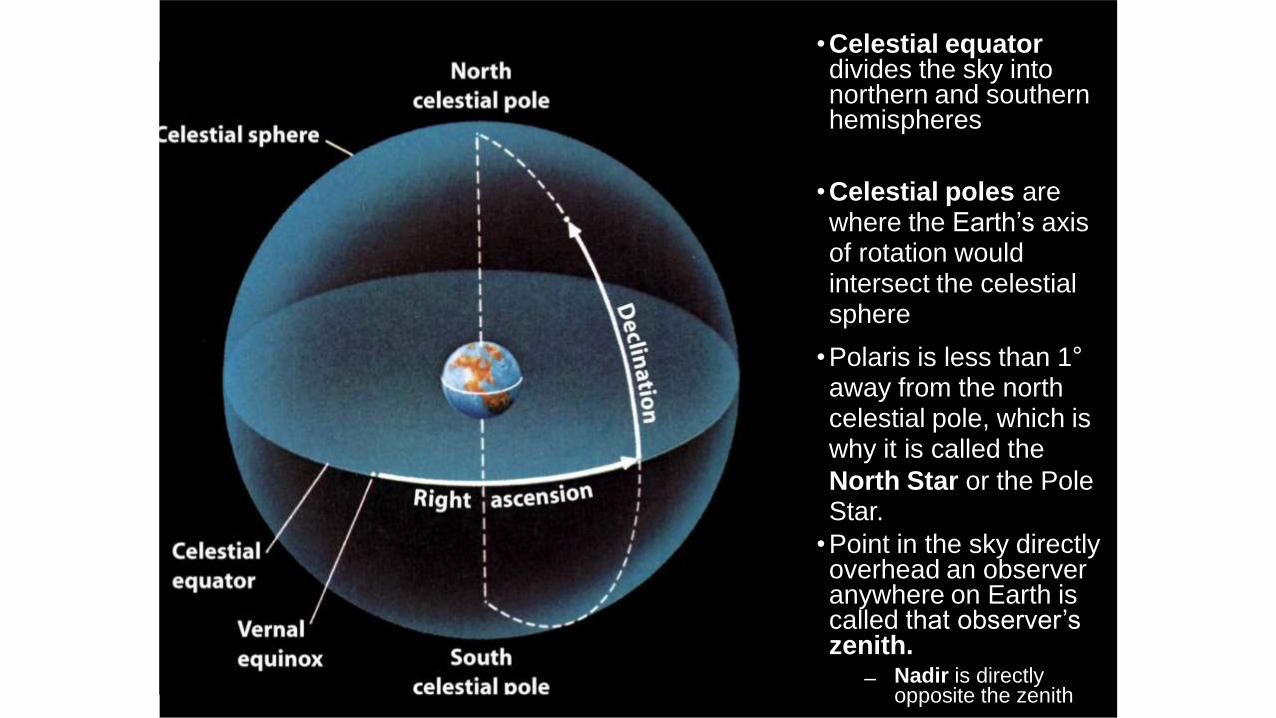
•Celestial equator divides the sky into northern and southern hemispheres
•Celestial poles are where the Earth’s axis of rotation would intersect the celestial sphere
•Polaris is less than 1°away from the north celestial pole, which is why it is called the
North Star or the Pole Star.
•Point in the sky directly overhead an observer anywhere on Earth is called that observer’s zenith.
– Nadir is directly opposite the zenith
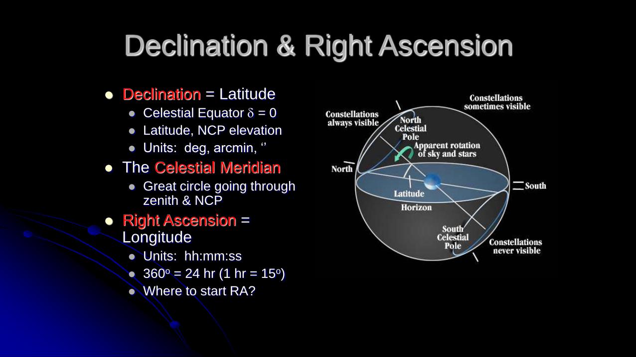
Declination & Right Ascension
Declination = Latitude Celestial Equator d = 0
Latitude, NCP elevation
Units: deg, arcmin, ‘’
The Celestial Meridian Great circle going through
zenith & NCP
Right Ascension = Longitude Units: hh:mm:ss
360o = 24 hr (1 hr = 15o)
Where to start RA?

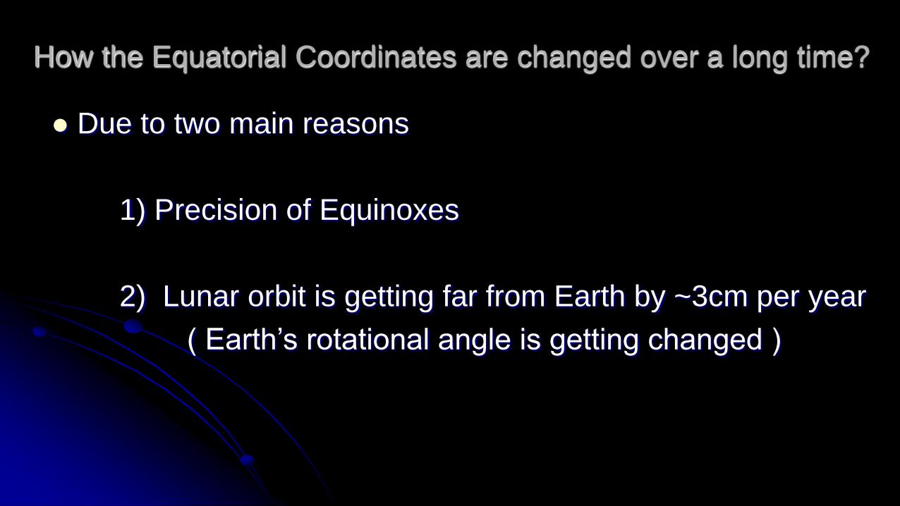
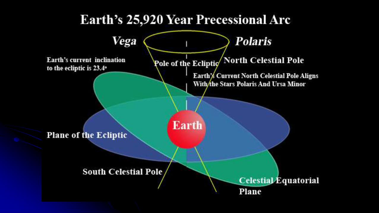
How the Equatorial Coordinates are changed over a long time?
Due to two main reasons
1) Precision of Equinoxes
2) Lunar orbit is getting far from Earth by ~3cm per year
( Earth’s rotational angle is getting changed )

Thank you