six mile bridge 015-0352
TRANSCRIPT
OMB NO. 1024-0018
United States ~ e ~ a r t m e n t of the Interior National Park Service
NATIONAL REGISTER OF HISTORIC PLACES REGISTRATION FORM
Ths form u lor wr m m m u r . or requusnC d c 4 m u m m ~ for mndivldu propem- and dtsmca Scc YLIWCUORI in HOW c C m k f t 41. NonomI Rcrnrrr nf Huronc P l o r u Revwanon Form (Nawrul Replsrer Bulkm 16.41. C w k o u c h itrm by muruy 'r' in k bsppmnae hur or by rnlenne mc infomoon rcquulcd. If any tern d m m( apply 0 Ih p w q k m g drrunmred. cnlcr 'N lh ' lor '"3 aopllcable.' For lumoonr. srchlecrurnl clasrtflooon, momk. and vcas at rlprulunse. cnler only oeeoner md subur~ona horn rhe i~rmcaom. Place rdd~oolui e n m u and mmave tlem. on cononu.non sheem (NPS Form 1@m). Urc ri rypwnrcr. word pmauor. or c q u o r . lo compltu all ~smt.
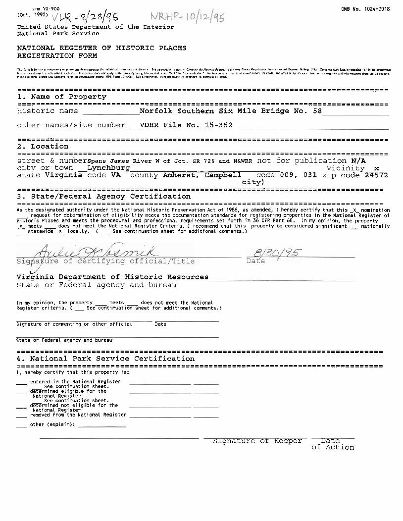
............................................................................... ............................................................................... 1. Name of Property ............................................................................... ............................................................................... historic name Norfolk Southern Six Mile Bridge No. 58
other names/site number - VDHR File No. 15-352
............................................................................... ............................................................................... 2. Location
street & numberspans James River W of Jct. SR 726 and N&WRR not for publication N/A city or town Lynchburg vicinity x state ~irginiacode VA county Amherst, Campbell code 009, 031 zip code 23572
city) .............................................................................. .............................................................................. 3. ~tate/Federal Agency Certification
As the designated a u t h o r i t y under t h e Nat iona l H i s t o r i c Preservat ion Act o f 1986, as amended, I hereby c e r t i f y t h a t t h i s X nominat ion - request f o r de terminat ion o f e l i g i b i l i t y meets the documentation standards f o r r e g i s t e r i n g p rope r t i es i n t he ~ a t i o n a l - ~ e g i s t e r o f H i s t o r i c Places and meets t he procedura l and pro fess iona l requirements se t f o r t h in 36 CFR Par t 60. I n my opinion, t h e p r o p e r t y - x- meets does not meet the Na t i ona l Reg is ter C r i t e r i a . I recomnend t h a t t h i s p rope r t y be considered s i g n i f i c a n t - n a t i o n a l l y - s t a t e w x - X - l oca l Ly. ( - See con t i nua t i on sheet f o r add i t i ona l comnents.)
3?d ~ a f e
B/30/7-'5 fying official/Title
c/: Virglnia Department of Historic Resources State or Federal agency and bureau
1n my opinion, t h e p rope r t y - meets - does not meet the Nat ional Reg is ter c r i t e r i a . ( - See c o n t i n u a t i o n sheet f o r add i t i ona l comnents.)
Signature o f comnenting o r o ther o f f i c i a l Date
Sta te o r Federal agency and bureau
.............................................................................. .............................................................................. 4. National Park Service Certification .............................................................................. .............................................................................. I, hereby c e r t i f y t h a t t h i s p rope r t y i s :
- entered i n the Nat iona l Reg is ter See con t j nua t i on sheet.
- f i r m i n e d e l i g i b l e f o r t h e Nat iona l Reg js ter
See con t i nua t i on sheet. - G r m i n e d no! e l i g i b l e f o r t h e
Nat iona l Reg is ter - removed from the Nat iona l Reg i s te r
o ther (exp la in) :
Signature or Keeper Date of Action
--
Norfolk Southern Six Mile Bridse No. 58 Amherst and Cam~bell Counties. Virainia
................................................................................ 5. Classification ................................................................................ Ownership of Property (Check as many boxes as apply)
x private - - public-local
- public-State - - public-Federal
Category of Property (Check only one box) building (s )
- district site
x structure - - object
Number of Resources within Property
Contributing Noncontributing 0 0 buildings
-0- -0- sites -1- -0- structures -0- -0- objects -1- -- -0- Total --
Number of contributing resources previously listed in the National Register -- 0
Name of related multiple property listing (Enter "N/A1' if property is not part of a multiple property listing. ) N/A ................................................................................ 6. Function or Use ................................................................................. Historic Functions (Enter categories from instructions)
Cat: TRANSPORTATION Sub: Rail-related
Current Functions (Enter categories from instructions) Cat: NOT IN USE Sub :
-------------------------==------------=----------------------==========------=== ......................... 7. Description ................................................................................. Architectural Classification (Enter categories from instructions)
OTHER: Pratt Truss
Materials (Enter categories from instructions) foundation - STONE walls N/A
roof N/A other METAL: steel
Narrative Description (Describe the historic and current condition of the property on one or more continuation sheets.)

Norfolk Southern Six Mile Bridae No. 58 Amherst and Cam~bell Counties, Viruinia
................................................................................. 8. Statement of Significance .................................................................................
.Applicable National Register Criteria (Mark " x " in one or mare bones for the Criteria Camsideratioms (Mark "Xu in al l the boxer that apply.) cnteria qualiiying the propeny for National Register listing)
A a d by a i r l i g la . vutiution or ucd for rcligim prmnsa. - I A P r o v q ~1 P U O C ~ ~ ~ with cucnw that hive mads r s~wRcm Eanmhlum la fhc broad . .
panem of au lurmn. - B rcrnaved hom lu o r i g d lolauon.
B ~ r a p c q u msociaud with 6x lwcs of pcisonr s~mRcant m arr part. - c a blnhplace or a pavc. -
- C Prcpcq ~rnbodles fhc dlrfmuvc characeruurr of a type, pcnd. or r n c M of - D acmcv" . canrmcucn or rc menu the wotk of r martcr, or rwscr $a uuluc valuer. or reprcmu a il&lcanr md distbgumhablc enuy WE= cornpanenu lack lndrv~duai - E a rccanrmuud bulldhg, objecLor smcurc
Areas of Significance (Enter categories from instructions) - TRANSPORTATION
Period of Significance - 1854-1945
Significant Dates 1854 -1865- -1899- - -
Significant Person (Complete if Criterion B is marked above)
N/ A
Cultural Affiliation N/A
Architect/Builder unknown
Narrative Statement of Significance (Explain the significance of the property on one or more continuation sheets.)
................................................................................. 9. Major Bibliographical References .................................................................................
(Cite the books, articles, and other sources used in preparing this form on one or more continuation sheets.)
Previous d o c w n t a t i o n on f i l e (NPS) Primary Location of Addi t ional Data
- prel iminary determinat ion of ind iv idual l i s t i n g (36 CFR 67) x s ta te H is to r i c Preservat ion Of f i ce - - has been requested. - Other State agency
- previously L is ted i n the National Register - Federal agency - previously determined e l i g i b l e by the National Register - Local government - designated a National H is to r i c Landmark - Univers i ty - recorded by H i s t o r i c American Bui ldings Survey # - Other - recorded by H i s t o r i c American Engineering Record #- Name of repository:
--
Norfolk Southern Six Mile Bridqe No. 58 Amherst and Cam~bell Counties, Virqinia
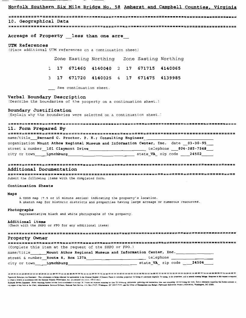
==============================================================-================== 10. Geographical Data ........................................ .................................................................................
Acreage of Property - less than one acre -
UTM References (Place additional UTM references on a continuation sheet)
Zone Easting Northing Zone Easting Northing
- See continuation sheet
Verbal Boundary Description (Describe the boundaries of the property on a continuation sheet.)
Boundary Justification (Explain why the boundaries were selected on a continuation sheet.)
................................................................................. ................................................................................. 11. Form Prepared By ............................................................................... ............................................................................... name/title-Bernard C. Proctor, P. E.; Consulting Engineer
organization Mount Athos Regional Musew and Information Center, Inc. date -03-30-95-
street & number-101 Claymont Drive telephone -804-385-7548-
city or town- Lynchburg state-VA- zip code 24502 -
----------- ............................................................................... Additional Documentation ----------- ............................................................................... Submit the following items with the completed form:
Continuation Sheets
Maps A USGS map (7.5 or 15 minute series1 indicating the property's location. A sketch map for historic districts and properties having large acreage or numerous resources
Photographs Representative black and white photographs of the property
Additional iterne (Check with the SHPO or €PO for any additional items)
-----------===------------------------------------------------------------------- ----------- ................................................................... Property Owner ......................... ..........................................................
(Complete thia item at the request of the SHPO or FPO.)
narne/title Mount Athos Regional Museum and Information Center, Inc.
street & number-Route 8, Box 137A telephone
city or town- Lynchburg state-VA- zip code 24504-
NPS Form IOBOOP I-)
United States Department of the Interior National Park Service
National Register of Historic Places Continuation Sheet
Norfolk Southern Six Mile Bridge No. 58 Section number 7 Page 1 Amherst and Campbell Counties, Virginia
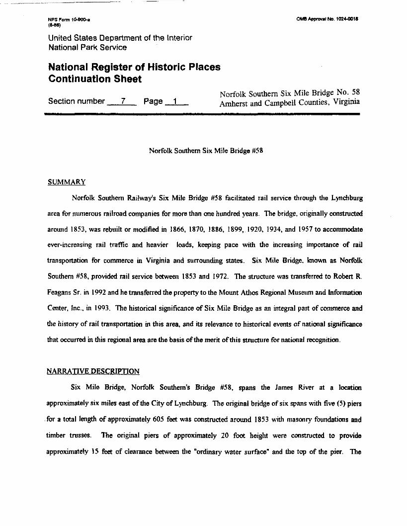
Norfolk Southern Six Mile Bridge #58
SUMMARY
Norfolk Southern Railways Six Mile Bridge #58 facilitated rail service through the Lynchburg
area for numerous railroad companies for more than one hundred years. The bridge, originally constmcted
around 1853, was rebuilt or modified in 1866, 1870, 1886, 1899, 1920, 1934, and 1957 to accommodate
ever-increasing rail traffic and heavier loads, keeping pace with the increasing importance of rail
transportation for commerce in Virginia and surrounding states. Six Mile Bridge. hown as Norfolk
Southern #58, provided rail service between 1853 and 1972. The structure was transferred to Robert R.
Feagans Sr. in 1992 and he transferred the property to the Mount Athos Regional Museum and Information
Center, Inc., in 1993. The historical significance of Six Mile Bridge as an integral part of commerce and
the history of rail transportation in this area, and its relevance to historical events of national significance
that occurred in this regional area are the basis of the merit of this structure for national recognition.
NARRATIVE DESCRIPTION
Six Mile Bridge, Norfolk Southern's Bridge #58, spans the James River at a locution
approximately six miles east of the City of Lynchburg. The original bridge of six spans with five (5) piers
for a total length of approximately 605 feet was constructed around 1853 wrth masonry foundations aad
timber trusses. The original piers of approximately 20 foot height were constructed to provide
approximately 15 feet of clearance between the "ordinary water surface" and the top of the pier. The
NPS Fam 10-Wo-a (-)
United States Department of the Interior National Park Service
National Register of Historic Places Continuation Sheet
Norfolk Southern Six Mile Bridge No. 58 Section number 7 Page 2 Amherst and Campbell Counties, Virginia
original stonework of the piers, except for the east abutment and first eastern pier which have been
replaced, is still intact and a number of mason's marks are visible. The four (4) piers in the river were
constructed to bedrock using coffer darn construction techniques.
In 1870 the height of the masonry piers was increased by approximately twenty (20) feet and the
length was increased by approximately 44 feet for a total length of 654 feet. Wrought iron trusses,
approximately 112 feet per span, of the Fink truss design were also installed. In 1886 two additional Fink
trusses were added to each span for increased load carrying capacity.
In the 1890's an additional pier was installed on the east bank ofthe James River and a new shorter
Fink truss and a plate girder span were added. In 1899 the F i trusses w m replaced with two laterally
braced Pratt style trusses across each span and the Fink truss and plate girder spans on span two and one,
respectively, were replaced with heavier plate girder spans. In 1920 an additional PratI truss was installed
between the two installed in 1899 and the easternmost span was raised to provide greater track clearance.
The three truss per span superstructure remains in place today. In 1934 ccmcrete focUings 28 feet long, 14
feet wide and 10 feet deep were installed at the base of each pier in the river to provide increased bearing
support for heavier train loading. In 1958 the length of span 1 was increased by approximately 25'-6" feet
to permit construction of State Route 726.
Route 726 was constructed to provide access to the Babcox and Wilcox Commercial and Naval
Nuclear Fuel Facility and Lynchburg Foundry at Archer Creek from Route 460. Span 1, increased from
United States Department of the Interior National Park Service
National Register of Historic Places Continuation Sheet
orf folk Southern Six Mile Bridge No. 58 Section number 7 Page 3 Amherst and Campbell Counties, Virginia
46'-6" in length to approximately 72'-O", required a new plate girder span and a new eastern abutment and
the overall length of the bridge increased to approximately 680 feet,
Six Mile Bridge with a length of 6802 now has seven (7) spans, six (6) piers and two (2) end
abutments. Five of the spans consist of three. riveted Pratt style steel trusses, each approximately 112 feet
in length with a 14 foot depth of section. Two of the spans are ccnstructed of steel plate girden with one
span of 48'-6" (span 2) and one section (span 1) of 72'-0" spanning the CSX rail line and Route 726. Oo
the top of the new concrete abutment on the east side of the bridge is a U.S. Coast and Geodetic Swvey
Batch Mark showing an elevation of 523.62 feet above sea level.
The rails have long since been removed from the bridge and the bridge deck of standard wooden
railroad ties has deteriorated. Tl~e superstructure, however, remains in good structural condition and well
above any flooding to date tn this century. The stone masonry of the bridge piers retain their point and the
piers have not been damaged. Erosion has begun to affect the western abutment but there does not appear
to be any structural threat to the integrity of the bridge at this time.

u.lm Awfonl No. 1mCQ)ia
United States Department of the Interior National Park Service
National Register of Historic Places Continuation Sheet
Norfolk Southern Six Mile Bridge NO. 58 Section number 8 Page 1 Amherst and Campbell Counties, Virginia
STATEMENT OF SIGNIFICANCE
SUMMARY
The Norfolk Southern Six Mile Bridge No. 58 spans the James River downstream from Lynchburg,
Virginia, linking Amherst and Campbell counties. The bridge is eligible for listing in the National Register of
Historic Places under Criterion A for its significance in the history of transportation in Virginia. An evolved
structure, the bridge was built of wooden trusses on stone pien and completed in 1854. Soon after its destruction
during the Civil War, the bridge was rebuilt twice: fust in wood, and again about 1870, when the height of the
piers was increased and an innovative wrought-iron Fink truss bridge was consuucted. The bridge was strengthened
in 1886 and again about 1901 using a riveted-steel Pran truss design. From its creation in 1854 until the railroad
abandoned it in 1972, the bridge carried both freight and passenger ukc. The Six Mile Bridge continues to
represent well the antebellum and postwar eras in Virginia rail transportation history.
United States Department of the Interior National Park Service
National Register of Historic Places Continuation Sheet
Norfolk Southern Six Mile Bridge No. 58 Section number 8 Page - 2 Amherst and Campbell Counties, Virginia
Prior to the development of the radroads, Lynchburg and the Certral V i area were *dent
a! the James River and poor dirt roads for transpottaaon. Bateaux &c on the James River ficilttated
commerce bawea Rictunand and Lynchburg from the mid-1700s rmtil the opening of the James River and
Kanawha Canal between Riduwnd and Lynchburg in 1840. In the 1820s seven1 Lynchburg toll road
companies bad be^ rrarted and these compues provided somewht better roads. As d y as 1831
Lynhburg :aEempt4 unsuccessfully to organize a c ~ w r t i u m to caut~d a droad westward but it
wasu't until 1850 that conrtrucbon of the V u p a and Tamessee Railroad h u Lynchburg, Virginia to
Briaol, Tmnessee finally began.
Late. in 1849 concurrent wrth the wnstmuici~ of the Virgima and Tennessee Radroad, a line which
was completed in 1856, work on a rail link betwea Petmburg and Lynchburg, Vir- for the South Side
Rs*lroad began in P&ersburg, V i . The Soutb Side Railroad shady had a n h a d h e between
Petenburg and Richmood and the exteasion to Lynchburg.

W M No. 40144018
United States Department of the Interior National Park Service
National Register of Historic Places Continuation Sheet
orf folk Southern Six Mile Bridge No. 58 Section number 8 Page 3 Amherst and Campbell Counties, Virginia
Work an the South Side Rallroad line m e e n Petemburg and Lynchburg prcceeded rapidly and
by late 1854 the Line was providing rail service to Lynchburg. In 1854 work bad begun by the Norfolk
and Petenburg Railroad on a line behveen Norfolk and Petenburg, Virginia and this line was colnpletai in
1858. When canplaed, these three railroad Lines (the Norfolk-Petersburg Railroad the Petenburg-
Lynchbug R a h a d and the Virginia Tamessee Railroad) would provide s iad line across V- fiom
Norfolk, Virginia via Richmood and Lynchburg, V i to Bristol, Tmnessee, to provide service to the
Mississipi River at Mempb.
mere were four major bridges on the Petersburg to Lynchburg line, mcluding Six Mile Bridge.
One notable strudure on this line was the famous High Bridge just east of Fannville, Virginia. High
Bridge is 3,400 feet long and 125 feet high. m e first and major structure over the James River, however,
was located near Lpchburg and it was known as the "First Crossing of the James", a reference noted in the
South Side Railroad company records. The bridge is located approximately six miles below Lynchburg;
crossing from the east side of the James River in Campbell County to the west side of the James River into
Amherst County. This "First Crossing of the lames" is currmtly referred to locally and oncurrent U.S.

United States Department of the Interior National Park Service
National Register of Historic Places Continuation Sheet
Norfolk Southern Six Mile Bridge No. 58 Section number 8 Page 4 Amherst and Campbell Counties, Virginia
Geologictl Survey Maps as the Six Mile Bridge. Two other bridges cross the James River west of Six
Mile Bridge toward Lynchburg. These remaining bridges are similar construction but shorter span. These
smaller bridges camed the rail line from the north bank of the James River in Amherst County over the
James River to the lower end of Percivals Island and from the upper end of the island into Lynchburg,
respectively. where the line was joined with the Virgmia and Tennessee Railroad. A railroad depd was
located at ihe upper end of Percivals Island with a wagon bridge connecting it to the town (Lynchburg) at
Washington Street.
Other sites of historic merit are located near Six Mile Bridge. At the east end of Six Mile Bridge, then
known as Bridge No. 1 (across the James River), lies the confluence of Archer Creek and the James River. Archer
Creek borders the west end of a small ridge along the James River and theis ridege is known as Mount Athos. The
massive stone ruins of a house named Nount Athos, built around 1800 by William Lewis, stand atop this ridge.
Mount Athos was later owned by Judge John Robenson, older brother of Virginia governor Wyndham Robenson.
The ruins were named to the Virginia Landmarks and the National Register of Historic Places several years ago.
The South Side Railroad line between Petersburg and Lynchburg, Virginia opened late in 1854, but
Six Mile Bridge, the two small bridges at Percival's Island and the wagon bridge from the Percival Island
Depot into Lynchburg were nd completed until the spring of 1855. Until their completion, passengers and
freight were transferred to canal boats at Six Mile Bridge for passage into Lynchburg. Near the east end of
Bridge No. I was a small transfer station known as Mount Athos Depot. Close by on Archer Creek was

NPS Form 1O-WC-a (W)
M Appmu~l No. 10244018
United States Department of the Interior National Park Service
National Register of Historic Places Continuation Sheet
Norfolk Southern Six Mile Bridge No. 58 Section number 8 Page 5 Amherst and Campbell Counties, Virginia
the stone Fredonian Mill, constructed about 1807 as a part of the Mount Athos plantation. The walls of
this mill are still standing. Just above the ~tlill on tile east bank of the creek is a stone quany which
provided the stone used in nearby canal structures and stone from this quarry was probably used for the
stone work of Six Mile Bridge.
The masonry contract for Bridge No. 1 (now Six Mile Bridge) was awarded to William Mwre on
March 1, 1853. The bridge foundations consisted of four (4) tall, slender stone pien of approximately 20
feet in height. 15 feet above the water service level in the river and m e short 14 foot pier on the east bank
plus large stone abutments on bdh ends of the bridge. rile original stonework, except for the original east
abutment and first eastern pier, which were rrplaced later to accommodate longer bridge spans, is still
intact and a number of mason's marks are visible.
The contract for the initial wooden truss superstructure was awarded later. The five spans over the
river were about I I2 feet each in length and the span on the east end was about 48 feet long. The James
River and Kanawha Canal passed under this last span on the east side ofthe James River.
The opening of ?lie Petersburg to Lynchburg rail line drew considerable trade from the canal,
causing the canal to reduce its tolls as a result. The canal in the meantime, however, had also been
.extendd to Buchanan in 185 1 and a branch canal line to Lexington, Virginia, on the North River (now the
Maury) was completed in 1860.

United States Department of the Interior National Park Service
National Register of Historic Places Continuation Sheet
Norfolk Southern Six Mile Bridge NO. 58
Section number 8 Page 6 Amherst and Campbell Counties, Virginia
Six Mile Bridge carried all tlirough-traffic on its single track throughout the Civil War. Sometime
during the Civil War a fortification was built downstream of the bridge on top of a ridge on the west bank
of the James River overlooking Six Mile Bridge. This fortification consisted of a sizable square redoubt
with outlying trenches and two cannon emplacements, obviouslv constructed to protect the bridge and the
rail approach to Lynchburg. The redoubt, now called Fort Riwrview, has been listed in the Virginia
Landmarks Register and the National Register of Historic Places.
The railroad hem Richmond and Lynchburg and points west served as a strategic asset for
Confederate forces during the Civil War and protection of the bridge was a high priority. The significant
military value of the bridge is evidenced by the fact that the operating control of such rail facilities was
taken over by the Confederate government between 1861 and 1865 since the system provided the main
artery for supply and communication between the armies of (Northern) Virginia. the seat ofthe Cmkdente
government in Richmond Virginia, and Confederate forces throughout the South. The redoubt and gun
emplacements stands as a testimony to the early significance of this site and bridge.
Confederate major general Lunsford L. Lornax who serwd in Lynchburg in 1865, ordered the
bridge burned alorig with several others between South Side Railroad Bridge No. 1 and the City of
Lynchburg to protect the city from federal forces. Immediately following the surrender of the Confederate
f o b of General Robert E. Lee at Appomattox, the remnant of the bridge was rehlrned to its owners, the
South Side Railroad. The bridge was then rebuilt witl~ wooden trusses similar in design to the original
trusses using timber provided from Waverly, Virginia.
NPS Form 10900. ( 8 - w
United States Department of the Interior National Park Service
National Register of Historic Places Continuation Sheet
Section number 8 Page 7 Norfolk Southern Six Mile Bridge No. 58 Amherst and Campbell Counties, Virginia
In the fall of 1865 the Petersburg-Lynchburg rail line, which had sustained serious damage, had
been adequately repaired to reopen. Replacement of the bridge superstructure at the location of Six Mile
Bridge was well under way in December 1865 when an unfortunate accident resulted in the collapse of two
of the trusses. The trusses had apparently been set in place but not secured when a severe wind dorm
toppled them into the river. Mr. Garrison, the contractor from Pe~enburg, and a Mr. Barry were killed and
18 workmen were injured. Work, however, continued and full service to Lynchburg was restored by
February, 1866. In the meantime rail traffic again had resorted to use of canal boats to umnect f m
Mount Athos to Lynchburg.
Good structural timber to replace the trusses was scarce in 1866 and green timber of inferior
quality, cut and sawn at the mill, had to be used for construction. Recards between 1868-1869 show that
the timber had deteriorated and rendered the bridges unsafe for the heavier trains and increased traffic.
Concern for the safdy of the traveling public prompted the Southside Railroad to suspend passenger service
while steps were taken to replace the trusses. By early 1870 the wooden trusses on the two bridges at
Percivals Island had been replaced with Fink style wrought iron suspended trusses and replacement trusses
of the same style were planned for Six Mile Bridge.
In September 1870, however. a disastrous flood wast~ed out the new wrought iron trusses on the
two upper bridges near Percivals lsland and the remaining wooden trusses on Six Mile Bridge. m e chief
cause ofthe collapse of the wooden trusses on Six Mile Bridge was due to buildings, canal boats, and other

NPS Form 1s- (8-w
M Appmwl No. 10Z+ml8
United States Department of t h e Interior National Park Service
National Register of Historic Places Continuation Sheet
Norfolk Southern Six Mile Bridge NO. 58 Section number 8 Page - 8 Amherst and Campbell Counties, Virginia
floating debris which lodged against the relatively low bridges, creating more lateral force than the
superstructure could withstand. Orders were rushed to the Baltimore Bridge Company for new Fink
trusses for all three bridges.
The Balt~more Bridge Company had been formed in 1866 as a steel fabricator and operated until
1880 or later. At this same time the Baltimore Bridge Company also furnished similar Fink trusses for the
High Bridge near Farmville. An advertisement of the period shows several bridges for which they had
supplied trusses of similar design with specific mention of the High Bridge, a bridge containing 21 spans of
1 12 feet each with the deck Fink truss over its length spanning the Appomattox River.
While waiting for the Fink trusses, the stone piers and abutments of Six Mile Bridge were nearly
doubled in height to about 40 feet to avoid future flooding problems. These extensions are clearly
discernible in the piers. with different color stone above the original cap stones. A similar flood in 1877
caused no damage to the higher Six Mile Bridge though the two, newer iron bridges at Lynchburg's
Percival Island were again lost.
On November 12, 1870, the three separate railroads described previously were combined into the
Atlantic, Mississippi and Ohio Railroad, connecting Norfolk, Virginia with Bristol, Tennessee. Former
Confederate Major William Mahone was appointed as its presidmt. Some time after this consolidation, the
renovation of the bridge using the Fink trusses was completed. It seems likely that canal boats were again
used to make the connection with Lynchburg while these three bridges were being rebuilt.

NPS Fum 10-WD. (a)
CMB -1 No. 102+clo16
United States Department of the Interior National Park Service
National Register of Historic Places Continuation Sheet
Norfolk Southern Six Mile Bridge NO. 58 Section number 8 Page 9 Amherst and Campbell Counties, Virginia
Financial problems put the Atlantic, Mississippi and Ohio in receivership in 1876. On February
10, I88 1, it was taken over by northern interests and renamed the Norfolk and Western Railroad. During
the 1880's cotton shipments were the major revenue producer for the line. Beginning about 1890 the
rapidly developing coal trade became the railroads major source of rewnue. Tn the meantime the canal
authorities failed tinancially and the canal facilities were taken over in 1880 by the newly formed
Richmond and Allegheny Railroad which built a new rail line on the original canal towpath.
During the early development of mil systems the railroads throughout the couotry had been
operating with various track gauges. The original rail lines between Norfolk and Bristol had been
constructed with a five foot gauge. This design feature made the transfer of cars between lines difficult. In
1886 agreement was reached to change all track gauges to the 4 foot, 8 112 inch standard gauge. In June
1886 with crews in readiness, rail traffic was shut down and the rail gauge of all lines were changed to the
standard gauge.
As trains became heavier and rail traffic increased it became necessary to strengthen Six Mile
Bridge again. The wrought iron superstructure installed in the early 1870's on Six Mile Bridge each
consisted of two parallel Fink trusses tied together on 12-foot centers. Large 14"deep wooden ties, spaced
close together, had been placed between the trusses to cany the rails of the single track. It was decided in
1886 to add two additional Fink busses between the two outer trusses on each span with all trusses tied
together with cross bracing 2 I12 foot centers to strengthen the bridge.

NPS F m 1DSQO-a I-)
C W l l p p r m l No. 10144018
United States Department of the Interior National Park Service
National Register of Historic Places Continuation Sheet
orf folk Southern Six Mile Bridge NO. 58 Section number 8 Page 10 Amherst and Campbell Counties, Virginia
The Norfolk Southern has turned over their complete file on Six Mile Bridge to the Mt. Athm
Regional Museum and Information Center, Inc. These documents include a historical sketch plus
elevations. plans, and detailed steel drawings dating from 1870 to the present. An 1870 profile shows the
six original raised piers for the Fink trusses with d ~ e canal under the eastern span.
An 1886 drawing by Norfolk & Western engineer J.R. Schick shows a detail of the two reinforcing
Fink trusses added for reinforcement. These elevations show the piers, the Fink truss spans, and the new
Richmond & Allegheny Railroad track under the east span, replacing the canal tow path that the Richmond
& Allegheny Railroad had taken over in 1880. The canal towpath had beeit used for the alignment of its
rail line. This line had originally been placed close to original Pier No. 1 to gain the required clearance
under the Fink trusses. The alignment resulted in a curve in the track with insufficient radius for the rated
speed of newer trains and an excessive grade. To corred these deficiencies it was decided in 1886 to divide
the easternmost span of Six Mile Bridge into two sections unth a new pier in the center and to install a plate
girder span from the new pier to the abutment and a shorter Fink truss with the additional lateral
reinforcing for the new, shorter second span. The Richmond & Allegheny Railroad agreed to firrnish the
new pier and the plate girder span over its new track location under the new first span in order to straighten
the track and eliminate the grade. The new Fiik trusses were firmished by a different company since the
Baltimore Bridge Company had ceased operation prior to 1886.
In 1890 the Richmond & Allegheny Railroad was taken over by the Chesapeake & Ohio Railroad
and became its James River Division. The Richmond-Allegheny rail line under the east span had the best
United States Department of the Interior National Park Service
National Register of Historic Places Continuation Sheet
Norfolk Southern Six Mile Bridge No. 58 Section number 8 P a g e 11 Amherst and Campbell Counties, Virginia
rail grade to the Tidewater area and this newly acquired line replaced their old main h e for through-freight
hauling and such hauling under Six Mile Bridge continues on the Chesapeake and Ohio Railroad line to this
day.
During the early 1890's the Norfolk & Western had also made ambitious expansions and mergers
but its financial crisis of 1893, however, put the line in jeopardy and the N & W railroad was placed in
receivership on February 6, 1895. On September 30, 1896, the company was reorganized as the Norfolk &
Westem Railway. Its successful growtl~ continued until its 1981 merger with other lines to become the
presentday Norfolk-Southem Corporation.
Trains continued to grow in size and weight and in 1899 the Norfolk & Western Railway
Company determined that it was necessary to strengthen the bridge again. The Pennsylmnia Steel
Company was contracted for this bridge upgrade. The Pennsylvania Steel Company was formed in 1867 in
Steeltan, Pennsylvania, to produce steel and it began steel fabrication about 1891. The company went out
of operation in 1901 soon after completing the Six Mile Bridge job. I h e company's drawings of the bndge
give full details of the design and construction, including the wooden falswork needed to erect the spans.
The design selected for the upgrade consisted of two, heavy framed, opem style PW-type suspended trusses
on 9-fod 3-inch centers, 14 feet deep and laterally braced. The two short spans on the east end of the
.bridge were designed as elevated, plate type girders as they remain today.
NPS rm 1 0 . 0 0 ~ (ws)
OM0 *ppmnl No. 10L+mt8
United States Department of the Interior National Park Service
National Register of Historic Places Continuation Sheet
Norfolk Southern Six Mile Bridge No. 58 Section number 8 Page 12 Amherst and Campbell Counties, Virginia
B r this time the railroad had started a numbering system for its bridges and Six Mile Bridge
became Norfolk and Western's Bridge No. 58, a designation continued until the present. Sometime after
1900 the original No. I stone pier on the east bank was either encased in concrete or replaced with a
reinforced coocrete pier, probably the latter. By 1920 it was felt necessary to s ~ n g t h e n the bridge again.
The American Bridge Company, of Ambridge, Pennsylvania, furnished a single center Pratt truss placed
halfbay between the two outer trusses and laterally braced. It also furnished a heavier plate girder-type
truss for the short first span between the eastem abutment and the first eastern pier. The first span was
also raised. This division of U.S. Steel was by far the largest steel fabricator in the country.
About this time the Norfolk Western Railway Company decided to by-pass Lynchburg and shortRl
the distance to Norfolk, Virginia. This realignment began west of Lynchburg at Forest, Vuginia and
skirted the southeast edge of the City of Lynchburg and rejoined the old rail line alignment at Concord.
The realignment is practically level and eliminated the long winding downgrade from Forest into the
congested downtown Lynchburg riverfront area and the subsequent long upgrade from Six Mile Bridge to
Concord. This realignment eliminated the heavy freight off the line across Six Mile Bridge No. 58, but the
bridge continued to carry all scheduled passenger traffic and local freight.
In 1934 it was found that the mortar in the four stone piers was failing below the waterline. To
correct this deficiency the Company chose to encase the bases in concrete, reinforced with old railroad
rails. Cofferdams were used to insure getting down to bedrock and pouring solid concrete m place. These
piers being 40 feet tall and only five feet wide at the top were considered slender for the loads being carried.

NPS Fnm 1&SOVa (W
cwn *ppal No. 107Cml8
United States Department of the Interior National Park Service
National Register of Historic Places Continuation Sheet
Norfolk Southern Six Mile Bridge No. 58 Section number 8 Page 13 Amherst and Campbell Counties, Virginia
The concrete bases were extended approximately three tk& above the waterline. The foundation
improvements were also designed to allow the pier to be fully encased with concrete for their full height if
deemed necessary later, but these pier improvements were never accomplished.
Except for some minor repairs, no further changes were made to Bridge No. 58 until 1956 den
the Babcock & Wilcox Mount Athos Nuclear Fuel Plant located on the east side of the James River a mile
dawnstream of Six Mile Bridge. To improve the mad under the bridge leading to the new industrial
facility, it was necessary to cut back the hillside on the east en4 relocate the abutment and increase the first
span from 46'4" to 72 feet. Again the American Bridge Company furnished the longer, heavier plate
girder span from its Roanoke, Virginia, plant. The Virginia Departmart of Transportation arranged for all
the road improvements.
About 1972 most rail through traffic on the old main rail line W e e n Concord and Forest via Six
Mile Bridge and Lynchburg line had been abandoned, and the railroad considered abandonment of this
section of rail line. One mile east of this bridge, on the east side of Mount Athos, is the large Rockydale
Quarry which has been active for many years. The quany continued to use the railroad line to haul stone
for some years tmtil it switched all of its hauling to trucks. This use of truck hauling for stone led to the
final decision to abandm the bridge and most of the line between Lynchburg to Concord. After the 1985
flood, the rail line from Lynchburg downstream to Six Mile Bridge was abandmed, including the rail line
on Percivals Island and the two bridges serving it.

NPS Form 10.- (M6)
United States Department of the Interior National Park Service
National Register of Historic Places Continuation Sheet
Section number 8 Page 14 Norfolk Southern Six Mile Bridge No. 58 Amherst and Campbell Counties, Virginia
By a letter of October 5, 1992, the Norfolk Southern Corporation advised Robert R. Feagans, Sr.,
President of the Mount Athos Regional Museum and lnformation Center, Inc. and owner of the property on
the west end of Six Mile Bridge that the bridge would be donated to the Museum. This action followed
months of negotiation between the property owner and Norfolk-Southem Corporation on the disposition of
the bridge and the abandoned rail line bed right of way.
Adjoining this historic railroad bridge are a number of other historic structures in addition to the
Mount Athos Plantation previously referenced. Several canal locks, culverts, an aqueduct, and other
works; the now deconsecrated Mount Athos Episcopal Church, now serving the headquarters of the Mount
Athos Regional Museum and Information Center, Lnc.; the pre-Revolutionary Oxford Iron Furnace and two
later furnaces; the early-1900s Piedmont Manganese Mining Company; and the former Lynchburg and
Concord Turnpike.
Six Mile Bridge has been a local landmark since 1854. It's history not only typifies the
development of railroad bridges from early wooden structures to modem, heavy duty steel structures, but
this structure was an important part of the only significant early transportation system connecting eastem
and western Virginia with other markets west and south of Virginia to the Mississippi River.
Six Mile Bridge is undoubtedly the most familiar local bridge other than Natural Bridge, known to
the area citizens. Except for its rails, which were removed when the line was abandoned in 1972, Six Mile
Bridge stands today basically the same as when it was rebuilt in 1899, and the existing structure still rests

United States Department of the Interior National Park Service
National Register of Historic Places Continuation Sheet
Norfolk Southern Six Mile Bridge NO. 58 Section number 8 Page - 15 Amherst and Campbell Counties, Virginia
on its original 1854 stone piers. It has withstood the many major floods smce that time, including the flood
of 1985. The 1985 flood far exceeded any previous recorded flood readling nearly to the bottom of the
trusses a distance of 25 feet or more above normal water level.
It is interesting to note that for many years the coal trains of the two largest coal-hauling nilroads
in this country, the Norfolk & Western and the Chesapeake & Ohio, crossed at this point on their way to
the Tidewater area. It is also interesting that the Chesapeake & Ohio, now CSX, has a bridge three miles
below Six Mile Bndge, crossing the James River and also on the Mount Athos Plantation lands. This
bridge was built originally by the Ricirmond & All&my in 1880-81 and has been known as Nme Mile
Bridge over the years for its distance below Lynchburg. It is now being rebuilt for the heavy traffic it
continues to carry.

NPS Form 1&COh (-1
OMI) lpp-1 No. 1024-0018
United States Department of the Interior National Park Service
National Register of Historic Places Continuation Sheet N O ~ ~ O ~ Southern Six Mile Bridge No. 58
Amherst and Campbell Counties, Virginia
Section n u m b e r 9 Additional Documentation Page 1 Additional Items - BiblioaraDhy
1. Annual Reports of Southside Railroad and the Atlantic, Mississippi and Ohio Railroad
U.P.I. Archives and the Virginia Board of Public Works Annual Reports.
2. Richmond & Allegheny Railroad 1887 Annual Report
American Association of Railroad Library, Washington, D.C.
3. Lynchburg Newspapers - 1854-1855, 1860 - 1865, 1870 - 1871
4. The Norfolk and Western; A History E.F. Pat Striplin; Ccpyright 1981
The Norfolk and Western Railway Company, 8 North Jefferson Street, Roanoke, Virginia 24042
5. Detailed drawings donated by Norfolk - Southern Railway; Drawings donated to the Virginia
Polytechnic Institute and State University Library.

NPS F m t- (=)
United States Department of the Interior National Park Service
National Register of Historic Places Continuation Sheet
Norfolk Southern Six Mile Bridge No. 58 Section number 10 Page Amherst and Campbell Counties, Virginia
VERBAL BOUNDARY DESCRIPTION
Six Mile Bridge spans the James River at a location of approximately six miles of the City of
Lynchburg. The western abutment lies in Amherst County, Virginia on property owned by Robert R.
Feagans, Sr. and others. The eastern abutment lies in Campbell County, Virginia. The bridge spans the
James River, the historic Kanawha Canal, State Route 726 and a single track rail line of the Chesapeake
and Ohio railroad. The original span of 670 feet, now approximately 697 feet, is approximately ten (10)
feet wide.
The approach to the west end of the bridge is on the former railbed right of way which is now the
property of Riverview Farms, Inc., a sole proprietorship. Access to the east end of the bridge is facilitated
by an easement approximately 80 feet wide (former railway right of way width) by 50 feet in length beyond
the end of the bridge for cclnnedion to State Route 726.
The bridge begins on its east end at Norfolk-Western Railway 10273+56 on bearing N87 26' W to its
retaining wall abutment on the west end at Norfolk-Western Railway Sta. 10280+56. See Plat #RB-
910024 dated March 27, 1991, of bridge to be conveyed to the Mounth Athos Regional Museum and
Information Center, Inc.
BOUNDARY JUSTIFICATION
The boundaries of Six Mile Bridge, Norfolk and Western Railway Company, Bridge #58 are clearly
those associated with the structure only. The property should be defined between its abutments with

NPS Fnm 1- (-)
OMLl A p p d No. 10Nml8
United States Department of the Interior National Park Service
National Register of Historic Places Continuation Sheet
Norfolk Southern Six Mile Bridge No. 58 Section number 10 Page Amherst and Campbell Counties, Virginia
abutment access. Plat of donation prepared by Norfolk and Western clearly defies the limits of Bridge
#58 and justifies this boundary description

t I SCALE 1 24000 Y* = >--L i ,~ 0 -. d _ L - L I MtLt
1m0 0 lam 2m 1cm 4% urn h~ ,ma r i r r 6 7 ~Fzz3==::~FF=z<.-x7 a
I 5 0 - -=
T q * ~ : : I "IL0YrItn
--=- ?I Ulls CONTOUR INTERVAL 2 0 FEET
NIllONAL G E W T I C VERTICAL DATUM OF 1929