site appraisal and selection highworth neighbourhood plan
TRANSCRIPT
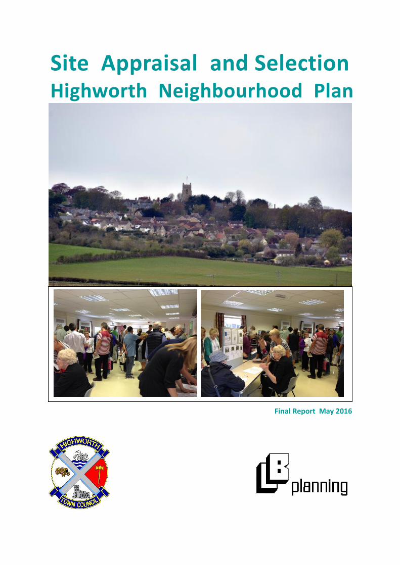
Site Appraisal and Selection Highworth Neighbourhood Plan
Final Report May 2016
2
LB Planning 2016 Site Appraisal Highworth
Contents
1. Introduction and Initial Shortlisting of Sites ................................................................................... 3
2. The Short-listed sites....................................................................................................................... 7
3. Consultation Process 2015 ............................................................................................................ 12
4. Final Sites Assessment .................................................................................................................. 14
5. Site Selection and Development Briefs ......................................................................................... 17

3
LB Planning 2016 Site Appraisal Highworth
1. Introduction and Initial Shortlisting of Sites
1.1 The Highworth Neighbourhood Plan (HNP) is due to be formally consulted on shortly. An
important task of the plan is to allocate sites for residential development, in line with the strategic
requirement of the recently adopted Swindon Local Plan Part 1 (SLP1). The SLP1 states that
Highworth will need to find sites for at least 200 Dwellings to provide for the SLP1’s time period up
to 2026 (policy SD2 p36). As existing planning permissions and recent construction account for 88 of
these required dwellings, the HNP needed to find sites for at least 112 dwellings.
1.2 Led by Town Councillors, but including other local residents and stakeholders, a Neighbourhood
Planning Group (NPG) has been meeting regularly since 2012 to progress work on the HNP. The NPG
has undertaken several consultation exercises during this time, including two similar consultations in
2013 on the desirability of residential development on most of the open land in and around
Highworth. People attending the consultation were asked to indicate if they supported
development or protection of the sites. As the sites included important open space, this
consultation resulted in strong feelings about which sites should be protected, but also revealed
sites that the local community felt were better suited for development. The results of this
consultation are summarised in Table 1 Below.
Table 1: Results from the 2013 Sites Consultation Exercises
Site Supporting
'Protect'
Supporting
'Develop' Comments
Swindon Road Allotments 47.00% 3.00% Valued Allotment site
Lower Rec allotments 47.00% 3.00% Valued Allotment site
Park Avenue Allotments 42% 2.00% Valued Allotment site
Town Green 26% 3%
Useful Public Open Space and link to
countryside
r/o Priory Green & Cullerns 19.00% 3% Useful public open space
Edencroft 18.00% 5.00% Useful public Open Space
Haresfield Play Area 21.00% 10.00% Useful public open space
Haresfield Community Field 28.00% 12.00% Useful public open space
Crane Furlong Park 18.00% 29.00% Short-listed
R/o Crane Furlong 22.00% 30% Short-listed
Home Farm/Islay Triangle 18.00% 19.00% Short-listed
Home Farm 3 areas 17.00% 11.00% Useful public open space

4
LB Planning 2016 Site Appraisal Highworth
The Village Greens 26.00% 6.00% Useful public open space
Newburgh Green 26.00% 6.00% Useful public open space
Top Field - Pentylands Park 40.00% 4% Useful public open space
Barra Field 42.00% 3.00% Useful public open space
Site Supporting
'Protect'
Supporting
'Develop'
Comments
Kilda Field 39.00% 11.00% Useful public open space
Pentyland Field (17) 38.00% 11.00% Useful public open space
Pentyland field (17a) 38.00% 14.00% Useful public open space
Upper Rec 48.00% 2.00% Useful public open space
Lower Rec 49.00% 2.00% Useful public open space
Golf Course 52.00% 2.00% Useful public open space
Land next to cemetery 22.00% 13.00% Short-listed
Land surrounding Roundhills
mead 17.00% 25%
Visual intrusion too great and contrary to
promotion of the Hilltop village and
setting aim.
Field at Eastrop 16.00% 23%
Recent designation as an ancient
monument
Field at Eastrop (North) 19.00% 18.00%
Recent designation as an ancient
monument
Land to N of Industrial Est. 9.00% 25.00% This site is designated for industrial use
Redlands 29.00% 19.00% Short-listed
Key to percentages:
35-50+% 0-7%
20-34% 8-15%
<20% >15%
Green Cells show the strongest support for protect, and the lowest for developing.
Yellow cells show a less pronounced desire to protect a site rather than develop it; white cells are the
sites most accepted for development from this consultation.

5
LB Planning 2016 Site Appraisal Highworth
1.3 The 2013 sites consultation indicated valued open space and allotment land. These sites have
been excluded from the final shortlist of potential sites for residential development, and instead
designated as open space or Local Green Space as appropriate in the draft Highworth
Neighbourhood Plan. Land to the north of the Industrial Estate which is designated for employment
use has also been excluded from the shortlist. Additionally two sites at Eastrop were excluded due
to the recent formal designation of an ancient monument on much of the land.
1.4 A review of the Swindon Borough Council’s (SBC) Strategic Housing Land Availability Assessment
(SHLAA) Document showed no other possible sites that would fit naturally into the existing town or,
due to bordering onto the urban area, would extend Highworth sensitively with regard to the
existing settlement boundary. Policy RA1 in the SLP1 informed decisions here, in particular the
requirement to
“maintain the separate identity of Highworth as a hill top market town and respect its
landscape setting”.
1.5 Besides the short-listed sites from the 2013 consultation, a further site, offered to the Town
Council after the 2013 consultation, was also included. As this site, ‘land off Shrivenham Road’ was
adjacent to the settlement boundary it was also shortlisted for further consideration. The two sites
at Crane Furlong have been considered jointly, resulting in five sites being shortlisted for further
consideration. These sites are discussed and described below. Figure 1 shows their location.

6
LB Planning 2016 Site Appraisal Highworth
Figure 1: Location of the shortlisted sites in Highworth
1. Crane Furlong 2. The Triangle
3. Adjacent to Cemetery 4. Redlands
5. Shrivenham Road
1. 1.
2.
5. 4.
3.

7
LB Planning 2016 Site Appraisal Highworth
2. The Short-listed sites.
2.1 Land at Crane Furlong: 2.32 Ha - current use agriculture and recreation
Consultation site above left; site for housing considered in assessment right.
2.1.1 The eastern section of the consultation site is owned by the Town Council on a lease from
Swindon Borough Council and is used for recreational purposes. The land was originally included
within the site, but only to be available for access to the rest of the site. The Town Council have
since decided however not to release their land, and so the site considered in the post consultation
assessment is only the section offered for housing, to the west.
2.1.2 The site slopes very gently to the north and is located on low-lying land (90 – 85m contours) to
the north of the town, adjacent to the Industrial estate and sewage works. There are no significant
flood risks associated with the site, although adjacent development is reported to have dealt with
small springs and ground water. It is a natural extension of the town, and infills between residential
development and the Industrial Estate, although it is outside the settlement boundary defined in the
previous Swindon Local Plan. It has been assessed in the SHLAA, sites 731 and 1135 refer.
2.1.3 Although little reference is found in the site description in the SHLAA, the Environmental Health
Department have indicated initial concerns about the proximity of the site to the sewage works and
industrial area; odours from the former and noise nuisance from the latter are possible issues.
Aerial View of Crane Furlong

8
LB Planning 2016 Site Appraisal Highworth
2.2 Land adjacent to the Cemetery: 0.75Ha – current use agricultural
2.2.1 The site slopes gently down to the west, and lies outside the current settlement boundary. It is
crossed by the 125m contour and within 100m of the northern boundary a scarp slope descends into
the Bydemill Brook valley. Development of the site would therefore intrude into the countryside and
impact on the hilltop setting of Highworth to some extent. The site lies on the edge of the urban area
on the north side of Cricklade Road. It is bounded to the north by a public footpath and fields and to
the west by fields. To the east its boundary is the cemetery wall and to the south residential
development along Cricklade road, from which access would be taken to this site.
2.2.2 It is approximately 500m from the town centre. Schools and health services are all accessible.
The site was not considered in the SHLAA.
Aerial view of Cemetery, Cricklade Road and site to north of road and west of Cemetery

9
LB Planning 2016 Site Appraisal Highworth
2.3 Triangle Site Home Farm: 0.5Ha – current use informal open space
2.3.1 The Triangle site is within the town on the Home Farm development of modern small and
medium market housing. The site is reasonably level, bordered on the NW side by St Michaels Road,
from which access would be taken. The NE side of the triangle site is bordered by residential
development, and on the south side a footpath and residential development border the site. There
are several semi-mature trees on the site.
2.3.2 The site is not in the SHLAA, currently being open space in the ownership of the Local
Authority. It is accessible to all services and just over 500m from the town centre (Market Square).

10
LB Planning 2016 Site Appraisal Highworth
2.4 Redlands Site: 6.93 Ha – Current use agricultural
2.4.1 This site is outside of the current settlement boundary, but adjacent to it and partly infills
between existing development. It slopes gently to the south, and is 120m above RD at its lowest
point making it low-lying relative to the town on its southern boundary. It is approximately 500m
from the town centre. The eastern side of the site has been identified in the SHLAA as being visually
more intrusive in its impact on the setting of the town. The site has mature trees and hedgerow
boundaries, both of which would need be retained in any future development. A larger site of which
this area is a part is considered in the SHLAA, sites 732 and 733 refer. It is considered that reducing
the SHLAA site to the northern component has reduced the adverse impact on the green corridor to
the south of Highworth identified as a problem in the SHLAA. Access would be taken from Swindon
Road, the A361 which has significant traffic flows. A treatment of the junction that improved traffic
safety for all transport modes may well be required as part of any development.
Left: Aerial View of Redlands Site

11
LB Planning 2016 Site Appraisal Highworth
2.5 Shrivenham Road: 1.7 Ha – current use agricultural
2.5.1 The site is on the outskirts of the town reasonably level but with a gentle slope down to the south,
it is crossed by the 125m contour and is on a level with the more elevated part of the town. It is
approximately 500m from the town centre, and reasonably accessible to services, although Shrivenham
Road does not have a regular bus service on it. A public footpath borders the site to the west.
2.5.2 It is outside of the existing settlement boundary, and projects into open country, although
existing residential development borders the site along some of its boundaries. The site has not
been considered in the SHLAA, but as it is adjacent to Redlands and on the eastern side of that site,
it also has potential problems of visual intrusion into the setting of the town and the surrounding
countryside. Shrivenham Road has no footway adjacent to the site, and has on street parking that
causes traffic congestion nearer to the town centre.
Left: Aerial view of Shrivenham Road site

12
LB Planning 2016 Site Appraisal Highworth
3. Consultation Process 2015
3.1 In July 2015 LB Planning was commissioned to undertake further work on the site selection and
develop a draft Neighbourhood Plan for Highworth. This report details the work undertaken with
the Town Council on site selection by LB Planning.
3.2 The Methodology was to firstly consult on the five short-listed sites and explain why the Town
Council were looking to allocate sites in their Neighbourhood Plan. The sites would also be assessed
on technical merit, but the preferences of local residents would be a factor in the final choice.
3.3 A consultation exercise ran from the 12th September to the 2nd October 2015 and included a
questionnaire both on-line and hard copy (Appendix 1) and a drop in event at the Town Council
Offices in Highworth on Saturday the 12th September. The questionnaire had basic information
about the sites including location plan and photo, size and current use. The same question was
asked of each site:
“Do you think this site is suitable or not for development? Ring the response below that best
describes how you feel:
Very Suitable / suitable / Not sure / not suitable / definitely not”
3.4 The Drop in event ran for three hours on a Saturday morning and was attended by 203 People. It
was generally considered very successful. Developers and/or their agents were present for the
Crane Furlong, Shrivenham, Cemetery and Redlands sites, and happy to answer residents’ queries
and discuss their proposals. Questionnaires were available at the drop in event for people to fill in.
3.5 The questionnaire was returned by 447 people (4 duplicates were removed where people had
replied online and on a hard copy). The responses for each site were as follows:
Figure 2: Responses from Questionnaires for each site.
Where DN = Definitely not; NS = Not Suitable; S = Suitable; VS = Very Suitable
0
50
100
150
200
250
DN NS not sure S VS
Ratings for each Site
Cemetery Crane Furlong Redlands Shrivenham Road Triangle

13
LB Planning 2016 Site Appraisal Highworth
3.6 The responses from the questionnaires were also grouped into either pro-development or
against development of each site, by combining ‘DN’ and ‘NS’ to give the ‘against development’
view, and ‘S’ and ‘VS’ to give the ‘pro-development’ view.
Figure 3: The ‘Pro’ and ‘Anti’ view of development for each site
3.7 Figure 3 showed two sites where a clear majority of respondents were opposed to development.
The Triangle site was felt to be useful open space that should not be developed, its importance for
children’s play having increased with the removal of a nearby grade-separated crossing of St
Michael’s Road that led to further open space. The site would not provide much housing were it to be
developed, and the clear view from residents that it should remain public open space has prevailed.
3.8 The Cemetery Site was objected to (in further comments) on grounds of its impact on the hilltop
setting of Highworth, traffic impact on Cricklade road, the progress of coalescence with Hampton
and that the land should be reserved for extension of the cemetery. The Local Authority also
indicated concerns about the impact of the site on the hilltop setting of Highworth, and that there
were likely to be archaeological features on the site. As it was the second least popular site, and less
that 50% of the community supported its development, it has also been discounted from further
consideration.

14
LB Planning 2016 Site Appraisal Highworth
4. Final Sites Assessment
4.1 The removal of shortlisted sites where a majority of residents were opposed to development
resulted in 3 sites remaining in consideration for housing allocation. The intention of the Town
Council was to allocate at least the housing required in the Local Plan, 112 dwellings. Keeping to this
number or not much more in this plan will leave land available for future expansion, important in a
town constrained by its important visual setting above the Thames Valley.
4.2 Table 2 below shows the criteria used to assess these three sites on their technical merits and
disadvantages. Assessment of flood-risk is not considered as all sites are similarly not in a significant
flood risk location (zone 2 or 3). All have vacant possession and none involve brownfield
development as they are all greenfield development and on land of agricultural grade 3 (information
from Swindon BC, detail on Grade 3A or 3B not available). No significant environmental constraints
are known for any of these three sites besides mature trees and hedgerows, there are no water
courses affected. All sites would need an initial archaeological survey undertaken prior to
development. All of the sites have reasonably level access, the impact of extra traffic generated is
assessed however for each.
4.3 The criteria used to assess the sites were weighted by the Neighbourhood Planning Group as
either high, medium or low importance, and this is also indicated in Table 2. The weighting affects
the scores awarded for each criteria in Table 3, and thus also the final score for each site. The
implications of this assessment are considered further in section 5 of this report.
4.4 Table 3 below shows how each of the sites performed against the criteria in table 2. For each
criteria the site was judged as being either ‘good’, ‘fair’ or ‘poor’ on the grounds indicated in Table 2.
The final score then depended on the weighting given the criteria.
4.5 Scores on the assessment give a general indication of degree of suitability, but it is not wise to
choose sites purely on scores in such a matrix if those scores are mathematically very close. The
maximum score is 108. The site at Shrivenham Road has scored less well at just over half the
maximum obtainable, but Redlands and Crane Furlong are of the same order of magnitude – being
around 70-75% of the maximum score.
Table 2: Criteria used for site assessment
Criteria Factors considered Weighting
1. Community benefit
Opportunities including FP
connections, improved or new
open space and traffic calming.
Significant/Some/Few high
2. Vehicular access does not
create highway and traffic
problems on unsuitable roads.
Distance to distributor road or main road <50m
good; <200m fair; else poor.
high
3. Accessible to town centre on
foot.
Centre of town < 300m = good; 750m = fair; else
poor. Centre of town is Market Square.
high

15
LB Planning 2016 Site Appraisal Highworth
Criteria Factors considered Weighting
4. Visual impact on hilltop town
location.
Visible from surrounding low land = poor; Fitting
into existing urban footprint = good; else fair.
high
5. Mature trees or hedgerows
affected by the development.
TPO/mature trees or hedgerows within site = poor,
trees mainly on boundary = fair, else good.
medium
6. Impact of the site on heritage
and archaeological assets
Listed building and curtilage, archaeological site or
conservation area within 20m of site boundary =
fair; on the boundary or within site = poor. Else
good.
medium
7. Pedestrian access routes/RoW
maintained or improved.
New link can be created =good; existing path to go
or be diverted = poor (unless better, more direct
route can be provided); else fair
medium
8. Housing will suit the character
of the town at the location
New housing can be designed to complement and
fit into existing urban form = good; surrounding
countryside will be adversely visually impacted by
housing development = poor; else fair.
medium
9. Site impact on views out (to
the surrounding countryside).
No impact = good; Minimal impact = fair;
considerable impact = poor.
medium
10. Impact on residential amenity
of neighbours?
More than 10 dwellings within 8m of site = poor;
more than 10 dwellings under 16m from proposed
site = fair; else good.
medium
11. Potential adverse impact on
residential amenity of future
residents
Potential bad neighbours within 16m of the site =
poor; within 30m of the site = fair; else good.
low
12. Proximity of regular bus
services
Bus stop within 200m of site = good; within 400m
= fair; else poor.
low
13. Local Opinion 60%+ in favour = good; >50%=fair; else excluded. high

16
LB Planning 2016 Site Appraisal Highworth
Table 3: Draft Sites Assessment Criteria for Highworth Short-listed sites
Criteria Redlands Crane Furlong Shrivenham Rd
1. Community benefit opportunities
including FP connections, improved or
new open space and traffic calming.
10 10 5
2. Vehicular access does not create
highway and traffic problems on
unsuitable roads.
10 10/5* 0
3. Access to town centre on foot. 5 0 5
4. Visual impact on hilltop town
setting.
10 10 5
5. Mature trees or hedgerows affected
by the development.
0 4 4
6. Impact of the site on heritage and
archaeological assets
8 8 8
7. Pedestrian access routes/RoW
maintained or improved.
8 8 4
8. Housing will suit the character of
the town and extension of settlement
boundary causes minimal visual
intrusion into the countryside.
4 8 0
9. Site impact on views out. 4 8 4
10. Impact on residential neighbours 4 4 8
11. Residential amenity of potential
residents
5 0 5
12. Proximity of regular bus services 5 5 0
13. Local Opinion 10 5 10
Total Score 83 80/75 58
The scores given are 10 good, 5 fair, 0 poor for high priority criteria. For medium criteria the scores
are respectively 8,4,0 and for low priority the scores are 5,2.5,0.
*This score will depend on whether an access can be negotiated directly onto Lechlade Road or not.

17
LB Planning 2016 Site Appraisal Highworth
5. Site Selection and Development Briefs
5.1 The selection matrix shows the site at Shrivenham Road to perform less well in a technical
assessment of attributes. Although the site was popular at the consultation event, the impact on
Highworth’s countryside and the character and setting of Highworth as a hilltop town are serious
disadvantages in planning terms, both for the Neighbourhood Plan and the Local Plan (Policy RA1).
It is also not accepted that a new footpath to the town centre would be created, although the
existing path could be maintained and given a better surface. The developers may have been
referring to the provision of a ‘footway’ along Shrivenham Road as part of the proposed scheme, this
would be required on grounds of highway safety, and is not considered a community benefit, as it
would be required by the development and mostly serve only residents on that development.
5.2 The other two sites are considered the best locations for new housing, and there is merit in
allocating some housing to each end of the town. The Crane Furlong site needs to adequately buffer
the potential threats to residential amenity from the industrial uses and sewage works to the north.
With this site able to provide around 42 dwellings, the Redlands site would need to provide a
minimum of 70 dwellings. This development could be provided on the larger western portion of this
site, despite the constraint of needing to protect and retain the existing trees and hedgerows. The
more visually sensitive area of the consultation site on the higher ground of the eastern field is not
proposed to be allocated in the Plan, although a link to the existing footpath will be required.
5.3 This proposed allocation minimises the potential adverse effects of each site, while offering
significant community benefit to both the north and south of the town. Outline development briefs
are offered for the Crane Furlong and Redlands site below, setting out the requirements for a
successful planning application for residential development. These are also appendices to the draft
Neighbourhood Plan.

18
LB Planning 2016 Site Appraisal Highworth
5.4 Development Brief for Crane Furlong Site

19
LB Planning 2016 Site Appraisal Highworth
1. Site Description
1.1 The site slopes very gently to the north and is located on low-lying land (90 – 85m contours) to
the north of the town, adjacent to the Industrial estate and sewage works. Its current use is low
level grazing agriculture, and it is 2.32ha in size. It is located between residential development to
the south and the Industrial Estate to the north, and the unadopted Pentylands Lane and Crane
Furlong both currently offer access to the site.
2. Planning Context
2.1 The site is outside the settlement boundary carried over into the Swindon Local Plan 2026 (SLP)
from the previous Swindon Local Plan. Allocations outside this boundary in Neighbourhood Plans
are acceptable within the terms of Policy SD2 c) of the SLP, and the Highworth Neighbourhood Plan
(HNP) will revise the settlement boundary in line with allocations made. The site has been assessed
in the SHLAA; sites 731 and 1135 refer, and assessed in this document as deliverable in 0-5 years.
Development will be required to comply with planning policy in the HNP and the overall
Development Plan. Particular attention is drawn to policies DE1, DE2 and EN7 in the SLP.
3. Site Constraints
3.1 There are no significant flood risks associated with the site, although adjacent development is
reported to have dealt with small springs and ground water.
3.2 Environmental have indicated initial concerns about the proximity of the site to the sewage
works and industrial area; odours from the former and noise nuisance from the latter are possible
issues. The developer will be required to use part of the site for mitigation purposes, as discussed
below.
3.3 The land to the east of the site is owned by Highworth Town Council on a lease from Swindon
Borough Council and is used for recreational purposes. The land was originally be available for a
new access to the site from Lechlade road. The Town Council have since decided however not to
release their land, and so this potential access has not been considered in this brief.

20
LB Planning 2016 Site Appraisal Highworth
4. Site Requirements
4.1 The development will not be required to provide an area of open space, but will be required to
contribute to the improvement of the adjacent area of open space. Improvements to include the
provision of a MUGA/skatepark, seating areas, planting and drainage works where required. CIL
receipts for the Town Council are likely to be spent on Town Centre improvements.
4.2 Environmental Health concerns about the proximity mean that a buffer zone with mitigation
measures as recommended by Swindon BC will be required on that part of the site adjacent to the
Industrial Estate and Sewage Works. They have advised that
“we would expect to see some form of odour evaluation and assessment [of] the soundscape in
the area that demonstrates what impact we might expect to see on the amenity of residents of
the proposed development … [and what would] be possible in terms of ….. mitigation.”
4.3 If the option of taking access to Lechlade Road is offered through the recreational site adjacent,
then that is the preferred access route. This would require new open space and improvements to be
provided as compensation. Should this not be possible then either or both of the access points
shown can be used. The access onto Pentylands Lane is required to encourage turn left only
movements, and will need to suit any new access constructed as part of the development to the
west of the site (Planning permissions S/11/0280 and S/RES/12/0640 refer).
4.4 The Housing Mix required on the site is 42 dwellings, of which the affordable housing
component of 13 dwellings (30%) is required to include shared ownership dwellings and some
starter homes as defined in the Housing and Planning Bill/Act 2016.
4.5 Design of housing is to comply with policy 17 in the HNP and other requirements of the
Development Plan. A privacy strip is required as shown to dwellings on Crane Furlong and the
development should be no higher than 2 storeys. Main external elevational treatments to be brick
in keeping with rest of the town. Any development will also need to comply with the design
requirements of policy DE1 of the Swindon Local Plan Part 1.
5. Further Information
SBC Planning Department is the local planning authority that will deal with the planning application.
Highworth town Council will be happy to provide further local information. Contact Details as
follows:
Swindon Borough Council: E-mail: [email protected] Tel: 01793 445500
Highworth Town Council: http://www.highworthtowncouncil.gov.uk/contact.asp Tel: 01793 762377

21
LB Planning 2016 Site Appraisal Highworth
5.5 Draft Development Brief for Redlands Site
1. Site Description
1.1 This site is outside of the current settlement boundary, but adjacent to it, located to the south
of the town centre, at approximately 500m distance. The current use is for agricultural grazing, and
it is 4.3 ha in size. There are residential properties to the north of the site, Redlands House and
outbuildings are to the south. The main A361 road to Swindon is the western boundary of the site,
to the east to site rises to form open fields. It slopes gently down to the south and west, and is
120m above RD at its lowest point making it low-lying relative to the town centre.
1.2 The eastern side of the site has been identified in the SHLAA as being visually more intrusive in
its impact on the setting of the town. For this reason the site allocated for housing has slightly
reduced in size the original site consulted on, and discounted for the life of this plan development on
the eastern section of the site.
1.3 The site has mature trees and hedgerow boundaries, all of which would need be retained in any
future development.

22
LB Planning 2016 Site Appraisal Highworth
2. Planning Context
2.1 The site is outside the settlement boundary carried over into the Local Plan from the previous
Swindon Local Plan. Allocations outside this boundary in Neighbourhood Plans are acceptable within
the terms of Policy SD2 c) of the Swindon Local Plan 2016 (SLP), and the Highworth Neighbourhood
Plan (HNP) will revise the settlement boundary in line with allocations made. A larger site, of which
this area is a part, is considered in the SHLAA, sites 732 and 733 refer. It is considered that reducing
the SHLAA site to the northern component has reduced the adverse impact on the green corridor to
the south of Highworth identified as a problem in the SHLAA. Development will be required to
comply with planning policy in the HNP and the overall Development Plan. Particular attention is
drawn to policies DE1, DE2 and EN1 in the SLP.
3. Site Constraints
3.1 There are no significant flood risks associated with the site.
3.2 The site has a stand of mature trees within it, several mature trees on the boundaries and trees
standing alone within the site. The site layout is required to retain these trees and the hedgerows
on site, and integrate them well into the public circulation spaces where possible. A green corridor
should flow into and through the site, linking these existing ecological assets.
4. Site Requirements
4.1.1 There is an existing Public Footpath (FP10) and link to the countryside to the North east of the
site, and access to this path should be made in any layout. There is a further possible connection to
a potential path that should also be possible if the legal situation with it can be established. A link
between the existing footpath FP16A Starting on the west side of the A361 adjacent to the site and
path FP10 Should be facilitated within the layout (footway acceptable), and safe pedestrian crossing
facilities provided to link the site to FP16A And the recreation ground.

23
LB Planning 2016 Site Appraisal Highworth
4.1.2The A361 is a potential cycle route to Swindon, and measures that improve the situation for
cycling along this road will be required as part of the development. In particular, making a safe
route for pedestrians and cyclists between the site and the junction of FP11 with the A361 will
improve connectivity on the rights of way network and promote active and sustainable travel.
4.2 Access will be taken from Swindon Road, the A361, which has significant traffic flows. A
treatment of the junction that improved traffic safety for all transport modes will be required as part
of any development. A mini roundabout with pedestrian and cycle crossing facilities is the preferred
option.
4.3 Public Open Space is not required to be allocated within the site, but an alternative contribution
to improvements to the recreation ground will be required.
4.4 A contribution to Town Centre environmental improvements will be required from the
development.
4.5 The site is required to provide 70 dwellings, of which 24 should be affordable, with a minimum
of 18 affordable homes to be rented. A minimum of three plots for self or custom build should be
offered for sale for a minimum of three months at a reasonable price, to revert to market housing if
there is no effective interest. The site is considered suitable for a maximum of 12 executive houses,
as promoted by policy HA1 of the Swindon Borough Local Plan Part1 and suggested by the mature
woodland on site and need to build to lower densities on parts of it. Other housing should be
provided in line with existing demand for market housing within Highworth.
4.6 The development should respect the site location on the edge of the settlement, and maintain a
‘soft edge’ with screening landscaping (sometimes retained) and native tree planting to boundaries
with the open countryside. Development should be no more than 2 storeys high and main external
elevational treatments to be brick in keeping with rest of the town. Any development will need to
comply with the design requirements of policy DE1 of the SLP and Policy 17 of the HNP.
5. Further Information
SBC Planning Department is the local planning authority that will deal with the planning application.
Highworth town Council will be happy to provide further local information. Contact Details as
follows:
Swindon Borough Council: E-mail: [email protected] Tel: 01793 445500
Highworth Town Council: http://www.highworthtowncouncil.gov.uk/contact.asp Tel: 01793 762377